
3 Food Courts that are Redefining Moscow's Culinary Experience
A world of flavours in the heart of Moscow
The emergence of Moscow as a gastronomical capital has already been well documented and one of the great food stories of the last decade.
But a less reported aspect of this trend is the fact that, alongside the upmarket (and often overpriced) award-winning restaurants, a whole new breed of food courts and markets have also popped up in different areas of the city, offering an impressive selection of international cuisine choices at democratic prices.
Truth be told, there were already plenty of casual dining options in Moscow, but the novelty is in how these have now been brought together, literally, under the same roof, recovering some emblematic historical buildings along the way and transforming how new generations of urbanites eat out in the Russian capital.
Where to find Moscow’s best food courts, food malls and gastronomic markets?
Read on to enter the Moscow food court revolution!
Tsentralniy Rinok (Центральный рынок) - “Central Market”
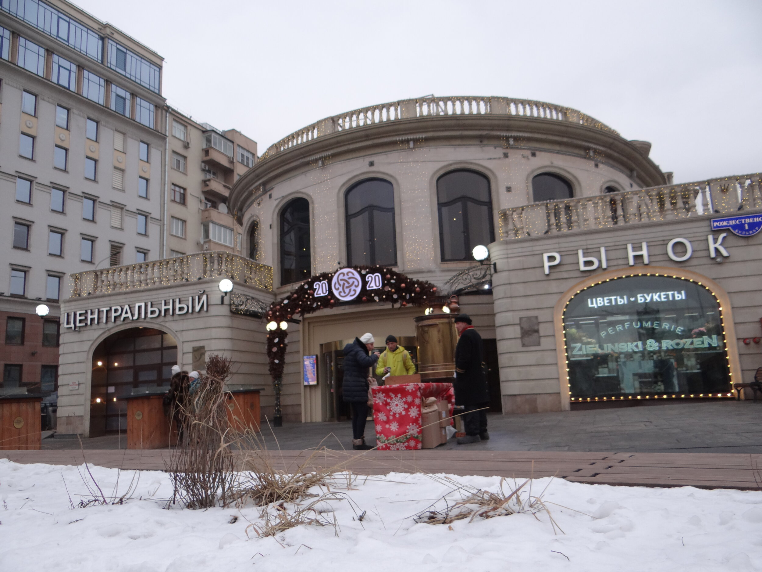
True to its name, Moscow’s Tsentralniy Rinok (or “Central Market”) is located right in the middle of one of the boulevards that ring the inner area of central Moscow.
A market of some sort has existed at this spot at least since the mid-19th C, although it was not until later in the mid 20th C. that a proper market building was built. Like other institutions in Russia, the market suffered during the messy years following the fall of the Soviet system and it was closed in 1994.
It would take over two decades for a new project for the Central Market to be reborn. In 2017 Tsentralniy Rinok re-opened. It’s external appearance had been more or less preserved, but inside it had gone through an total and thorough redesign, an entirely different concept.
Tsentralniy Rinok (Центральный рынок)
Rozhdestvensky Blvd, 1
Moscow 07031
https://moscowcentralmarket.ru
Metro: Trubnaya / Svetnoy Boulevard
A modern food court in a classic building
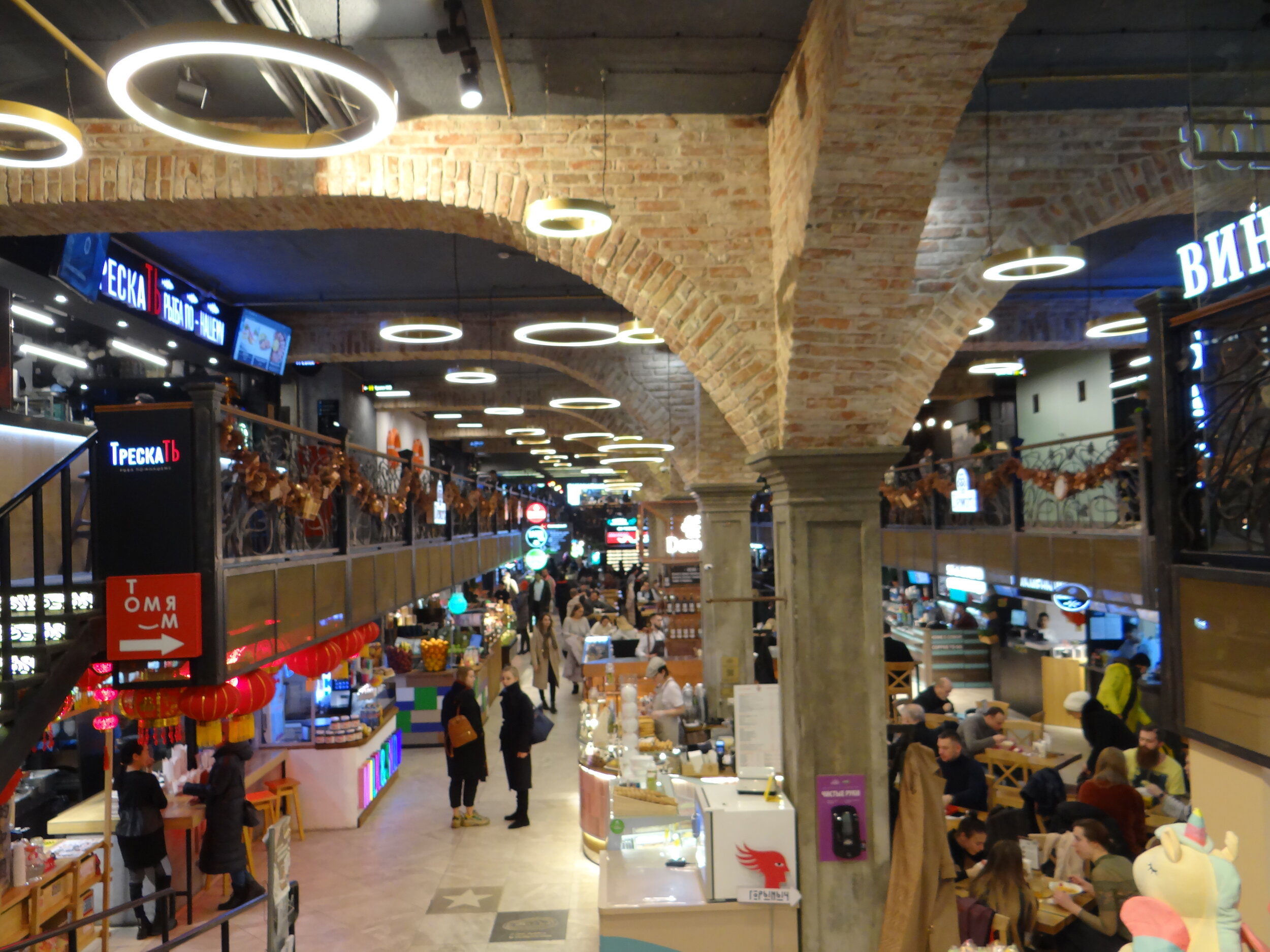
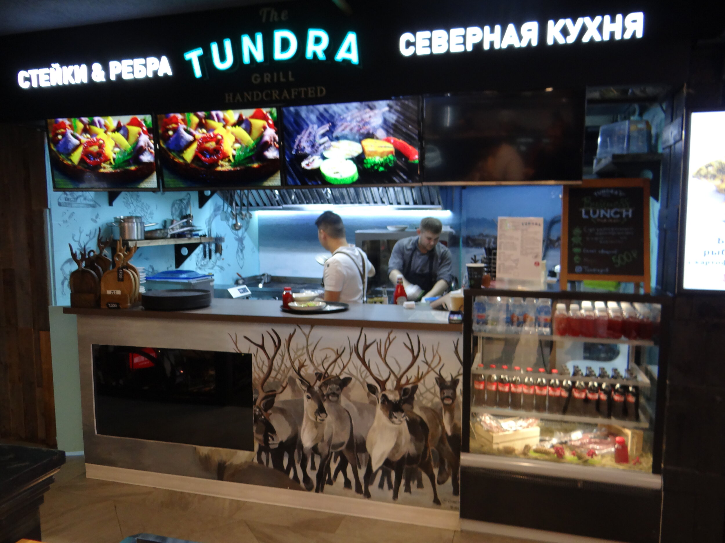
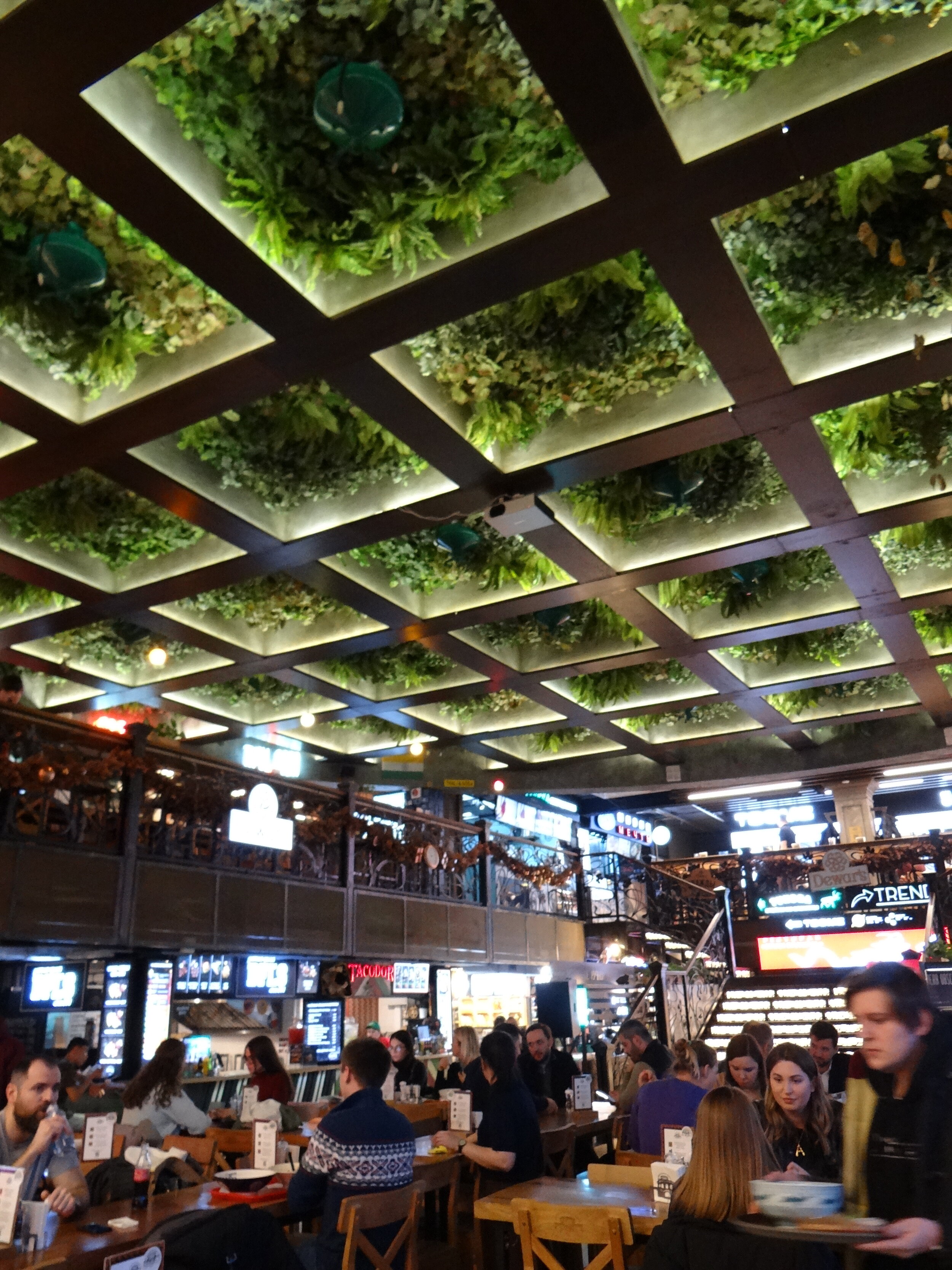
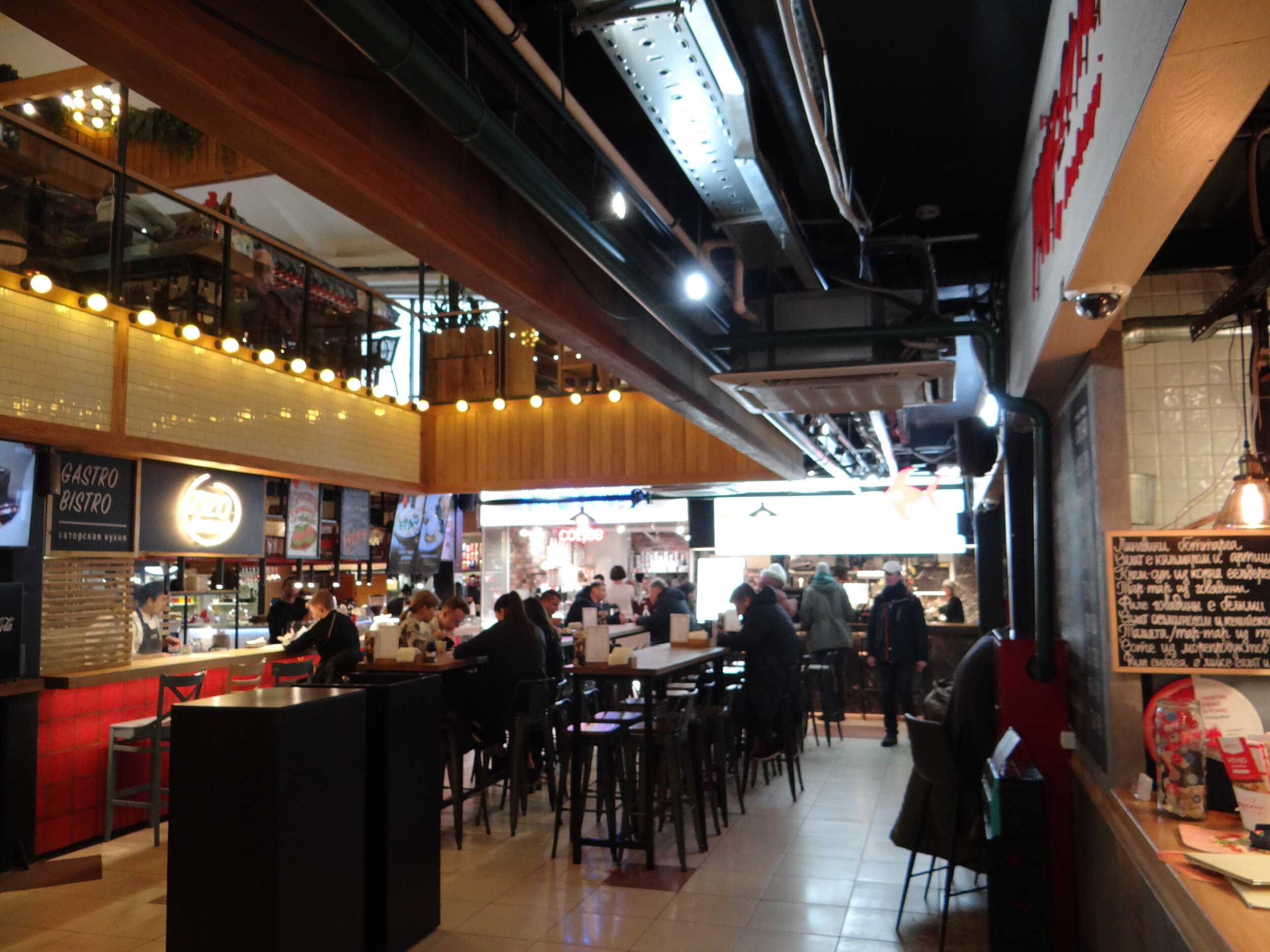
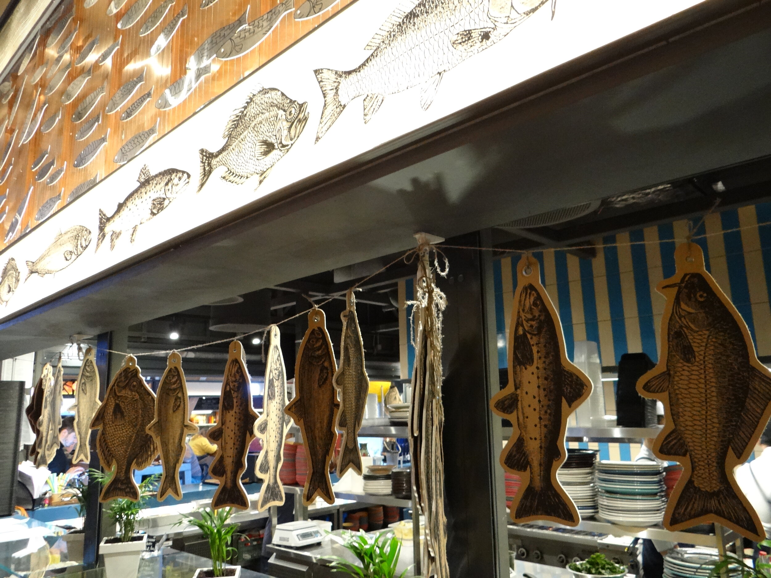
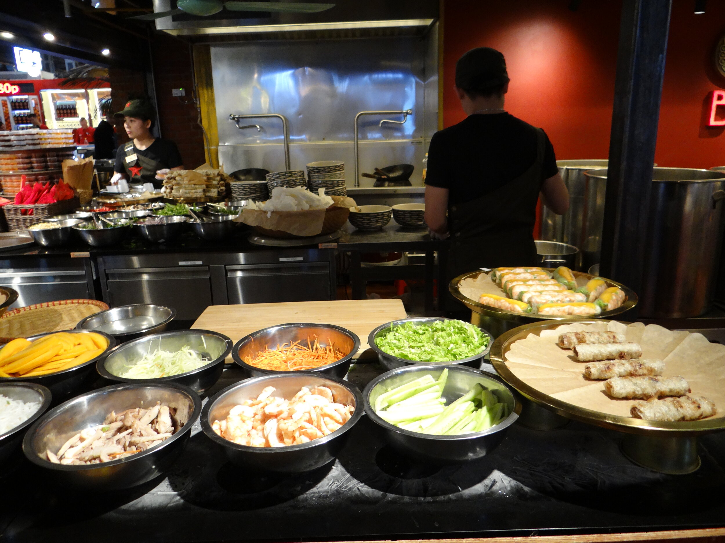
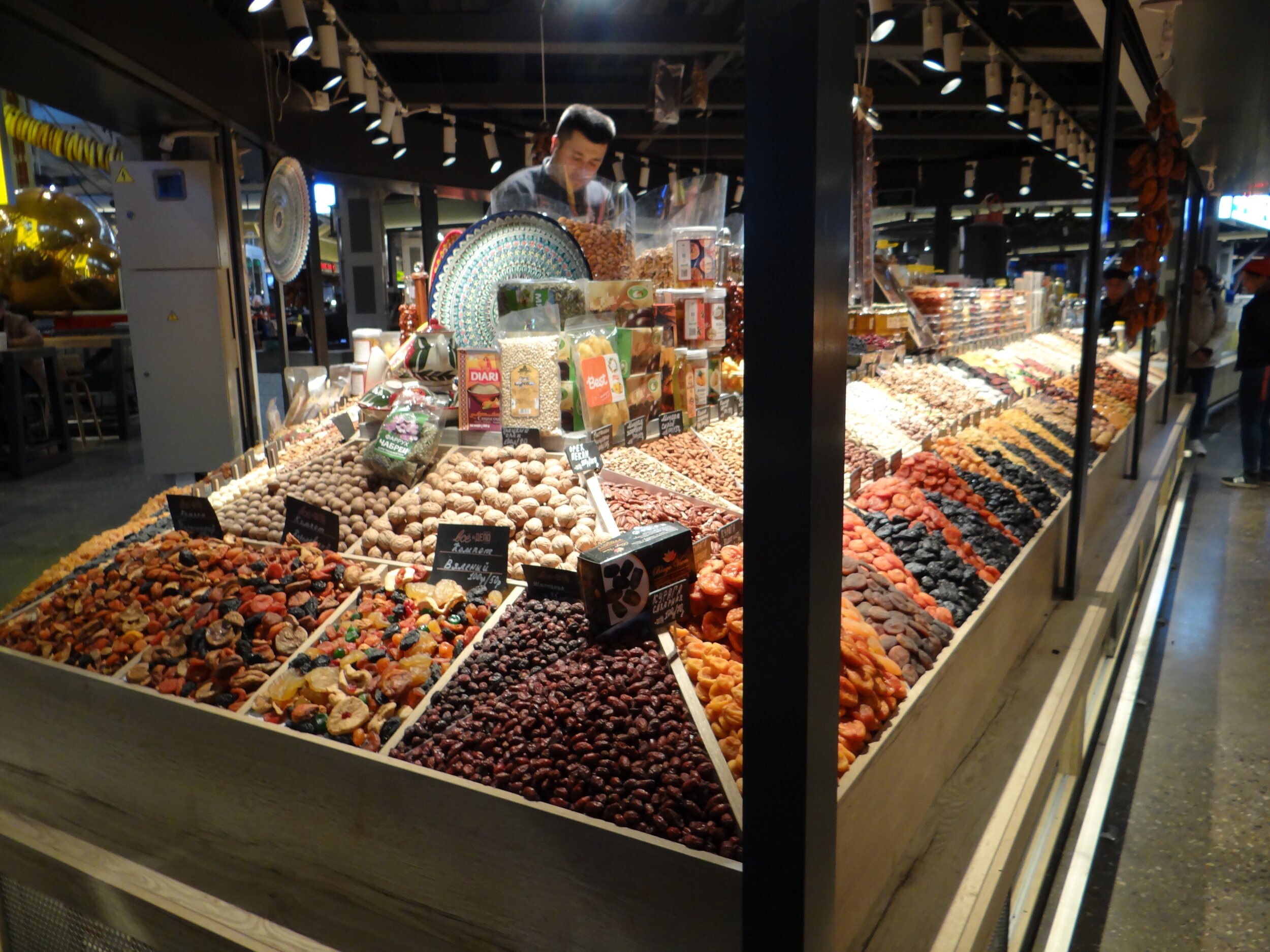
Unlike other Moscow food courts, Tsentralniy Rinok is devoted almost entirely to eating out. No market stalls here, but close to 50 casual eating stalls representing a broad diversity of different cuisines from around the world.
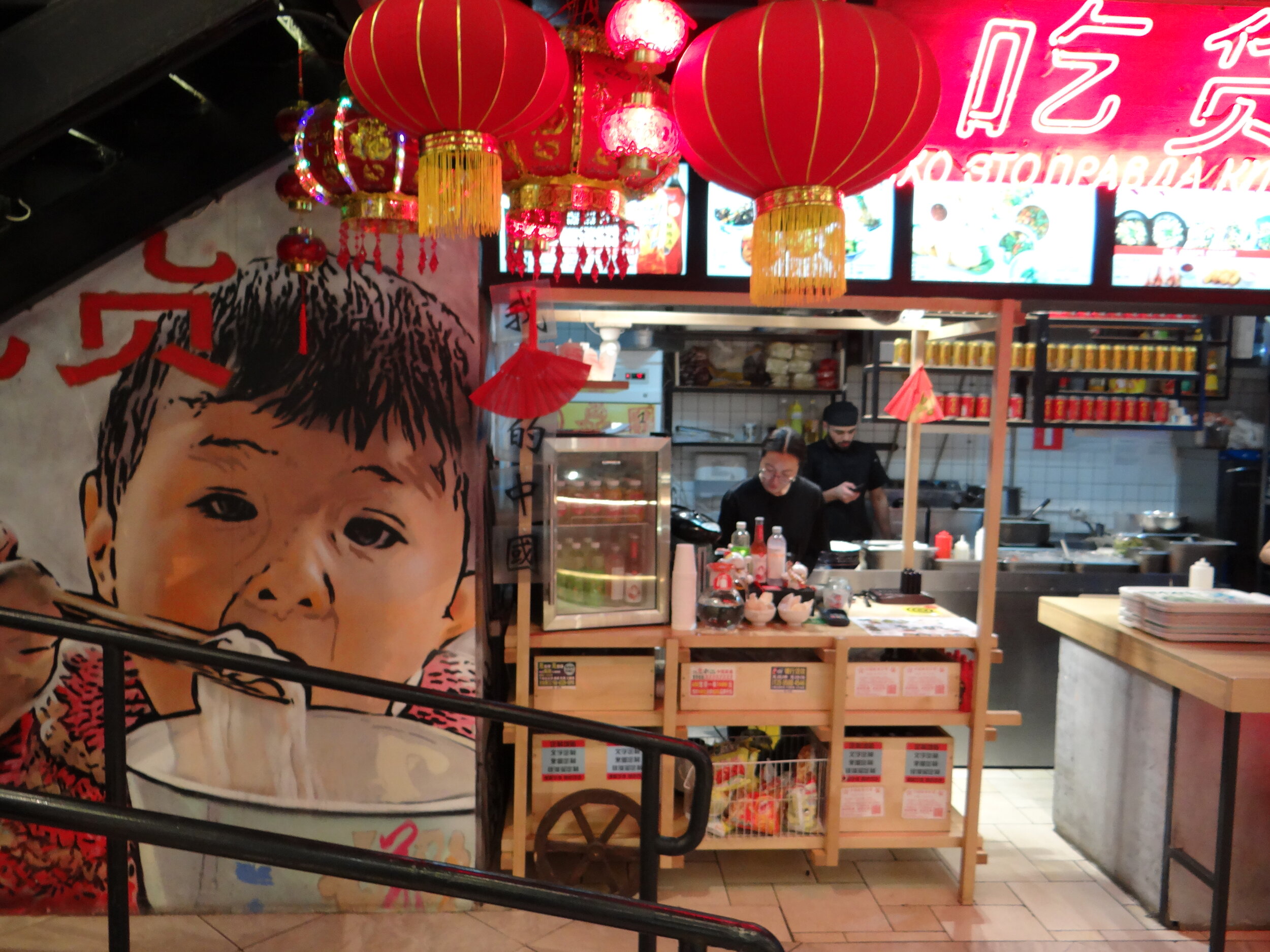
This international focus is actually one of the differential points of Central Market. There are, of course, some food outlets offering foods classical of the region, for example, food from the Russian north or Georgian food (there’s even has a bakery where you can see how bread is baked in a traditional oven), but most of the space is devoted to specialities from other parts of the world, Moroccan tagine, Swiss raclette, Mexican tacos, Japanese food, Chinese food and more….
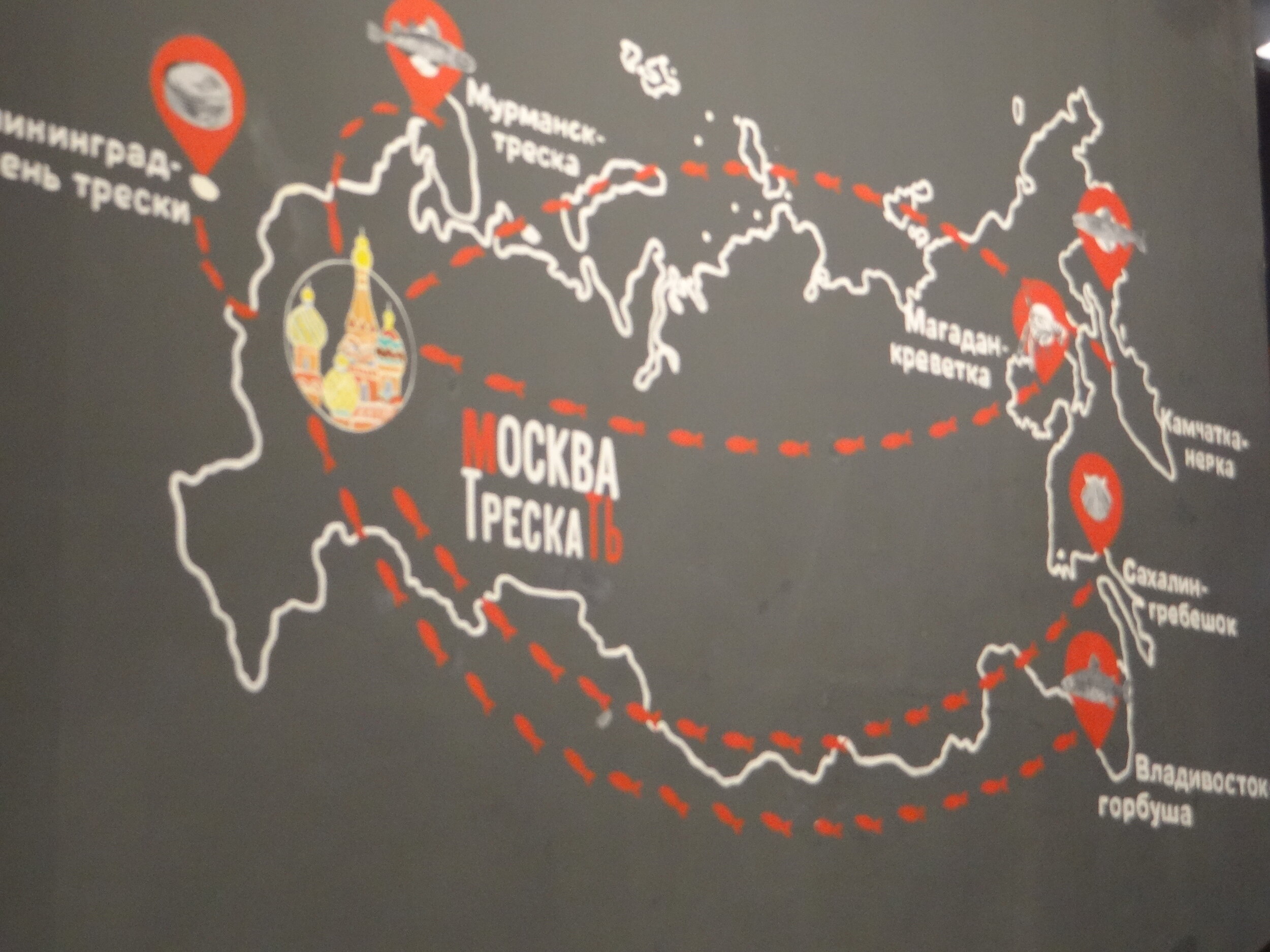
Besides some classics, like Chinese food (below), there is also a re-evaluation of specialities from the Russian regions, such as “northern cuisine” (above). Also the idea of sourcing and traceability is also making inroads as you can see in this illustrated poster map that depicts where the different types of fish and seafood at the Central Market have been sourced from.
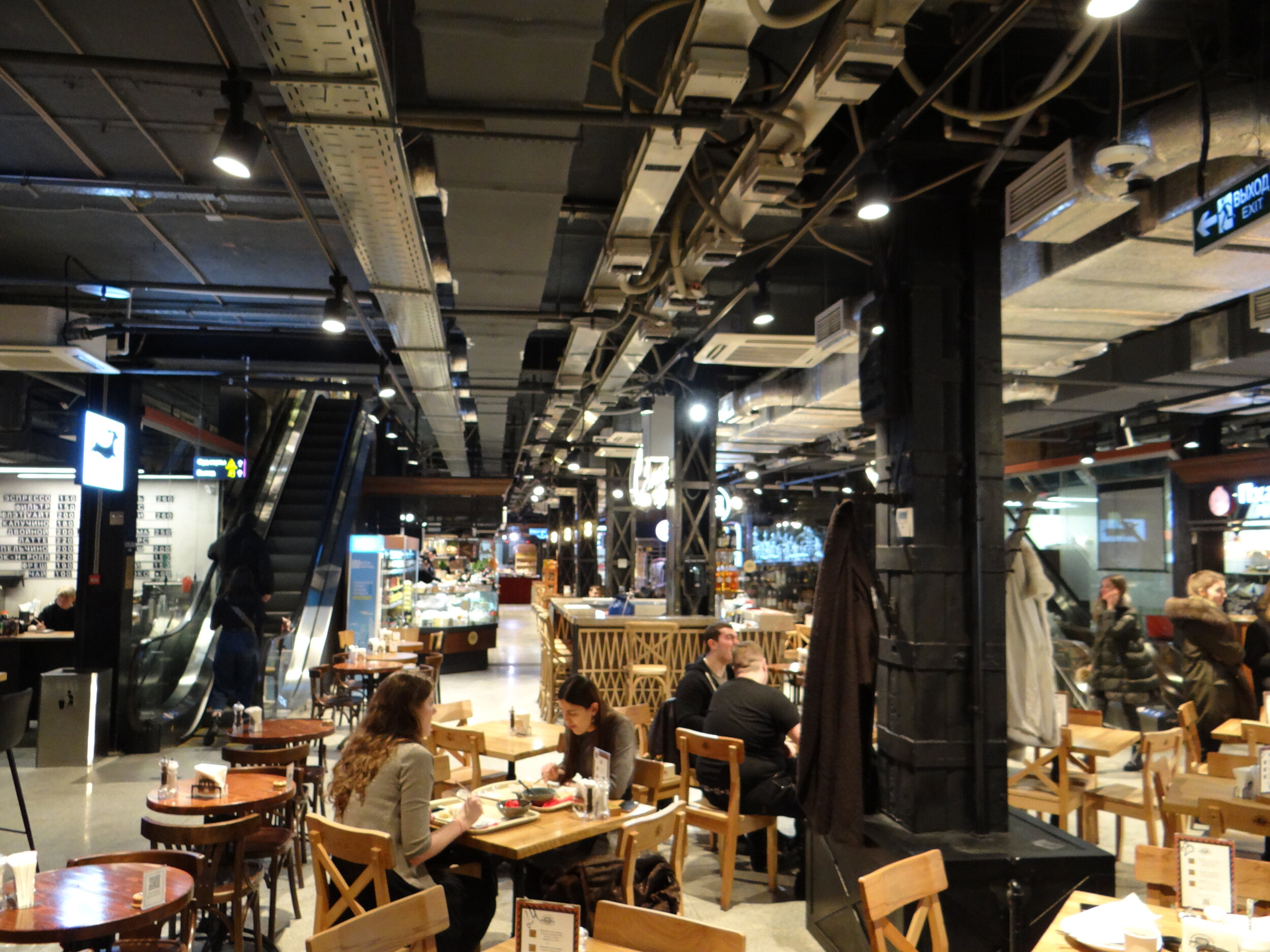
Most of the action is at the central food court.
The market-like purpose-built architecture has facilitated the structuring of the market offerings all around the central space on the lower floor.
There are also a (less busy) upper floor and a lower ground floor.
The structure of the building is the original, but the inside has been completely redone, including the roof that has also got some greenery in the process!
Usachyovskiy Market (“Усачевский рынок”)
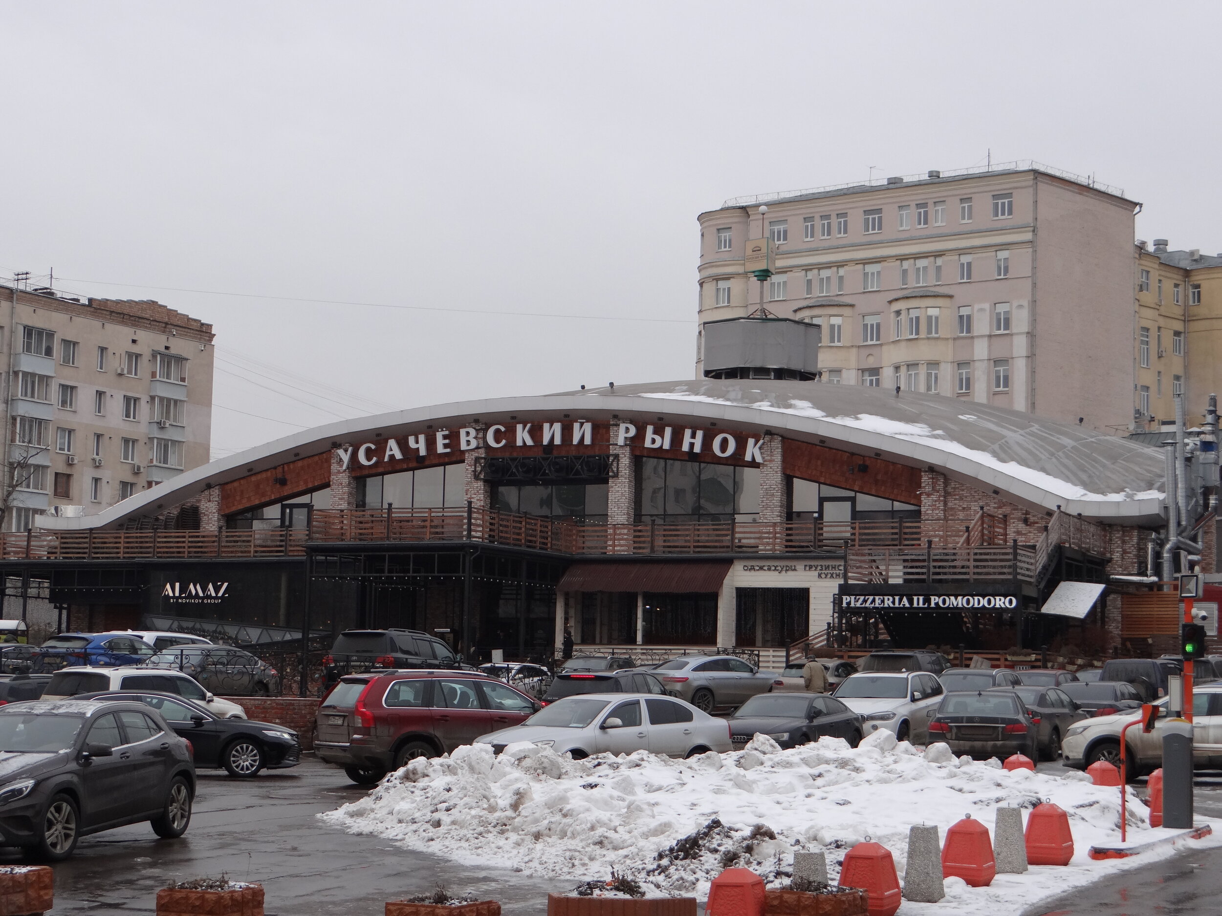
Usachevskiy Market traces its roots back to the 19th C. when a trader called Usachev was based at this spot on the Khamovnikov (Хамовников) area of Moscow.
Since 2017 Usachevskiy Market has enjoyed a new lease of life after undergoing extensive renovation.
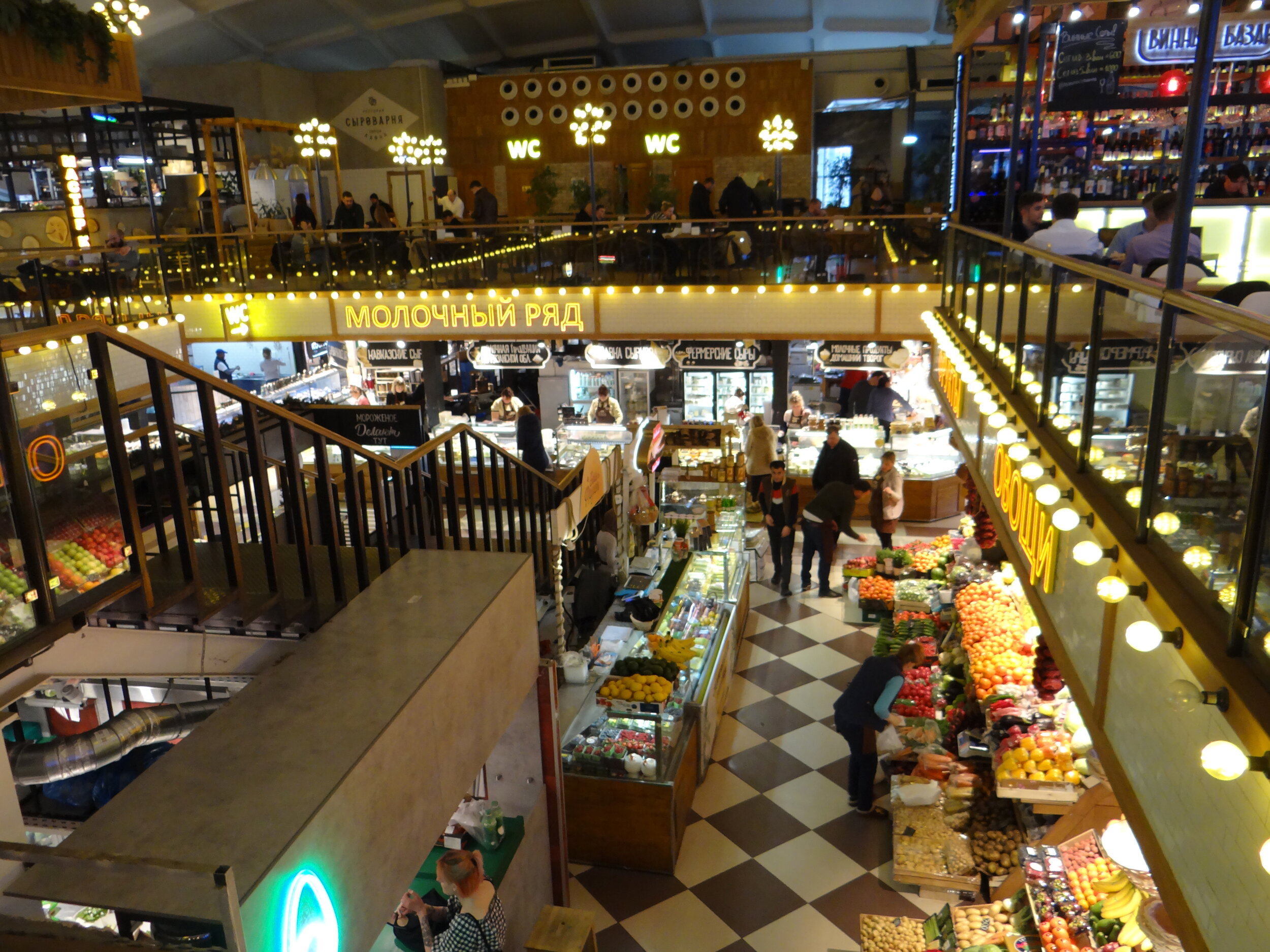
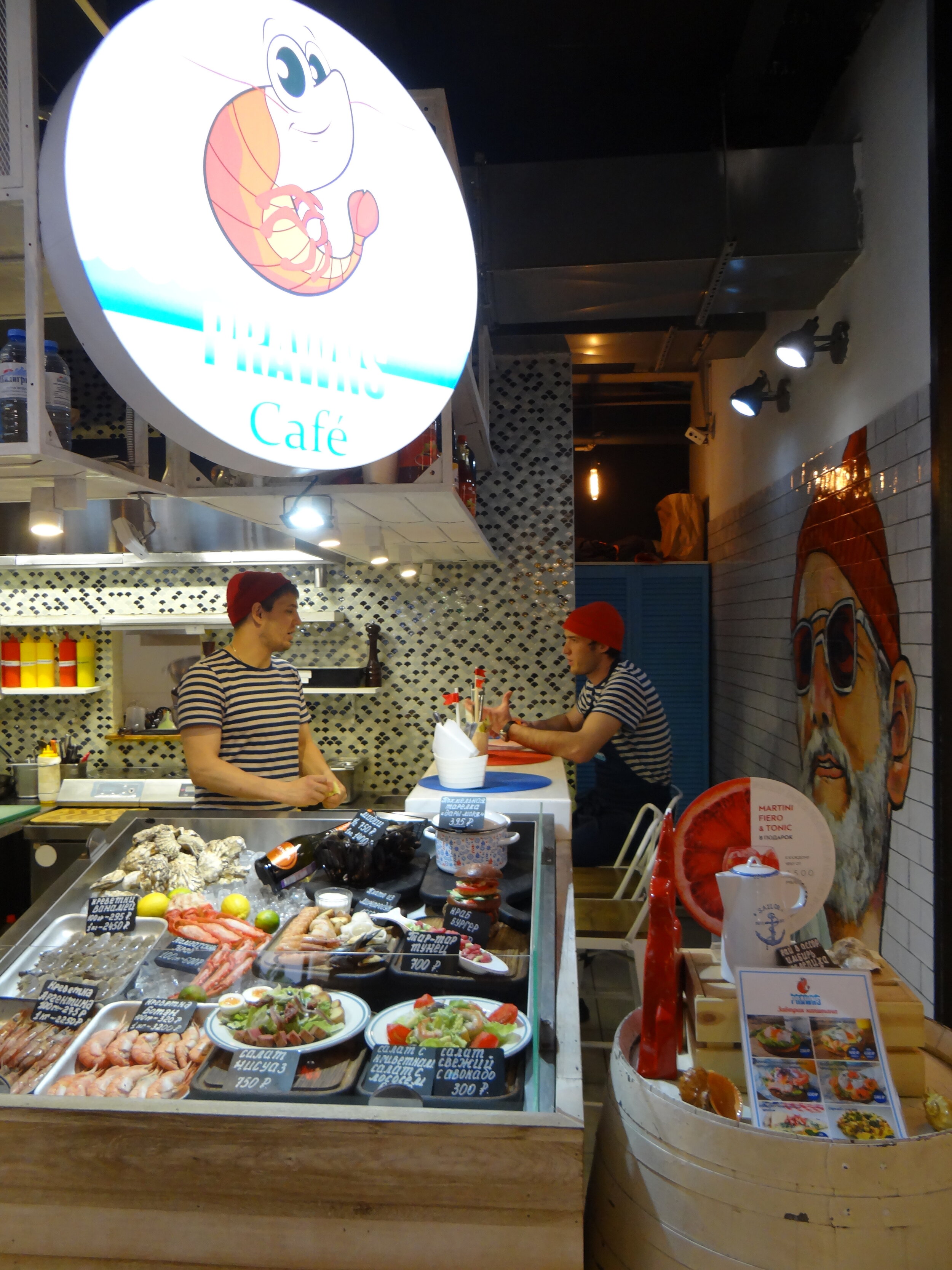
Compared to the other two food courts-markets featured in this post, Usachevskiy market is still primarily a market, with stall overflowing with all sorts of fresh produce.
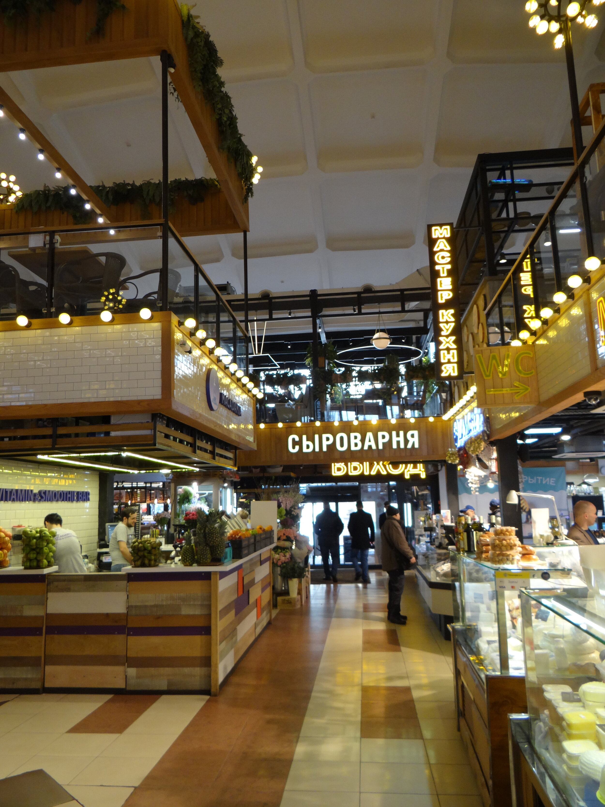
Nevertheless, there is also a food court at Usachevskiy market also quite a few interesting options for those that looking for a spot where to eat out.
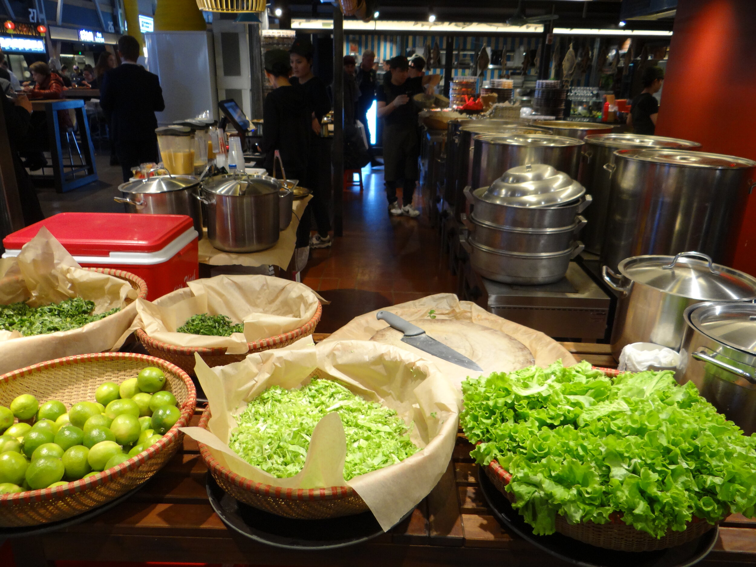
Seafood is a particular star here, with several places offering a selection of fish, oysters and other crustaceans. But there are also some international choices, from Greek to Asian food.
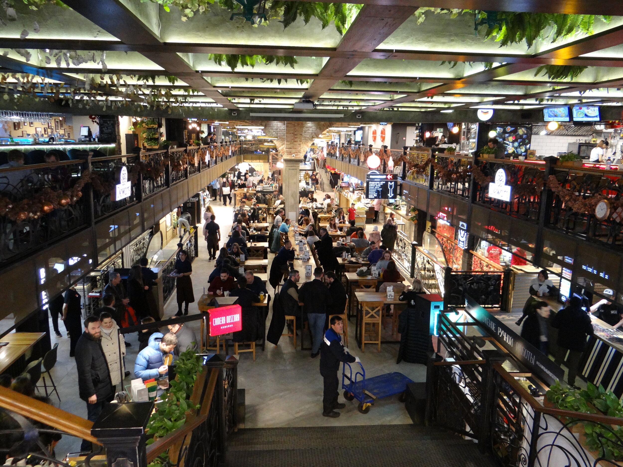
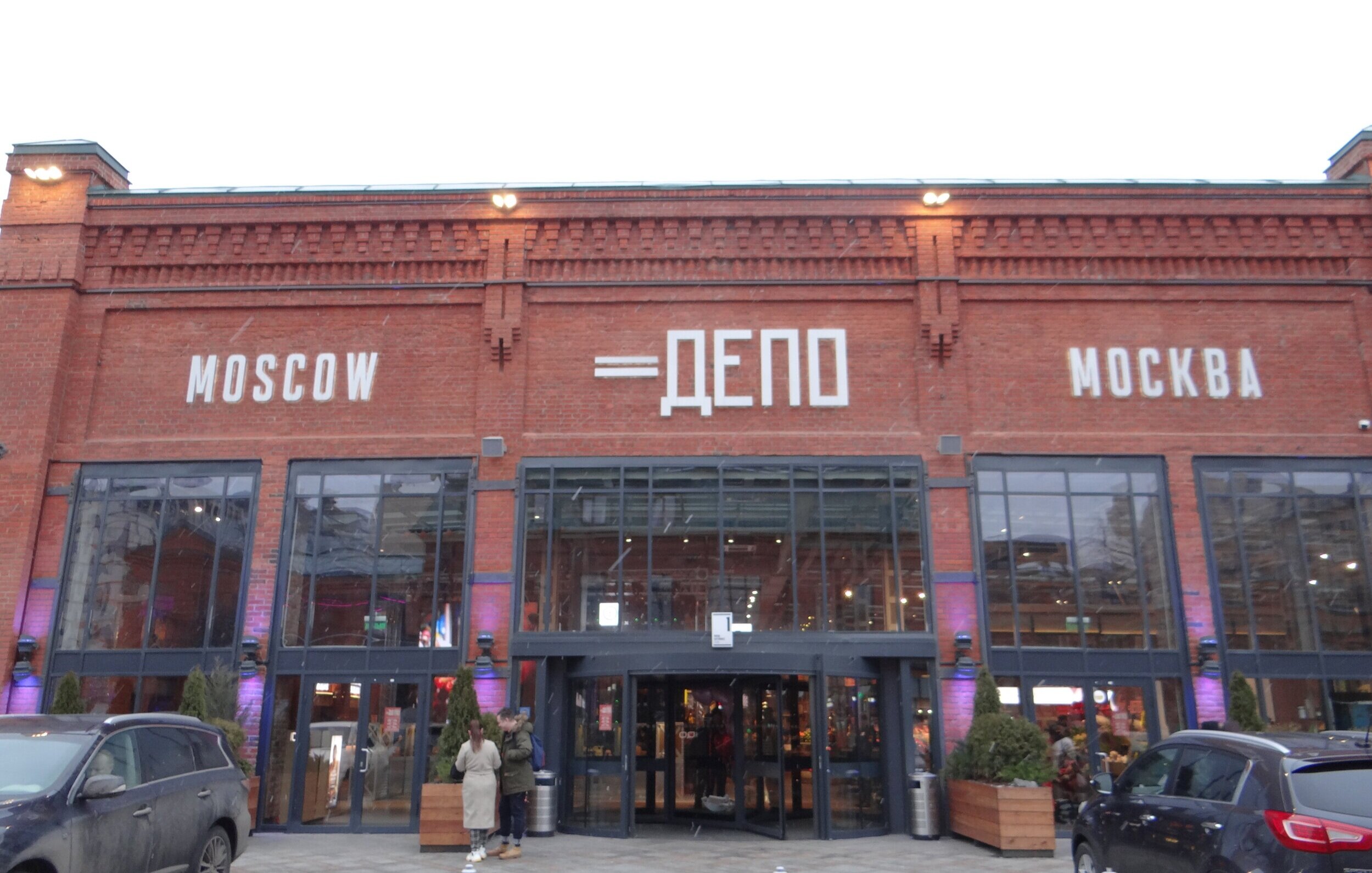
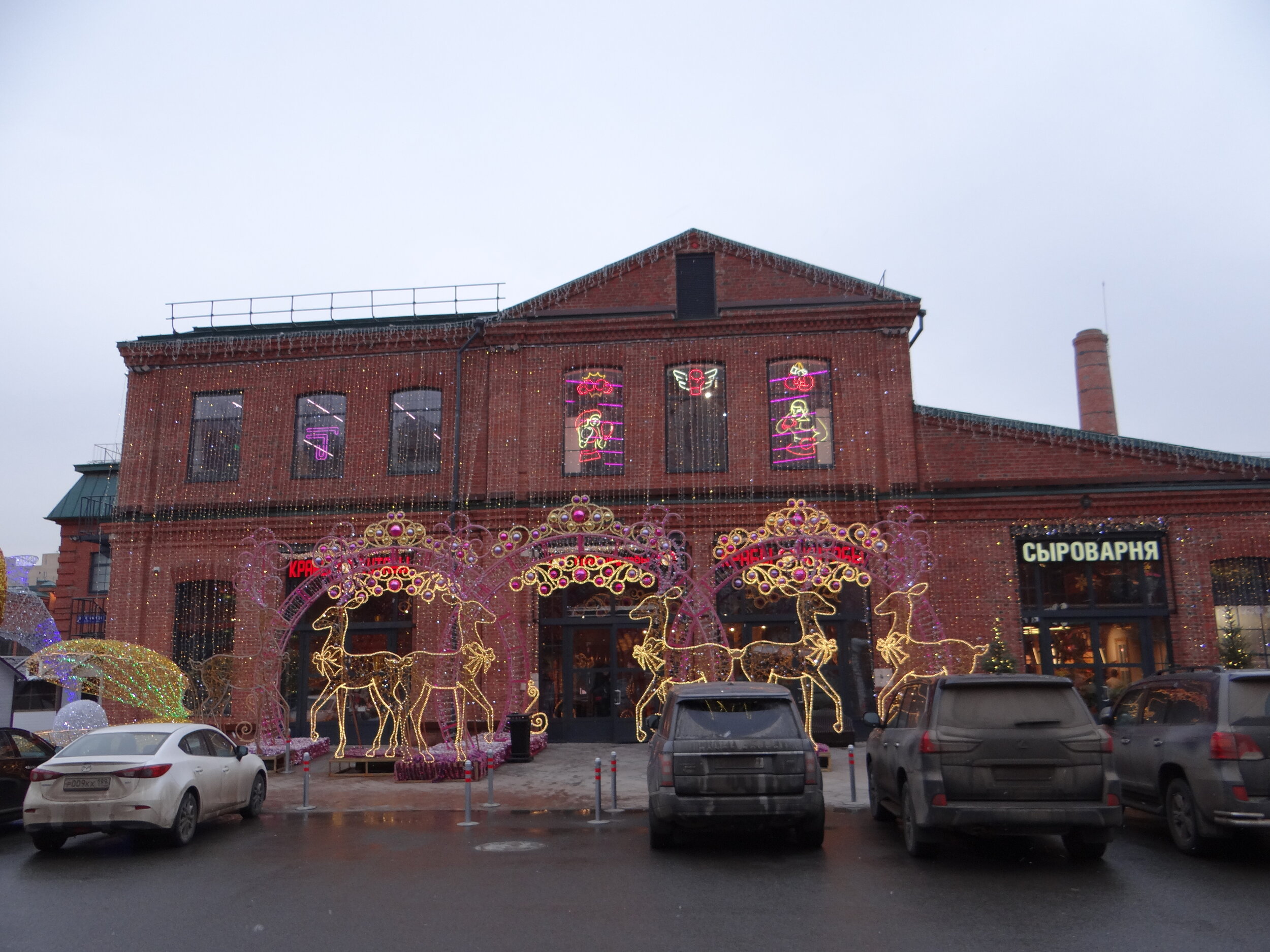
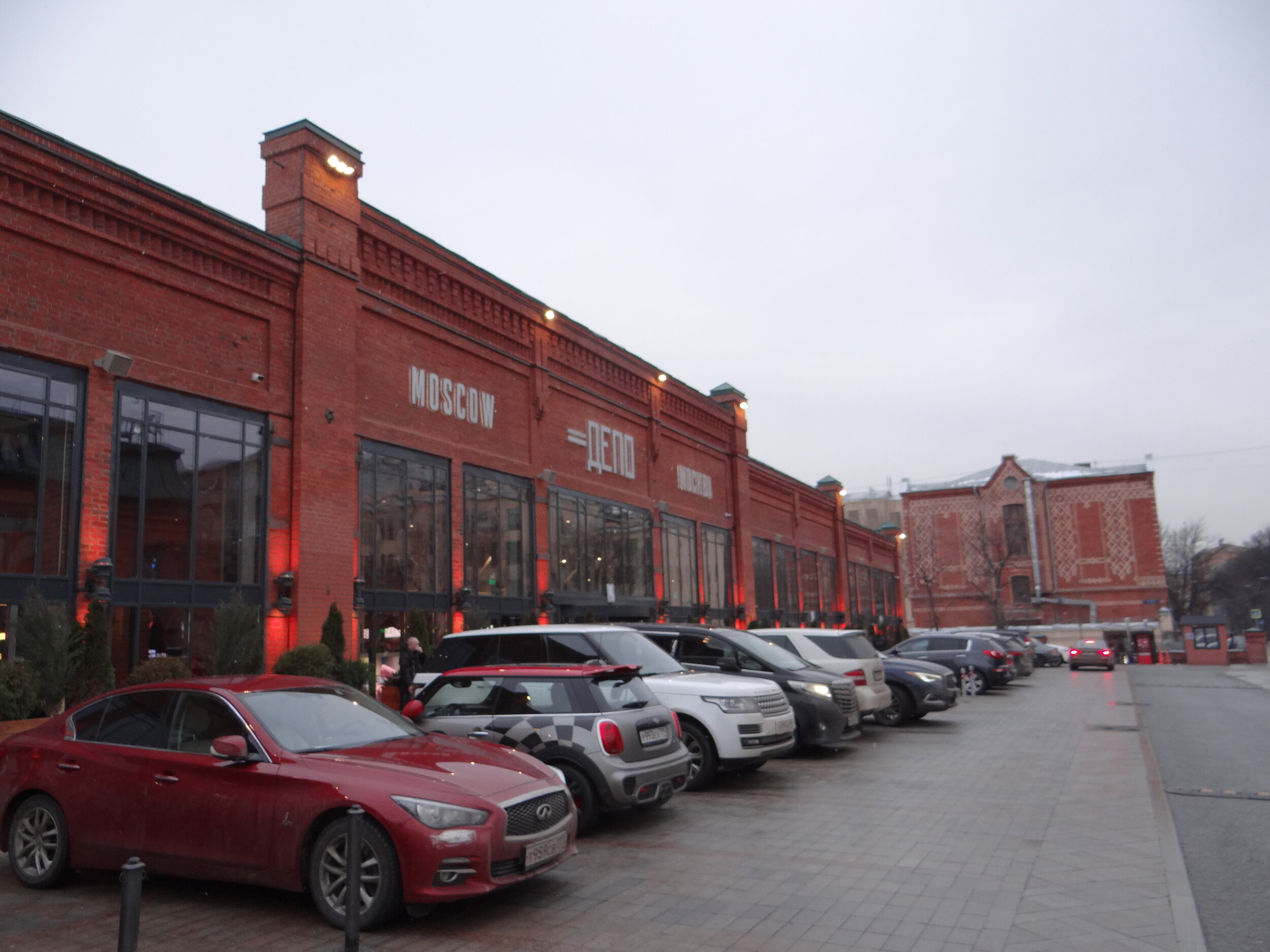
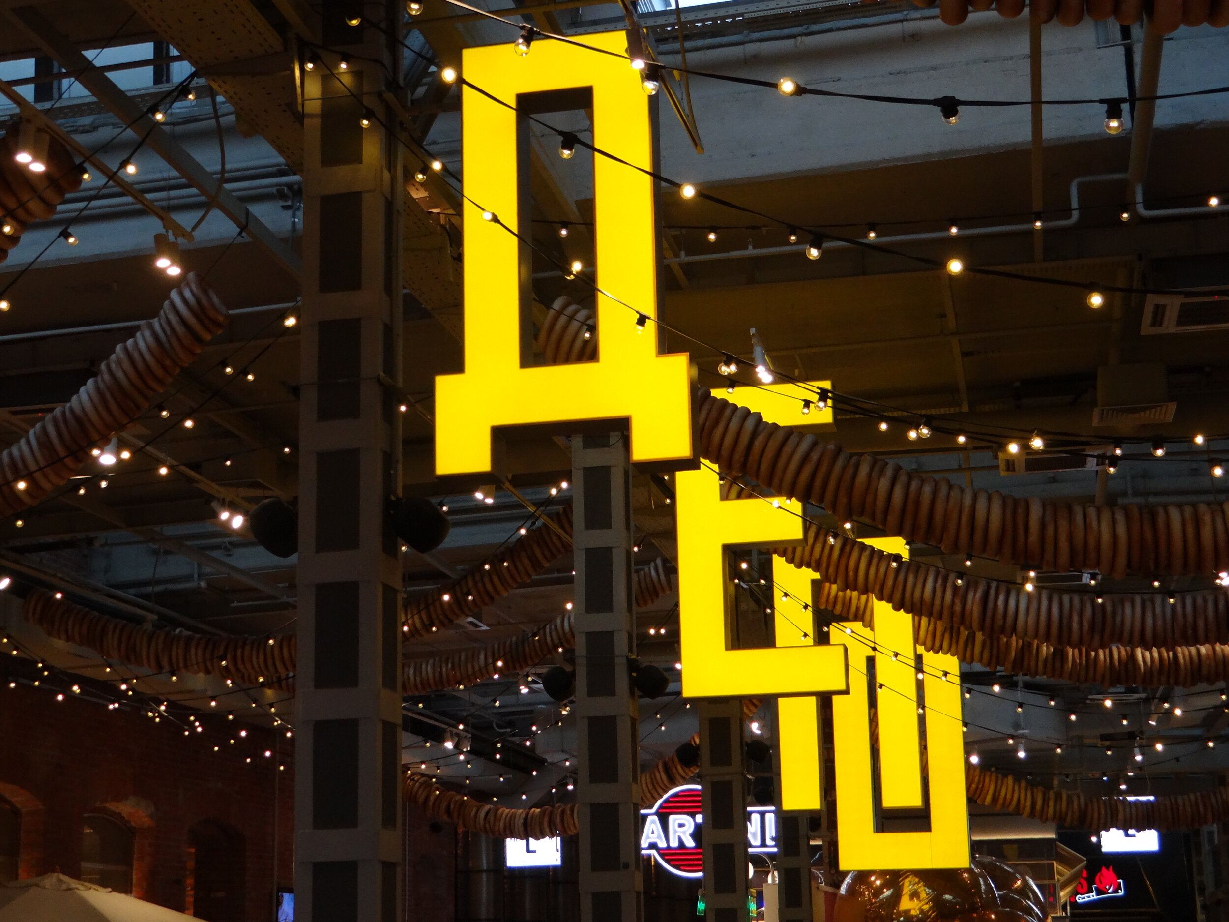
Depo (“Депо”)
I have deliberately left for last what is arguably the largest and most diverse of Moscow’s new generation food courts
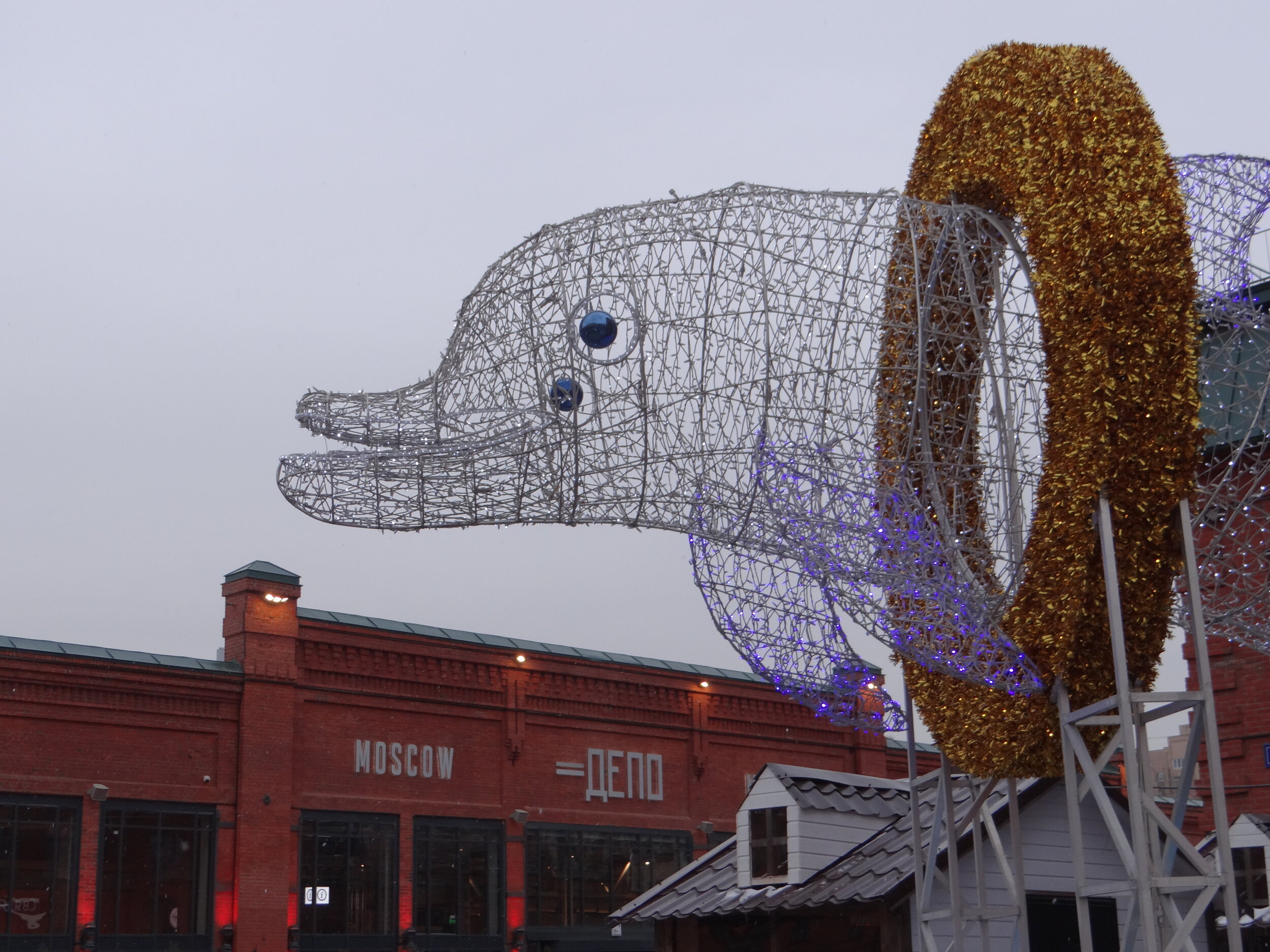
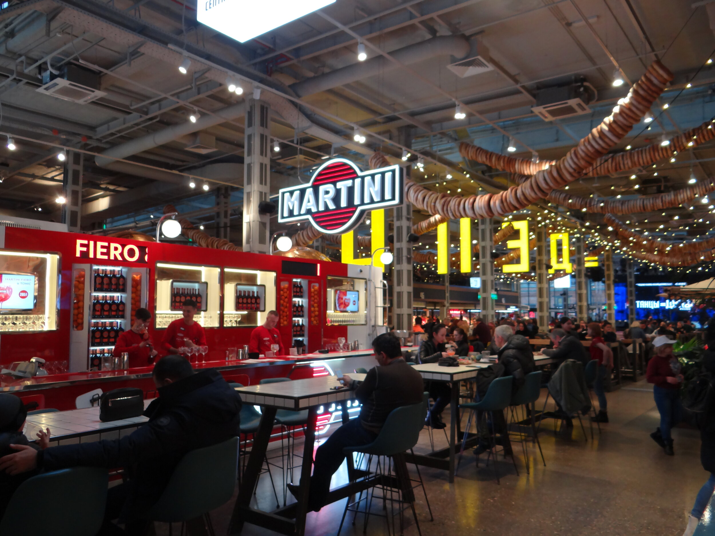
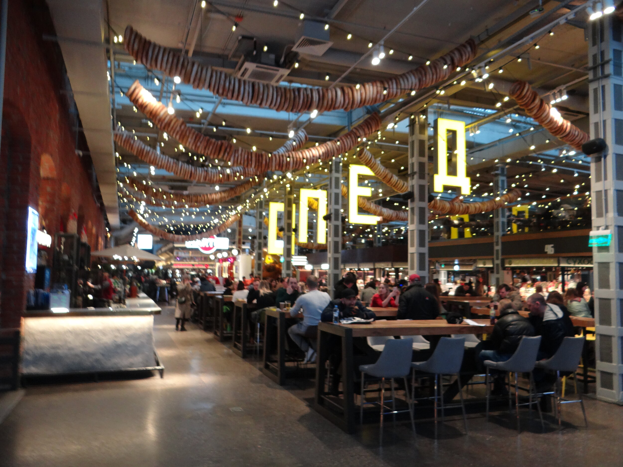
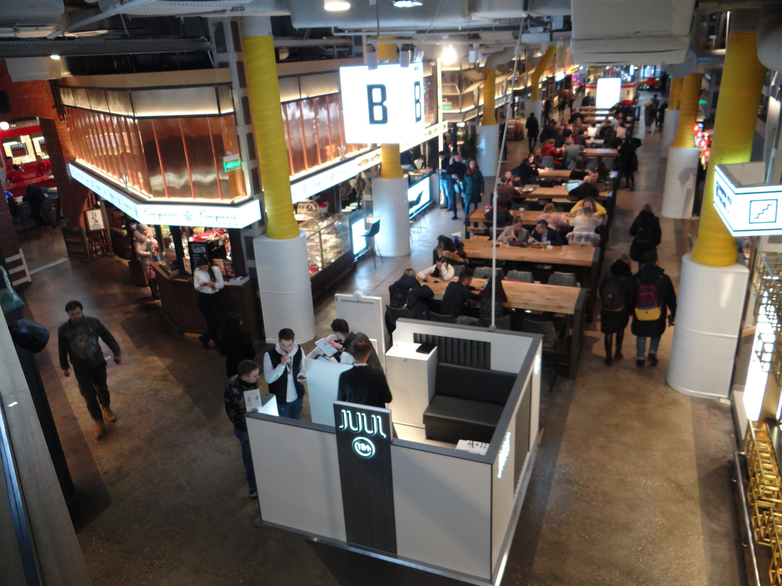
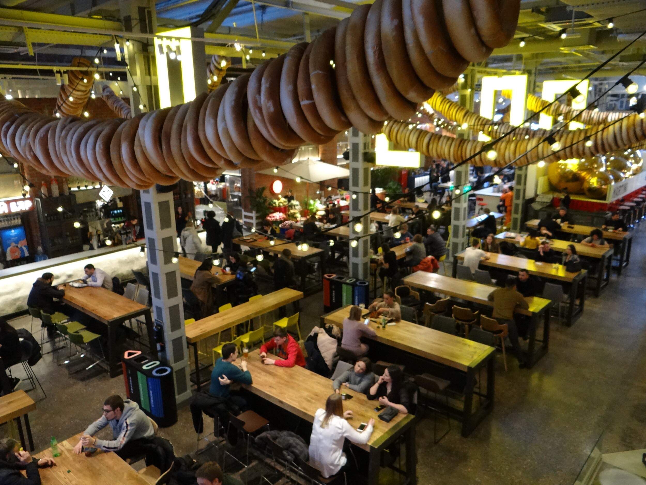
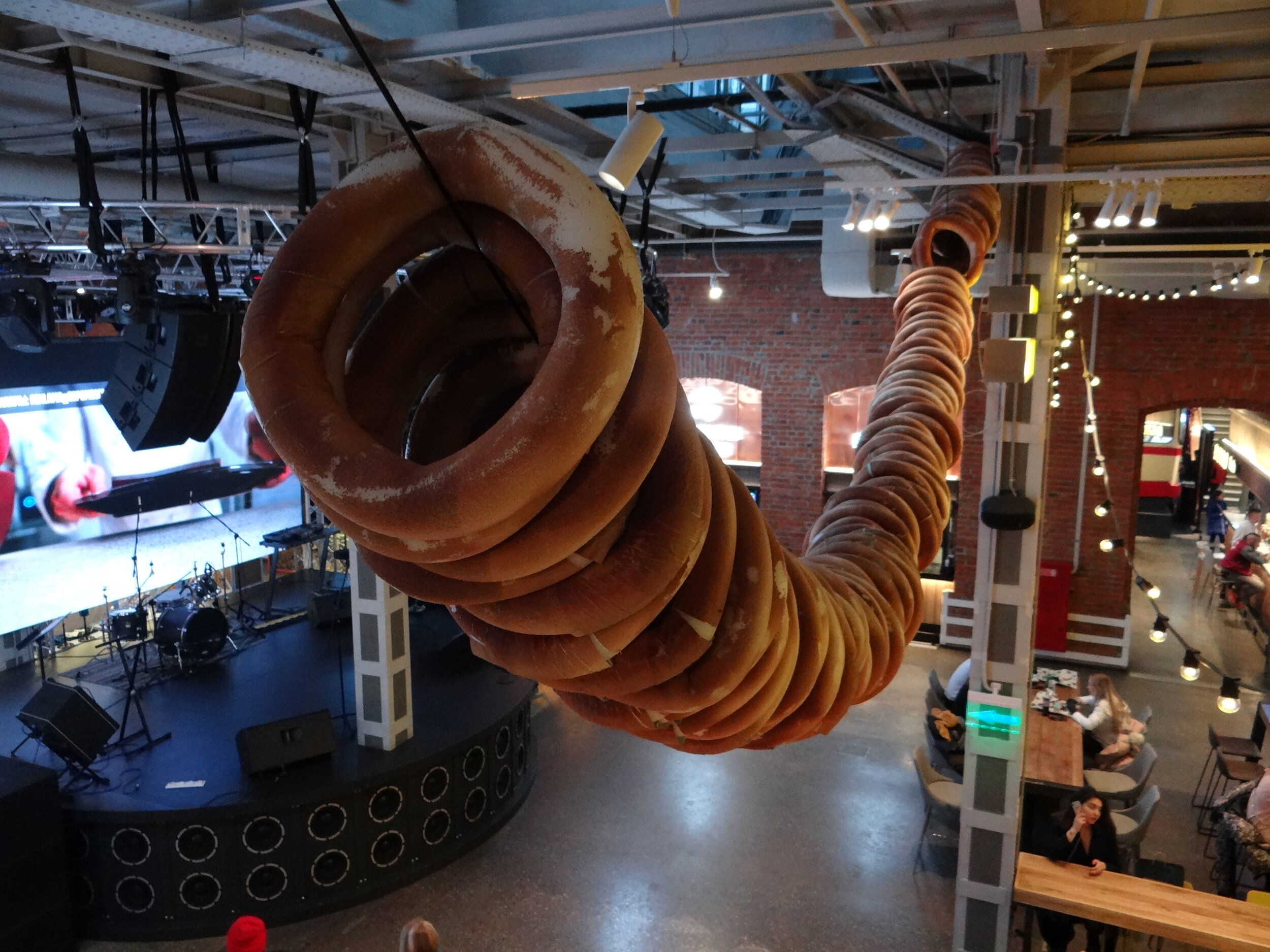
“Depo Moscow Foodmall”, which opened in 2019, claims to be the largest food mall in Europe and while I have no way to verify this, it is certainly very large and a remarkable sensory experience.
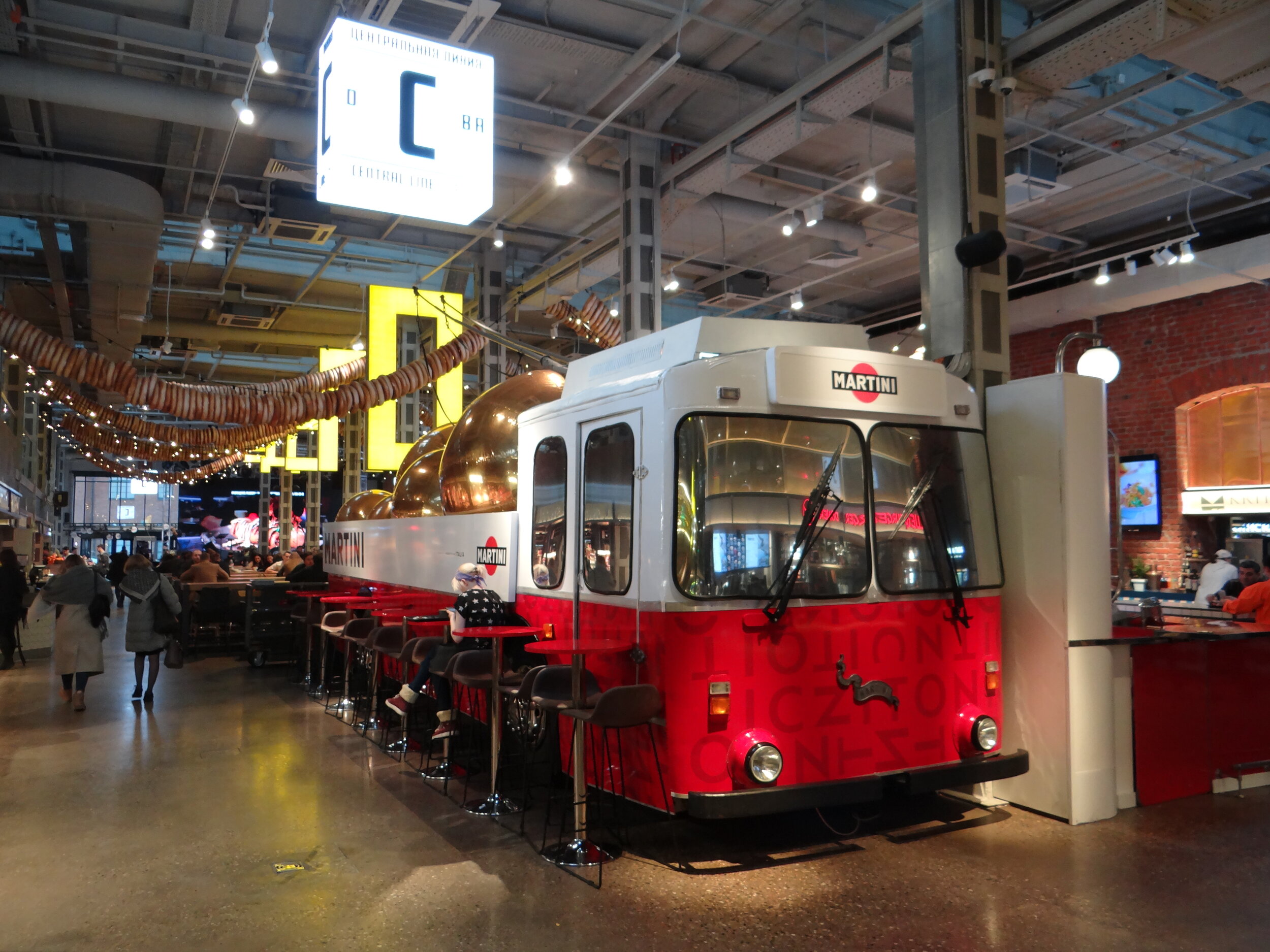
Its name “Depo” is not coincidental: it is housed in what used to be the maintenance depot of Moscow’s municipal bus company.
Depo is part of a rather large red-brick compound very close to Belorusskaya station, one of Moscow’s main business hubs (many multinational companies have their offices nearby) and the terminus of Aeroexpress, the direct fast train to Sheremetyevo airport.
In addition to the foodmall, some of the nearby buildings house restaurants, cafés or shops, thus helping make of this also a rather busy culinary entrepot
Depo Moscow Foodmall
Lesnaya Ulitsa, 20
Moscow 125047
Metro: Belorruskaya or Novoslobodskaya
Welcoming visitors at Depo are some of the old buses that used this facility when it was a repair and maintenance shop. A nice touch that, in addition to paying homage to the place’s heritage, adds a touch of character and uniqueness (not to mention that old buses can make for a nice Martini bar too!).
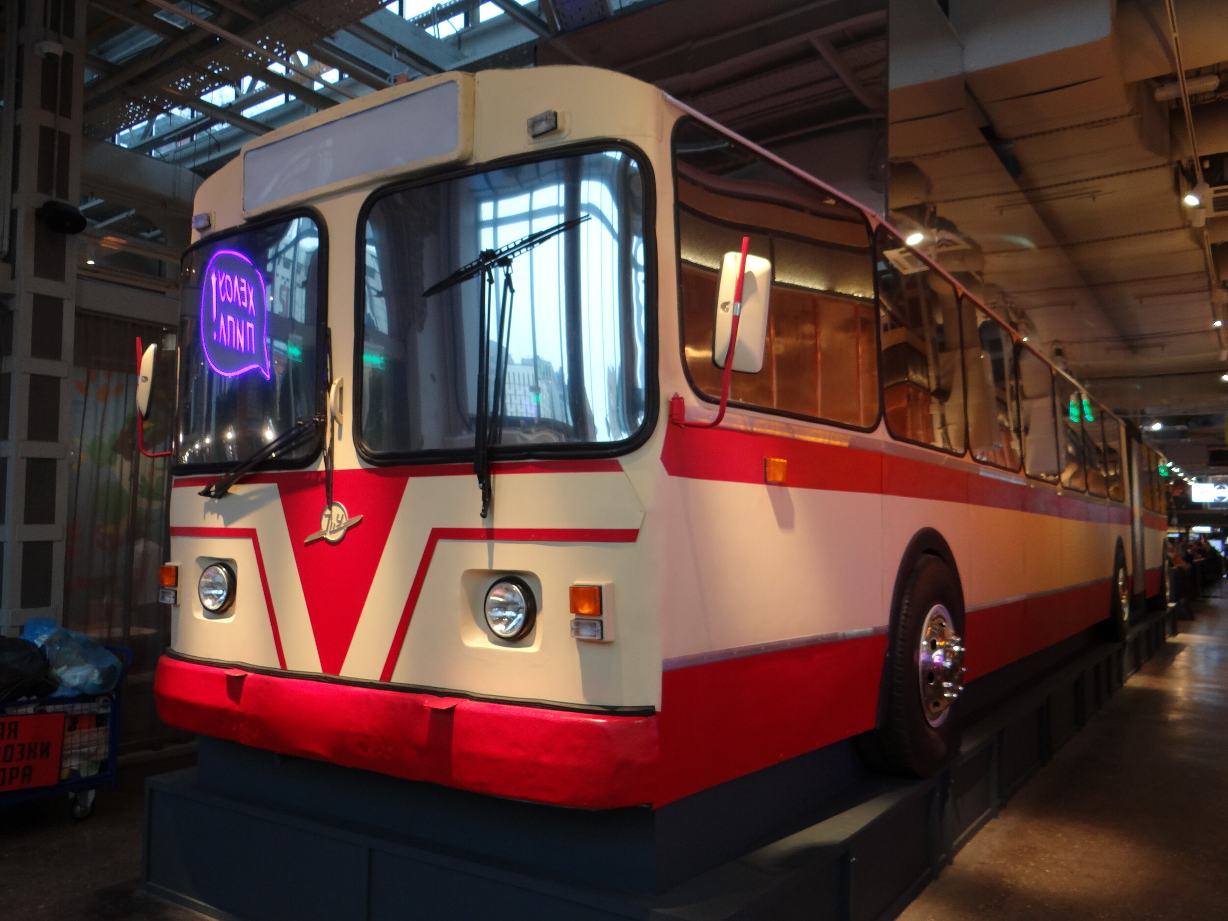
Before making you choices I would recommend any first time visitors to Depo to walk around and check out the different aisles thoroughly, the amount of food choices is simply staggering!
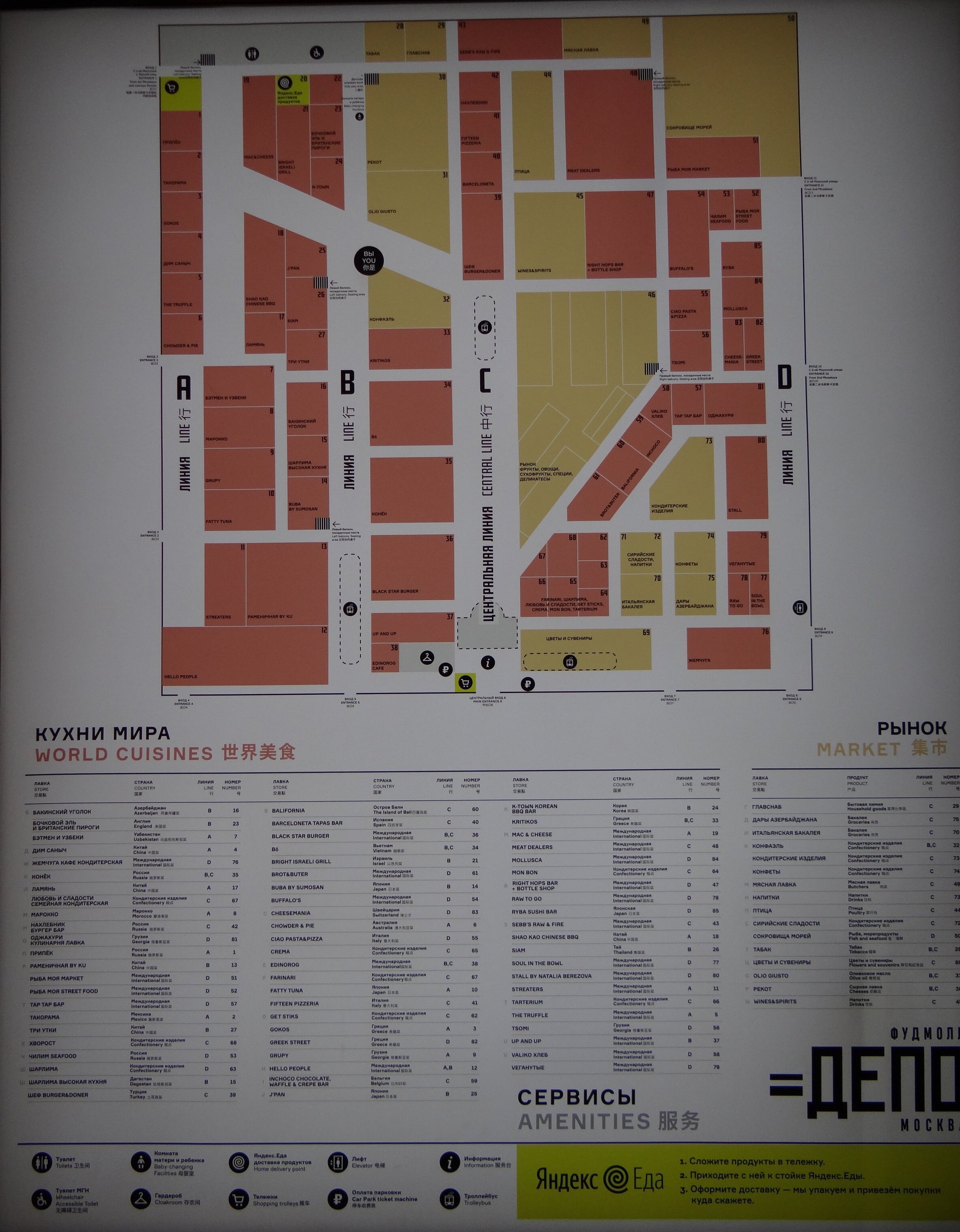
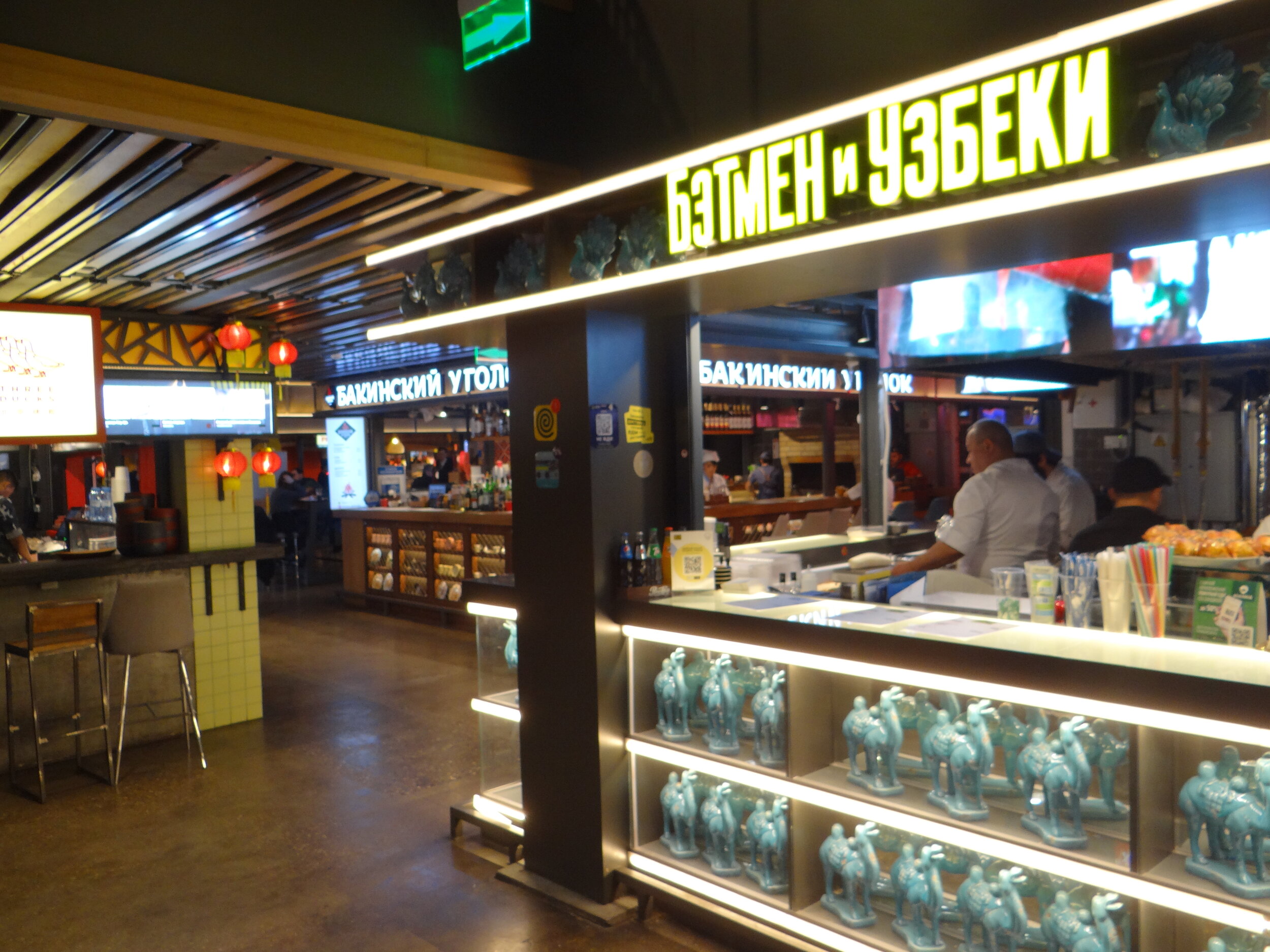
More than 60 food establishments have a stall at Depo, with pretty much all major culinary styles from around the world represented here: Russian, Central Asian, Chinese, Vietnamese, Italian, Middle Eastern, Greek, Japanese…there’s even a traditional English pie shop!
Seating is available on a couple of larger open halls, but also in myriad other smaller spaces scattered on two levels all over this larger former industrial setting.
A little army of service staff makes sure that all is impeccably clean. Make sure you don’t leave your food try unattended for even a few minutes…chances are that it will be removed and thrown to the bin!
If there’s a place where the paradox of choice can be plainly explained and experienced, this is Depo! Granted, it may not be high cuisine, but we are talking tasty, varied and reasonably priced casual eating here.
Just imagine working in one of the nearby office blocks and compare with the typical workplace canteen. Or let’s say you can’t make your mind and want to try small portions, mixing different tastes and products. Or you are a group with varied preferences. Problem sorted!
In addition to the ready to eat food, there is also a market at Depo, where you can buy different types of products, from dried fruit to fresh vegetables and imported products. Unlike the restaurant stalls, it is rather upmarket here.
Talking upmarket…there is even a small Gucci store within the premises!
And it is not just about food…the central hall at Depo has also a stage for all sort of shows and performances.
In short, the latest major addition to Moscow’s food scene has lots going for it. Definitely a must visit if you happen to be around the Beloruskaya/Novoslobodskaya area and feeling hungry!
San Marino - "The Ancient Land of Liberty"
A day in the world’s oldest republic

What if I told you that the oldest nation-state in the world in continuous existence is the small land-locked Republic of San Marino?
Surrounded by Italian territory on all sides, the preservation of this political relic, which claims its origins stretch all the way back to the early 4th C. AD, seems almost like a miracle.
Perhaps divine intervention has had something to do with it, after all the Most Serene Republic of San Marino is named after a monk that went to live as an hermit on the slopes of Mount Titano, the mountain that is, both in a physical and spiritual sense, at the core of this proudly independent nation.
Even more remarkable is the fact that San Marino emerged unscathed from the political and military shake-up that was the Italian Risorgimento, which brought the many different kingdoms, dukedoms and states that until the mid-19th C. dotted the Italian Peninsula under the rule of an unified Italian state.
But what is there to do and to see in San Marino that makes it well worth a visit?
Keep reading to find out…
The Border

“Benvenuti nell’Antica Terra della Libertà” (which is Italian for “Welcome to the Ancient Land of Liberty”)
It took us about an hour drive from Bologna, where we had rented the car, to this road sign marking that informed us that we were about to enter this tiny sovereign island within the European Union.
Was it not for its presence, both on traffic signs and inscribed on the sides of a pedestrian elevated crossing, we would have hardly noticed that we were leaving Italy to enter one of Europe’s remaining micro-states and one of the smallest sovereign nations on Earth.

In fact, entering San Marino can feel a bit like an anti-climatic moment for enthusiasts of geographical curiosities. There are no border barriers of any sort between San Marino and Italy and no one to watch over the line. A simple concrete marking in the middle of a bridge (a dry river-bed marks the border) suffices.

The lack of border policing is, however, not due to a lack of police and military bodies in the tiny Republic.
Despite having a population of just over 30,000, San Marino has not only its own police force, but also a Gendarmerie, and several other military corps: the Guardia de Rocca (Guards of the Rock), the Guard of the Council, a volunteer Uniformed Militia and even a Crossbow Corps!
Nowadays these are, obviously confined to ceremonial duties, some of them faced no less than the Wehrmacht during WW2, when they help allied (mainly British and Indian) troops round up German prisoners after the Battle of of San Marino (also called the Battle of Monte Pulito), that took place partly within the confines of the Republic.
Although less dramatic, in the post-war years San Marino saw episodes of political upheaval which included a semi-successful coup that culminated in a rather bizarre episode that unfolded, literally, in one of the corners of the country, the so called Fatti di Rovereta.
In any case, and whether due to this impressive array of police and military units or because of the good nature of their inhabitants, San Marino tops the global league tables when it comes to incarceration rates, with total figures usually in the single digits (on some years, such as 2011, the figure can be as low as one person!). So, I guess, you can feel really safe here!
Visiting Monte Titano and the Old Town of San Marino
Once in Sammarinese territory, you may wanna get up to the top of Mount Titano, where the capital and pretty much everything else of interest (besides de border itself) is located.
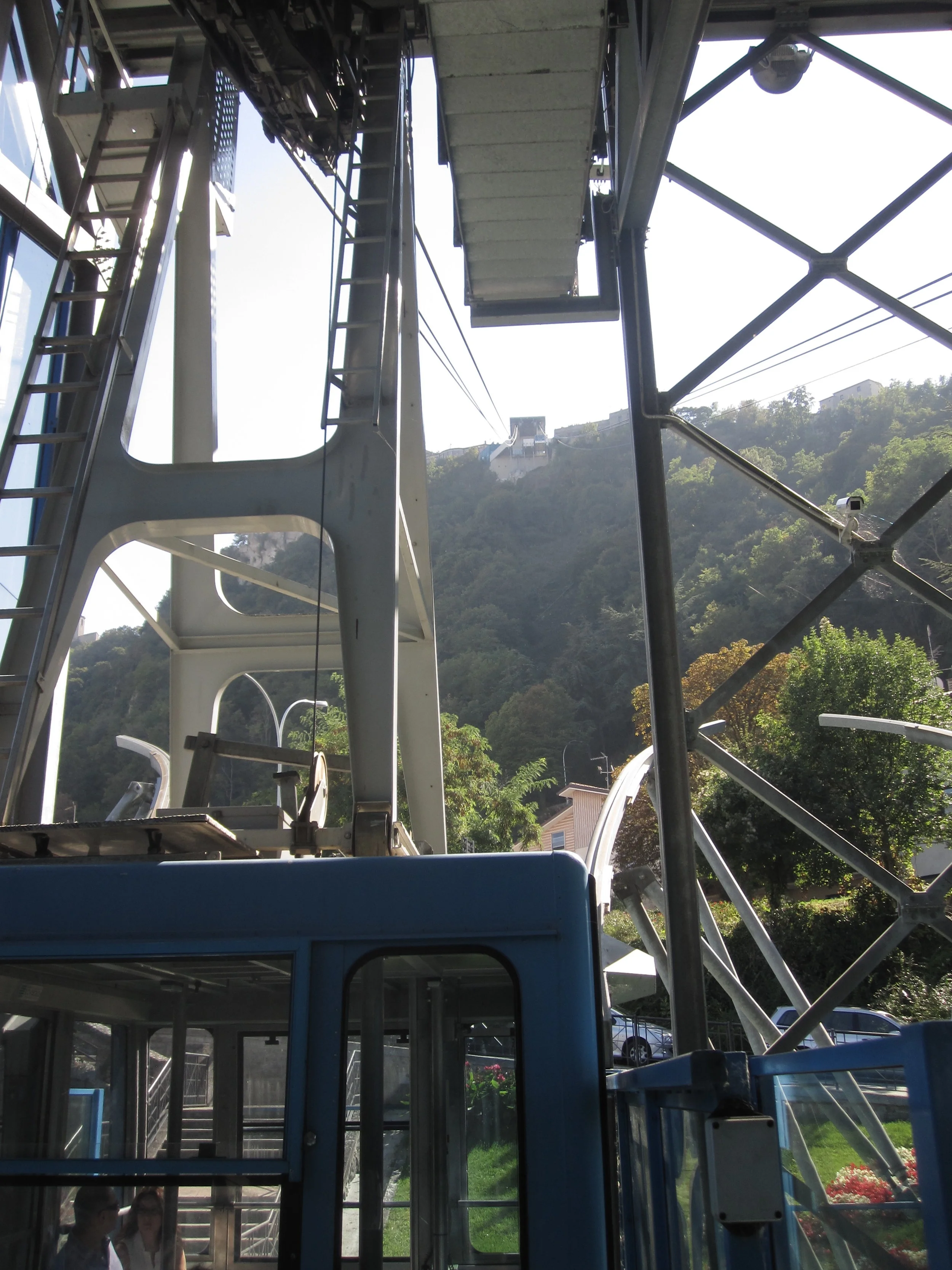
And the best and most scenic way to do so is to park your car in the plain and take the cable car (called “Funivia di San Marino”) all the way up to the old town. A return ticket costs €4.5.
When you get uptown, you may think you have reached some sort of fairy tale principality, particularly if, as it was our case, you inadvertently arrive on the day in which the Captain-Regents rotate and there are soldiers in their traditional vintage uniforms walking around.

The ceremony to change the two Captains-Regents is one of the most prominent features of the very peculiar political system of San Marino, one of only two countries in the world (the other is Andorra), where the responsibility of head of state is exercised at the same time by two people (technically known as a “diarchy”).
In the case of San Marino, these two people, the Captain-Regents, that are at the same time Heads of State and Heads of Government, are changed by rotation every six months.
Whenever is time to renew them, a ceremony takes place at the Palazzo Pubblico (San Marino’s government house) in the old town’s main square.
But even if you just visit on a normal day, you likely won’t be disappointed. This is not because there are any major attractions in San Marino’s old town, but because of the rather harmonious ensemble: nice views, plenty of flowers and the allure of walking through the heart of what is possibly one of the world’s oldest democracies. The old town and Mount Titano are classed as a World Heritage Site by UNESCO.

Those interested in political tourism and memorabilia have three things to do in San Marino: first of all, go to the tourist office to get a stamp in your passport. As we explained earlier, there is no border control or customs when you drive into San Marino from Italy, but those avid to collect passport stamps can get a very nice one upon request. You just need to walk into the Tourist Office, pay €5 and they will stick a nice stamp with the San Marino’s coast of arms onto your passport. A rather original souvenir!
You can also get San Marino postal stamps and a San Marino Euro coin set at any of the many souvenir shops in the old town. These sells for more than its nominal value of €12, but given the scarcity of Sammarinese euro coinage it is likely to fetch higher prices elsewhere.

Other than that, truth be told, when it comes to shopping, there is little else of interest in San Marino.
The other must is the fortress, the “Rocca” in Italian.
It is located at the very top of Mount Titano, a mountain with an elongated shape raising from the adjacent plains as if it was the crest of a wave.
Regardless of the historical value of the well preserved (or restored) castle, from here you can enjoy some amazing views. Obviously of the whole republic of San Marino but also beyond, all the way to the sea and Rimini (the closest decently-sized city).


And this is it, really.
I would like to post some recommendation about where to stay in San Marino, but we didn’t spend the night there and went to Rimini instead, where there are literally hundreds of hotels, since it is a major seaside resort.
Neither can I write any recommendation about where to eat in San Marino, because we did not really find any place worth the mention. Perhaps because we got there a bit late to conduct some proper research, but we ended up eating a re-heated pizza slice in a non-descript bar by the main shopping street. Nothing to write home about, even less on this site.
To be fair, San Marino packs as much charm and picturesqueness in its 61 sq km of territory as you could possibly ask for!
What to see near San Marino: San Leo (Italy)
Bonus points: if there is enough time, I would recommend combining a trip to San Marino with that of nearby San Leo, already in Italian territory.

San Leo is a rather picturesque, hilltop village located on a rocky outcrop (to get there you need to drive through a rather narrow road that at some points seems to have been literally carved out of the rock.
It does have cobbled streets, houses painted in ochre tones, a 12th C. church, a town square with a nice stone fountain and a pretty impressive fortress that looks like every castle should look like, with four massive round stone towers protecting each one of its corners (although unfortunately I did not have time to take a picture before it got dark!).


Winter in Sakhalin, Russia's largest island
Russia’s best kept secret

Sakhalin is the largest Russian island. It is larger than Ireland, yet, barely half a million people live on it, most of them in the capital, that lies at its southern tip.
I had wanted to visit this far-flung part of Russia for already quite some time and the opportunity just came up during winter time, which is sort of low season there, but, on the other hand, allowed me to discover a proper snowy wonderland where few tourists venture.
Right after my trip I published this article on CNN, where I compiled some of my impressions from my visit to the island, but I was left with the feeling that one single piece was not enough to describe this very interesting, off-the-beaten path destination as thoroughly as I would have wanted.
So, I decided to pen yet another post with some extra pictures and additional information that didn’t make it to the CNN article.
Visiting Yuzhno-Sakhalinsk

This was a quick, 3-day trip to Sakhalin.
Take away jet-lag recovery (Sakhalin is 10 hours ahead of Moscow, the city I was flying from) and the morning transfers and waiting time at the airport and I was left with something like 48 hours “effective” hours to explore the island.
So my visit was focused on Yuzhno-Sakhalinsk, the capital city. However, I could arrange a private tour: a half-day excursion along the Eastern coast of the island. And this was a great decision, the experience certainly did not disappoint me! (more on this further in this post).
How to get to Yuzhno-Sakhalinsk

Sakhalin is just 40km north of the island of Hokkaido and there is a ferry that travels between this northernmost Japanese island and Korsakov, a port in southern Sakhalin.
The most practical way to get to get to Sakhalin, though, is by air.
Although rather small, Yuzhno-Sakhalinsk has an international airport with regular connections to Japan, South Korea and China, in addition to Vladivostok, the capital of Russia’s Far East, on the mainland. For travellers coming from Europe, though, the easiest and cheapest way is, in most case, via Moscow.
There are daily direct flights between Moscow and Yuzhno-Sakhalinsk, operated by both Aeroflot and its subsidiary Rossiya, and it is possible to find very reasonably priced tickets if you fly off-season. For example, I could get a ticket for some €350 return, which is rather good for a 10-hour flight!

The airport is not far from the centre of Yuzhno-Sakhalinsk. There is little in the way of public transportation, but a taxi ordered through the Yandex.taxi (an app that I recommend downloading to everyone visiting Russia - it is also the local Uber partner) application should cost no more than 500 rubles (or around €7-8, less than $10).
If travelling in Winter, get some warm clothes, since it can be pretty cold! You have been warned!

By the way, the region of Sakhalin includes also the Kuril Islands (as this poster at Yuzhno-Sakhalinsk airport conveniently reminds us). This is definitely a destination I would consider for another trip, although foreigners need a special permit to be able to visit (the southern Kurils have been the object of a territorial dispute with Japan since the end of WW2).


Yuzhno-Sakhalinsk airport is far from grandiose. In fact, at the time of my visit, its old terminal was showing quite evident signs of ageing and decay. The good news are that a new terminal is already being built next to it following modern standards. It should be ready sometime in 2020.
(You can find more about commercial aviation and traveling by air in the Russian Far East in this article)
Things to do and things to see in Yuzhno-Sakhalinsk
One of the first sights one comes across when driving into Yuzhno-Sakhalinsk is the gleaming towers of the Cathedral of the Nativity.
This is, apparently, the largest Orthodox church in the Russian Far East and it was inaugurated as recently as 2016!
It is located on a hillside elevation on the eastern side of town, right next to two other attractions of the city: the WW2 museum and one of the access points (via lift) to the ski resort of Gorniy Vozdukh (“mountain air” in Russian).

The contrast between the traditional, rather majestic, religious architecture of the cathedral and the, also monumental, military museum next door, makes for quite a few impressive perspectives, particularly on a sunny morning, when the snow and the cupolas reflect the rays of the sun!

City Center and War Memorials
Yuzhno-Sakhalinsk is a city of wide, straight avenues forming a grid. The buildings are , for the most part, Soviet-style residential blocks, although not as tall or dense as those found in Moscow or other cities in the Western part of Russia. Scattered all over the place you can find also some more modern constructions, offices and commercial centres, I’d say of a rather uninspiring architectural style.


The dimensions of the city mean that most of downtown is walkable, though.
Pretty much all avenues are fitted with broad pedestrian sidewalks that allow for rather pleasant walks when the weather is sunny. The reticular pattern of the streets means that it is relatively easy to find your way around.
You can also extend the walk into Gagarin Park, the city’s main urban recreation area. It has quite an amusement park, a reservoir and its very own miniature railways.
Sakhalin Railway Museum
Talking about railways, next to the Yuzhno-Sakhalinsk’s railway station (there is one single rail line in Sakhalin, that runs along the whole length of the island) there is what looks like a rather interesting railway museum with several historical locomotives on display outdoors.
Unfortunately, I did not have time to step inside, but i could check some of the historical locomotives from the outside.

Sakhalin Regional Museum
This is yet another must-see place in Yuzhno-Sakhalinsk. Don’t be misled by the rather humble, unassuming name.
This is a small museum, granted. But it is a great place to get in a relatively short time, quite a comprehensive view of the natural and human history of the island of Sakhalin, with a special mention to the role of Sakhalin as a bone of contention between the Russian and Japanese empires (in fact, the Southern half of the island, including Yuzhno-Sakhalinsk, was under Japanese rule for several decades until the end of WW2)
To add interest to the museum, the building where it is housed is one of the few buildings left from the time of Japanese rule, as it is pretty obvious from the style if was built in.


A Japanese, WW2-era light tank
During WW2, Sakhalin went from being as far as it gets from the front (while the Soviet Union was fighting Germany in Europe) to becoming a front line in the last few weeks of the war, when the Soviets joined the fight against Japan.
Military history is very present all around the city. In addition to the dedicated WW2 museum, there are quite a few places where it is possible to see all sorts of vintage military hardware, from tanks and artillery to fighter jets, as you can see in these images.

And these are Soviet tanks, also from WW2

But the most gripping, solemn, of all the military-related points of interest in Sakhalin is the war memorial dedicated to those fallen in WW2, or “Great Patriotic War” as the Russians prefer to call it.


Skiing in Sakhalin
Another interesting and rather unique thing you can do in Yuzhno-Sakhalinsk is the opportunity to ski in a semi-urban setting..
The ski resort of Gorniy Vozdukh is located on a hill side overlooking the city and you can, actually, take the lift pretty much from the city centre, since the base access point is located next to the cathedral, as you can see in the photo below.

It is a small resort, but it has the views! Where else can you ski within sight of a city of half a million?
Despite there being plenty of snow (or perhaps because of this) when I visited, in early December, the slopes were not open to the public yet. Workers were rushing to get everything ready for the season’s opening.

Shopping in Yuzhno-Sakhalinsk
Although Yuzhno-Sakhalinsk is not exactly a great shopping destination, there is the one thing that you can’t miss: fish and seafood!
Sakhalin is a sort of seafood-lovers paradise (and in fact all over Russia, seafood from Sakhalin and the country’s Far East enjoys a well deserved reputation).
Yuzhno-Sakhalinsk fish market is, thus, another must for any visitor. Here you will find all sort of seafood: fresh, canned, dried…some of it, perfectly packed and ready to take with you to the plane.
Two of the most celebrated products: giant read crab and caviar. Each of these two products is available in multiple variations and permutations. There is also plenty of salmon of all sorts.
Here is the address of Yuzhno-Sakhalinsk main fish and seafood market:
Uspekh Market
Sakhalinskaya Ulitsa, 71
Yuzhno-Sakhalinsk 693005

A great find, and one that is not too expensive and easy to bring with back with you on the plane, are the small chunks of dried salmon and other types of fish (sold perfectly vacuum-packed), which make for delicious snacking!).

There are also plenty of street vendors offering frozen fish and seafood next to other sorts of (non-edible) merchandise. Since the air is so cold, no natural refrigeration is needed. People would just get it wrapped in any sort of paper or cardboard to take home!

Day Excursions from Yuzhno-Sakhalinsk

If you get the chance, do not hesitate to arrange some excursion out of the city to experience the unspoiled nature of this island!
To do so, I’d recommend contacting one of the local tour agencies, which will provide a guide an a car. Usually these run tours for groups (if you are travelling alone you may either join a group or you can arrange a private tour).
I booked my tour with Druzya Pokhodniki (http://pohodniki.net). A day excursion in a 4x4 vehicle cost around 10,000 rubles, although the fee per person is lower if you travel as part of a larger group. The manager, Ekaterina, is fluent in English and she may bring her lovely dog “Yasha” to the excursion too!
(btw, they also have a great and rather popular Instagram profile where you can get a feel of the excursions: @druzia_pohodniki)
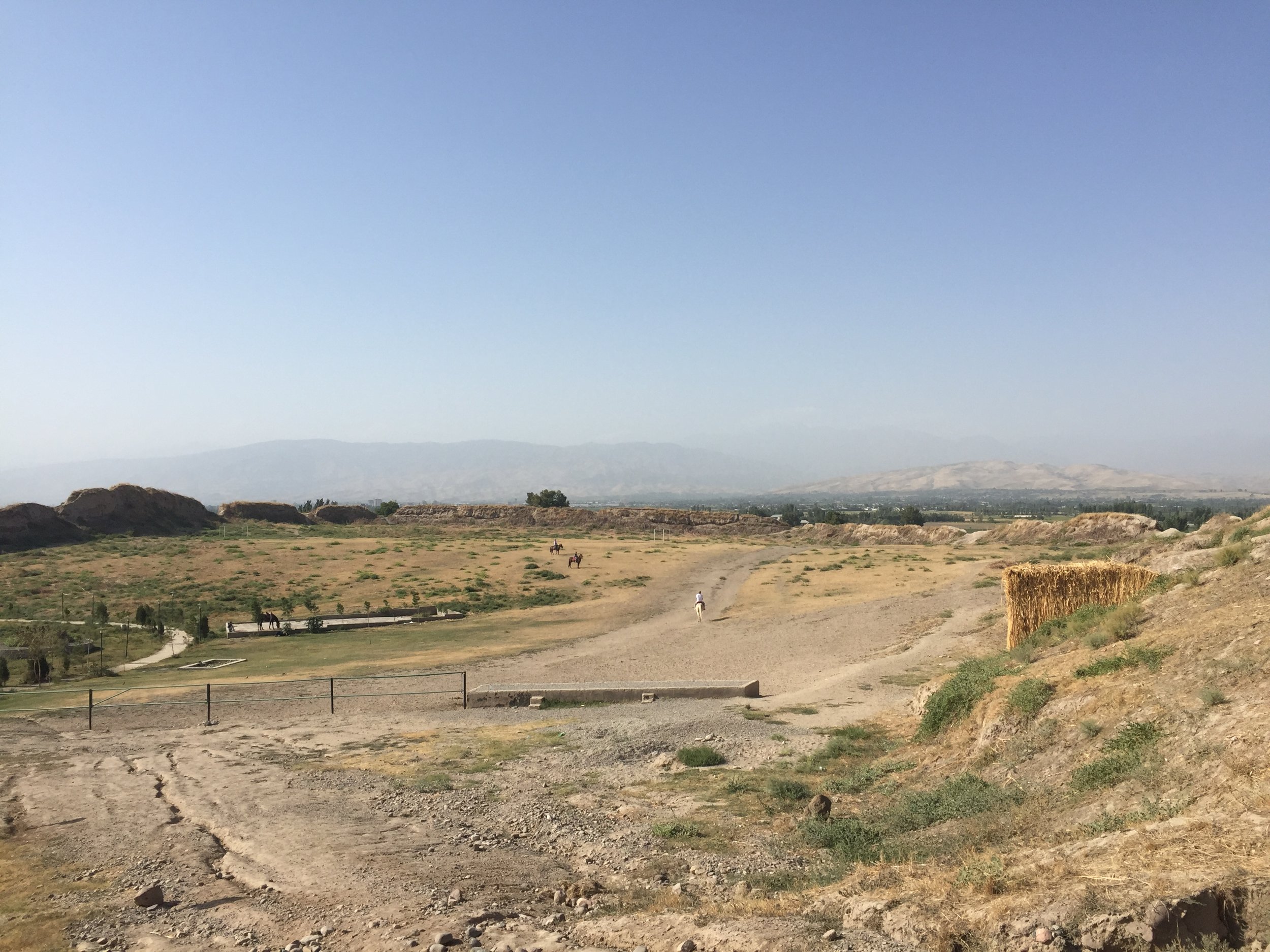
The initial idea was to do a day trip to Cape Giant, a peculiar rock formation on the coast south-east of Yuzhno-Sakhalinsk, yet, due to the weather and road conditions in the area, we finally opted for another destination: Bukhta Tikhaya (“Quiet Bay”) some 50km north of Yuzhno, on the east coast of the island.

And “quiet” it was!
This is a secluded bay that, at the time of our visit, was covered in ice and snow. This rugged, frozen coast could well have been somewhere in Antarctica!
And no one on sight for miles and miles! It is quite amazing to think that this unspoilt nature is literally less than a hundred miles away from densely populated Japan and less than two hours away from hundreds of millions of potential visitors.

To get there you had to drive along the only road along the east coast of the island, with magnificent views of the mountain range that runs all along the centre of the island. Although Sakhalin is quite a narrow (some 40 miles at the narrowest point), it is very mountainous. The only roads run along the coasts and the area in the middle is just a pretty much impassable forested wilderness, covered in a velvety, thick powdery mantle, almost cotton-like.

We also stopped at a long open sandy beach, dunes and sand covered in snow, where amber is often found (and indeed we did find a crumb of amber!)

Along the way, nested on the side of small hill overlooking a small fishing hamlet, we stopped to see another of the vestiges of the Japanese era in Sakhalin: a ceremonial “torii” gate dedicated, back at the time when it was built, to the Emperor.
Its lonely presence, overlooking the ocean from the top of a hill, that you need to climb knee-deep snow, made it quite a sight!


And right after we visited the torii gate, we stopped again. But this time it was in order to get some provisions in the form of freshly caught giant crab.
Some local women from the fishermen’s village engage in fierce market competition here, selling freshly caught amazingly large red crabs to passers-by.
When you have selected the ones you want to take home, they pack them for you in some cardboard boxes. In this rudimentary packaging I managed to get two of them on the plane to Moscow for the long flight back…a tasty souvenir from Sakhalin!

Where to stay in Sakhalin
There are not many places to stay in Sakhalin. These are possibly the two nicest hotels, catering to an international clientele:
Mega Palace Hotel
https://megapalacehotel.ru
Pacific Plaza Hotel
http://www.sakhalinpacificplaza.ru
As the number of good quality hotels in Yuzhno-Sakhalinsk is somehow limited, a good alternative is to rent an apartment. With many new residential buildings being built at the moment in Yuzhno-Sakhalin, it is possible to find modern, furnished apartments for a good rate on Booking.com (as I did) or on other major hotel and apartment booking sites.
Where to eat in Sakhalin
It was a short visit but here are a couple of spots that I tried when in town:
Bambu Restaurant (inside Mega Palace Hotel)
Great for Asian food and local seafood specialities (more upmarket)
https://www.megapalacehotel.ru/services/restoran-bamboo/
Assorti
International cuisine, but with a focus on Japanese food and sushi. Rather casual.
http://cafe-assorti.com
Mooma, an apple paradise in Catalonia
A world of apples in the heart of the Costa Brava

If an apple prompted the expulsion of Adam and Eve from Paradise, a young local entrepreneur has created his very own apple paradise in a rural corner of Catalonia’s Baix Empordà region, right in the heart of the popular Costa Brava.
Every summer hundreds of thousands of holidaymakers from all over Europe flock to its great beaches and picturesque medieval towns that dot this flat and green area of Northern Catalonia.
Drive a few miles inland, though, and it is proper farm country.
Just like in other parts of Europe, with agricultural prices hardly keeping up with the general cost of living, local farmers are struggling to stay in business.
This was the case of the family behind the Mooma project. For six generations they have managed a farm called “Mas Saulot”, in the tiny hamlet of Palau-Sator.
Most of the lands within this property were devoted to growing apples and, in fact, the grandfather of the farm’s current owner was one of the founders of the local fruit cooperative. The problem was that selling apples was not a particularly profitable business and the mid to long term prospects did not look encouraging.

Aware of this fact, but convinced of the potential of their 80ha of apple trees, the youngest in the family set to travel around the world looking for inspirational success cases in the field of apple cultivation.
They went to places like England and Normandy, with a long tradition of turning apples into higher added value products such as cider.
This is how the idea for Mooma got started.

Mediterranean cider
“Mooma” is a portmanteau word formed by the “Mo”, the two first letters of “Montgrí”, the grey mountain that dominates the local landscape, and “poma”, the Catalan language word for “apple”

The Montgrí mountain is always in the background
Mooma would become a rather unique case of Mediterranean cider-making. In fact, its owners claim it is the only cider brewery located right on the Mediterranean shores.
The issue for Mooma’s new cider brewery, which took its inspiration from the English cider brewing tradition, was that cider had a limited appeal in the local market. It is a niche product with little significant demand aside from some connoisseurs.

The answer was to diversify and start making apple juice
But people were then complaining it was too sweet, so they added green apple juice to make it more acidic, but then it was too acidic. It has been a trial and error process.
Currently you can buy apple juice made with 4 different apple varieties: Granny Smith, Pink Rose, Fuji and Royal Gala, each with its own set of characteristics (in fact the Mooma farm grows a few more varieties of apple in, but only these four are used to make juice)


And why I am writing about cider and apple-juice making in a site about travel?
Because, in a move that would prove essential for the future of the project, Mooma decided next to expand into the tourism and catering market.
From farm to mouth

While Mooma sits in the midst of one of Europe’s top summer tourist destinations, the idea of turning an apple farm into a tourist destination was a rather unique proposition in this part of the world, but one that has been proven to be a resounding success.
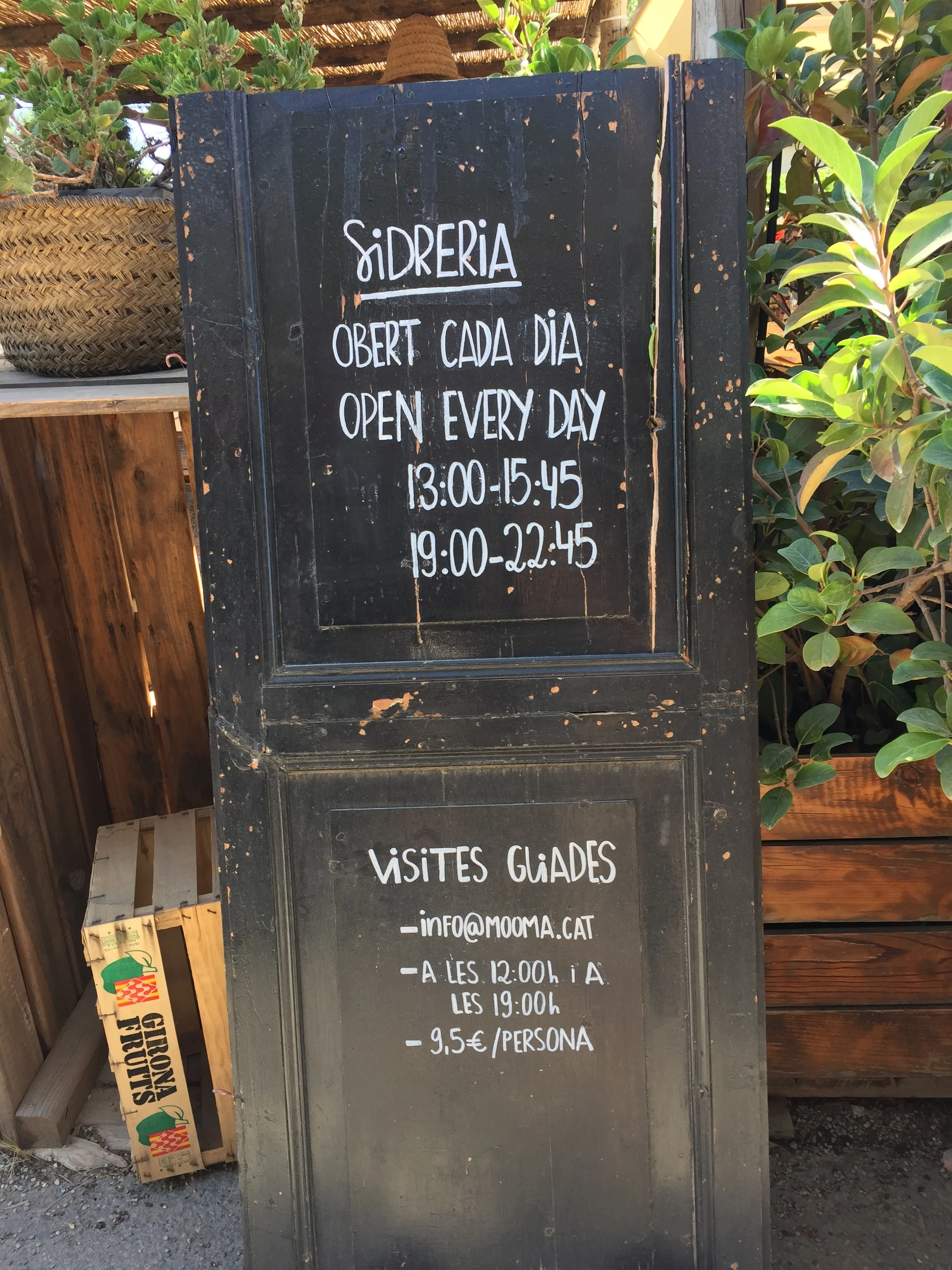
It all started by opening the doors of the farm to small tour groups, of 4 to 20 people, that would take a tour of the orchards (which in nice weather is quite a pleasant outdoor experience for all publics) as well as teh the facilities where cider and other apple by-products are made.
The cost of the visit: €9.50 per person
Tours tended to be in the mornings and then some people started to ask whether it was possible to have something for breakfast, so a patio next to the farm as turned into an impromptu restaurant.
This was an immediate success and, through word to mouth marketing, Mooma started to get increasing numbers of visitors.
It was time to become a gastronomic destination on its own right.
Nowadays, Mooma no longer serves breakfast, but it has become a proper restaurant. From June to September and on weekends during the rest of the year you can lunch or dine at Mooma.

The particularity is that pretty much all dishes are cooked with apples.
For drink you have a choice of different varieties of locally-made apple juice and cider, all made from apples grown at the property.
Staff are always ready to help make the choices, since not many people are familiar with the particularities of each type of apple.
In any case, be it because of the culinary experience, be it because of the appeal of the very explicit apple focus, Mooma has become a great example of local produce and specialization acting as a powerful business driver. It has also become a sort of “must see” place for many of the regular holidaymakers in the area that seek a unique experience aside from the sea and sand of the beaches.
With harvest running August to November, depending on the variety of apple (each of them is spaced out over a number of weeks) most of these visitors are able to see the apple orchards at its peak, with their branches full of apples awaiting to be harvested.

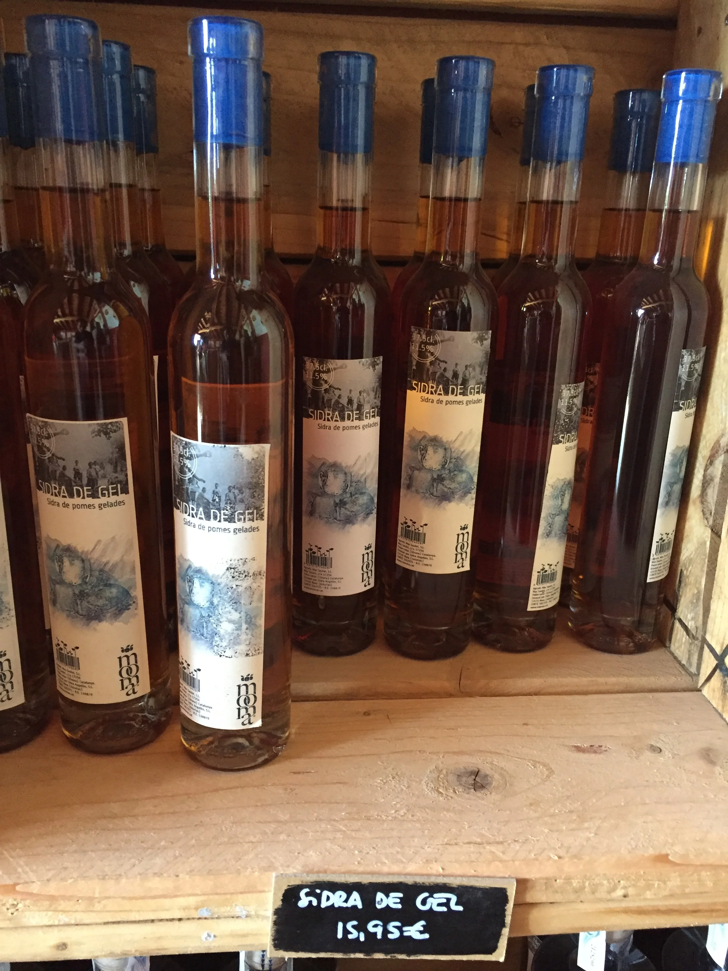
Also of interest is Mooma’s little shop, where you can buy the whole range of products, that, in addition to juice made with different varieties of apple, cide (and ice cider!), it includes also apple vinegar and perry (“pear” cider, elaborated by another, also local, producer) as well as some liquors.


How to get to Sidreria-Restaurant Mooma
Sidredría Mooma
Mas Saulot s/n 17257
Palau-Sator, Catalonia
info@mooma.cat


Urbino, home of Raphael
The little known jewell of the Renaissance

Perched on the north-eastern slopes of the Apennine mountains and roughly 30 miles from the Adriatic shores, the walled city of Urbino is a perfect way to step back 500 years in time, all the way back to Renaissance Italy.
Unlike the larger and way more crowded historical cities west of the Apennines, Urbino has preserved, within its stone walls, the charm of an idealized Italian Renaissance, complete with illustrated princes, warring “condottieri” and sublime artists.
Although nowadays Urbino is essentially a picturesque and placid provincial backwater, in the mid 15th century this one of the centres of power in the Italian peninsula and a hub of artistic activity.
The famous painter Raphael, who, together with Michelangelo and Leonardo, formed what is perhaps the best known trifecta of the history of art, was born in Urbino. In fact, he was known as “Raphael d’Urbino”.
The architect Bramante, another Renaissance super-star, also called Urbino home.
And, although these two artists worked mostly in other cities there is no shortage of Renaissance art in Urbino.
The local dynasty, the Montelfeltro ducal family, and, very particularly, duke Federico III de Montefeltro, who ruled Urbino for some forty years in the mid-15th century, turned this hilltop city into one of the centres of culture in Renaissance Italy.
In addition to being a “condottiero”, or one of the princes and warlords that played power politics during that messy period of Italian history, Federico de Montefeltro fully embodied the spirit of the “Renaissance man”. In addition to its political, military and diplomatic activities, he sponsored numerous artists and aim to attract artists and scientists to his court. Most of what one see today at the Palazzo Ducale, including the impressive art collection at the Galleria Nazionale delle Marche, is his legacy.
What to see and what to do in Urbino: ascent to the Old Town

Just like in the good old times of Duke Federico, visitors still enter Urbino through one of the gates in its walls (although the fortifications have suffered some modifications since the 15th century!).
We entered Urbino through the Porta Valbona, that is located next to the main car (and bus) park. This access point has the advantage of being located next to one of the most curious architectonical elements in Urbino, the “Rampa Elicoidale”.
What is the “rampa elicoidale”? Urbino is a rather steep city, with the ducal palace (“palazzo ducale”) dominating from its highest point. As there were no escalators or lifts in the 15th century, what they did was build a tower with an helicoidal ramp inside (as perfectly described by Italian name) so that duke Federico could come and go from his palace, from the upper town to downtown, while on horseback!
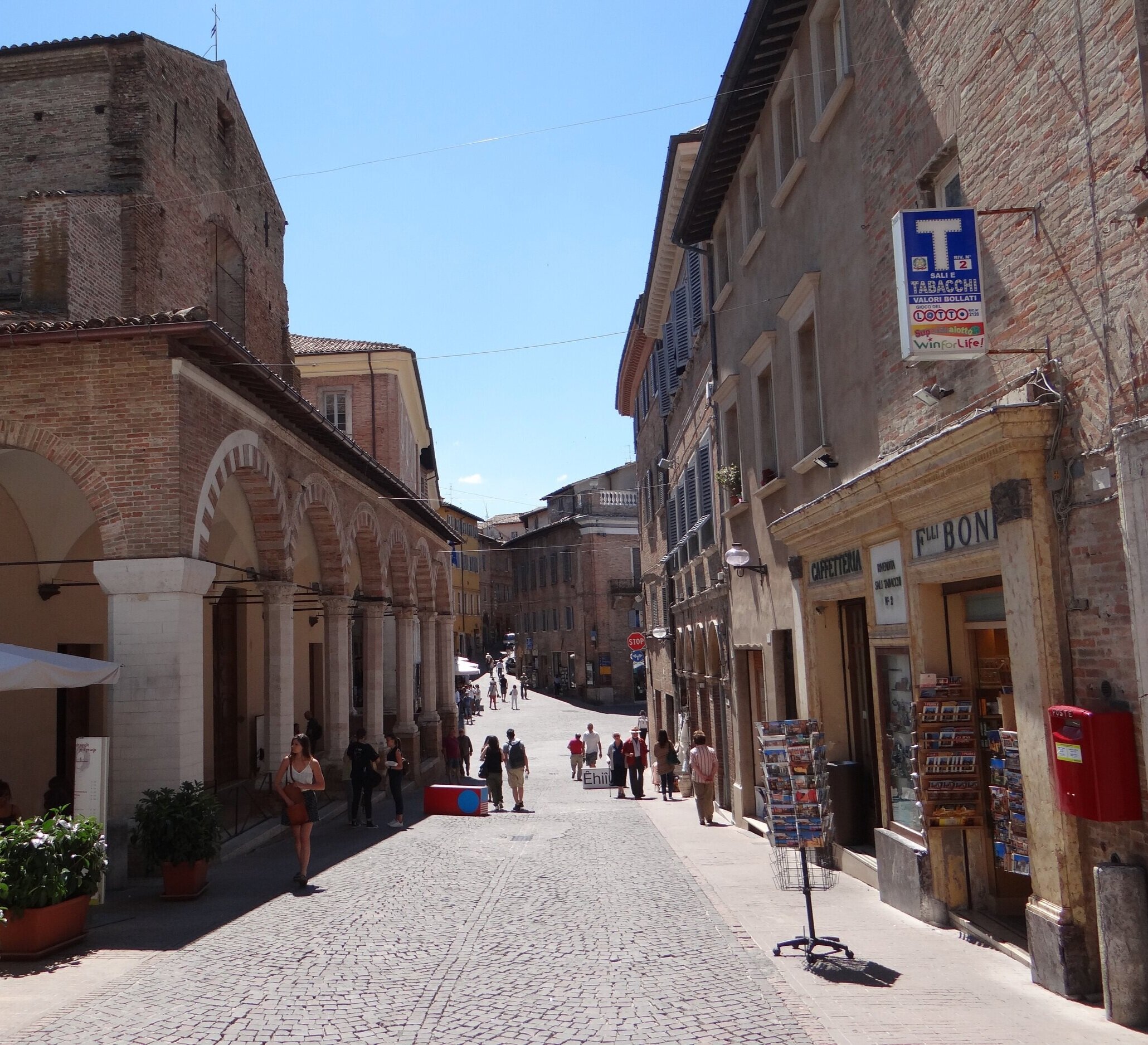
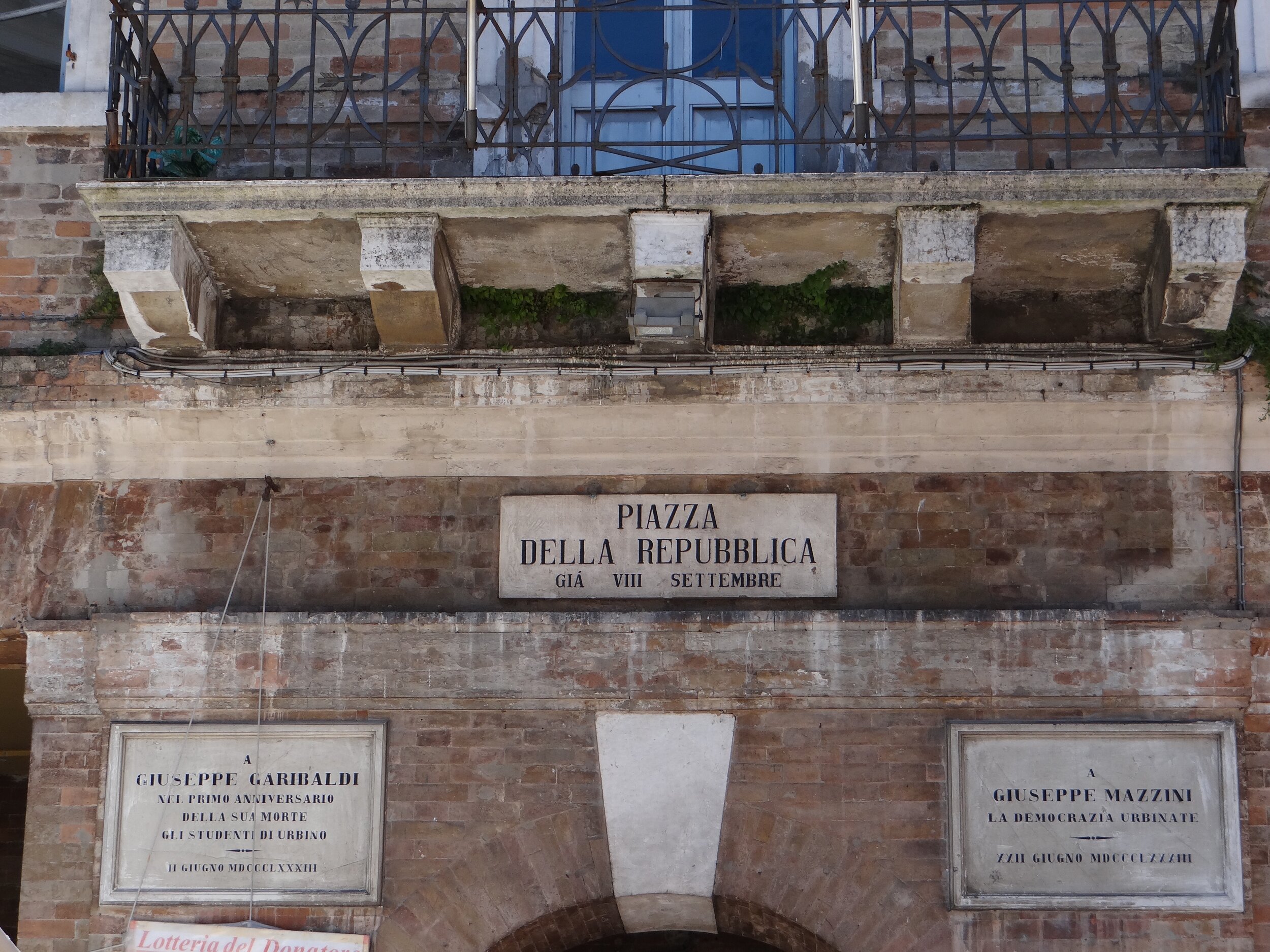
Once in the upper part of town, and on our way to the palazzo ducale, we get to the center of the historical city, around the Piazza della Repubblica.
It must be said, though, that despite its postcard-like aspect, the centre of Urbino experienced some changes since its apogee in the Renaissance period, particularly in the 19th century, when some of the main streets were enlarged and reorganized. This historical area, though, has undoubtedly retained its charm.
A short walk further uphill and we get to the political and religious centre of Urbino. Here is the Palazzo Ducale, the Montefeltro’s center of power, as well as the cathedral (the Duomo of Urbino) and several other churches.

Duomo of Urbino with its neoclassic facade
Although it can trace back its roots to at east the 11 century, the cathedral Urbino got a neoclassic face-lift in the early 19th century, when it was reconstructed following serious damage by an earthquake in the late 18th century.
Brick-like ochre tones are prevalent throughout Urbino’s old town, including the outer part of the ducal palace. As you can see in the pics below, only some neoclassic decor elements, such as some statues and church porticoes and facades, introduce some touches of colder white colour.


The ducal palace (“palazzo ducale”) is without doubt the top thing to see in Urbino.
This was, obviously, the centre of political power for a long period of time and the art-sponsoring activities of Federico de Montefeltro have left their mark. Even five centuries after his death and despite many works ending up in other cities, from Florence to Milan and Paris, as rulers and invaders came and went, the collection at the Galleria Nazionale delle Marche, hosted in the palace itself, is still one of the finest when it comes to Renaissance art.
Here you can find paintings by Raphael, Paolo Ucello, Piero della Francesca, or the great Titian.

Besides the art, the palace also offers an interesting glimpse onto the way of life in the princely courts of Renaissance Italy. Of particular interest is the private cabinet of Federico de Montefeltro, a space for the duke’s work and study full of references to what he saw as his role as a promoter of art and knowledge.
It is also possible to visit other areas of the palace such as what was the 15th century equivalent of a spa area, complete with hot and cold baths, located at the buildings lower levels in imitation of Roman termal baths.
The palace itself looks rather unassuming from the town side, with a rather unpretentious facade and an harmonious internal porticoed courtyard. One side of the palace, though, was built right on top of a cliff, with the walls (and different floors of the building), following the steep relief of the hill.
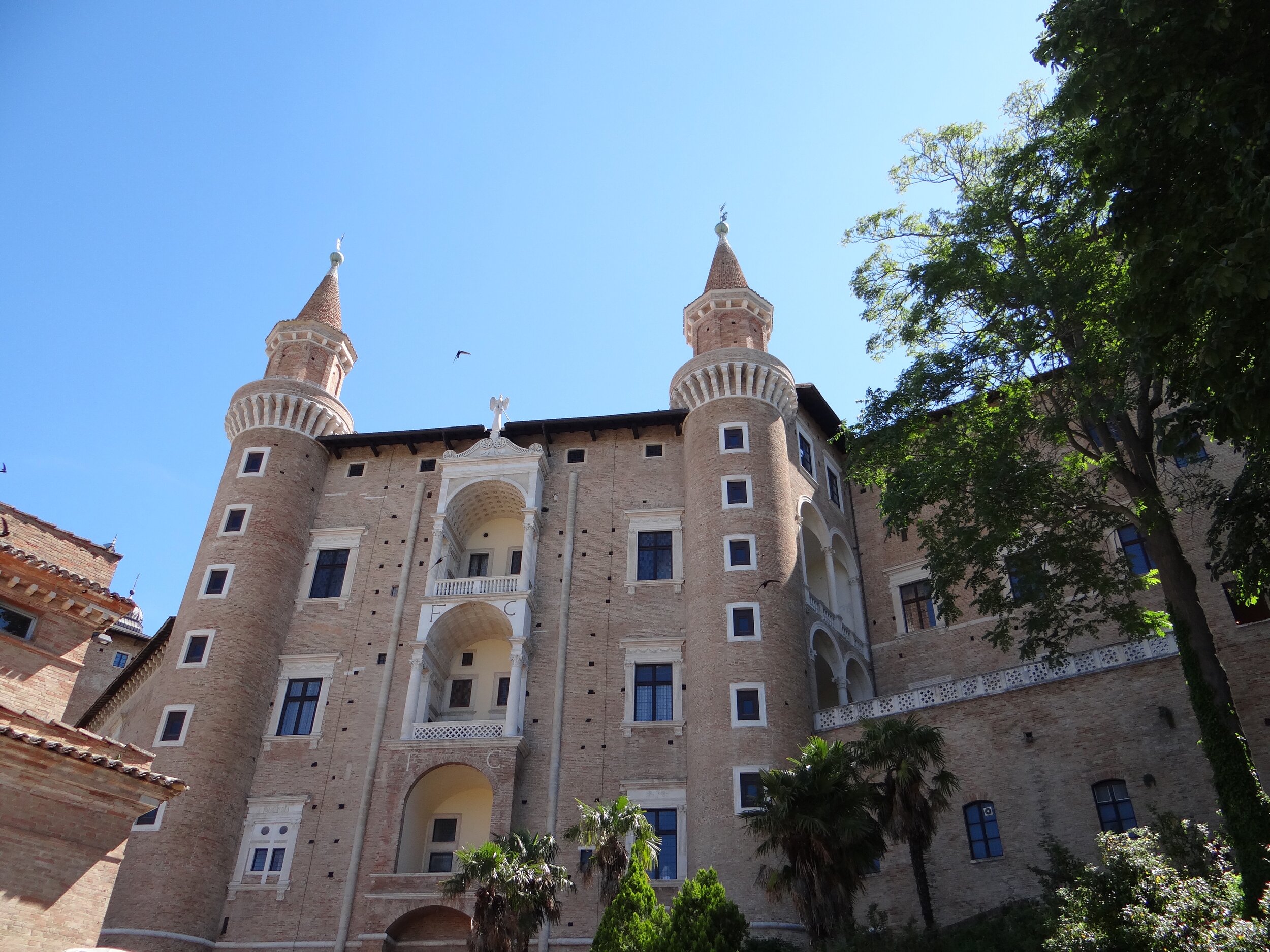
The ducal palace, perched on a hillside
Walking around the old town of Urbino

But, ducal palace and art collections aside, Urbino is also a place to enjoy outdoors.
Its historical centre, a UNESCO World Heritage Site, is pedestrianized, which makes for a pleasant city stroll along the city’s cobbled streets.
By walking down from the palace, past Piazza della Repubblica, and along the, aptly named, “Via Raffaelo”, you reach “Casa Santi”, the house where the great painter Raphael was allegedly born. Today it is a museum.

The house where the painter Raphael was born
The Marche region, where Urbino is located, is also known for its gastronomy and, if you are lucky enough to visit Urbino on market day you may get a chance to buy some local produce from street stalls, such as these truffles…


Where to eat in Urbino
Osteria Tanto Piacere
Via Vittorio Veneto, 29
61029 Urbino
This quite a small place off one of the old town’s main streets. When coming in, only a small part of the place is visible at first glance, because most tables are in a room downstairs.
Here you can taste some local specialities such as salami and other cold cuts, cheeses and the typical flat bread of the Marche (called “Crescia Sfogliata”), which is reminiscent of some flat, thin breads you find in Indian cuisine. It also has a rather impressive collection of local olive oils and wines.
The staff know their stuff too and are helpful in explaining which product is which, where they are from, etc. Great to eat pretty authentic food in a rather casual atmosphere.

Ancona and the Riviera del Conero
A gastronomic feast in an ancient port city

About Ancona
It is one of the oldest cities in Italy, yet, Ancona is usually nowhere near the top of the ranking when it comes to the country’s most visited cities.
Located on the Adriatic shore, just on the opposite side of the Peninsula from Rome, Ancona has been a seaport for thousands of years and it is to this day one of the major shipbuilding centres in Italy and Europe.
The Greeks arrived here by sea (from their colonies in Sicily) and built a first settlement.
They also gave the city its name, since the ancient Greek name for Ancona means “elbow”, a reference to the promontory where the ancient where the old city (“Acropolis”) was built and the Medieval Romanesque cathedral currently stands.
What to see in Ancona: the old town
As you would expect in a city with such an ancient history, the oldest part of Ancona is on a hilltop. It is here that the Greeks built their first acropolis, that would later become Roman. It is from this ancient core that Medieval Ancona sprung and developed.

The oldest part of Ancona, on a hilltop
Old Ancona is crowned by the cathedral, which was built during the 11-12th Centuries, although a much older church had likely stood on this spot for centuries prior to that.
Its entrance is guarded by a pair of stone lions, while its interior keeps the remains of several saints, including that of St. Ciriaco, patron saint of the city. These are actually exhibited in the crypt, which make for quite a spooky sight!

Ancona cathedral is of a a relatively modest sized compared to those found in other Italian cities. But this can be misleading as to the importance of Ancona in the middle ages.
In fact, Ancona was a maritime republic for a few centuries, in competition with Adriatic powerhouse, Venice, and it had a vibrant economy and a rather cosmopolitan population that included significant Greek and Jewish communities.

The rest of the old town spills from the hilltop downwards onto the adjacent plain, a maze of narrow streets and alleys so typical of Mediterranean towns.
In this regard, I wouldn’t say Ancona particularly stands out in terms of monumentality, but it does have some interesting details and a scale that allows you to visit leisurely without getting overwhelmed by the surroundings, as it is often the case in many old Italian cities.


Visiting the port of Ancona: past and present
Ancona is, eminently, a port city and some of its most interesting historical episodes are connected to the sea. From example, it is from Ancona that Roman emperor Trajan embarked for its campaigns in Dacia (present day Romania) and to mark this occasion a triumphal arch was erected. It stil stands to this day, although dwarfed in scale by the more modern constructions around the port area.
It is also due to its role as a port that, in the First World War, Ancona saw its fair share of action, despite being way behind the (land) frontlines.
In 1915 the Austro-Hungarian fleet bombarded the city, causing significant damage. But, the most interesting episode is perhaps that of the daring seaborne raid staged on Ancona’s Lazzaretto (one of the port’s fortifications) by Austrian commandos in April 1918.
The intruders were, however, challenged by two sentries of the Guardia di Finanza (an Italian military corps that is also in charge of customs control and fighting tax fraud). A short fight ensued that ended with the capture of the assailants.
The port remains key to Ancona’s economy. Fincantieri, Italy’s largest shipbuilding company builds some of the most modern models of cruise ship here.
This was actually the purpose of my trip to Ancona, as we came to the city to see the keel laying ceremony for the Regent Seven Seas Splendor, one of the newest and most luxurious cruise ships in the world.

Where to stay in Ancona
SeePort Hotel
Via Rupi di Via XXIX Settembre, 12,
60122 Ancona, Italy
This is a modern boutique-style hotel located on the slope of one of the hills next to Ancona’s port.
Although not right in the center of town, it is within a walkable distance and it provides what is perhaps one of the best views of Ancona’s seafront and harbour.
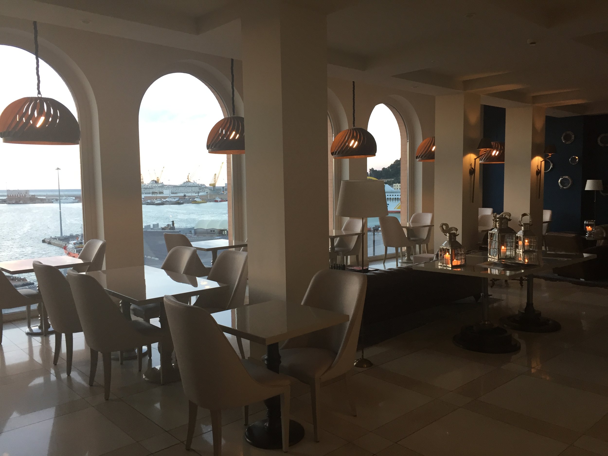

Ginevra restaurant and rooftop
These are two of the highlights of the SeePort hotel.
Here I had the chance to taste several dishes such as this risotto (below) and a very interesting menu that consisted exclusively of potatoes (of different varieties and cooked in different ways)


The view from the SeePort hotel. Ancona has regular sea links with other ports in the Adriatic and Greece
Where to eat in and around Ancona
In this trip I was able to get a taste of some really amazing cuisine in and around Ancona.
Restaurant La DegOsteria
Via Ciriaco Pizzecolli, 3
60121 Ancona, Italy
Led by four young chefs, La DegOsteria is one of the places to include in a gastronomical tour of Ancona. It is located a bit north the centre, near the port area, but well worth the ride.
(I had somes issues with my camera, so I only could keep pictures of the dessert, which tasted as great as it looks here!)


Things to do and where to eat around Ancona
Ancona is not just a urban destination. The Marche region, of which it is the capital, boasts a long coastline, known as the “Riviera del Conero” (taking its name from Mount Conero, a rocky promonotory in its midst) with countless beaches.
And you don’t need to drive far from the city center to encounter some lovely stretches of countryside, complete with rolling hills and lush with greenery…


It is precisely in one of these rural settings where we had one of the most remarkable gastronomic experiences during our Ancona trip.
Restaurant Saviotti
Frazione Massignano, 3
60129 Ancona, Italy
This is an absolutely delightful spot for an evening meal.
Although officially within Ancona’s territory, this restaurant is located in Massignano, a rural hamlet a few miles from the centre, in the middle of the countryside.

Saviotti is a family-run affair, taking a tastefully decorated town house. But, as the weather was nice, we had our dinner outside, in the terrace, which has great views of the surrounding countryside (and of the moon rising over the Adriatic!).

Glad to report that the food was as glorious as the views!


Restaurant & Hotel Fortino Napoleonico
Via Poggio, 166
60129 Portonovo, Italy

This is another remarkable place to eat near Ancona (it’s located a few miles down the coast)
Located right on the seashore in an old Napoleonic era fort (some guns are still visible all around and the decor aims to evoke the “Empire style” of the time). Its terrace allows you to dine while enjoying the sea breeze, while the blue-green waters of the adjacent bay are always on the line of sight.


The star here is, obviously, seafood!


Teruel: road trip through Spain's empty corner
Múdejar art and Russian airplanes in Spain’s smallest provincial capital

As Spanish politics have become heated up in recent times, the sparsely populated and eminently rural province of Teruel, has become the center of attention.
A small local provincial party called “Teruel Existe!” (which means “Teruel Exists!”) obtained a parliamentary seat. The tight vote that followed to elect the next prime minister ensured that this platform, that focuses on problems such as depopulation and infrastructure deficits in the province, became an unlikely kingmaker.
The fact is that, despite all this sudden spike of awareness, Teruel remains more or less “terra incognita”, not only for the millions of foreign tourists that visit Spain every year, but for many Spaniards as well.
Although it is not far from the balmy Mediterranean coast, its location in an elevated inland plateau and the local orography are responsible for a rather unforgiving climate (the particularly cold winter of 1937, while one of the largest battles of the Spanish Civil War was raging in the era, produced some conditions not unlike those of that soldiers on WW2’s Eastern Front would experience a few years later!)
Add to this the fact that it is removed from the main communication axis and Teruel province, like many other areas of Spain’s interior, has suffered from progressive depopulation: empty villages dotting large swathes of its lands.
But it is precisely this climate environment and availability of space that has brought here a rather unique facility, a storage and industrial airport of which few exist in the World.
And it is precisely the need to conduct some in-field research for this article about Teruel’s airport, that appeared on CNN some time ago that gave me the chance to complete a short, one-day road trip , through Spain’s second least populous province.
On the road (I): Barcelona to Alcañiz
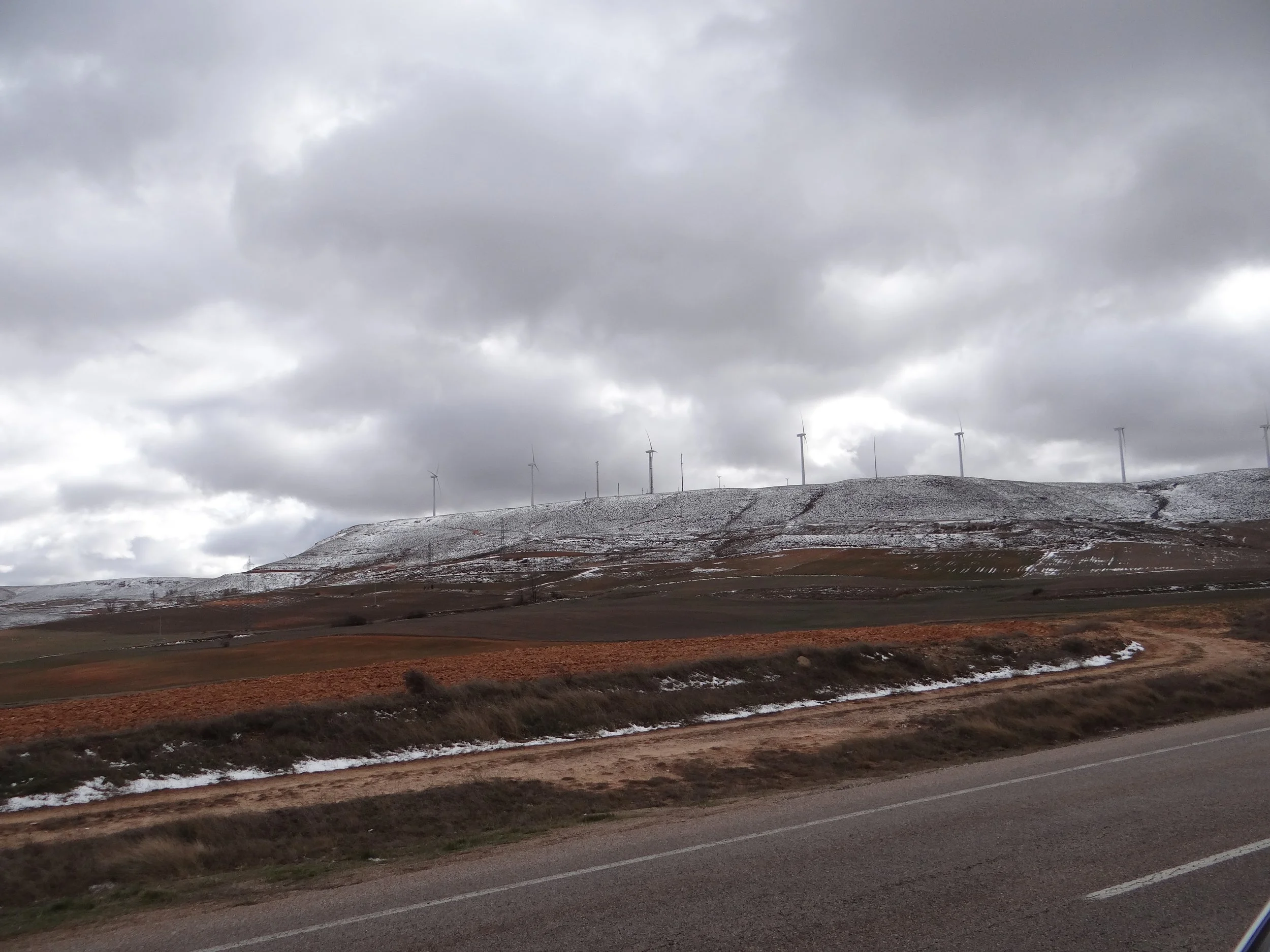
As soon as you leave the coastal region and drive inland into the highlands of Lower Aragon, one thing becomes apparent, the immensity of the landscape and how sparsely populated this area is.

This is mostly dry land with a rather extensive sort of agriculture with olive and almonds trees dominating the landscape as far as the eye can see. We were lucky enough to travel at a time when we could enjoy the view of almond trees in full bloom.
Alcañíz is the capital of the Lower Aragon county and a town with a remarkable historical centre.
We did not have time to visit the fortress, which dominates the surrounding landscape, but did stop for a short walk in town.
Alcañiz was a rather important town in the Middle Ages, when the city sustained a prolonged dispute to assert its city rights in opposition to the military-religious order of Calatrava, that controlled the castle and much of the surrounding region.

Among the most important buildings is the church of Santa María La Mayor, that dates from the 13th C. although it features a rather majestic baroque façade.

Church of Santa María la Mayor, Alcañiz
But, being big city dwellers, perhaps one of the sights that most caught our eye, was that of the many stork nests, like in this bell tower, but also on other buildings all over town!

On the road (II): Alcañíz to Teruel
This was the longest part of the road trip and it did not disappoint. Something akin to traveling along the legendary roads of the American West, with long stretches of road without seeing a single soul.
Only a tiny village every now and then punctuated the emptiness of the landscape. It is amazing to thing there is such a landscape less than two hours from the buzz of the coast!
There were signs, though, that it was not always like this. We could see quite a few derelict farmhouses and even entire hamlets where clearly no one had been living for quite some time. Also some out of service railways stations that use to serve a line that is obviously long gone.

We got to experience as well how the weather can vary tremendously, from the balmy temperatures on the sunny side of the valleys to frigid temperatures as soon as we started to drive uphill. We even encountered some snow!
Downtown Teruel
If the province of Teruel is next to bottom in Spain’s population ranking, its capital claims the honour of being the smallest of all provincial capitals, with a population barely above 35,000.
In the Middle Ages, during the andalusí period, an independent islamic kingdom sprung in this area, centered on nearby Albarracín (a town that still boasts a rather impressive defensive wall and historical center, but which we did not have time to visit in this rather short day trip).
The town of Teruel itself changed hands several times in the medieval period, remaining finally in Aragonese hands.
The long period under Islamic rule has left its mark, though, in the characteristic “múdejar” style (that is common throughout Aragon, in fact the ensemble of Múdejar Art in Aragon has UNESCO World Heritage Site status). It is easily recognizable because of its rich ornamental style and earthy tones (often using bricks for construction).

One of the best example of Múdejar architecture in Teruel, the 14th C. El Salvador tower
In fact, Teruel boasts one of the few cathedrals anywhere in the world built entirely in Múdejar style.
The city boasts also its very own version of the “Romeo and Juliet” story, known as “The Lovers of Teruel”, that are buried side by side in a magnificent marble mausoleum (that despite the appearance were sculpted in the 20th C., although the story of the two lovers is, indeed, much older).
As you might imagine, the center is really small, so pretty much all sights are clustered around the central square known as “El Torito” (not the official name!), a market square that takes its name of a little sculpture of a bull that lies on top of a column.


On the gastronomic side, Teruel Ham is the local highlight.
Again the dry, cold climate is responsible for the curation of the meat. Teruel Ham has its own protected designation of origin, although, generally speaking, is does not enjoy as much recognition as Ibérico hams from South-west Spain (the price differential shows as well).
We arrived when it was already quite late in the afternoon and finding an open restaurant that would admit us proved to be a challenge…So, we ended up at some random bar, nothing to write home about, so, unfortunately, no restaurant recommendation this time!
Teruel Airport
And, finally, the object of our visit!
We made it just before sunset and it was a thrill. It is quite a thing to be driving along a broad, open, empty plateau, lined by snowy peaks on both sides, to stumble upon hundreds of aircraft tails of all sorts!

The airport is not open to visitors, but you can drive all along its perimeter, where row upon row of airliners sit idle. Some of these aircraft are there temporarily until they are reassigned to a new operator or owner, some others may be dismantled or cannibalized for parts an spares at the end of their operational lives.
At the time of our visit, the airport was mostly full with aircraft from two Russian airlines, Transaero, that has collapsed just a couple of months earlier and had sent virtually all its fleet to storage here, and UTair, that had underwent a serious restructuring and downsizing in the months prior and had sent many of the redundant aircraft for storage.

Besides being a storage airport, it is also the base of a small aeronautical industrial cluster, with several companies, from MRO operators to drone research firms having set up shop in Teruel since the airport’s inauguration.
Again, to learn more about it, you can always check out my CNN piece…

24 hours in Dushanbe, Tajikistan - What to see and what to do
Exploring the capital of the smallest of the Central Asian republics

Tajikistan is not among the World’s top tourist destinations. Even in a context of increasing interest for the countries of Central Asia, this mountainous country, roughly the size of Greece (both in area and population), is often overlooked.
This was a short business trip that, nevertheless, left me with nearly 24h to do a bit of sightseeing in and around the capital city, Dushanbe.
First of all, some practical considerations: you would need to request (and pay for) a visa at least a few days in advance. For most countries (including all EU members and the US) the whole process can be done quite easily through this website. It costs US$50.
Once you have received the email confirming your visa application has been approved (in my case it took 5 days to receive it after applying), it is good to bring a printed copy with you, since you will have to enter the reference number in yet another form that needs to be complimented at customs, upon arrival (and the border guards may request to see the visa approval confirmation)
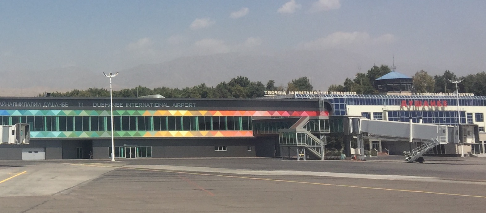
Arriving into Dushanbe - First impressions
Once you arrive at Dushanbe International Airport, be prepared for some rather chaotic scenes at the queue or customs. In fact, I should say “the absence of queue”, because there is absolutely no semblance of order, and is everyone for himself racing to be the first to go through customs. Luckily the airport is rather small and, even in such circumstance, it doesn’t take long to go through.
Next thing you should be prepared is the hassle to get a taxi. International or Russian ride hailing apps are not available here. When you set your feet on the arrivals hall you are immediately approach by a several taxi drivers as well as by some fixers that distribute work among the drivers. I was later advised by locals to call a couple of serious taxi companies (I was advised to call 3333 next time).
In this occasion I just took a random cab and paid 1,000 Russian rubles (around US$12) to take me to the hotel. This was possibly a bit above the normal price, but it was 4am in the morning, I did not have local money and neither did I have smaller change (it is possibly a good idea to carry hard currency in small denomination notes), in any case, I was too tired to start bargaining around for just a small sum.
The airport is right next to the city center, in fact it is pretty much attached to it, so you should not be paying much more than this in any case.
Things to see in Dushanbe
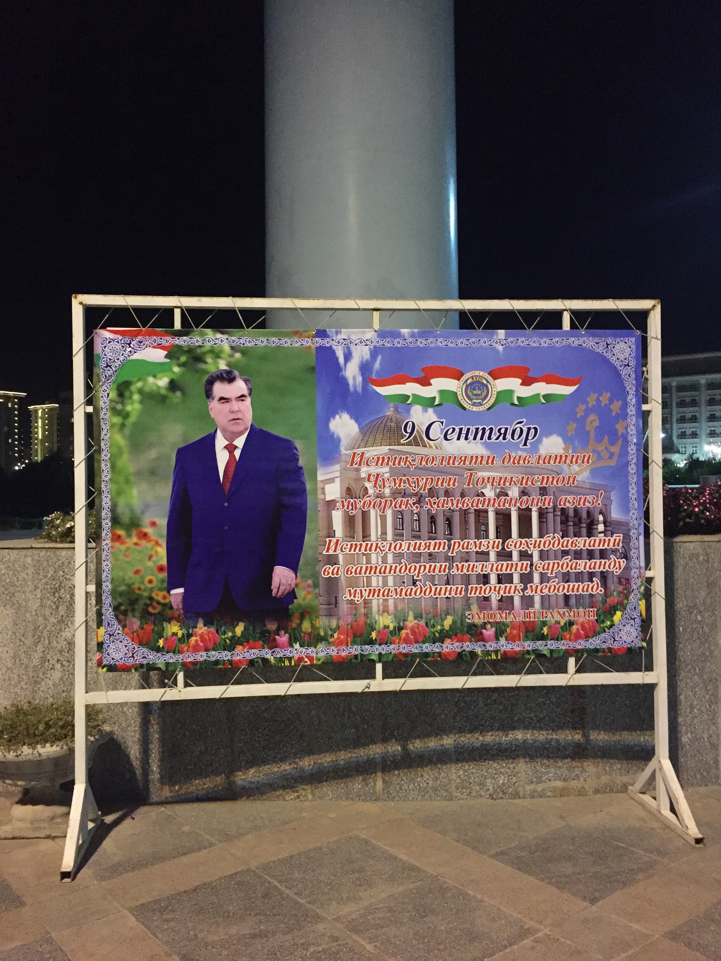
1. Presidential posters
Tajikistan is a presidential republic and, if you are not acquainted with its president, Emomali Rahmon, who has been in the post since 1992, you soon will right after landing in Dushanbe, since his image is literally on every other wall!

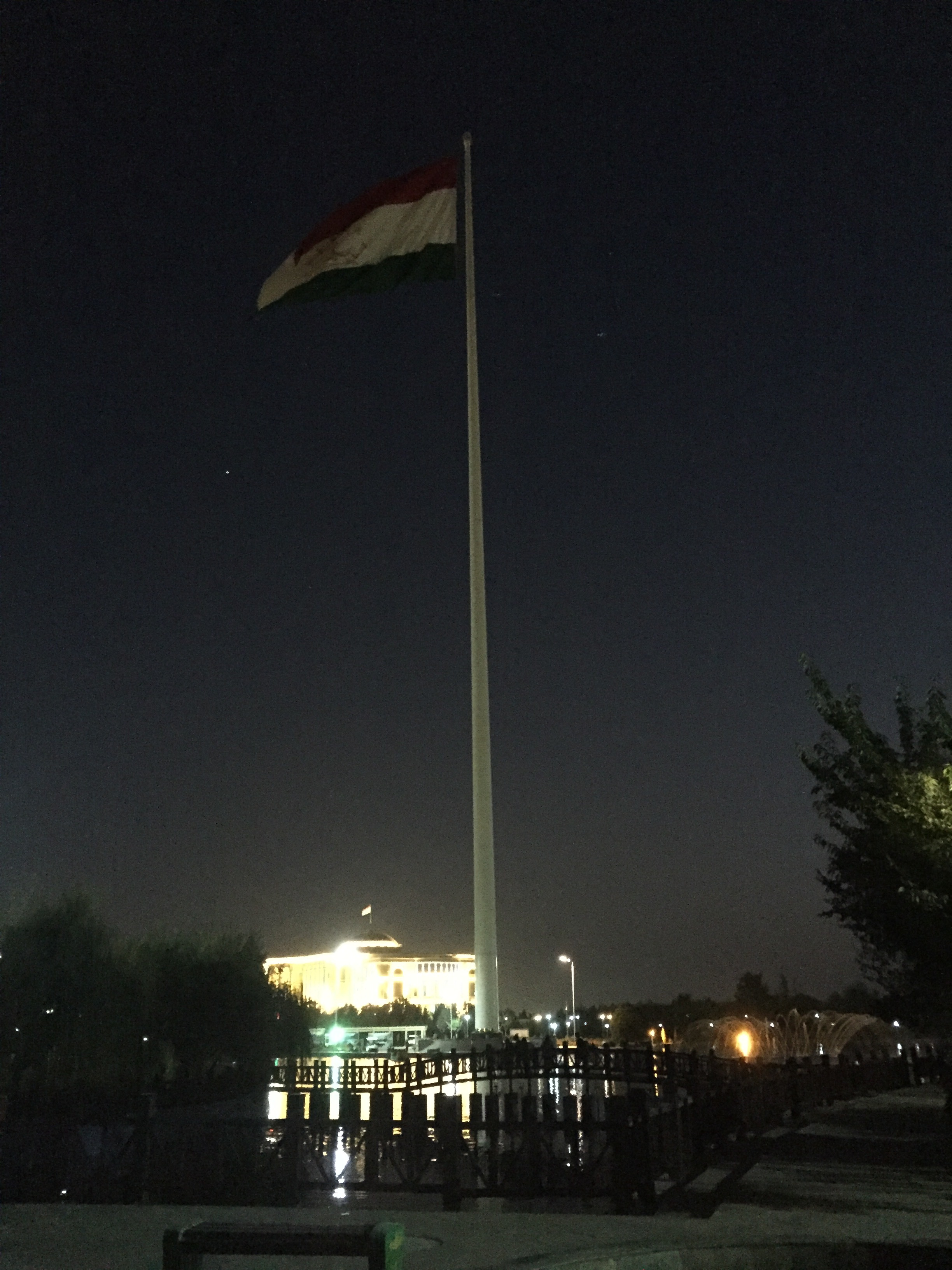
2. The (until recently) largest flagpole in the world
That’s right: until it was surpassed by a Saudi flag in Jeddah, Dushanbe had the honour of having the tallest self-standing flag pole in the world.
The flag, is visible from many points of the capital and is located in the middle of a very central and modernly-designed park area (more on this soon).
Unfortunately I could only visit this area at dusk, and therefore the pictures I could take are not of the best quality, but you get an idea.
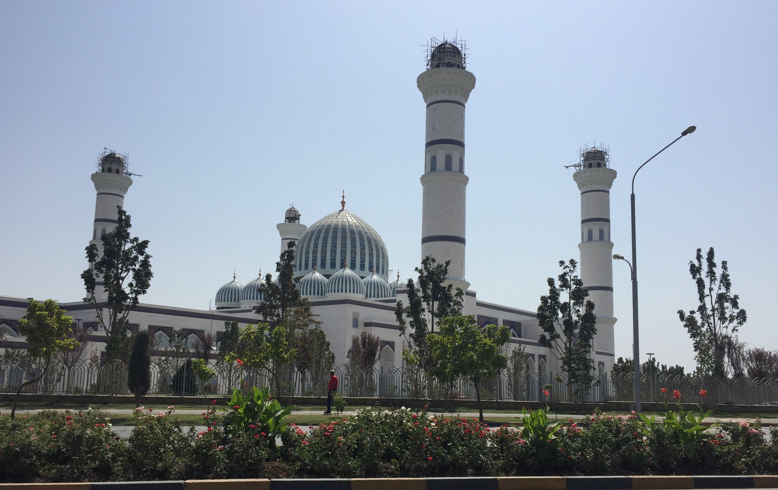
3. Mosque of Tajikistan
Tajikistan is a majority-muslim country and this is its largest mosque. It construction is quite recent and, actually, I am not sure it is completed yet, since you could see some building structures and workers around when passing by with the car.
It is located in the outskirts of the city, next to the city’s university.
4. Monuments to the Samanid Empire (plus a bit of history)
Once upon a time, around the 9-10th C. AD, Tajikistan was at the centre of a large empire, that controlled a big chunk of Central Asia, including the present-day country of Tajikistan, plus large swathes of Uzbekistan, Iran, Kirgyzstan, Kazakhstan and Afghanistan.
The founder and most important ruler of the Samanid dinasty, as this historical period is known, was Ismail Samani. This is the other guy, after the president, that you get to know about when you visit Tajikistan. He has a rather impressive statue in central Dushanbe, plus the local currency (the Somoni) is named after him and his crown is emblazoned in the national flag.
Also, the name of the country, in the local Tajik language means “Land of the crowned”, another reference to this period.
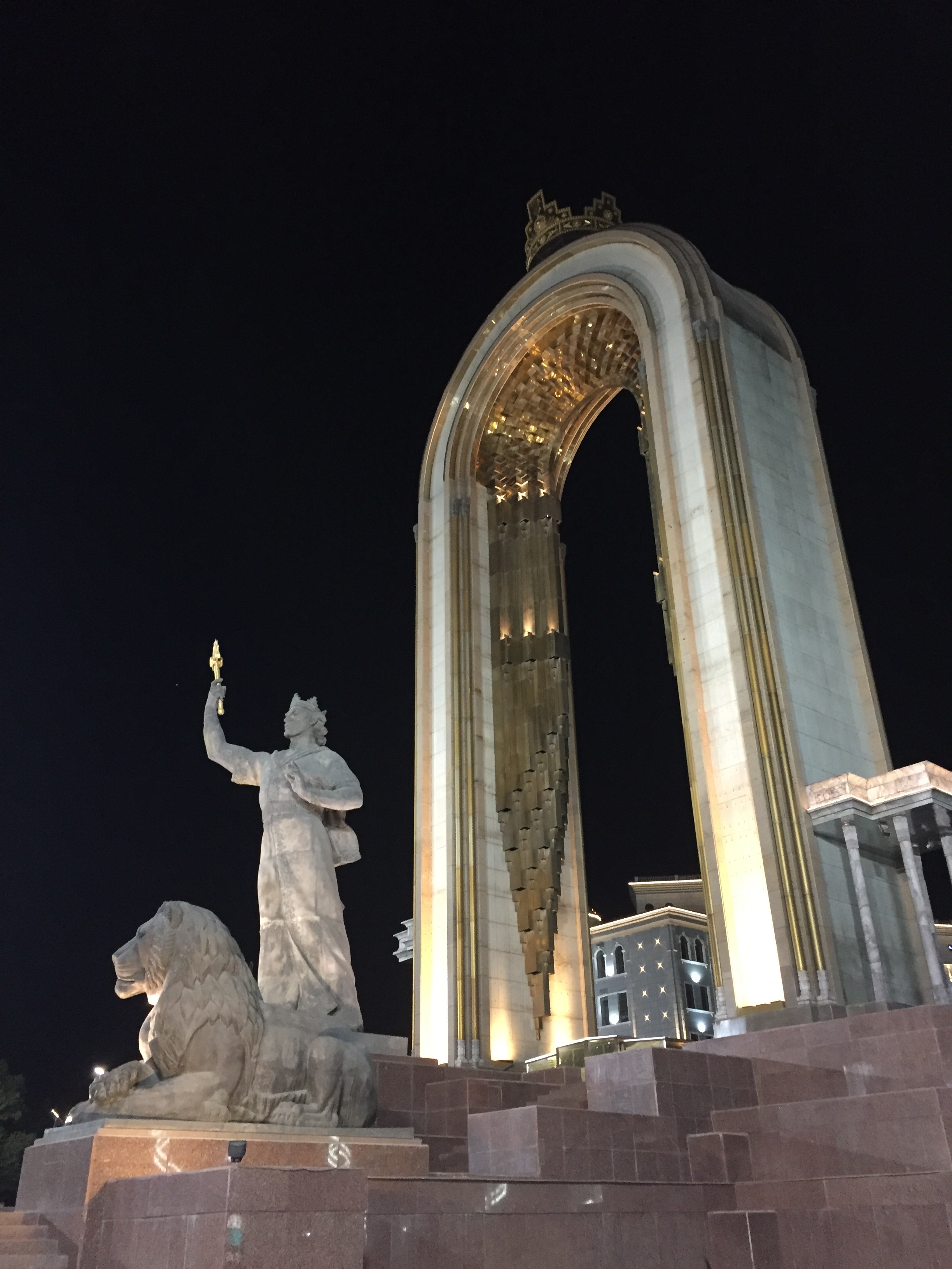
Statue of Samani (above) and right next to it (below), a monumental map that depicts the maximum extent of his empire.
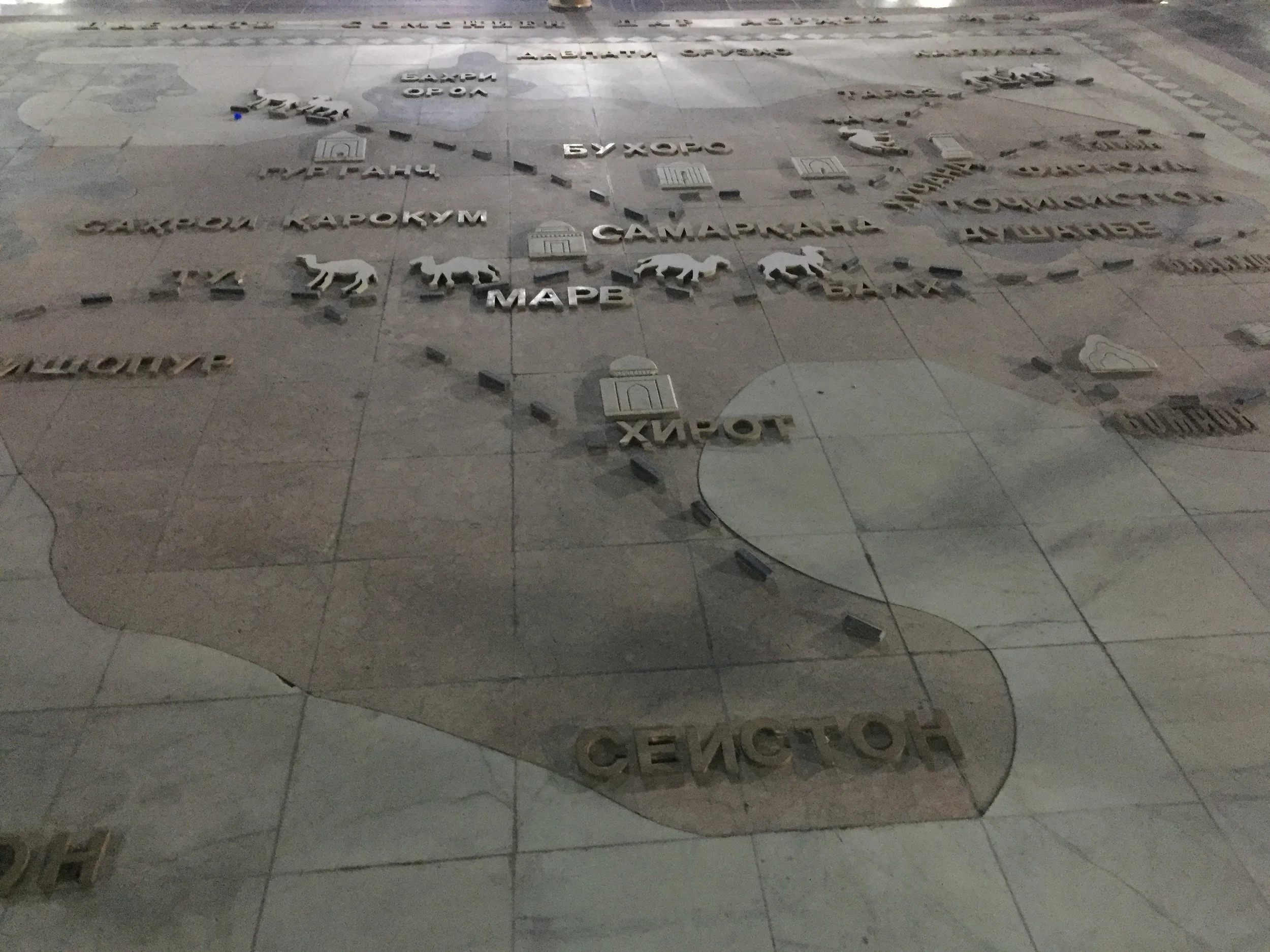
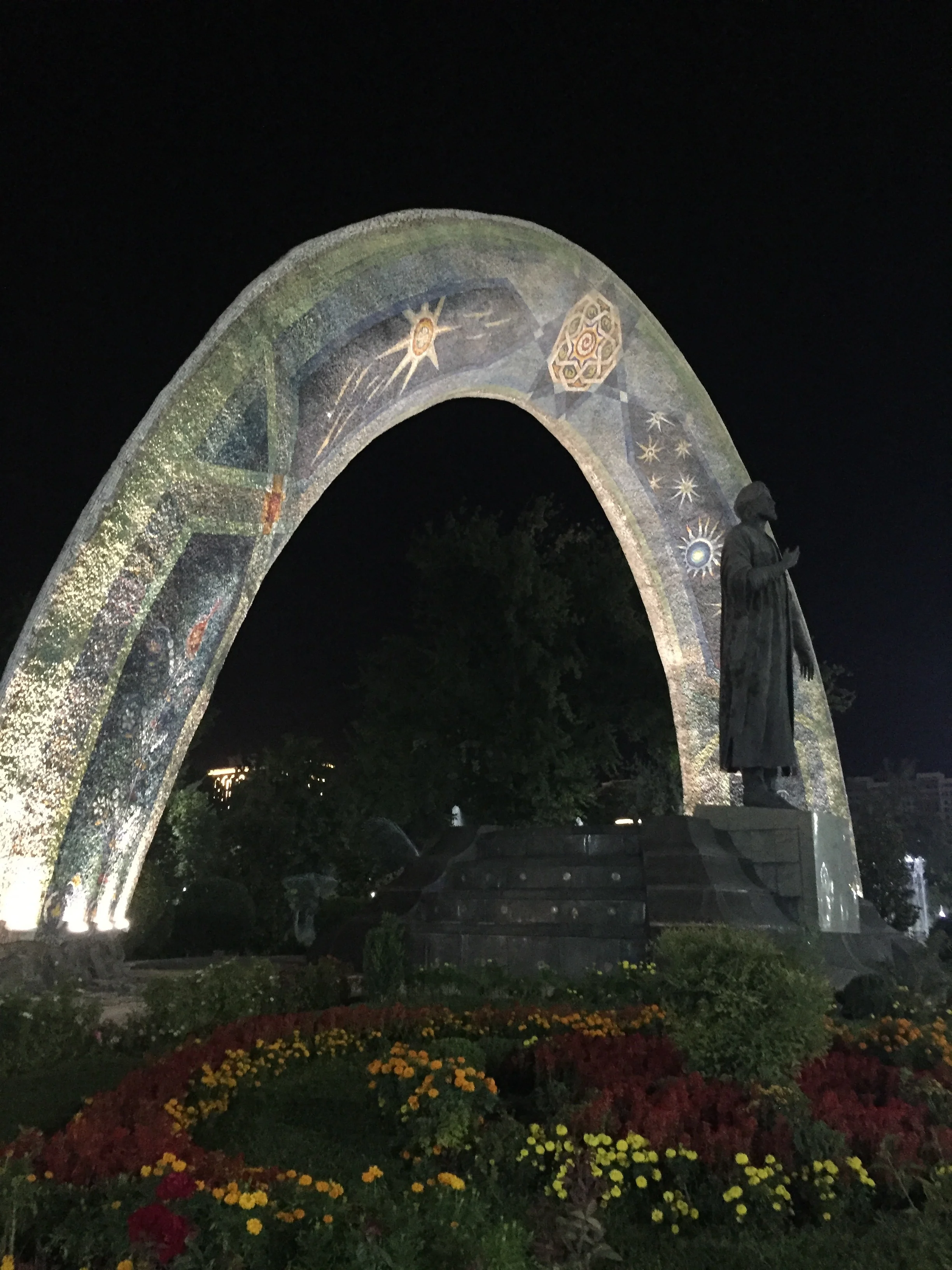
Tajik language is closely related to Persian (in contrast, other Central Asian countries have mostly Turkic languages) and this extends to cultural links as well. Poet Rudaki, who was born and lived in present day Tajikistan, is considered one of the great authors of modern Persian language. One of the most centrally-located parks in Dushanbe and this monument (below) are dedicated to him.
5. Exploring Central Dushanbe
Although I had less time that I would have liked to to roam the streets of Dushanbe, my impression is that of quite an orderly city, at least in the center, with broad avenues shaded by trees. I guess this is in part a vestige of Soviet urban planning (between 1929 and 1961 Dushanbe was known as Stalinabad). There seems to have been quite a lot of new construction going on in recent years as well, with large modern-looking granitic buildings lining some of the city’s mai avenues, particularly on the way to the airport.
Although you wouldn’t be able to tell from its central areas, Tajikistan is a rather poor country, though, and this is most evident in the suburbs, that are mostly made of one-storey very simple constructions.

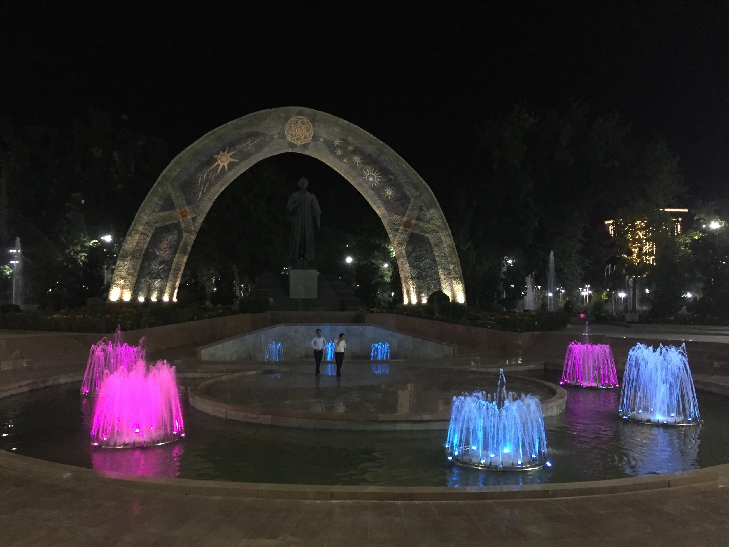
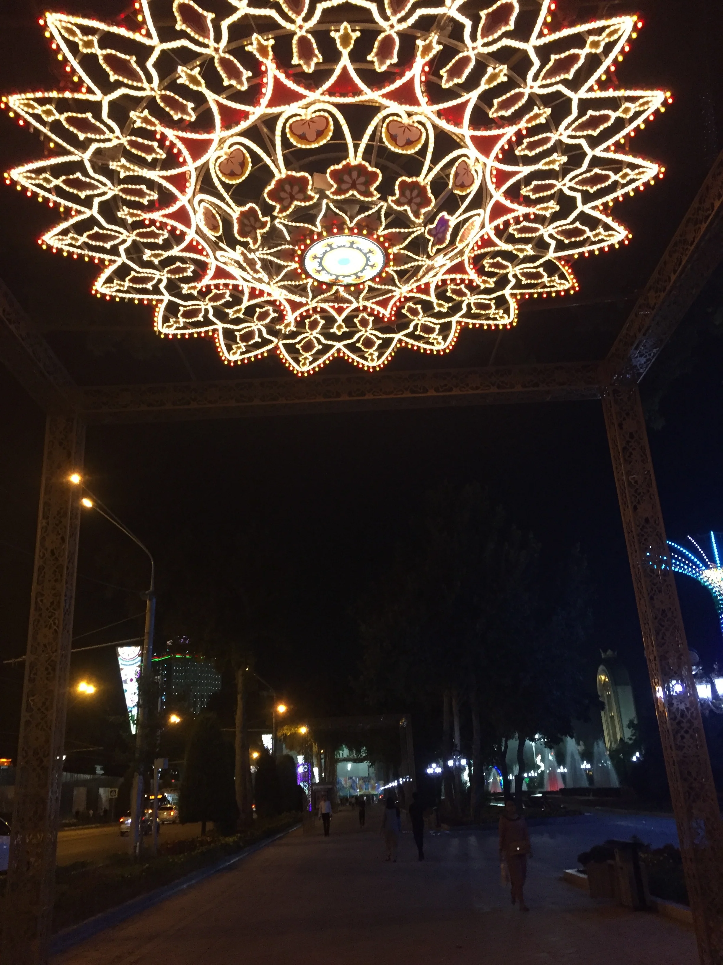
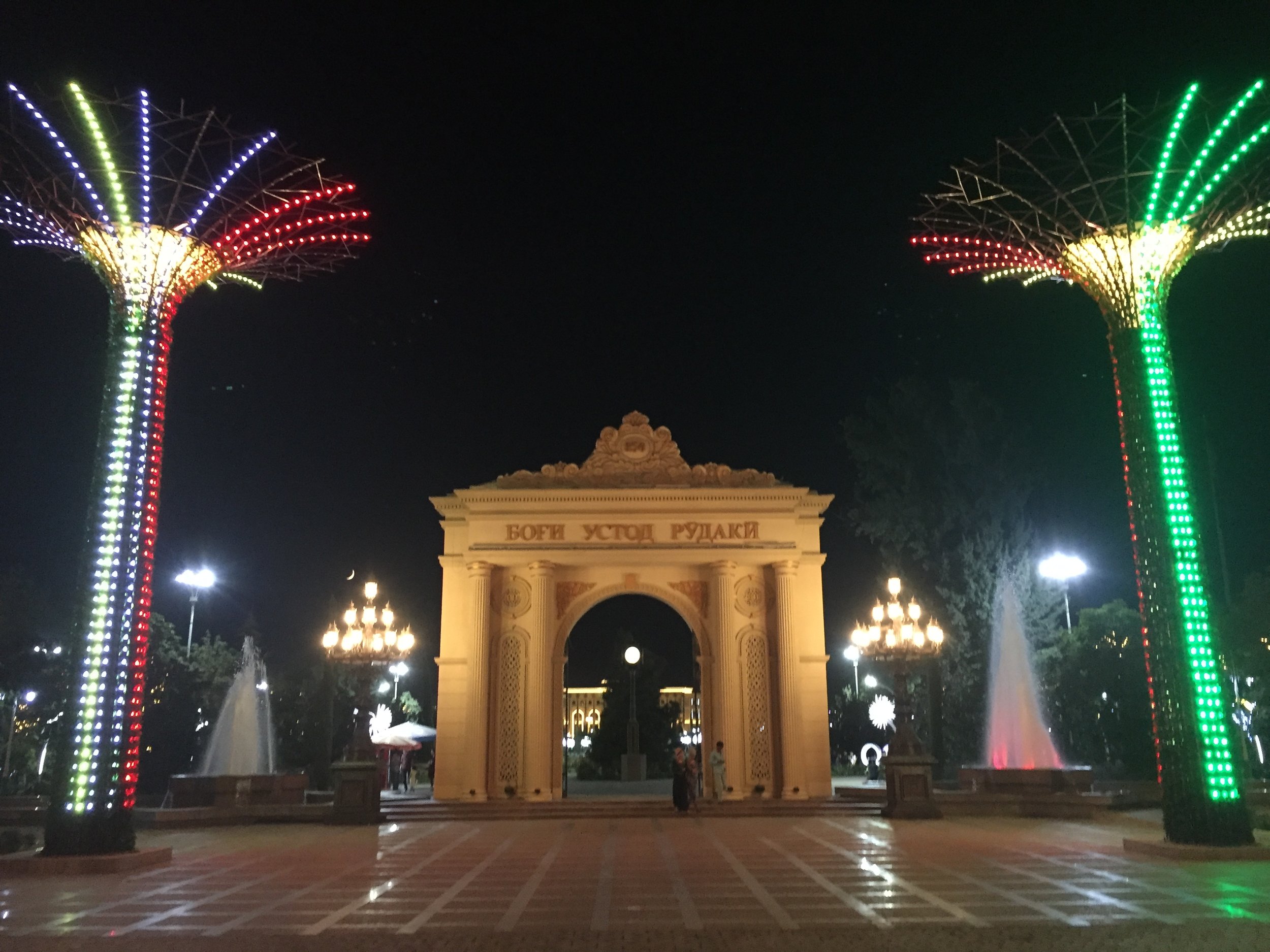
There is quite a lot of flashy street decor - perhaps not everyone’s cup of tea - all around the Rudaki Park area. Next are some pictures (again image quality is not the best, since I took them with my phone!).
The building below is the National Library of Tajikistan, that is located next to Park Rudaki and not far from the famous flagpole.
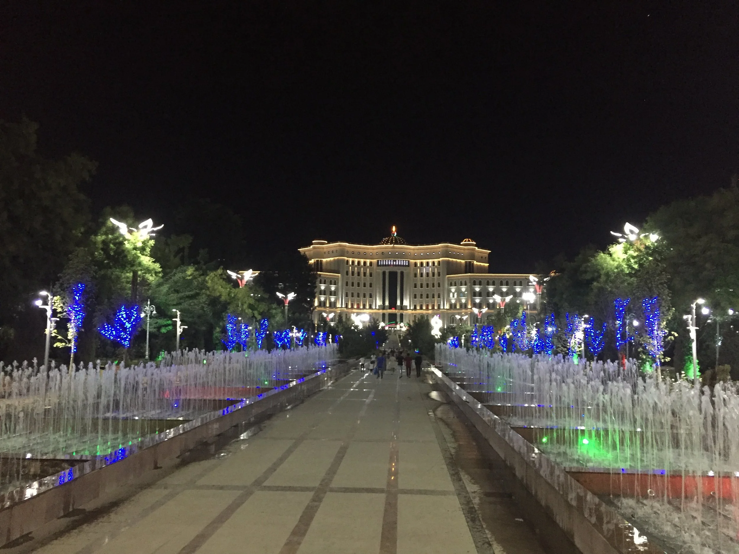
Below is the entrance to Park Rudaki, a perfectly well kept stretch of the city.
6. Excursion to Hisor Fortress
I am grateful that my hosts in this business trip volunteered to show me a bit of the country outside Dushanbe.
Some 30km West of Dushanbe is the town of Hisor, where we were able to visit the remains of a historical fortress and have a proper Tajik meal
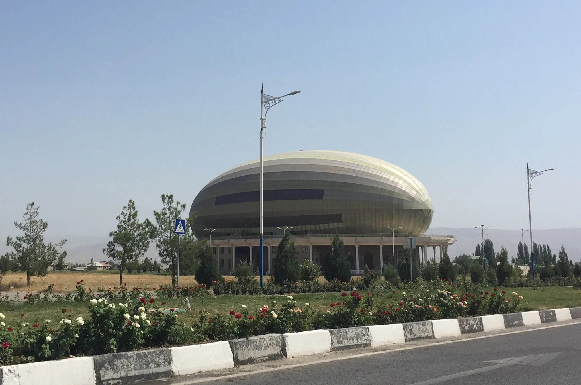
But the first sight we came across when approaching the city of Hissor is this melon-shaped building. This choice of design is, I am being told, an homage to local produce, as melon is one of the most valued local products (it is common to see roadside stalls selling fresh melons and grapes). This building is a sort of community center and it is used to host all sort of events.

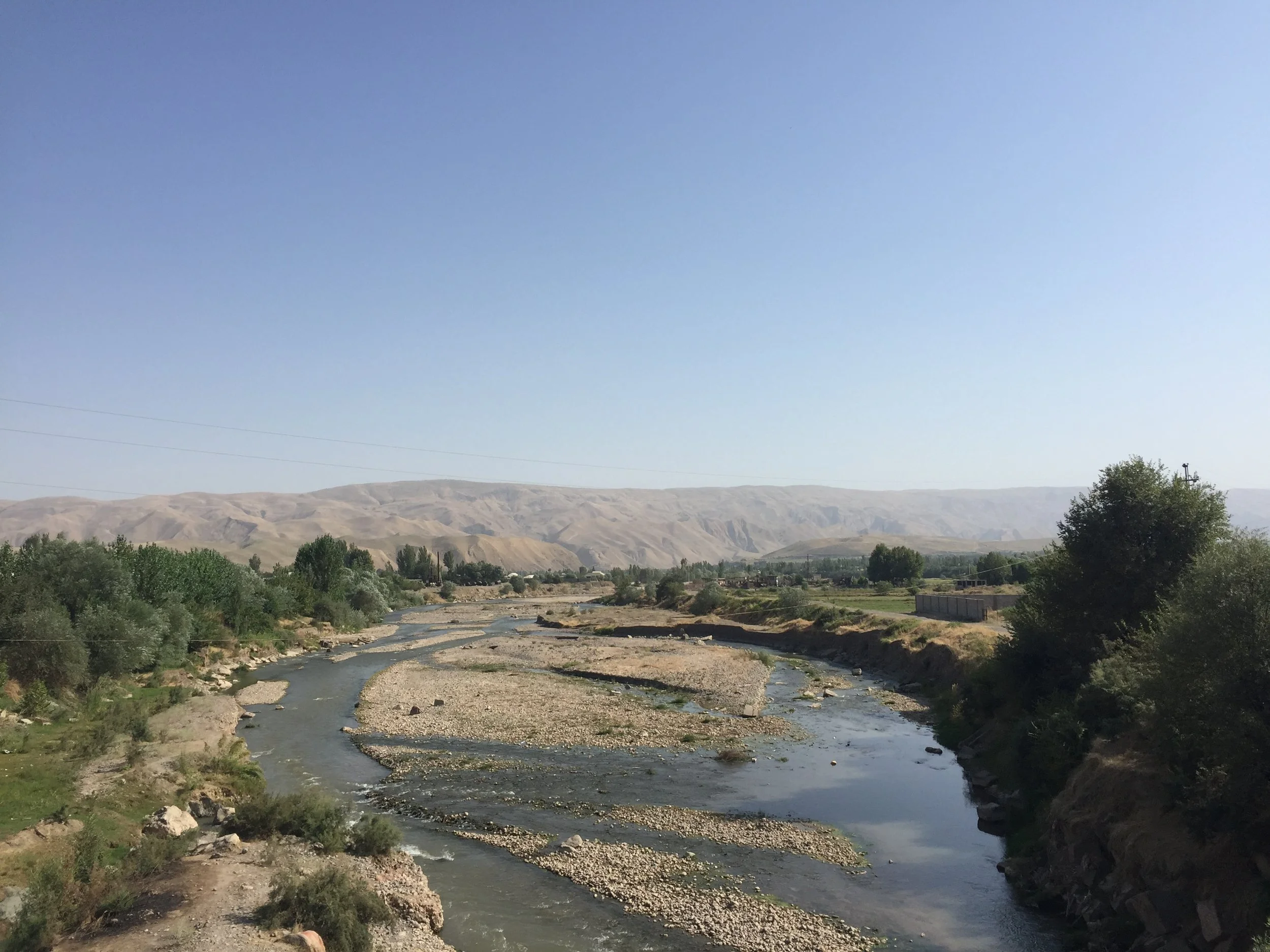
The landscape of this part of Tajikistan (the Eastern half of the country, in contrast, is completely mountanious) is that of a series of valleys, irrigated by multiple running streams, and surrounded by very dry mountains and steppe, as you can see in the picture below.
Places to eat near Dushanbe
Tabakai Karayev (near the village of Ittifok)
This is quite an interesting place. Located right on top of a river bank and just a few kilometres west of the town of Hissor, it is an open-air restaurant specializing in Tajik specialities (“tabaka” is in fact one of the dishes we will soon get acquainted with!).

The restaurant is structured around a running stream. In fact, when coming into the restaurant, people wash their hands with running water (and soap) from a tap in the open, something that makes sense if you consider that later some of the dishes require eating with your hands to some degree.
People eat inside these cabins that are suspended on top of the water, seating casually around the central table.


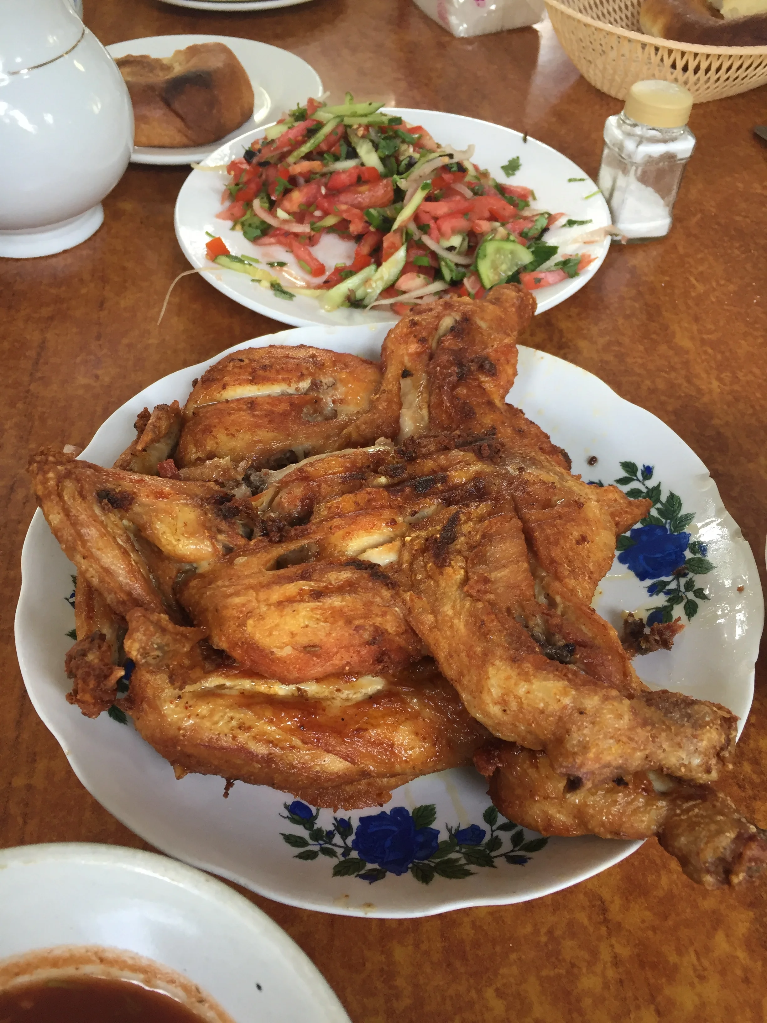
Local cuisine includes lots of meat (although there are also some vegetarian dishes). And some interesting condiments, for example, the white sauce, called “chaka” (чака) is in fact a sort of sour creamy cheese. The red one is called “kemal” (кемаль) and has a tomato base. They are applied to both salad and meat.
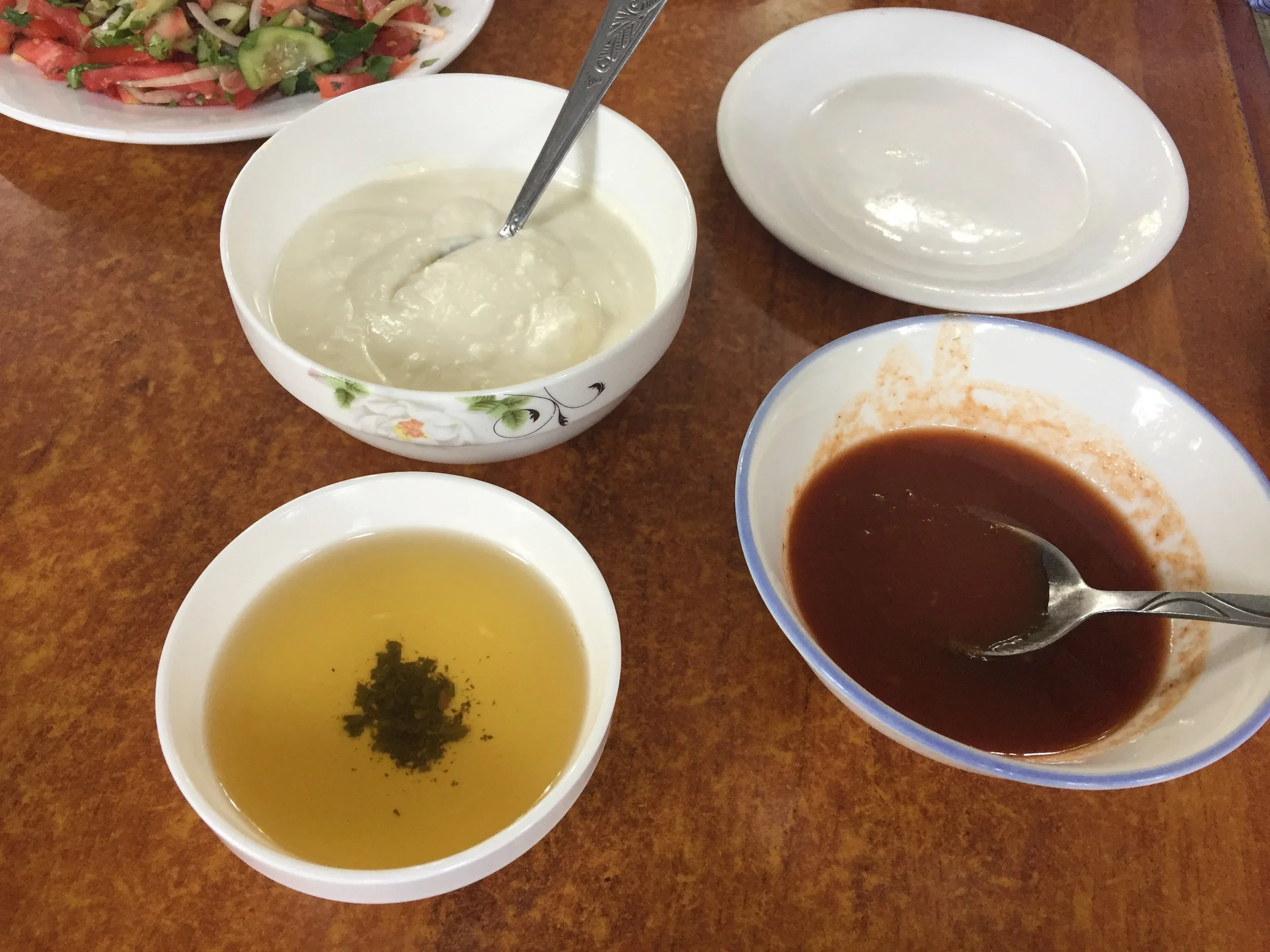
Below is a Tajik specilaity, chicken tabaka (табака из курицы), that is served usually with a fresh vegetables salad (in the background) called “shakarob” (шакароб). All of this together with the “lepeshka” flat, round, bread (лепешка) so typical of Central Asia (well, not sure all varieties of bread are technically called lepeshka, but they are of this style)
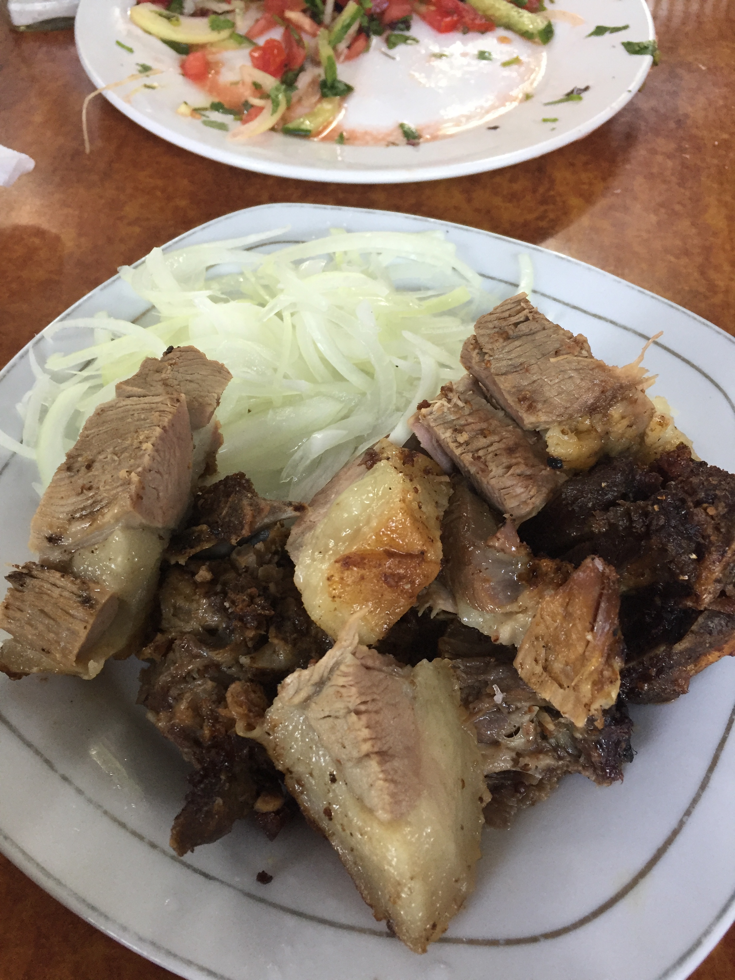
And we had also some lamb cooked in a tandoor (тандури) oven. Very tasty.
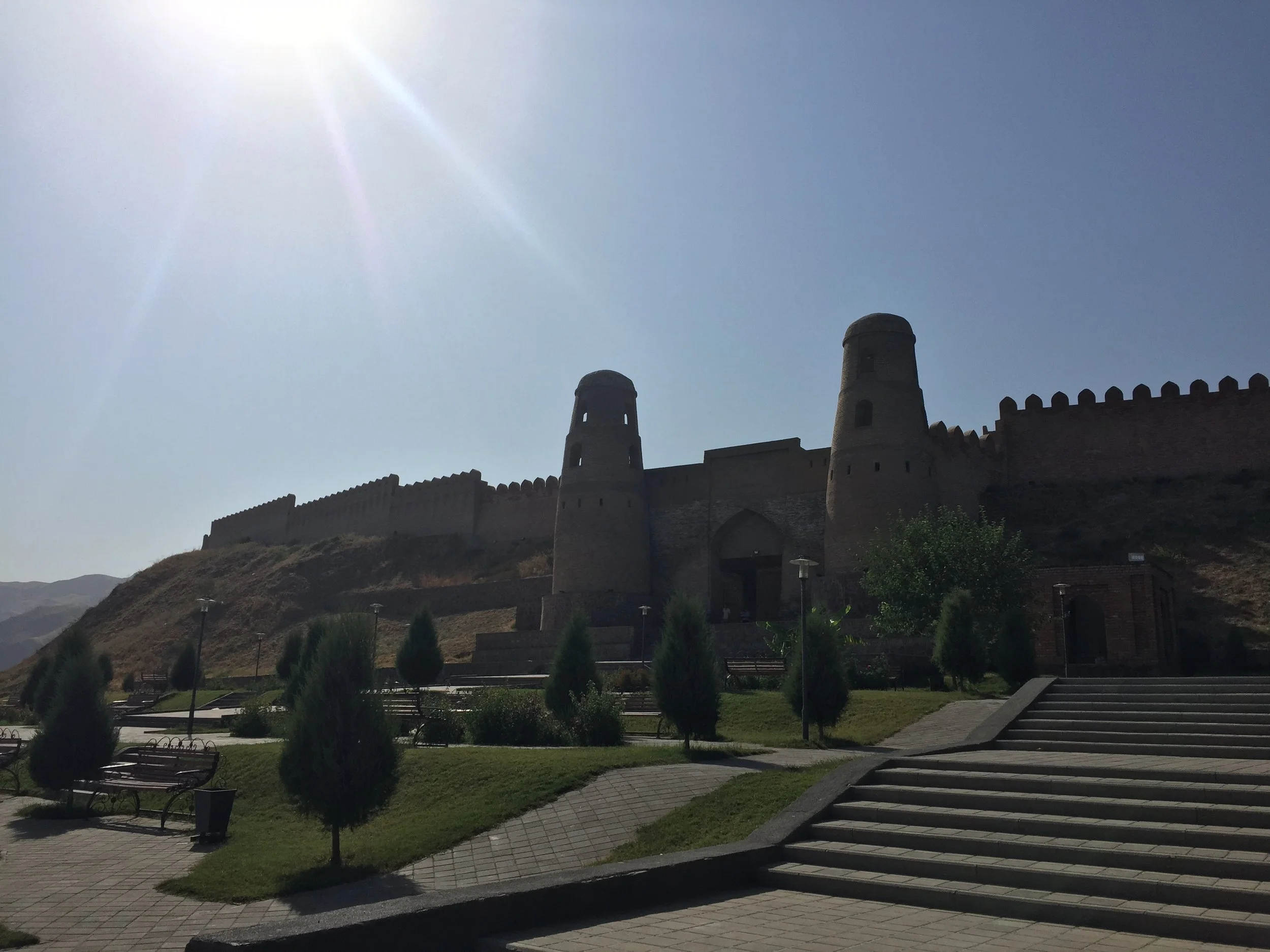
Hisor Fortress
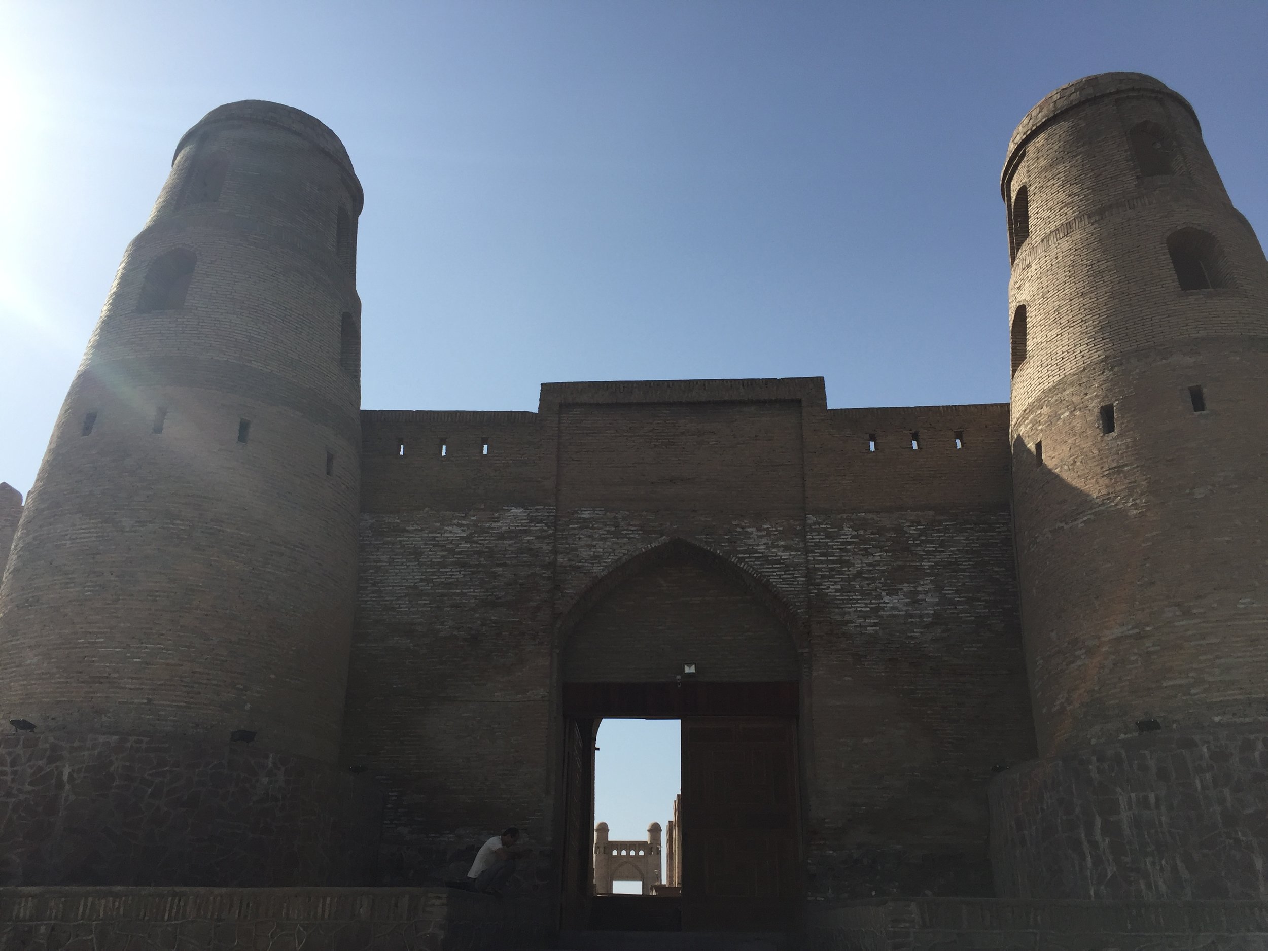
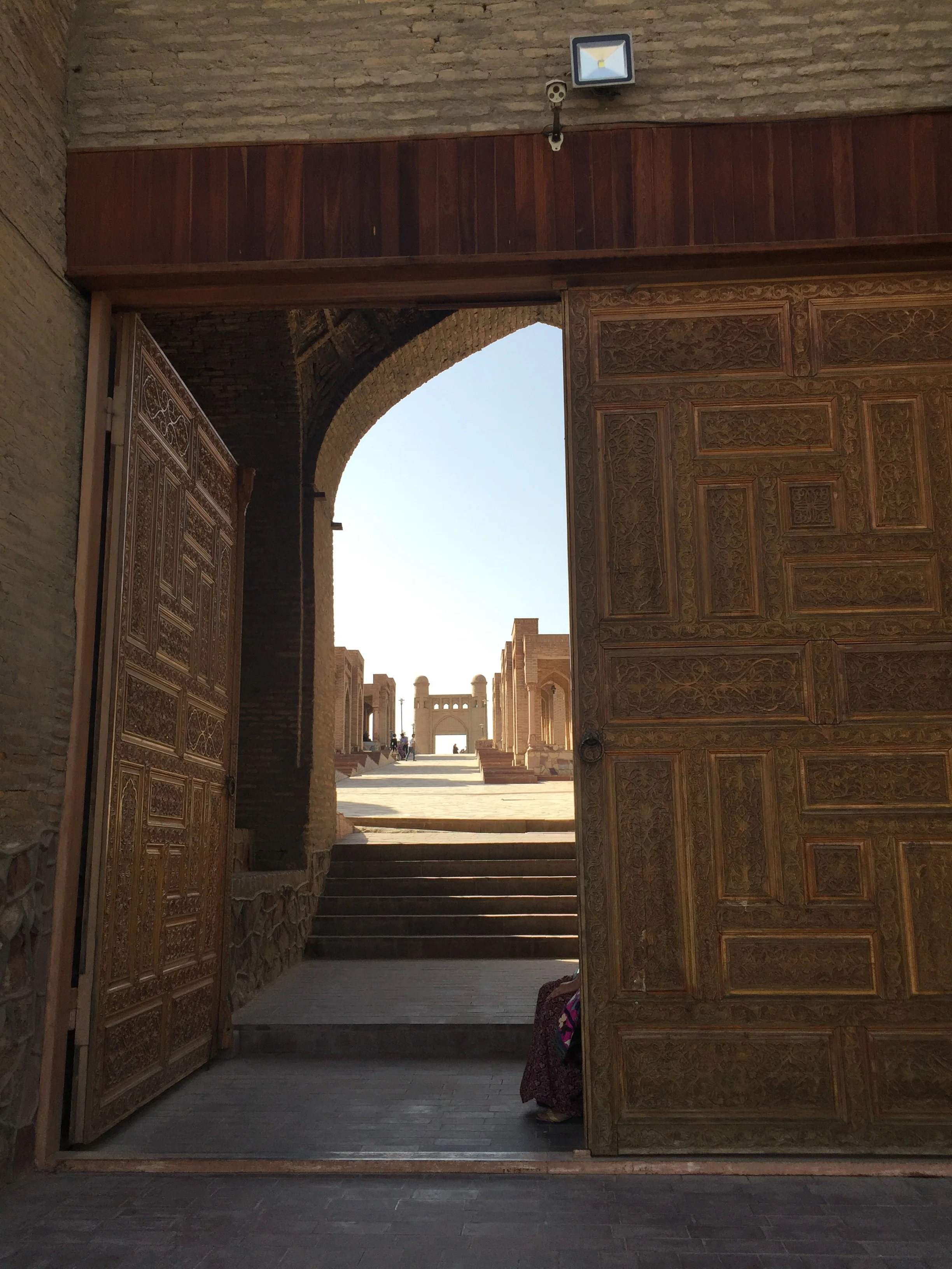
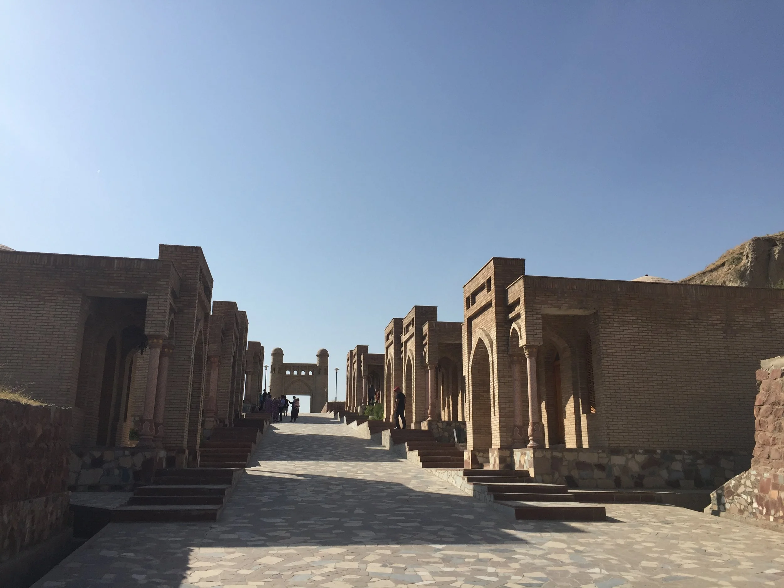
Although highly restored, Hisor fortress is a very ancient structure located on one of the branches of the famous Silk Road. In the middle ages it was for some time an independent khanate and later also a dependency of the Emirate of Bukhara. The current gates are a restoration of the 16th C. ones.
There is little inside, aside from a few souvenir shops, but it is possible to get to the top of the walls and admire the landscape of the surrounding valley and mountains.


Eating in Dushanbe
Restaurant “Lola” («Лола»)
It’s a place with a large outdoor terrace serving “shashlik” (barbecued meat on skews), alongside the Tajik sauces we mentioned earlier and excellent french fries.
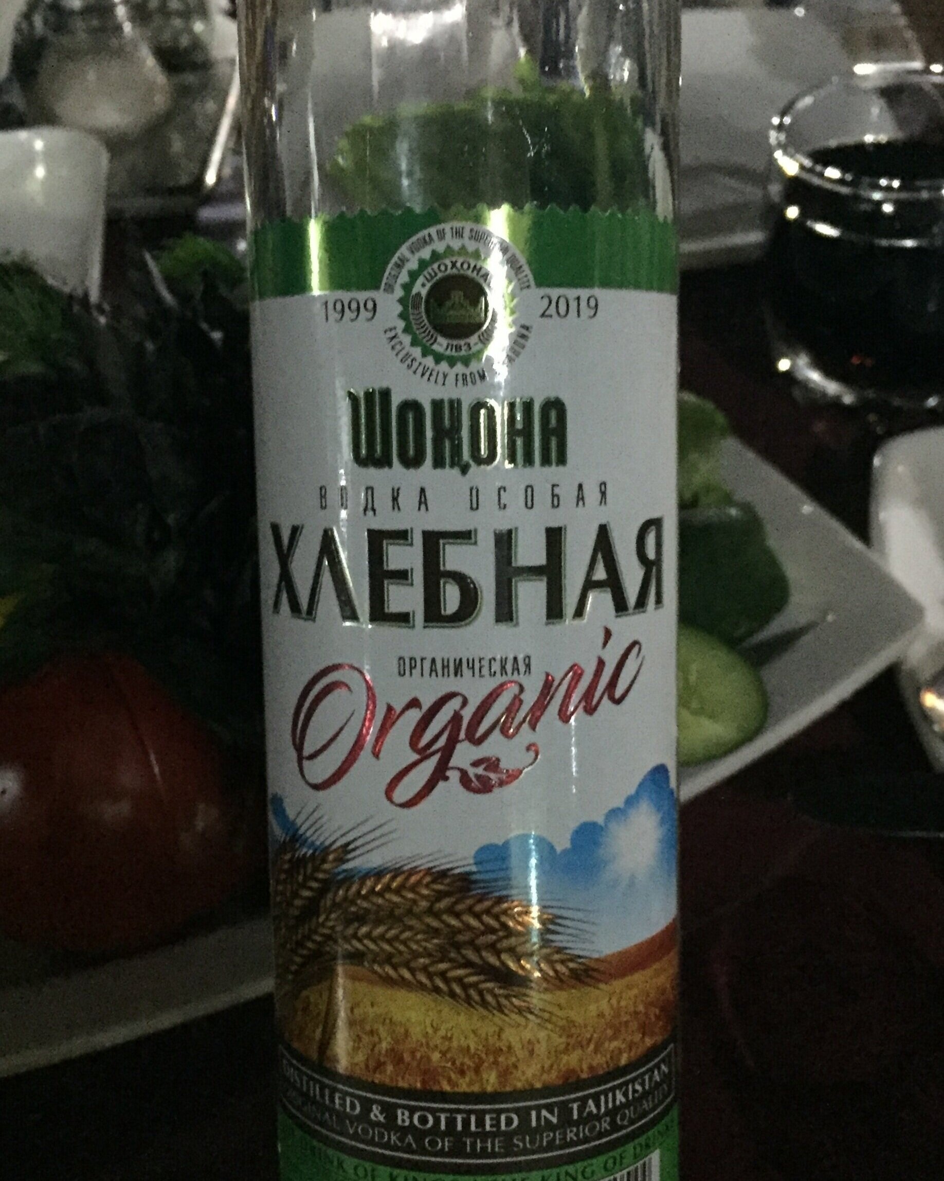
We also had a chance to try the local cola drink, that apparently is made under license from an American firm “RC Cola”, as well as local organic vodka, which turned out to be really smooth. I was told that it is the high quality mountain water available locally that makes all the difference!
Where to stay in Dushanbe
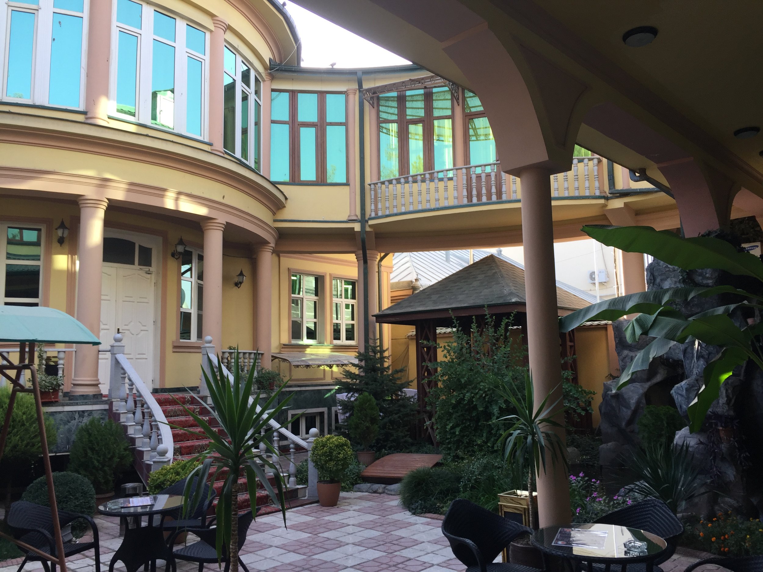
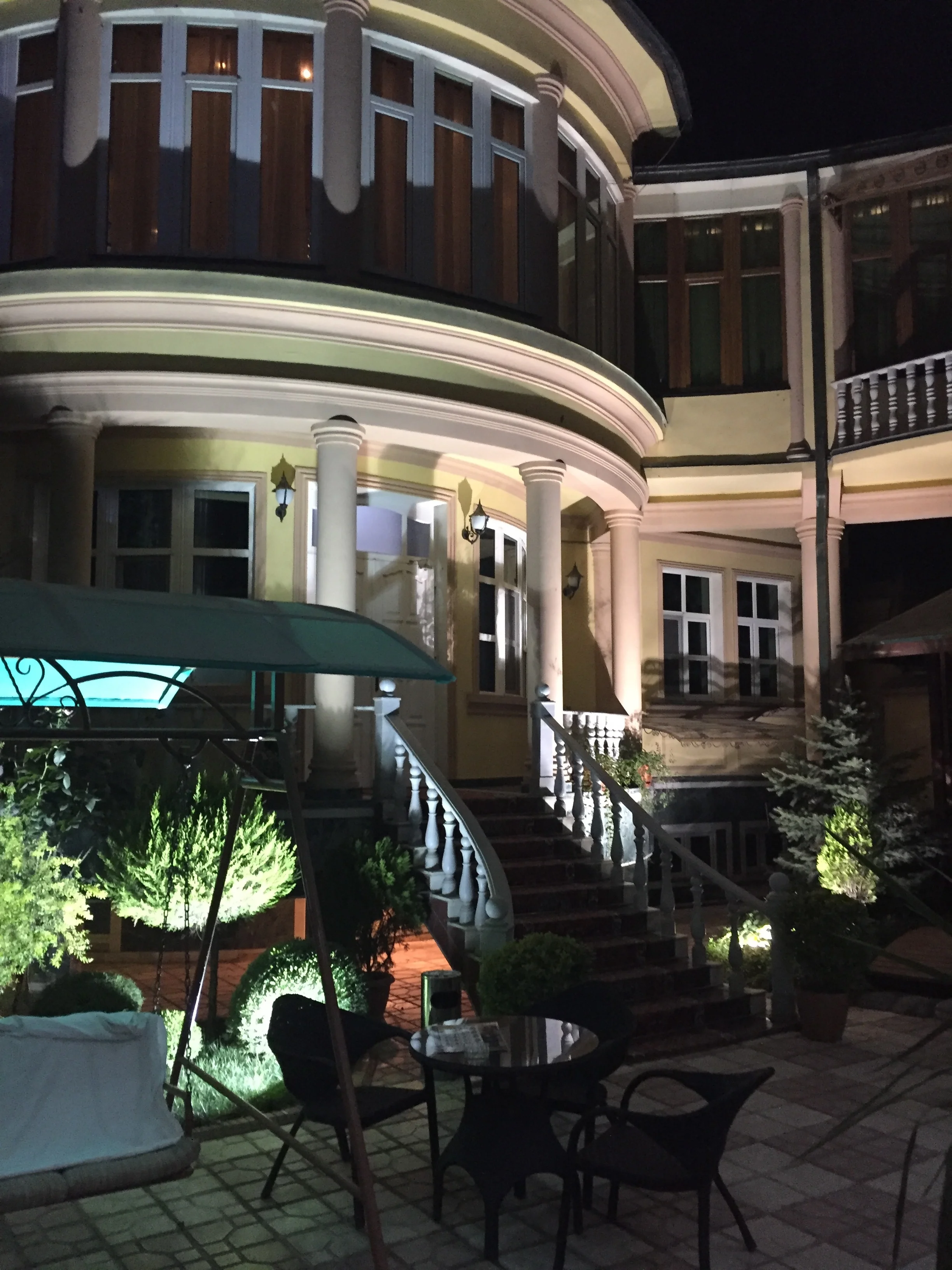
My hotel in Dushanbe was the Twins Hotel.
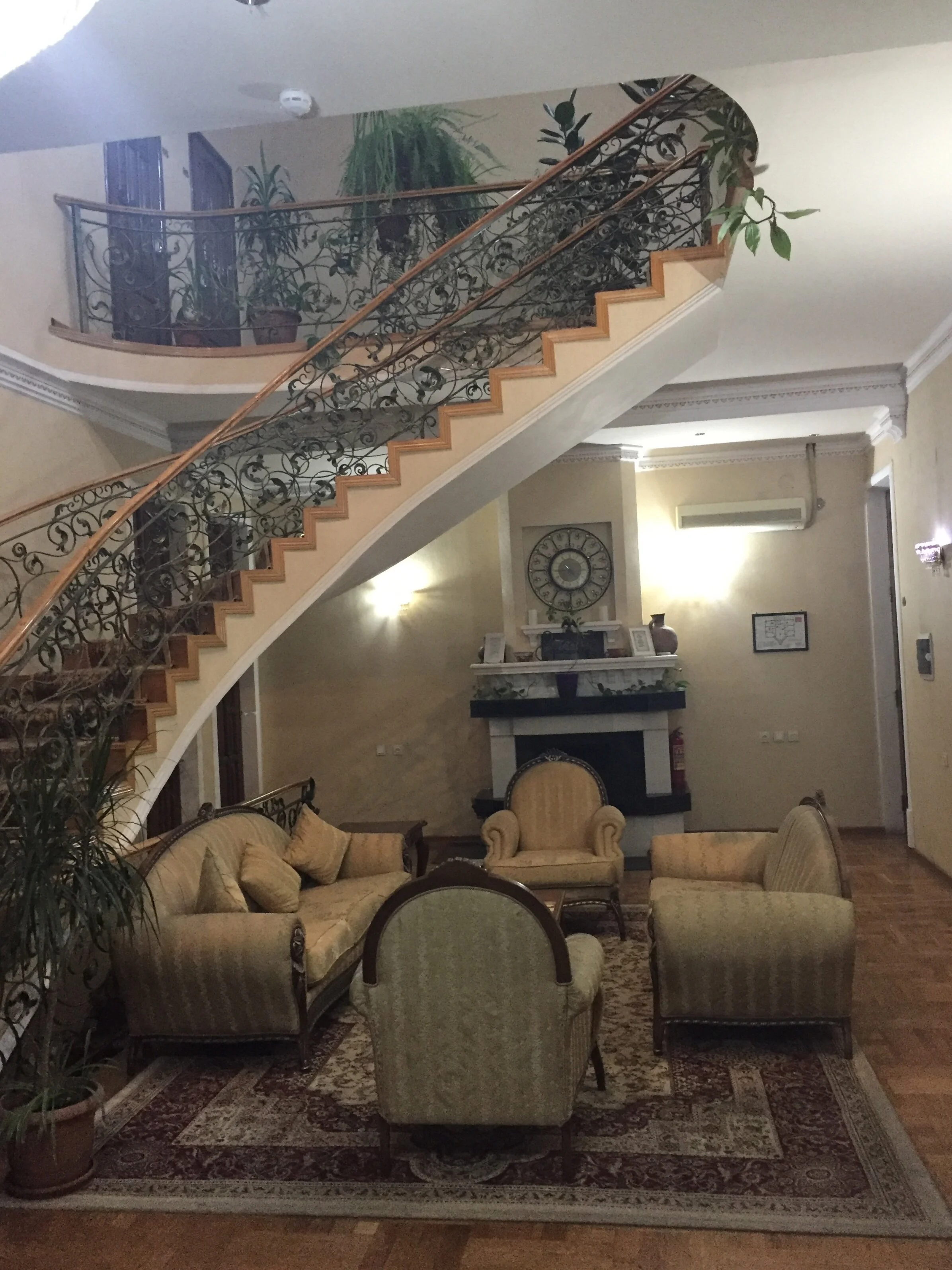
This is a quite central four-star independent boutique hotel located in a sort of small palace. You enter it through a courtyard (below) and the rooms are then immediately in the main corpus of the hotel. No conventional reception or front desk, you just do your check in and check out procedures at the courtyard.
Also, there is no formal eating room (or at least it was not open when I visited), all breakfasts are delivered directly to the room (the previous evening you are handed out a paper with the menu and you make your choices)
The facilities inside where modern and clean, the internet was working well and staff were helpful and spoke both English and Russian.


Always leave something for next time
And it was soon time to get on the road (or on the plane) again. Here is an image of the rather small, but functional, airport at Dushanbe.
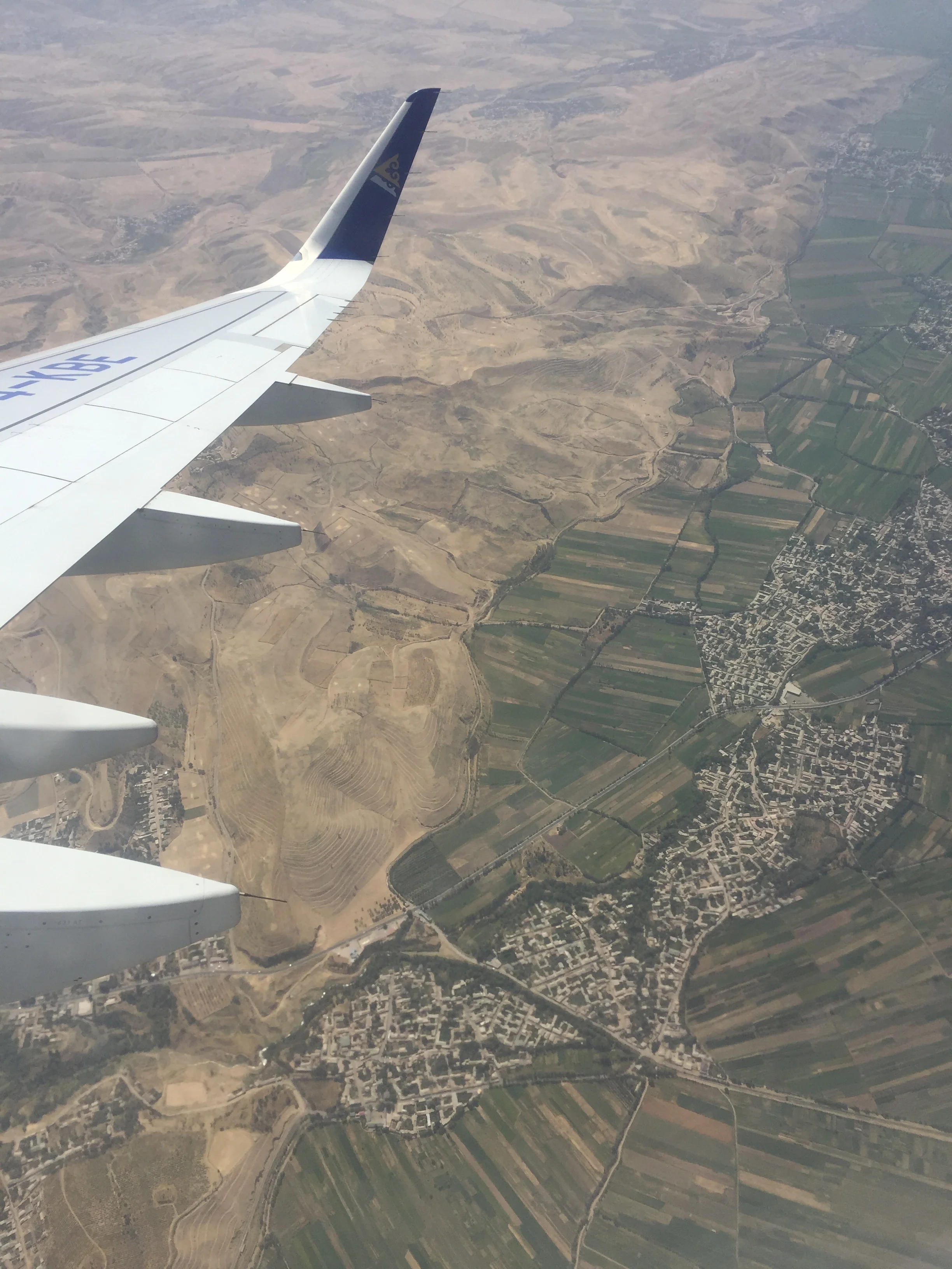
I have included also a couple of pictures taken from the plane, since I am told that some of the most interesting sights in Tajikistan are actually in the mountains, something for next time!


A cruise on Viking Orion - Nordic chic on the high seas
How is it like to sail on the maiden voyage of a Scandinavian luxury cruise ship

The Viking Orion, anchored off Portofino, Italy
Viking Orion’s naming cruise
A brand-new, sate-of-the-art luxury cruise ship…Italy…a beautiful (and extravagant) naming ceremony…a bunch of NASA astronauts, the chance to meet one of the most interesting personalities in the cruise business…this is a post I had long wanted to write.
Yes, I know that Viking Orion’s maiden voyage is not exactly breaking news - it took place in 2018 and another ship, the Viking Jupiter, has been delivered since then - however, even today, after more than one year has passed, it is hard to forget that very first voyage on the Viking Orion cruise ship.
This is not just because of the amazing ship naming ceremony that took place at the port of Livorno, Italy, but also because this cruise gave an opportunity to try out, first-hand, Viking’s Nordic-inspired luxury cruise experience and I think it’s fair to say that pretty much all my observations about the ship and the services it offers are still perfectly valid today.

Viking’s ships, all identical and built by Italian shipbuilder Fincantieri, are a truly beautiful sight, with their pointy bow and elegant lines
The Ship

Viking Orion’s modern lines next to Livorno’s old port fortress
Viking Orion is the fifth of Viking’s seagoing cruise ships.
It was followed in 2019 by the “Viking Jupiter” and there are six more ships on order, plus options for an additional four. So, if all goes according to plan, Viking’s ocean-going fleet will number 16 by 2027.
This is quite a commitment by Viking Cruises, that only relatively recently (2015) entered the market for sea-going cruises. The Norwegian-owned, Swiss-headquartered, operator has traditionally been better known for the river cruises that are at the roots of the company. Viking Cruises started up in the 1990s, after founder Torstein Hagen purchased some second hand river boats in Russia to ply that country’s internal waterways. It has since become the largest operator in the world in this market segment.
Viking’s sea-going ships are all identical in their dimensions and design. Some of the features onboard, though, such as the Explorer’s Dome on Viking Orion (more on this later), may differ from ship to ship.
This Viking Orion maiden voyage was by invitation only and not open to the general public.
Passengers were a rather unusual mix, starting by Viking’s charismatic owner, Torstein Hagen, his daughter, Karine Hagen, who is also involved in the management of the firm, and most of the firm’s top brass. Guests, flown in for the occasion, included an impressive number of astronauts (retired and active) as well as other personalities connected to space exploration. They all joined in Viking Orion’s celebration of space exploration, a recurrent theme through this very special cruise (more on this later!)
The itinerary: Civitavecchia to Barcelona by way of Livorno, where the naming ceremony took place, Portofino (offshore stop), Genoa and Montecarlo.
Before that, the ship had earlier sailed from Fincantieri’s shipyard in Ancona (all of Viking’s ships have been built by the Italian shipbuilder) with only crew onboard.
Because of agenda constraints I had to get off the ship at Genoa (btw, see my chronicle about this fascinating Italian port city), but in the two days and nights I was onboard, and despite this not being your ordinary cruise, I could get a glimpse of how is it like to sail on a Viking cruise.


The 47,842-ton, 14-deck Viking Orion can carry up to 930 passengers, a rather suitable size for the sort of high end experience that it aims to provide. It has most of the facilities you can find on larger ships, such as the elegant spacious central hall (above), the spa and deck pools (below) yet, it is able to maintain a feeling of exclusivity throughout.


One of the distinctive features of the Viking Orion (and, although I have not seen it by myself, I guess is the case of all its other ships too) is its Scandinavian-style decor, that pervades every corner of the ship. It is a rather subtle, understated type of luxury that draws its inspiration from nature and is instrumental in creating the sort of harmonious, cozy interiors that you find in most areas of the ship.

Some of the common areas, such as this reading room (below) wouldn’t be out of place in a Norwegian mountain lodge, it is only when you turn your head and see the blue expanse of the sea through the large panoramic windows, that you come round to the fact that you are actually onboard a ship!


Viking Orion features 2 specialty restaurants (Chef’s table ad Manfredi’s), plus the every-day “originally” named “The Restaurant", a pool side grill buffet.
The several bars and cafés that dot the ship are also an option for a light meal and, of these, I would highlight “Mamsen’s”, right next to the Explorer’s Lounge, on one of the ship’s upper decks. It offers great views in a relaxed, cozy environment. Its offerings, based on Norwegian specialities and inspired by the culinary tastes of Mr. Hagen’s mother, make it quite unique to the Viking experience.

As this was a special cruise, with quite a few celebratory events where a rather generous amount of food and drink was served, the eating regime was far from normal. I don’t think a culinary critique would be very representative of the regular Viking experience.
If what we tasted on the aforementioned occasions, the skills of Viking Orion’s chefs and kitchen staff are on a par with the rest of the experience.
As they say, an image may be worth a thousand words…

The Cabin

All cabins onboard Viking Orion are verandas with sea views.
There are three types of cabins available for booking, by order of luxury (from less to more): Veranda Stateroom, Veranda Deluxe Stateroom and Penthouse Veranda Stateroom.
During the two days I was onboard I was lodged in a Veranda Stateroom and the whole experience was very positive and not just because I was the very first one ever to sleep on that cabin (so it was as new and shiny as it gets!).
The space is more than enough, particularly if you consider that you are likely to spend most of the day outside enjoying either the excursions or the ship’s multiple attractions.
A nice detail that I particularly appreciated is that the room is equipped with a pair of binoculars (it was great entertainment to spend some time in the balcony doing a bit of ship-spotting and tracing the contour of the Italian coastline from the distance!) as well as a universal adaptor to recharge electrical devices.

Thumbs up also to the bathroom: contemporary design following the same type of minimalist, elegant lines that are a signature of the house…and guess what? the floor is heated!
The amenity kit, that features personal care products from several Nordic brands, is also very nice.


Scandinavian warmth

If you have made it this far down the text, you have possibly noticed, by now, a common theme: Scandinavian-ness.
And for those of us that are big fans of that region, this is great news!
True to Viking Cruises’ name and roots, Scandinavia’s celebrated approach to design is a constant, wherever you are in the ship: the simple, elegant lines, the palette of soft colours, the air of understated sophistication…
It is not just that subtle equilibrium between minimalism and warmth that only the Nordics seem capable of achieving, Viking Cruises goes one step further in claiming its Norwegian (and Nordic) heritage and succeeds in turning it into a major corporate identity symbol.
For a starter, there is a whole section of the ship dedicated to Norwegian culture and history, this includes some interesting exhibits, such as these traditional dresses (below) that we would have a chance to see again during the naming ceremony!


There is also a prominent place for Nordic art, in its different expressions, all throughout the ship.
Runestones, an ancient form of Norse art that consists in decorating stones with memorial purposes. They are found all over Scandinavia and in some of the territories that were once upon a time visited by the Vikings. The Viking Orion partakes of this tradition too and runestones hang from the ships’ walls (I guess they are copies, not the real thing, though!)
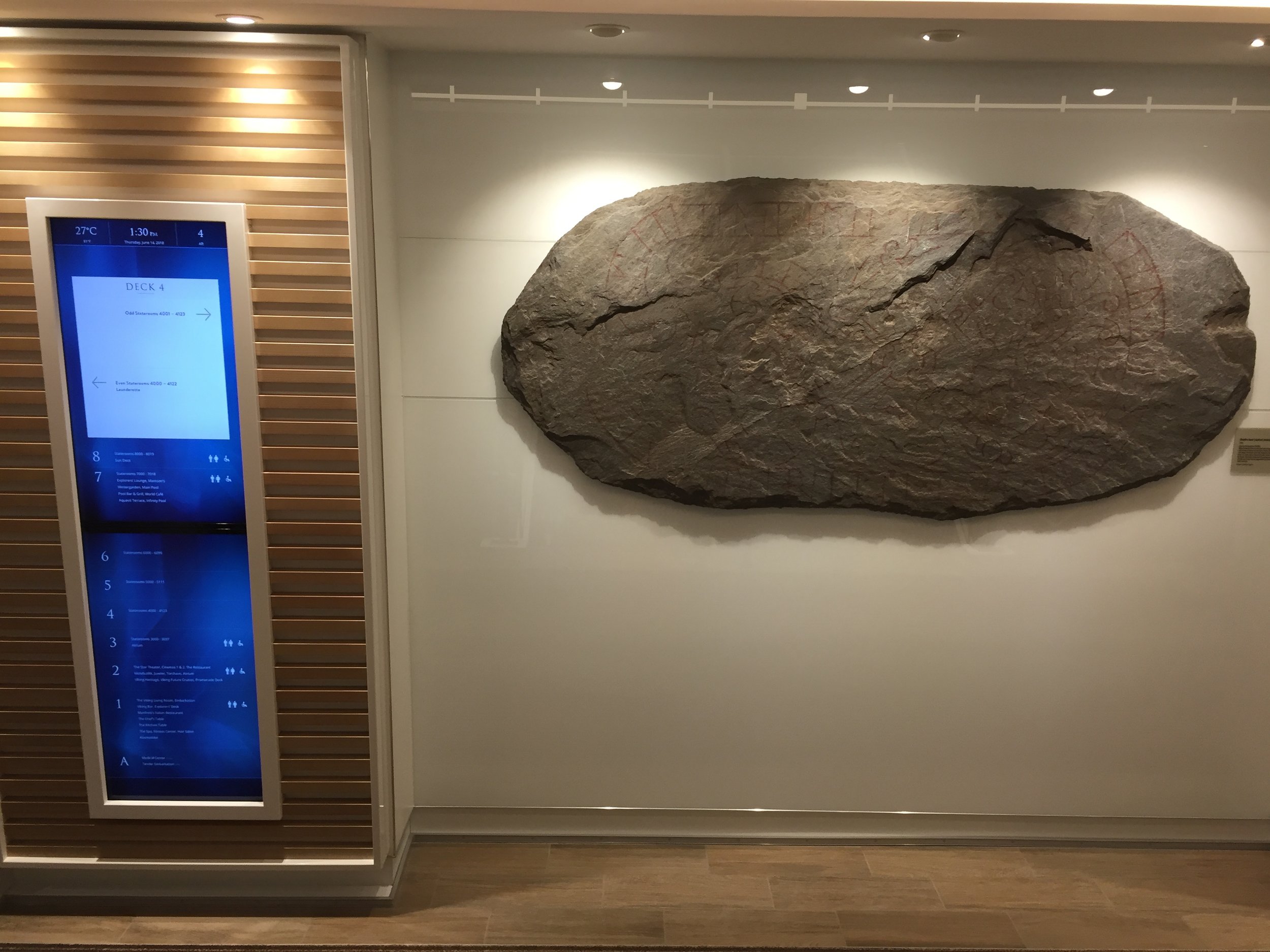
These stone runes offer quite a contrast with the high tech that is prevalent throughout the ship

Runes are an ancient form of Norse art
Another piece of decor with Nordic undertones: a reproduction of the famous Bayeux tapestry (that narrates the Norman conquest of England in the 11th century) adorns several levels of the ships’ main staircase.

Space Connection

If Nordic identity is a company-wide feature, space exploration is Viking Orion’s theme.
Viking Cruises been able to use the ship’s name and its astronomical resonances as an excuse to engage in an amazing exercise of story-telling.
Space exploration has inspired what is perhaps, the ship’s most unique signature feature: the Explorer’s Dome and Space exhibit, a planetarium and space-themed 3D cinema that lets passengers explore the universe and deepen their astronomical knowledge.
Not for nothing the ship’s godmother is retired NASA astronaut Anna Fisher, who has the honour of having been the first mother to travel to space. Several other astronauts were also onboard (possibly, the largest gathering ever of astronauts in any one place outside NASA) as were several prominent astro-physicists and senior figures connected to NASA and space exploration.
The ship’s naming ceremony in Livorno, was another opportunity to link the ancient Viking’s legendary exploration skills (they were the first European to get to America after all!) with that of Italian astronomer Galileo Galilei, who lived in the nearby (but inland!) city of Pisa.
The Experience

As a passenger you receive everyday a detailed booklet with detailed information about the next port of call and the activities available to you. So far so good, but here is where things start to get interesting…
When it comes to experiencing a destination, Viking deploys a rather immersive approach.
Passengers are able to attend a full programme of talks and lectures covering specific historical and cultural aspects of the places they are going to visit during the cruise. In fact, there is an historian-in-residence on every ship (Viking Orion being no exception) tasked with designing and delivering these prep talks. At the company level there is also a chief historian (would this be a CHO?) tasked with developing and coordinating all these learning programmes for Viking ships around the world, which gives you an idea of how seriously Viking takes this specific part of the cruise experience.
But this is not all…in the case of Viking Orion, an astronomer-in-residence is also at hand with pretty much the same functions!

During my Viking Orion cruise I attended an interesting lecture on Norse history given by an expert in the subject

These launches have a dual purpose, as safety boats and, in normal conditions, to reach some of the smaller ports along the way. Here at Portofino, on the Ligurian coast. We dropped anchor off this picturesque little town and then a shuttle system was organized the whole morning using the ship’s launches.
For those that are into food, Viking offers also a rather immersive experience.
At selected destinations you can join the ship’s chef on an expedition to the local markets to source fresh ingredients. When back at the ship these will be the raw material for a hands-on cooking session where passengers learn about different culinary traditions.
The resulting meal is then enjoyed, together with the rest of the group, at the intimate eating venue next to the kitchen (below).

The Party

Although this is not really part of the regular “Viking experience” (or of that of any other cruise operator for that matter), I thought it was necessary to include some words about the impressive naming ceremony of the Viking Orion in Livorno.
The images below can give you a feel of how it was like.


The show, that had British explorer Ranulph Fiennes as master of ceremonies, started with a magnificent music and light show projected on the tower and walls of Livorno’s fortress. Guests could as well enjoy the voice of renowned Norwegian opera singer Sissel Kyrkjebø, that performed live at the event.
The surprise came in the form of a jetpack-flying man that delivered the ax with which retired astronaut Anna Fisher cut the inaugural ribbon.


She was next to give Torstein and Karine Hagen some really cool-looking NASA jackets just before the event closed with a massive firework display.


24 Hours in Kansas City - What to see and what to do?
Visiting some amazing museums in the heart of the Midwest

The Midwest is often snubbed by those living on both coasts of North America, as “flyover country”.
And I must confess that, until recently I was not at all inmune to this stereotype. So, when I was invited to attend a work gig in Kansas, I did not really know what to expect.
Yet, a day in Kansas City (that, by the way, is not located in the state of Kansas, but just across the state line in Missouri!) sufficed to dispel any such notions as totally inaccurate.
In fact, as soon as I started to put together my own research and the tips I got from my local contacts it started to become obvious that the full day I had allocated for sightseeing may not be enough...by quite some way.
My impression of Kansas City is that it is a city of museums...and some rather unique ones at that. Whether you are into military history, aviation history, American history you have come to the right place.
In my case, I had only a limited amount of time in the city, so I had to prioritise.
When looking at the main attractions in Kansas City, the National WW1 Museum and Memorial was a must (since I had included it in this list of great military museums that I compiled for CNN ) and, given my interest in commercial aviation, so were the TWA Museum and the National Airline History Museum.
At the very last minute, I also decided to visit the Arabia Steamboat Museum, that did not disappoint.
This meant there was no time left for some other items in my to-do list, such as the Nelson-Atkins art museum or the money museum at the Federal Reserve of Kansas City.
But, well…they say you should always leave something for the next visit!
So here is my list of what to do in Kansas City
Downtown
National WW1 Museum and Memorial
City Market and Steamboat Arabia
TWA Museum

Downtown Kansas City at dusk, seen from the National WW1 Museum and Memorial
Downtown Kansas City
Like so many other cities in America, Kansas City has glass and steel downtown. Nothing special here.
But, what other cities possibly lack is the sort of privileged vantage point offered by another of Kansas City’s landmarks, the National WW1 Museum and Memorial (more on this later) and its tower (whose height adds to the museum’s already elevated position, on top of a hill).
Once you are up there, looking at the lights of the city, any sense of coldness and impersonality in contemporary American architecture fades way. There is always something mesmerizing about this type of skyline.
If looking at downtown Kansas City from the WW1 museum, one particular building dominates the scene. It is not a high rise tower, but the massive classical-style building of Union Station, built in 1914, a vestige of the time, well before the idea of “flyover country” came into being, when Kansas City played an important role in the transcontinental rail network.
Kansas City nightlife


Above are a couple of interesting “steampunk”-style pieces of street decor near Union Station
The National WW1 Museum and Memorial
This is, simply put, the museum of reference about WW1 in America.
The museum was set up in 1926 by popular subscription, the tower and adjacent pavilions are from that time. It was, however, vastly renovated a decade ago.
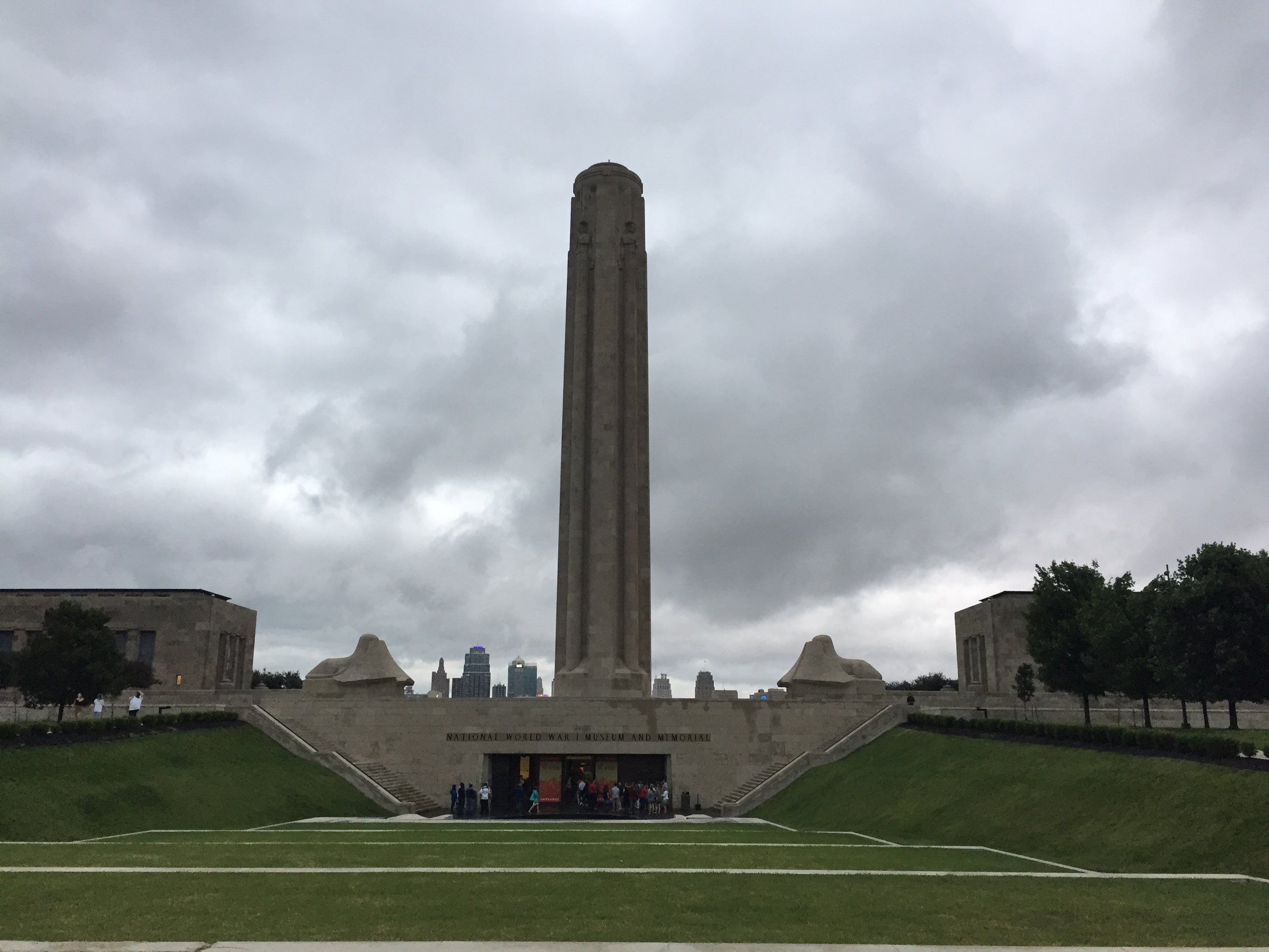
The granitic, solid look of the museum grounds, and its majestic location, on a hill overlooking downtown Kansas City and surrounded by vast green open spaces, give it a, quite fitting, solemn aspect.
The museum is structured around a tower, whose top floor, still open to visitors today, was, for many decades, the highest point in hundreds of miles around.


Some of the key allied commanders in WW1 met all together for the first time in Kansas City after the war


An interesting feature of this museum is that, unlike other war museums, it depicts the conflict in its entirety, in a purely chronological manner, instead of focusing only on the American point of view.
Also, pretty much all items in the museum are original and have come from the many different fronts of WW1, often via donations from individual collectors.

The exhibits go from the macro, societal level aspects of the war, all the way down to the many gripping personal stories, as well as some curious facts about the war.

I found personally interesting the story of a guy that, in the course of the conflict, fought successively, and in the same area of the front for, both, the Germans and, after successfully deserting and immigrating to America, for the US. Here displayed are the two different uniforms he wore.
The museum also regularly organizes temporary exhibits covering specific aspects of the conflict. When I visited there was an interesting exhibit about handicrafts produced by people that were involved in the conflict.
But, perhaps one of the most remarkable items, at least for me, is the painting Pantheon de Guerre.
This is a rather unique piece of art, since it is said to have been the largest painting ever completed. When it was whole (only part of it is preserved), it covered the same area as a football field.

Pantheon de Guerre, that was completed shortly after the war, depicts over 6,000 characters, real and allegorical, representing the victorious nations and its leaders. Quite conveniently, it is possible to check who is who in the painting with the assistance of some electronic displays located throughout the hall.

As a bonus, I visited during the week of “Taps at the Tower”. A memorial taps ceremony, with a bugler and flags is performed at sunset every day during a whole week (weather permitting!). At the end of the ceremony, it is possible to get up the tower for a nocturnal view of Kansas City’s skyline.


City Market

The sloping area between downtown and the Missouri river is home to the City Market, an open square (with parking space at its center).
This space is lined by fresh food shops and restaurants offering different cuisines from around the world.
On certain days there is an outdoor market too, hence the name of the place!
At first glance, it looks like City Market and the adjacent streets are a sort of small pedestrianised (a somehow “hipsterish”) enclave in Kansas City

The Steamboat Arabia Museum
It is also here that you will find one of Kansas City’s most interesting and unsuspected finds (in this case, quite literally!): the Steamboat Arabia.

The Arabia was a paddle steamboat was one of many that plied America’s waterways in the pre-Civil War era. Navigation in the American frontier was far from safe and sinkings were a relatively frequent occurrence.
This is what happened to the Arabia, on one night of 1856, when it hit a drifting log (when floating in the downstream current logs can be dangerous to ships, like a torpedo of sorts!) and sunk.
In fact, it did not sink immediately, but it settled slowly in a mudflat a few miles upstream from Kansas City. All passengers could be safely evacuated, but not its cargo.
And this is what makes the Arabia so interesting.

The log that sunk the Arabia

Our passionate guide, a former Marines officer and distant relative of president Van Buren!
The anaerobic environment in which it sunk helped preserve in (almost) mint state the 200 tons of goods that it carried onboard. Mainly merchandise to re-supply stores serving newly created settlements upstream in the frontier. In short, it was the 1850s equivalent of a “floating Wal-Mart”, a time capsule of what life was like at that time for ordinary Americans.
The location of the wreck was lost shortly after it went down, but in the 1980s a team of entrepreneurial enthusiasts set to locate it. And this they did, in 1988.
As soon as the hull was found, efforts started to recover it and salvage its contents.
The museum is the result of this private enterprise. It is not large, but very well organized and the exhibits are quite impressive, as most of the items are in mint condition.

There is an impressive array of tableware, tools, clothes, footwear, weapons and even some relatively well preserved canned sardines (although still whole, I confirmed that no one actually dared to taste them)
I would strongly recommend joining one of the guided tours that run throughout the day and are included in the entrance fee.
At the end of the tour, visitors are shown a video documentary and...surprise!...at the end of it, a member of the Hawley family (the one that found the wreck and manages the museum) shows up and addresses the group, ready to answer any additional questions about the Arabia.
After 30 years of work, the restoration of the Arabia Steamboat’s contents is not yet finished, there are still tons of material in storage waiting to be cleaned. Visitors to the museum can get an idea also about how the items are cleaned and prepared for exhibition at a special lab (picture below).

And this is not all, the Hawley family is already preparing to dig a second wreck, this one of 1841, while it keeps looking for more. Ultimately their idea is to add sections to the museum, with one wreck from each decade of the first half of the 19th Century.
Note: the Steamboat Arabia museum may be moving to a new location in the coming years, something that has not been decided yet. This is a real possibility as new space will need to be found if salvage of additional wrecks goes ahead.
TWA Museum

This is a really small museum, but one that will surely delight aviation history enthusiasts.
Although no longer in existence, the TWA brand has retained much of its allure and it remains, to this day, one of the most iconic airlines in commercial aviation history.
The museum, that is located in a building adjacent to Charles B. Wheeler Downtown Airport (just across the river from downtown Kansas City) is absolutely packed with all sorts of memorabilia connected to the history of the airline.
You can also admire a beautifully preserved Lockheed Electra aircraft, which, I later learned, had arrived to the museum the day prior to my visit!

Also, right by Kansas City Downtown Airport, is the National Airline History Museum. Unfortunately, it was closed on the day I was in town, but from what you can find on its website it looks like an interesting option to combine with the TWA museum.
Other interesting museums in Kansas City
Here are some other museums, that, had I had the time, would have been next in my schedule. I leave the details here, in part as a to-do note for my next visit!
Nelson-Atkins Art Museum
Apparently one of the best art museums in the Midwest (and in America, for that matter!)
https://nelson-atkins.org/visitor-information/
Money Museum
Located within the building of the Federal Reserve of Kansas City and just across the street from the National WW1 Museum and Memorial grounds. To judge from the reviews, this seems to be also quite an interesting museum.
Shopping
While on the museum front Kansas City really overshoot my expectations, the shopping experience was a bit underwhelming, at least when it comes to the city centre (didn’t explore big box retailers and malls in the suburbia).
To be fair, I visited just one downtown mall, Crown Center, located next to the WW1 museum and Union Station. It is part of a large office complex of the same name (that happens to be the HQ of famous Hallmark greeting card company!), but I found the offerings, both shopping and eating, to be nothing to write home about. It also closed at 7pm, which is quite early (even for European standards!).
Same story for nearby Union Station. As I got there on my (unfulfilled) quest to find some spot to eat before the taps ceremony at the museum. The station itself is quite beautiful and monumental, a vestige of the time when Kansas City was a major rail hub, however it was totally deserted and only one, not too appealing, restaurant was open.
To be fair, preparations were going on for some sort of festival, which may explain why activity was below normal, but even taking this into account it was far from what I was expecting from such as central spot.
Sergiyev Posad, the spiritual heart of Russia
Russia’s most important monastery throughout the centuries, just a short ride away from Moscow

Not far from Moscow, some 70km to the North, lies the small town of Sergiyev Posad (Сергиев Посад), home to Russia’s most important monastery: the Trinitry Lavra of St. Sergius, that has UNESCO World Heritage Status.
Sergiyev Posad is an interesting day trip from Central Moscow, and a recommended outing for those travellers that have already ticked Moscow’s main highlights of the to-do list and looking to see a bit more of Russia without leaving the comforts of the capital.
How to get to Sergiyev Posad
The best way to reach Sergiev Posad from Moscow is possibly by train. The town is on the Moscow-Yaroslavl trunk line, so train service is frequent (literally every 10-15min during daytime).
From Moscow Yaroslavl station (Ярославский Вокзал) trains take between 1h (if taking a fast train) or 1h 30min a slower (and cheaper) commuter train.
Prices can vary a lot between the normal suburban trains (fare can be 300 rubles, or around €5) or the faster trains that you can book in advance (with some tickets going for up to more than 2,000 rubles, or some €30)
Visiting Sergiyev Posad - What to see
Sergiyev Posad is named after Saint Sergius of Radonezh, one of the most venerated saints of the Russian Orthodox Church, who is said to have founded the first religious establishment at this spot in 1337.
In fact, when St.Sergius first moved into this area, in the 14th Century, he was intending to live an ascetic life, alone in the middle of the forest.
Yet, with time, other monks arrived to join him and the community kept growing to the point that a proper monastery was built.
The other component of the town’s name “Posad”, refers to the emergence of this community, since this was the name typically given to settlements next to fortresses or monasteries.

The buildings visitors see today, though, are quite old, but don’t date back to that foundational era.
In fact, the oldest of the structures within the Lavra (like most Russian monasteries, the Trinitry Lavra is a complex of stand-alone buildings within a territory enclosed by walls) is the Trinity Cathedral, that dates from 1422 (the same year St.Sergius was declared a saint).
This cathedral appears much smaller than the neighbouring 16th Century Assumption Cathedral, but actually, it has quite a remarkable religious significance, since it is in the Trinity Cathedral that St. Sergius relics are kept (they were returned to the Lavra in 1946, after years in hiding).

The largest building and the one that takes a central spot within the complex is the Assumption Cathedral, built in the 16th Century in times of the tsar Ivan the Terrible (1547-1584). Here are the remains of Boris Godunov, the late 16th and early 17th Century Russian ruler that inspired the opera of the same name.

Proof of the important role that the monastery at Sergiyev Posad has played in Russian history is the fact that, in successive centuries, some of the most remarkable tsars left an imprint on it.
Peter the Great took refuge here in the early, convulsed, years of his reign and added a palace.
Her daughter, Empress Elizabeth used to do an annual pilgrimage to Sergiyev Posad, conferred it the title of “Lavra” and added a 88m. bell tower that is, by far, the tallest structure in the whole area.

For most of its history, Sergiyev Posad was, likely, Russia’s richest monastery.
Thoughout the centuries, some of the most celebrated artists and architects of the time came over to take part in the works, starting with medieval master painters such as Andrei Rublev, that, together with fellow painter Daniil Chyorny decorated the first cathedral at Sergiyev Posad, or 17th Century painter Simon Ushakov, some of whose masterpieces decorate the Cathedral of the Assumption.

The Trinitry Lavra at Sergiyev Posad continues to to be an important religious center to this date (this role was only interrupted between 1920 and 1945, between the Revolution and the end fo WW2), with a community of some 300 monks living here.
Walking around, you can see how tourists mix with those that have come to pray and expressions of religious devotion are commonplace.

People collecting holy water from a well. The well was discovered in 1644 and has its own chapel attached.
Where to eat in Sergiyev Posad
If you are going on a day trip to Sergiyev Posad, you want to have the lunch options covered after an intense morning visiting the monastery.
A good option is Russkiy Dvorik, located on the road just outside the monastery’s walls.
The look from outside (and the name) is a bit touristy, yes, although the crowd is mainly “local” (from Moscow) Russian tourists. The place is quite cozy inside and the food (mostly Russian specialities, pretty good too). I particularly recommend tasting the local Medovukha, a traditional Russian beer-like drink made with honey.
Russky Dvorik
Prospekt Krasnoy Armii, 134/2
Sergiev Posad

Millenary olives, cave art and Iron Age hill forts in Southern Catalonia
A truly amazing concentration of ancient treasures
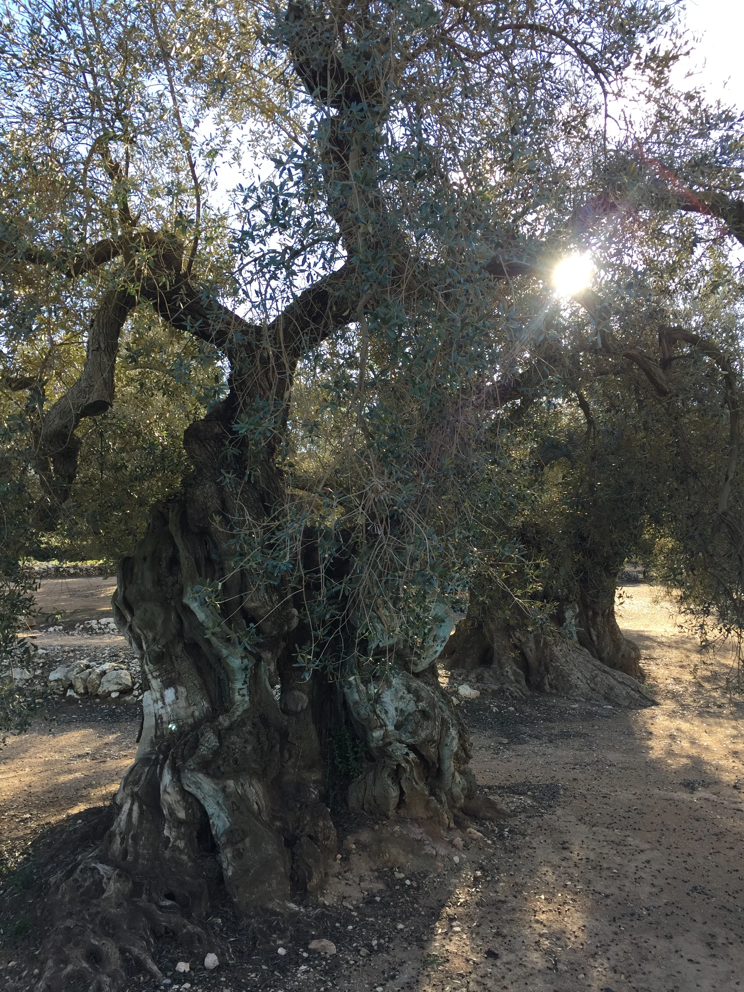
There is a corner of Catalonia that feels far, far away from the well known resort towns of the Costa Daurada.
And, yet, the crowds that every summer converge in places such as Salou or Cambrils or those queueing to get a wild roller coaster ride at Port Aventura…are barely 50 miles away from the quintessentially Mediterranean landscapes around the town of Ulldecona.
But it is here, nested between two chains of bare hills that run parallel to the coast, that an astonishing concentration of unique, ancient treasures awaits those travellers curious enough to go off the beaten path.
What to see around Ulldecona:
1) The largest concentration of millenary olive trees in the World
2) The Iberian hilltop fort of La Mola del Remei (located, actually, in the nearby town of Alcanar)
3) Prehistoric cave art of the Abric d’Ermites
In fact, this is not all, because the urban center of Ulldecona is crowned by a well preserved medieval castle, yet when prioritising our schedule by order of ancientness, we found out that did not have enough time to visit it!
This post is the chronicle, in no particular order, of a day trip from Barcelona to the Southern-most town in Catalonia and an exploration of its nearby (pre)historical sites.
How to get to Ulldecona
Getting to Ulldecona is quite easy, provided you have a car, as Ulldecona lies right next to the major AP-7 highway that runs all along Spain’s Mediterranean coast. It’s about 2h drive to Barcelona going North and a similar distance to Valencia going South.
There is also a train station, but most trains don’t stop locally and service is spotty.
In any case, it is difficult to visit the sites detailed in this post without a car.
The train station is a good starting point for any visit, though, as it is next to the local tourist office, hosted in an early 20th C. modernist building (below). Its interior has been fitted with modern exhibits about the region and its main agrarian produce: olive oil.


The olive trees
Olive trees are truly amazing living things.
They can live for thousands of years and still keep producing their valued harvest, season after season.
It is mind-blowing to imagine what some of the olive trees we have in front of us might have seen…
We are at the Arión estate, a couple of miles west of Ulldecona. We have come here because here is found what is, allegedly, the largest concentration of millenary olive trees anywhere in the World.
And the start of all of them, a tree called “La Farga D’Arion”.
Although quite impressive in its voluptuous shapes, to the untrained eye it looks not too different from the surrounding monumental olive trees. Yet, this particular tree has been around for some 1,700 years. Some scientific studies have dated it to the 4th Century AD, the reign of the Roman emperor Constantine.
Local conservationists claim this makes it the oldest living scientifically-dated olive tree, although this is disputed by some other claimants in the Eastern Mediterranean.

In any case, it is a truly spectacular living organism. The presence around it of tens of other trees that are hundreds and perhaps even over a thousand years old, adds to the attractive of this place.
Most of these ancient trees are of the Farga variety. The fact that it is less productive than other varieties means its cultivation was progressively abandoned and only a few pockets like the Arion Estate remained.
In recent times, efforts have been made to recover and protect these living monuments.
Perhaps one of the most effective ways to guarantee they continue well kept for many years, though, is the fact that some local entrepreneurs have started producing and marketing “millenary oil” produced with olives harvested from these trees.
Yes, you can consume olive oil from a tree that was already producing in the Roman era!
Millenary Oil
Amador (pictured below) is one of such olive oil entrepreneurs.
Based in the town of Traiguera, across the river Sènia, that separates Catalonia and the Valencia Region. Amador not only harvests from its own olive groves, but also has moved around the whole area, identifying ancient trees and negotiating with local landowners the harvesting of their fruits.

Back at its small mill in Traiguera, in a semi-artisanal operation, Amador bottles this oil with the “Millenary Oil” label. This is a quality brand that has been set up by a number of local producers that decided that, instead of the traditional bulk trade, they would move upmarket by highlighting this very unique characteristic of the olive oil they produce.

Despite its small production, Amador’s millenary olive oil has achieved a degree of international success, with orders arriving from places as far as China.
The popularization of high quality extra virgin olive oil outside its traditional Mediterranean markets has certainly contributed to differentiated olive oils, such as those under the Millenary Olive Oil label, to exploit its differentiated positioning.
By the way, you can buy Amador’s millenary olive oil here: https://www.aceitespeset.com/

Amazingly, some of the olive trees currently producing for the “Millenary Oil” brands were abandoned and in a rather derelict state until quite recently.
Iberian Hill Fort
The next stop takes it a few centuries back, to pre-Roman times.

Located on one of a 200m-high peak on the Serra del Montsià and overlooking the sea and the town of Alcanar, there is the Iberian hilltop city of Moleta del Remei.
It is believed that it was occupied between the 7th C. and 2nd C. BC by an Iberian tribe called the Ilercavones.
At least two stages of habitation have been established, the first iron age hamlet possibly destroyed by fire and then rebuilt. It was self-contained within solid stone walls, that also acted as walls for some of the houses, as can be clearly seen when visiting the ruins.
It is possible to see a reconstruction (below) of how one of the houses may have looked like.

The hilltop fort had also a great view points over the surrounding territory and the sea and had other satellite settlements in nearby hills.
It looks like it was abandoned shortly after the Roman colonization. The newcomers had certainly different ideas when it comes to urban planning!

The Cave Paintings
But if an iron age hilltop settlement and the millenary olive trees were not ancient enough for you. Here is another treat: the beautifully preserved prehistoric cave paintings on the Serra de Godall, declared World Heritage Site by UNESCO.

The paintings are actually in the open, not inside a deep cave, but under an outdoors rock shelter. To get there you just need to walk some 50m from a little church (Ermita de la Pietat, hence the name the paintings are also often called “Abrics de l’Ermita”).

The paintings are some of the best preserved examples of the so called “Levantine cave or rock paintings”, a type (or style) of cave art that is found in over 700 sites all throughout Eastern Spain.
Although dating is not precise, it is believe that this Levantine style of rock art originated in a transition period between the Paleolithic and the Neolithic, that is 8000 to 3,500 BC.
The ones here in Godall, near Ulldecona are scattered all over the rock wall. The stylized figures are clearly visible to the naked eye, with animals and hunters painted in warm colours that melt into the yellowish-reddish tones of the stone.
A truly amazing sight and really easy and straightforward to visit. For free.
To learn more about this amazing region, you can also check my piece on CNN Travel: “Spain's ancient olive trees: New taste for old flavor”
Also, may thanks for its guidance and support during the field trip to Jaume, director of Taula del Sènia, an entity that aims to reinforce institutional cooperation between the three territories that meet in this area: Catalonia, the Valencia Region and Aragon.

Trekking to the "Chinese Wall" of Finestres
Rock, water and nature. A little know spectacular rock formation near the Pyrenees
The “Chinese Wall” of Finestres is, in fact, neither a wall, in the strict sense of the word at least, nor in China. Yet, when you see how it looks like, you can understand why this name has stuck.
The lands on both sides of the Ribera Ribagorçana river, that demarcates the border between Catalonia and Aragon, 200km West of Barcelona, hide some truly amazing natural wonders that have, so far, escaped the attention of the masses. The Wall of Finestres, a peculiar rock formation that straddles one of the arms of the huge Canelles reservoir, is one of them.
This area is at the Western edges of a mountain range called the “Montsec” (which means “Dry-Mountain” in Catalan language), one of the mountain ranges of moderate height that run parallel to the Pyrenees.
Rural exodus hit these mountain areas in the Aragon-Catalonia borderlands particularly hard. In fact, it would not be totally inaccurate to refer to the area surrounding the Canelles reservoir as a sort of wilderness.
This has, at the same time, been a blessing in the sense that these magnificent landscapes have been preserved pretty much intact and those that come to admire them in person are still few.
How to get to the “Chinese Wall” of Finestres?
By land
It is possible to reach the abandoned village of Finestres by car, and from there it’s just a few hundred meters to the best viewpoints…but, be warned! the only way is through an unpaved road that may not always be in the best condition.
The direct route would take you from the town of Estopanyà, and through a bridge over the river Guart, all the way through an unpaved track to Finestres.
However, on the day we visited, sections of this track were impassable due to heavy rain on the previous days, so we took instead an alternative and much longer route. Starting much more to the North, in the hamlet of Viacamp, which sits right next to a major road (N-230). From there is another unpaved track that traverses a long ridge on the Western side of the reservoir. The track is some 20km long, but it takes over an hour to drive, because the track is steep at times and some sections have a rather irregular ground, with plenty of scattered rocks. Yet, it was dry and we managed to drive through with ordinary cars.
By kayak
There is another way, possibly more picturesque, and it is to join a kayak expedition organized by one of the several local active tourism operators.
The abandoned village of Finestres
The end point of our drive and the start of the walking part of our expedition is the abandoned hamlet of Finestres.
The landscape here is what you would expect in a place that has been devoid of any permanent inhabitants for over half a century: the ruins of what once was a thriving community, complete with a 17th Century church, totally overgrown by vegetation…or almost. There is, apparently, one house that is still inhabited in the summer.
The village, on its own, makes for quite a suggestive place, and it also has some nice views of the Canelles reservoir, but we did not come here for this.
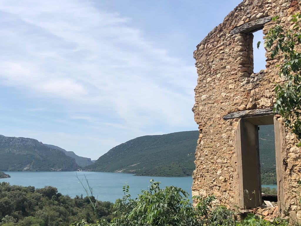
The first part of the trek was to cover the roughly 200m from the abandoned village of Finestres to the nearby Saint Mark chapel, located on a small hill overlooking the large man-made lake, that stretches as far as the eye can see.
And it is also from here, that we got our first glimpse of the spectacular “Chinese Wall”…
The Wall of Finestres
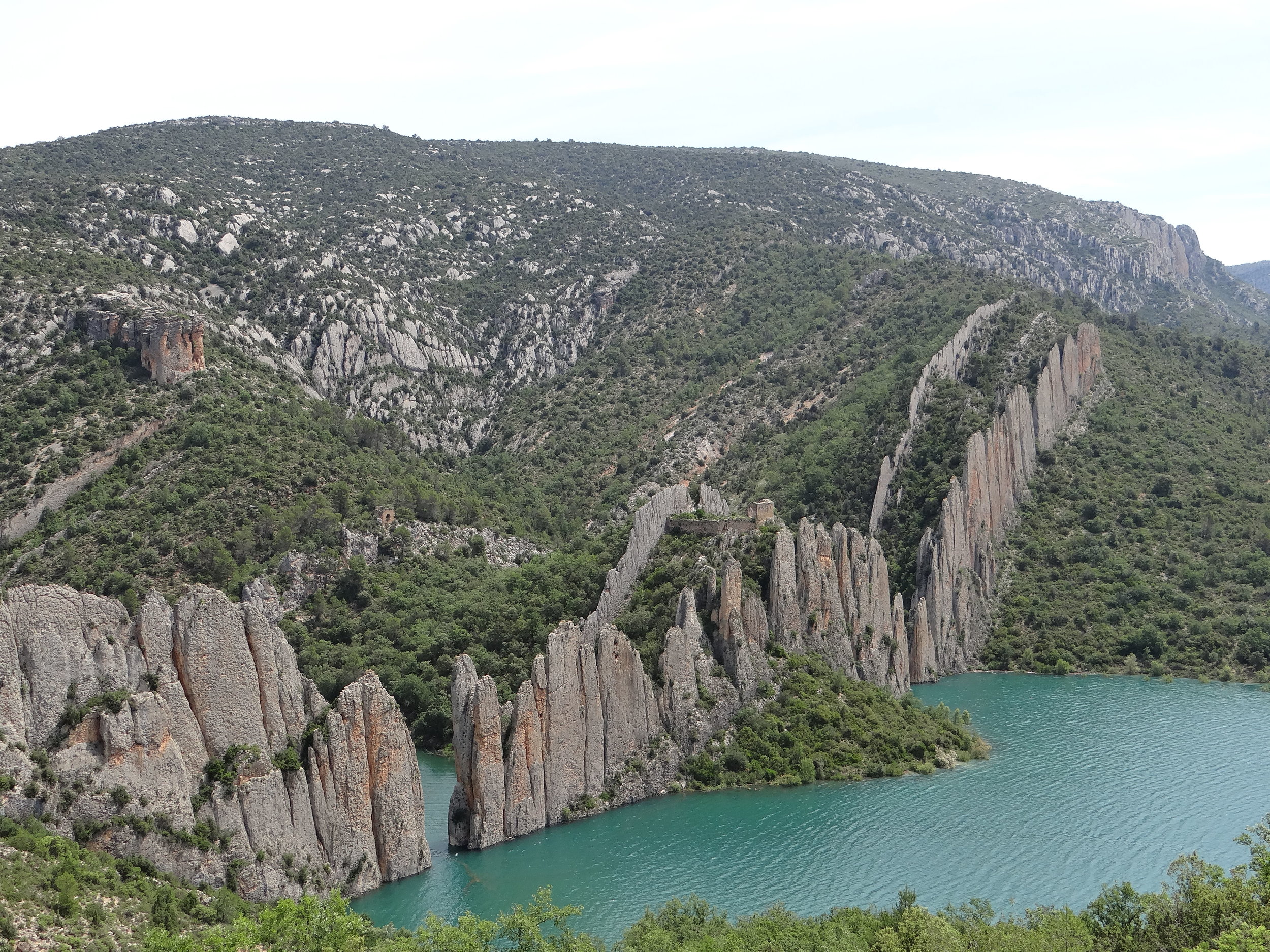
The so-called “Chinese Wall” is actually a two parallel lines of vertical mineral strata that run along one of the edges of the Canelles reservoir, partly enclosing one of its lateral arms, and creating, when the waters are high, a sort of secluded bay.
Adding to the spectacular ensemble, a XI Century Romanesque church crowns the highest point at the center of the wall. The church of Saint Vincent (Sant Vicenç de Finestres) was built right in the space between the two walls of rock.
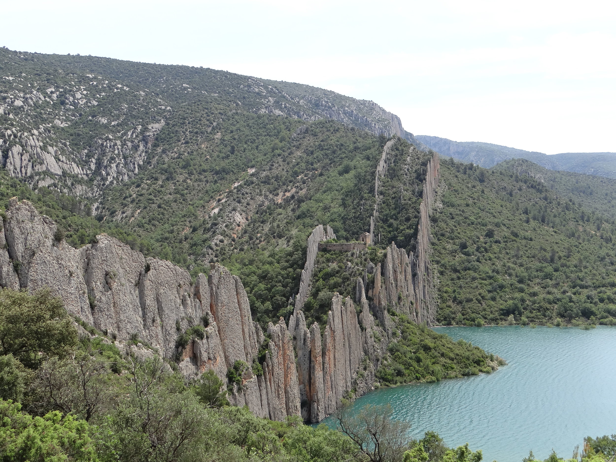

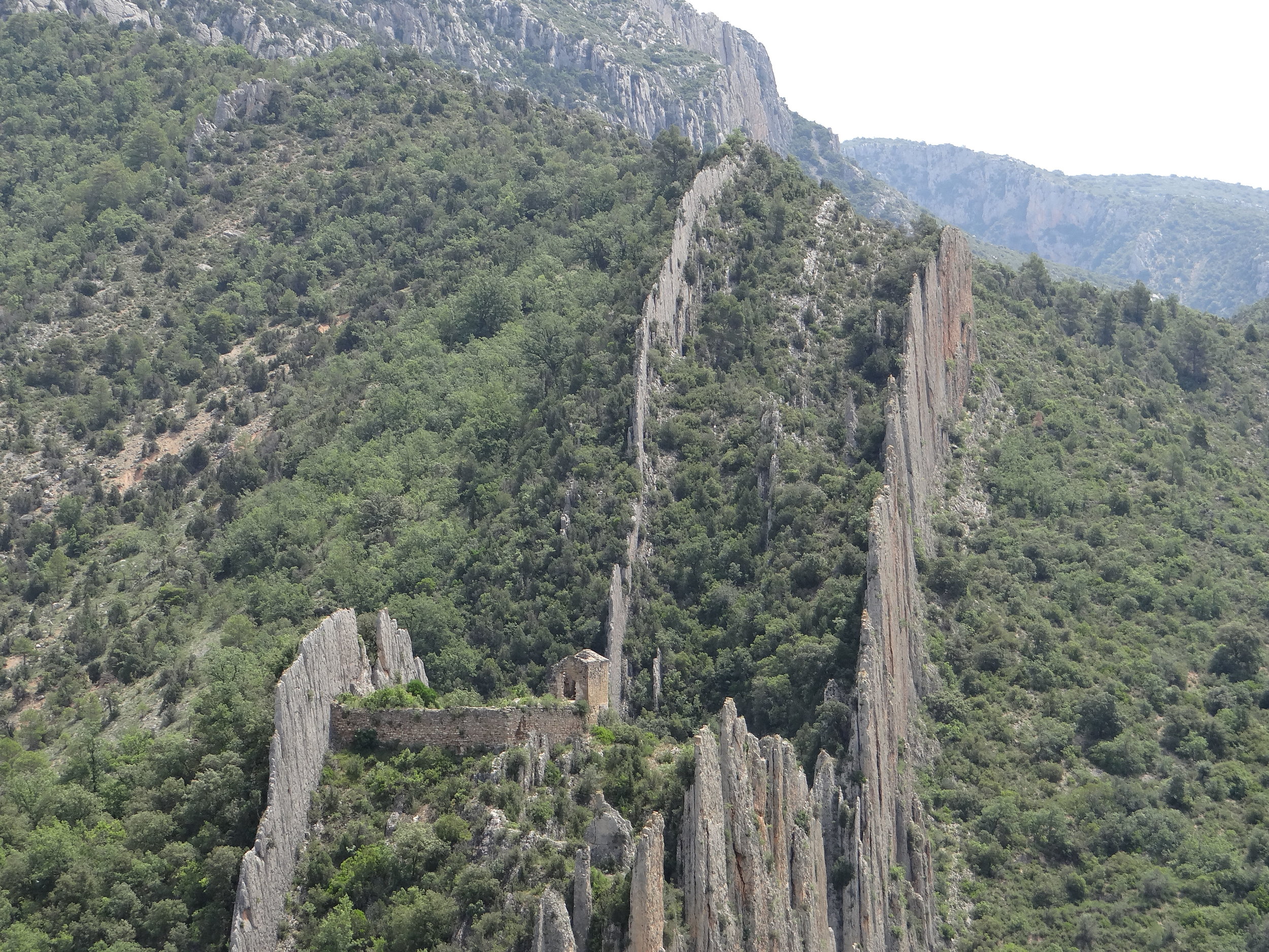
From Finestres, there is a trail that takes you to the church of Saint Vicenç by making a detour around the very steep hillsides, yet, we decided to try the direct route and went straight for the water, heading for the bottom of the ravine that lays at the bottom of the wall, in the hope to find a passage along the shore or, at least to go for a swim (it was summer!). (Warning: although not technically complicated, it is quite a steep descent and there is not a well designated trail!)

What we did not count on was the water level, which at the time were quite high (due to a rather snowy and rainy winter and spring.
At this point the Canelles reservoir has a small side arm that, with low water levels is possible to walk around and get to the trail that leads up to the Wall and the church of Sant Vicenç, but with the water a crossing on foot was out of the question. There was still the option to swim, but we would possibly need to leave bags and cameras on the near shore.
Luckily, a group of kayakers just showed up at the right time and helped us to get across the few meters of water that separated us from the other side.
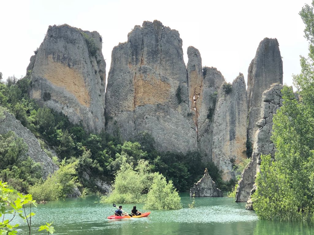
From this point is a 10 minute uphill walk to the central part of the Wall.
A gap in the “Chinese Wall” gives access to the picturesque romanesque church, built in the Lombard style that was common in these lands at the turn of the 11th Century. Again, the trek does not require much technical expertise or equipment, although it is quite steep and at some points it requires climbing over rocks. In particular, the last stretch, to enter the space between the two parallel lines of rock that make “the wall” requires going through a 2-meter high metal staircase that has been afixed to the rock.
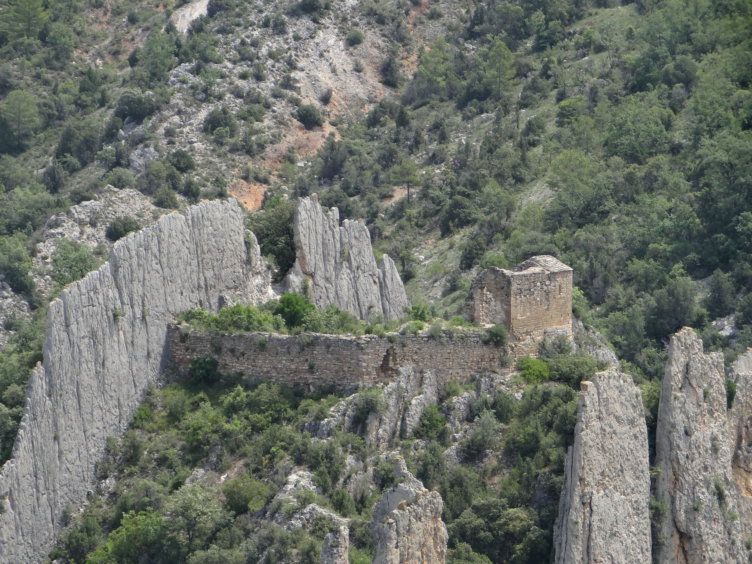
If the views of the Wall are quite amazing from the outside, there are also some amazing views from the inside…
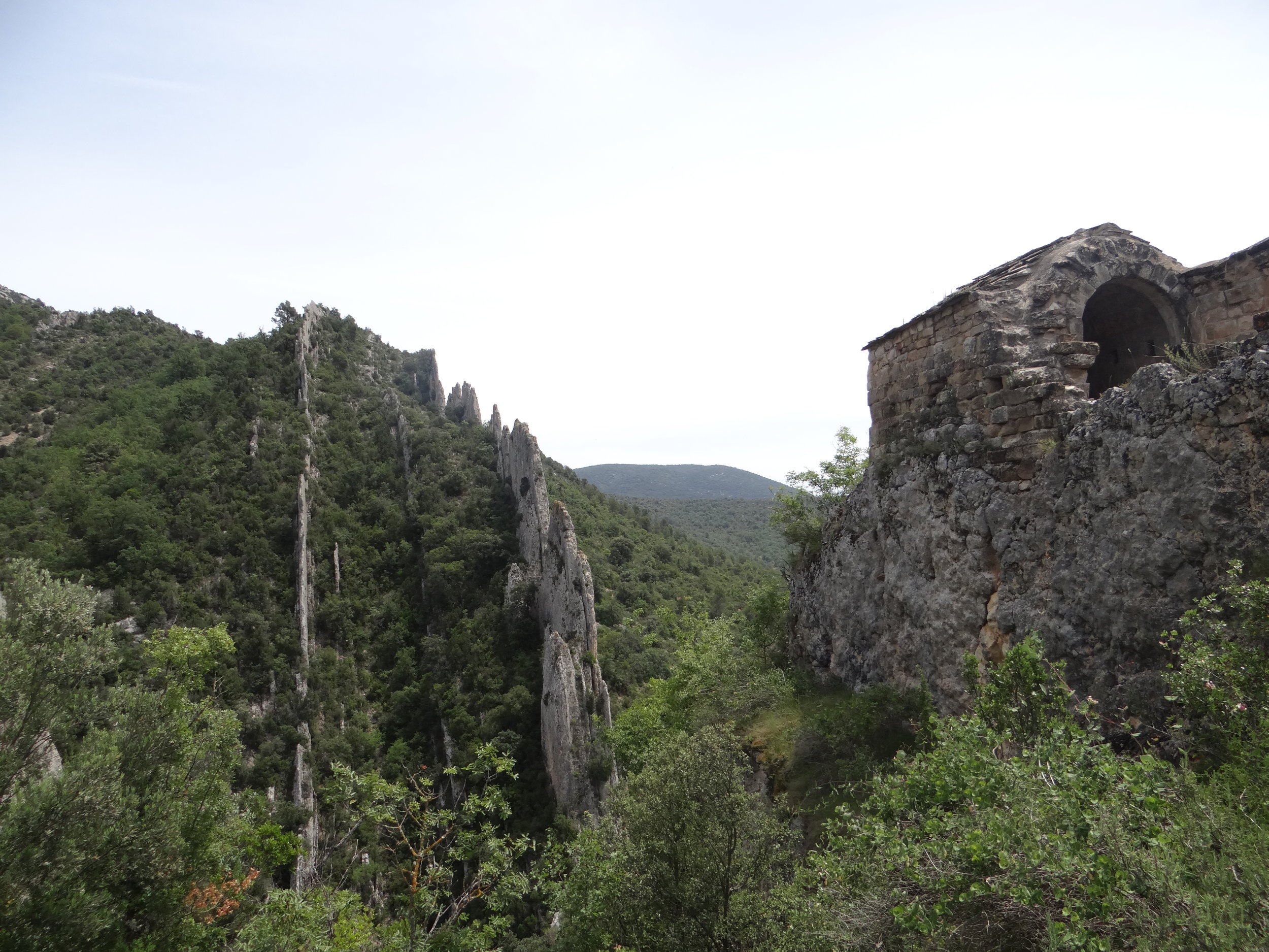
There was also time for a bath before making our way back…


Visiting the Historical and Cultural Complex Vyatskoye
The history of Russian rural life in one of the most beautiful villages of Russia

The little village of Vyatskoye, in the woods near the city of Yaroslavl, 250km North of Moscow, looks, at first glance, like any other rural villages in Russia…a bunch of scattered wooden houses here, an old church there…a small stream flowing slowly in its midst…
But this impression is quite misleading.
Because Vyatskoye is at the center of one of the most interesting projects that are taking place in the up-and-coming Russian tourism scene.

What is the Historical and Cultural Complex Vyatskoye?
About a decade ago, a couple of Russian entrepreneurs from Yaroslavl, the Zharovs, bought a house in Vyatskoe with the intention of restoring it and making it their second home.
What they possibly didn’t know at the time is that this purchase would kick off of a long-running initiative that would turn the tiny hamlet of Vyatskoye into the “Historical and Cultural Complex Vyatskoye”, a sort of live theme park that showcases Russian rural life of the last 200 years.
It is a theme park that is actually alive, because people continue to reside in Vyatskoe, yet, at the same time, the Zharov family has been investing in the restoration of the village, turning several of its old houses into museums that explain several aspects of Russian rural life through the centuries.
This has also been accompanied by the opening of several hotels, restaurants and shops to cater to the nearly 80,000 annual visitors, a figure that is expected to keep growing.
Vyatskoe is also a officially of the Most Beautiful Villages of Russia.

There is a constant, ongoing restoration work in Vyatskoe. Like so many other parts of Russia, Vyatskoe has its fair share of derelict buildings, but some of these are being brought back to the approximate state in which they were when this was a rather prosperous village at the turn of the 20th Century.
Some panels on the street give you an idea of how the place looked like at that time.


As it is the norm in Russian villages, Vyatskoe does not have a compact historical center such as those found in many Western European towns, but instead it is more of loose cluster of two-storey wooden buildings, that spans a rather large area (a feature of Russian rural architecture that we have commented here before).
Handily, at one of the museums there is a scale model of the village with all its houses.
What to do and what to see in Vyatskoe
Vyatskoe is basically a place where you can spend the whole day strolling from one museum to the next, although the village also makes for a nice walk outdoors, as it is a pretty rural setting (do not forget to buy cucumbers or cucumber seeds, as this is the typical produce of Vyatskoe!)
The museums themselves are not huge, as each usually takes a renovated village home and almost all of them are around Sovyetskaya Ulitsa, which is the main street.
Visitors to Vytaskoye can currently visit the following museums (this may have changed since the time of our visit)
Museum of Russian Entrepreneurship
This museum was started with the idea of showing everyone how the people of Vyatskoye were quite an entrepreneurial bunch. In the 19th and early 20th centuries, locals often traveled to Moscow and Saint Petersburg to earn a living and then came back to the village to enjoy the fruits of their labour.
The scope of the museum has now been expanded, so that now it is not only about Russian entrepreneurship but covers also local history with a much longer perspective that goes as far back as medieval times.
Cinematograph and “Dietsky Mir” Museum
Dedicated to children and historical toys

Musical Museum “The Sound of Time”
This museum hosts one of Europe’s best collections of music recording and reproduction equipment, including some very rare pieces from the 19th and early 20th centuries.
Museum-Printshop “Pages of the history of the printing business”
Well, I guess this one is self-explanatory
Museum of Kitchen Equipment
Another with a rather self-explanatory title. In fact, you can find here several rooms of a village house as they may have looked like before the Revolution.

Museum of Russian Amusements
Dedicated to the recovery of old Russian outdoor traditional forms of entertainment
Museum of the Russian “Banya”
Although it is not as well known as the Finnish one, Russia has its own version of the sauna, called “banya”, this museum is dedicated to it.

House of the merchant peasant or House of the Peasant Gorokhov
Museum of the Return of the Saints
This museum keeps keeps and tells the story of a 18th C. Gospel book that had been lost during the Russian Revolution and then recovered
Museum of the House of Angels
Tells the story of a local villager that in 1829 volunteered to repair single-handedly the angel at the top of the Peter and Paul spire in Saint Petersburg, which is 122m high. Given the technology of the time, this was a rather daunting enterprise.
Interactive museum of the traders Urlov brothers
Recreation of one of the two hotels that existed in the village at the turn of the 20th century.
Polytechnical museum of mechanisms and machines
It is located in the first floor of the same building as Urlov Brothers museum, it shows machines that were used by the peasants of Vyatskoe in their in everyday lives.
Where to stay in Vyatskoe
Hotel-Museum Vyatskoe
Ulitsa Sovetskaya, 8, с. Вятское, Yaroslavskaya oblast'
http://xn----ctbjbwjreuef9m.xn--p1ai/otdih-v-vyatskom/hotel/
This hotel is also part of the renovated ensemble of the village. Large rooms, each with its own decor and personality and a somehow retro style, although this is in line with the overall theme of the place and is part of the charm I guess, since the hotel is actually quite modern. The service is good.


Madeira, paradise island
A thorough exploration of an exuberant, diverse island. A proper Garden of Eden in the middle of the Ocean.
There is little doubt that Portugal has become one of the hottest tourist destinations in Europe.
A case in point is Lisbon’s comeback, from sleepy capital on the periphery of Europe to a must-visit place for any discerning traveller has been remarkable. But it is easy to forget that the wonders of Portugal are not limited to its mainland..
One of Portugal’s most fascinating territories is the small island of Madeira (whose name means “wood” in Portuguese).
Once a stepping stone on Portugal’s long Oceanic routes, Madeira is just 57km long and 22km wide (at its widest point) but thanks to its orography and geographical position, it has an amazing diversity of landscapes and ecosystems that guarantee you won’t get bored anytime soon.
A press tour organized by TAP Air Portugal, Turismo de Portugal and the Madeira Promotion Agency gave us the chance to explore the island in the company of other bloggers and journalists.
The first impression we got upon landing is that Madeira is incredibly mountainous, in fact the island is the emerged part of a volcanic ridge that goes all the way from the ocean floor to a height of nearly 2,000m above sea level.
There is hardly a square mile of flat terrain on this island, and this is why even the island’s airport had to be built, partly, on a hill-side man-made structure sustained by pillars (resembling an aircraft carrier of sorts)
Madeira’s complex orography becomes evident on the drive from the airport to its capital, Funchal, through a brand new motorway with innumerable tunnels and bridges. Houses are perched on the what look like impossibly steep inclines right and left, with deep ravines and cliffs around them.
This is about as flat as it gets in Madeira!
Funchal
Madeira’s capital and its administrative and services hub, Funchal, is on the South-eastern coast of the island.
Located in a rare opening of the vertical cliffs that line the island’s coast. Although Funchal’s neighbourhoods climb onto the surrounding hillsides, its historical centre is right by the sea.
The feel is that of a rather sleepy provincial town and, although it is hard to pinpoint one major point of interest, the whole ensemble, particularly the streets on the oldest part of town, is not devoid of charm.
One of the points of interest in Funchal is the fish and vegetables market.
We were to late for the fish auction, but could get a first glimpse of the produce that results from Madeira’s mild sub-tropical climate.

The flower and fruit display at Funchal market can’t be described as anything else but a colour explosion, with passion fruit of different sorts and varieties being the star here!


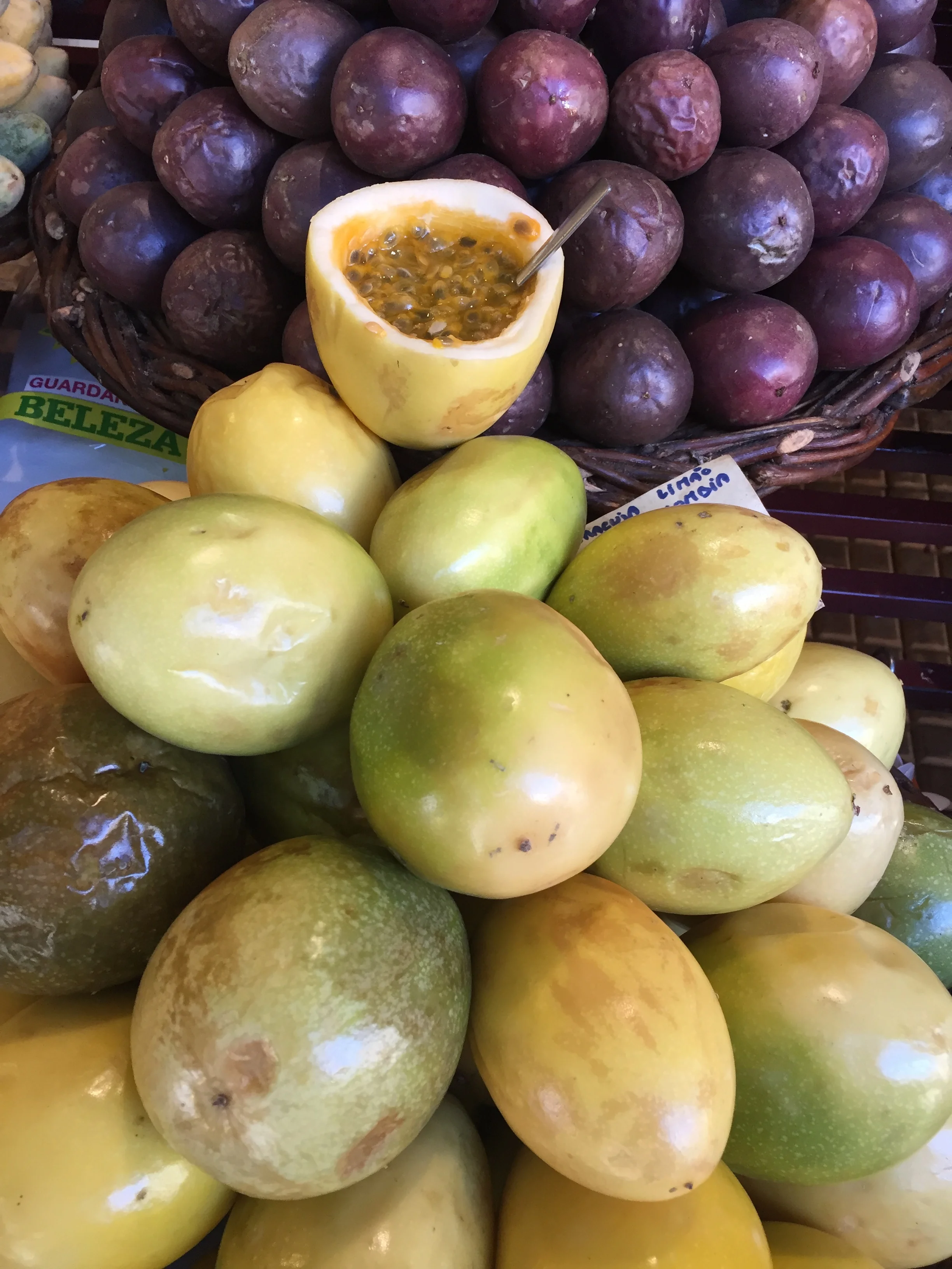
Dolphin Spotting in Madeira
One of the great things to do in Madeira is to take a whale and dolphin watching tour.
Even if you don’t get to spot any, it is the perfect excuse to enjoy the clean, deep blue waters that surround the island and contemplate its magnificent orography from the sea.
There were a dozen of us on a fast boat as we moved out of Funchal’s harbour for a glorious morning at sea. It was bright and sunny but the constant breeze kept the temperature balmy and pleasant at all times.
It did not take long before we spot the first dolphins, we followed them for a while before they were gone…far from being a rare encounter, we soon got visual contact with another group…and then another…and another…
Lunch at Fajã dos Padres
A great continuation to the dolphin-spotting adventure, as traveling by boat is the best way to access this secluded oasis of calm nested between the sea and high vertical cliffs.
It would be fair to say that this narrow tongue of land concentrates much of what makes of Madeira such a special place: crystalline waters, great food, exuberant vegetation and amazing weather set in a rough, rocky landscape.
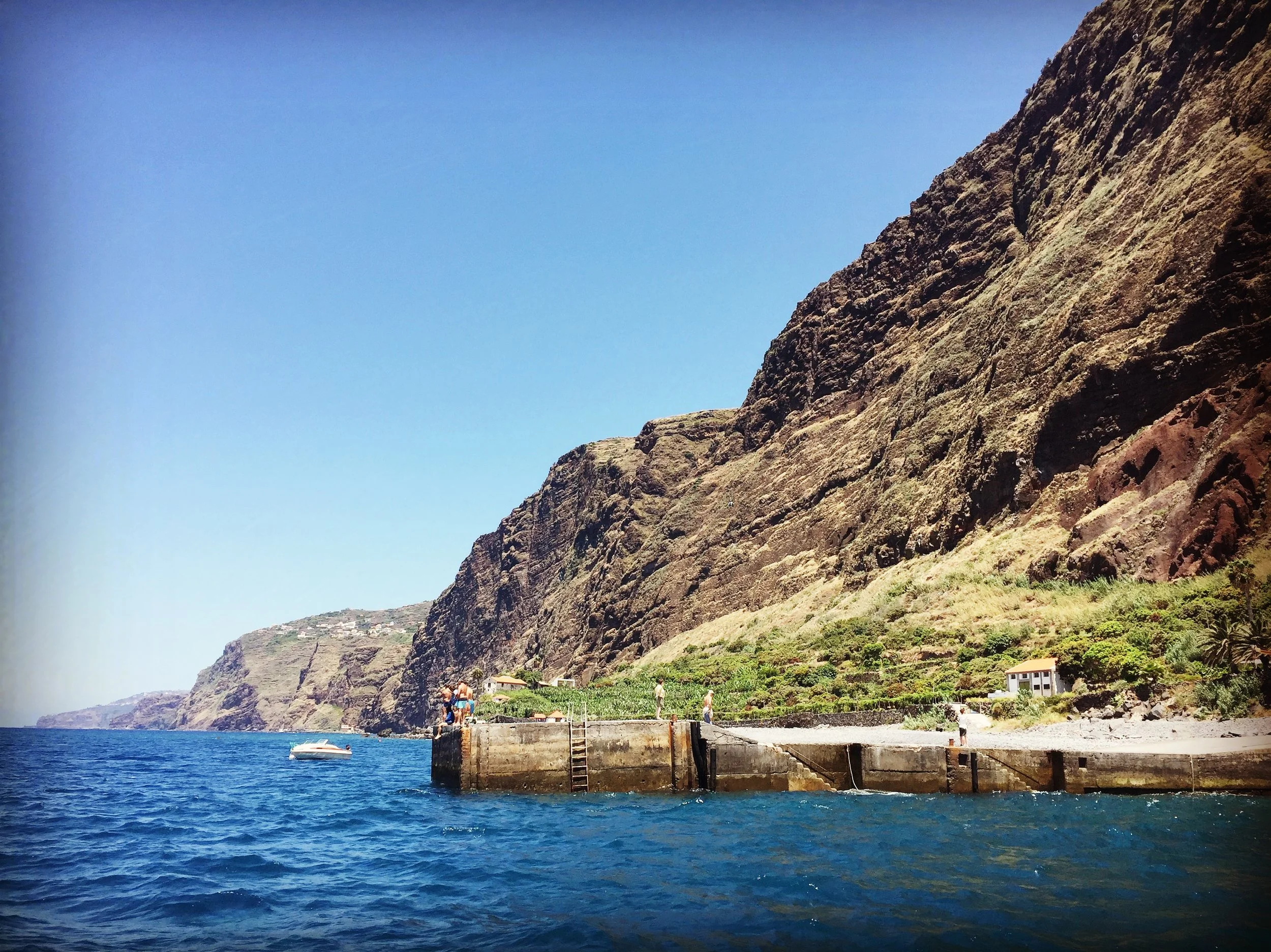

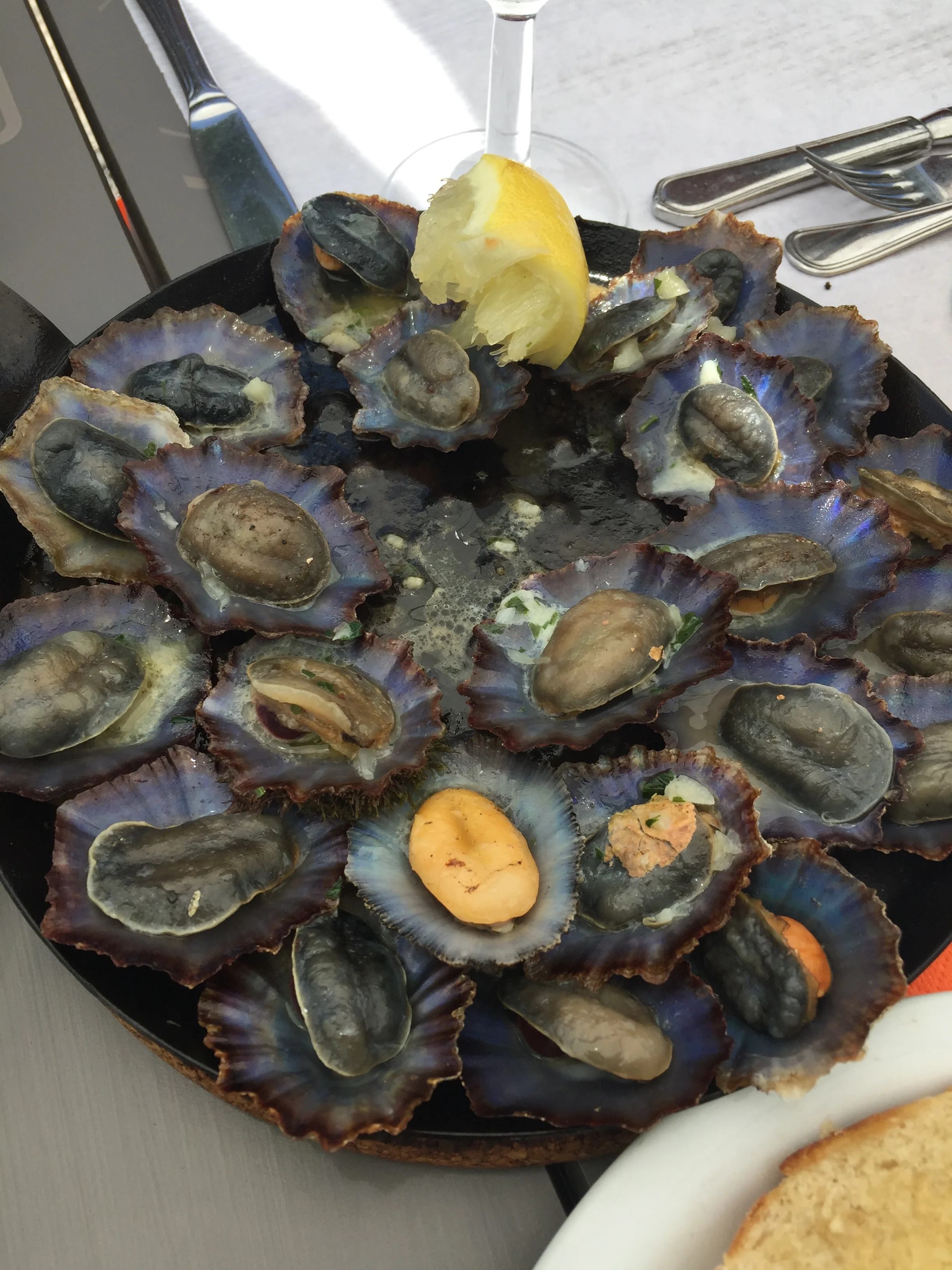
There is a restaurant and terrace in Fajã dos Padres, the feel is rather vintage, but this is exactly what fits this place, that seems to move at its very own pace. In fact, the Fajã dos Padres offers some of the best produce that Madeira has to offer: fresh fish and seafood and succulent tropical fruit and this shows in the menu…By the way, one of the local specialities: limpets with a sprinkle of lemon!
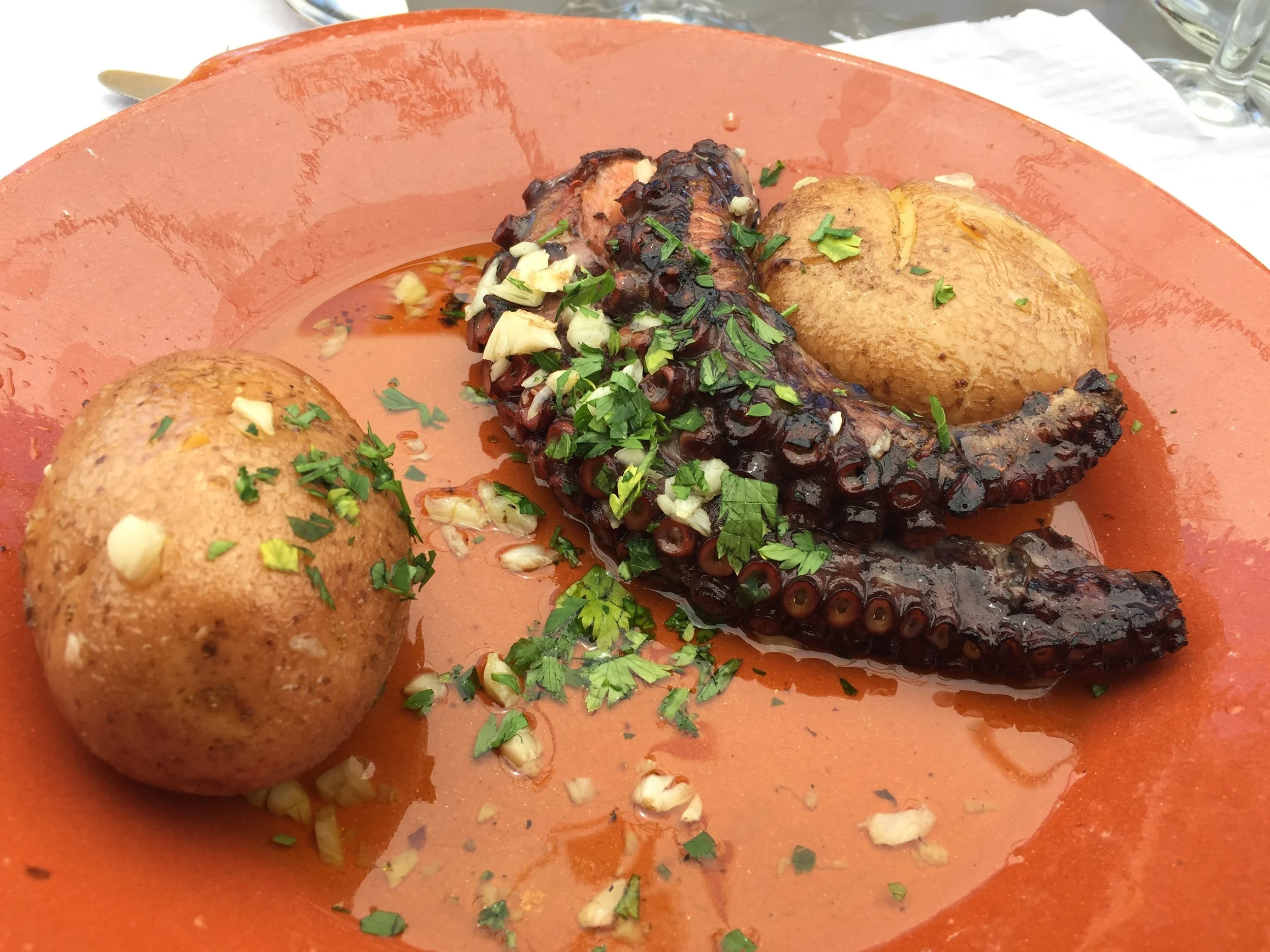
How to get to Fajã dos Padres if you don’t have access to a boat? There you used to be a lift that would take you all the way up to the island’s main road…

This is no longer in service and there is a modern cable car instead.

The ride uphill gives you an idea of the rather precarious narrowness of this strip of seaside that is the Fajã dos Padres. Enough land, though, for several tropical fruit plantations and orchards to be found all along the sea side.
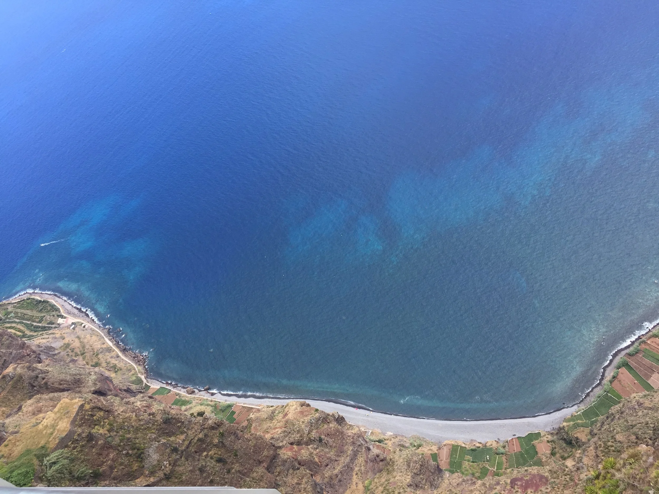
Up in the Mountains
Our activity for the next day could not be more different, a sweater and raincoat were required.
In a matter of just a few miles we got from sea level to a height of over 1,800m. From the warm, subtropical temperatures to the rather fresher mountain air.
The car struggled at times to keep going in the super steep ramps that lead to the highest point in the island. Once you are on top, though, the views are simply otherworldly.
The mountains at the centre of the island form deep canyons on the north side that are quickly filled with the thick clouds coming from the ocean. On the Eastern side, it is the blue ocean.
Would it be it possible to see the Africa coast from here? We tried…
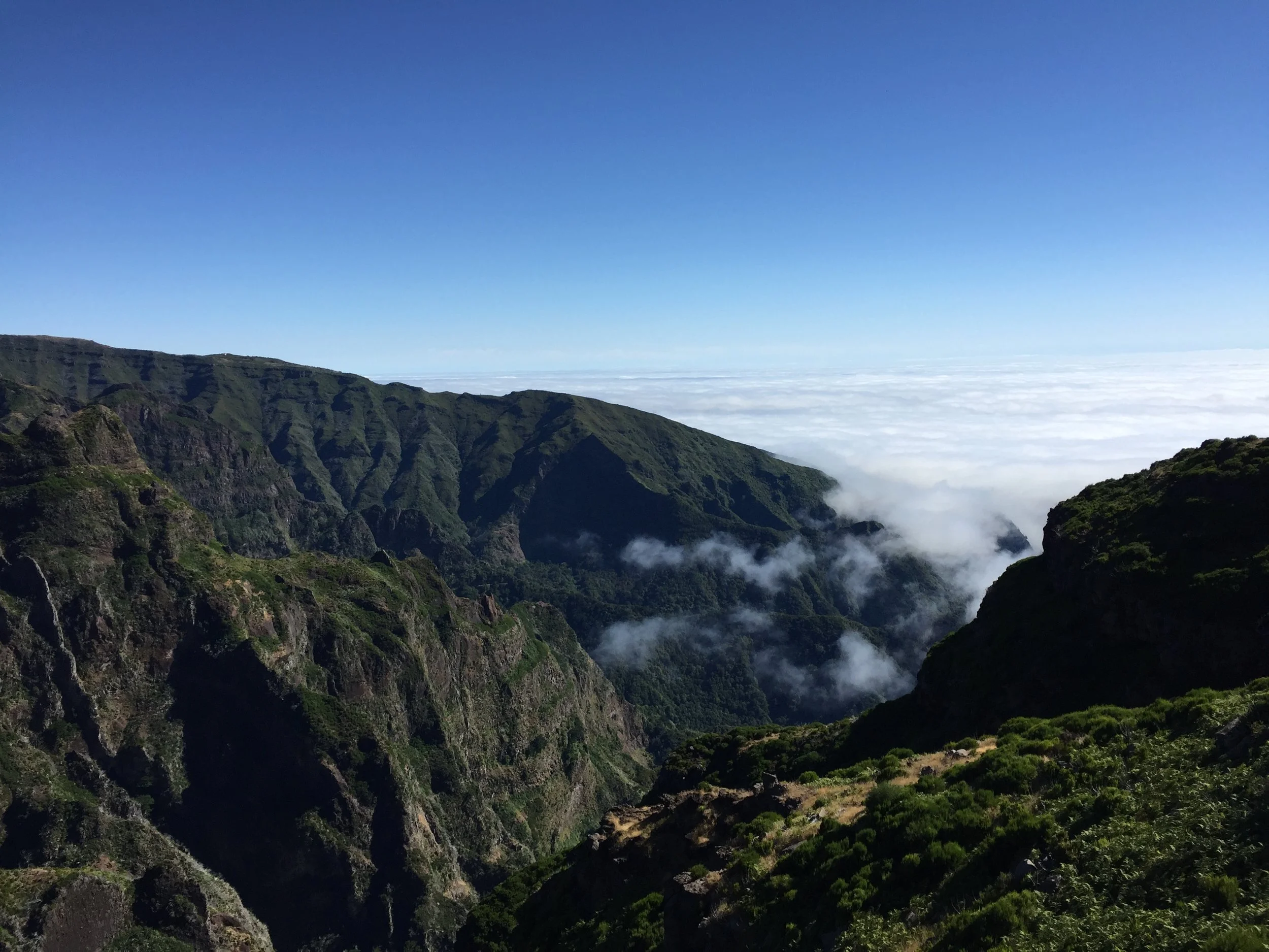
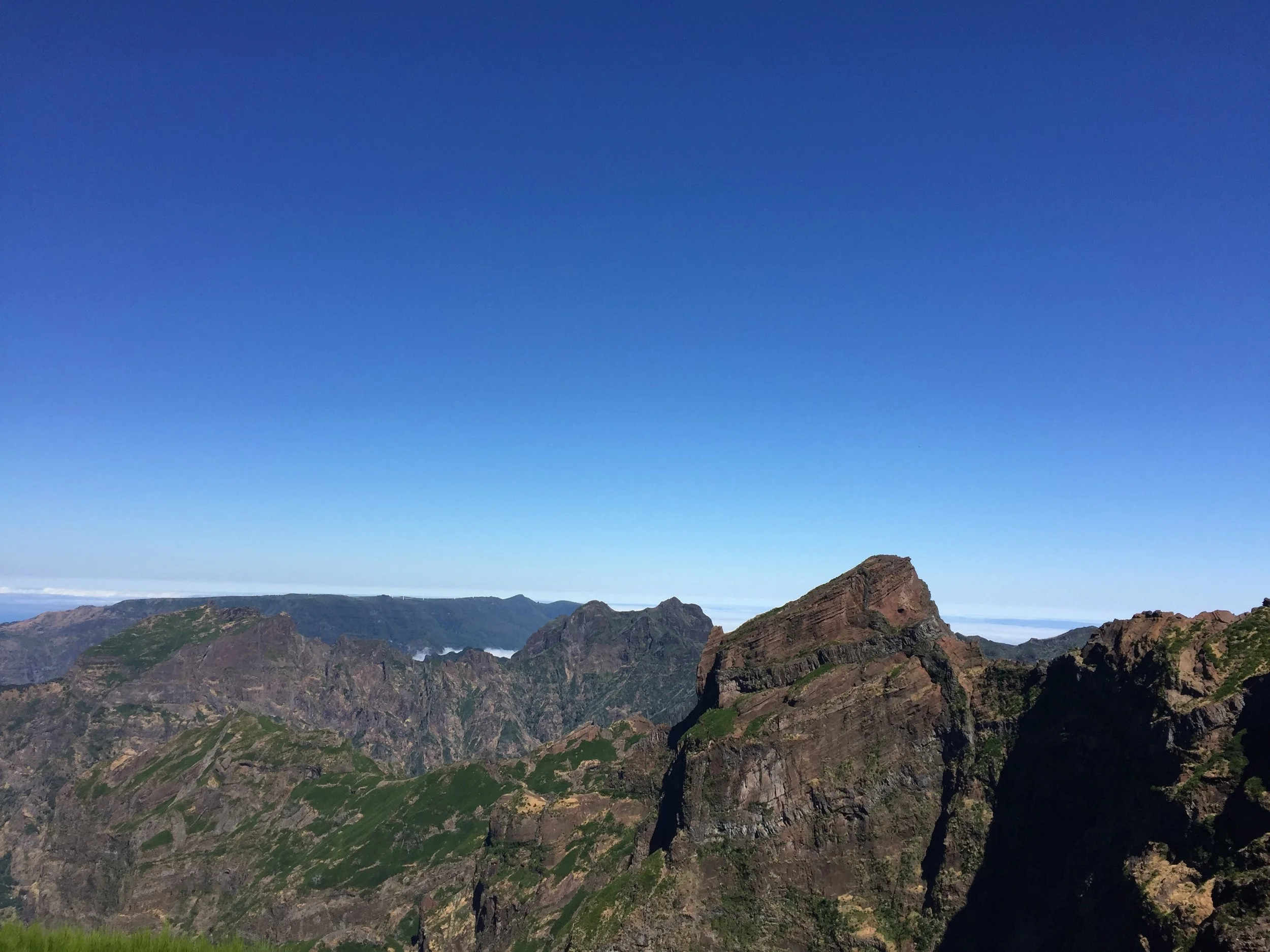

Exploring Madeira’s Western side
Once you start to descend towards the Northern side of Madeira, it feels like you are in a totally different island.
Everything of the western side is absolutely dripping wet. Here the rainforest is thick, green and lush. In a matter of a couple of miles we have been transported from the aridness of North Africa to a landscape that could well be that of the Pacific Northwest.

But, one thing is the same, flowers bloom here everywhere. Just a different sort of flower. At points these white, round flowers called…form cottony bushes, so thick at some points that they threaten to block the roads.

Upon arrival at the aptly named “Ribeiro Frio” (Cold River), we had the chance to do bits of a Levada Walk.
The “levadas” are old irrigation channels that, historically, had been built to bring water from the rainy Western side of the Madeira to the arid East, where most people live. Some of them run for many miles and tunnels and aqueducts were built along their path to sort out the complicated orography of the island.
Nowadays a network of trails follow the routes of these “levadas”.
After the walk, time to eat something…
Restaurant Quinta do Furao
Estrada da Quinta do Furão Nº6, 9230-082
Santana, Portugal
This restaurant and hotel is located among the vineyards at the North tip of the island. Besides the excellent food and the views, here in Santana there are also some houses built in the traditional style of Madeira.

The coast is here a sight to behold, almost devoid of vegetation and with an almost lunar aspect at some points. This is the predominant landscape until we get to Ponta San Lourenço, the Easternmost tip of the island. From here we follow the road along coast all the way back to Funchal.

Madeira Embroidery
One of the traditional economic activities in Madeira and one that still employs quite a lot of people in the island is embroidery.
We had the chance to visit Bordal, one of the firms in Funchal, that still work on this traditional craft, and to learn about the artisan process that results in these highly valued embroidered textiles.
This industry is structured in a very capillar way. A handful of houses in Funchal control de embroidery industry, they distribute work to a large network of women all over the rural parts of the island. They, then, at home, complete parts of the process, before taking the semi-finished fabrics to Funchal, where they are completed and dyed with different pigments.
It is still today an artisan process and the old sub-contracting work system continues in place.
With a renewed interest around the world for craftsmanship and artisan products, Madeira embroidery may be set for a revival and has even attracted the attention of some big names of the fashion industry.


Madeira Wine
The other well known Madeira export is its wine.
Madeira wine was highly appreciated by the British, whose ships often called at Funchal on their way to India and the Far East. In fact, in the 18th and 19th Centuries Madeira attracted quite a few British entrepreneurs that settled in the island and helped develop its wine industry. Some of those entrepreneurs gave rise to wine-making dynasties that continue to play a prominent role in the local economy and society.
This is the case of Blandy’s, the wine cellar we visited in central Funchal.

Madeira wine is indeed, quite unique, with a flavour similar to Port in some ways (note: I am not a wine expert, so forgive me if I am not technically accurate in my words, will try to transmit what they told us there!).
Blandy’s offers and didactic tour about the process of elaboration of Madeira wine.
The most remarkable feature of the Madeira wine production process, and that that gives it its very distinctive taste, is the heat-aging process. As part of the production process, the wine is exposed for relatively long periods of time to high temperatures. The origin of this practice is in the fact that, centuries ago, someone figured out that Madeira wine that went on long transoceanic voyages in the hold of ships bound for the tropics, did actually taste better. Later, techniques were developed to replicate and accelerate this process on land.
Another feature of Madeira wine is that they can last very very long time and still be drinkable. One of the interesting moments of the visit to Blandy’s is when you get to the room where bottles containing many decades of vintages are displayed together and you can just but marvel at the dates that appear on the bottles.

In the 18th Century Madeira was a very popular drink, particularly in America and, in fact, the US Founding Fathers toasted to the Declaration of Independence with a glass of Madeira wine!
During the 20th Century, though, Madeira wine lost its hype and came to be regarded as unfashionable, a state of things that the current generation of Madeira producers are working hard to change.
Although not an expert myself, I quite like Madeira’s very unique taste and I hope it will eventually get back the recognition that it deserves!
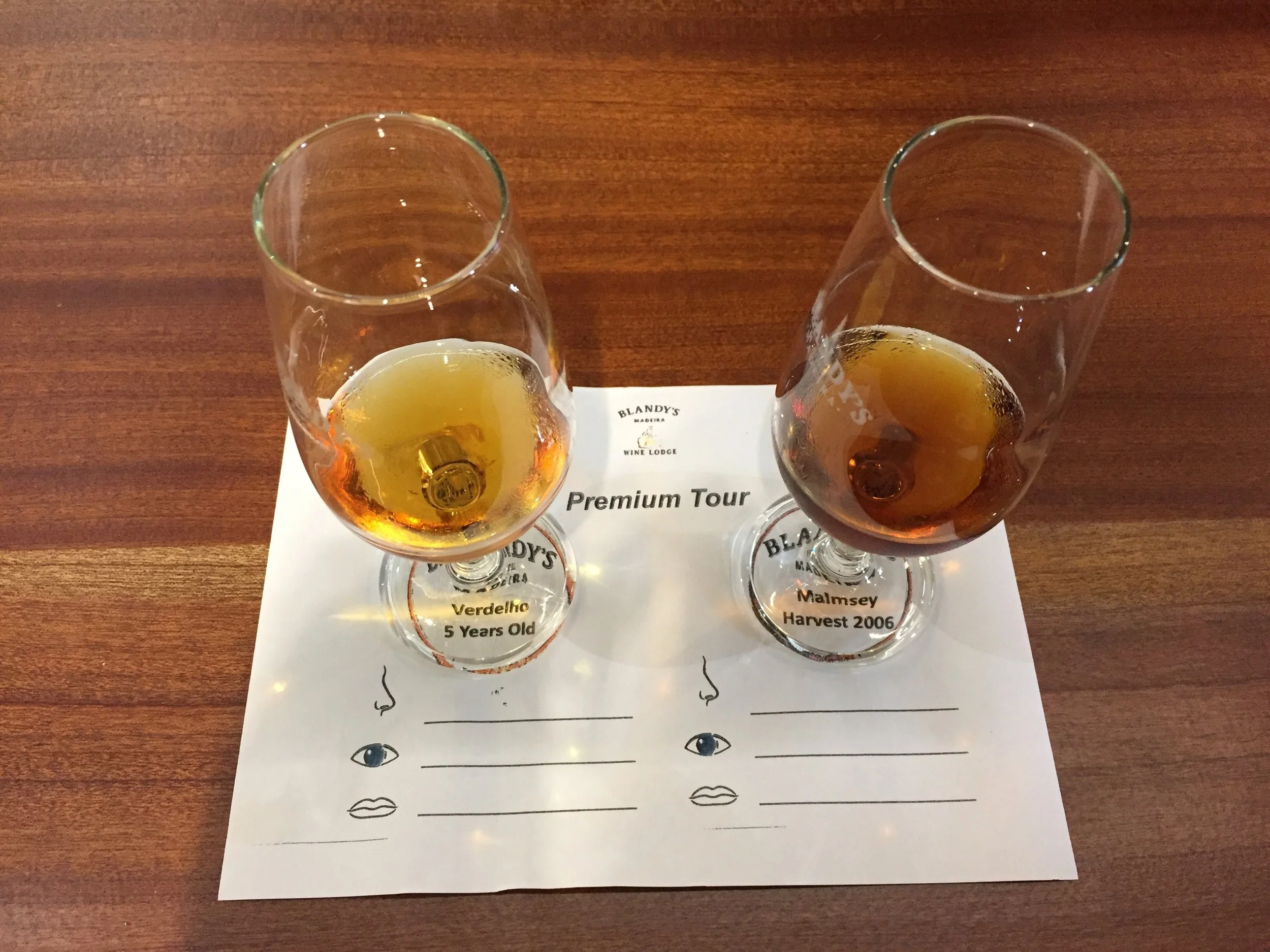
Madeira Sledges
A truly unique activity you can experience in Madeira is descending on the Monte sledges.
Although nowadays is a tourist attraction, starting in the early 19th Century, this sledge-descent tradition used to be a daily way of communication between the uphill town of Monte and downtown Funchal.
The experience itself is getting into a basket-like sledge that, guided by two professional drivers, called “carreiros”, goes on a 2km downhill descent through a paved road. The ride takes some 10min and it is, definitely a thrill and it is amazing how those guys manage to keep it all the time under control.
Places to Stay in Madeira
Hotel Pestana Casino Park
Rùa Imperatriz D Amelia, 9004-513 Funchal
http://www.pestanacasinopark.com/
Possibly the hotel of reference in Funchal.
It was designed by Oscar Niemeyer, the famous Brazilian architect (who designed also Brazil’s capital, Brasilia) and this shows in the style. The hotel has also amazing views, particularly from the infinity pool area, that is also where you guests have their breakfast.


Hotel Pestana CR7 Funchal
Av. Sá Carneiro, 9000-017 Funchal
Together with wine and embroidery, football player Cristiano Ronaldo (also known as CR7) is the other Madeira export with global reach.
In partnership with the Pestana Group (Portugal’s largest hotel operator), he has opened a number of CR7-themed hotels.
I did not stay at this hotel, but I had the chance to visit its facilities and be shown around by the managers.
While the one in Lisboa is rather more neutral in its decor, the Funchal CR7 hotel is totally dedicated to CR7 as a football star and has some rather unique elements.
The hotel occupies on a modern, two-storey, elongated building right by the port.
And just outside the hotel: a statue of CR7.
The roof is a massive solarium and outdoor spa area, complete with pool, sauna and other amenities.
And while this hotel may not be for everyone (warning: if cult of personality is not you thing, you can skip the rest of this review), CR7’s fan base may be large enough for this concept to work. In fact, in conversation with the manager on duty, I got confirmation that some guests travel thousands of miles just to have the CR7 experience…


While the lobby and restaurant on the ground floor have a modern design where, little (besides some memorabilia here and there) indicates the connection to the footballer. It’s another story in the upper floors, where the rooms are located. Everything here is football and CR7-themed.
And below a couple of rather disturbing (imo) elements in the decor, that are intended to be a constant reminder of the sort of constant surveillance and public attention that football stars of the caliber of CR7 constantly get, 24/7.

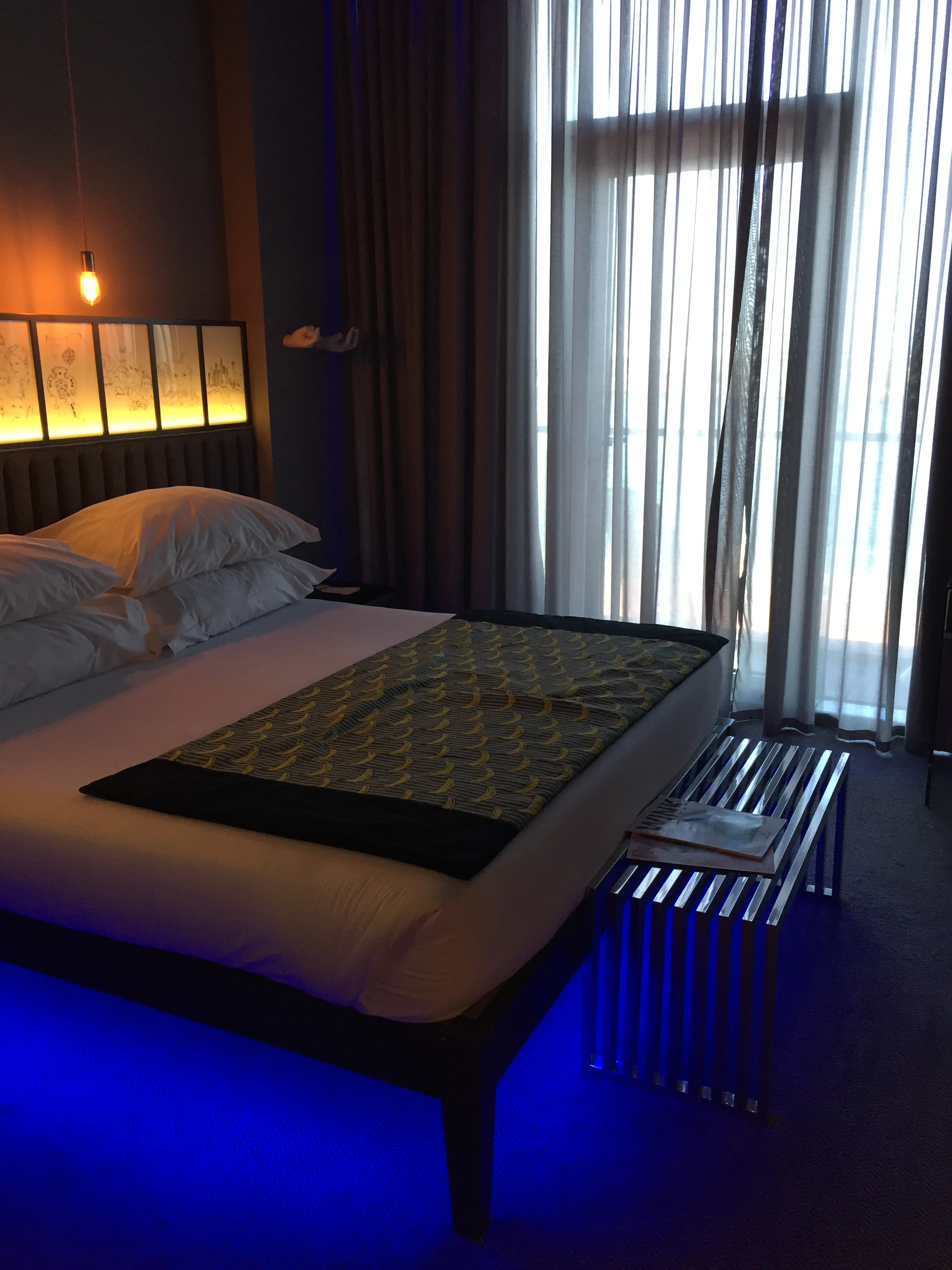

Here is one of the rooms. As you can see the decor is contemporary and minimal. There is one element to highlight though…
The paintings lined up over the bed tell the story of the life of CR7, from his childhood in poverty to stardom…while aesthetically they fit in, I found this a bit…mmmh…too much, maybe? But I guess this is a plus for his fans (disclosure: I am a FC Barcelona supporter)
Places to eat in Madeira
Nini Design Centre Andrade Silva Restaurant - DC Atelier
Estrada da Pontinha
Forte de Nossa Senhora da Conceição, Funchal
http://www.ninidesigncentre.com
This stylish contemporary restaurant is located within the walls of an old fort at Funchal’s harbour. The DC Atelier restaurant of modern cuisine is, in fact, part of a larger design and cultural hub that serves as a setting for temporary art exhibitions and a number of fashion and design shops.
The place has magnificent views as its terraces open towards the port of Funchal, with the town and neighbouring mountains on one side and the open sea on the other side. The mix of contemporary decor and the old walls of the place also makes for an interesting contrast.


As it could not be otherwise in a house dedicated to design, the cuisine here is contemporary, with a degree of creativity, and, what’s more… rather generous portions.
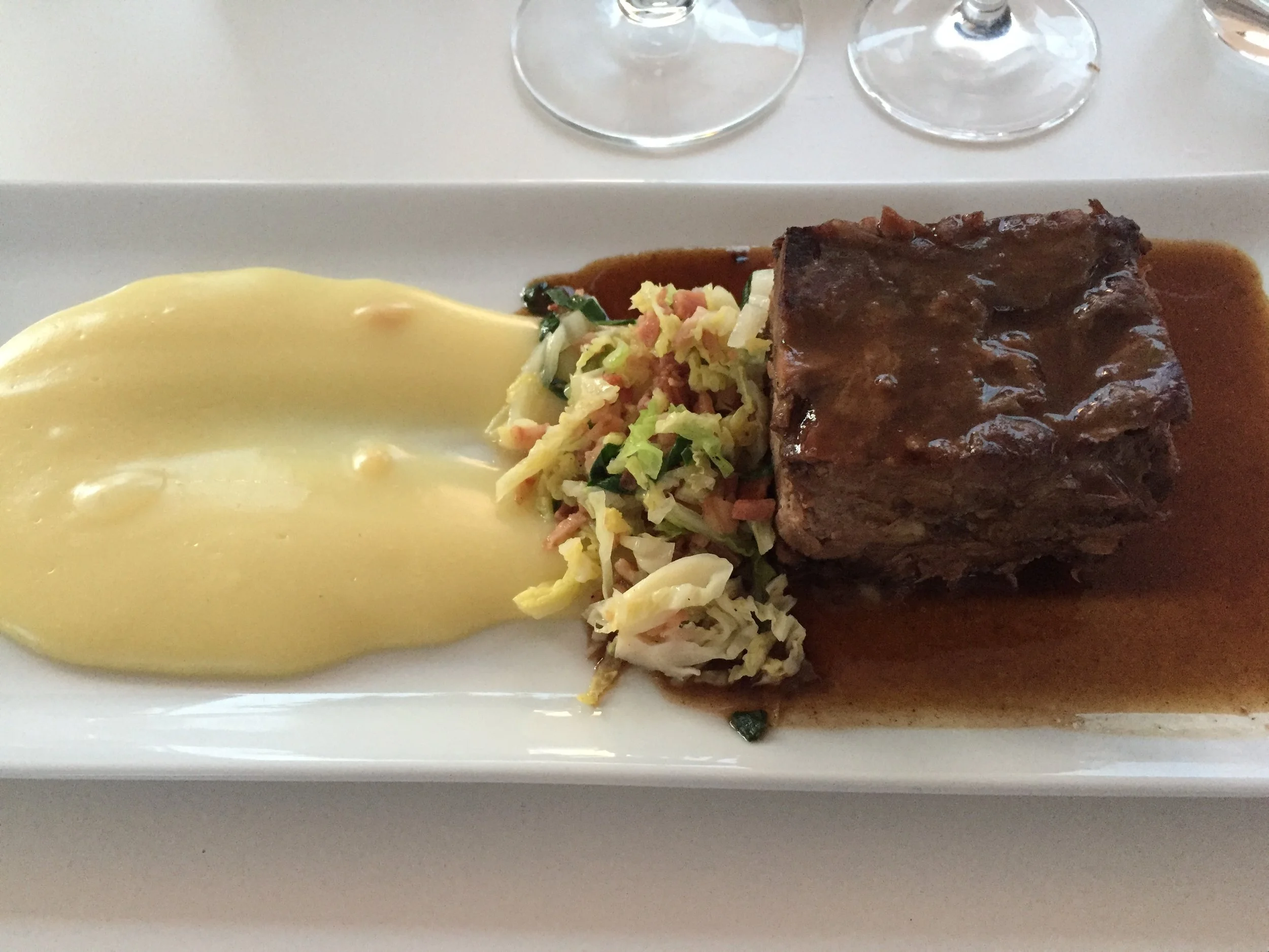
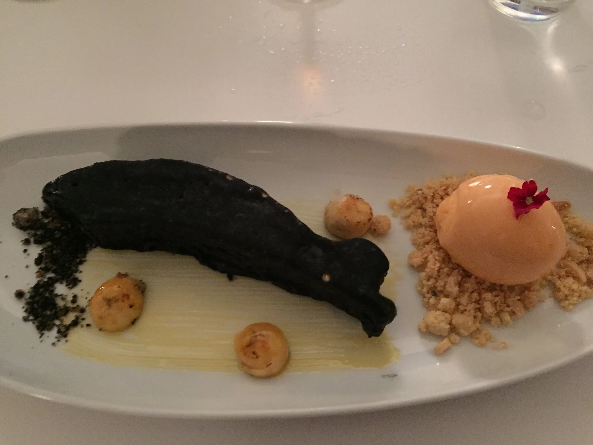
Restaurante do Forte (Sao Tiago Fortress)
Tv. do Forte 3, 9060-123 Funchal
Located in a 17th Century fortress at the edge of the old town, this is another great place to eat while admiring one of the most prominent pieces of Funchal’s historical heritage.
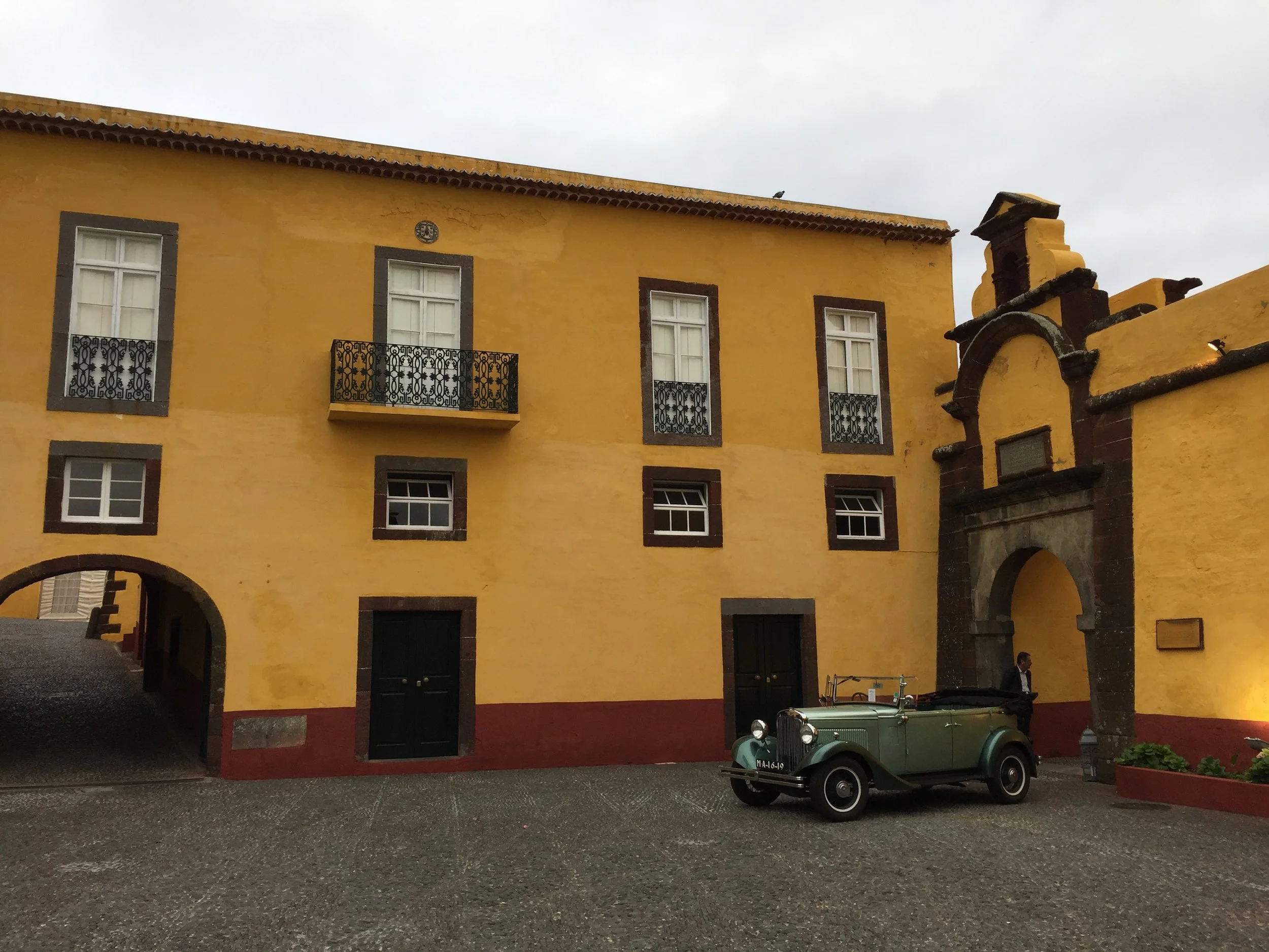


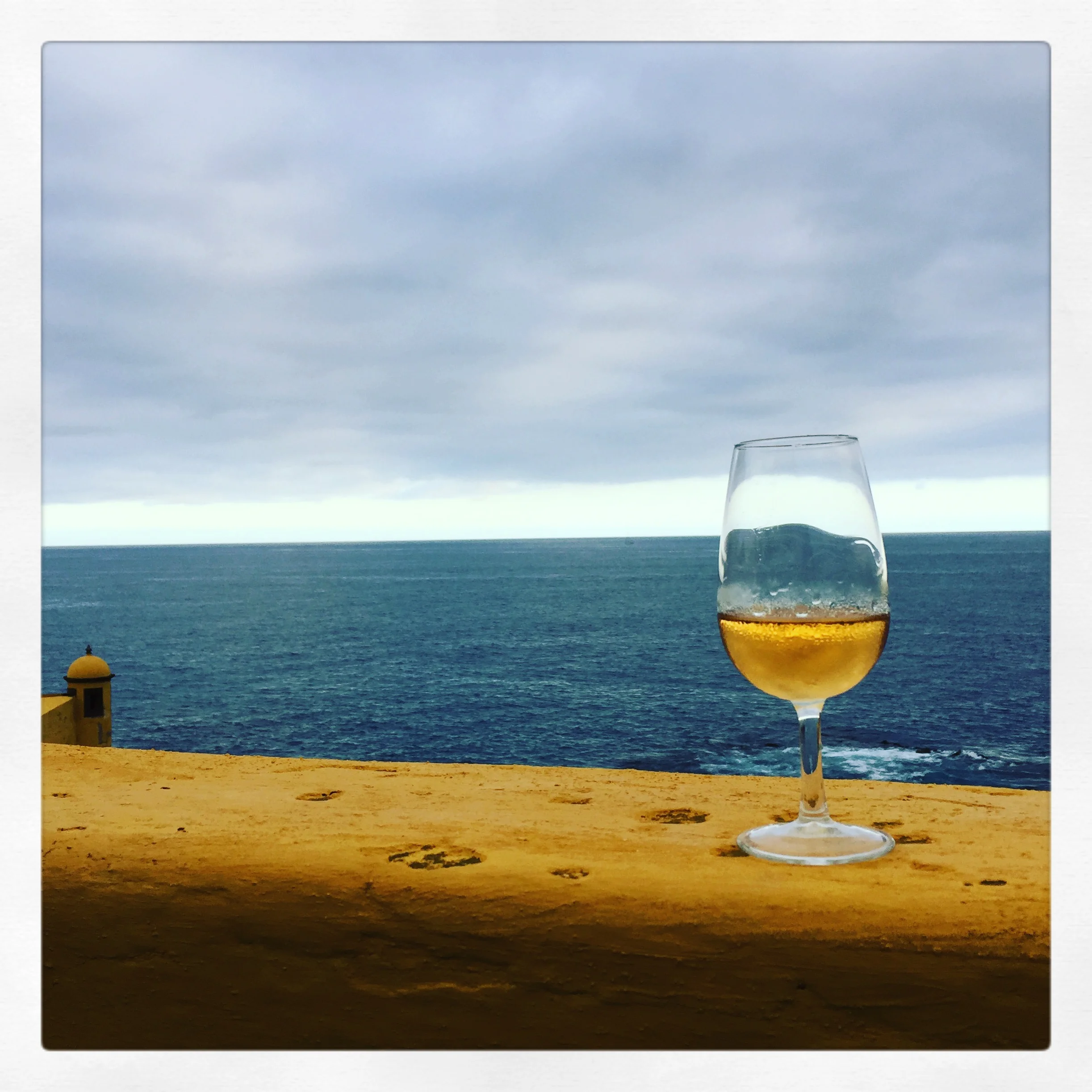

As you can see, seafood and local Madeira wines features prominently in our meal here. Very tasty and great location by the sea, next to the historical centre of Funchal.
Believe it or not, this is not a painting, but and iPhone photo with some retouching on Instagram!
Restaurant Adega da Quinta
R. José Joaquim da Costa, 9325-034 Madeira
https://www.facebook.com/restauranteadegadaquinta
Located on a hilltop near Funchal, this restaurant has great views and lush gardens.
The speciality here is meat, that is cooked in the traditional “espetada” beef skewers. It has also a cellar where local Madeira wine is kept in oak barrels.
How to get to Madeira
Being an island, the obvious way to get here is by plane. Although there are also, at least seasonally, ferries to mainland Portugal and the Canady Islands, as well as to the nearby island of Porto Santo (that administratively depends of Madeira).
Funchal airport is named…you guess it!…Cristiano Ronaldo International Airport and it has the particularity, as we commented earlier, that part of the runway is supported by pillars as there was not enough space to build it entirely on firm ground.

TAP Air Portugal has several daily flights between Madeira and mainland Portugal and the island is also included in the ailrine’s “Portugal Stopover” programme.
The UK and Germany stand out when it comes to the number of year-round air links to Funchal (FNC) operated both by full service airlines such as British Airways and Lufthansa and leisure-focused operators such as Jet2, TUI or Condor.
Quite a few other European airlines fly to Madeira, including low cost airlines Ryanair and Easyjet.
Pereslavl-Zalessky: Lake Plescheyevo and the Nikitsky Monastery
Peter the Great’s playground. A place of natural and historical significance near Moscow.

A staging point on Russia’s Golden Ring itinerary
Located some 140km North of Moscow, the city of Pereslavl-Zalessky, on the shores of Lake Plescheyevo (and the National Park of the same name), offers quite a convenient stopover point, roughly half-way on the road to the historical city and UNESCO World Heritage site of Yaroslavl.
Although this time we pretty much skipped the city itself, we had the chance to visit what is likely its most remarkable historical attraction: the Nikitsky Monastery, on the Northern outskirts of Pereslavl-Zalessky.

The Nikitsky Monastery is remarkably old (at least by Russian standards), as it was founded in the 12th Century by Nikita, a saint of the Orthodox church that led an ascetic life in the area where the monastery is now located.
One of the striking features of the monastery is the grey, silvery colour of its domes, which, in combination with the white-washed walls that encircle the compound give it quite a neat appearance (particularly when you compare it with other, more colourful churches and monasteries in Russia).
The current look of the monastery is the result of some intense restoration effort, though, as during the communist era the monastery lost its religious function and was used as a prison and later as a military installation, being only recovered by the Russian Orthodox Church in 1993.
We had the chance to visit on a rather cloudy spring afternoon. The sun was gleaming at times through the cloud cover, with its rays never fully breaking through it, but managing to convey, however, quite a mystic atmosphere to the place.


Lake Plescheyevo
Although not particularly large by Russian standards (9.5km at its widest point), the almost perfectly round Lake Plescheyevo has some interesting historical particularities.
One of them is that in the late 17th Century the tsar Peter the Great used the lake as its first naval training ground in, more or less open water (previous navigation attempts had been confined to the narrow Yauza river, in Moscow). Always keen on naval matters, Peter the Great set up a flotilla in the lake that entertained him during the summer months (he used the nearby Nikitsky Monastery as his base during that time) and went on to become, eventually, the Russian Navy.
Also on the shores of the lae is a Blue Stone, that was venerated by the pagan Meyran people that inhabited this region in the early middle ages.
Lake Plescheyevo is nowadays a recreational area that enjoys protected status as a National Park.

Weekend in Yaroslavl, a taste of Old Russia
A prosperous city packed with history. Where Russia’s Golden Ring meets the Volga

Pretty much every Russian (or visitors to Russia for that matter) are familiar with a lone character illustrating the green, widely-circulated 1,000 ruble bill.
The man depicted in the image is non other than prince Yaroslav the Wise, and its statue is one of the landmarks of the city he gave its name to.
A city of about half a million some 250km North of Moscow, today Yaroslavl is a relatively prosperous mid-sized Russian city, but once upon a time it was the second largest Russian city.
And even before than it was the capital of an independent principality that traces its roots back to Viking settlers in the middle-ages. Most of the city was razed by a fire in 1658, yet some of its architectural and artistic treasures were somehow miraculously preserved.
As one of Russia’s oldest and most important historical cities, Yaroslavl has some interesting heritage sites. In fact, its historical center has World Heritage Site status by UNESCO.
Yaroslavl is one of the eight cities of Russia’s “Golden Ring” (check also our chronicle from the lovely little city of Suzdal!) and an interesting weekend destination from Moscow.

Getting to Yaroslavl
Although Yaroslavl airport is rather small and with only a handful of connections (and no scheduled international flights at the time of writing this), the city is connected to Moscow by train and a good quality highway, which is the option we took.
Traveling to Yaroslavl by car has the advantage that the visit can be combined with the visit of other sights along the way (more on this in future posts!).
Things to do in Yarolslavl
The old town is on a roughly triangular plot of land at the confluence of the Kotorosl and Volga rivers. Here is where most of the main sights in the city are. There is enough to keep you going the whole day.
The main things to see in Yaroslavl:
Church of Ilya the Prophet (Церковь Ильи Пророка)
Cathedral of the Dormition
Spasso-Preobrazhenskiy Monastery (Спасо-Преображенский монастырь)
River bank promenade
Volkov theatre and boulevards
Church of the Prophet Elijah (Церковь Ильи Пророка)
Built in the mid-17th Century, this church is one of the many that were financed by the city’s rich merchant community, this church in particular was paid for by a rich family of called the Skripins, that traded in precious stones and gems.
but one that stands out because its richly ornated interior, covered in colourful frescoes has been very well preserved, and they even survived a large fire that devastated the city in 1658 and in the 1930s it was turned into a museum, but reverted to its condition of church in 1989.
But better that you check by yourselves what is inside…


The church of the Prophet Elijah, was left at the center of a late 18th Century urban transformation plan that saw the opening of several avenues and squares on the edge of the old town. These later became the administrative center of the city and, as a result, the ancient aspect of the church, with its green-tiled domes, contrasts starkly with the dull, grey, Soviet-style architecture the dominates some of the adjacent streets.

Cathedral of the Dormition
From the church of Prophet Elijah, a broad tree-lined avenue leads to the Cathedral of the Dormition (Успенский собор) that is located at the vertex of the old town, overlooking the point where the two rivers meet.

Some 3D, WW2-themed street art
The original cathedral was built on this spot in the 13th Century, yet, it has been destroyed and rebuilt three times, in the 16th C, then in the 17th C. and the latest time, in 1937. The current building was completed as recently as 2010 and it is slightly larger than the previous one.
Before getting there, though, one comes across the city’s impressive WW2 memorial.

Spasso-Preobrazhenskiy Monastery (of the Transfiguration of the Saviour)
This place played a rather important role in Russian history, since it is here where, in the 17th Century, Minin and Pozharsky assembled their military expedition to liberate Moscow, that had fallen to a Polish army.
The monastery is located on the elevated bank of the river Kotorosl and it perimeter is enclosed by a solid stone wall, painted wait and with the ramparts covered by a green tiled roof, that gives him the appearance of a fortress (which actually was, at the time).
It was founded in the 13th Century and it has within its grounds its very own cathedral, the Spassky Cathedral (of the Saviour)

Among the several buildings in the monastery’s territory, perhaps one of the most interesting for the visitor is the stand-alone bell tower.
It is possible to get to the top of it, from where it is possible to enjoy some great views of the city and its surroundings.

The monastery’s bell tower offers a privileged viewpoint of the city of Yaroslavl

The path along the bank of the river Kotorsl, that leads from the Cathedral of the Dormition to the monastery, with some other churches along the way

The modern city of Yaroslavl in the background
Walking through Yaroslavl
There is a promenade that follows the course of the river, with a narrow peninsula protruding from the point where the Kotorosl joins the mighty Volga. This park area along the river banks has been carefully gardened and makes for a nice stroll next to the old town.

The armed bear is the symbol of the city of Yaroslavl. You can also see a reference to the year of its foundation.


Yaroslavl is home to what is, allegedly, the oldest theatre in Russia (established 1750) in continuous existence, the Volkov Theatre (although the current building, that acts as a nexus between the old and modern towns, is from 1911).

The old town is also encircled by a ring of boulevards, forming a semi-circle around it, making it, thus, quite a pedestrian friendly city for Russian standards. On the outer part of this ring is the modern part of the city, that is rather unremarkable.

The river Volga is at the northern end of the boulevard ring
Ice, water and power in the Sognefjord
Traveling by car along the shores of Norway’s longest and deepest fjord. Top things to see and do.

Wild, untamed nature can at times be overwhelming and overpowering.
This is exactly what you may experience if you travel to the Sognefjord, Norway’s longest fjord.
For over 200km, from the sea near Bergen all the way to the ice sheet of the Jostedalbreen glacier, the largest in continental Europe, the Sognefjord is like a nonstop beauty pageant, with a succession of dramatic mountain landscapes framing the calm, clean, cold waters of the fjords.
But this area has also its fair share of man-made attractions, both ancient and contemporary…
Sogndal
Located on a peninsula on the north shore of the fjord, this is the county's capital and was to be our base during this trip.
Getting to the Sogndal
We flew into Bergen airport and took a rental car there to drive all the way to Sogndal, all along the road that follows the South side of the fjord.
This is a rather nice 3h drive throughout the Norwegian countryside (it passes through the area where the famous Voss luxury mineral water is sourced).
The shortest route involves a ferry crossing at Laerdal (the alternative would involve a rather long detour through mountain roads)
There is also a small airport at Sogndal, with direct flights to Oslo operated by Norwegian regional airline Wideroe.
A striking feature of the road between Bergen and Laerdal is the amount of tunnels and the length of these. Some of them are tens of miles long and they have conveniently fitted with some colourful vaults that help drivers keep focused on the road. I would not exxagerate if I said that considerable stretches of this route are primarily underground.


It is faster and more convenient to cross the Sognefjord by ferry than drive around it
Sogndal is a rather small town of some 7,000 inhabitants, that in this part of the World can feel like a metropolis. Although pleasant, there is little of interest in the town itself other than it being a services hub for the whole region.
But, very close to Sogndal, the town of Kaupanger has a truly unique gem: a 12th C. stave church.
Stave churches are medieval wooden churches that were once built all over Scandinavia. Although back in their time, they were built in the thousands, today only about 28 of them remain in Norway and a handful more in other locations in Scandinavia and Northern Europe.

Kaupanger stave church, near Sogndal


Where to stay in Sogndal and the Sognefjord

The view of the fjord from the Hofslund Hotel
Hofslund Hotel
Fjørevegen 37, 6856 Sogndal
http://www.en.hofslund-hotel.no
An independent family-run hotel that has been in business since 1912.
It is located right on the shore of the fjord, and it even has its very own pier from where it is possible to plunge into its very cold waters (yes, I tried it myself!).
Traditional style, nice and cozy.

A traditional Norwegian breakfast
Visiting the Nigardsbreen Glacier
An absolute must from Sogndal is a visit to the Nigardsbreen glacier, that it is, in fact, one of the arms of the much larger Jostedalsbreen Glacier.
This amazing wonder of nature is located some 20km up the valley from Sogndal. The foot of the glacier is easily accessible.
There is a visitor’s center a couple of miles from the ice sheet and we could actually get a bit closer than that with the car through a road in good condition.
At the time when we visited there was barely anyone else around (we saw barely half a dozen other people in the immensity of the valley).
Even if you do not get on top of the ice (we did not have special equipment, so stayed just on its edge), the scenery is breathtaking. The solitude of the place adds a lot to the experience (although I don’t know whether this is the case in high season, probably not), just ice, water and rock around.
For more info on how to visit the Nigardsbreen, I recommend checking out this website.


At the time of our visit, you could access the glacier by trekking along the path on the right side of the photograph. It is not a flat and super easy trail, but neither did it require any special training or equipment to get through.

Getting closer to the ice…

And here’s the Nigardsbreen! (you can see the two people at its foot for size reference. In other times, at the right times of the year, local people used the surface of the ice as a sort of highway, to move between the different valleys. Not sure what has been the evolution of the ice since then, or even since the time of my visit, since glaciers seem to be receding pretty much everywhere these days…

This is what the glacier looks like from up close

Jostedal Hydropower Station
As if the wonders above ground were not enough in this part of Norway, there is also a real marvel of engineering underground.
Although an oil-exporting nation, Norway gets most of its domestic energy needs from hydropower. The Jostedal hydro power plant (Jostedal Kraftverk), located on the same valley that leads to the Nigardsbreen glacier and owned by the national electricity company Statkraft, is one of the many that dot the country’s geography, making use of its abundance of water and steep mountains.
I am not sure whether the Jostedal hydropower plant is normally open to the general public, we were able to visit it upon request, as part of the broader work trip that took us to Sogndal, but, as we could see, there are occasional educational tours.


The Jostedal hydro power station has some technical features that make it quite impressive. Rather than being based on a river dam, the turbines are driven by the high pressure water of Lake Styggevatnet.
An underground tunnel channels this water from an elevation of over 1,200m. The pressure is so high when the water reaches the turbines that we were told the concentrated water jet is able to cut through steel.
After having driven the turbines, the water exits the water through another tunnel that takes it to the fjord.
For those interested in learning more about Norwegian hydro power, there is the Norwegian Museum of Hydropower, located in a former hydropower plant in Tyssedal, just South-East of Bergen. I have not visited it myself, but I heard good things about it.
Visiting Aurlandsfjord - Flåm
And now we move already to the South side of the Sognefjord. The two branches of the Sognefjord known as the Aurlandsfjord and the Nærøyfjord have UNESCO World Heritage Status and are some of the most visited spots in the region.
In this area, the tiny hamlet of Flåm stands out.
Flåm is located at the head of the Aurlandsfjord, one of the Southern branches of the Sognefjord. Two factors contribute to it being one of the most touristy spots on the Sognefjord: it is a docking spot for cruise ships and it is a stop on the Bergen to Oslo railway line.
Otherwise, and although certainly beautiful, I did not find the Aurlandsfjord to be particularly more attractive than other corners of the Sognefjord region.
Besides a walk through the village, I would recommend (if you have a car), to drive to the Stegastein (Bjørgavegen 83, 5745 Aurland) viewpoint, on the fjord’s Eastern flank.
Here’s a modernly designed viewing platform that protrudes from the side of the mountain.

Flåm is regularly visited by large cruise ships

The entrenchment of water into the mountain landscape produces images like this in this part of Norway

Some earlier forms of ship-borne visitors

Aurlandsfjord from a vantage point
Lærdal - Visiting the Norwegian Wild Salmon Center
If salmon is one of Norway’s top exports, the Sognefjord is (or at least, used to be!) a particularly rich breeding ground for the species.
Also on its Southern shore, the town of Laerdal is home to the Norwegian Wild Salmon Center.
Norsk Villakssenter
Øyraplassen 14, 6887 Lærdal
http://www.norsk-villakssenter.no/en
This is a modern museum and interpretation center about the life cycle of salmon and its fisheries. The center has even some aquariums, fed by the running water of the village’s stream, where you can see live salmon in their habitat.
Besides that, the village of Laerdal has a small, but very neat center, with streets lined with colourful houses that make for a rather pleasant stroll.

There are quite a few more things to do and to see in Sognefjord, from tasting the famous Undredal brown cheese to a broad range of outdoors activities, but this was actually a rather short trip.
Wouldn’t like to close this story without a couple more pics of the top attraction of the Sognefjord, though, the amazing Norwegian landscape!


Behind the scenes at the Cirque du Soleil
One of Québec’s most popular exports, alongside aircraft and “poutine”, is the magic of the Cirque du Soleil…

It was a wintry morning when we visited the Cirque du Soleil’s HQ. Here the view from the conference room, with downtown Montréal and the hill that gives its name to the city (to the right)
One of Québec’s most popular exports, alongside Bombardier aircraft and the famous, highly-caloric dish “poutine”, is the magic of the Cirque du Soleil.
What started as a mere band of street jugglers has become, in a matter of decades, a global entertainment business with several simultaneous shows running all over the World.
The Cirque du Soleil, however, remains firmly rooted in the city of Montréal, where it has its HQ.
After having been able to enjoy, a few months ago, “Sonor”, one of the Cirque’s latest shows, onboard the cruise ship MSC Meraviglia, I accepted an invitation by MSC Cruises to come to Montréal and see the backstage where these shows are conceived and readied for launch.
During this trip, I not only had the chance to learn about this very unique company that is the Cirque du Soleil, and get acquainted with the modus operandi that lies at the base of its success, but also, and despite the cold December weather, to explore on foot some of the most interesting bits of Québec’s largest city.
A city of creativity


The Cirque du Soleil HQ is located in one of Montreal’s northern suburbs.
It is a rather special place, that combines the cold, modern functionality of a corporate headquarters with the vibe of a creative environment, the healthy discipline of a high performance sports training center and the buzz of an artisan workshop.
Because the Cirque du Soleil is all of these things at the same time.

One of the open areas at Cirque du Soleil HQ
To give you an idea of the orders of magnitude we are talking about, some 4,000 people work for the Cirque du Soleil globally, and of these around 1,500 are based in Montréal.
But, how does the Cirque find the rather exceptional artistic talent that is needed to staff all those shows?
Well, it sources it from, literally, everywhere.
It has what is, arguably, the largest professional database in this segment, with over 55,000 artists. So, the Cirque’s recruiters are quite sure to find whatever skill they need, whether it’s former gymnasts or whole families of acrobats (something not unusual in some parts of the World).
Whenever there is a new show in the making, the selected performers gather in Montréal and practice together for a few months at the Cirque’s facilities. We had a chance to observe some of them in action, training and it was hard to keep the attention at any one place, since there was so much going on at the same time at the large, factory-sized training facility.

The Cirque du Soleil at Sea
If its performances are usually an artistic tour-de-force, the Cirque du Soleil has taken things one step further by developing a new generation of shows specifically designed to fit in the constrained spaces of cruise ships.
The partnership with cruise operator MSC Cruises has produced already four of such shows, “Sonor” and “Viaggio” on MSC Meraviglia and “Varélia” and Syma” on the recently launched (it had its maiden voyage on 4th March) MSC Bellissima. Four additional shows are being prepared for the upcoming new ships MSC Grandiosa and MSC Virtuosa, that will be launched in late 2019 and 2020 respectively.
Syma is the story of a young sailor that is stranded on an island full of fantastic and mysterious creatures.
Varélia is about a princess with violet skin and its admirer-hero, who happens to be blind. Then there is a villain, that kidnaps the princess because he has an obsession for all things violet. The hero will embark on a quest to liberate her, with the help of some other friendly characters…
At the time of this visit, the Cirque and MSC were readying the launch of these two shows.
Thus, we were shown a preview under conditions of strict confidentiality and learned about the challenges of performing on a moving ship.

The creative team explains the concept behind the show “Varélia”, that launched on MSC Bellissima in March 2019
The shows themselves are of a smaller, shorter format than the ones on land.
There are several factor that need to be taken into account, one is the fact that the ship is not static. In the evening, when the performances take place, the ship is usually moving and, although we are talking about some of the largest ships in the World, some swell is inevitable.
Another factor has to do with space, as it is obviously at a premium onboard a ship. For this venture, MSC built dedicated theatres at the stern of the ships. These have a special, custom-made design at a cost of over $20M each.
Last but not least, the logistics are also constrained. If a show on land can typically employ some 50 performes and another 170 as support crew, the sea-going troupes are usually 15-16, with a similar number as support staff.

While they are at sea, the artists have to rely on themselves, this includes make up. Here they train them, so that they are able to apply their own make up before the shows as well.
Another highlight of the tour was a pre-view of different scenes of the two new shows designed for MSC Bellissima. These are now, more or less in the open, but not at the time of the visit. One of the things that truly amazed me is the effortless look of those practicing these amazing stunts. I am sure there is a lot of work behind them, but, the appearance of ease and naturality is simply awesome.


The Workshop
The show’s are expected to be visually stunning, this is one of the hallmarks of the Cirque.
One of the essential functions of the Montréal HQ is to act as a supply center for all the Cirque’s branches around the World, whether in Las Vegas, China or a cruise ship somewhere in the Mediterranean.
in addition to its administrative and training functions, a third and rather large section of the Cirque’s facilities is occupied by a super-sized workshop. Here all sort of costumes and atrezzo are designed and manufactured to match the demands of each of the shows.
Everything is done in-house and even the clothes and shoes are made to measure.


Technology plays a role in Cirque’s du Soleil shows, of course, but it is very subtle, a support rather than the main theme. The artists remain the protagonists at all times.
And this is also true behind the scenes. A large amount of processes and work is done by hand. It’s artisan work. But different technologies are also leveraged, for example a broad range of innovative materials are used for lightness and comfort, even if sometimes are made to look like another sort of material. It is a constant process of experimentation, that gets feedback from the performers all the time.
Also, 3D printing (below), for example, is finding its uses in this environment that requires a high degree of customization.

The result of all this…you will need to book a cruise on either MSC Meraviglia or Bellissima to find out!
BONUS: A walk through Montréal
It was a short trip, but there was also some time to visit Montréal’s downtown and its historial center, one of the oldest and in North America, and allegedly one of the most charming too…although it was rather cold and deserted at the time of my walk!
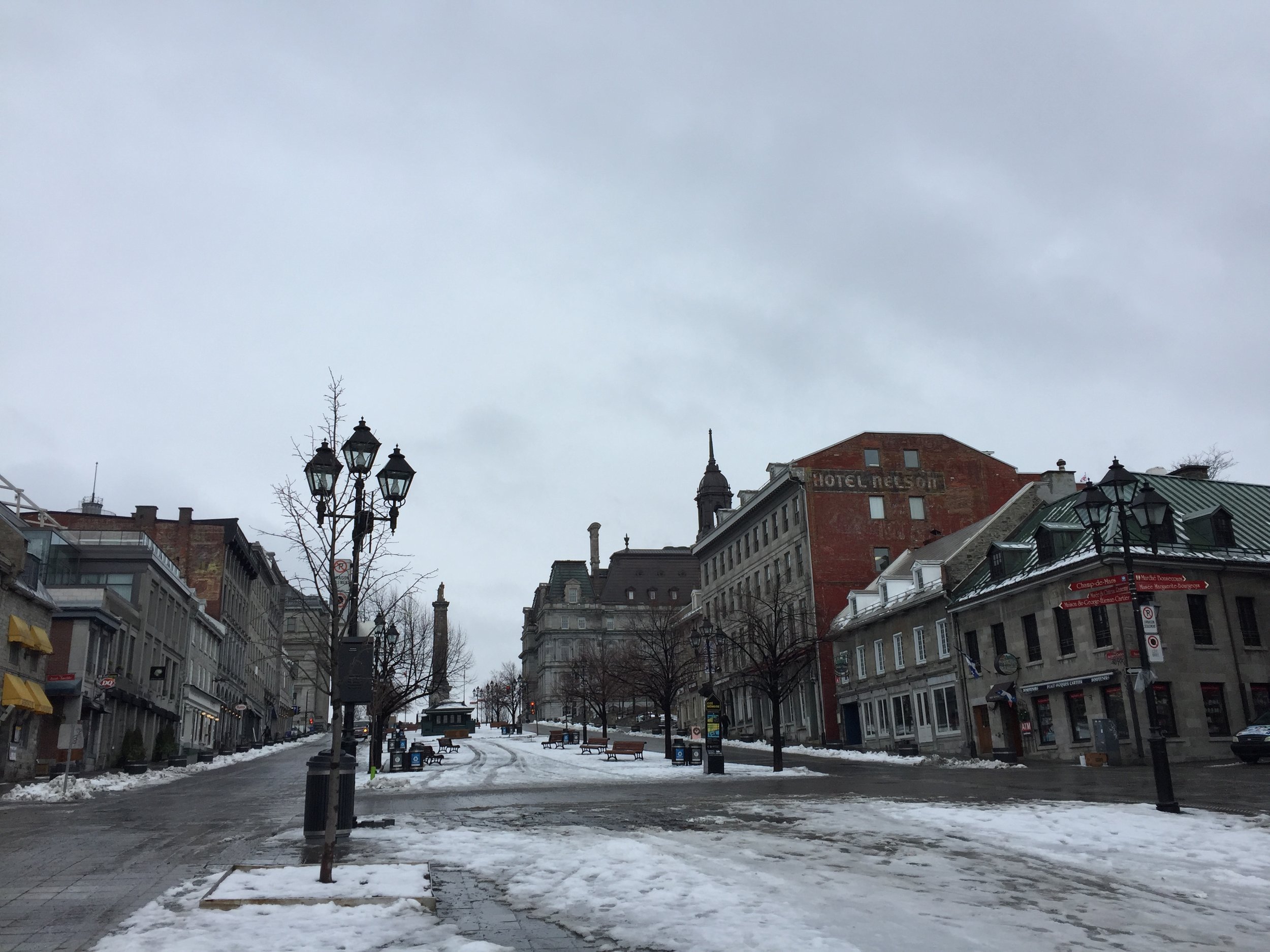
Place Jacques Cartier, with the Nelson column at the end of it
Montréal is built on an island on the St. Lawrence river and the old town, the Vieux-Port area, occupies its Eastern shore. The stone houses and 18 and 19th C. architecture gives to this district a rather harmonious, “old-world” vibe, although the historical area, properly speaking is quite small, at least for European standards.
One of the details I found interesting is that of these two statues below, located on the Places des Armes, the historical heart of the old city. They, apparently represent the British (him) and French (her) powers, the tension between the two cultural and political spheres that have shaped the history of Montréal and the rest of Québec.


Moving away from the Vieux Port and into the modern downtown, I found this other statue, perhaps with less political undertones, but undoubtedly very representative of the times we live in.

A view of downtown Montréal from the snowed-in campus of McGill University
Where to stay in Montréal
The Fairmont Queen Elizabeth
900 René-Lévesque Blvd W
Montreal, QC H3B 4A5
The embodiment of a landmark hotel.
A big, granitic, building in the very center of the city. It is even possible to access the metro directly from its premises.
Nice views from the upper floors. Rooms with a contemporary, warm design and large bathroom.


One of the pluses of this hotel is the executive lounge on the top floor.
Here there is a cozy atmosphere and it is possible to enjoy either breakfast or a selection of tasty snacks, sushi, cold cuts and drinks during the day.

…and did I tell you that the views are also great?

The view from the executive lounge at the Fairmont Queen Elizabeth
Places to eat in Montréal
La Champagnerie
Tasty food and nice, joyful atmosphere
343 St Paul St E, Montreal, QC H2Y 1H3
https://www.lachampagnerie.ca

Aside from the food, La Champagnerie has some other pluses:
Its location on one of the most picturesque streets of Montréal’s old town and the cozy atmosphere inside (the two go well together)

As a curiosity, it seems that one of the traditions of the place is that they show guests how to uncork a bottle of champagne with a sabre!

The main dish at La Champagnerie. Apologies: no notes on what it was!
Ristorante Beatrice
Upmarket Italian food
1504 Sherbrooke St W
Montreal, QC H3G 1L3
http://beatriceristorante.com
Le Balsam Inn
International food - young atmosphere
1237 Metcalfe St, Montreal, QC H3B 2V5
http://lebalsaminn.com

Here is the Farro aux Champignons Sauvages

Faded Genoa and its hidden gems
It is undeniable the city of Genoa has seen better times, yet, some pleasant surprises await…

The famous “lanterna”, an old lighthouse that has traditionally signalled the entrance to the port of Genoa. It has become part of the popular imaginary in such a way that, in Italy people say “I am under the lanterna” (“sotto la lanterna”) as a synonim of “I am in Genoa”
Once the capital of a mighty maritime empire, it is undeniable the city of Genoa has seen better times.
Unlike Venice, Genoa has managed to preserve its role as a maritime-industrial city, yet it lacks the iconic status of its historical arch-rival. Not only that, but its many charms are often overlooked by tourists that see it just as a gateway to Portofino and the Italian Riviera or, simply, as a port of embarkation for the many cruise ships that have it as a port base.
To be fair, having passed briefly through the city once in the past, this is an opinion I shared to some degree…until I recently had the chance to spend a full day in Genoa exploring it throughout.
In this post I am going to try to illustrate why I think Genoa is quite an underrated city and why you should consider adding it to your Italian bucket list…
In fact, this chronicle is quite limited in its scope: what to do, what to see and what to eat in the historial center of Genoa in one day.
There are quite a few more things to do in Genoa, such as the whole maritime promenade (with its Aquarium and museum) as well as the modern part of the city that are not covered here, but may be worth considering if you are planning to spend a longer time in the city.
The Port and Historical Genoa
As one of Italy’s historical four “Maritime Republics”, Genoa’s life has for centuries revolved around its port and the old city occupies a hill just above the port basin. In fact, the whole territory in and around Genoa is quite hilly and flat space is at a premium!

This is a photo from a previous visit to Genoa, when the weather was a bit better!
A practical way to see the city is to take the Piazza De Ferrari as a starting point of your itinerary. This square, that serves a nexus between the old and new parts of the city, is not only is well communicated by metro (yes, there is a metro in Genoa, although it has only two rather short lines), but from its elevated position at the hilltop it is easy to reach any other point of the historical center on foot.

The walls of Old Genoa
Leaving aside the port, I would say Genoa does not have one single major attraction that outshines all the others. What makes it quite interesting and unique is the ensemble of its historical center: a maze of narrow streets and alleys, peppered with remains of its glorious past, such as the avenue of the palaces (that we will review later in this post). So get a good pair of boots, have a nice breakfast and prepare to walk…
One possible itinerary to optimize your time while getting a good general view of the city is to go down Via San Lorenzo, from the cathedral towards the port, then, turn right towards Porta dei Vacca. You may want to go all the way to the Palazzo Reale (that hosts a museum), before turning back again towards the old town and Via Garibaldi to visit its magnificent palaces.

Like in any other European city of note, the cathedral is one of the focal points of the old town.
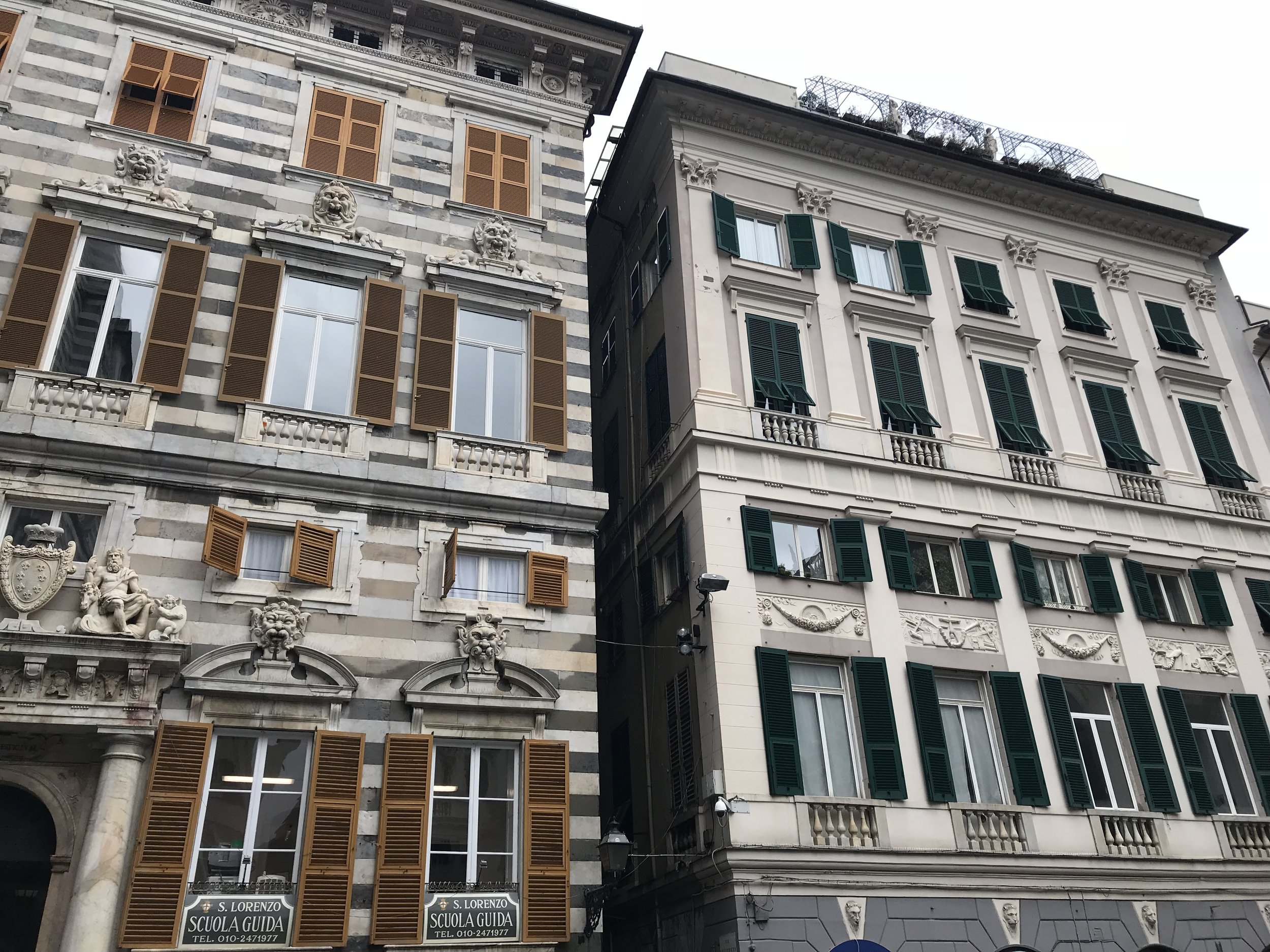
The architecture on Via San Lorenzo
Although there are quite a few attractions around the port, such as the Aquarium, it is a pity that Genoa’s seafront is not (yet) very pedestrian-friendly. Unlike in other Mediterranean cities that have implemented urban reforms to modernize and open up their maritime façade, here there is still quite a lot of industrial activity going on and there are motorways between the quays and the city. Plus most of the buildings, shops and restaurants facing the port are in a rather decadent state.
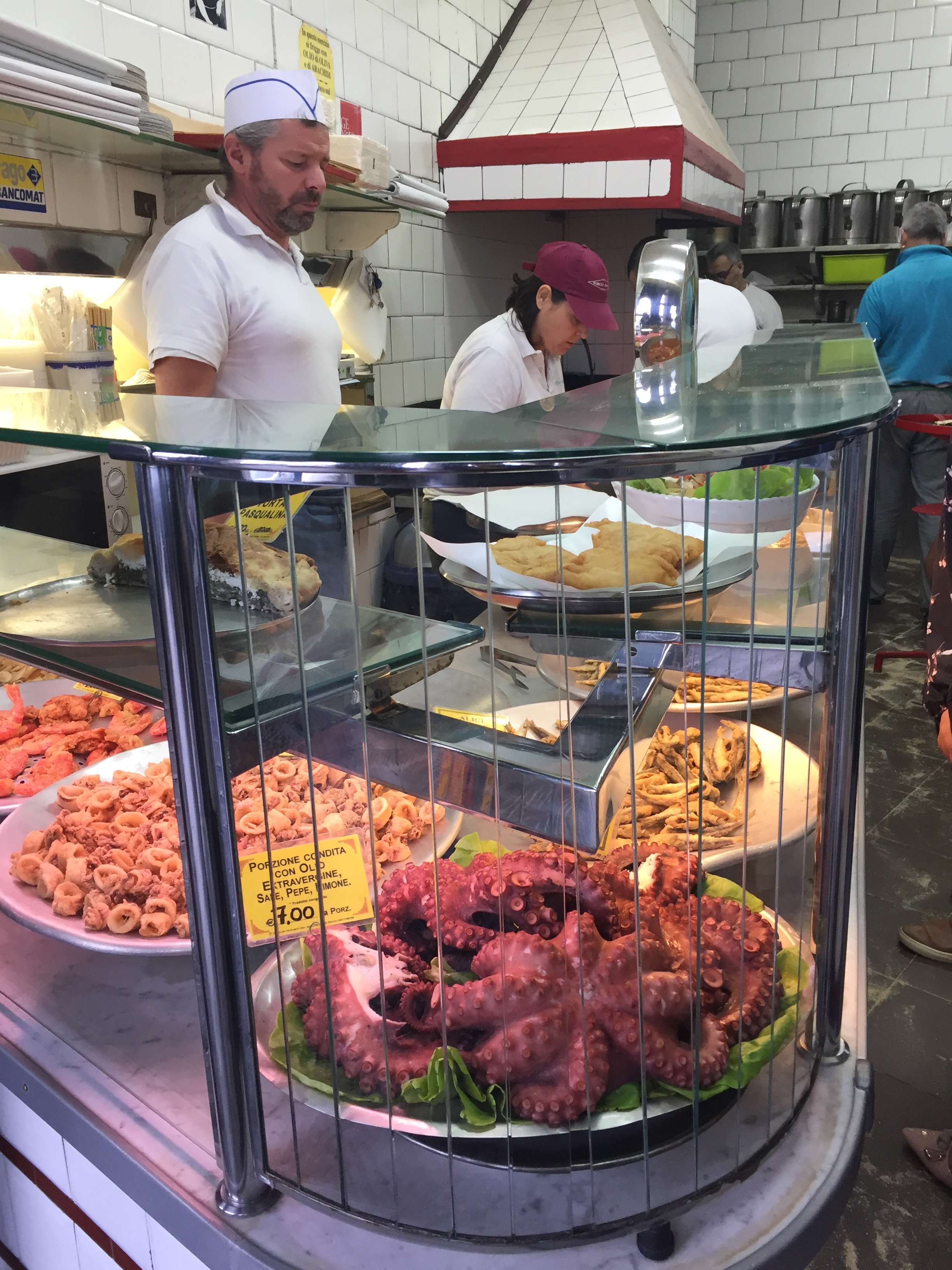
All along the port it is possible to eat at these small, popular restaurants specializing in seafood. Fast-food Genoese style. We would go back to food later, but in a rather different way…

A typical street in Genoa’s historical center, you can spend the whole day walking around these
Genoa played its role in the Italian Risorgimento and the unification of Italy, in mid-19th Century. Walking around the city you may stumble upon some plates that recall that era.

Mameli, the composer of Italy’s national anthem, lived in Genoa, close to the cathedral.
Another plate, near the port, remembers another key episode of the wars of Italian unification: Garibaldi’s expedition of the Mille, that assembled in Genoa before sailing to take Sicily.

Places to eat in Genoa
Antica Sa Pesta
Via dei Giustiniani, 16/R, 16123 Genoa
https://www.sapesta.it
The place to go to taste local Genoese and Ligurian cuisine, particularly the local speciality “farinata”. Thankful to the local that suggested it to us!
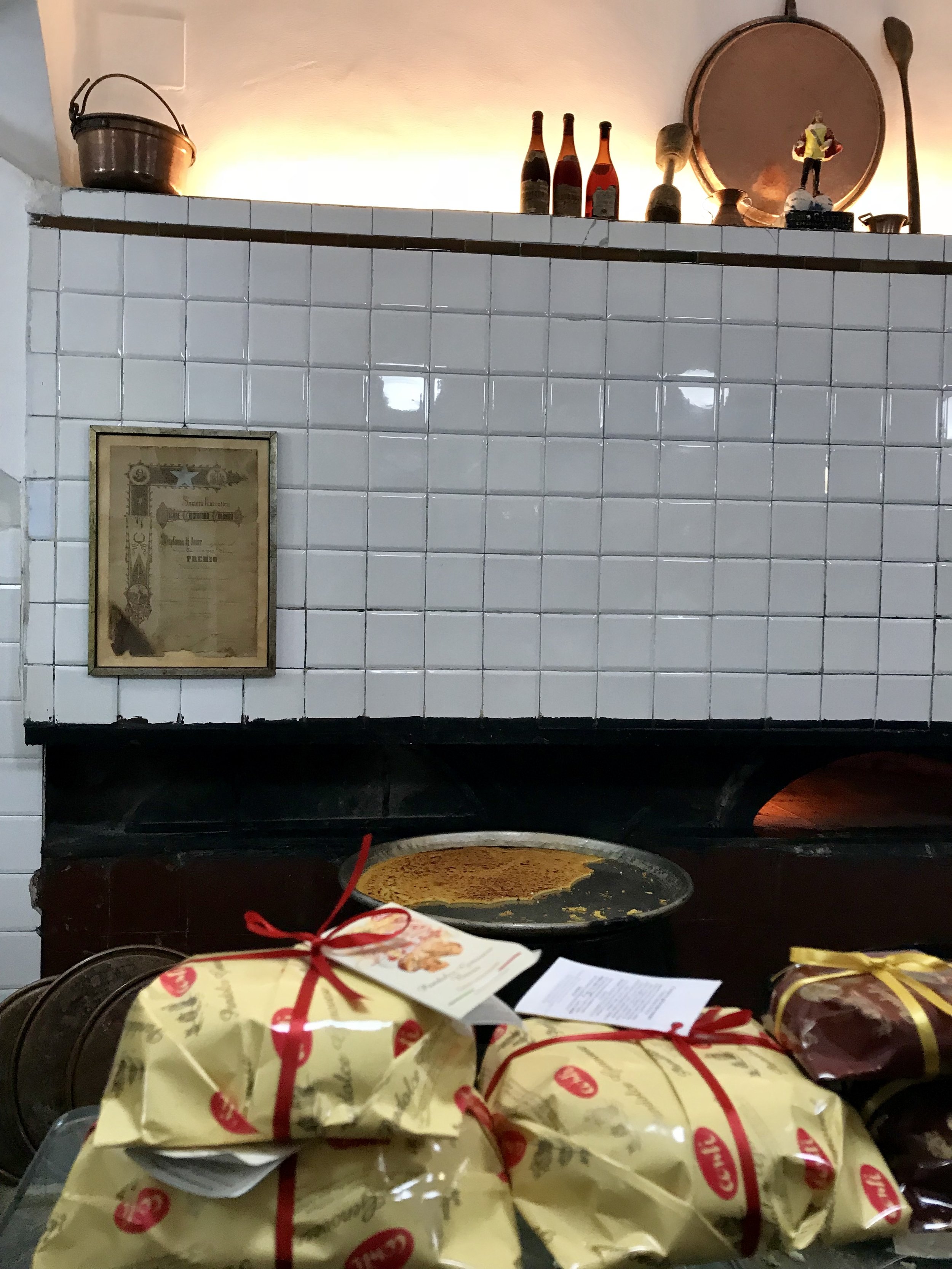

“Farinata” is the perhaps the most typical dish of Genoa. It is a sort of pancake made of unleavened chickpea flour, that is baked in the oven.
The one prepared at the restaurant Antica Sa Pesta was excellent and really great value. It’s their speciality.


Classical “farinata” on the left, nothing but baked chickpea flour. On the right, “farinata” stuffed with cheese. Both tasting great.

We also tasted this delicious seafood pasta

Ready to continue the walking tour after a well deserved pit-stop

Definitely not flashy and without pretensions, a proper hidden gem. (Avoid the touristy restaurants that abound on Genoa’s main thoroughfares…!)
The restaurant Sà Pesta is a rather small, modest-looking affair, but the atmosphere oozes authenticity. Would repeat without a doubt next time I am in Genoa.
The Palaces
As an old, rich, trading republic, Genoa has its fair number of palaces, built by the local oligarchy as a display and reflection of status and success.
Luckily for the tourist with limited time, three of the most impressive palaces are currently in public hands, and are located literally next to each other on the same street, Via Garibaldi.
They are the Palazzo Rosso (Red Palace), the Palazzo Bianco (White Palace) and Palazzo Tursi.
In addition to their interiors, which have an historical interest in themselves, the Palazzo Rosso and Palazzo Bianco host also notable art collections.
The ensemble of these palaces is known as the palaces of the “strade nuove” (“new streets”) or “palazzi dei rolli”, most of which were built in the 16th and 17th century at a time of urban expansion in Genoa (hence the “new streets” name).
42 of 163 palaces (yes, Genoa is really a city of palaces!) have been granted World Heritage status by UNESCO, among them, the three commented here.
It is possible to buy a combined ticket for the three (recommended)

Palazzo Rosso
This is perhaps the most interesting of the three (IMHO)
It belonged for centuries to one of the most prominent Genoese families, the Brignole-Sale, who happened to be also avid art collectors, hence the origin of the collection currently on display at the Palazzo Rosso.

The Palazzo Rosso has several floors, where it is possible not only to admire its valuable art collection, but also to see some of the apartments where the palace owners lived at different periods in time.


The view from the upper floors of the Palazzo Rosso
Although I liked the Palazzo Rosso the most, and despite the risk of serious artistic overload, I did not want to close this section with a couple more pictures of the art that seems to be everywhere in Genoa


A visit to the market
Mercato Orientale
Via XX Settembre, 75r, 16121 Genoa
If you like the exuberance of a fresh food market, don’t leave Genoa without stopping at the Mercato Orientale.
Located in what used to be the cloister of a former church, this market is a wonderful festival of colours and smells, as fresh produce from all over Italy piles up at the stalls.
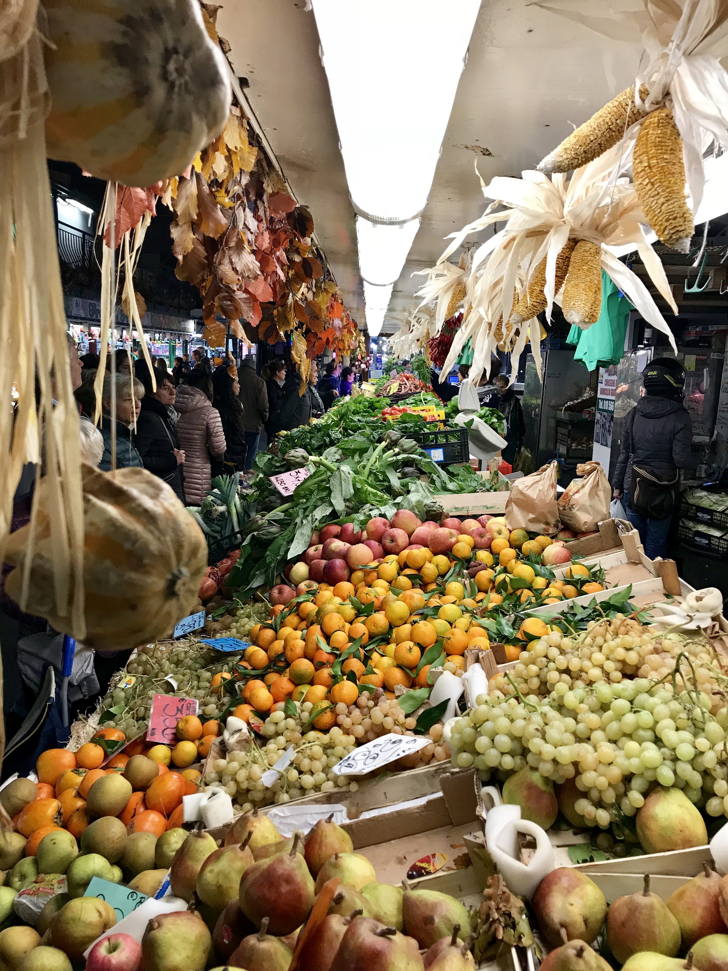


Places to eat in Genoa
Da Leccarsi i Baffi
Piazza Cavour, 91r, 16128 Genova, 16123 Genoa
A place to continue with the exploration of Ligurian cuisine, particularly of seafood.
At this modern and cozy restaurant you will be able to taste, for example, sardines prepared according to the local Genoese recipe.

There is also a diversity of seafood dishes, like this pasta (below), which was truly delicious.
Service was great as well, and, with most of the people eating there being locals, it definitely does not feel like the many tourist traps that line the streets a bit further up the center.
Recommended.

Night walk in Genoa
And to wrap up this intense day in Genoa, a couple of pics to illustrate the night walk to the hotel.

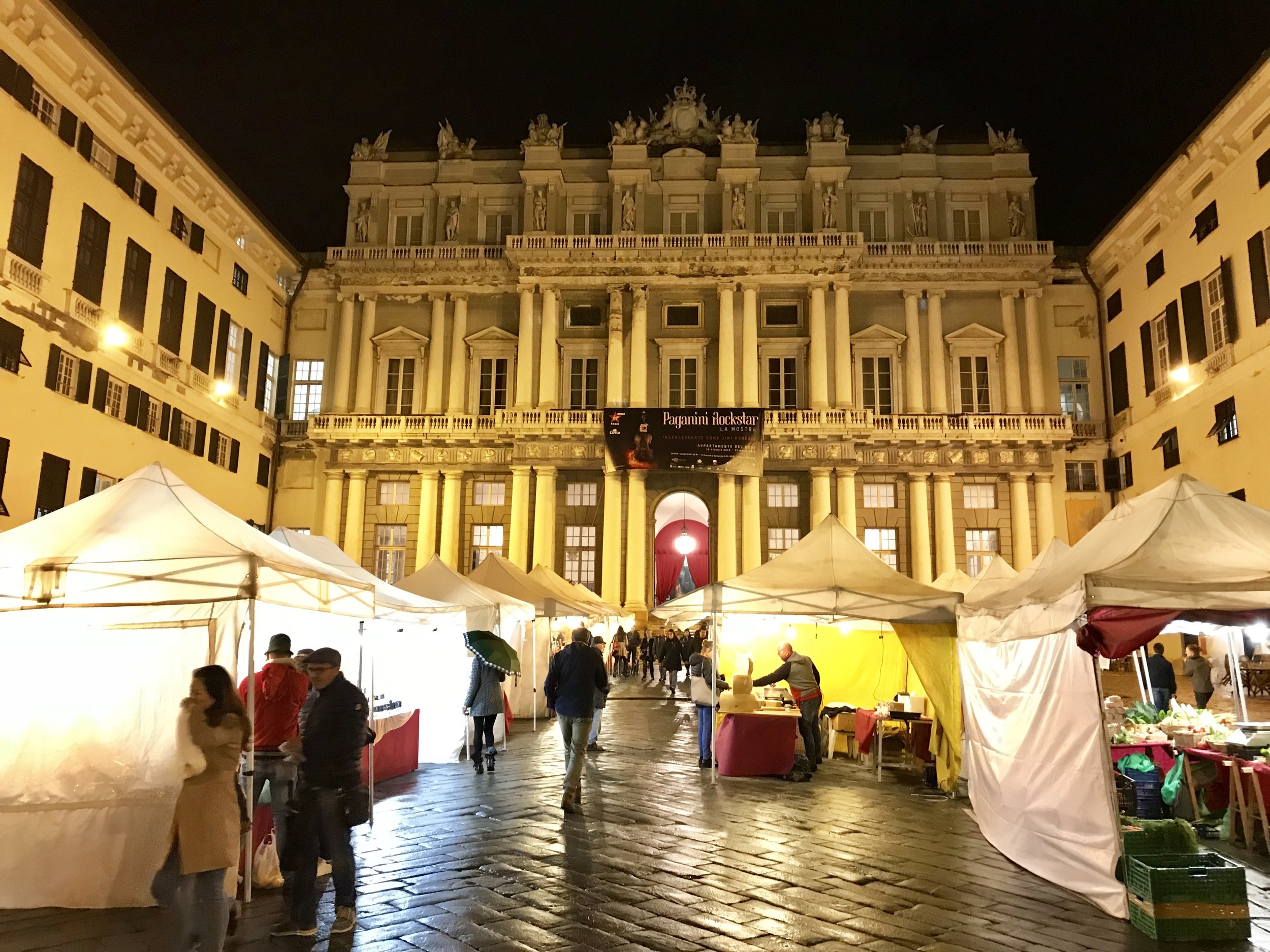
A street market in the courtyard of the Palazzo Ducale
Hotels in Genoa
Holiday Inn Genoa City
Via Milano, 47, 16126 Genova
It is business-style four star hotel. A bit impersonal, I know, but it turn out to be very modern and have huge rooms (almost like a little apartment, not sure all the rooms are the same, though).
It is not in the very center, although the distance is walkable. There is also a metro station within 5 minutes walk (convenient since it was raining!) and the trains take you to De Ferrari station in the very center in less than 10 minutes.
It is a very convenient option if your are embarking or disembarking from a cruise ship, as it is located right next to the maritime terminal (the hotel was, in fact, booked by the cruise company that arranged the rest of our trip)