More top things to see in Uruguay: a day in Montevideo
Sandwiched between two giants, Brazil and Argentina, Uruguay often doesn’t get the attention it deserves and I am not even talking about the two World Cups this small South American country won in the past!
A previous post on this site offered a quick glimpse of Uruguay’s top historical site, Colonia del Sacramento, so now it is time to turn our attention to the country’s capital, Montevideo.
To be fair, Montevideo is a relatively small and quiet city, don’t expect the buzz of a megalopolis here. However it has just got enough to keep you going for a couple of days without getting the sort of anxiety that can get hold of you when visiting larger cities on a limited time budget. This was, in fact, my case, with my travel schedule allowing for a full 24h in the Uruguayan capital.
So, in the following lines I will try to provide a summary of my main impressions of the city and my thoughts about what to do and what to see in Montevideo, even if I had to leave at least a couple of things for my next visit!
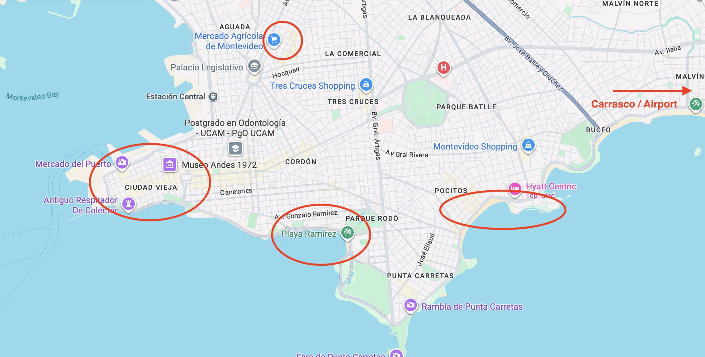
Main areas to visit in Montevideo
First of all, let’s start with the general layout of the city of Montevideo to set the stage.
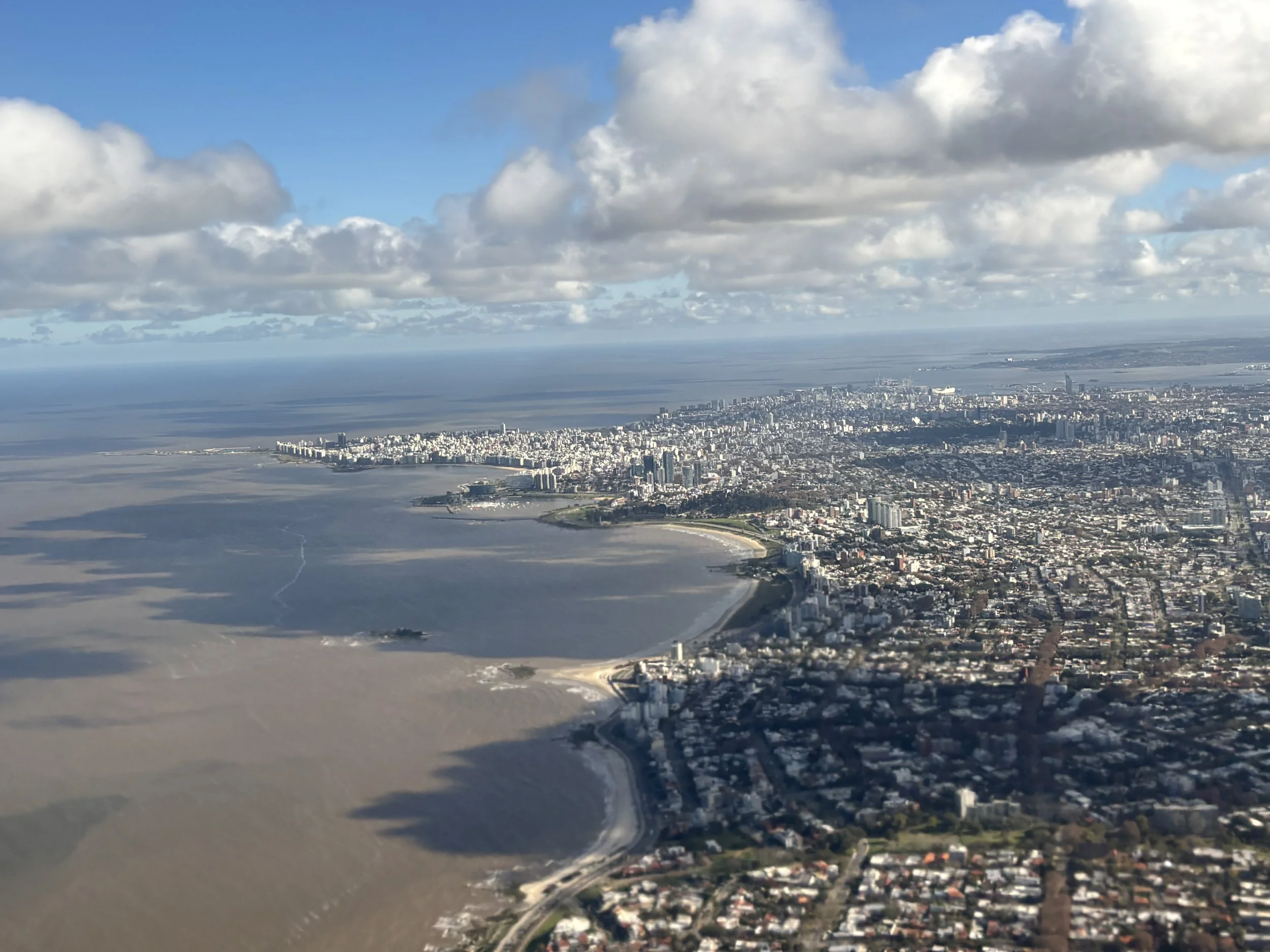
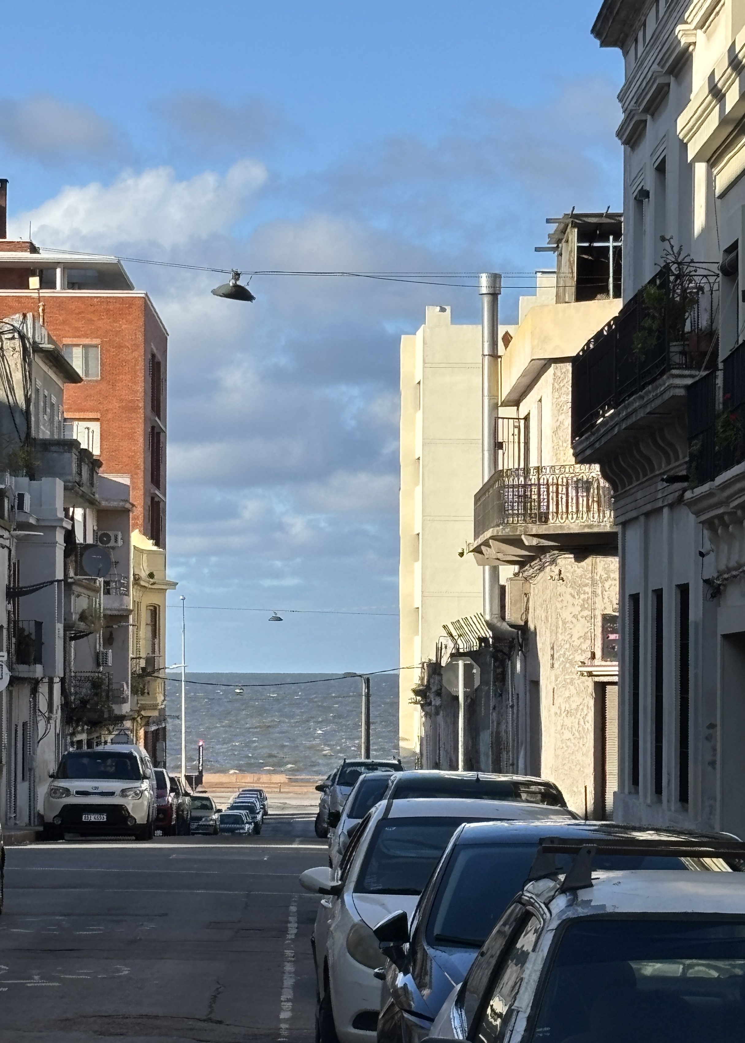
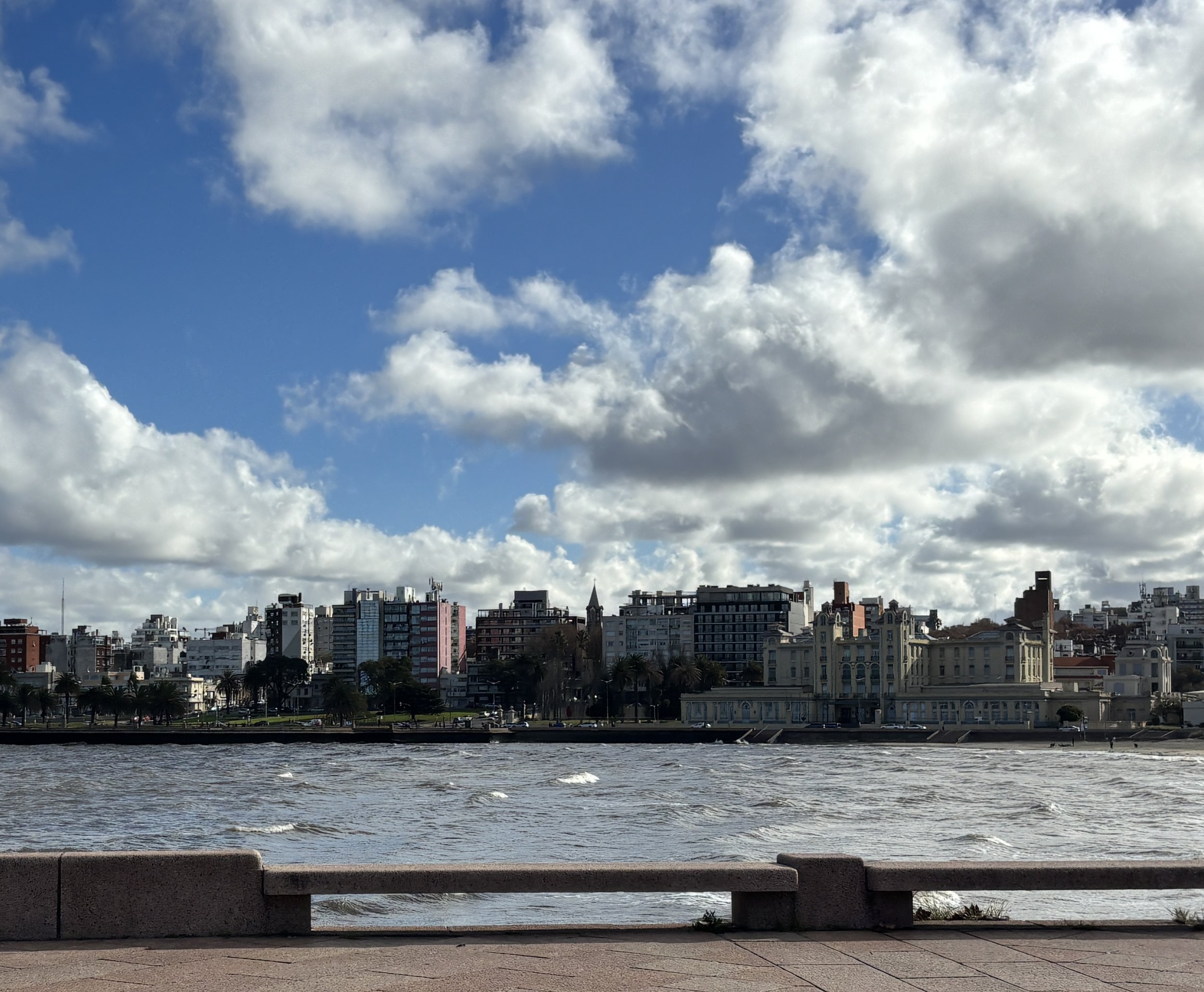
Montevideo is located mostly on a small peninsula protruding into the Rio de la Plata, the huge estuary which separates Uruguay from Argentina.
The old town ("Ciudad Vieja") sits at the tip of this peninsula, while the more modern districts extend inland in an orthogonal grid. The city also slopes gently toward the sea, with the central areas located at a slightly higher elevation. In fact, you can see the brownish waters of the Rio de la Plata from many areas of central Montevideo.
In this post I am going to focus my attention on:
Ciudad Vieja and the adjacent Independence Square
Palermo/Punta Carretas/Pocitos/Carrasco, the rather affluent seaside districts on the south side
Villa Muñoz, to the north of downtown
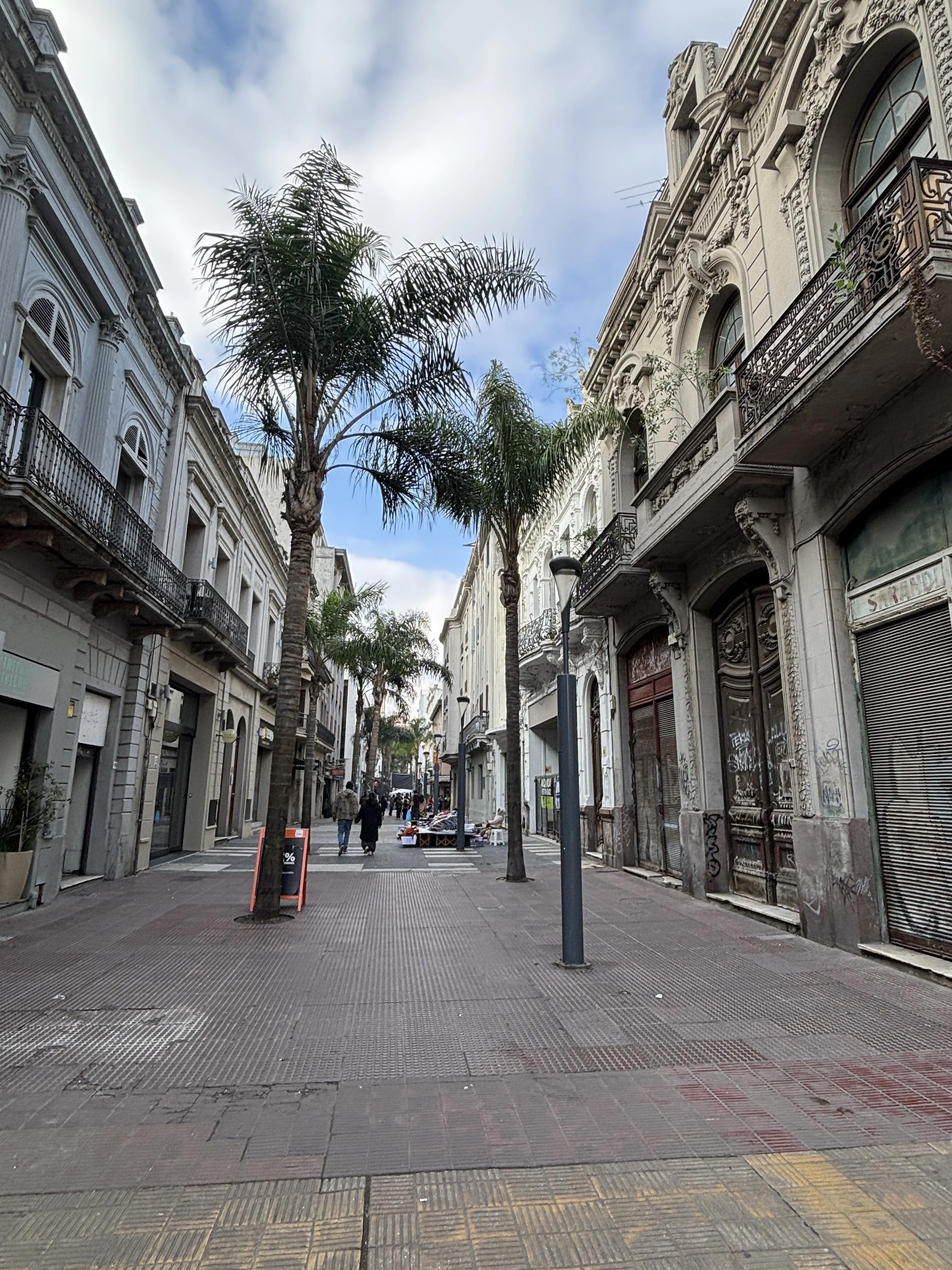
What to see in Montevideo’s Ciudad Vieja
This is the historical part of the city, a mostly pedestrianized area that runs along a ridge which offers views of the sea both right and left, as you walk its central streets.
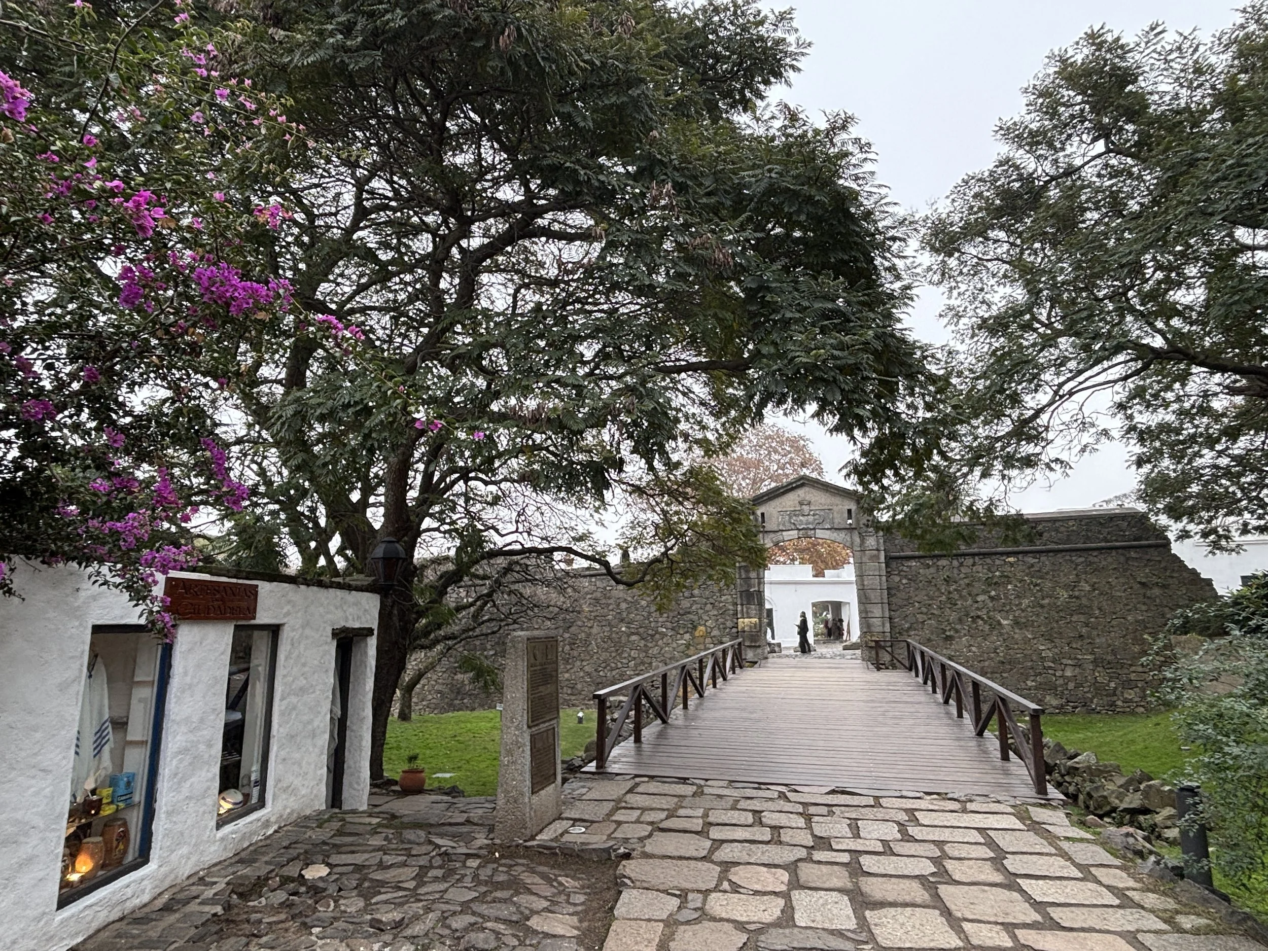
Like Colonia del Sacramento, old Montevideo was at the tip of a small peninsula with its landward side fortified. The walls are now gone, but one of the gates remains as a reminder, demarcating the border between the old and modern parts of the city.
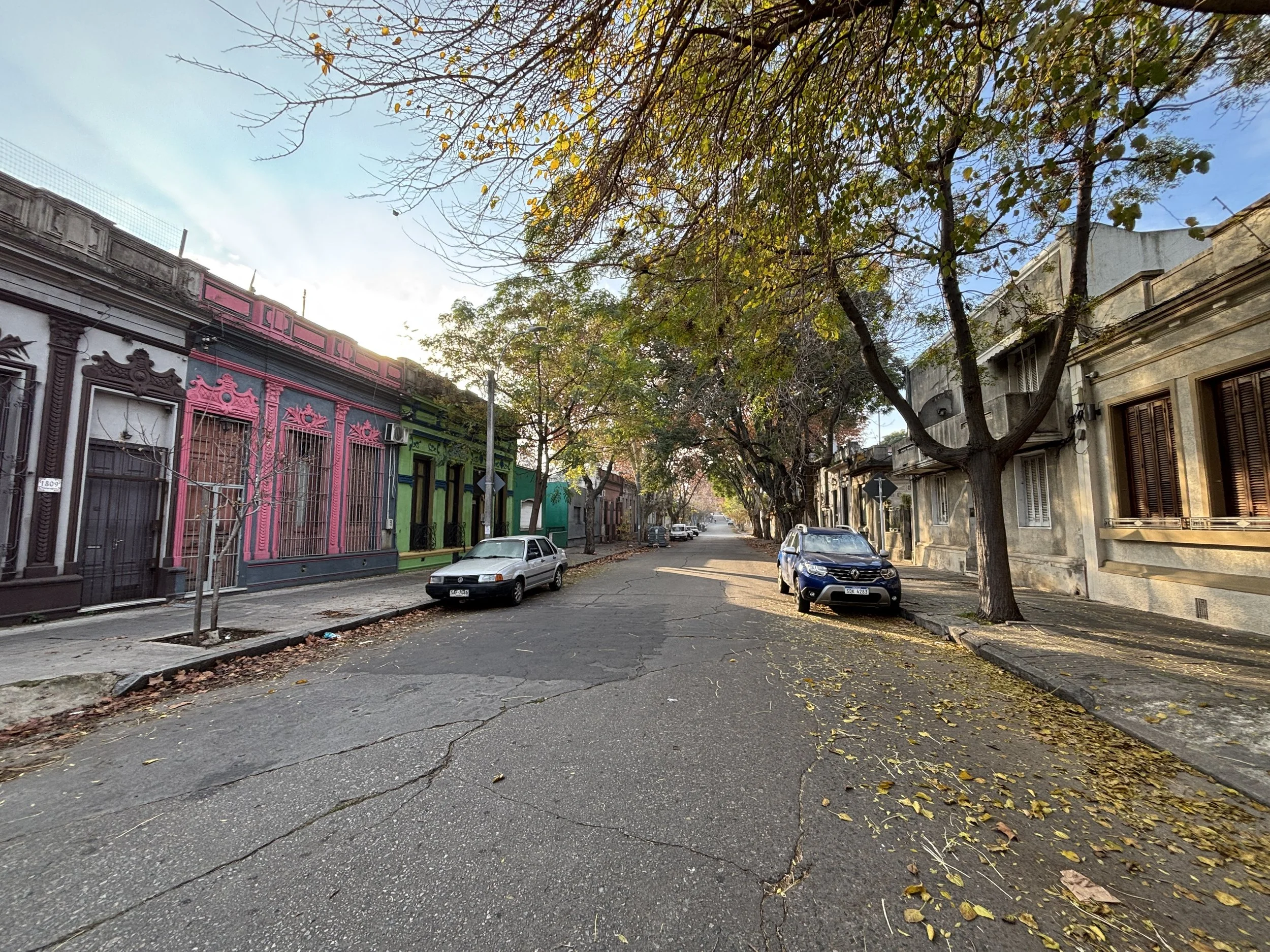
It is important to remember, though, that it is the “old city” in the context of Uruguay, which is a country that grew mostly between the second half of the 19th C and the first half of the 20th. So, it is a relative type of “old”, however, this area of the city does keep its own character, differentiated from the orthogonal grid that is the (formerly extra-muros) modern part of Montevideo.

The main points of interest in Montevideo’s old town are:
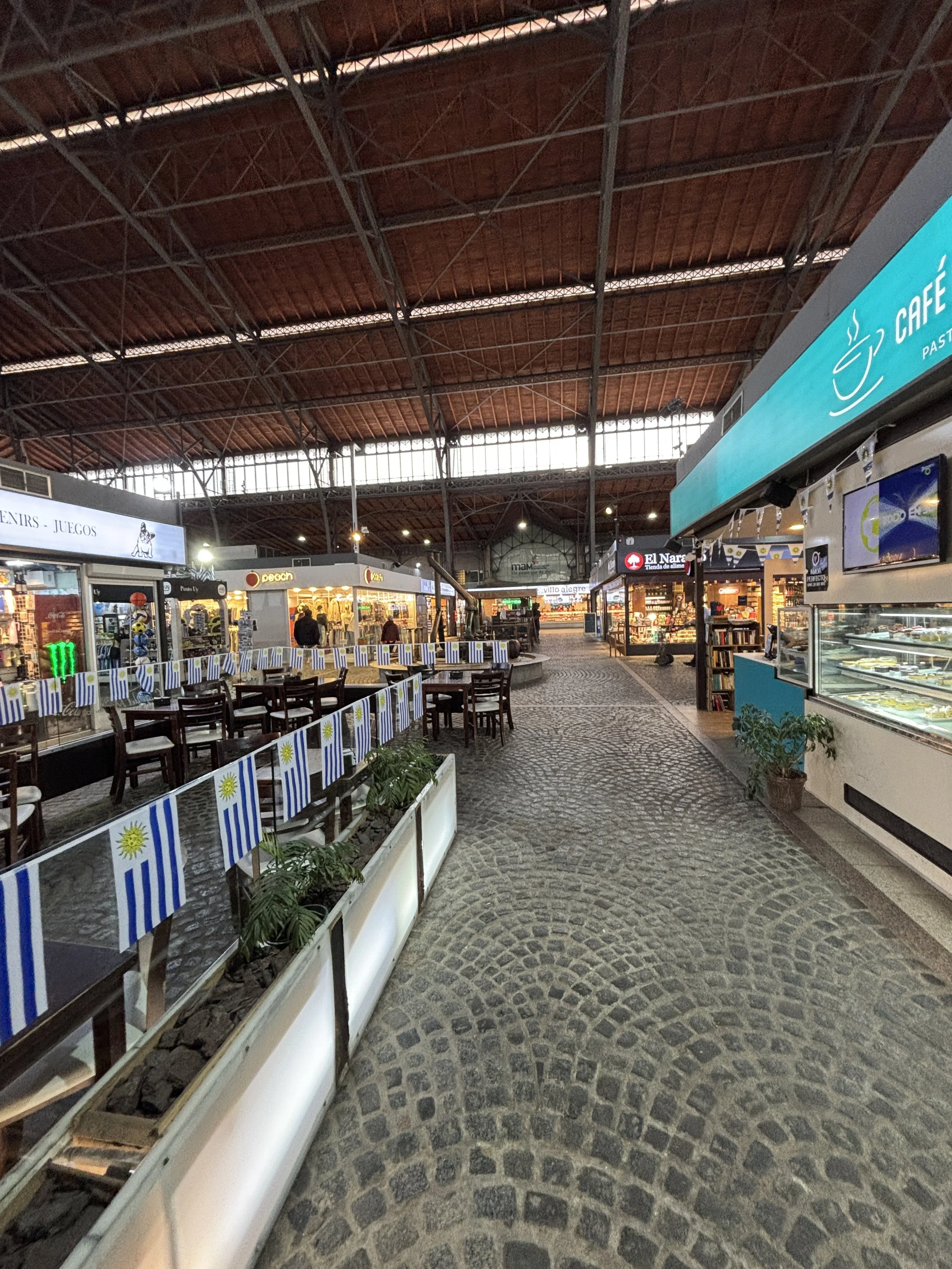
Mercado del Puerto
Palacio Taranco (Museo de Artes Decorativas)
Museo del Gaucho y de la Moneda
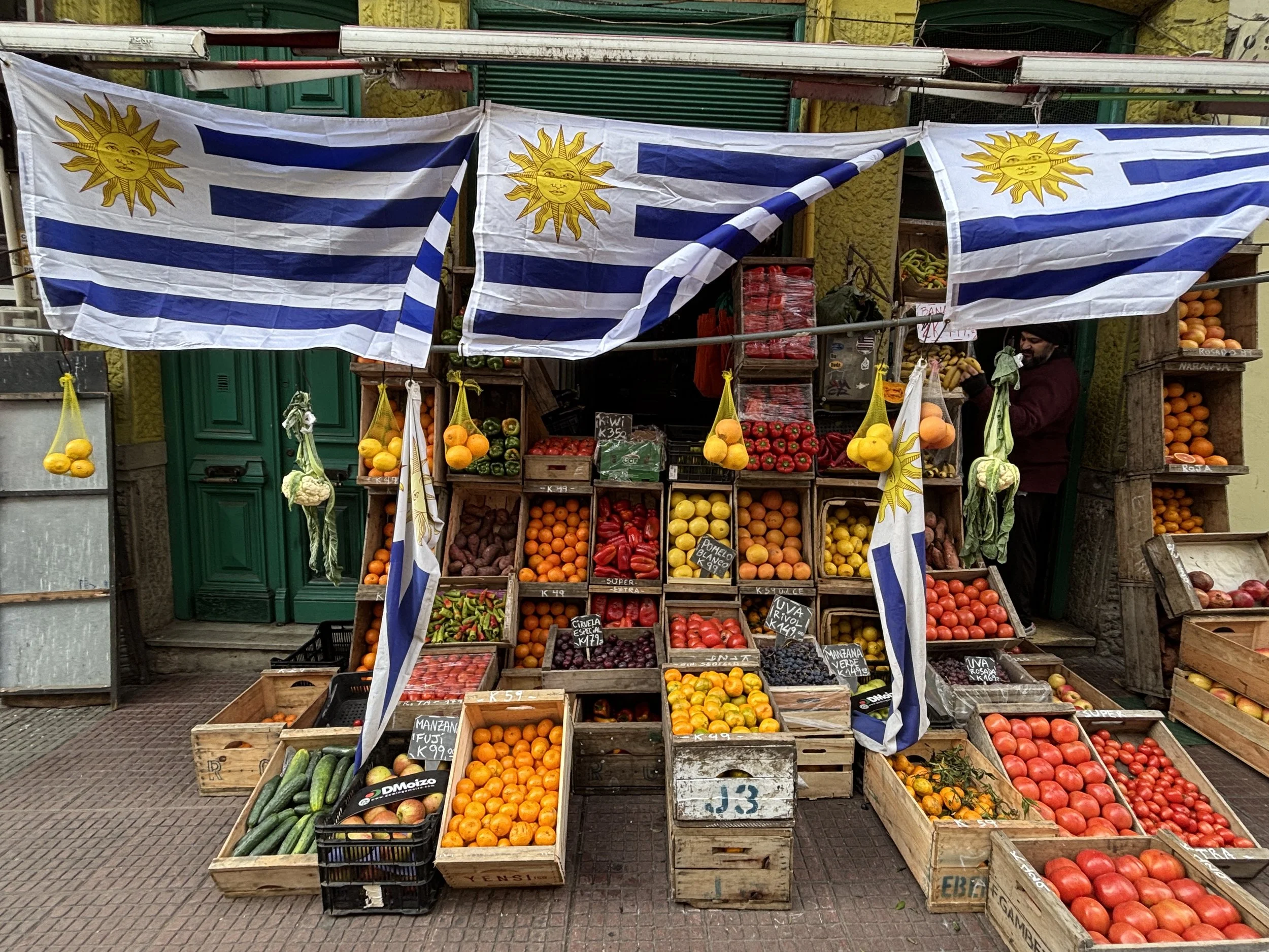
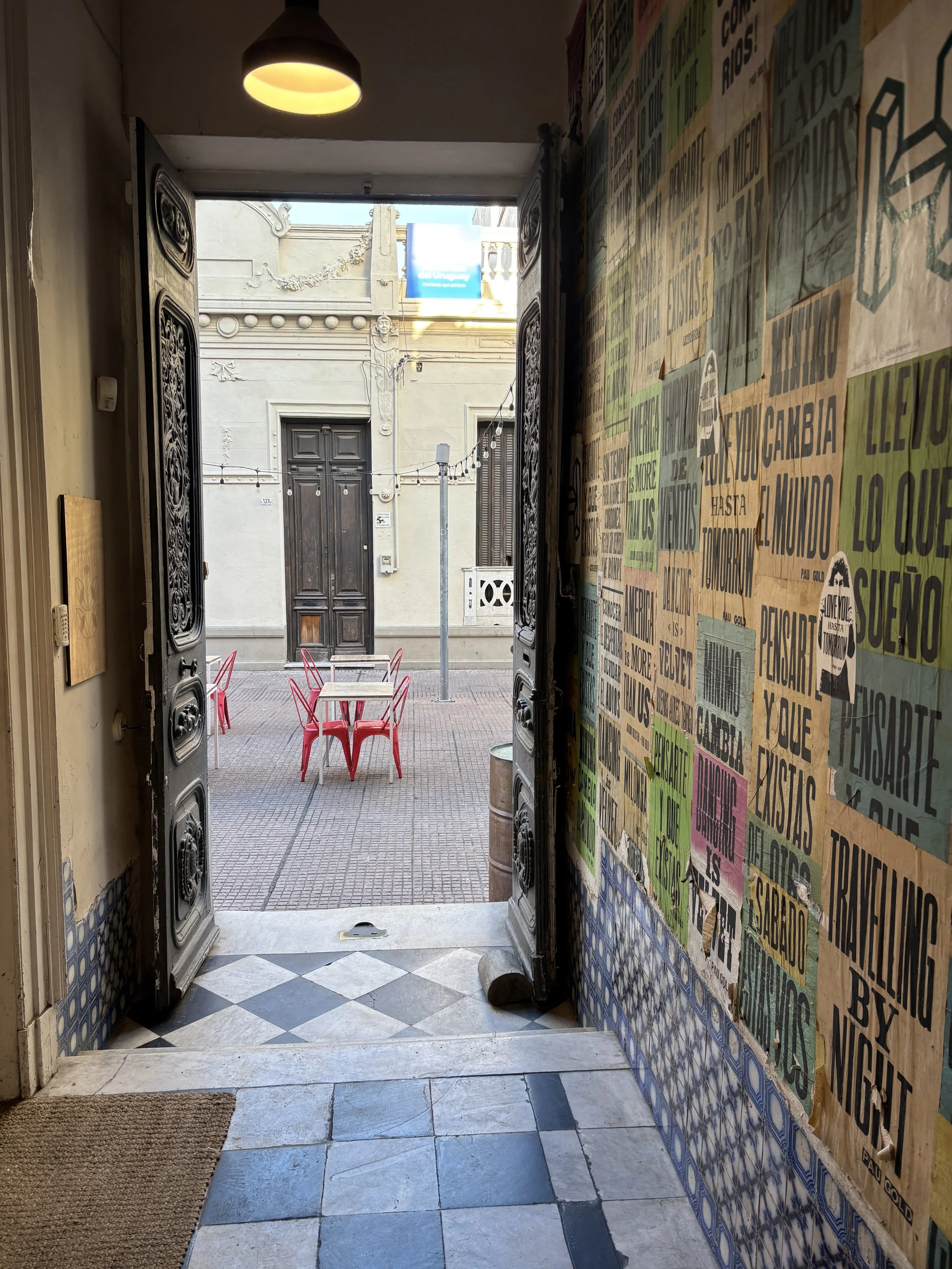
The Ciudad Vieja is very walkable and the distances involved are short. At good pace you can actually see almost all of it in a couple of hours, even if stopping for coffee at any of the several small cafés and bakeries that line its streets.
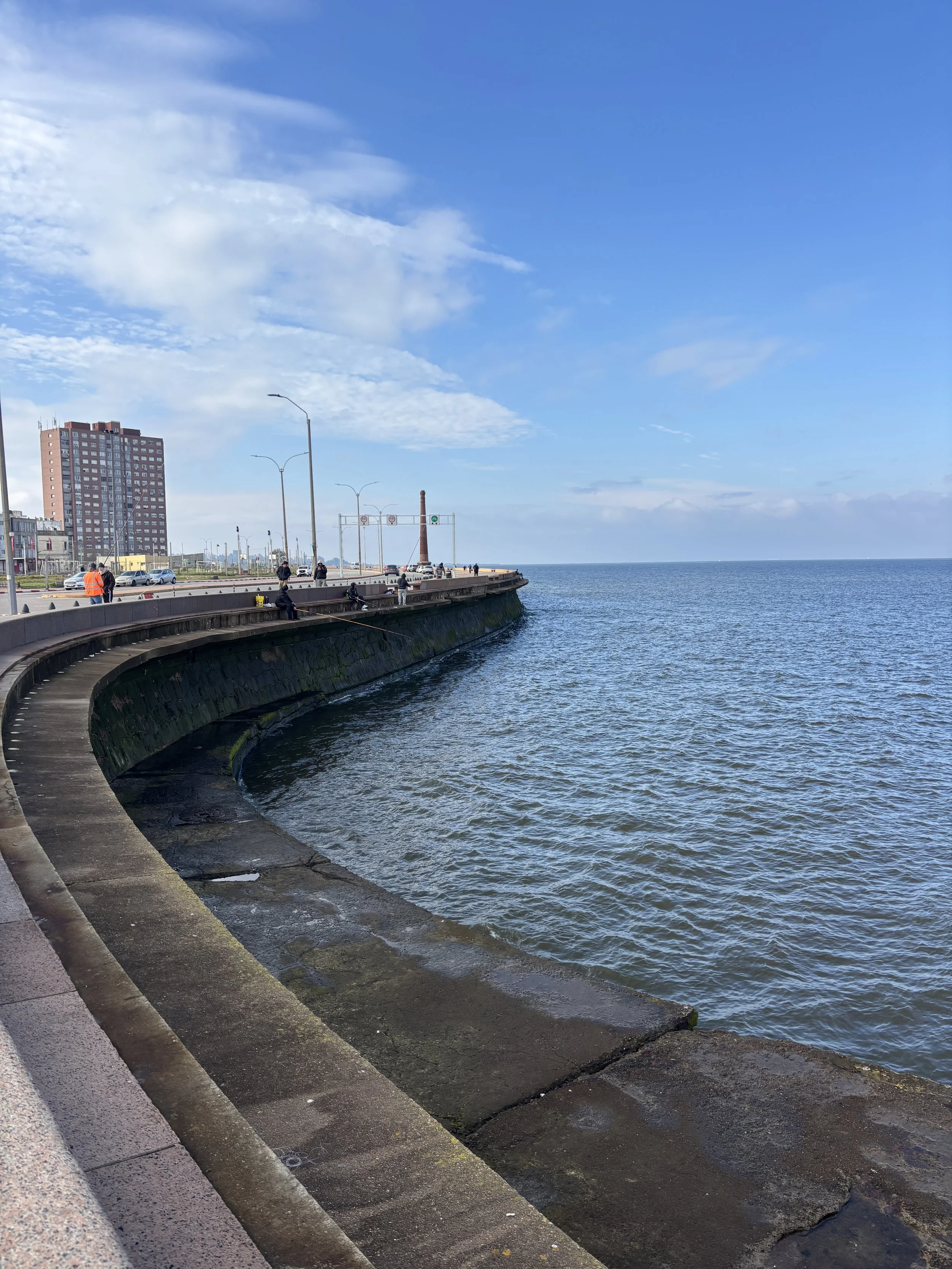
One thing to keep in mind, though is that some areas in the old town appear to be quite run down (I was told it may even be a bit unsafe to walk around at night).
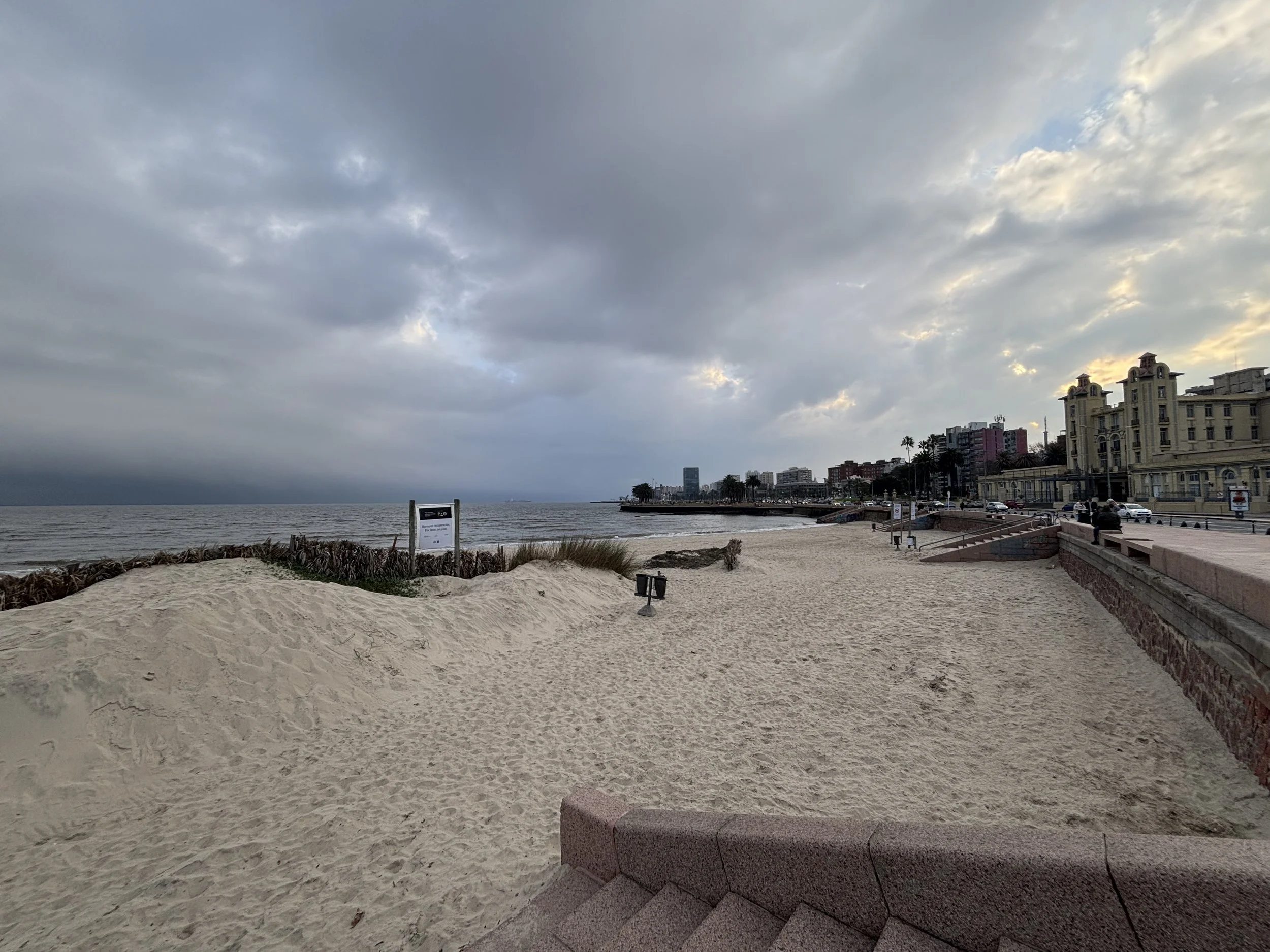
This becomes very apparent if you walk all the way down to the seaside. In most cities this would be prime real estate, but in Montevideo’s Ciudad Vieja what you come across is a number of uninviting open spaces and semi-derelict constructions. At the far end you end up at a sort of embankment where some people are fishing with rods, but the whole area is, again, rather unappealing.
Also, worth noting that the separation between the old town’s pedestrian area and the industrial port is non existent.
One of the spots by the sea that I found most interesting, though, is a large white art-déco building towering over the Mercado del Puerto. Sadly, this is actually off-limits, since it is Uruguay’s naval headquarters!
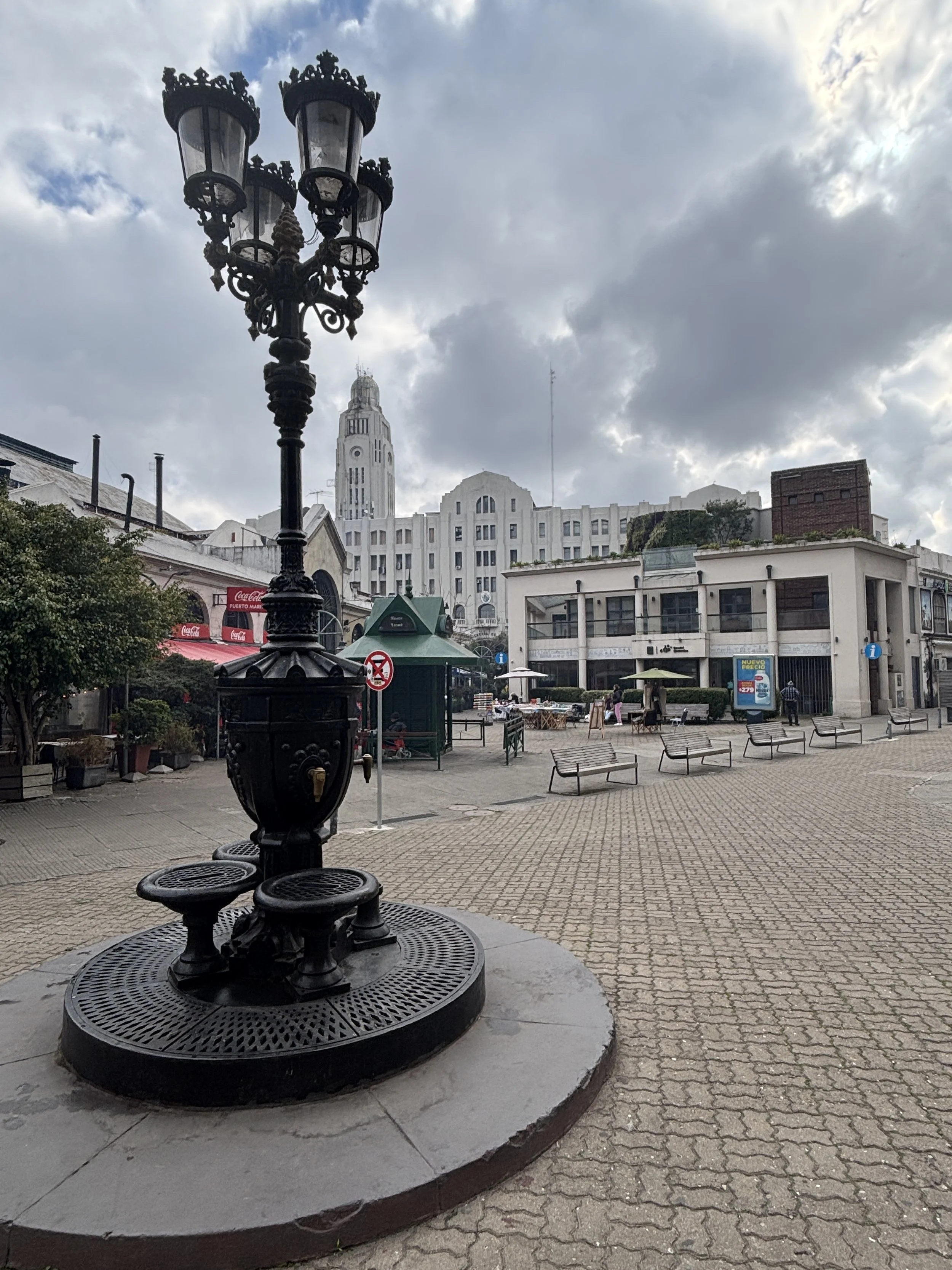
In the following pictures you can get a sense of the look and feel of the area and see also how, even if not particularly accessible in this part of town, the sea, or more accurately, the Rio de la Plata, is always looming in the background.

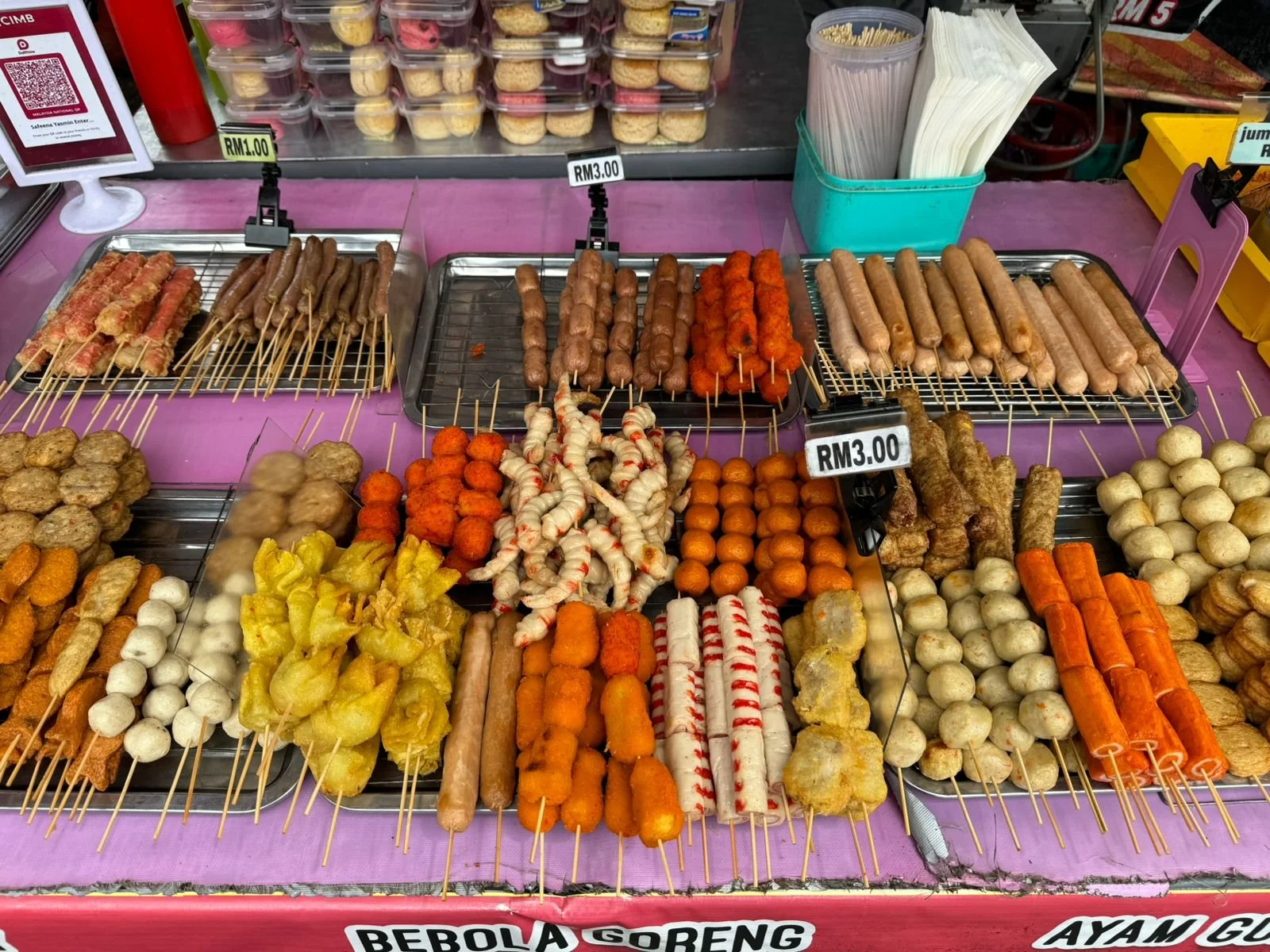
Mercado del Puerto
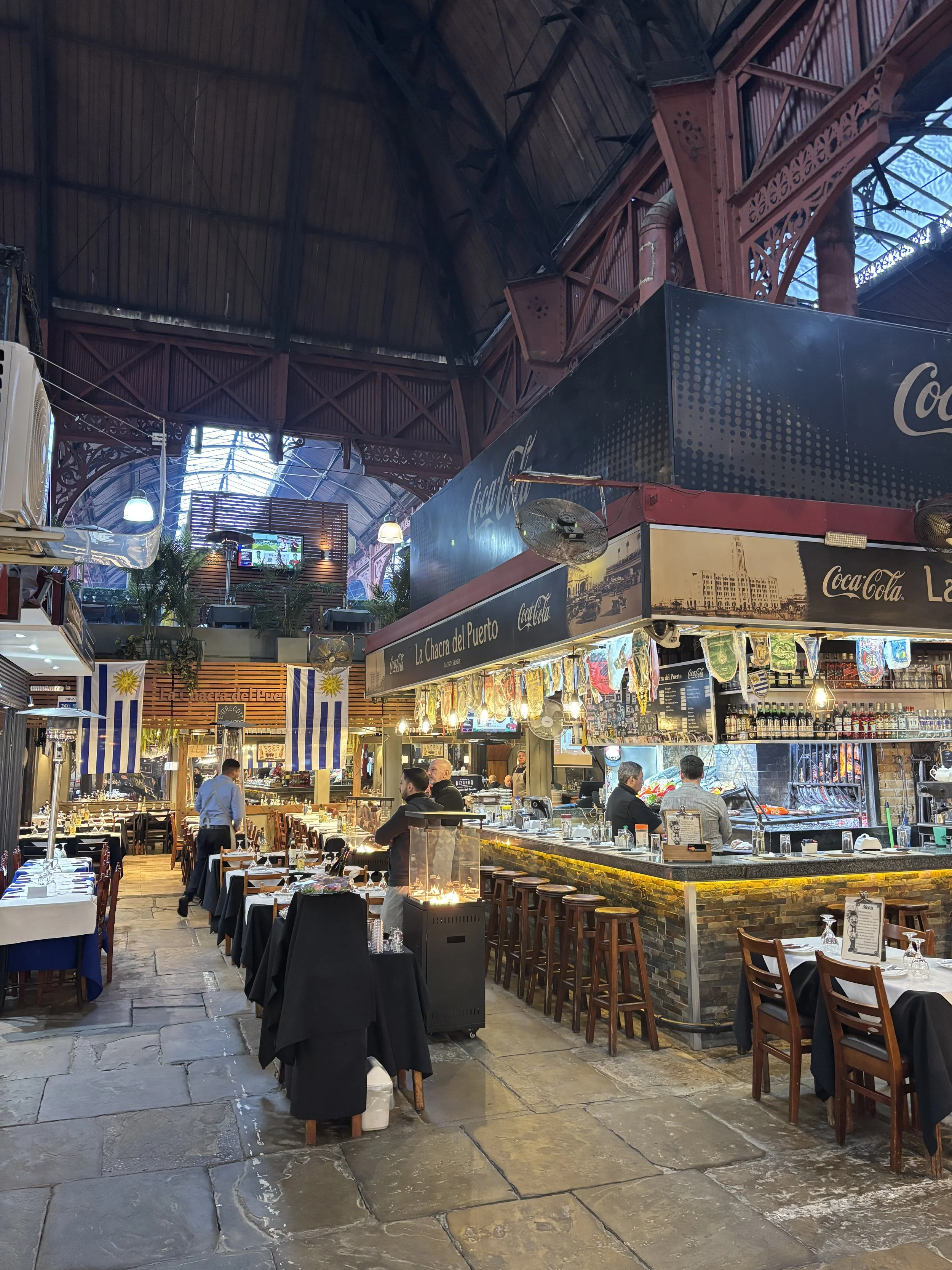
This market is a must visit in Montevideo, not because of its size or the exuberance of the wares on sale. In fact, it is rather small and most of the shops are actually selling souvenirs.
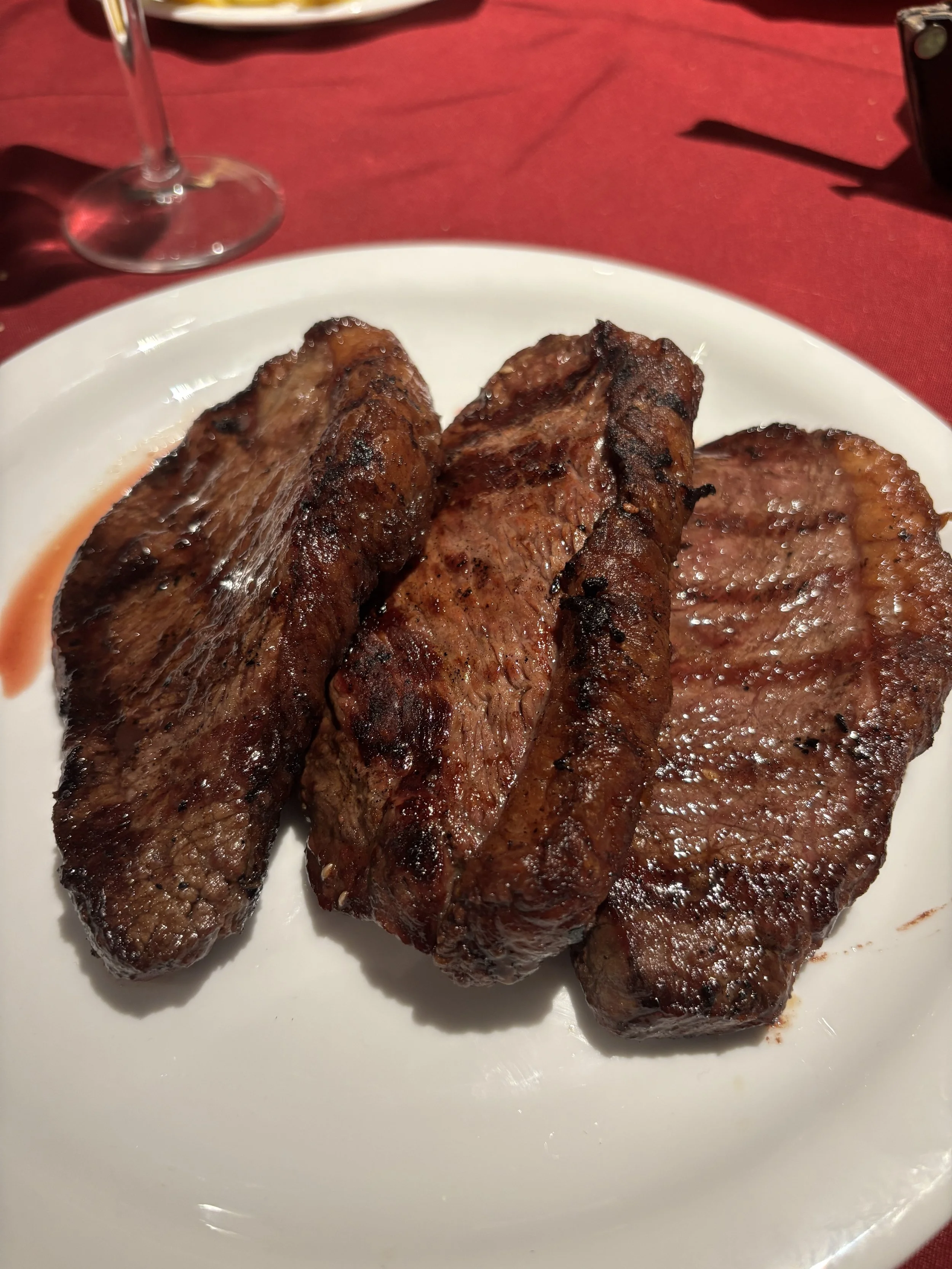
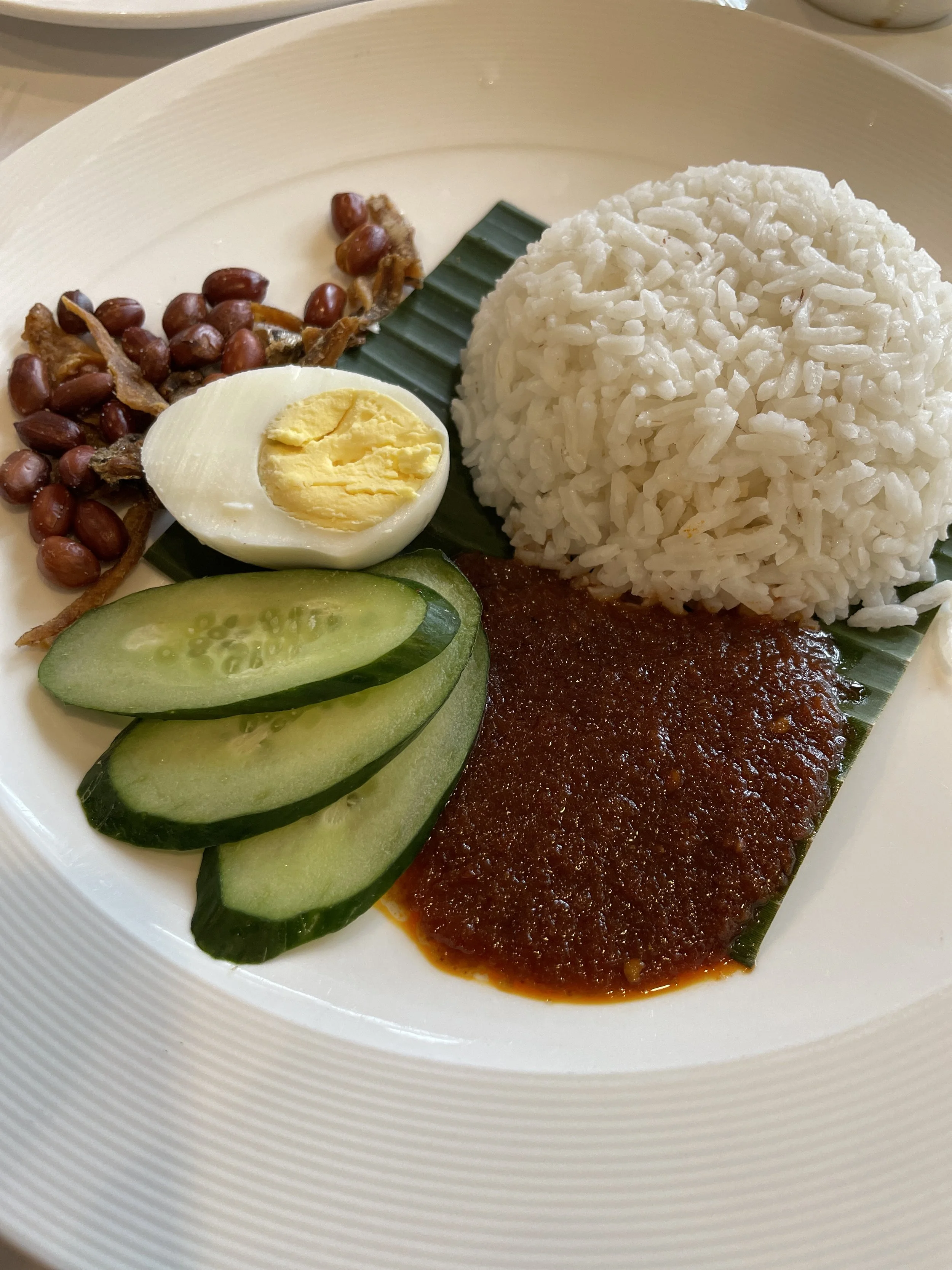
But here you will find some totally great places to eat a typical (and very abundant!) Uruguayan asado!
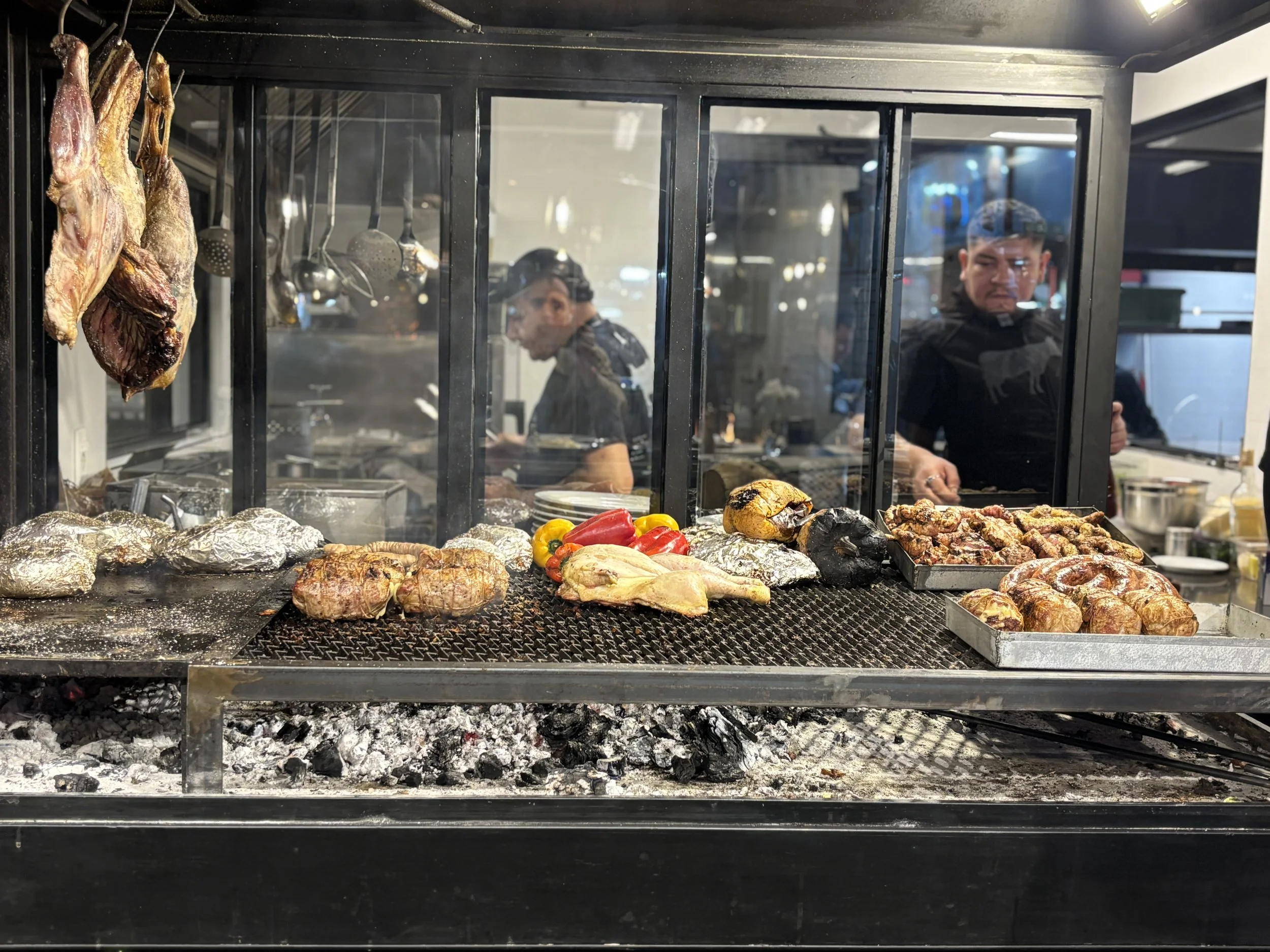
Grilled meat is one of Uruguay’s specialities. So, provided you are not vegan, you will likely enjoy eating here.
There are different restaurants, all of them offering basically the same selection of grilled meats, which are cooked in the open on proper charcoal.
There is a rich meat-eating culture in Uruguay, so you will be offered a choice of different cuts, best served alongside some local red wine.
What is pretty much guaranteed is that the rations will be huge!
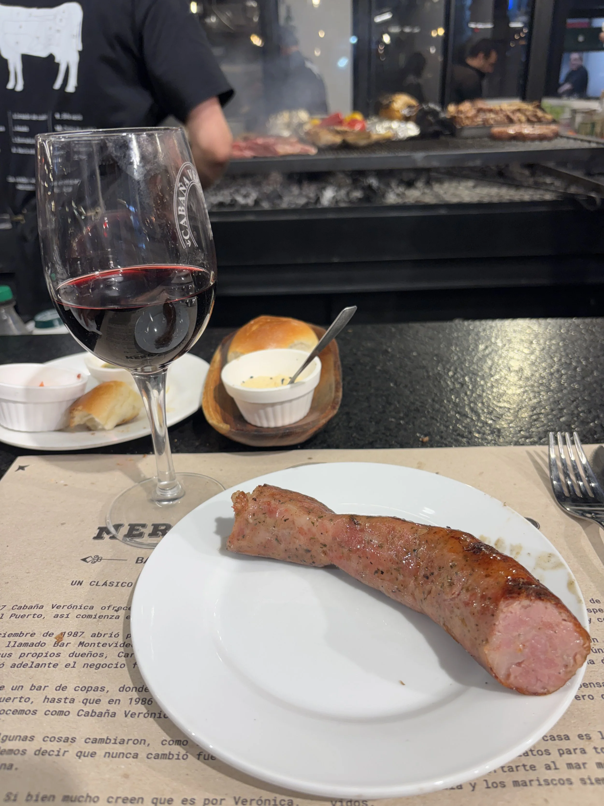
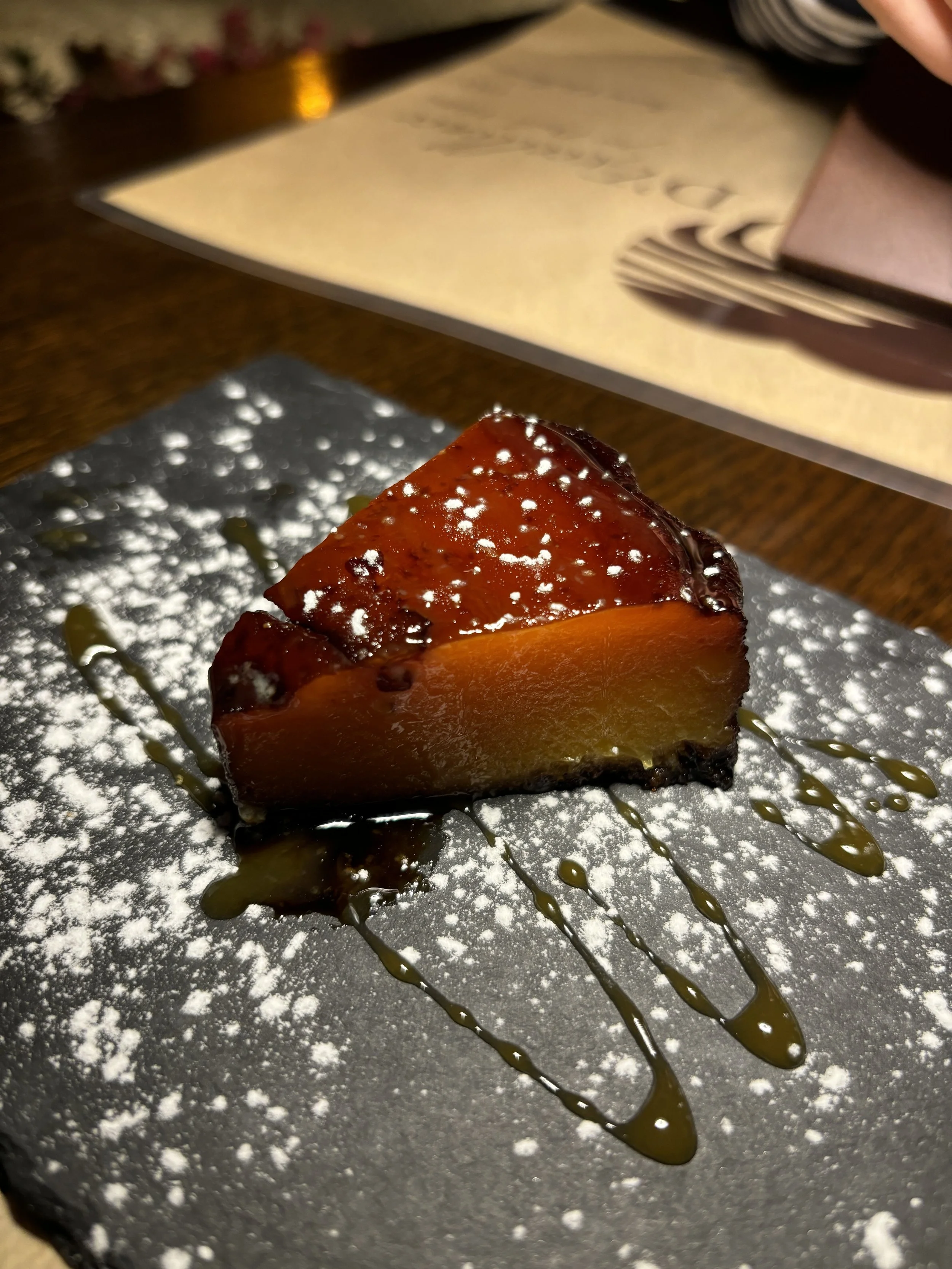
Cabaña Verónica
This was my choice at the Mercado del Puerto (it was later recommended to me independently by my hotel’s staff) and it did not disappoint. Amazing food and great service throughout.
Also worth mentioning that I sat at the bar, watching how the meat was being cooked, which adds to the speed of service and the authenticity of the experience!
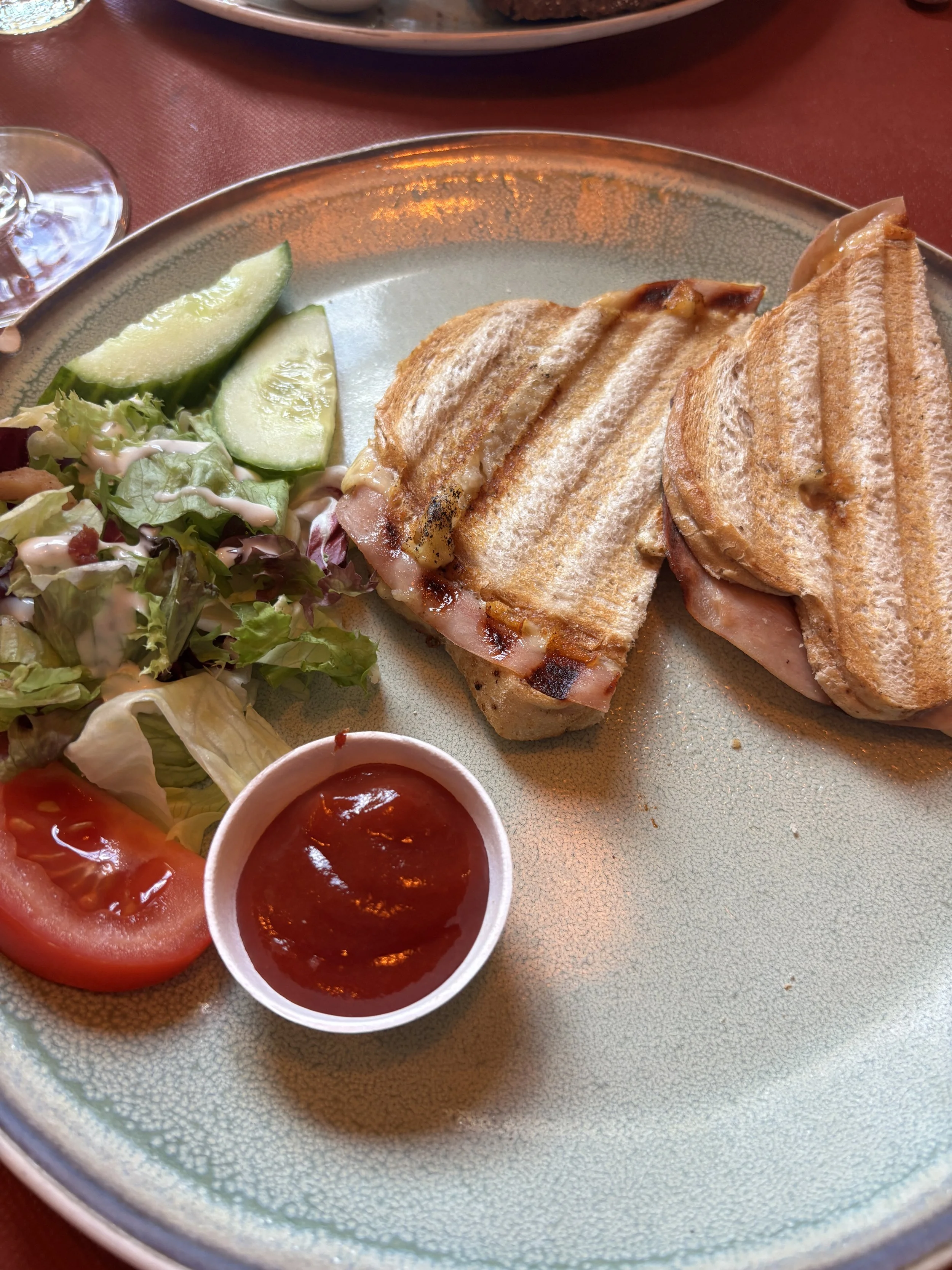
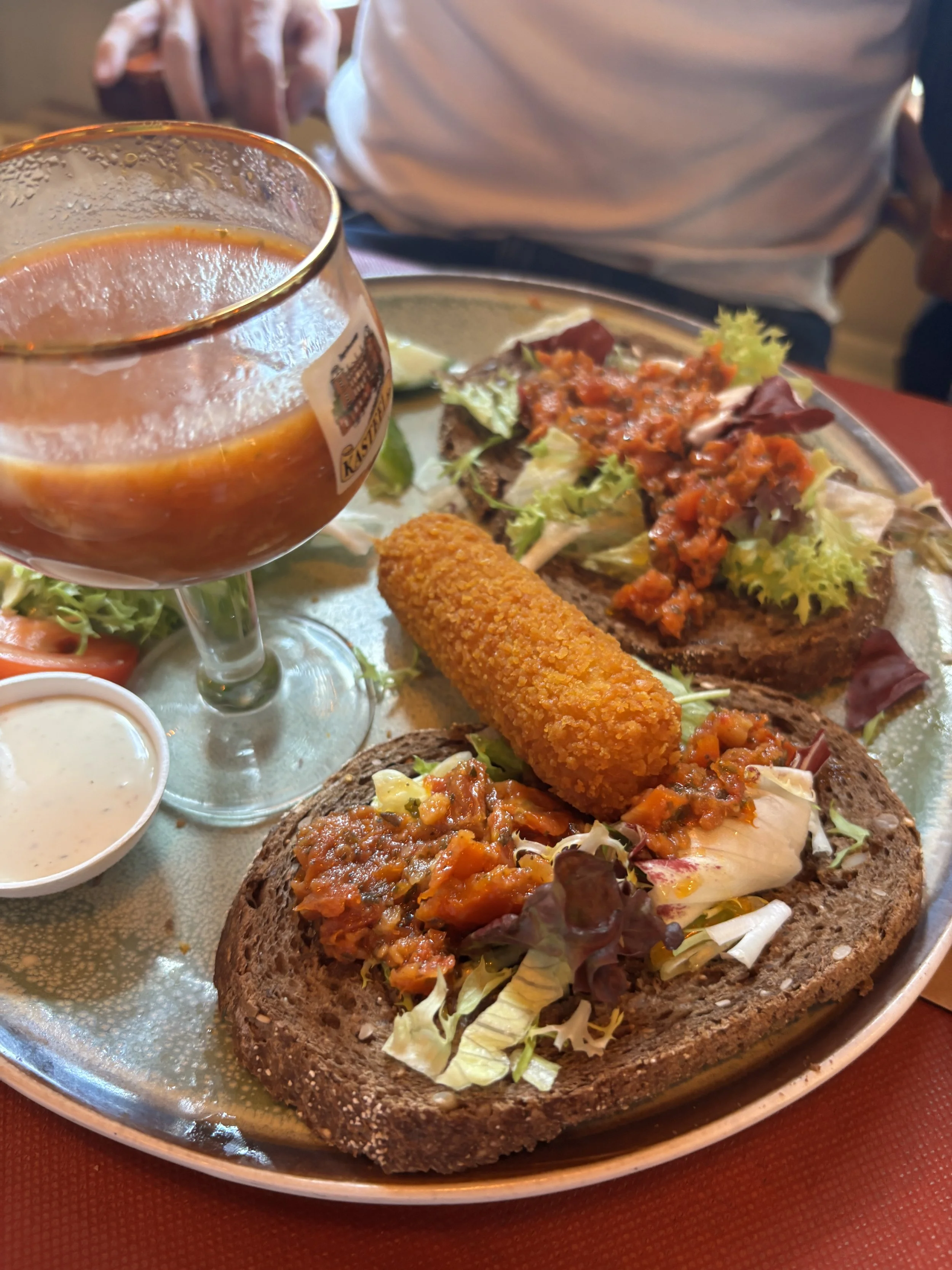
In the picture below you can see what you get if you order one of the most basic cuts, the “tira”.

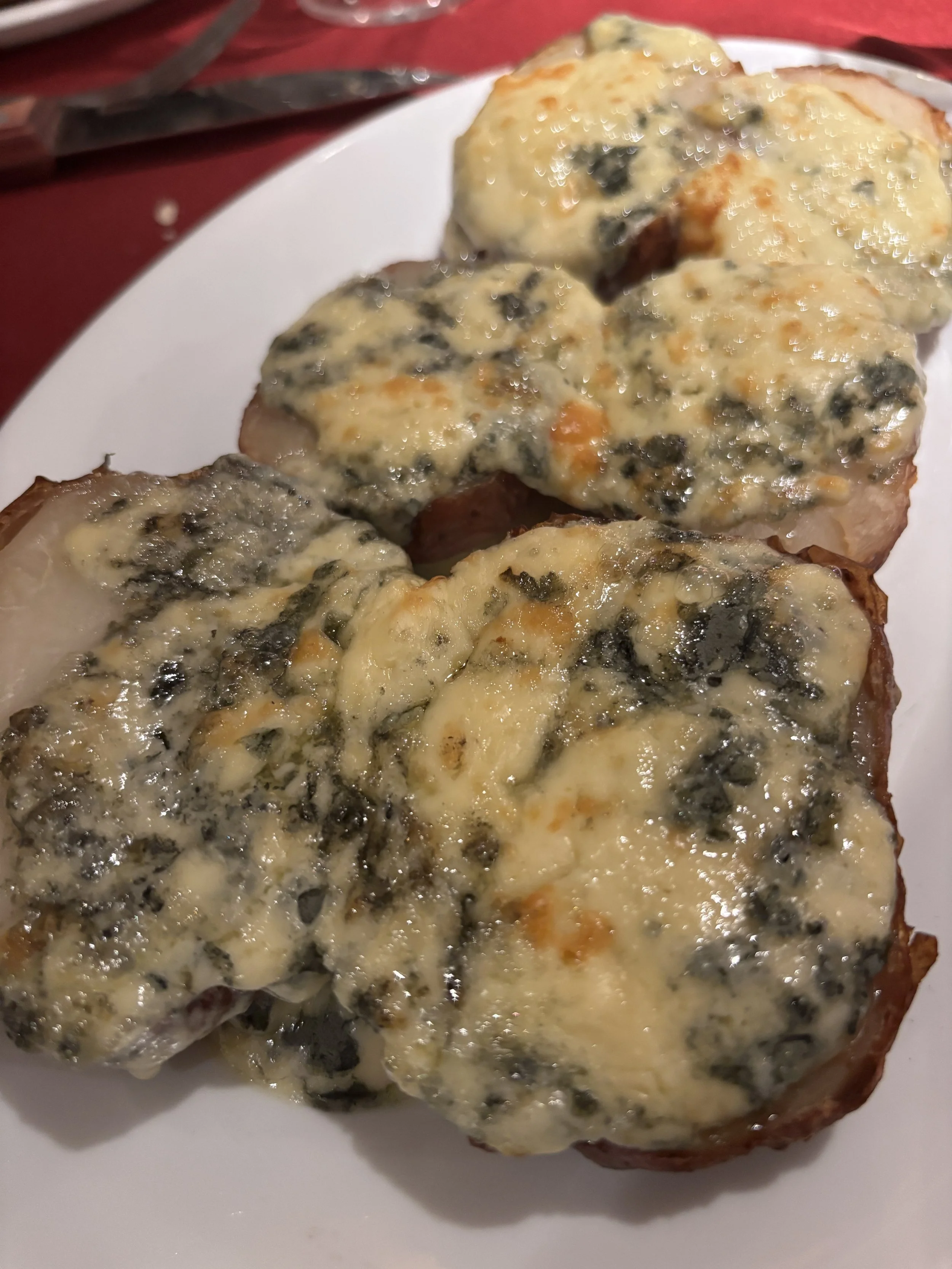
For good measure I also tried the grilled sausage (“chorizo”), which you can see below. All. of these dishes are served with accompanying breads, sauces (pour at your discretion, I personally found it very tasty without adding anything!) and a side, which is usually potato-based.
Visting the Palacio Taranco - Museo de Artes Decorativas
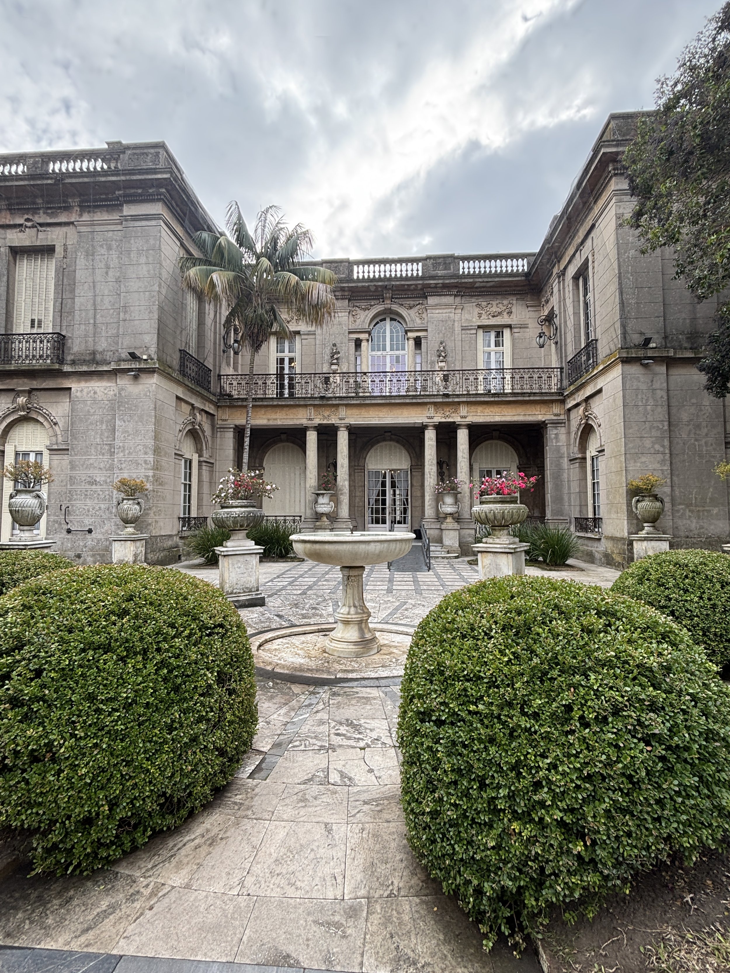
This is a small but beautiful and tasteful palace located on the main square in the Ciudad Vieja, Plaza Zabala. It belonged to a rich Montevidean business family, which lived here in the early 20th C.
Since the 1970s it has hosted the Museum of Decorative Arts (“Museo de Artes Decorativas”), which is essentially a small art museum which contains pieces by some famous European masters, from the Dutch Golden Era to more modern artists, like the Spanish painter Julio Romero de Torres.
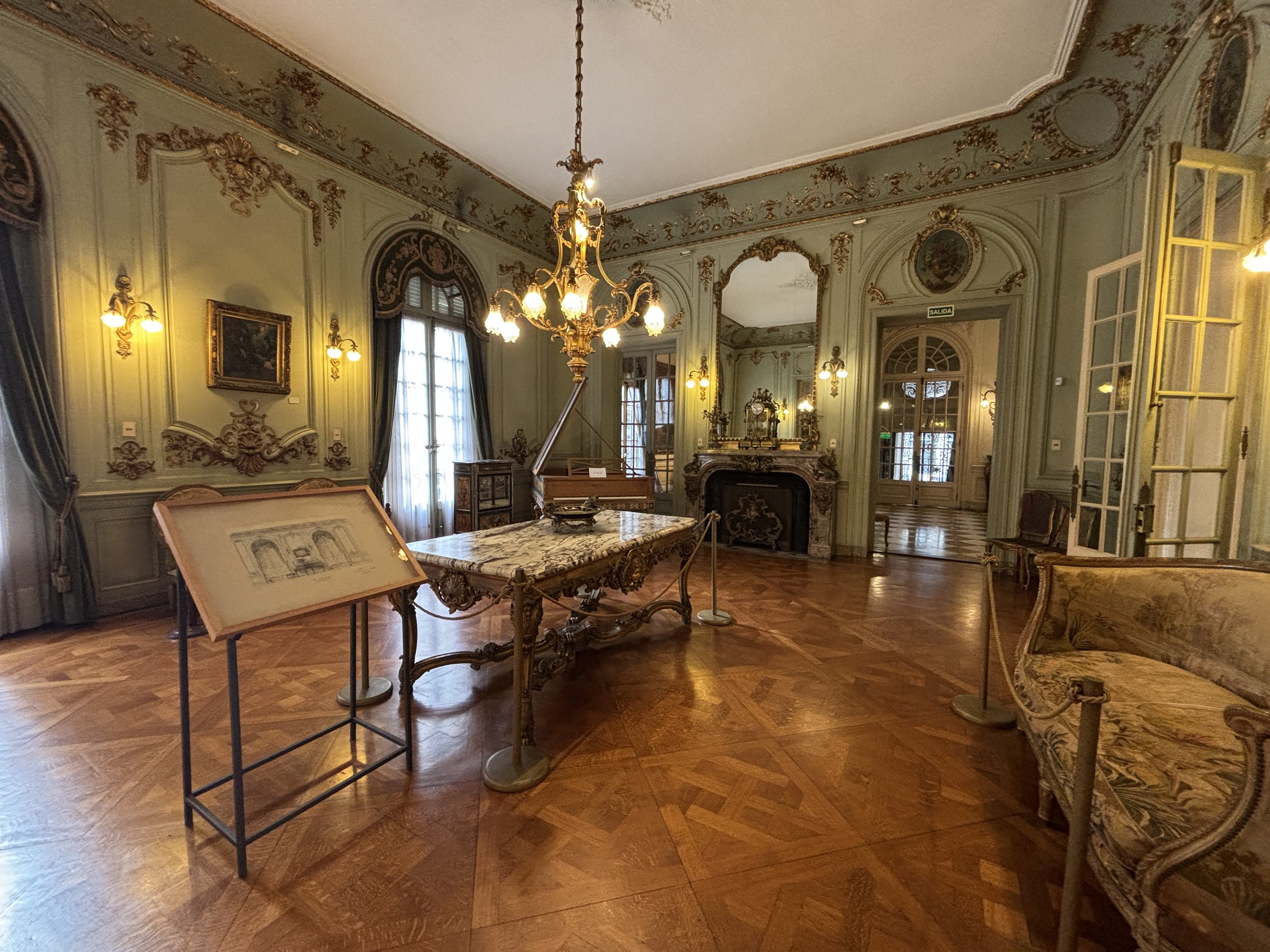
Besides the art, Palacio Taranco shows how the elite of Uruguayan society lived at the time when the country was at its apogee. Palacio Taranco once even hosted the Prince of Wales, who later would become Edward VIII of England, when he visited Uruguay in the 1930s.
The palace can be visited in about 30 minutes or so (it is not that big!) and entry is free.
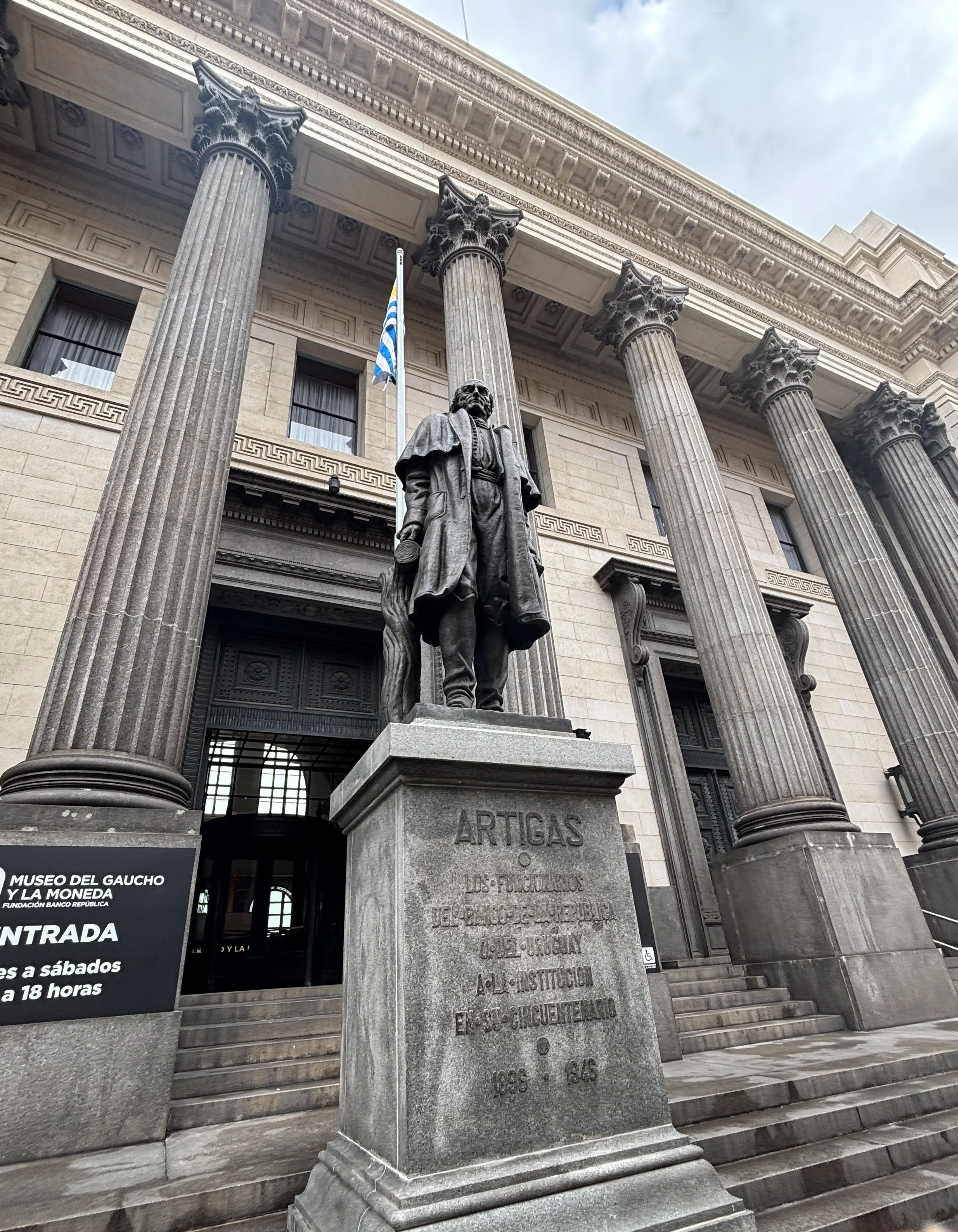
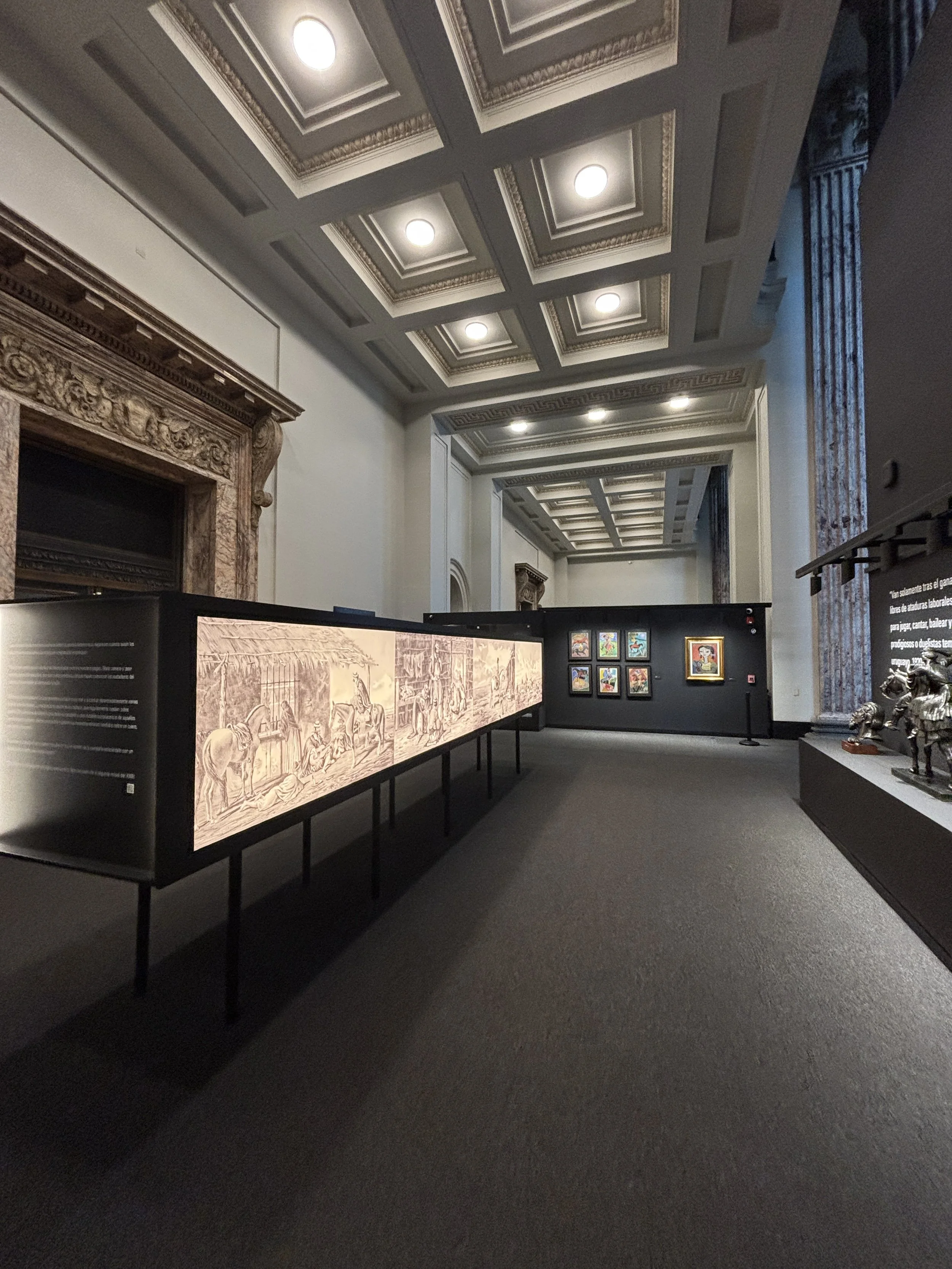
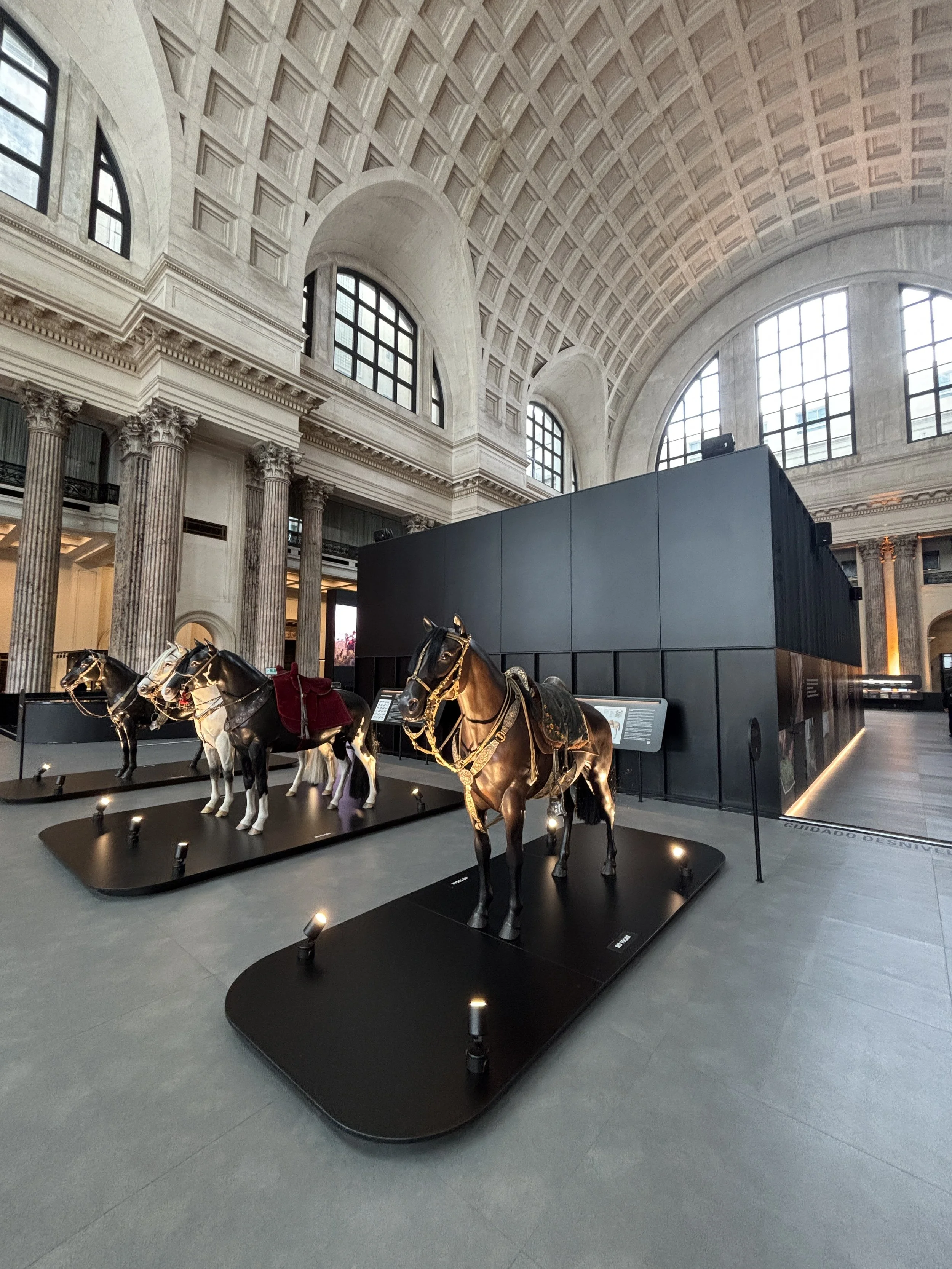
Museo del Gaucho y de la Moneda
This museum has a rather intriguing name, since it is devoted to two apparently unrelated topics:
On the one hand it tells the history and culture of the “gauchos”, the mounted frontiersmen that lived in the plains of Uruguay raising cattle and later expanded into the neighbouring Argentina and southern Brazil. They were, roughly, the South American equivalents of the “cowboys” of the US Far West which so popular became in pop culture.
The other topic is…the monetary history of Uruguay! Not for nothing, the rather majestic building which houses this museum used to be a bank.
The museum curators seem to be well aware that this mixing of topics can be a bit confusing to the visitor and they explain throughout the exhibition that the two are linked in the sense that they helped shape Uruguayan nationhood. Fair enough!
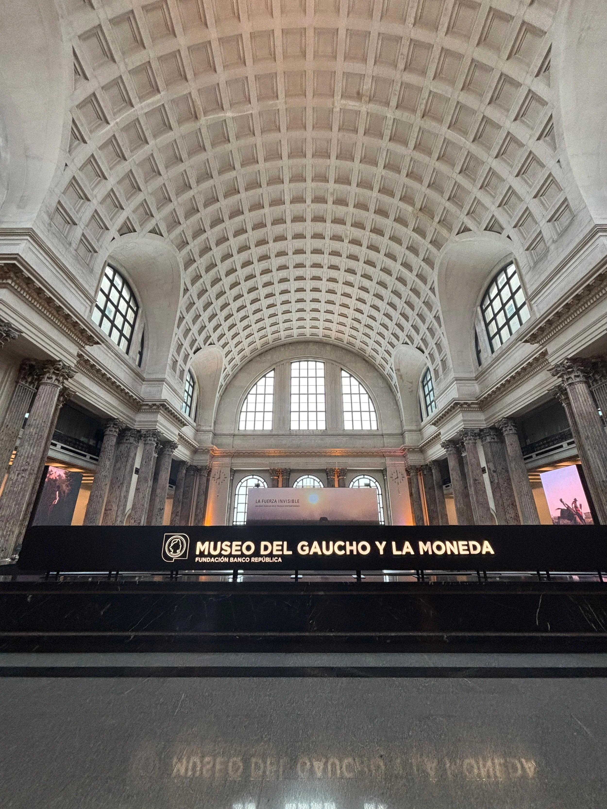
The exhibition part is rather small, with the gaucho history exhibition taking the side areas of along the grand central hall and the monetary-banking part located in the centre, where there is also an immersive video experience about life in rural Uruguay.

Altogether is a rather eclectic and unconventional mix, but not without interest. In any case, the building is well worth the visit, if only to contemplate its grandiosity.
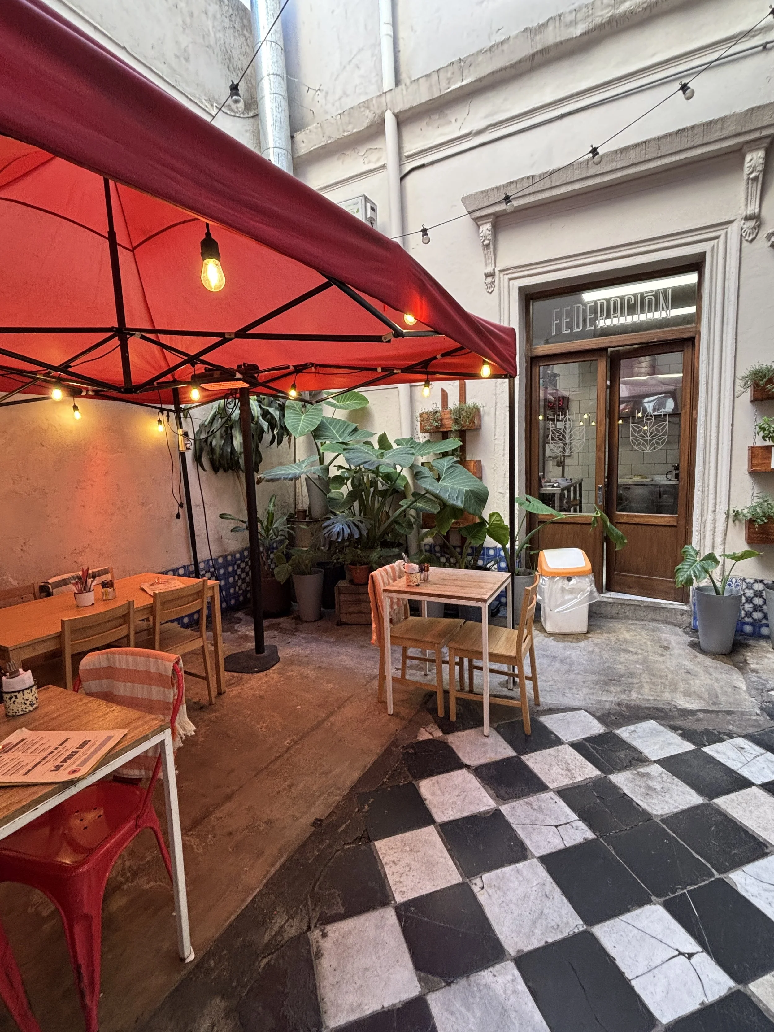
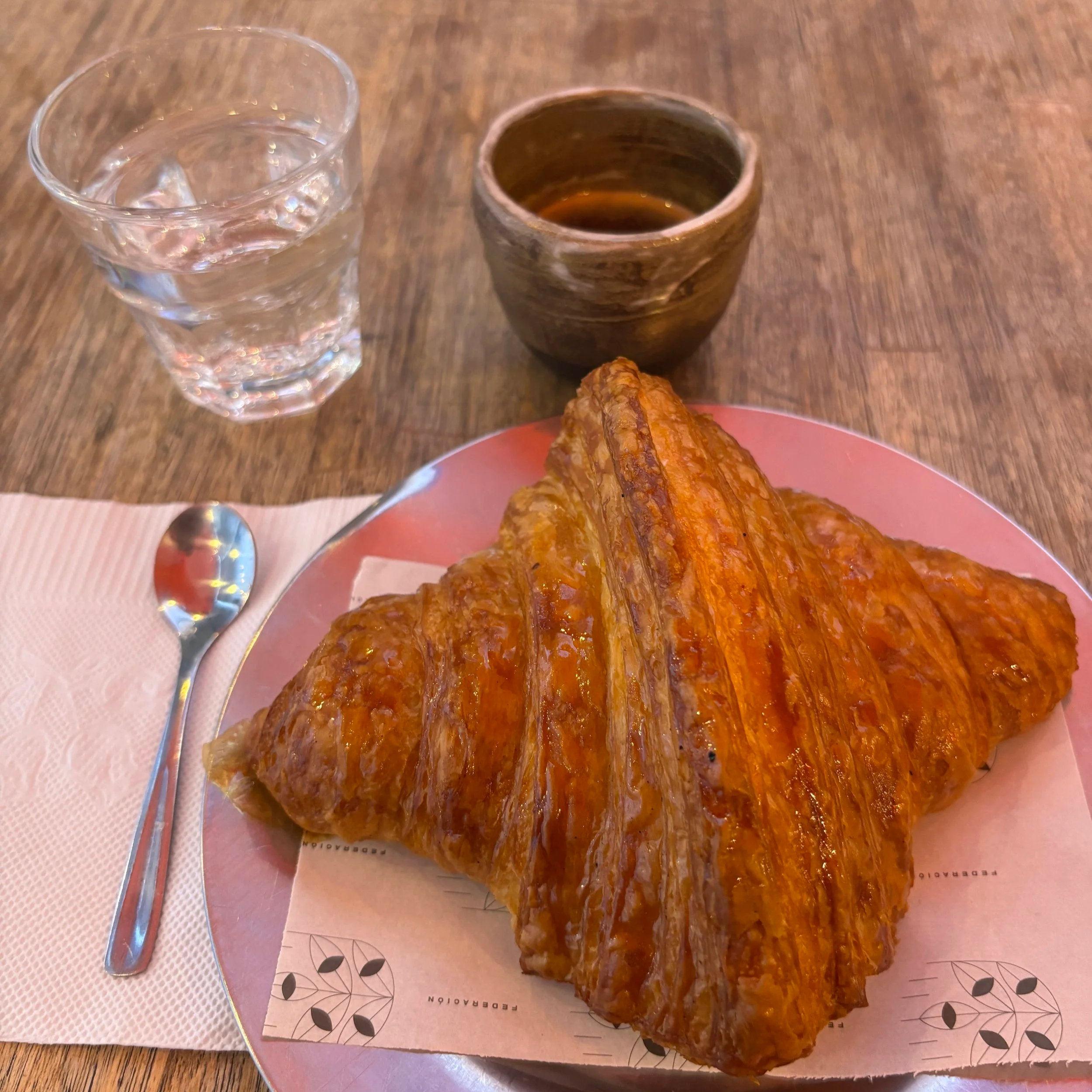
Nice place to have coffee and breakfast in the Ciudad Vieja
Federación (Café y Panadería Urbana)
Calle Perez Castellano 1370, 11000 Montevideo
This is a cozy place where you can have a little rest while visiting the old town. It offers sitting space on the street as well as in a quiet interior patio. It has great croissants, “media-lunas” (which is another type of croissant) and other pastries,
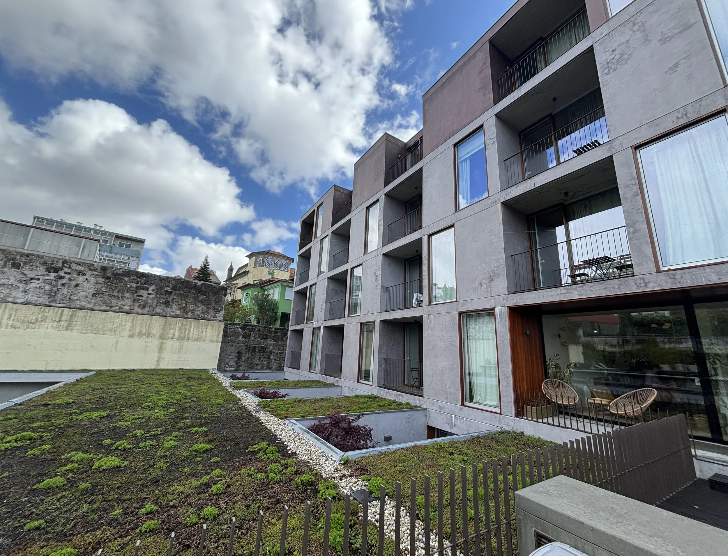
Amazing boutique hotel in Montevideo
FAUNA Montevideo
Sarandí 287, 11000 Montevideo
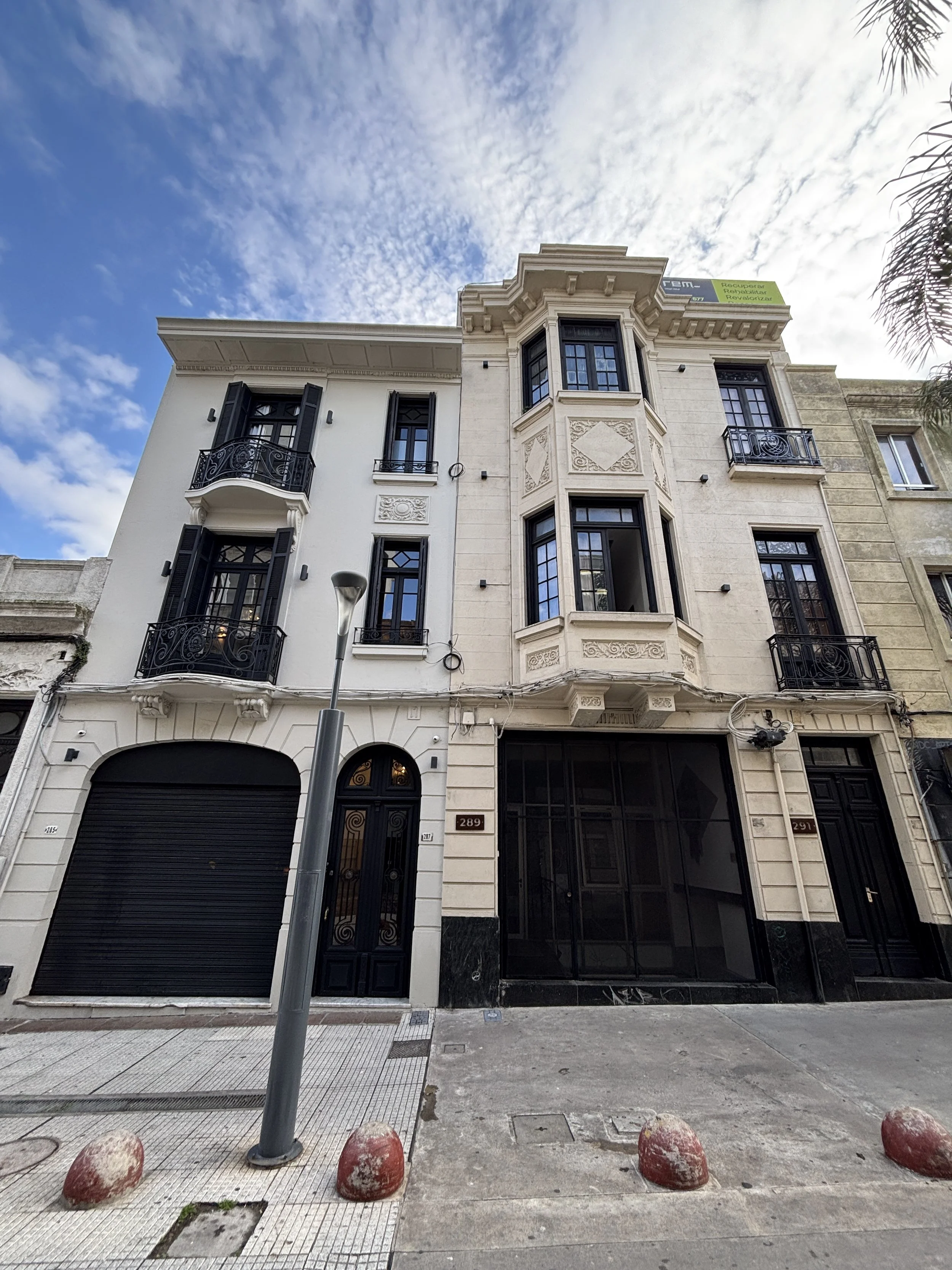
This boutique hotel was one of the highlights of the trip. I booked it in great part because it had raving reviews on Booking.com. It is, in fact, rare to find properties with a spotless five-star rating, but I can confirm it is well deserved!
On top of that, it has great pricing and a location that is as central as it gets in the middle of the Ciudad Vieja.
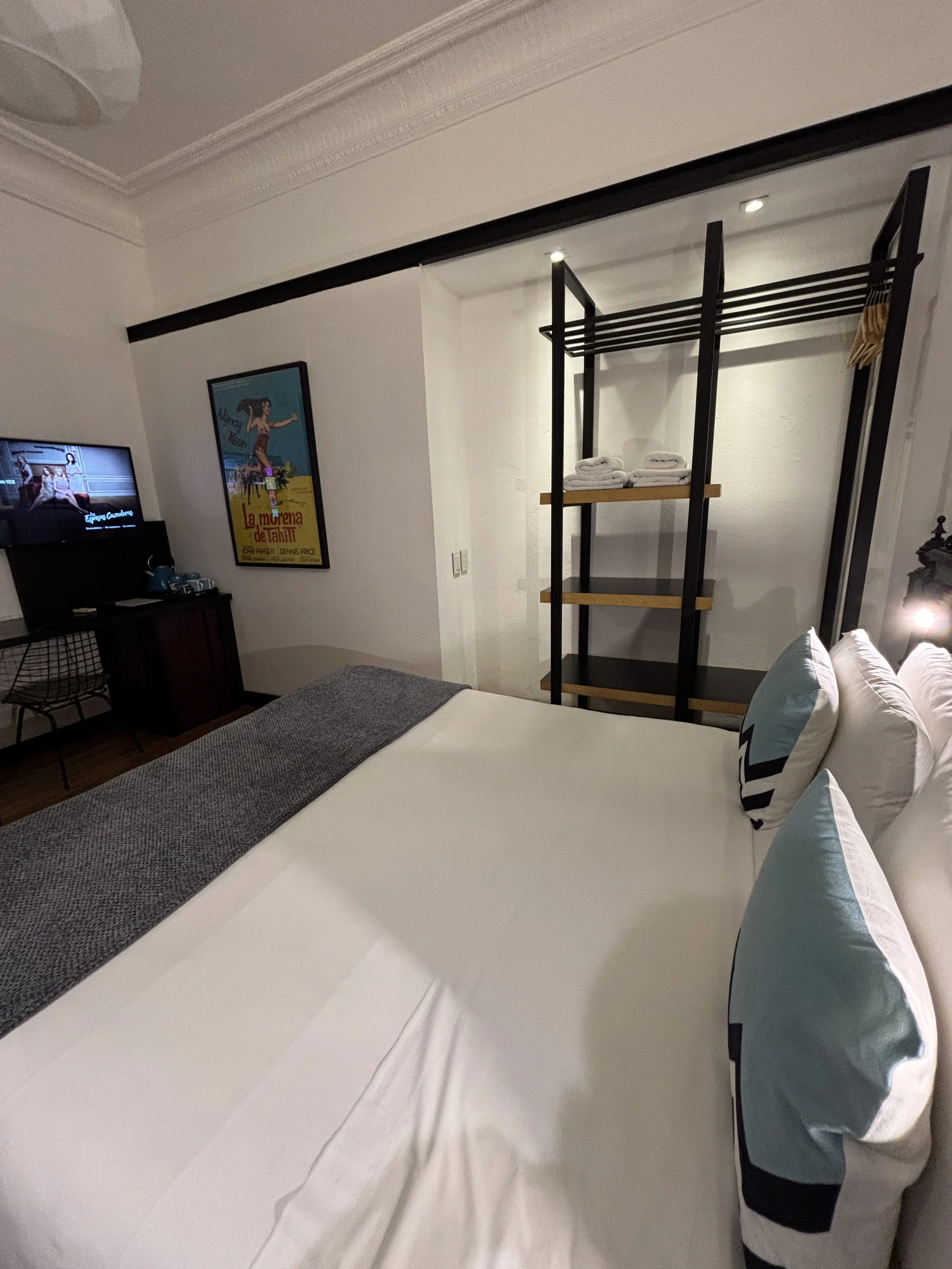
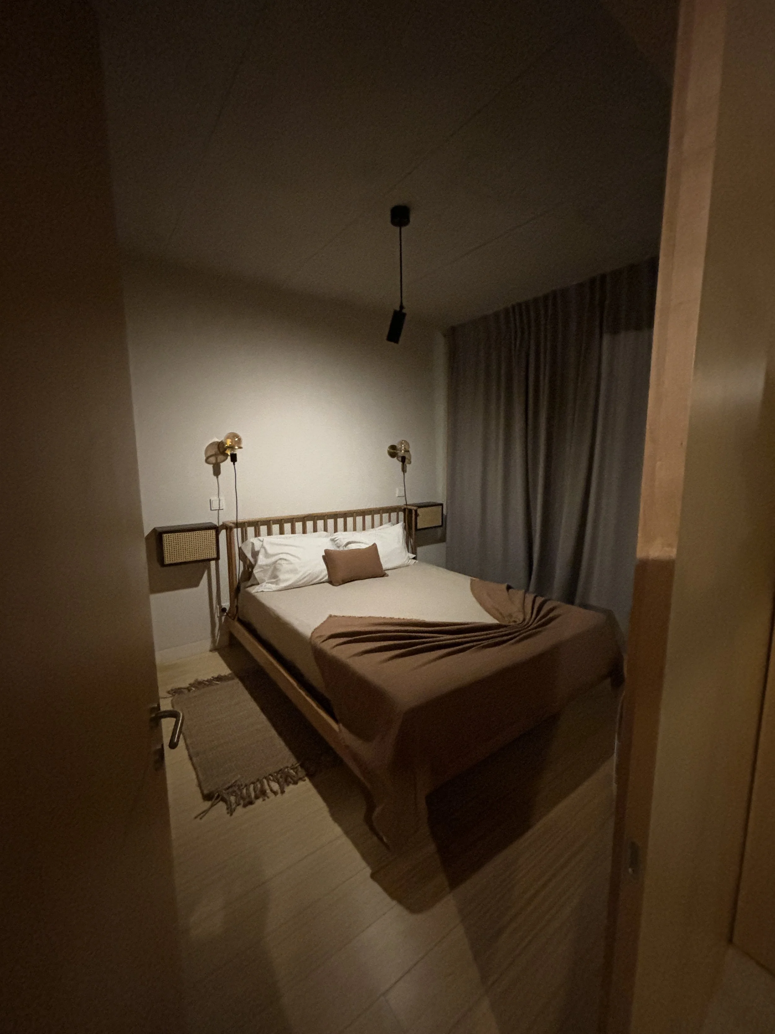
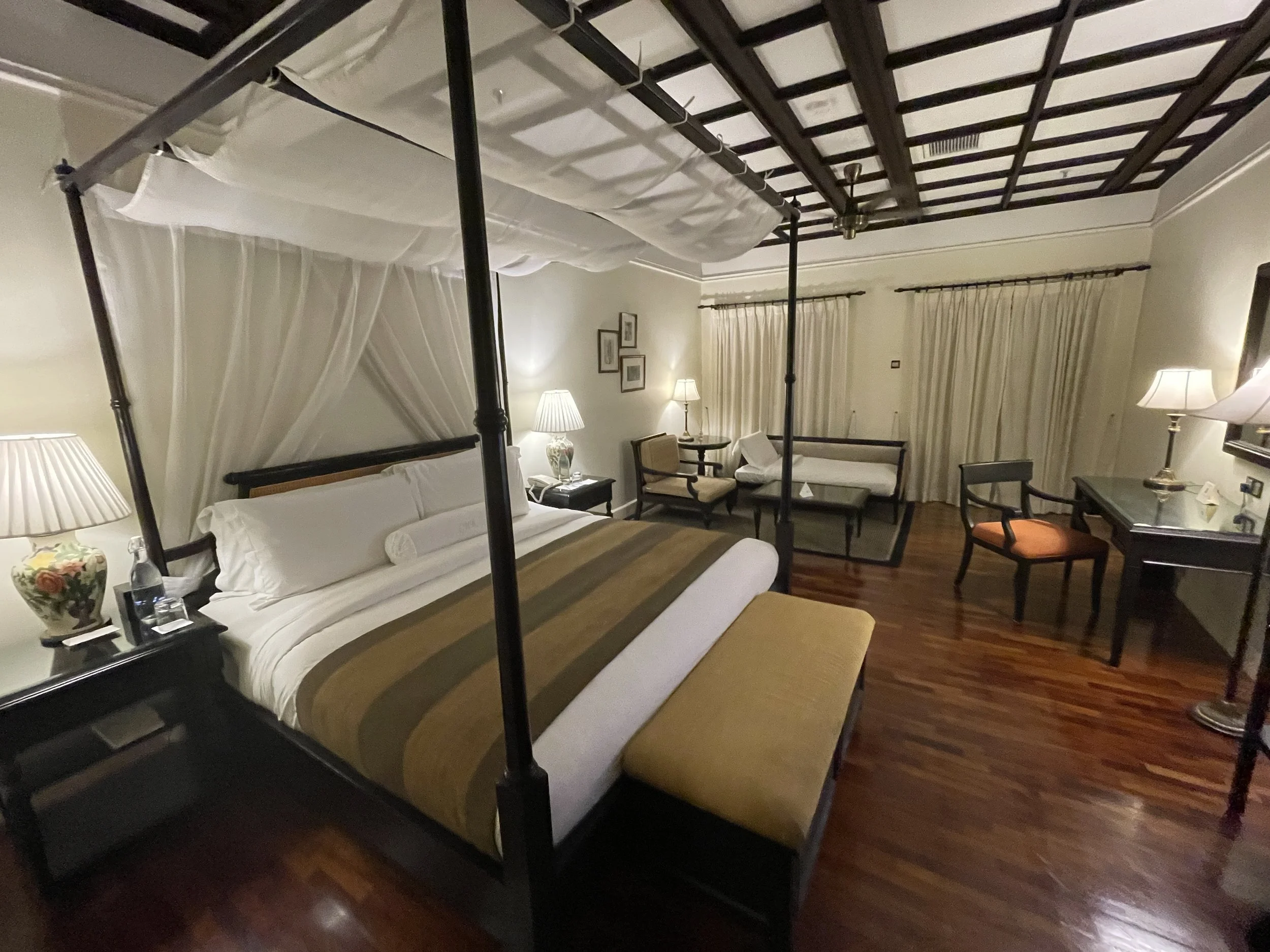
The hotel is in a perfectly restored early 20th C. building, with the reception and some of the rooms on the first floor.
The interior is tastefully decorated to the slightest detail and the lady that manages was extremely nice throughout. She allowed me to check in considerably earlier than the regular time, something which simplified my logistics significantly and pro-actively provided recommendations via whatsapp about things to see in the Ciudad Vieja, as well as places to have breakfast (the hotel does not offer breakfast in its premises) and where to have lunch and dinner.
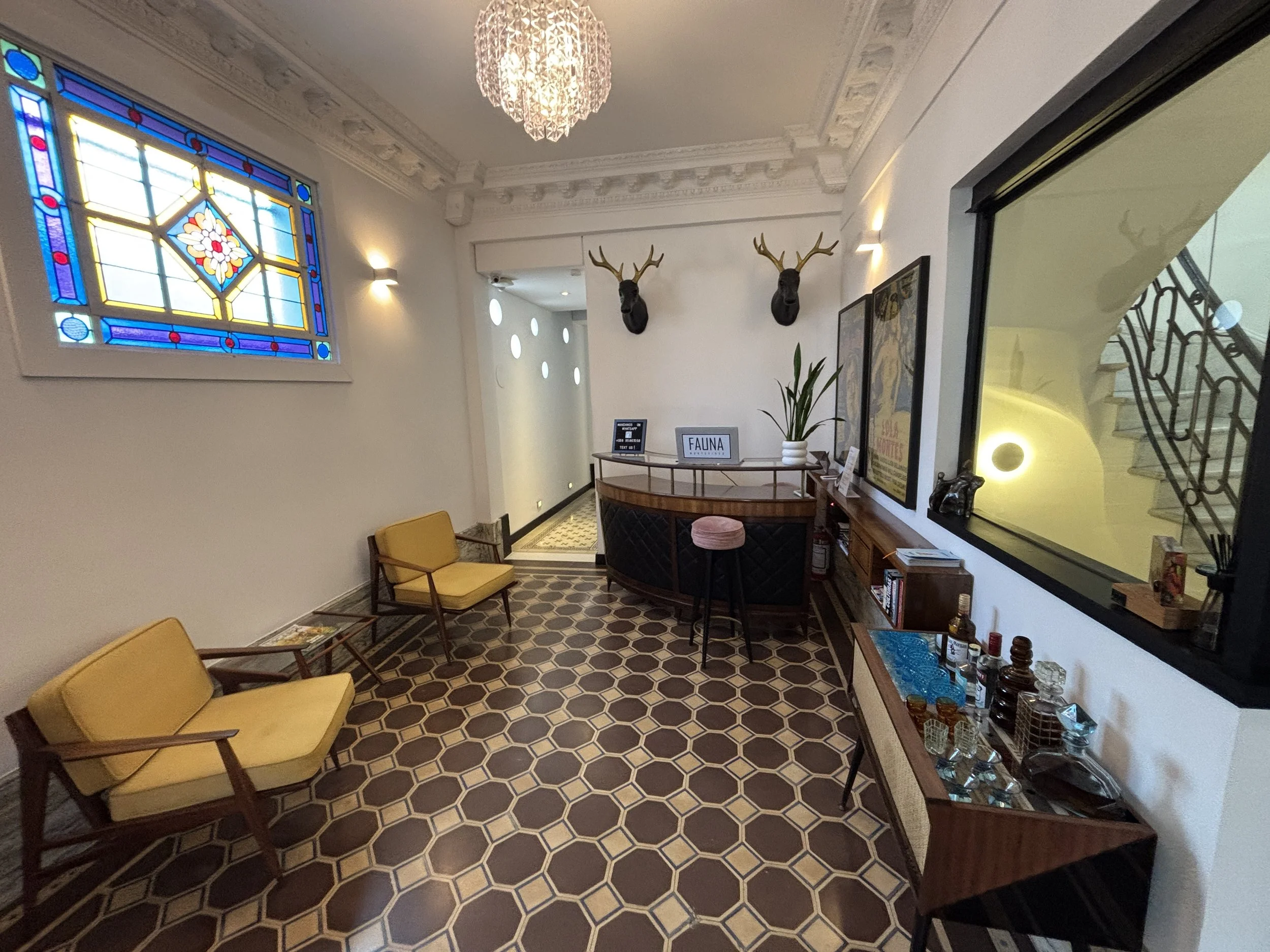

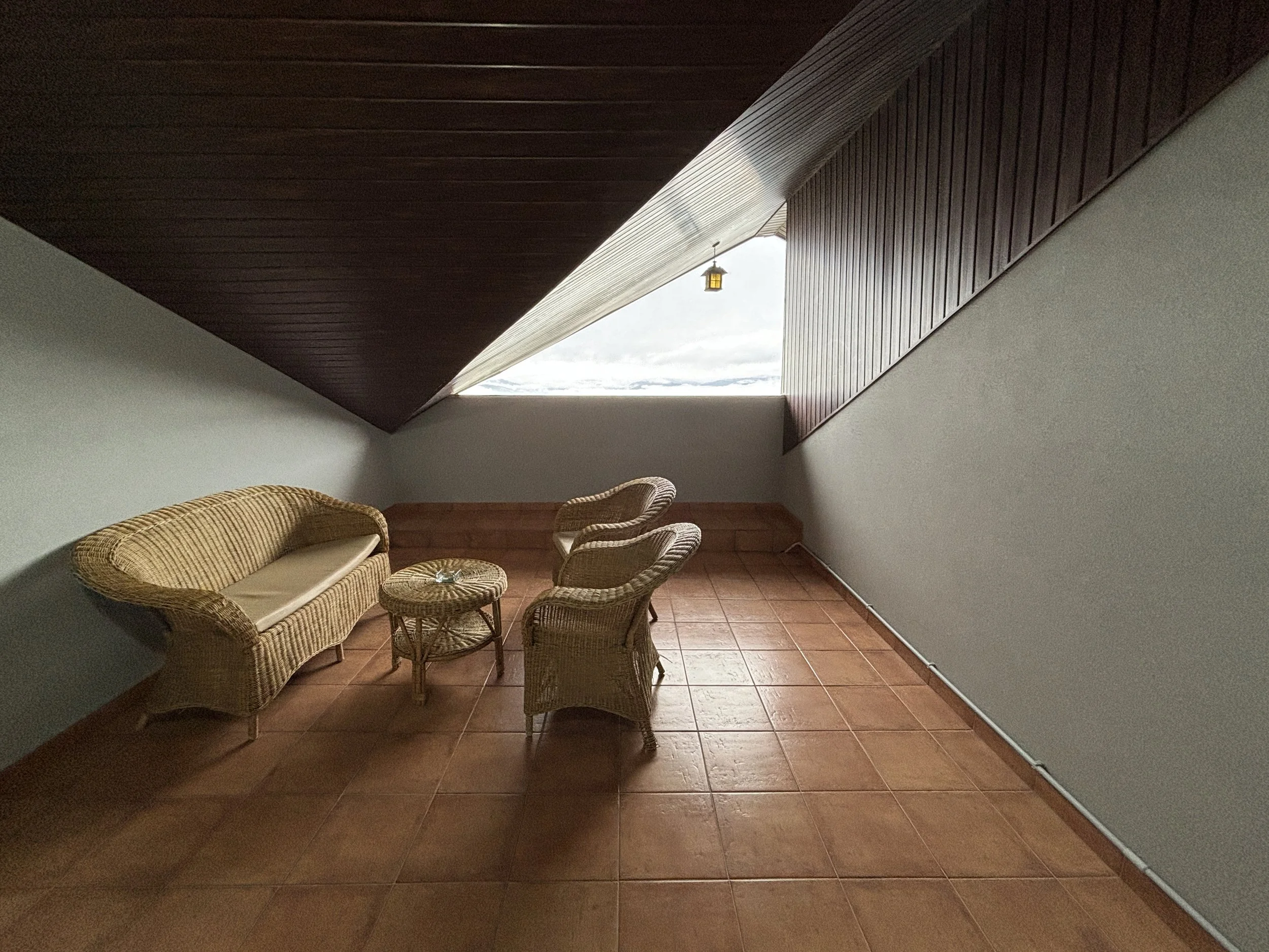
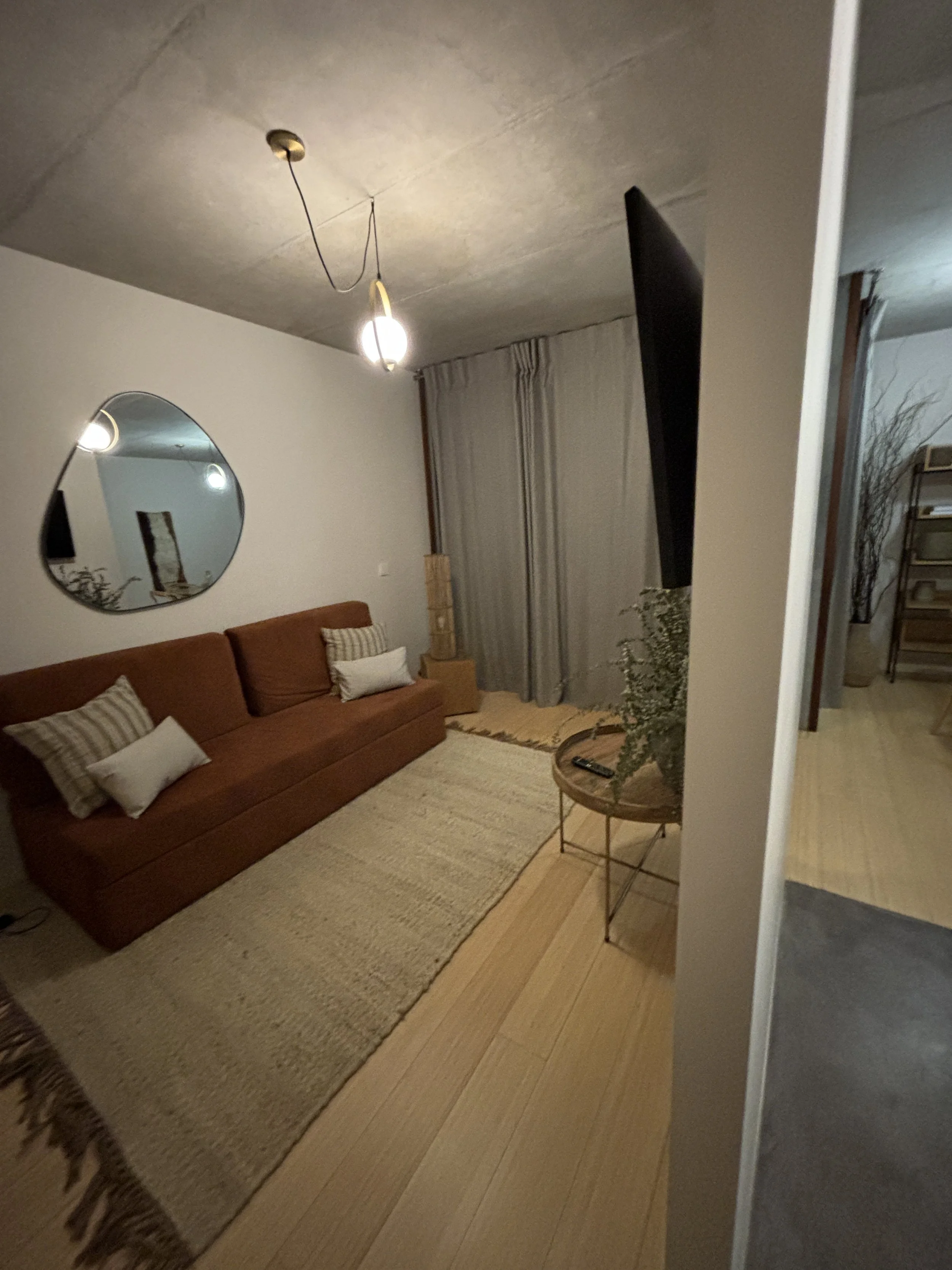
The hotel has a living room which manages to provide a really cozy atmosphere and it is even fitted with a liquor bar which is free to serve (in moderation, of course!). It was a bit chilly outside due to this visit being in the middle of the southern winter, and the heating in the premises provided just the right contrast.
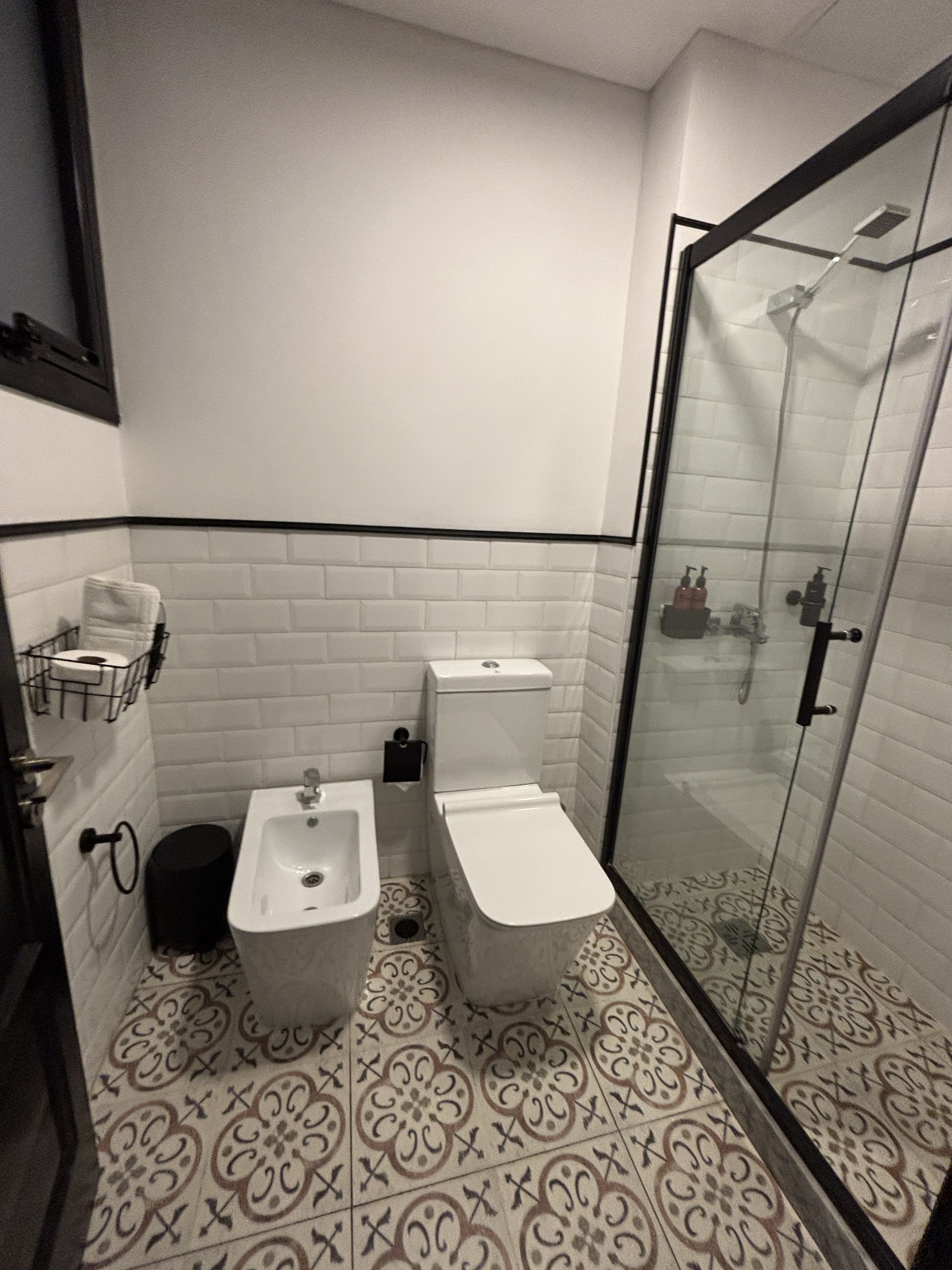
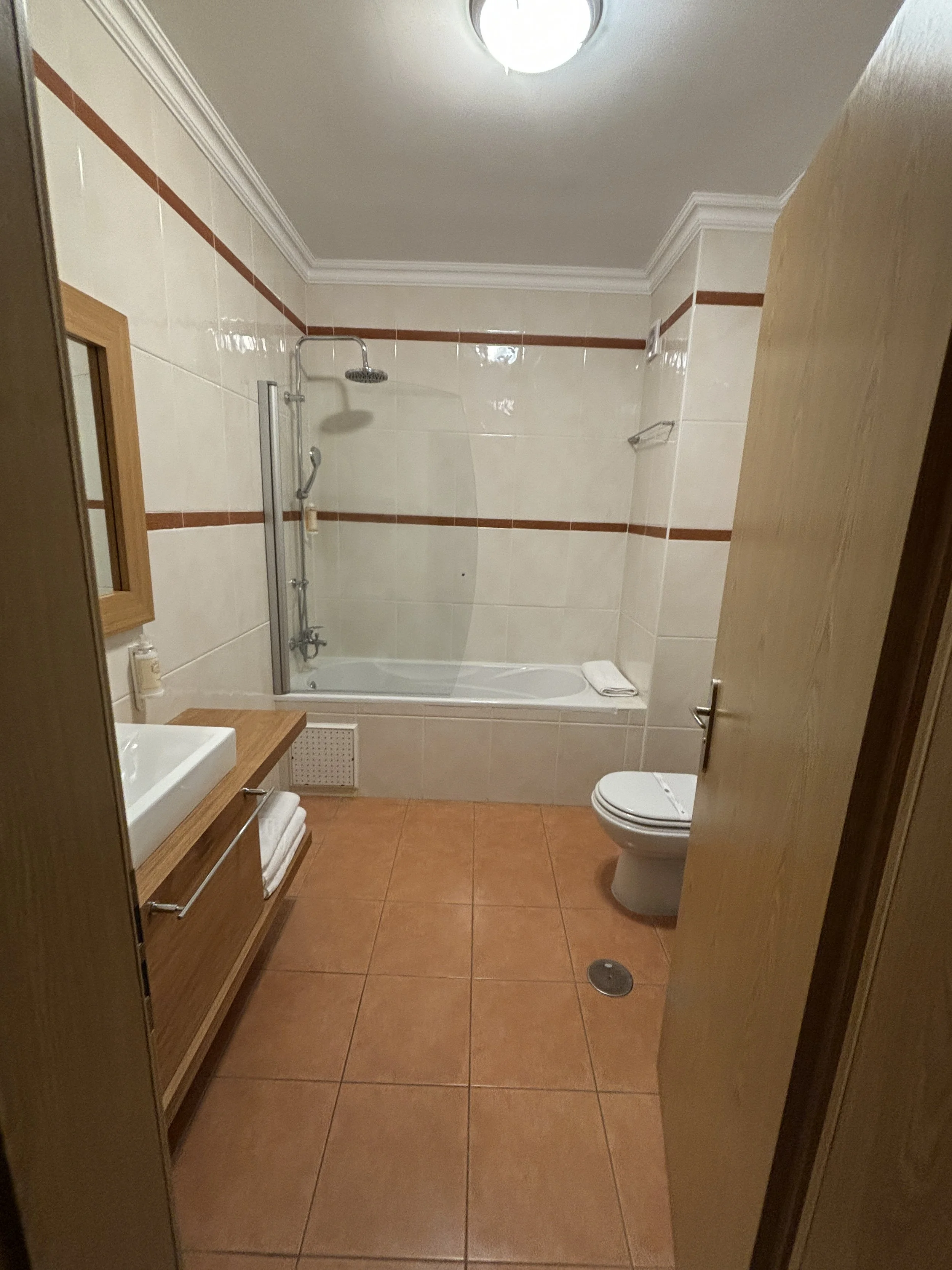
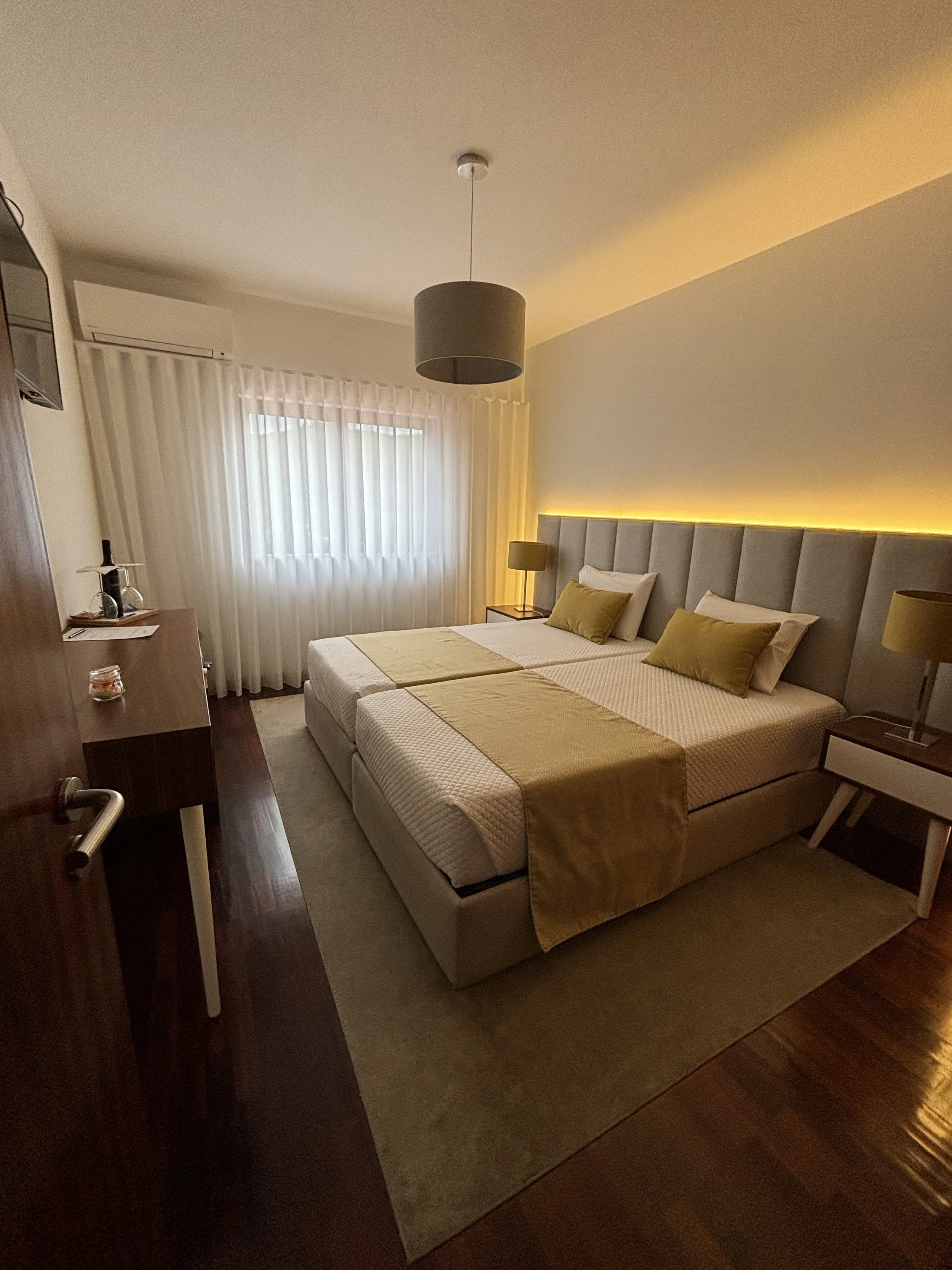
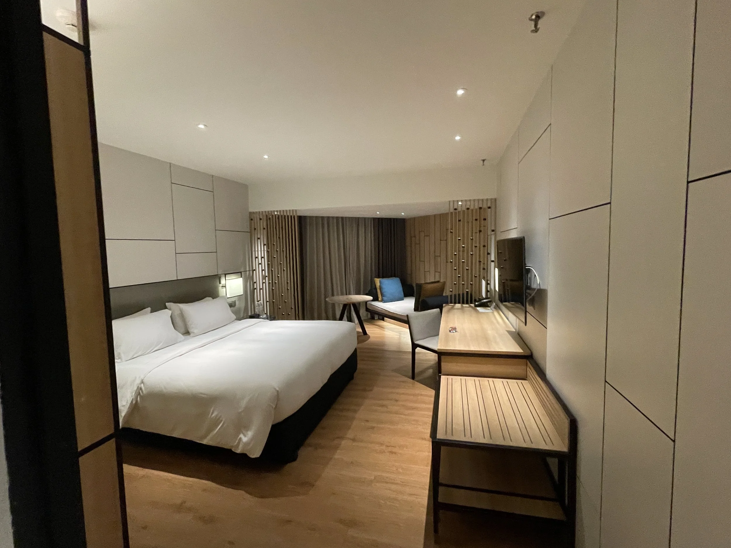
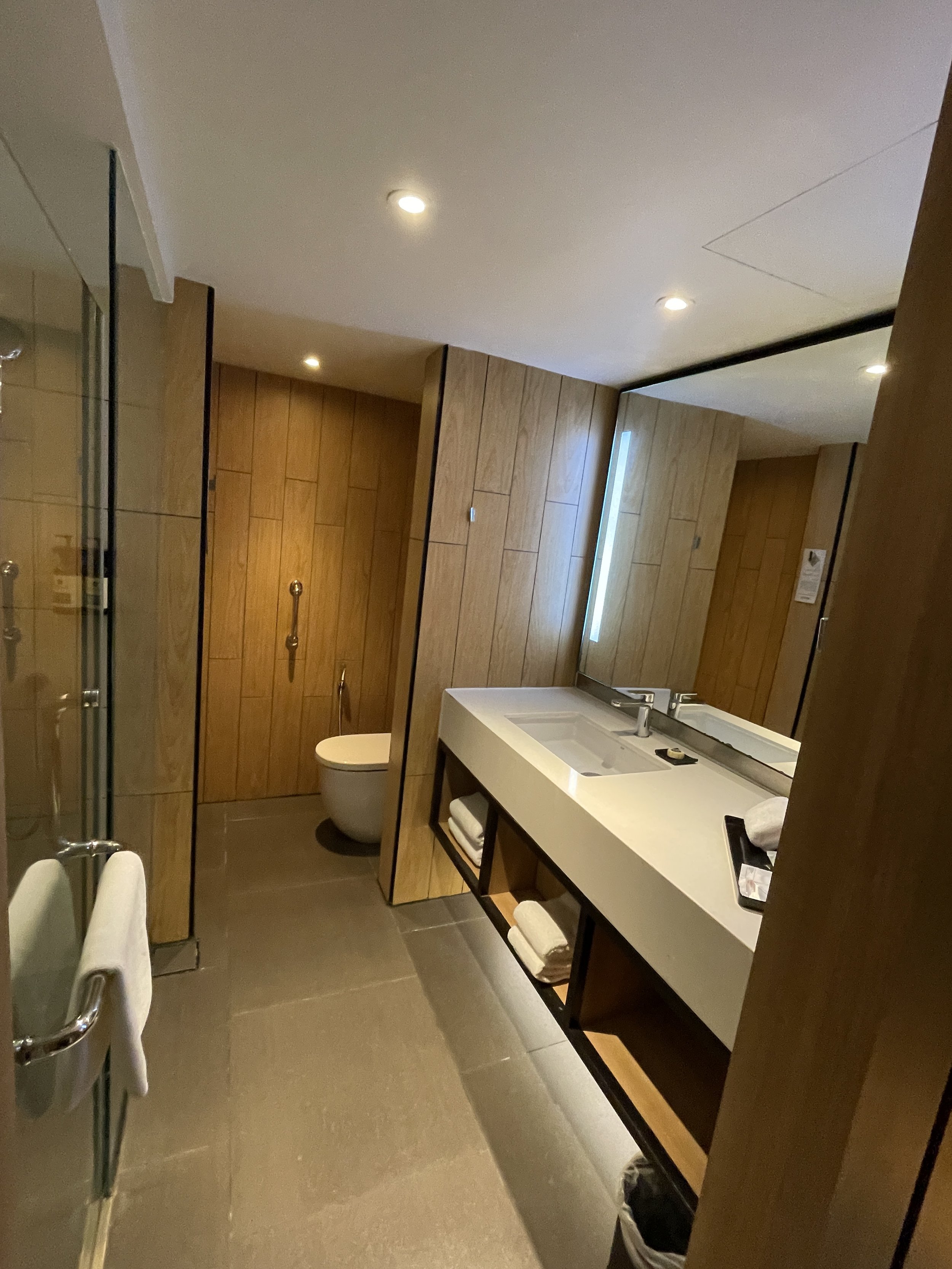
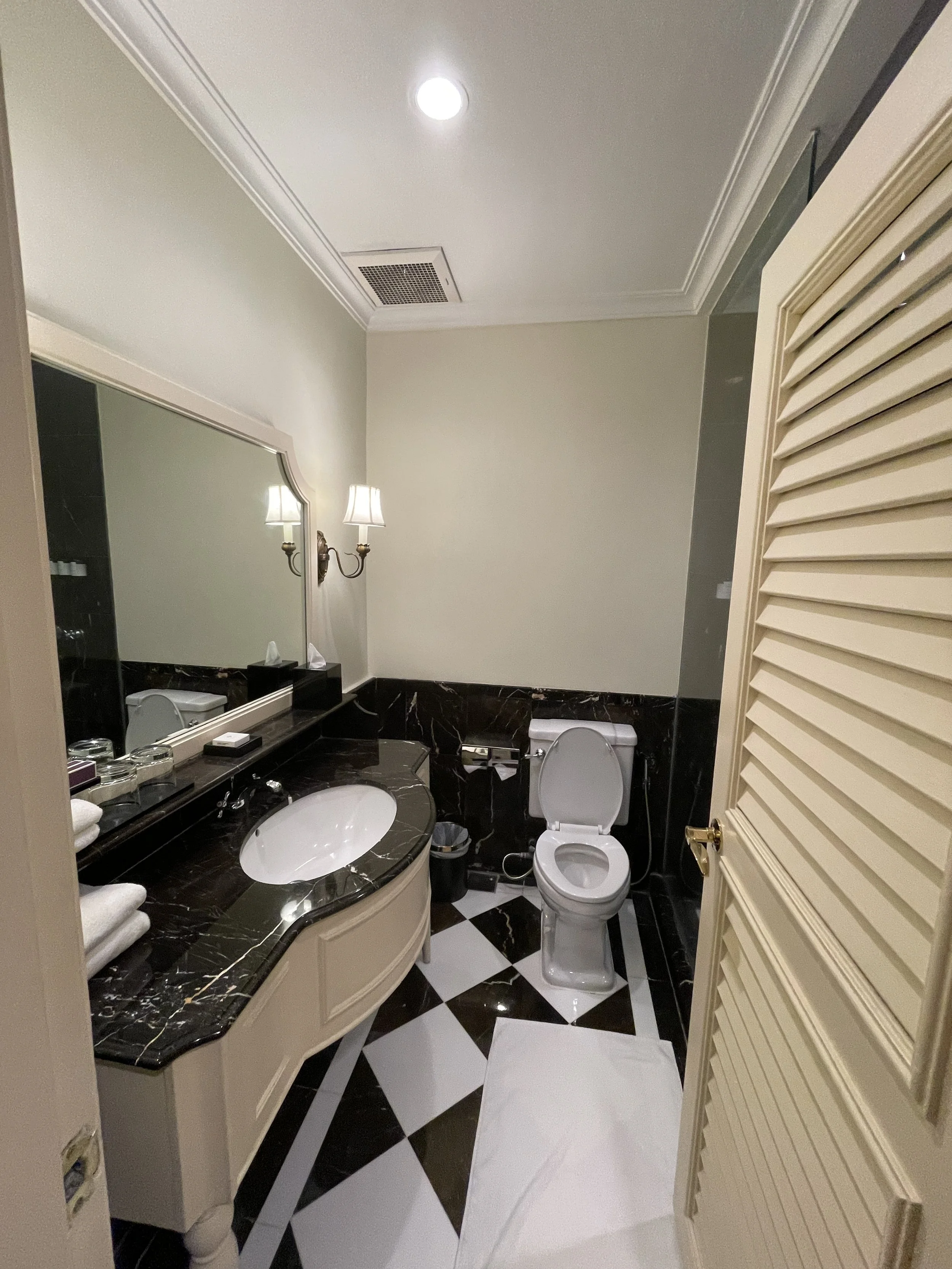
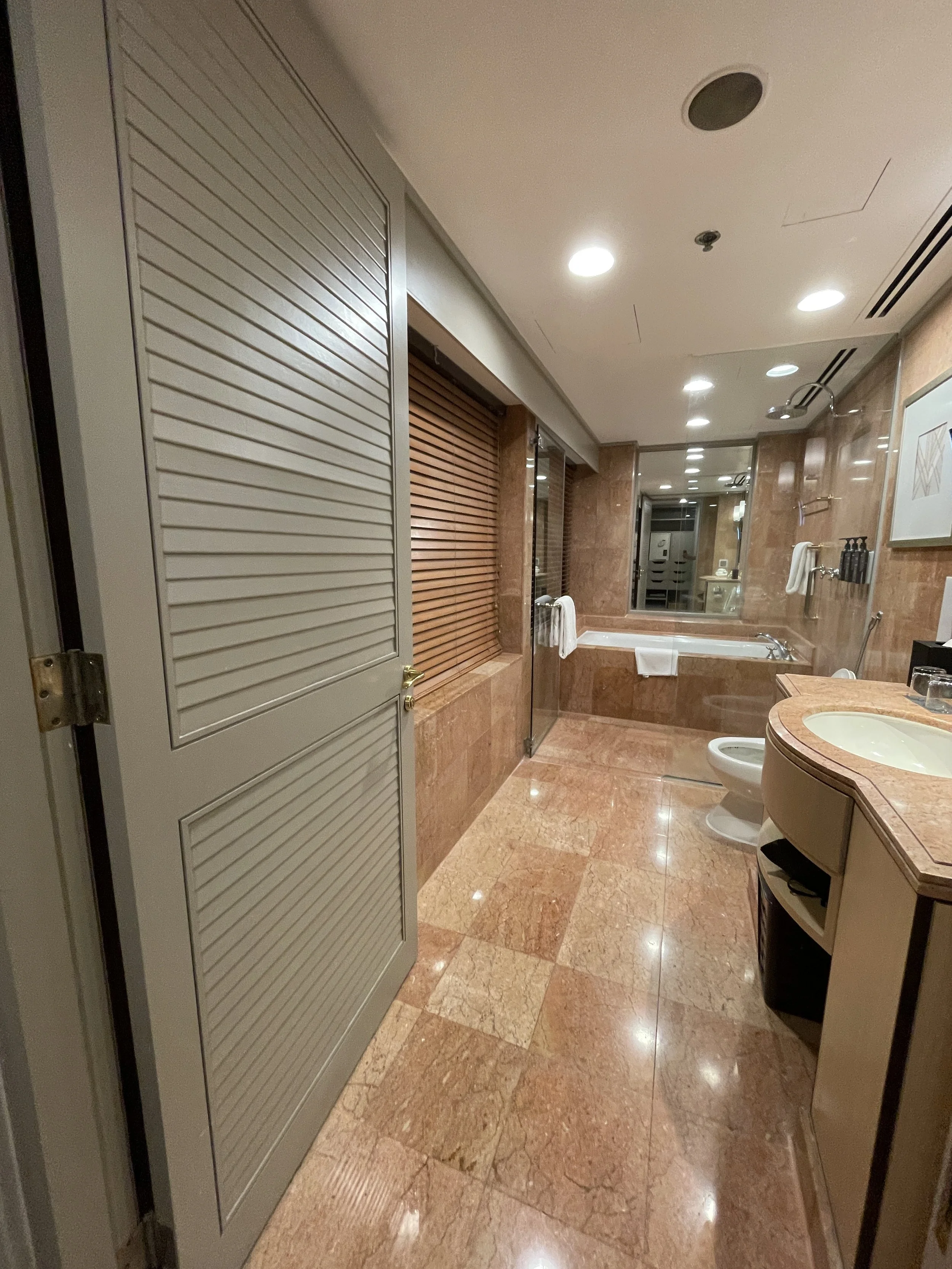
The room was spotlessly clean and tastefully decorated, modern, with a few traditional elements woven in for good measure.
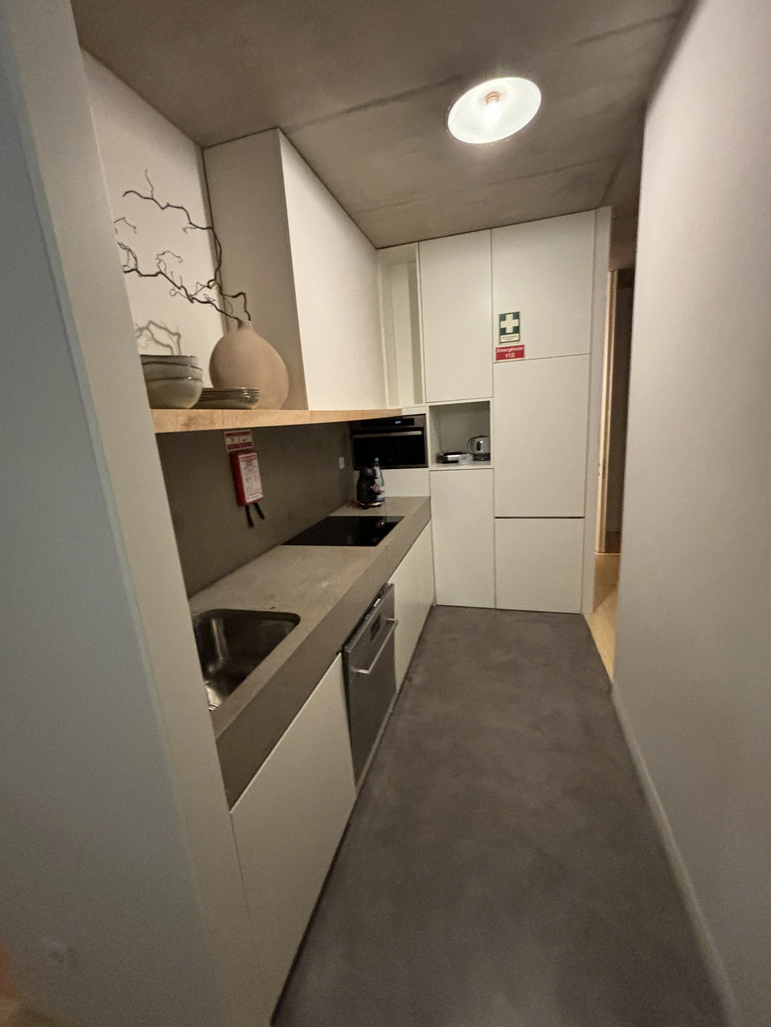
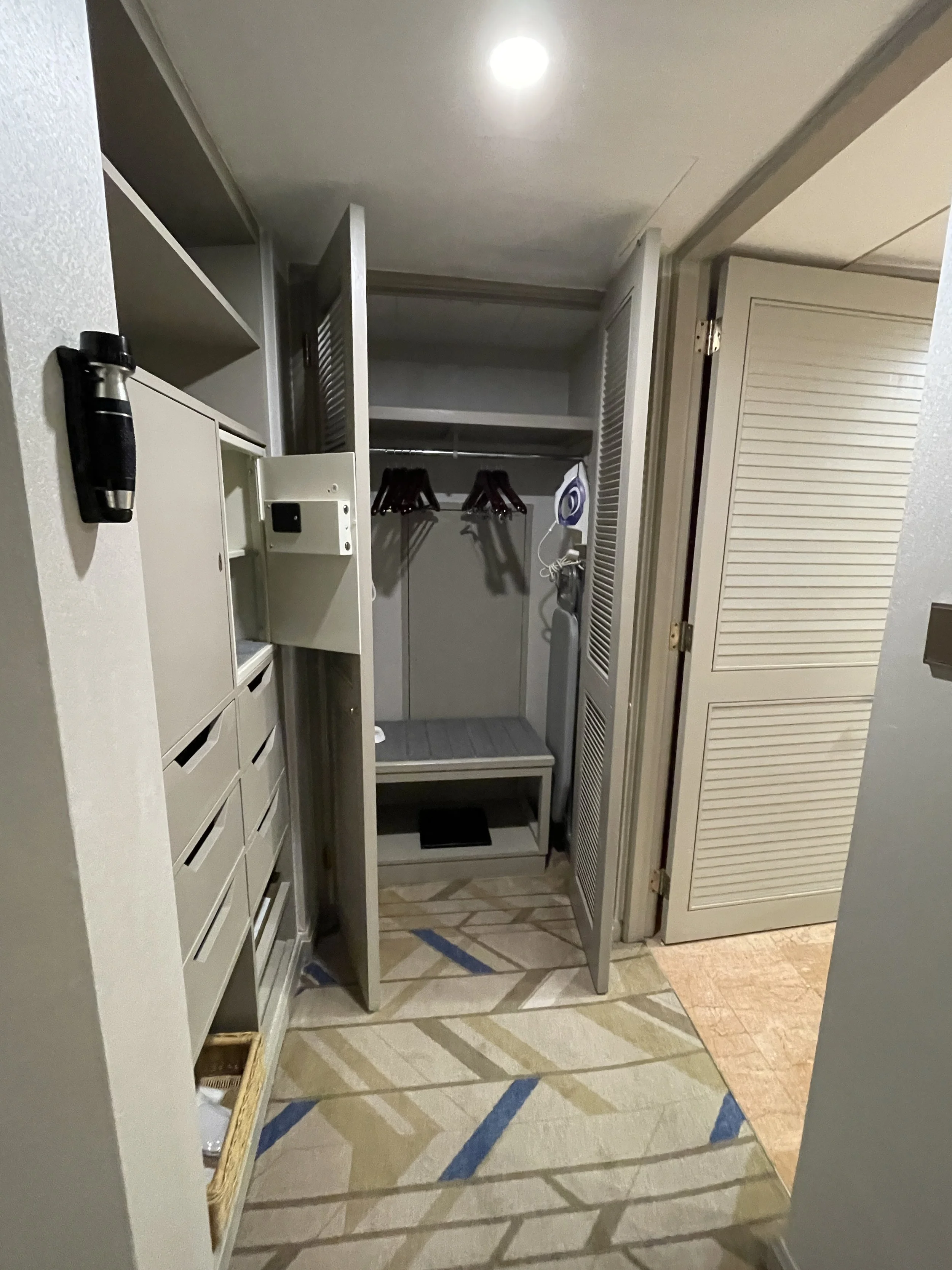
The finishings, materials and general quality standards were also excellent throughout; there was not even a scratch anywhere. I also liked, btw, the layout of the shelves, which makes it quite easy to store your things while keeping them easily accessible at all times.

The room had also a work desk, well stocked with tea and coffee (including a designer kettle!), a fridge with complimentary still and sparkling water and a flat screen TV with Netflix connection included (I didn’t really have time to use it, but some readers may find this information of use).
So, happy to give my five stars, as well, to FAUNA Montevideo and don’t forget to check it out if planning a trip to the city. You may be surprised by the cost per night of everything I just told you!
Exploring modern Montevideo
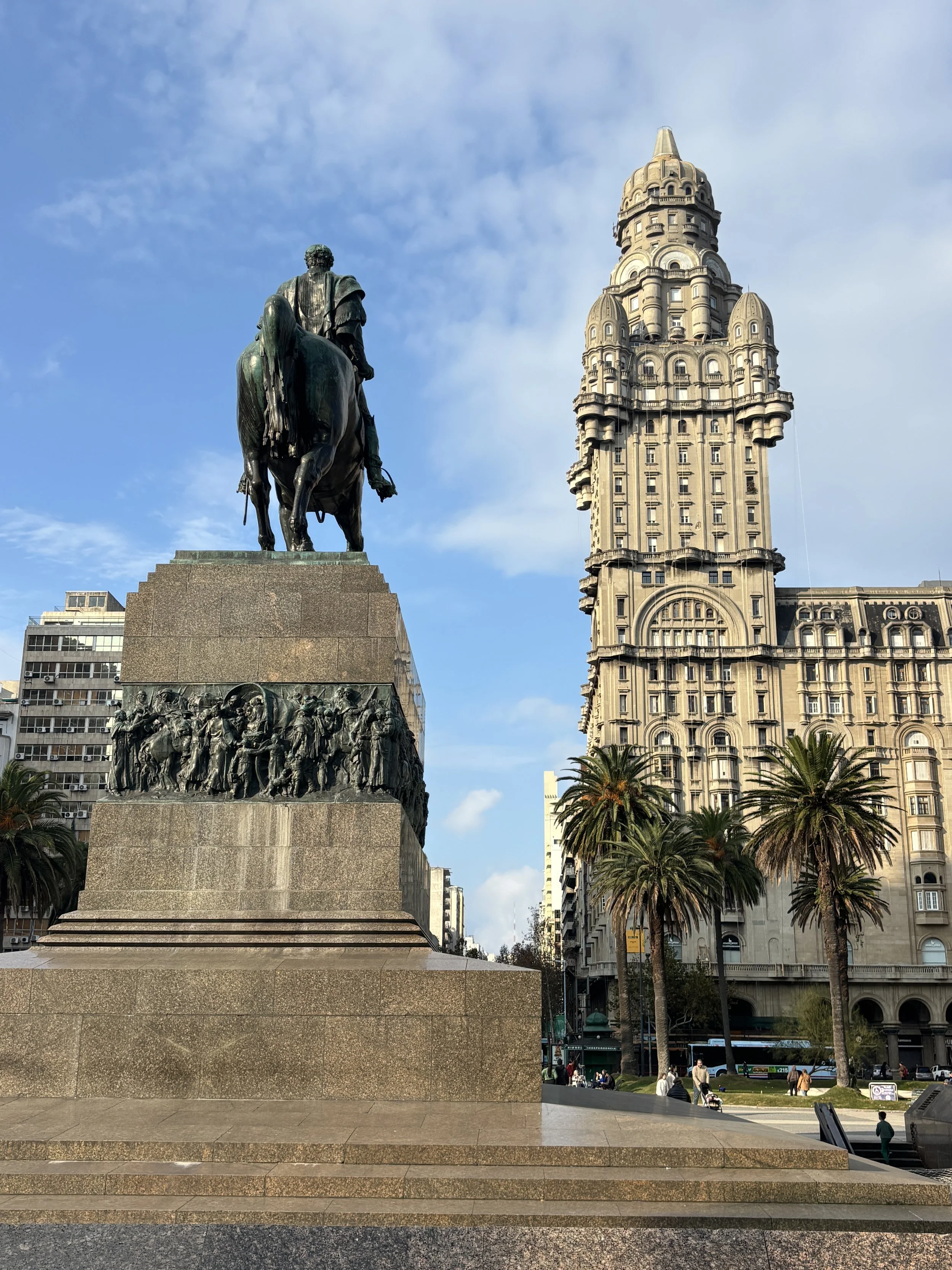
Plaza de la Independencia
So, now that we have seen Montevideo’s old town, it is the turn of its modern part and the first stop in our itinerary is the Plaza de la Independencia (Independence Square).
This square not only acts as the nexus between the old and modern towns, but it is also the closest it gets to a central node of the city.
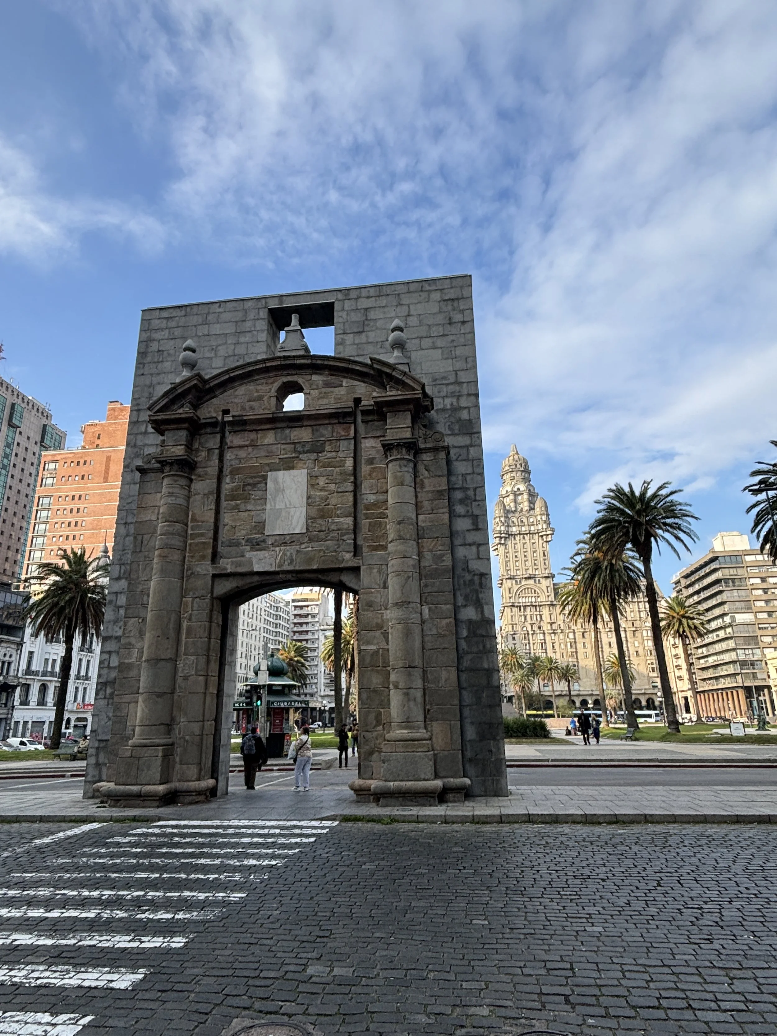
It is here that you find the gate of the old walled town, the “Puerta de la Ciudadela”, which stands now at its original location, the only remnant of the old fortification. The gate, however, has had a more agitated life than it looks. In 1877 it was dismantled stone by stone and moved to another location and it was only in 1959 that it was again moved to its original spot.
The walls are gone, but, as you can see below, there are other wall-like structures nowadays guarding the entrance to Montevideo’s Ciudad Vieja.

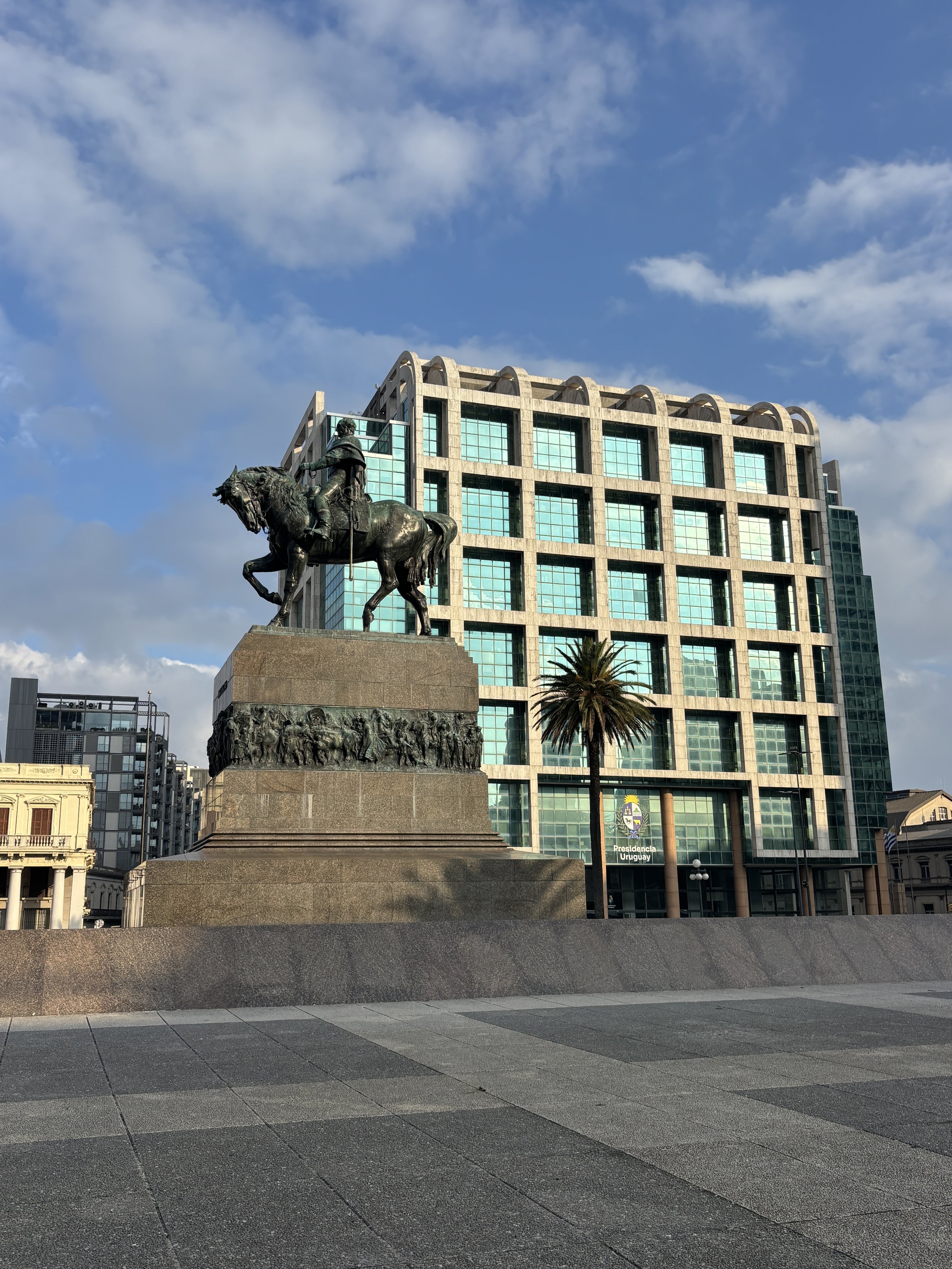
But the most iconic and prominent building on Montevideo’s Plaza de la Independencia is, without a hint of doubt, the Palacio Salvo, which you can see in the picture below at the opposite end of the square from the citadel gate.
The Palacio Salvo, which is named after the businessmen brothers that commissioned it, was, at the time of its construction, in 1928, and for a bried period of time, the tallest building in South America, standing at 105 meters.
Its style is rather difficult to categorize, since it mixes elements of all sorts of styles (neo-Gothic, Renaissance, Neoclassical, Art-Déco) to come up with its very own character.
Also interesting is the fact that the Palacio Salvo has a twin across the Río de la Plata in Buenos Aires, the Palacio Barolo, designed by the same architect, Mario Palanti. There were even plans to link the two visually with a beam of light. That would have been something worth seeing!
It is possible to get to the top of the Palacio Salvo by taking one of the guided tours, which run at specific times (for example, before 1pm on Saturdays). I couldn't make it due to schedule issues, but this is something I would certainly have liked to do!

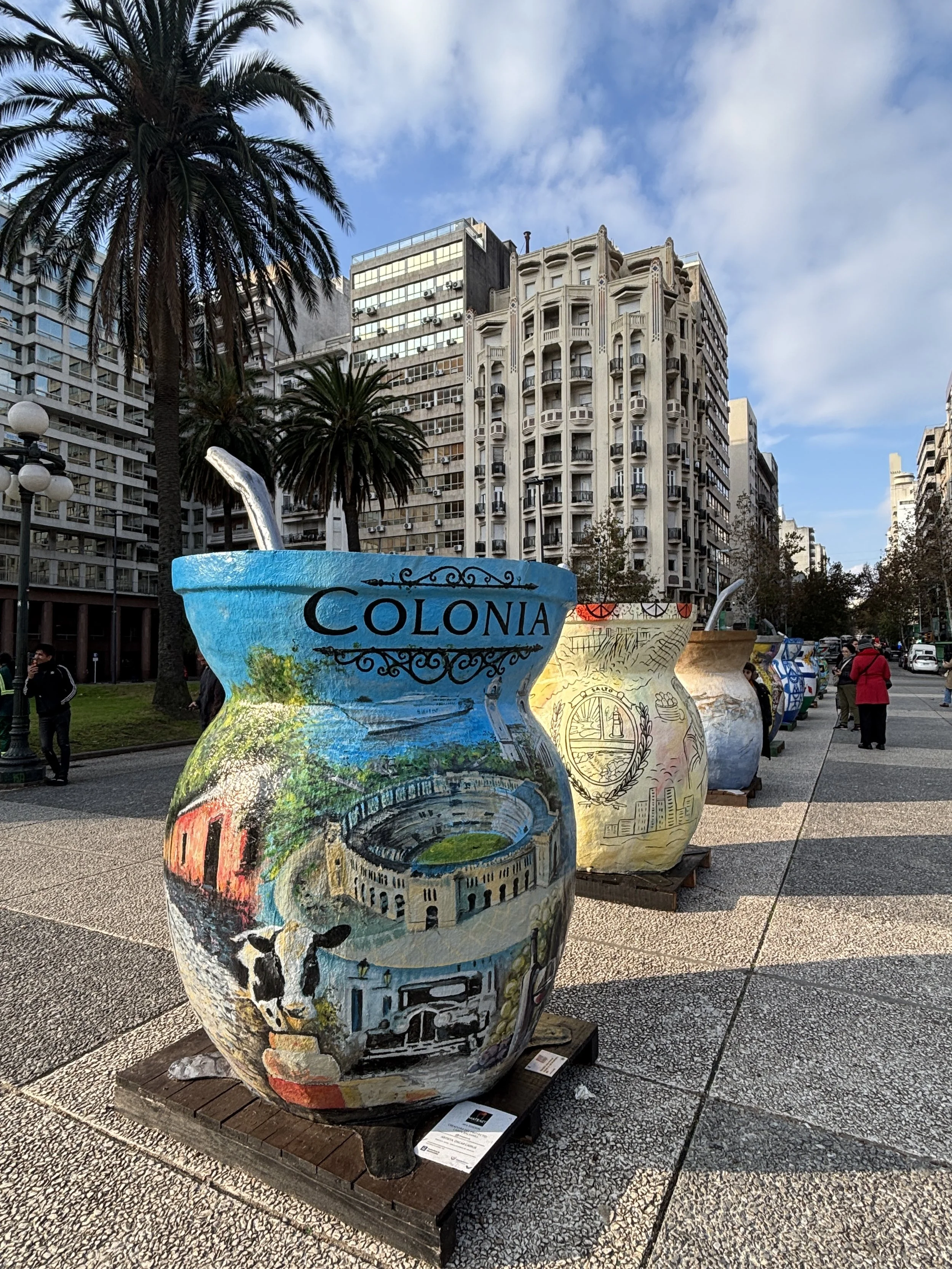
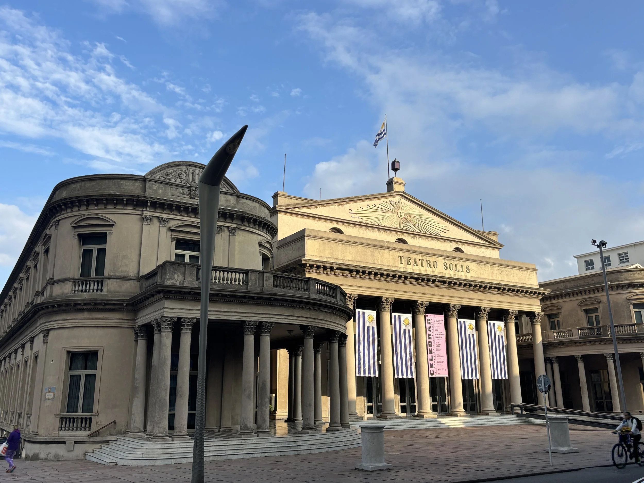
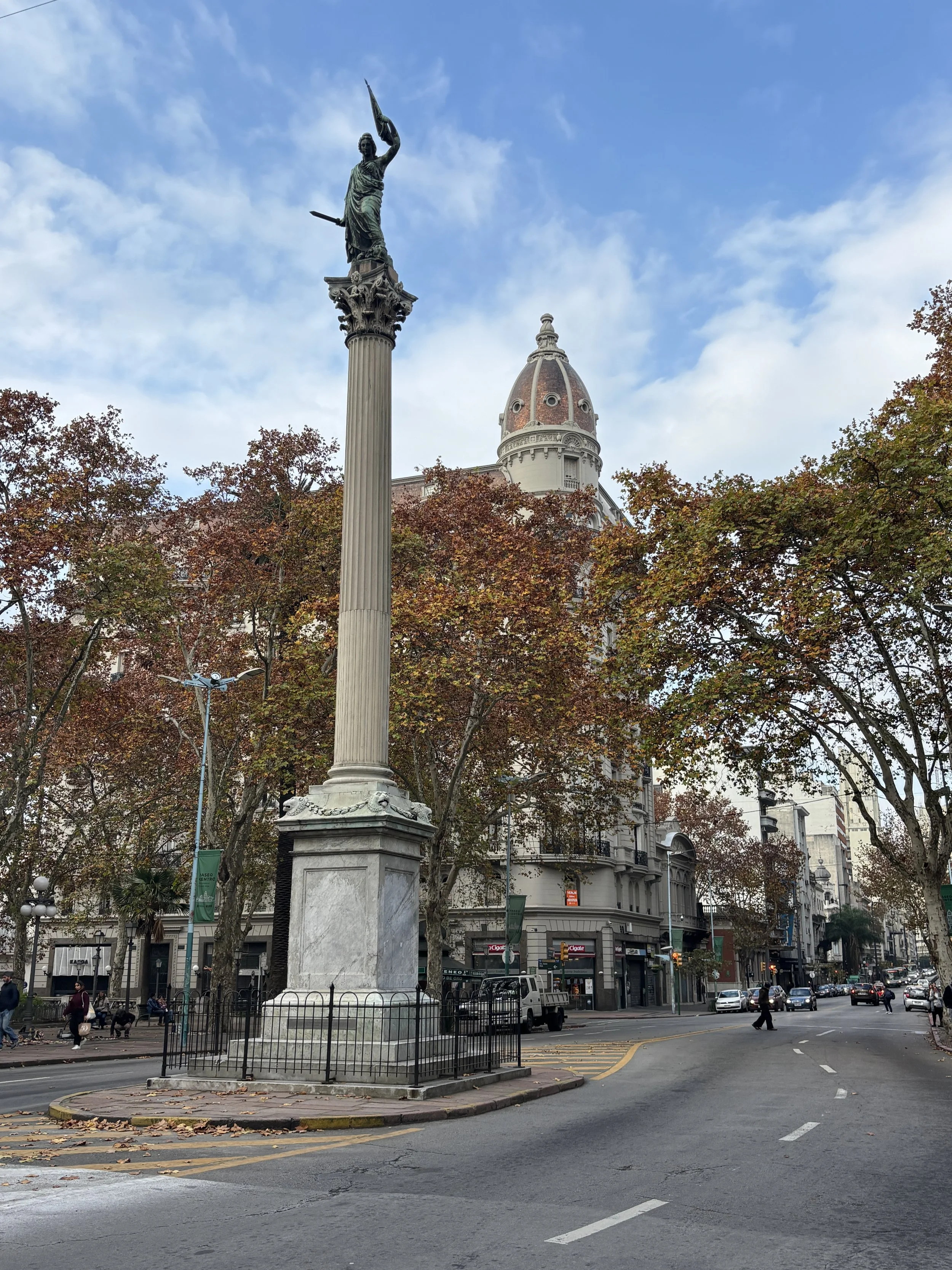
Here below, other interesting elements on Plaza de la Independencia: some oversized yerba mate cups (one of them featuring the bullfighting ring in Colonia del Sacramento, which I covered in my previous Uruguayan post), the statue of national hero Artigas, and the Teatro Solís, which can also be visited with a guided tour.
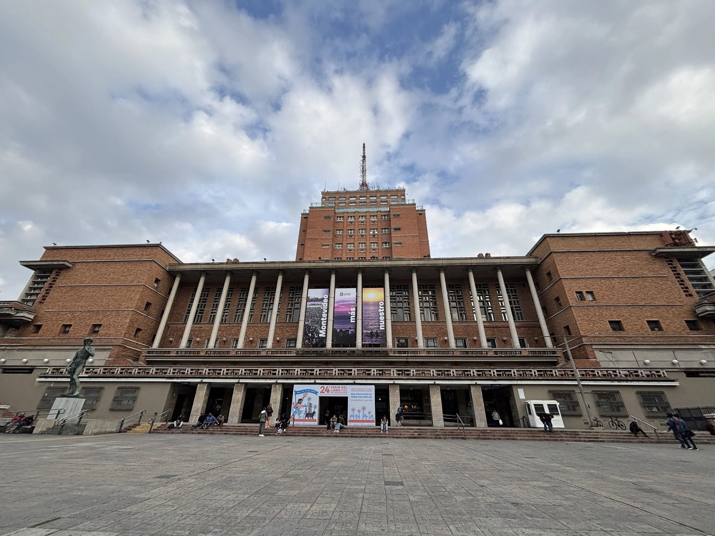
Another city view point is the top of the townhall (“Intendencia de Montevideo”), the red brick building you can see here above. This is further along the “18 the Julio” Avenue, which is the main thoroughfare running through the middle of downtown Montevideo.
The column on the left is also in the area.
Mercado Agrícola de Montevideo: a walk through the northern neighbourhoods

This produce market is a focal point in the northern part of the city center. I visited it in the morning as part of a walk from the area of Tres Cruces to explore this part of the city.
The maket stalls were just getting ready for the day, so it was all very quiet. I had breakfast at one of the cafés.
I would say, if you are short of time, you can skip this one!
The northern part of town has a totally different character, with many low-lying houses and broad and surprisingly quiet streets.
In this regard, maybe it was due to it being a weekend, but in general I saw few people on the streets in Montevideo. It is true, as some Uruguayan friends pointed out to me, that this is a very low density country, with 3.5 million people living in a territory almost the size of Britain, but didn’t expect the capital city to feel that empty as well!
The seaside neighbourhoods: Palermo, Punta Carretas, Pocitos, Carrasco
To be totally honest, my experience of this part of the city was rather fleeting: I did walk from the old town to Pocitos in one afternoon and the next day I had also the chance to drive by in an Uber all along the coastal road, also from the old town to the airport, which gave me a good panoramic ride of the whole seaside riviera of Montevideo.
This is, however, a part of the city that, while it doesn’t have much in the way of historical buildings or landmarks, appears to be rather pleasant, way more affluent than the old town and the northern districts and well suited for outdoor activities.
I had limited time to explore this part of the city, but it is well worth it if the weather is nice and wish to spend some time outdoors.
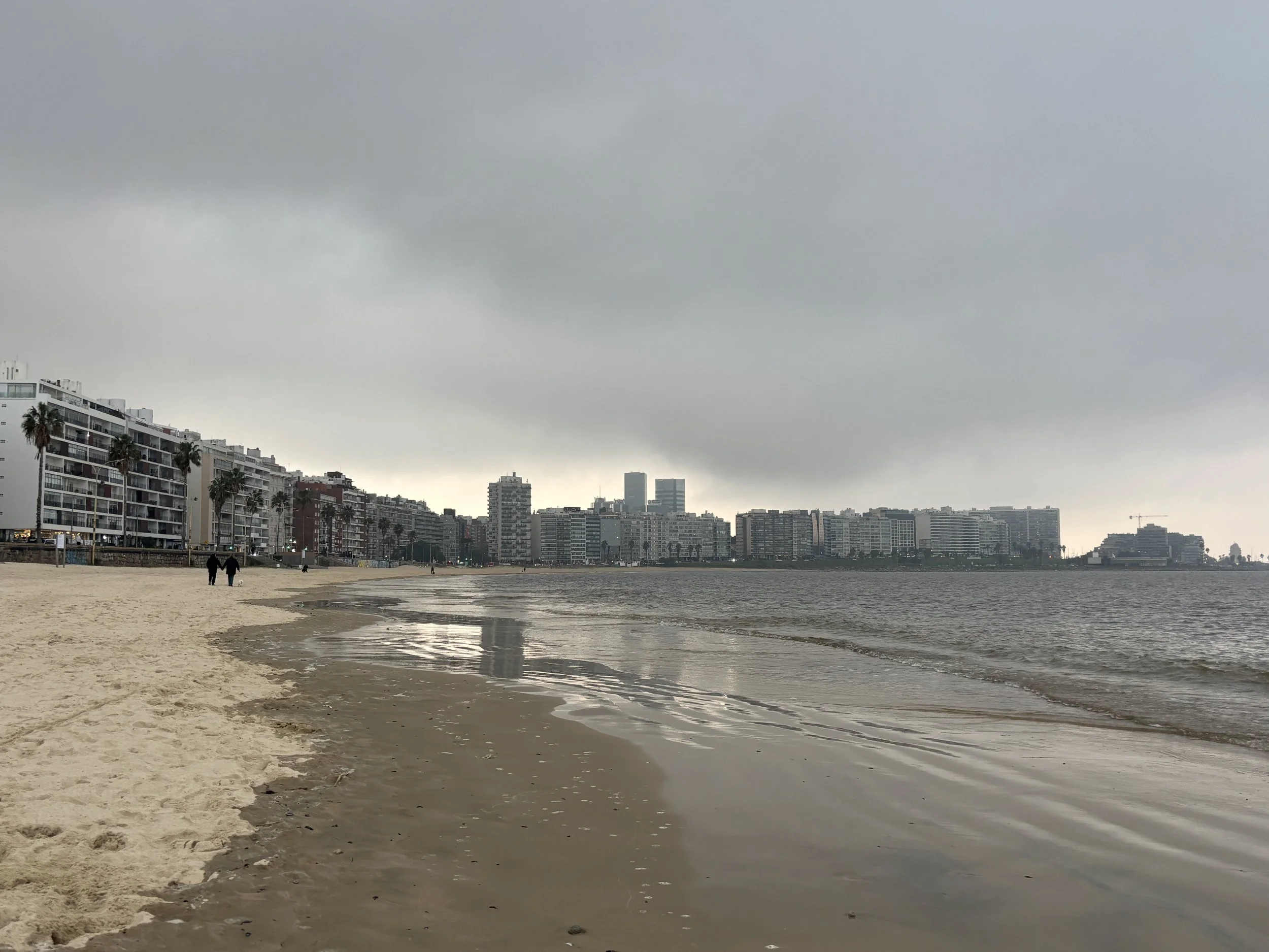
The southern side of Montevideo is where most of the best beaches area and the area is also peppered with many parks and recreational areas. For example, here above you can see the view from Punta Carretas (a small peninsula which is the southernmost tip of the city) and below you can see the beach at Pocitos, which is a fancy residential-commercial district to the east of it.
For many purposes, the area around Pocitos has become like a second downtown. There is even a modern business district next to it, with the typical glass and steel towers and the like.
The Montevideo riviera continues all the way east towards Carrasco, another fancy neighbourhood located near the airport, in a succession of beaches and residential areas.
Great place to eat in Carrasco
Restaurante García
Av. Alfredo Arocena 1587, 11300 Montevideo
And I would like to close this post with another restaurant suggestion: yet another place where it is possible to eat a proper Uruguayan asado, albeit in a bit more formal setting than at Mercado del Puerto, but one with a more local crowd.
The cooking here is not done in the open, but the results are equally impressive, as you can see in the following pictures.
The restaurant is in the main street of Carrasco, next to the beach, so relatively far if you are in the old town, but reasonably close if staying in Pocitos or one of the districts in the eastern part of the city.


Top things to see in Uruguay: a day in Colonia del Sacramento

Colonia del Sacramento (which from now on I will refer to simply as “Colonia”) is one of the top things to see in Uruguay outside the country’s capital, Montevideo (which I will cover in a separate post).
In fact, you don’t even need to visit Montevideo to visit the little gem that Colonia is. Its proximity to the large international gateway of Buenos Aires, just a short ferry ride away in Argentina, makes it possible to visit as a day excursion from the Argentinian capital.
Colonia, which has enjoyed UNESCO World Heritage Site status since 1995, is one of the earliest European settlements in the territory that today is Uruguay, and one that changed hands several times between Portugal and Spain. It is precisely this liminal status between the two large Empires that dominated South America during the Colonial Era which confers to Colonia its unique character.
To be fair, the historical centre of Colonia is pretty small, but this also makes it perfect for a short excursion without the anxiety of leaving too many things on the table.
So, without further ado, let’s have a look at the things to and to see in Colonia del Sacramento!
Getting to and from Colonia del Sacramento:
Arriving in the ferry from Buenos Aires
This is the option that most visitors take, since Buenos Aires is not just geographically closer to Colonia than Montevideo, but it is also a far larger metropolis with many international and long-haul air connections.

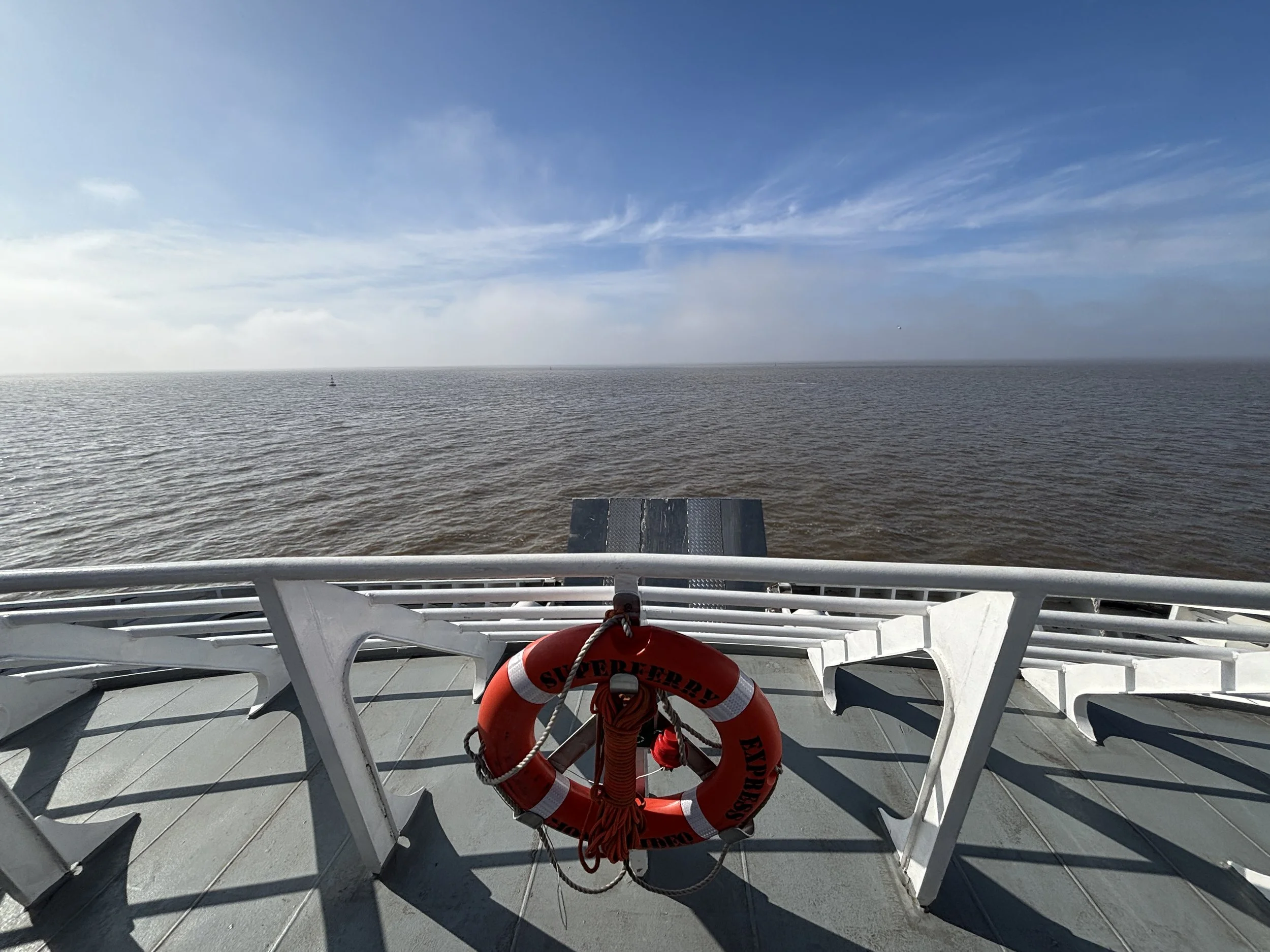
The distance between Colonia and Buenos Aires is some 40km as the crow flies across the Rio de la Plata, the large estuary that separates Argentina from Uruguay.
As of June 2026, there are two ferry companies operating the service, Buquebus and Colonia Express, each offering some 4-5 daily services in each direction (it is possible that there is some seasonality in the service, I will leave it to you to check it out!). Pricing can vary a bit depending on the time of the booking but it is roughly in the $25-50 range per person each way. Some ferries are faster than others but you should count 1.5 to 2h as the standard travel time.
Each of the ferry companies operates its own terminal in Buenos Aires, both of them quite close to Buenos Aires historical downtown, so they are pretty easy to reach.
I traveled from Buenos Aires on Colonia Express, which departs from the southern edge of Puerto Madero, the modern business area adjacent to Buenos Aires historical San Telmo district.
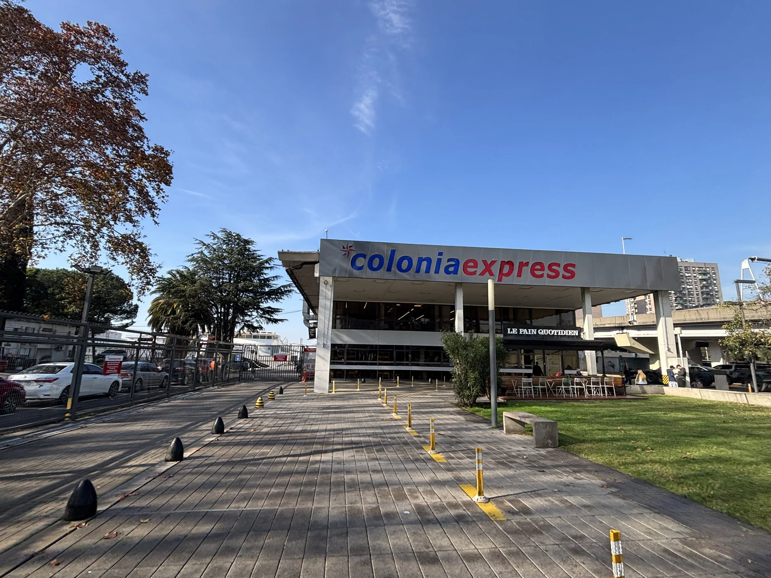
The terminal is super modern and it houses both the Argentinian and Uruguayan customs, so you get both immigration stamps before boarding the ship.
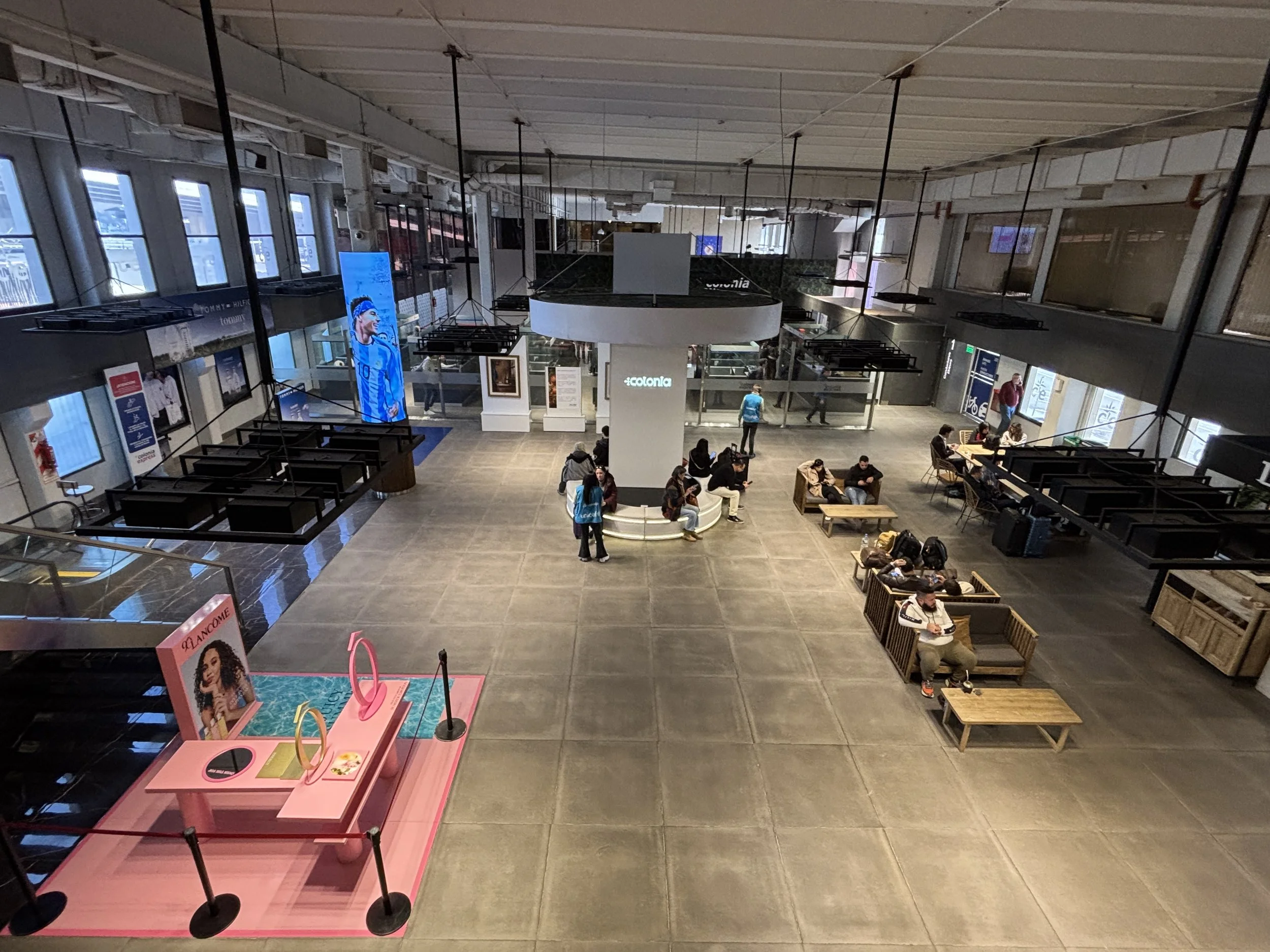
Likewise, I was positively impressed by the ship, which was also pretty modern, clean and comfortable. It has two passenger decks has a bar, a duty free shop, a currency exchange bureau and multiple toilet facilities. You can also go outside, which makes it possible to get nice views, particularly as you depart Buenos Aires, but most people just go inside after that as it can get terribly windy outside!
The arrival at Colonia is, likewise, at a modern terminal which is witihin 5-10min walk from the gates of the historical centre. At the time of my visit, the arrival terminal appeared to be undergoing some expansion or refurbishment work.
Also next to the maritime terminal there is the Tourist Information Center, housed in a stylish contemporary building in what it used to be a railway yard (the building actually re-uses some of the steel and iron elements in its design), so this is a good place to gather some information and start your visit to Colonia!

Getting to Colonia del Sacramento from Montevideo
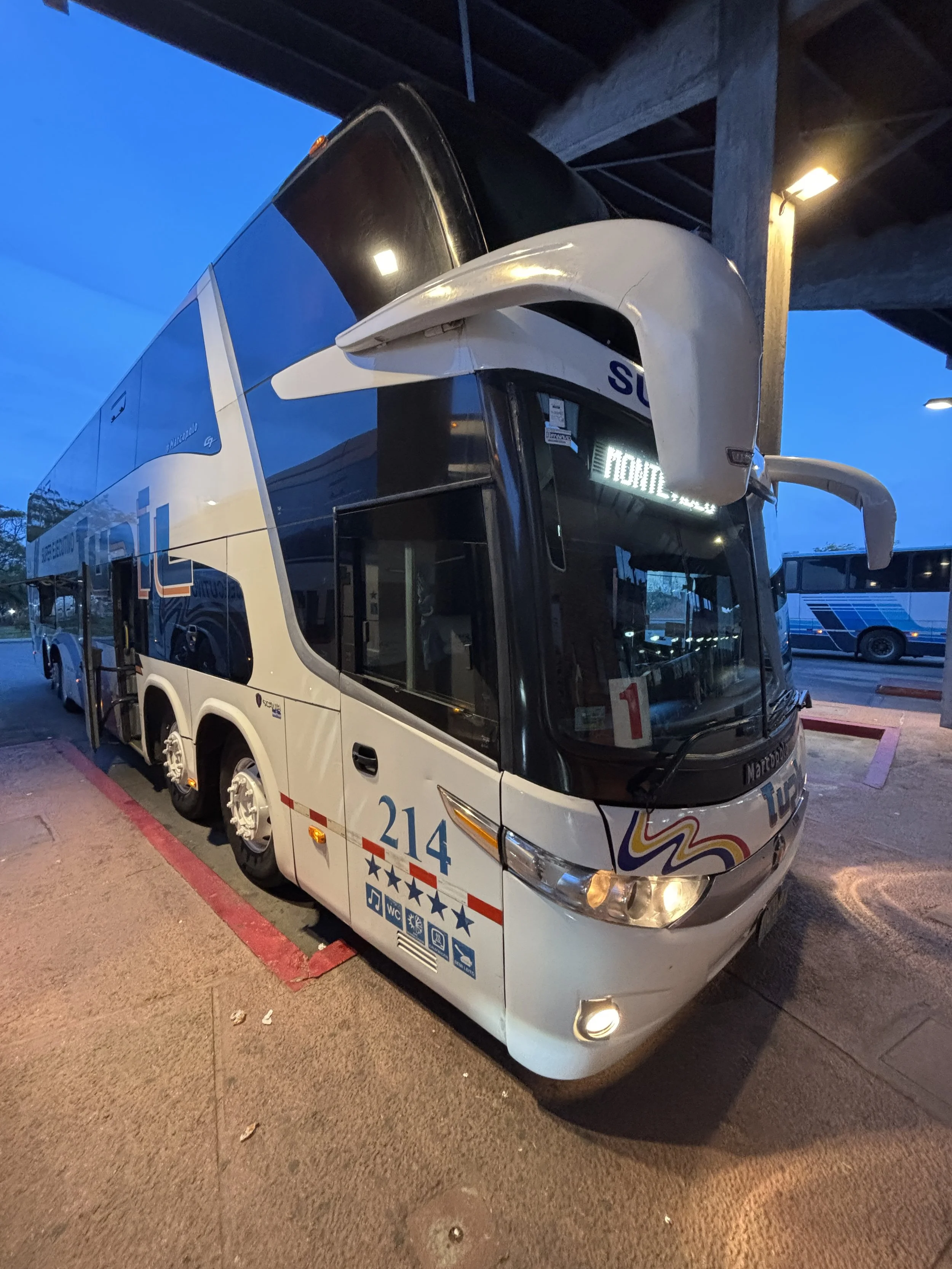
The other way to get to Colonia by public transportation is to take the bus from Montevideo, which is around 2h 45 minutes away. I actually did that after completing my sightseeing in Colonia.
It is also possible, of course, to arrange a private transfer, but I am not sure the price differential makes it worth it, considering the bus is pretty comfortable and costs on the order of €25-30.
There are two bus companies, Cot and Turil, operating this route. They each offer several services per day and prices are pretty similar. The tickets can be booked online, both on their respective websites or on travel aggregators.
The bus terminal is right next to the maritime terminal and the tourist information centre and less than 1km away from the historical centre. It is a rather basic building, but it does have all the services, including a a bar, some small shops and a fair number of electric sockets to charge phones and electric devices (btw, unlike Argentina, Uruguay uses a type of electric socket which is compatible with the European type!).
The bus was surprisingly comfortable, with a larger seat pitch than you would expect on some European airlines’ business class cabins, and it has even a sort of foldable foot and leg rest for extra comfort. I think there was a sign saying there was wifi, but no network appeared to be active.
Btw, the bus stops along the way multiple times to pick up people, so better make sure you are seated on the seat assigned during booking (they are numbered). The bus also has a toilet.
The terminal in Montevideo is in Tres Cruces, which is pretty central in the modern part of the city.
The historical centre of Colonia del Sacramento
Colonia has a really interesting history. It was, in fact, founded as a Portuguese outpost. The Kingdoms of Castile (the nucleous of what later became Spain) and Portugal agreed to demarcate their respective areas of influence through the Treaty of Tordesillas in 1494, which used an imaginary line to the West of the Cape Verde islands as the boundary.
With cartography being still, at the time, a rather inexact science, Portugal tried to enforce a rather favourable (to its interests) interpretation of this line to claim the northern part of the Rio de la Plata and the territory of what is now Uruguay.
So, in 1680, the Portuguese founded Colonia as their southernmost outpost in the Americas. At that time, Spanish settlement of the area was still not fully consolidated, so the Portuguese kind of got away with it for some time. But, it was not long before tensions started between the two European kingdoms, as they both tried to create facts on the ground.
Spain took Colonia by force several times between 1680 and the mid-18th C. and each time the Portuguese recovered it through diplomatic means. This went on until 1777, when the Spanish Crown reclaimed Colonia one last time.
Colonia, however, was not to remain in Spanish hands for long, since in the early 19th C. the independence movements kicked off in Latin America, taking advantage of the Napoleonic Wars in Europe.
Colonia did eventually end up being part of Uruguay, which obtained its independence in 1830 (after yet another war, this time between the United Province of the Rio de la Plata, which later became Argentina, and a Brazil that has just become independent).

The foundations of Colonia’s Portuguese governor palace, which was razed to the ground by the Spanish, can still be seen in the centre of this square
If I am explaining all of this in detail is because it is essential to understand the uniqueness of Colonia and the reasons that led it to become the first UNESCO World Heritage Sites in Uruguay.
Colonia del Sacramento is the only place in the Americas which has managed to preserve a fusion of both Portuguese and Spanish colonial era styles, something that can be seen in the architecture and urban planning of the site.

Four top things to see in historical Colonia
The city wall and entrance


The Portuguese were well aware of the nature of Colonia as an outpost in contested territory, so one of the first things they did was to build an enceinte of fortifications, complete with its own colonial-style gate.
After the Spanish takeover, however, the walls lost much of their utility and they were mostly demolished. The inhabitants at the time were not that appreciative of their historical and aesthetic value. This, however, changed a bit later, in the 1970s when work started on the preservation of Colonia as an heritage site.
Fortunately, most of the stones of the old wall had been deposited right to their original location, so a large portion of the wall and the gate could be reconstructed, which is what visitors see now. So, not quite the original thing…but almost, since the reconstruction is an exact reproduction of the original and it even used the very same stones!
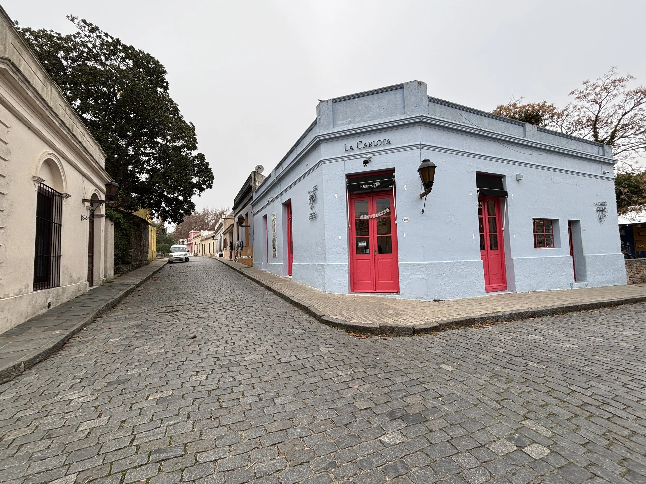
2. “Calle de los Suspiros” ("Street of Sighs")
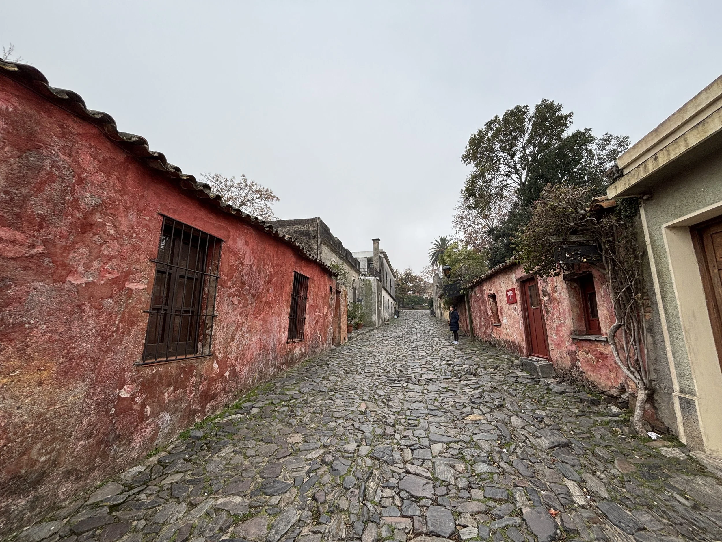
This is one of the most scenic streets of Colonia, combining traditional houses in the Portuguese and Spanish styles, with an irregular cobbled pavement which is more typical of Portuguese settlements. The street has also embellised with some tiled street signs in the Portuguese style, although these appear to be a later addition.
In fact, Colonia is not a historical center in the European sense, with densely packed narrow streets, but more of a spread-out settlement with rather wide streets and plenty of open spaces.
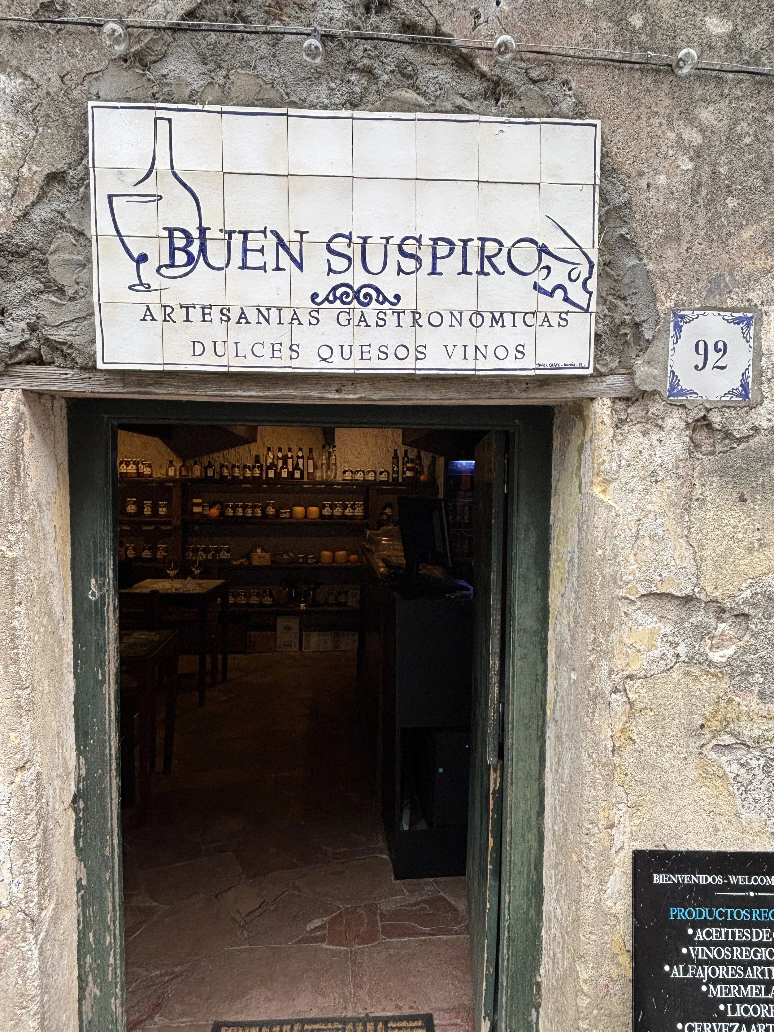
In this street you will also find a shop selling produce from the nearby countryside, which is famous in Uruguay for its wine and cheese production.

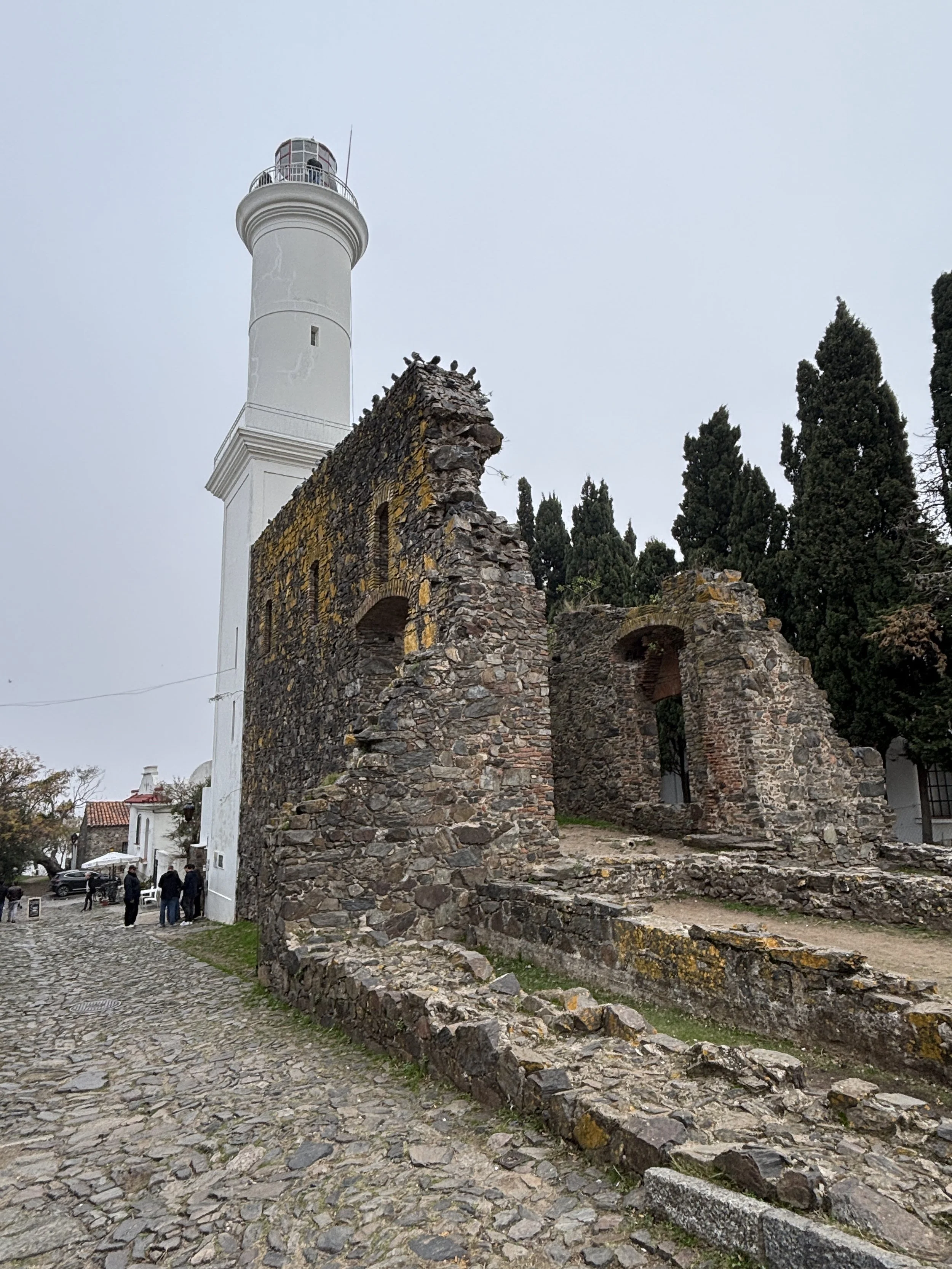
3. The old lighthouse
This lighthouse was built in 1859 on top of the ruins of a former Portuguese Franciscan monastery. Located on the historical’ town’s main square (“Plaza Mayor”), this tall structure provides a point of reference in the otherwise low-lying urban grid. It is also located on one of Colonia’s two major historical squares. It is possible to climb up the lighthouse to get the views.
4. The oldest church in Uruguay
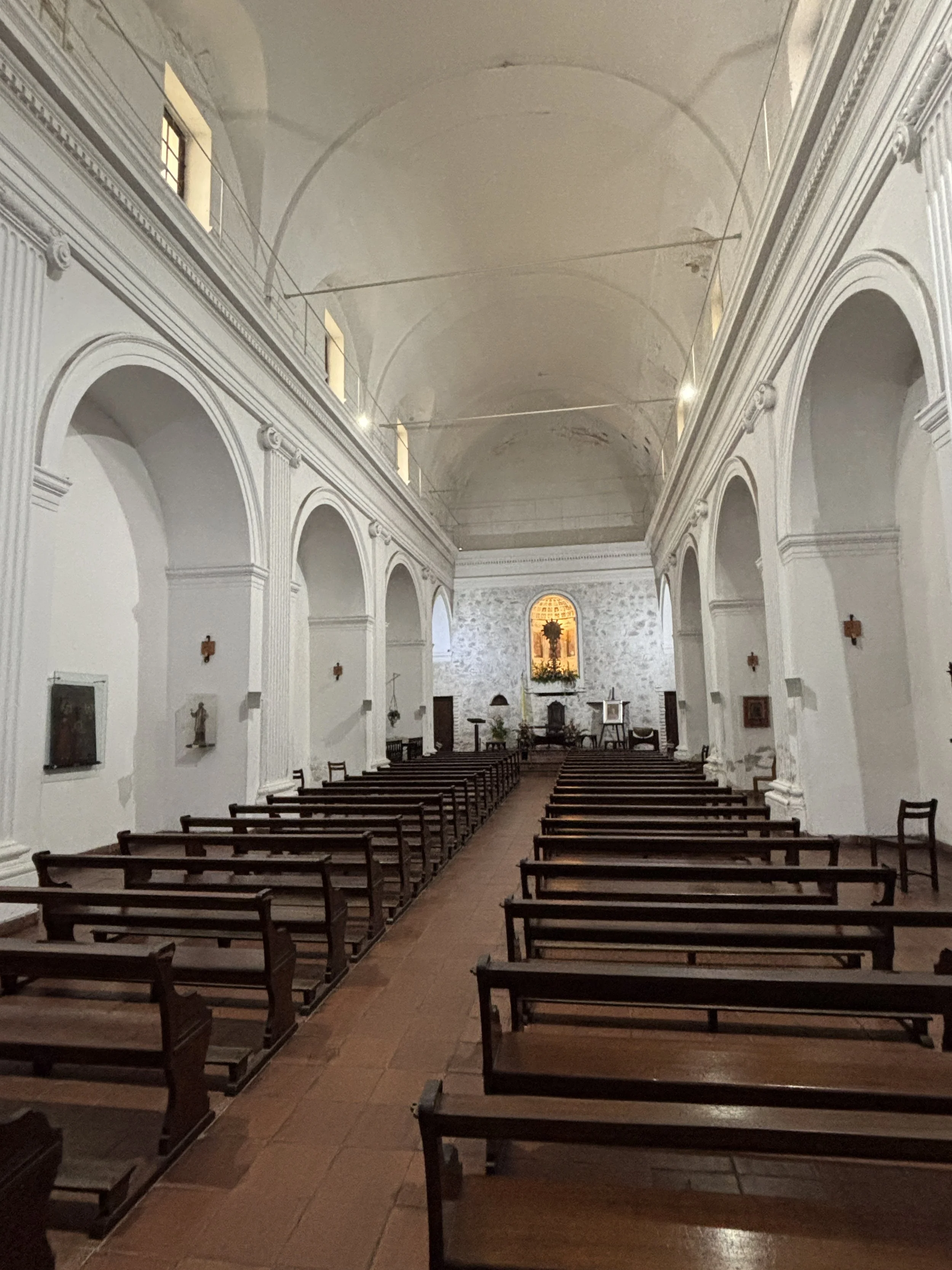
Built in 1699, the church of the Holy Sacrament (“Iglesia del Santísimo Sacramento”) is the oldest in Uruguay. It was built opposite the Portuguese governor’s palace, located on the highest point of the historical town (apparently it was a common Portuguese practice to build the main church and the governor’s house on the highest point in town, unlike the Spaniards, which did so at sea level when possible).
When the Spanish took over the governor’s palace was demolished (its foundations can now be seen in the middle of the square), but the church was modified to fit the Spanish aesthetic canon, which involved covering most of the original stones and some architectural elements with stucco. Modern restorations have brought back some of those original elements while leaving also as much as possible of the Spanish additions.
Other than that, as mentioned earlier, Colonia is not a large place. There are quite a few shops and cafés, but if you visit off-peak as it was my case, it doesn’t feel crowded. So I would suggest wandering around a bit.

The bullfighting ring in Colonia del Sacramento
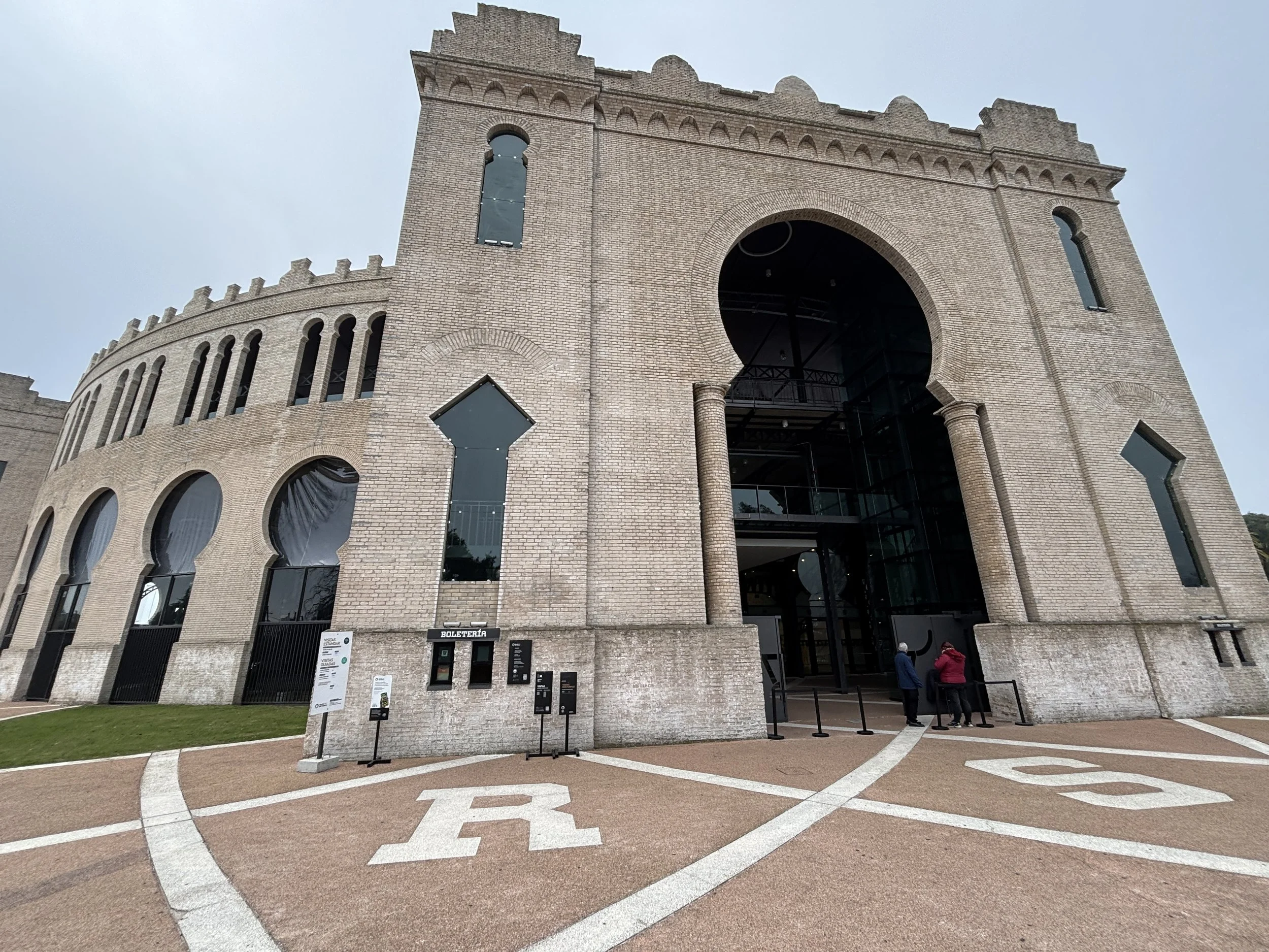
The historical town is linked through a seaside promenade to the other major landmark in Colonia: its former bullfighting ring which has now been turned into a cultural centre.
The ring was actually built at the initiative of Nicolás Mihanovich, an Argentinian shipping magnate of Croatian ancestry, who had the vision of turning Colonia into a sort of “South American Riviera” at the turn of the 20th C.
The idea was that the ring, which was capable of hosting up to 10,000 spectators, would be the centerpiece of a whole leisure complex which would include a luxury hotel and some other entertainment amenities around it, such as a “frontón”, a venue to play the game of Basque pelota, which is now also being restored. The complex had also a small rail line connecting it to the ferry terminal, which would bring visitors from Buenos Aires.

This project was partly realized in 1910, when the ring was built in a rather impressive period of 6 months (possibly would be impossible to do the same today!) using pre-fabricated modules and structural sub-assemblies which were shipped from Europe. Mihanovich also brought some of the top bullfighting stars of the time from Spain for a grand opening.
However, the project was short lived, since Uruguay banned bullfighting in 1912. So, Colonia’s ring hasn’t actually hosted a show of this nature for more than a century.
In fact, after losing its primary function, the ring fell progressively into disrepair and it was already in a very poor state of conservation when, already in the 21st C. it was decided to turn it into a culture and events venue. The structure was restored and had its grand re-opening in December 2021.
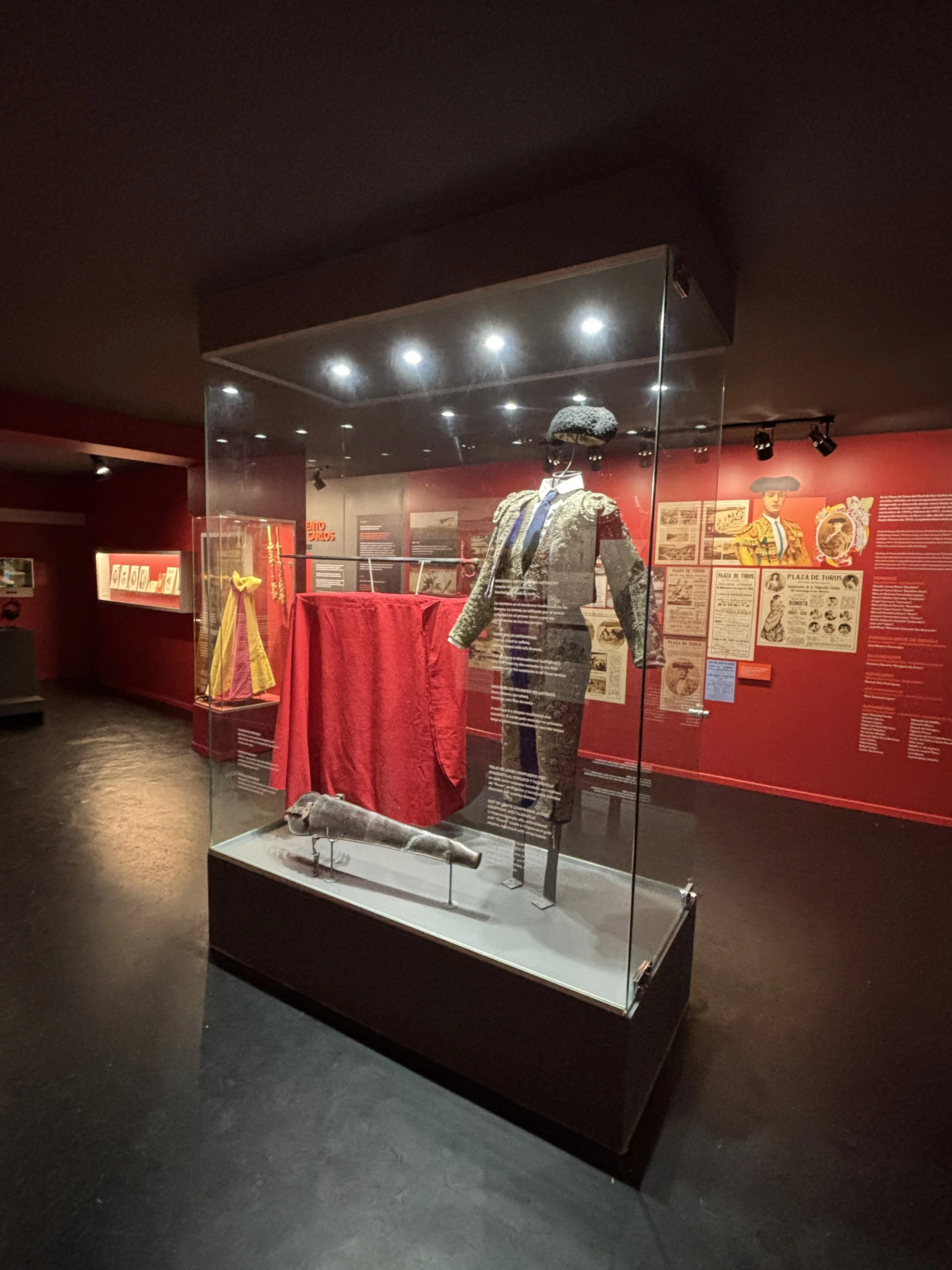
Today it hosts corporate and civic events regularly and it is also being readied as a sports venue, using the central ring as the pitch. It also hosts several shops, cafés and temporary exhibitions, as well as a small museum of bullfighting which shows also an interesting video animation documentary about the history of the ring and Colonia as a tourist destination.

Even if you are not into bullfighting (which I am not), it provides some interesting context to the building and the reasons that led to the set up of the ring in Colonia and the vision the Mihainovich had for this place.
Btw, the ring is in an area called “Real de San Carlos” (named after Charles III of Spain, because it is where the Spanish army that took over Colonia in the late 18th C. set up its camp) located some 5 kilometres away from the historical town along the coastal path. So, a distance technically walkable from the old town, and possibly a nice walk on a sunny day, although a bit on the edge and, if you are short of time, possibly best to order an Uber, which works generally well in Uruguay, or rent a bike!

How to visit Europe’s weirdest border town: Baarle
Regular readers of this site possibly know by know that I am fascinated by the topic of borders. It is not for nothing that we have a dedicated “Borders” section here. And this is a topic which I have also explored on CNN on several occasions, whether in Europe or elsewhere.
But when it comes to borders, there is no other place like Baarle. Well, there kind of used to be one, the enclaves of Cooch Behar on the border between India and Bangladesh, but the two countries decided to straighten the border back in 2015, so that border line got greatly simplified.
Feudal land divisions and the messy divorce between Belgium and The Netherlands shortly after the creation of the former in the early 19th C. led to the formation of what is most likely Europe’s weirdest border arrangement.
Fortunately, though, the fact that both Belgium and The Netherlands are part of the EU and the Schengen Area facilitates enormously not just the lives of its inhabitants but also of the many visitors that come here on purpose to check out this border curiosity of the first order.
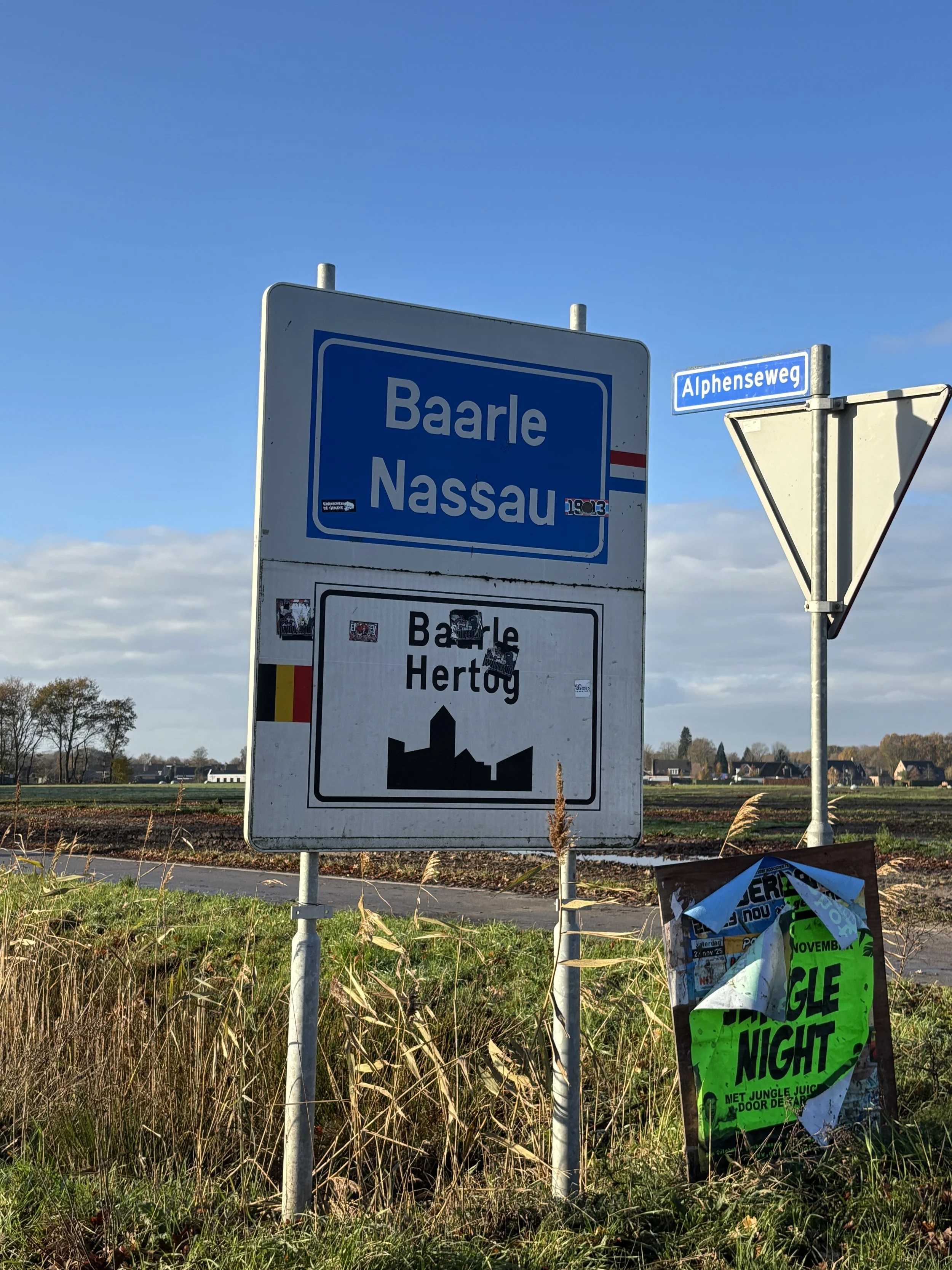
By the way, in order to keep it simple, throughout this post I am going to refer to the town simply as “Baarle”, since there are technically two towns in one: Baarle-Nassau if you refer to its Dutch portion, Baarle-Hertog when it comes to its Belgian municipality, which has also part of its territory on the Belgian “mainland”.
And I use the word “portion” very purposefully here, and not “side” which is often used when talking about borders, because it is frankly difficult to define “sides” in this corner of Europe.
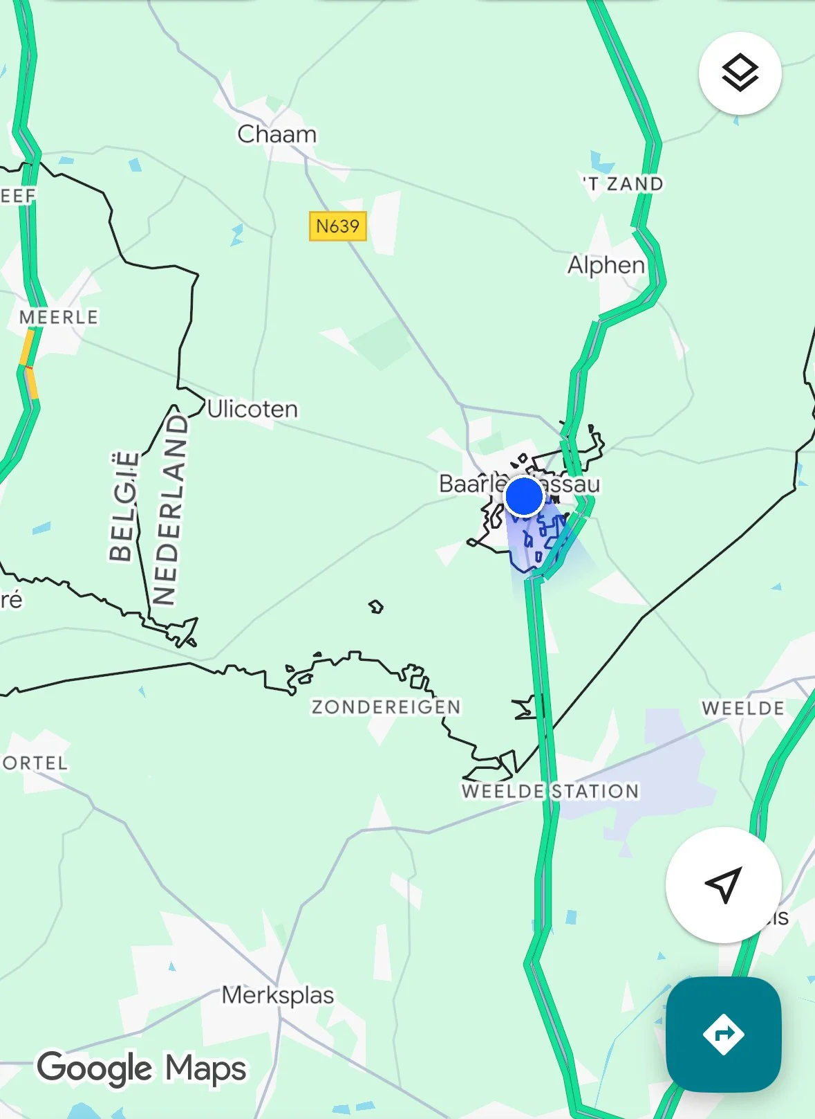
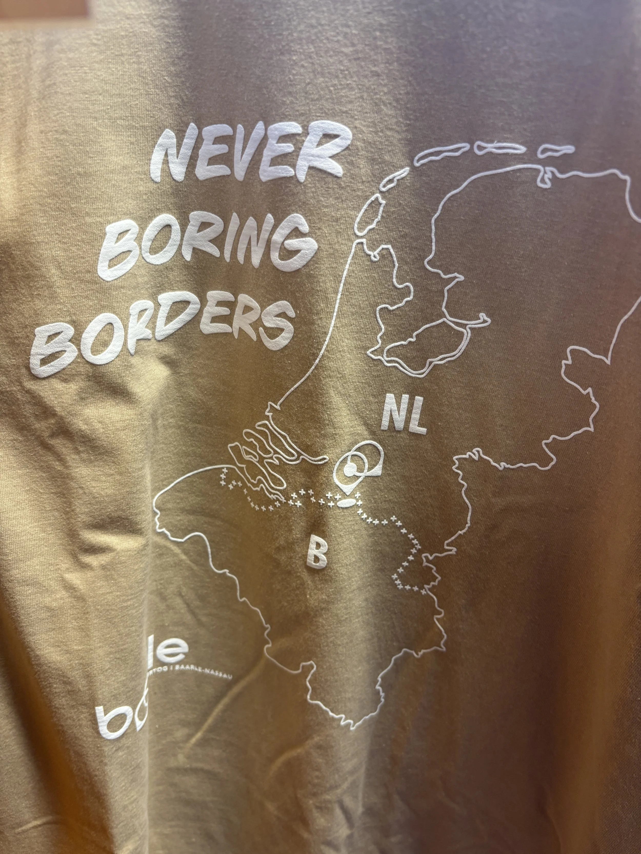
There is, of course, the main border line between Belgium (and Flanders) and The Netherlands, and then there is the enclave of Baarle-Hertog, a piece of Belgium north of it, but if you zoom in, a more complex panorama appears, since the Belgian enclave is, in fact a patchwork of 22 smaller enclaves which have another eight Dutch meta-enclaves (or counter-enclaves) in them. There are also a few smaller Belgian enclaves on Dutch soil outside the urban centre, but we’ll leave those aside for the purposes of this post.
In the images below you can see how all these enclaves look like on the map:

This post may contain affiliate links. If you book or buy something through them, I earn a small commission, at no extra cost to you. It's a way to keep Places of Charm going. Thank you for your support.
Main points of interest in Baarle
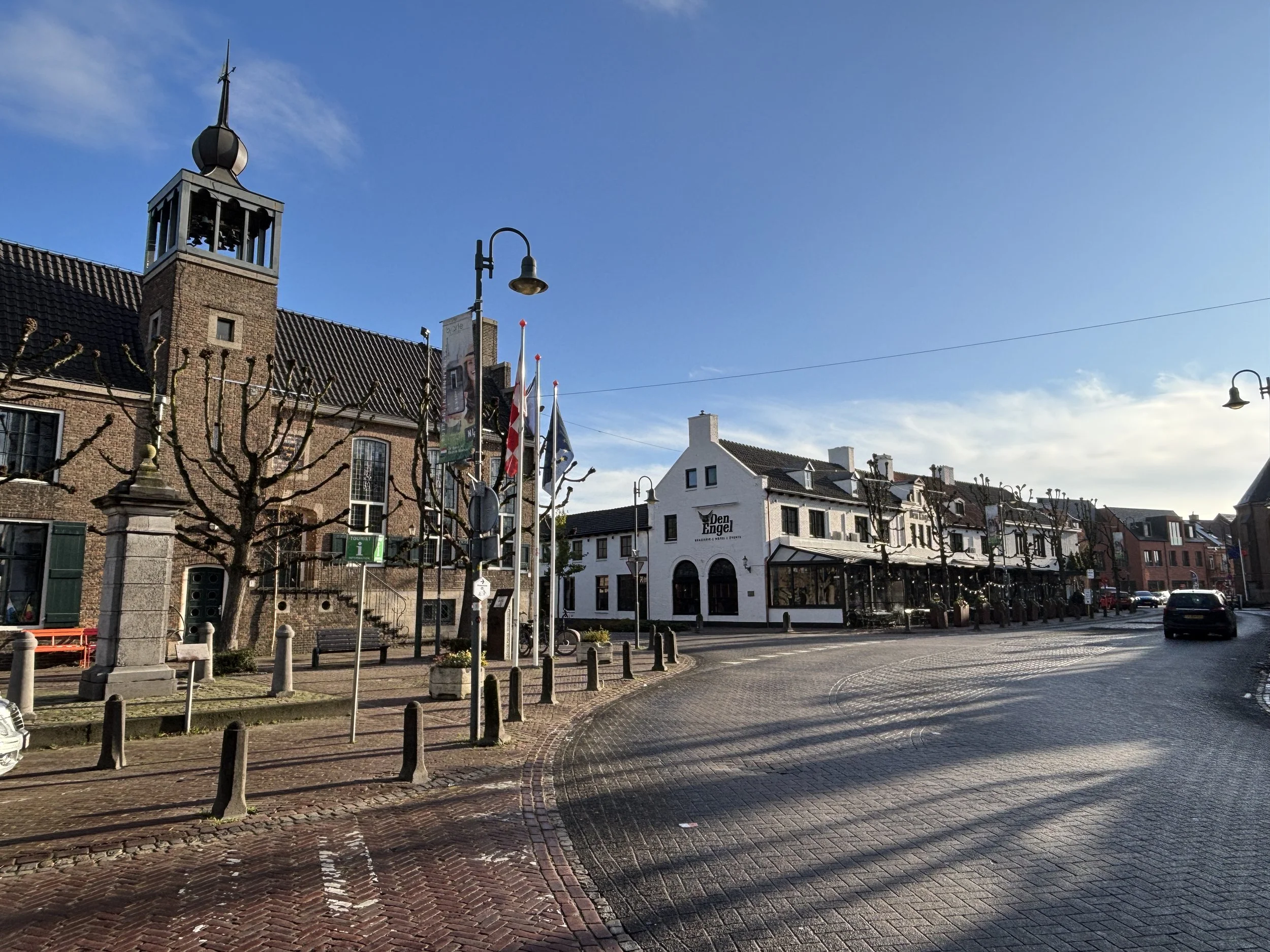
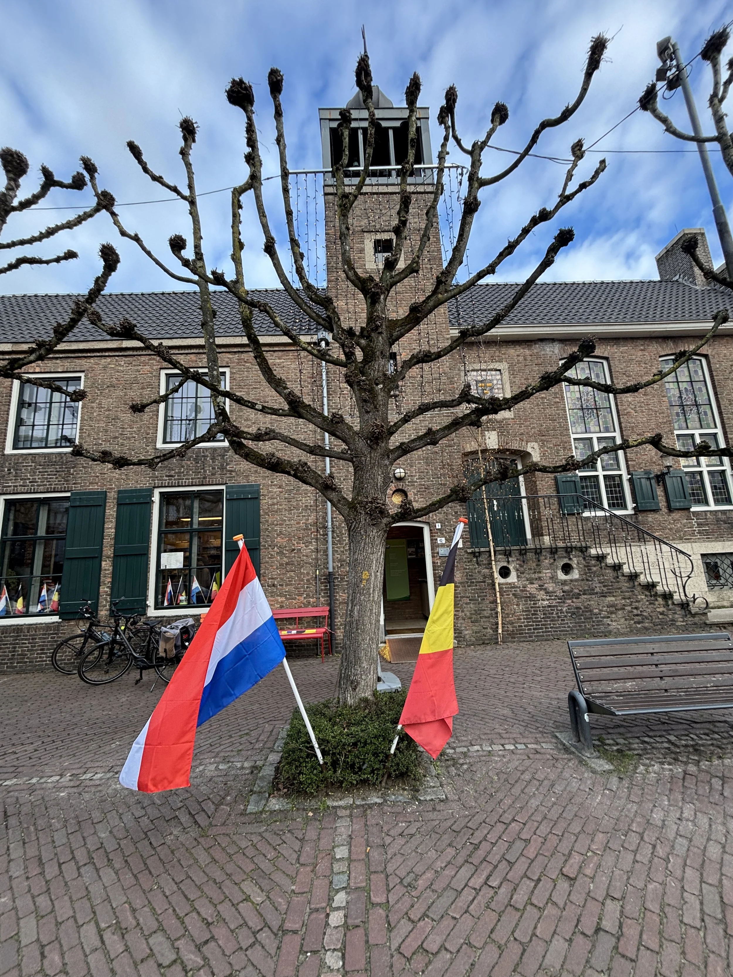
Baarle is not large and most of its commercial activity happens along what could be considered the town’s neuralgic center, the Singel. It is here that you find the tourist information center, the church and what is possibly its café of reference.
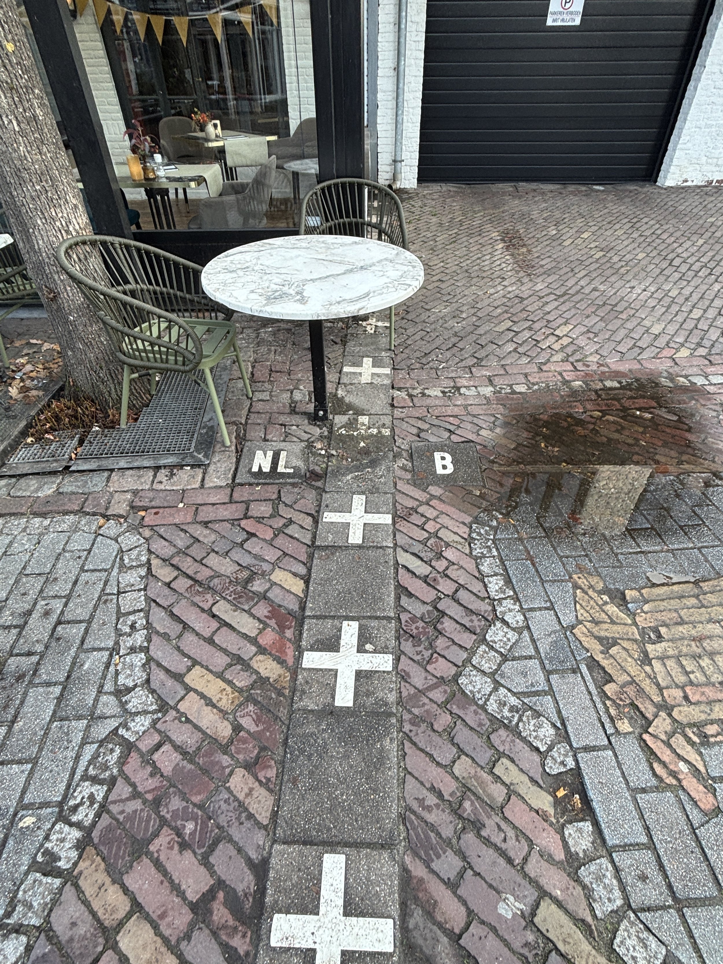
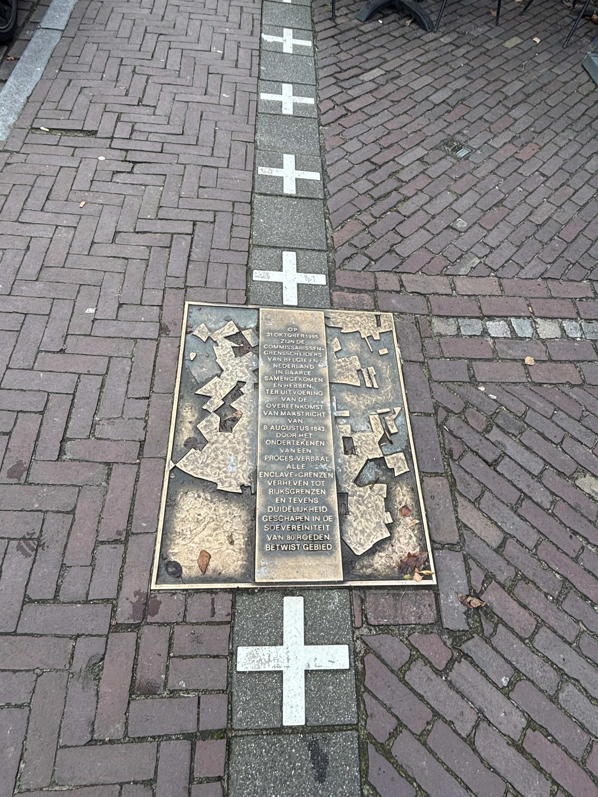
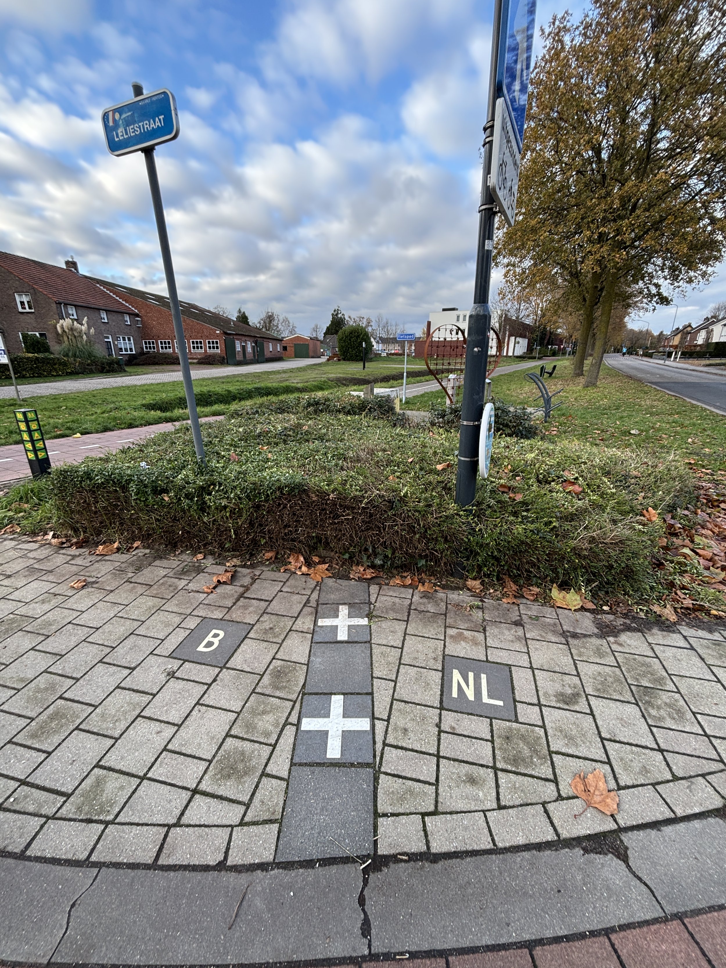
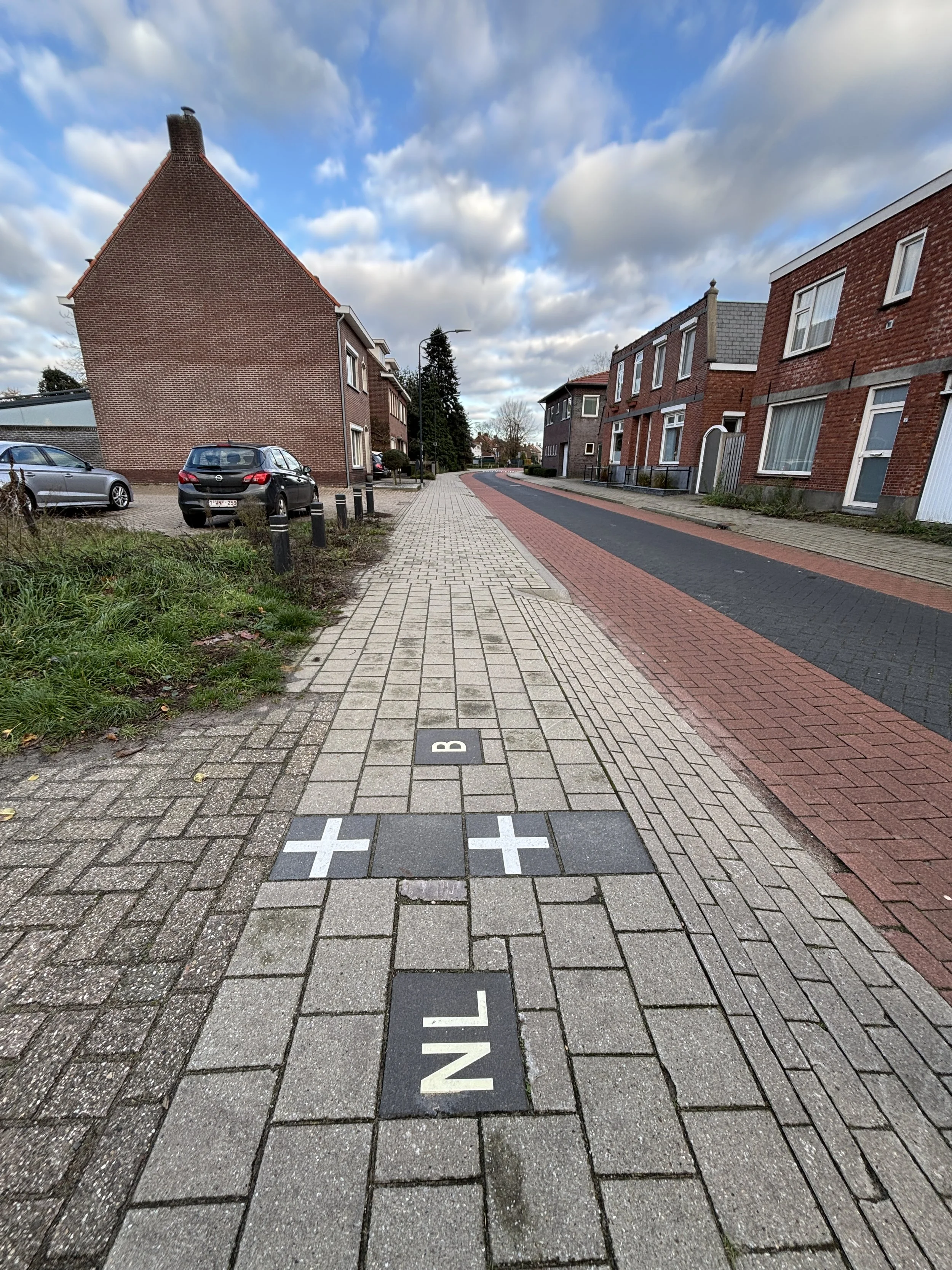
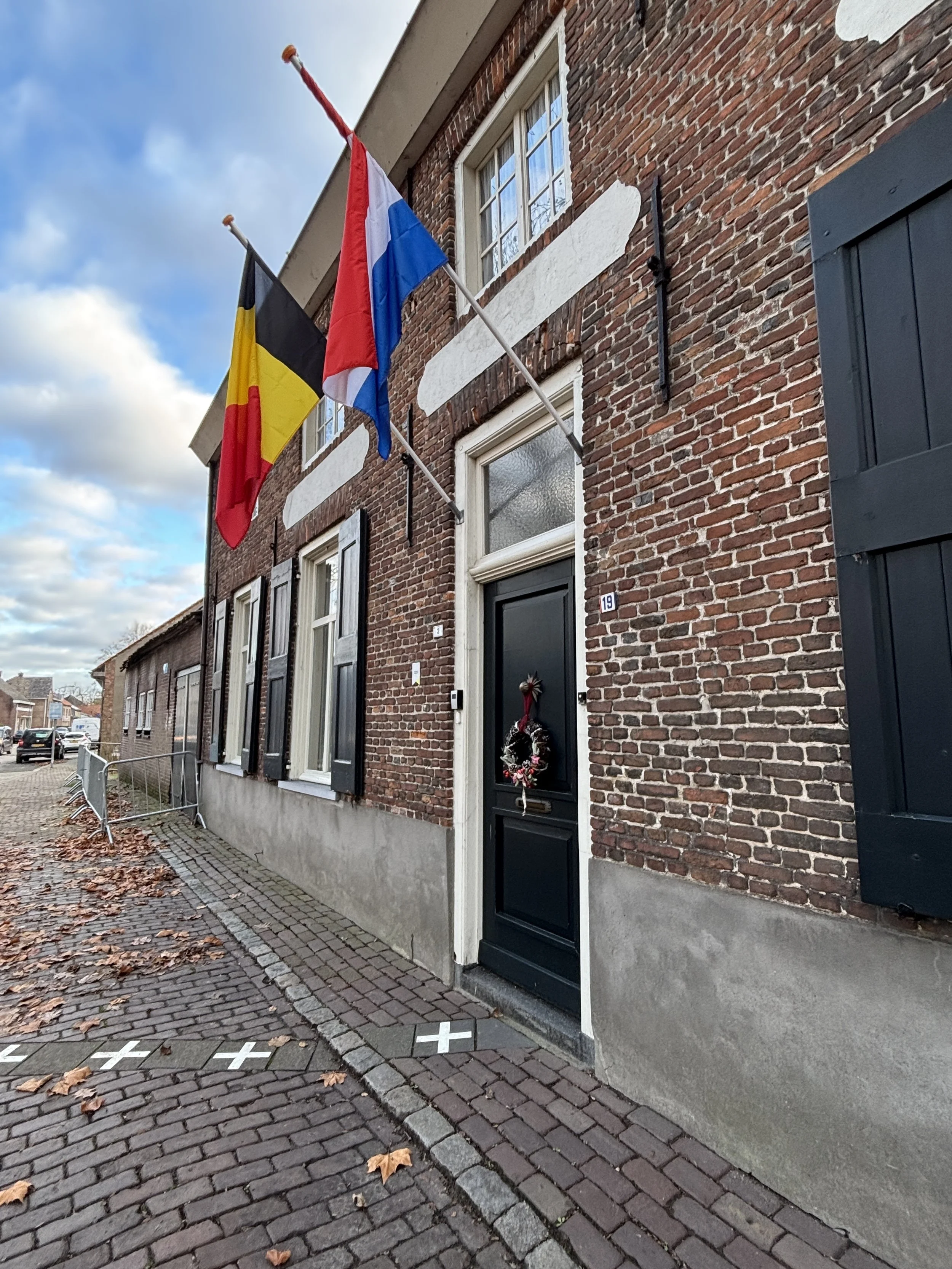
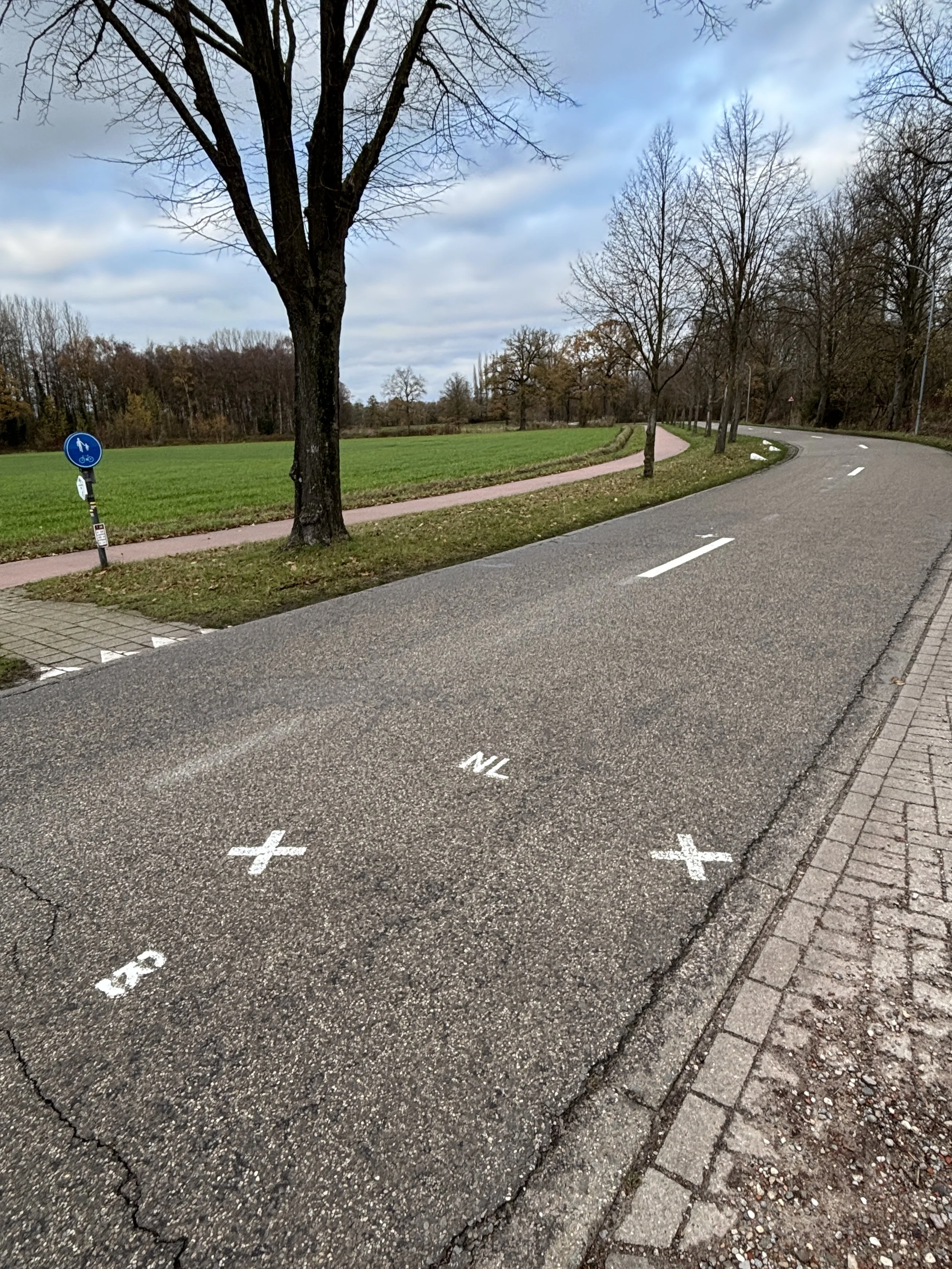
It is really helpful that the local authorities have taken the care of painting the border line on the pavements, with the letters “B” and “NL” to indicate in which country you are at any time.
Café Den Engel
Singel 3, 5111 CD Baarle-Nassau
If you don’t know where to start your route through the streets of Baarle, this is a good starting point.
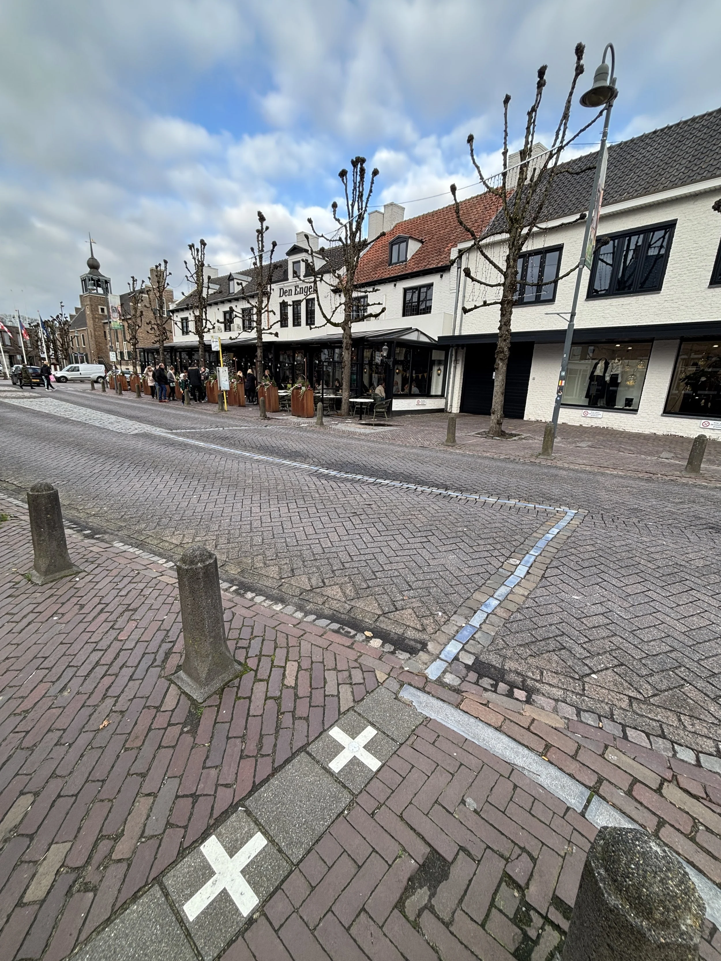
It is here also that you will find the Café Den Engel (“The Angel”), which is also a hotel (you can check the prices here) and has a bi-national terrace in which it is possible to sit down at a table that is bissected by the border.
Note also, in the picture below, which zooms out from the outside of the café, how the border does not necessarily follow straight lines. At this point the border does a sort of zig-zag, making to straight angles in the middle of the road which leave Den Engel fully within Dutch territory.
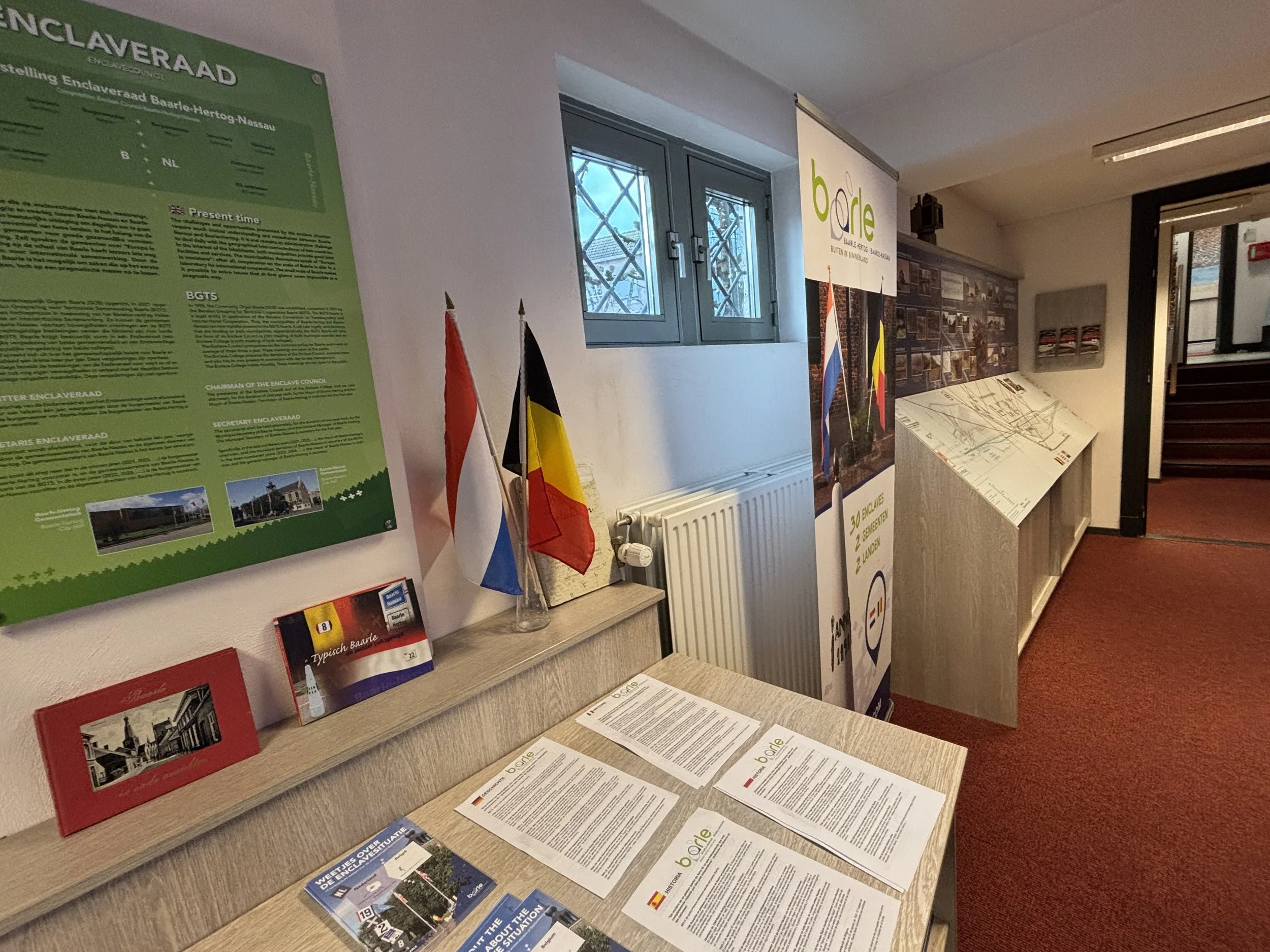
Baarle Tourist Information Office & Museum
If you think border tourism is weird, just go to the Baarle tourist office and you won’t feel alone anymore, because the facility is dedicated to serve the constant stream of visitors that come to check “The Line”.
So, Baarle’s tourist office, which is also located on the Singel, is well stocked with all sorts of maps and other reading materials about the border. Here you can also get suggestions and advice about the best walking routes routes to see the most picturesque border points in and around town. By the way, here you can also buy some border-themed merchandise!
There is also a small museum in the basement. It is just one room, but it has some interesting stories, pictures and other border-related items. It’s worth checking.
By the way, not everything in Baarle is about the border.
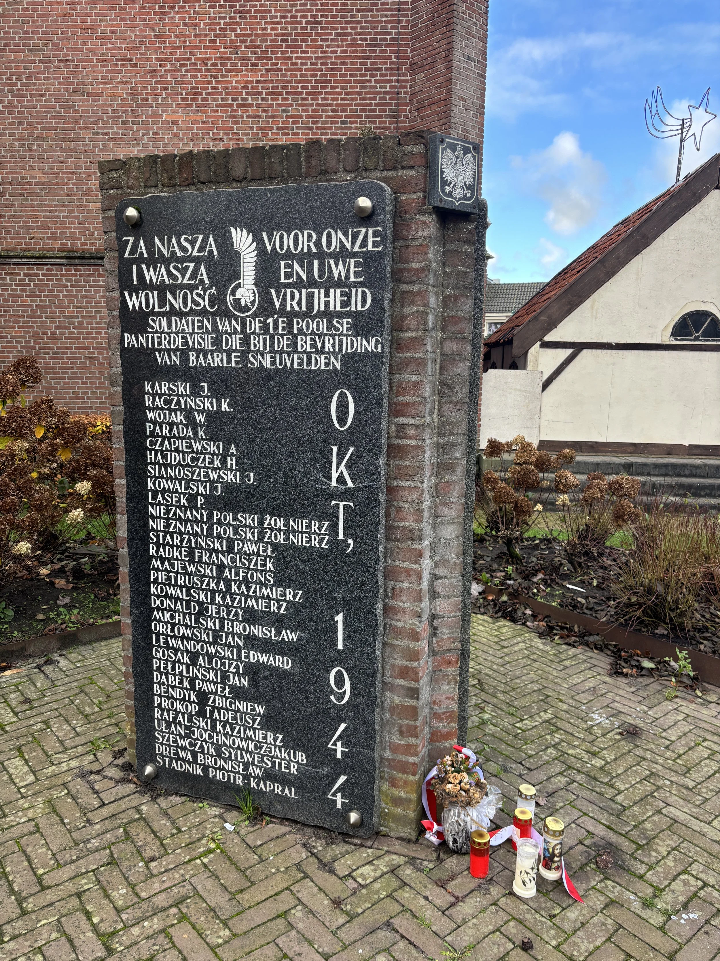
There is also a WW2 memorial, which is located in front of the church. It is dedicated to Free Polish troops which liberated the town of Baarle and the surrounding region in October 1944.
The rather long list of names in it gives you an idea of how fierce the fighting was in this area, with many young Poles losing their lives in the combat for this borderland.
This episode of WW2, in which the 1st Polish Armoured Division under general Maczek went on to liberate much of the region of Brabant, in the southern Netherlands, was also remembered by a 34km remembrance walk organized by organised by WIEGO, a Dutch walking association, and the Maczek Memorial.
The walk took place on September 21, 2024, between Baarle and Breda to mark the 80th anniversary of the liberation of the city by Polish troops.

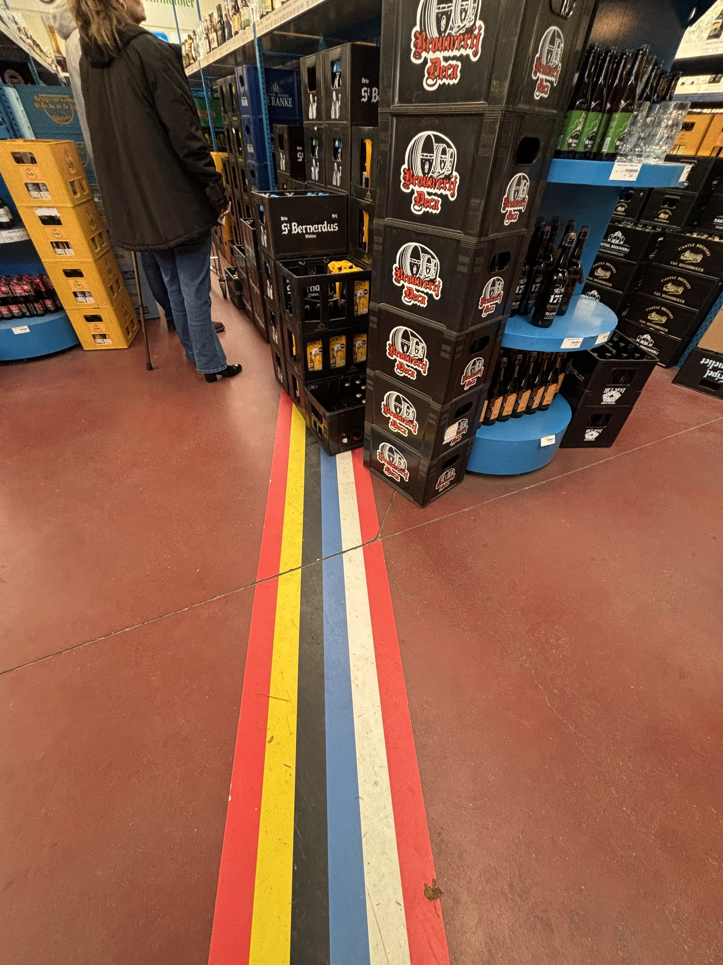
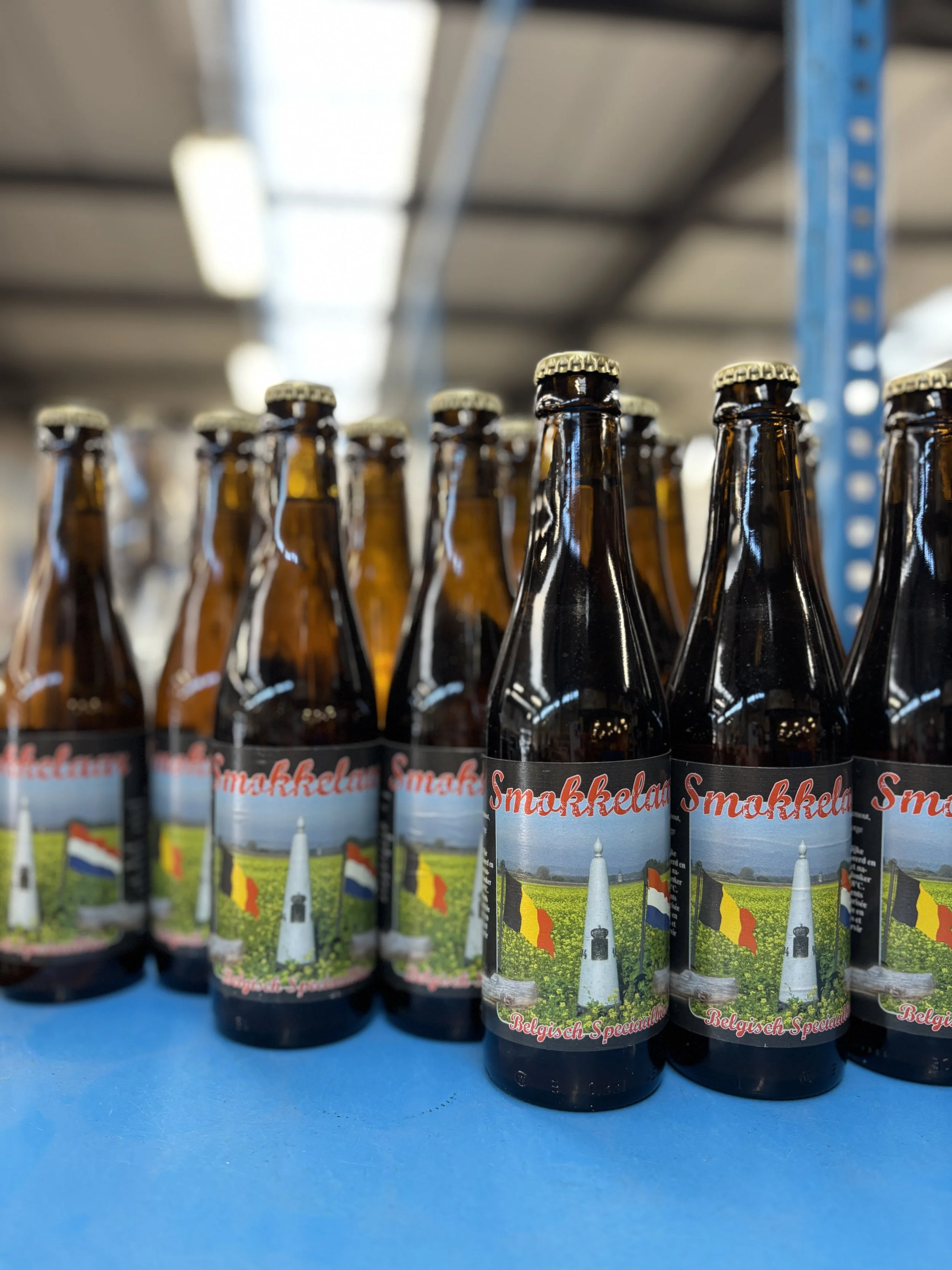
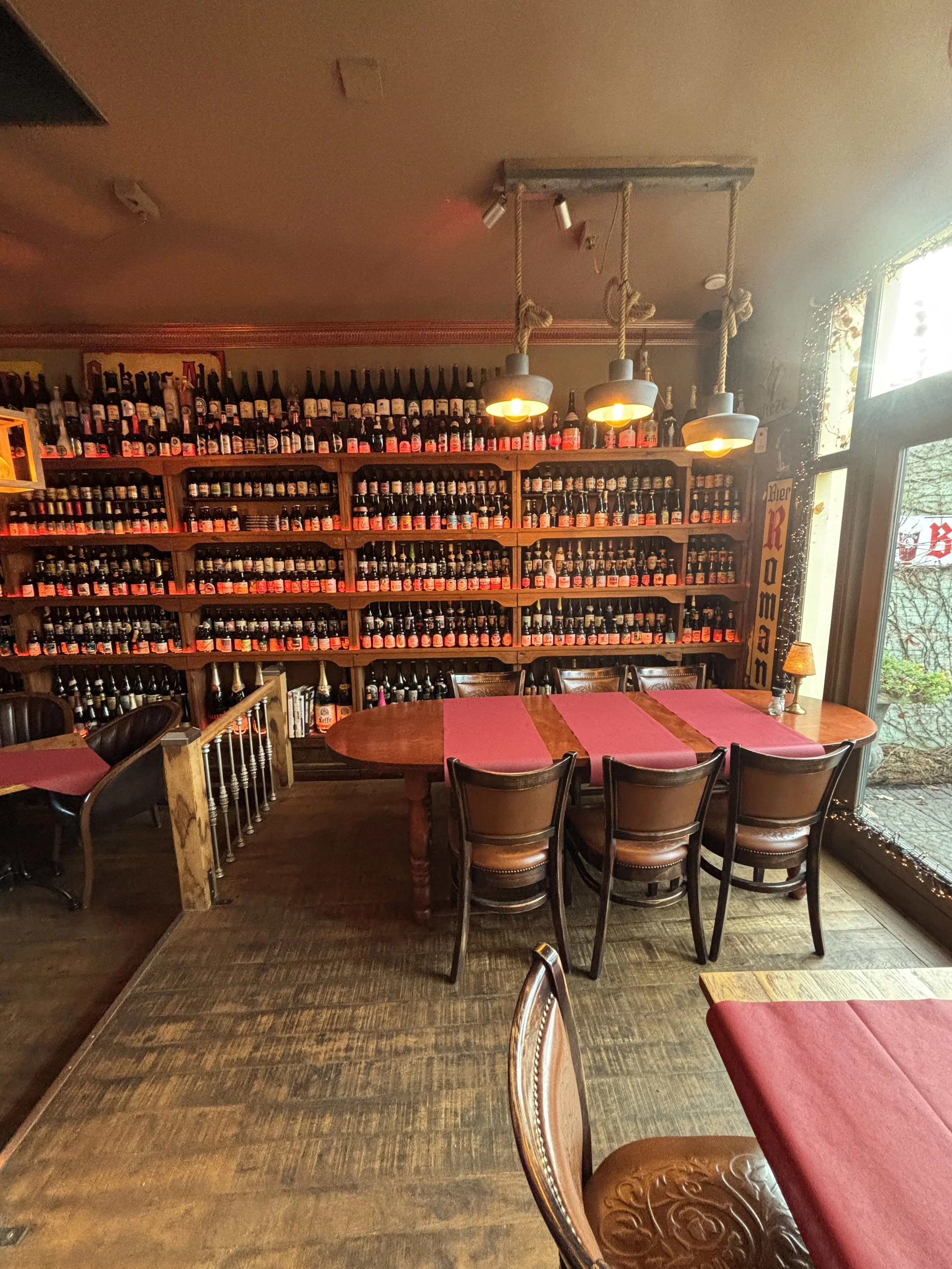
De Biergrens, a bi-national beer & liquor store
Molenstraat 98, 5111 CE Baarle-Hertog
This is another interesting spot to visit, first because the short walk to get there is a perfect excuse to check a few more of the border “crossings”, as the two countries intersect several times along the way.
But, also because this store, De Biergrens (which could be translated as “The Beer Border” or “Beer at the Border”) has the particularity of sitting right on the border line. And it does so, because part of the building is actually within one of the Dutch counter-enclaves, the smallest of them all, actually!
The fact that the sale alcohol is usually subject to a whole set of taxes and regulations depending on the country you are in, only makes the place more interesting.
The store owners are well aware of this and have actually laid out a line with the flags of the two countries to demarcate the border inside the store.
Here you can also buy the local, border-themed beer, called “Smokkelar” (“the sumggler”).
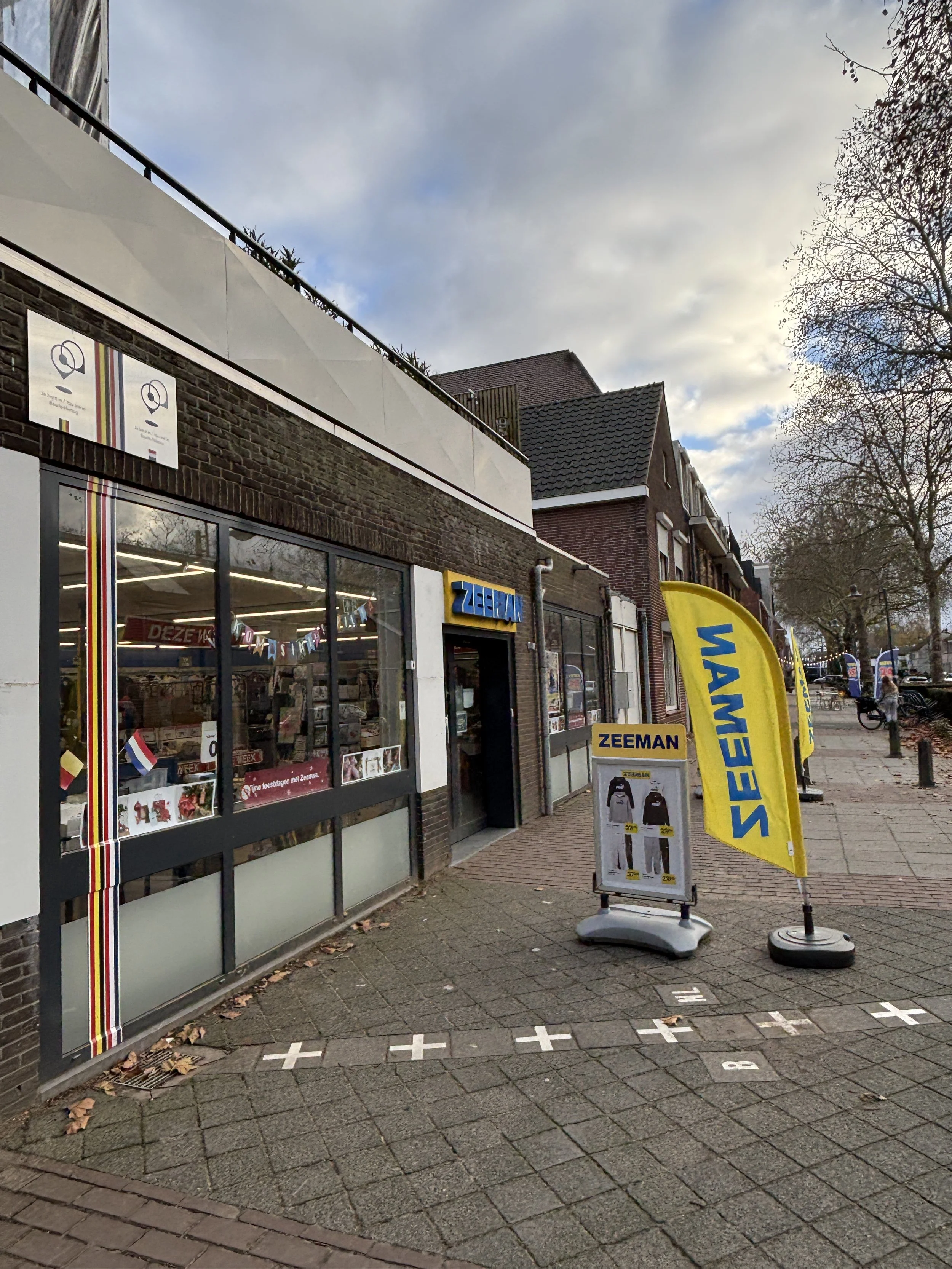
Baarle’s bi-national apparel store
Zeeman
Stationsstraat 1A, 5111 CK Baarle-Nassau
If you are not into beer, here is another bi-national store you can check, this one is a Zeeman apparel store.
It is located next to Baarle’s main commercial street, at a spot where the border makes an angle.
Like at De Biergrens, here the border line has been demarcated with a line showing the two flags which runs all through the store’s floor. I assume, though, that the administrative complications of selling apparel and household items across border lines are not nearly as great of those of selling alcohol.
Baarle’s WW1 Radio Station
This is actually a spot in Baarle which has quite an interesting story.
During WW1, the Germans occupied almost all of Belgium, except for a tiny pocket in the westernmost side of the country and, of course, the Belgian enclaves in Baarle, since they protected by a narrow slice of neutral Dutch land.
This meant that Belgian authorities could continue to operate freely within their own territory in Baarle, so a radio station was smuggled in through Dutch territory to operate as both a listening and a broadcasting post.
Zendstation MN7 had a 40-meter tall mast, a replica of which was erected again, just few years ago, at its original location on one of the Belgian enclaves. Unfortunately, the mast appeared to have been taken down, perhaps for maintenance, at the time of this visit. However, it was possible to read about this fascinating story on several information panels at or near the spot where the original mast was located, at the corner of Leliestraat and Sint Janstraat.
Even if the mast was no longer there, the walk to get there offered the chance to see some more bi-national streets.
The bi-national house
We have seen a number of commercial establishments that sit right at the border, but there are also private homes where this happens.
This is the case of the house in the picture, located partly on one of the Belgian enclaves, which has the distinction of being the smallest enclave in the World, actually.
In addition to featuring two flags, this house has also two addresses, Loveren 2, Baarle-Hertog (Belgium) and Loveren 19, Baarle-Nassau (The Netherlands), because the border goes literally through the door.
This is not as unusual as it might sound, for example, check this story I wrote for CNN about the Franco-Swiss hotel which sits right at the border between France and Switzerland, with the border running through the middle of some rooms and even beds.
It is worth noting that in Baarle through which the location of the front door which determines the address and to whom do you pay taxes. So, there have been recorded cases of people that have physically modified their own houses to “move” to their preferred jurisdiction.
Recommended place to eat in Baarle
Eetcafé De Lantaern
Molenstraat 42, 2387 Baarle-Hertog, Belgium
This restaurant, which is located entirely within one of the Belgian enclaves, is a nice option to eat in Baarle. To be honest, the food choices are not huge, also don’t expect super-sophisticated cuisine, but it offes good value, in my opinion.
The portions are reasonably good, the desserts in particular, and they also have a very large selection of Belgian beers.
But, the best of this place is the atmosphere, which is pretty nice and cozy inside. It also has a courtyard, which I guess it is a plus when the weather is nice.

The main B-NL border and the WW1 fence
Here is another point which would be of interest on its own right, but there is part of history that makes it even more interesting.
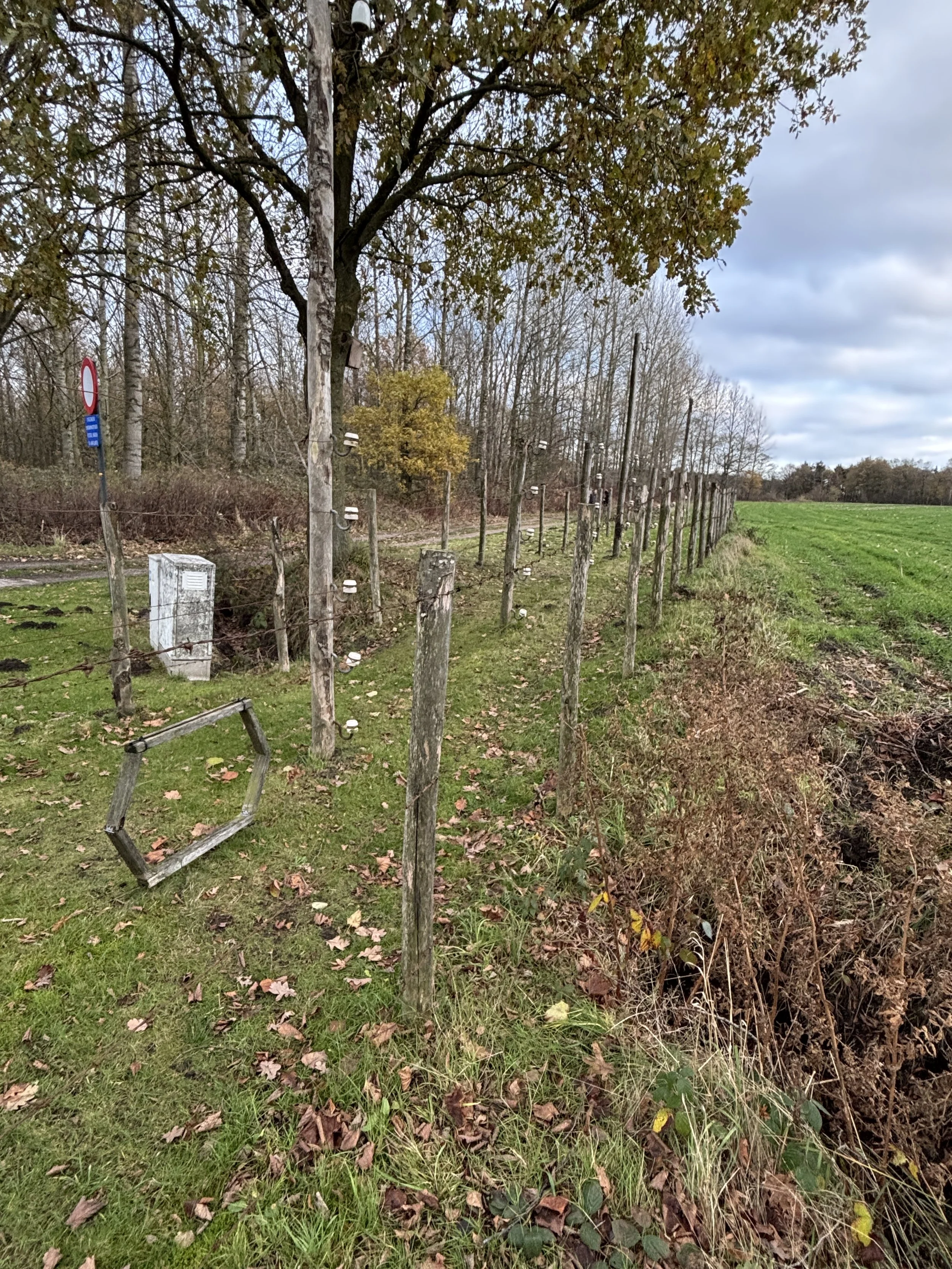
During WW1, Imperial Germany decided to seal off occupied Belgium from The Netherlands, which were neutral. However, since there are no natural borders in this part of Europe and people on both sides of the border speak the same language and have also many links, this was very difficult to do without an extreme level of coertion.
So they built the “Dodendraad” (“the Wire of Death”) an electrified fence which would kill anyone touching it while trying to cross it. It is estimated that while it was in place this fence killed between 2,000 ad 3,000 civilians trying to cross it!
Today, a reconstruction of that fence stands at the exact spot where it used to be, as a memorial. This is a poignant reminder that borders are not always a safe or friendly place!
There is a little parking next to it, so you can stop your car here and walk along the border if you feel inclined to do so.
Also, note that, at this spot, the border does not run in a straight line across the road, but it makes a 90º angle at about one third of the width of the road. The quirks of the border in this part of Europe are almost endless!

Additional resources:
If you wish to know more about Baarle and how this weird border layout came to be and, more generally, about borders, here are some additional sites and resources you can check:
The great and comprehensive post about Baarle on the Frontera’s Blog (in Spanish)
A road trip through the Douro Valley: what to see & to do

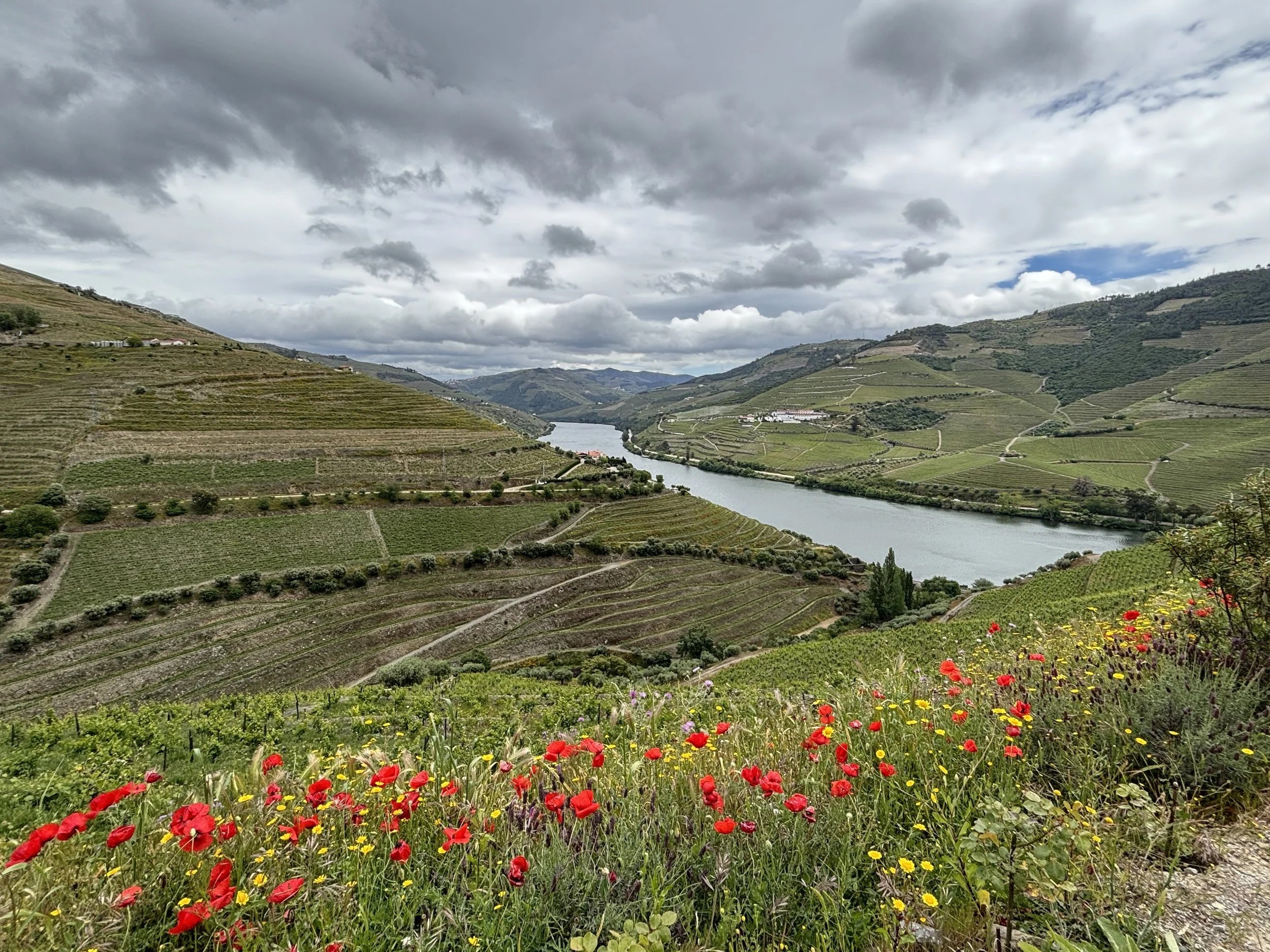
Let me set the tone for this article by saying that the Douro Valley is one of most beautiful wine regions in Europe, if not the entire World.
The are is, of course, famous for being the place of production of the rather unique and famous Port wines, but also of a whole variety of other wines under the Douro Designation of Origin (Denominação de Origem Controlada - DOC). There is a large number of cellars, many of them small, family-owned businesses, all along the Portuguese stretch of the river Douro, pretty much from the Spanish border to the city of Porto and the Atlantic Ocean.
But even if you are not into wine, or your wine-tasting capability is limited because you need to drive (there is a touristic train that runs along the valley from Porto, but to visit the places named in this post you will need a car), the Douro Valley is a magic place full of incredible landscapes.
What’s more, it has pretty good infrastructure throughout, and in here I include not just roads and the like, but also hotels and restaurants, which are in most cases, small family-run affairs as well.
In fact, I would say the main problem when visiting the Douro Valley is the large number of choices, of wineries to visit and potential places to stay at. I hope this post, while inevitably limited in scope, will provide a starting point for those doing this type of research ahead of a trip to this beautiful part of Portugal.
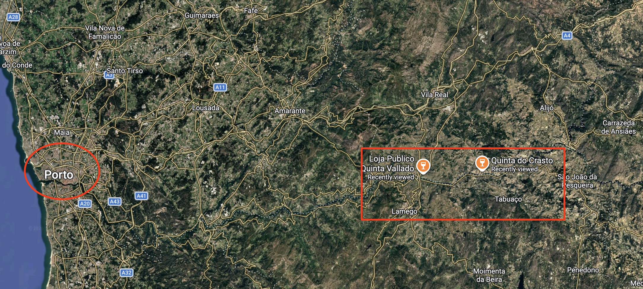
In the map below you can see some of the places that are mentioned in this story in which I will share my experience driving through the Douro Valley and sharing some tips, from my own experience, about which wineries to visit (or which “Quintas” to visit, to use the local parlance) and what to do and what to see in this beautiful area of northern Portugal.
This post may contain affiliate links. If you book or buy something through them, I earn a small commission, at no extra cost to you. It's a way to keep Places of Charm going. Thank you for your support.
A good base to explore the Douro Valley: Lamego

This town makes a good starting point for any road trip through the Douro Valley.
It is located on the south bank of the river, about an hour drive from central Porto.
It is actually a place of historical significance in Portugal since it is here where, it is said (apparently it is has not been completely ascertained), the first King of Portugal was proclaimed in the Middle Ages.
The town is also a place of pilgrimage, since it has the Sanctuary of Nossa Senhora dos Remédios (“Our Lady of Remedies”), which sits, very spectacularly at the top of a hill and is reached by an impressive flight of stairs.
Unfortunately, we arrived to Lamego when it was already late in the evening, so didn’t have the chance to visit it, but enjoyed the views from the town’s main avenue.
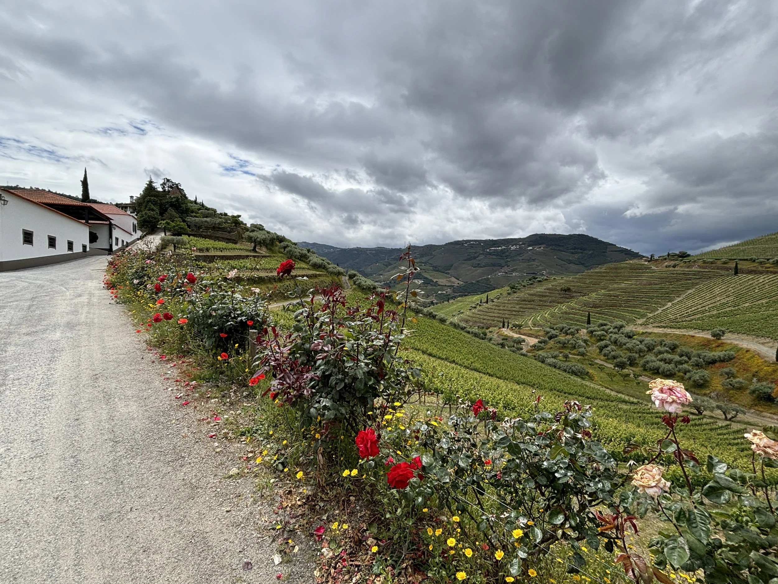
Btw, below is a picture of the landscape around Lamego taken from one of the nearby hills, where our hotel was located.

Check this great place to eat in Lamego
Douro Excellence, por Paulo Matos & Jacira Galhardo
Largo da Vitória, R. Macário de Castro, 5100-196 Lamego
We stumbled upon this restaurant almost randomly, after arriving in Lamego quite late (most of the town was closed) and asking some locals. It turned out to be an excellent piece of advice!
So, if you are in the area, definitely make some time to eat at this restaurant, even better, just call to book in advance, because it is well worth it.
The restaurant is run by a husband-and-wife team and it has a really welcoming and homely atmosphere. The food was also really good, with plenty of Portuguese specialities, nicely presented in slate plates and matching local wines.
Nice place to stay in Lamego
Paraíso Douro AL
Caminho Da Serra Das Meadas 44, Quinta da Pegada
5100-043 Lamego
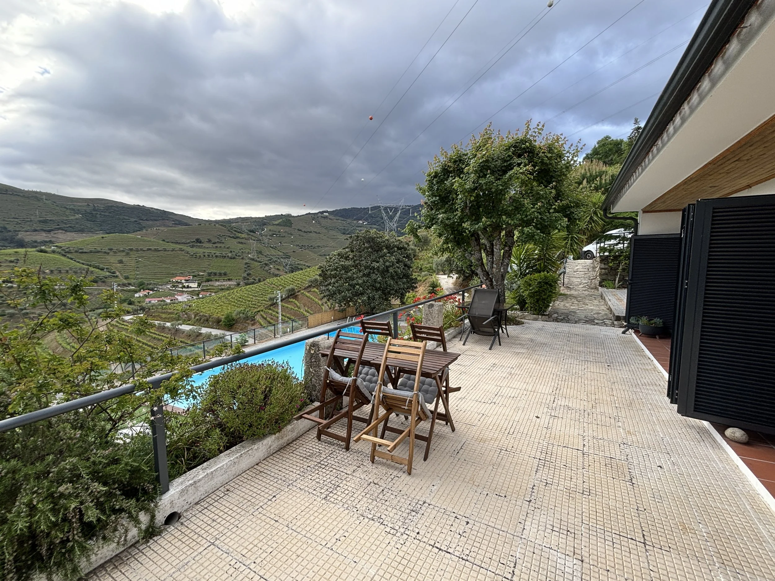
This hotel is a bit out of town on a hill with amazing views (check the pics below).
It has rather large grounds, with a garden area and a pool, although we just stayed there for a night, so didn’t use it much.
Very large rooms and good breakfast!
Visiting wineries in the Douro Valley
So, after Lamego, it was time to cross onto the northern bank of the Douro for the first winery visits. Here are a few things that I wished I knew before planning this trip.
Number one is: book in advance your winery tours. Yes, with the large amount of wineries in the Douro Valley, it may be easy to assume that there should be no problem with access, but this is not the case.
Many of these wineries run tours only at certain times and for small groups and we found out that quite a few of them were quite full, actually. You may find one that is available, of course, but the issue is that if you go on knocking doors time and kilometers start adding up, since the Douro Valley is quite a large area, and you have wasted your morning before you have even noticed!
As we shall soon see, in our case, this ended up being a blessing in disguise, because, after all we had a limited amount of time (one day) for the winery tours and ended up having a great experience at the one we ended up at, but a bit of planning wouldn’t have been out of place!
So, here are two wineries that we called at, and stopped by, but couldn’t properly visit. Although they looked quite interesting and had a well stocked shop where it is possible to do some sampling of wines.
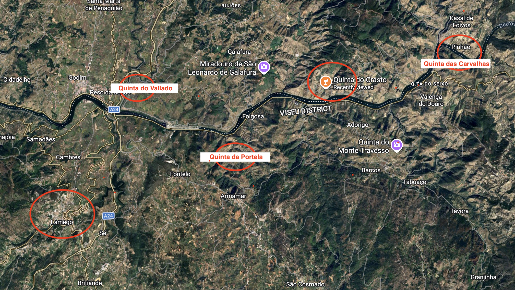
Quinta do Vallado, in Peso da Régua
This is one of the most historical wineries in the Douro Valley and it has been run by the same family since the 18th C.
Traditionally its product had always been Port wine, but in recent years it has diversified into other types of wines, as well.
The family’s old manor house has also been transformed into a boutique winery hotel.
Quinta do Crasto
This is another of the most prominent wine estates of the Douro Valley. Its roots date back at least since the 17th C. and the name hints at a possible Roman presence (“Castrum” or castle at this spot).
But, even if you don’t do the tour, is worth stopping by the estate to check the amazing sights of the wine groves all around, since the winery is on top of a hill overlooking the Douro river on one side and the nearly endless wine terraces on the other.
Driving on the north bank of the Douro: from Peso da Régua to Pinhao
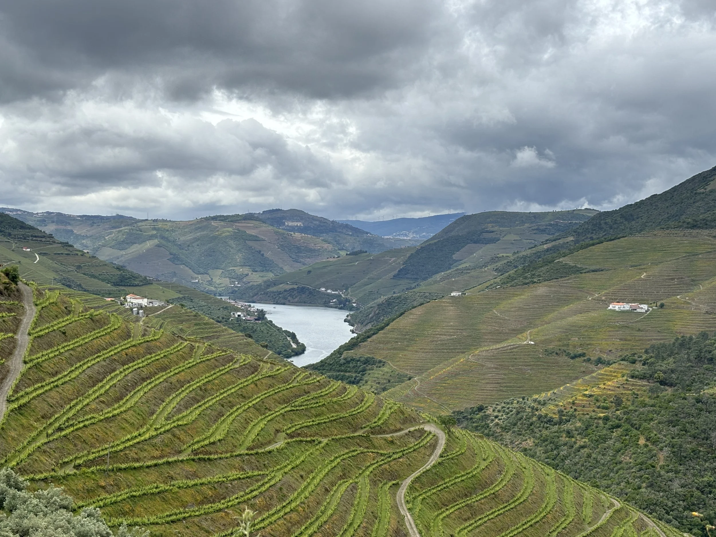
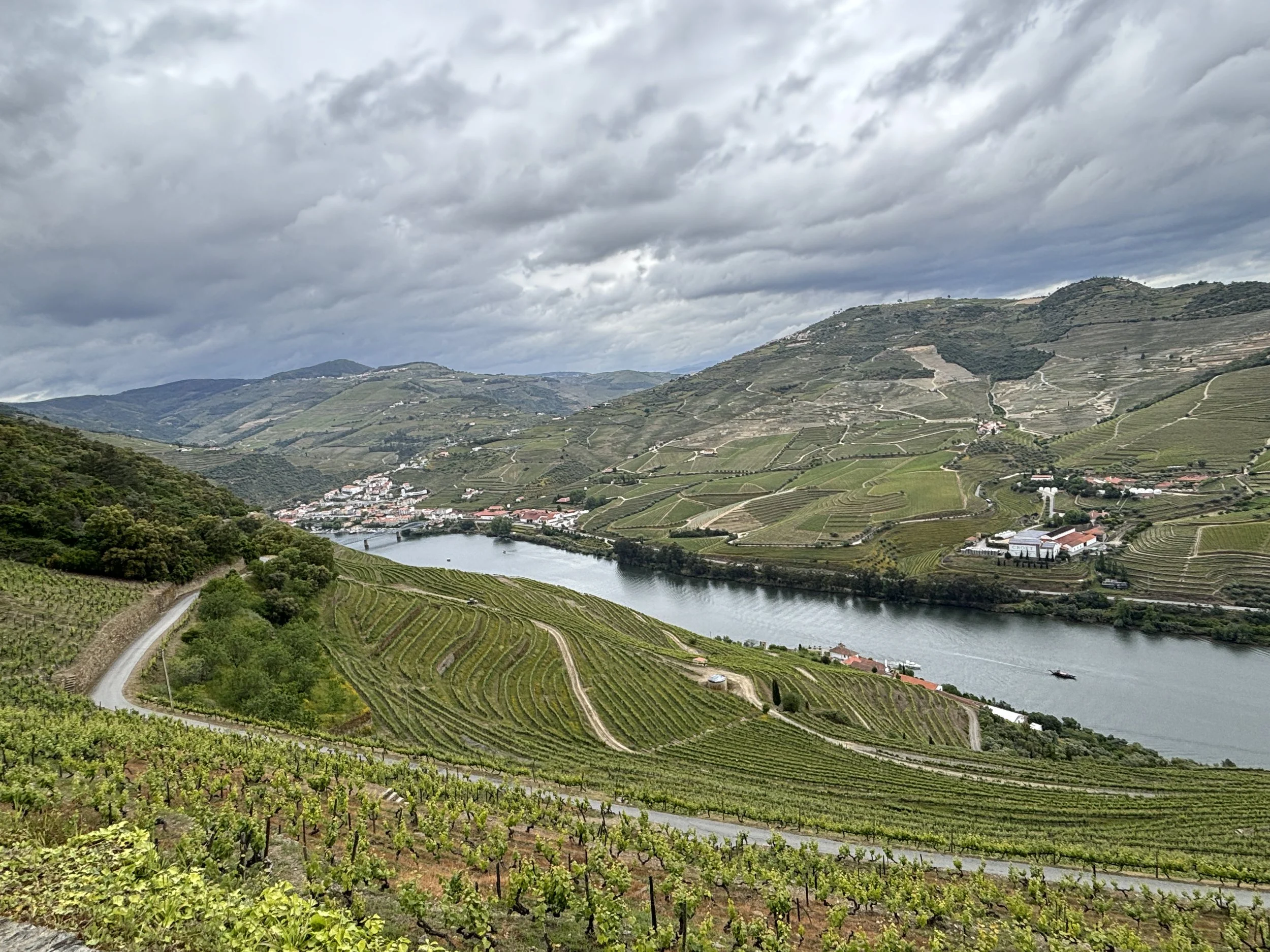
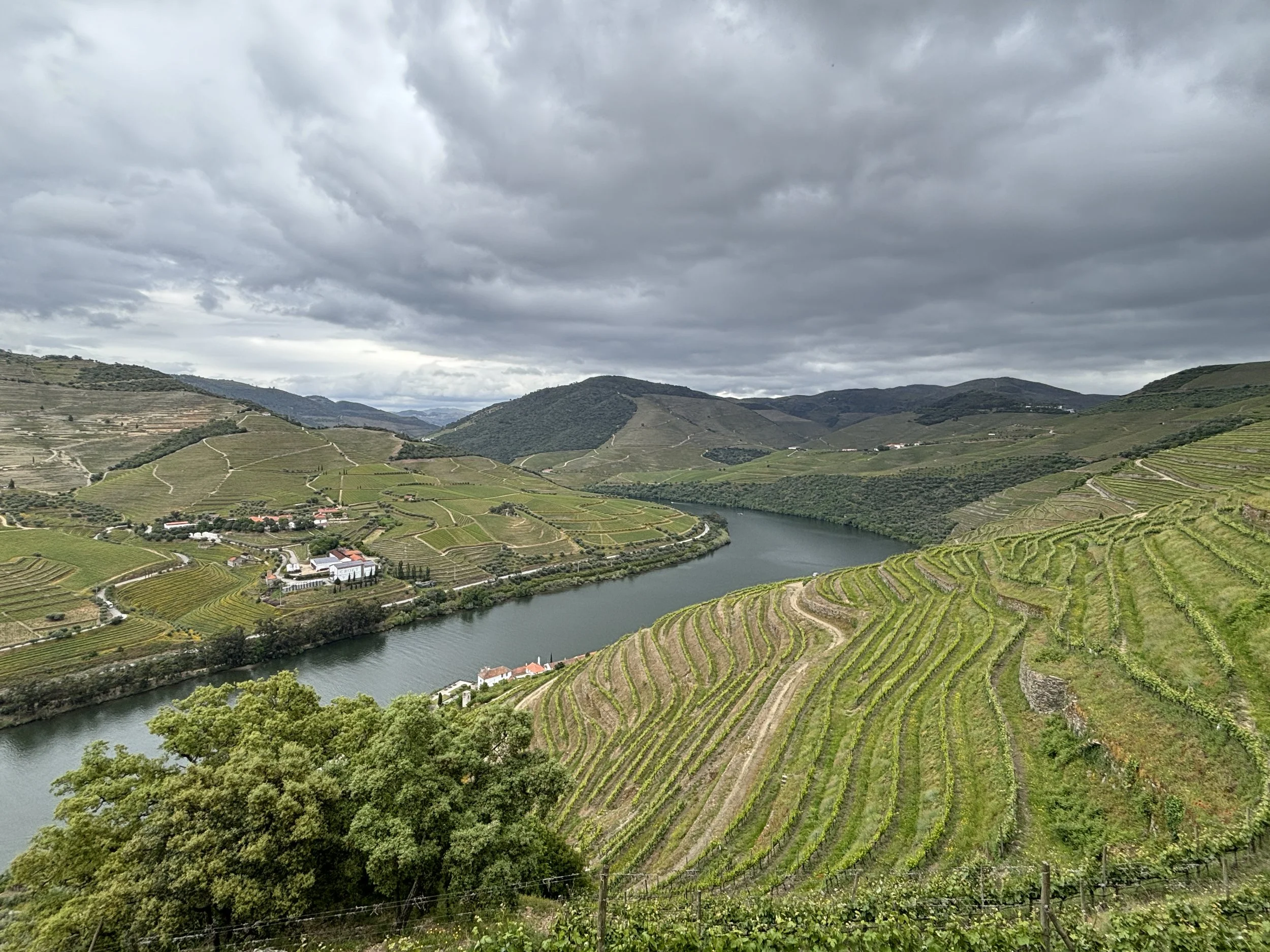
Another good reason to pass by the Quinta do Crasto is that it lies in the middle of an absolutely scenic road. The route from Peso da Régua to Pinhao makes a large arch, heading first towards the northeast towards Vila-Seca and then southeast back towards the river by way of Gouvinhas. It is near the spot where the road rejoins the river that Quina do Crasto is located.
This last stretch of the route, from Gouvinhas to Pinhao is a winding countryside road full of curves but it provides some postcard-perfect (or Instagram-perfect, if you prefer) pictures of the Douro Valley landscape, with its green terraced slopes mixing vines with olive groves.
This is a very rural area and every now and then you come across some village which looks as if it has come out of some time-travelling machine!

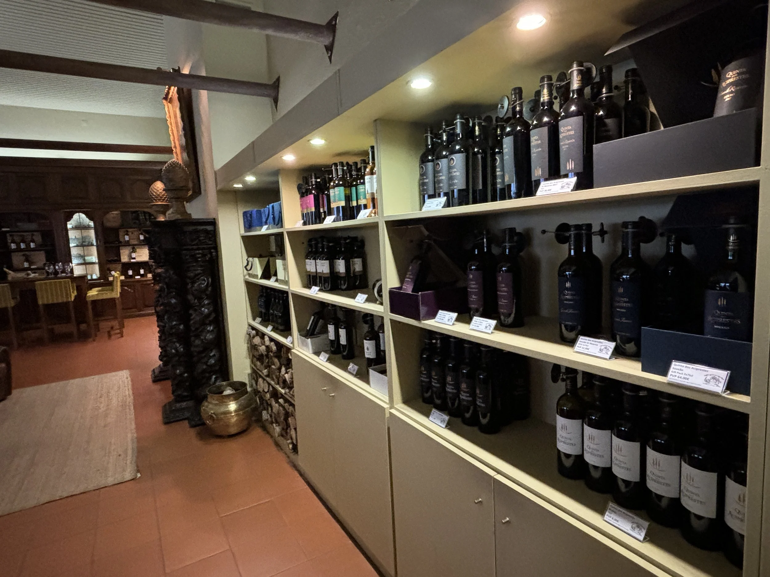
Winery visit: Quinta das Carvalhas
Quinta das Carvalhas, 5085-034 Pinhão
So, after a few frustrated attempts to do the winery tour, we did find one winery that would take us and it was actually a pretty good one!
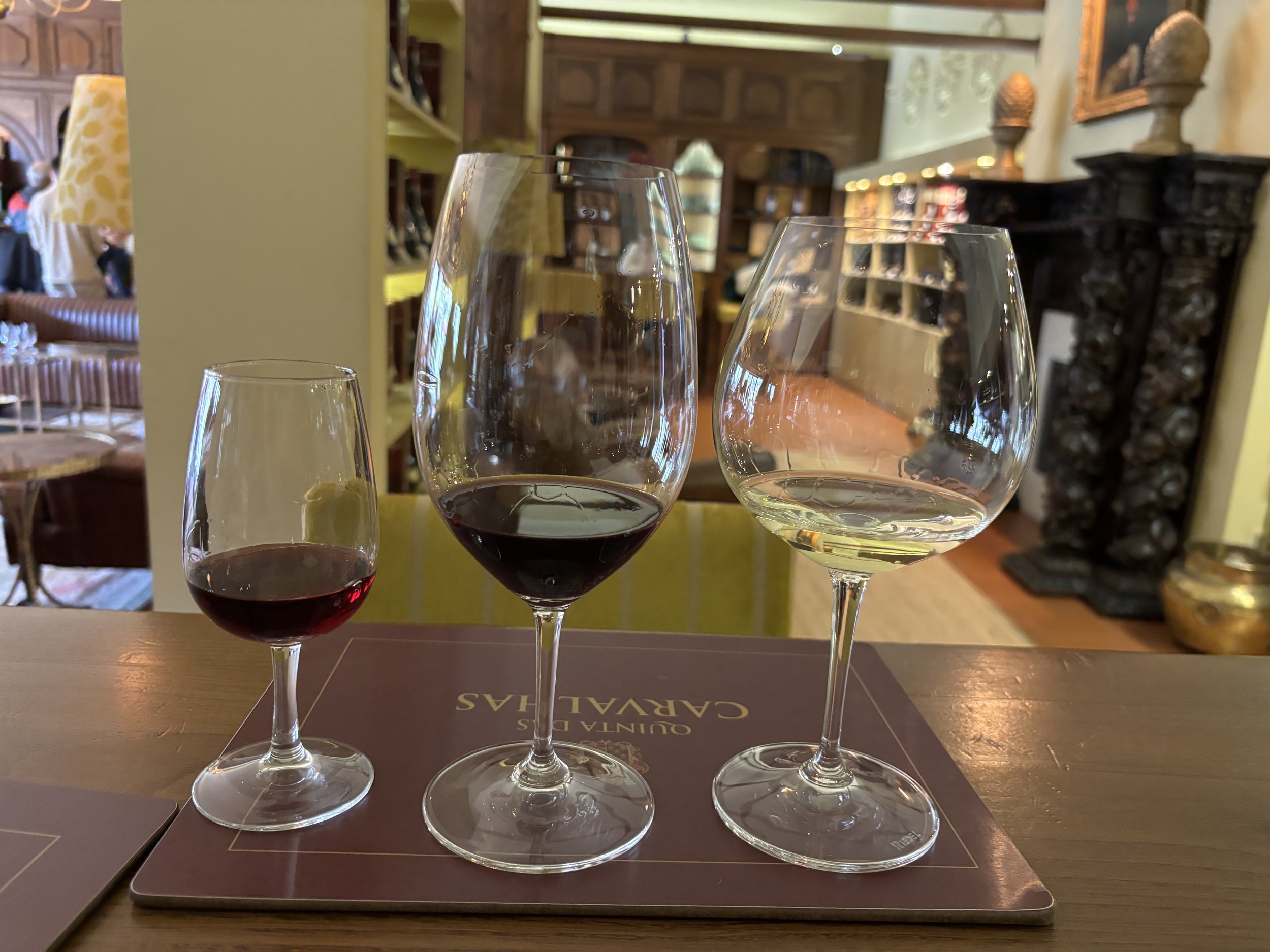
If you are looking for a comprehensive winery visit, with great explanations, landscapes and tastings, the Quinta das Carvalhas, just outside Pinhao, is an excellent option.
Pinhao is also on the railway line from Porto, so even if the winery is on the opposite bank of the river, it is next to a bridge and should be easy to reach even without a car.
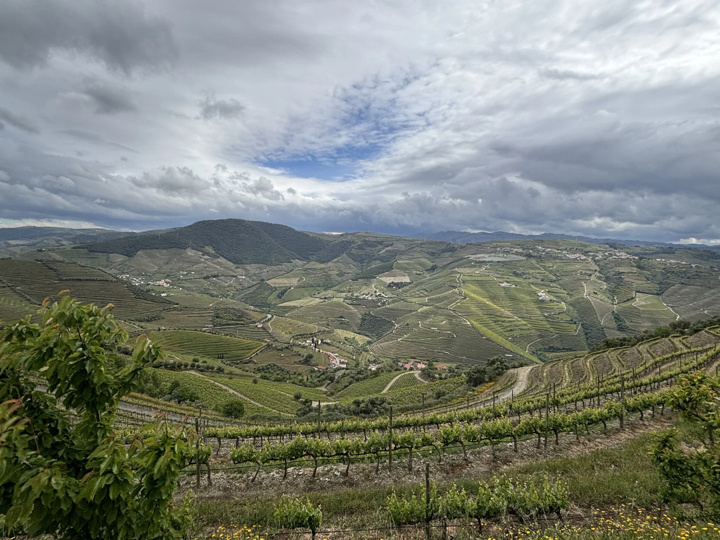
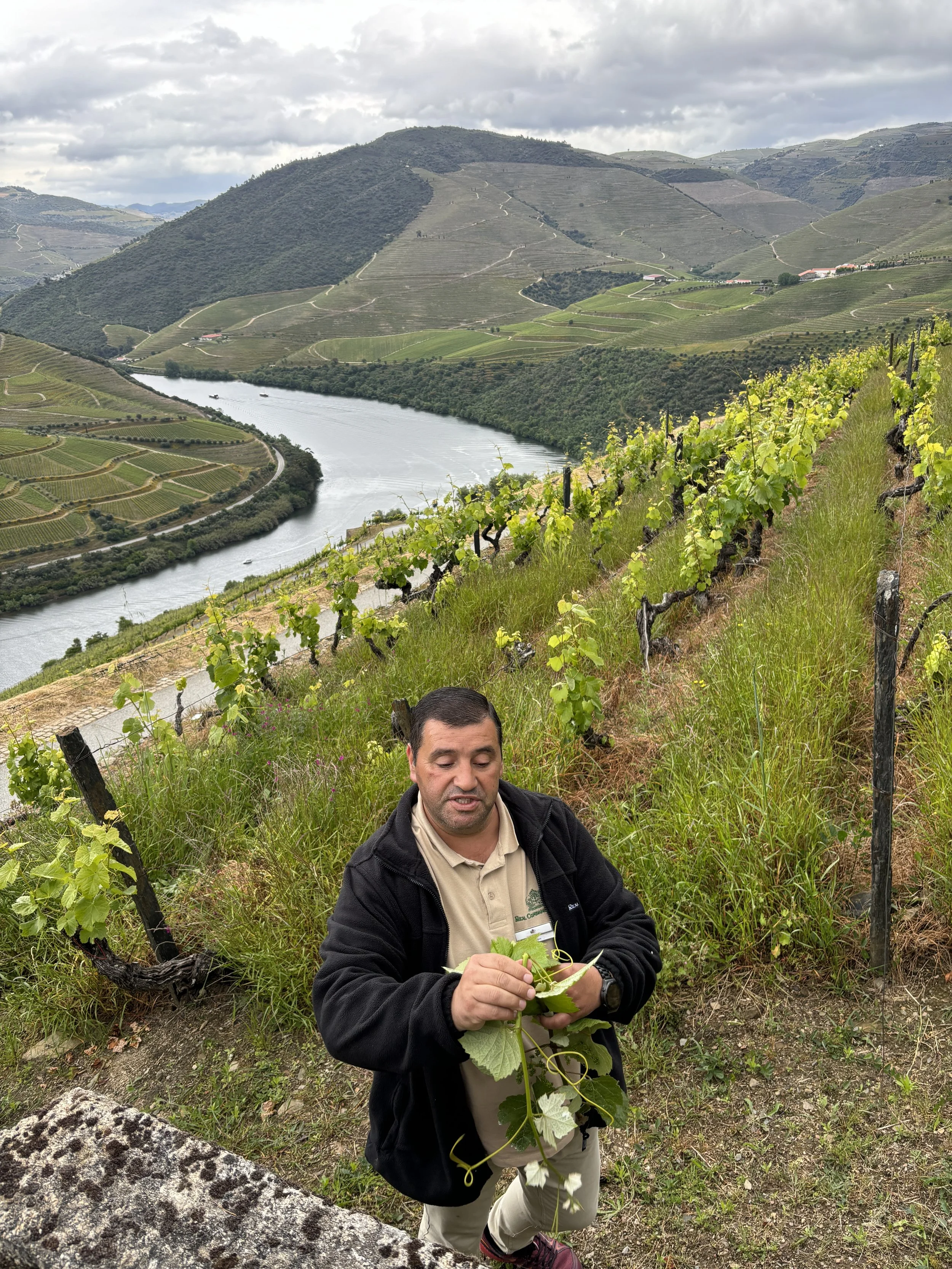
Quinta das Carvalhas offers a guided tour which, rather than showing you the cellars, takes you outdoors through the different areas of the estate. The vines grow on the slopes on the southern bank of the river, offering some truly amazing views.
Since the whole mountain is within the estate, from its top you also have a nice view of the land side, the wine landscape that extends towards the south from the Douro river.
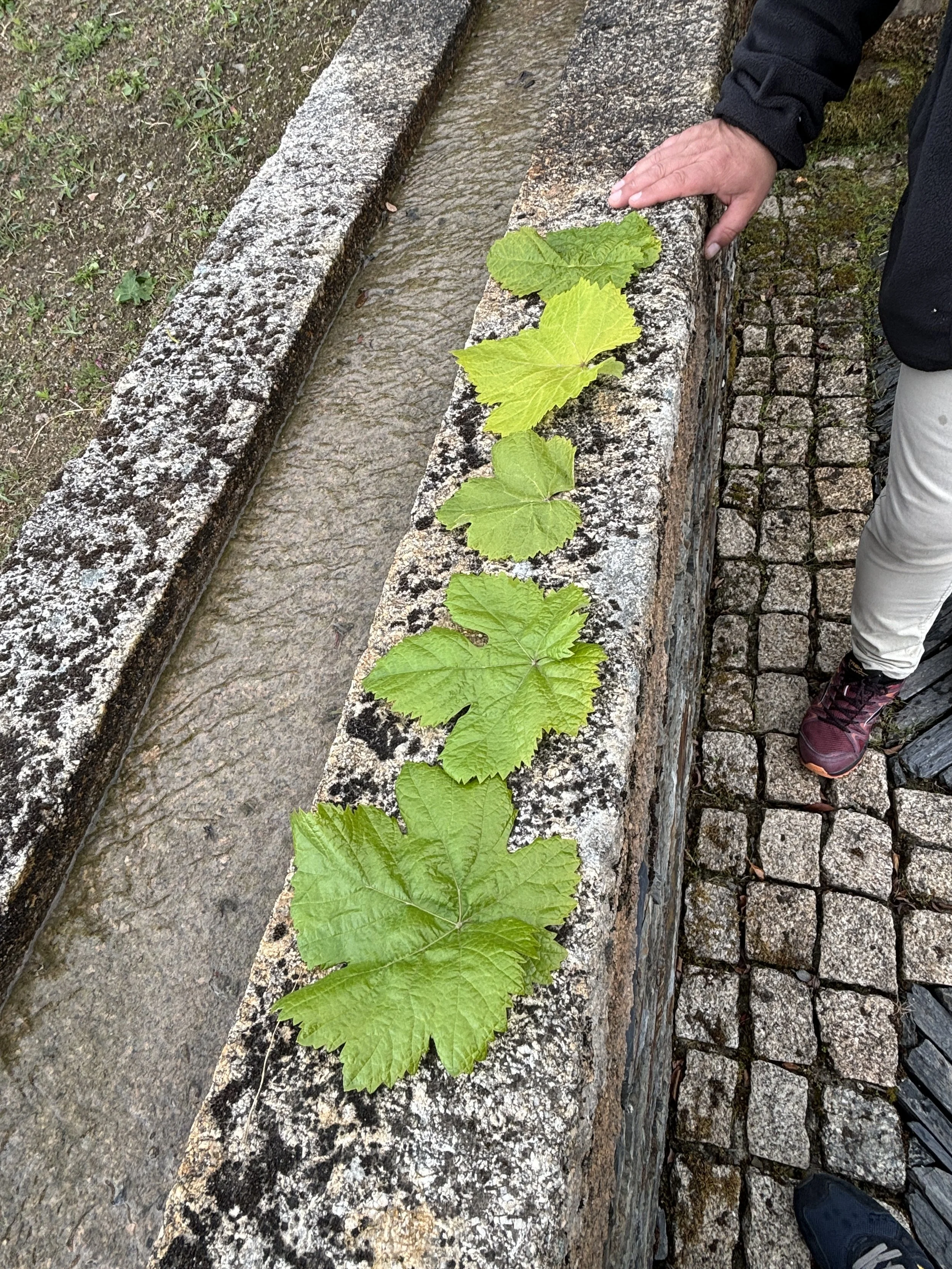
Our very knowledgeable guide provided us a really interesting explanation of how the estate is run and the different types of grapes that are grown there and how and why they are used.
The visit ends, of course, at the winery’s visitors centre, where there is a rather large and modern shop and restaurant.
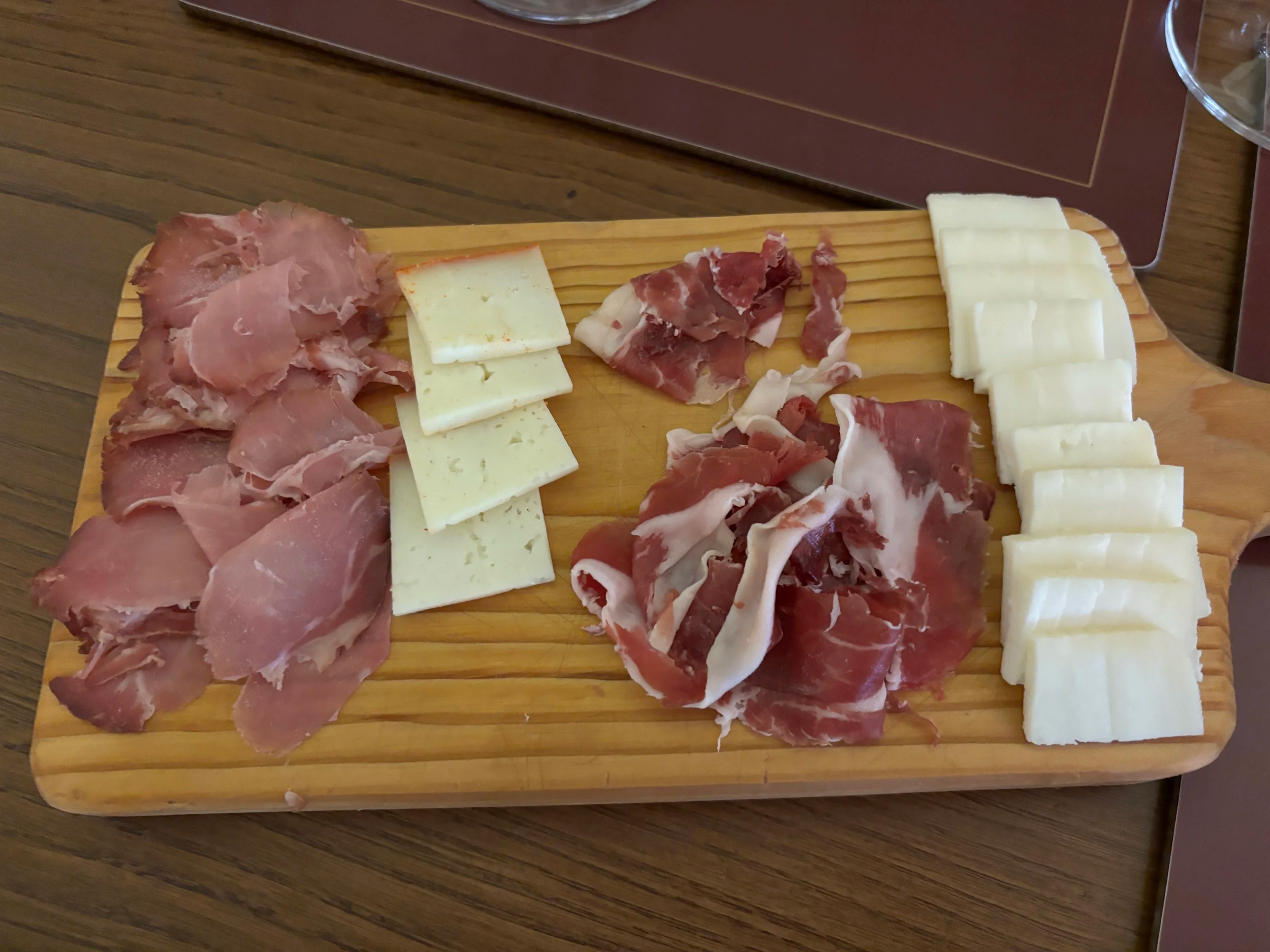
In addition to the wine tasting, there was also a chance to taste some local cheese and cured meats.
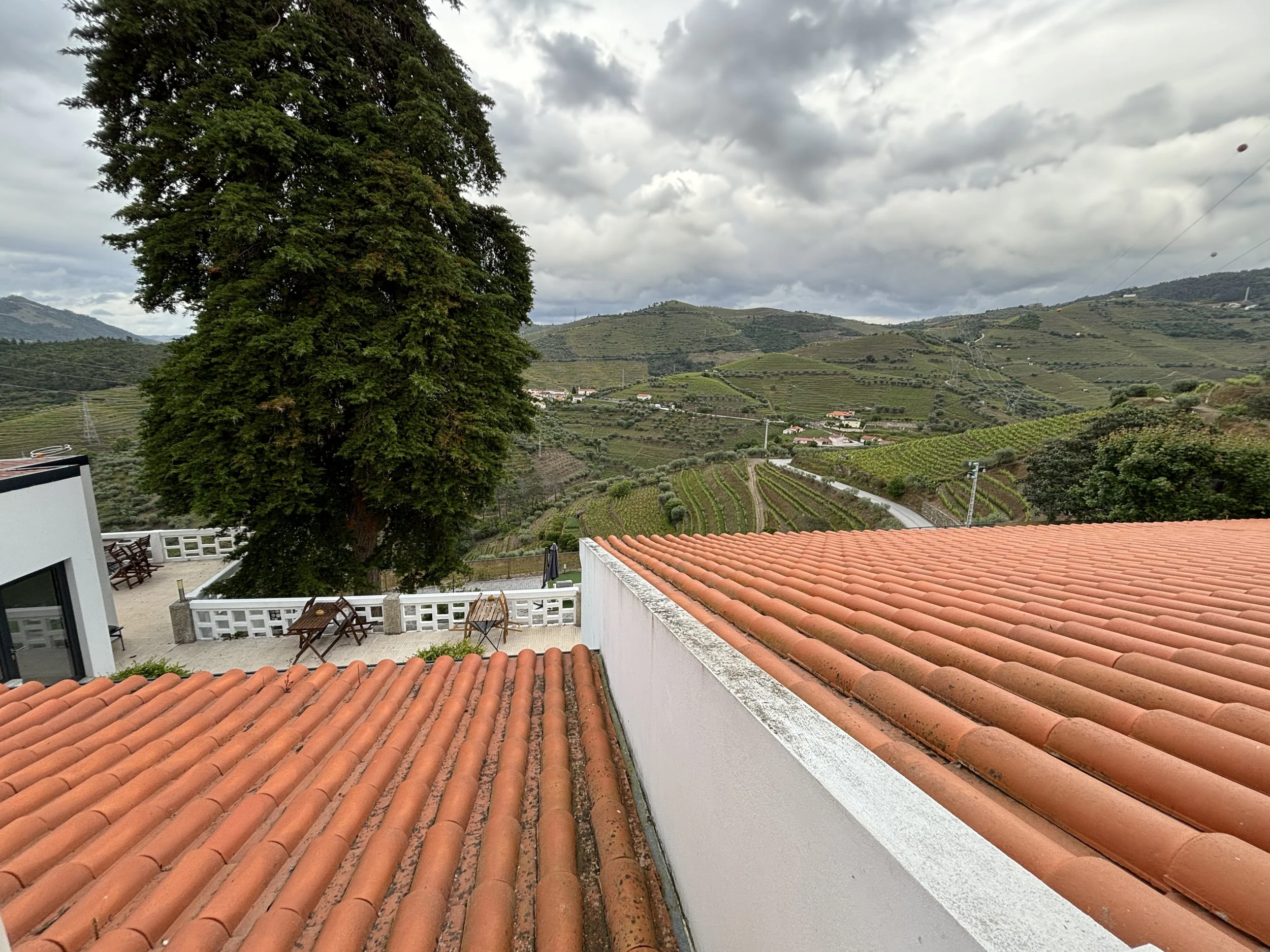
A nice place to stay in the Douro Valley
Quinta da Portela Douro
CM1099, Quinta da Portela n.º 123, 5110-662 Vacalar
This is a another place to stay at the heart of the Douro wine region.
The Quinta da Portela is located on a hill on the south bank of the Douro, near the village of Vacalar (again, you will need a car to get here, but most of the best hotels are in those rural locations anyway).
The Quinta da Portela manages to combine a modern setup with a homely feel remarkably well.
In fact, when we went into the nearby village to have dinner, we were told that, since there would be no one at the reception when we came back, we should just use our set of keys to access the hotel's common areas and make ourselves at home.
The hotel is perched on a hillside and it has its own private parking space, a nice terrace and a pool, which I am sure is great during the summer months, but, as you can see, we didn’t really have this type of weather. The one element that spoils the view a bit is the nearby electricity line, although you do not see it when looking towards the valley.
Here you can see the breakfast area, which could well be the living room of a designer house. So, overall, I must say, the experience at Quinta da Portela was pretty good.
A great place to stay in Porto
While it is a bit out of the scope of this post, it is safe to assume many travellers visiting the Douro Valley wine region will start or end their journey in the city. This is the reason that I found it appropriate to provide also a recommendation about where to stay in Porto. And my pick is…
Oporto Maison Anselmo
Rua de Anselmo Braamcamp 165, 4000-082 Porto
This property is technically an aparthotel although it has pretty much all the services you would expect in a hotel.
It is located in a rather modern facility, just one the edge of the historical center, which it makes it quite convenient if you are traveling by car. The aparthotel has, actually, its own parking space (which can be booked for a fee), although there appeared to be quite a lot of parking space also on the streets around it.
In fact, in terms of location, I’d say the Oporto Maison Anselmo hits the sweet spot, because it is close enough to the center that you can walk, it is about 20min of a nice walk, but it is also close enough to the main motorway ring and the accesses to the city that it saves you from having to navigate Porto’s very intricate urban grid in the very center.
The Oporto Maison Anselmo has also its own courtyard and a pool, although we didn’t really make use of these facilities, since were staying only for one night.
Also worth mentioning is that the staff were very friendly throughout and gave us plenty of guidance about moving around town, for example. Also worth noting is that there is an amazing bakery (“Confeitaira Miguel Ángelo”) just around the corner, which is where we had breakfast.
As per the room, we were given not just a room, but a whole two-floor modern apartment, complete with a large living room, two bedrooms, kitchen and even a small patio.
We didn’t spend that much time there to be able to enjoy all of this fully, but I must say we were really impressed by the whole setup and the value for money this establisment provides.
What to do in Penang & Malaysia’s Cameron Highlands
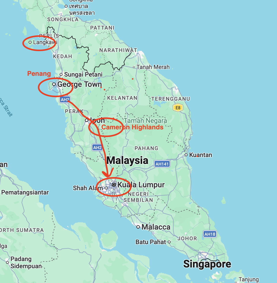
This is the second post about things to do and to see in Malaysia outside Kuala Lumpur.
If in the first instalment we travelled to the resort island of Langkawi to check its beaches and nature reserves, on this one we are going to explore another island, Penang, as well as the Cameron Highlands of Central Malaysian, a surprising lush cool mountain area covered by rainforest and tea plantations.
Our itinerary concludes in Kuala Lumpur, and although the capital of Malaysia is a bit out of scope for this post, since the city l is usually the gateway to many itineraries within the country, I have included a recommendation of what is, in my opinion a great value quality hotel in KL.
This post may contain affiliate links. If you book or buy something through them, I earn a small commission, at no extra cost to you. It's a way to keep Places of Charm going. Thank you for your support.
What to see and what to do in Penang: walk around Georgetown
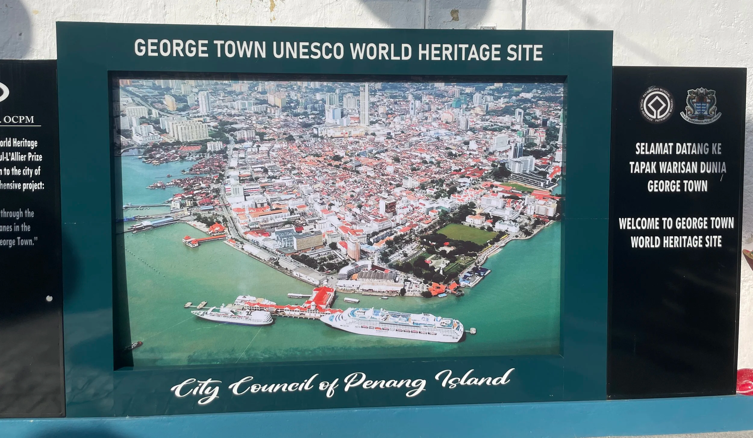
The historical city of Georgetown, capital of the island of Penang, is a UNESCO World Heritage Site. This designation recognizes the different cultural layers which over centuries have made of this traditional trading entrepôt such an interesting place to visit.
Located at the northeast of the island, Georgetown has, in fact, one of the best preserved historical centers in south-east Asia.
Like most other “Georgetowns” in the world, the city was named after a British sovereign (George III).
In fact, the arrival of the British in 1786 was the turning point in the history of Penang, since it turned the island into a sort of early version of what Singapore is today: a commercial hub which, under British protection, soon started attracting people and mercantiles communities from all over Asia and beyond (there is even an Armenian quarter).
This created a melting pot of Malay, Chinese, Indian, European, Indonesian, Arabic, Armenian and other peoples, with which is still reflected today in the varied architecture, religious practices and the local cuisine.
How to get to Penang
The easiest way to get to Penang is by air, with its international airport located on the south side of the island.
In fact, the island is currently connected to the mainland by two bridges, at its northern and southern ends, so you can also travel by land if driving through Malaysia, as was our case.
Penang is approximately 24 km long by 15 km wide (a similar size to Singapore, and, as we have seen, not the only thing that the two places have in common!) so, if you intend to see a bit of the island outside Georgetown the best way to move around it to rent a car (which is what we did).
Roads are ok, particularly in the area around Georgetown, but the island is very mountainous, particularly in its central part, so depending on where you go to you may encounter narrow roads or traffic jams (again, around Georgetown).
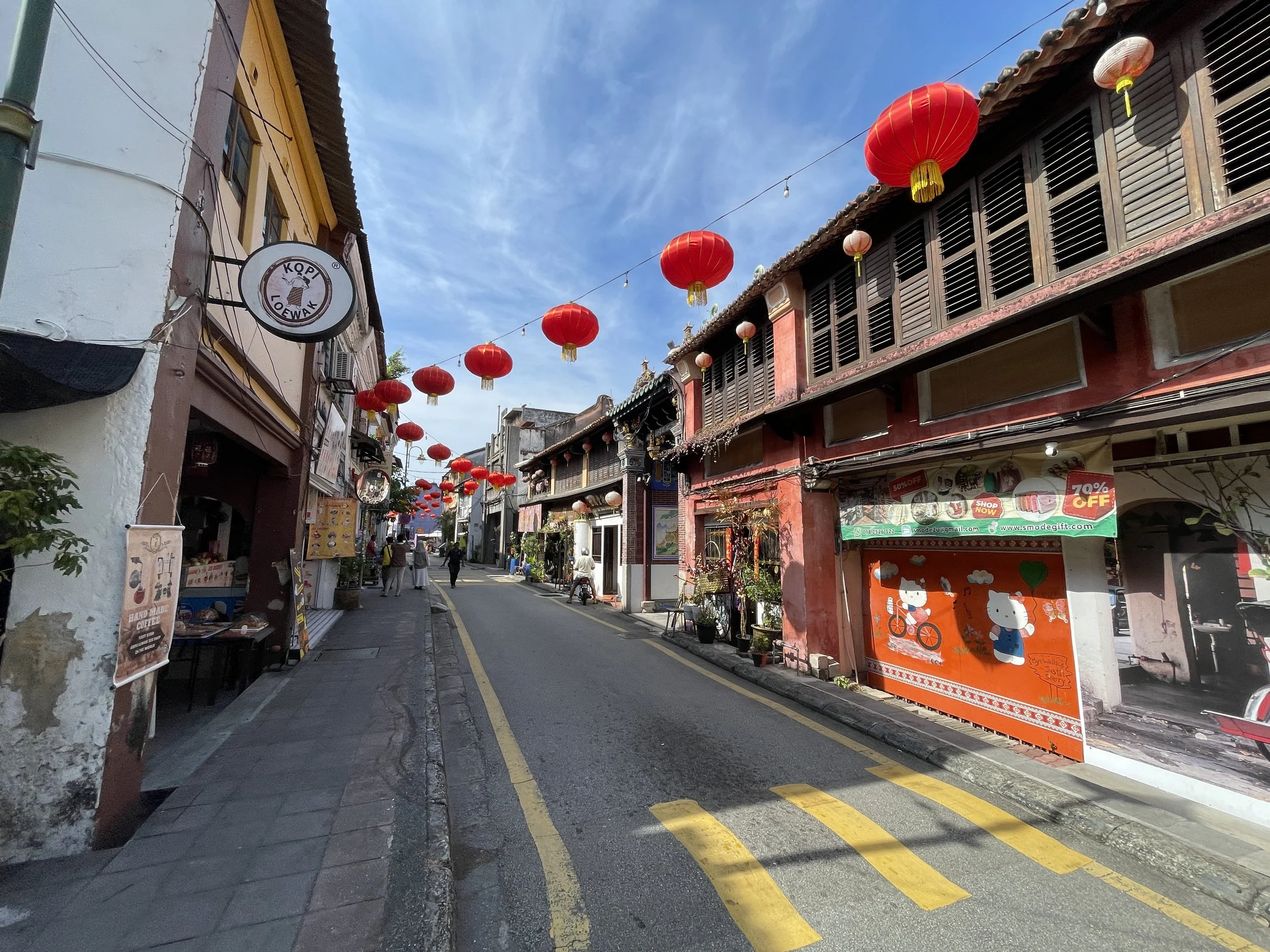
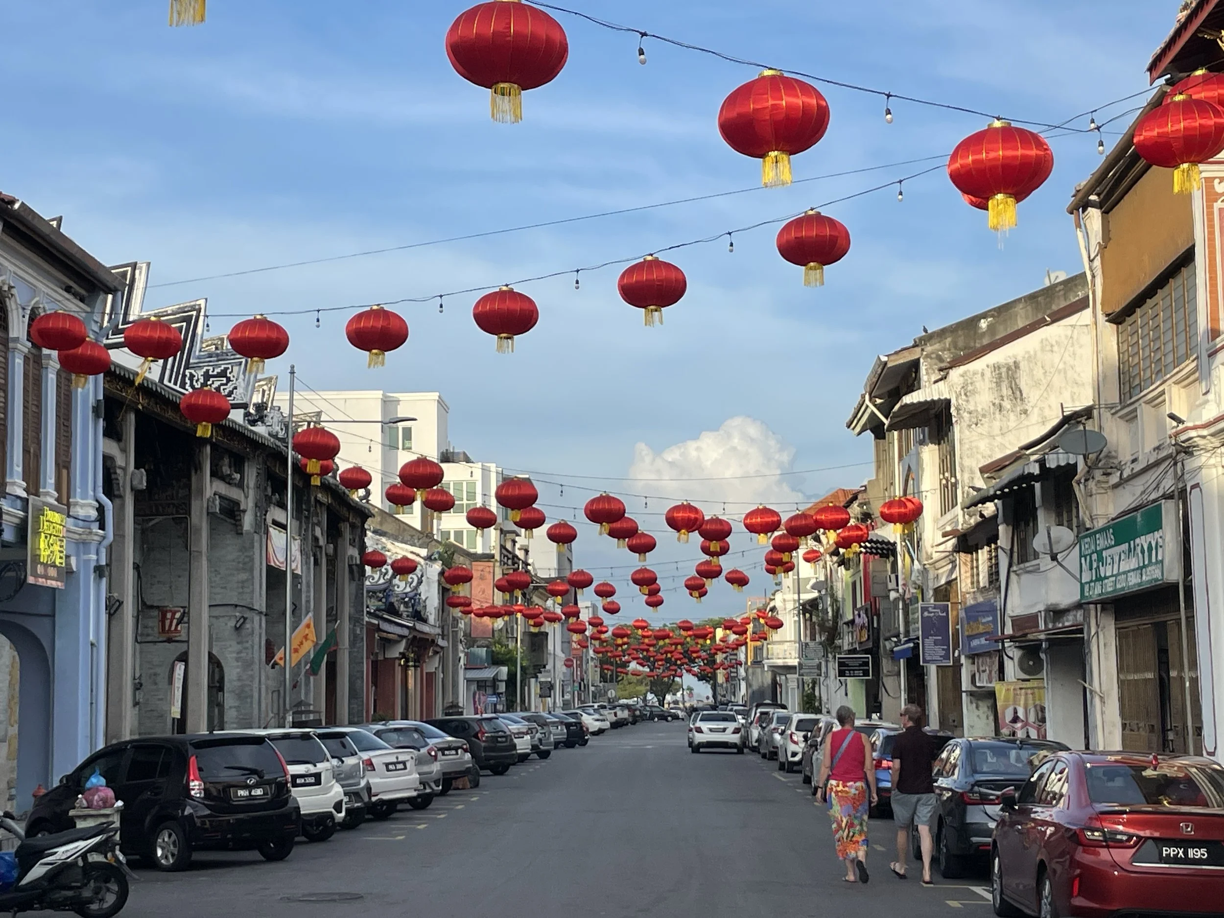
While I wouldn’t say Georgetown is harmonious or coherent in the sense in which historical towns may be, for example, in parts of Europe, its appeal is the different types of styles and contrasts you may find in and around its historical centre.
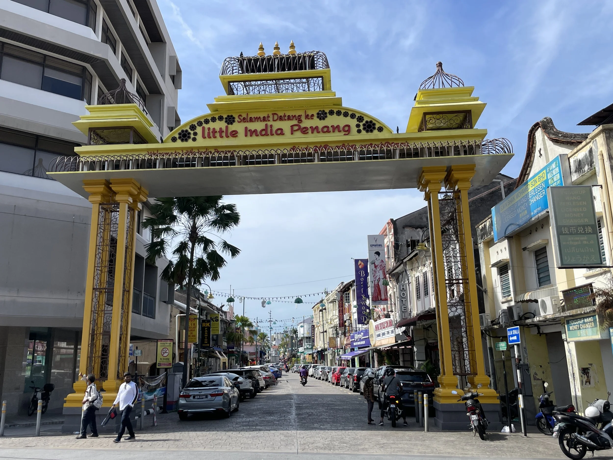
The centre is quite walkable and, in fact, it is what you would recommend doing in Georgetown first and foremost. You quickly pass from one of the historical “ethnic” neigbourhoods to the next. There is “Little India”, an Armenian quarter, then an area with Chinese clan houses (called “kongsi”) and so on…
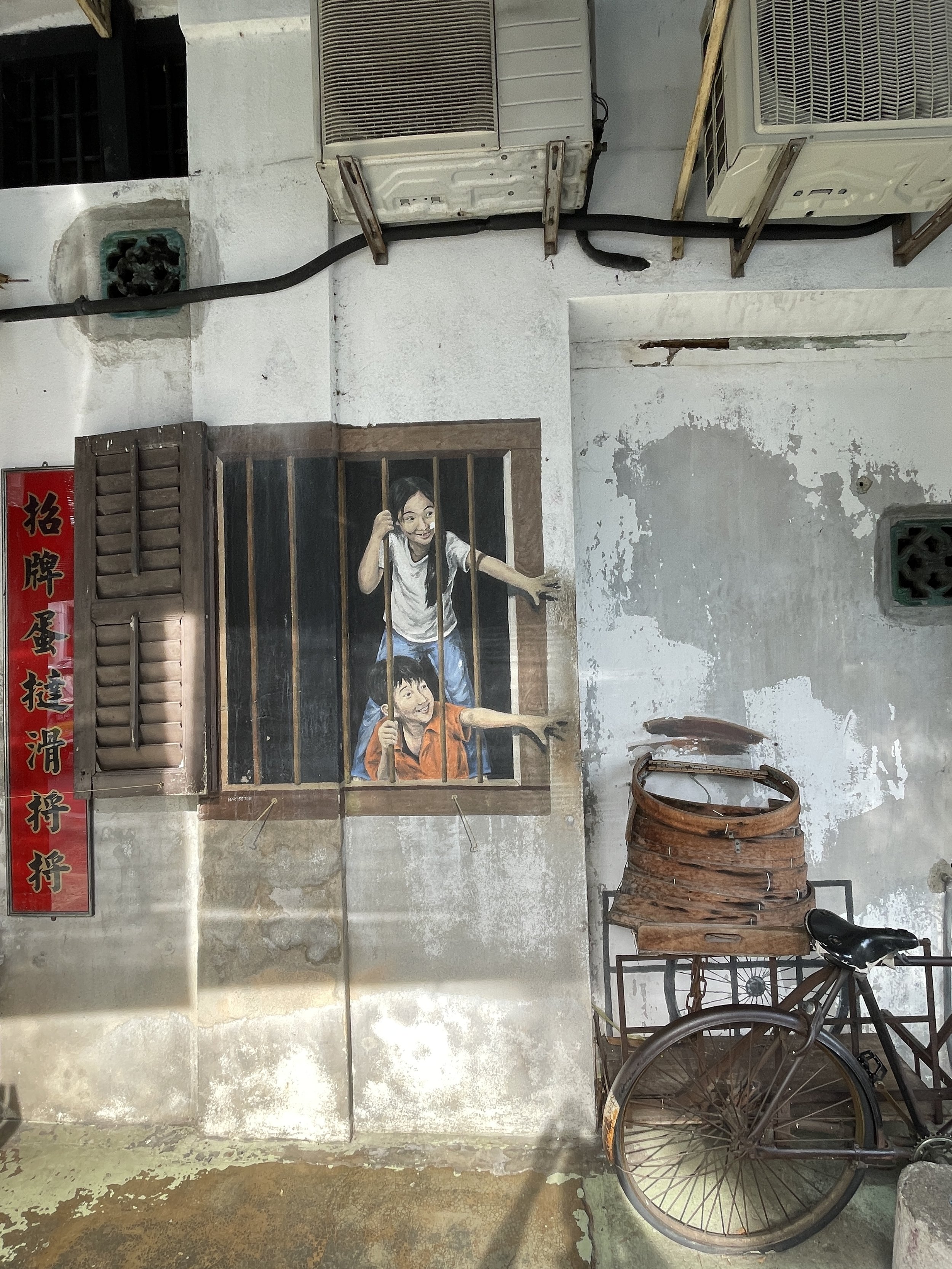
Also worth mentioning that here is also a considerable amount of street art which keeps popping up around every other corner, making the ensemble more lively.
The “Kongsi” or clan houses of Penang
One of the top things to see in Georgetown’s historical center are the Kongsi, or Chinese clan houses.
Their origin is in the arrival of Chinese immigrants from the late 18th C. and all the way through the early 20th C. Those migrants usually clustered around a specific clan or extended family with which they tended to share a surname.
These Kongsi were built in a very distinctive Chinese style and were a bit like a mix between a palace, a warehouse and a temple which acted as a base for a specific clan or group.
I recommend you visit at least one to get a good idea of this concept and how this type of societies work in Colonial Penang.
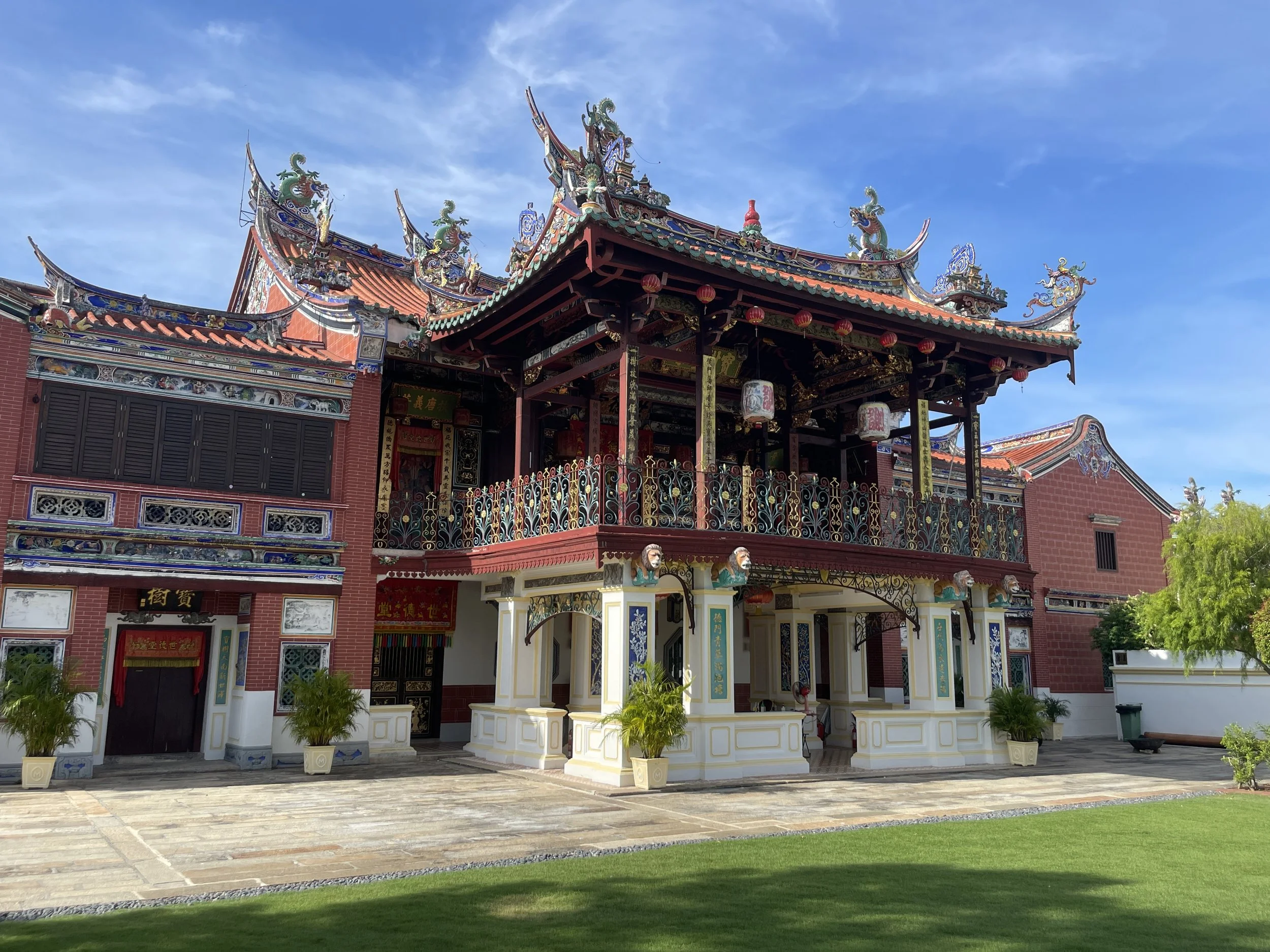
There are several Kongsi which have been turned into museums and can be visited nowadays in Penang, like the Cheah Kongsi, which you can see in these pictures above and right.

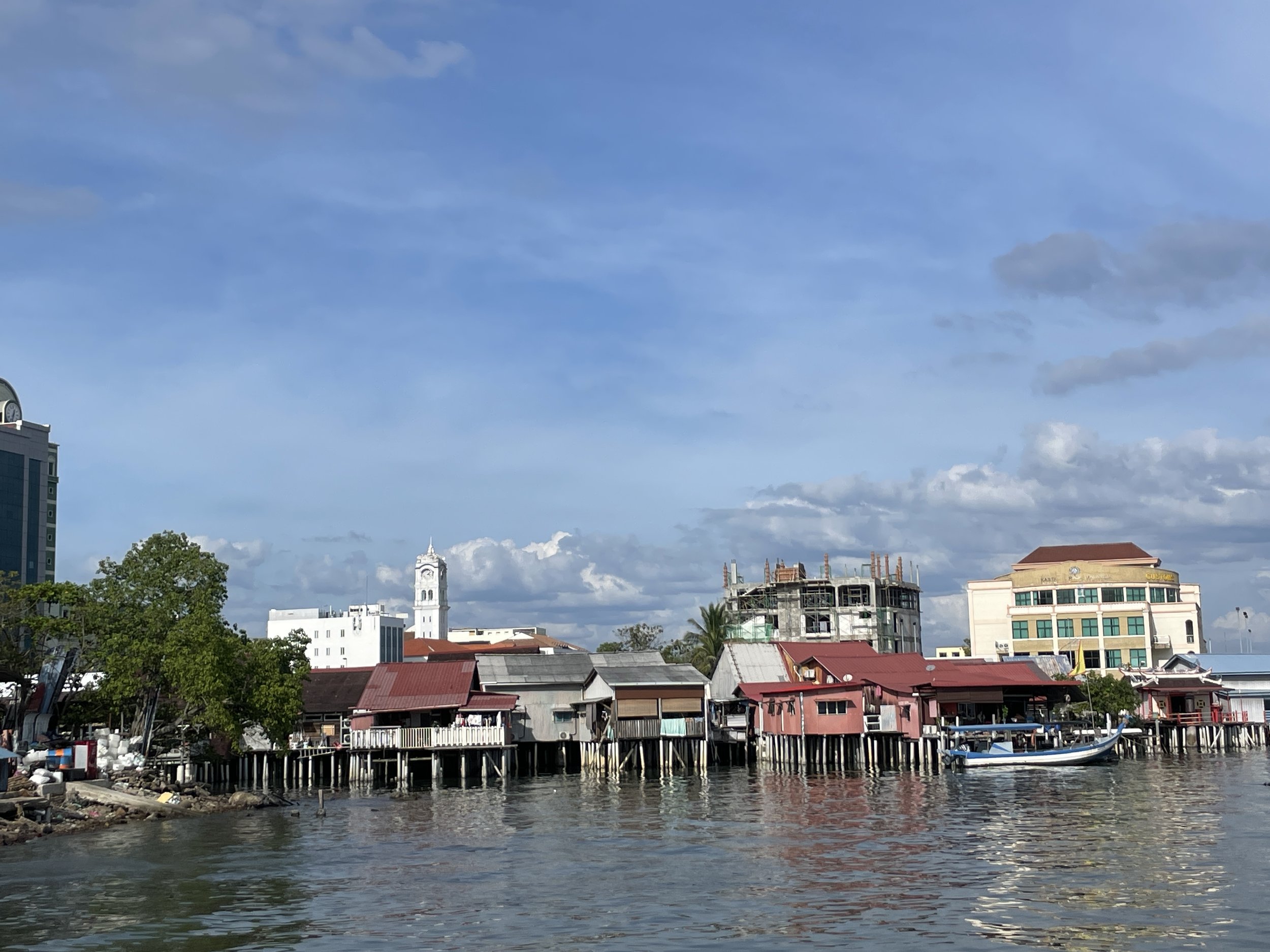
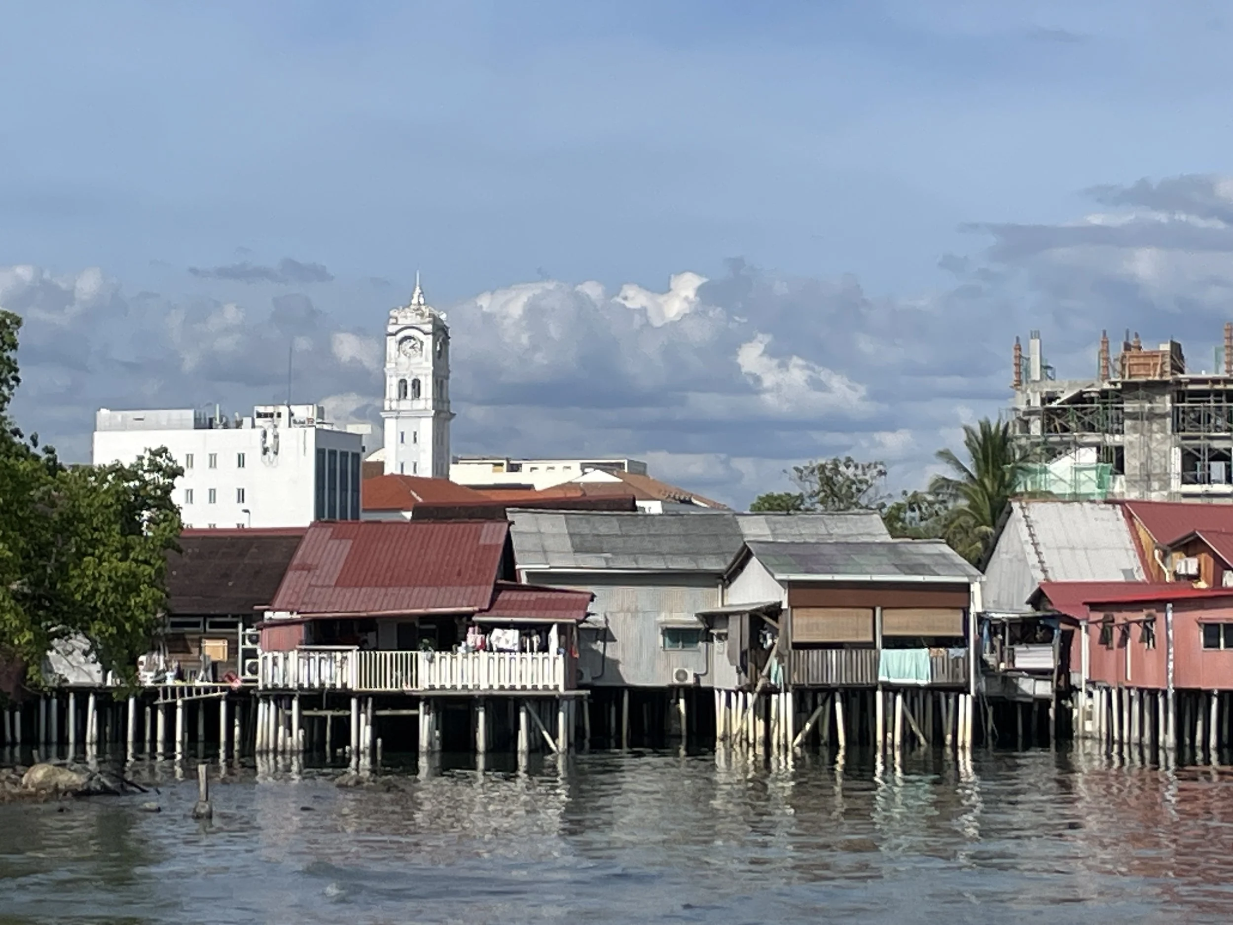
By the way, another area that was “divided” along clan lines is the jetties by the seaside. Penang was a busy port and the jetties were a key gateway for all this trade with each of them controlled by one of the clans.
The jetty area, by the way, can be visited today. These wooden platforms protruding into the sea are no longer used for bulk merchandise trade, but they have significant commercial activity in the form of restaurants, bars and the like.
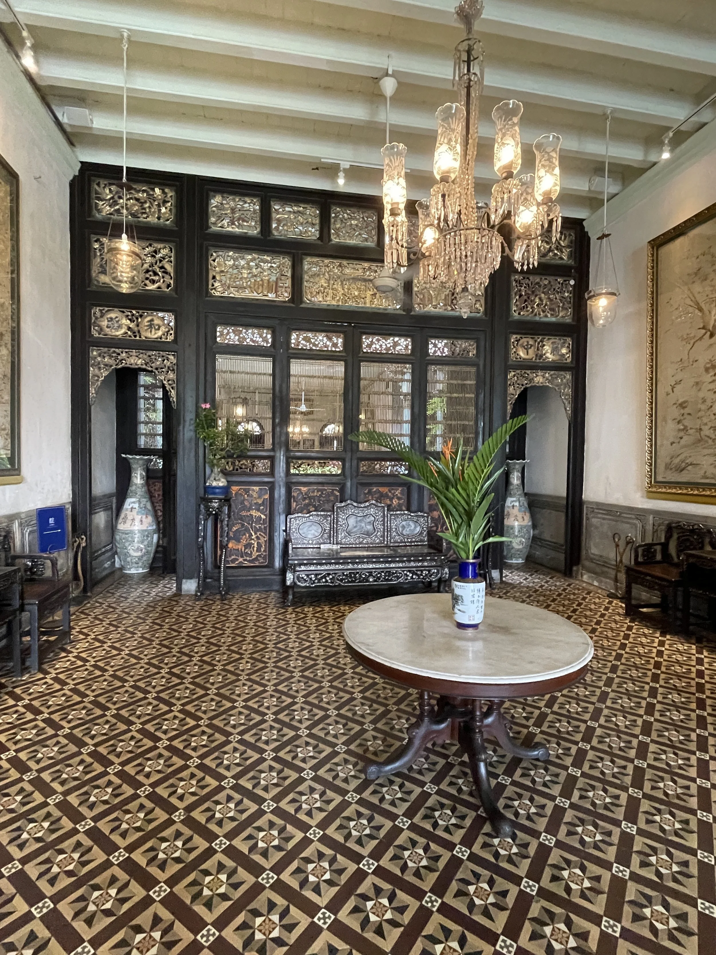
Georgetown’s Blue Mansion
This is another interesting piece of heritage you can visit in Georgetown, which brings you back to the times when the city was one of the top commercial entrepôts of South East Asia.
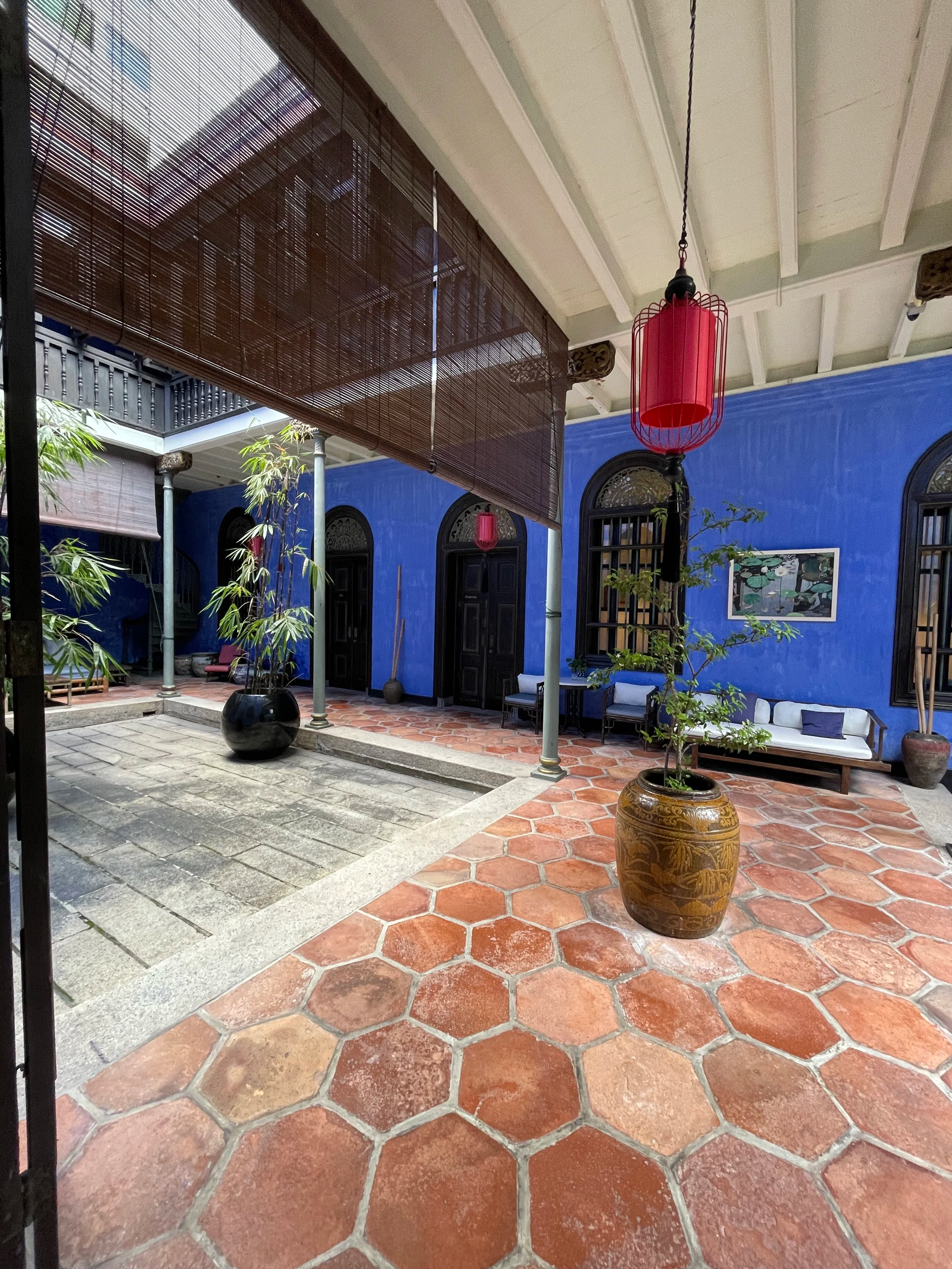

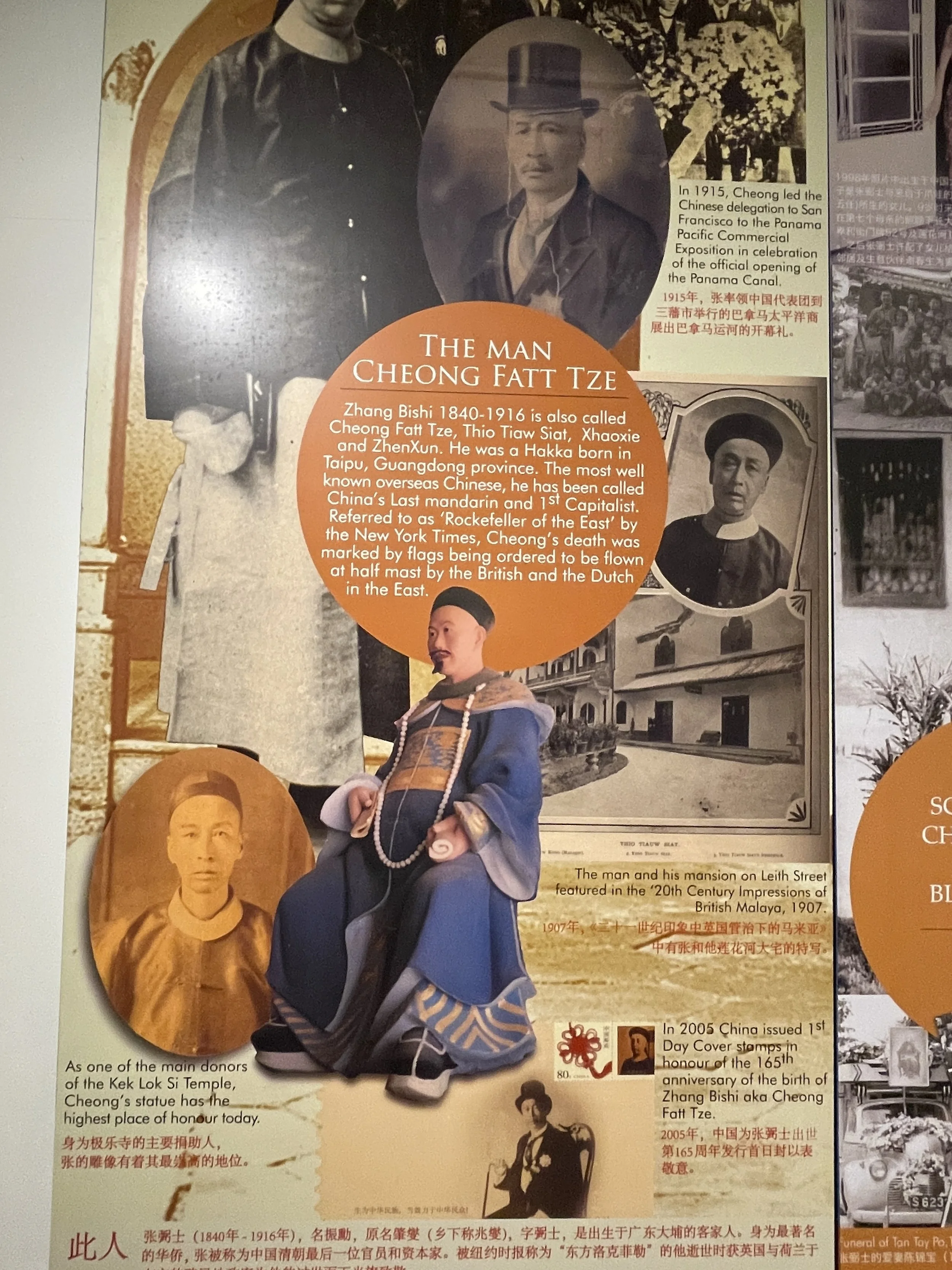
The Blue Mansion, which gets its name from the intense indigo colour it is painted on, is a palatial house associated to the figure of Cheong Fatt Tze, a Chinese entrepreneur and self-made millionaire, which used its as one of his residences (apparently he had eight different mansions through southeast Asia for as many wives).
Born to a poor family in Guangdong (Guangzhou), in the Pearl River Delta area, in 1840, Cheong Fatt Tze emigrated as a young man to the then Dutch East Indies (now Indonesia) and managed to make an immense fortune by engaging in different sorts of trade. He was so rich that, at some point at the turn of the 20th C. he became known as the “Rockefeller of Asia”.
After the death of Cheong Fatt Tze, and I guess, the decline of Penang as the commercial hub of reference in the region, the building became progressively neglected, to the point that it required a thorough restauration in the 1990s to recover its former splendour.
Today, Penang’s Blue Mansion is a boutique hotel, but parts of the building are also open to visitors, offering a glimpse into that Golden Era of Penang.
Exploring the colourful streets of Georgetown
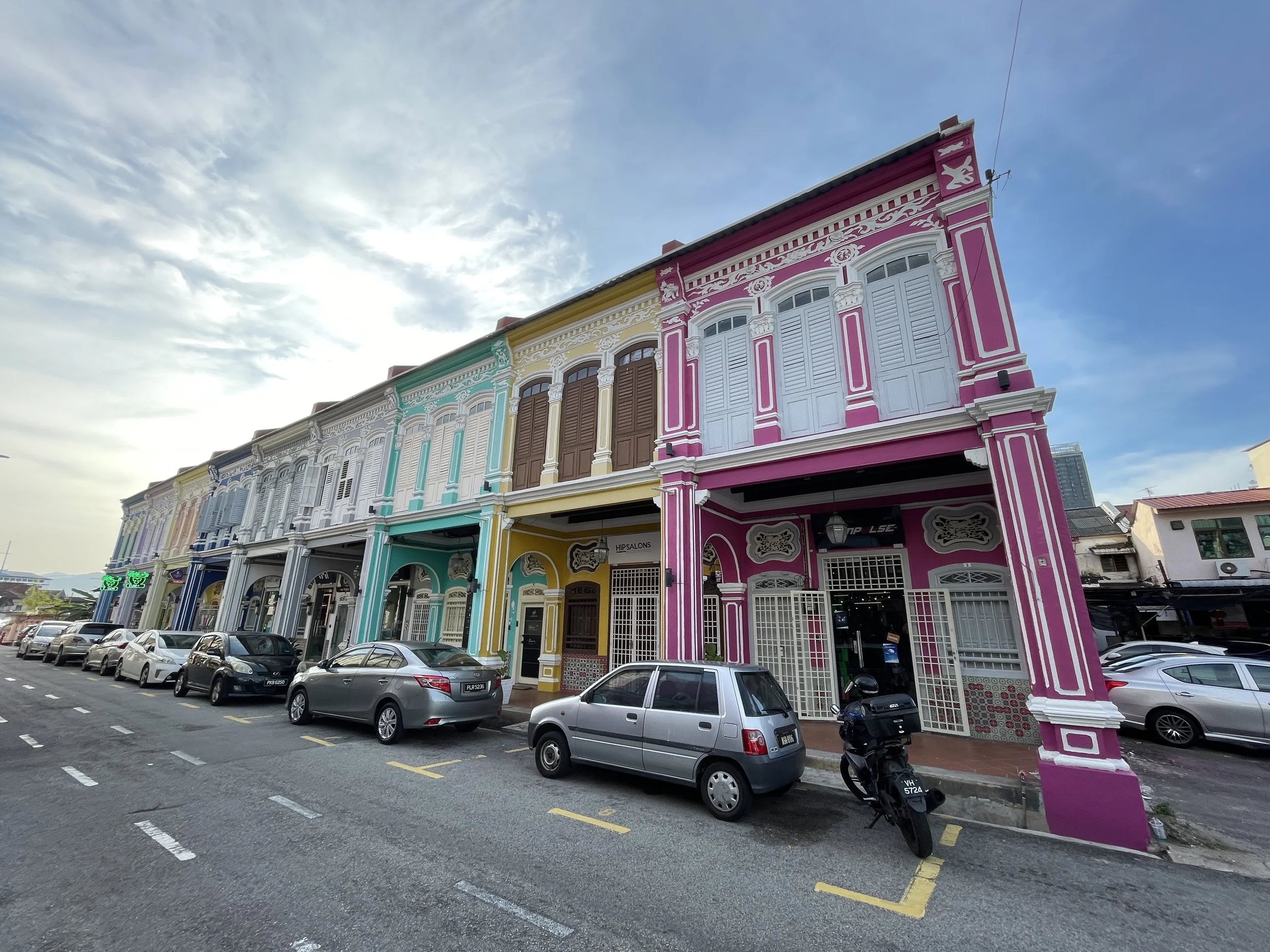
As mentioned earlier, one of the good things about Georgetown is that it has a relatively compact and walkable town centre.
Another of the top attractions you can find there, this one a bit outside of the inner core of the old town, but still reachable on foot, is Jalan Kek Chuan street. There you will find a row of beautiful painted houses with original front porticos.
Now, while these period houses are certainly cute, I think some Penang guides may be overselling them a bit. I even read somewhere that it was considered one of the most beautiful streets in the world, which I think is quite an exaggeration!
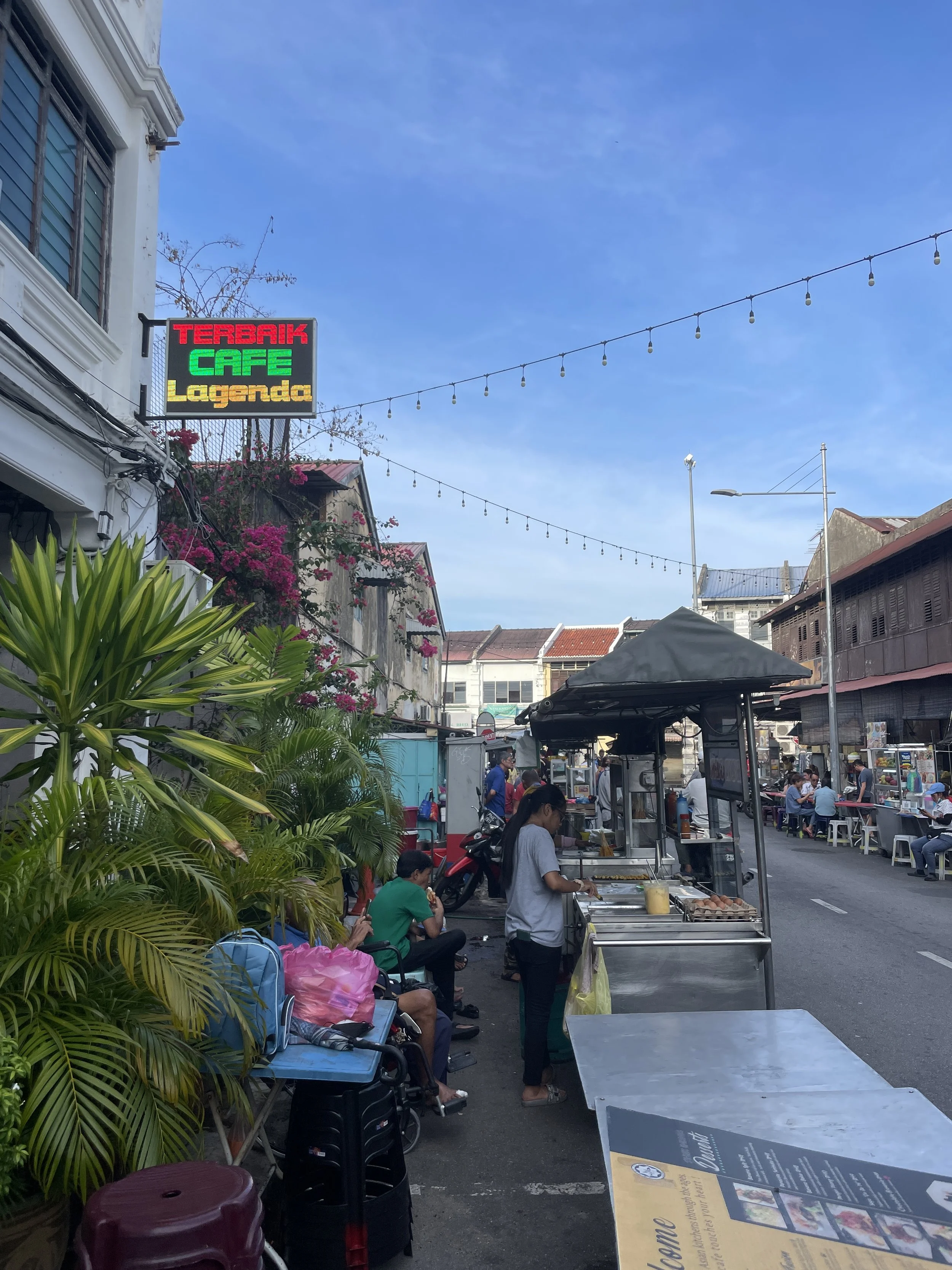
There are quite a few streets in central Georgetown where you can find plenty of street food. The picture on the right, for example, is from Lebuh Carnarvon street, which is a top area for hawker food stalls.
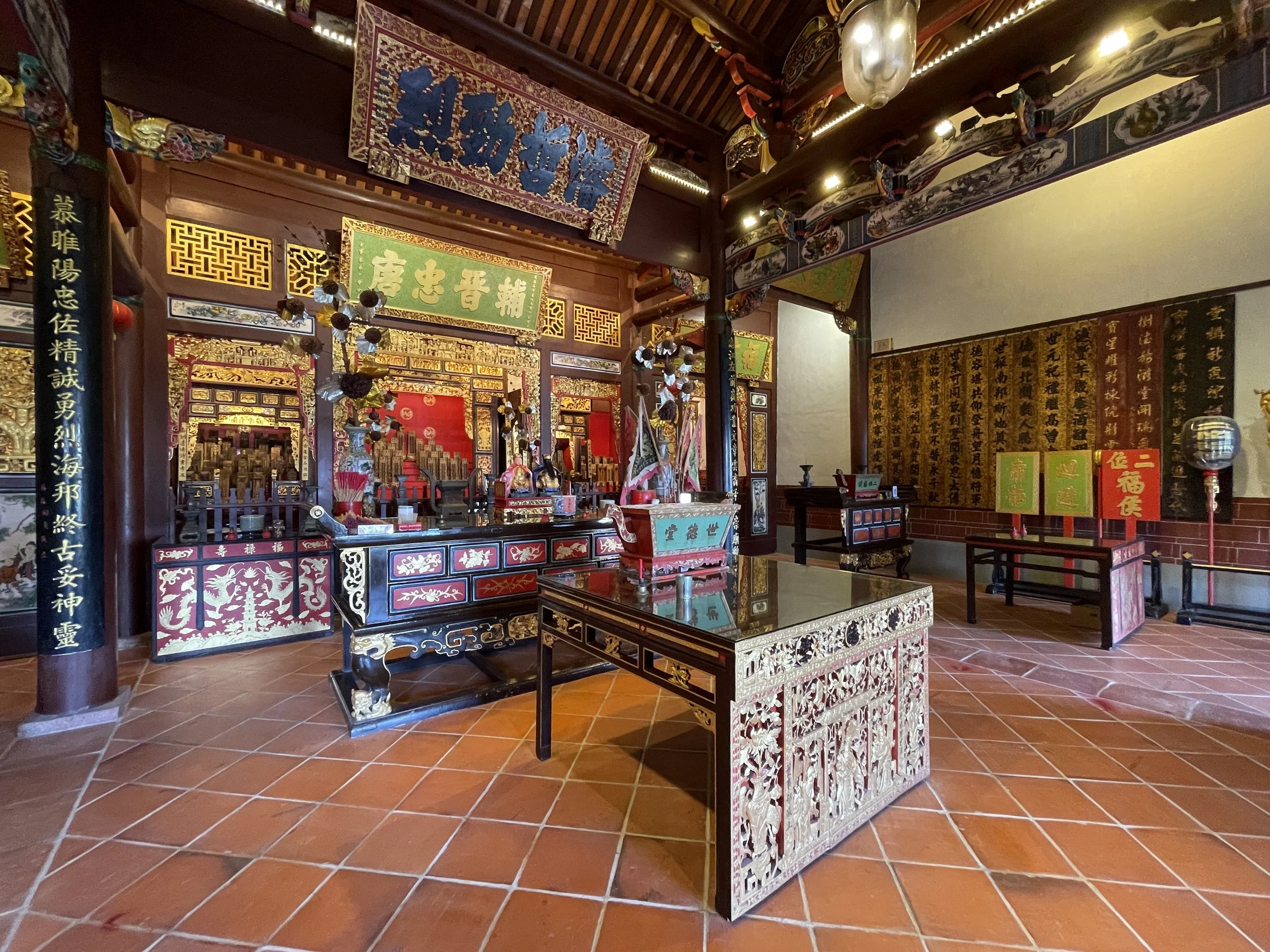
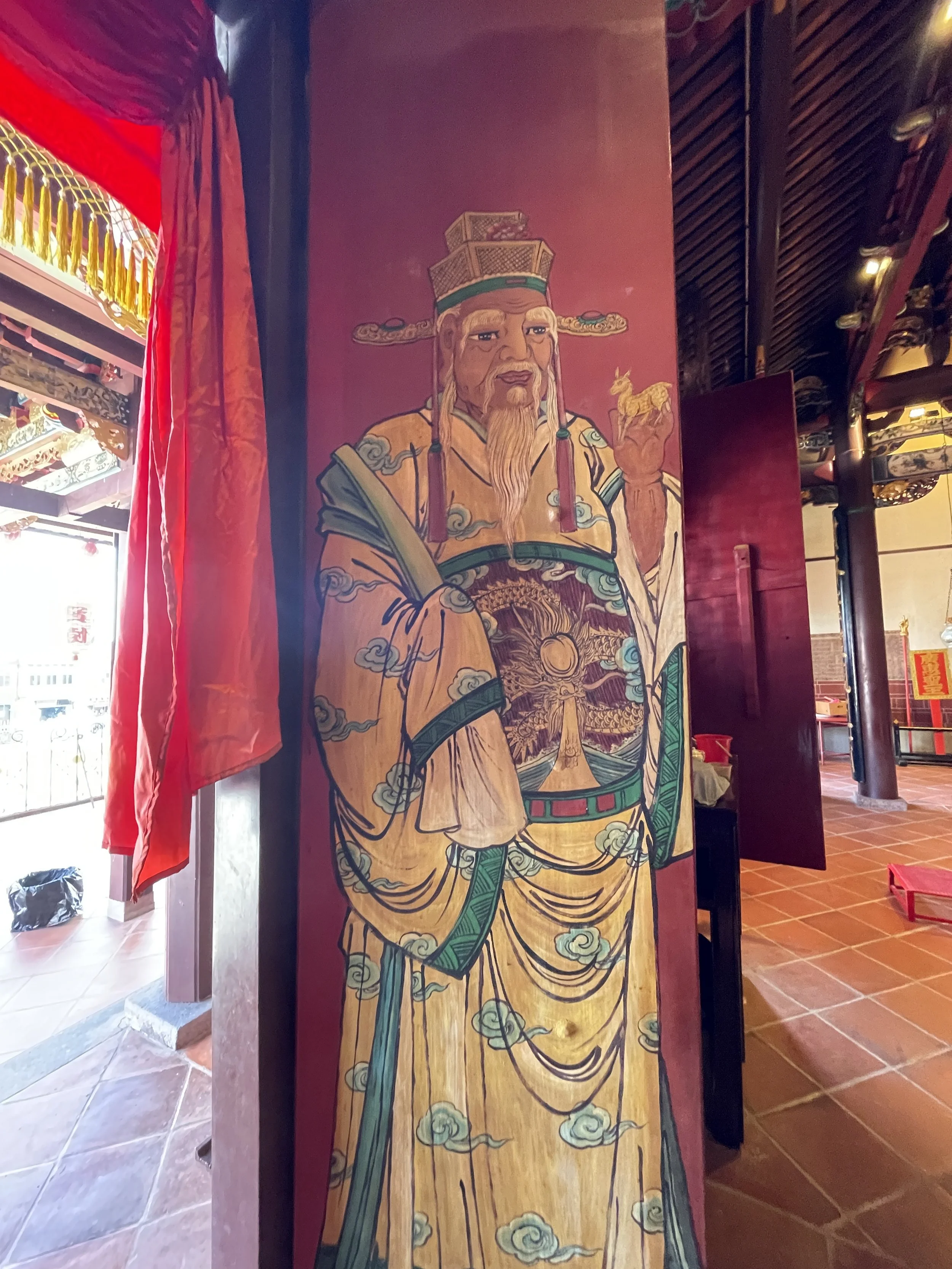
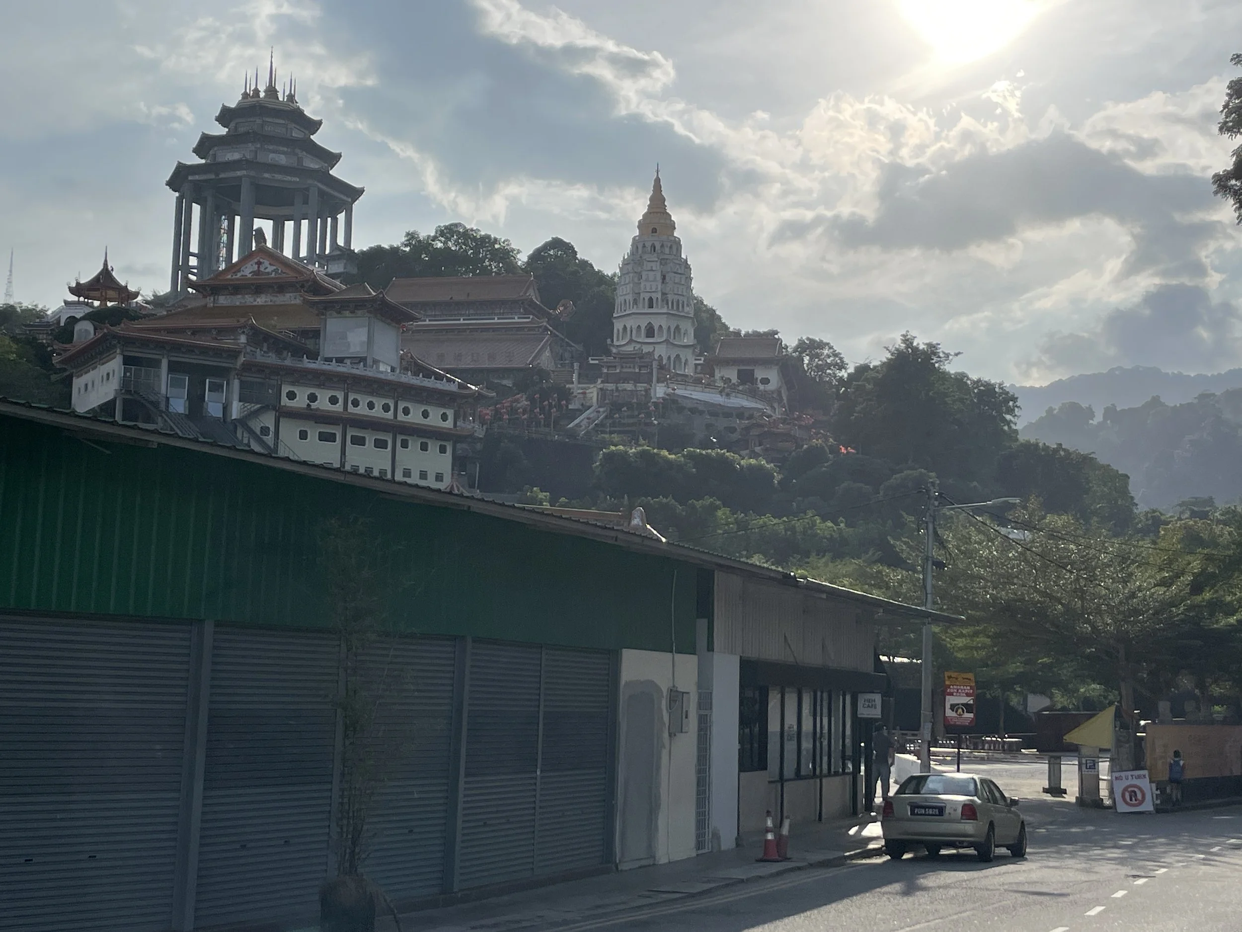
Kek Lok Si Temple
Kek Lok Si Temple is the largest Buddhist temple in Malaysia. It is located on a hill some kilometres southwest from central Georgetown. To be honest, I did not get inside, but the views from the street of this monumental religious complex are really impressive.
Where to stay in Penang
PARKROYAL Penang Resort
Batu Ferringhi Beach, 11100 Penang
Penang is not just about urban exploration, the island has its fair share of beach resorts (and even a national park!).
In fact, if you have a car with you, the beach resorts may be an excellent option to use as a base for your intra-island trips, coming back to relax in the afternoon/evening to the seaside.
Many of these resorts, as is the case of the PARKROYAL Penang Resort, are on the north coast of the island, just west from Georgetown. Remember that this is a relatively small island, so, if there is no traffic, you can be in Georgetown in half an hour drive or so.
Like in the case of Langkawi, I wouldn’t say the beaches are super amazing (don’t expect turquoise, crystalline waters), but the whole package, which includes a modern resort with its gardens, direct beach access, several swimming pools, parking, etc. can provide pretty good value.
Now, I am aware that many readers from the US, Europe or elsewhere outside the Asia-Pacific region may not be familiar with the PARKROYAL brand.
It is an upmarket brand of the Singapore-based Pan Pacific Hotels Group and it has properties all over South East Asia.
In the following pictures you can get an idea of the feel and look of the PARKROYAL Penang Resort. It is a rather large resort, tucked between the beach and the road that runs all along the northern shore of the island, in an area in which most of Penang’s upmarket hotels and resorts are located.
The hotel, however, is isolated from the buzz on the town-side, since most of its facilities are oriented towards the seaside and the surrounding gardens.
In addition to direct beach access (with some activities like parasailing, being offered for an extra fee), there is also a large pool area, with several water-side bars and a sort of mini-amusement aquatic park for children with slides and the like.
The rooms are modern and rather large. Some of the rooms have also a terrace and direct access to the gardens.
The PARKROYAL Penang Resort has also a rather elegant classy bar by the lobby, as well as several restaurants.
In case you were wondering, breakfast is really good, as well! So, all together, I would say this hotel is a great value option to stay at in Penang.
Driving from Penang to Kuala Lumpur
First Stop: Penang Bird Park
The Penang Bird Park is a zoo which is located on the mainland, very close to the northern bridge going into Penang Island. As the name implies, it is mostly about birds, although there are quite a few other animals, as well.
Now, I am not super big fan of zoos, but had read this one was quite interesting, not just because of the impressive collection, but also when it comes to the sort of setting, with plenty of vegetation and ponds. And on this account, it certainly delivers.
The Park is a rather low key attraction, there were just a few people, mostly locals. Also worth noting that it is a small island of greenery in what is, otherwise, a very industrial, and quite ugly, area. It made sense for use to make a quick stop, since it was pretty much on our way south, but wouldn’t have done the trek on purpose from Penang Island.
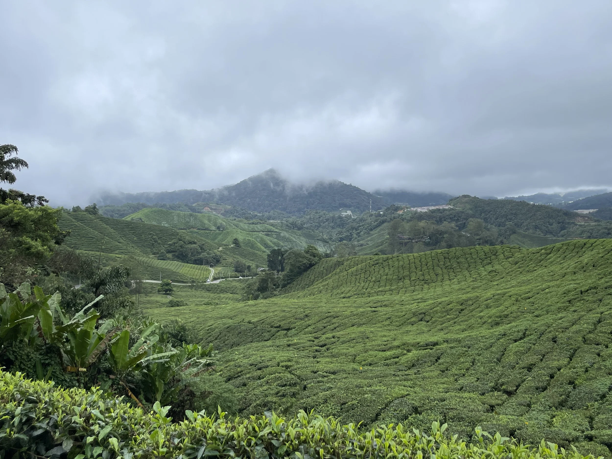
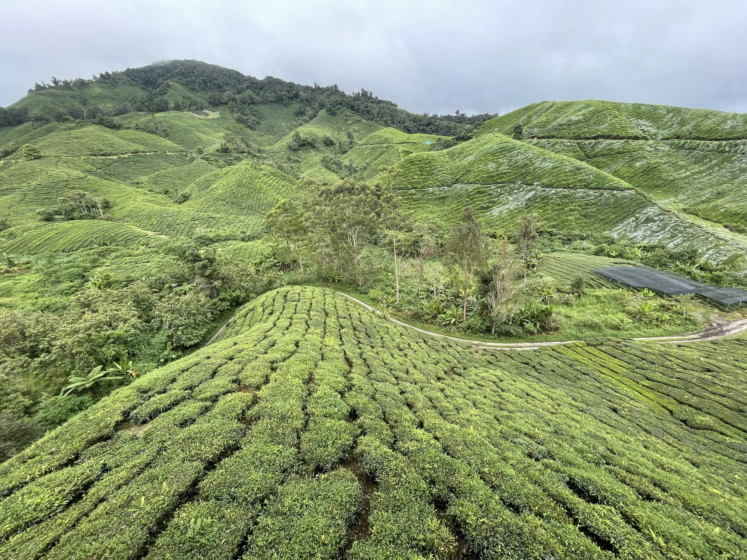
Driving through the Cameron Highlands: Malaysia’s tea country
Here is a truly different destination in the very heart of continental Malaysia. The Cameron Highlands, named after the British surveyor that mapped the area in 1885, are a series of mountain ranges located roughly half-way between Penang and Kuala Lumpur.
Because of their elevation, between 1,300 and 1,800 meters above sea level, they have a climate that is cooler than on the coasts. In fact it can even be a bit chilly in the evening. This is the one of the reasons that the British set up here one of the so-called “hill stations”, that is places where the colonial administrators and their dependants could spend the hottest months of the year in relative coolness.
The other thing that draw the British to the Cameron Highlands is that it has the right conditions to grow tea (particularly Assam-type black tea) and to this day tea plantations are the defining element in the Cameron Highlands landscape and the main reason they draw many visitors every year.
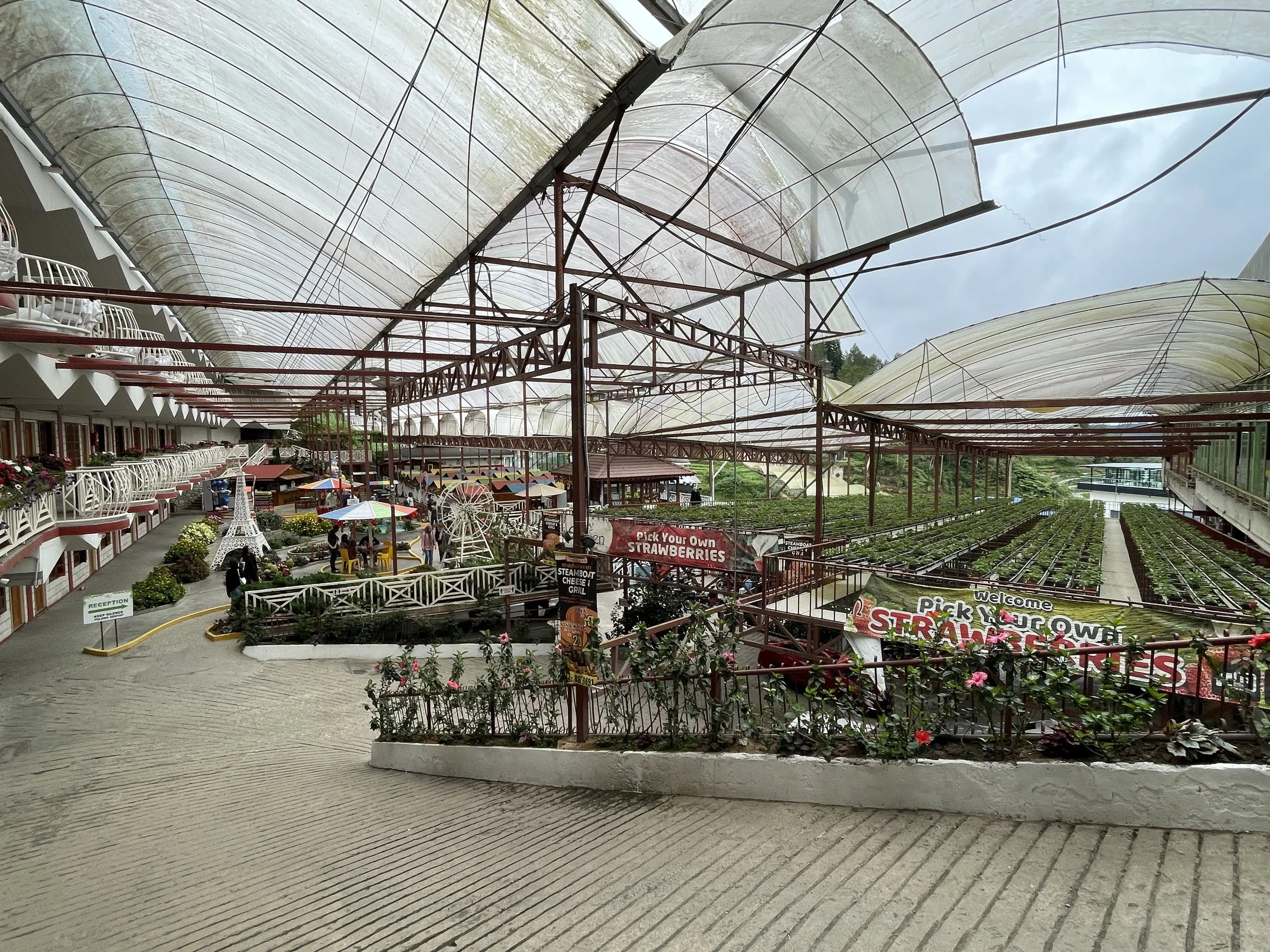
By the way, tea-growing has its complement in another cash crop: strawberries, which are now grown also in greenhouses all over the Cameron Highlands.
The Cameron Highlands cover a whole district, but one of the main settlements is in the area around Brinchang and Tanah Rata. It is here that you find most of the tourist infrastructure, in addition to a relatively large commercial area (including a McDonald’s!). It is also a central base from where to explore the nearby tea plantations.
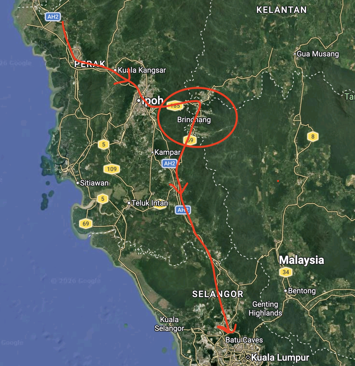
To reach the core of the Cameron Highlands, you leave the motorway at Ipoh, the closest large city, and take Route 185, which is a winding mountain road with a fair amount of curves. It is a two-lane road, although in good state throughout.
If driving from Kuala Lumpur, you can leave the motorway further south, near Tapah, and take Route 59, which runs uphill through a deep narrow valley. This road offers some really great views of the tea terraces in its upper reaches.
We did both, arrived from the north, crossing the highlands and exiting them through the south.
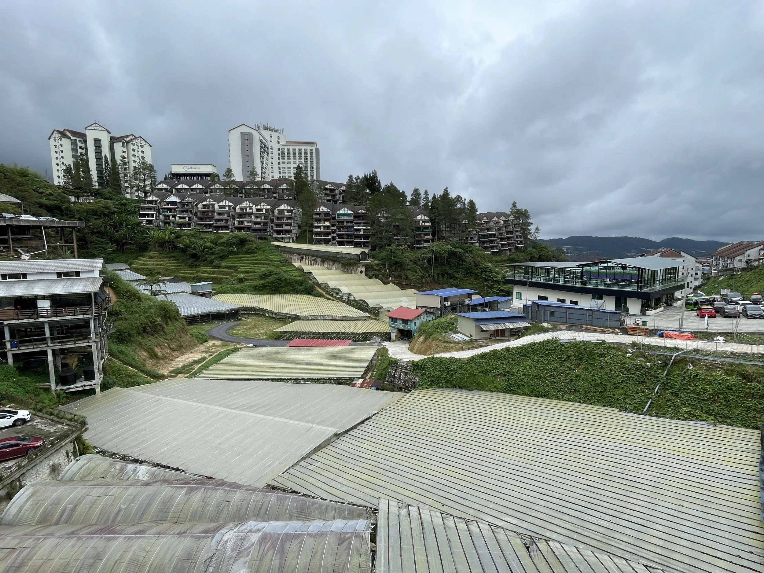
To be fair, the urban part of Brinchang is not very beautiful. It is basically a main road that crosses the town and a rather chaotic sprawl around it.
The whole area is very hilly, so constructions of different styles and heights pile up in the few flat areas around the road. This is also the town where you will find most services and places to eat, although we just had our meals at the hotel (more on this below).
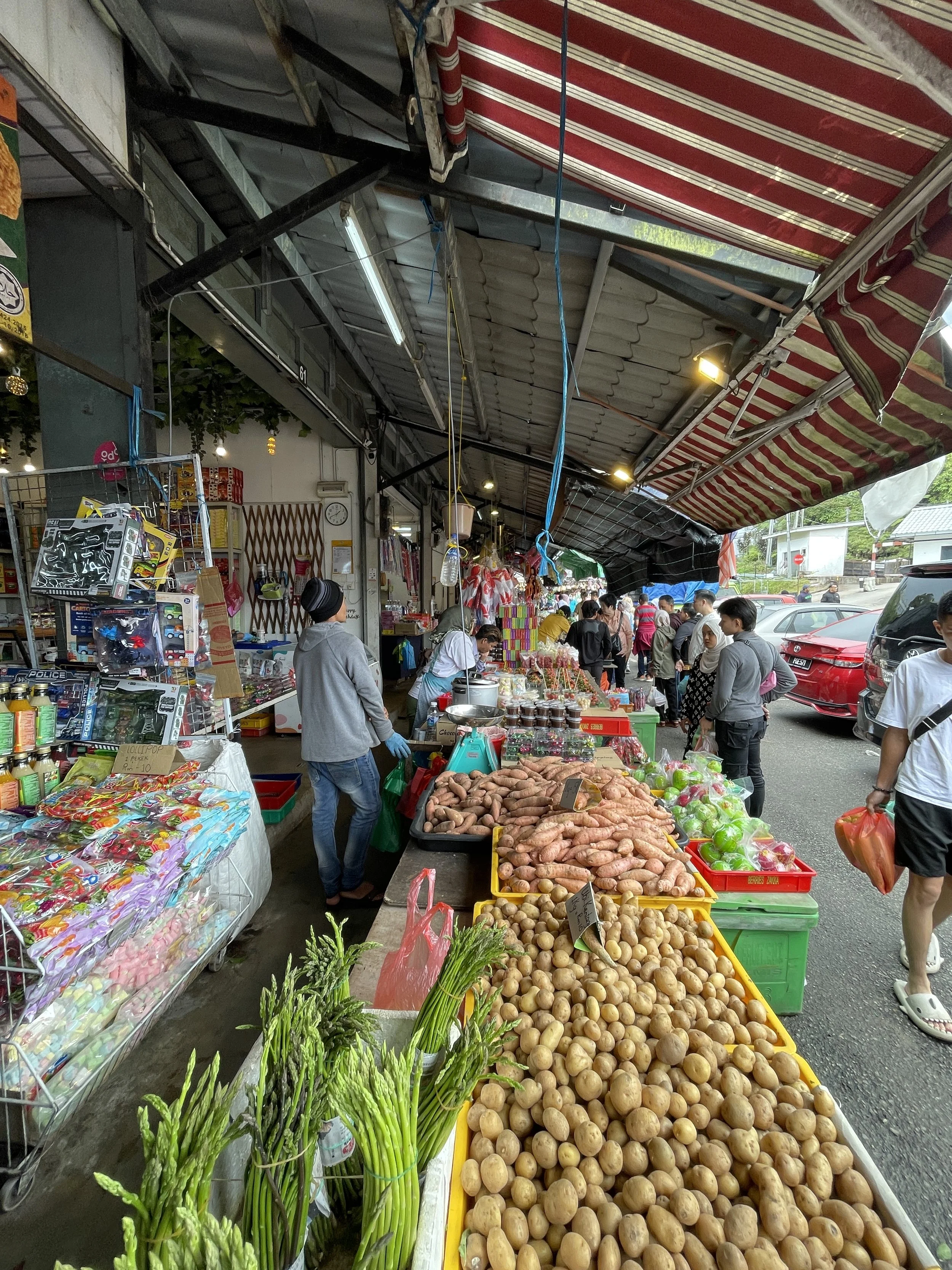
Brinchang Central Market is, perhaps, the one spot that deserves a brief stop, if only to check the buzz all around, with many shops and stalls selling all types of produce, including, of course, the local strawberries and tea!
Where to stay while in the Cameron Highlands
Cameron Highlands Resort - Small Luxury Hotels of the World
This is the hotel of reference in the whole Cameron Highlands area.
As you will see in the pictures below, it is a classic, upmarket hotel in colonial style.
It is located right on the main north-south road, which makes it a convenient base to reach the Boh Tea Plantation (more on this soon). It is also adjacent to the Cameron Highlands Golf Club.
It is part of the Small Luxury Hotels of the World network.
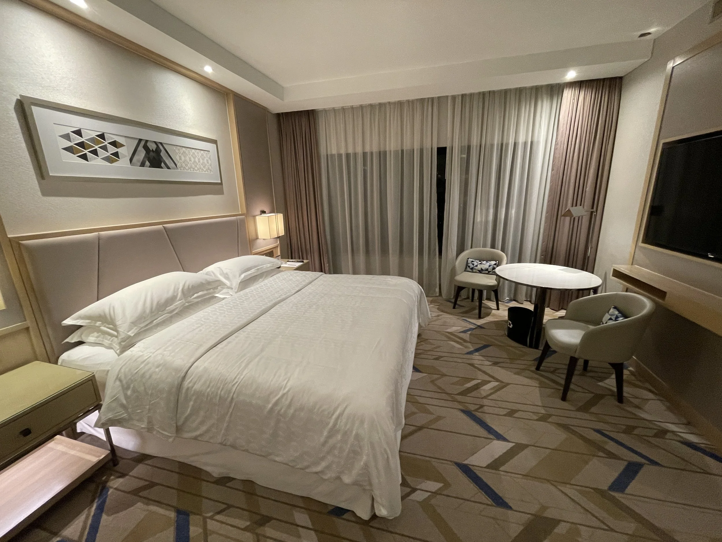
You can get an idea here of the look and feel of the rooms, which is very different from the beach resort that we have seen earlier in Penang and also, as you will soon see, of our recommended high-rise hotel in Kuala Lumpur, the Sheraton Imperial Kuala Lumpur.
The hotel has also a very nice restaurant and it is, actually, a very good option to have your meals (we didn’t find the options in town that convincing). Service was also excellent throughout!

In line with the “colonial hill station” theme, you can have afternoon tea English style at the hotel.
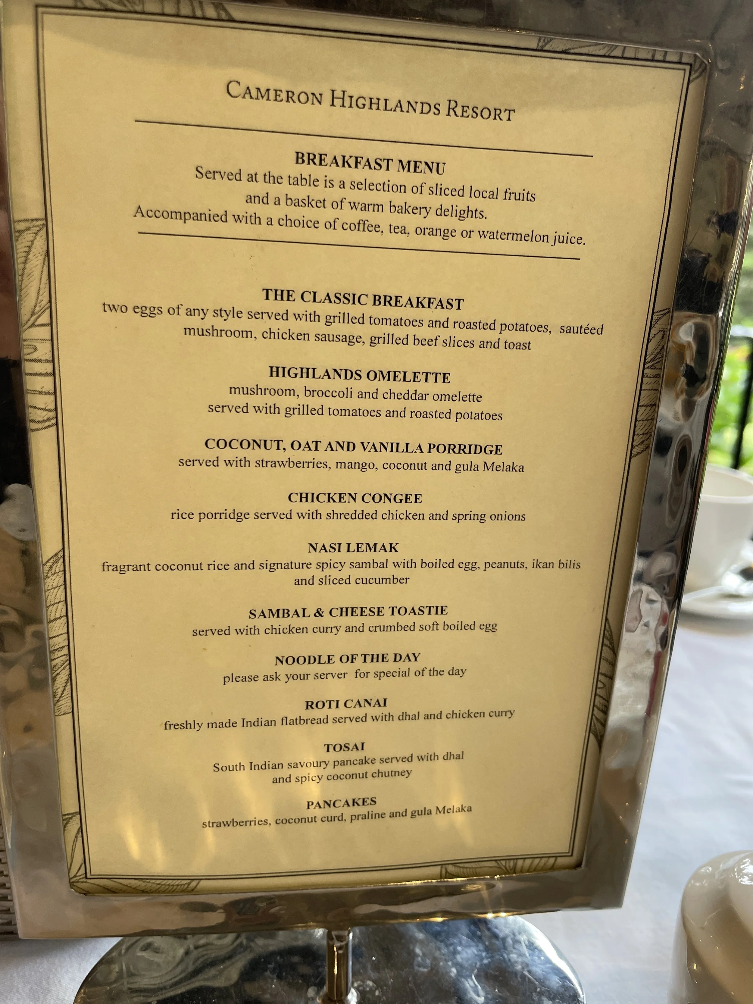
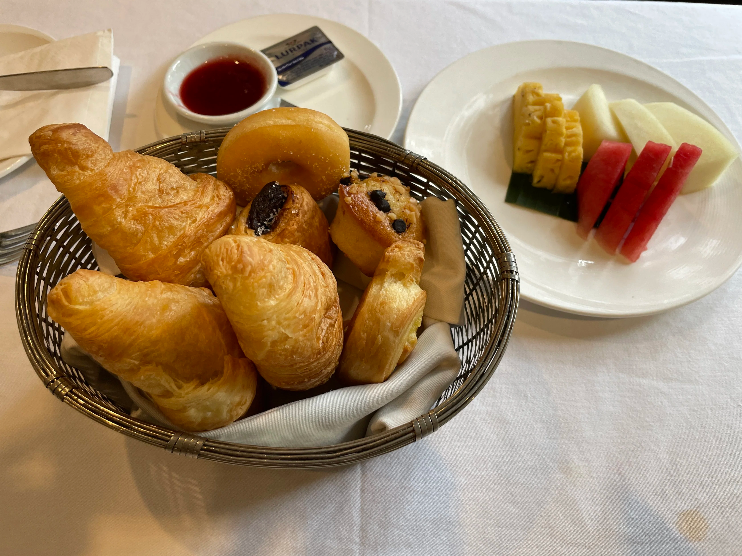
As per the breakfast, unlike so many other modern hotels, here, at the Cameron Highlands Resort, it is not a buffet, but more of an à-la-carte experience, although with ample choices for all tastes.
Visiting the Boh Tea Plantation
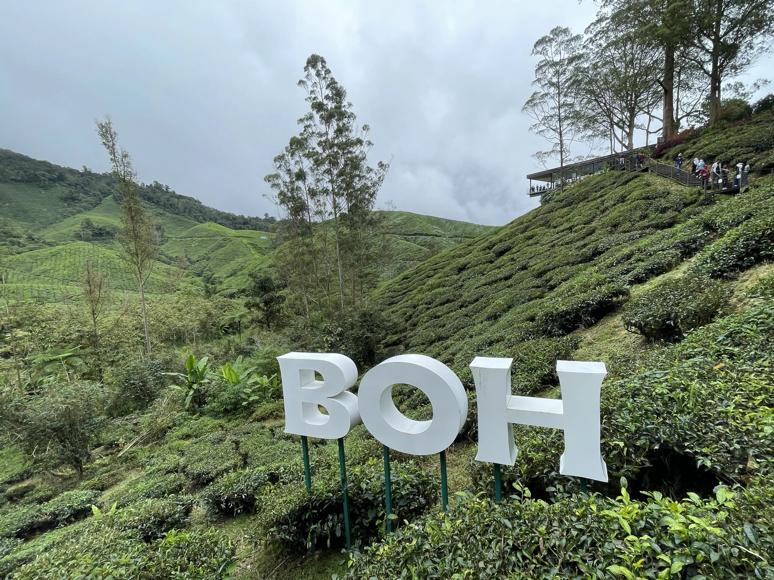
The top thing to do in the Cameron Highlands is, of course, visit a tea plantation. Actually, strictly speaking, you don’t need to get into any single plantation to enjoy the green, lush, undulating tea landscapes, since they pretty much everywhere around you in this area. But if you have the time and inclination to do so, I recommend visiting the BohTea Centre (“Sungei Palas Garden”).

The Boh Tea Centre is at the heart of a tea-growing valley, which completely covered in terraced plantations.
The Centre is run by Boh, which is one of the main producers in the area and in Malaysia.
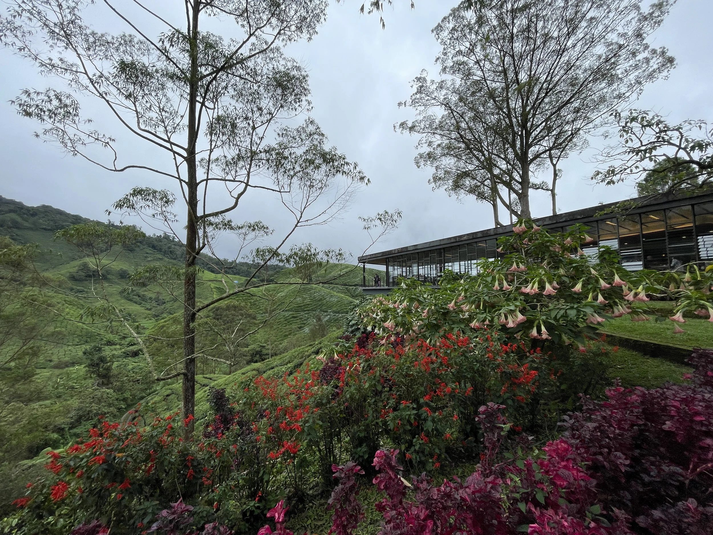
Boh has built a large and modern hilltop visitor’s center where you can learn about tea growing in this region, enjoy the views from the café and, of course, buy many different varieties of tea at the visitors’ center shop.
Besides the actual center, the drive there is worth the excursion, since you pass through some stunning incredibly green landscapes.
There is a large car park at the bottom of the valley and from there you walk uphill to the center, enjoying the views along the way.
There are also some other great views when driving along Route 59 (as you can see in the picture below). In fact there are several viewpoints where there are some roadside bars and restaurants with panoramic terraces.
A great place to stay in Kuala Lumpur
And this is how, a few hours after leaving the cool air of the Cameron Highlands, arrived in back in Kuala Lumpur.
So, since this most trips to Malaysia start or end in the capital city, I thought this post wouldn’t be complete without a brief mention to my recommended place to stay in Kuala Lumpur.
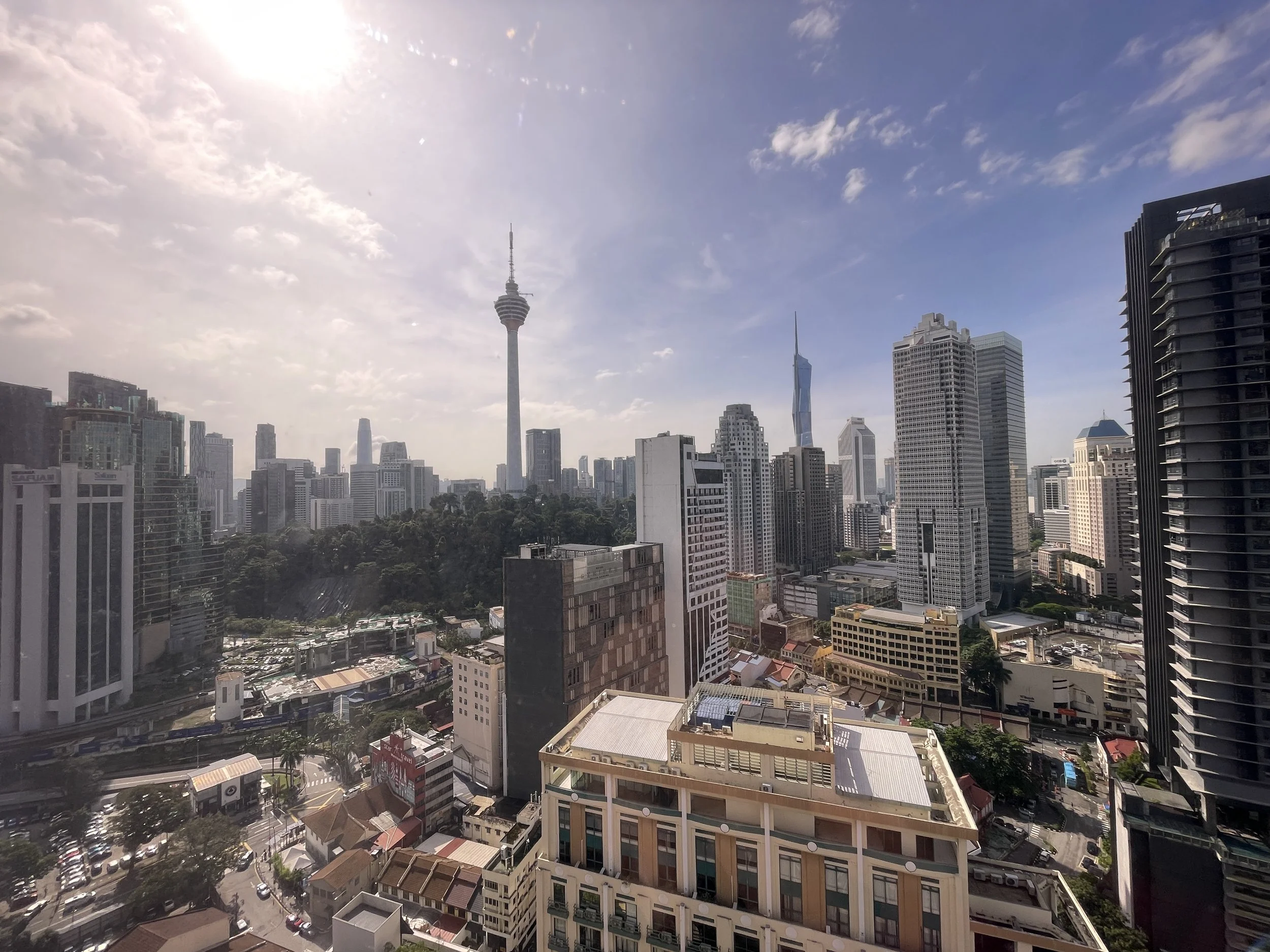
Sheraton Imperial Kuala Lumpur Hotel
Jln Sultan Ismail, Chow Kit, 50250 Kuala Lumpur
This is a rather central five star hotel which offers some pretty good rates, great food and amazing views. As you can see below, it has pretty large rooms as well. And I can also add that service was excellent throughout our stay.
The hotel offers parking for an extra, rather reasonable fee, but it is also located next to a metro station, and in front of a commercial centre, so pretty well served in terms of services.
Last but not least, a couple more points about the Sheraton Imperial Kuala Lumpur: it has also a small rooftop pool and, while I don’t have pictures to share, I can also tell you it has one of the best breakfast buffets I have seen in quite a long time!

The Top Three Things to do in Langkawi
It may not be as globally famous as Bali or Pukhet, but Malaysia has also its own island paradise.
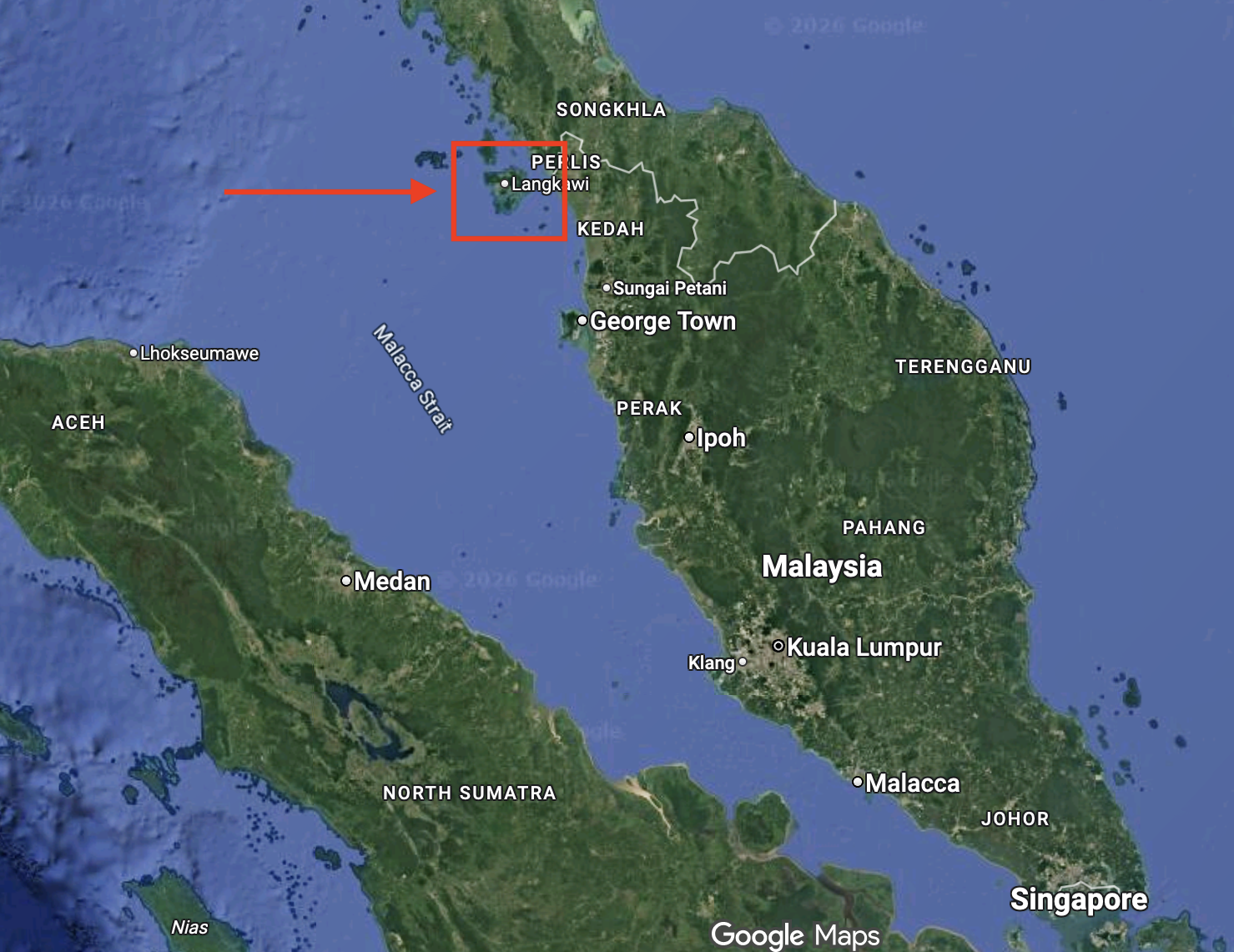
Located just a few miles off the northwestern corner of Malaysia, right on the Thai border, Langkawi is a bit more than a tropical beach resort. The island has been designated a UNESCO Global Geopark. This is not quite the same as a UNESCO World Heritage Site, but it is, nevertheless, a recognition of its natural singularity.
In fact, UNESCO defines this category of site as "a single, unified geographical area where sites and landscapes of international geological significance are managed with a holistic concept of protection, education and sustainable development.” Interestingly, this designation also involves explicitly the pursuit of some specific sustainable economic development goals to the benefit of local communities.
By the way, although I will be referring to Langkawi as “an island” throughout the text, Langkawi is, in reality, an archipelago with dozens of small islands and islets. However, many of the smaller ones are not inhabited and practically all population, resorts and infrastructure is on the main island, which is where I stayed (I am not even which of the smaller islands are open to visitors, since quite a few of them are officially categorized as nature reserves).
How to get to Langkawi?
The easiest way is to fly. Langkawi has an international airport which is connected multiple times a day to Kuala Lumpur (around 1h flight away) by several airlines. I found, for example, that Air Asia offers extremely cheap flights on this route, as well as a nonstop short connection from Langkawi to Penang, which comes in handy if you wish to see a bit more of the country outside the capital (Penang is another interesting Malaysian island that I will cover in another post soon!). Some major international airlines, such as flydubai and Etihad, have also started serving Langkawi too, providing some interesting connectivity options with the rest of the world.
The airport even hosts its own airshow every other year, the Langkawi International Maritime and Aerospace Exhibition, but this is material for specialized aviation sites, like Allplane, rather than this one!
By the way, Malaysia is quite an open country when it comes to visitors, and citizens of many countries, including the EU, UK and UK do not need a visa to enter (just fill in the Malaysia Digital Arrival Card (MDAC) within three days of your arrival). Transport infrastructure is generally good.
How to move around Langkawi?
My answer to this is rather straightforward: just take cabs and don’t bother with renting cars or motorbikes. I don’t do the latter, so won’t comment on it. As per renting a car, I did it in Penang and I am happy to report that driving in Malaysia is generally fine when it comes to infrastructure and general civility of the traffic and as long as you have no issue with driving on the left (a legacy of the time under British rule!).
However, the distances involved in Langkawi, an island that is no more than 20 miles across, combined with cost of local cabs and their ubiquity, makes this the best option, in my opinion. Now, I would recommend you download and open an account with Grab, the Malaysian ride-hailing app, since it is the one that works best in Langkawi (as in the rest of Malaysia).
This post may contain affiliate links. If you book or buy something through them, I earn a small commission, at no extra cost to you. It's a way to keep Places of Charm going. Thank you for your support.
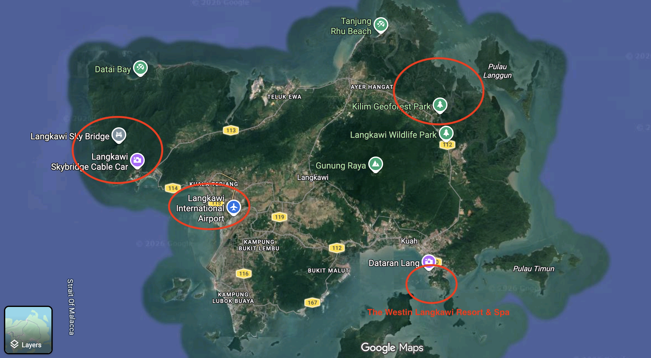
Top things to do in Langkawi: 1) the Langkawi SkyCab
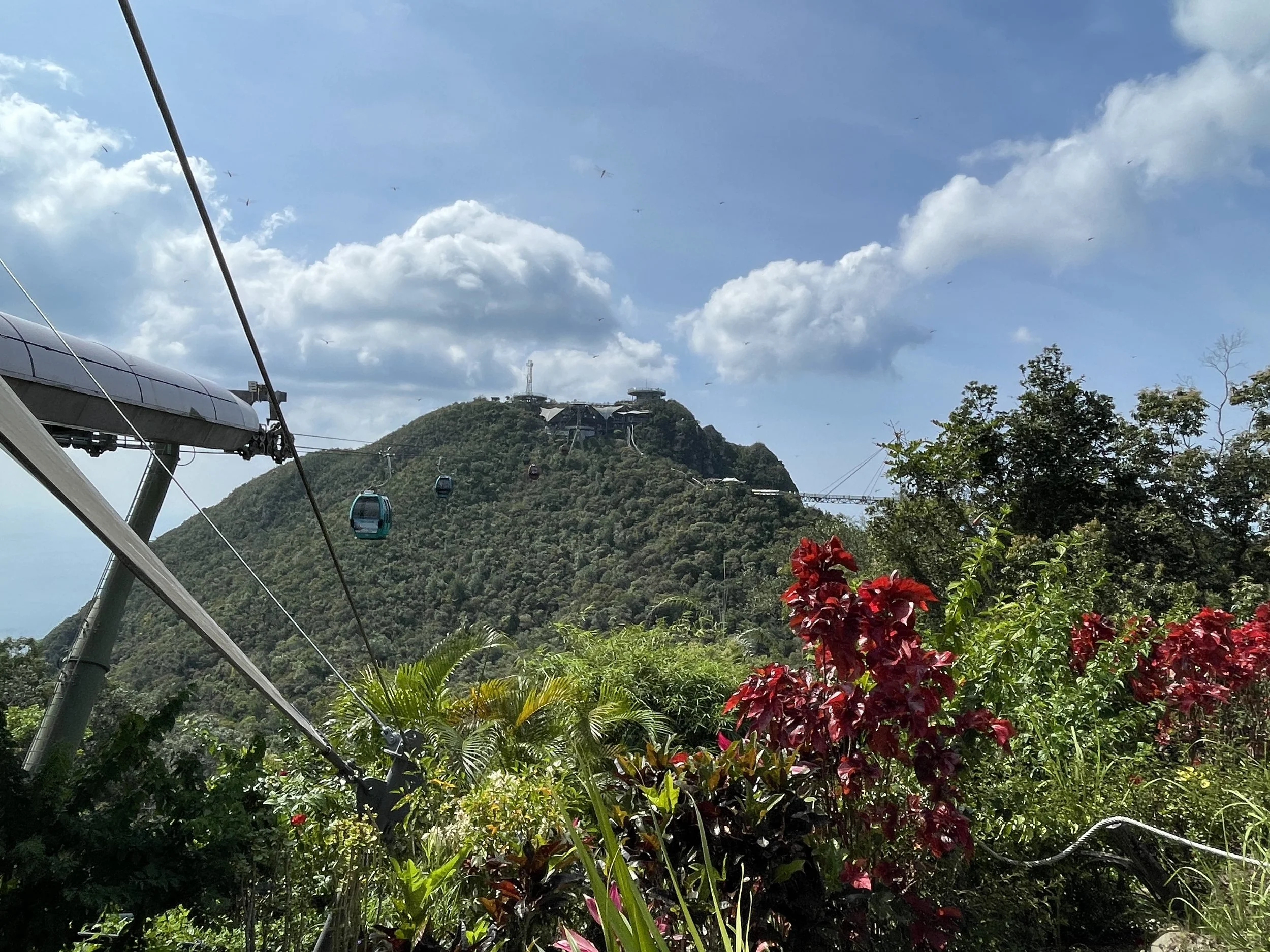
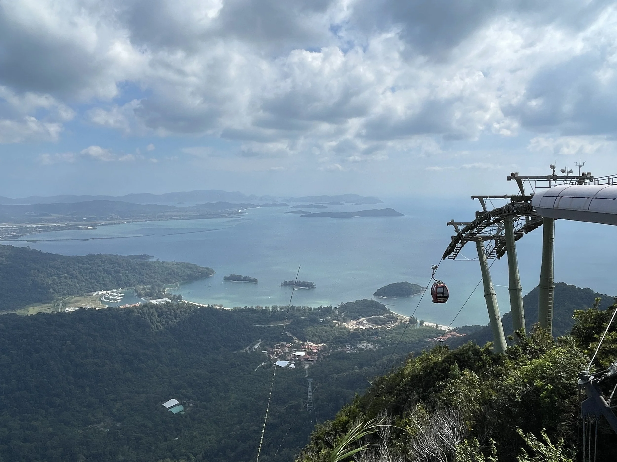
The Langkawi SkyCab is one of the must-dos in Langkawi.
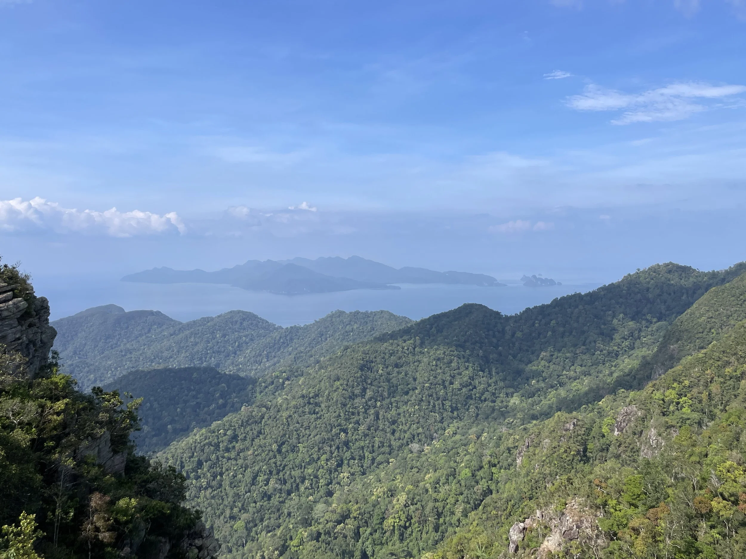
Located at the western end of Langkawi, this cable car which will take you to the highest point in the island (708 meters) from where you will be able to enjoy a broad panorama covering many miles around.
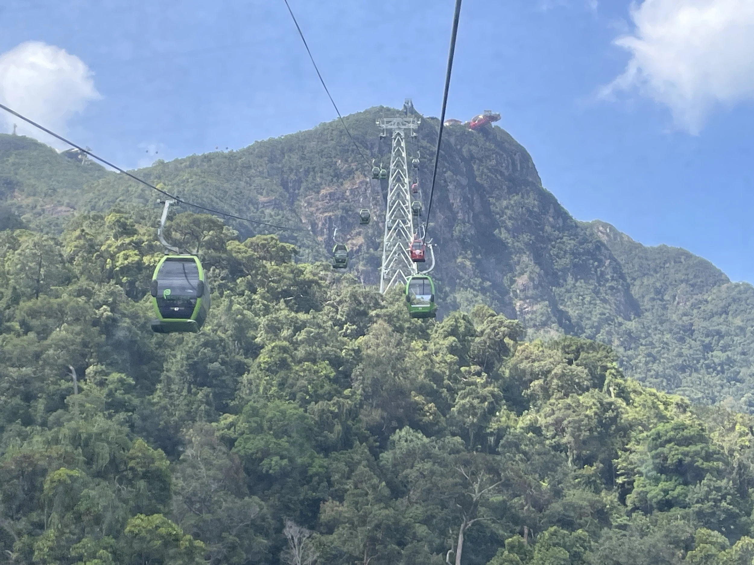
I said “a cable car” but this is not entirely accurate, because, just as with the island, there is not just one. In fact, there are two stages. The first and longest one takes you to an intermediate station at an altitude of 650 meters. From there you can take yet another gondola which takes you to the top.
The path is really steep (42º) and goes over a heavily forested area.
In fact, these hills that the cable car climbs to are among the oldest on Earth, dating back 550 million years and the surrounding rainforests are also very Ancient. This is one of the reasons, though not the only one, Langkawi is considered a “Global Geopark”.
The cable car ride itself takes around 15 minutes, although you are likely to spend some more time up the hill if you walk the Skybridge and take your time to take photos and so on.
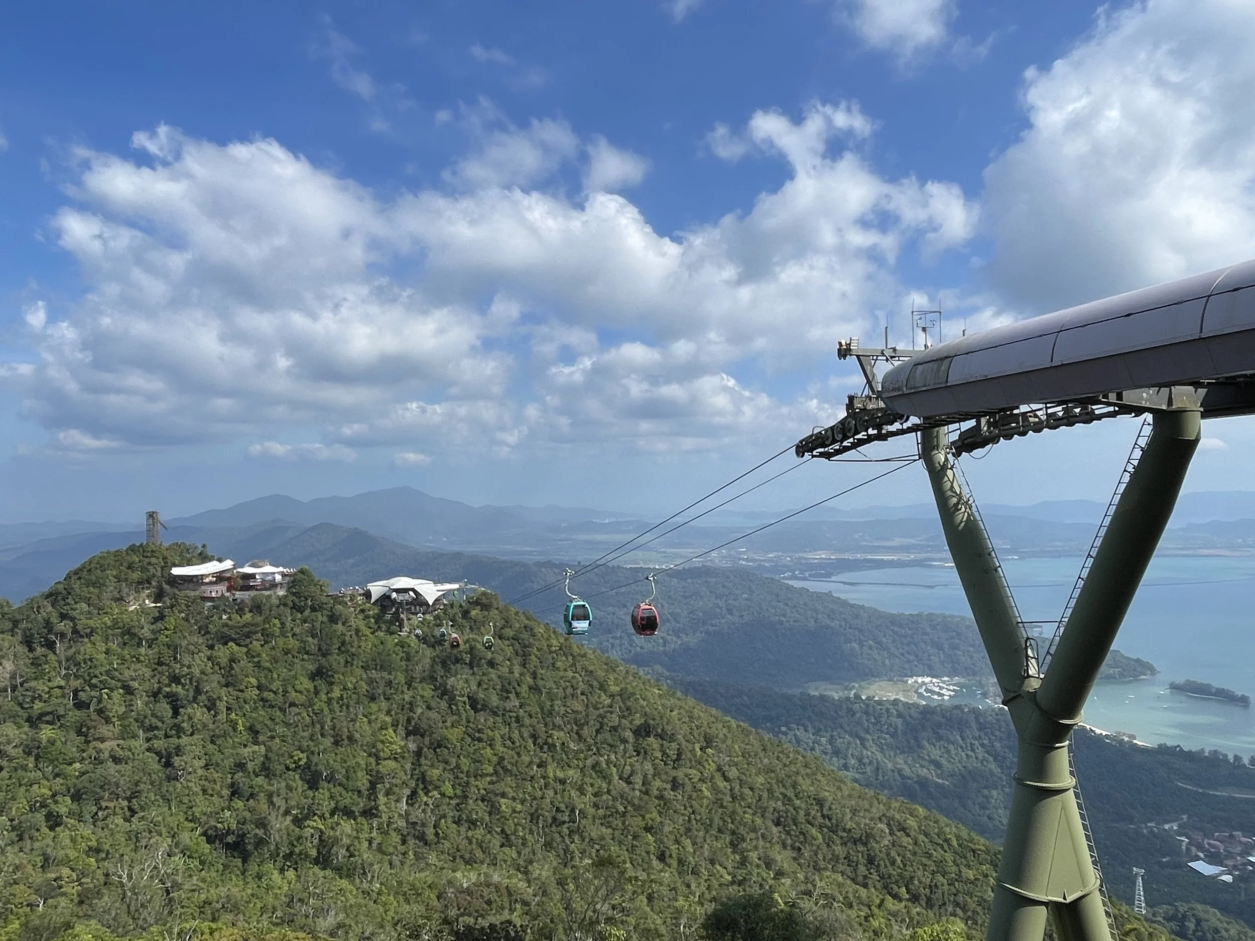
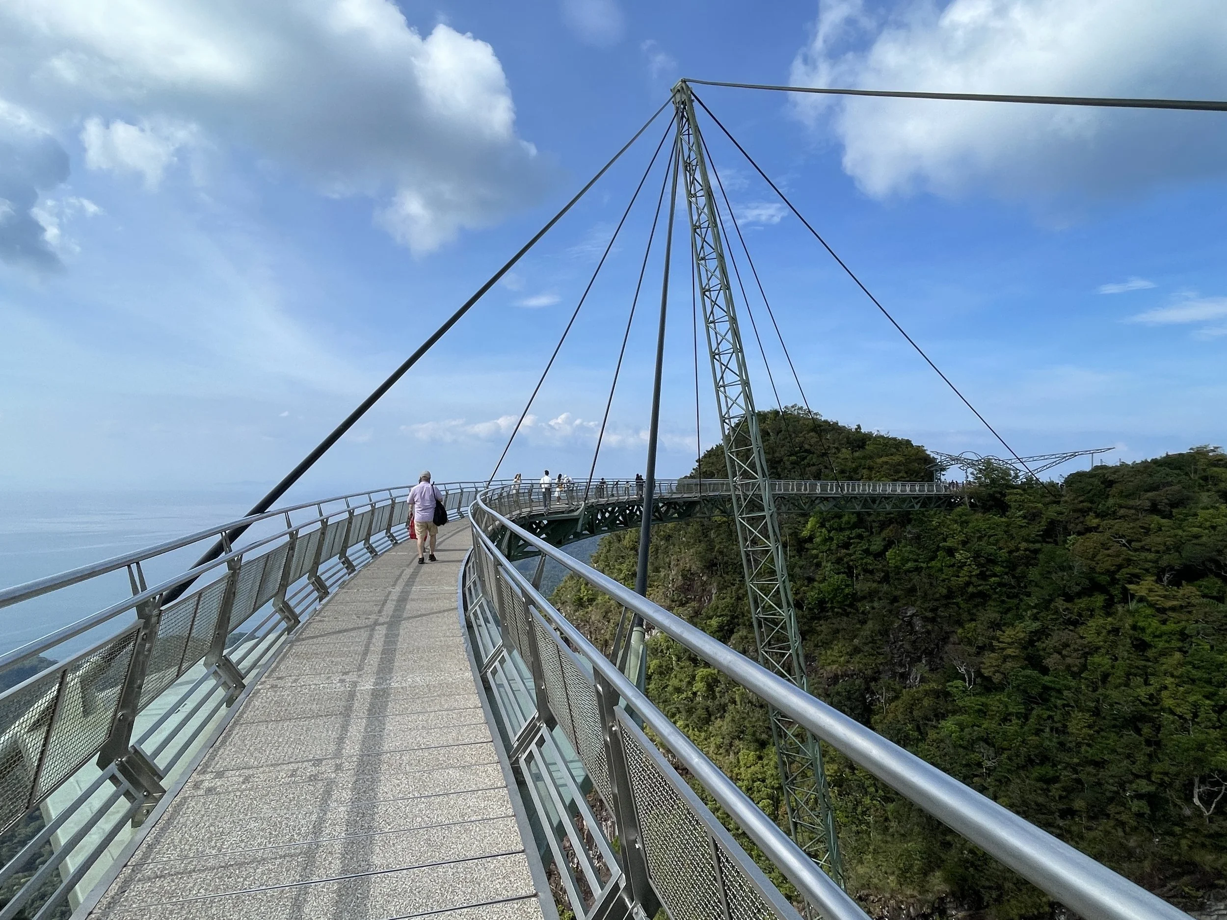
I would recommend booking in advance because the SkyCab is a genuinely popular attraction. The ticket gives you access to the SkyBridge, as well, which is a suspended footbridge which allows you to walk between different points in the ridge. It has even some patches with a glass floor for extra excitement (beware if you are afraid of heights, though!)
In addition to the regular shared SkyCab gondola, it is possible to book several more premium options, such as a private one or one with a glass bottom. To be honest, I think the regular one provides a nice enough experience and, if you want to feel the thrill of the heights, you can get that at the SkyBridge!
Last but not least, a word about the SkyCab base station, which is nothing short of a recreation park. There are lots of shops, different types of entertainment venues for kids and catering establishments. We didn’t spend much time there, but you can easily spend a whole morning there if you are into this type of thing.
2) Rest at a beach resort
That’s the other thing that people come to Langkawi for. And the island is well endowed with resorts for all tastes and budgets, including those from top-end international chains such as Four Seasons and St. Regis. So, while this site usually champions an active approach to traveling, sometimes is just a good idea to get a spot by the pool and enjoy a good rest. Why not?
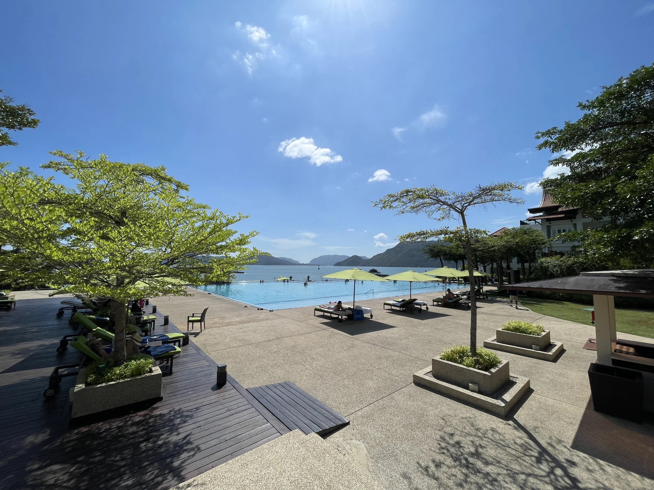
A great resort to stay at in Langkawi: The Westin Langkawi Resort & Spa
This beach-side resort is located on the southeastern corner of Langkawi, half an hour ride from the airport and on a small peninsula which it shares with the St. Regis resort next door.
The grounds of the The Westin Langkawi Resort & Spa face south, towards the narrow strait that separates Langkawi from several of its smaller adjacent islands.
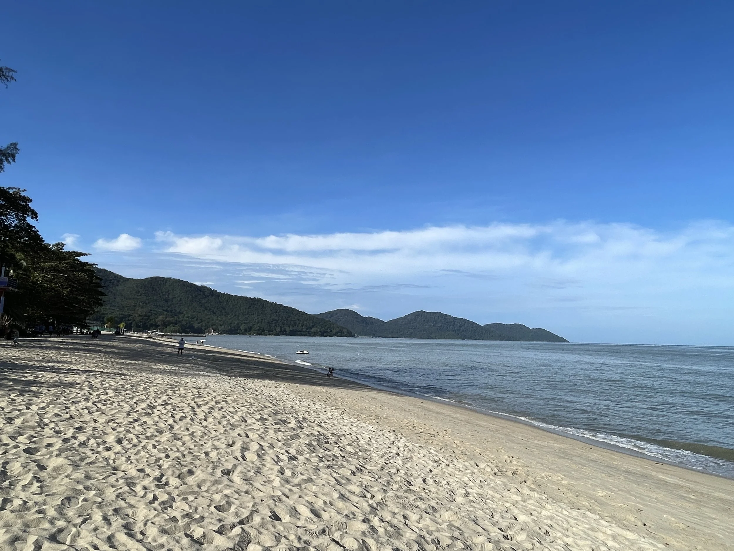
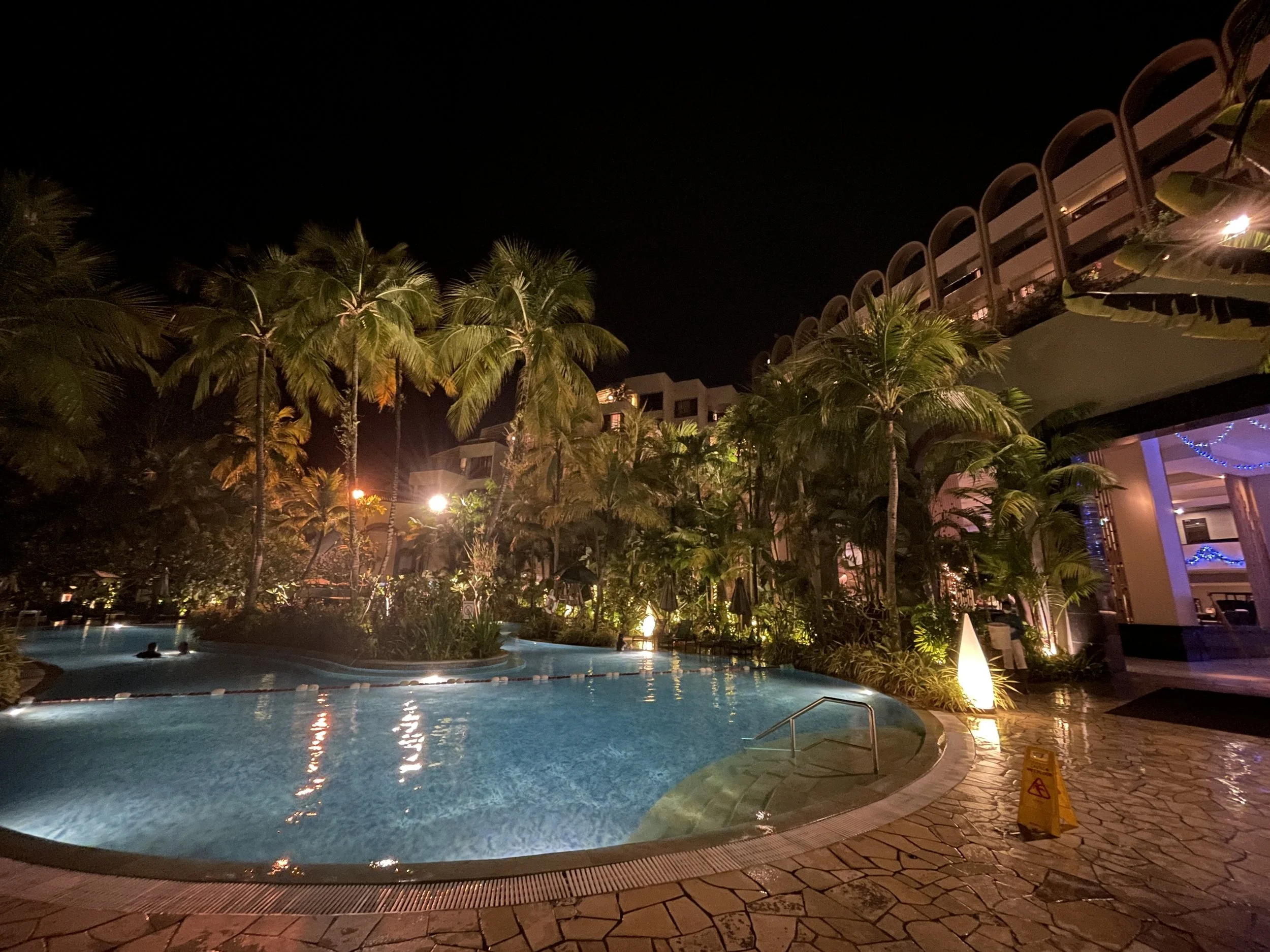
It’s got a large infinity pool, which you can see here below, as well as direct access to the beach.

To be clear, the beach is not private and exclusive to the hotel, although due to its location, it is unlikely you will see random bystanders passing by.
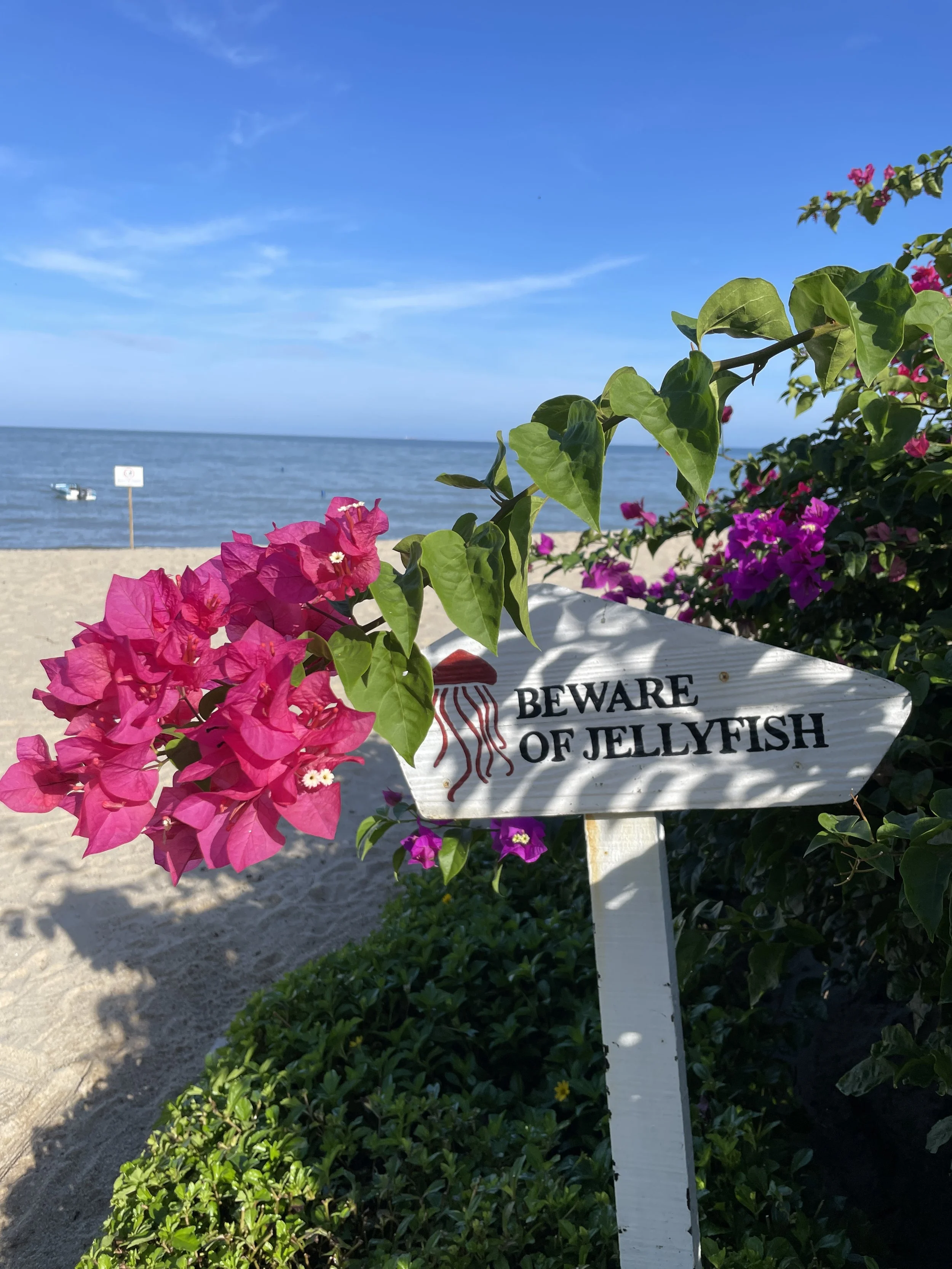
I must add, as well, that the beach, at least on this side of Langkawi, is not the main allure of the resort. In fact, I saw few guests actually using it, most just stay at the pool. There are several reasons for this:
First, the tides are strong and depending on the time of the day you would need to walk quite a bit in muddy sandy soil to get to the water. And when the tide is up, it is quite shallow, so you can’t really swim in the strict sense of the word.
Also, although clean, the water is not the turquoise, crystalline type you get in, let’s say, the Maldives.
Having said that, I did go to the beach, spend some time in it and swam in it, so if you are a salt-water person, definitely, don’t forgo it!
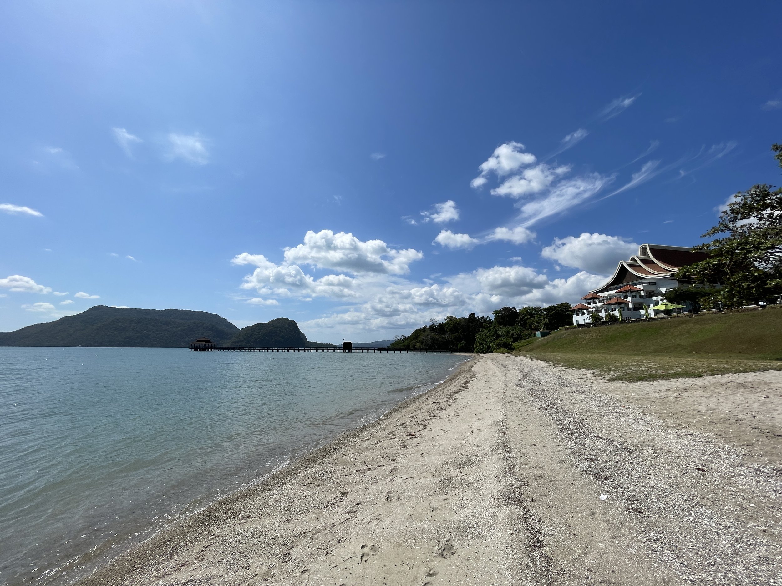
Most of the rooms (the resort has bungalows too) are located on the main corpus of the resort. Since the hotel has been built adapting to a terrain that is somehow sloping towards the sea, some of the upper floors do get actually a small patio.
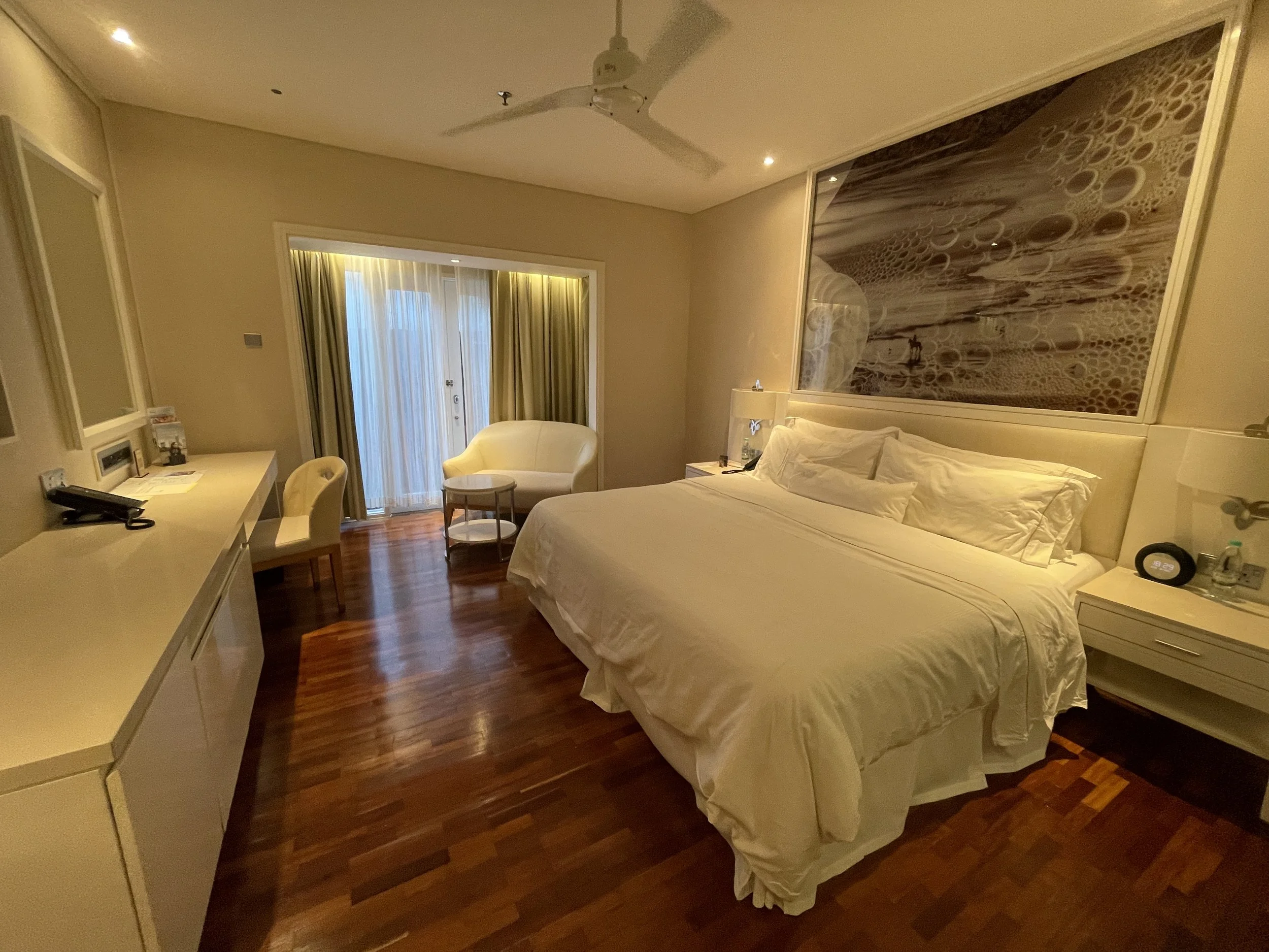
The rooms are modern and furnished in contemporary style. The bathrooms, likewise are large and modern. Bathrobes are provided for the spa (the pool area has also its own towel service). There is also generous space to leave baggage.
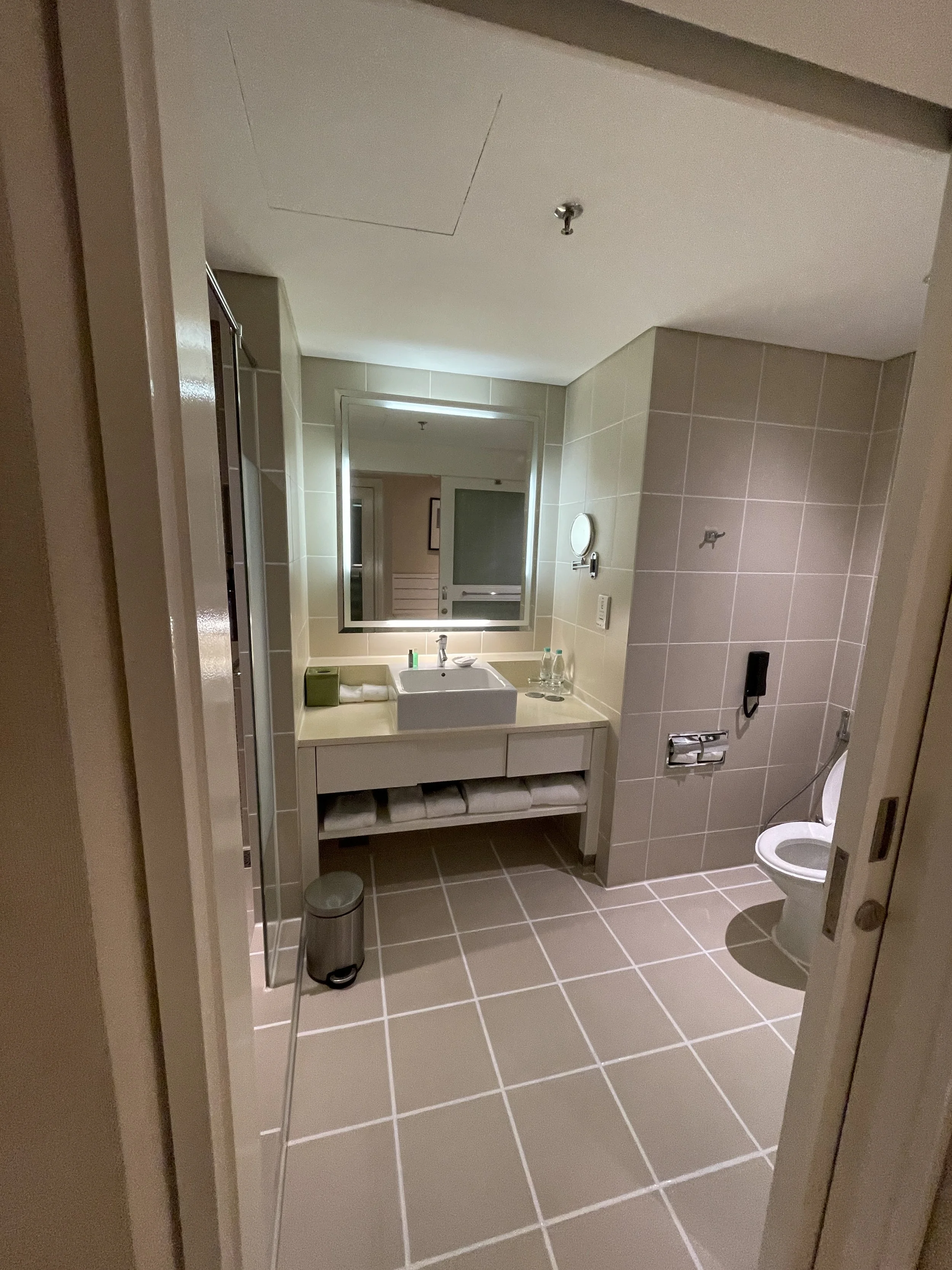
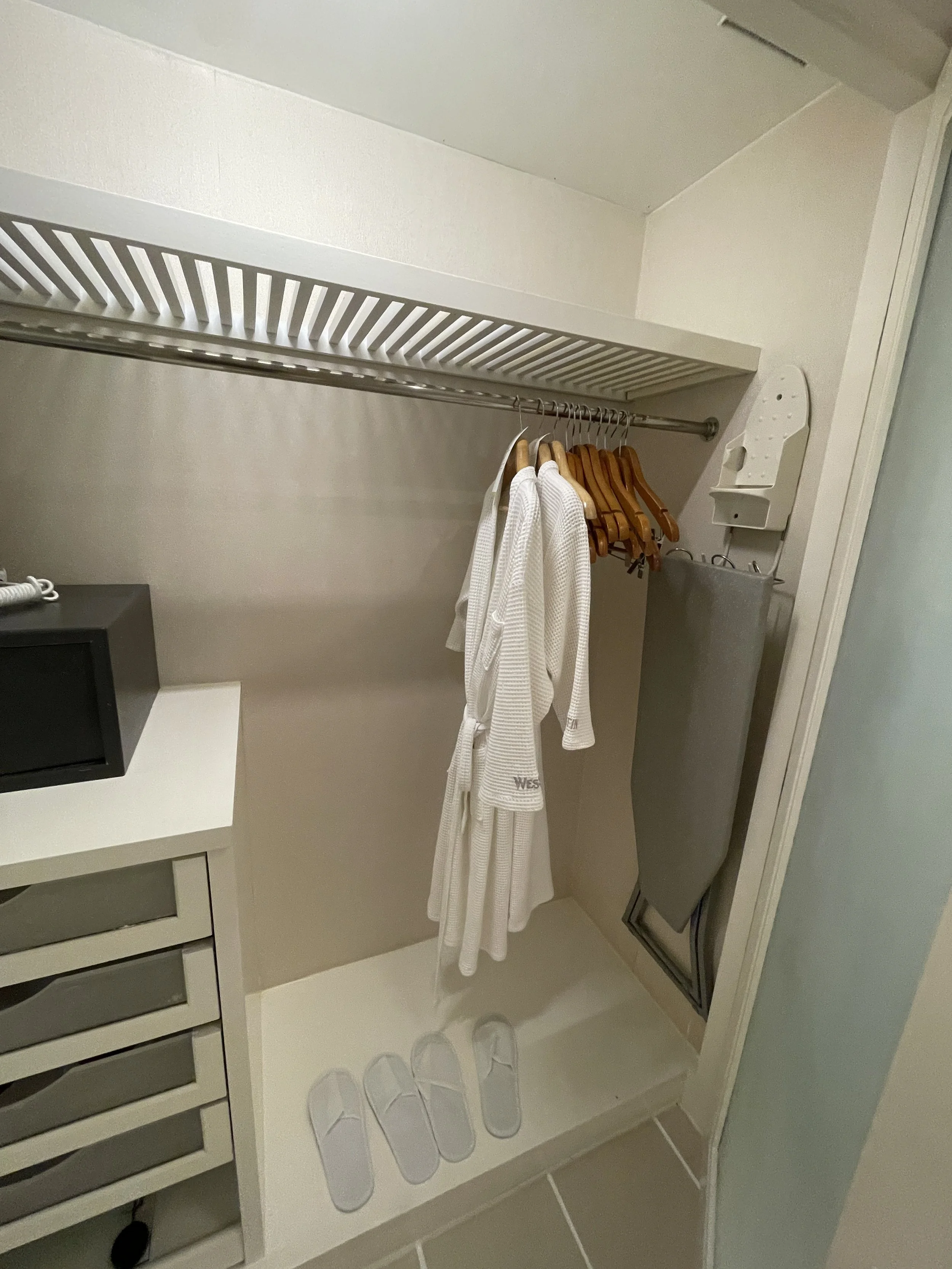
One thing to bear in mind, and which you are constantly reminded of, is that there are wild monkeys living in the resort grounds. It is easy to see them, as they often come close to the buildings are not afraid of people at all. This adds a touch of exoticism, imo!
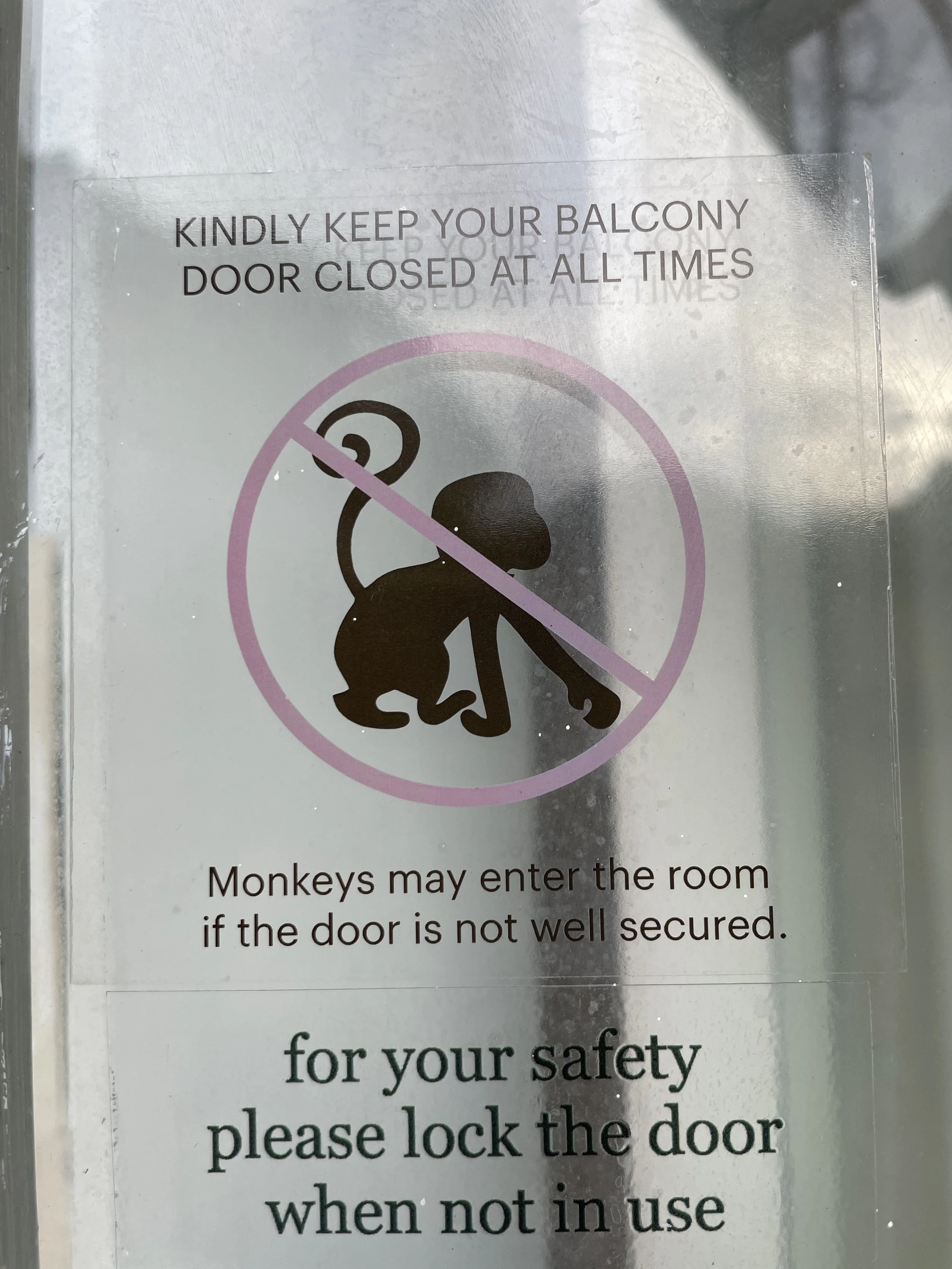
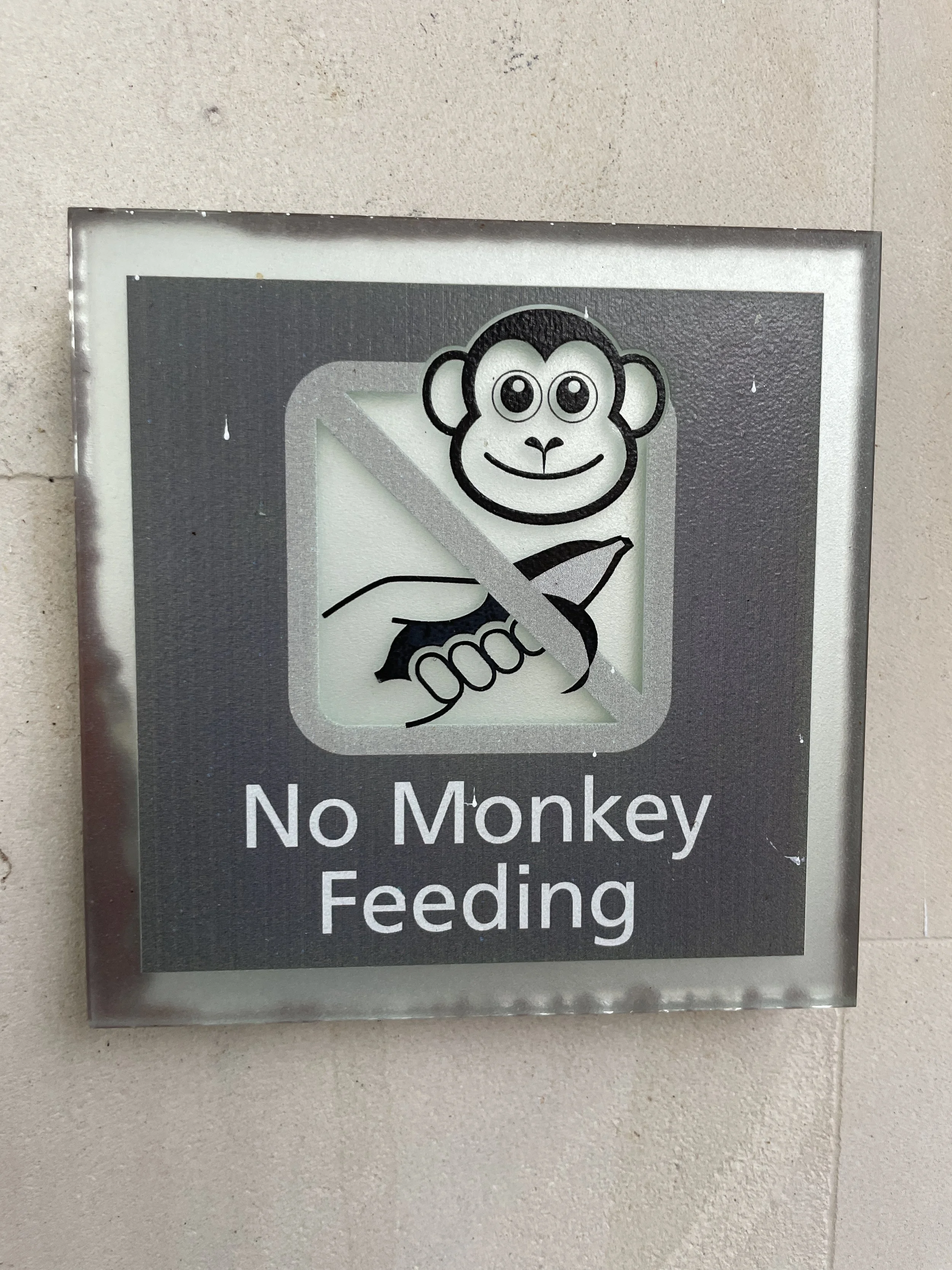
The Westin Langkawi Resort & Spa has several restaurants and bars, including one with a sea-view terrace. The food was great, although the service at the restaurant was a bit more irregular. We also tried the room delivery, which was a good option since we had the little patio in our room.
Breakfast was abundant and varied, with plenty of tropical fruit in the buffet.
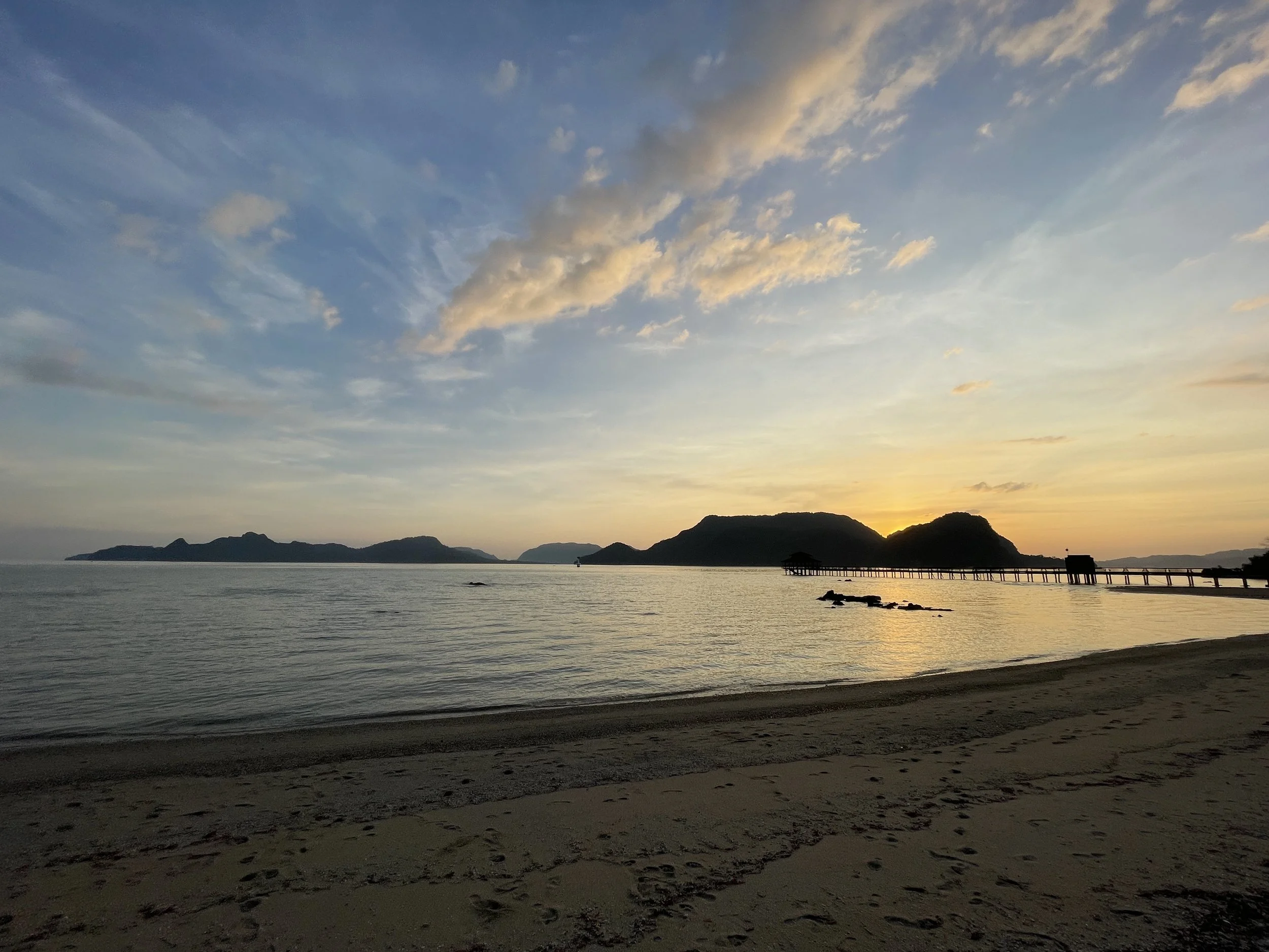
3. Take a boat tour of the mangroves at the Kilim Geoforest Park
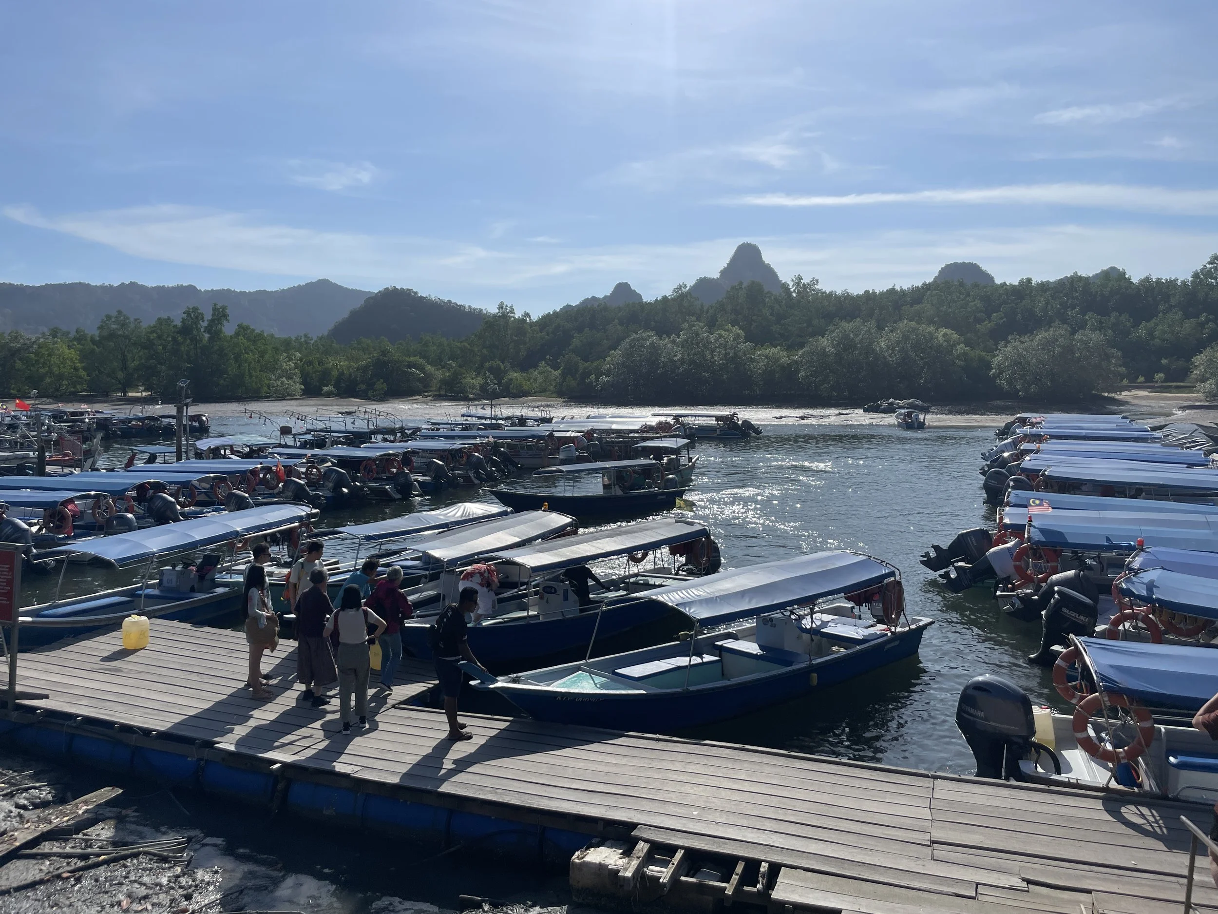
This is the other outdoors experience that I would recommend on Langkawi. You would need a guide for this one or to join one of the many organized tours that run throughout the day.
The Kilim Geoforest Park, on the northeastern corner of the island, is best seen from a boat (in fact, I am not sure whether is it possible to visit it any other way), since this is a natural area that combines the coastal karst formations with riverine landscapes covered by mangroves and the open sea.
It is a truly immersive experience which starts at a river station where are little armada of tour boats of different types and sizes assemble for the excursions. From there, the boats take the visitors through the different waterways that cross the natural reserve.
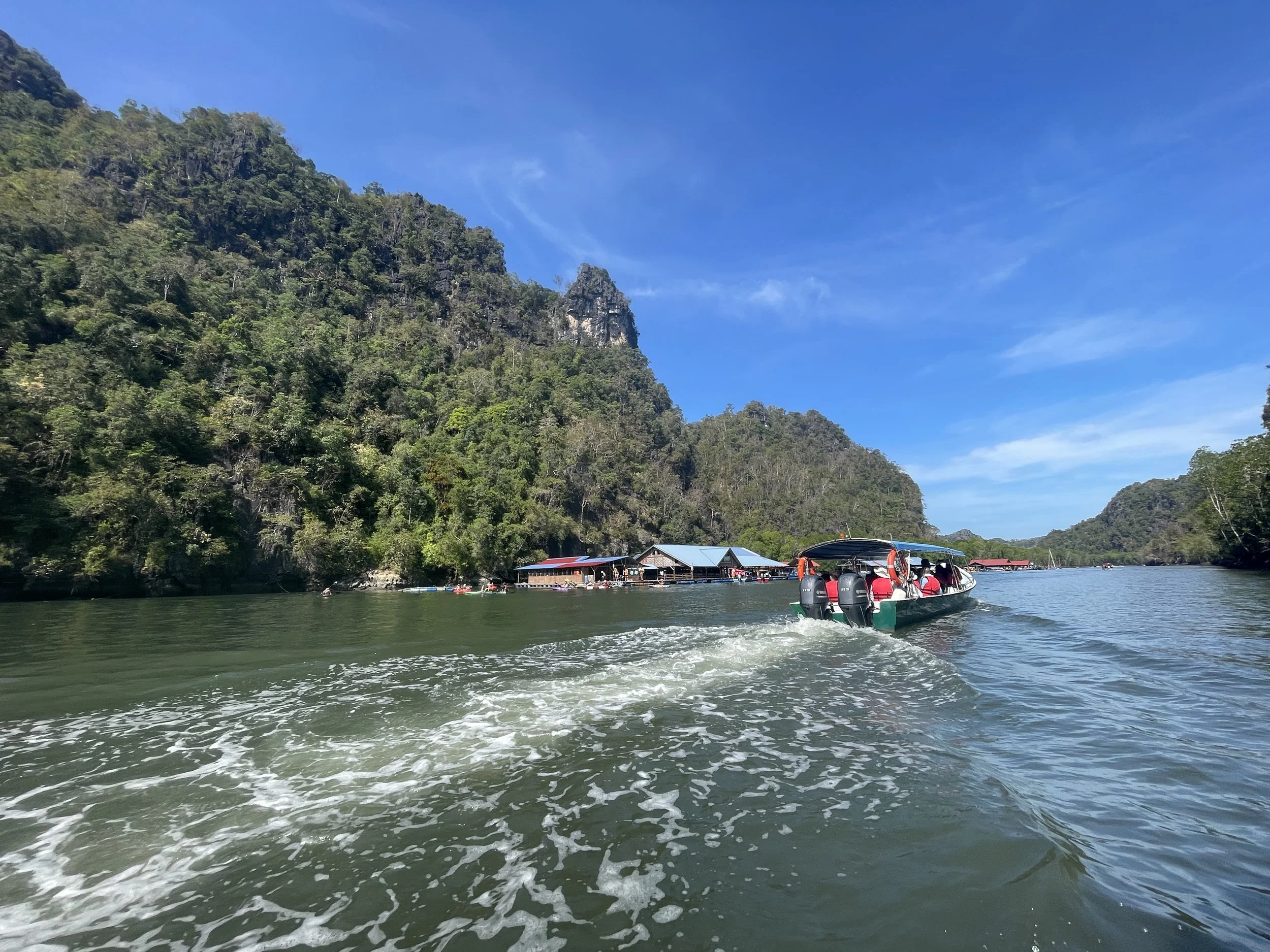
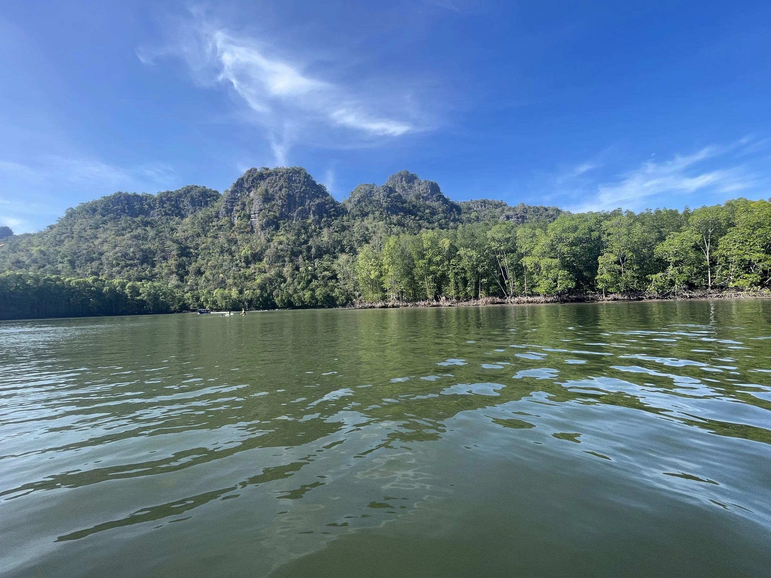
The boats stop at several spots along the way. One of them is this cave, where lots of bats live. There are also plenty of monkeys all over the place and you can see them as the boat gets close to the mangroves, which are the dominant form of vegetation in all this area.
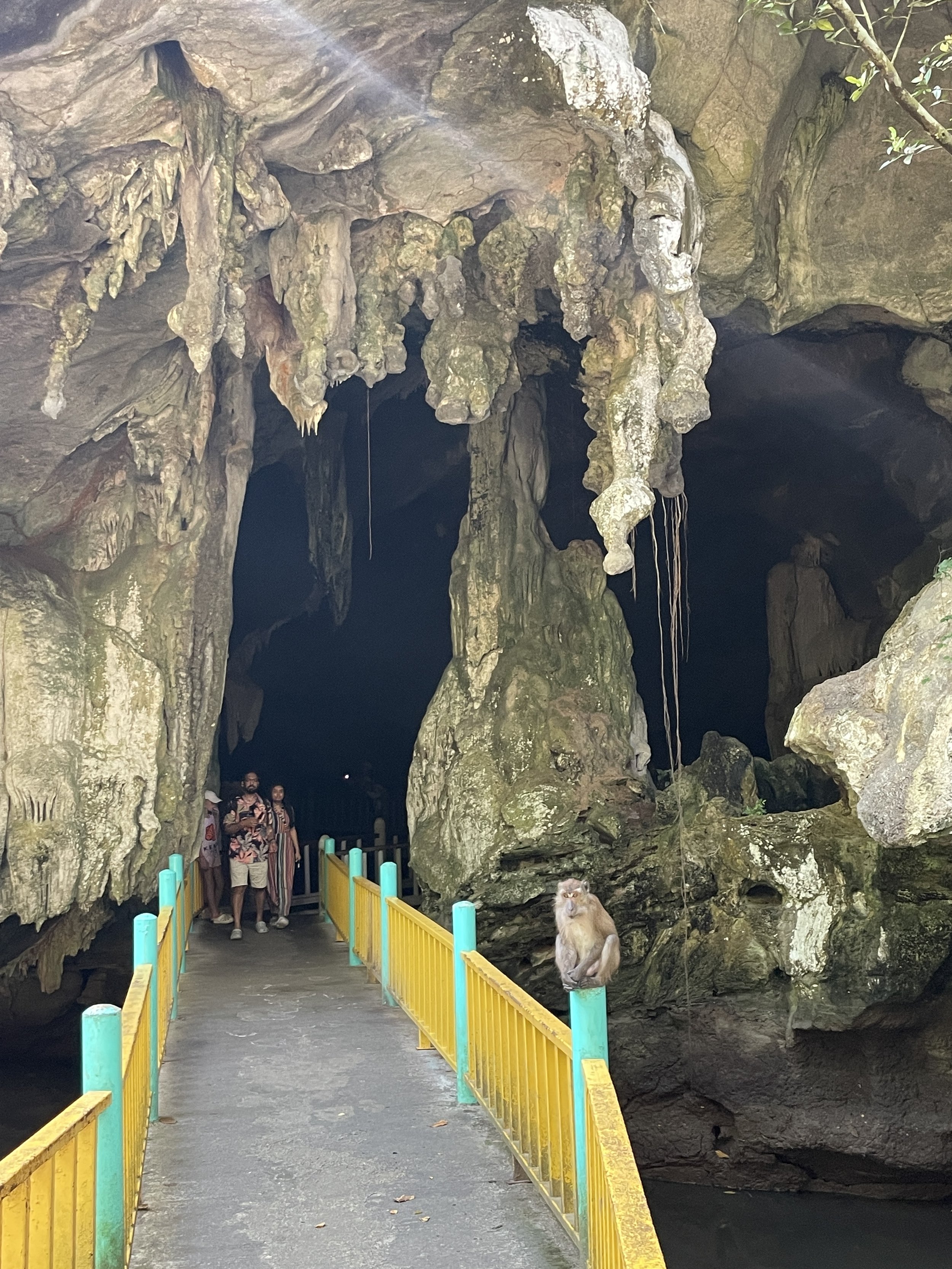
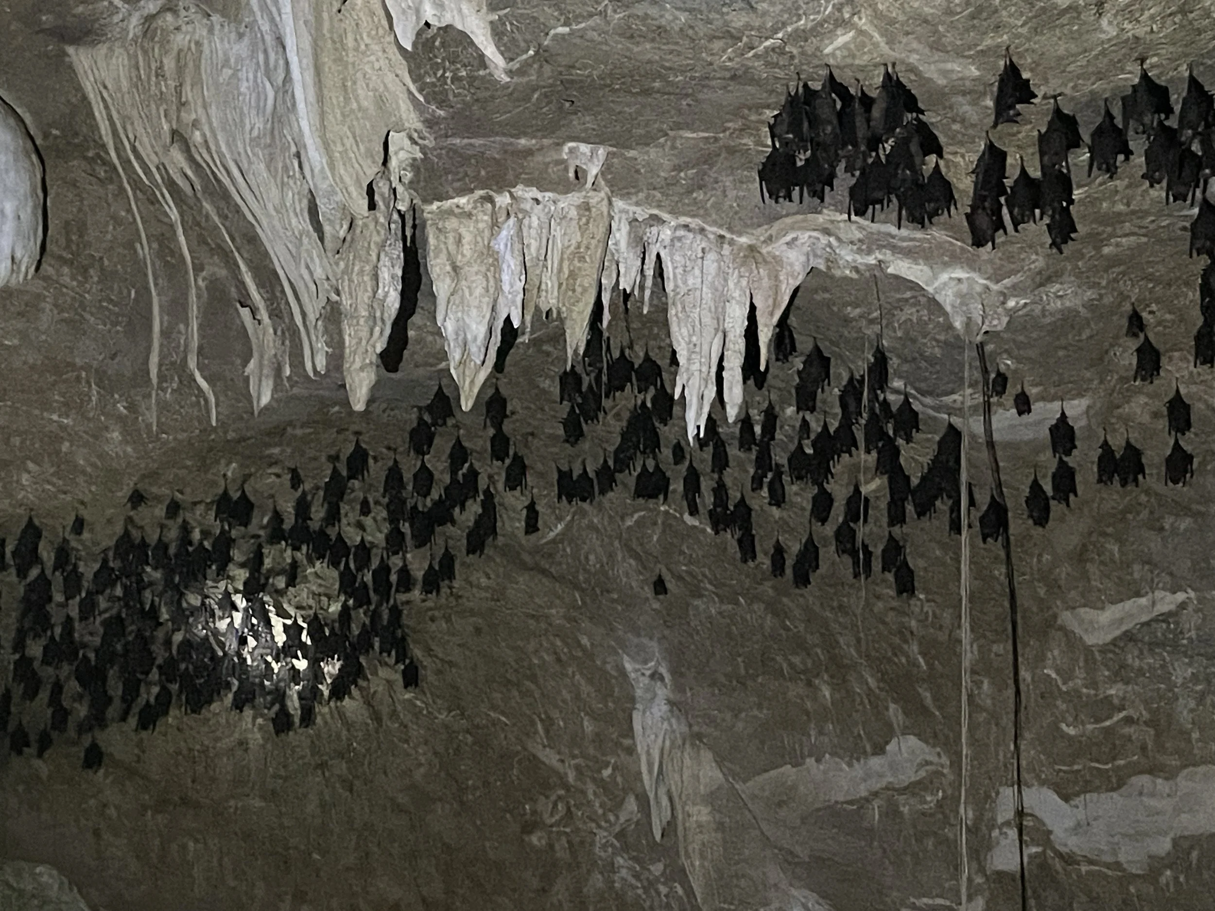
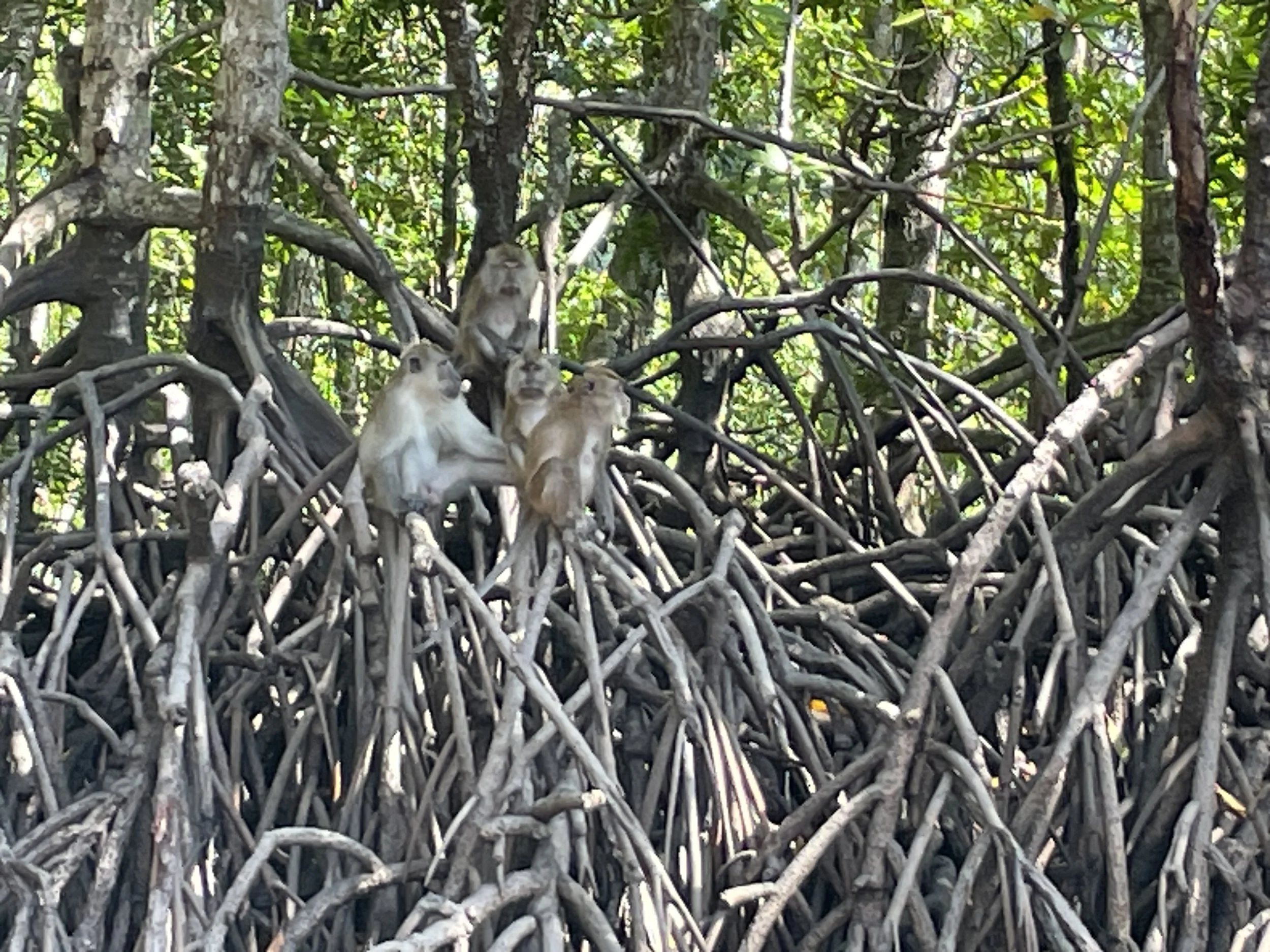
The whole excursion takes 3-4h and ends at one of the several fish farms which dot the waters of the Kilim Geoforest Park. At one, in particular, you can walk around the cages holding different spices of fish. The farm has a restaurant adjacent to it, with a terrace overlooking the river. It is pretty simple, street-food-style, but the food looked of good quality and with honest portions. Here you can try several dishes prepared with local seafood and fish.
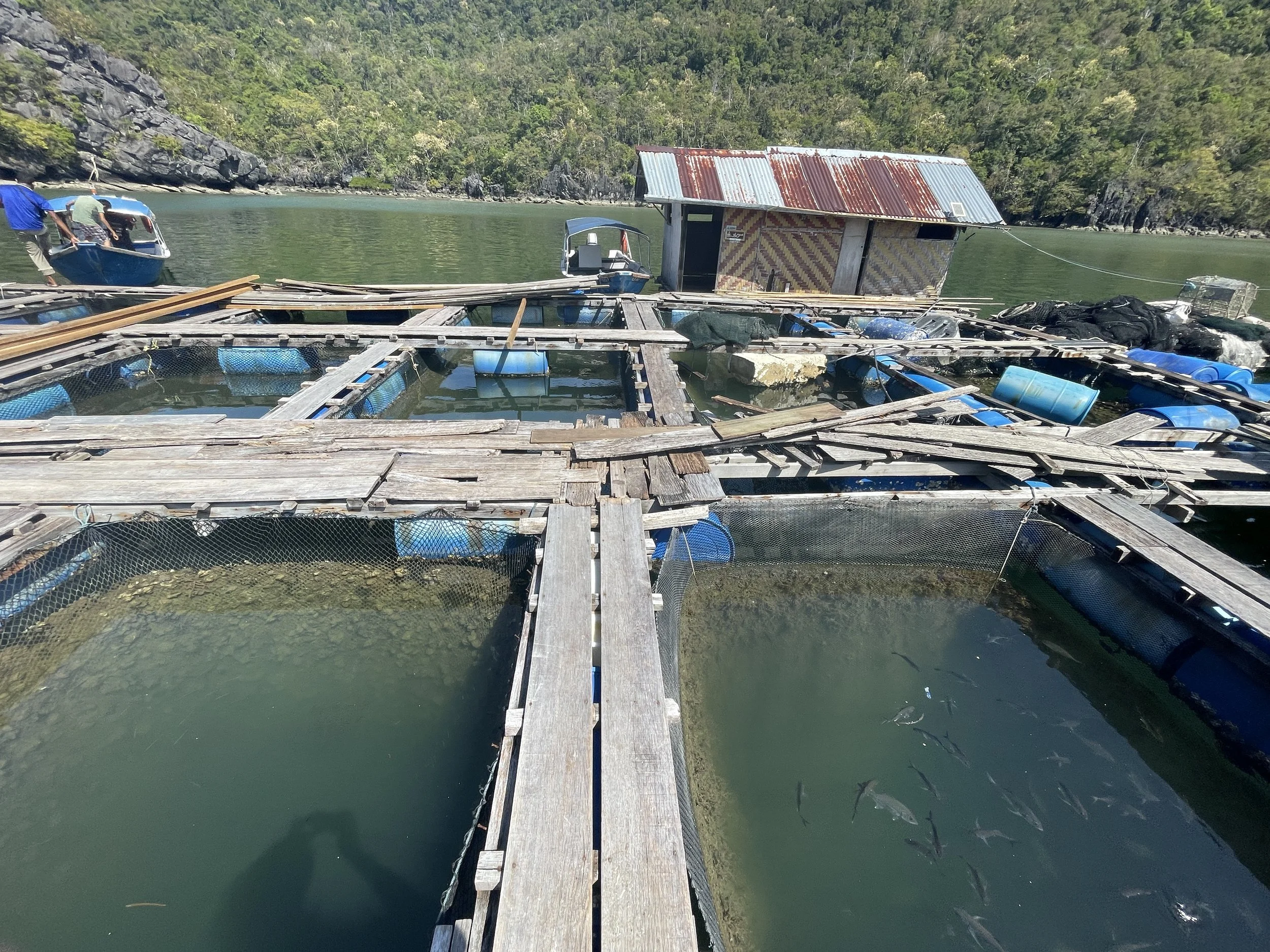
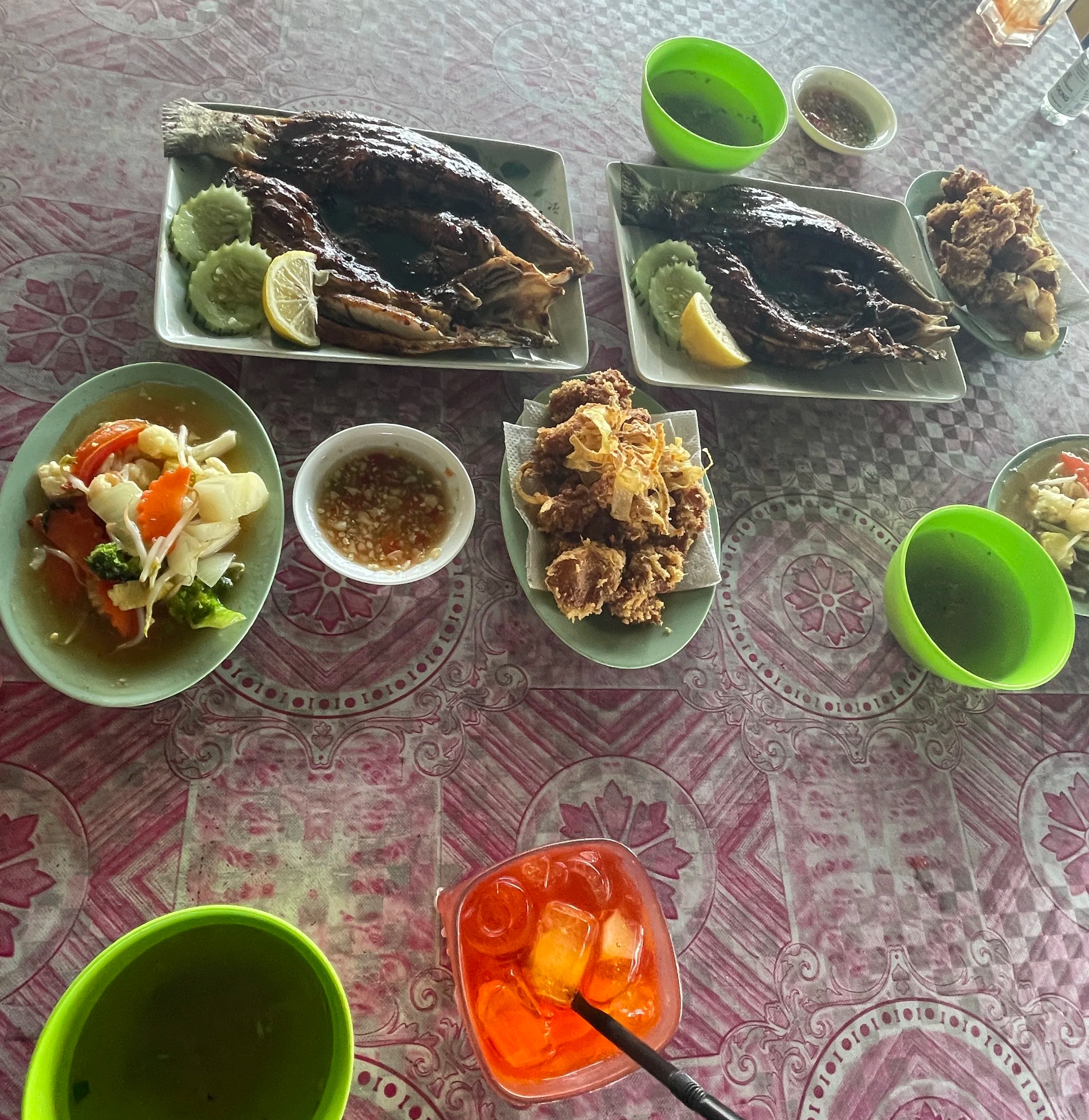
So, these are, I think, the top three things to do in Langkawi. I know I may have missed some interesting places and stuff, but overall I think they encapsulate what this island has to offer: not necessarily the best beaches, but some interesting sights, relaxed atmosphere and closeness to nature.
This post will have a follow up featuring other interesting places to see and things to do in Malaysia outside Kuala Lumpur. Stay tuned!
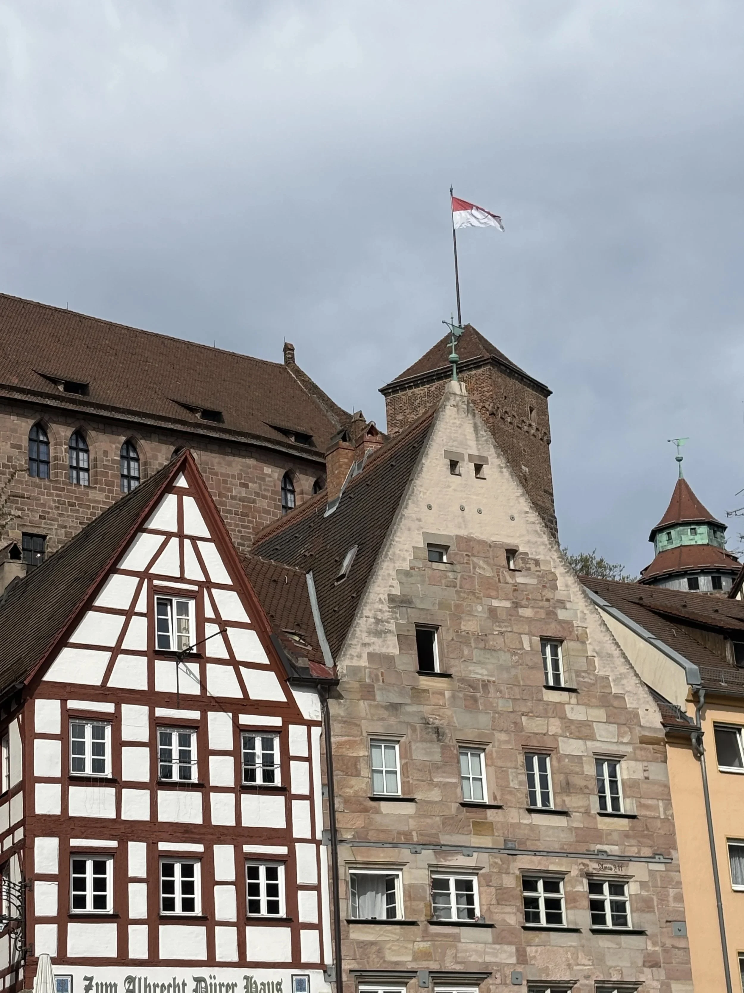
Top things to do and to see in Franconia (& 4): Nuremberg
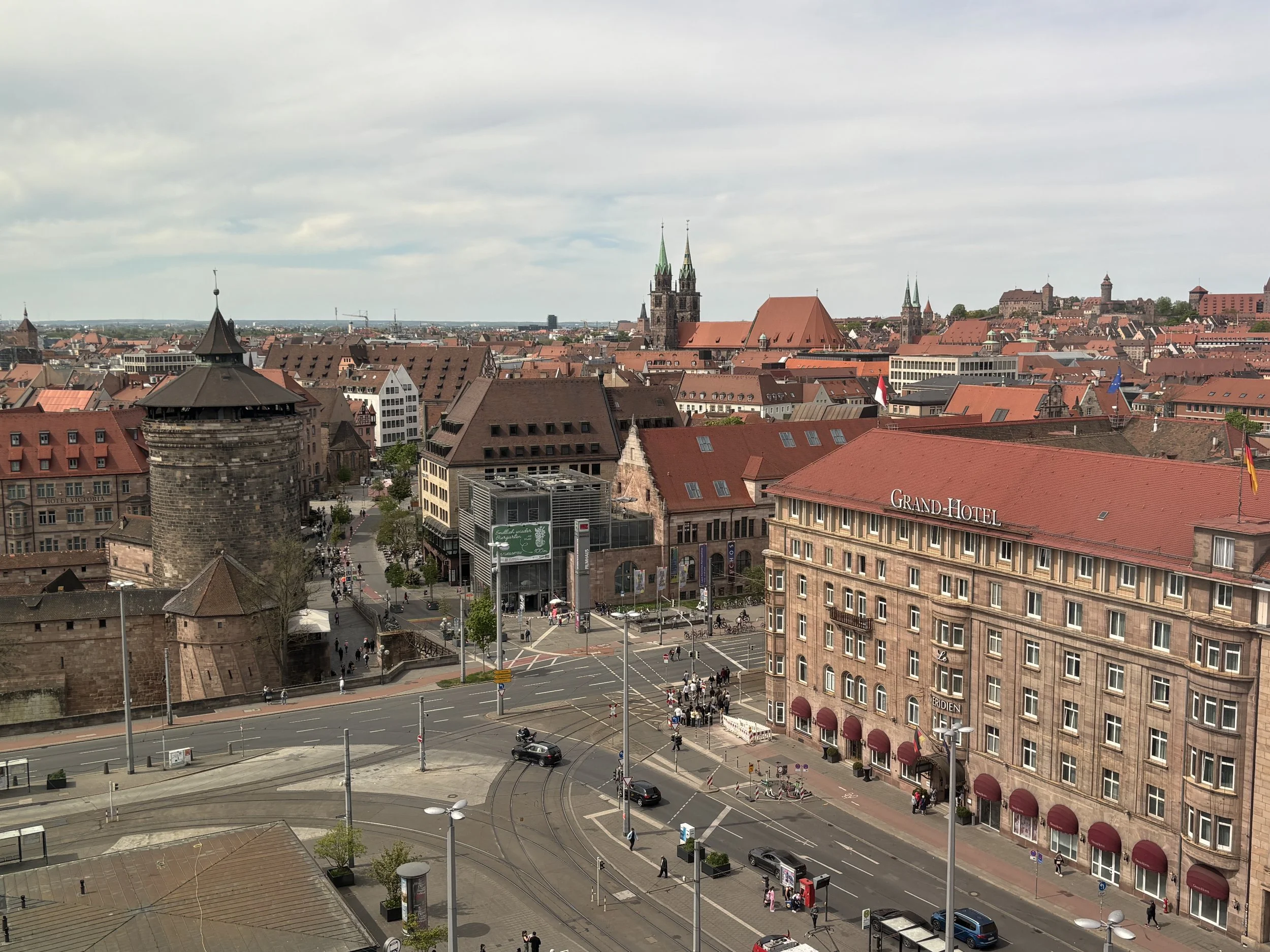

And this is how, after an intense weekend traveling by rail through the Franconia region of northern Bavaria, a journey that took me earlier to the beautiful historical towns of Bamberg, Forchheim and Fürth, reached its end at the Imperial city of Nuremberg.
Why Imperial city? Because since the Middle Ages and until Napoleon dissolved it in 1806, Nuremberg was governed as a free city that owed its allegiance directly to the emperor of the Holy Roman Empire.
What’s more, Nuremberg was also a designated meeting place for the Imperial Diet, a sort of proto-parliament attended by representatives of the many polities that made up the Holy Roman Empire, and it safeguarded also the Imperial Regalia.
But Nuremberg was also an important commercial city which commanded a rather large and rich hinterland from the safety of its imposing walls.
Nuremberg was perhaps at its peak during the early modern era, in the 16th C. and early 17th C., when it also gave the world its most renowned artist: Albrecht Dürer (1471-1528), whose home and studio in the city is still possible to visit in the historical downtown (in addition to giving its name to Nuremberg’s airport too!).
To be honest, this post possibly doesn’t do justice to Nuremberg, because due to time constraints I had to skip some of its top museums: the German National Museum of Toys (Spielzeugmuseum), the museum of the German railways (Deutsche Bahn Museum), the new Deutsches Museum Nuremberg, which focuses on technology, and the more classic Germanisches Nationalmuseum (Germanic National Museum), which focuses on German history.
What I did have time to visit were two sites connected to the more recent history of the city, and not a particularly proud period of it. These are two locations connected with the beginning and also the end of the Nazi period in Germany: Zeppelinfeld, where some of the first Nazi rallies were held, and the Nuremberg palace of justice, where the famous Nuremberg Trials were held after the war.
So, quite a lot to see in Nuremberg, a city that, while big, has still a very manageable size and a public transport system that makes it relatively easy and convenient to move around.
Traveler’s Tip: If you are planning to visit several of Nuremberg’s museums you can purchase a “Nuremberg Card”, which costs €38 and gives you access to most of them within 48 hours and includes also the public transport fare (metro, tram and S-Bahn) for Nuremberg’s Zone A, which covers the airport too.
So, without further ado, let’s have a look at the top things to do in Nuremberg if, like me, you are on a limited time budget!
Top things to see in Nuremberg that are covered in this post:
Nuremberg’s historical center
Nuremberg Castle (Kaiserburg), walls and gardens
Albrecht Dürer’s house and museum
Hauptmarkt, St. Lorenz and the river banks
Nuremberg Memorium:
Nuremberg Trials Museum
Courtoom 600
Zeppelinfeld
A great place to eat in Nuremberg
A great place to stay in Nuremberg
This post may contain affiliate links. If you book or buy something through them, I earn a small commission, at no extra cost to you. It's one of the ways I keep Places of Charm going. Thank you for your support.
I would like to thank also Franken Tourismus for facilitating this journey. All opinions are my own.
Things to see in Nuremberg’s historical centre
Nuremberg Castle (Kaiserburg)
Nuremberg’s castle has been the dominant feature in Nuremberg’s skyline since the Middle Ages. The castle is located on a hilltop at the northern edge of the old town, dominating the historical centre below it and providing some of the best of the city (but perhaps not THE best, as you will soon see further down this post!)
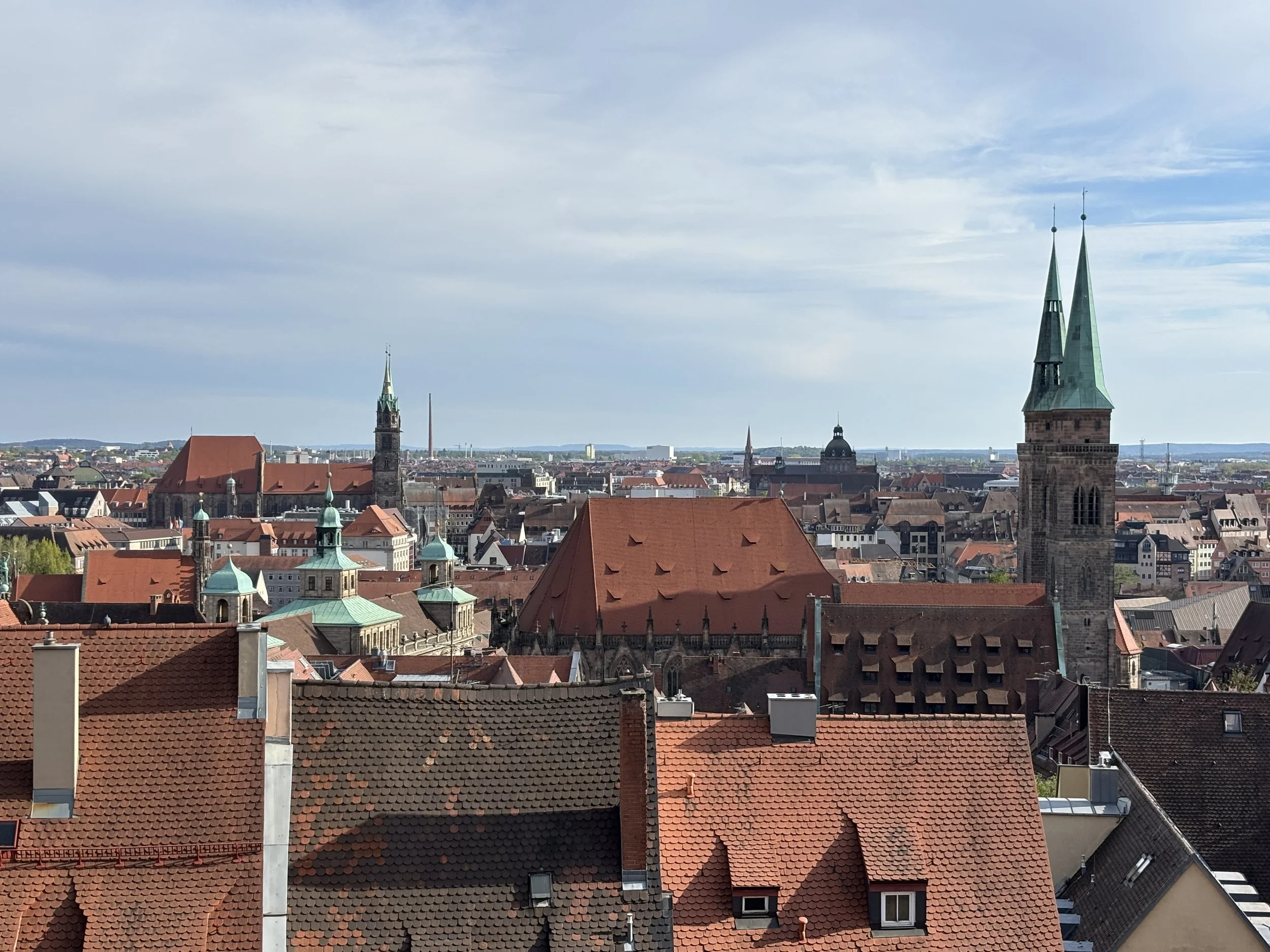
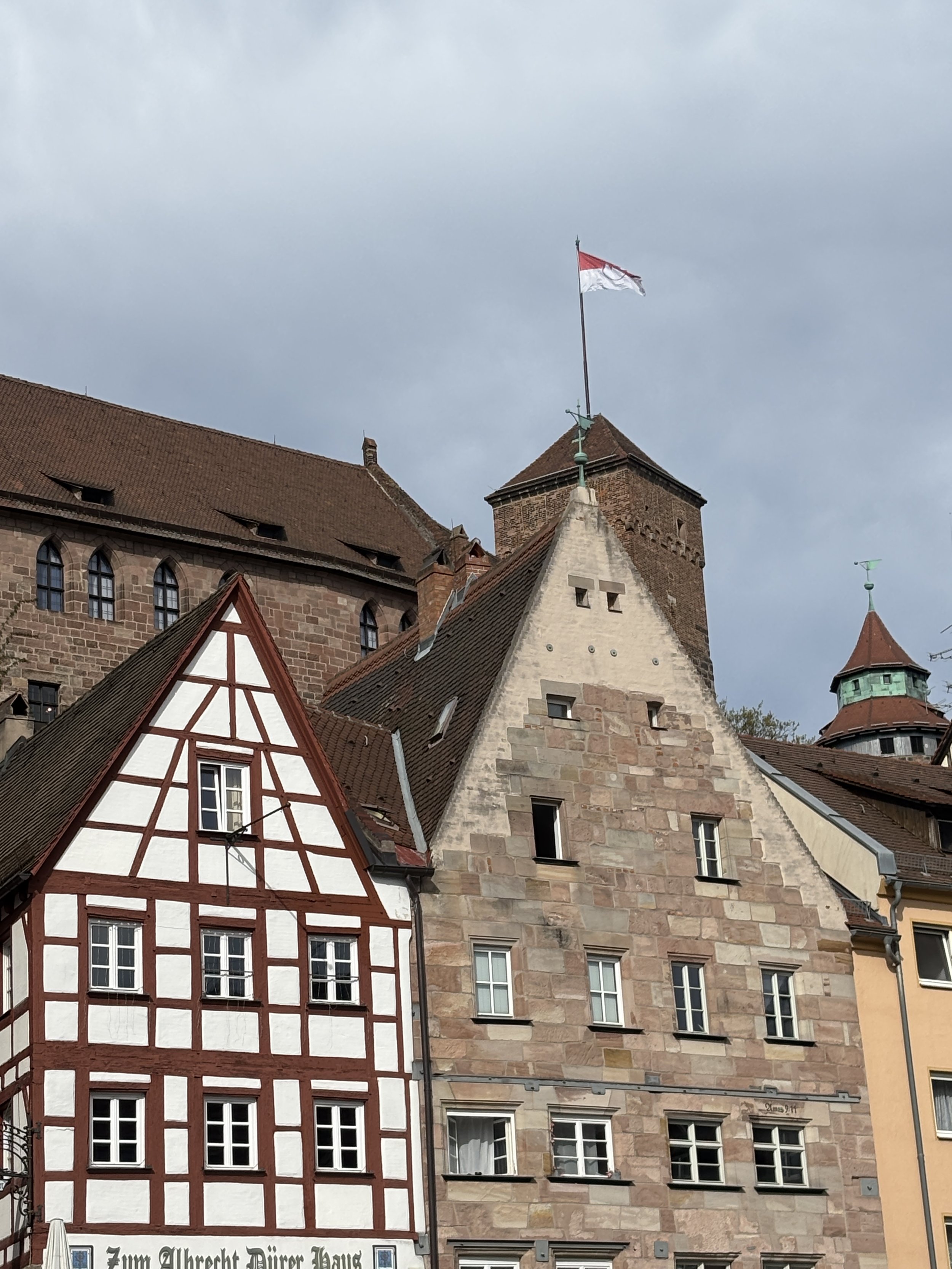
To get up the castle you will need to walk uphill, but the views are well worth it!
You can visit the inside of the castle if you feel inclined to do so.
The castle was, apparently, very heavily damaged by bombing during WW2, so many of the interiors are actually a post-war restoration.
In my case, I just walked around the outer areas to get a feel of the place and to optimize my time.
One of the aspects of the castle that are quite impressive is that it is atop a massive rock, which you can see in some places with the naked eye.
You don’t need any ticket to enter the castle’s enceinte and access the viewpoint facing the old town. It is also possible to walk a segment of the walls, which end in a small square adorned by some perfectly manicured gardens.
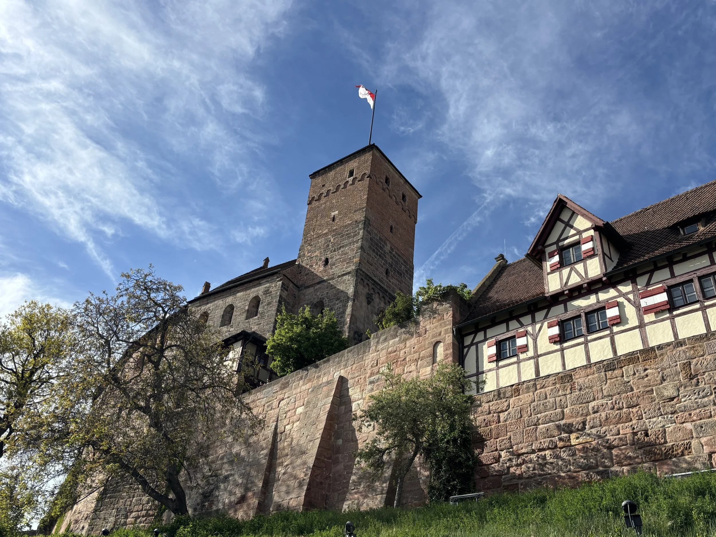
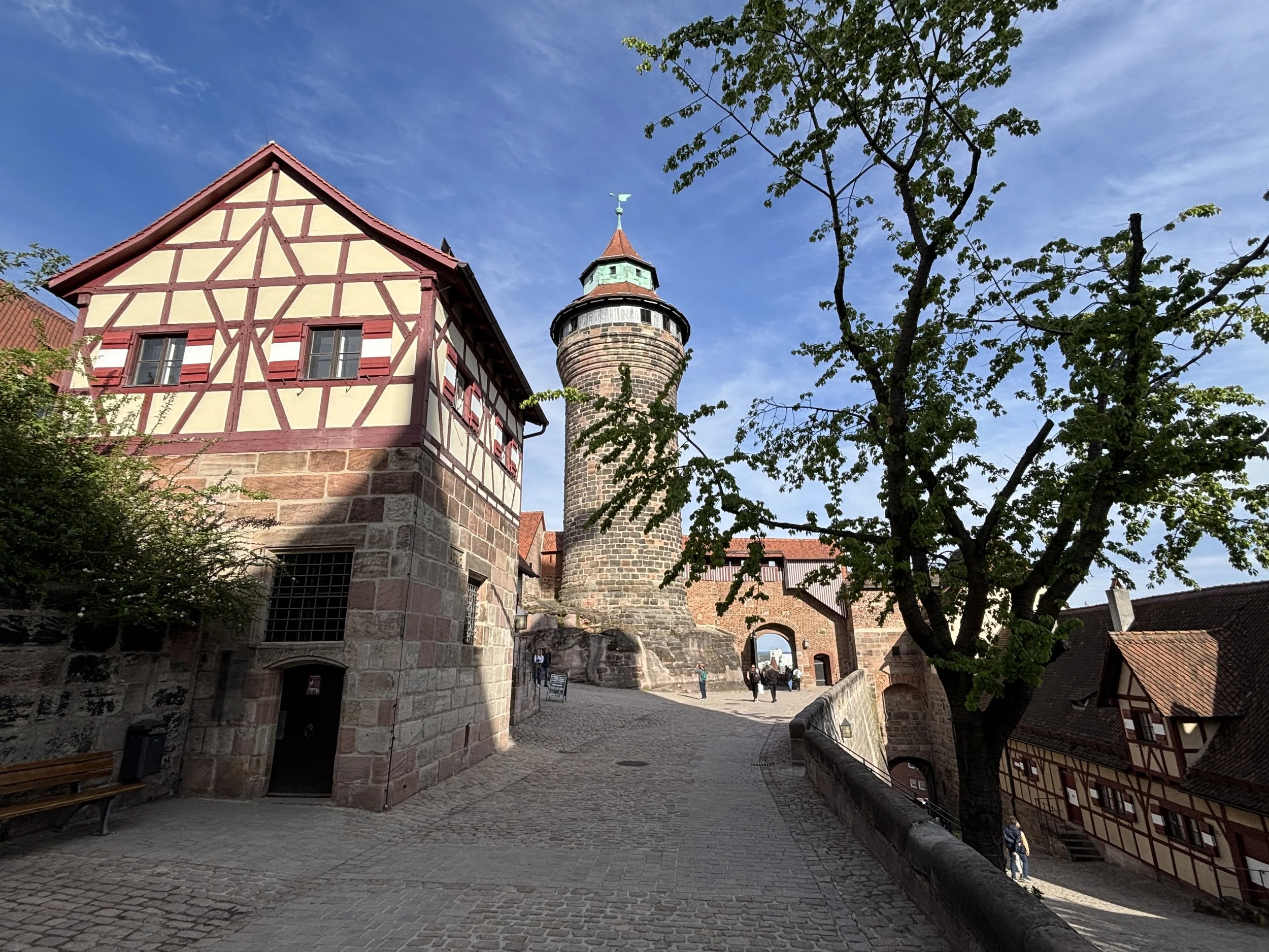
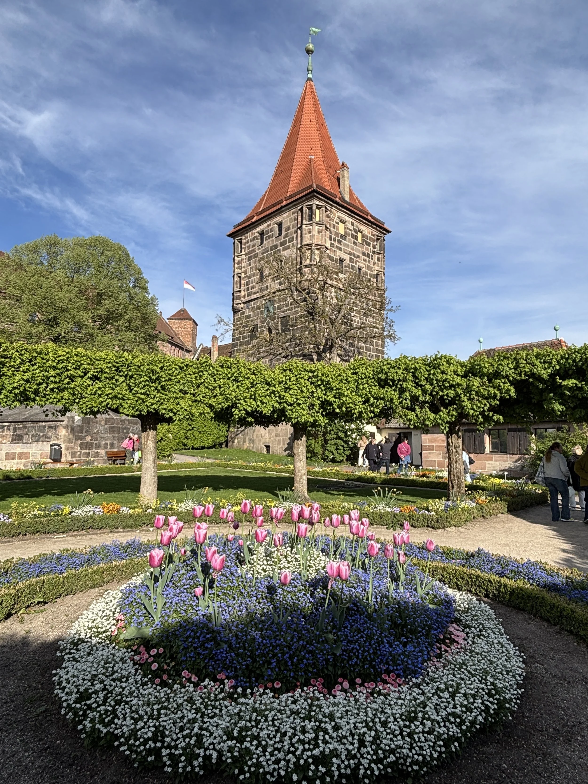
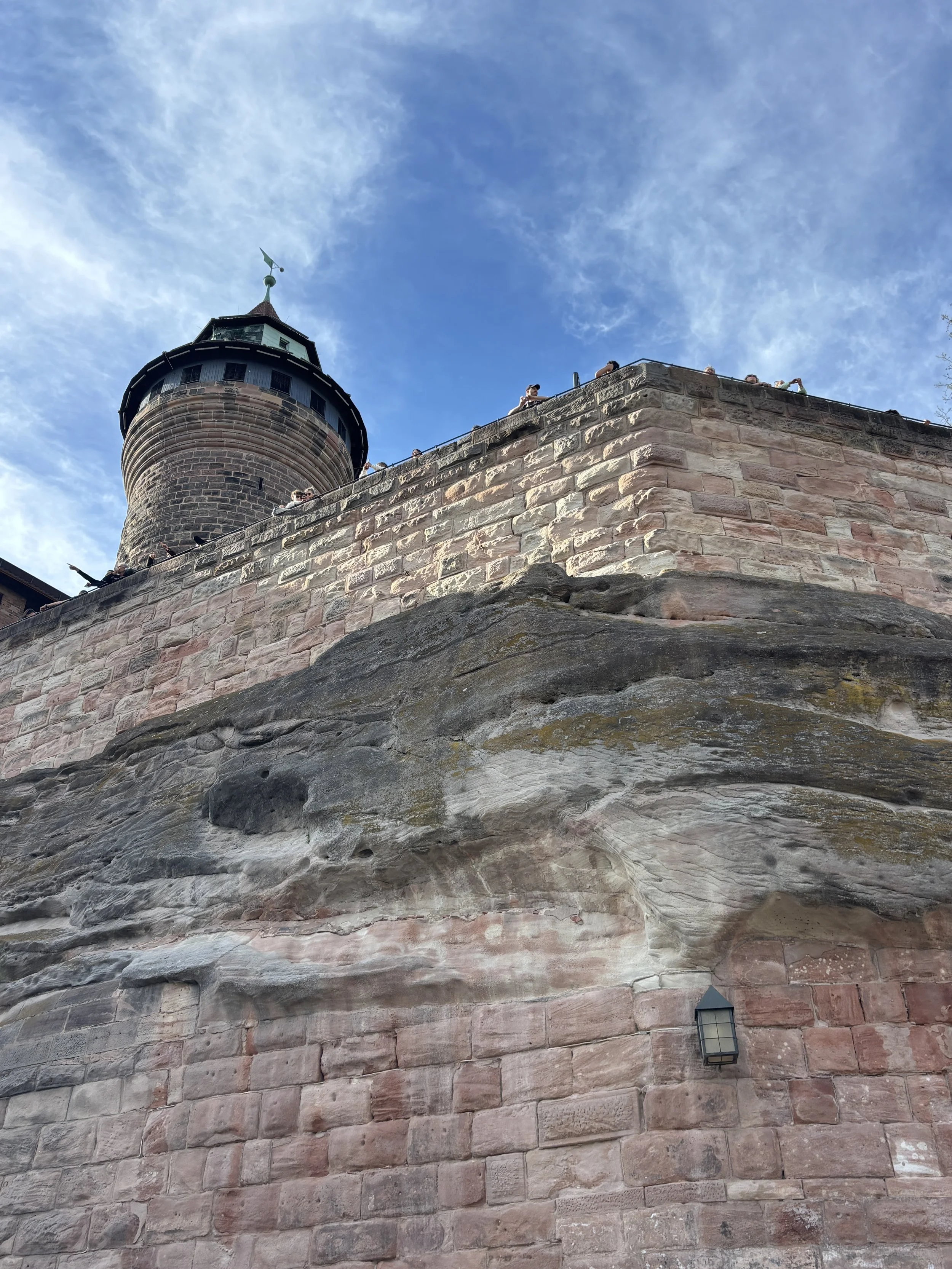
Albrecht Dürer’s House and Museum
The other focal point in this part of the old town and very close to Nuremberg Castle is the house where Albrecht Dürer lived part of his life. This half-timbered building is on the corner of a small square which opens up just underneath the castle and adjacent to the city walls.
This is a spot where many people congregate when the weather is nice and warm, since the south-facing slope makes it a good spot for groups to congregate and for tourists to get some rest and refreshment at the several bars that line the square.
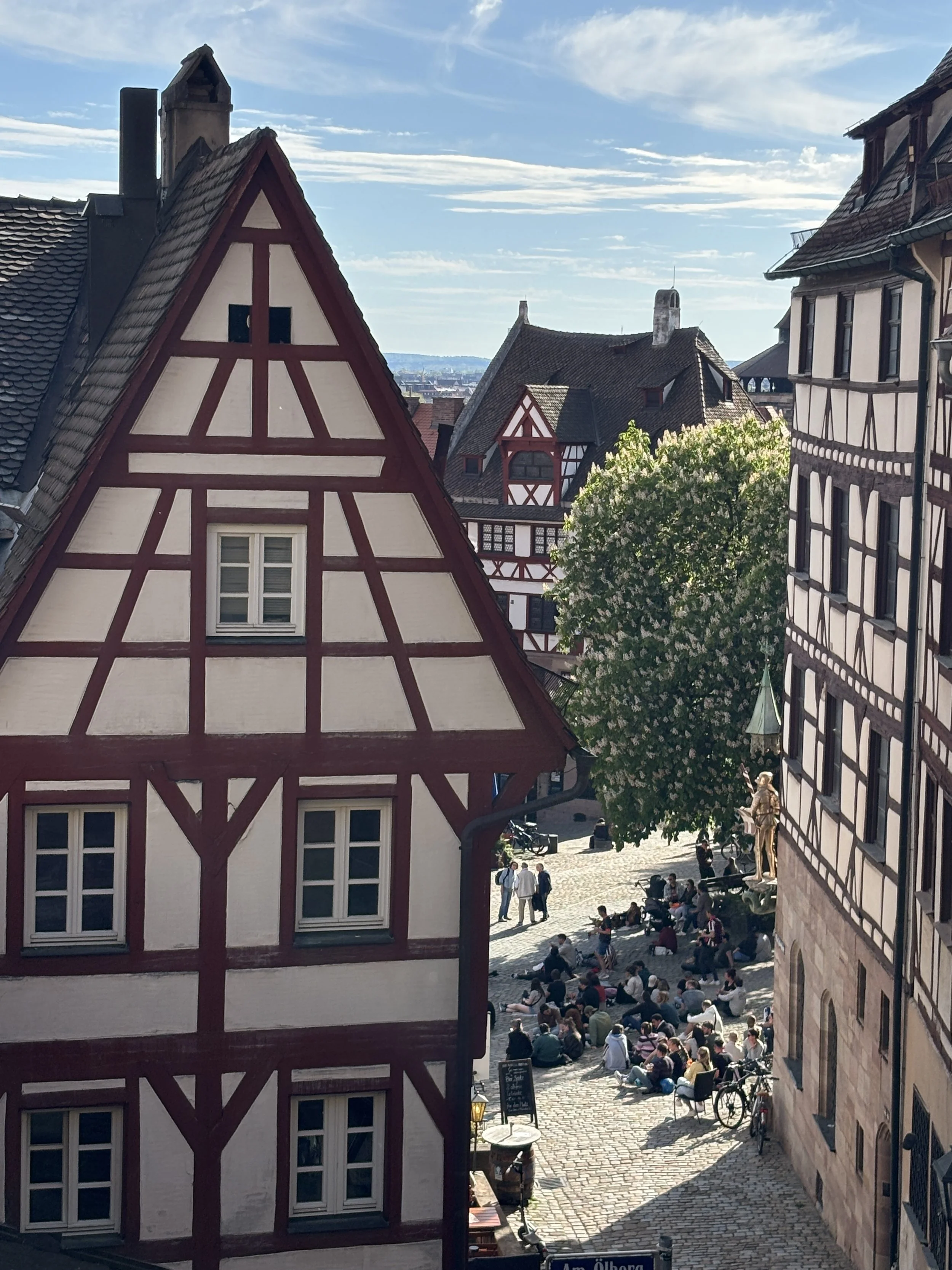
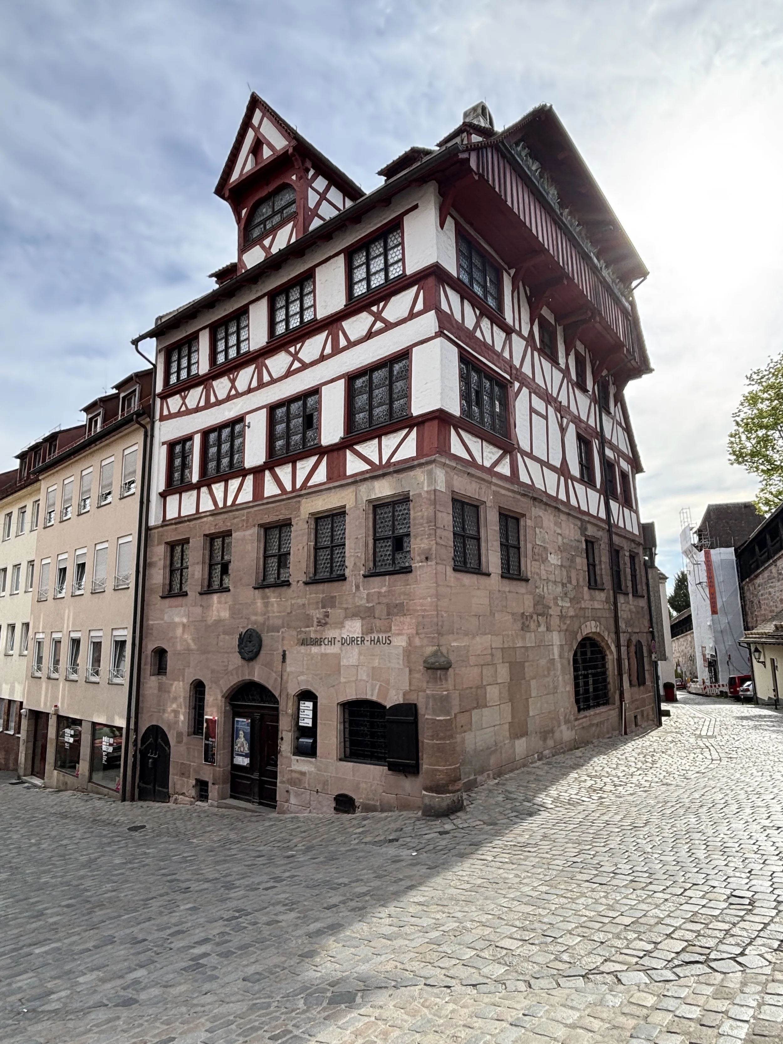
Albrecht Dürer is one of the great artists of the Renaissance era. He was contemporary to the great Italian masters of the time (Leonardo, Michelangelo and Raphael), but developed his own brand and style of creation. And while he was a very talented painter, Dürer is particularly well known for his engravings. This technology, which used an early form of printing press, allowed Dürer’s work to spread fast across Europe, making it famous and celebrated across the continent.
In this sense, Dürer was also “modern”, not just in adopting new technology to amplify its work, but also in that he was one of the first artists to cultivate his own image and fame.
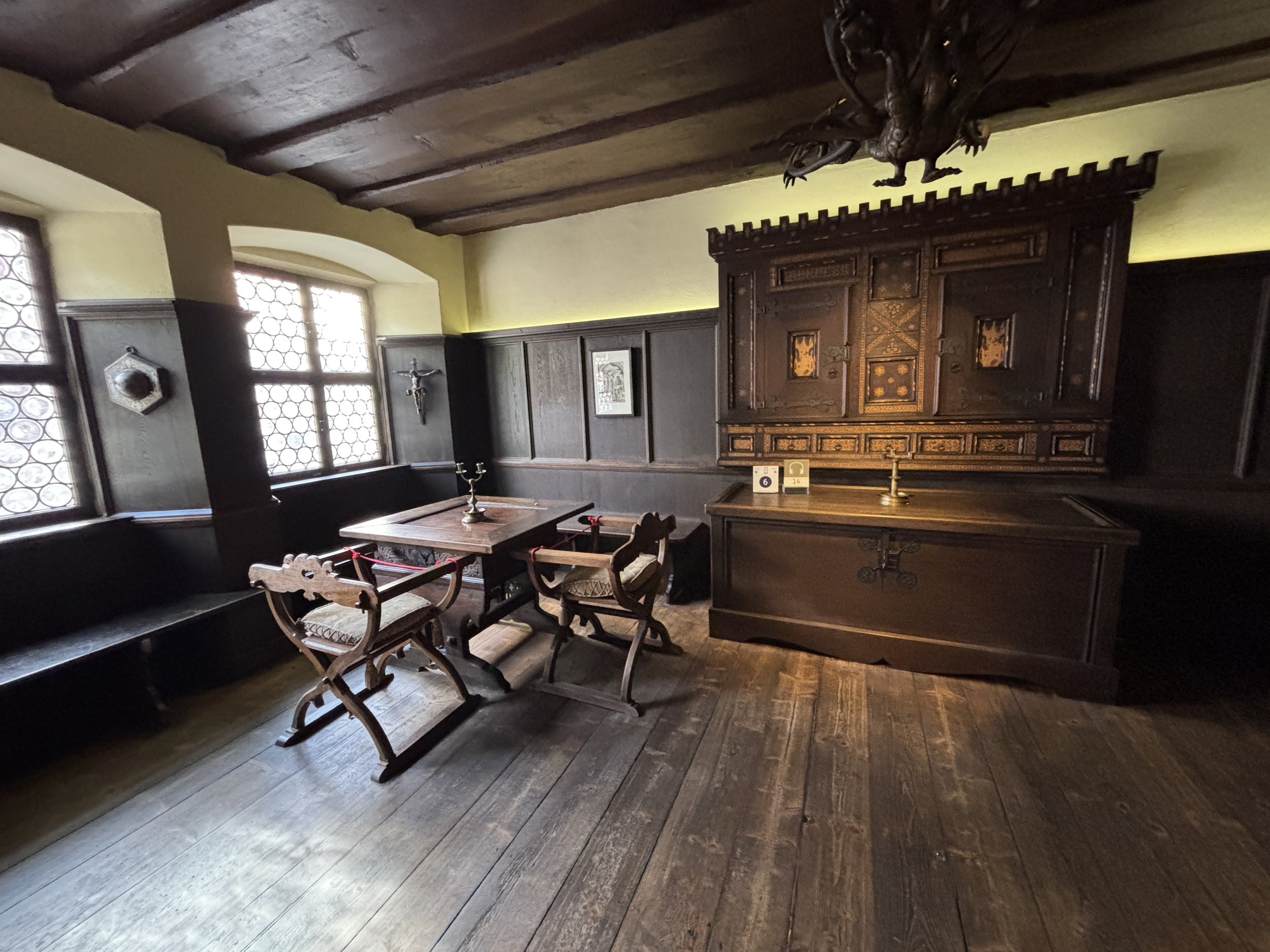
The house you can visit in Nuremberg was bought by Albrecht Dürer when he was already a well-known and reasonably well-off artist and he lived there with his family until his death in 1528.
Obviously, the building has suffered modifications throughout the centuries, but it has been painfully restored to something similar to what it may have looked like at the time. It now houses a small museum about the life and work of Albrecht Dürer.
It takes 30-40 minutes to see and it is a quite interesting way to learn more about a very interesting artist that is perhaps not as universally well-known as his contemporaries south of the Alps.
The entrance fee is €7.5 (it is also included in the Nuremberg Card) and an audioguide is included. Beware, that, as it is common in old buildings, there are some steep stairs to climb to do the visit!
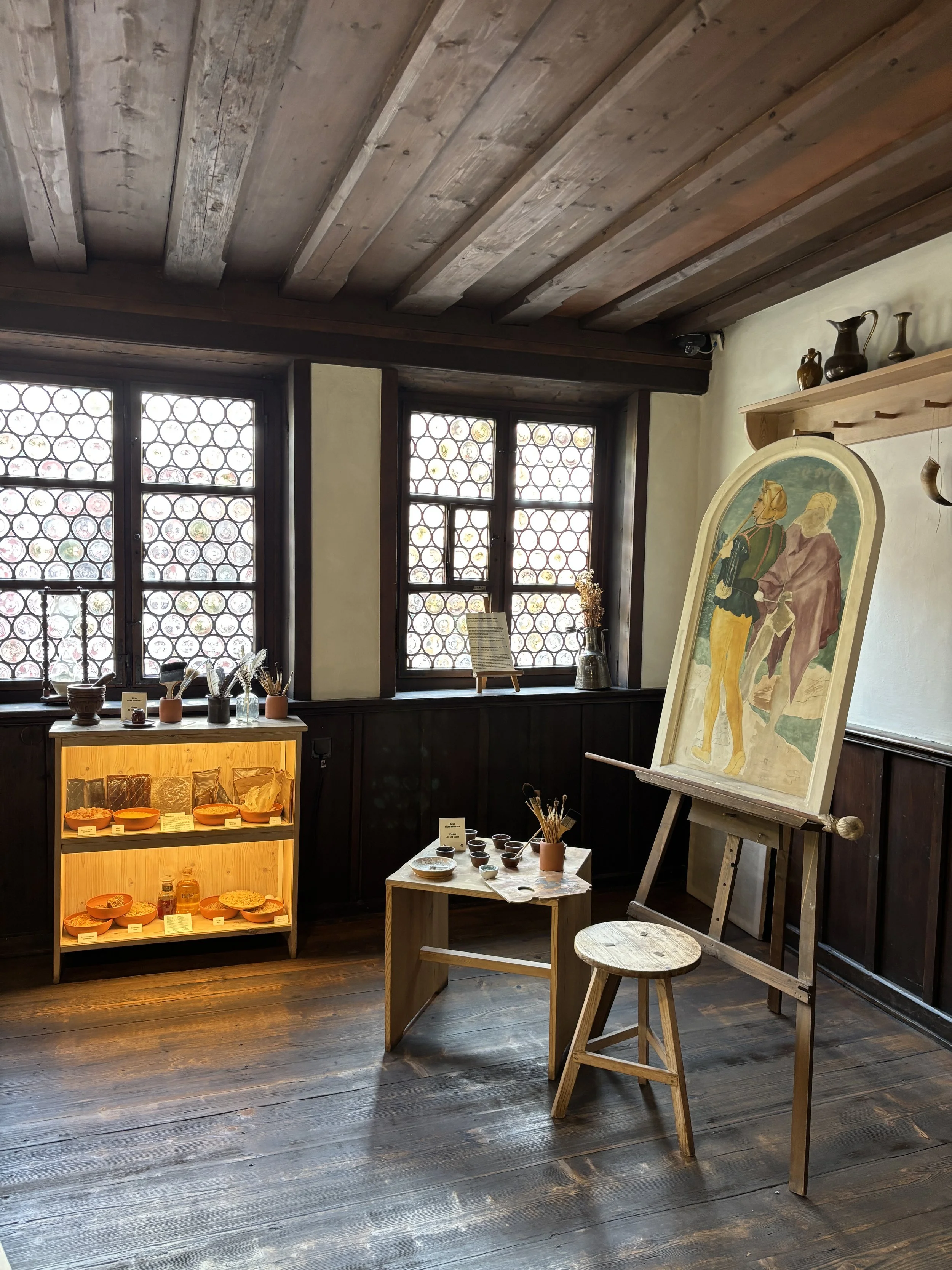
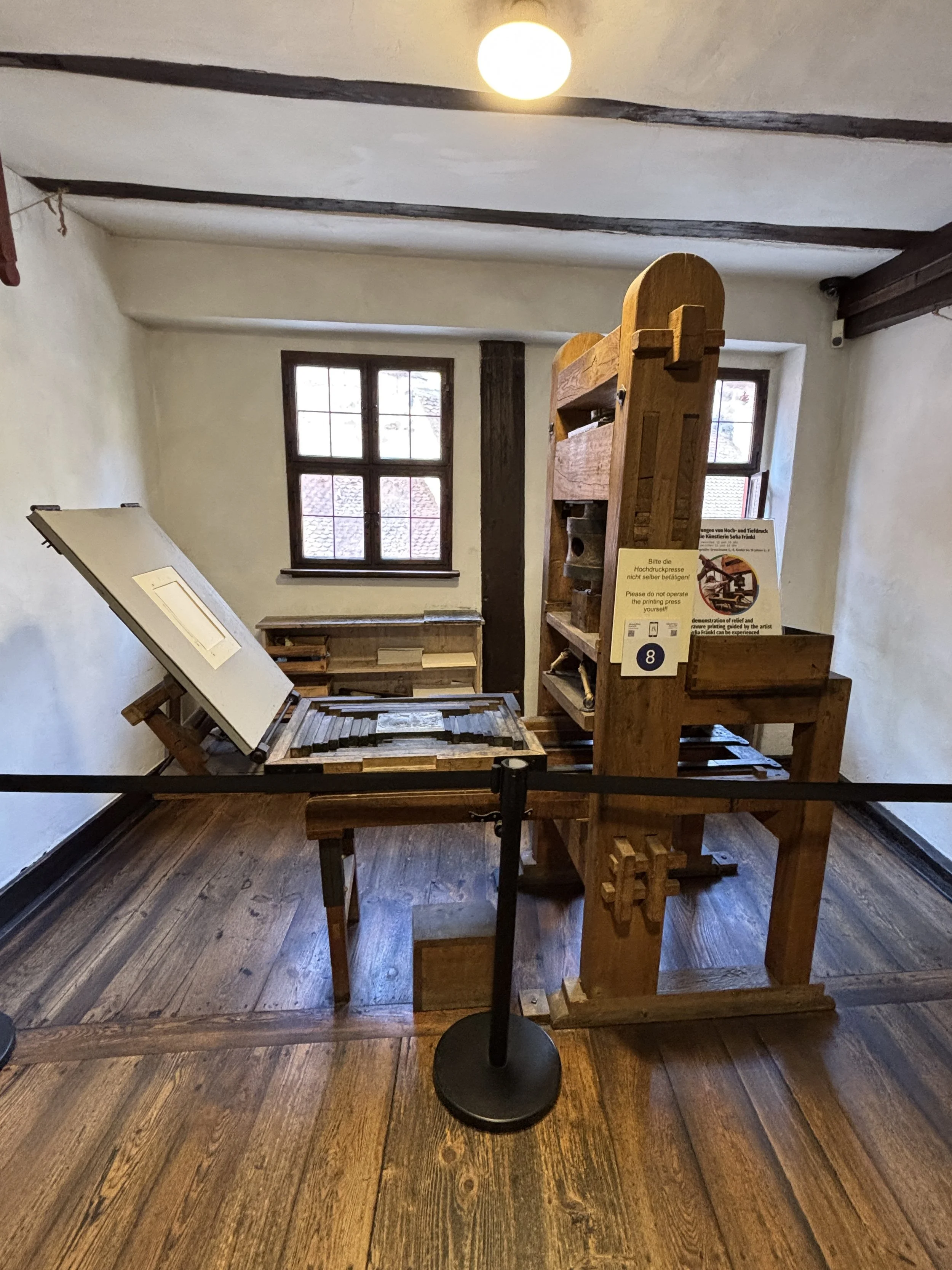
A walk through Nuremberg’s historical center
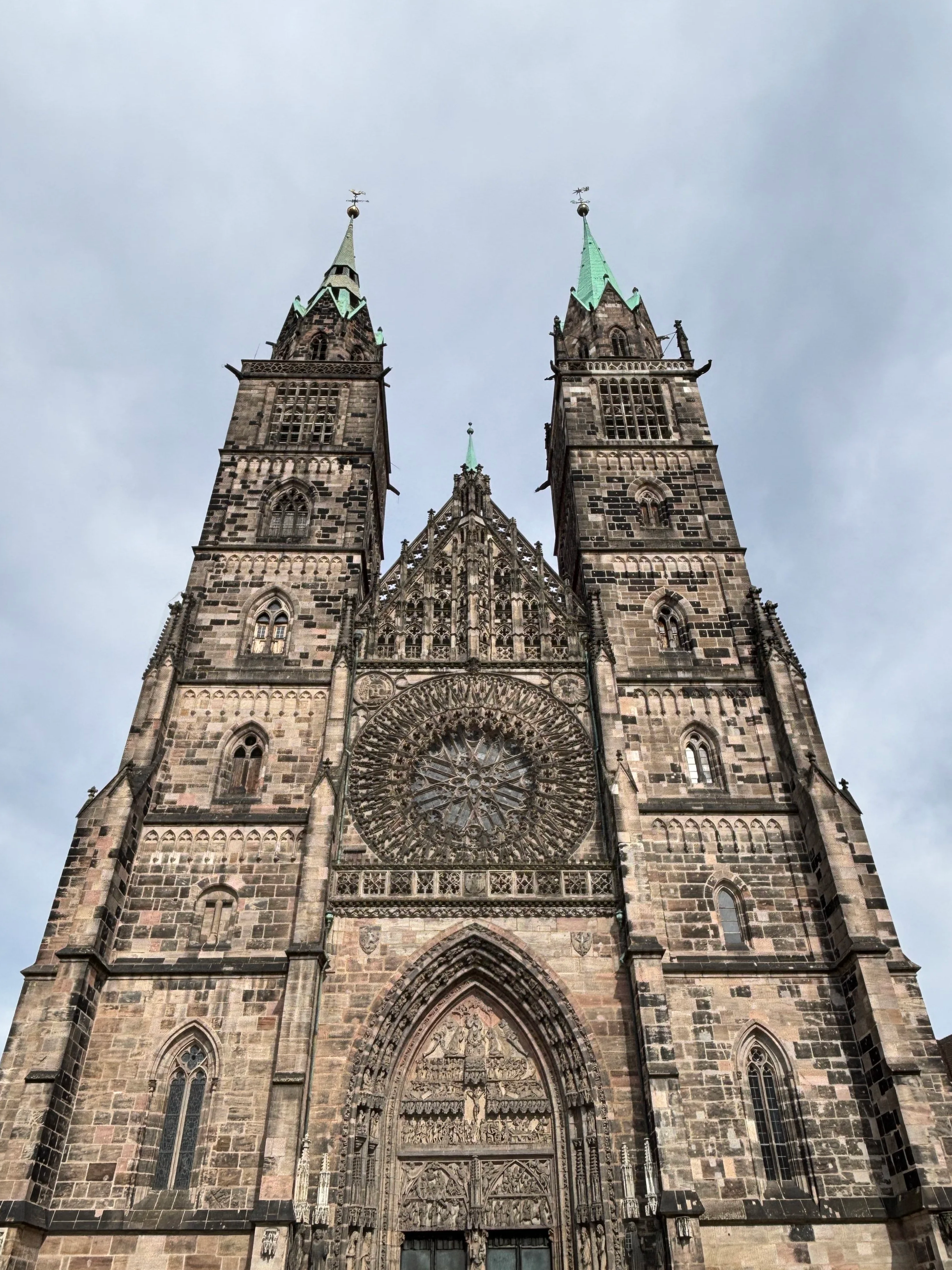
Besides the castle and museums, Nuremberg is endowed with a very large and mostly pedestrianized historical center to walk through.
As mentioned earlier, a large portion of Nuremberg’s city walls are still standing and in a good state of preservation, complete with the moat and towers.
The river Pegnitz also runs through the city center, dividing it in two, and with its two opposite banks sloping gently towards it. This offers also some nice views from specific spots.
If you are entering the historical town from the side of the central station (Hauptbahnhof) a typical route that would take you to the castle past some of the city’s top landmarks would be through Königstrasse north towards Saint Lorenz (depicted right) and then onwards to Hauptmarkt (the setting of Nuremberg’s famous Christmas market!).
At Hauptmarkt (below left) you will find the Schöner Brunnen (Beautiful Fountain) and the Frauenkirche, both built in the 14th C. Just north of it is Saint Sebaldus, another large Gothic church of note.
Continuing further up you reach the Albrecht Dürer house and the foot of the castle.
But you may also choose to walk south and west from Hauptmarkt, across the several bridges spanning the river Pegnitz, towards the Weisser Turm and Saint Jakob’s (below right).
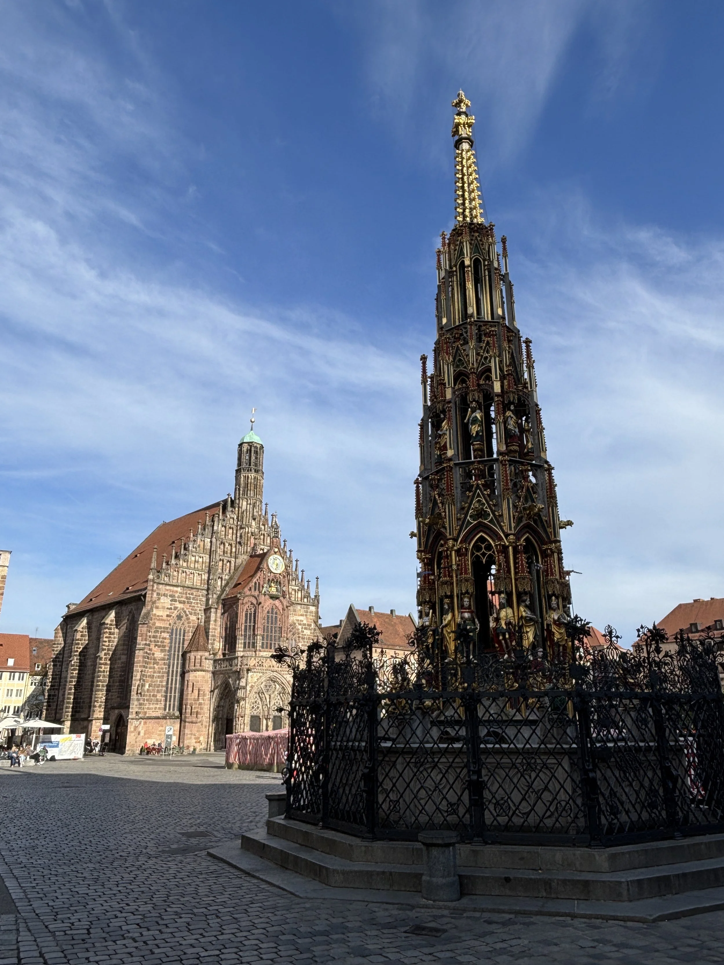
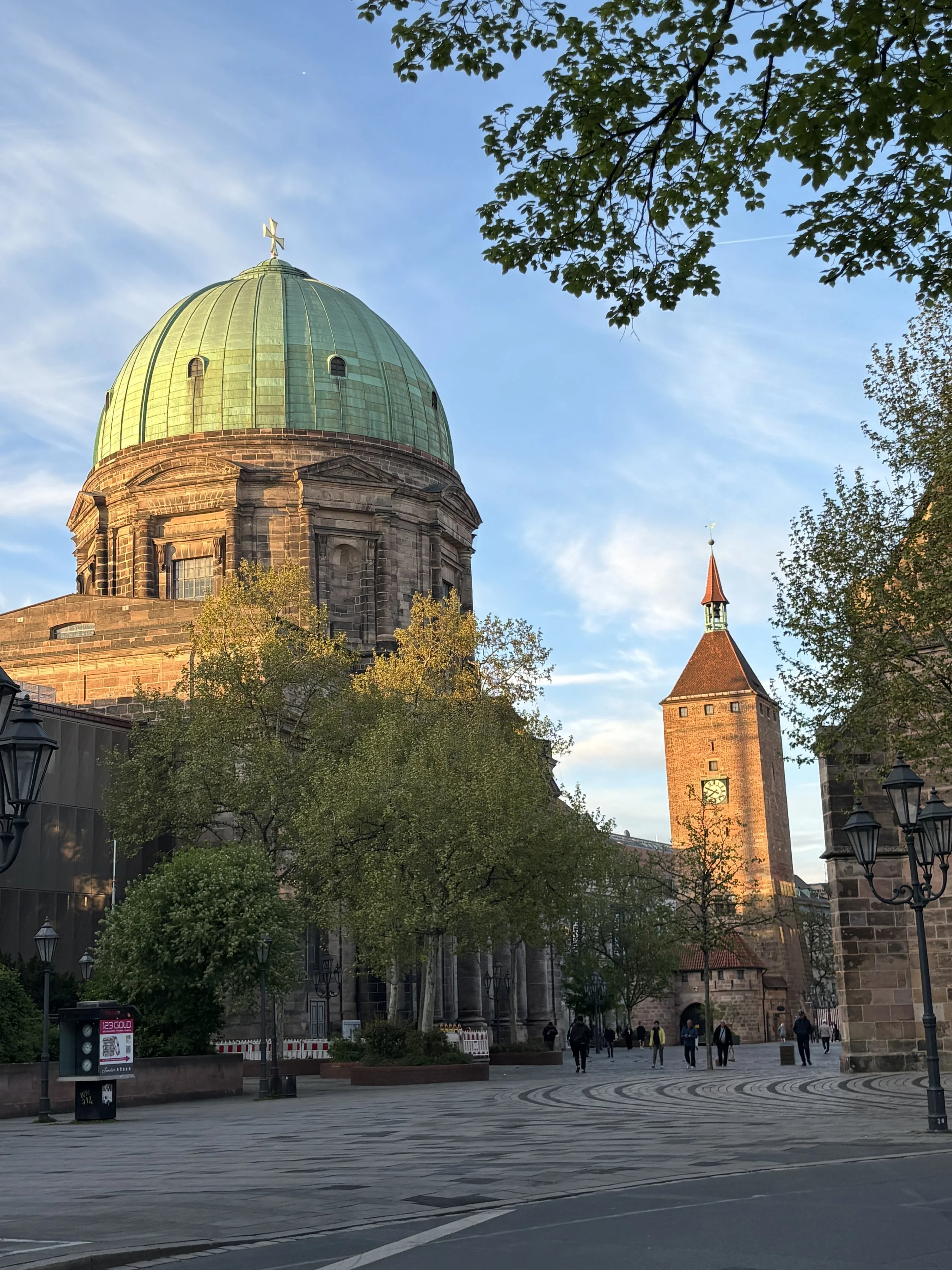
Nuremberg has managed to preserve the charm of its historical centre or, I should rather say “to restore” because the city, including the old town was thoroughly destroyed during the last months of WW2 and later faithfully reconstructed.
Let’s be clear, however, this city is not an open-air museum frozen in time, it has remained a lively,. commercial city throughout and this is apparent in the buzz and activity on its streets, even on a relatively Sunday afternoon, as it was the case of my visit.
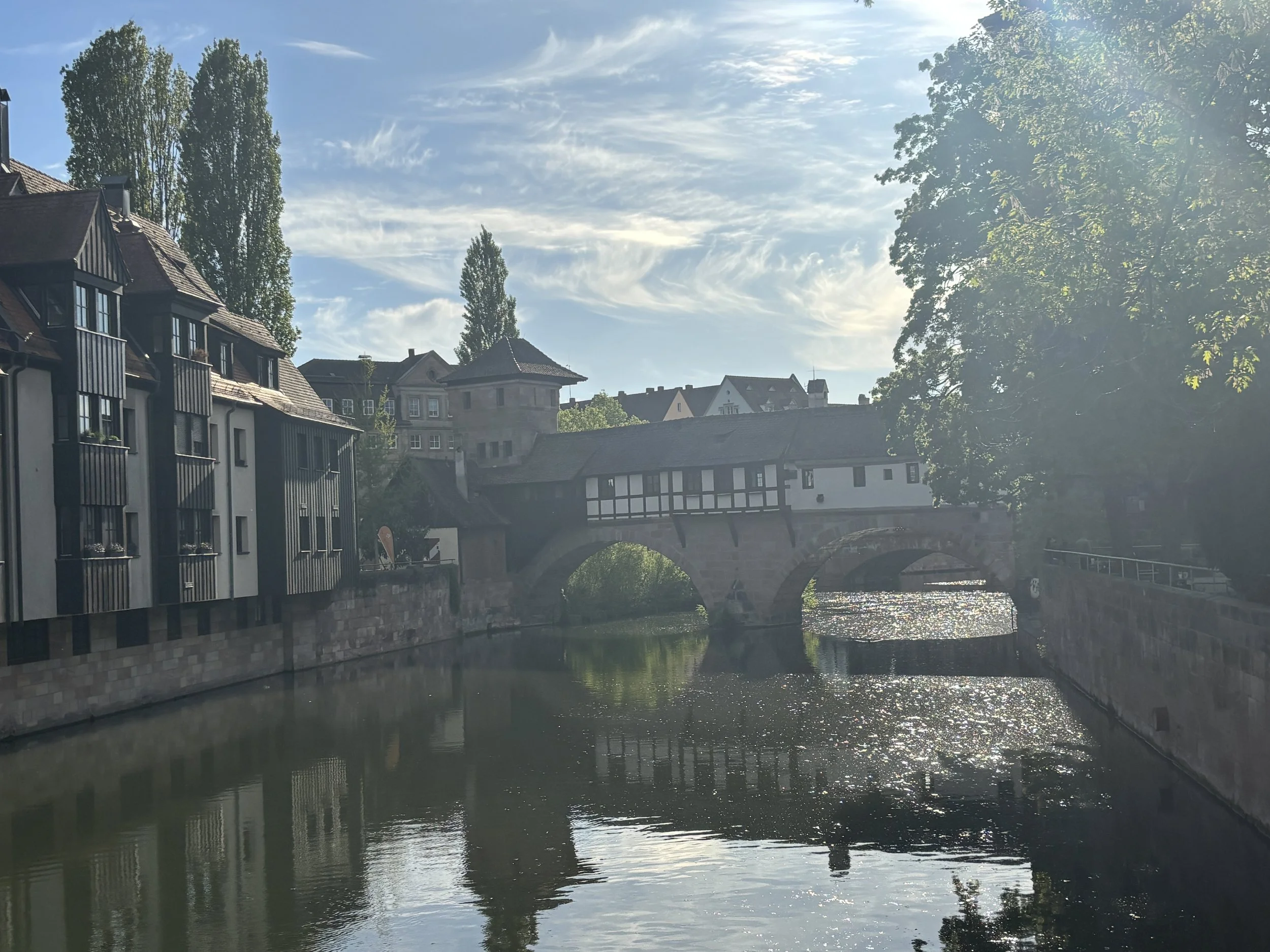
By the way, since most of the city’s landmarks are well illuminated at night for effect, Nuremberg’s historical centre makes also for a beautiful walk at night.
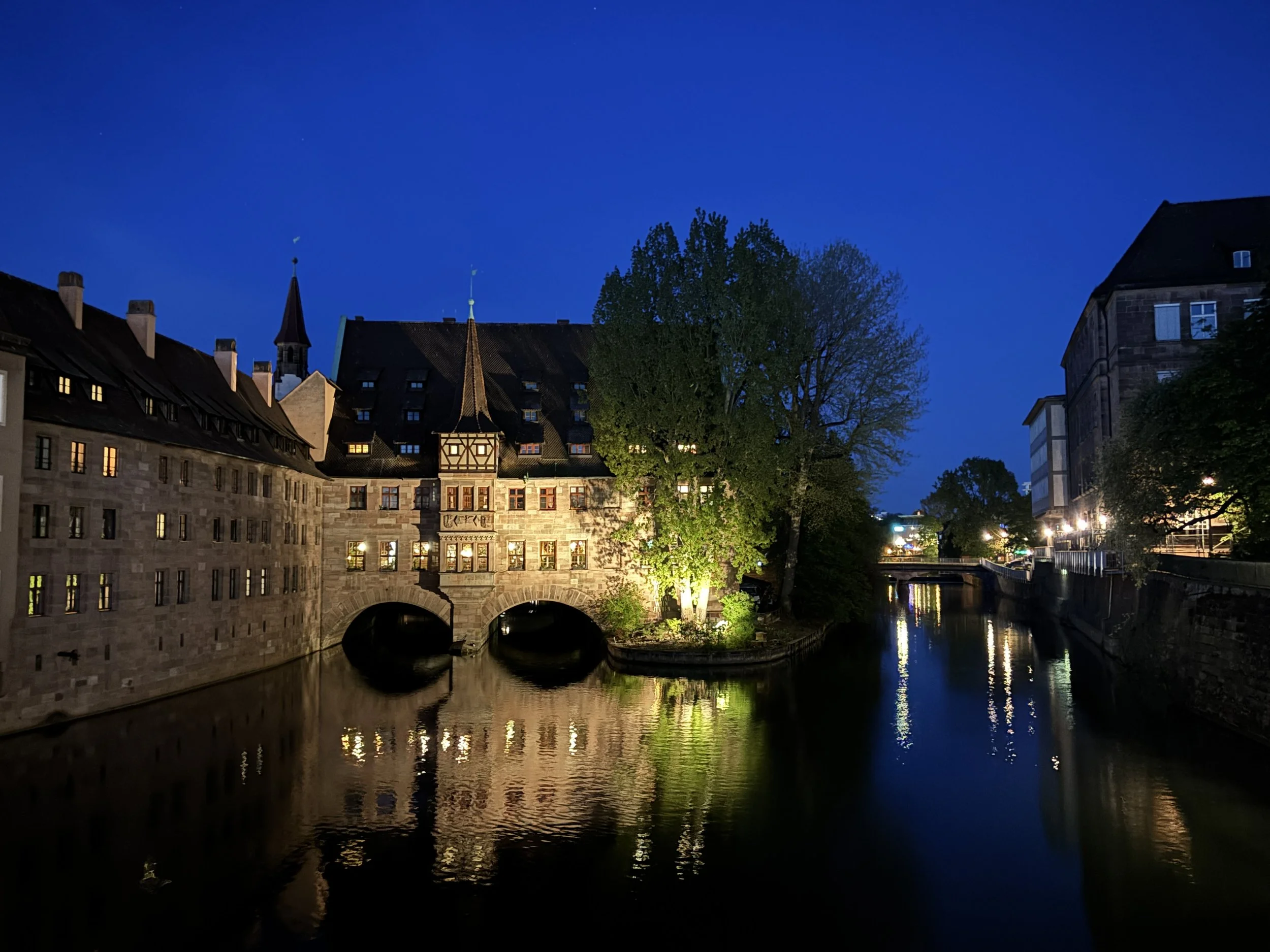
The Nuremberg of WW2
Memorium & the Nuremberg Trials courtroom
And from medieval and early modern Nuremberg to WW2, because the city has preserved sites which are linked to two very specific moments to that dark historical episode.
Remarkably these refer to both the rise and the fall of Nazism. One of them is Zeppelinfeld (covered further down this post), the other, and more impressive from a visitor’s point of view, is “Memorium”, the museum and documentation center at Nuremberg’s Palace of Justice, in which Nazi war criminals were tried after the war.
Memorium is located within the Nuremberg’s Palace of Justice. Note that the building, including the historical Courtroom 600, where the trial of the main Nazi leaders (at least those that could be captured alive) took place, is still in use today as a court of justice!
This site is an absolute must for anyone minimally interested in WW2 and, more generally, in international political and legal affairs.
The Palace of Justice is not in the very center of the city, but it is not very far either. It can be reached very conveniently, a 10min metro ride (station Bärenschanze), from Nuremberg’s central station. From the metro station it is a 200m walk to the entrance of the museum area, which occupies a wing of the Palace of Justice building.
The entrance fee is €7.50, although it is also one of the attractions included in the Nuremberg Card.
Once there, you are encouraged to download an app which acts as an audioguide (and it has also some gamified features for children).
It is not a requirement to download it, but I would advise doing so if you want to fully enjoy the experience and get all the wealth of information in it.
To be honest, there is so much information, including all the transcripts of the different speeches and other texts related to the trials, that you possibly won’t use all of it. But, nevertheless, is a good way to learn about the many details of the trials.
The most well-known of these trials are the ones that took place in 1945-46, with some of the remaining Nazi leaders. However, there were other batches of trials in the second half of the 1940s concerning also other lower rank Nazis which also took part in war crimes.
The trials represented quite a feat and not only because they involved getting countries which, while formally allies had very different world views, to agree on some common definitions of justice and in what could be define as a crime against humanity.
There were also quite a few practicalities to solve, such as, for example, having real time multi-language translations or getting the media to cover and document the whole process, something which was not trivial with the technology of the time.
The trials, however, were quite a success in terms of what they were trying to achieve, which was to set an example and standard of justice for regimes that commit atrocities and crimes against humanity.
Courtroom 600
This is, without doubt, the highlight of the visit. It is the very same room in which the trials took place. Even if it has suffered some modifications since the 1940s (which are all explained in the app), the general appearance is easily recognizable if you have seen footage of the original Nuremberg Trials.
Quite an impressive sight, to say the least!
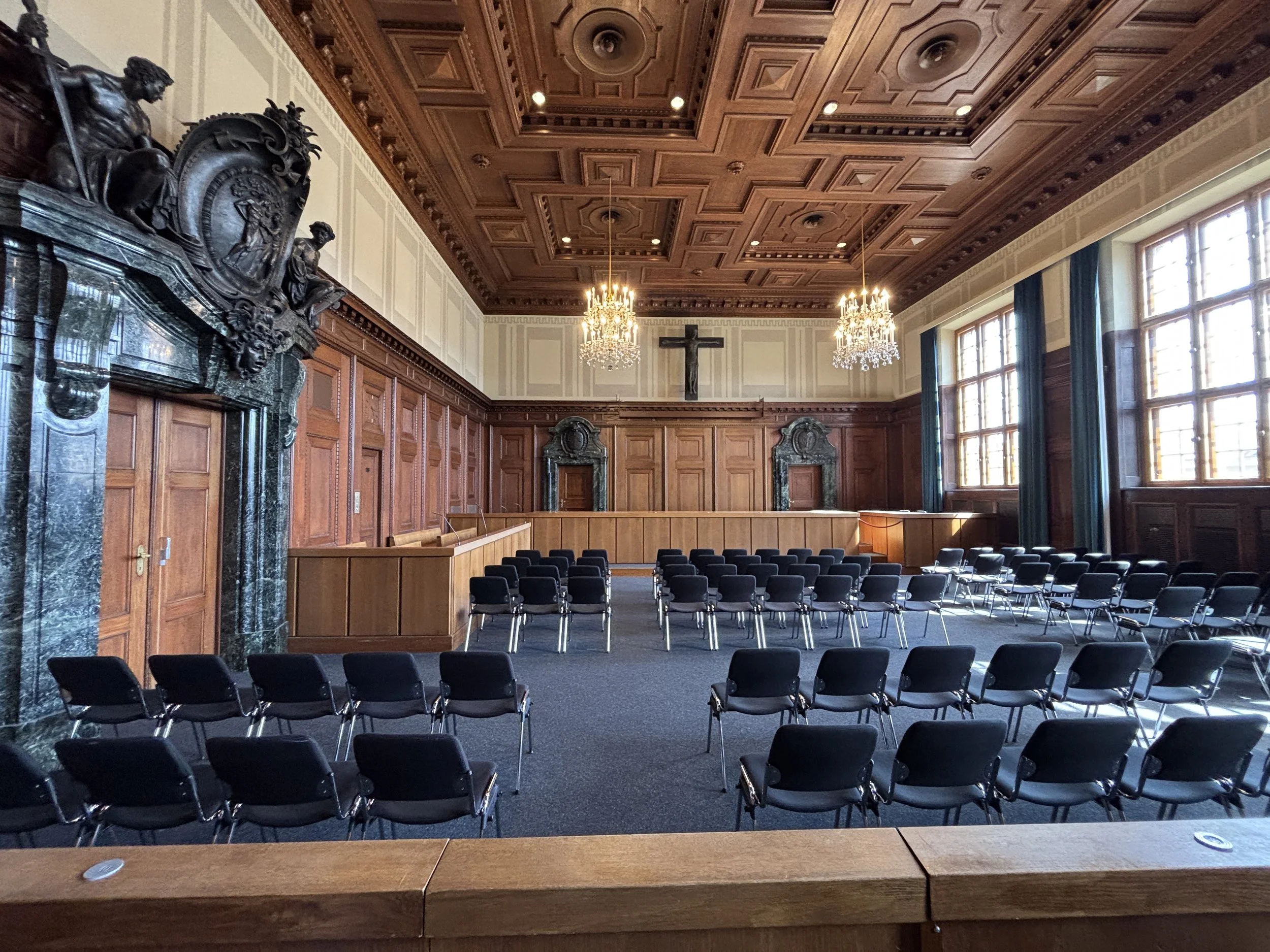
Then, there is the adjacent museum, one floor up.
The museum itself is not huge, but it is very dense in information and content.
The exhibition details the fundaments of international humanitarian law and the legal principles that were used to conduct the trials.
It then moves to explain the trials themselves, the charges presented against the defendants and the arguments that were used by the different parties.
There are lots of details about the practical aspects of the trials, the conditions in which the defendants were kept and their final fate.
You can also see some original items, such as the benches in which the defendants were sitting during the trial.
Below is the view from the wing of the building where the Nuremberg Trials took place. In the background is the former prison, where the Nazi war criminals were kept during the proceedings. Most of that old prison building was demolished some time after the trials, but you can get an idea of the place.
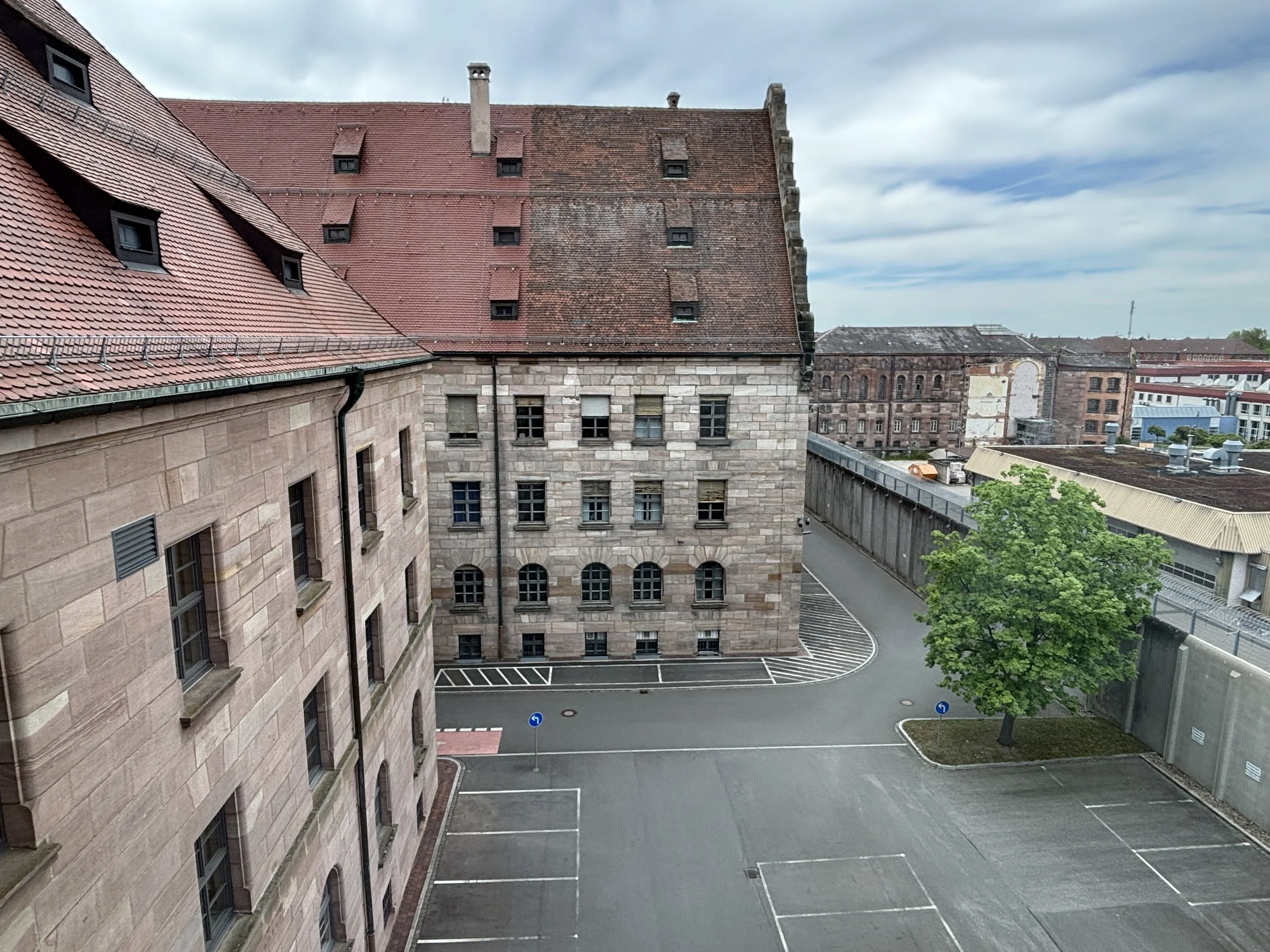
You can also get a view from above of the courtroom. In fact, during the trials, the American forces, which were responsible for the logistics on site, added a sort of elevated stage at this end of the room so that the attending media could better follow the sessions.
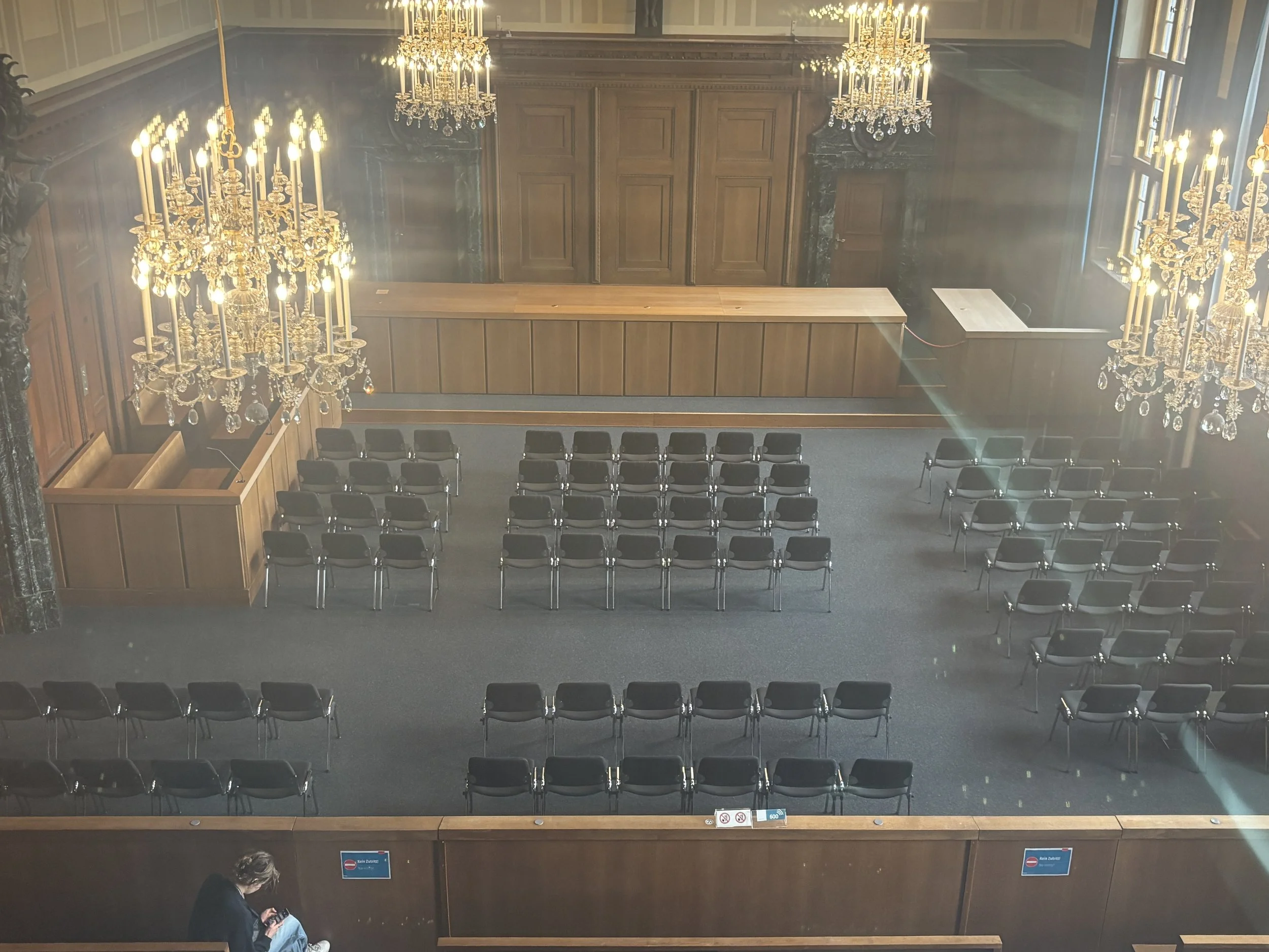
Visiting Zeppelinfeld
This is the other place in Nuremberg that is a must-visit for anyone interested in the history of the Second World War.
This is a large open ground which is infamously linked to the rise of the Nazism, since it was here that the Nazis held some of its mass rallies in the years before the war, with Hitler in attendance.
The name of the place actually comes the fact that, way before that, in 1909, airship pioneer Count Ferdinand von Zeppelin landed one of its airships here during a demonstration flight.
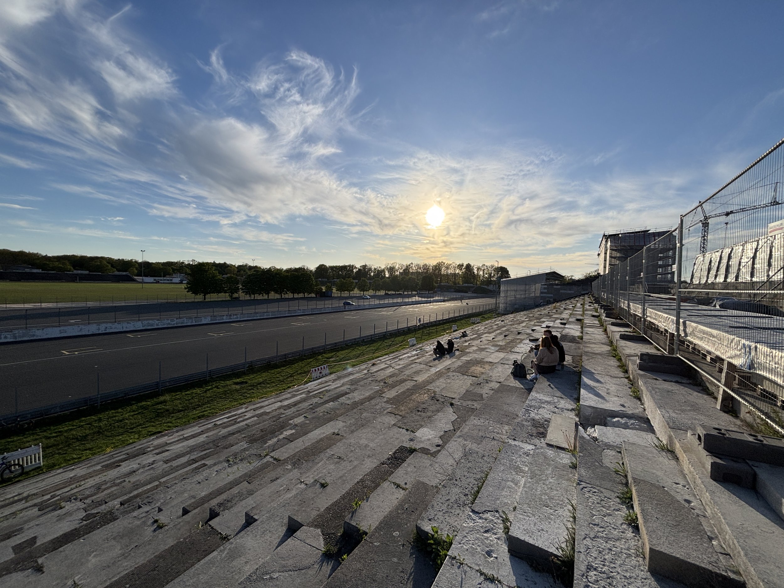
In 1937 Nazi architect (and later munitions minister) Albert Speer build a some monumental grounds at this spot, complete with a tribune from where Hitler and the other senior party leaders could preside the military parades.
In April 1945, the US 7th Army arrived in Nuremberg and after fierce fighting managed to capture the city. Shortly after the war was over, in a very symbolic move which was captured on camera, US military engineers blew up the large marble Swastika which was atop the main structure.
You can watch that moment in this short video documentary on Mark Felton’s channel, which contains also some interesting footage of the battle for Nuremberg in the last days of WW2 and shows the state of utter destruction in which the old town of Nuremberg was left.
After the war the venue was used for sports and music events and other public activities, but, apparently, no one was sure what to do with what was left of the main structures, which are still standing today, even if in a rather derelict state.
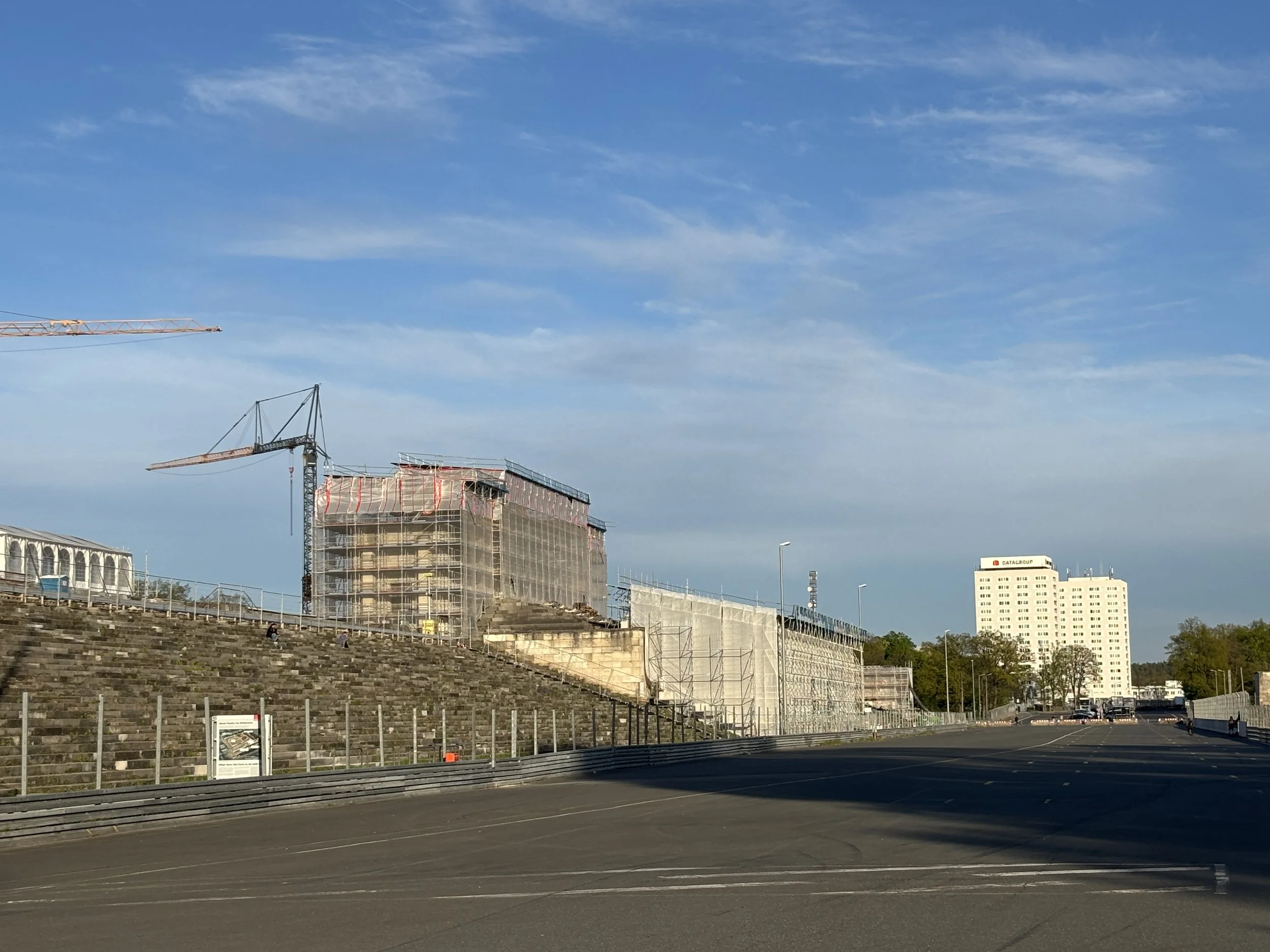
After the war the venue was used for sports events and other activities but, apparently, no one was sure what to do with what was left of the structures, so they have been left as they stood in a more or less derelict state.
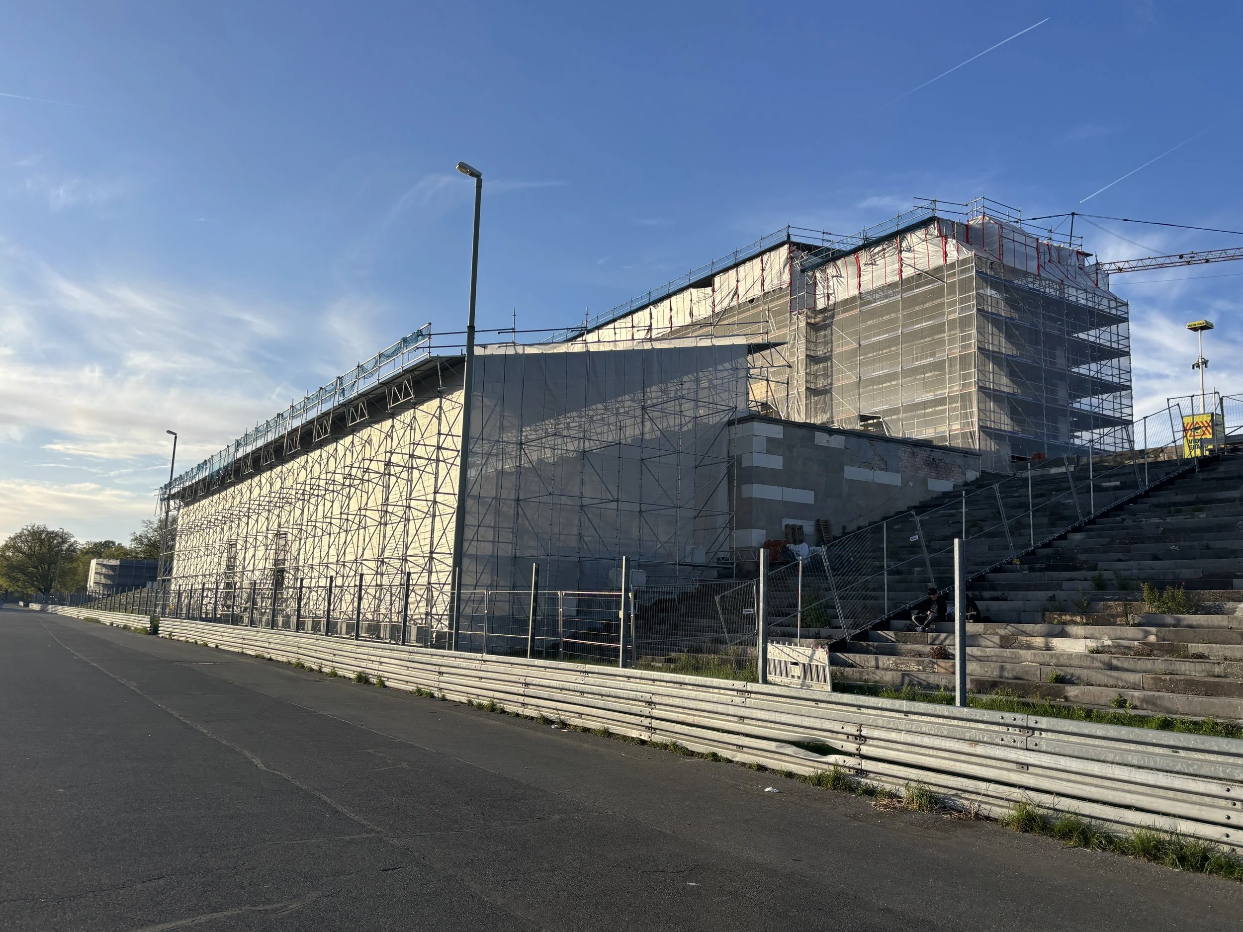
At the time of my visit the tribune at Zeppelinfeld was cordoned off and covered in scaffoldings, since there is a project to conduct some restoration work in order to strengthen the site’s role as a place of memory and remembrance.
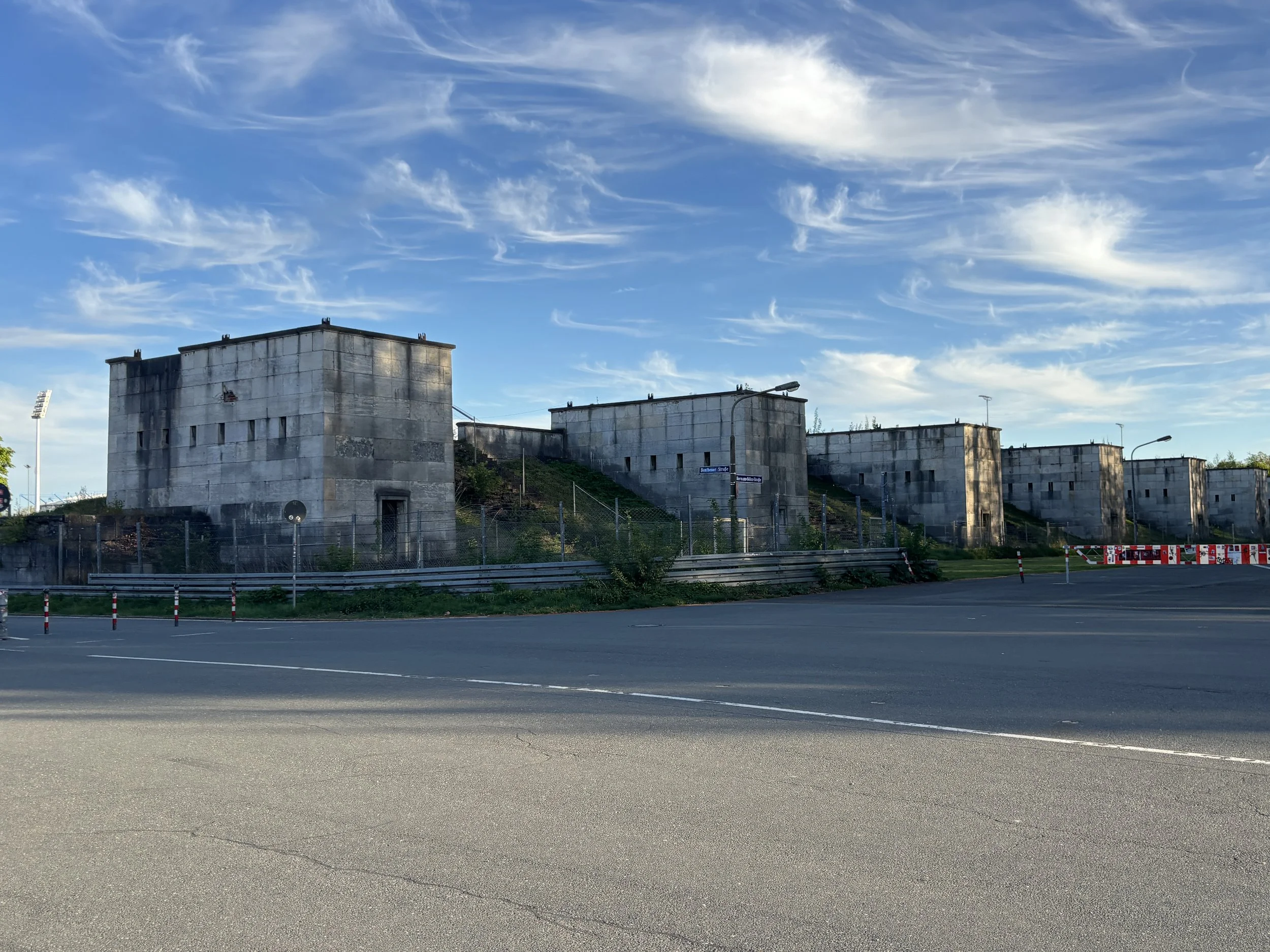
Besides the parade ground, with its tribune and grandstands, the Zeppelinfeld complex included also a large congress center across a small lake. Since 2001 that building, which was closed at the time of my visit, has hosted a research and documentation centre about the Nazi period.
The parade grounds themselves are open to the public, and are integrated in a larger outdoor recreation area, with quite a lot of greenery around.
Zeppelinfeld is a bit outside the city center, but it is quite easy to reach. You can take one of several tram lines or the S-Bahn. It takes a couple of stops and less than 10 minutes from the central station, getting off either at the “Nürnberg-Dutzendteich” or “Nürnberg Frankenstadion” stops and walking from there.
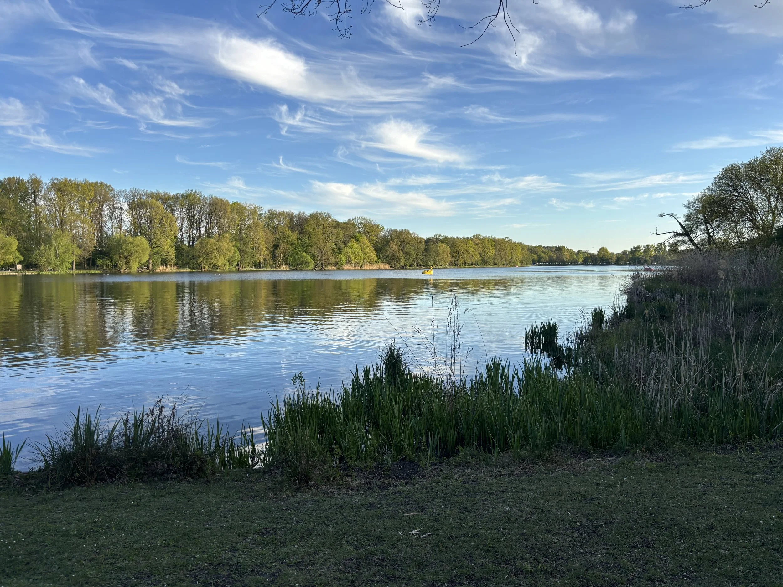
Great place to eat local food in Nuremberg
Bratwurstküche Zum gulden Stern
Zirkelschmiedsgasse 26, 90402 Nürnberg
If you are looking for a place to eat Franconian food or, more specifically Nuremberg’s signature sausage, the “Nürnberger Rostbratwurst”, look no further!
In fact, “Zum gulden Stern” claims to be not only the oldest Bratwurstküche restaurant in Nuremberg, but in the entire world!
Nuremberg Rostbratwurst is smaller than other German types of bratwurst and it is typically roasted over an open fire and served accompanied of sauerkraut, horseradish and a specific type of mustard that is sweeter than the standard one.
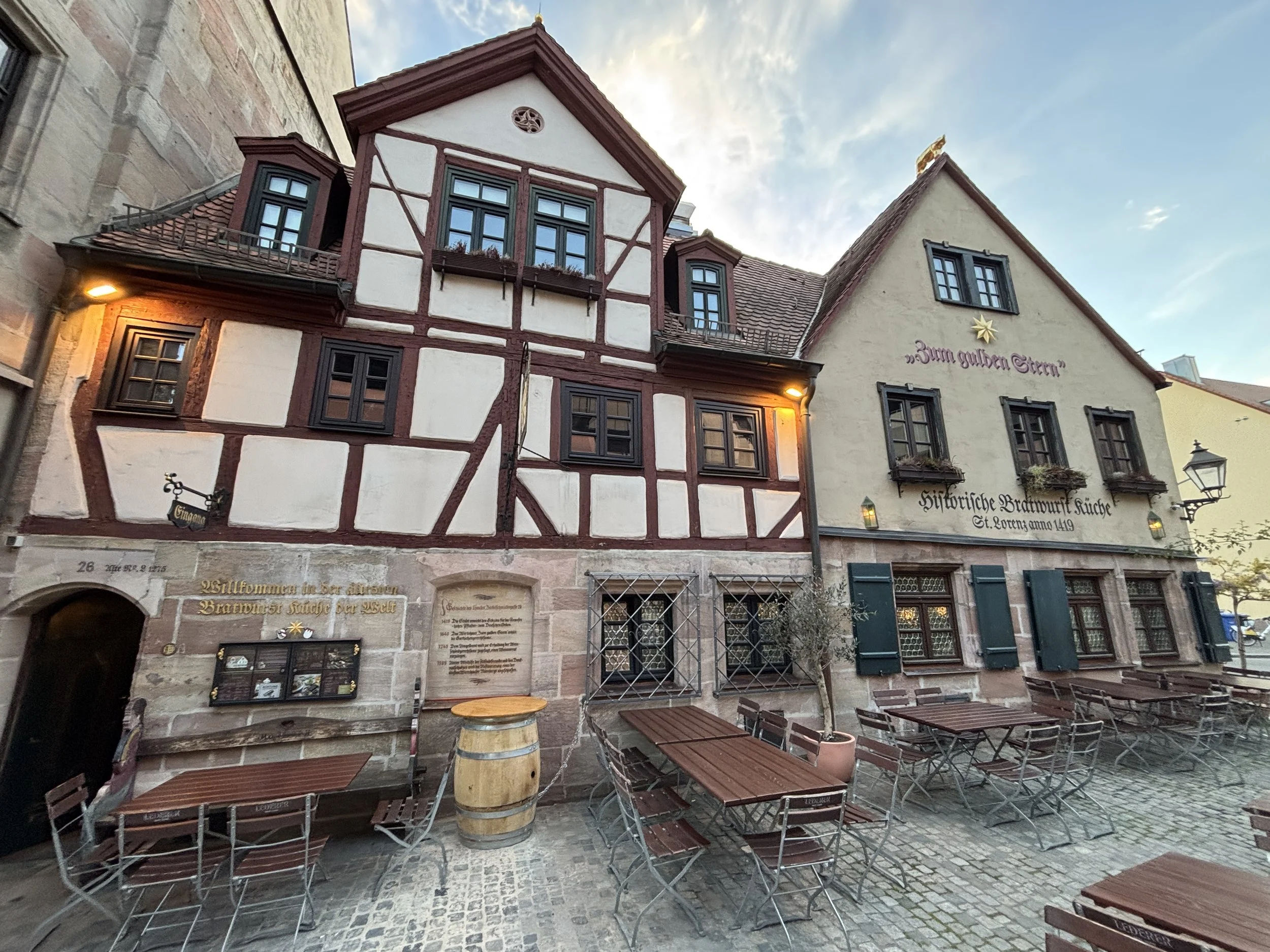
“Zum gulden Stern” traces its roots back to 1419, although it exists in its current form thanks to the efforts of a local entrpreneur, who is 1985 bought the derelict medieval building to save it from demolition and (re-)start the restaurant. His children are the ones now running it.
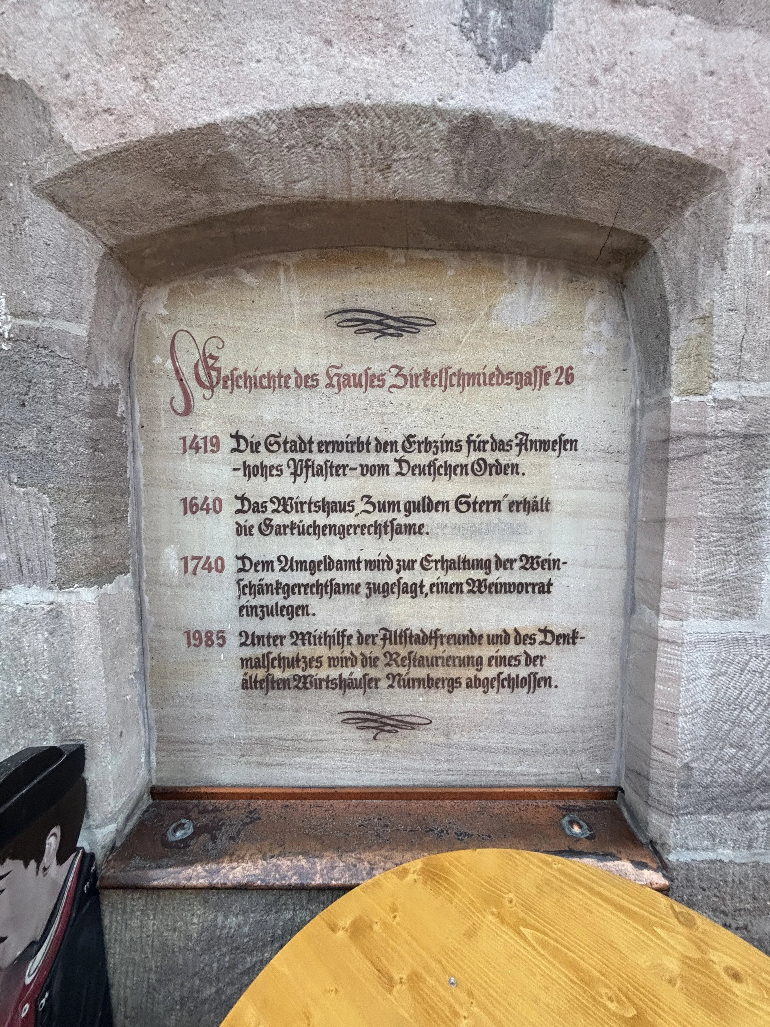
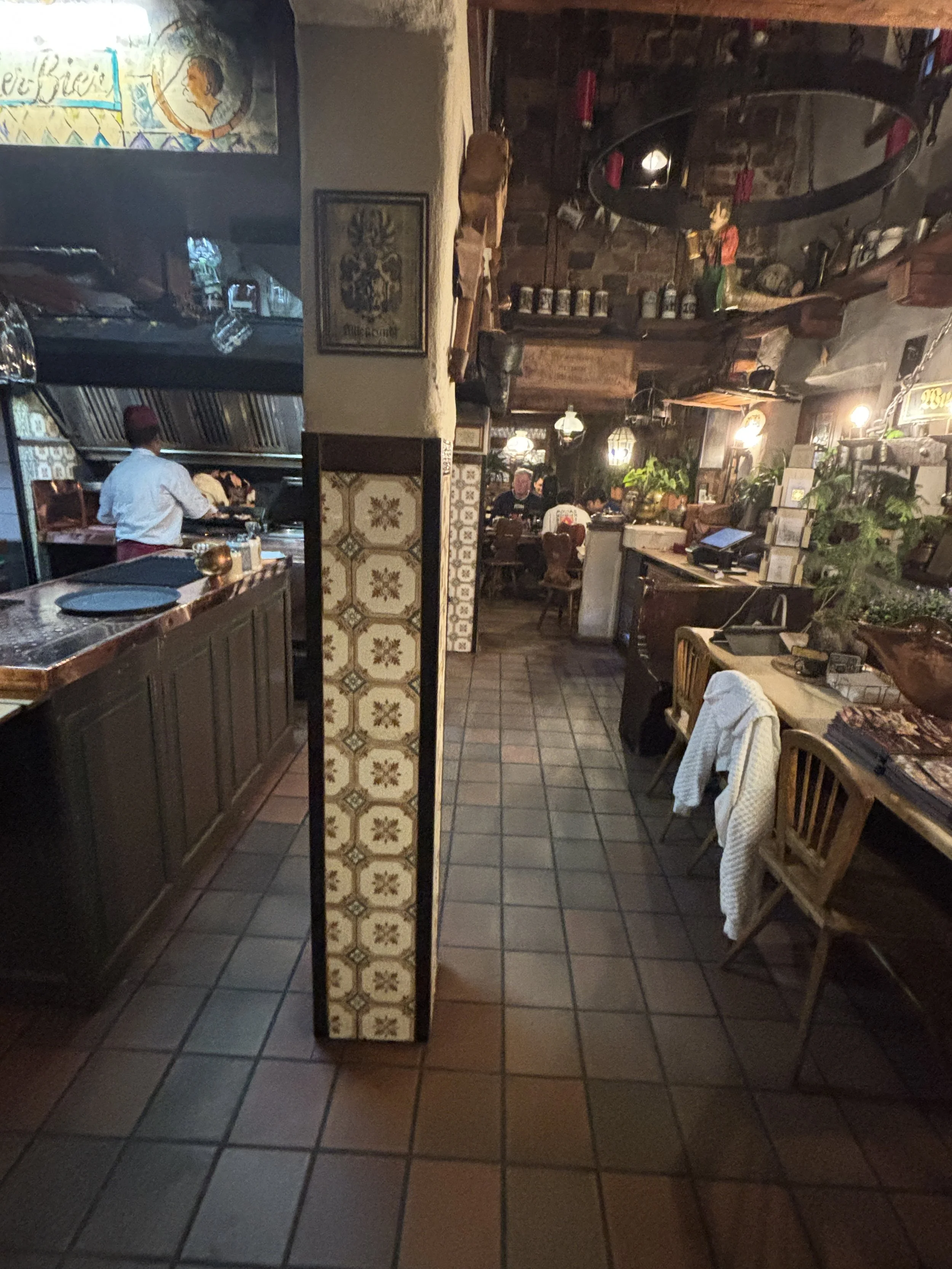
Whether the 600-year history claim is legitimate or exaggerated, the fact is that the owners of “Zum gulden Stern” do a really good job in creating the sort of cozy atmosphere with wholesome authentic local food that, I am sure, many visitors appreciate in a place like Nuremberg.
Most of the ingredients are locally sourced, as indicated in the menu, and the sausages are roasted in an open kitchen over a real wood fire. Prices are also very reasonable. So, overall this place provides a very nice experience and would recommend it to anyone looking to get the real Nuremberg culinary experience!
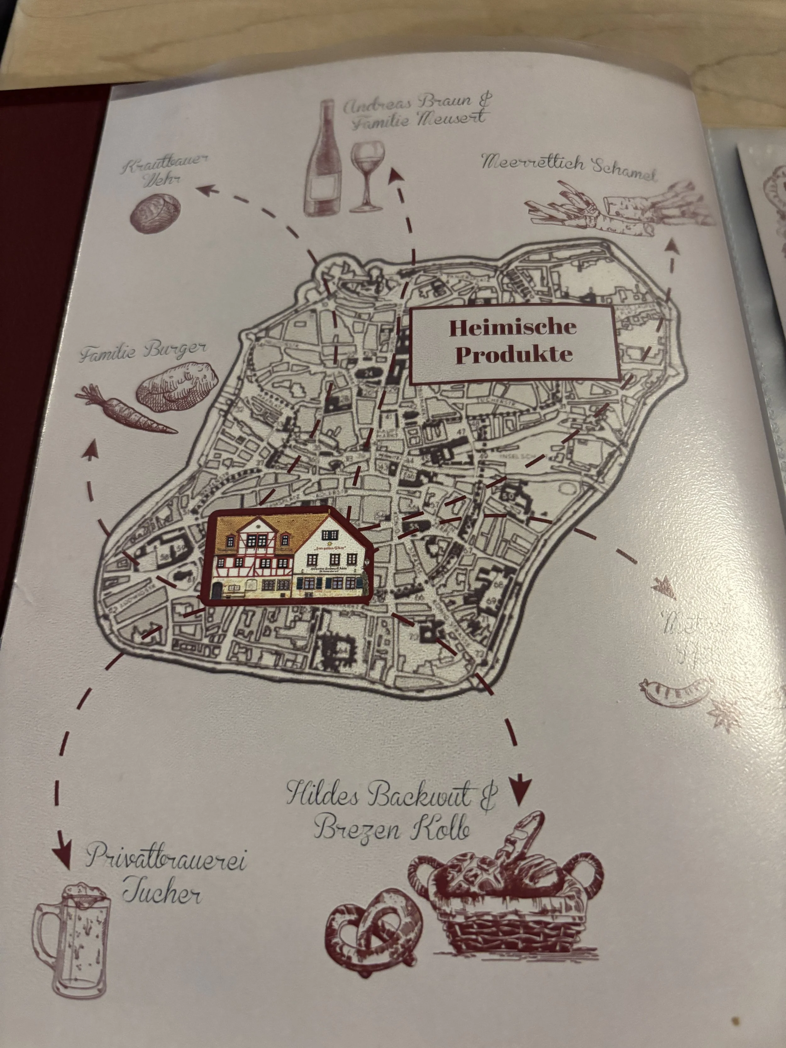
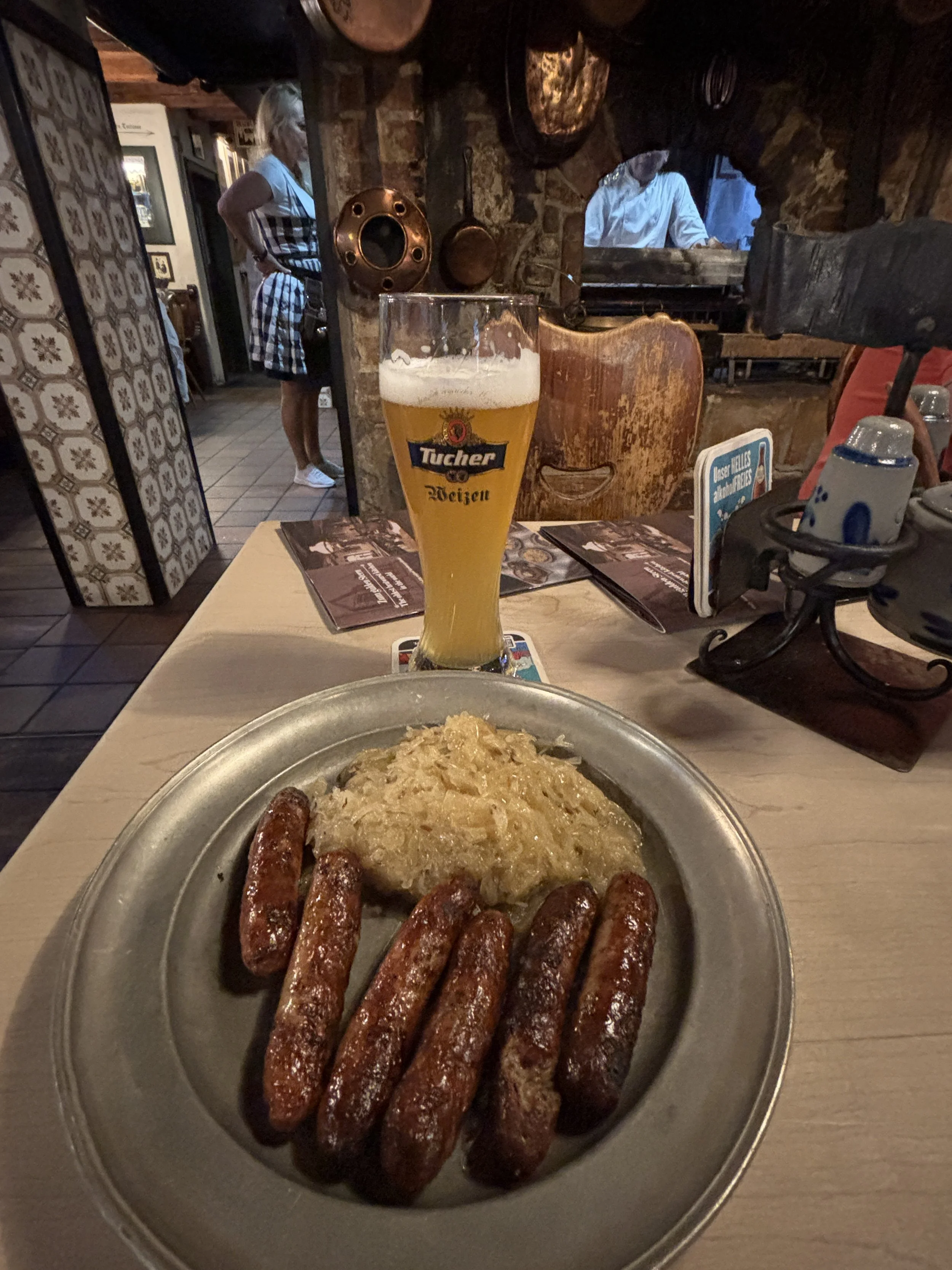
Top (literally!) place to stay in Nuremberg
Cloud One Hotel
Bahnhofspl. 1, 90402 Nürnberg
The Cloud One Hotel has possibly the best views in Nuremberg (by some parameters even better than the ones you get from the castle!).
This is due to the fact that it is one of the few high rises in town. Right outside the city walls but close enough to the historical centre to provide amazing views from its top floors. It is also just meters away from the central station (Hauptbahnhof), which makes it super convenient to go anywhere, since this is really the neuralgic centre of the city with most metro, tram, bus and rail lines converging here.
As an example, the Nuremberg Trials Memorium is less than 10min and the airport, 12 minutes away by direct metro. The nearby city of Fürth is barely 20 minutes and a couple of stops away by S-Bahn.
As you can see in these pictures, the rooms are small, but modern. The views from the 11th floor are absolutely stunning.
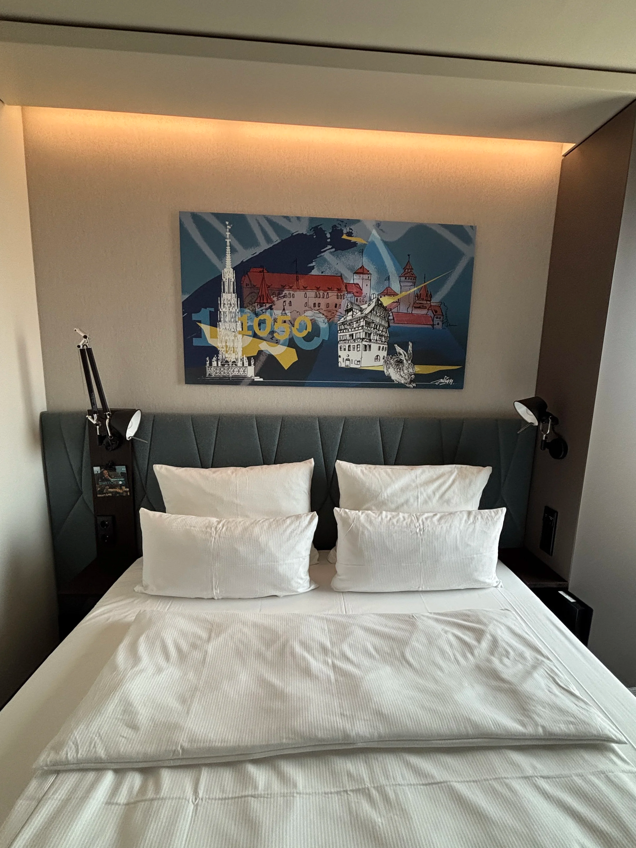
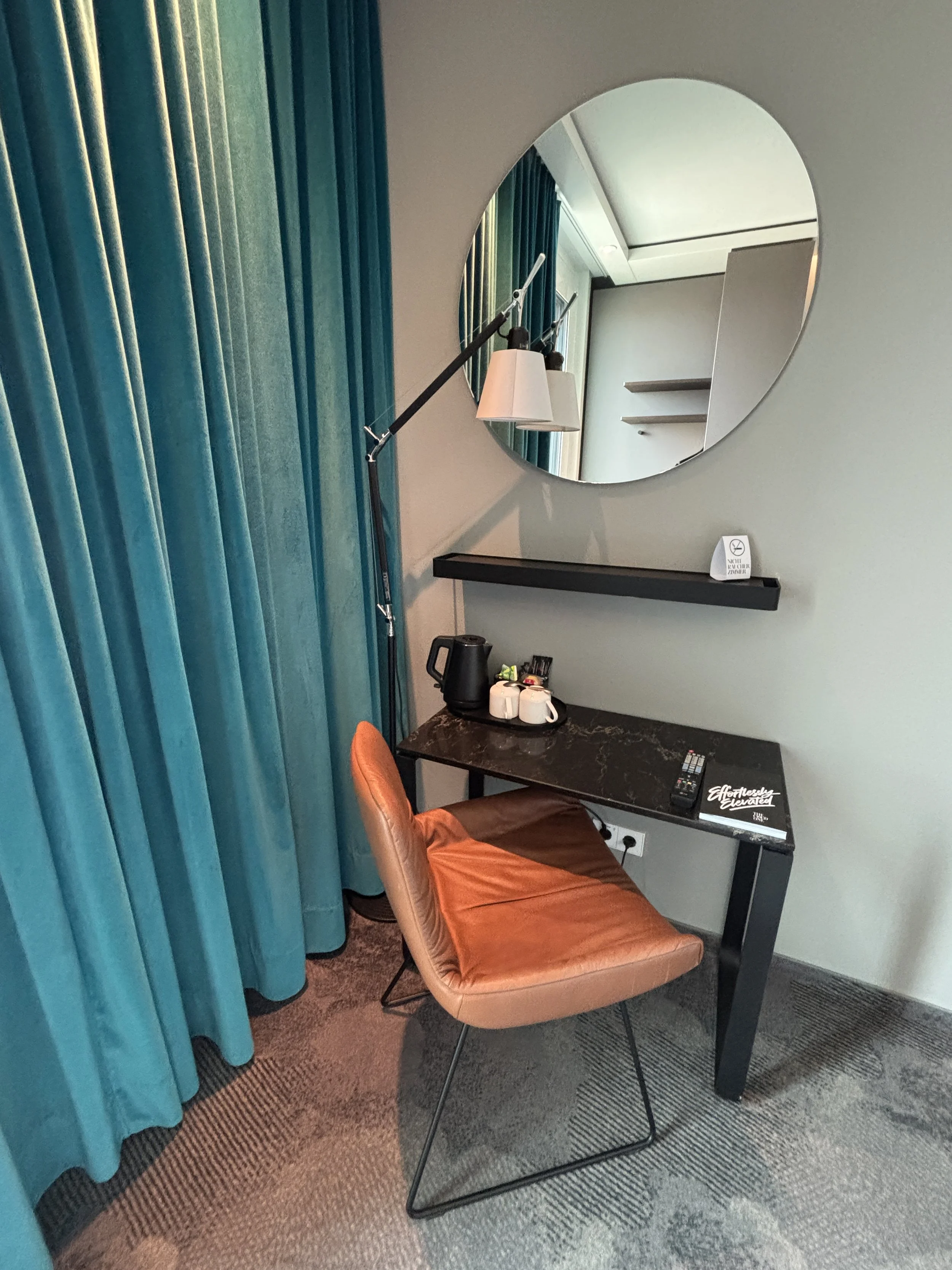
The Cloud One Hotel brand is apparently a premium offshot of the same German hotel group which manages Motel One. There are Cloud One hotels now at several German cities and even in New York City. The Nuremberg property, in particular, had been recently renovated at the time of my visit.
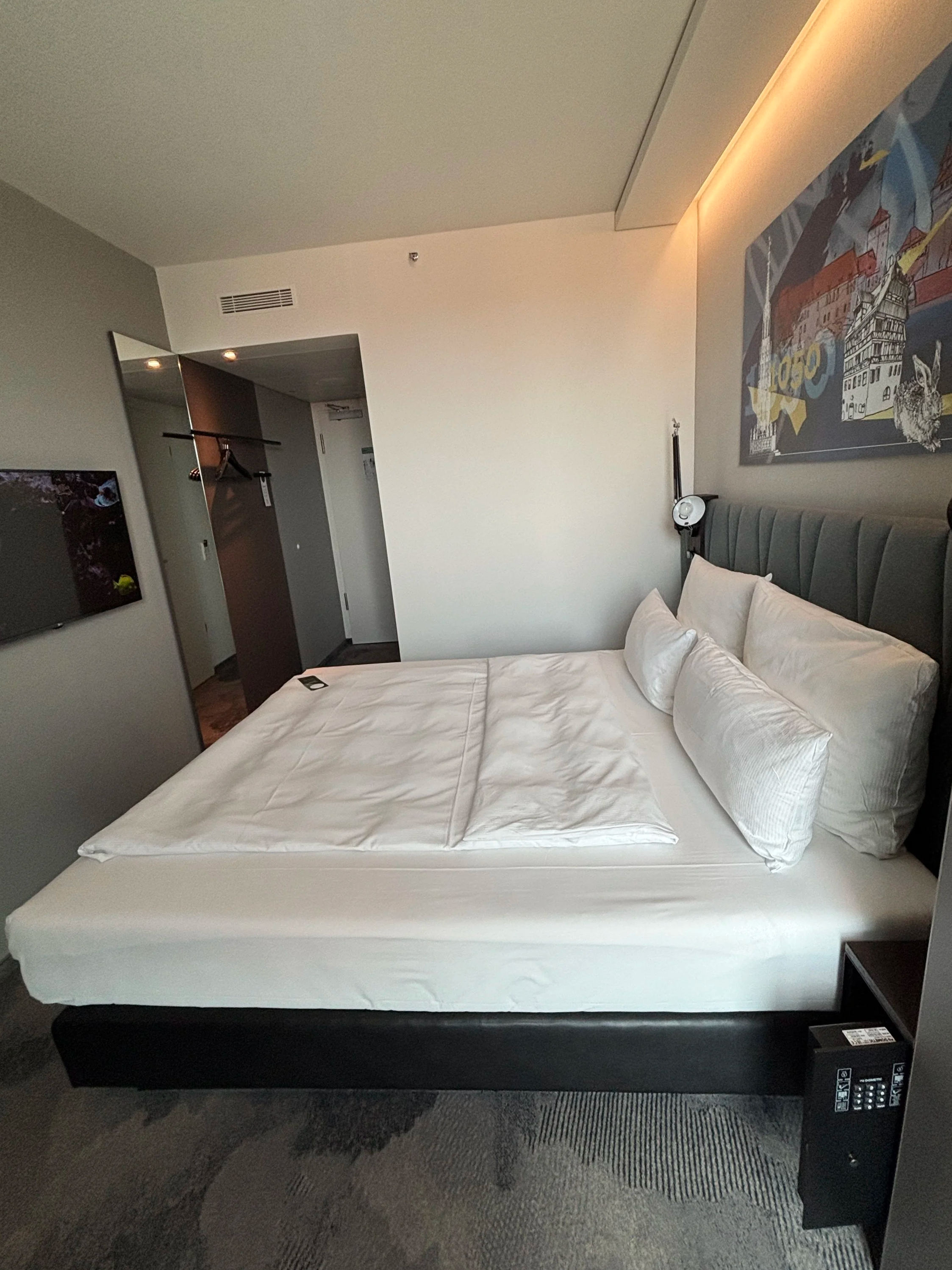
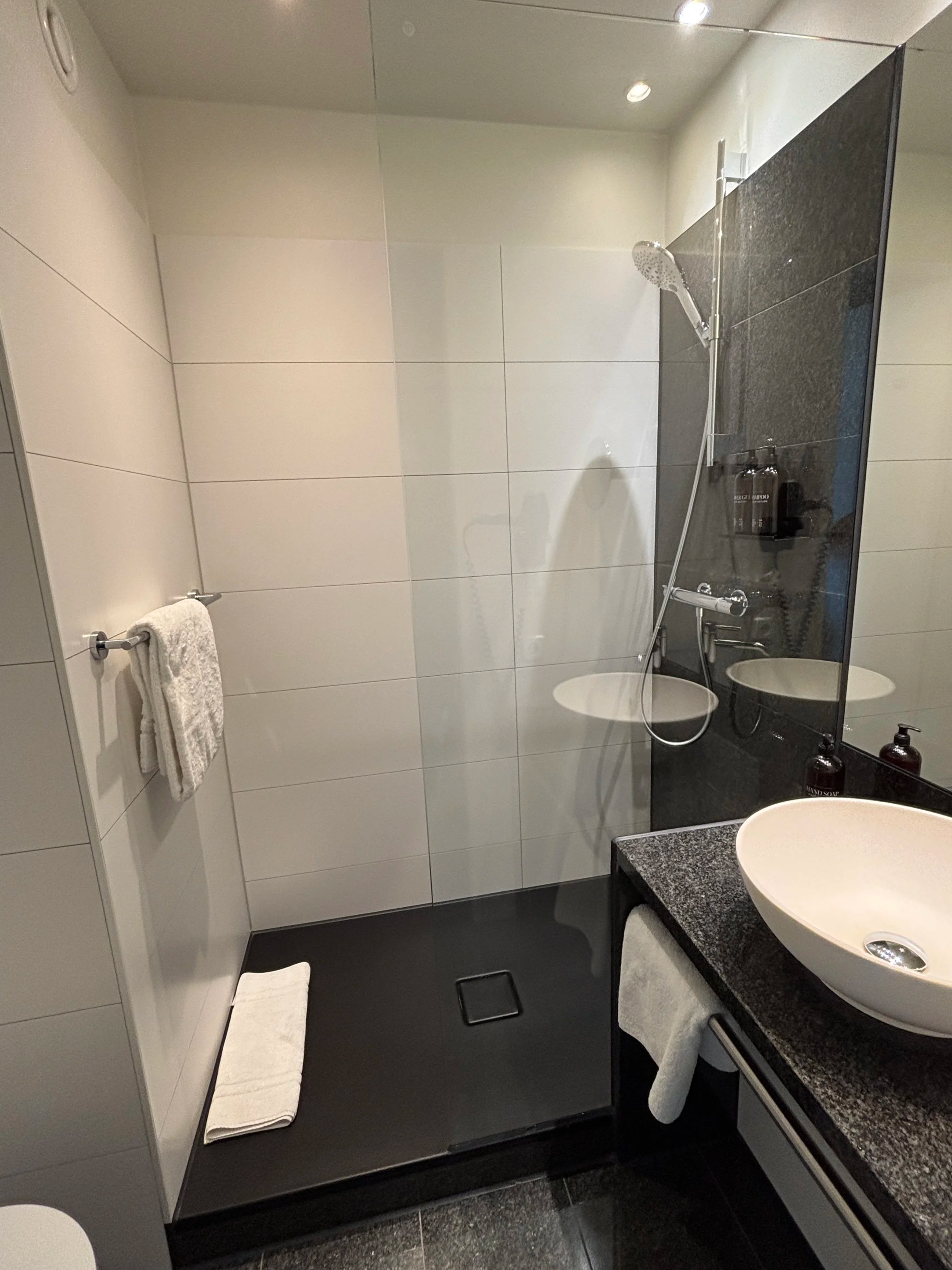
The hotel has also a very stylish cocktail bar on its top (14th) floor, also with truly privileged city views.
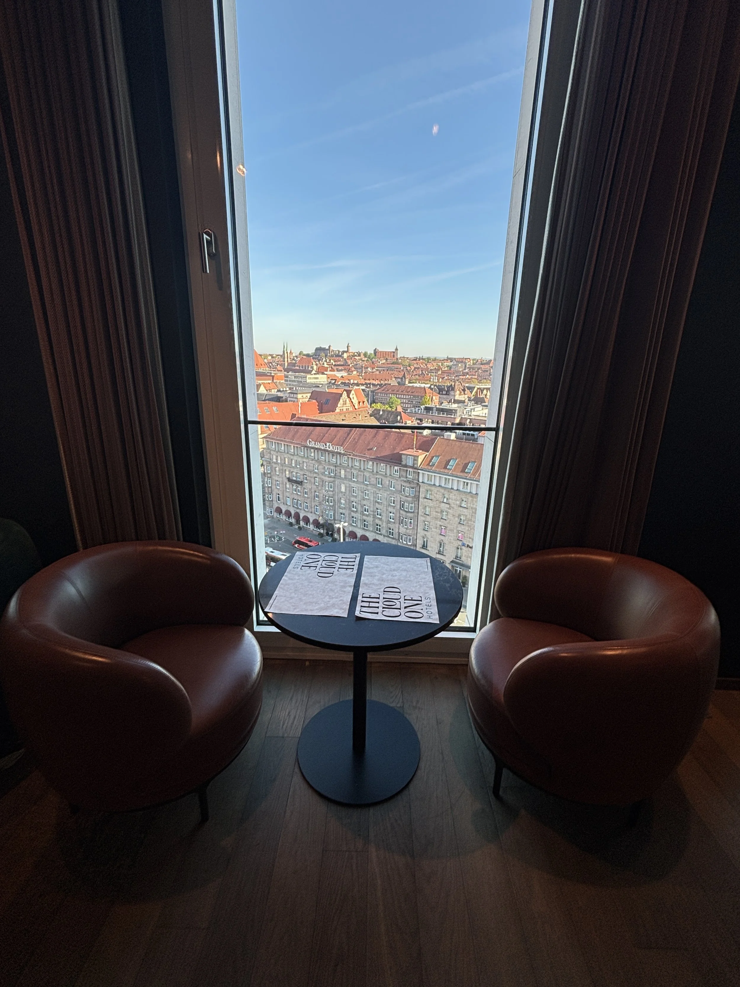
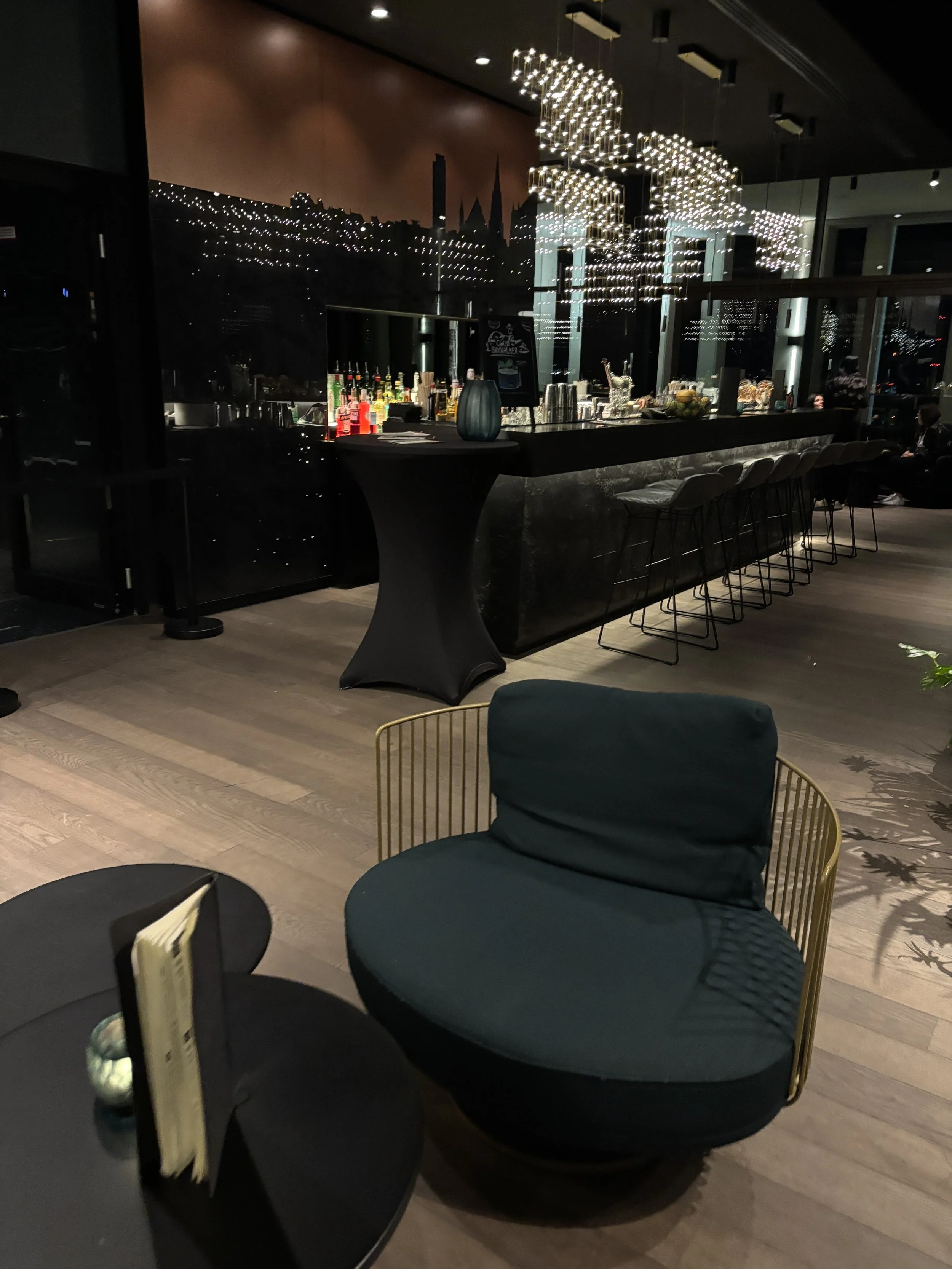
Breakfast was also pretty good, again with the majestic views (13th floor this time) and with lots of local products to try!
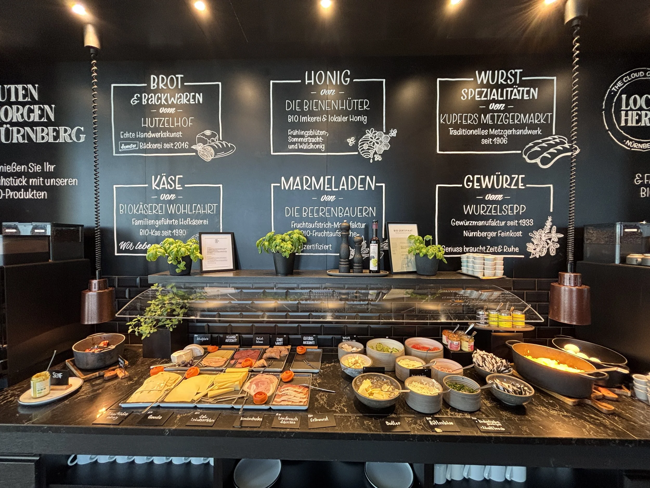
And, with this tasty Franconian breakfast, this itinerary through some of Germany’s most beautiful towns comes to and end.
If you are interested in learning more about Franconia and what to do and what to see in this beautiful part of Bavaria, check out my previous posts this region.
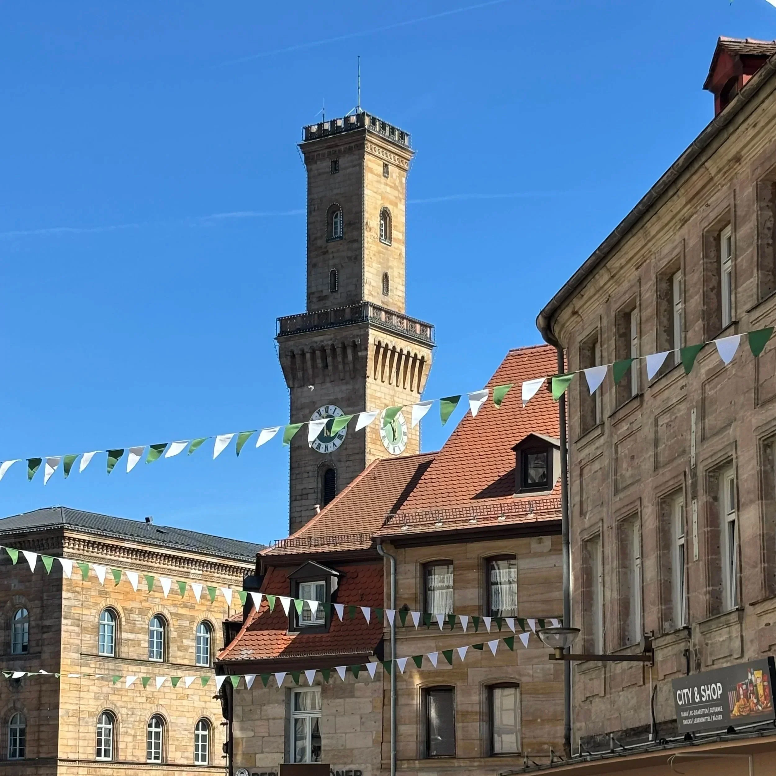
Top things to do and see in Franconia (III): Fürth, the “Franconian Jerusalem”
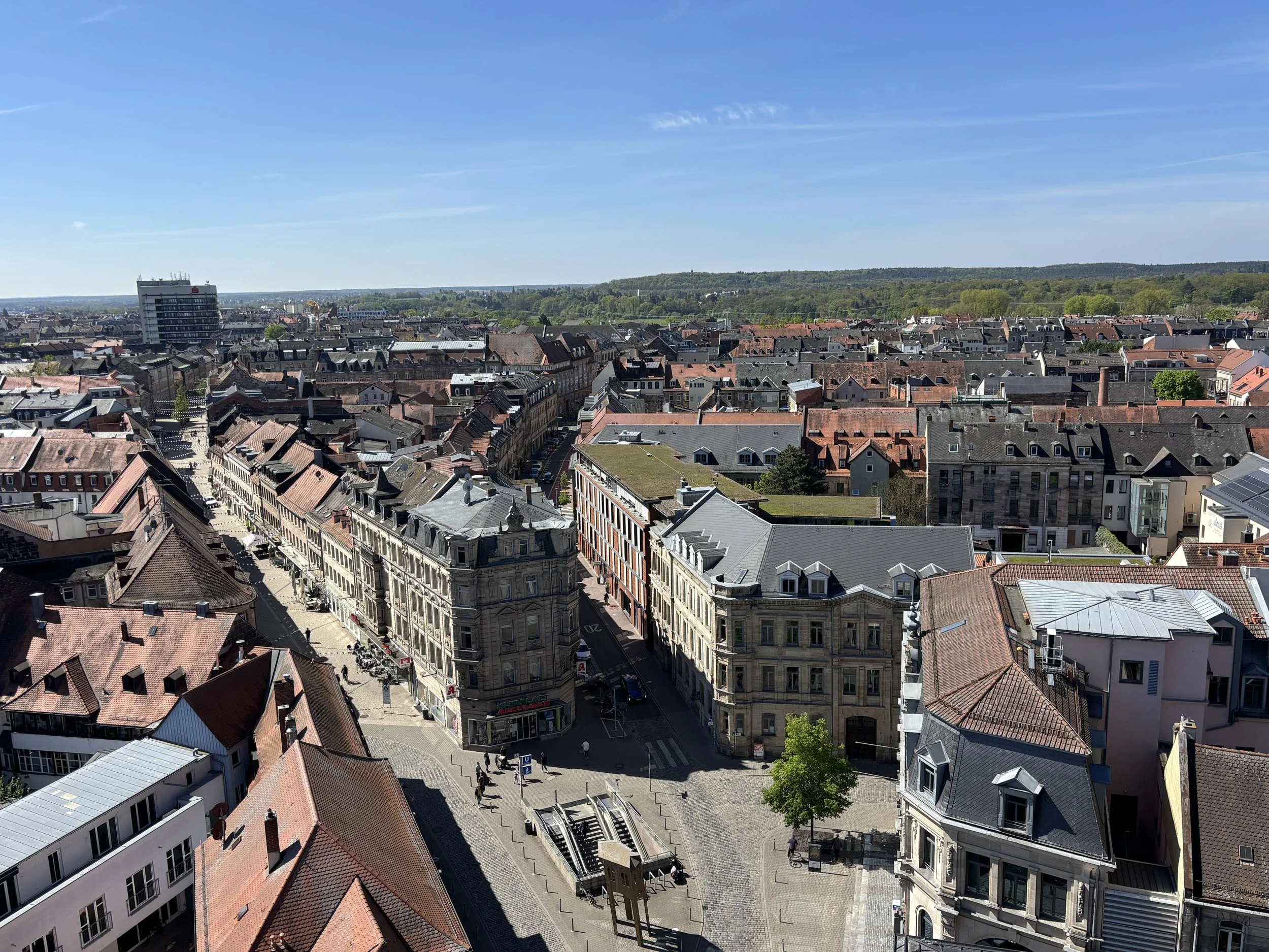
After visiting the beautiful historical towns of Bamberg and Forchheim, the next stop in my Franconian tour was the city of Fürth.
Now, if you look it up on the map, you will see that Fürth is today pretty much integrated into the greater Nuremberg urban agglomeration.
However, this Franconian city of more than 130,000 people has a rather rich and interesting history of its own and it is well worth a visit.

Fürth has enough to keep you going for a full day and it can also be visited as a day excursion from Nuremberg (since their urban transportation networks are interconnected, including the metro and S-Bahn, the suburban train system).
So, on this post I will share my impressions of my visit to Fürth and its main landmarks.
Here are some of the topics you will find next in this post:
The growth of industrial Fürth & its Italianate town hall
The Jewish heritage of Fürth
Protestantism in Fürth and the 30-Year War
The historical town of Fürth
Henry Kissinger’s birthplace in Fürth
Where to eat Franconian food in Fürth
This post may contain affiliate links. If you book or buy something through them, I earn a small commission, at no extra cost to you. It's one of the ways I keep Places of Charm going. Thank you for your support.
I would like to thank also Franken Tourismus and the Fürth Tourist Office for facilitating this journey and arranging a tour of Fürth with the great local guide Monika. All opinions are my own.
Walking around Fürth
Fürth is quite an old city, the origins of which can be traced back to the early Middle Ages.
In fact, its name is possibly derived from the old Germanic word for “ford” since Fürth sits at the confluence of the Pegnitz and Rednitz rivers (which join together a bit north of the city to form the Regnitz, the river which we have already seen in Bamberg and Forchheim earlier in this series).
While Fürth has grown over the centuries somehow under the shadow of the much larger (and Imperial) neighbouring city of Nuremberg, it has always had a very strong character of its own.
This is reflected today in some symbols of local identity, such as the cloverleaf, which is visible in quite a few urban ornaments (no connection with Ireland that I am aware of!). In past centuries, however, Fürth distinctive status in the German political order was based on a rather unusual political set up in which three entities shared power over parts of the city: the Princely Bishopric of Bamberg, the Principality of Ansbach, and the City of Nuremberg.
By the way, these three powers are depicted in one of the statues that adorn Fürth’s main commercial street (picture to the right).
This means, that, while very close to the Imperial city of Nuremberg, Fürth could sometimes carve its own path. For example, in the early 16th C., when many German territories, including the city of Nuremberg, were expelling their Jewish populations, Fürth welcomed them (in exchange of a “protection fee”, truth be told). This led, over time, to earn Fürth the nickname of “Franconian Jerusalem”, a topic we’ll revisit further down this post.
Another particularity of Fürth is that it was a Protestant stronghold in highly Catholic Franconia, this led to it being also the setting of some big military clashes in the 17th C. during the 30-Year War, something we’ll touch upon later in this post, as well.
So, Fürth evolved as a rather diverse cultural and religious entrepôt all the way to the industrial era, which Fürth also embraced wholeheartedly, becoming not just a major industrial centre but also the terminus of the first railway in Germany, which linked it to Nuremberg.
So, now, without further ado, let’s see what the city has to offer to the visitor today and my suggestions about what to do and what to see in Fürth.
Fürth has managed to preserve a small, nice historical center, however, the city has remained far from stagnant through the last five hundred years. In fact, most of Fürth’s current downtown is the product of the industrial revolution. Since the 19th C. Fürth became home to industries such as gold-beating, toy manufacturing, mirror production and electronics (radio and household appliances giant Gründig was founded in the city).
This gave Fürth the wealth and prosperity that allowed it to fund a world-class urban development program in the 19th C. and early 20th C. with broad avenues, elegant multi-storey buildings, department stores and a number of singular public buildings.
Among the latter was the Church of Our Lady, built in 1829, not long after Fürth joined the strongly Catholic Bavarian kingdom in 1806. Remarkably, the Church was built with voluntary contributions from the Protestant and Jewish communities.
Another civic venue which in the city which was built through citizen contributions (in this case with a major involvement of the city’s Jewish community) was the city’s majestic theatre venue, which was completed in 1902.
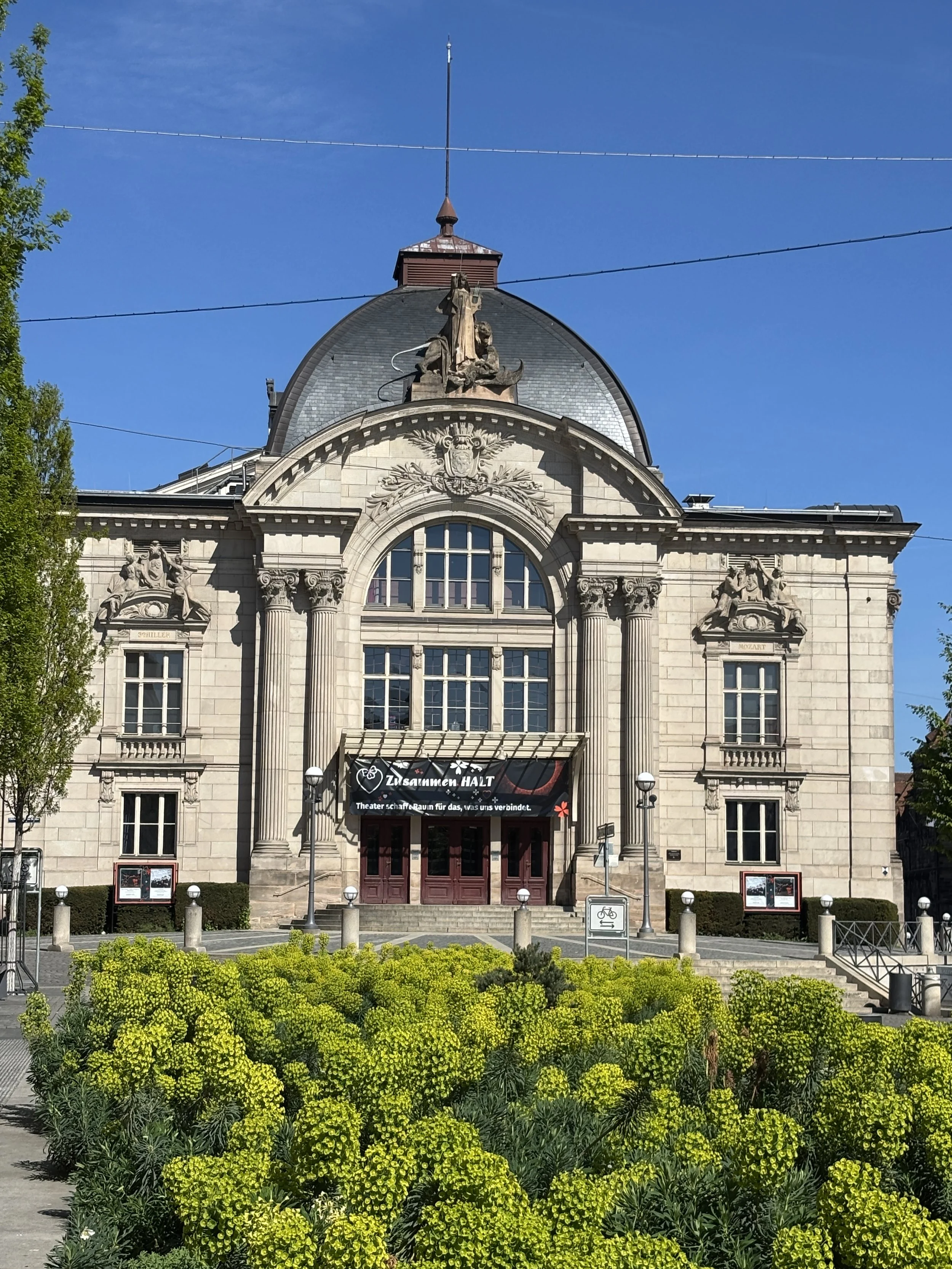
Interestingly, the architect that designed Fürth’s theatre used the blueprints it had devised for another theatre which had been commissioned to be built in what was then Czernowitz, in the Austro-Hungarian Empire (now Chernivtsi, in Ukraine). So the two cities did get eventually (more or less) the same building!
But perhaps the most eye-catching element dominating the Fürth skyline is the town hall, which was designed in the mid-19th C. If it reminds you of an Italian scene, it’s for a reason!
In their quest for something extraordinary, the citizens of Fürth decided that their city needed a replica of Florence’s Palazzo Vecchio as their new town hall!
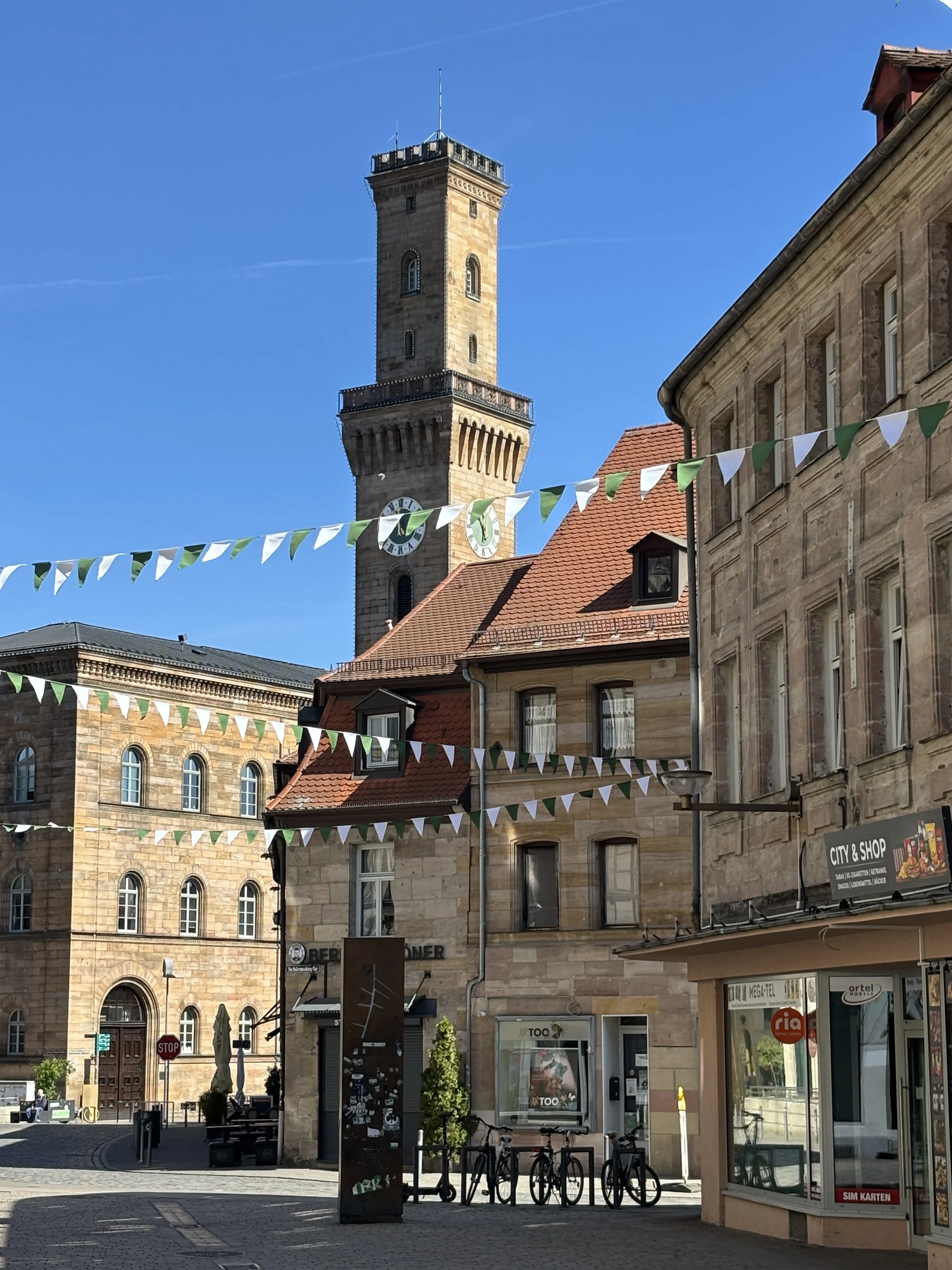
It is possible to get to the top of the Town Hall tower to get a 360º panorama of the city of Fürth, with the city’s two well-defined parts, the old and modern ones, as well as the surrounding countryside and as far as the city of Nuremberg, the main landmarks of which are perfectly visible in the distance.
The Jewish Heritage of Fürth, the “Franconian Jerusalem”
We have already mentioned how Fürth became a safe haven for Jews which, in the 16th C, had to flee other parts of Germany.
Over the next few centuries the Jewish community of Fürth kept growing and the city became, actually, a very dynamic center of Jewish learning to the point that it became known as the “Franconian Jerusalem”.
The hub of Jewish cultural life in Fürth was an area called the “Schulhof” (or “School Courtyard”), which was exactly that: several centers of learning and prayer structured around a large open courtyard.
This part of Fürth’s history came to an abrupt end in the 1930s with the rise of Nazism in Germany. As it happened to other Jewish communities in Germany and Europe, the Nazis targeted Jews in Fürth and razed the Schulhof to the ground.
What you see today is an ensemble of modern post-war constructions more or less laid out around that central courtyard. A monument by Japanese artist Kunihiko Kato, now stands in the middle of the courtyard remembering that past and what happened to it.
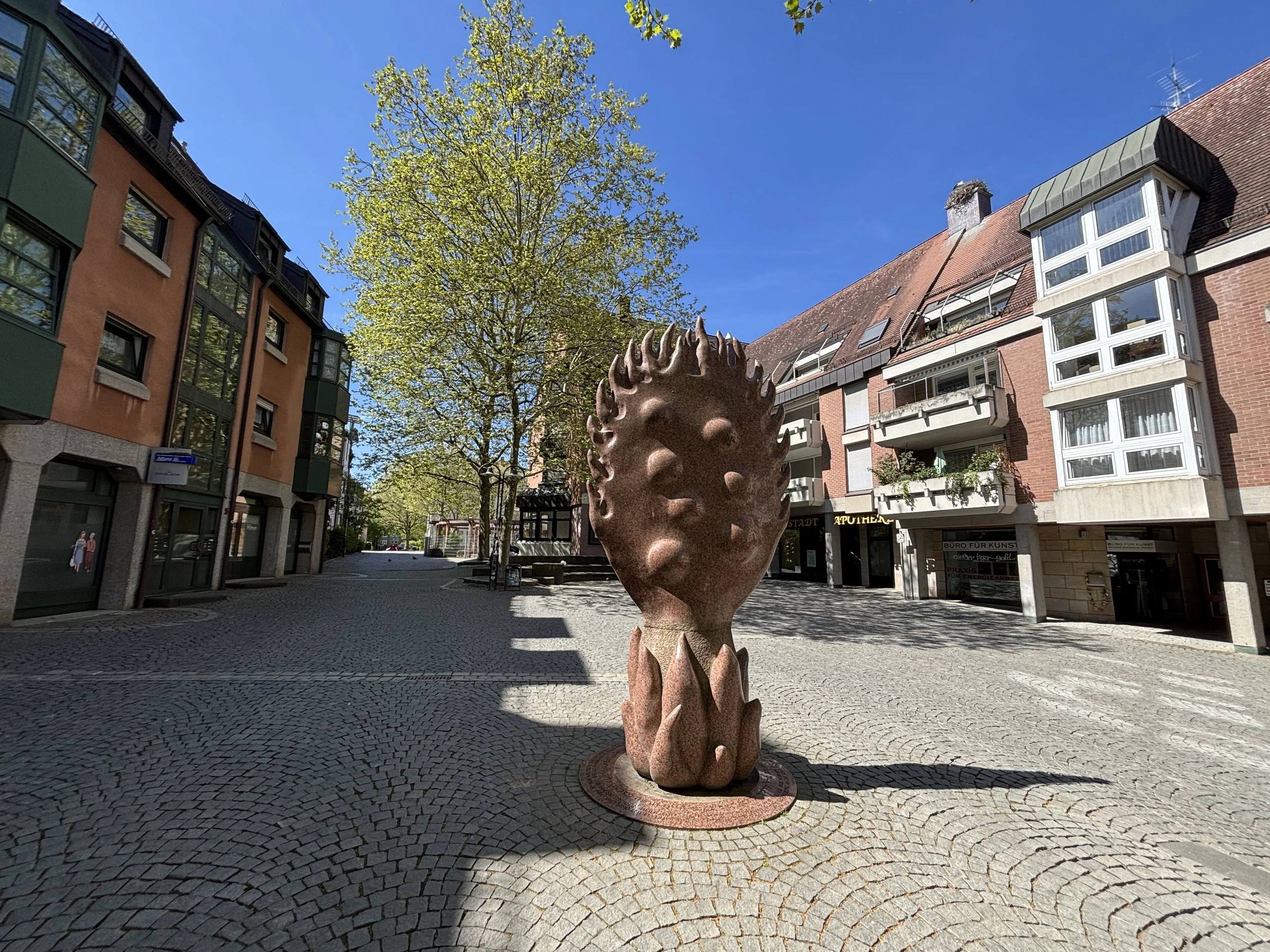
Fürth has other sites connected to the Jewish past of the city, although I was not able to visit them all due to time constraints.
For example, there is also a Jewish Museum, which has been housed by a modern purpose-built facility since 2018 and documents the history of Jewish life in Fürth and Franconia.
Another interesting site is the old Jewish cemetery, which is located in the outskirts of the old town. Since it is no longer in use, vegetation has covered most of the large patch of land in which is located, including many of the old tombstones, giving it a somehow remarkable aspect, which invites contemplation and remembrance.
Visiting the historical center of Fürth
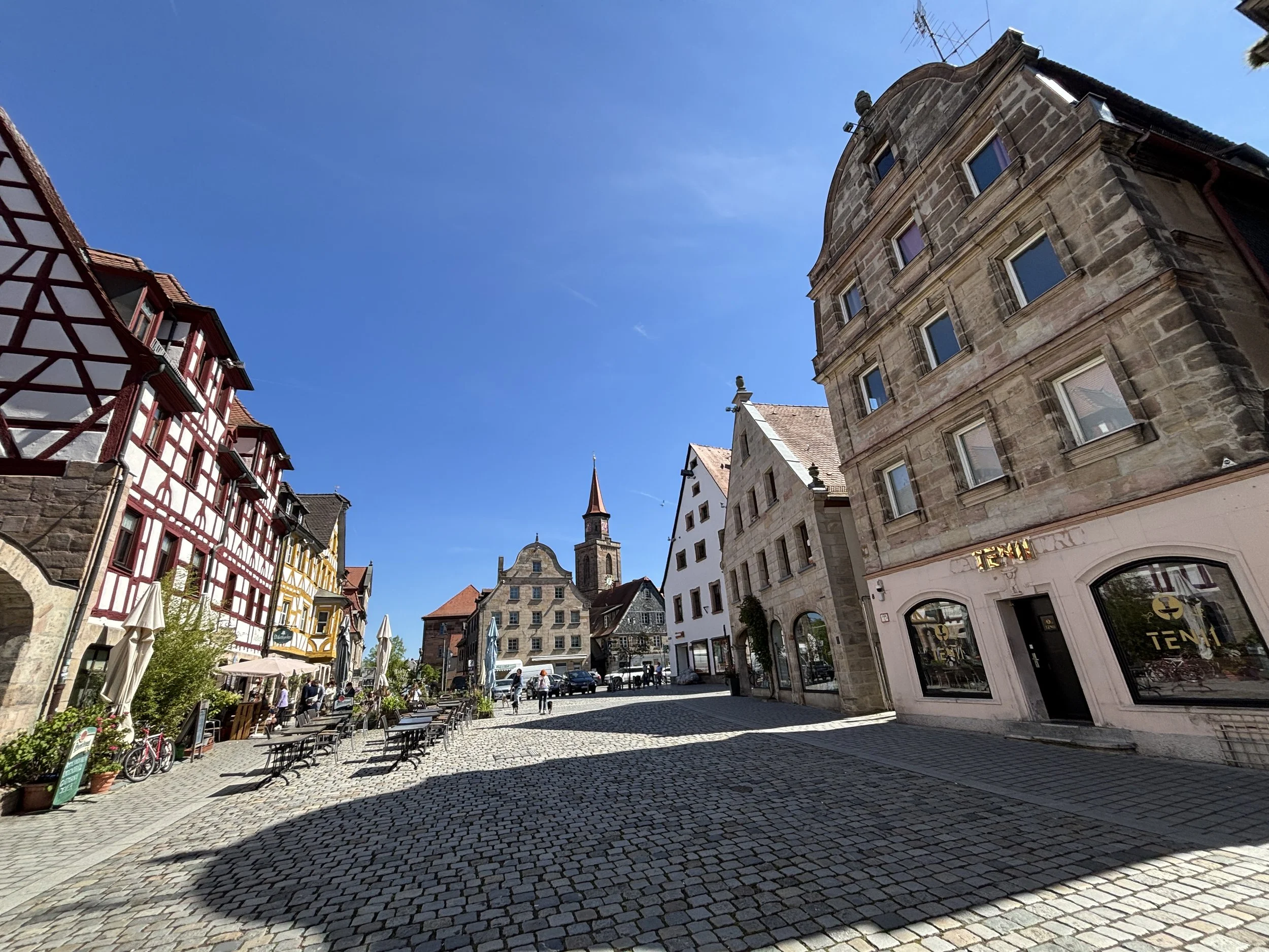
Continuing our walking tour of Fürth, we get to the historical town, which is not large, but survived WW2 pretty much intact.
Like many other historical German cities, Fürth has its fair share of half-timbered buildings, but if there is one aesthetic aspect for which this city stands out is its slate-clade facades.
Here, in Fürth, slate panels have been used profusely to cover all sort of surfaces, not just the roofs. Valued because of its insulating properties, slate is in facades and side-walls, often covering most of the building. In many places it is also possible to find facades which have been decorated by using patterned slate coverings.
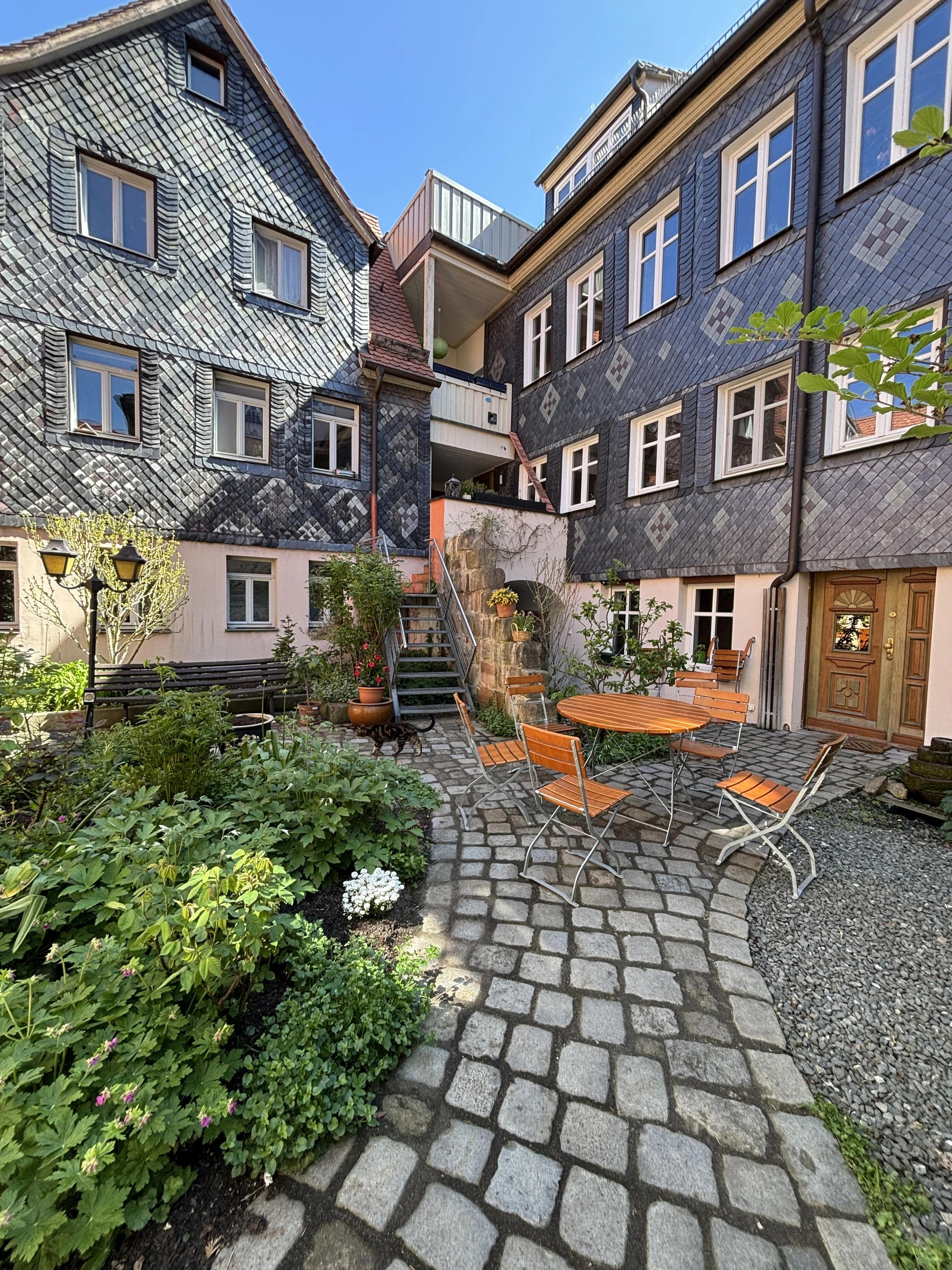
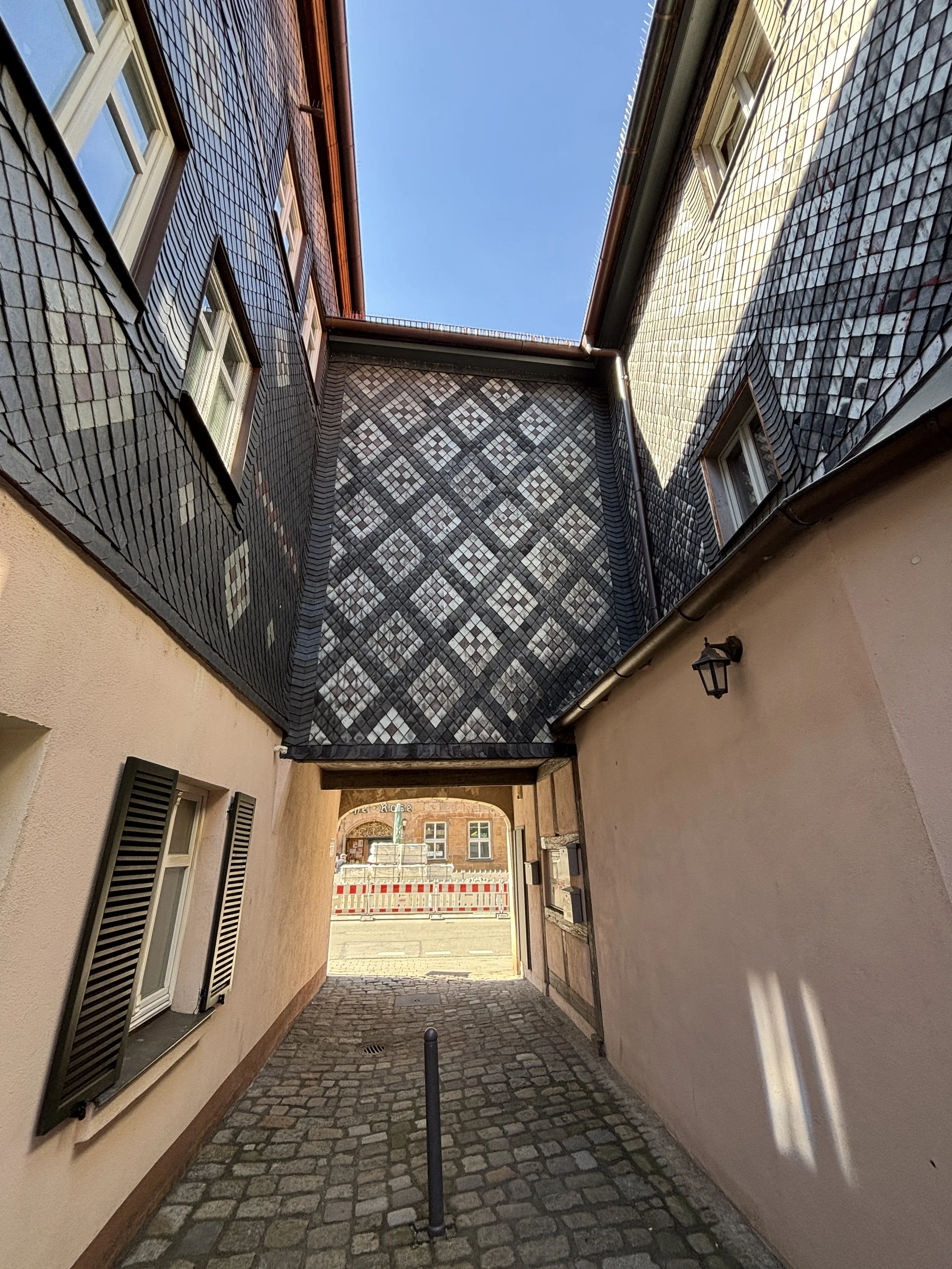
The other thing that historical Fürth stands out for is the abundance of little courtyards, some public, some semi-private, many of them perfectly well kept as gardens.
This phenomenon may be partly explained by the location of Fürth on a major axis of communication linking Nuremberg to Frankfurt and other major German cities. With Nuremberg a mere five miles away, the city of Fürth made a convenient overnight stop before being able to cross Nuremberg’s city gates in the morning. the courtyards provided a a safe place for travelers to leave their horses or carts for the night while sleeping at the adjacent inns.
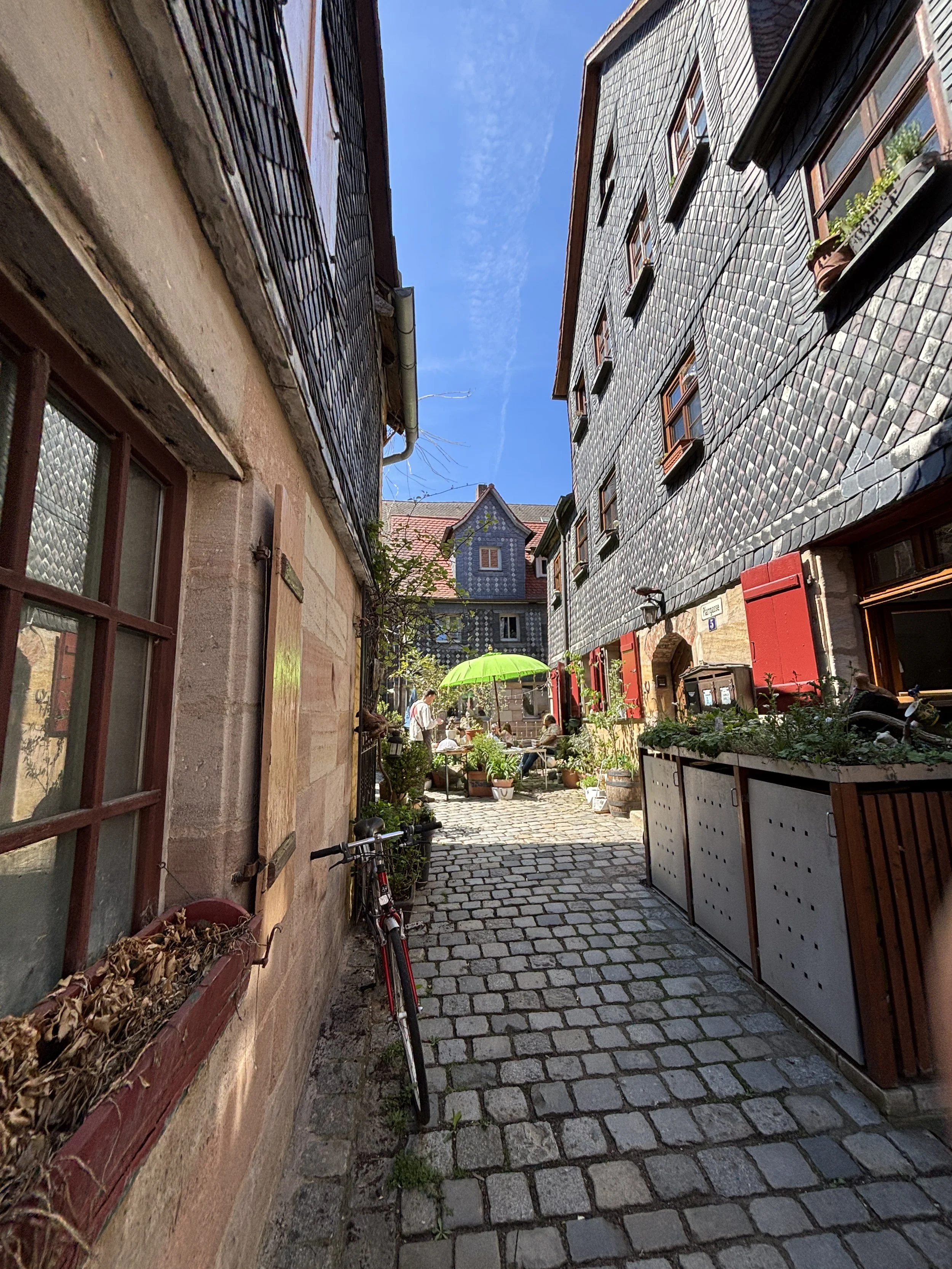
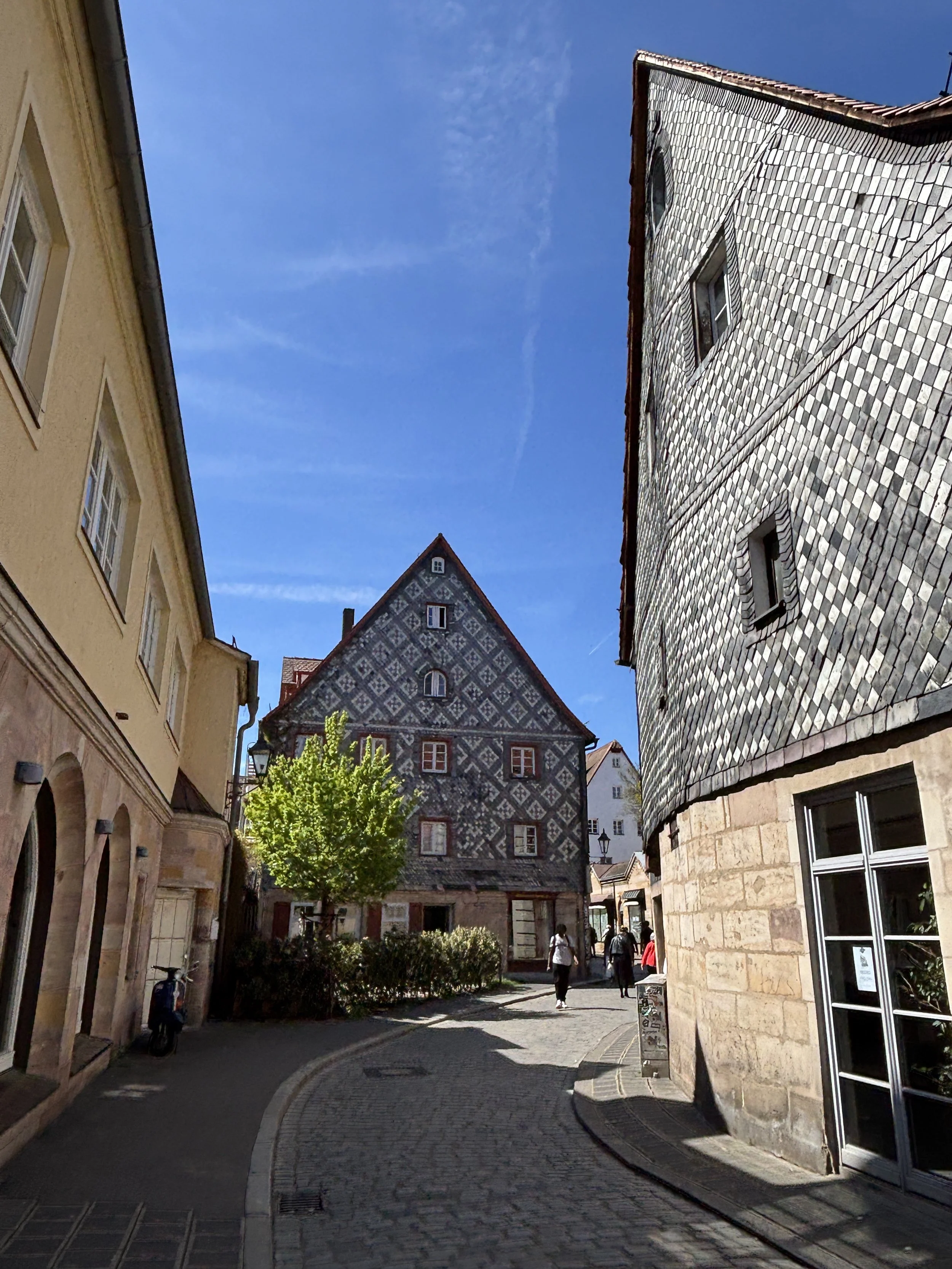
Protestantism and the Thirty Years War in Fürth
Fürth has also the particularity of being a majority-Protestant city in Catholic Bavaria. Fürth main Protestant church is Saint Michael’s, which is credired with being, possibly the oldest building in town, as well.
Fürth’s protestantism meant that in 1632, during the Thirty Years War, it hosted the King of Sweden, Gustavus Adolphus, which styled himself as a major defender of the Protestant cause in German lands.
The Swedish king is still remembered in Fürth, where a plaque and a bust remembers the royal visit. Gustav Adolphus apparently lodged at the rectory adjacent to Saint Michael’s church in June 1632. One of Fürth’s main streets is also named after the Swedish monarch.
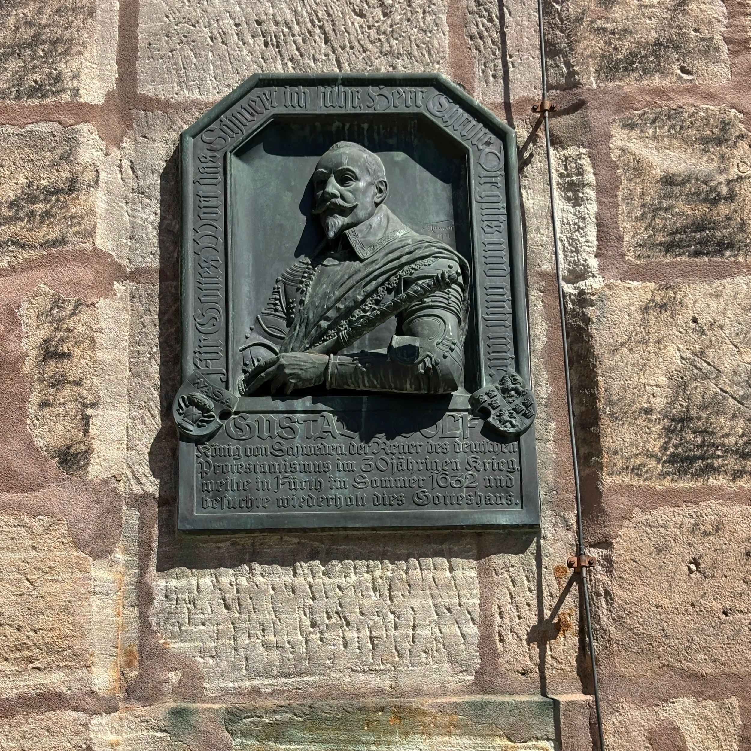
Gustav Adolphus campaigning in the area of Fürth culminated in a battle at a nearby hill called Alte Veste (“Old Fortress”). There, after a prolongued stand-off, Swedish forces charged the Imperial army under the command of Albrecht von Wallenstein, with the latter reportedly getting the upper hand. The city of Fürth and the surrounding countryside reportedly suffered quite a lot of damage during that conflict.
Visiting Henry Kissinger’s birthplace
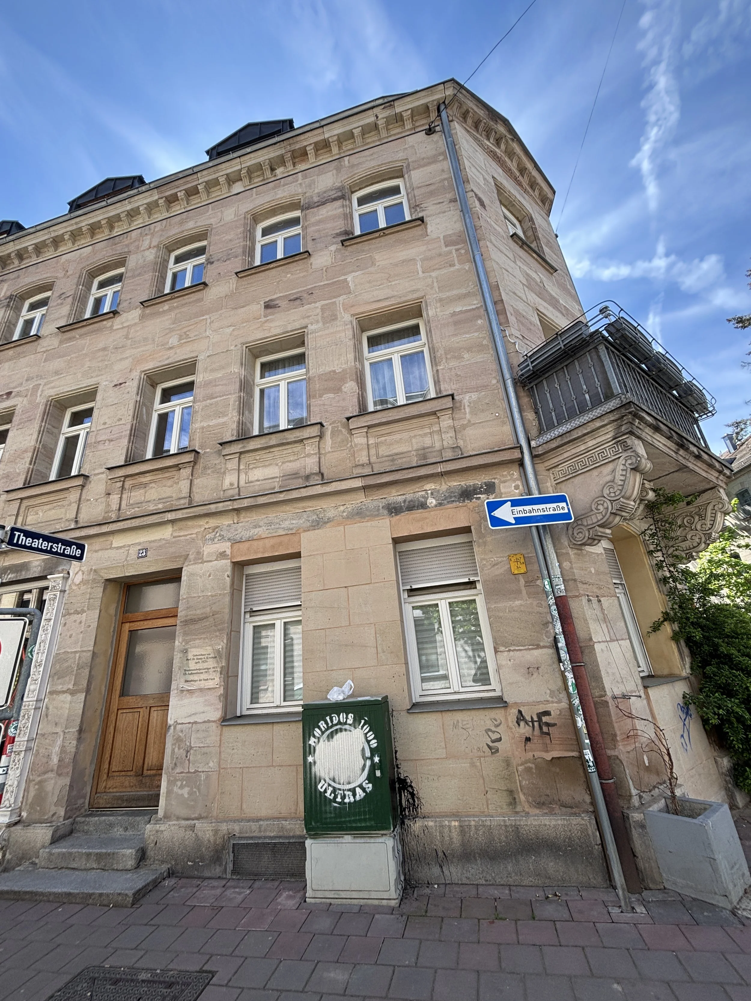
Fürth is the birthplace of two prominent statesmen.
One of them was Ludwig Erhard, who was Finance Minister of the German Federal Republic under Adenauer and later, between 1963 and 1966, Chancellor himself. A remarkable man who is widely credited with being one of the architects of the German post-war economic miracle (the so called “Wirtschaftswunder”).
The other major statesman born in Fürth is none other than Henry Kissinger, the formidable US Secretary of State.
Kissinger served in this capacity between 1973 and 1977 under Presidents Nixon and Ford, and later remained a very prominent and influential voice in international affairs pretty much until his death in 2023, at the venerable age of 100.
Kissinger was born to a middle class Jewish family at 23, Mathildenstrasse, in central Fürth and his native home still stands at this exact spot in a good state of preservation. A plaque by the door remembers visitors of this historical fact.
Kissinger’s family, however, had to flee Fürth, in 1938, as the environment was turning increasingly dangerous for German Jews. The Kissingers landed in the United States, where young Henry would go on to make a brilliant career, but this is another story that, I am sure, there are many other books and sources better qualified to tell in all detail.
Btw, the area in which Kissinger was born and spend his childhood in, with its broad, orderly avenues and solid residential and commercial housing blocs, is a good example of the modern expansion of the city of Fürth in the 19th C., as the city prospered as an industrial and trading center (in the picture below you can see how the streets of this district mostly look like).
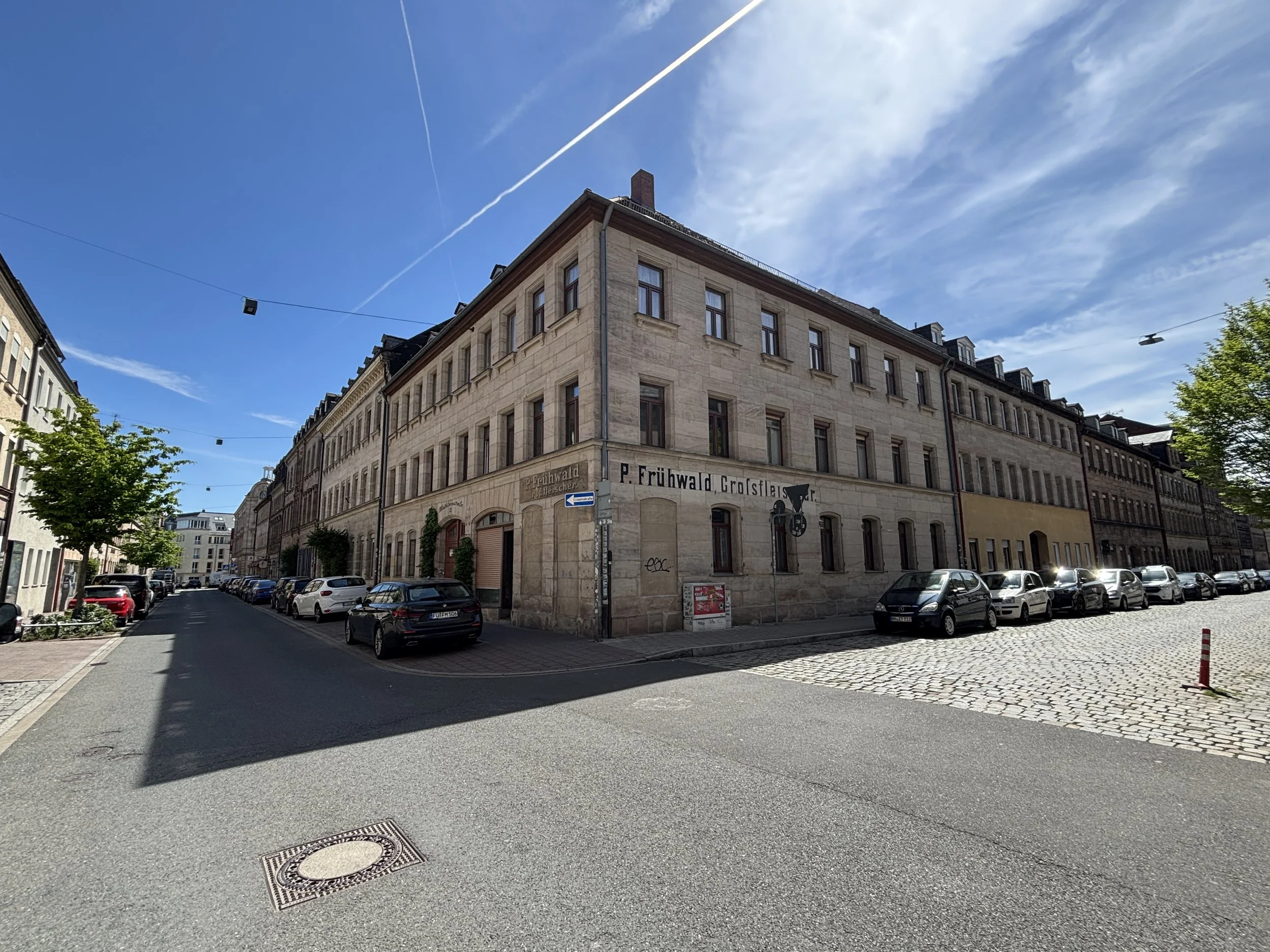
Where to eat in Fürth
Gasthof Grüner Baum
Gustavstraße 34, 90762 Fürth
This restaurant and guesthouse is located in one of Fürth’s most historical buildings.
While the current building dates largely from the early 19th C., an inn has been documented at this spot since at least 1607. A 2018 renovation uncovered some parts of the old structure, such as a wooden ceiling. Legend has it that the Swedish king Gustav Adolphus may have dined here in 1632, but this is totally unverified!
It has a terrace which is lovely when the weather is nice, as it was the case during my visit.
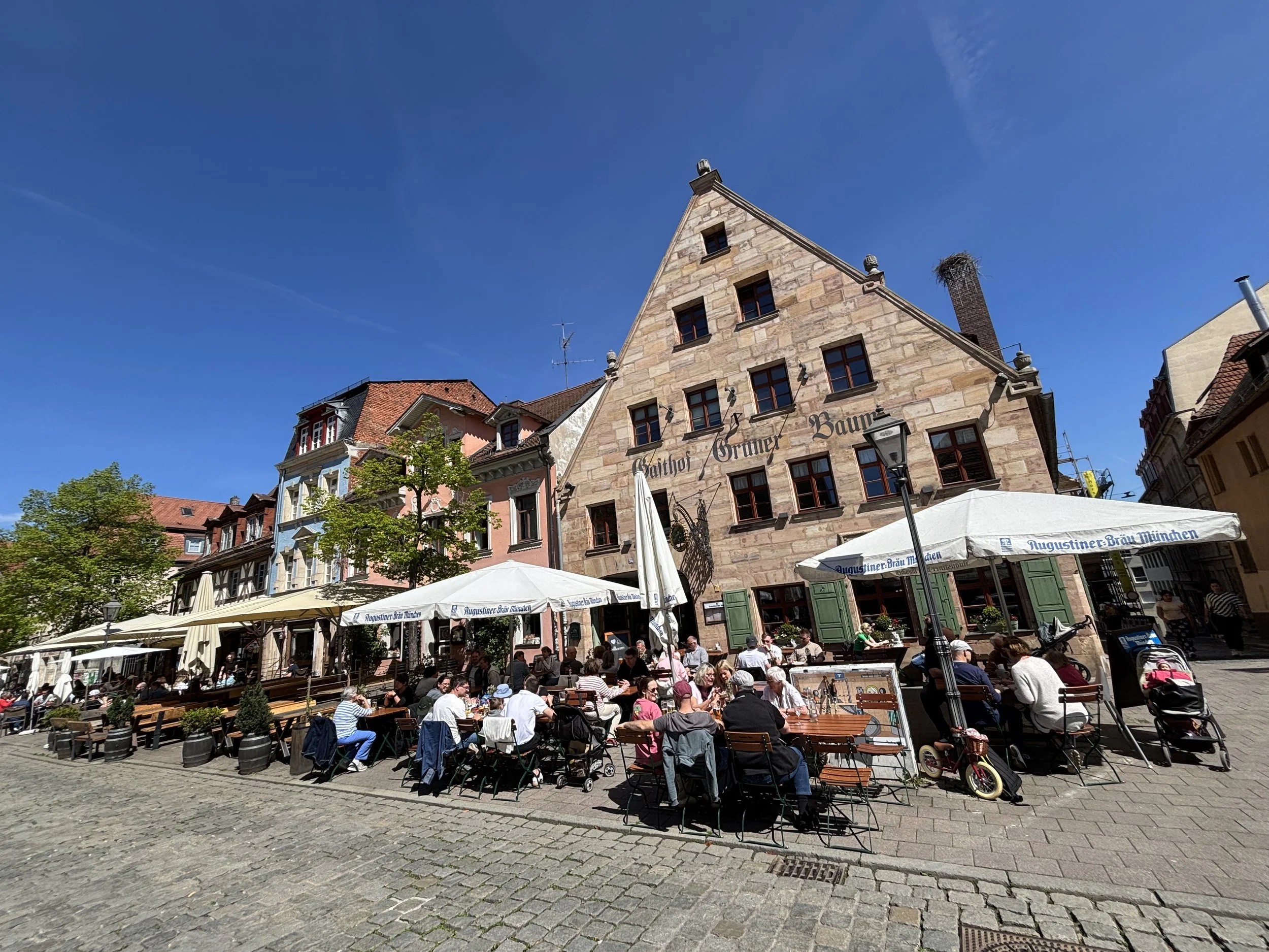
The food was, you guessed it (particularly if you have followed the previous stages of this itinerary)…Franconian cuisine!
In this case it was the sausages, although those of you that prefer schnitzel, will also be well served here. The dishes were accompanied by a nice potato salad and Bavarian beer.
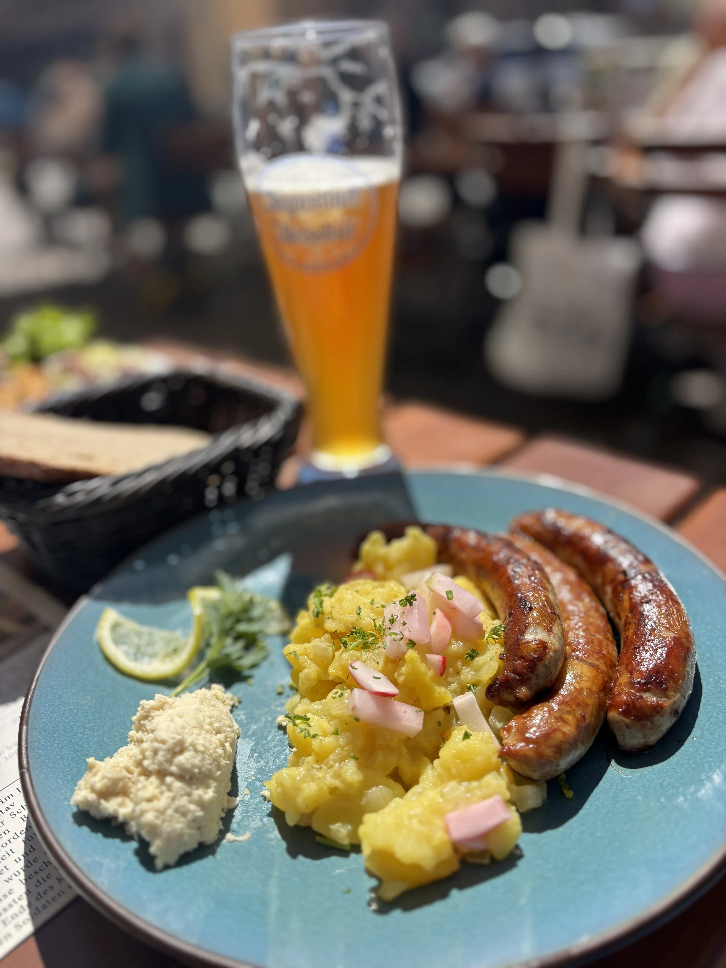
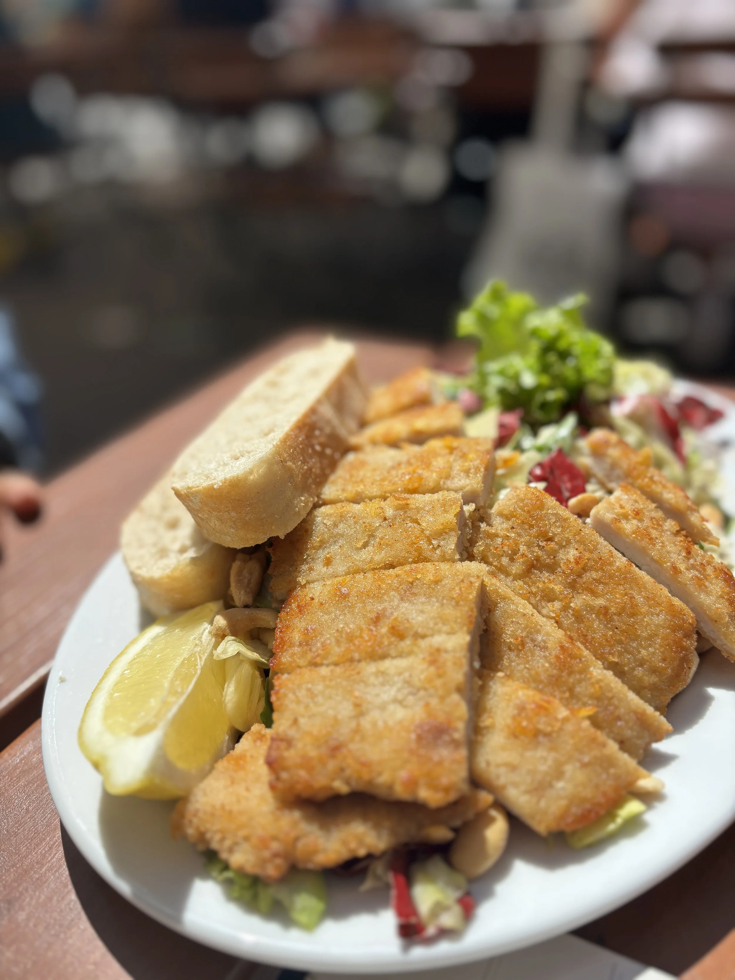
DÄCHLA Panoramic Terrace
Friedrichstraße 6a, 90762 Fürth
Another place of note in Fürth, particularly if you wish to have a coffee or a drink with some nice views is the rooftop bar at DÄCHLA, which is located at top of a the city’s public library in Dr.-Konrad-Adenauer-Anlage, a public park not far from the main train station.
Dächla, which apparently means “little roof” in Franconian dialect, has a large terrace offering nice views of the city (although not as impressive as the ones from the top of the town hall’s italianate tower).
This modern venue was renovated as recently as 2024. It works mostly as a coffee place during the day, doubling later as a trendy wine bar in the evenings.
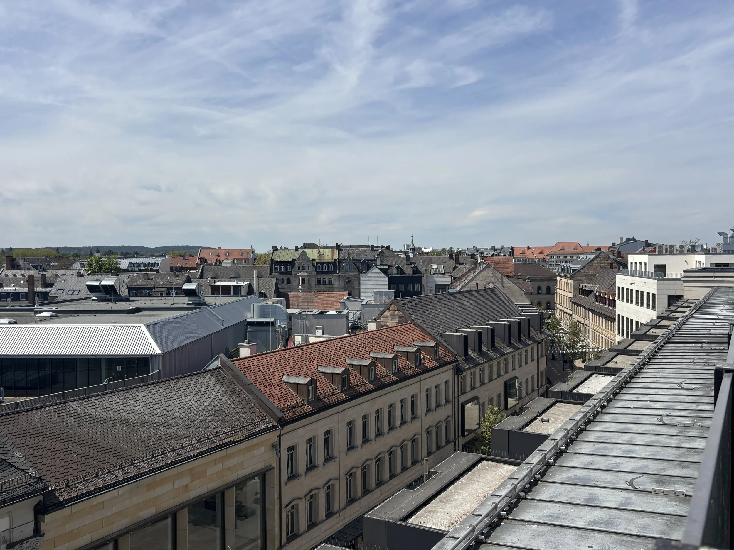
Germany’s first railway in Fürth
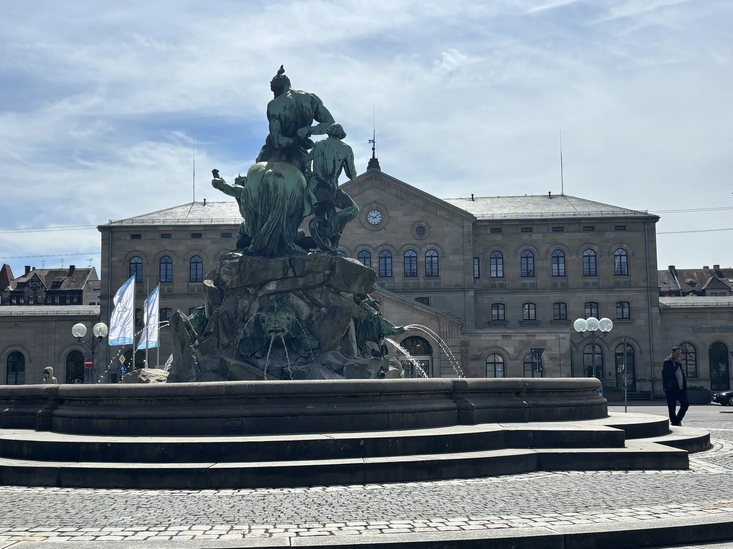
This post about Fürth wouldn't be complete, even more so considering that this visit was part of an all-railway journey, without a mention of Germany's first railway, which connected the city to nearby Nuremberg.
This first German railway line opened in December 1835, with the Adler ("Eagle"), a primitive steam locomotive, making the inaugural six-kilometre run between the two cities.
The train departed not from the present-day railway station but from where today's Fürther Freiheit square is located. The original terminus, known as Ludwig's Station, was demolished in 1938 to make way for a Nazi parade ground. Today this area is a large open square which acts as a venue for several outdoor markets.
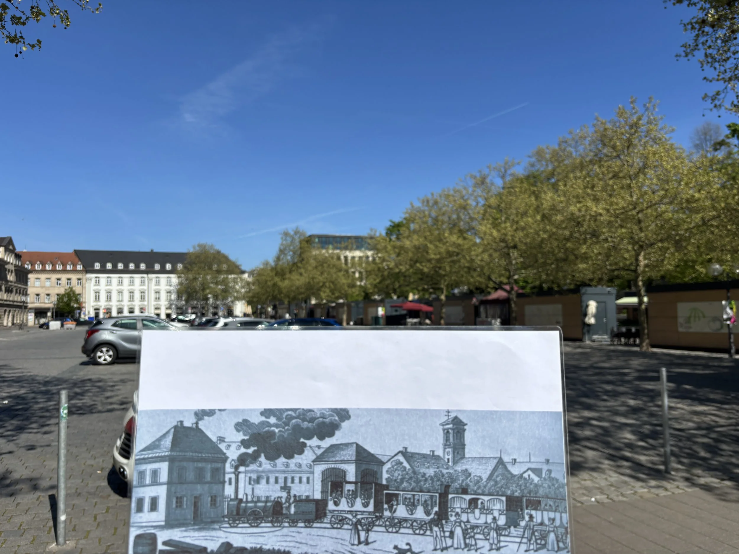
The history of Germany’s first railway is also remembered at Fürth’s railway station, where you can find several decor elements and even a scale model that relate to that major historical feat.
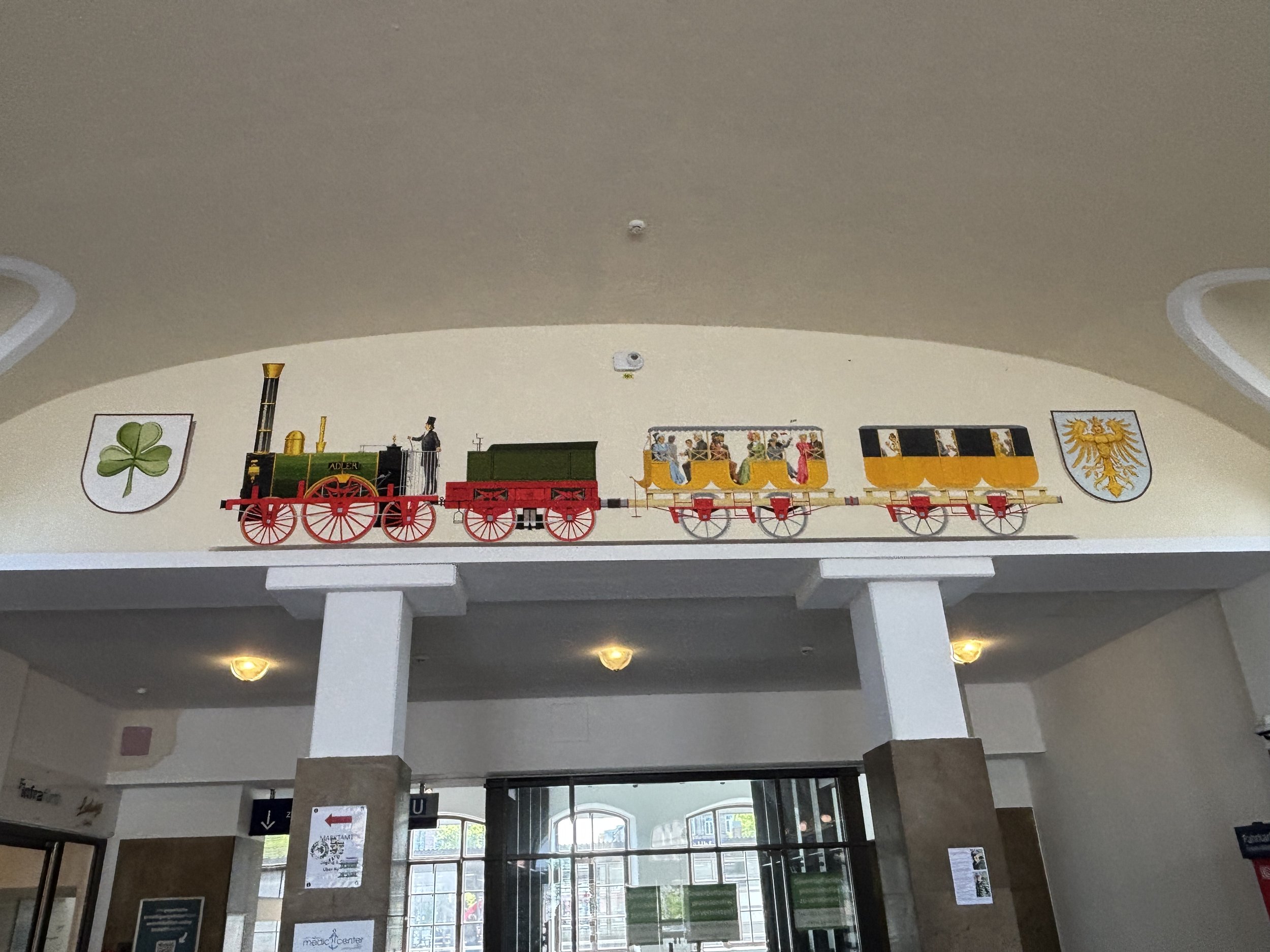
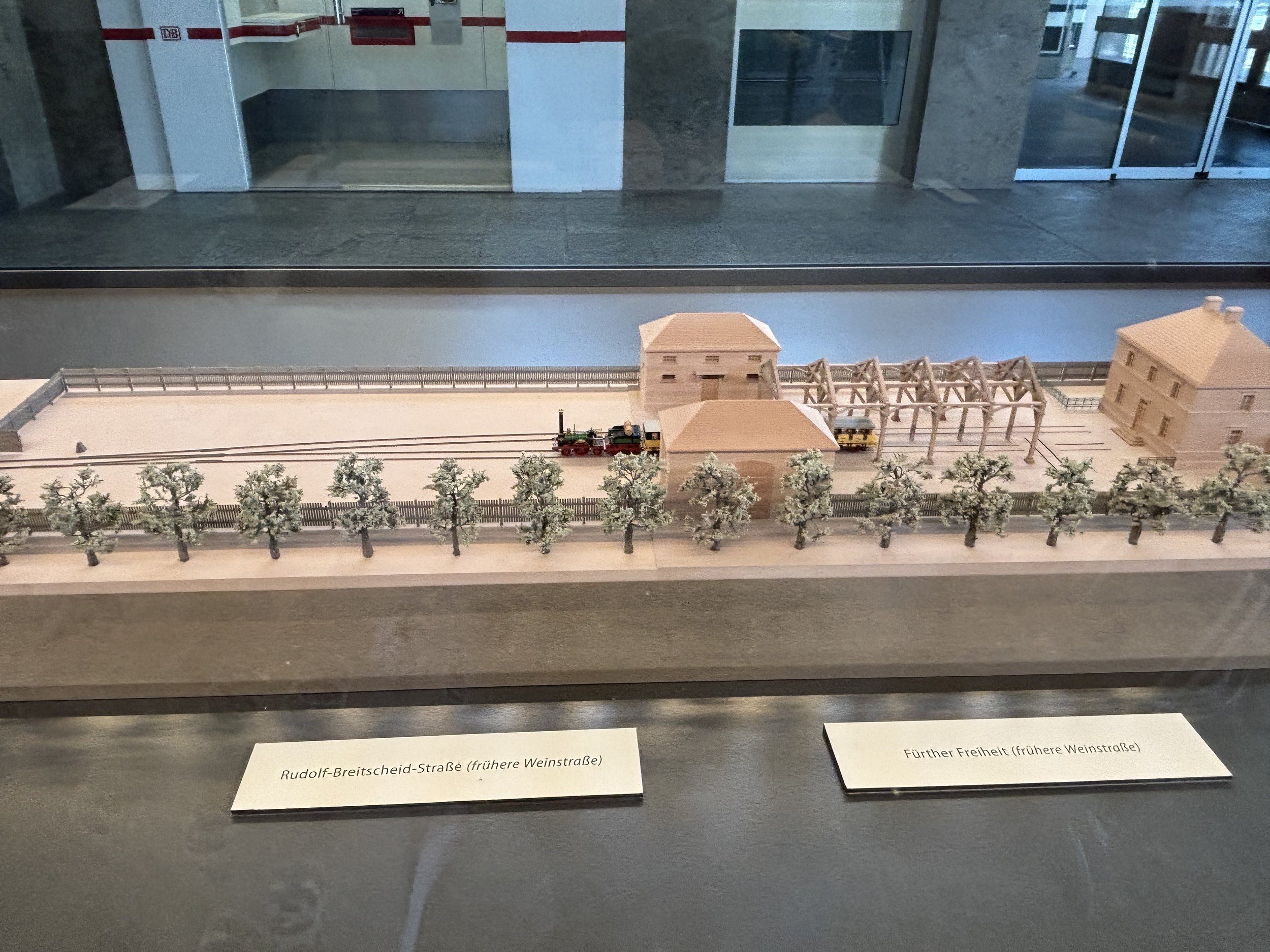
If you enjoyed this chronicle from Fürth, stay tuned for the fourth and last installment of the Franconian series, from its major city: Nuremberg.
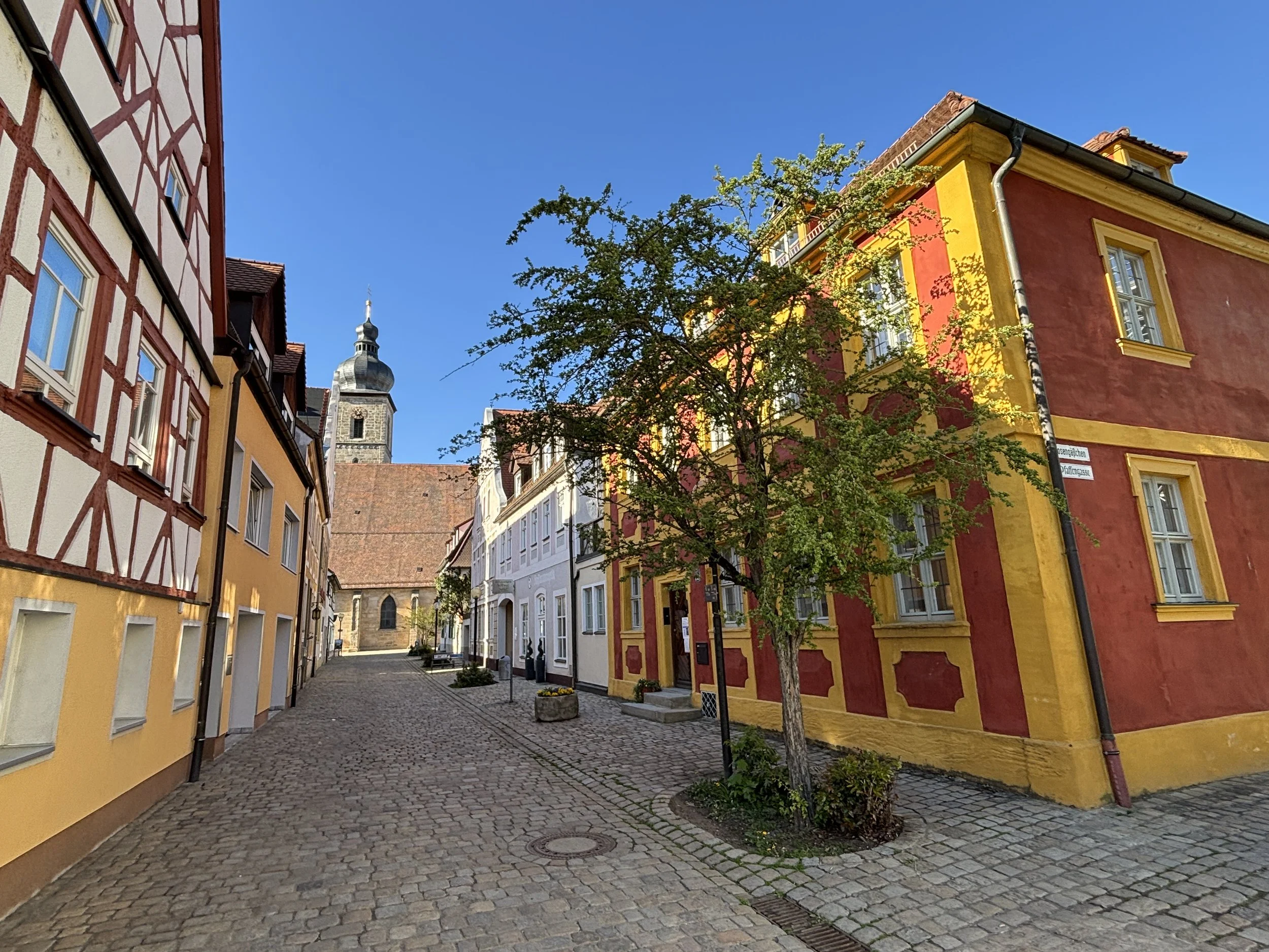
Top things to see and do in Franconia (II): Forchheim & its underground beer cellars

We continue our rail itinerary through the heart of the Franconia region of Bavaria with a stop at Forchheim.
First of all, just a quick reminder that this is but the second stage of a four-city tour to explore some of the most beautiful towns in Franconia (“Franken” in German). You can, of course, read this post as a stand-alone, but if traveling to this area, let me suggest also our other stories about:
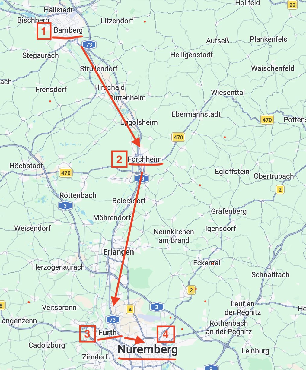
Let’s start with a few words about Forchheim, because, chances are you
With a population of around 30,000, Forchheim is actually larger than it looks when walking through its historical center. I am saying this, because the place is amazingly calm and relaxed, even when walking around on a weekend afternoon.
I guess this is due in part to the fact that, even if it is not lacking in charm and character, Forchheim does not get nearly as many visitors as nearby Bamberg, but also to a significant degree to the local population living kind of spread out all over the place rather than in a dense town center.
It is also worth noting that, during the warm months most of the social activity, particularly in the weekends and festive days, switches to the Kellerwald area, an outdoors recreation area with underground beer cellars (more on this unique feature of Forchheim further down this post)!
I must confess that I hadn’t really heard about Forchheim when the Franconia Tourist Office, which helped organize this trip, suggested a stop in Forchheim, but the place didn’t disappoint and, if you like artisan beer and traveling through Upper Franconia, you should definitely make some space for this town!
By the way, Forchheim is also considered to be one of the gateways to the “Fanconian Switzerland”, an area renowned for its natural beauty. Although this aspect of Forchheim is not the object of this post (I was sticking to the main rail axis on this occasion), it is worth noting in case you were traveling through Franconia by car.
This post may contain affiliate links. If you book or buy something through them, I earn a small commission, at no extra cost to you. It's one of the ways I keep Places of Charm going. Thank you for your support.
I would like to thank also Franken Tourismus for facilitating this journey and arranging a tour of Forchheim with the excellent local guide Christiane. All opinions are my own.
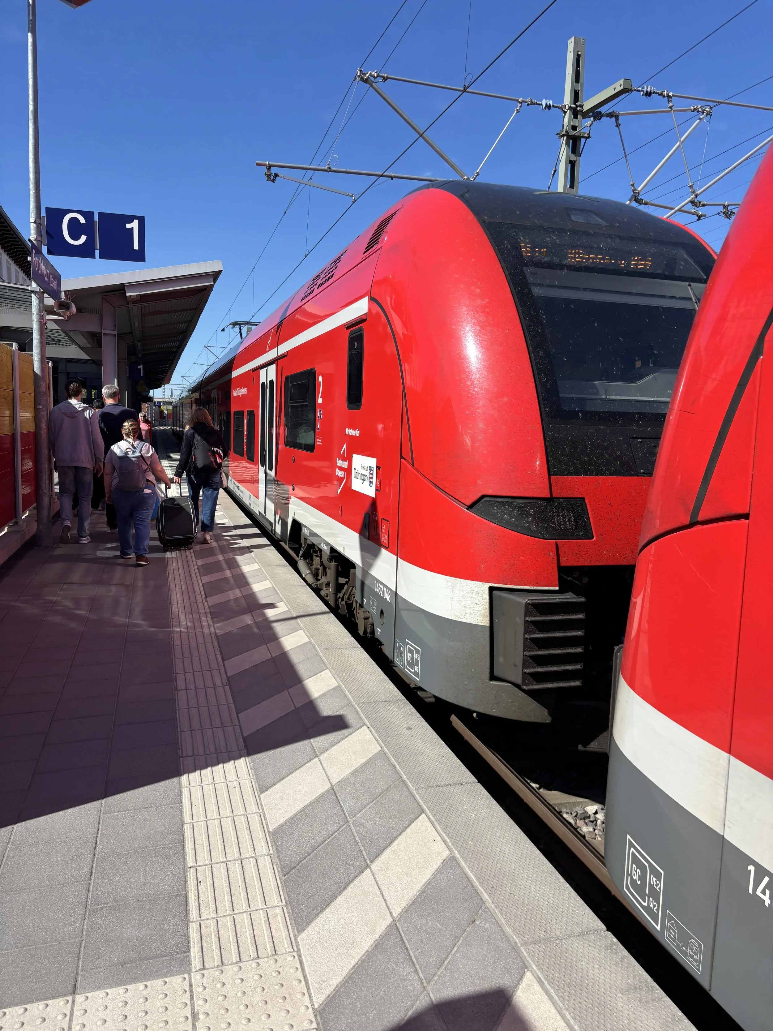
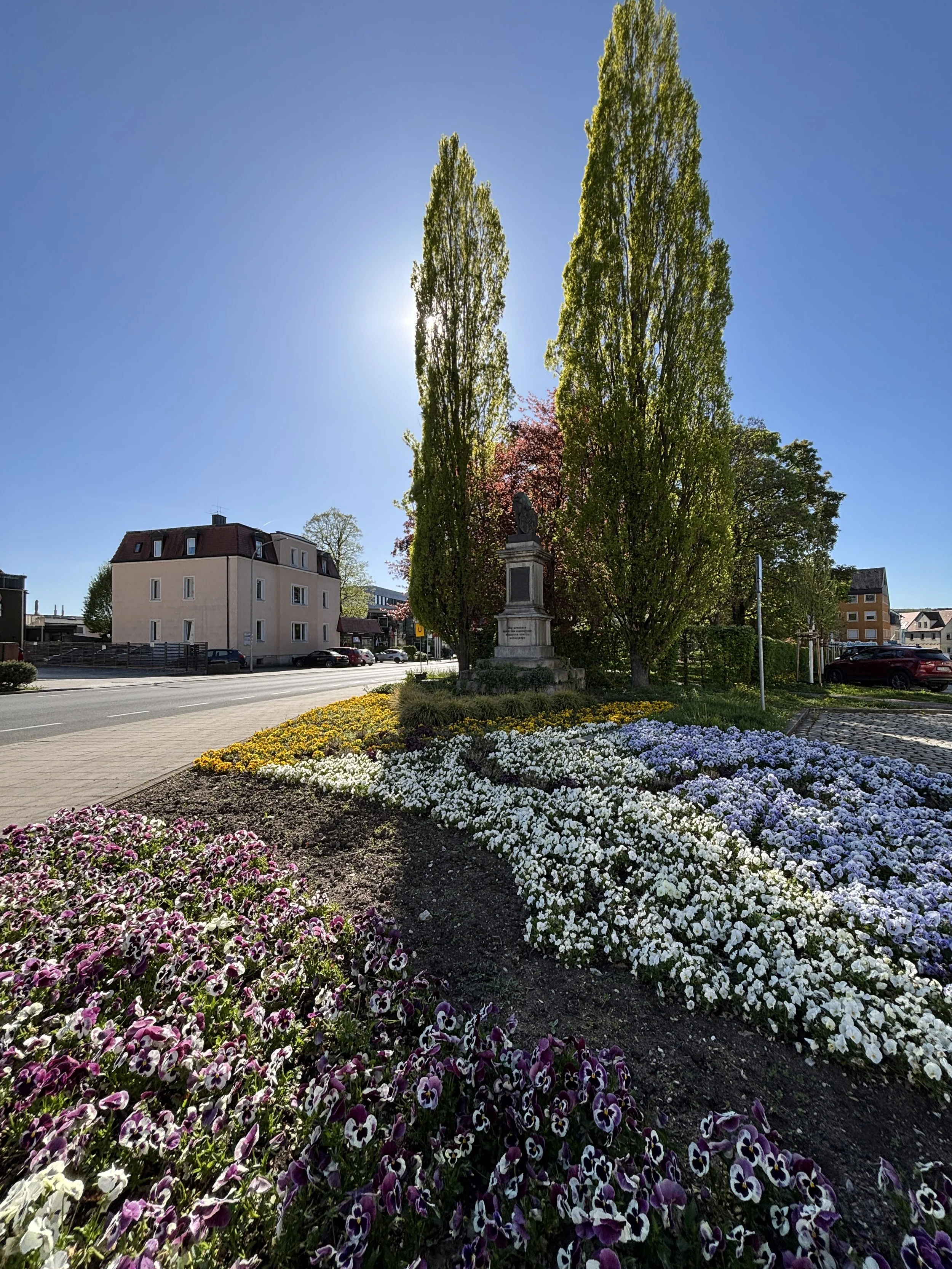
So, this is how I arrived to Forchheim from Bamberg, which is barely 20 minutes away by regional train (the ticket was around €6.5 at the time of my visit). The central station is literally 5 minutes away from the historical center (and 2 min from my hotel, the Arivo Aparthotel, which I will review, as well, later in this post).
Forchheim is, actually, quite an old place. There are mentions to it already in the Carolingian era and, from the 11th C. it belonged to the Price-Bishops of Bamberg, who had their own palace in town, as well. Like the rest of this ancient princely bishopric, Forchheim was annexed by Bavaria in the early 19th C.
Another important feature of the town is the river Wiesent, which runs through Forchheim’s old town before joining the river Regnitz just west of the city (besides being the same river that flows through Bamberg, the Regnitz is part of the river and canal system that connects the Rhein and Main basins to the Danube).
The waters of the Wiesent provide some of the most picturesque photo opportunities in Forchheim and give it also one of the first landmarks we encountered in our itinerary, the fish cages (“Fischkästen”). These are wooden structures lining up the banks of the Wiesent, where, for centuries, local fishermen have kept captured fish, mostly carp, alive before taking them to the market.
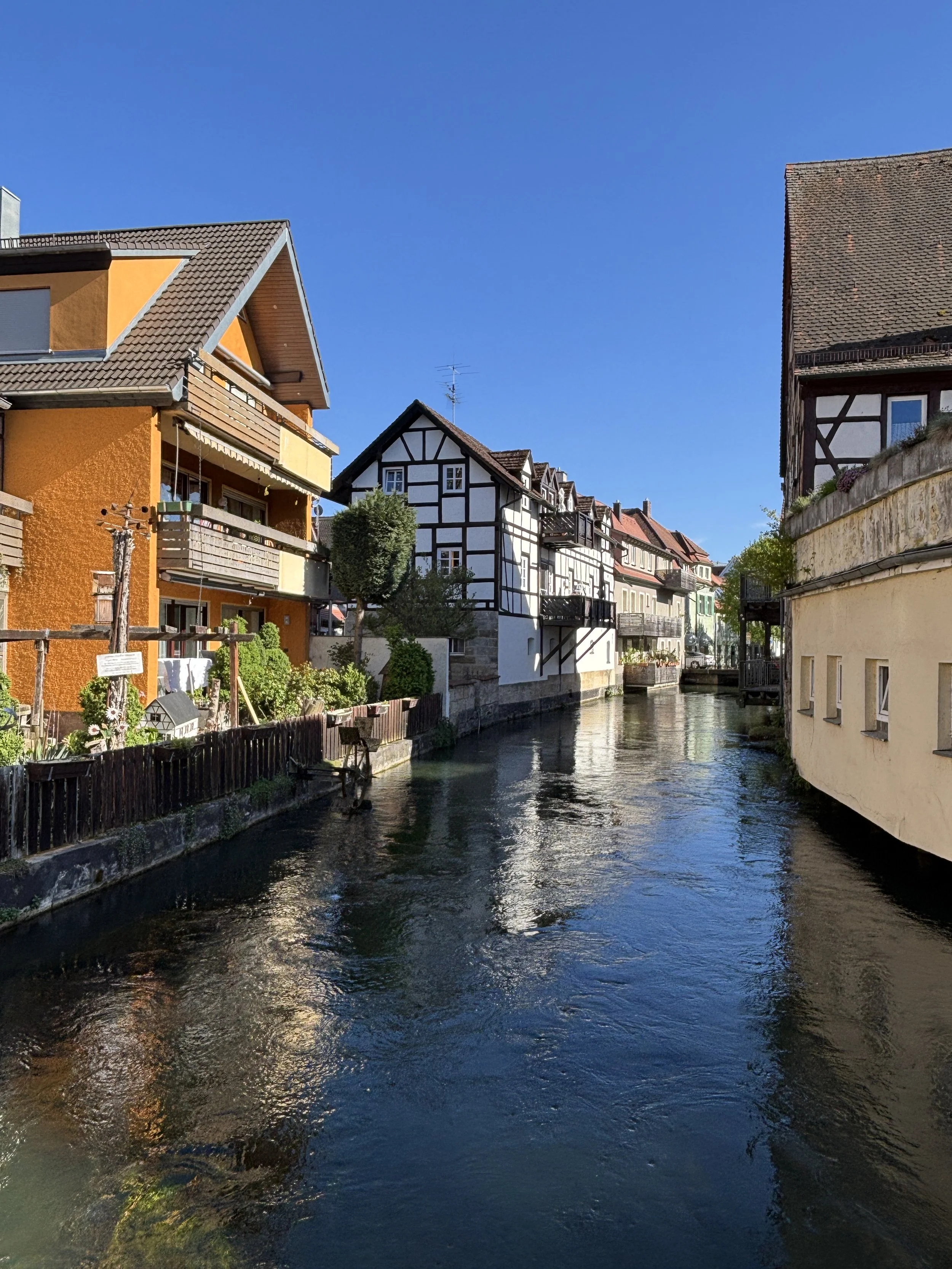
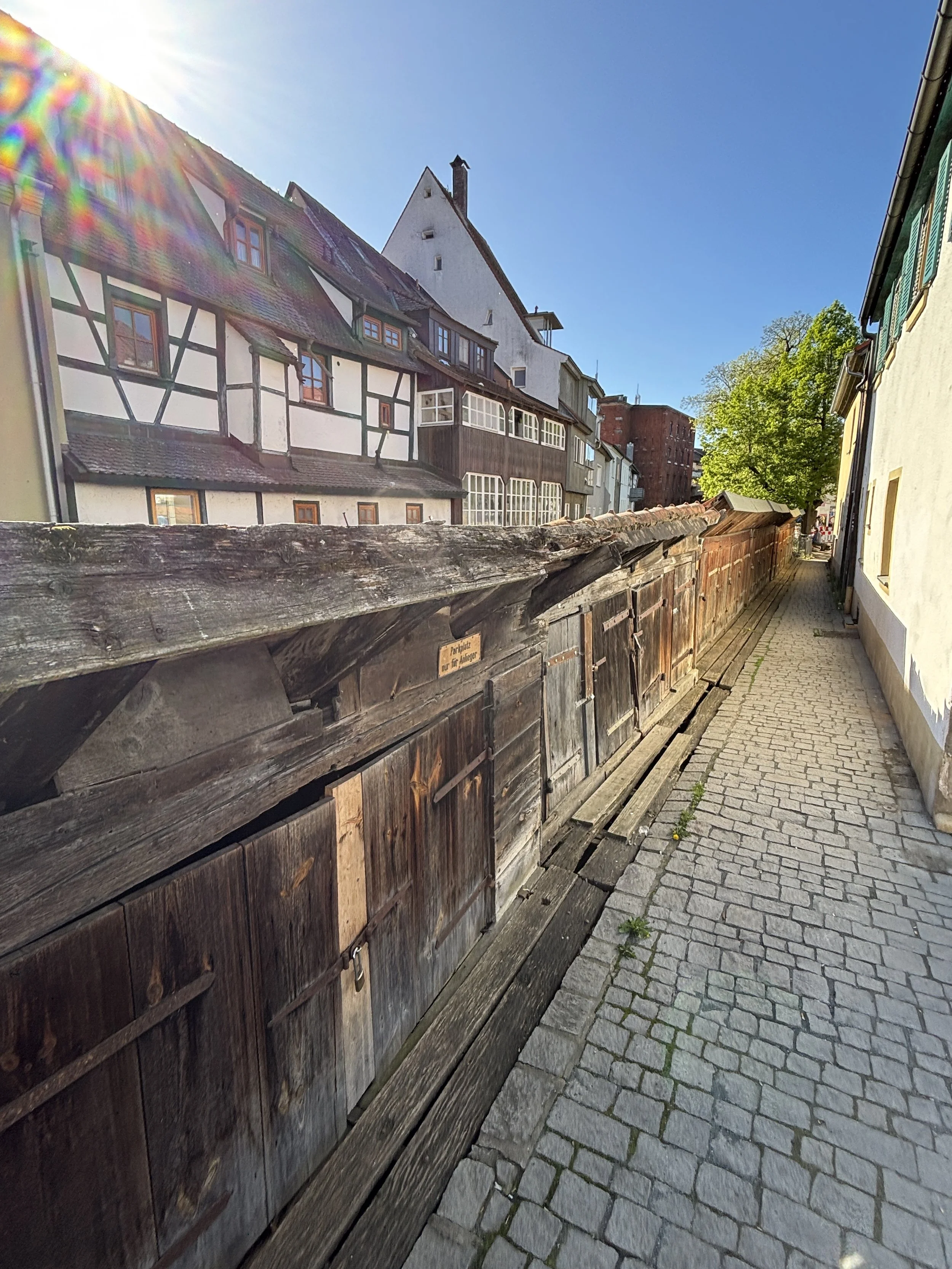
It is also along the banks of the Wiesent that we find a reminder of the fact Forchheim used to have a Jewish community, which was, sadly, destroyed in the late 1930s. A memorial (depicted below) is located in front of where the town’s synagogue once stood before it was torn down in 1938.
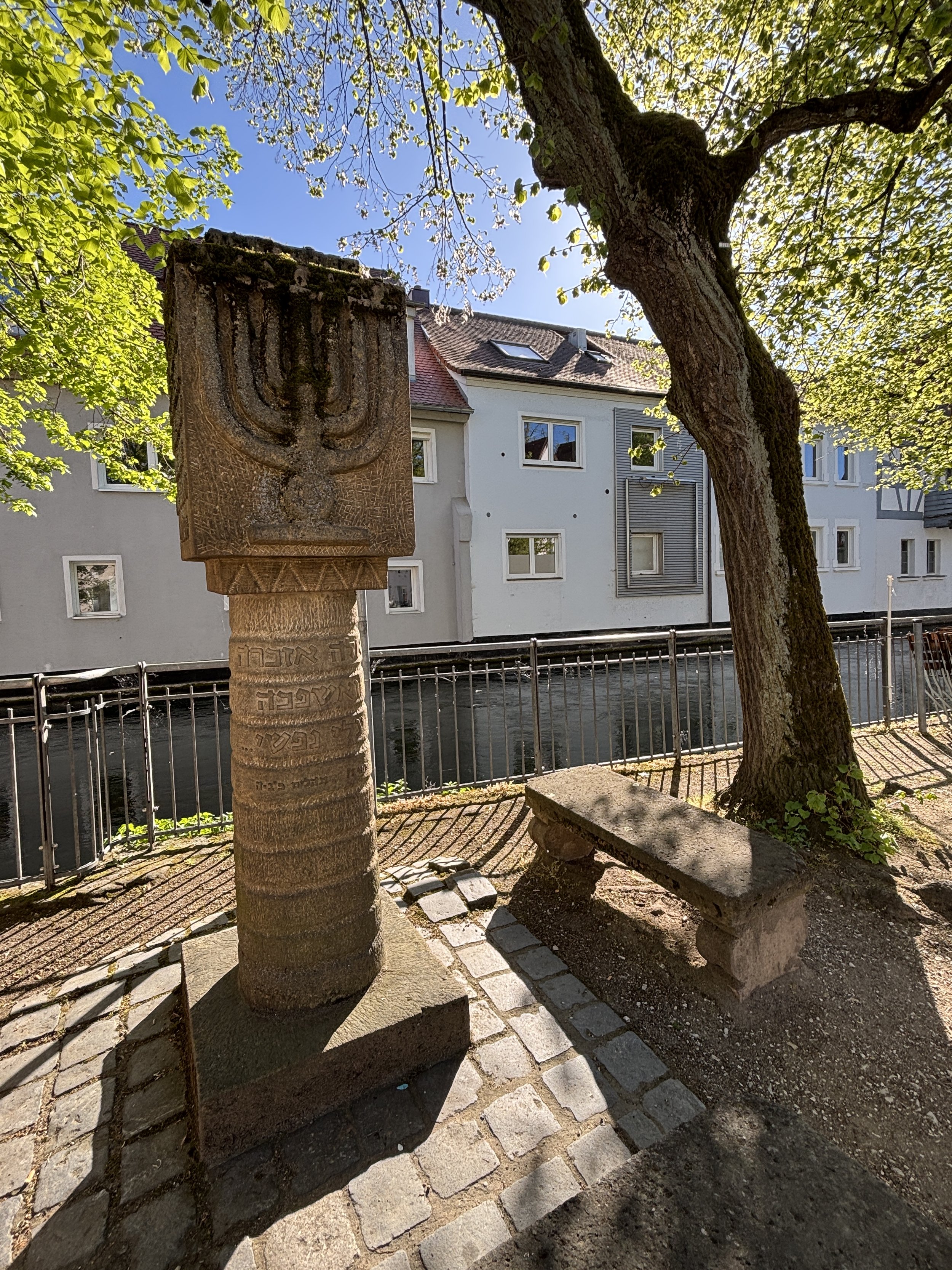
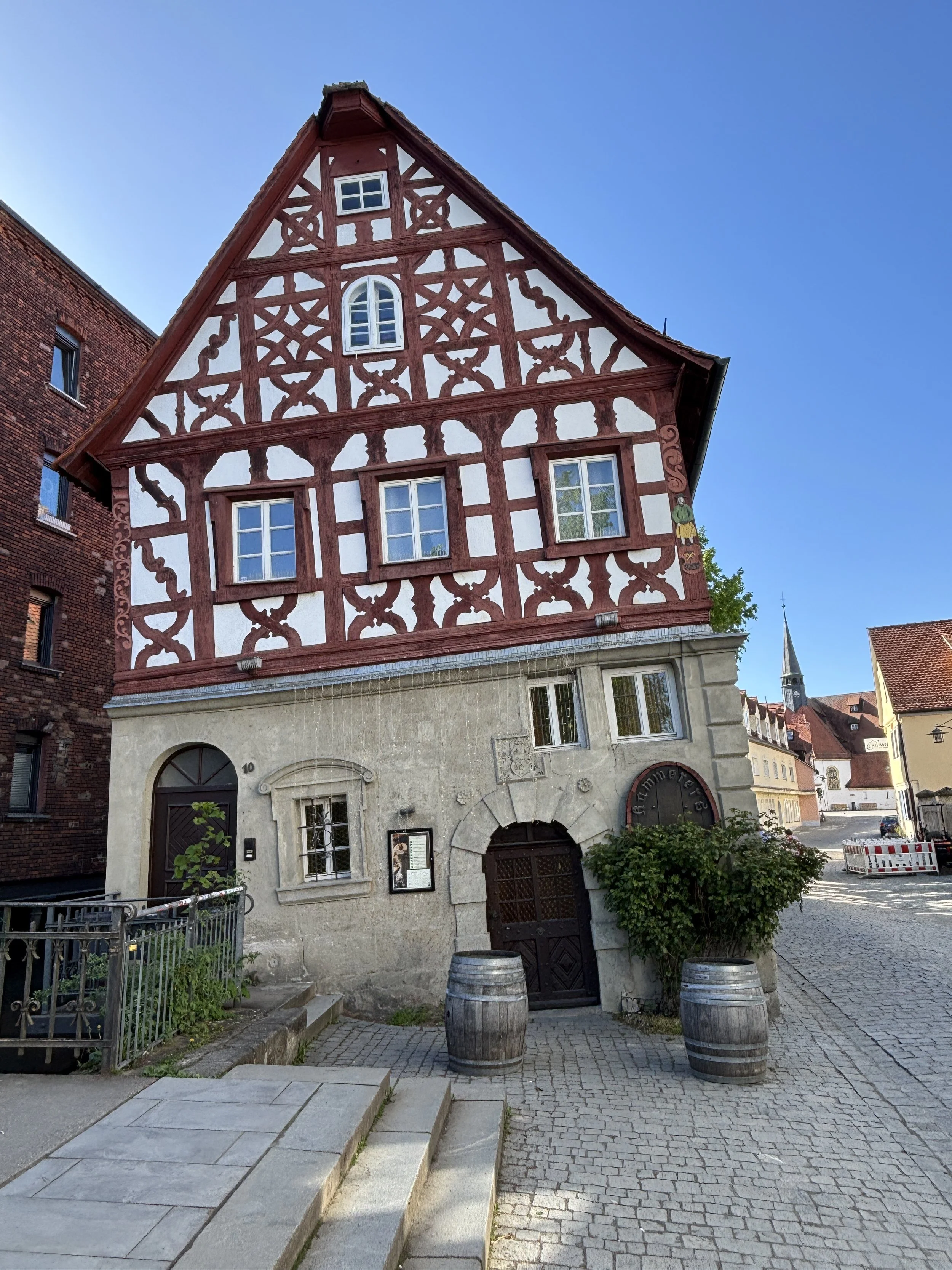
The historical center of Forchheim is made of (partly) pedestrianized cobblestone streets, so it makes for a nice walk.
There is one major landmark, which is the former Imperial Palace (“Kaiserpfalz”). This building, which is depicted below right, has a large open courtyard and today it houses the local museum. It takes it name from its early Carolingian origins, although the current structure dates back to the 14th C. when the town was under the rule of the Prince-Bishops of Bamberg.
Another curious structure in the historical center is this leaning timbered-house you can see depicted above.
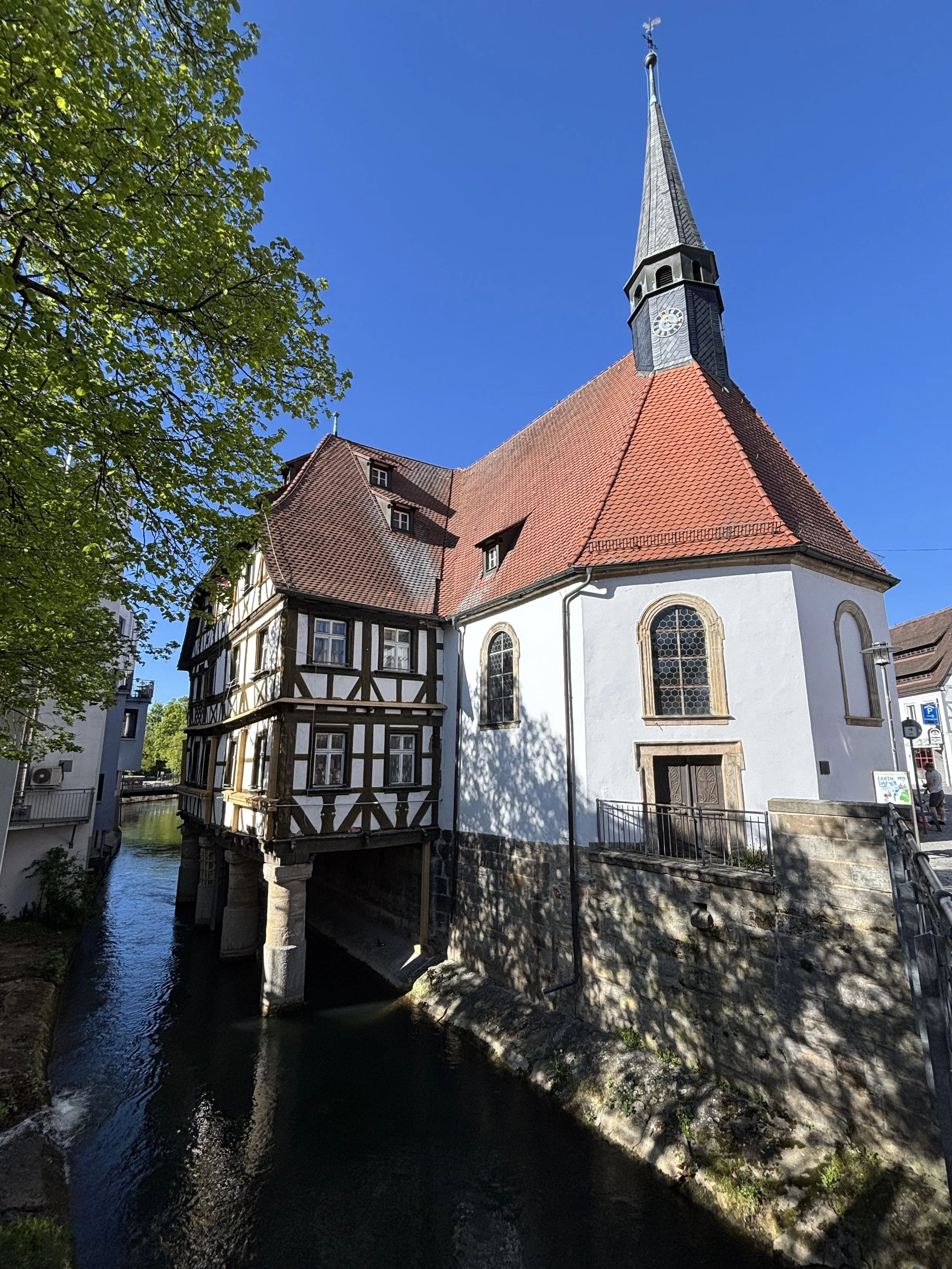
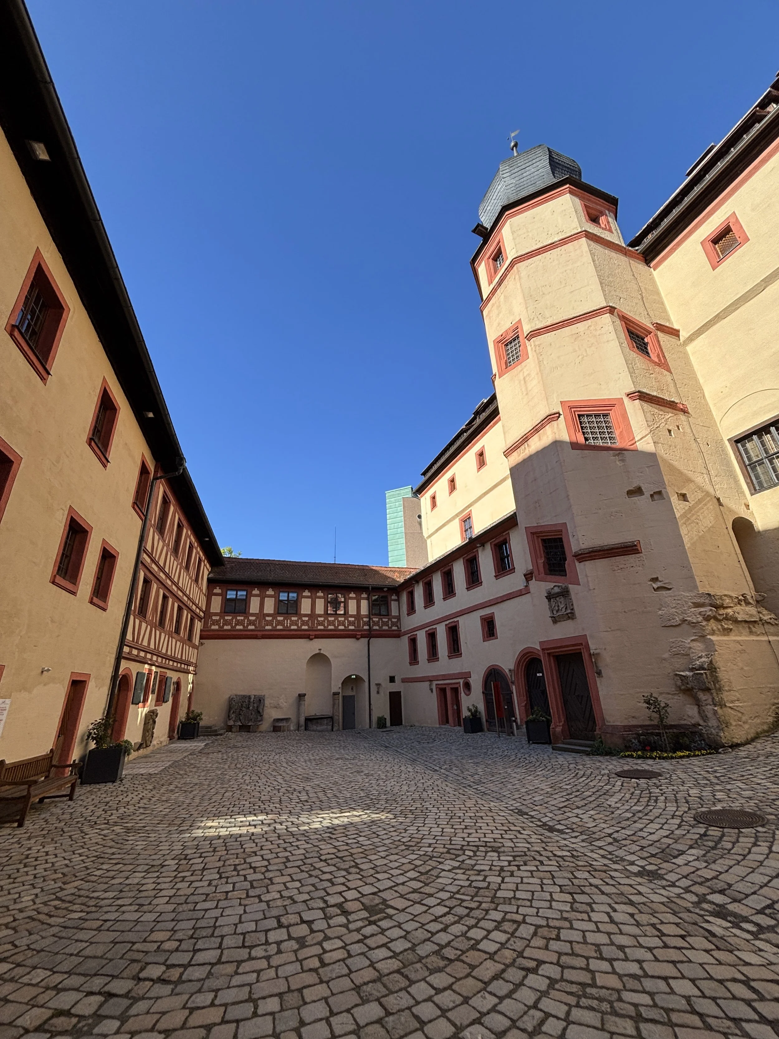
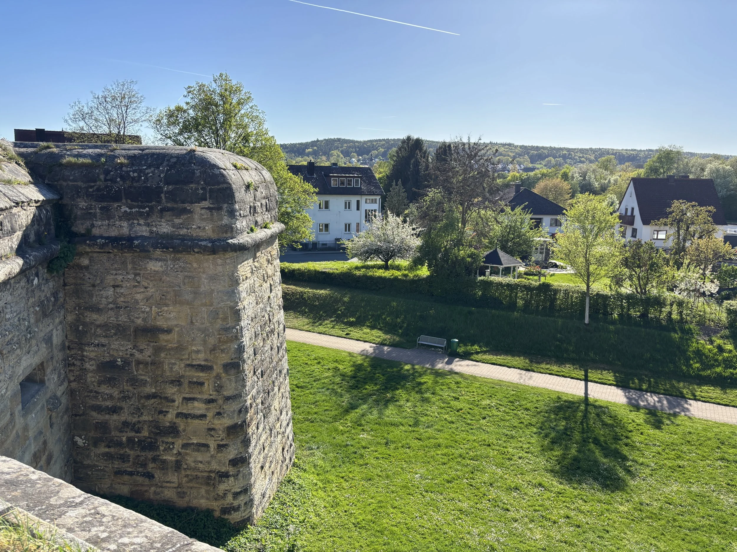
Forchheim used to be also a fortified stronghold, which resisted successfully attacks by Swedish troops during the 30-years War in the 17th C.
Parts of the massive bastions are still standing and today they are part of the historical trail through the old town.
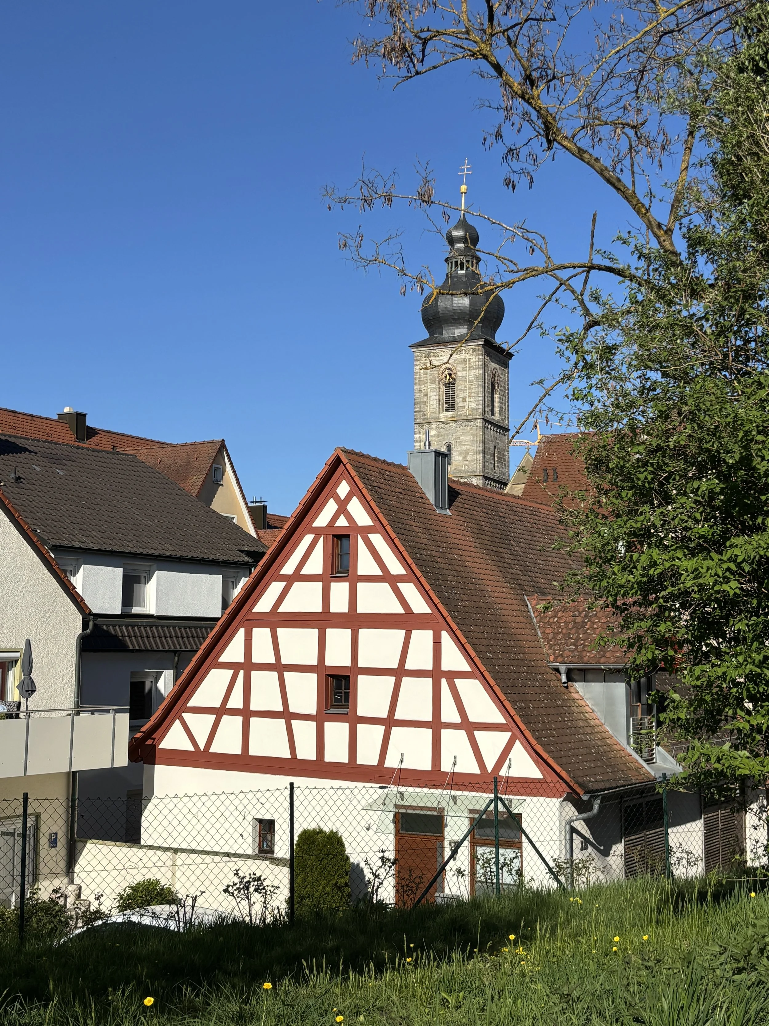
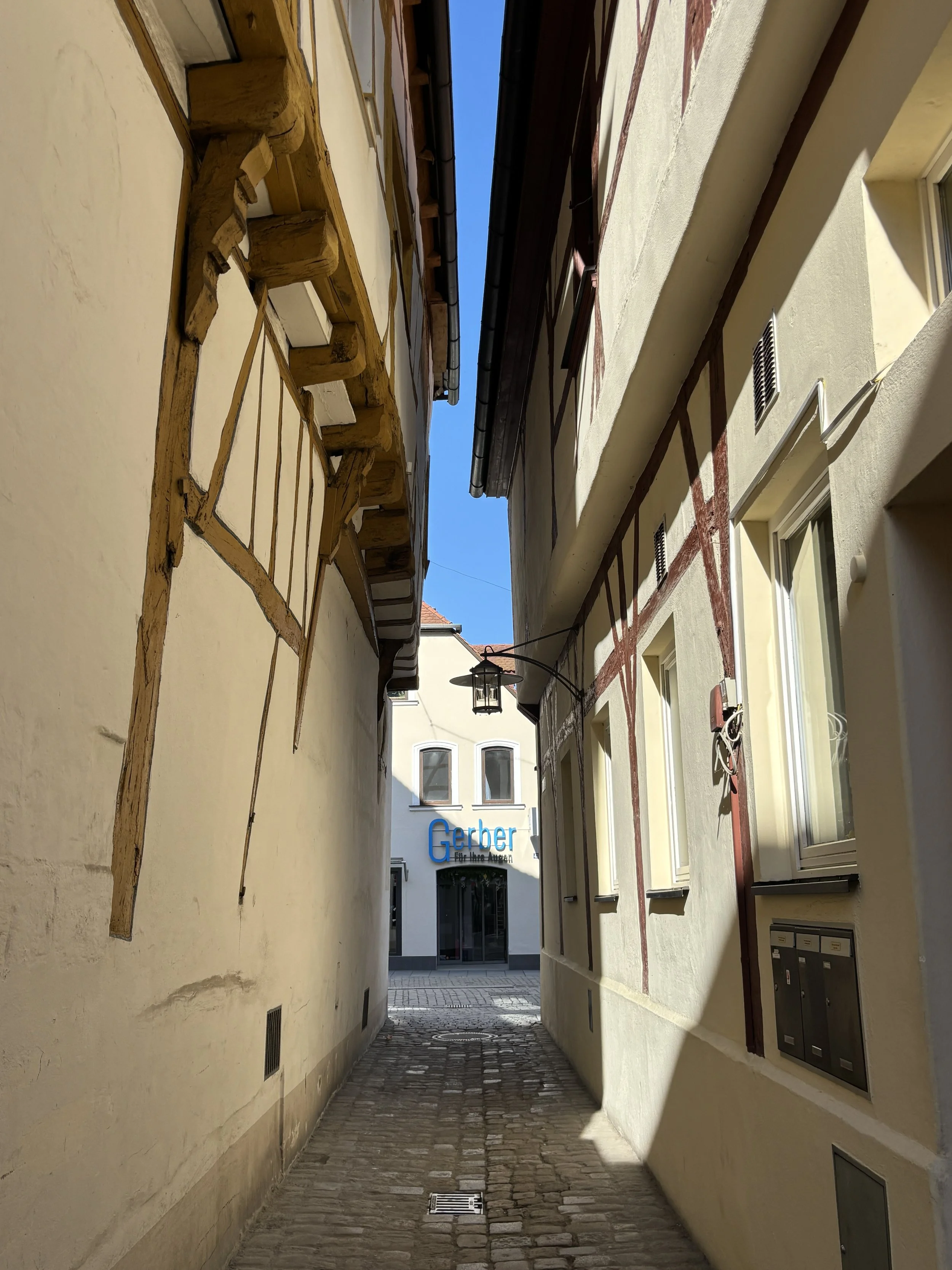
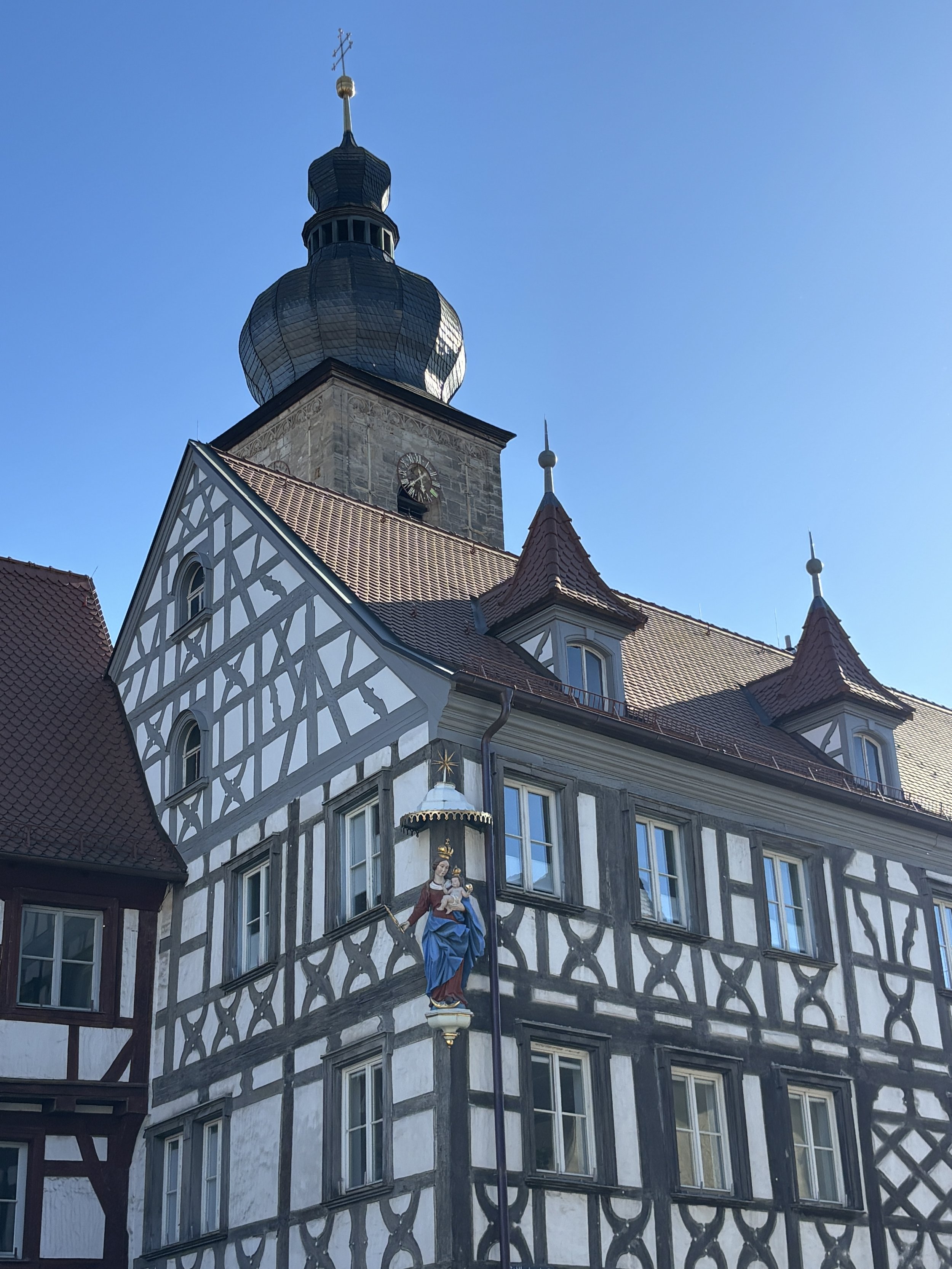
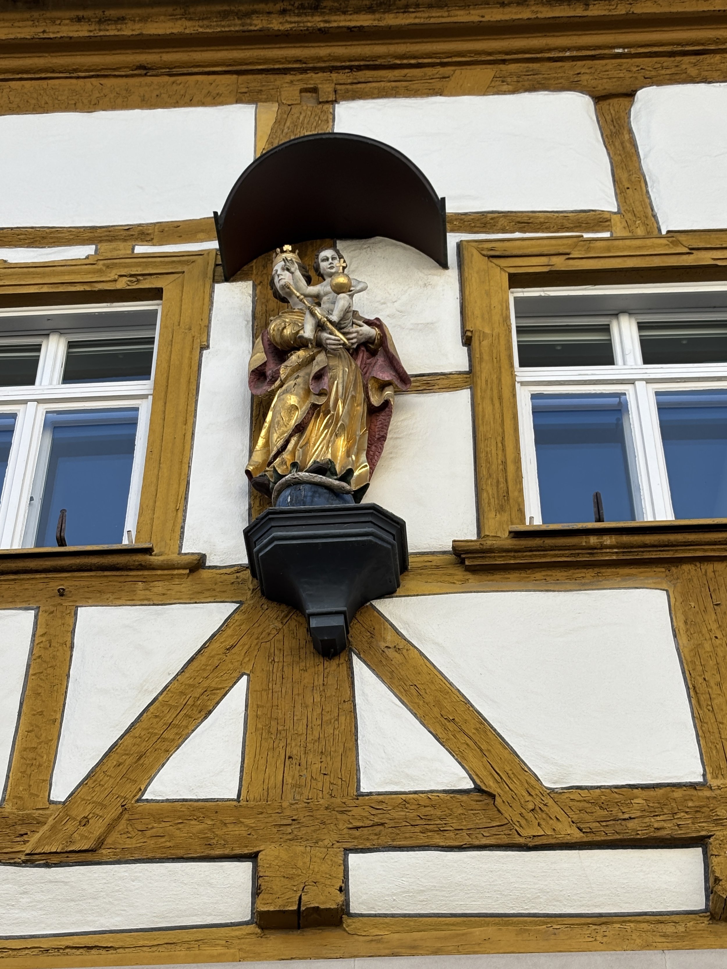
Most of the old town of Forchheim has preserved its authentic character, although many of its half-timbered houses were plastered over during the last few centuries, as, apparently, this type of style was, at times, not particularly popular. After restoration, many old houses in Forchheim, however, display again their half-timbered structure.
Forchheim is also a majority-Catholic town, so it is common to see religious imagery in public places, like the facades of homes.
Another important fact about Forchheim is that it used to have more than 20 breweries downtown. Their number, however, have been dwindling and today there are only three of them left.
The smaller number of commercial breweries does not mean, however, that the locals have turned their backs to beer. As we shall soon see, beer culture in Forchheim is alive and kicking and this does include a fair amount of home-made, artisan brews which are mostly consumed during the local festivals.
Where to eat Franconian food in Forchheim
Birgits Bauernstübla
Klosterstraße 18, 91301 Forchheim
This is a very nice place to sample from Franconian cuisine, particularly if the weather is nice, since it has an outdoor terrace.
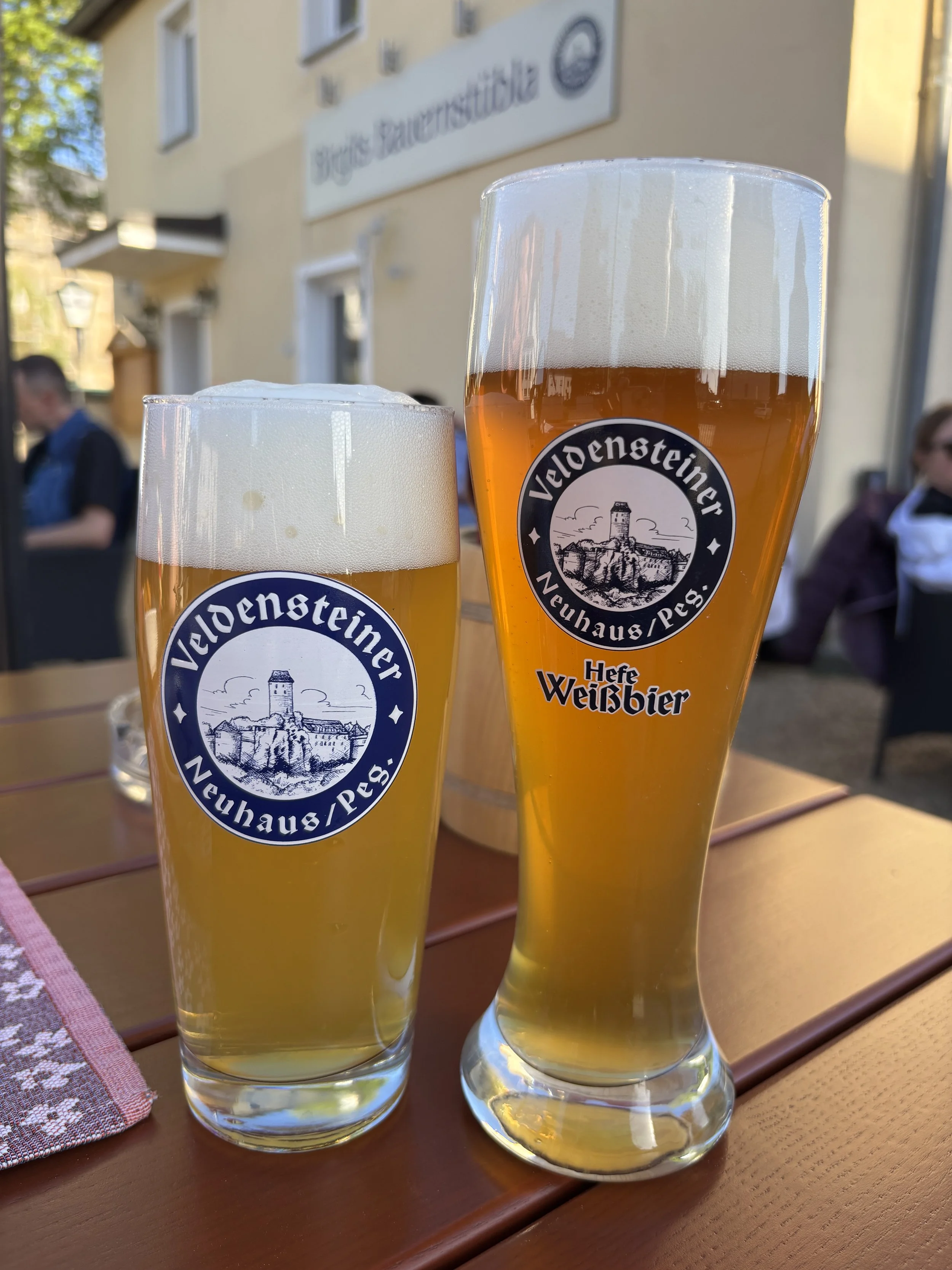
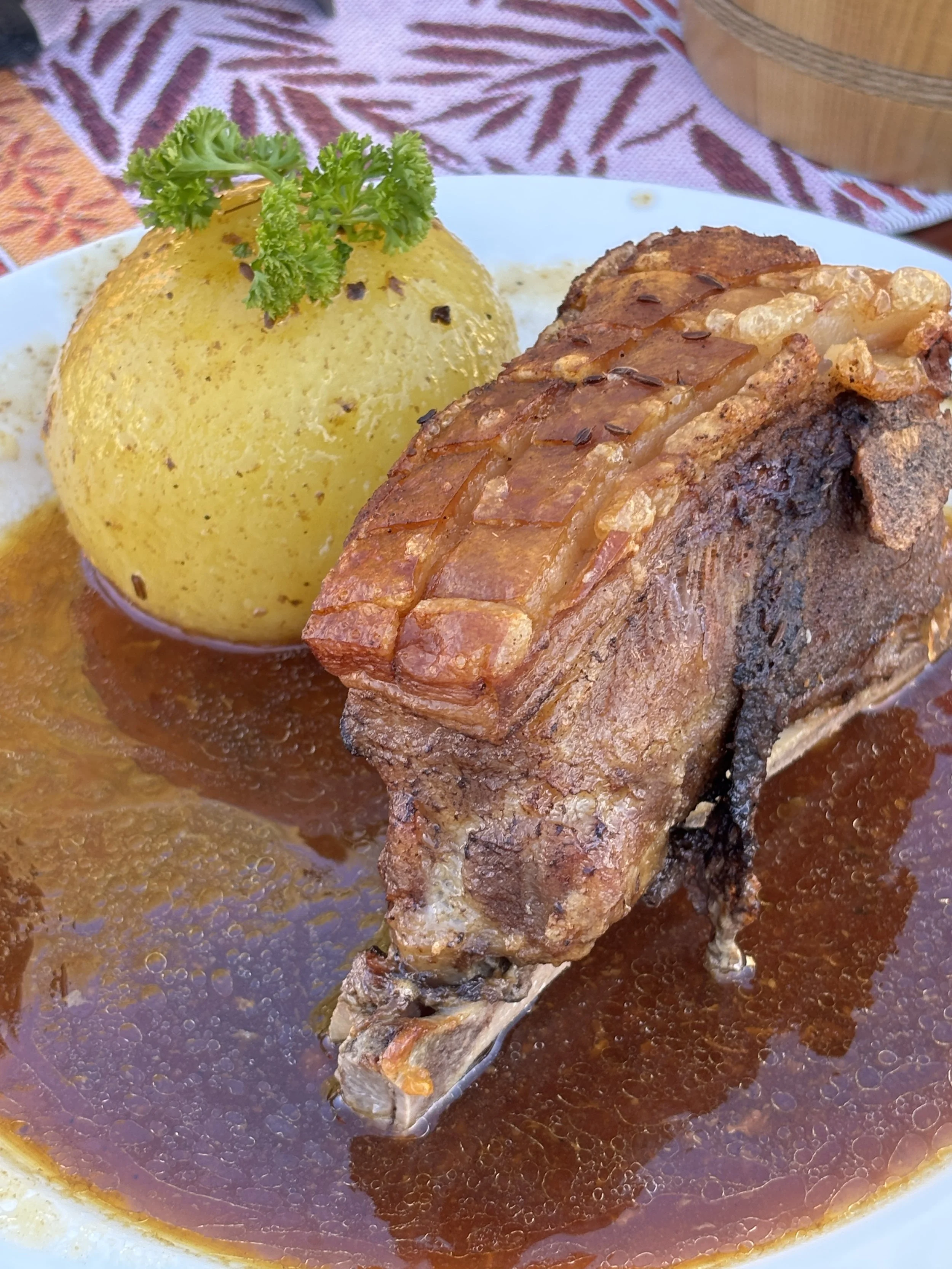
Here I tried Schäufele mit Kloß. This a typical Franconian speciality, which consists in a slow-braised pork shoulder which has been marinated in dark beer. It has a deep, crackling, caramelised crust, the meat underneath which is extremely tender. It is served with a copious amount of gravy and with a side dish of sauerkraut and, another Franconian culinary must, the Klöße.
These are spherical potato dumplings, made from a mixture of raw and cooked grated potato. They are very dense and tasty. All of this, of course, consumed with some local Franconian beer. In this case it was Veldensteiner, made by a craft brewery from Neuhaus an der Pegnitz, a small town east of Forchheim.
Kellerwald & Annafest: exploring artisan beer culture in Forchheim
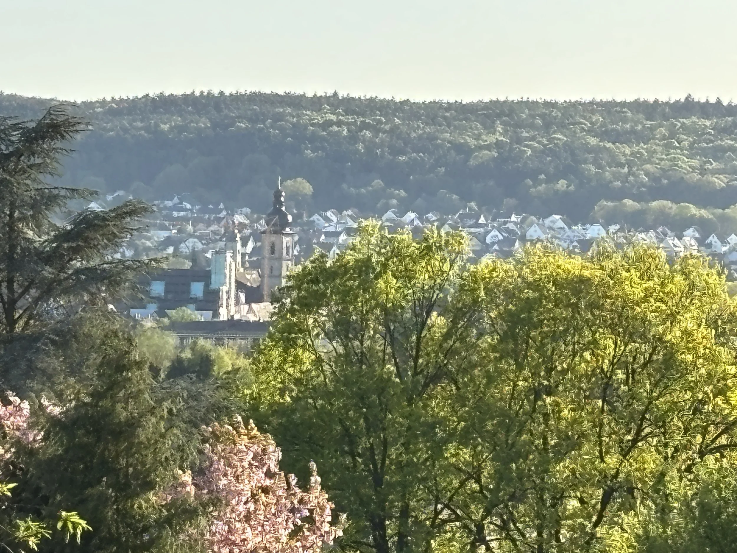
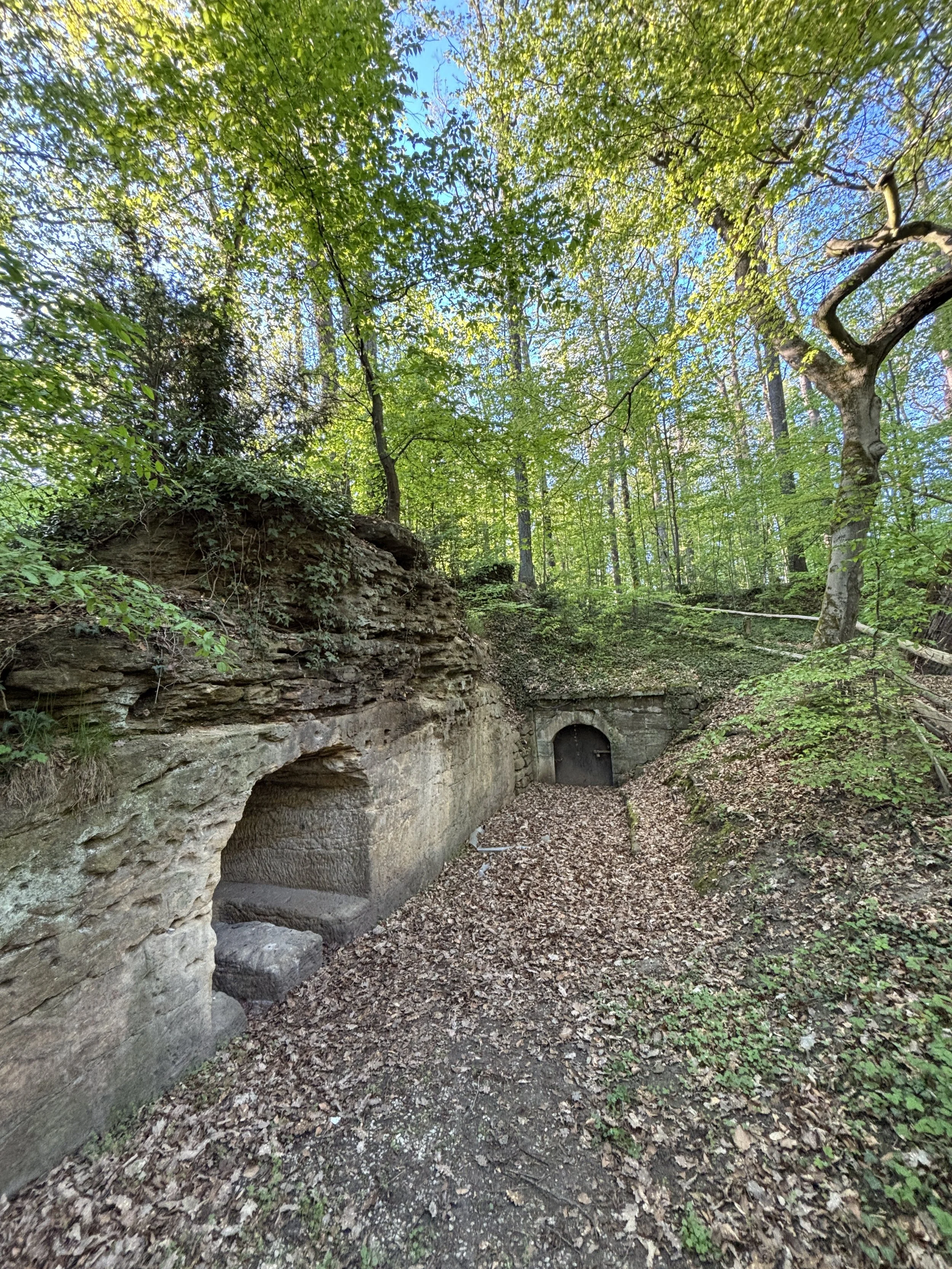
After our exploration of historical Forchheim and local Franconia cuisine, it is time to check a rather unique feature of the town: its underground beer cellars and the whole beer culture around them.
To do so, we leave the downtown and walk a couple of kilometres to the eastern outskirts of town, to a small forested hill known as “Kellerwald” (“Cellar Forest” in German). It is here that, for at least 400 years, the people of Forchheim have used and shaped the natural underground caves that form in the local limestone formations in order to store beer during the latter’s fermentation process.
The production of the type of beer that is popular in this part of Franconia requires relatively cold and stable temperatures and this is what these underground caves provided, since the temperature inside stays constant at around around 6–10°C throughout the year. This was particularly useful in the pre-industrial era, when to artificial refrigeration was available.
Nowadays, of course, you don’t really need to store beer in caves and, therefore, only a small portion of the underground cellar network is still used. However, a number of beer makers around Forchheim have preserved this tradition.
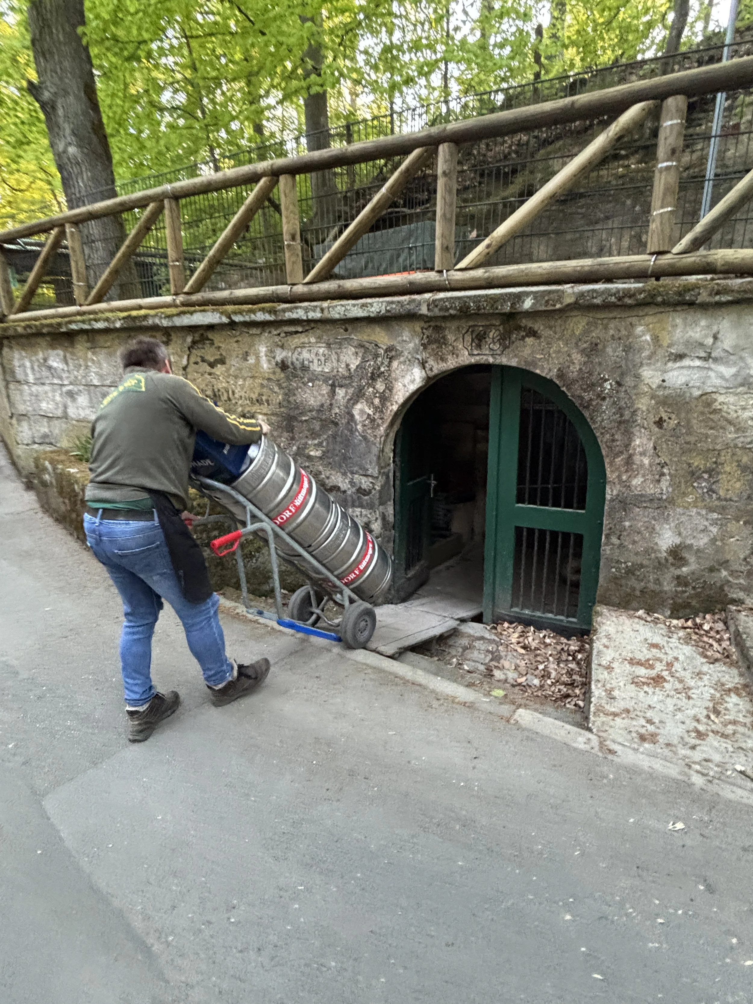
But don’t think of Kellerwald just as some sort of historical curiosity, it is here that, since 1840, Forchheim puts together one of the largest beer festivals in Bavaria, “Annafest”. Named after the festivity of Saint Anna, which is on July 26th (it takes places in the days around it), Annafest congregates some 500,000 people at Forchheim’s Kellerwald for several days (and evenings!) of beer drinking and fun.
Think of it as a sort of small-scale “Oktoberfest”, just that this one takes place in the middle of summer!
Annafest is really a big thing in Forchheim. It is an event that pretty much the whole community plan for during the whole year. There is even an official “Queen of Annafest”, which is elected every two years and represents the town of Forchheim at other similar events and festivals throughout Germany.
But you don’t need to wait to late July to enjoy beer drinking at Forchheim’s Kellerwald. While Annafest is the peak time of the season, the Kellerwald cellars start opening in spring, as soon as the weather is warm enough.
A whole network of beer gardens, restaurants and temporary food and beer stalls springs up around late April or early May and stays put all throughout the summer offering an outdoor venue for the citizens of Forchheim and visitors to enjoy the outdoors while sampling the fresh local beer.
The party at the Kellerwald starts in the evening, before dusk and can go on until relatively late (there are no sleepless neighbours at the Kellerwald!). It is not just about beer, there are also food stalls, live music and, above else, a lot of socializing!

Where to stay in Forchheim
Arivo Aparthotel Forchheim
Bayreuther Str. 1, 91301 Forchheim
This very modern aparthotel was a truly positive surprise. It is located right next to Forchheim’s train station, which makes it super convenient if you are traveling by train. By the way, the aparthotel may be located close to the tracks, but it is also very quiet, I had a room facing the station and didn’t hear a thing from that direction during my stay!).
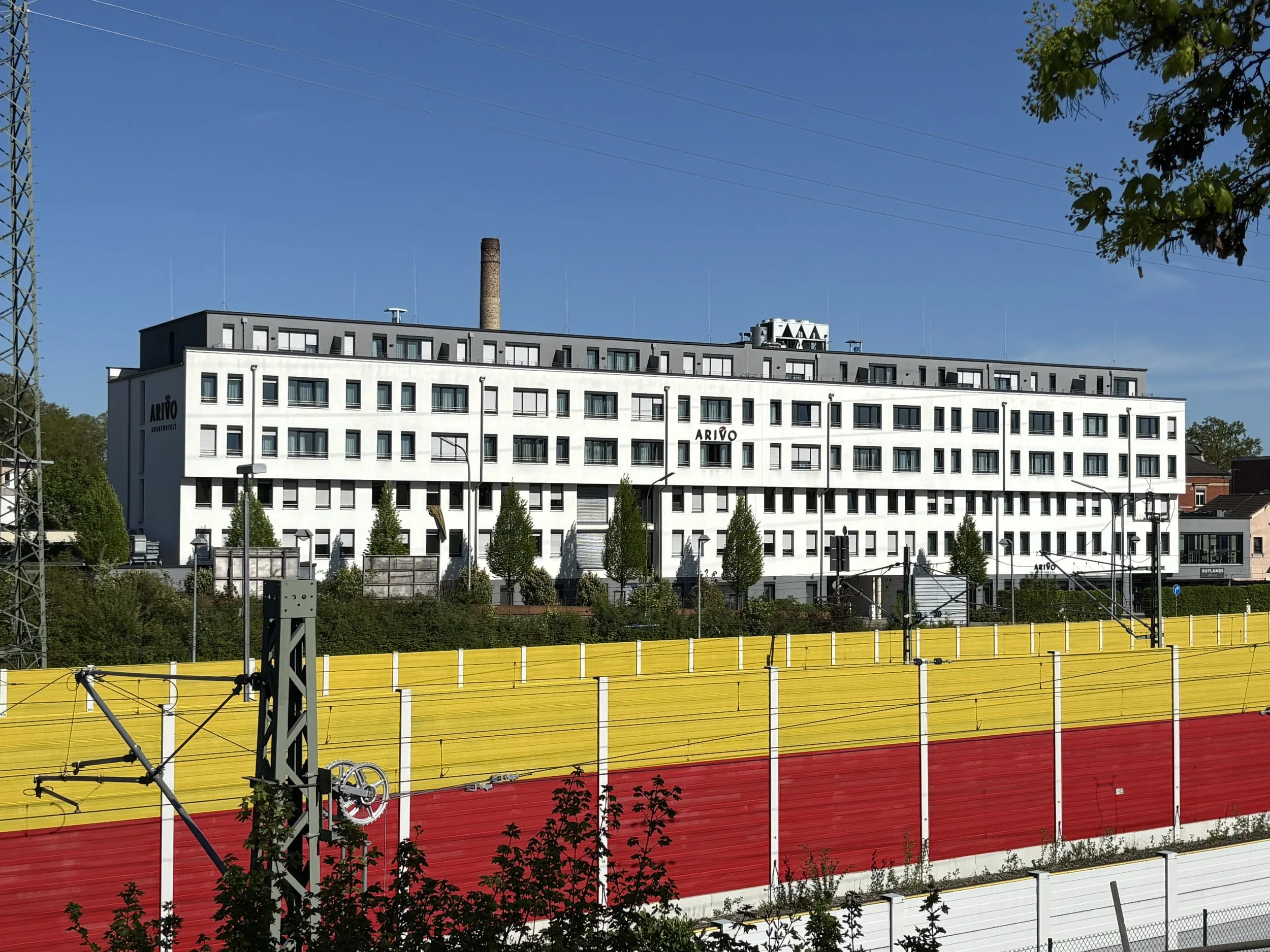
Arivo Aparthotel Forchheim operates a clerk-less checkin, you are given a set of codes with your reservation and you can make your way to the room without having to interact with anyone.
The whole building appears to be really new and modern. My room was super big and had a common bedroom-living room area separated by a false wall which holds a large flat screen tv.
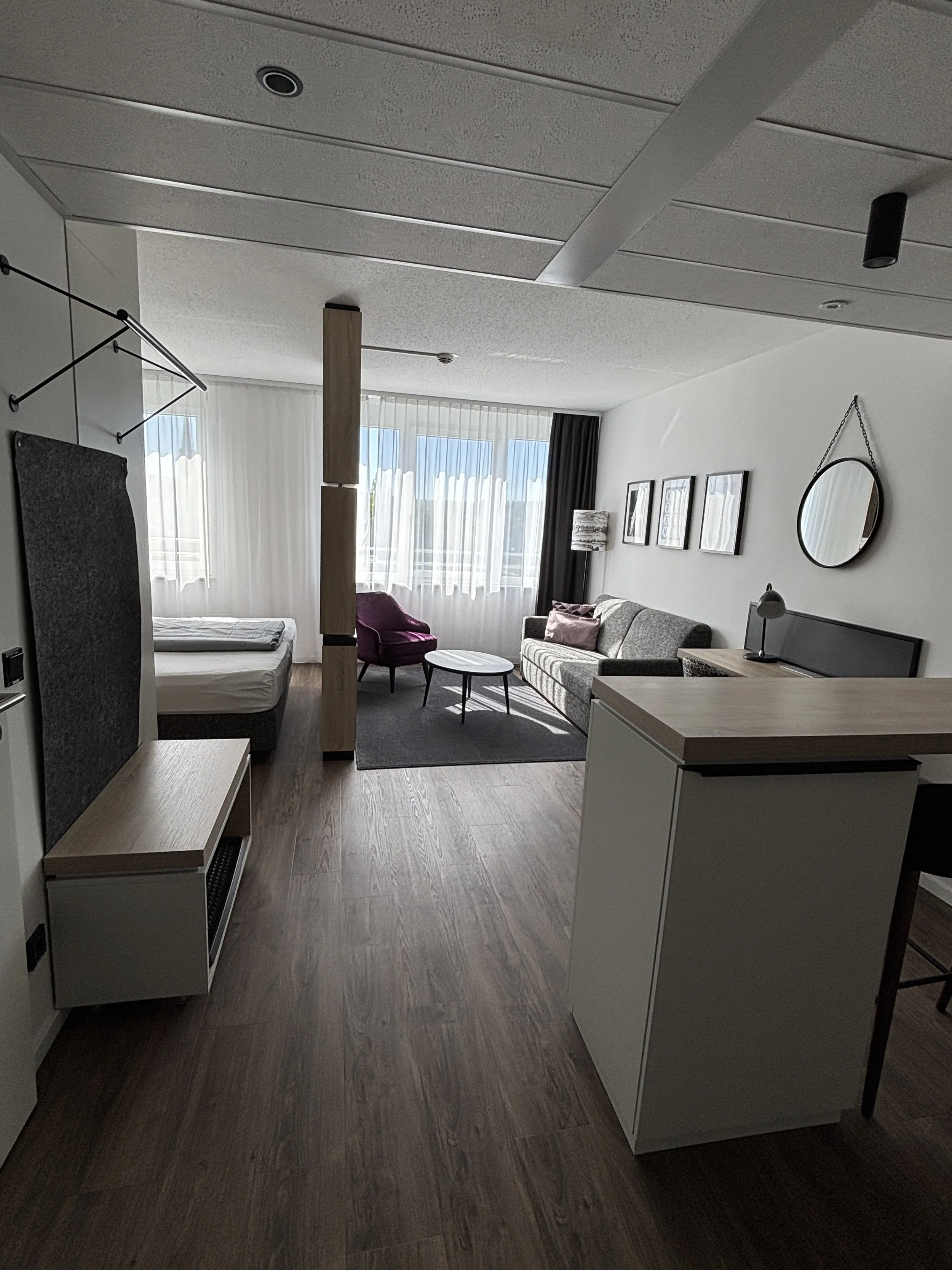
It had also a small kitchen and working desk as well as plenty of space to leave the luggage. There was some complimentary welcome coffee (from a Nespresso-style coffee machine) and some fresh sparkling water in the fridge.
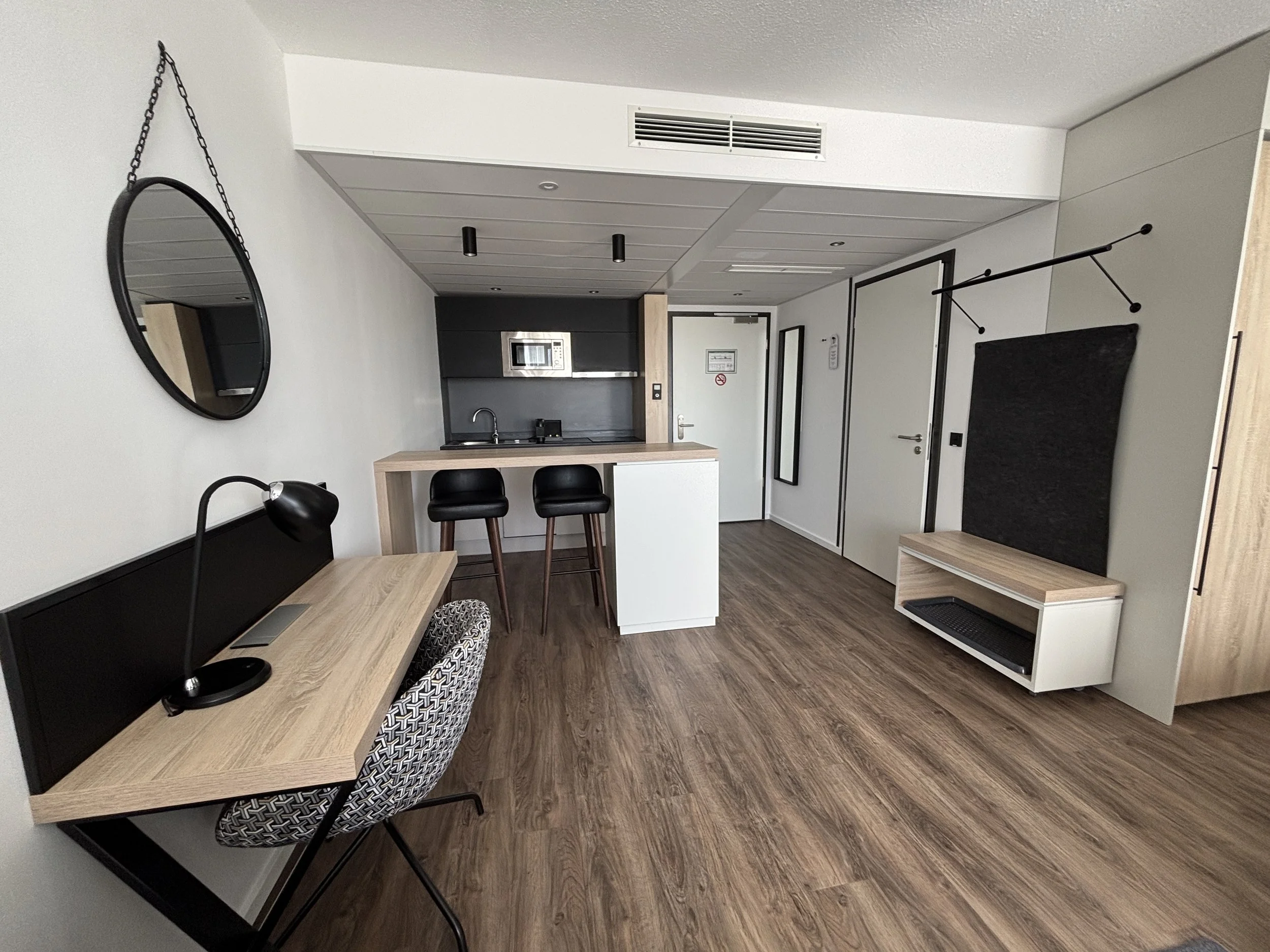
The bathroom is also super modern and in contemporary style. Everything was super clean.
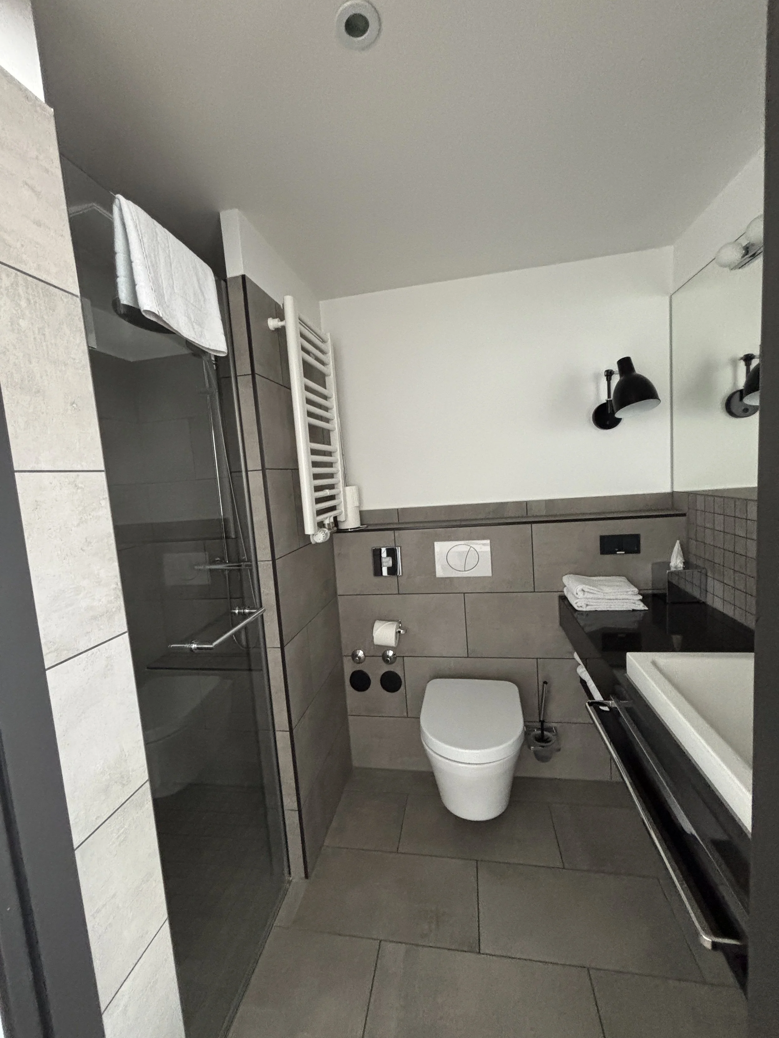
The ground floor has a rather large lobby-common area and restaurant, which is where breakfast is served in the morning. You can get the look and feel of the place in the images below. The breakfast was continental-type buffet.
The Arivo Aparthotel has also parking space, not relevant for me in this case, but I guess, it kind be quite an important detail to mention for those that are touring Franconia by car.
You can book this hotel here!
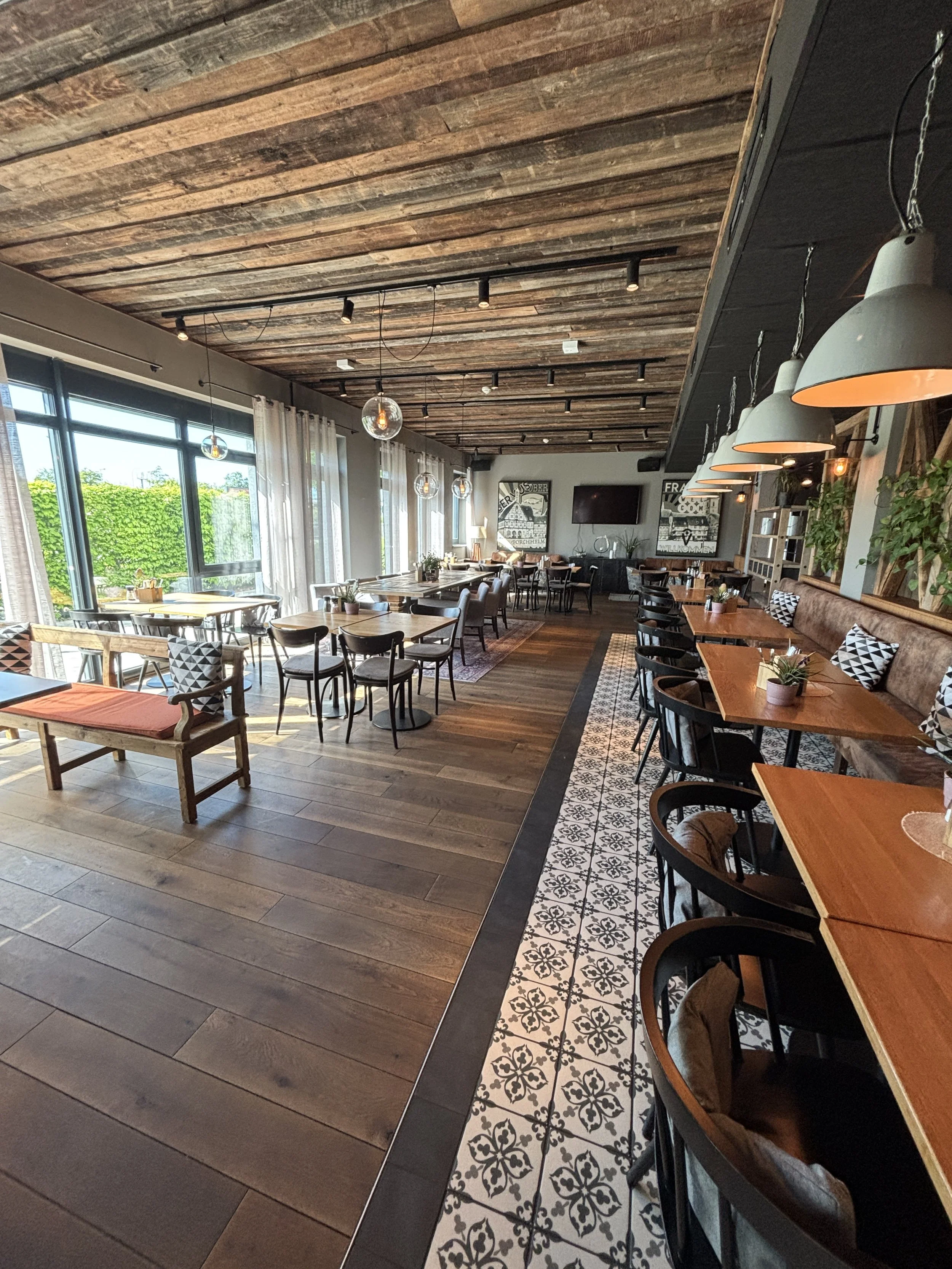
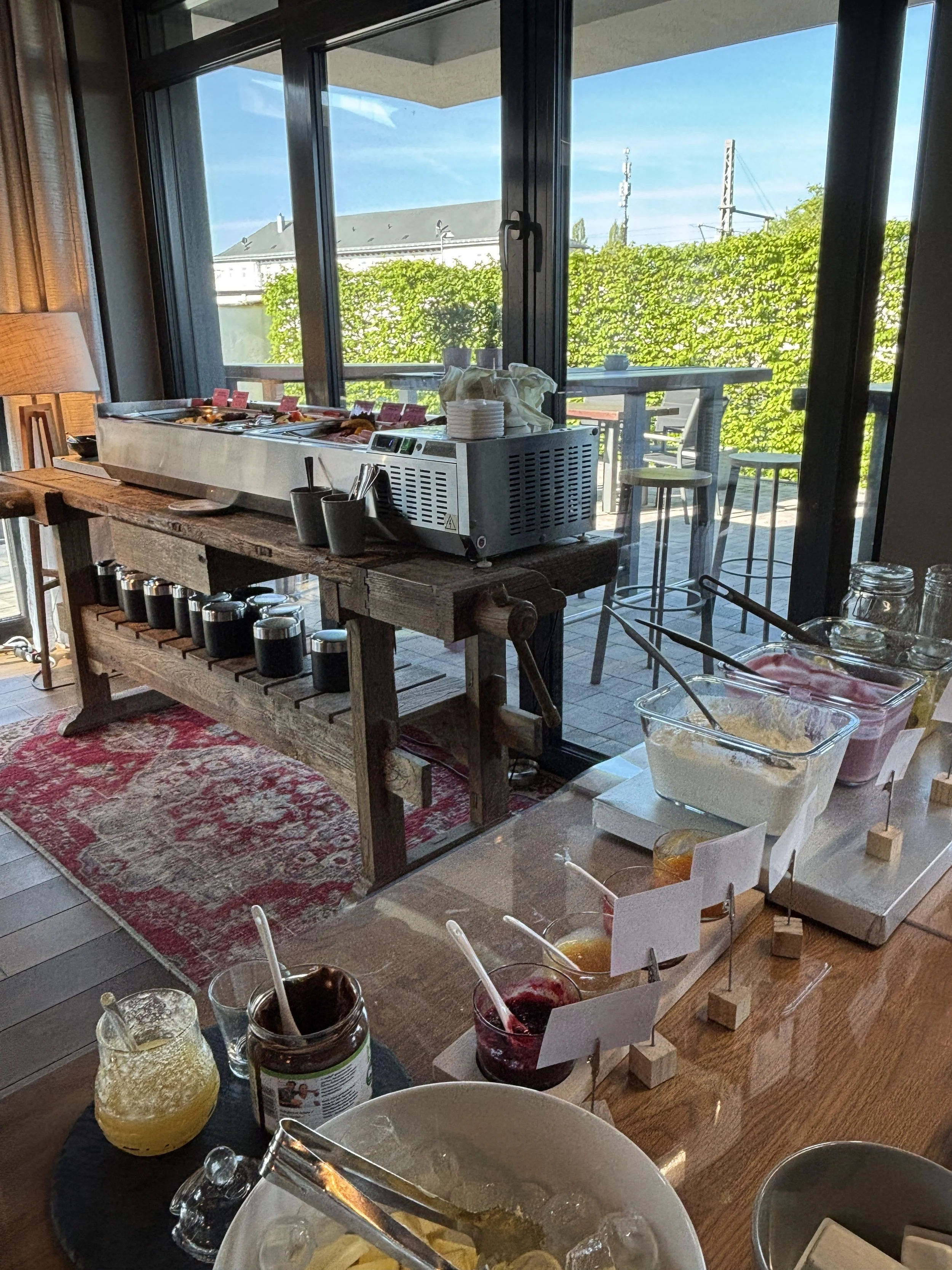
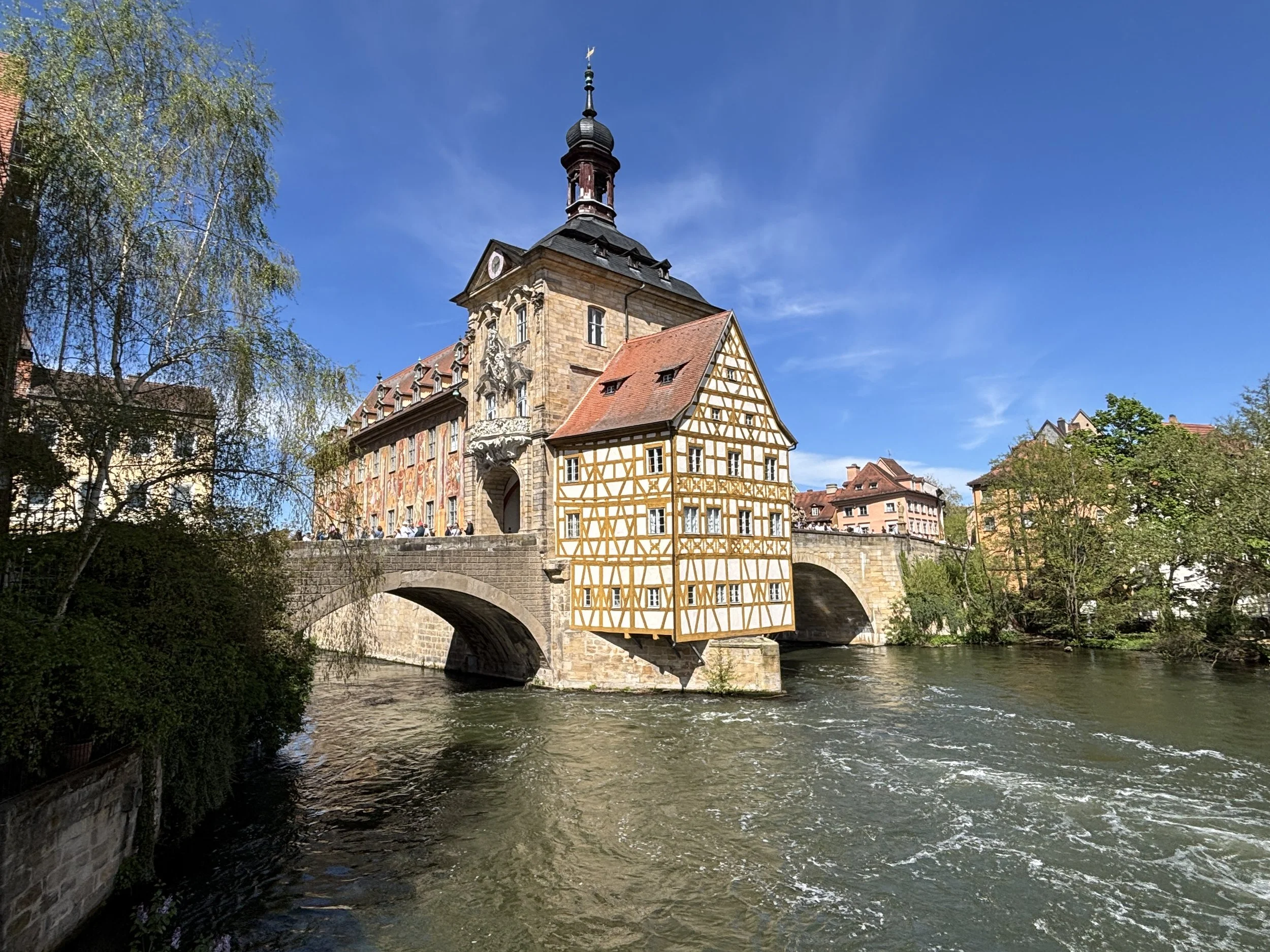
Top things to see and do in Franconia (I): a tour of Bamberg
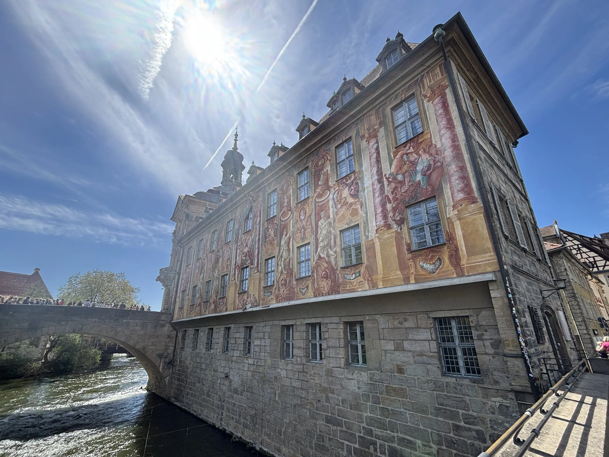
If you are looking for a Germany of charming fairy tale towns, almost intact medieval heritage, artisan beer and bratwürst, look no further than Franconia.
A Russian doll of cultural identities, local pride rules strong in Franconia (“Franken” in German), which is a historical region of northern Bavaria, itself, a former Kingdom and one of the parts of Germany that has most fiercely preserved its own character and distinct identity.
Culturally, it is equally varied: part of it is wine country, while other areas lean firmly towards beer; and while Bavaria is predominantly Catholic, Franconia contains Protestant enclaves, such as the city of Fürth.
This is perhaps due to the fact that, like much of the German lands, historically, Franconia was a complex patchwork of sovereignties, with different rulers sometimes having overlapping claims to parts of the land. Among them, Nuremberg held a pre-eminent role, since it is the place where the Imperial Diet (of the so-called “Holy Roman Empire”). Franconia only became part of Bavaria in the early 19th century, when the whole area became one of Napoleon’s client states.
In fact, Franconia is large enough that it can be divided in three large areas: Upper Franconia (Oberfranken), Middle Franconia (Mittelfranken) and Lower Franconia (Unterfranken), although this series of posts will cover only a relatively small central section of it, starting in Bamberg in the north and ending in Nuremberg at the southern end of my itinerary.
What’s more, unlike in other itineraries that I have featured on this site, this time my entire journey was done by train, since all four Franconian cities that I had the chance to visit (Bamberg, Forchheim, Fürth and Nuremberg) sit neatly in a straight line. This was, I think, a pretty efficient (and sustainable!) way to explore this region.
So, this post is the first of a series of four installments in which I will share my impressions of this region and some tips about what to do and what to see when visiting Franconia.
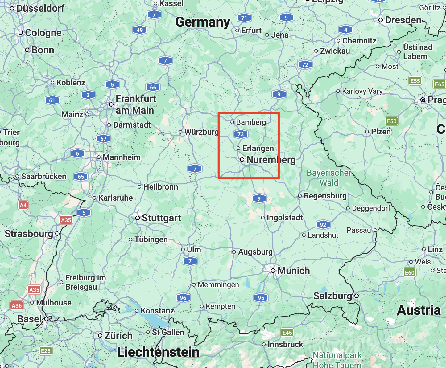
My itinerary started in Berlin, from where I traveled by train to Bamberg and then moved continued moving south always by train, all the way to Nuremberg, the largest city of the lot, by far.

This post may contain affiliate links. If you book or buy something through them, I earn a small commission, at no extra cost to you. It's one of the ways I keep Places of Charm going. Thank you for your support.
I would like to thank also Franken Tourismus for facilitating this journey through Franconia and the visit to Bamberg with excellent local guide Sabine. All opinions are my own.
Half a day in Bamberg: what to do and what to see

Bamberg is one of the jewels, not just of Franconia, but of Bavaria as well. Besides being a town of historical significance (it used to be the capital of a small principality ruled by a bishop), Bamberg was practically untouched by WW2, so most of what you see here is what a German pre-industrial city used to look like. Since 1993, Bamberg has been a UNESCO World Heritage Site.
What’s more, it’s geographical setting greatly enhances its historical attractiveness. First, there is the fact that, like Rome and several other cities of note, the city of Bamberg was built on seven hills. Then, there is the presence of the river Regnitz, a tributary of the Main, and therefore, the Rhein, which is navigable and accessible by river cruises (such as those operated by Viking Cruises, an old friend of this site!) and other operators. The river divides its waters between several canals when it passes through Bamberg’s old town, adding significantly to the aesthetics of the place.
I arrived at Bamberg’s main train station mid-morning and, after leaving my luggage at the station’s storage area (make sure you have €2 and €1 coins with you!) I headed on foot towards the old town, which is a mere 15-20 walk away.
I was to meet my guide for the day, Sabine, at Schlenkerla, Bamberg’s most iconic brewery (more on this place further down this article), for a quick but relatively intense walking tour of the city.
Bamberg’s “Little Venice”
When approaching Bamberg’s old town from the train station, you will first have to cross the Reignetz and its several canals. You will then be in an area popularly known as “Little Venice”, obviously because of its connection to water.
There is even a gondola service that would give you a ride through the canals for a fee! Or, if you prefer something more conventional, you will also find here several boats that a carry tourists around. We didn’t do that, and went for a stroll along the banks of the Reignetz instead.
When the weather is nice, as was the case during my visit, Bamberg’s river side is an amazingly beautiful place. However, crowds can form at some spots, and for good reason!
One such spots is the small island that holds what is one of Bamberg’s most distinctive buildings, the old town hall (“Altes Rathaus”), which is the beautifully ornated historical building the picture of which opens this article.
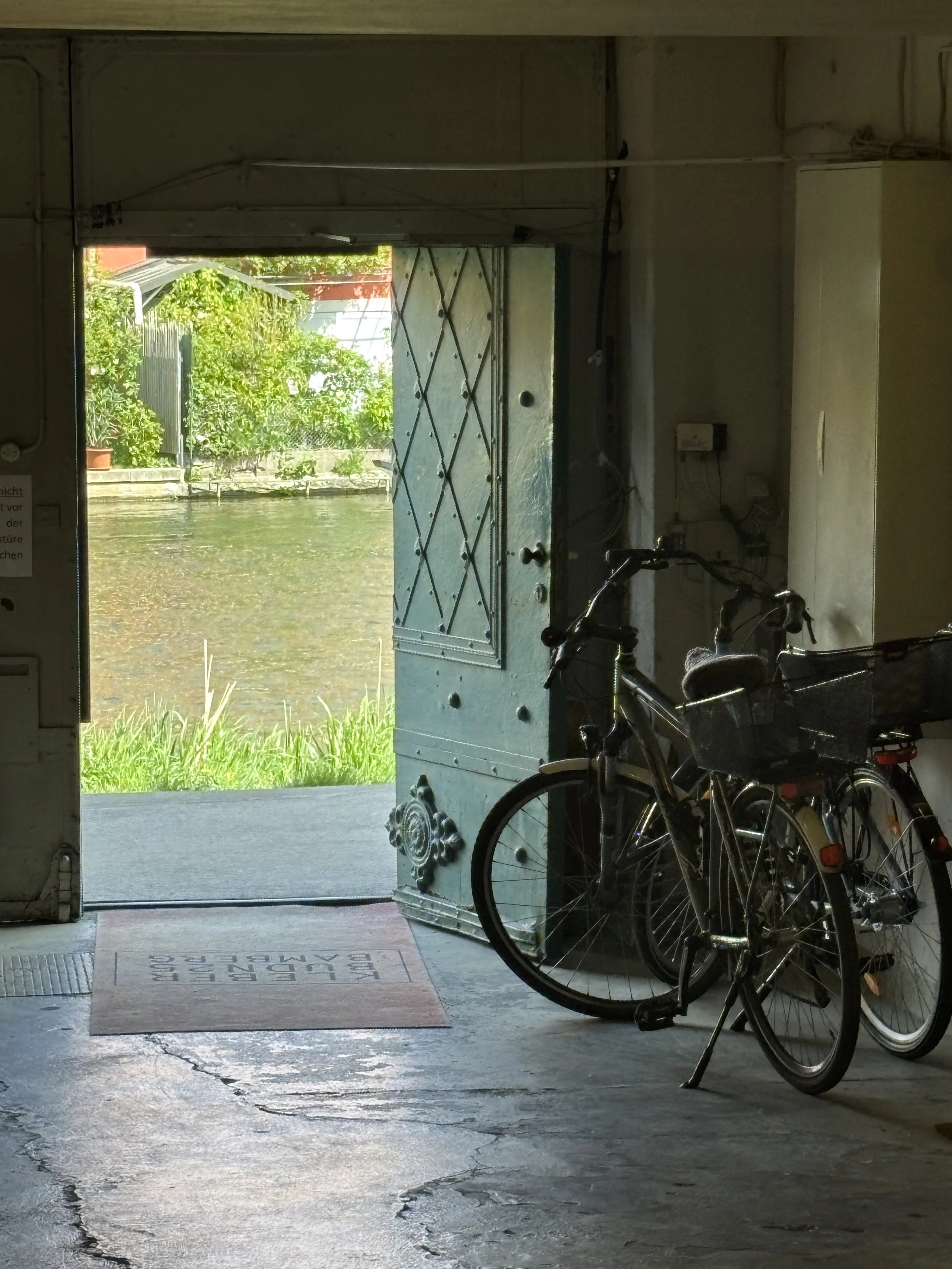
The whole area along the river banks, though, is pretty harmonious and makes for a pleasant walk.
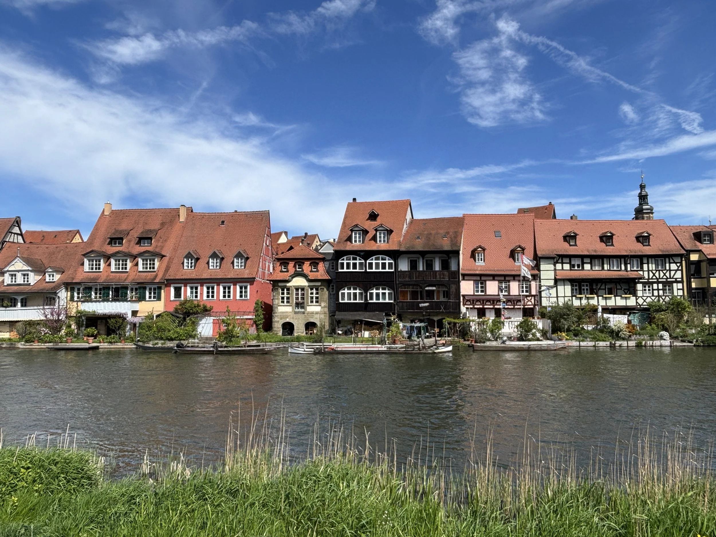
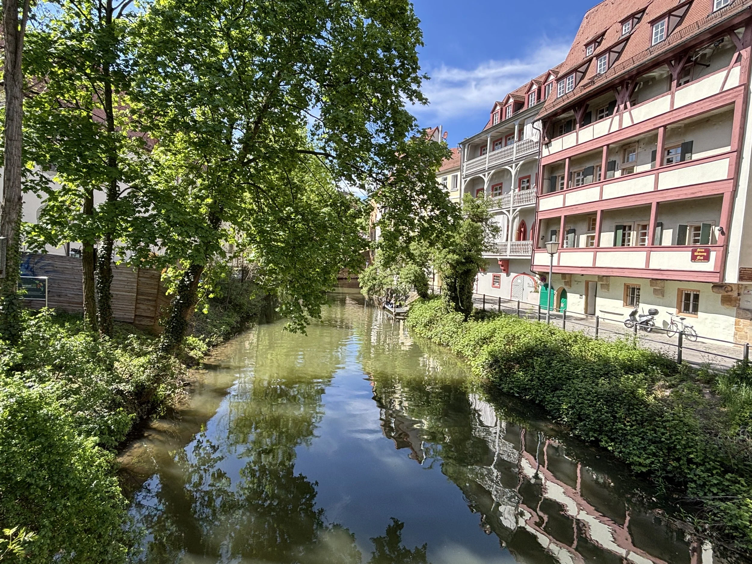
A walk through Bamberg’s old town
Our itinerary then took us uphill, for it is at the top of one of Bamberg’s seven hills that we find what was the nucleus of Bamberg’s political and ecclesiastic power for around eight centuries.
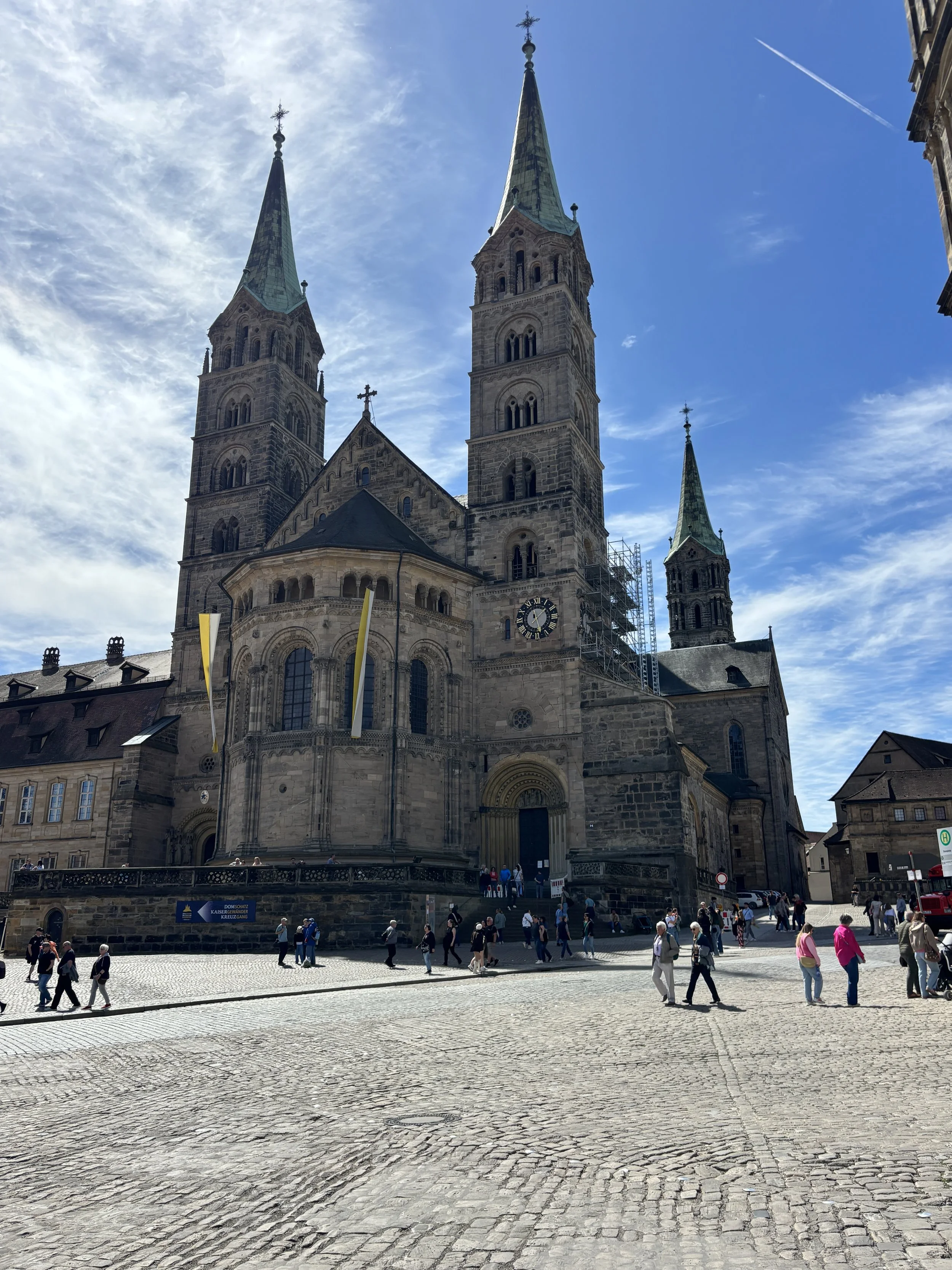
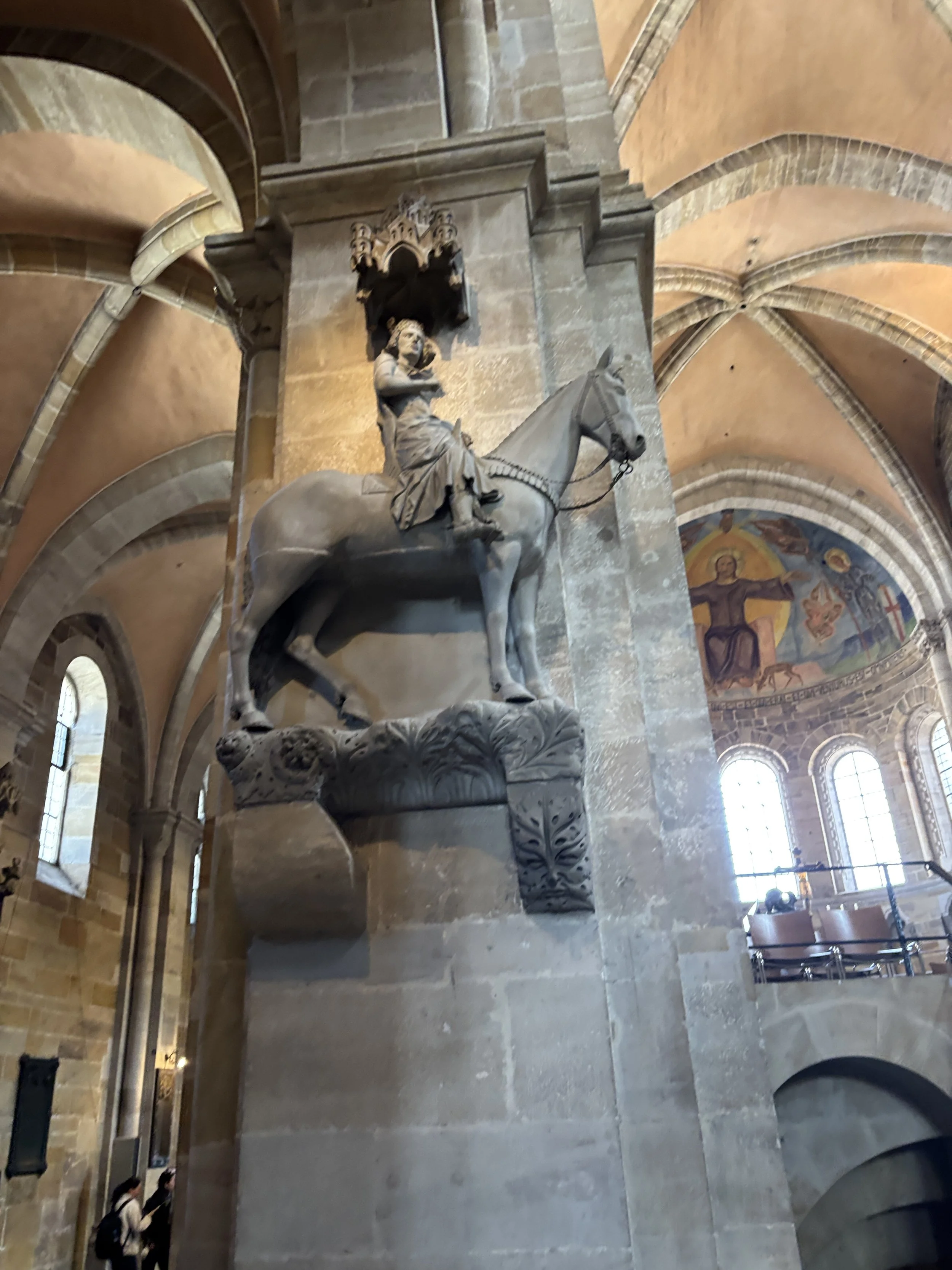
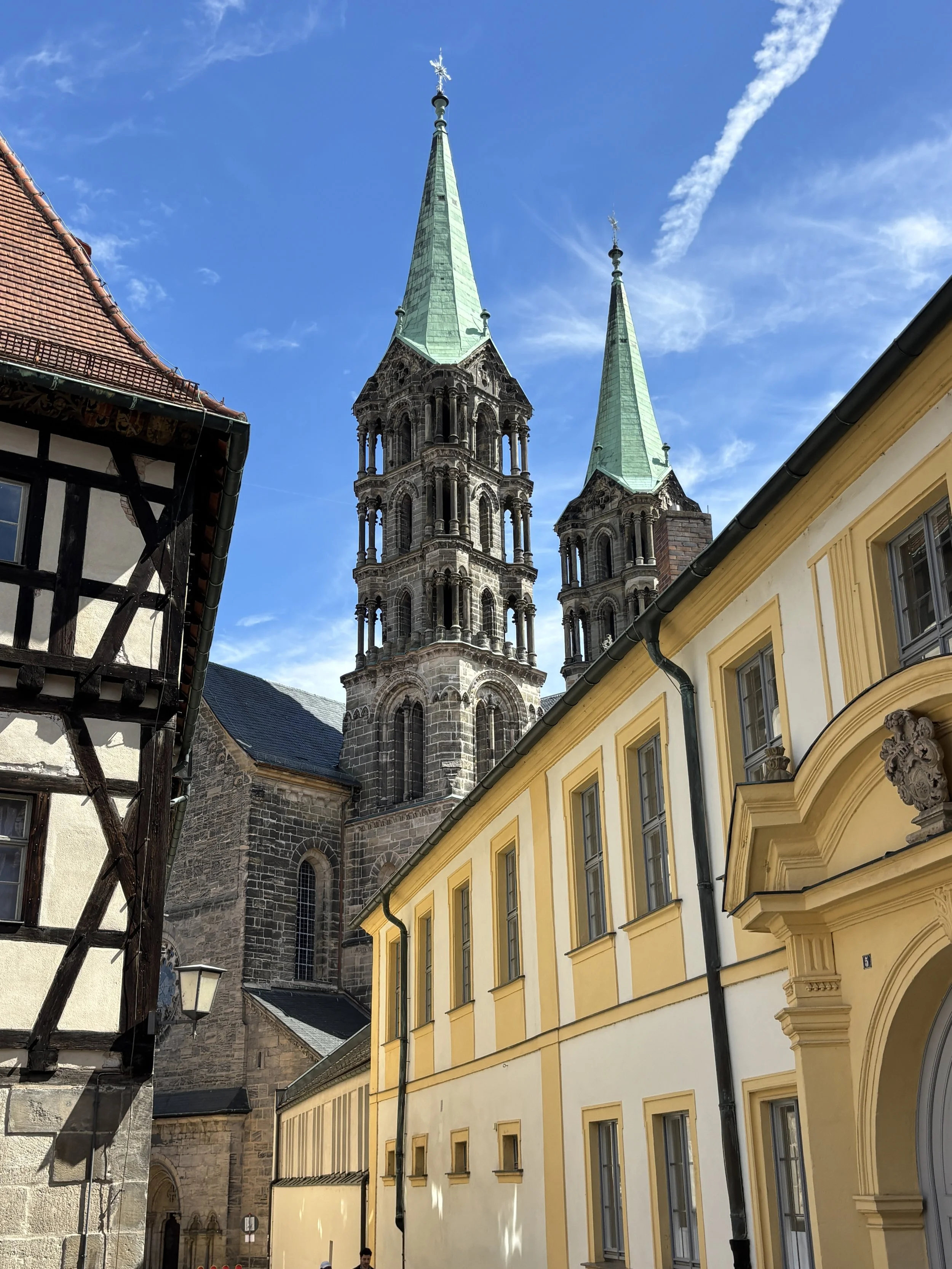
Bamberg’s Cathedral (“Bamberger Dom”) is the most imposing building of the lot and, from its hilltop position dominates the rest of the town. It has Romanesque and Gothic elements and no less than four towers.
Besides its religious and political importance, Bamberg Cathedral has two interesting curiosities: it has the tomb of Pope Clement II, which is the only papal tomb north of the Alps.
And it also has the Bamberg Rider, “Bamberger Reiter” in German (picture above right), which is a 13th C. statue which, to this day, no one knows who does it represent.
It is here, adjacent to each other and structured around a large open and somehow inclined square, that we find two other very prominent structures.
One of them is the Old Court, which is one of the oldest structures in the city and once upon a time an Epicospal residence, the other is the Neues Residenz (below), which was the main palace of the princely bishops of Bamberg.
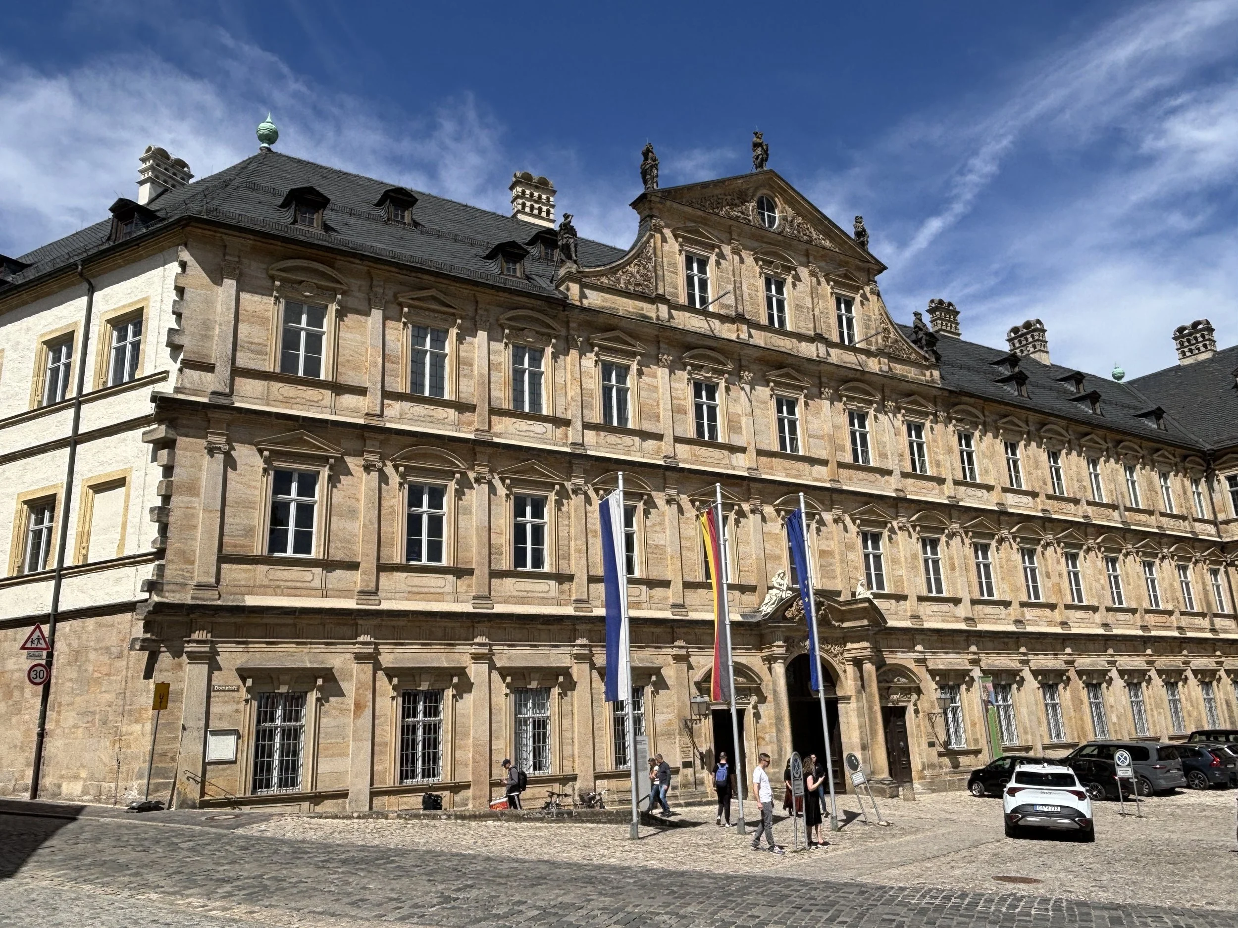
Below you can see the Old Court, which is a collection of very old timbered buildings organized around a central courtyard.
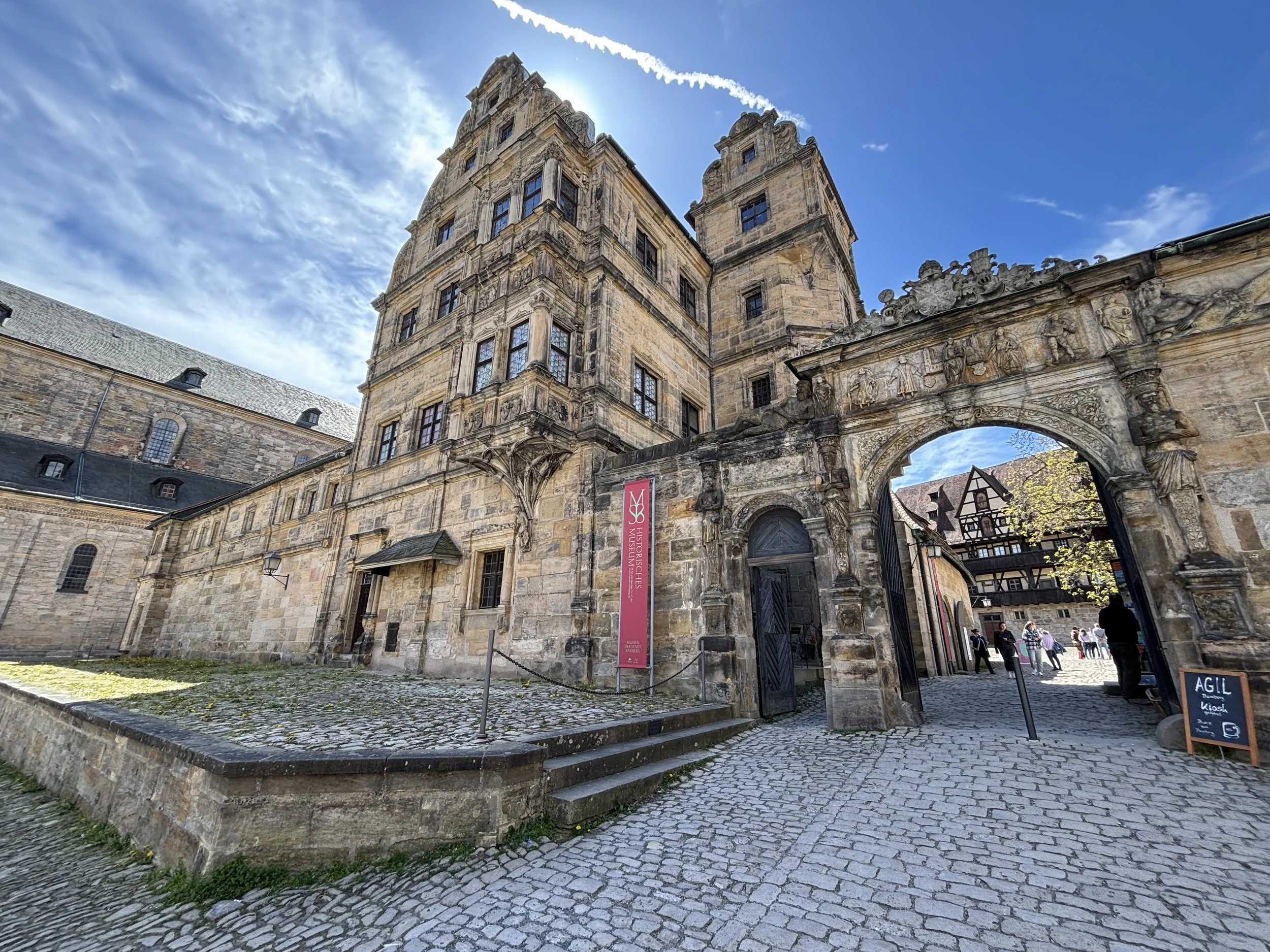
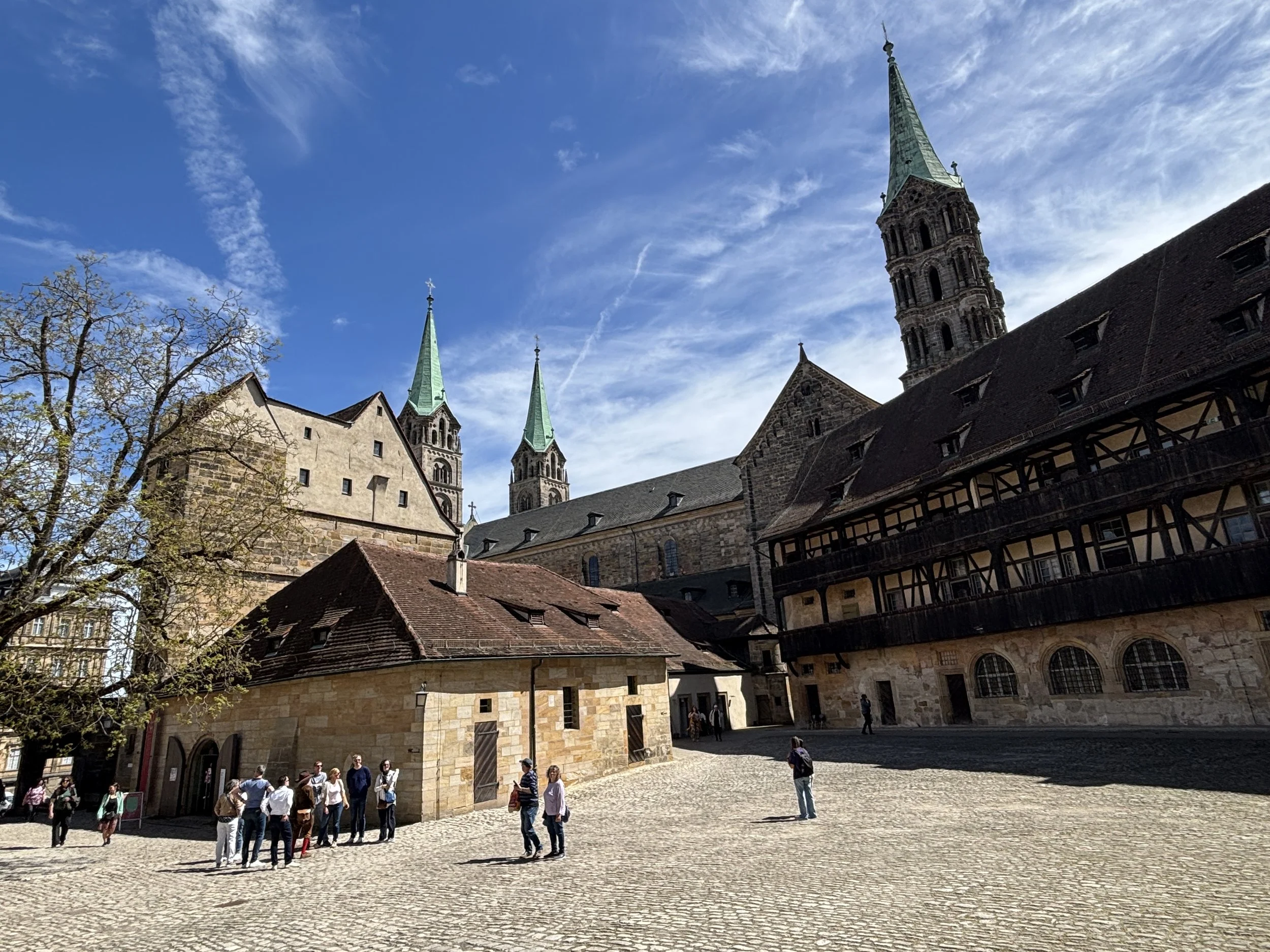
The old town of Bamberg is surrounded by greenery and, while there is a constant flow of tourists, it has quite a few quite and really calm spots.
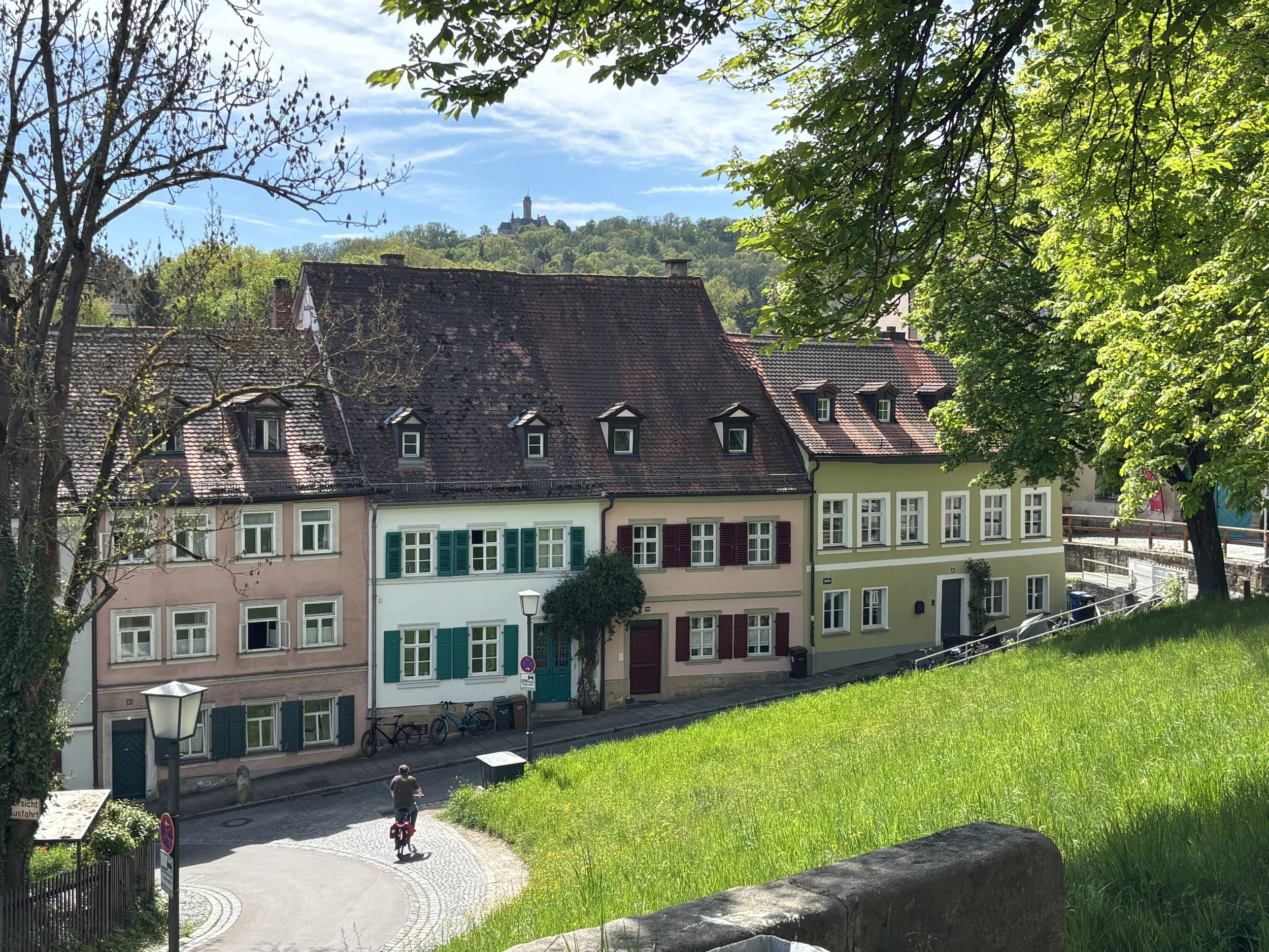
Another building of note is the Monastery of St Michael, which sits on top of another of Bamberg’s hills (the” Michelsberg”). It was built in the 11th C. as a Benedictine monastery and was secularized in the early 19th C.
It is one of the most iconic elements in Bamberg’s skyline, particularly when seen from the Rose Garden. The latter, which is an annex of the Neues Residenz, is a perfectly manicured classical garden which opens onto a terrace providing what is likely the best panoramic view of the city.
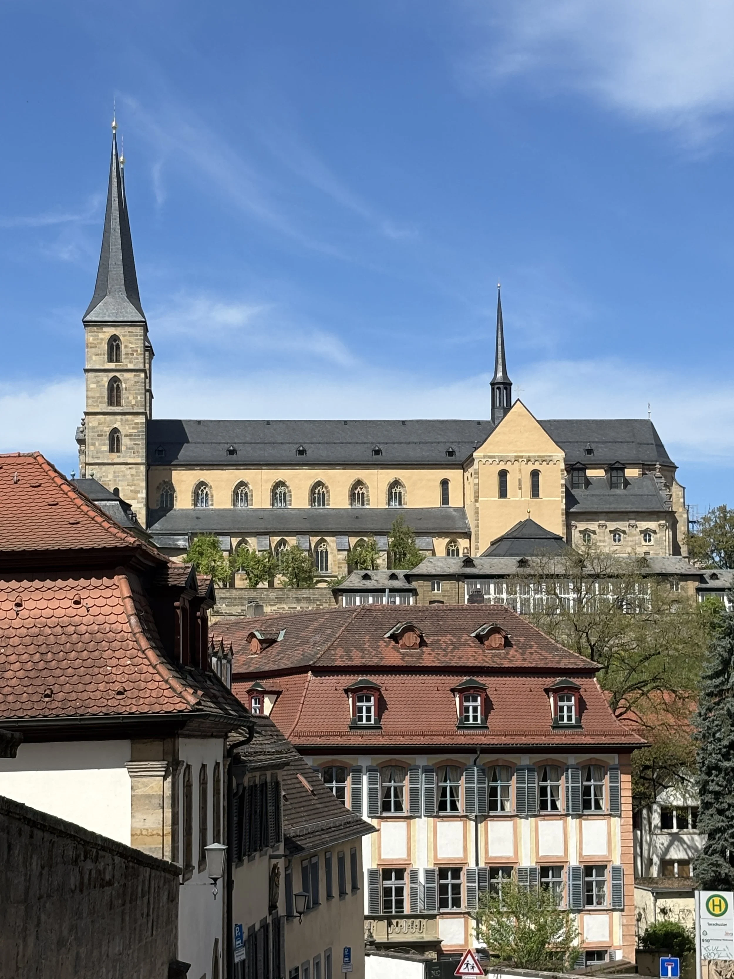
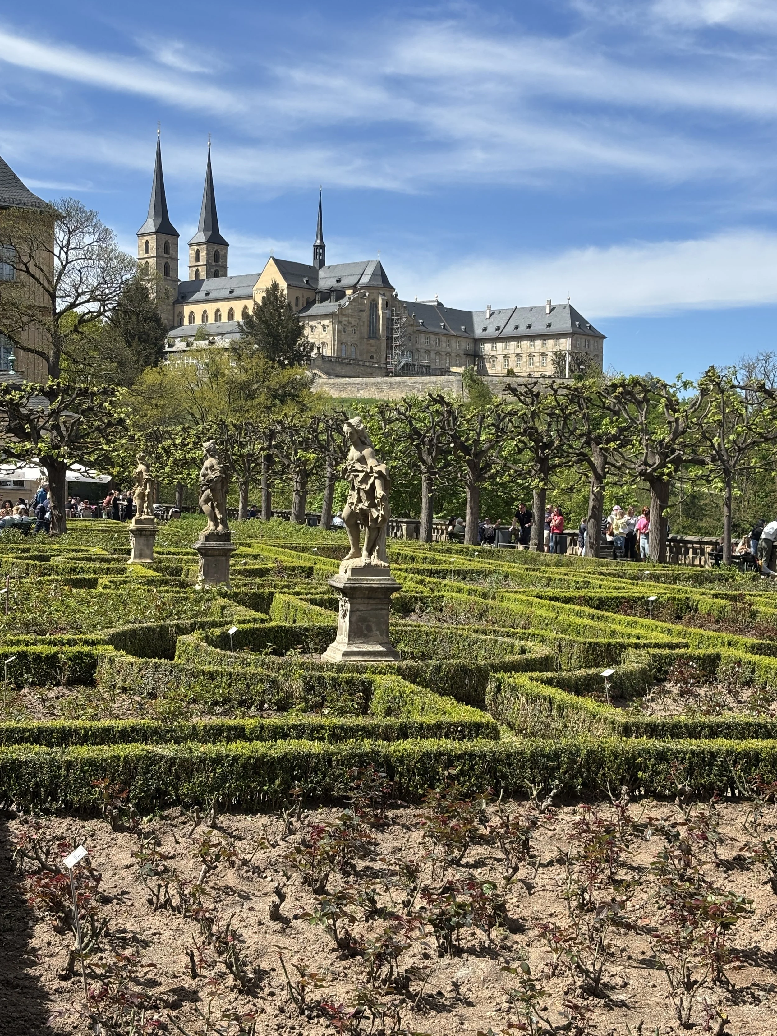
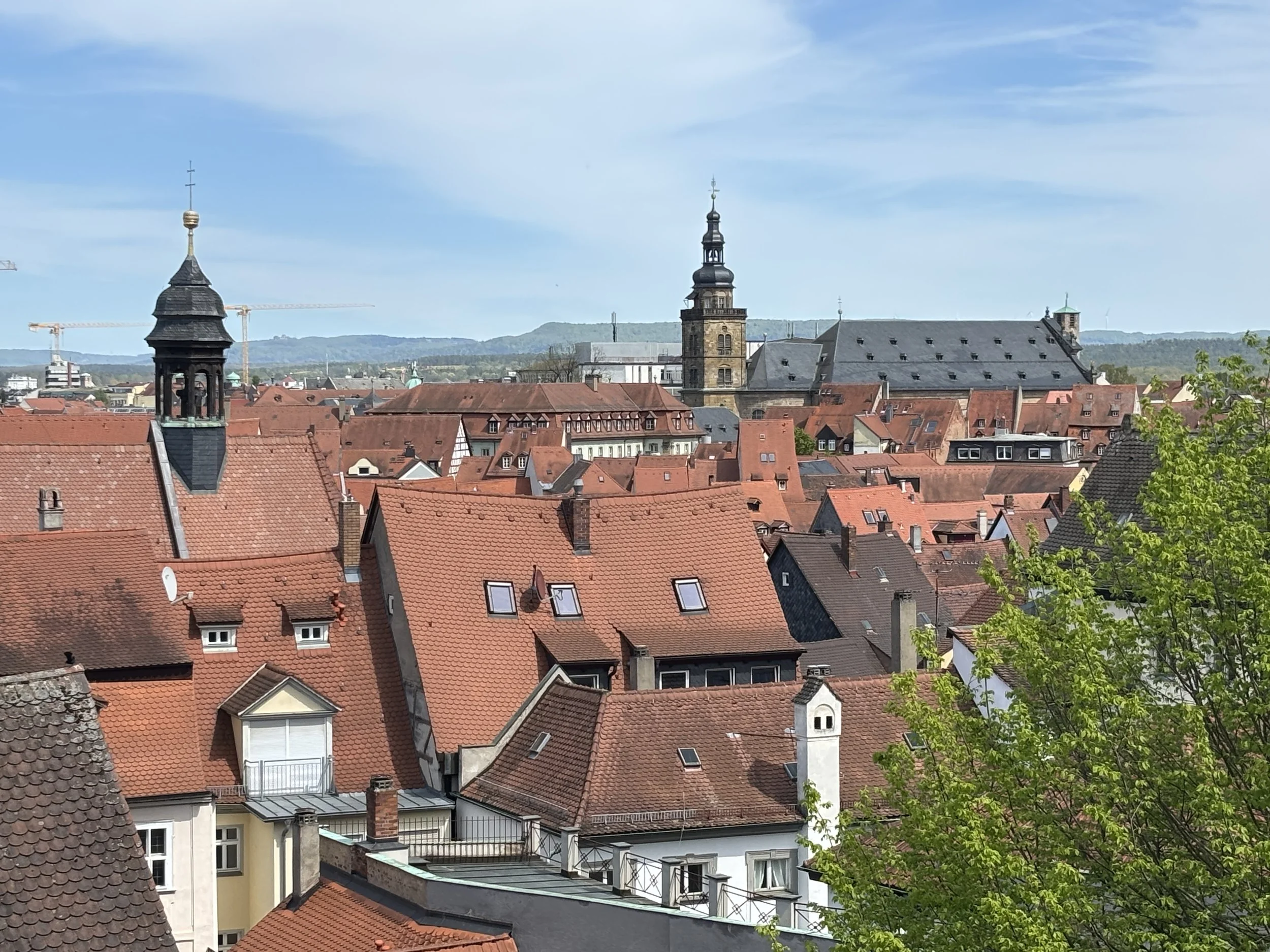
The walk through old Bamberg took us through several picturesque locations, with the unequal terrain offering several interesting perspectives.
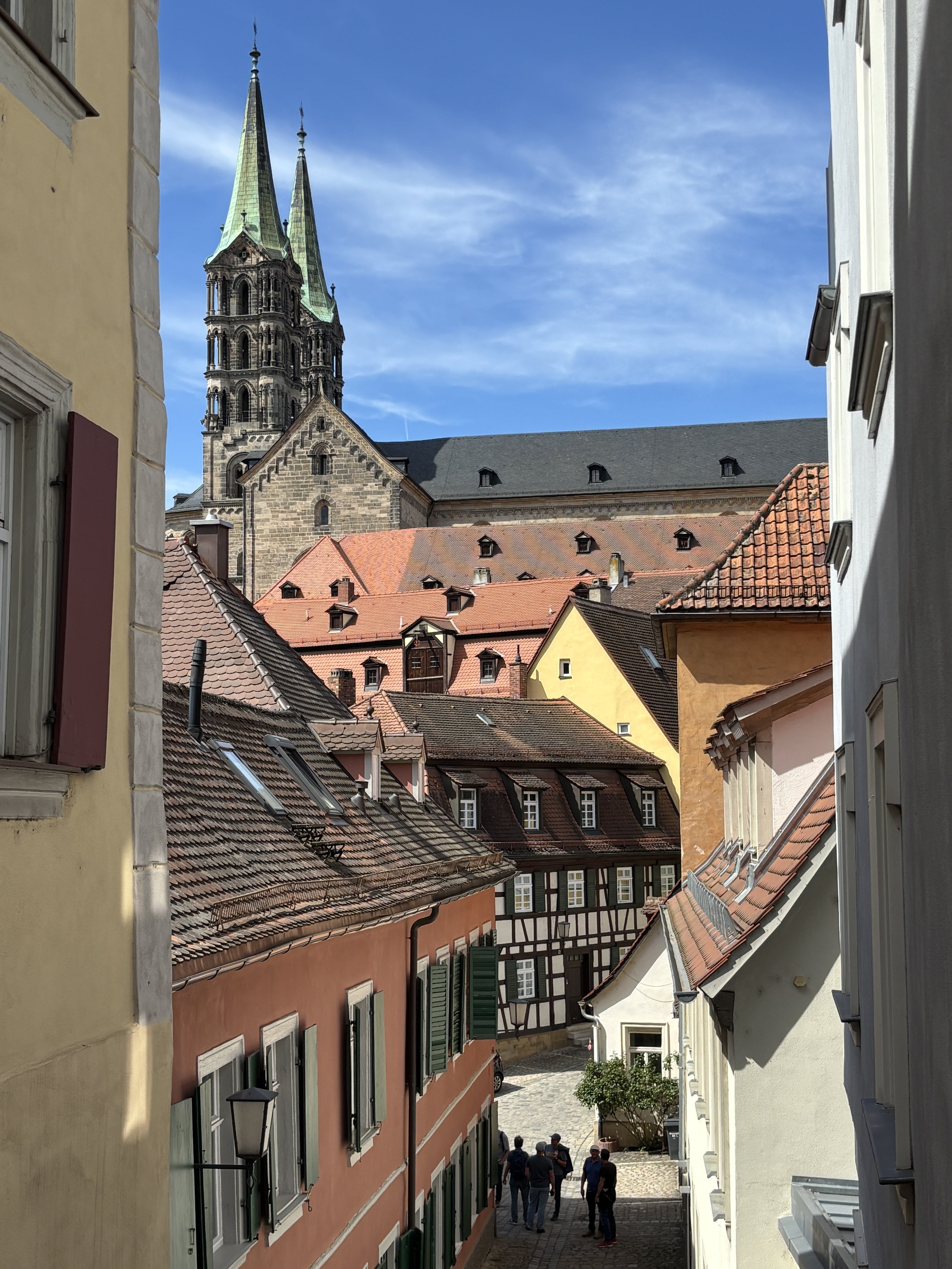
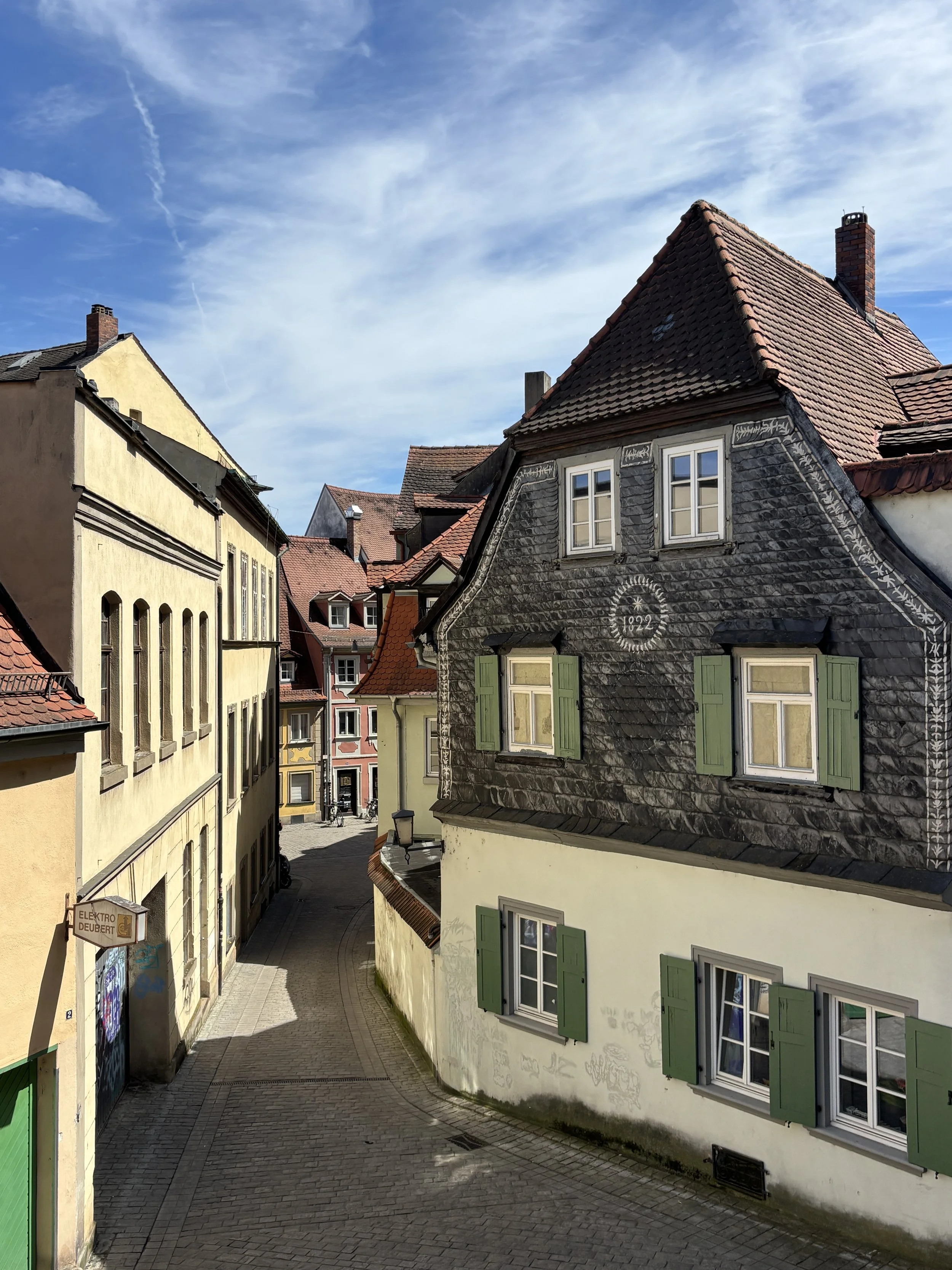
There are several other large churches of historical interest in Bamberg, such as Saint Jakob (a branch of the “Way of Saint James”, the famous pilgrimage route, passes apparently through Bamberg), Saint Stephan and the Parish Church of Our Lady (“Pfarrkirche Unsere Liebe Frau”). We only visited the latter of these, which is presided by a rather magnificent Baroque altar.
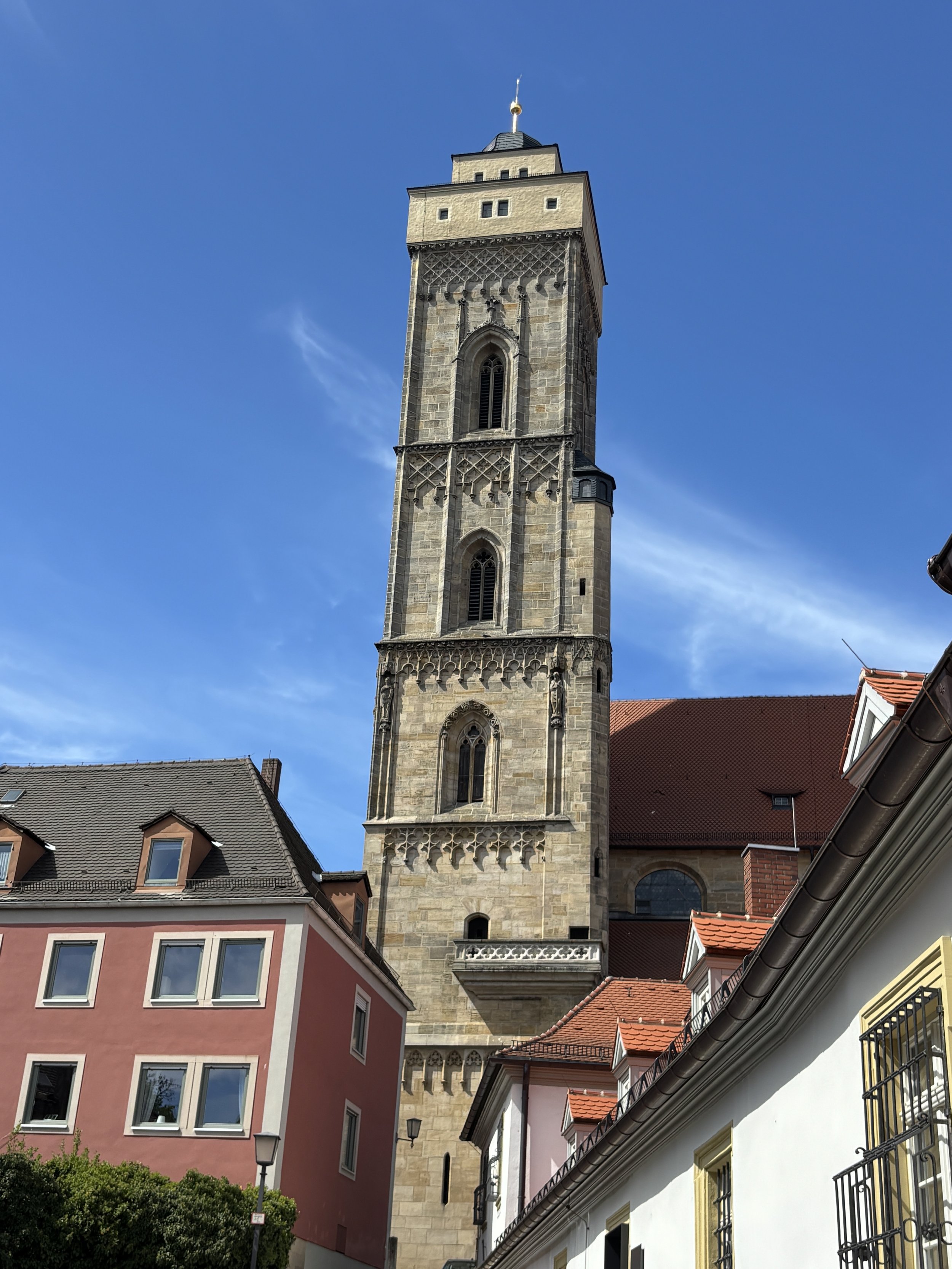
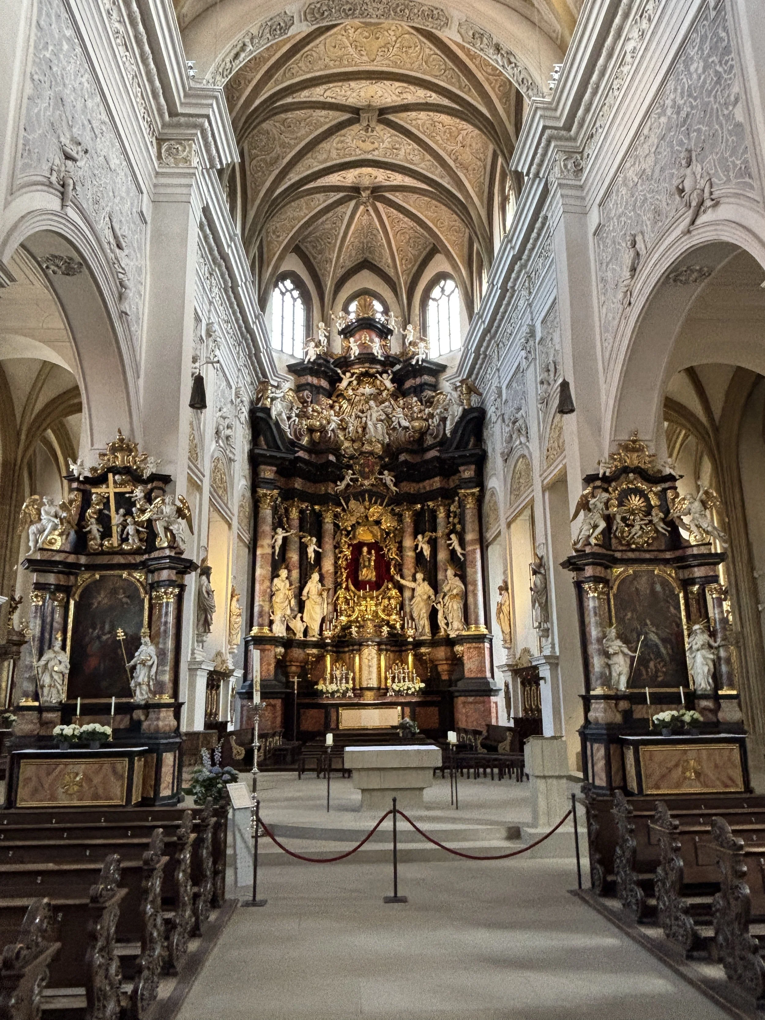
Where to eat in Bamberg
Schlenkerla Rauchbierbrauerei
Dominikanerstraße 6
96049 Bamberg
Bamberg is known for its smoked beer (Rauchbier) and no better place to taste it than its oldest and most renowned brewery, Schlenkerla.
This beer house was reportedly established in 1405 and it still produces smoked beer in the traditional way (using malt that has been dried over burning beechwood instead of hot air, a process which infuses the grain with a distinctive smokiness before fermentation). It is served in two versions: dark and light, with the latter being seasonal and available only in spring and summer.
So, if you wish to get the full Bamberg experience, make sure you stop by Schlenkerla to try it, even if you are not a regular beer drinker, as it is my case.
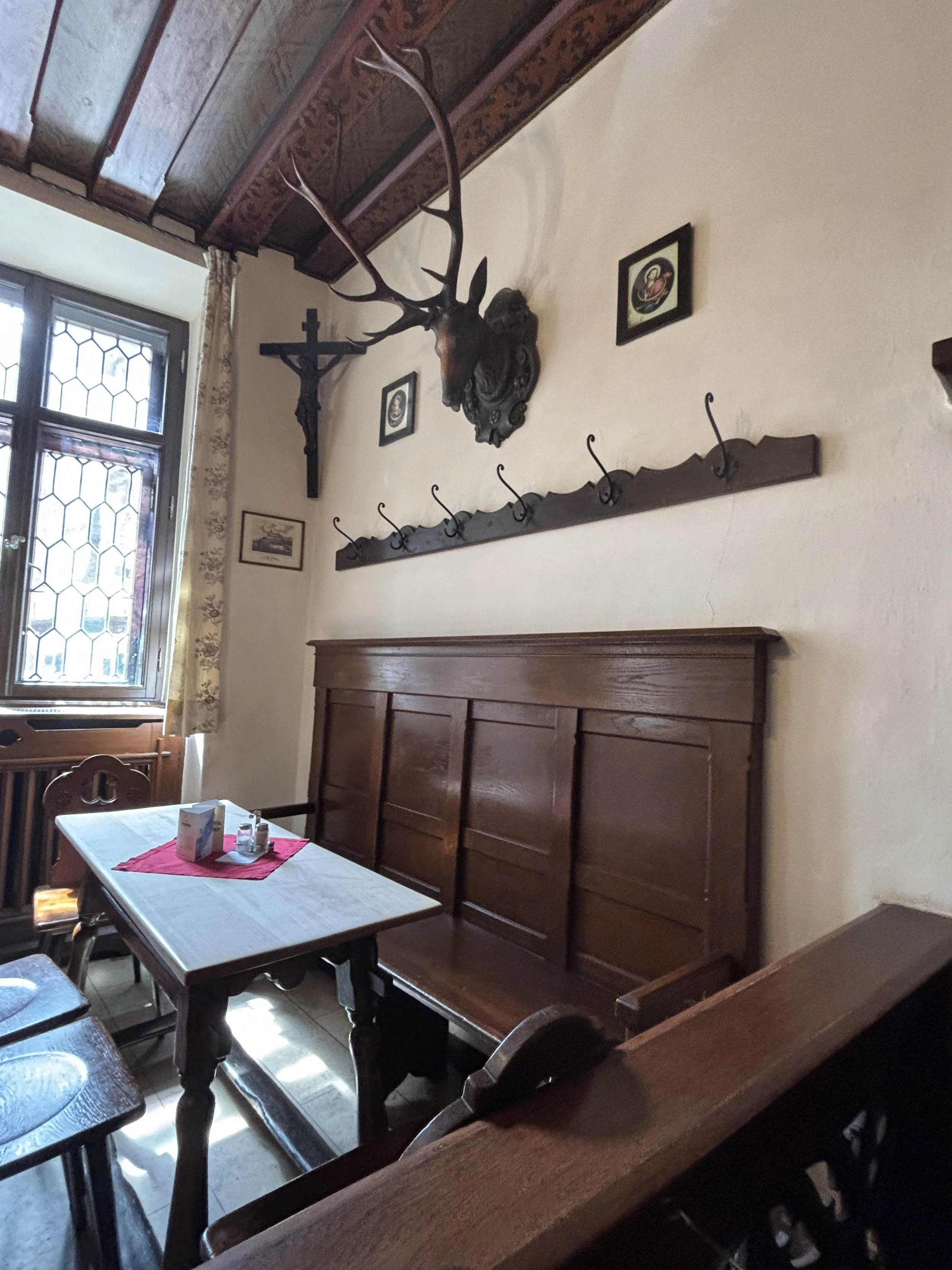
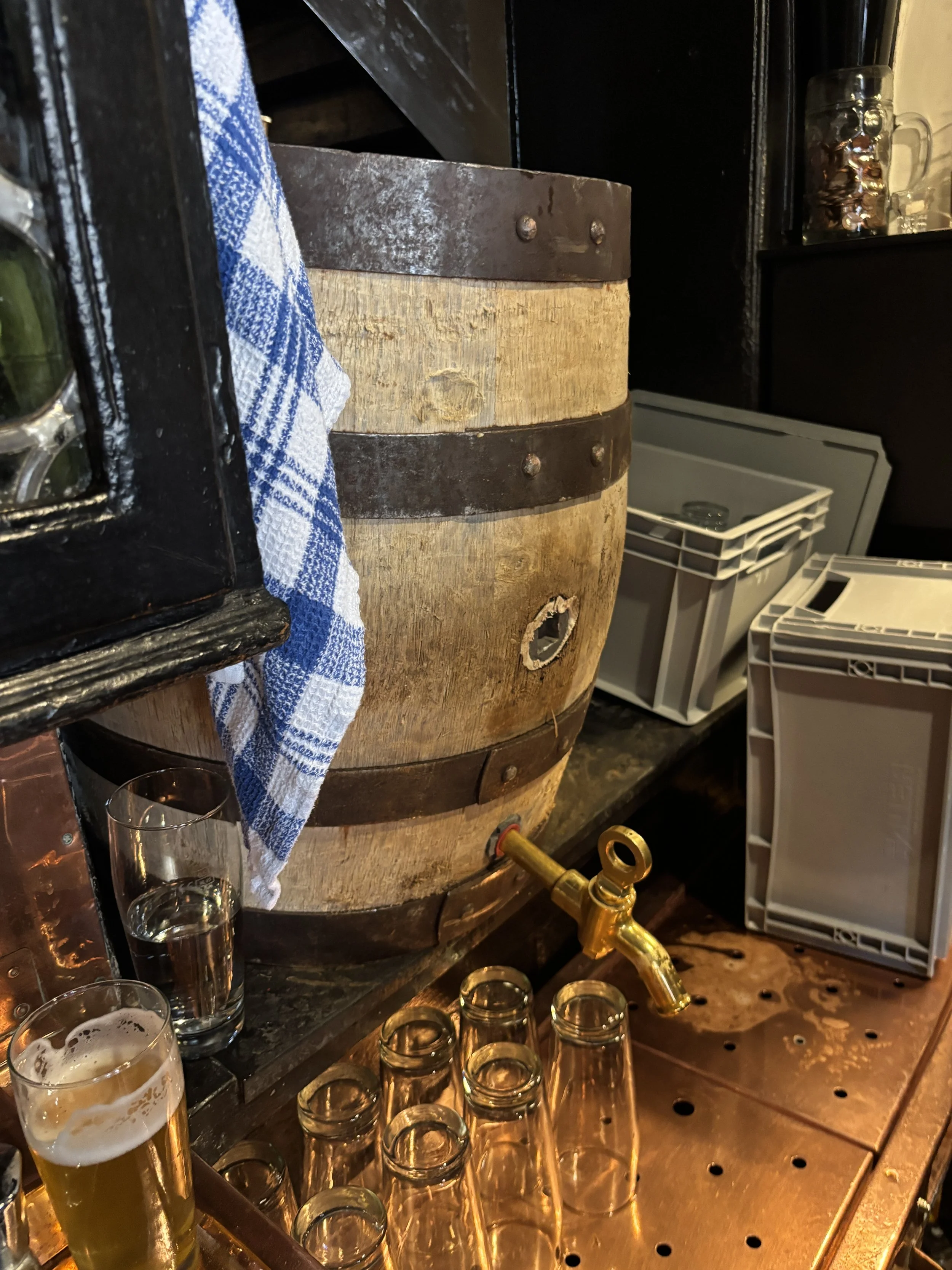
What’s more, since it is also a restaurant, you can have your beer together with another of the local specialities: stuffed onions (“Bamberger Zwiebel”). These are filled with pork meat and served with a side of mashed potato and gravy. It’s quite a filling dish!
By the way, the beer you see here is Schlenkerla’s Pale Lager, which is a special edition beer that the restaurant offers exclusively on “Beer Day”, April 23, and while supplies last. No smoked malt us used in its brewing process, however, it’s brewed in the same copper kettles and with the same yeast as the traditional “Rauchbier” in order to give it a slight smoky flavour.
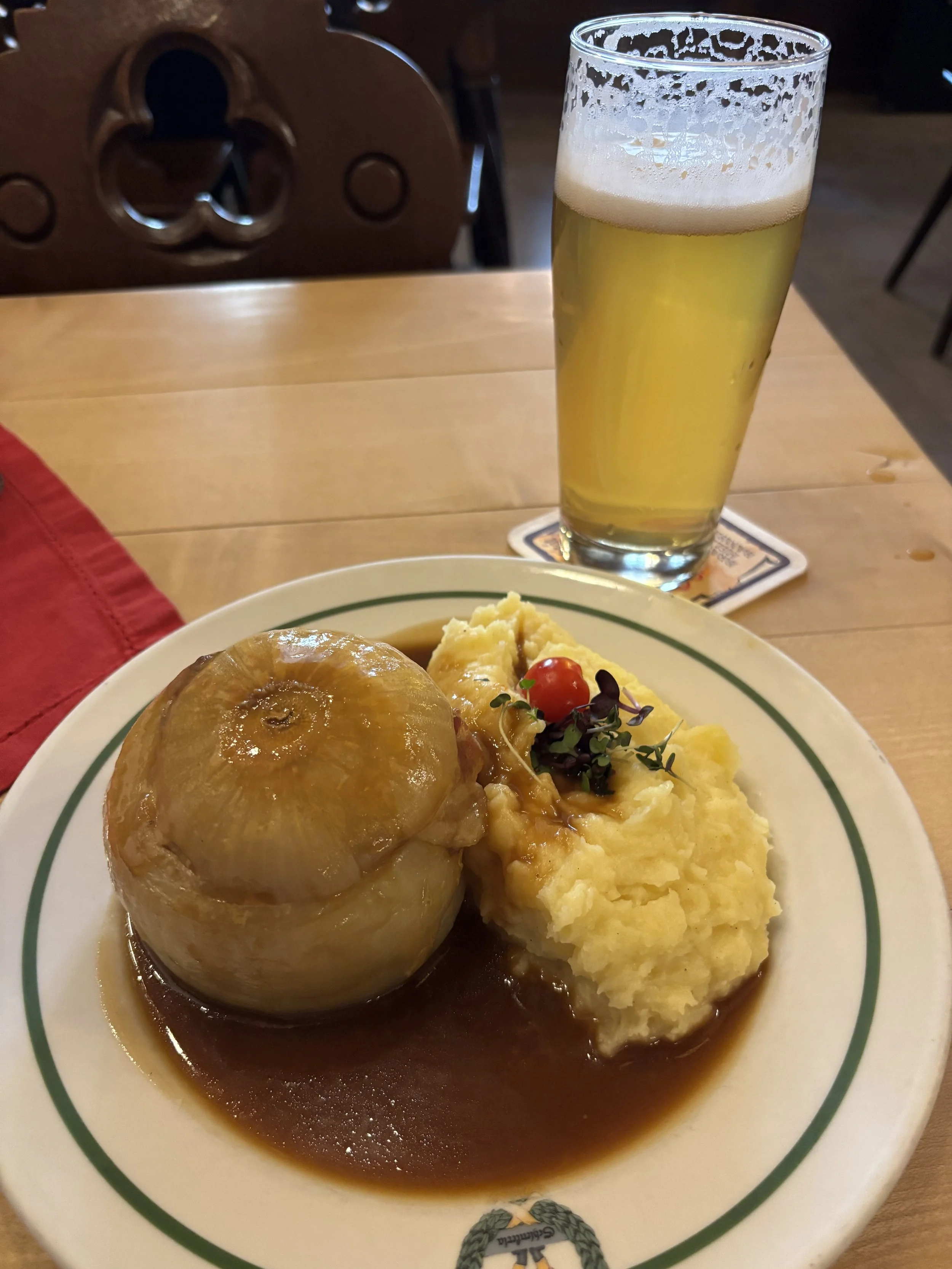

Grüner Markt and other Bamberg specialities

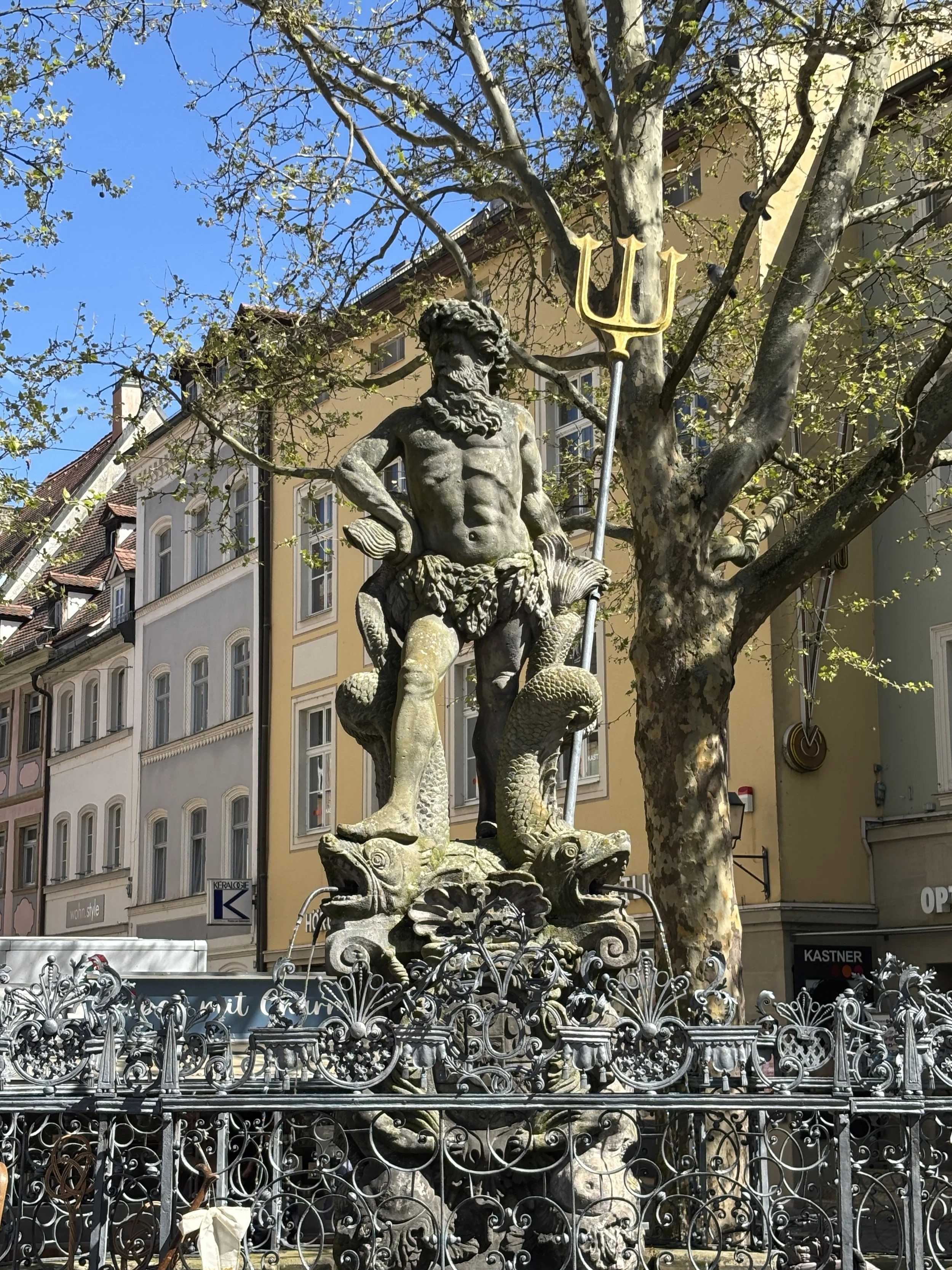
Bamberg’s downtown stretches onto the eastern bank of the Reignetz. And while this is still, technically, part of the old town, the streets here have a more modern feel, with Grüner Markt (“Vegetables Market”) and Maximilien Platz acting as buzzing commercial hubs of the city.
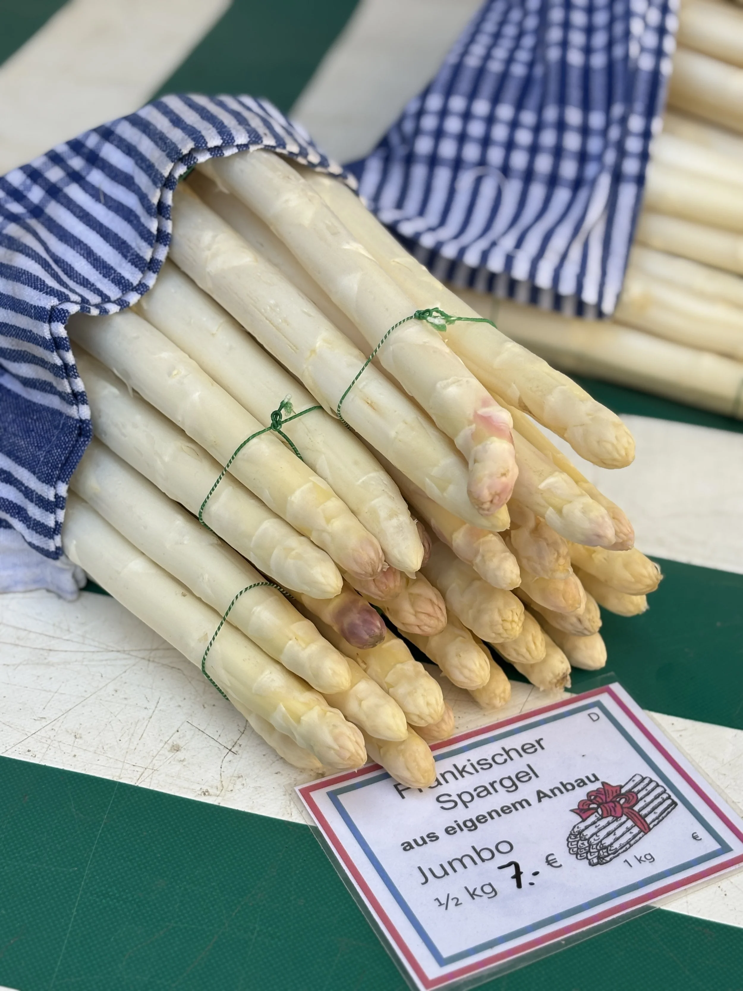
Grüner Markt, in particular, holds a street market for produce where it is possible to find some other local specialities, like the white aspargus and a special type of small crescent-shaped potatoes called “Bamberger Hörnla”.
Maximilien Platz (below), in turn, is the center of the city’s modern administration.
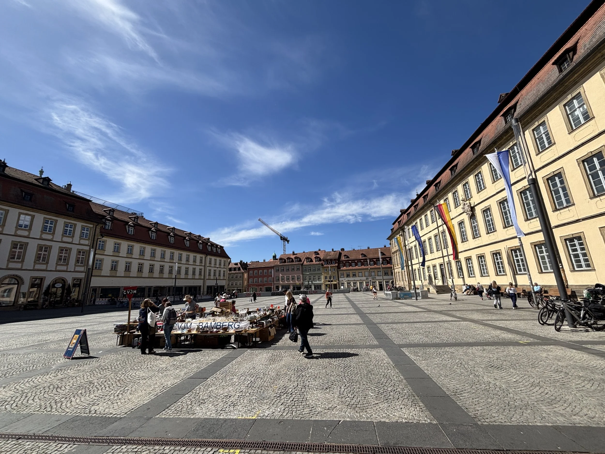
Yet another local speciality in Bamberg, this one in the bakery section, are the “Bamberg Hörnchen”, a type of croissants which are more curved than the regular ones and thinner at the center.
By the way, if you are into beer, before heading back to the station, you can stop at “Die Bierothek”, a shop where you can find specialty beer from Bamberg (including the famous smoked one) and the rest of Franconia (if you like beer, stay tuned for the next installment of this series, Forchheim, since it will feature plenty of it!).
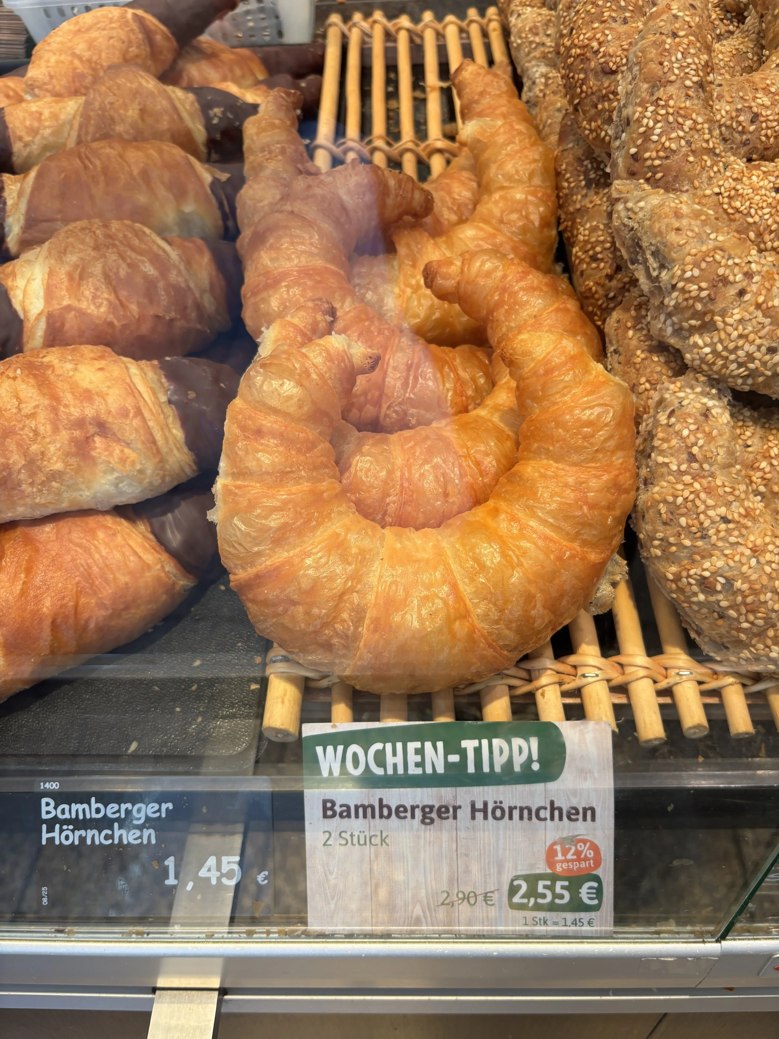
If you enjoyed this post, check out the next stage of my Franconian trip: Forchheim and its underground beer cellars!
Two great unique hotels with character in Berlin
I have been traveling to Berlin quite a few times in the last few months and, for good or for bad, I have had a chance to stay at quite a few hotels all over the city. It is rare when to come across properties that really stand out, but every now and then I come across some true gems which I think it is worth sharing.
To be clear, this is not a post about Berlin’s main tourist attractions, there are plenty of other blogs that can provide that, but to share some details about what I think are two of the best options to stay in Berlin right now at price points that are, I think, not particularly extravagant for the typical business traveler.
A recent trip to the German capital offered me the chance to experience two greatly located hotels which I will proceed to describe next:
Radisson Collection Berlin
The PostHouse Berlin
This post may contain affiliate links. If you book or buy something through them, I earn a small commission, at no extra cost to you. It's one of the ways I keep Places of Charm going. Thank you for your support.
I would like to thank also Radisson for facilitating the stay at this specific property. All opinions are my own.
A review of the Radisson Collection Hotel Berlin
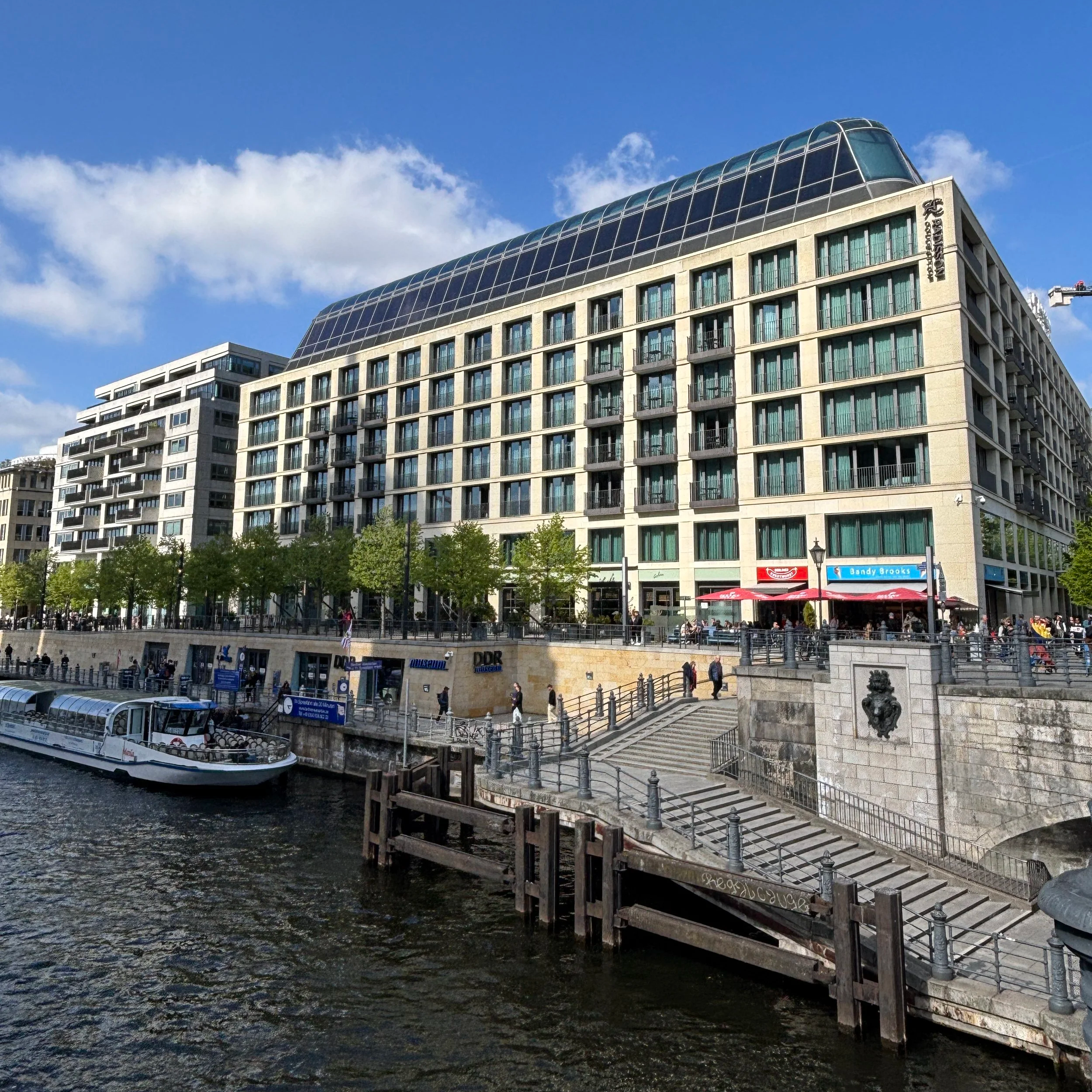
The Radisson Collection Hotel Berlin is truly a landmark hotel. It is located in what must be one of the most prime pieces of real estate of any hotel, of any category in Berlin, right on the banks of the river Spree, next to Museum Insel and the opposite the Berliner Dom.
The building itself is also quite remarkable, a compact and solid, building with a large indoor courtyard that is dominated by a rather impressive central structure that simulates a sort of giant tree.
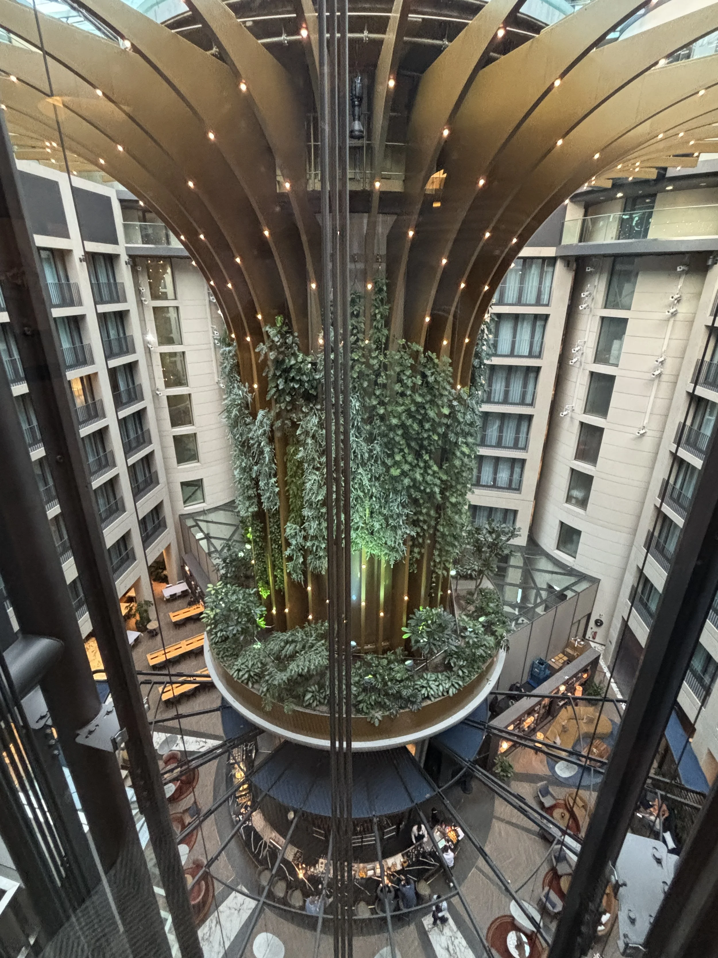
The overall aesthetic is modern and elegant throughout, but with a rather cozy vibe which is rather different to that of other more, let’s say, “classical” luxury establishments.
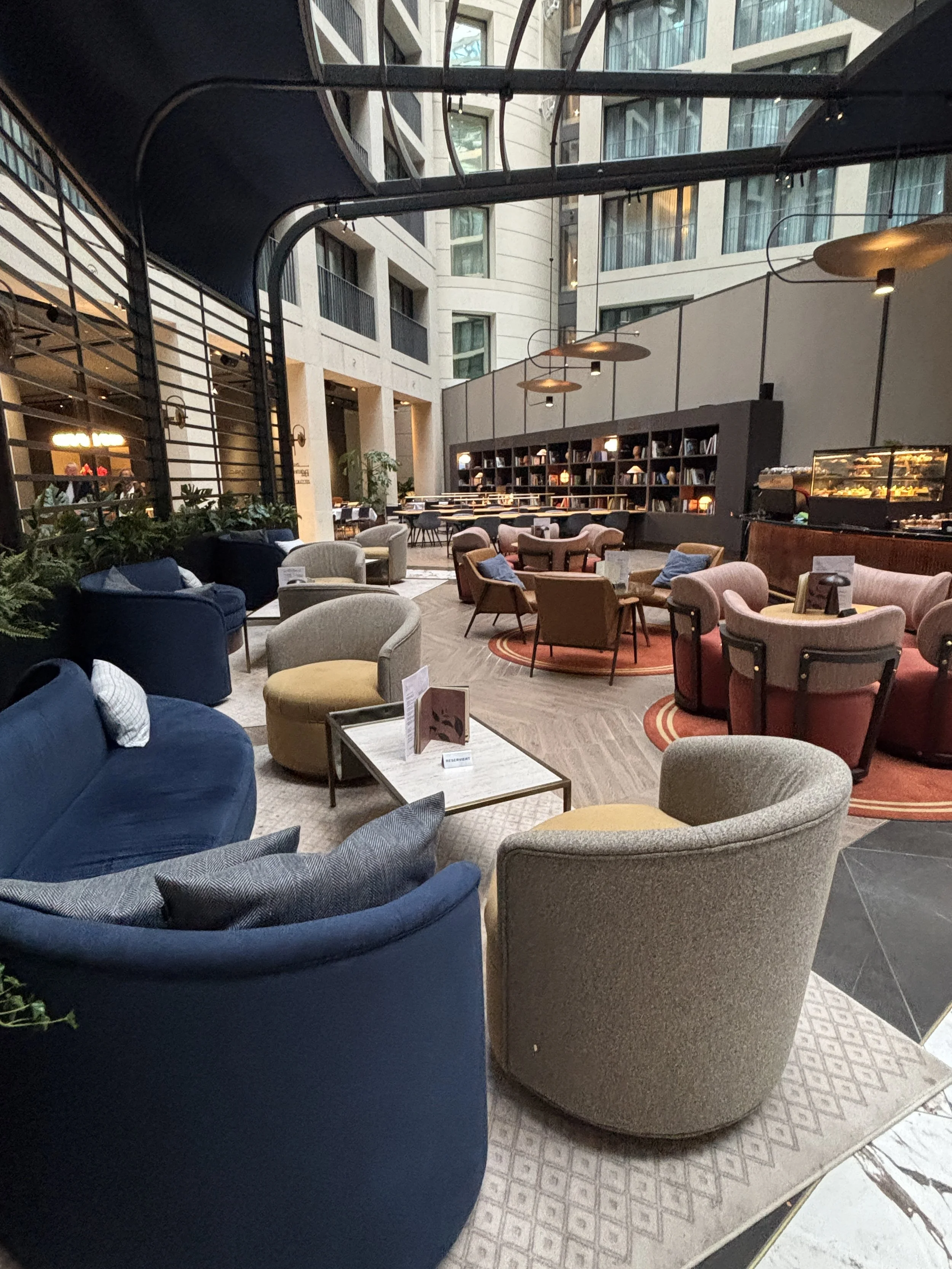
In fact, all around the aforementioned central trunk, in the lobby area is a mixed bar/restaurant-library/reading room-workspace area, complete with a fully stocked library (interestingly, with what appears to be a rather large Scandinavian book section, which possibly reflects Radisson’s own roots!)
This somehow round floor plan makes it possible for all these different areas of the lobby to be conveniently compartimentalized while remaining within the same open plan. The reception area is also somehow segregated from this more innerpart (albeit still public) area of the hotel.
Access to the rooms is through the glass lifts which make for quite a scenic up and down the building. Access to each of the floors is also rather grand, with a large open space in a rather modern and harmonious style, including the colour palette, and local touches of decor.
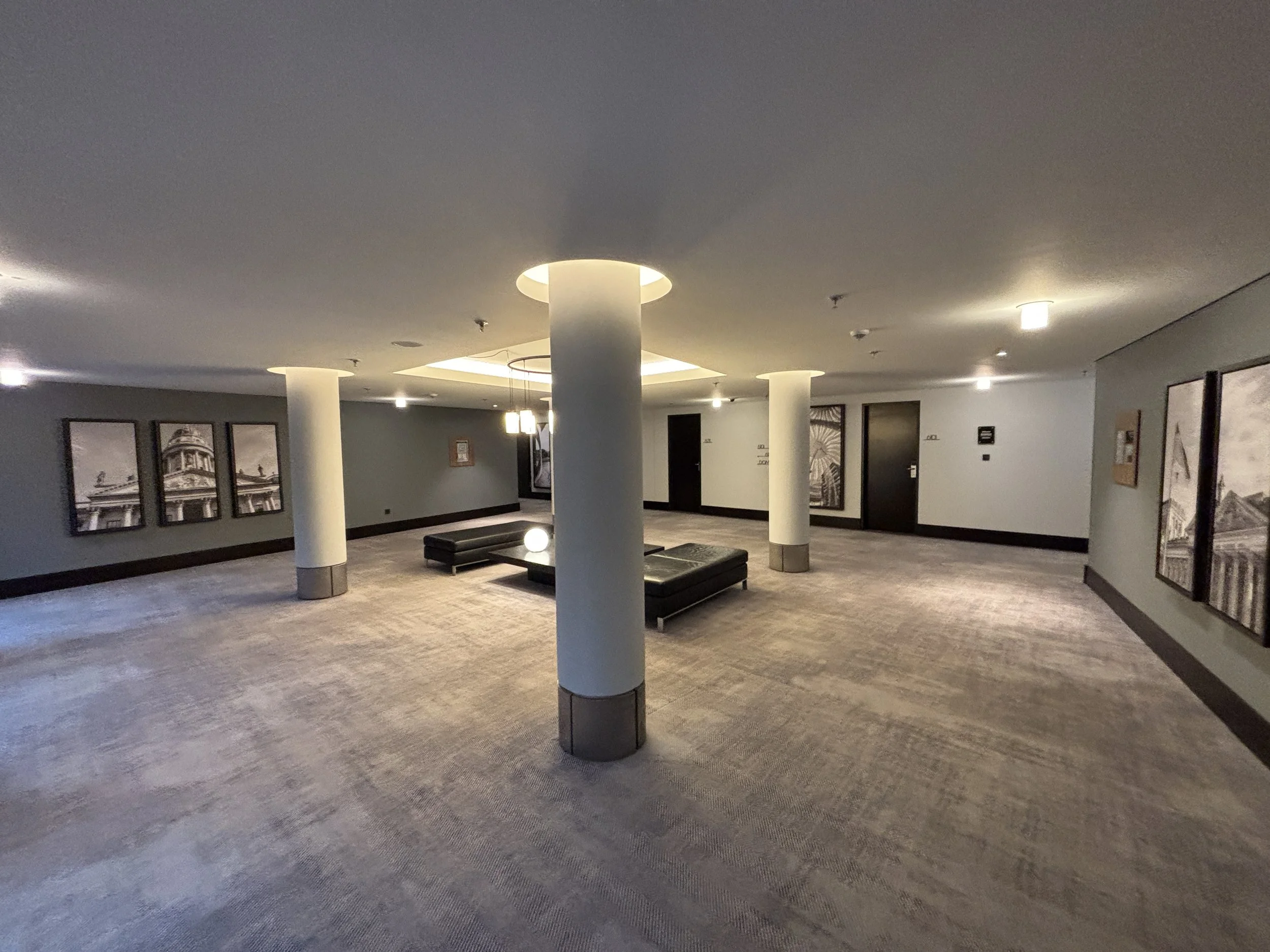
The rooms at the Radisson Collection Berlin
As you may have already guessed, the rooms follow more or less the same contemporary style and no-nonsense approach to comfort. In this case, my room, located on Floor 11 (one of the highest) west side had also a special “surprise” that I will soon disclose, further down this post.
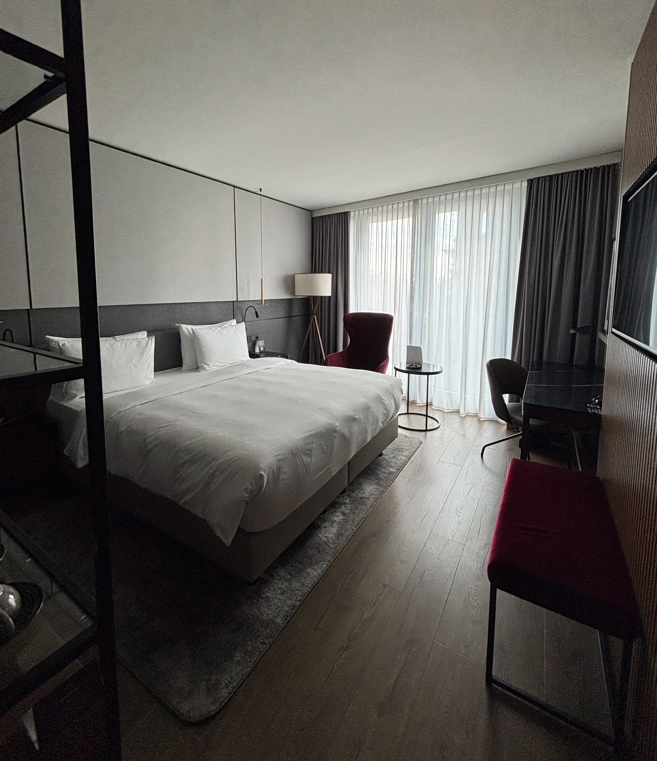
As you can see, the rooms have wooden flooring (another Scandi design touch), which I tend to prefer.
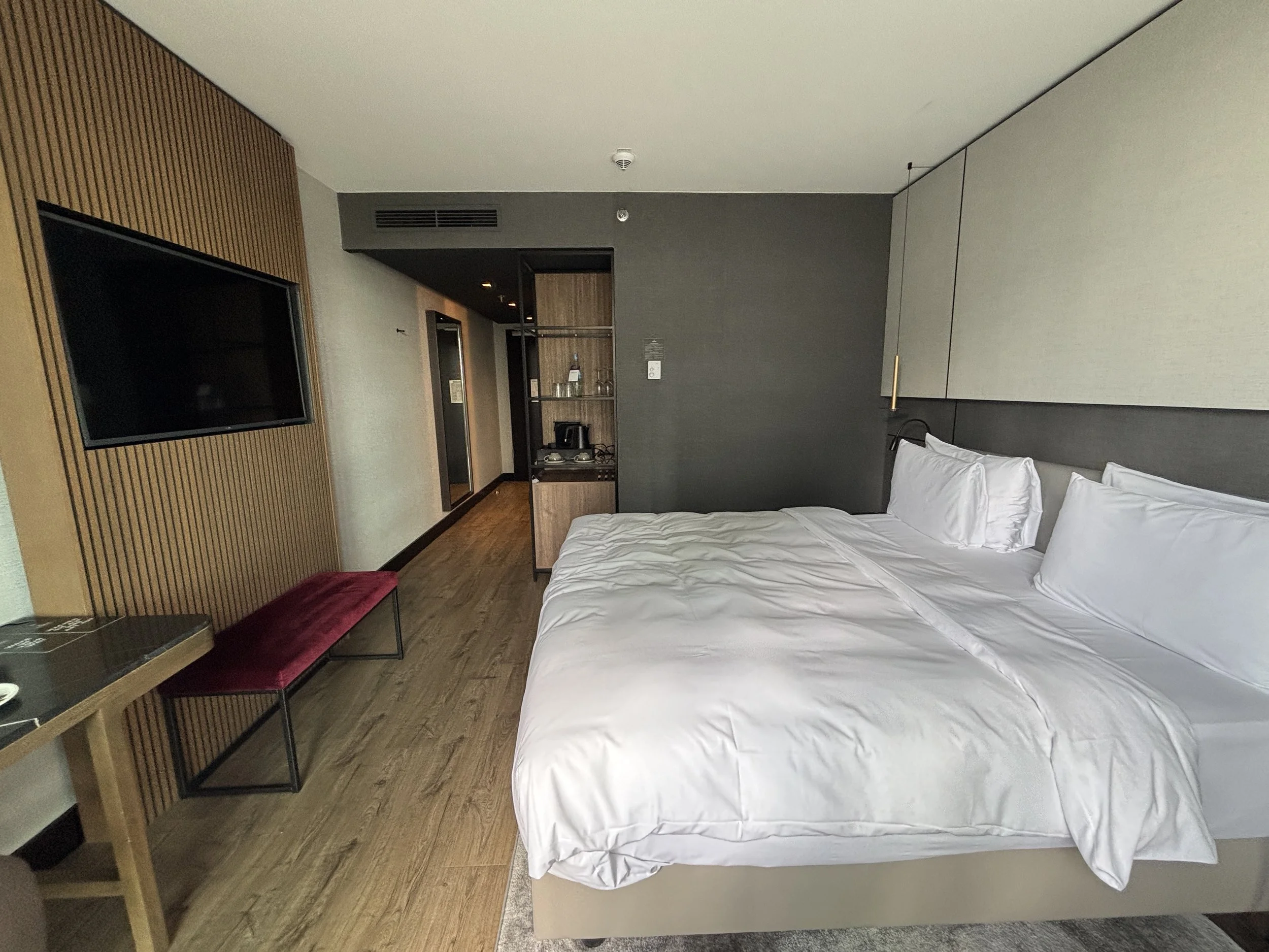
A few other details I liked about the room: note the large amount of storage space, both for luggage and also to layout clothes and personal items. Also, as is the norm in this category of establishment, there’s a coffee machine and some mineral water waiting for the guest.
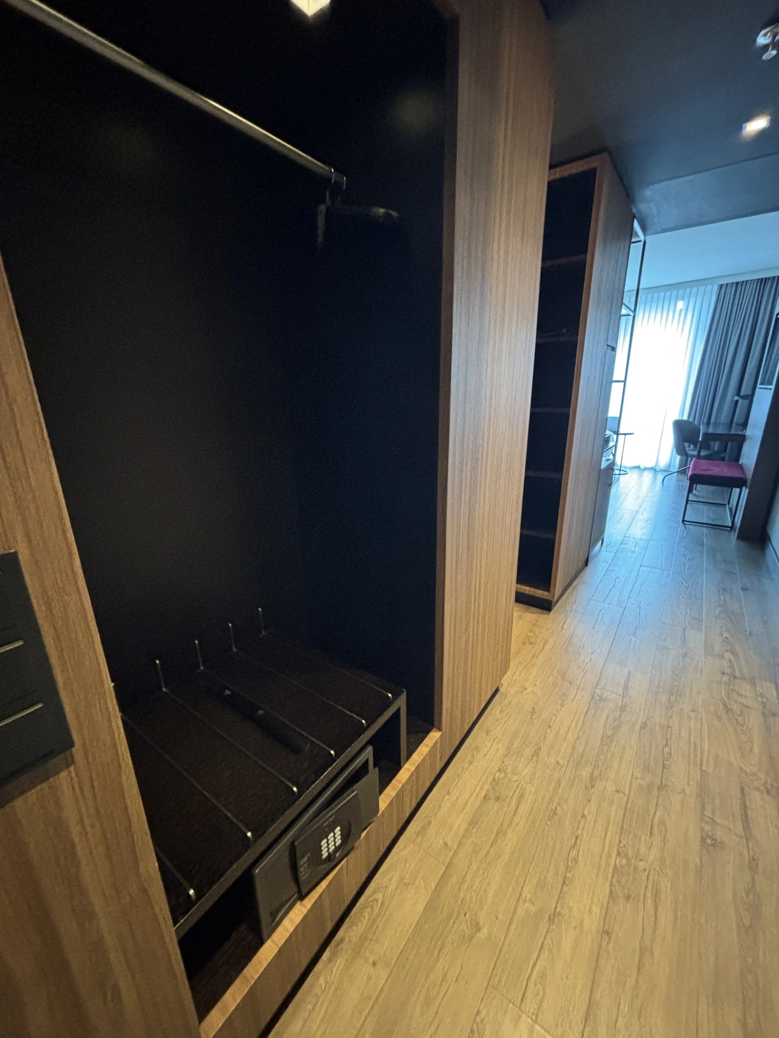
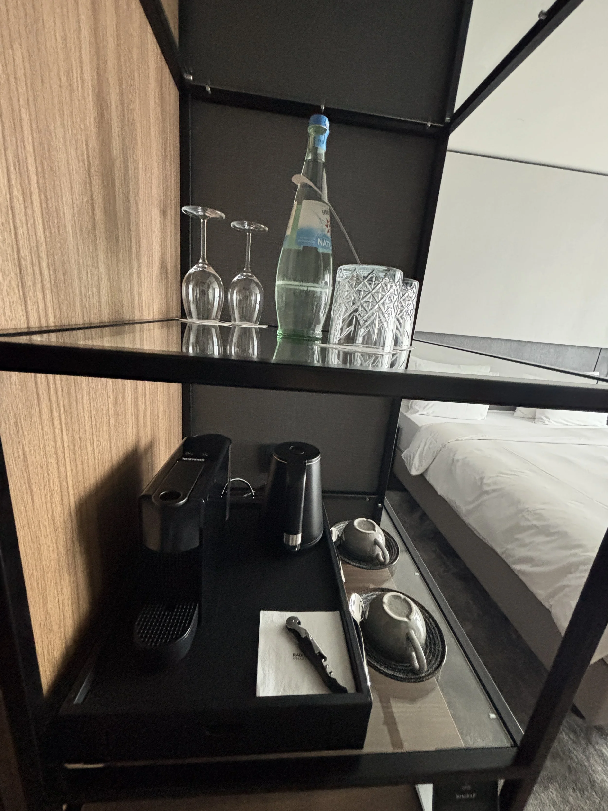
The two-piece bathroom is also pretty impressive: very modern throughout and with a power shower. Bathrobes are also provided, since the hotel, as we shall soon see further down this post, has also a small indoor pool and a spa area.
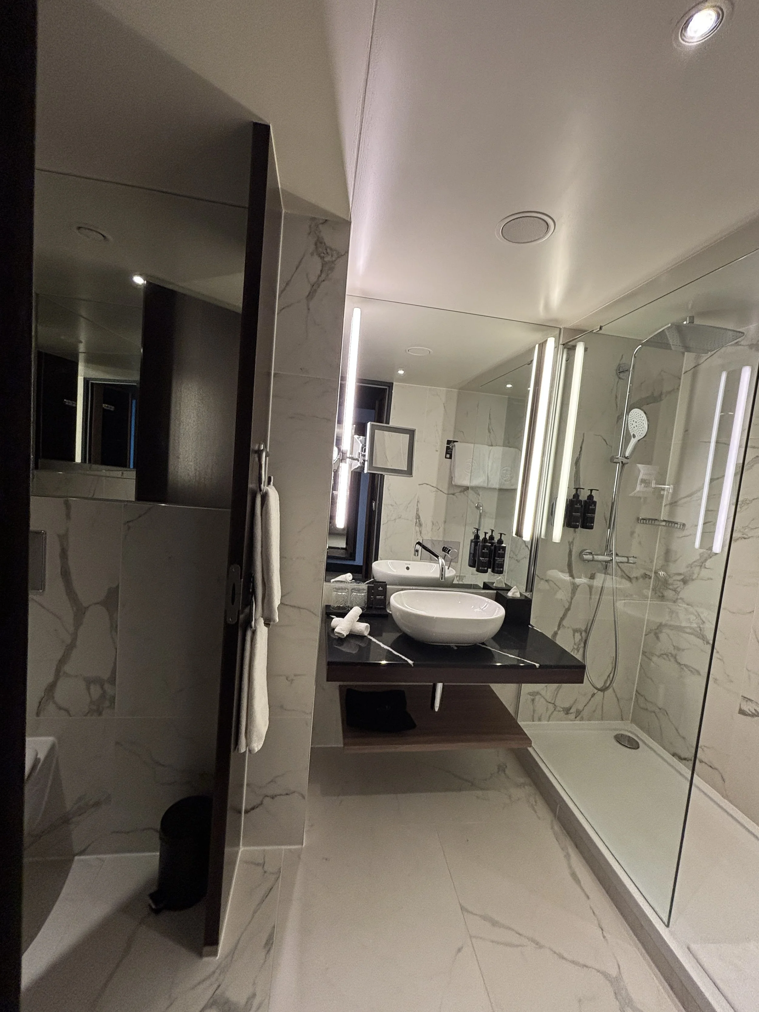
The hotel offers also a whole range of additional ancillary services, from a choice of different pillow types to laundry, all through the electronic console which is accessible through the room’s work desk.
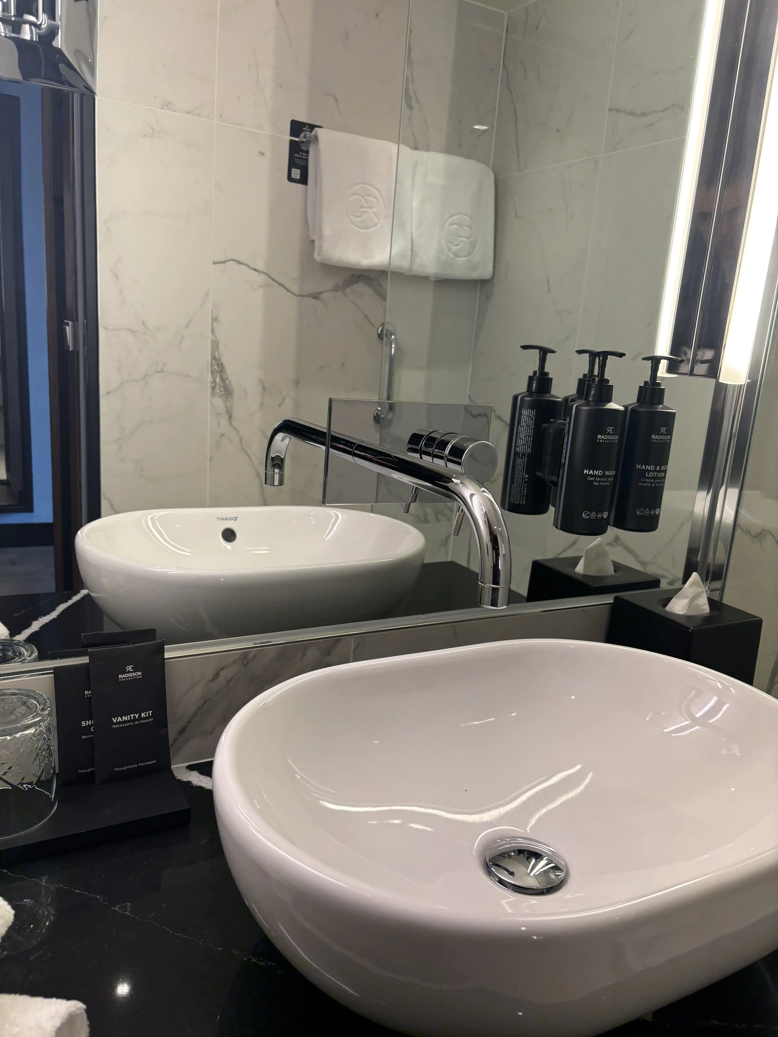
Best hotel room views in Berlin?
And now, the “surprise” that I mentioned earlier, because if this was an Instagram account, the moment of opening the room’s small balcony would be the time to do that typical influencer gesture of covering your mouth with the palm of your hand, in awe of the sights! The picture below is the unfiltered picture of what I could see from my room. Does it get better than this in Berlin?

And, for good measure, this is the view from the bed itself! That’s what I would call a central location!
Btw, in this picture you can appreciate the little balcony, which makes it easy to enjoy the views in full, since you can actually open the doors, a particularly suitable feature during the Berlin spring and summer when the weather can be quite balmy in the German capital! Btw, when that’s the case, you can just spend the afternoon watching the boats on the river Spree pass just underneath your balcony.
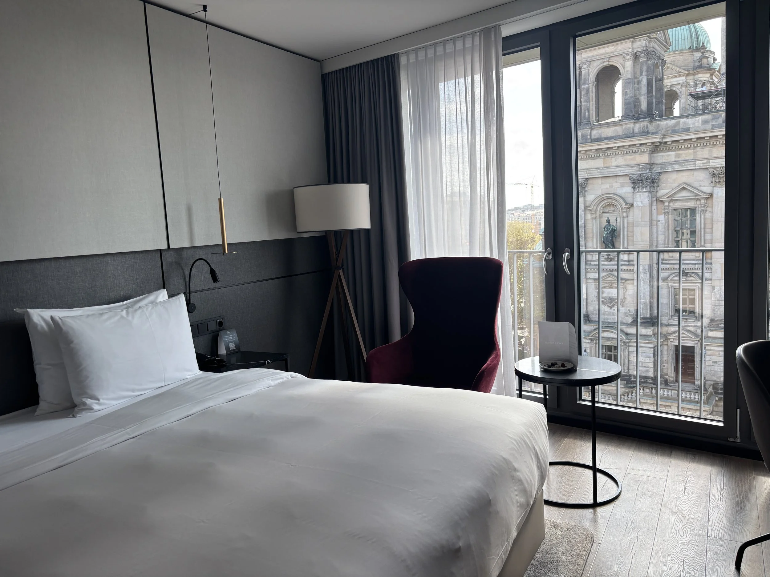
Also in the room is a work desk: the right size for the traveling professional and with plenty of natural light, as you can see!
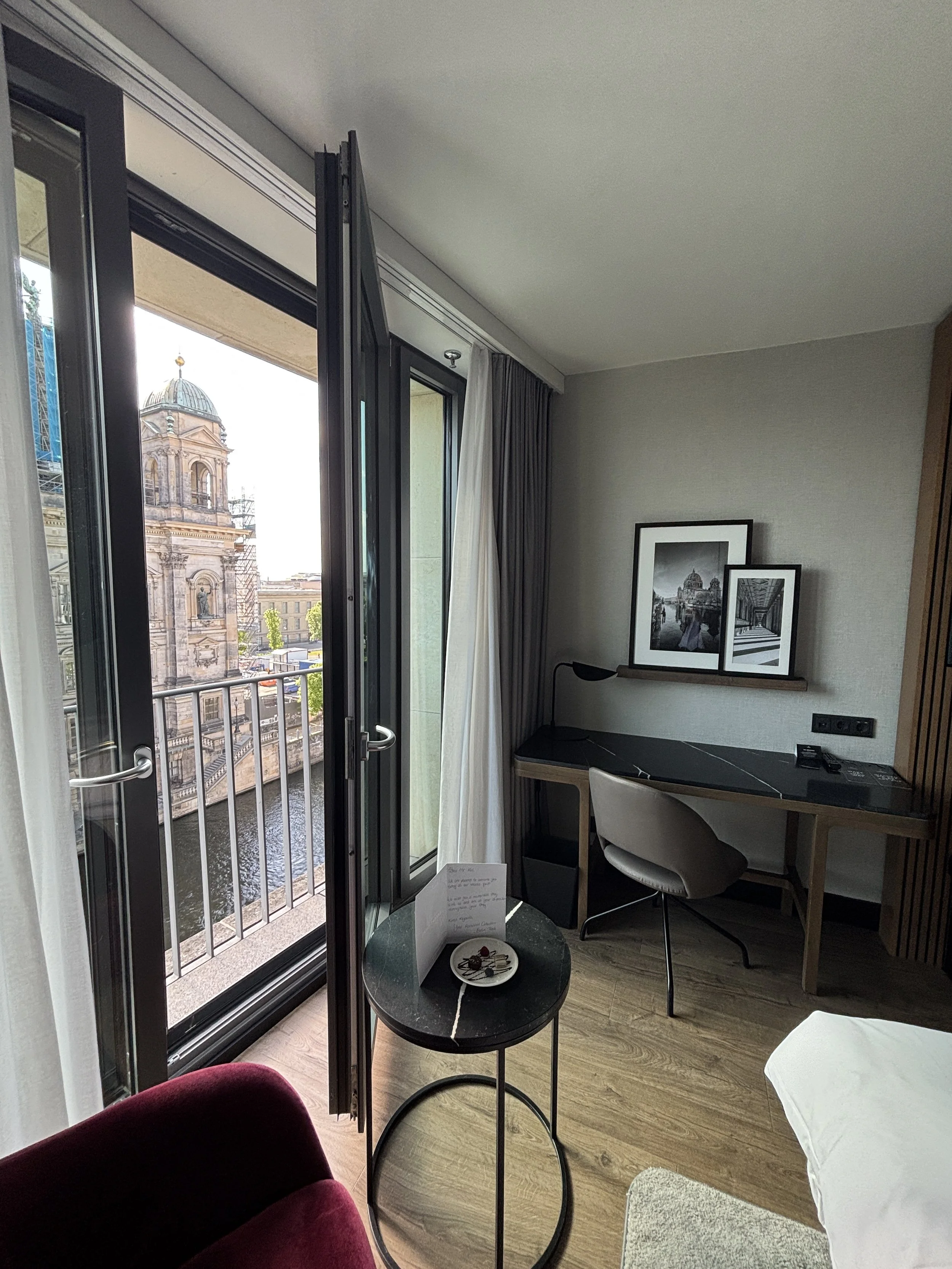
Gym, Spa and Wellness at the Radisson Collection Berlin
As I mentioned earlier, there is a fitness and wellness center in the hotel. To be fair, the facilities are small, but they have pretty much all you would possibly need during a urban city break.
The fitness and wellness center is in the basement and accessible directly from the rooms through the lifts. There is a small pool, more for relaxation than exercises, tbh, as well as separate cardio, yoga, and weight rooms.
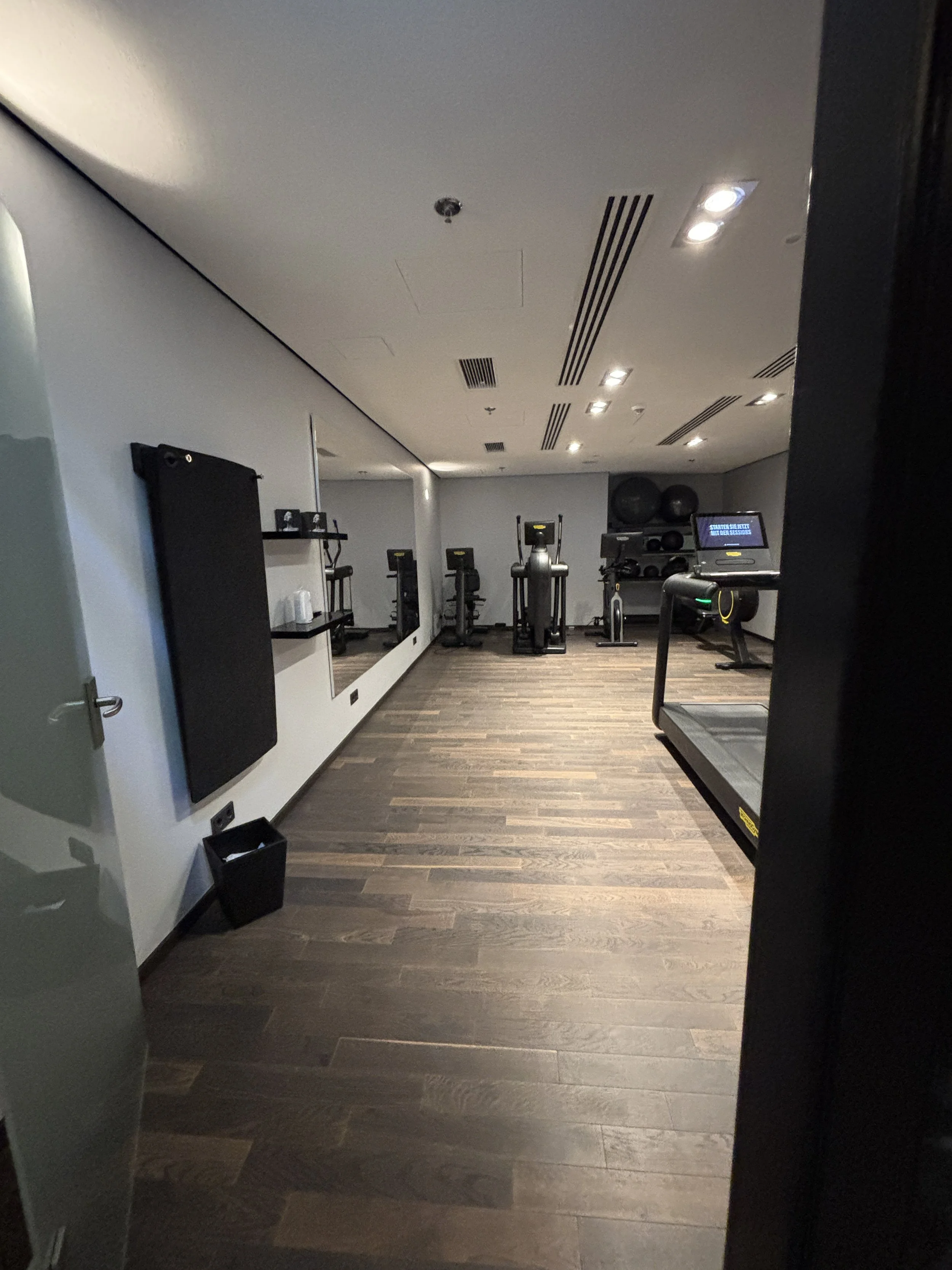
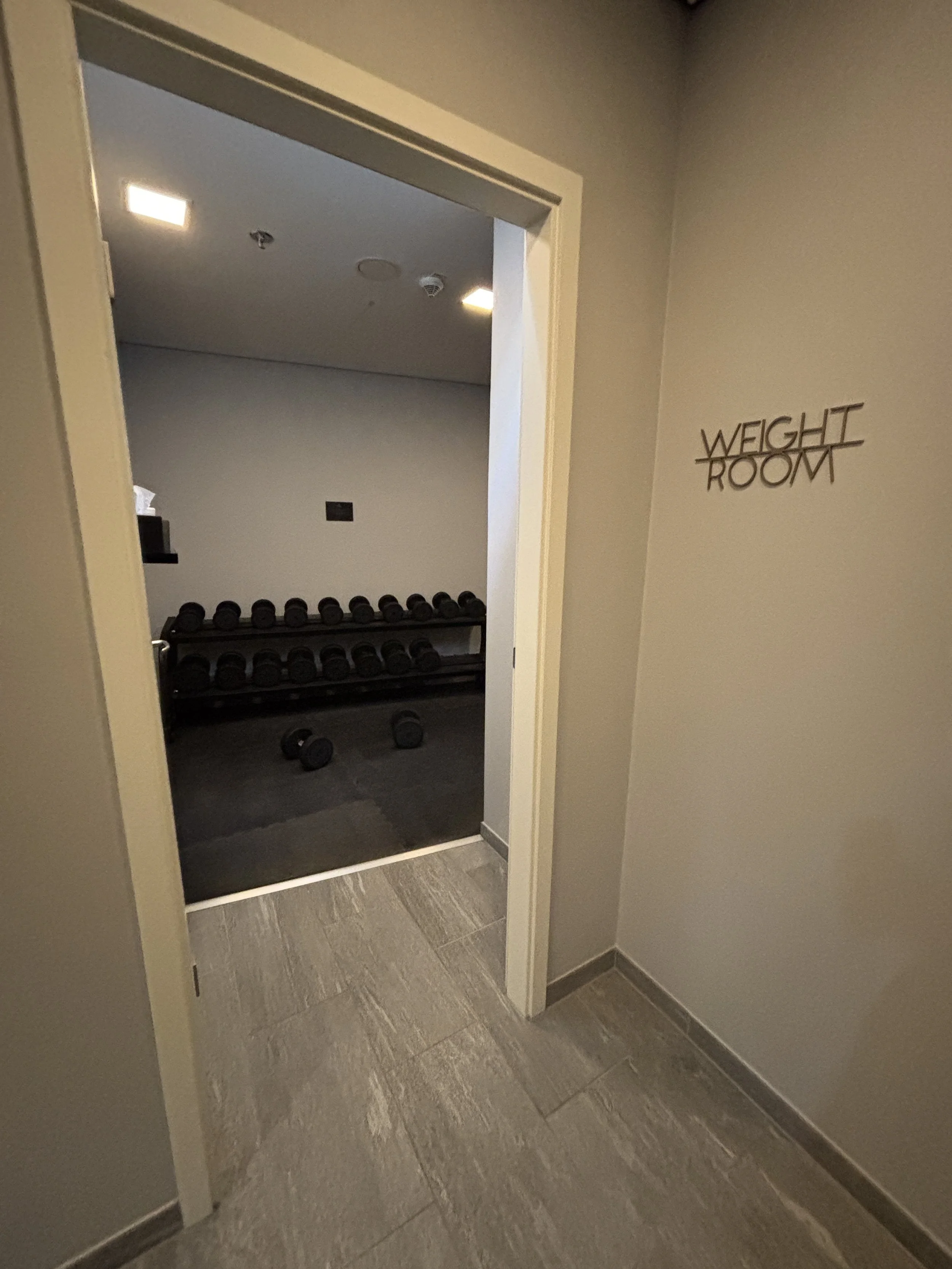
Eating at the Radisson Collection Berlin
The hotel has, of course, a restaurant. It is located on the ground floor on the west side of the property, which means that it has views of the river bank. The decor is aligned with the modern-cozy style of the rest of the property.
I had the chance to have my buffet breakfast there and it didn’t disappoint. The breakfast offering was predominantly continental, but with a fair amount of choices. This being Germany, the bakery section was particularly impressive!
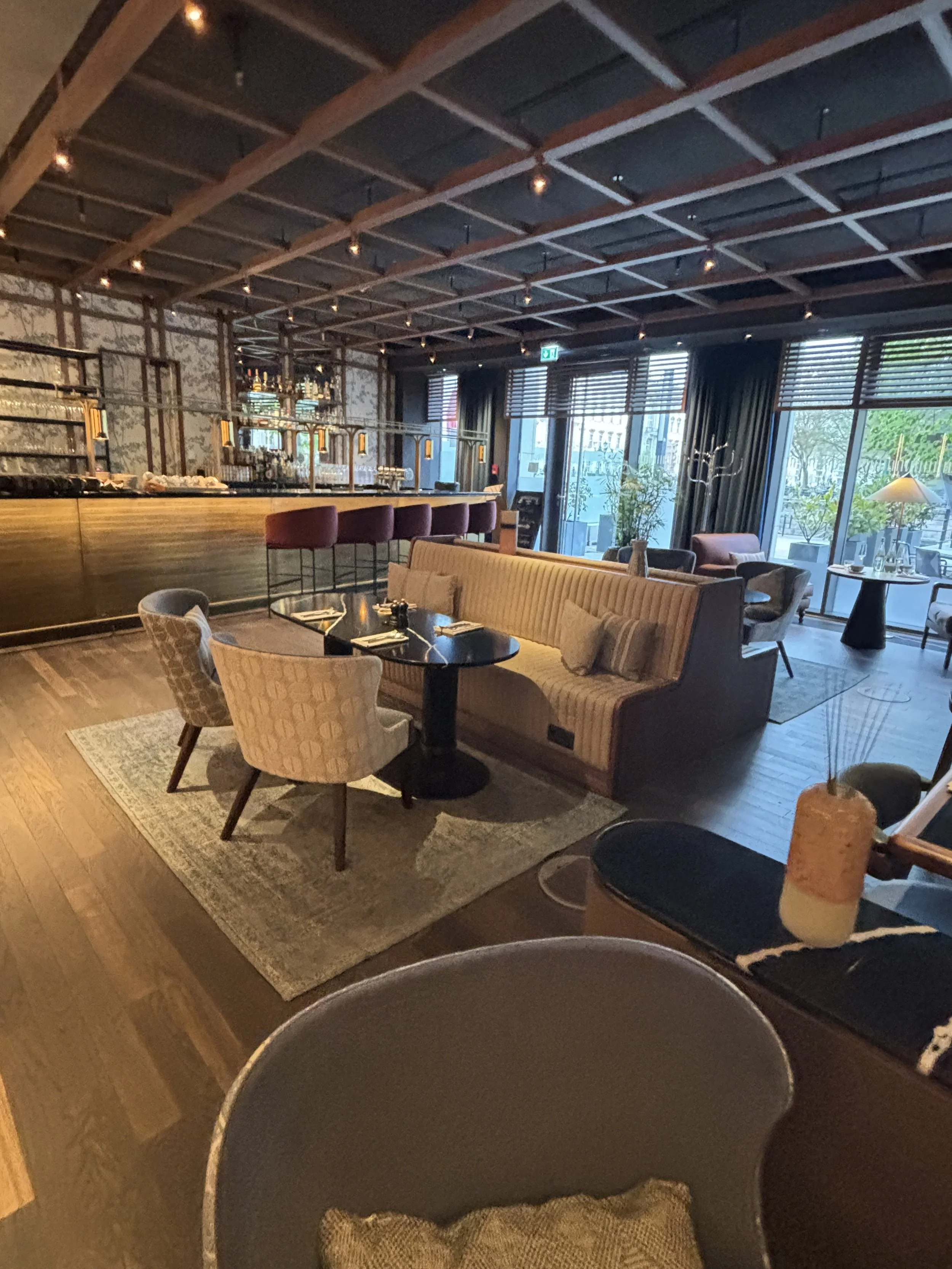
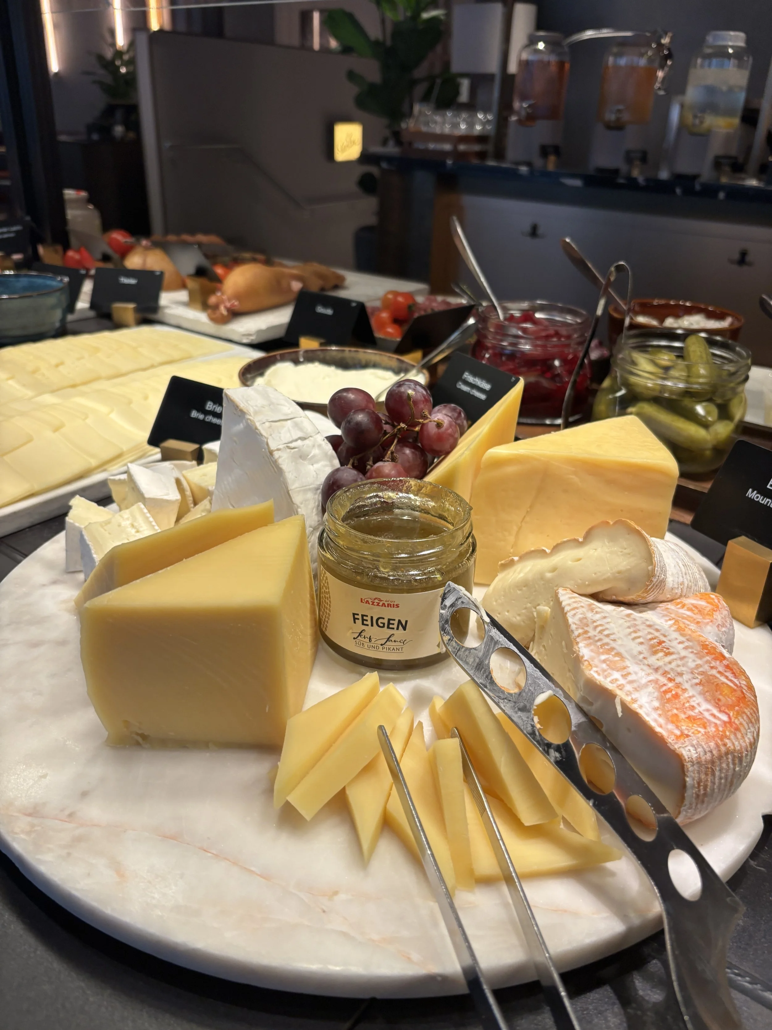
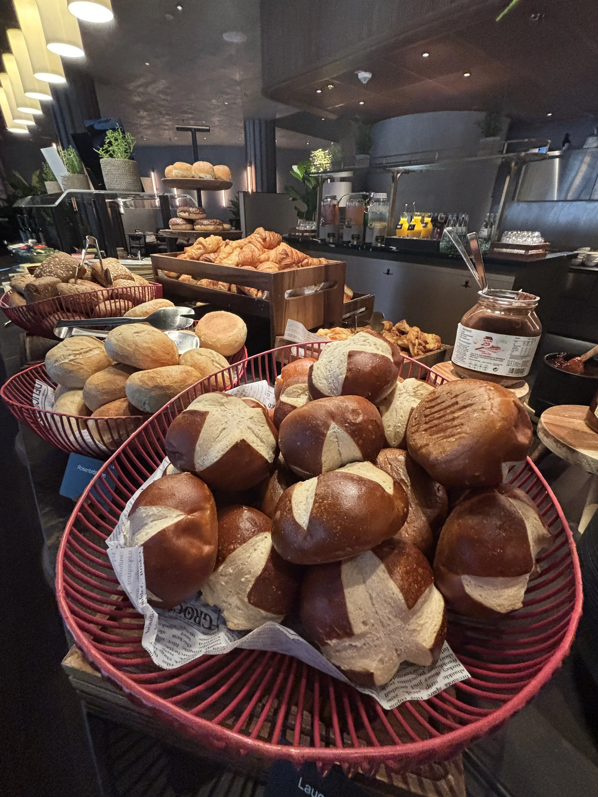
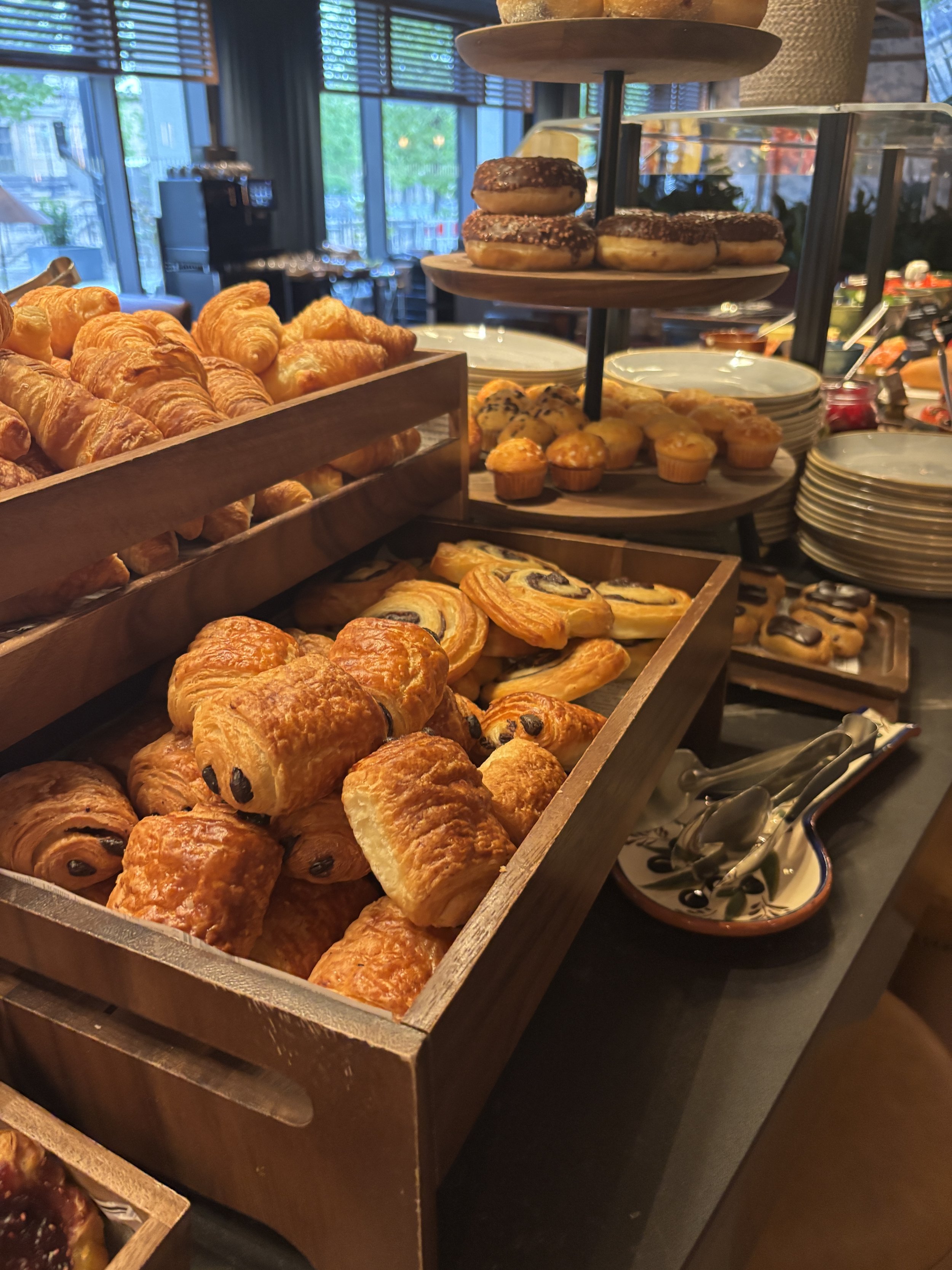
So, overall, a very well rounded experience with the added touch that, as a guest, you have a very good chance of getting one of the very best panoramic views of the city of Berlin included in the fare (which, I may say, at this property tend to be in a very reasonable range for Berlin standards and adjusting for quality and location!), a true gem.
A review of The Posthouse Berlin Hotel - Potsdamer Platz
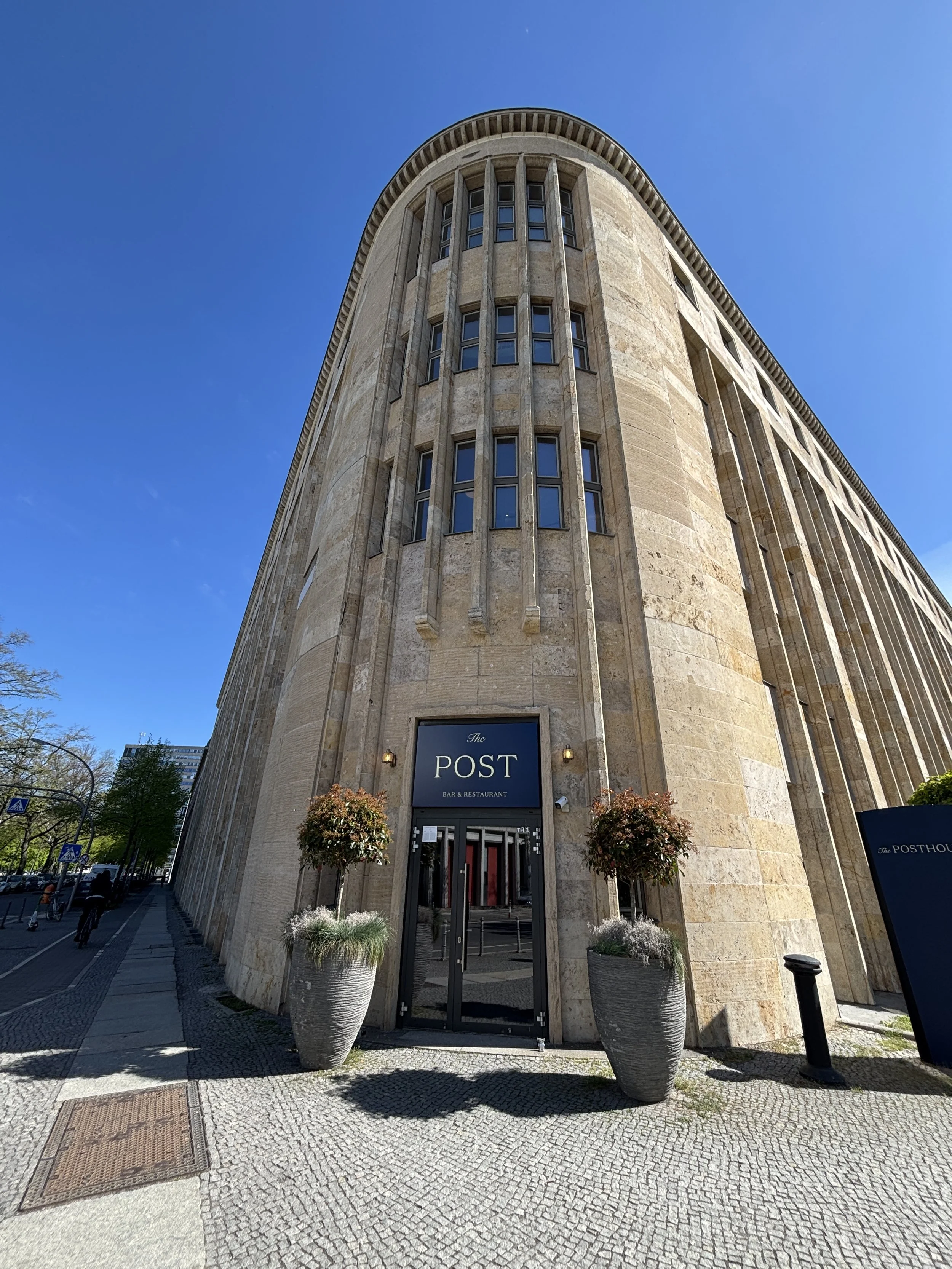
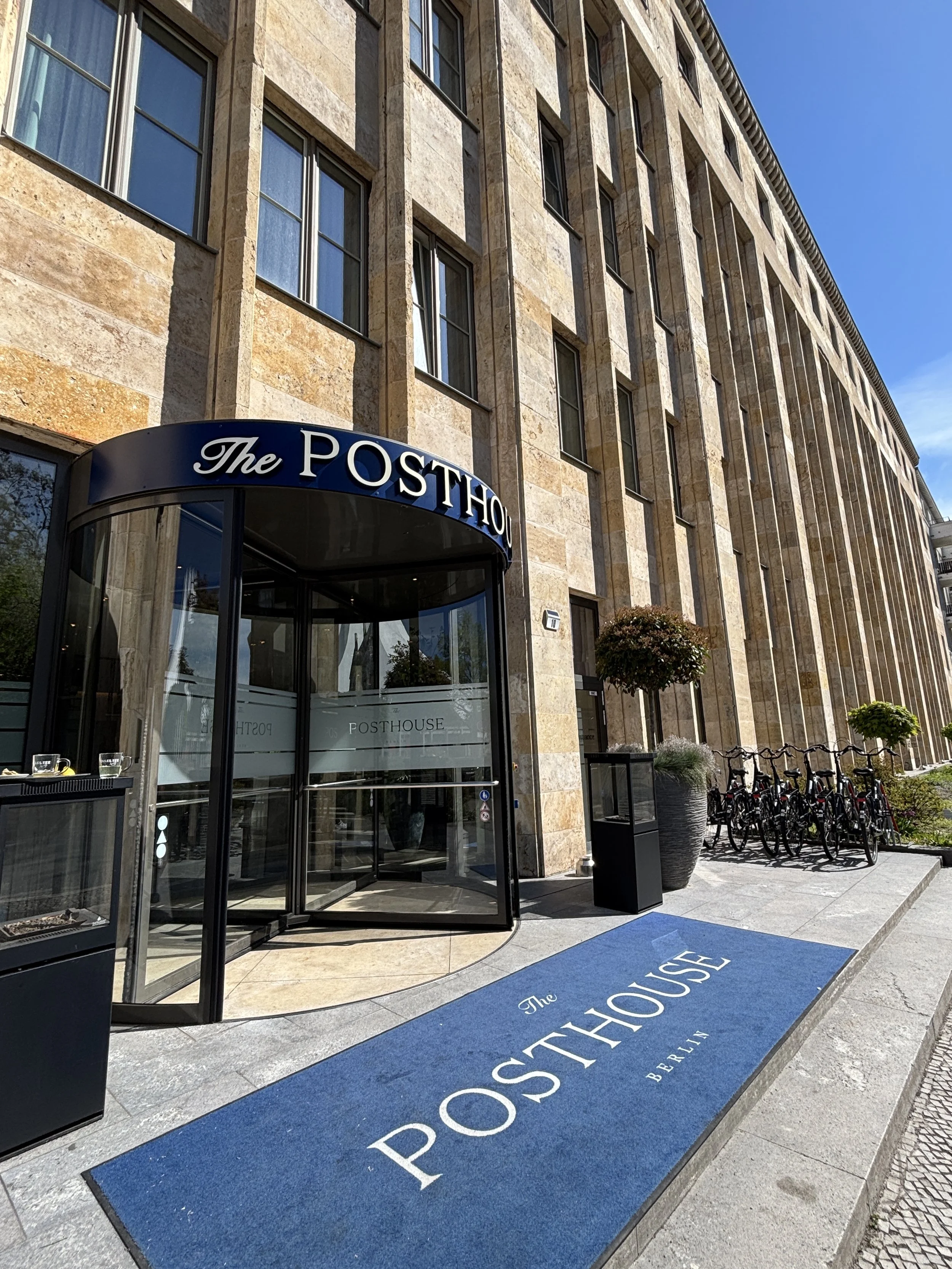
This was another find during a recent visit to Berlin, another real gem, offering great value at a prime location. The Posthouse Berlin Potsdamer Platz – Leonardo Limited Edition is a very modern hotel, which belongs to the Italian chain Leonardo.
It has the additional allure of being located in a historical building which once housed Berlin’s main postal distribution center, something that you can kind of guess looking at architecture of the place. In this case, as we shall soon see, Leonardo has fully embraced this truly unique character of the building when it comes to marketing this property.
While it is not located right next to the city’s top landmark, like the previous hotel we have seen, The Posthouse is also incredibly well located from the point of view of its centrality in the city. It is located within walking distance (10min) of Potsdamer Platz, right at the core of the Government District and pretty much on top (give or take a few dozens of meters) of where the Berlin Wall used to be. It has also within 5minutes walk of the Anhalter Banhof S-Bahn station and the Möckernbrücke U-Bahn station (in addition to the aforementioned Potsdamer Platz, which is also a major railway station).
What’s more the area is very walkable and safe, with broad avenues and lots of hotels, restaurants, shops and museums in its vicinity.
The rooms at The Posthouse Berlin
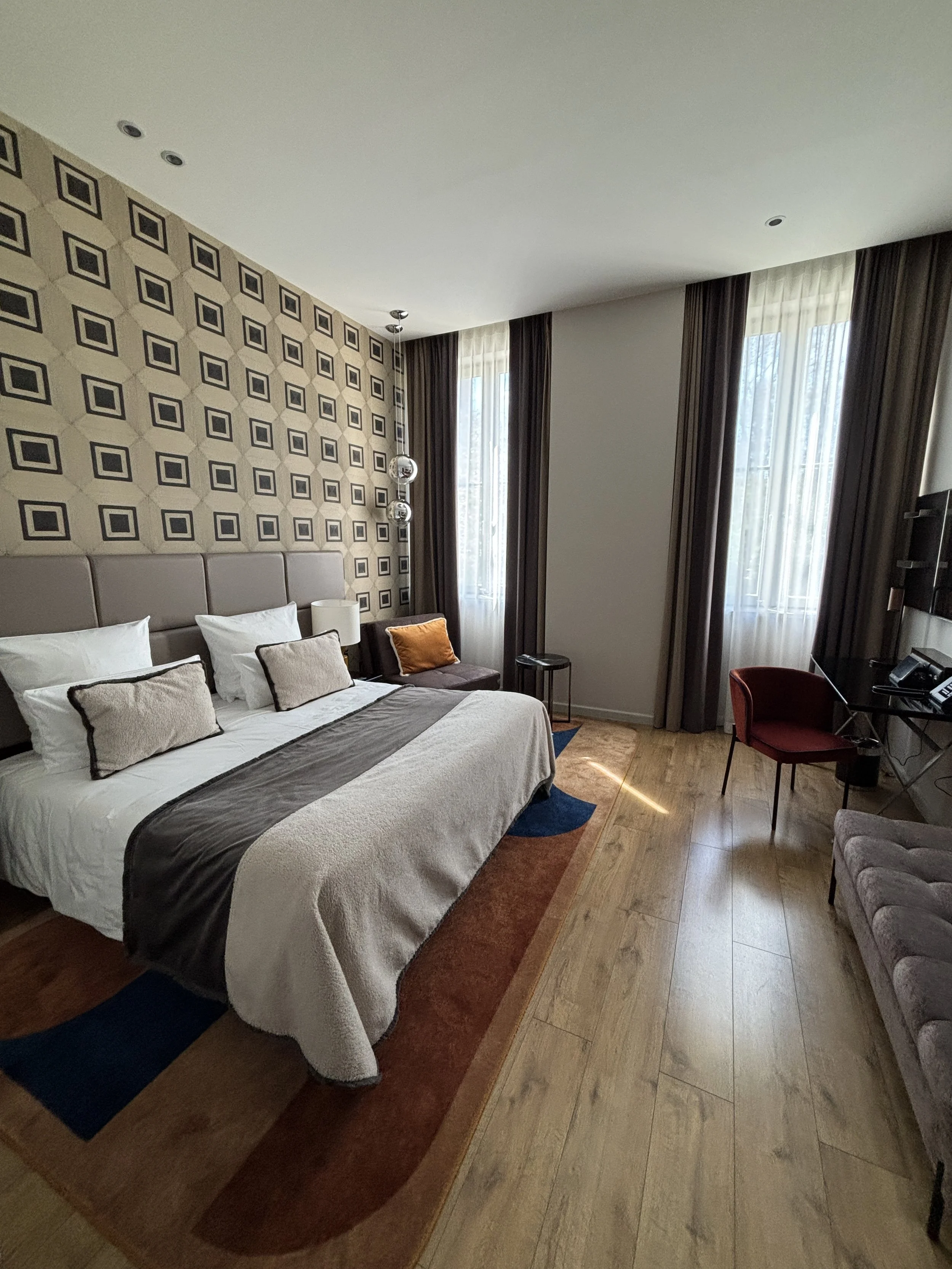
The rooms are large and very modern and cozy, with a mix of coulours that is warm and sophisticated at the same time. The little touches of colour make the whole ensemble more lively preventing it from being too “neutral”, while keeping the whole subdued.
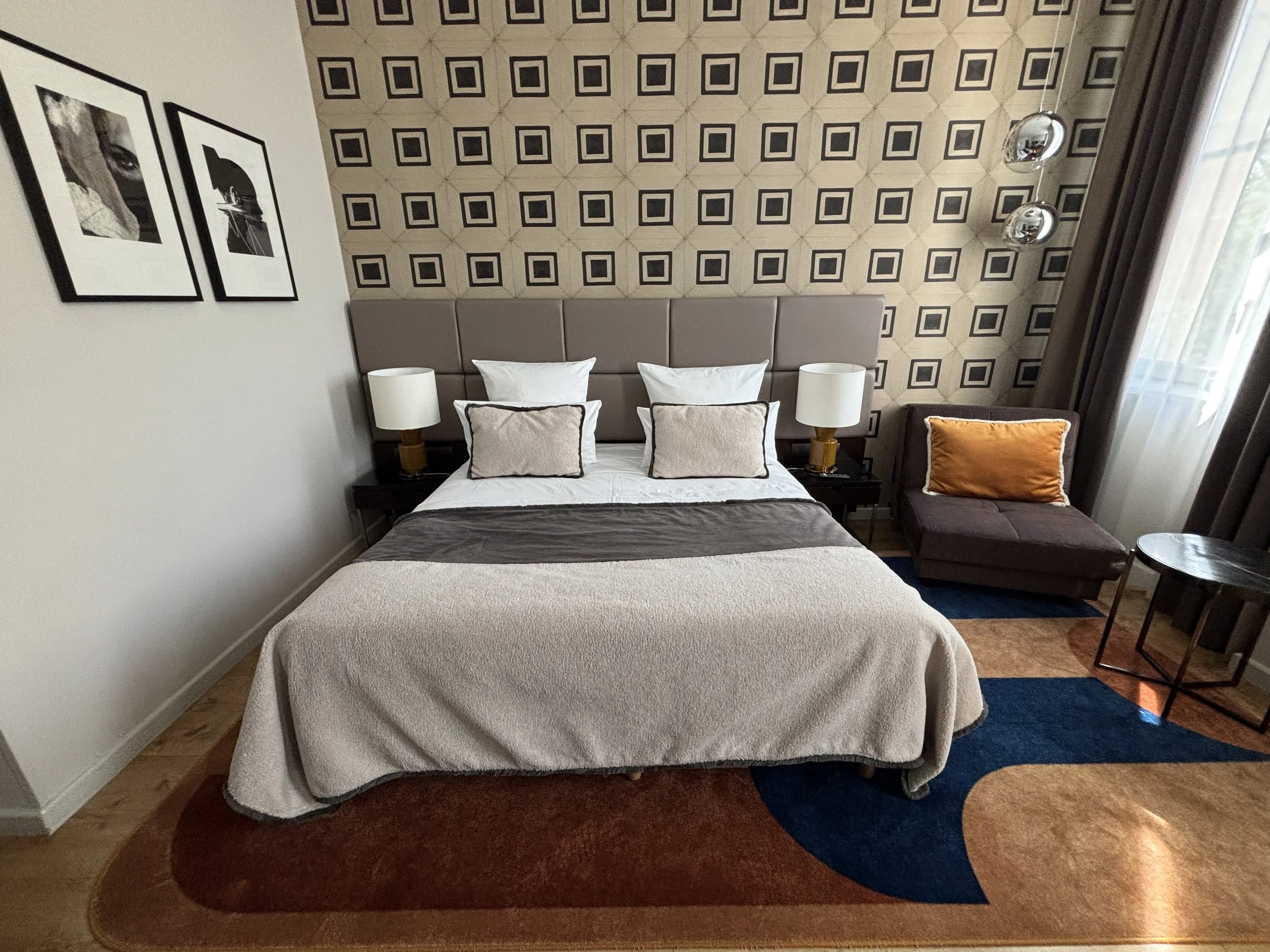
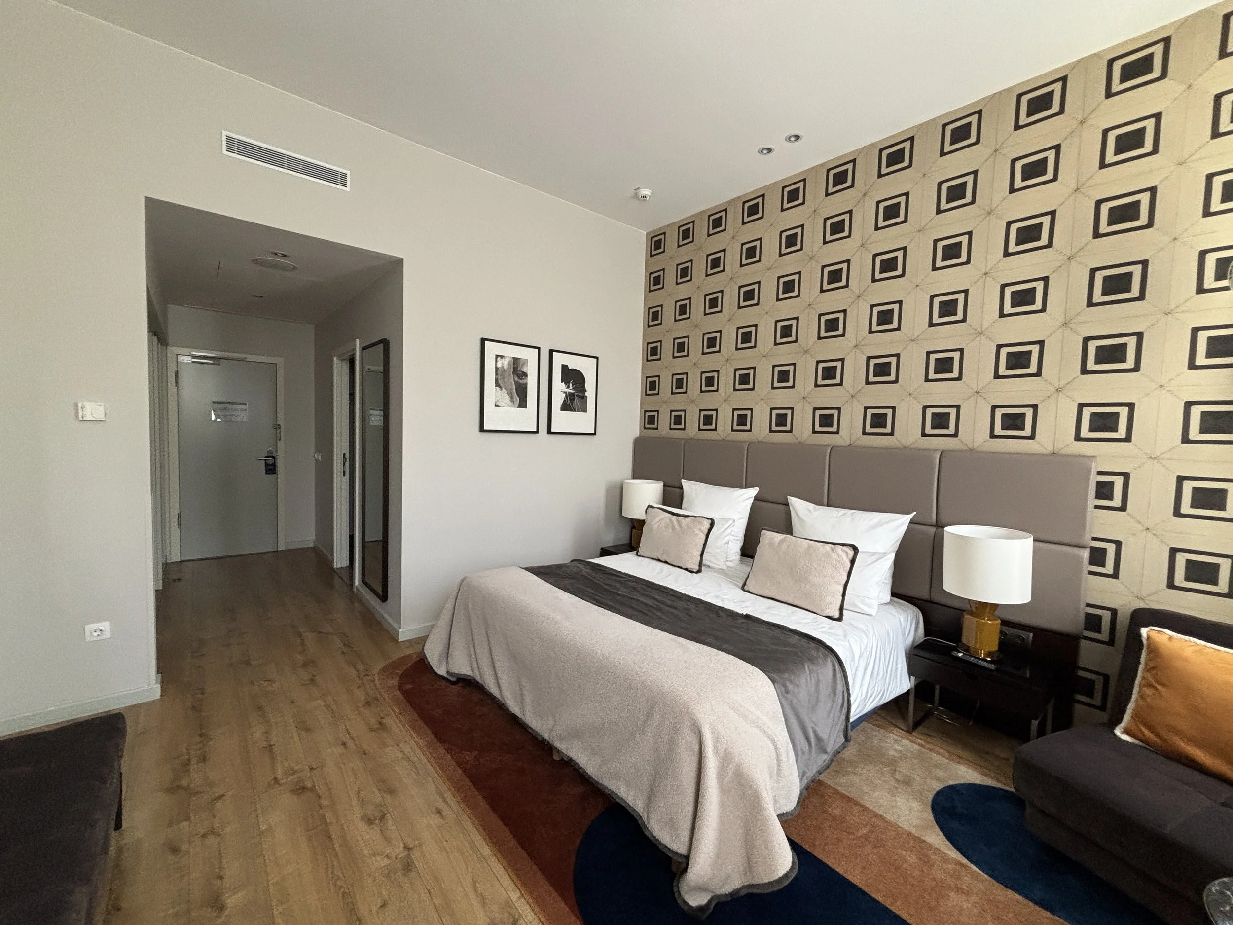
The bathroom, rather large, also super modern and impeccably clean.
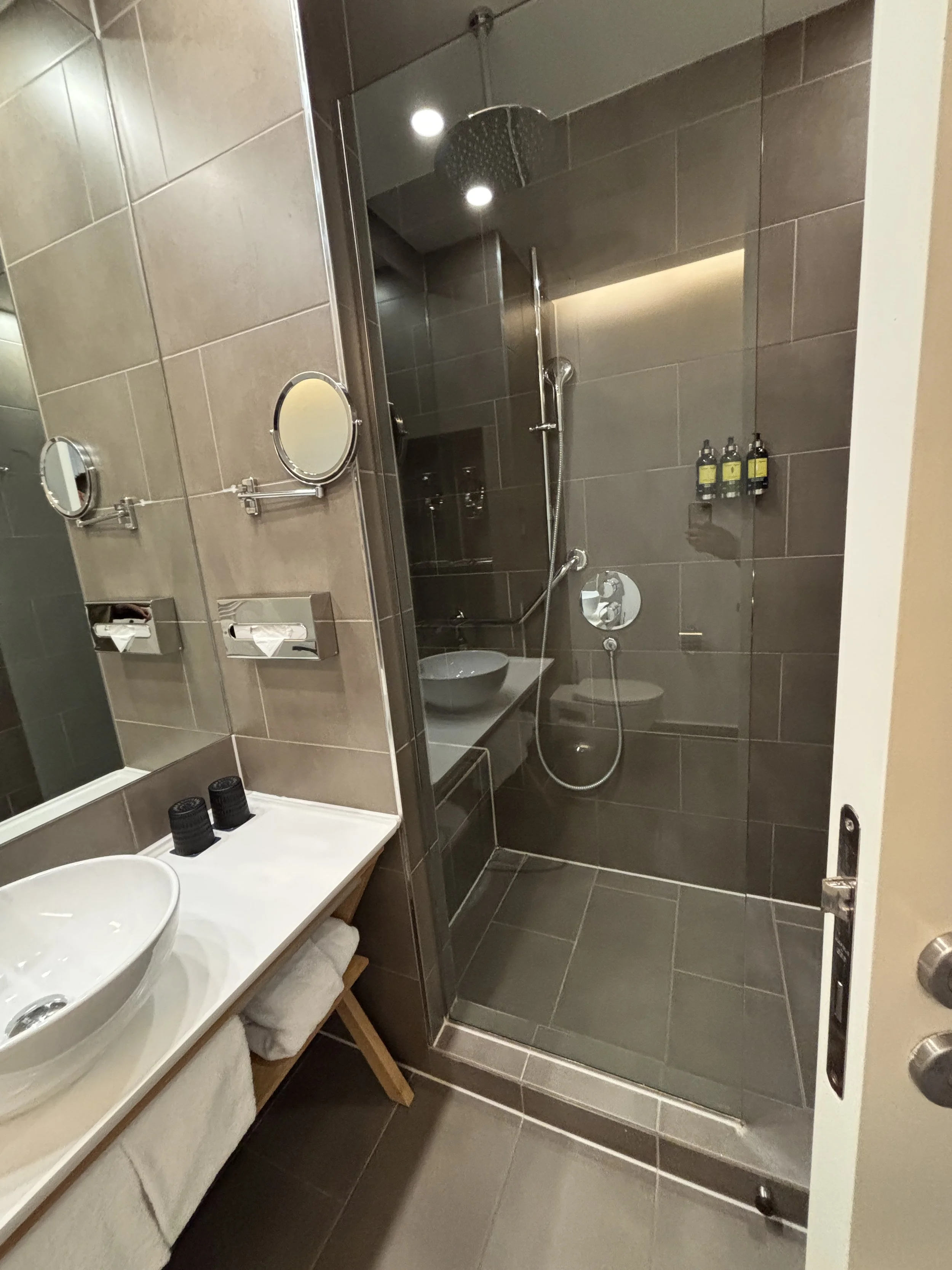
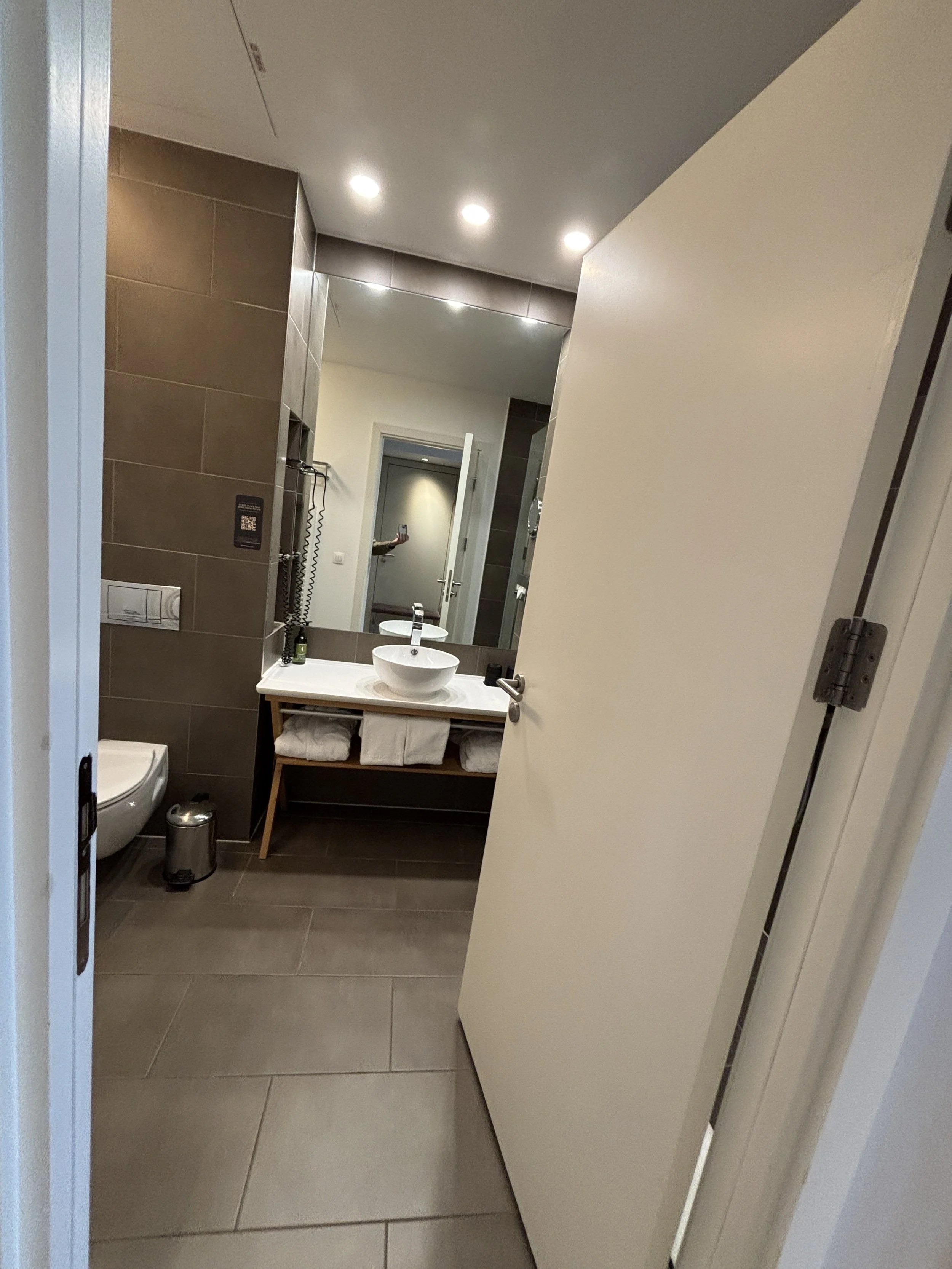
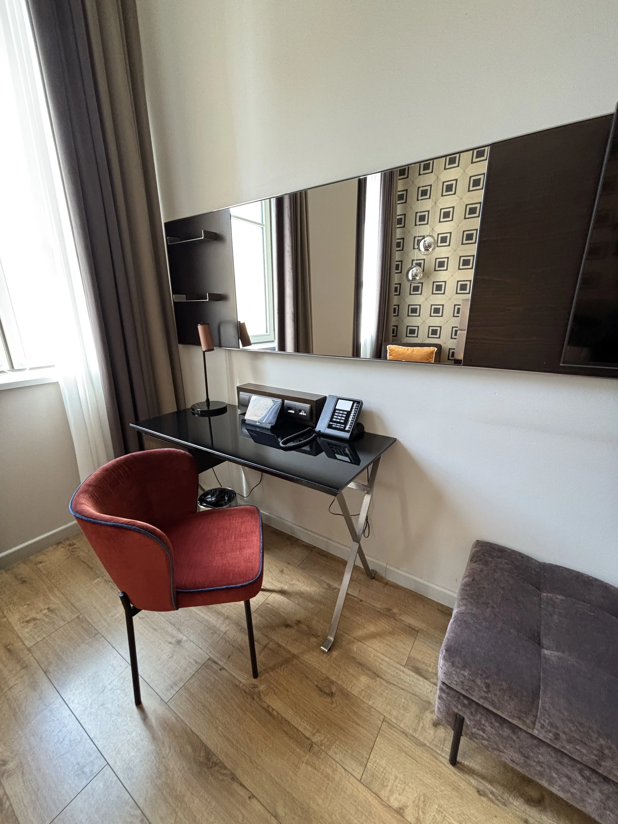

There is a little work desk, also very stylish.
On top of it, a little electronic console provides information and access to services, doing away with the old-school service directory folders.
Some more details that make The Posthouse Berlin a great hotel
A couple of additional details here: lots of space for luggage (you may have noted in the pics above that there is also a rather long bank opposite the bed) and even to sit down to take your shows on or off.
The windows open into a very calm street next to a large green area. In fact, the hotel is located in a rather nice area, with several pedestrian streets around and some shops.
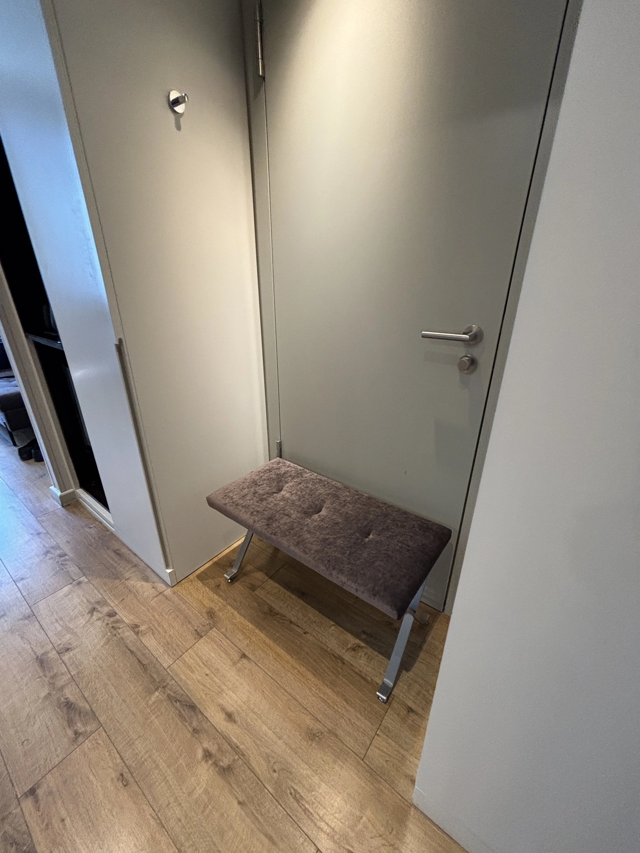
As mentioned earlier, Leonardo has developed a whole brand identity for The Posthouse which is pervasive throughout the property. I particularly liked the very elegant way in which it is applied to all the small items you find in the room and in other parts of the hotel.
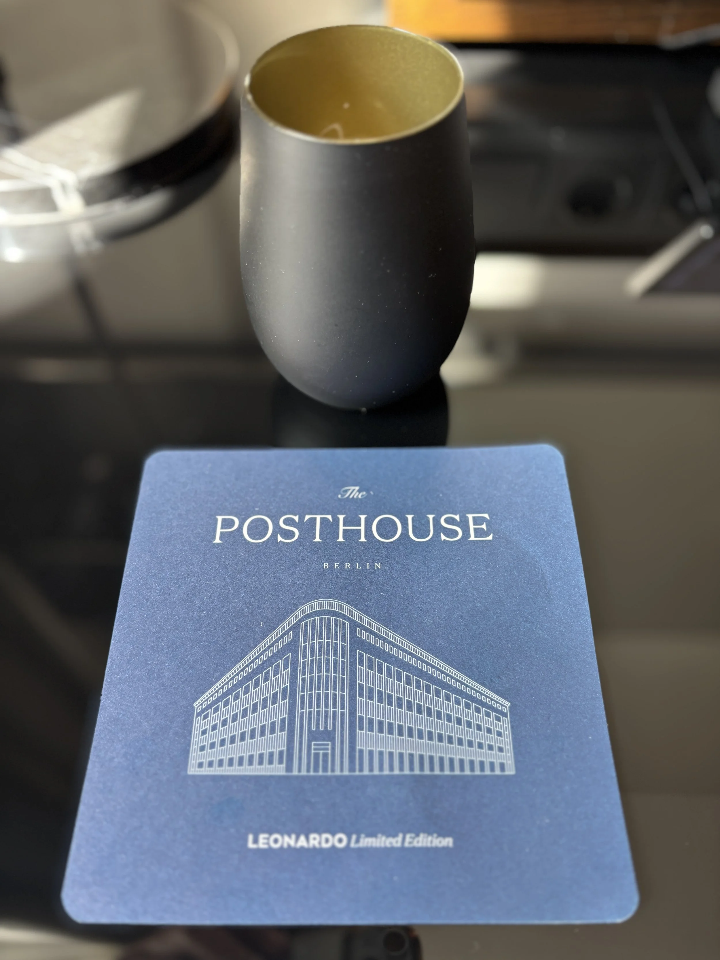
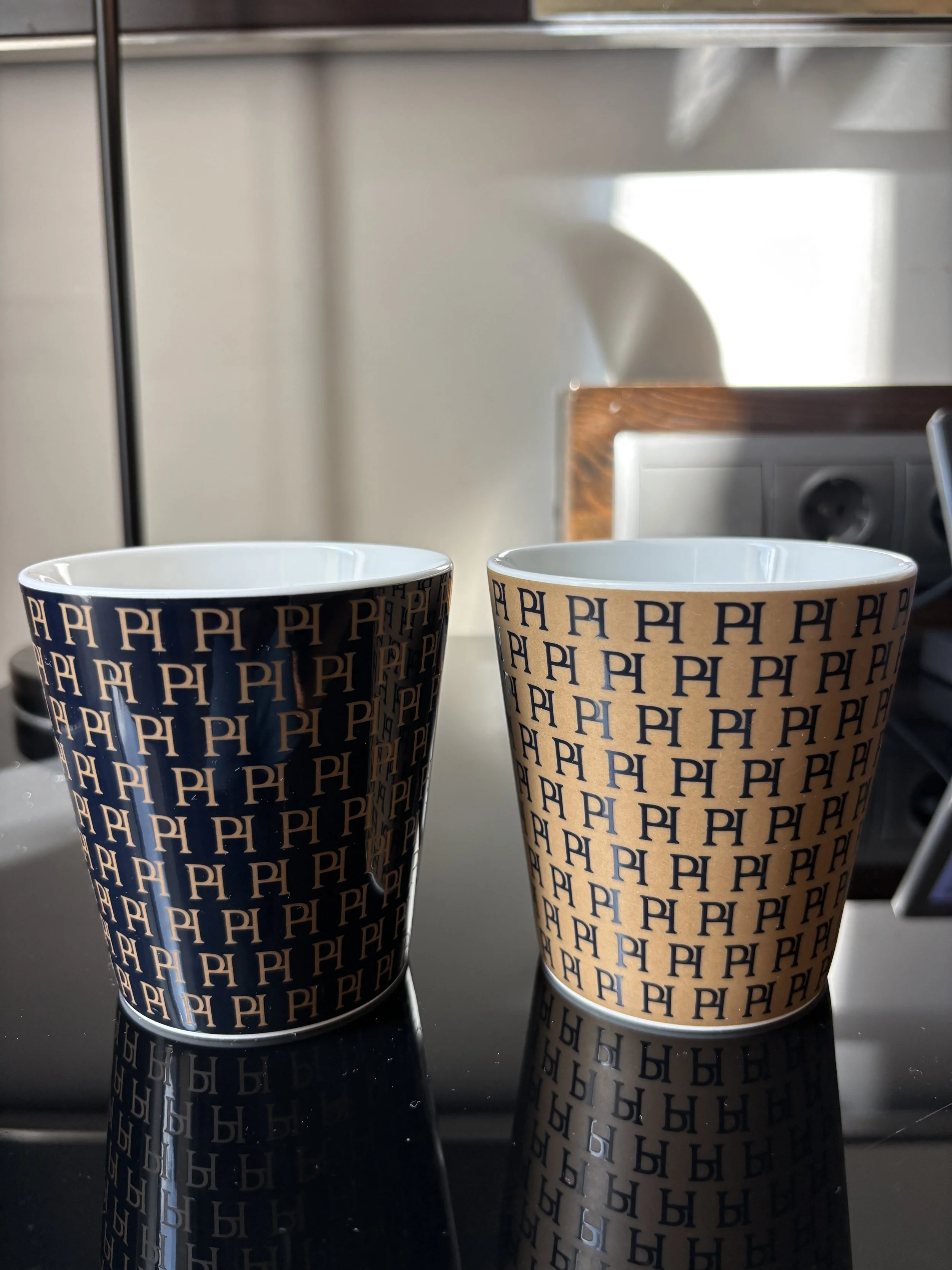
The Posthouse has also its restaurant, which shares the same ground floor space as the lobby and reception area. The different spaces are blended seamlessly and get plenty of natural light through the large windows that open onto the street on one side and onto a very large open courtyard on the other.
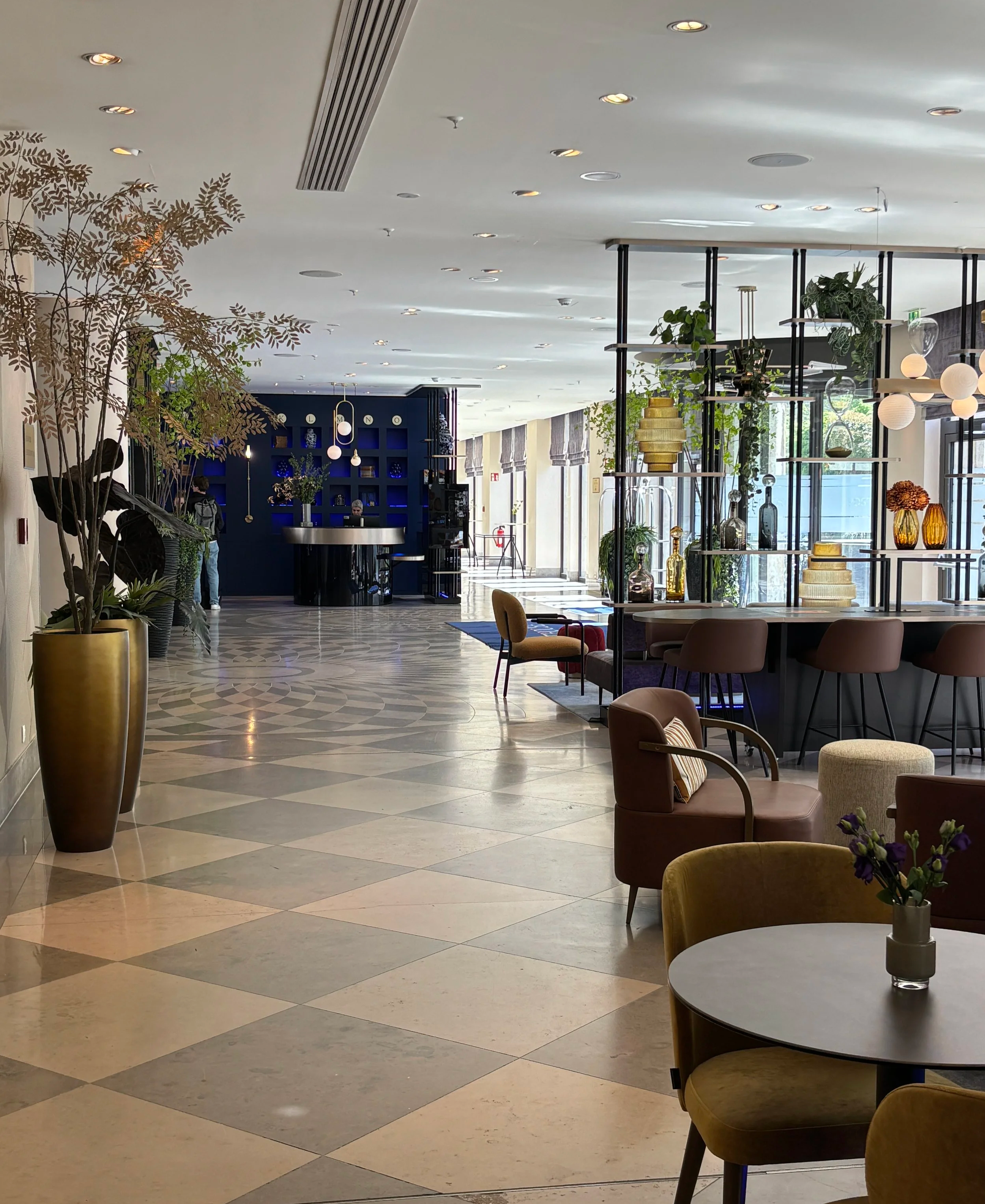
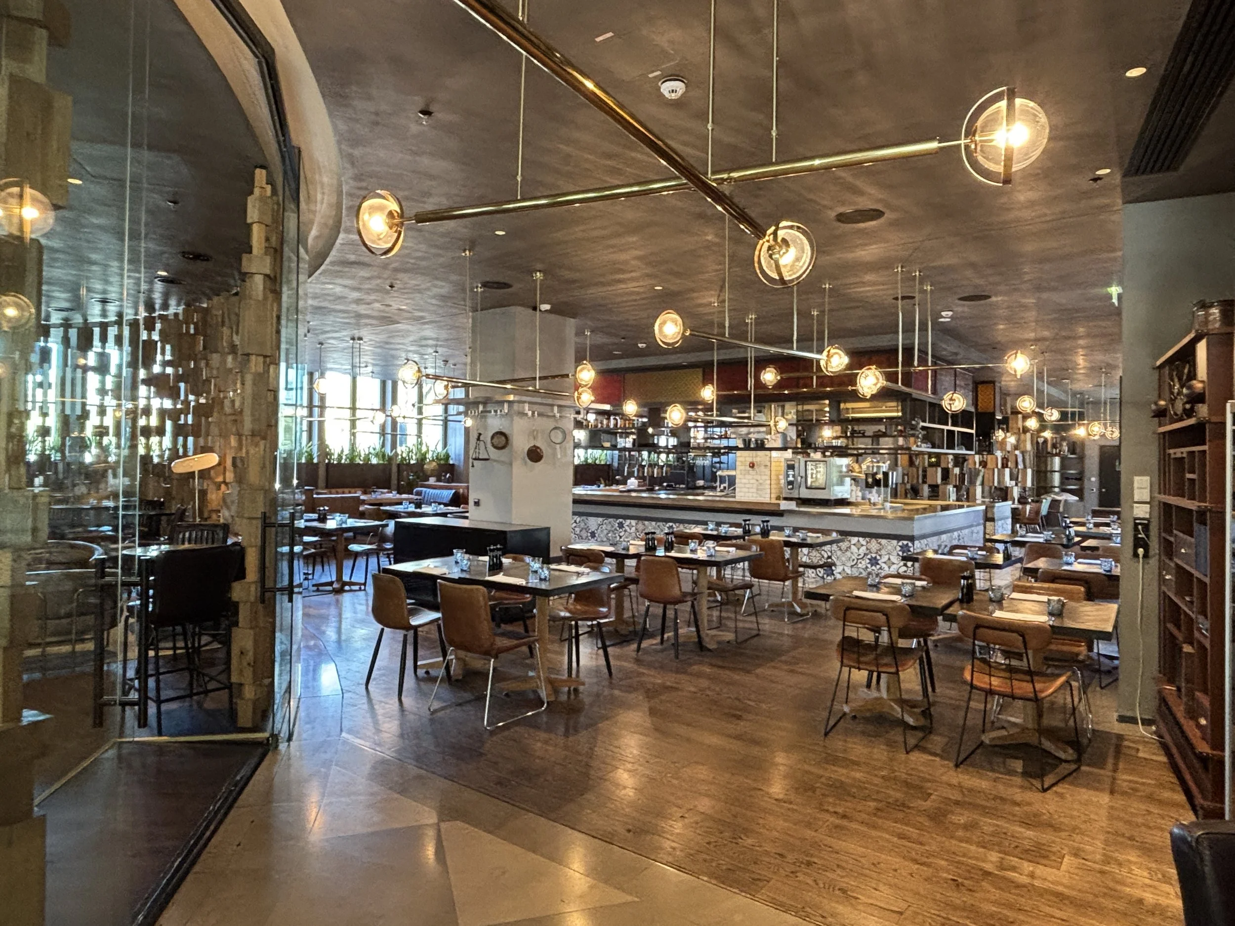
A couple of other details I liked in the lobby area:
A snacks and water station which guests can access at all hours. Even if the hotel staff renew the bottles of mineral water in the room, its location on the way to the lifts makes for a very convenient stopping point to get some refreshments on the way to and from the rooms. Btw, note also how the hotel decor takes into account the postal history of the place.
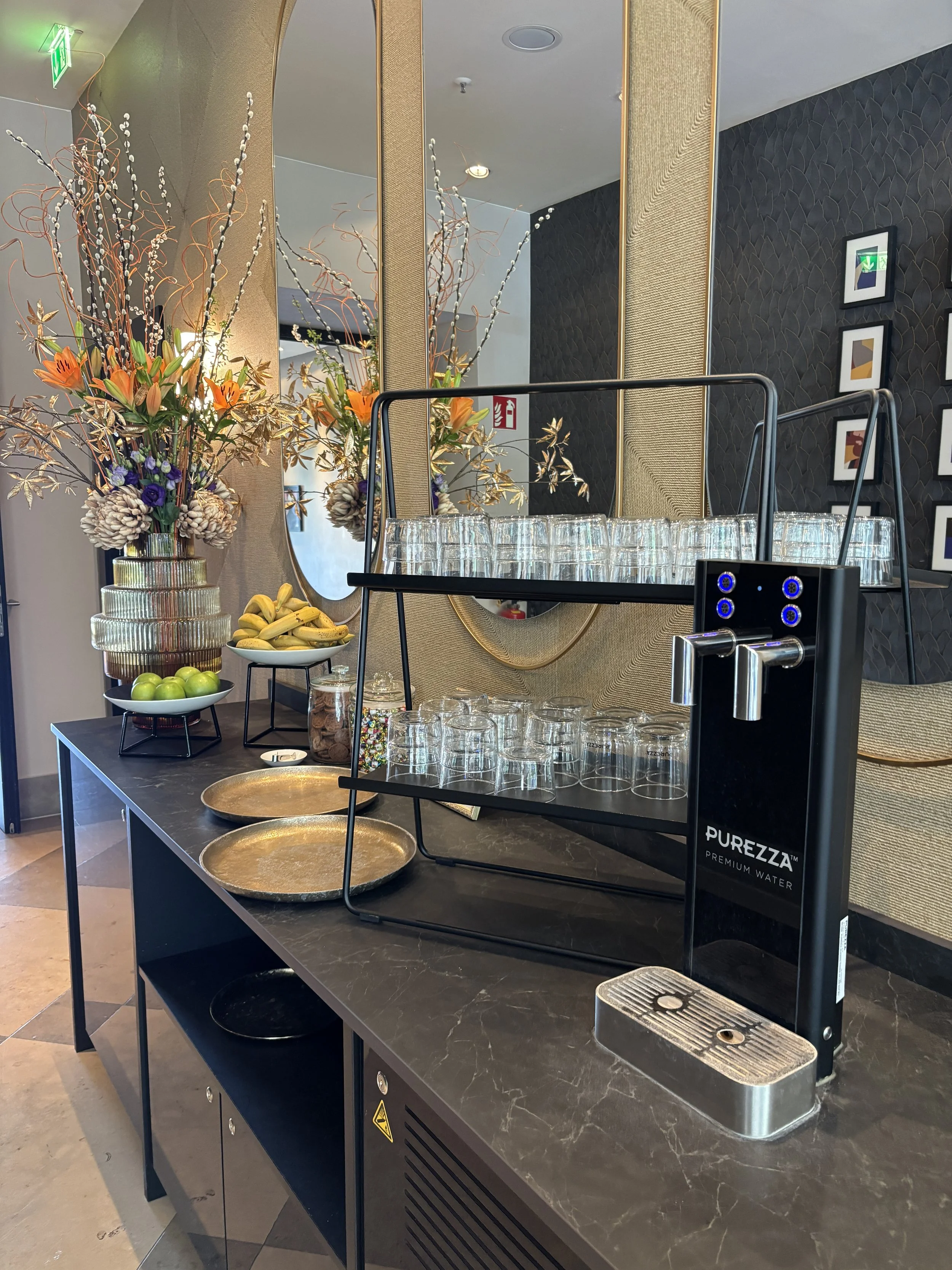
When you come into The Posthouse you will notice a bicycle parking. These bicycles are actually available for rental by the day, you just need to ask at the reception, here below you can see the prices.
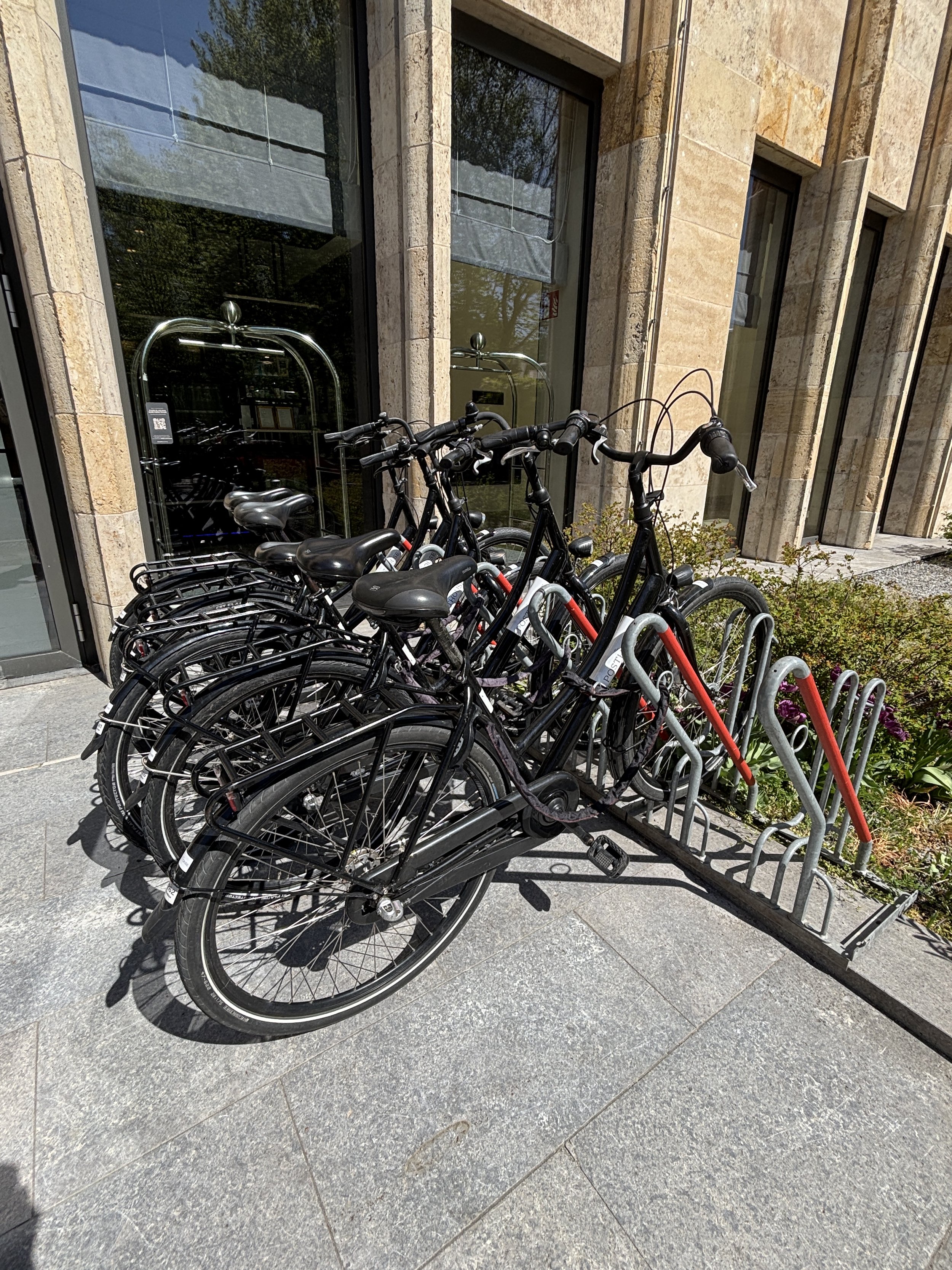
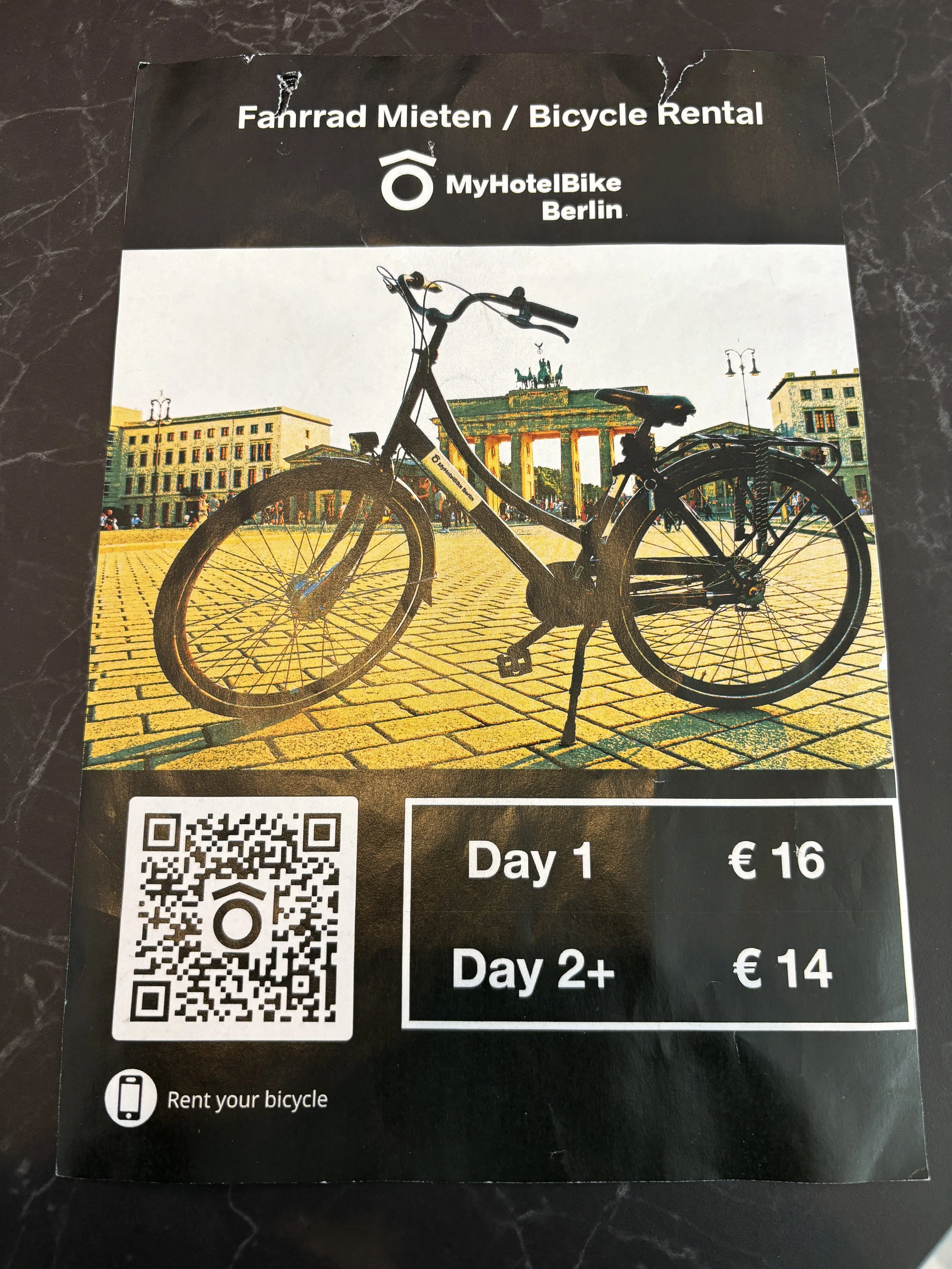
So, what’s our take: this hotel offers also amazing value for any visitor to Berlin, whether for business or leisure. As was the case of the Radisson Collection Berlin, The Posthouse Berlin Postadamer Platz offers and amazing combination of modern, spacious and pleasant facilities, impeccable service and prices that are truly hard to believe for what you get!
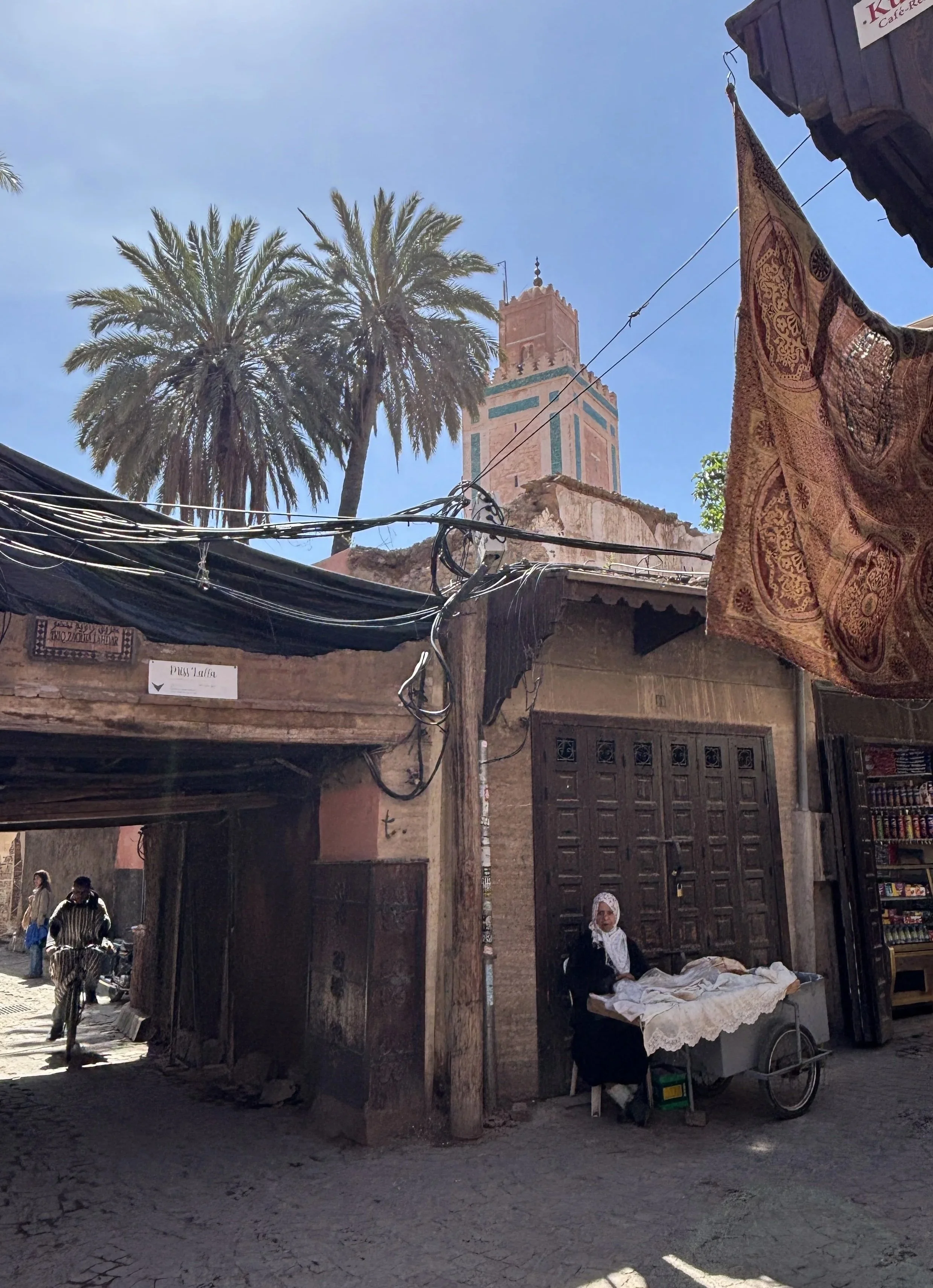
One day in Marrakech, what to see and what to do
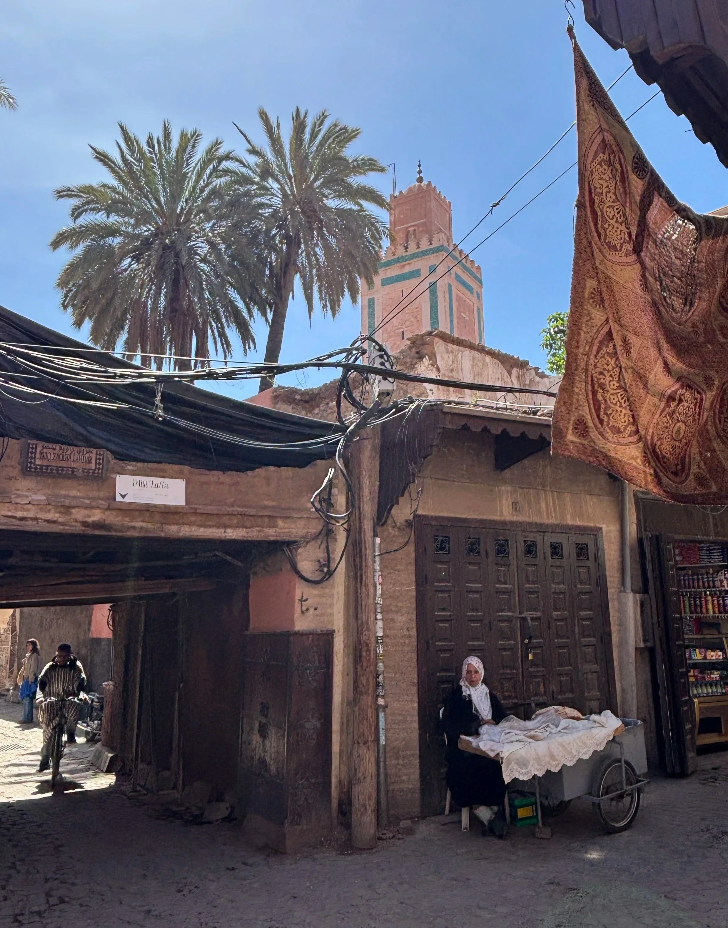
Marrakech is a top tourist destination and for good reason. The fact that Morocco has a visa-free policy for most countries and that it is part of the European single skies area (making it attractive and accessible to all European low cost carriers) makes it also a very attractive destination barely a couple of hours’ flight away from many European capitals.
There is, indeed, much to see in Marrakech, and Morocco in general, but what if you are somehow time-constrained, as it was, in fact, my case, as I was attending a conference in the city?
The good news is that most of Marrakech's highlights are within easy reach of each other, meaning an efficient day tripper can cover a surprising amount of ground. That said, a couple of extra days are well worth it to fully absorb the sensory experience that is Marrakech.
In any case, I have compiled here a list of the top things to do and to see in Marrakech in a day (and on a budget!).
Some of you may notice some omissions, like the iconic Villa Majorelle. I actually tried to fit it in my itinerary, but, alas! it was already fully booked during the time slots in which I may have been able to visit. So, the only advice I can give regarding this site is: if you are planning to visit, book in advance!
And, now, without further ado, let’s start our quick, but intense, tour of Marrakech!
In this post we will see:
Jemaa el-Fna, the beating heart of old Marrakech
A walk through Marrakech Medina and its different souks
Best rooftop view in Marrakech
The Ben Youssef Madrasa
Bahia Palace
Koutoubia minaret and gardens
Hotel La Mamounia
Recommended places to stay in Marrakech
Moving around Marrakech: practical tips
Modern Marakech
Menara Gardens
This post may contain affiliate links. If you book or buy something through them, I earn a small commission, at no extra cost to you. It's one of the ways I keep Places of Charm going. Thank you for your support.
What to see and what to do when visiting the Medina of Marrakech
Jemaa el-Fna - The main square of Marrakech
I decided to start with Jemaa el-Fna because this wide open square is not just the best known spot in Marrakech, but also the heart (not in a literal geographical sense though) of the Marrakech Medina.
Jemaa el-Fna is buzzing with activity throughout the day and evening. It is here where you can get the first taste of, let’s say, the exotic side of Marrakech. The large esplanade is full of street musicians, snake charmers and other sorts of stalls, each peddling their own merchandise or trade. There is also a whole section that is take by food stalls, forming a sort of open air, food court.
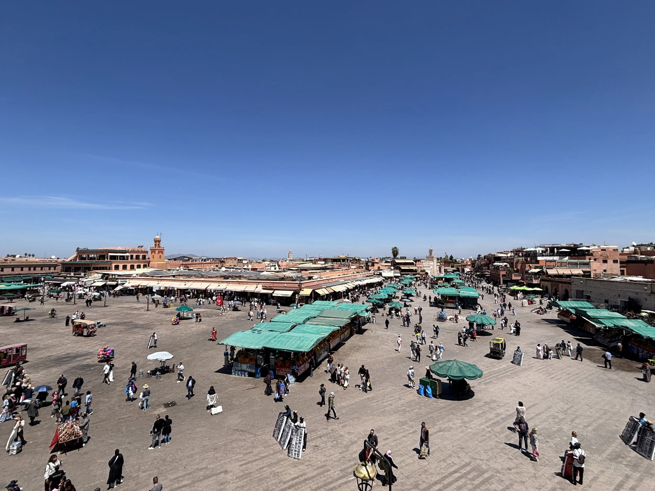
Jemaa el-Fna acts also as a nexus with the modern part of town, so if you are coming by taxi, for example, it is likely to be your gateway into the Medina. It is also on the main axis leading to the Koutoubia minaret and gardens and La Mamounia Hotel, which will explain in more detail further down this post.
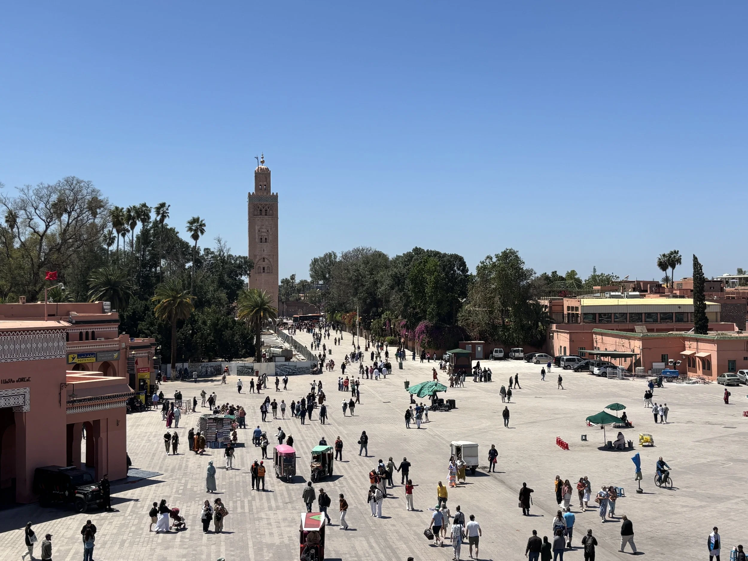
Best view of Jemaa el-Fna? The rooftop terrace of Café Glacier
While a walk through Jemaa el-Fna is a must of any Marrakech visit, I also recommend getting the general perspective by visiting the rooftop terrace at Café Glacier (“Le Grand Balcon Café Glacier”). This is a traditional café which has views towards the main section of the square (it is the point from where the above pictures were taken).
The café is nothing luxurious, but it has a sort of old-school charm. There is a ground floor area as well (see the pic below), but I would definitely recommend going upstairs (just one note: there is little in the way of shadow, so it can be quite hot when the Sun is shinning!).
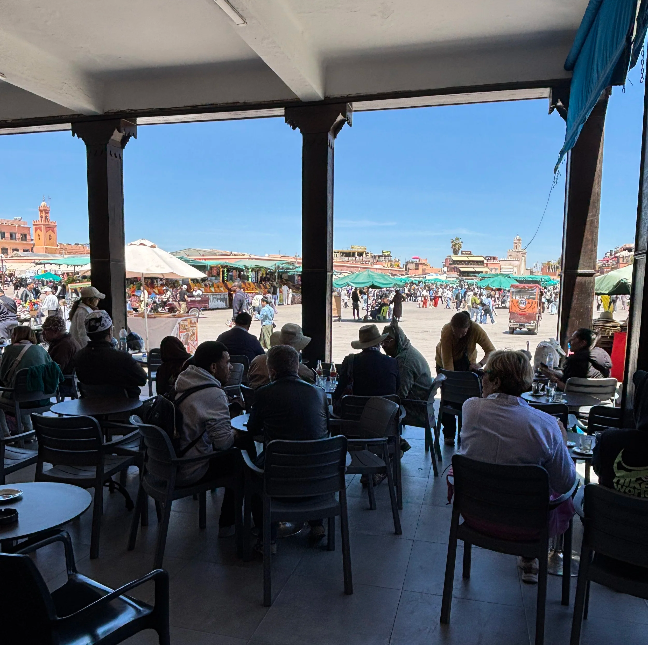
Visiting Jemaa el-Fna in the evening
Regardless of what is your itinerary throughout the day, make sure you allocate at least some time for an evening visit to Jemaa el-Fna. This is actually when the square is the most lively.
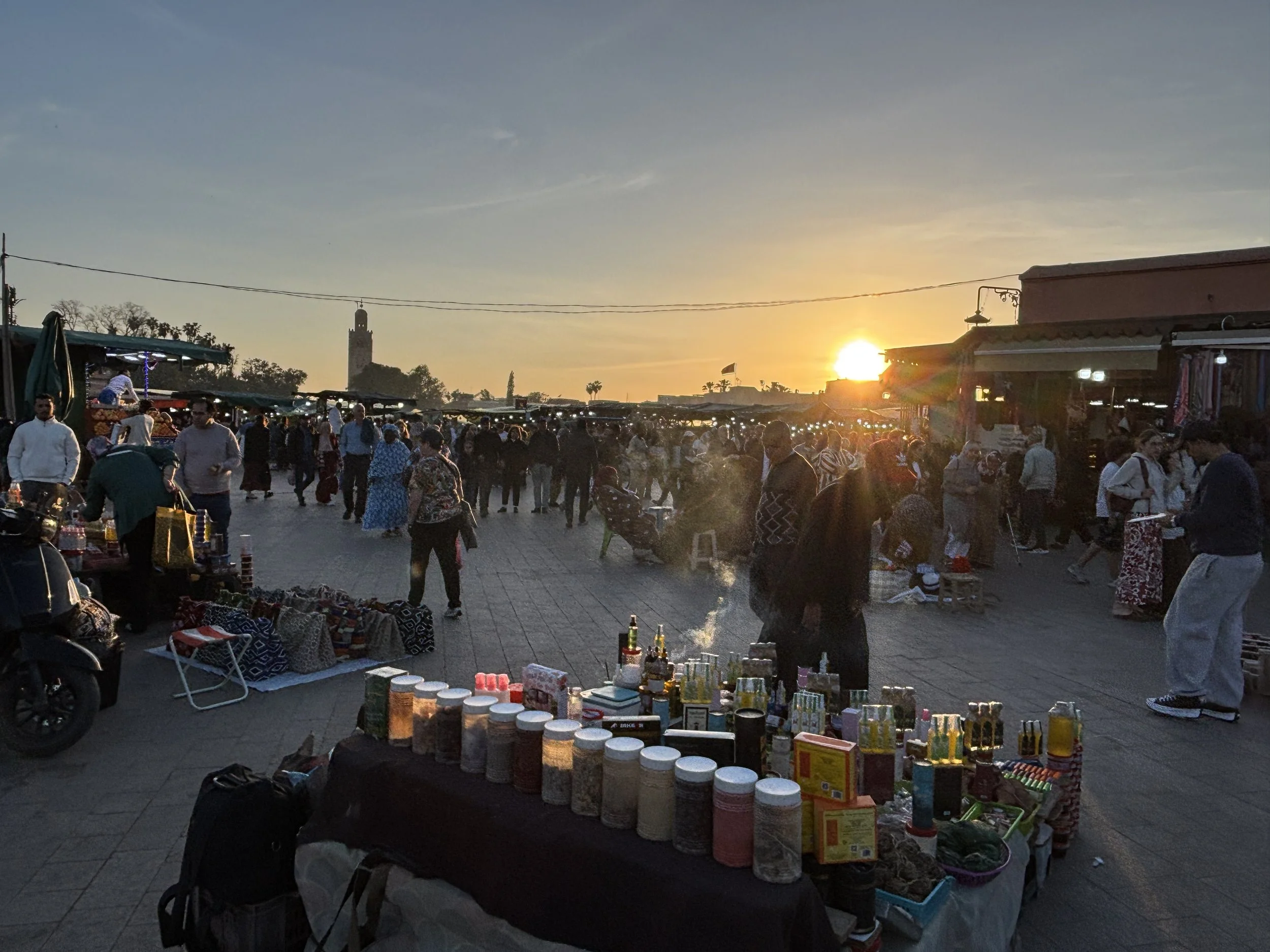
As the sun goes down (and outdoor activity becomes more pleasant in the balmy weather), activity picks up, with traders, musicians, performers and the like taking over Jemaa el-Fna.
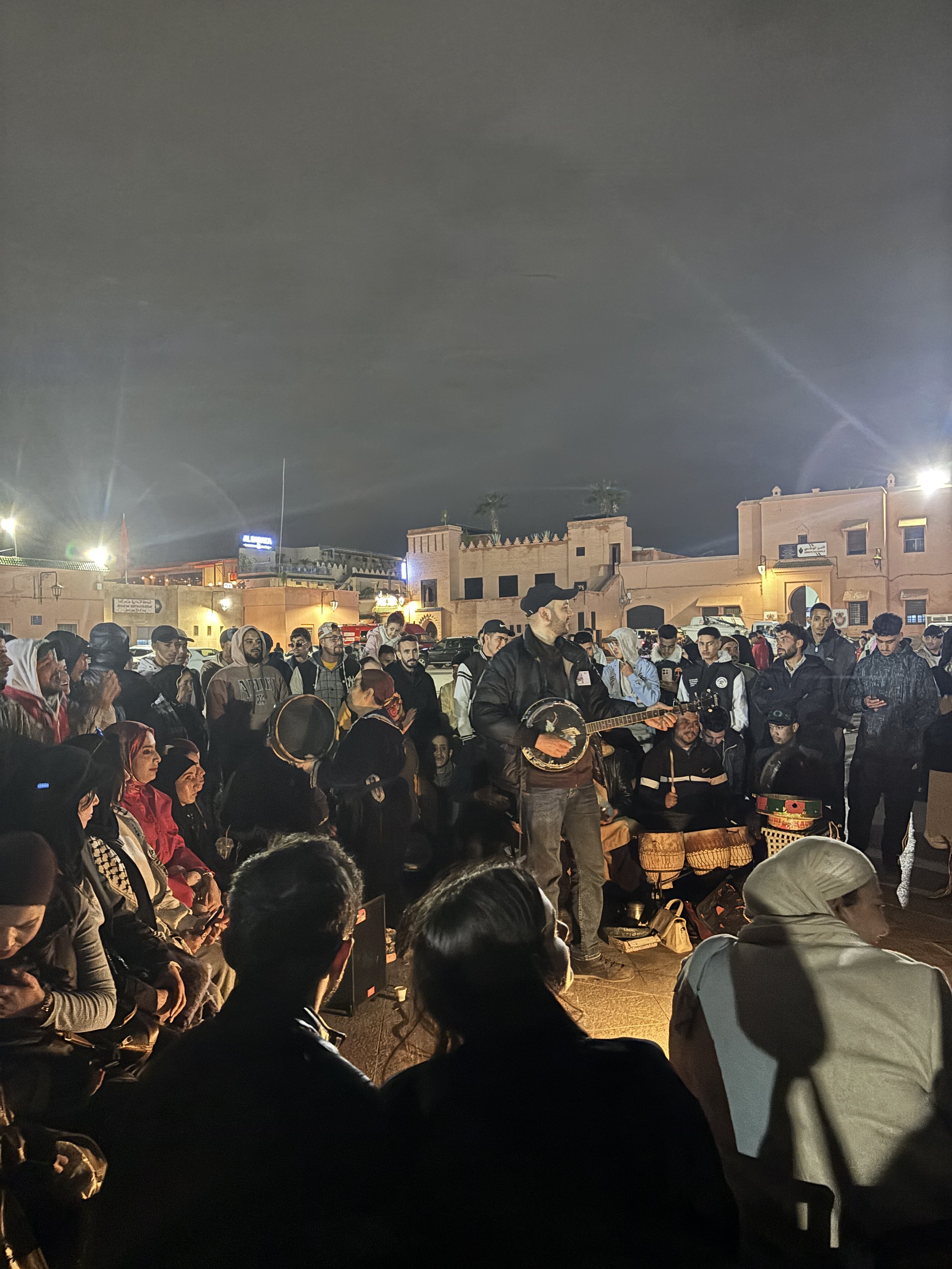
The buzz goes on until quite late at night, with the numerous food stalls catering to a crowd of both locals and tourists. Be prepared for many of the vendors trying to get your attention as you walk by!
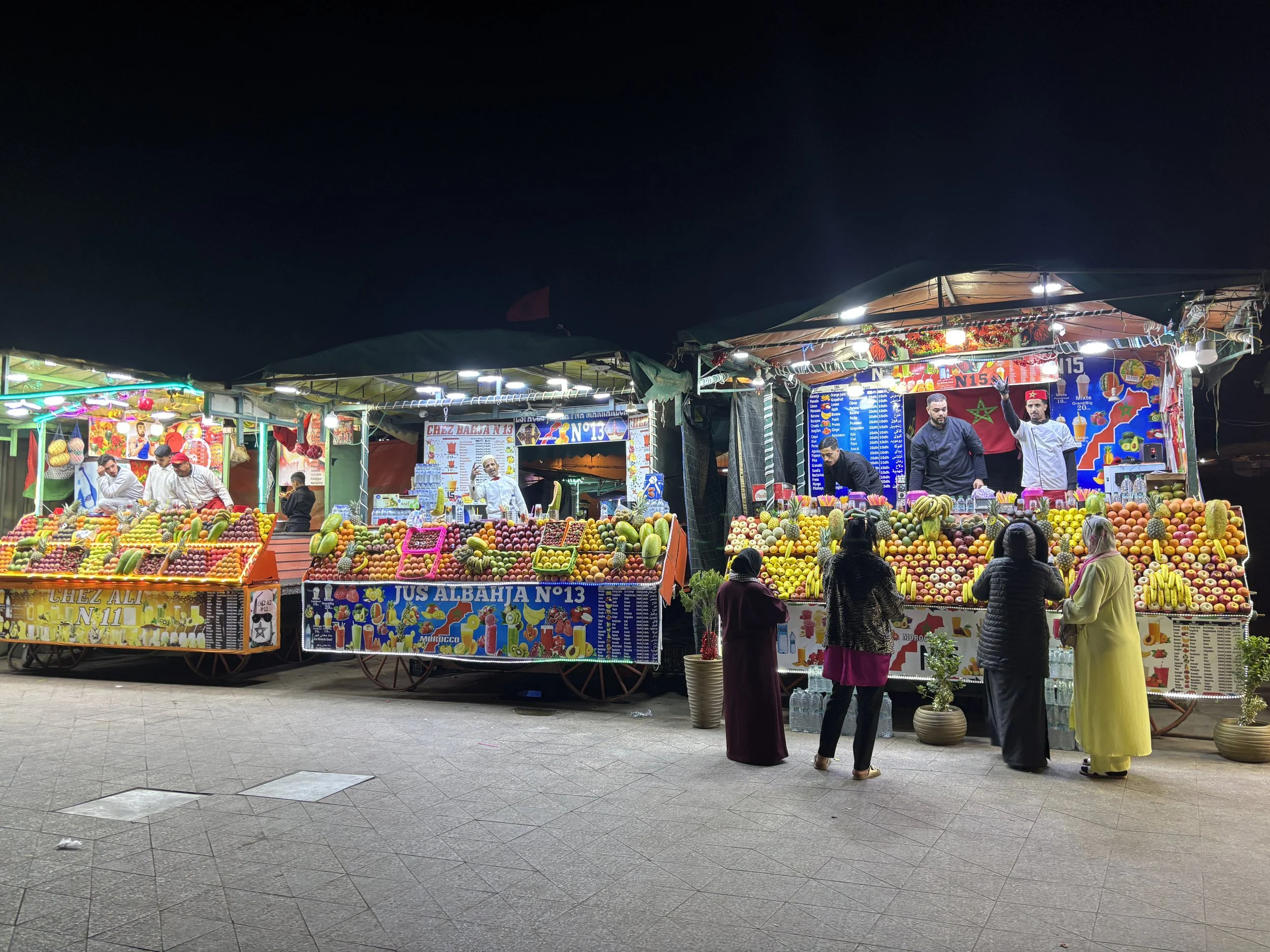
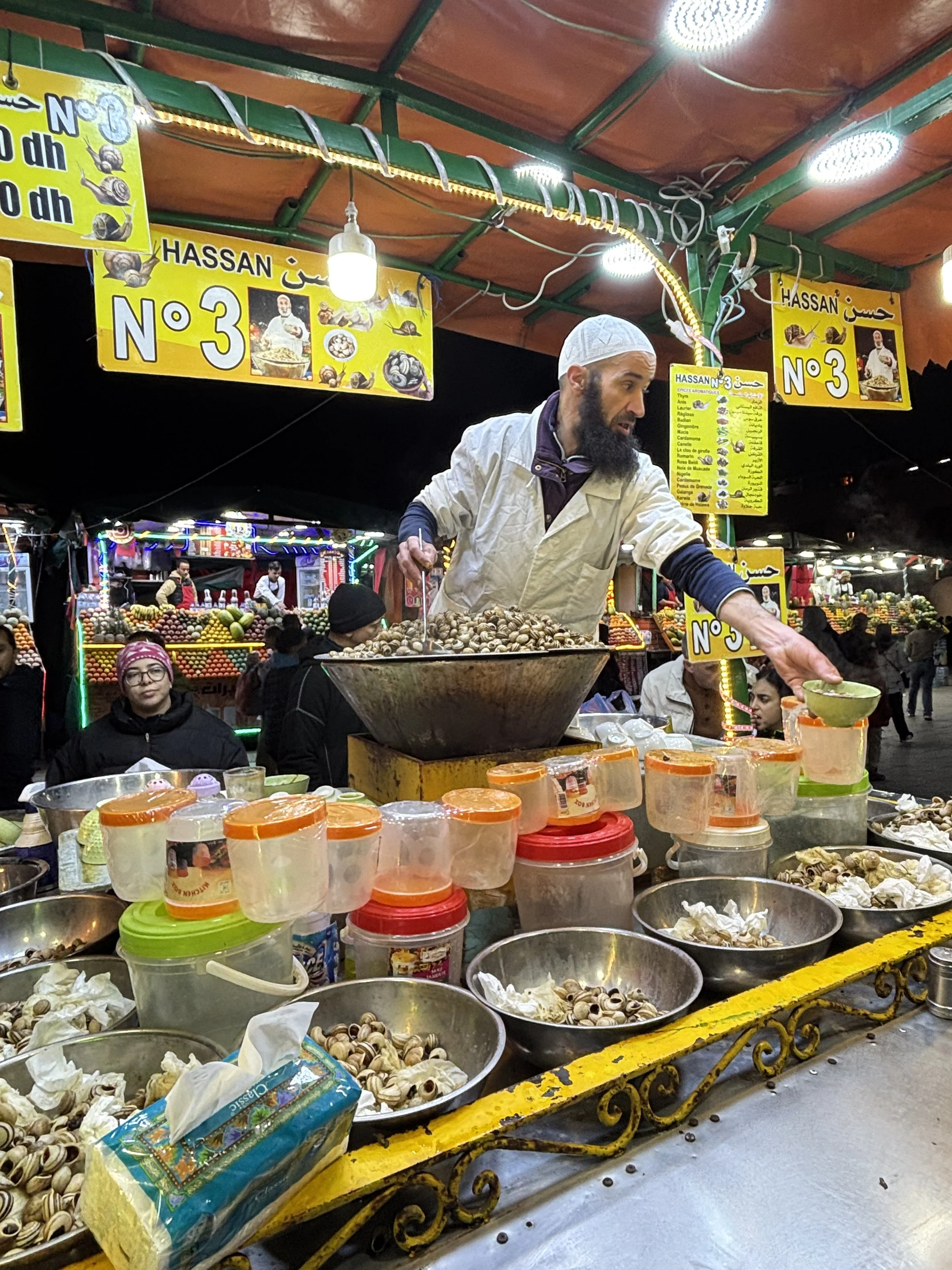
A walk through the Marrakech Medina
Whether you are into shopping or not, a walk through the Medina is going to take most of your time while in Marrakech. The place is simply huge! In fact, the whole historical town of Marrakech is like a giant souk, with seemingly endless streets and alleys fully lined up with shops and stalls.
The Medina of Marrakech is actually a UNESCO World Heritage site. When the French took over Morocco, in the early 20th C., they brought with them European-style urban planning, which is now visible in parts of modern Marrakech, but left the medina untouched. So, the city has preserved pretty much its entire walled ensemble.
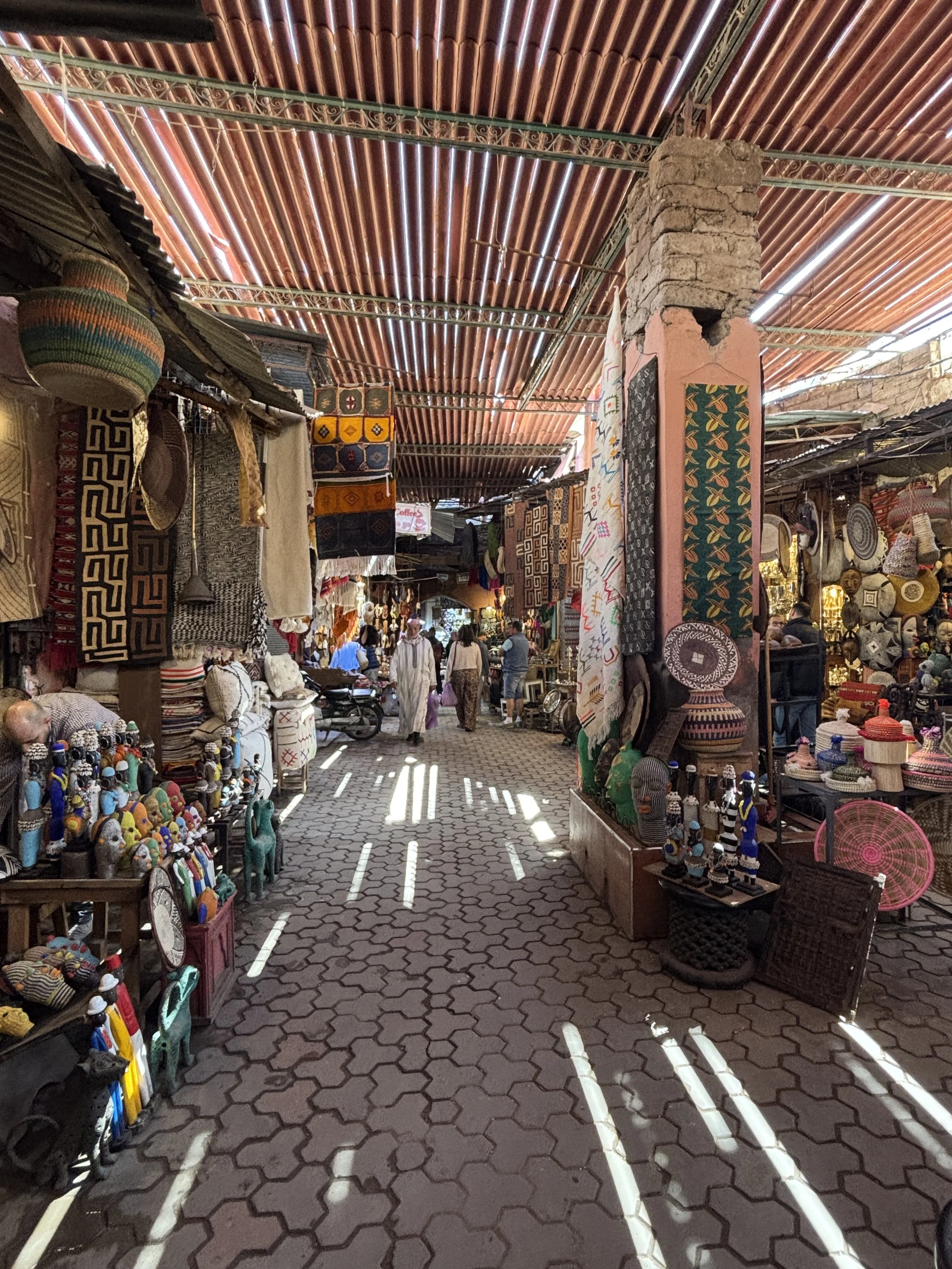
When it comes to walking through the Medina, I don’t have a specific itinerary to recommend. In fact, the best plan is possibly to visit with no plan at all, just walk around randomly and you likely won’t be disappointed, since there is something new around every corner.
Nowadays the streets of the Medina are obviously quite tourist-oriented, although you can still see some scenes that look like from the old days, like people riding carts pulled by mules and the like.
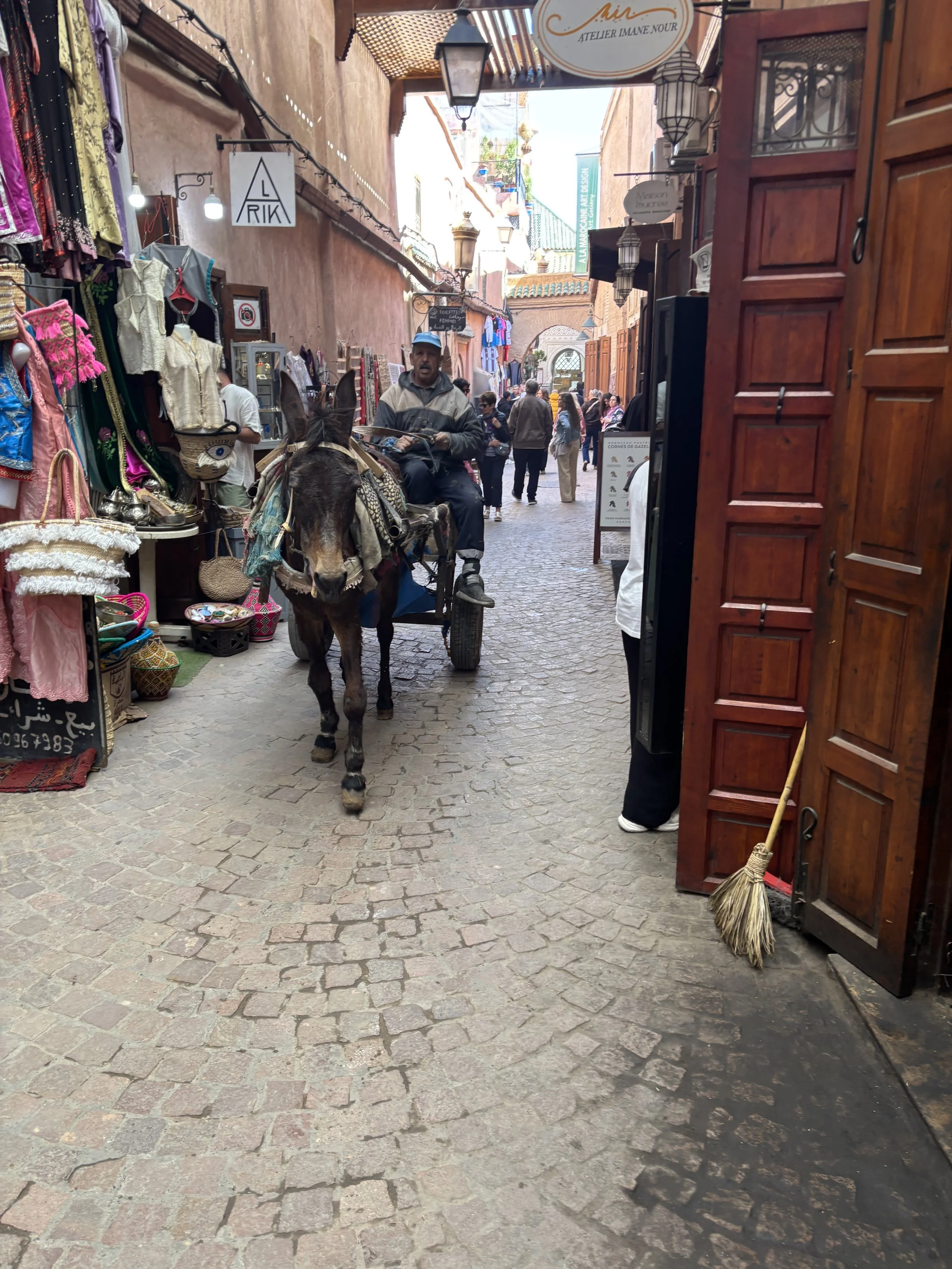
The Medina contains, actually, a number of different “souks”, each dedicated to a different trade. The limits between them, however, are not very evident to the visitor, since they exist in a continuum.
Below are some of the souks, in practice you may walk from one to the next without even noticing:
Souk des Babouches for sandals and footwear
Souk des Caftan for traditional robes and garments
Souk Lghzel, a wool market
Souk des Tanneurs and Souk Cherratine , for leather goods
Souk Haddadine, for metal work
Souk des Menuisiers (Souk Chouari) for woodwork and carpentry
Souk des Teinturiers, or the dyers' souk.
Don’t expect, however, the sort of open, colourful dye vats that are found, for example, further north in Morocco, in the city of Fez. These, apparently, exist in Marrakech at small scale in the backyard of the establishments and some are open for visits upon request (and possibly a fee), but I didn’t, so I don’t have pics or specific advice about this.
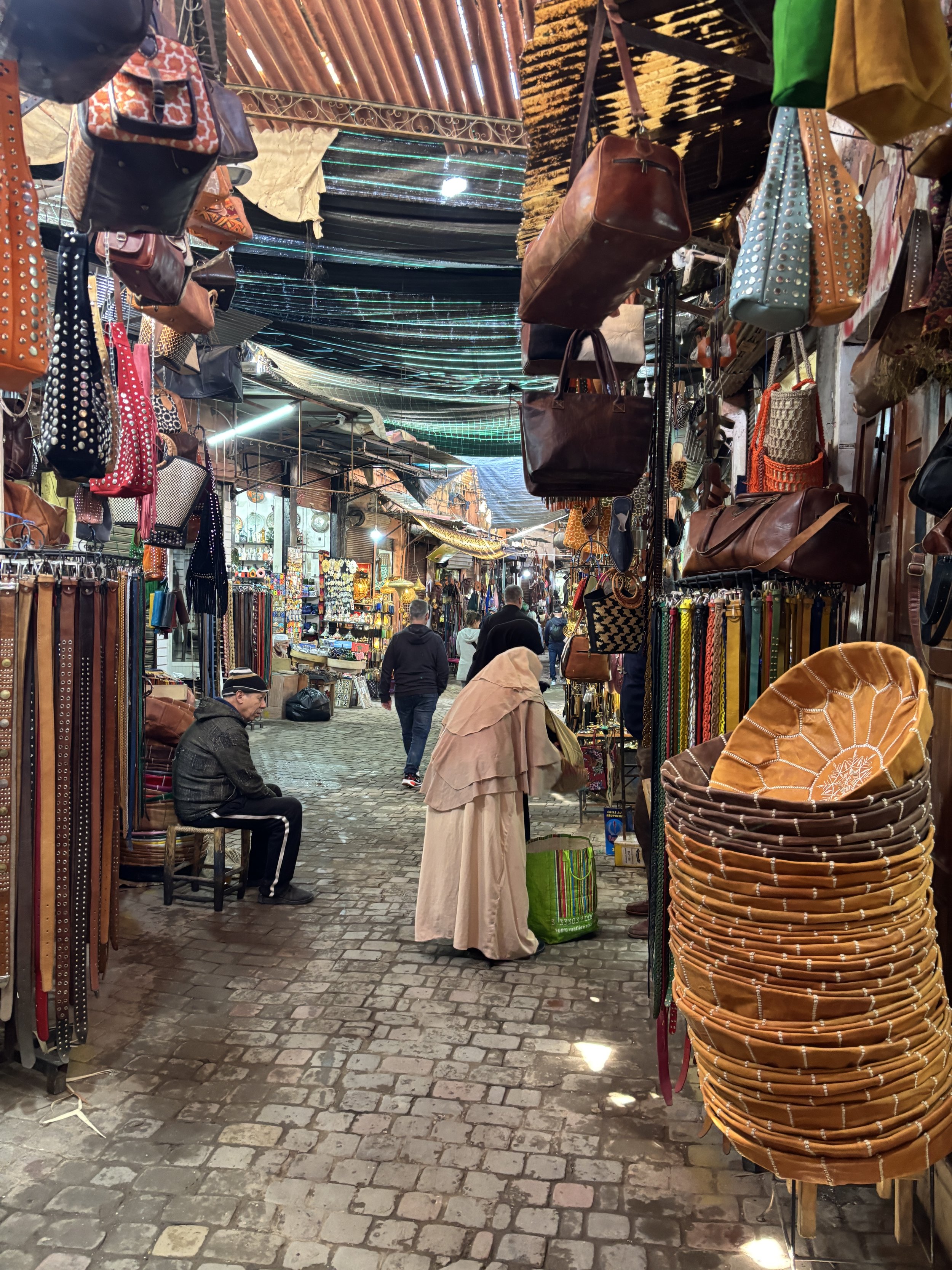
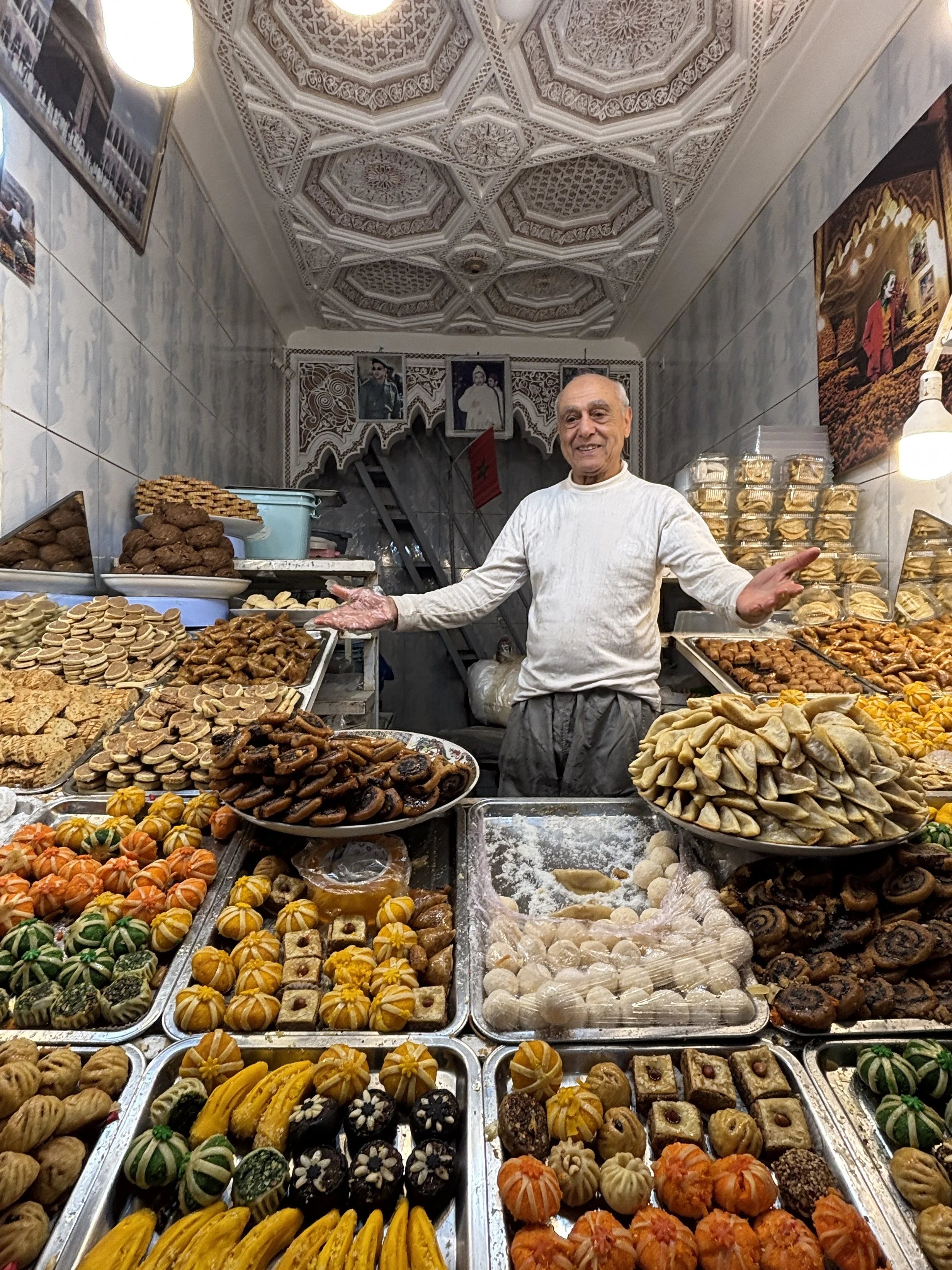
If you have a sweet tooth, you can’t miss the stalls selling traditional Moroccan desserts and sweets!
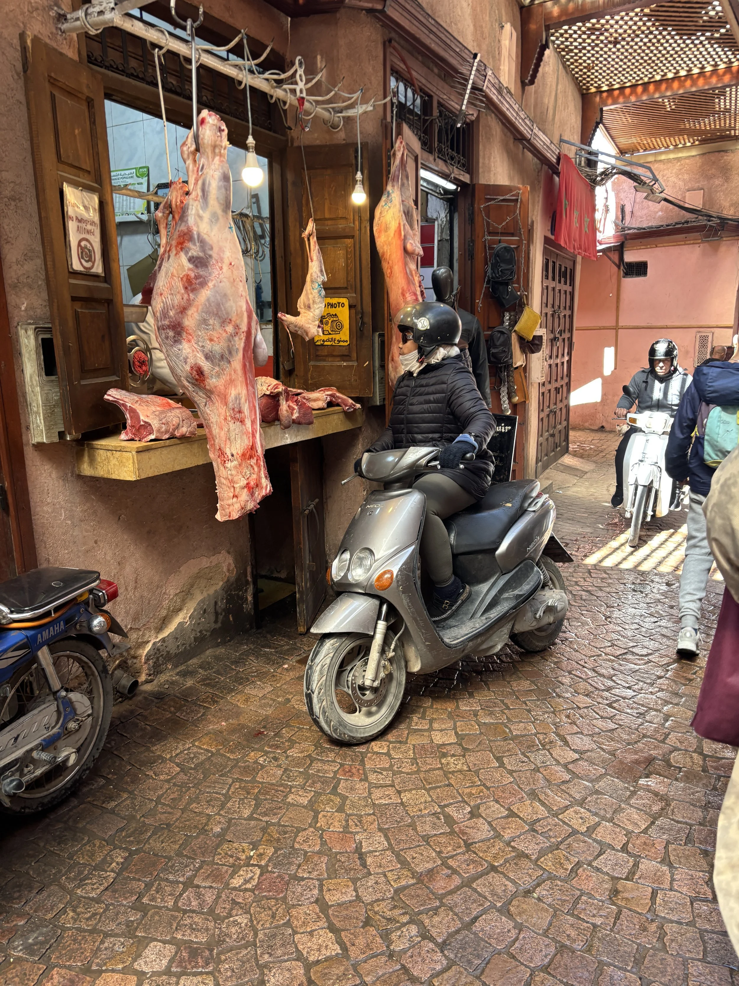
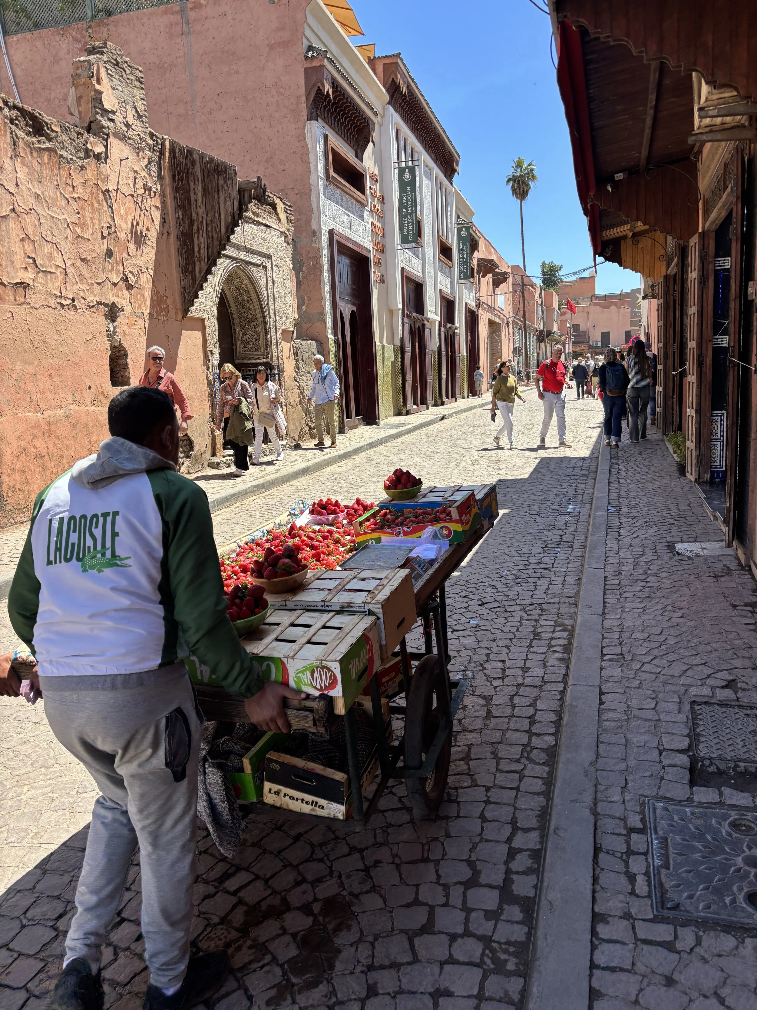
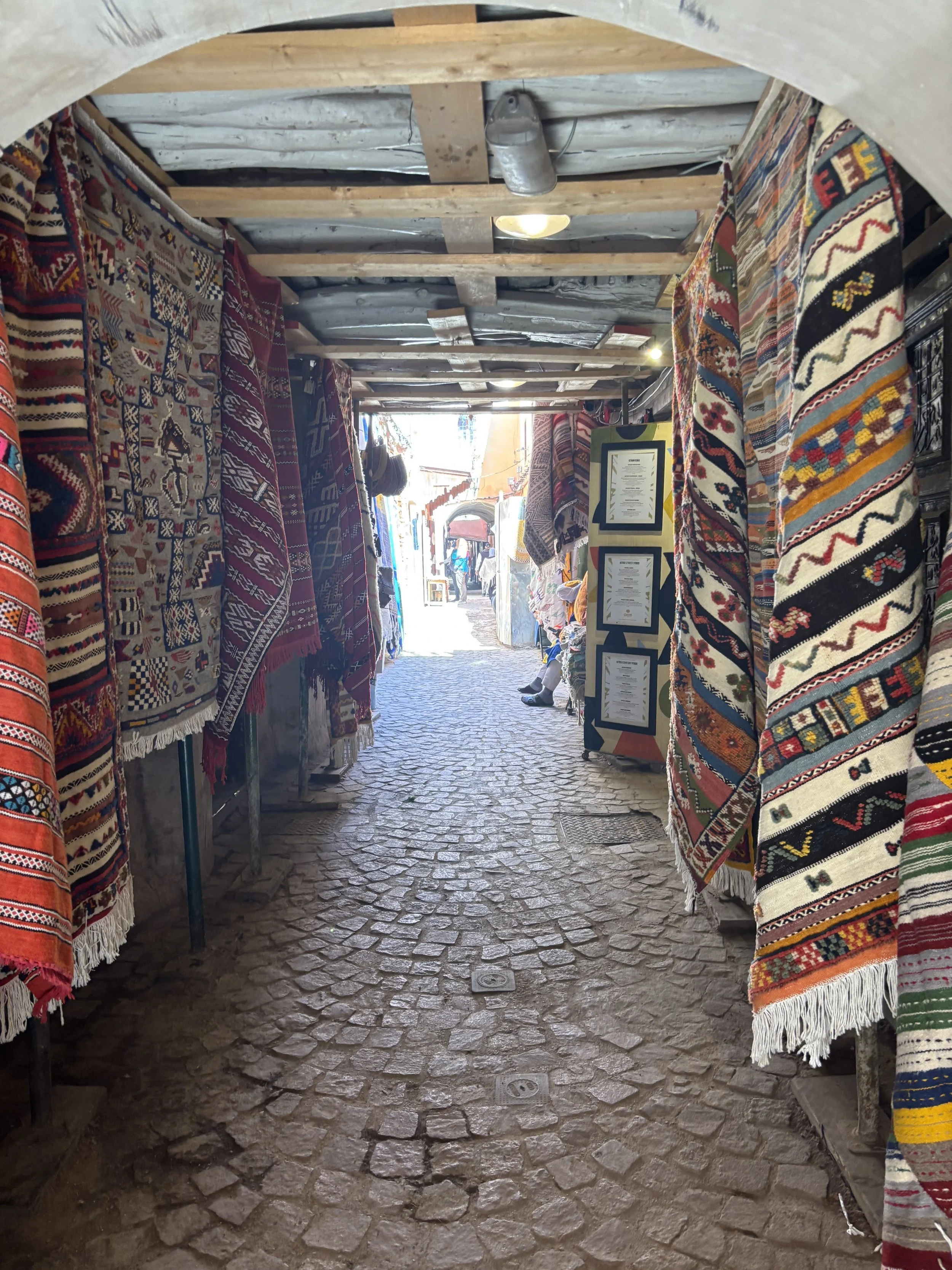
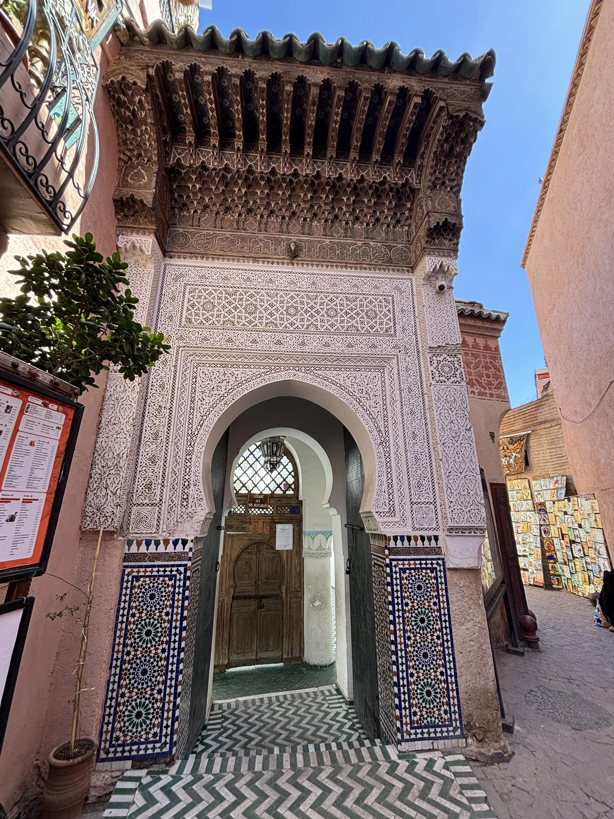
The Medina is also interesting at night, when most of the shops have closed.
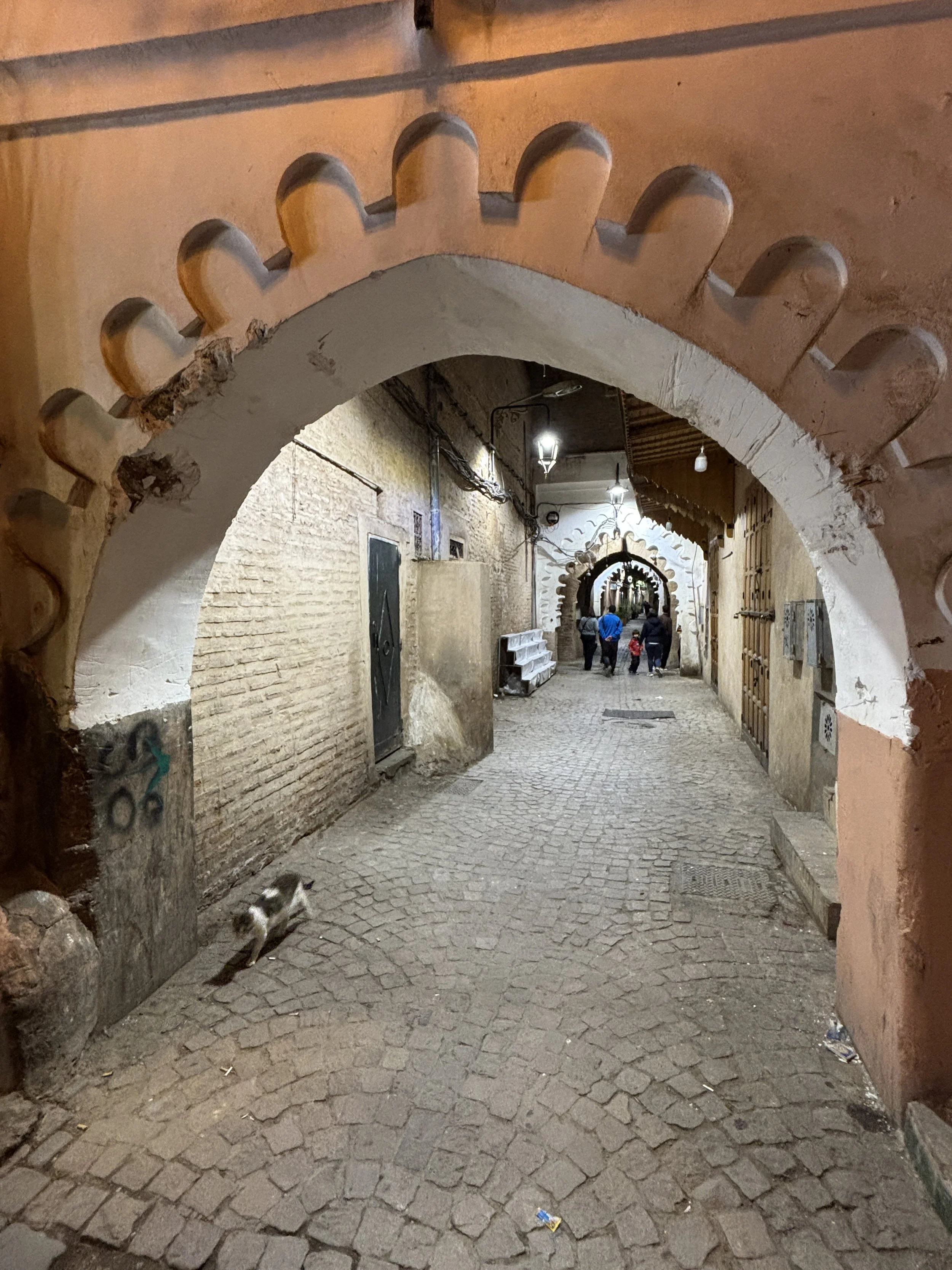
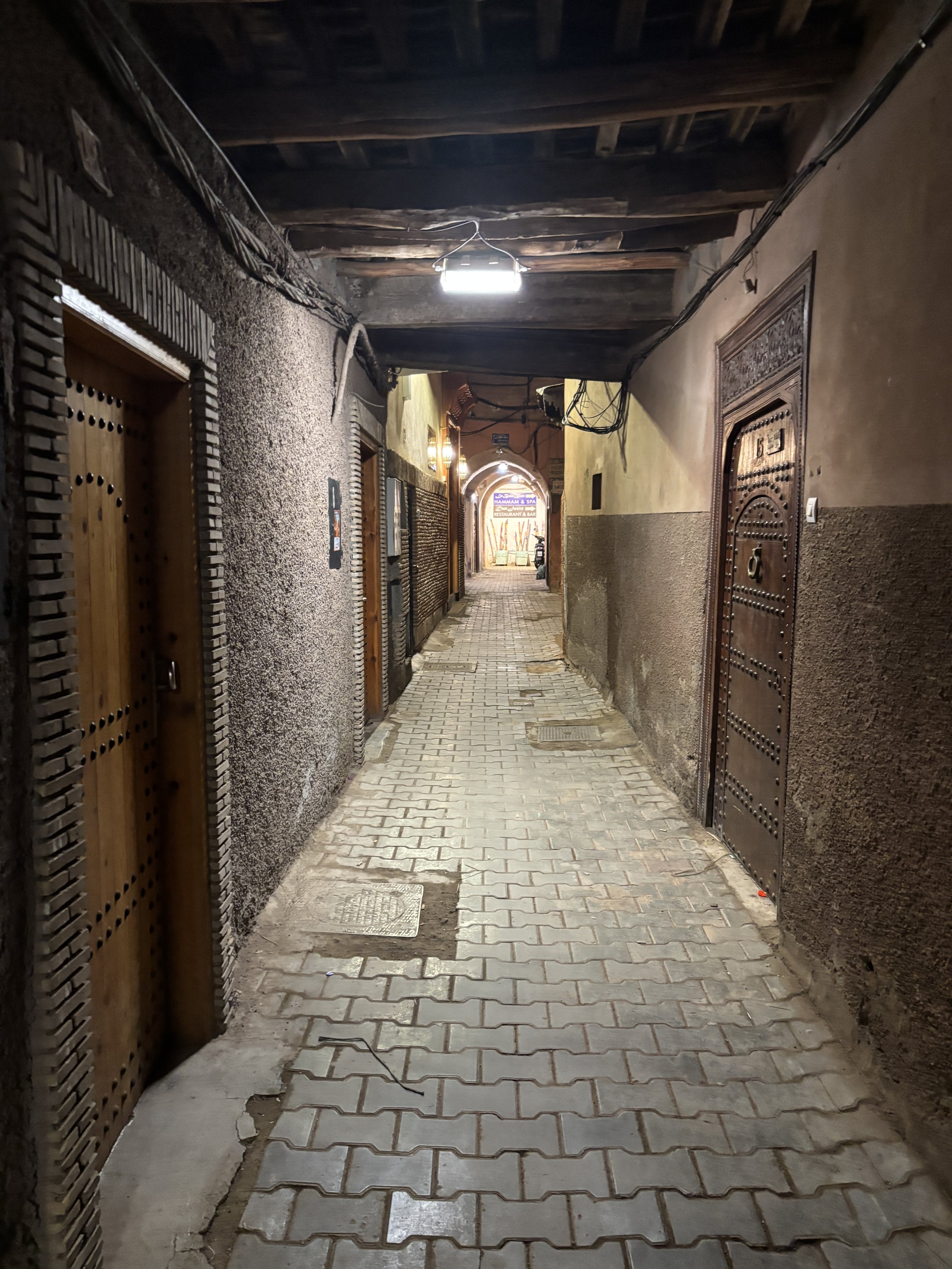
In the middle of the intricate street pattern of the Marrakech medina you will also find quite a few spots of interest, such as these ornate doors. You will also notice that most streets are actually covered.
There are also quite a few riads (traditional Moroccan guest houses) tucked into the old town (like the one I describe further down this post)
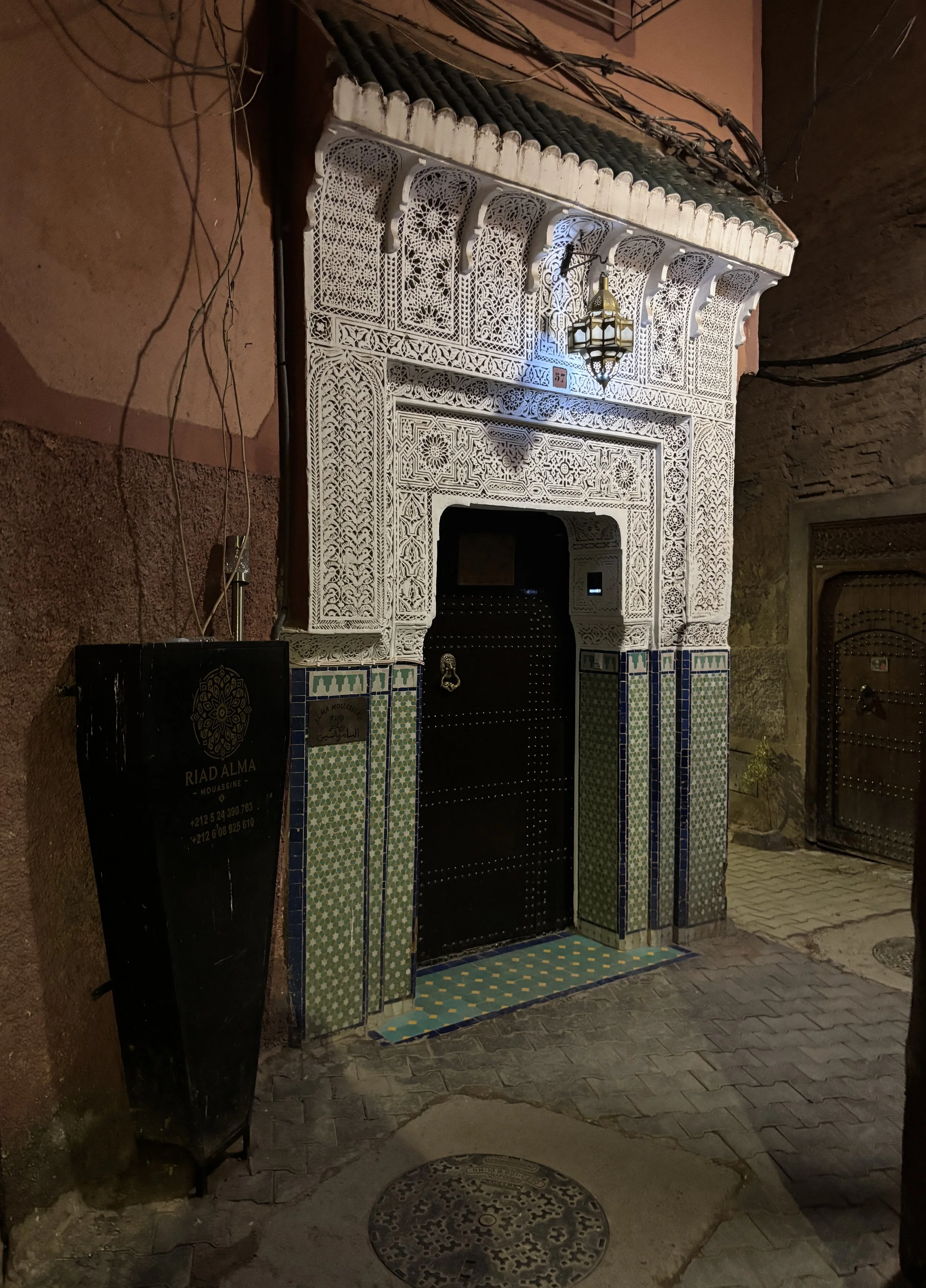
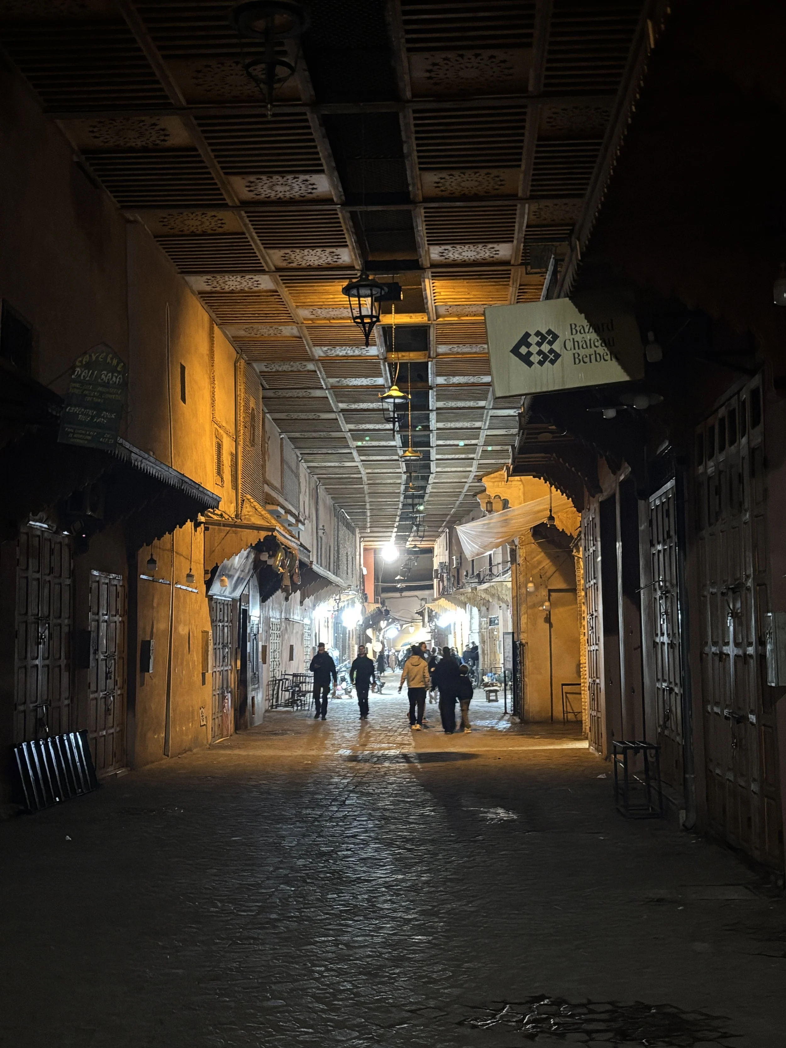
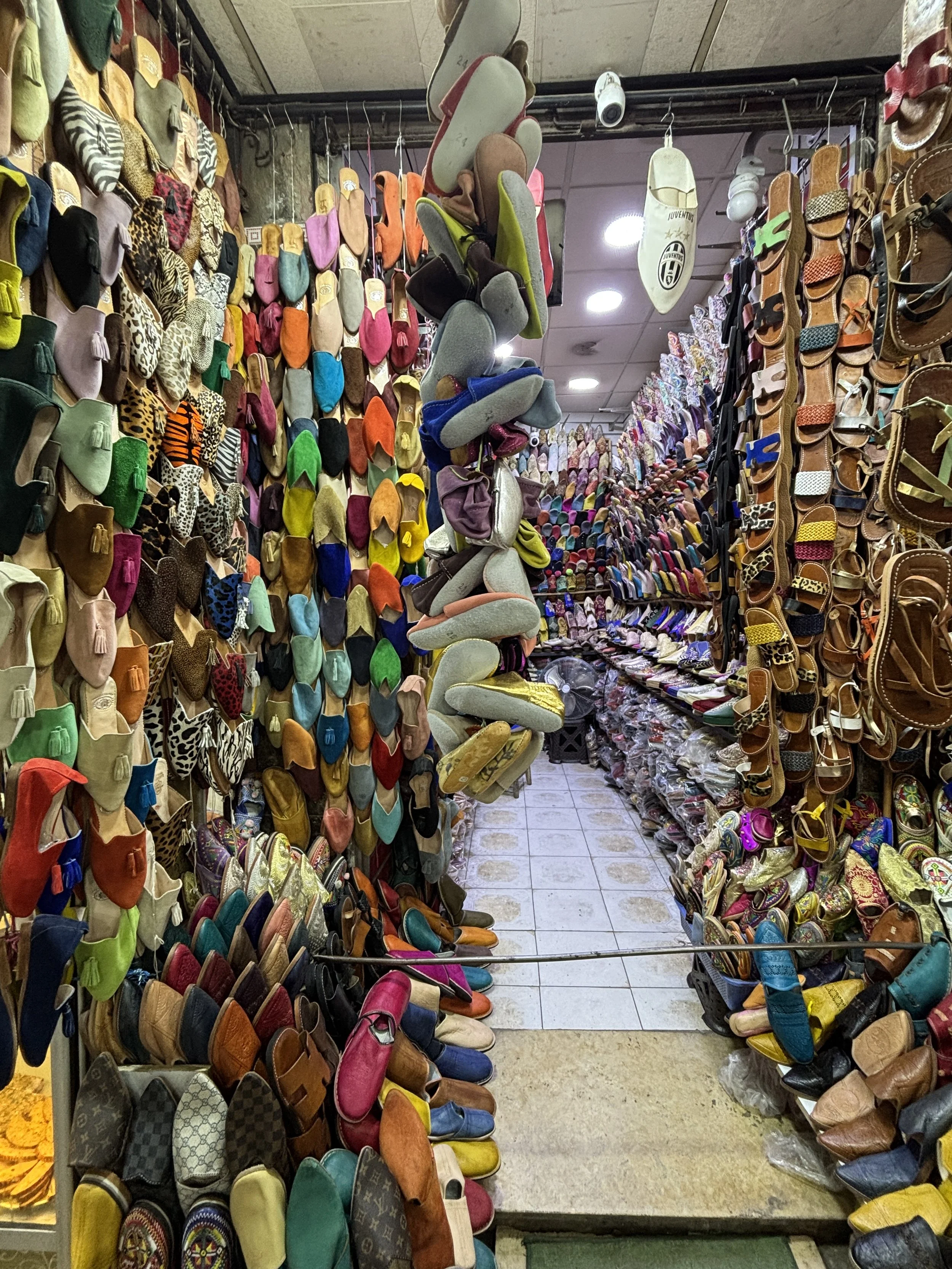
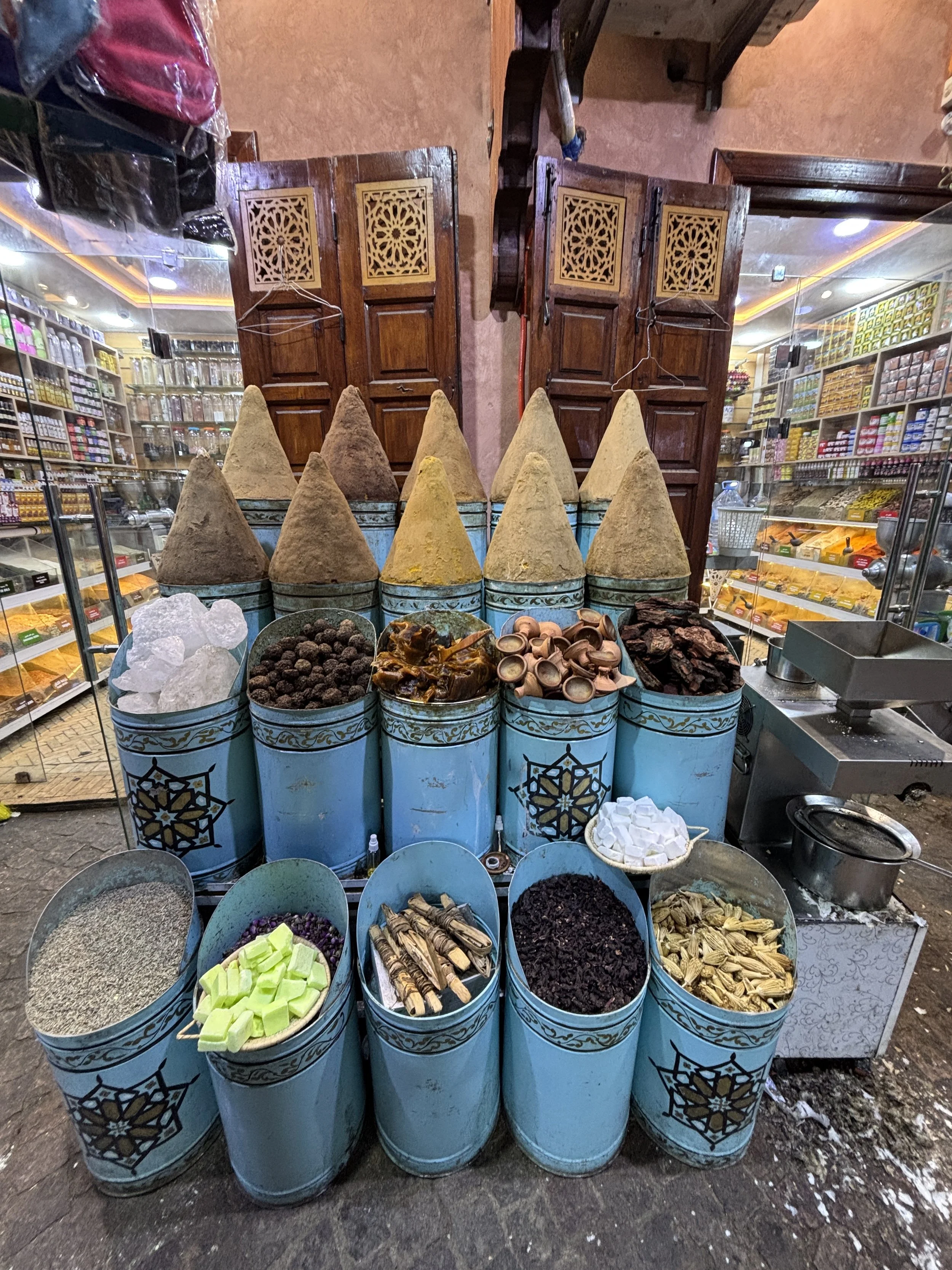
Top things to visit in the Marrakech Medina
Besides the random walk through the Medina, there are a couple of actual landmarks in the old town of Marrakech which are worth a visit. These are:
The Ben Youssef Madrasa
Bahia Palace
Visiting the Ben Youssef Madrasa
The Ben Youssef Madrasa is located next to a mosque and a square of the same name (which is one of the few open spaces in the old town). It also provides one of the key points of reference for orientation within the Medina (the other being Jemaa el-Fna at the opposite (south) edge of the old town.
This is quite a popular tourist spot and there was a constant stream of people walking through, although no queues at any time. Entrance fee is 50 Dirhams (around €5/$5).
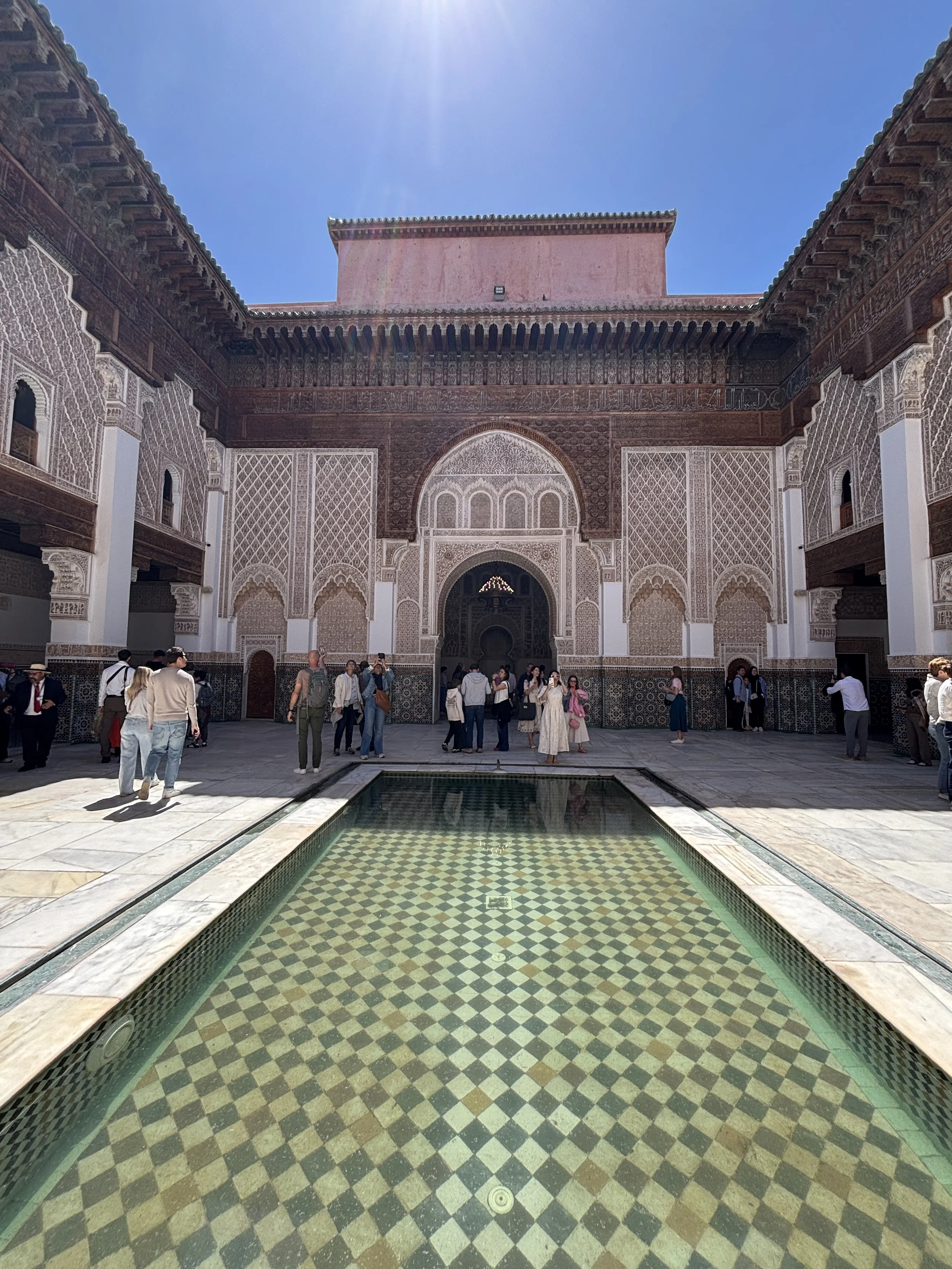
The current building of the Ben Youssef Madrasa was built in the 16th C. (although the actual educational establishment is older). In its heyday, hundreds of students from across the Islamic world lived here while they were studying religious doctrine and law.
The madrasa is structured around a beautiful central courtyard with a shallow pool at its center. The upper floors contain a myriad of small tiled rooms which is where the students lived.
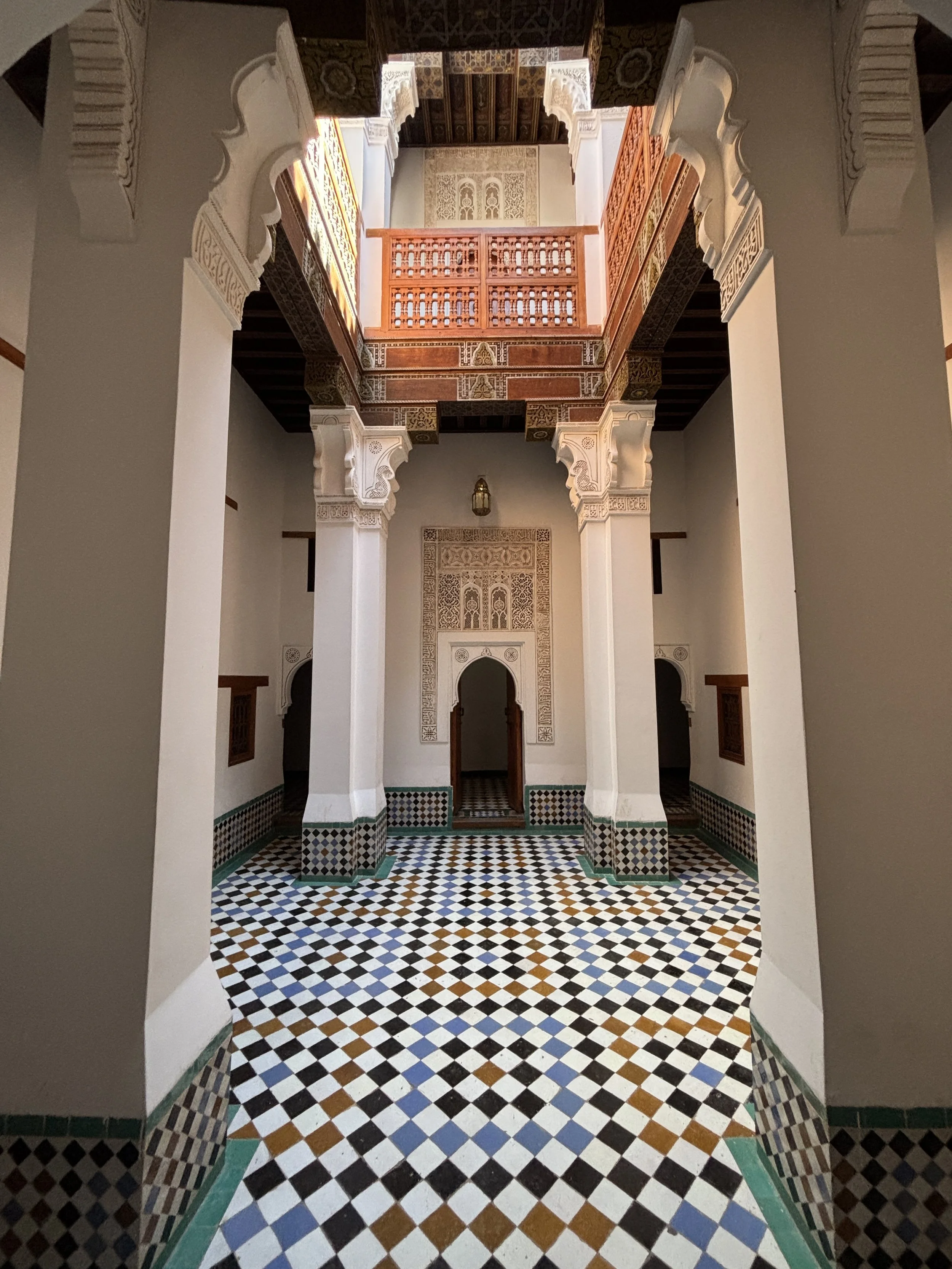
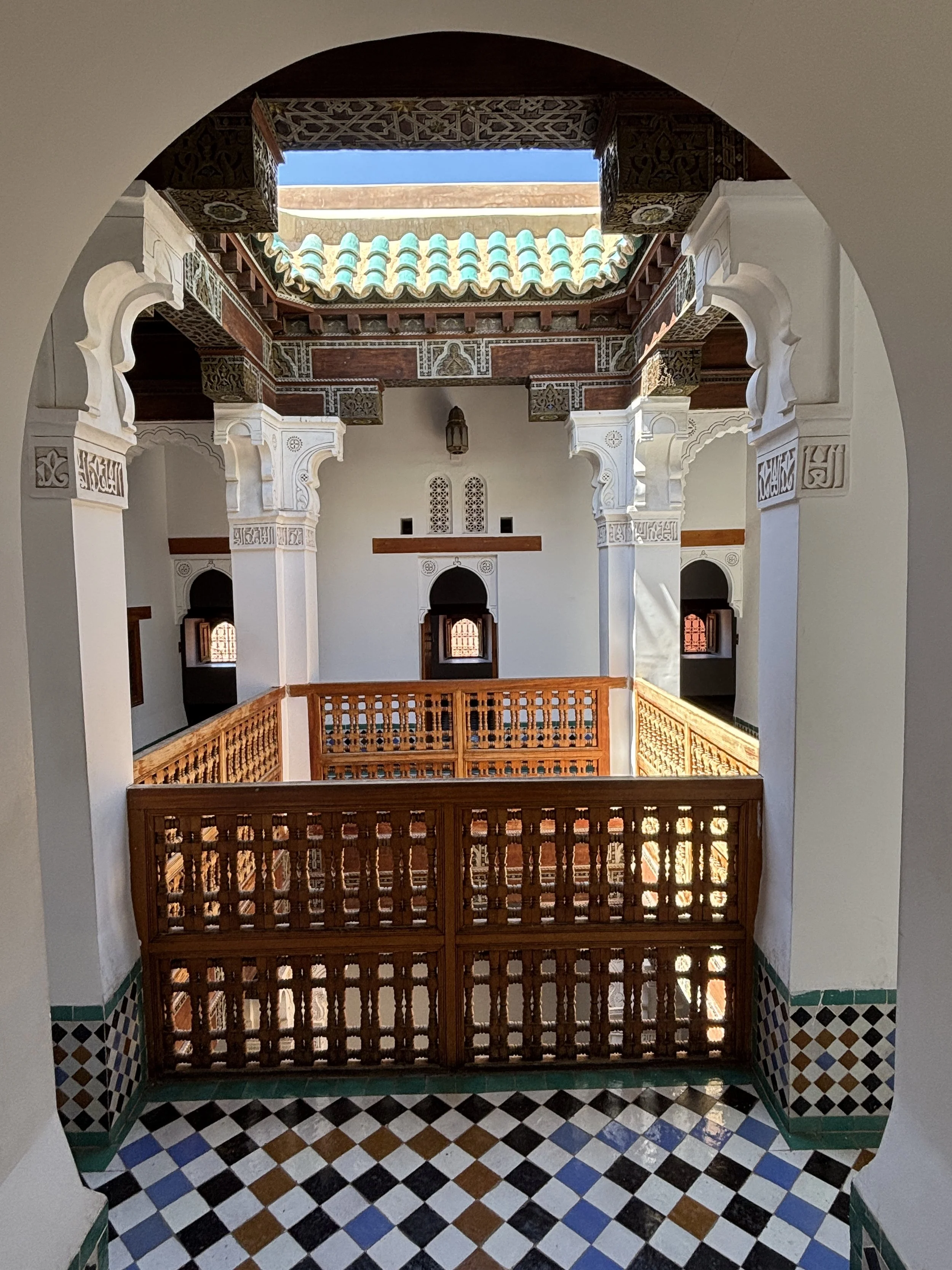
The Ben Youssef Madrasa was painstakingly restored to the smallest detail in the 1980s
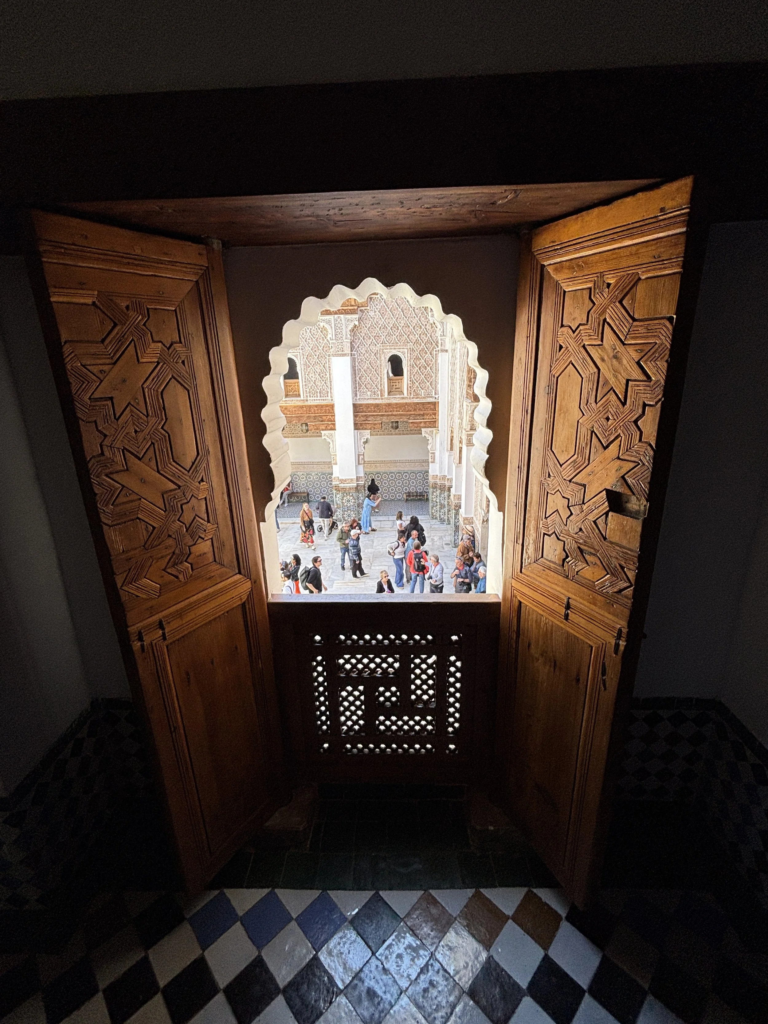
Visiting Bahia Palace
This is another beautiful place to visit in the old town of Marrakech, although it sits at its southeastern edge rather than in its core. The Bahia Palace was built by a grand vizier (sort of a prime minister) of the Sultan at the turn of the 20th C. It was later used by the French resident-general (the governor, in fact), Louis-Hubert Lyautey, as his official residence.
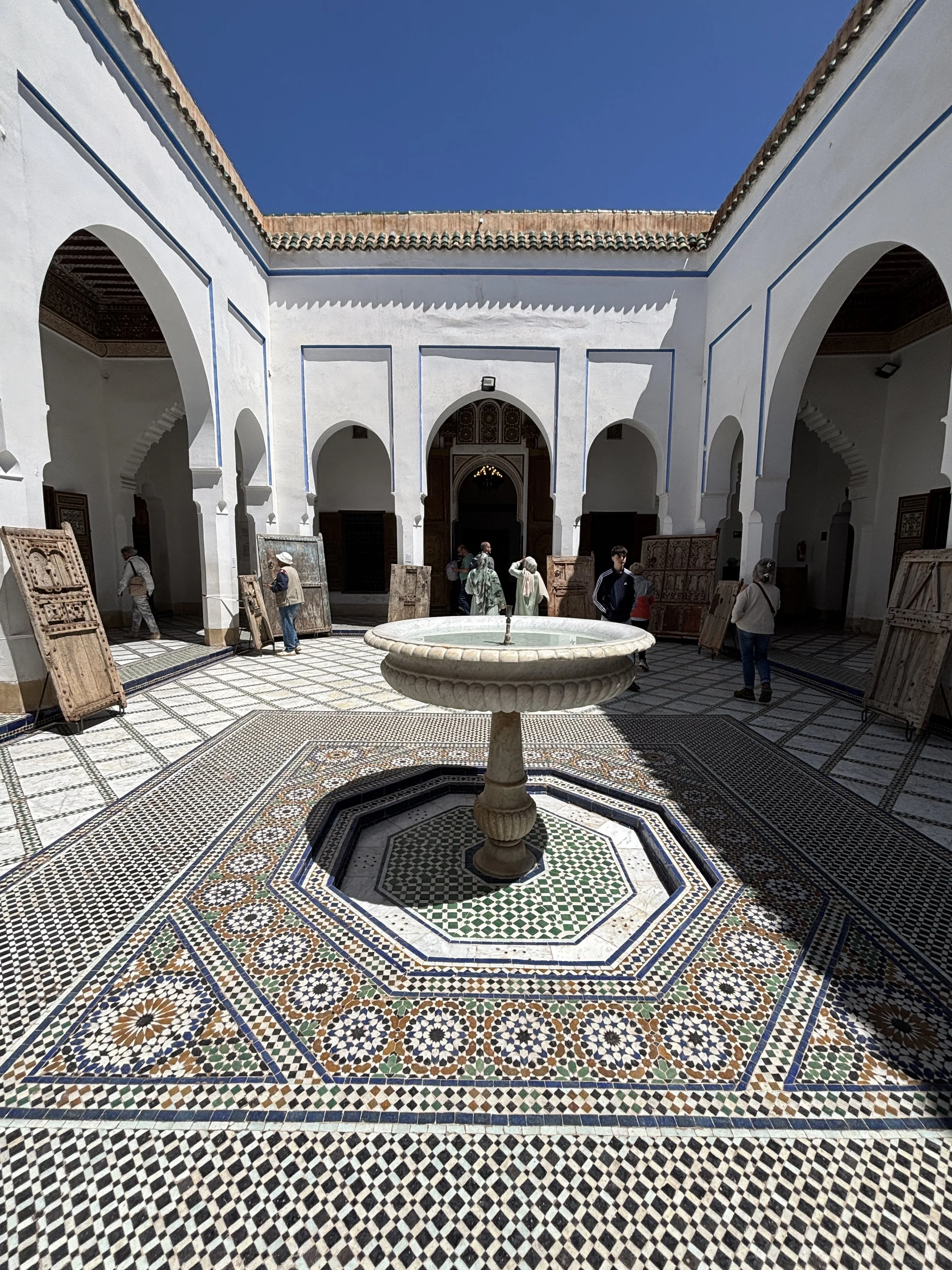
The palace has plenty of ornamental details throughout, several courtyards and some rather large gardens. In fact, only part of it is currently open to visitors and the visit itself doesn’t take much time.
There were quite a few visitors, but it was much less crowded than the Ben Youssef Madrasa.
Perhaps is best let images speak for themselves…
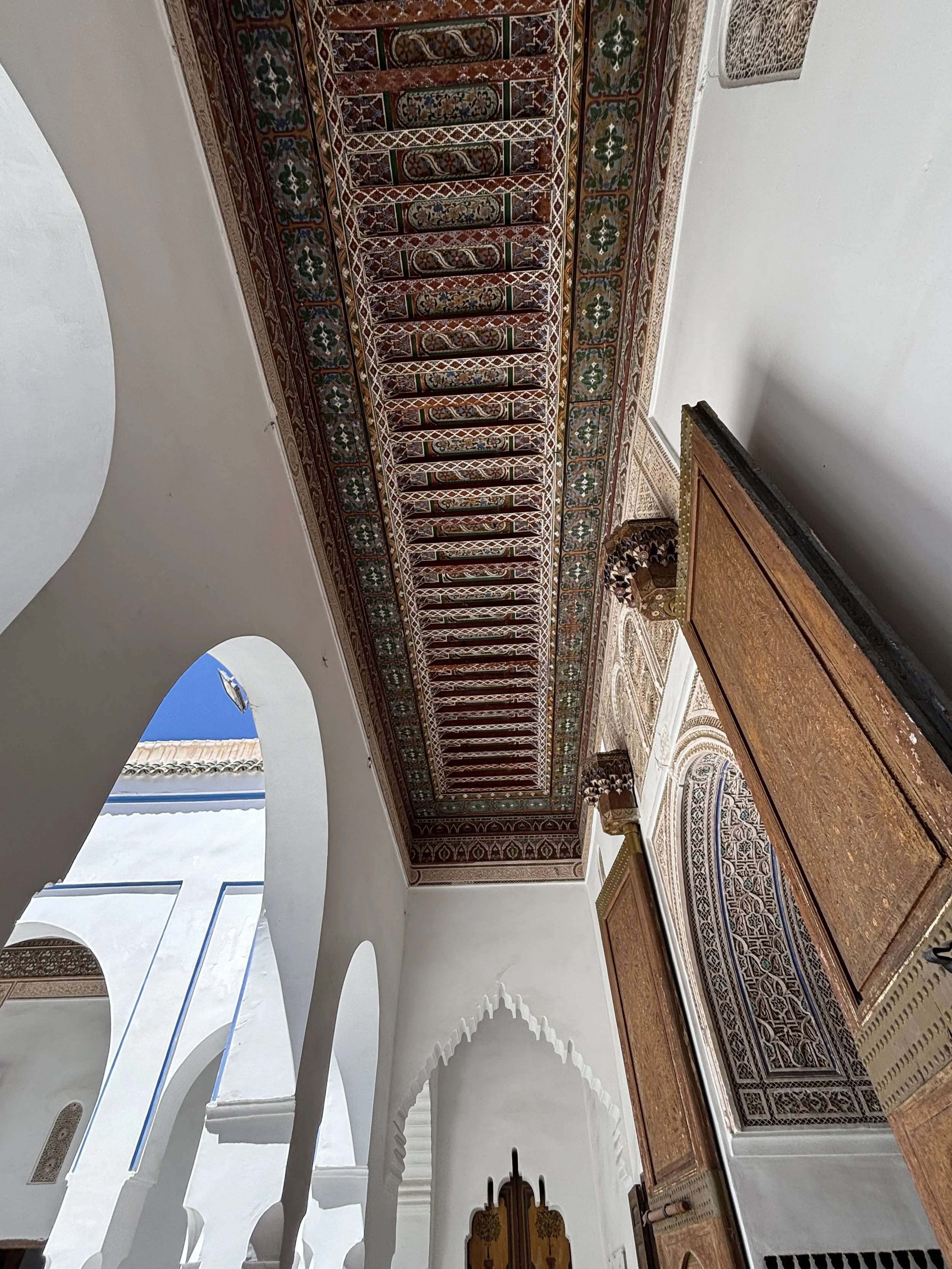
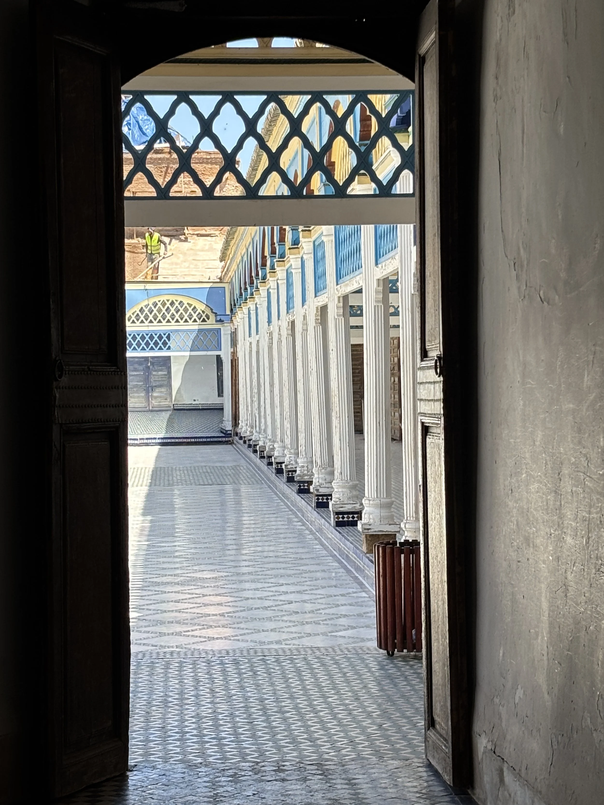
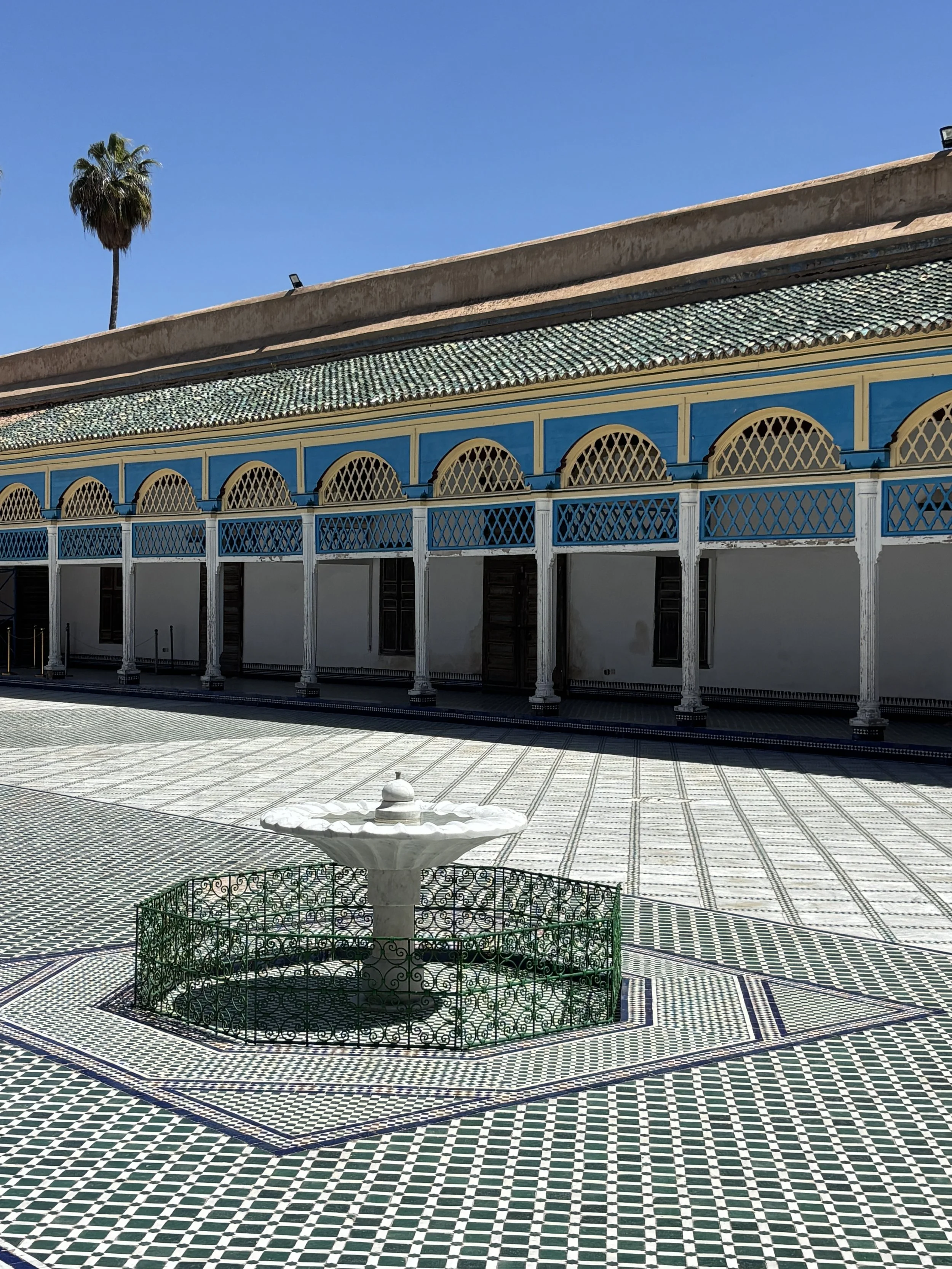
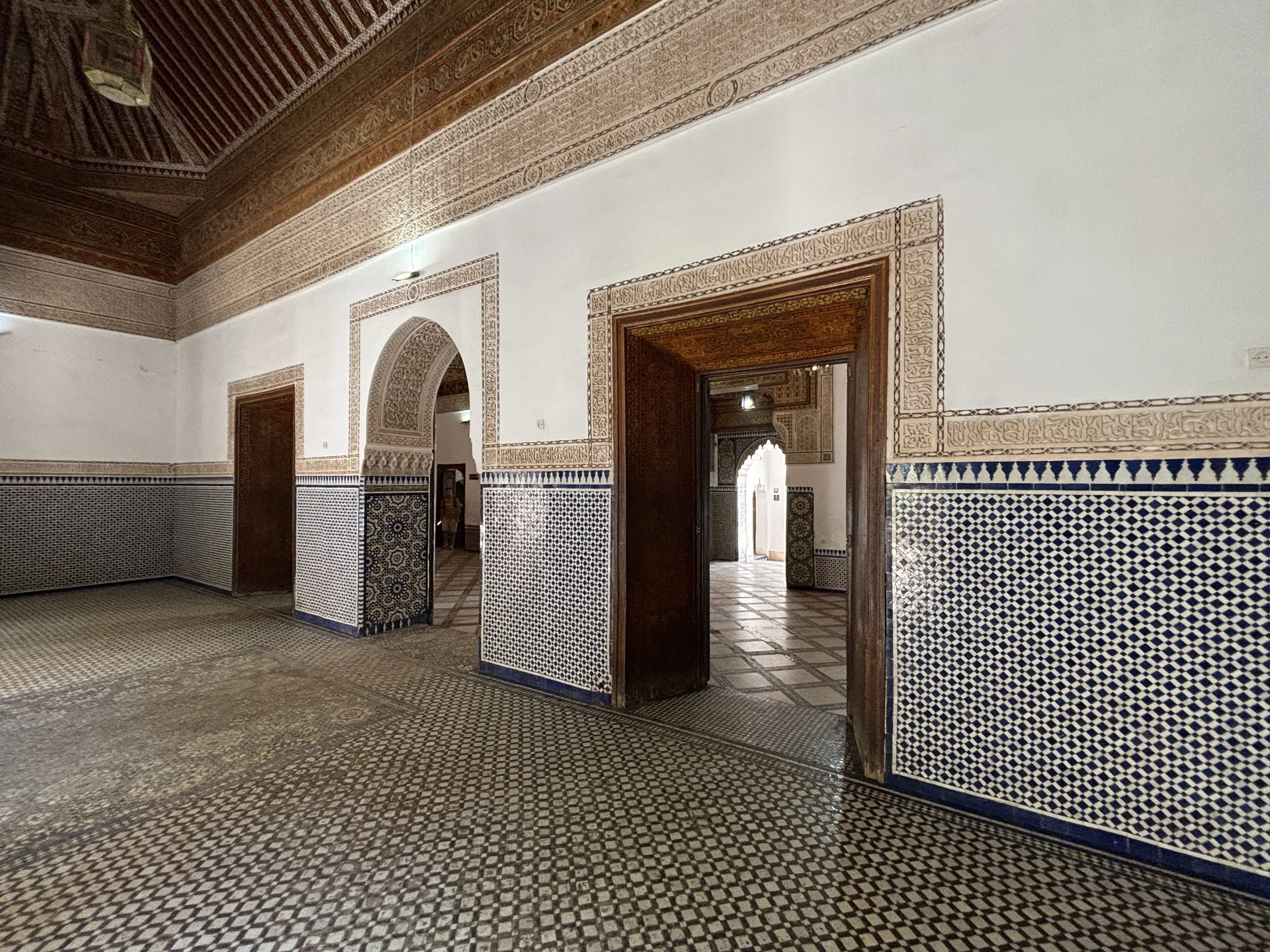
At the time of my visit there was also an exhibition of traditional Moroccan doors, although I don’t know if this was a temporary or permanent exhibit.
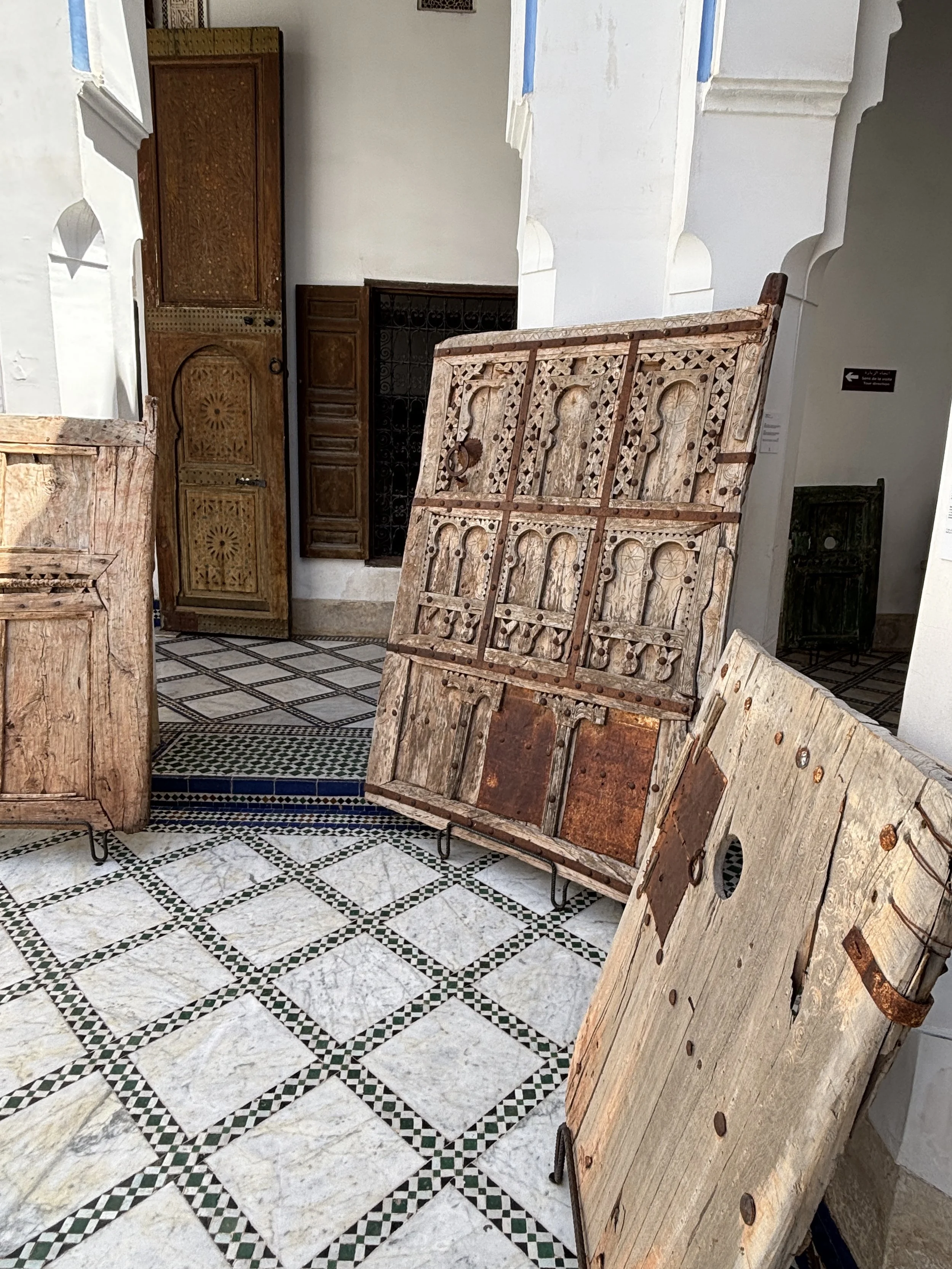
At the time of my visit there was also quite intense renovation work going on. For example, a whole wing of the palace’s beautiful blue courtyard was being fully restored.
By the way, I didn’t mention it, but there is an entrance fee of 100 Dirhams (around €10/$10), which is a bit pricey, but definitely worth it.
Other things to see near the Marrakech Medina: the Koutoubia minaret and gardens
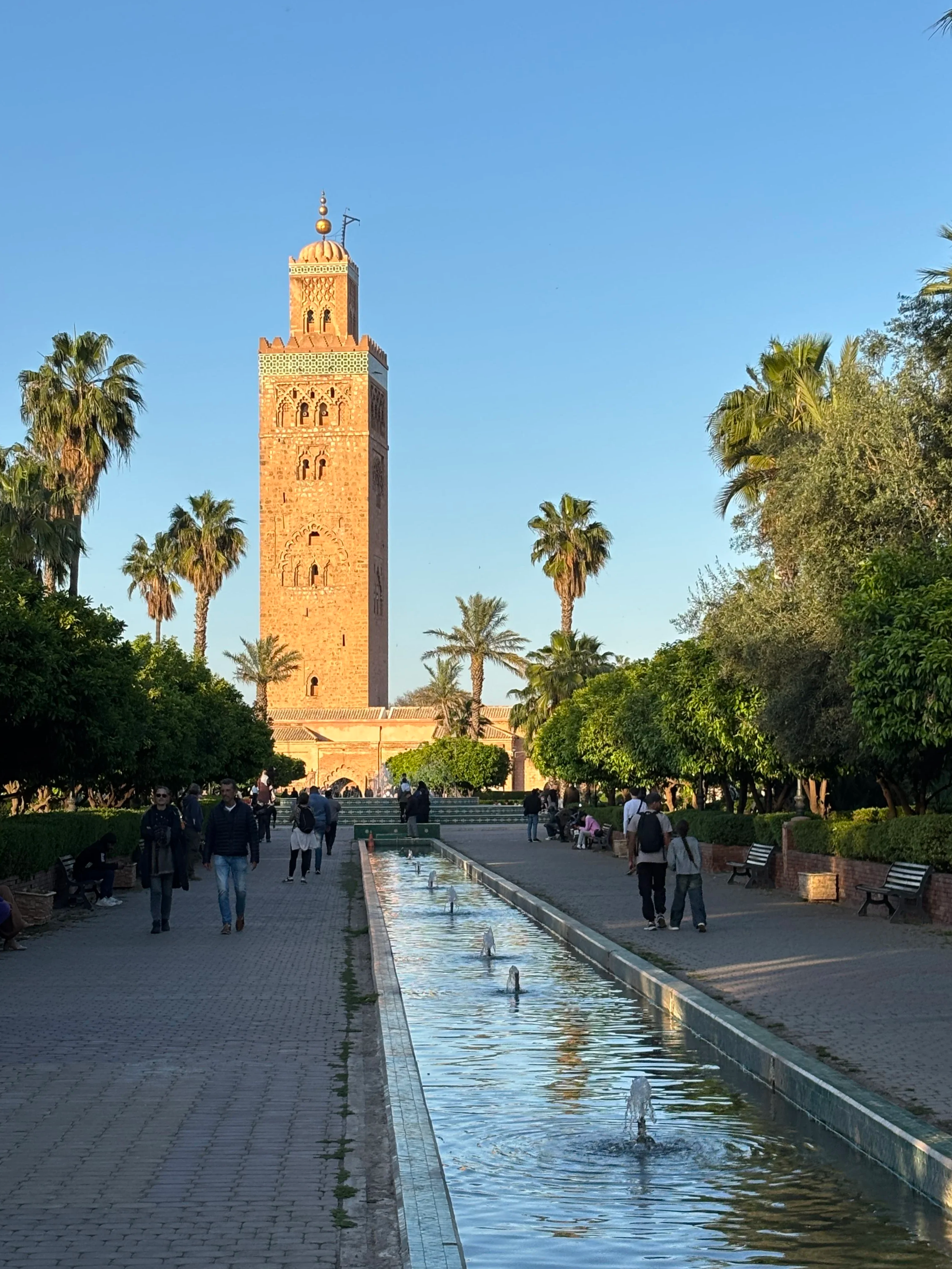
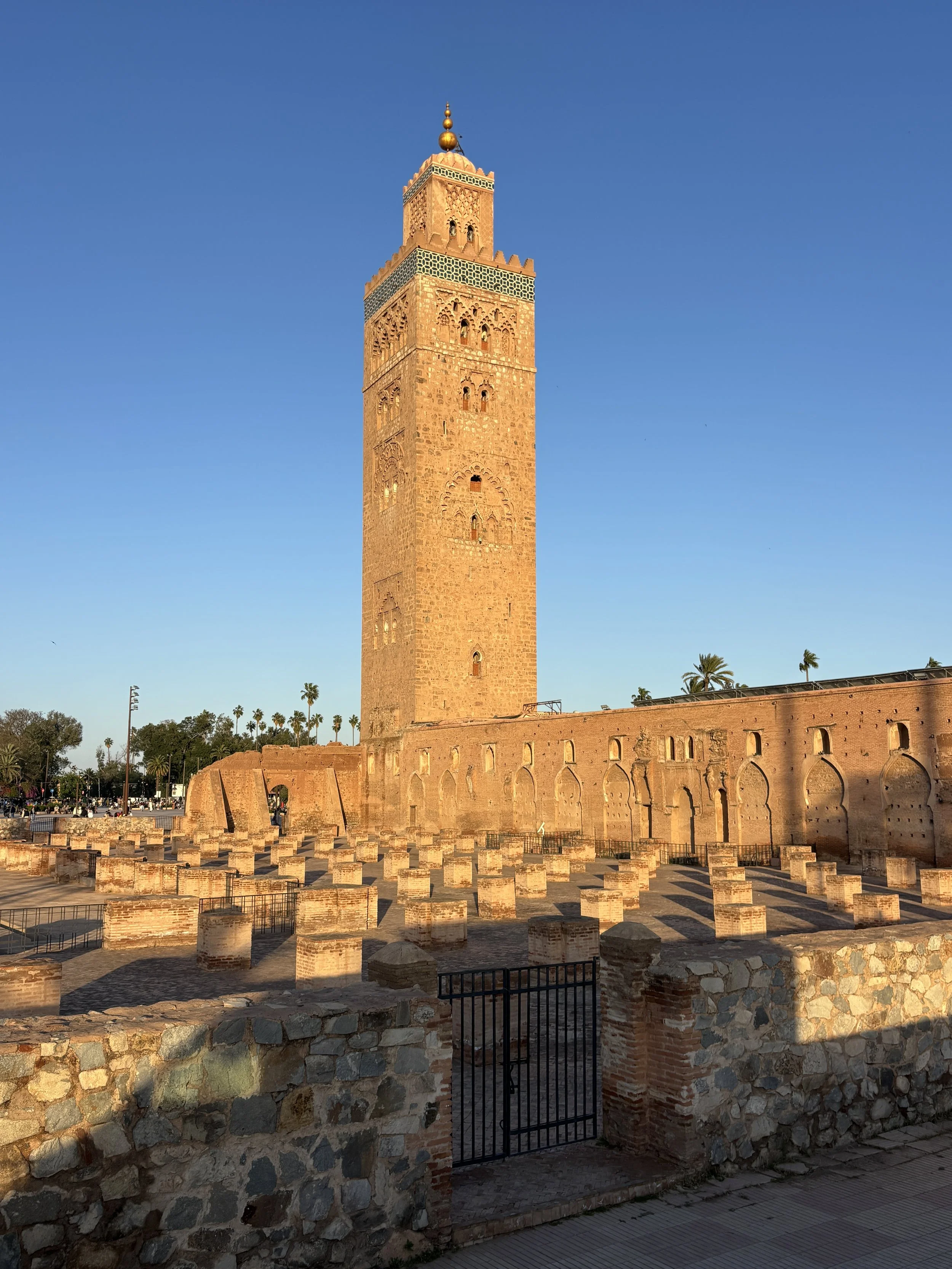
The 69-meter tall Koutoubia minaret is one of the most recognizable views of Marrakech and it defines the skyline of the city. It was built in the 12th C. and it is adjacent to two mosques.
If its outlines looks familiar it is perhaps because the Marrakech Koutoubia minaret inspired also the famous Giralda of Seville (as well as the Hassan Tower in Rabat).
Its location next to the Jemaa el-Fna means that you can’t miss it. There are some lovely gardens next to it, as well!
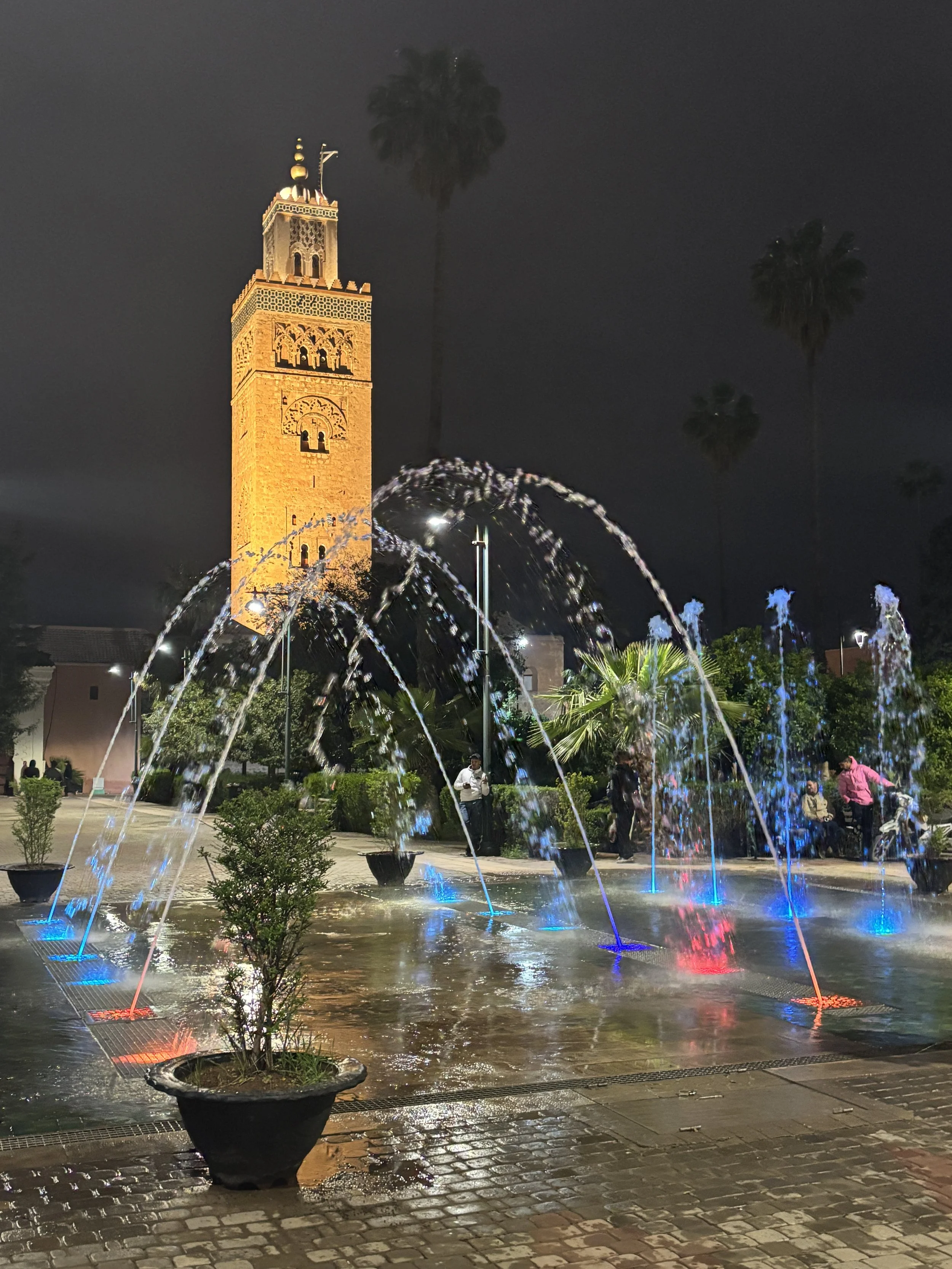
Visiting a legendary grand hotel: La Mamounia
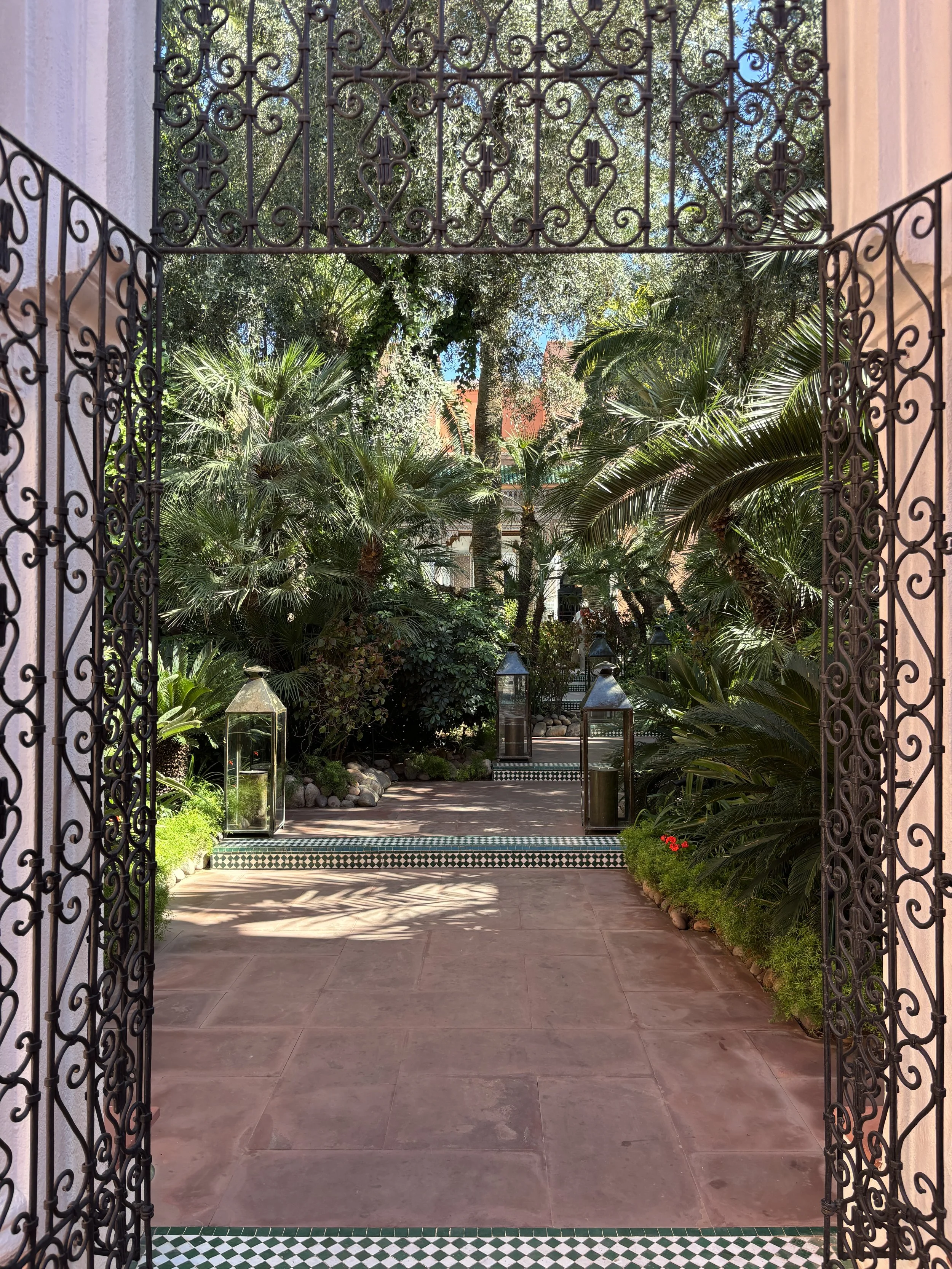
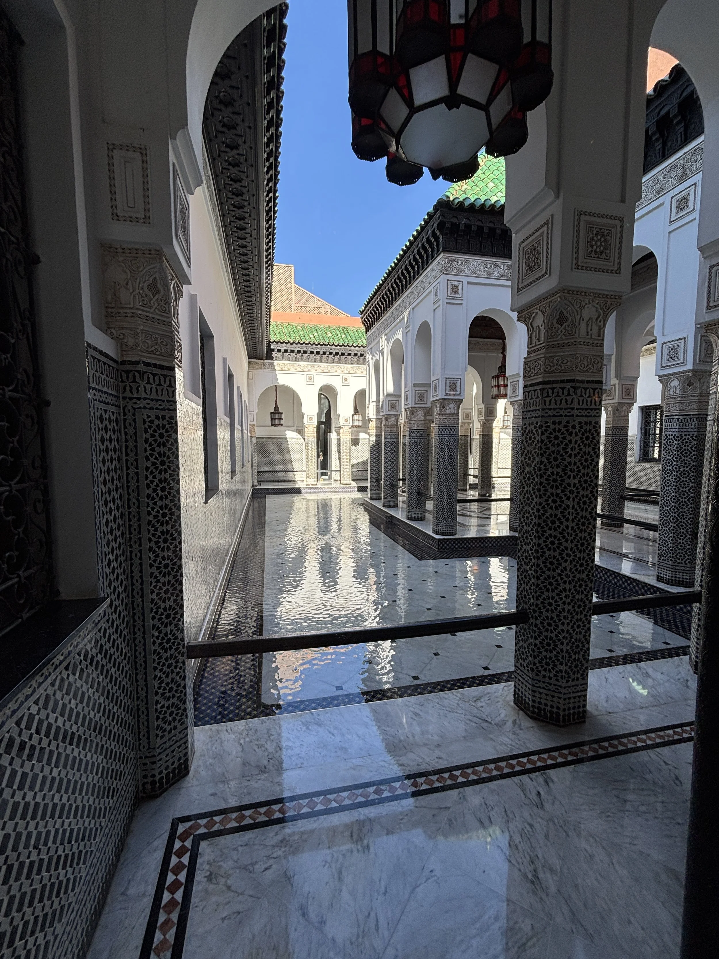
La Mamounia is one of the world’s most iconic grand hotels and it is located just a short walk away from the Koutoubia and Jemaa el-Fna.
It was built in the 1920s by French architects who mixed art-déco elements with traditional Moroccan architecture. Over the following decades La Mamounia hosted many world leaders and celebrities, but perhaps the guest which has been most closely associated with La Mamounia is Sir. Winston Churchill, who had the place in great esteem and sojourned here several times, including during the war, in 1943, right after the Casablanca Conference.
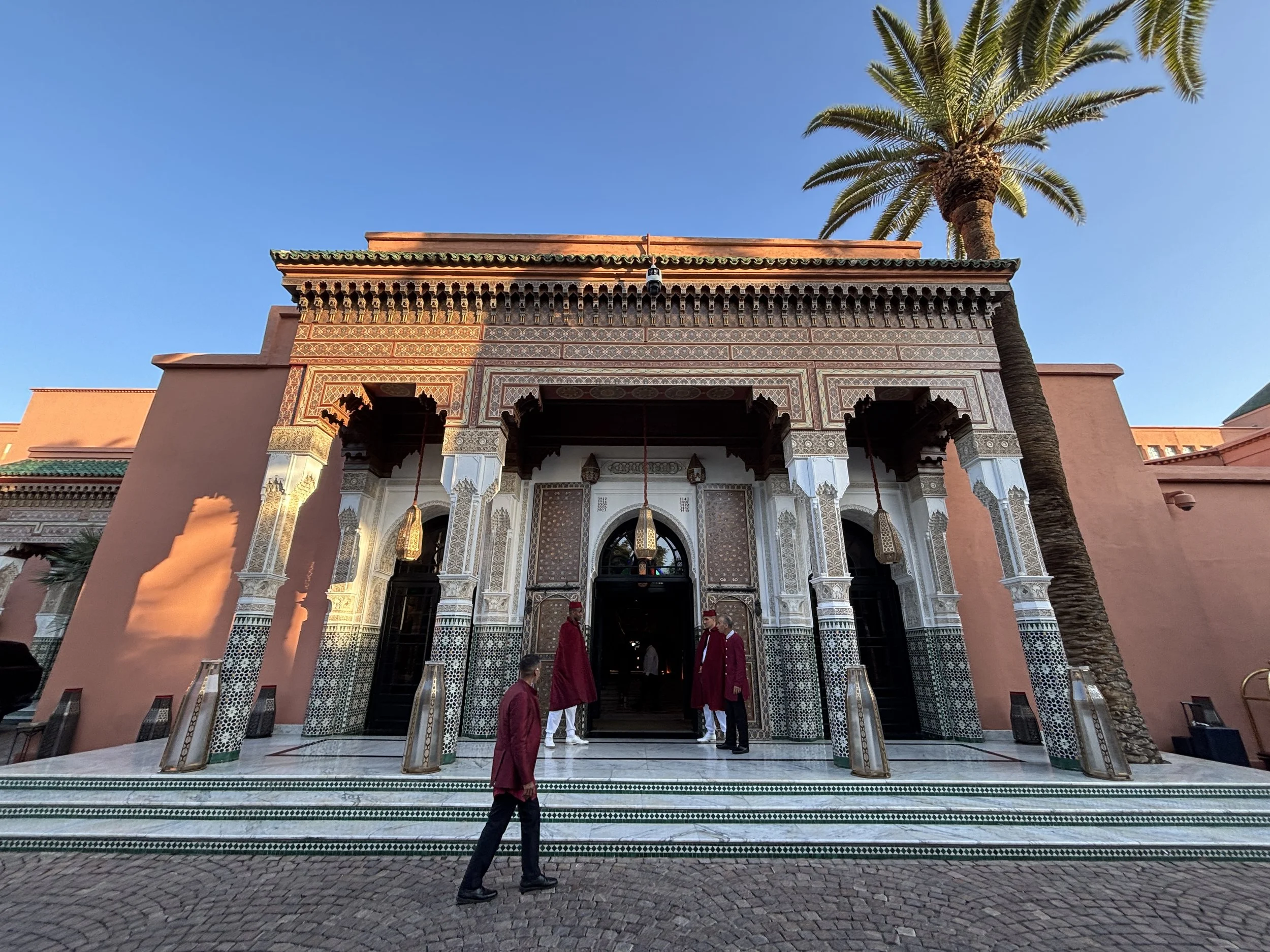
Even if a stay at La Mamounia is beyond your budget, you may be able to visit its grounds to enjoy a drink (or two) at its bar or terrace. Bear in mind, though, that this is a rather exclusive, private venue, so at times, for example if events are taking place, external visitors may not be let through.
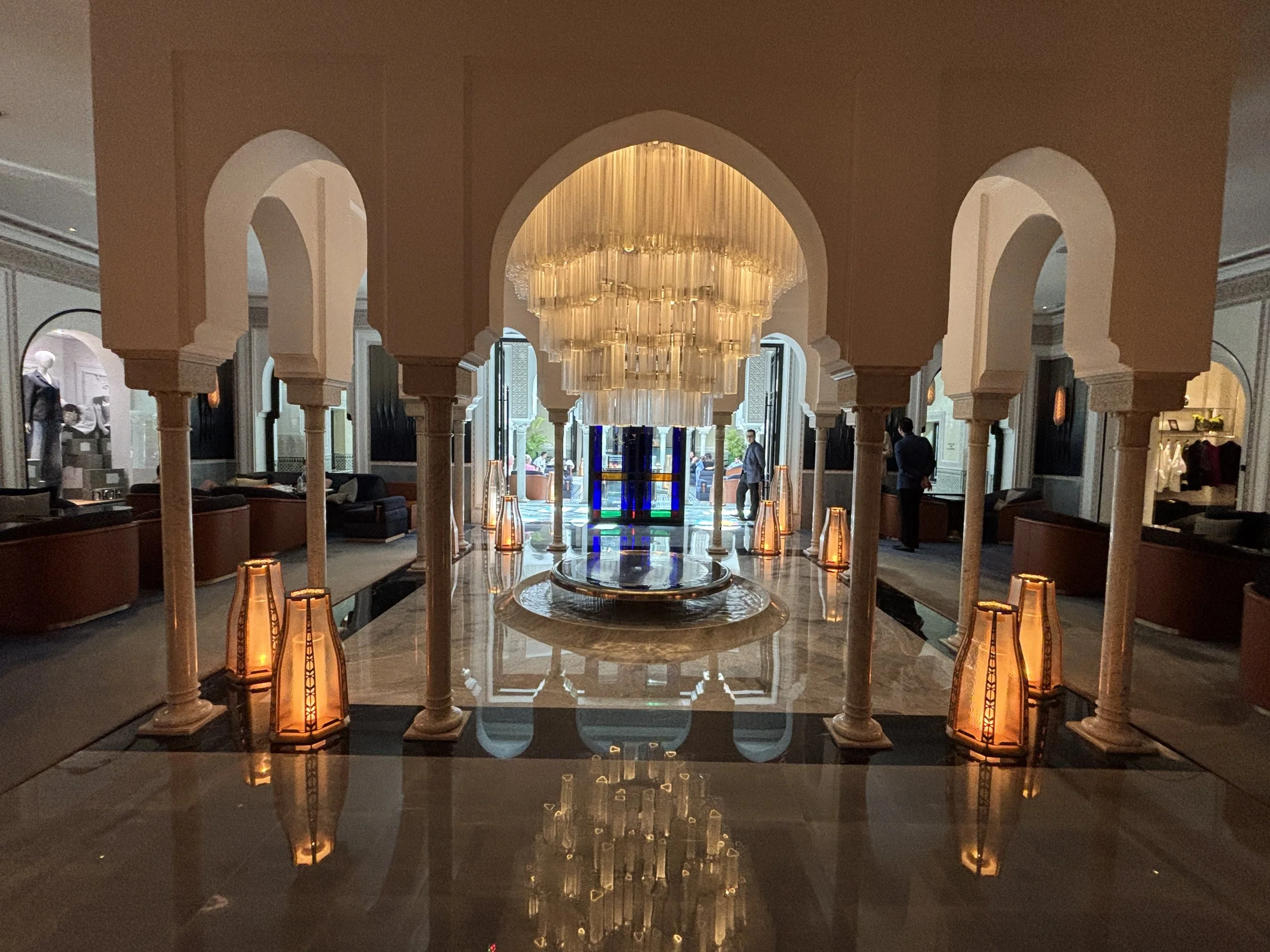
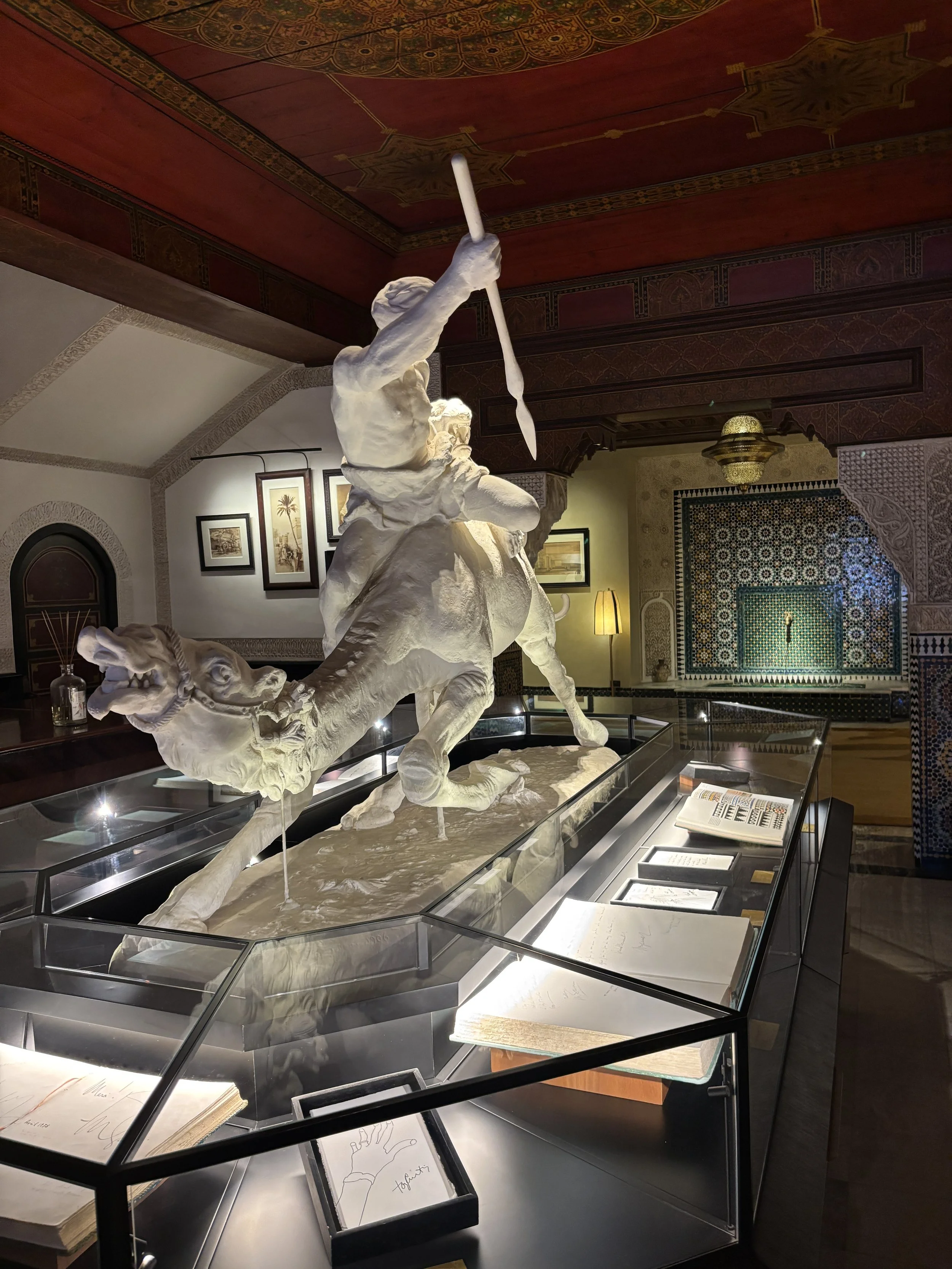
Besides its sumptuous lobby area, La Mamounia hosts also several luxury shops (making it, in practice, a mini-luxury mall) as well as some exhibition space displaying elements connected to the history of the hotel. Worth noting also that La Mamounia has a huge garden!
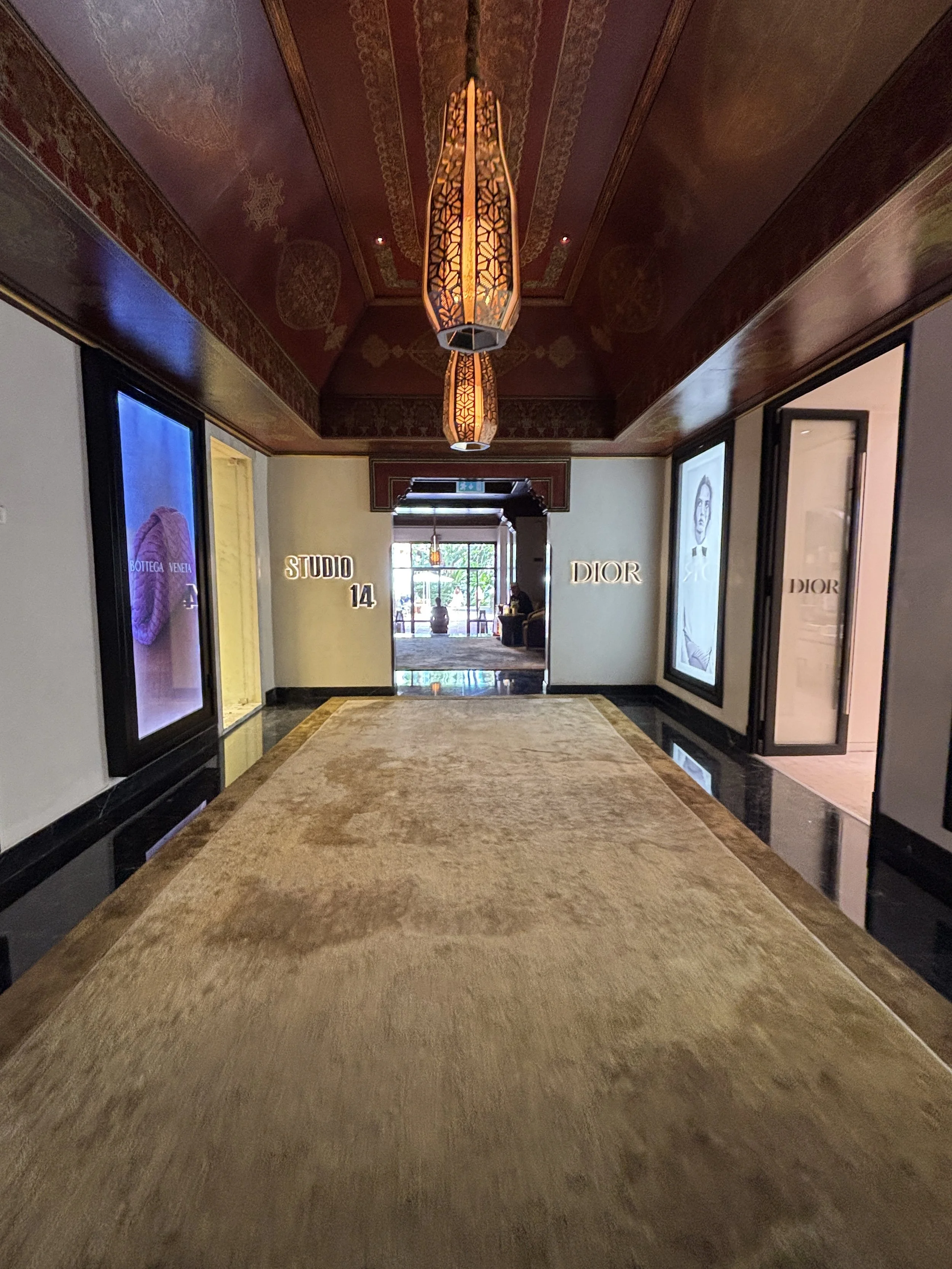
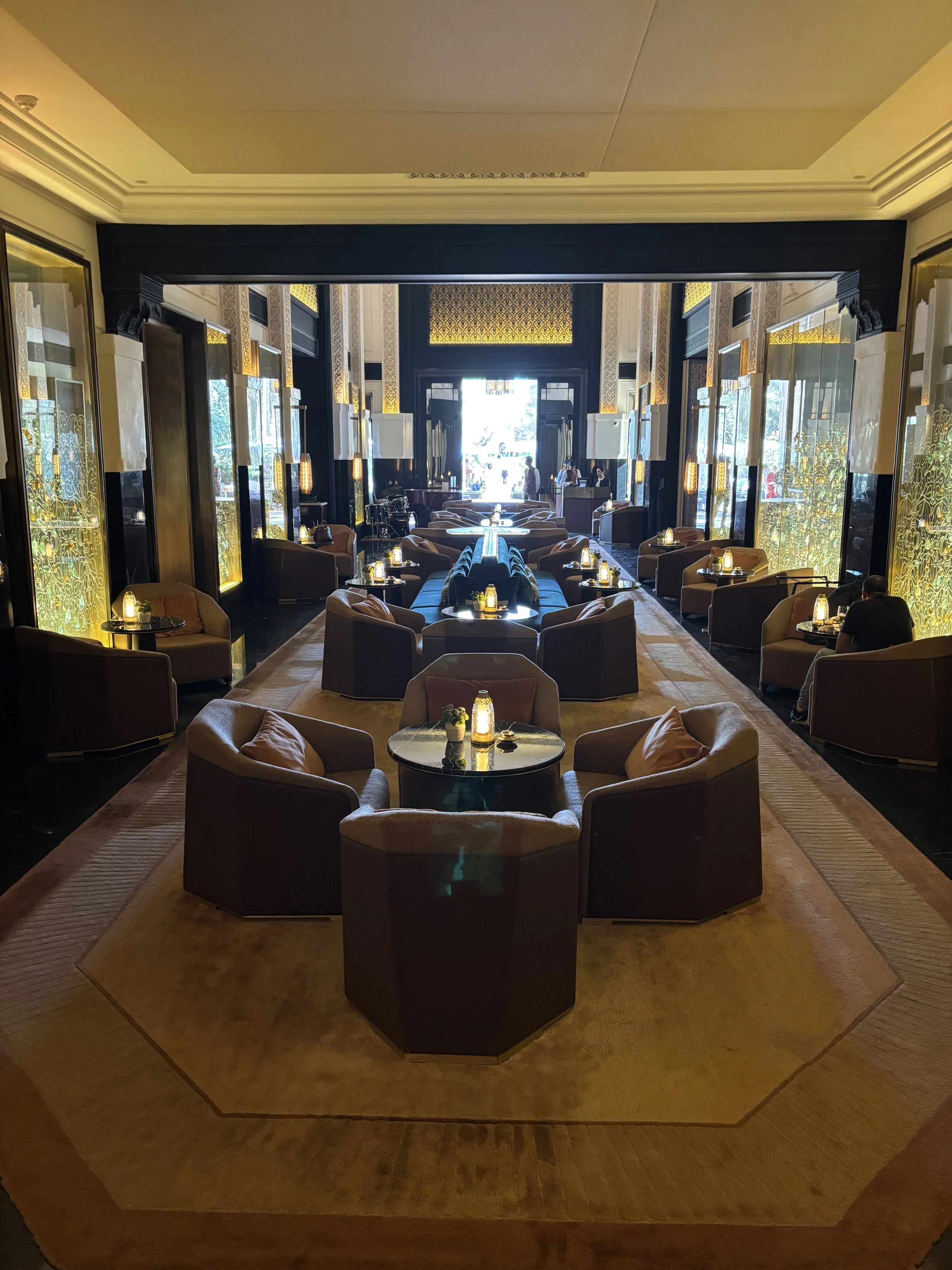
The bar at La Mamounia was one of Churchill’s favourites (it has since been obviously modernized) and it extends into the outdoor area. A coffee at the terrace at La Mamounia would cost you around 80 Dirhams (€8/$8), but, believe me, it is good value, all things considered.
This is a perfect oasis to recover some energy in the hottest time of the day, after a few hours walking nonstop through the souks. From here it is also quite easy to return to the Medina to check the evening atmosphere at Jemaa el-Fna.
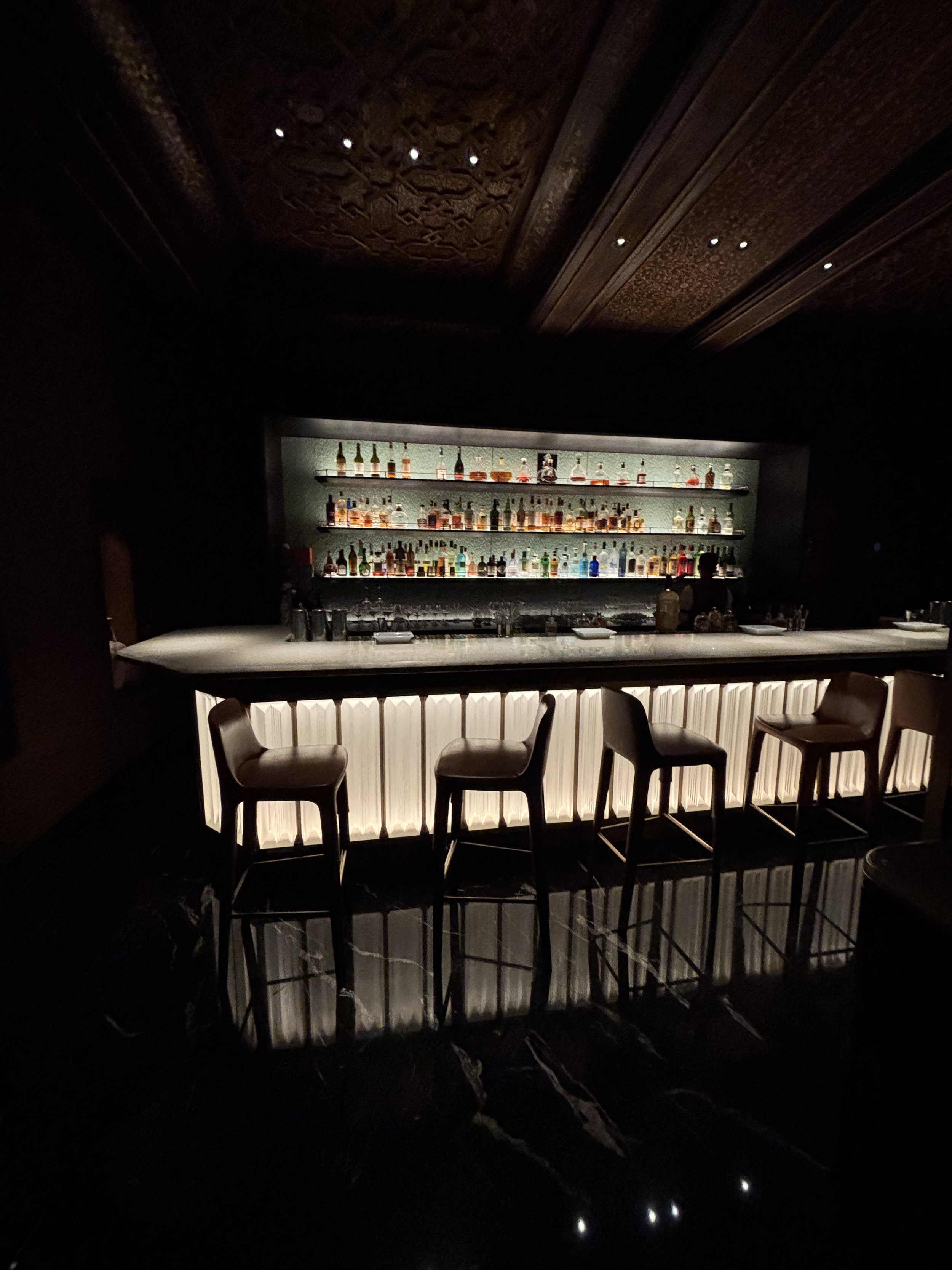
Where to stay in Marrakech
Marrakech is a city of riads, that is the traditional Moroccan guest houses. Many of these have been modernized to cater to the standards of the modern sophisticated traveler, but keeping as much as possible of their authenticity.
Riad Maison D’Hôte Abdel & Jamila
25 Rue Mouassine, Marrakesh 40000
This is a recently renovated riad and at around €75 per night offers great value right in the heart of the Medina, as well as very nice service throughout.
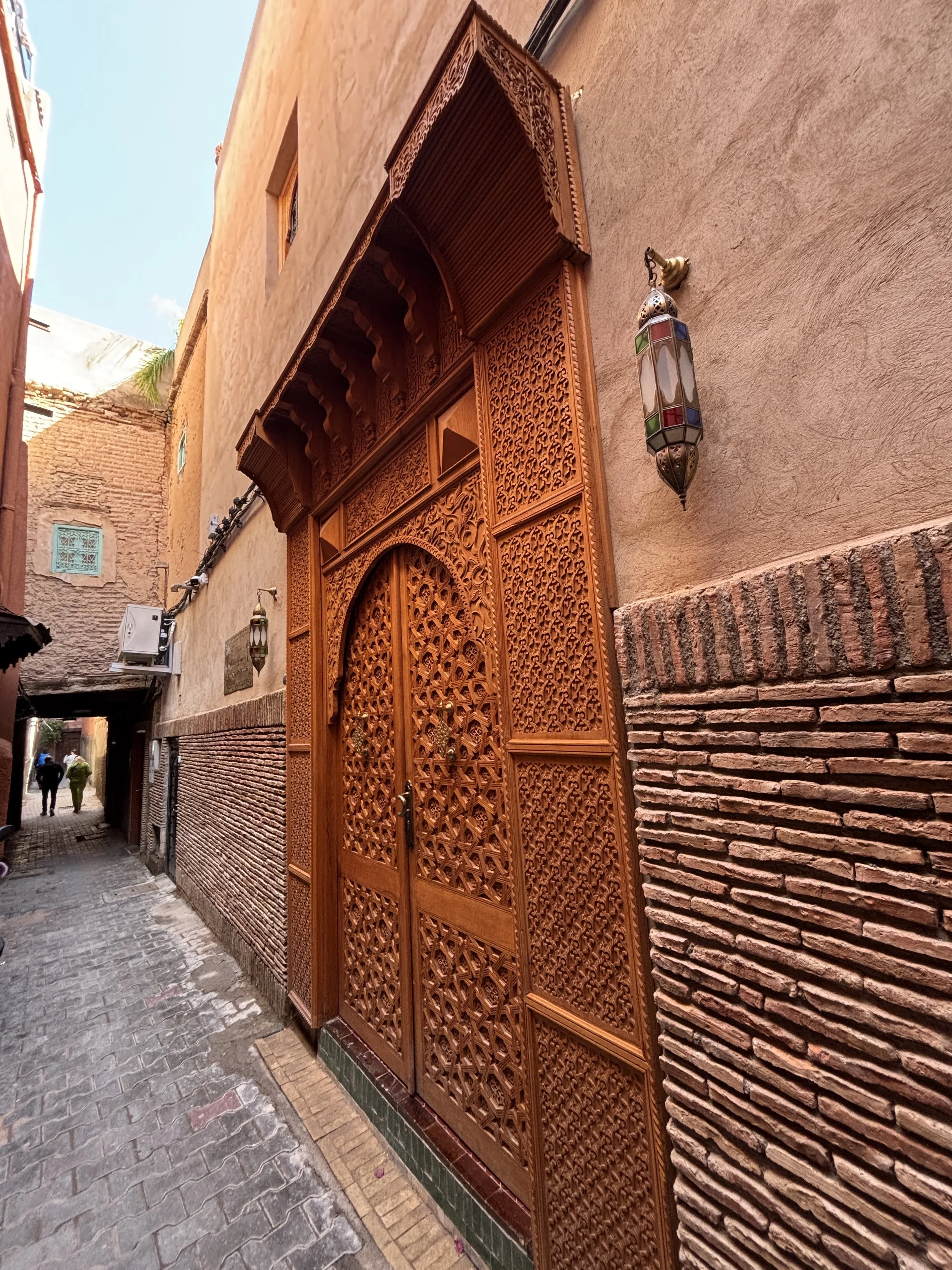
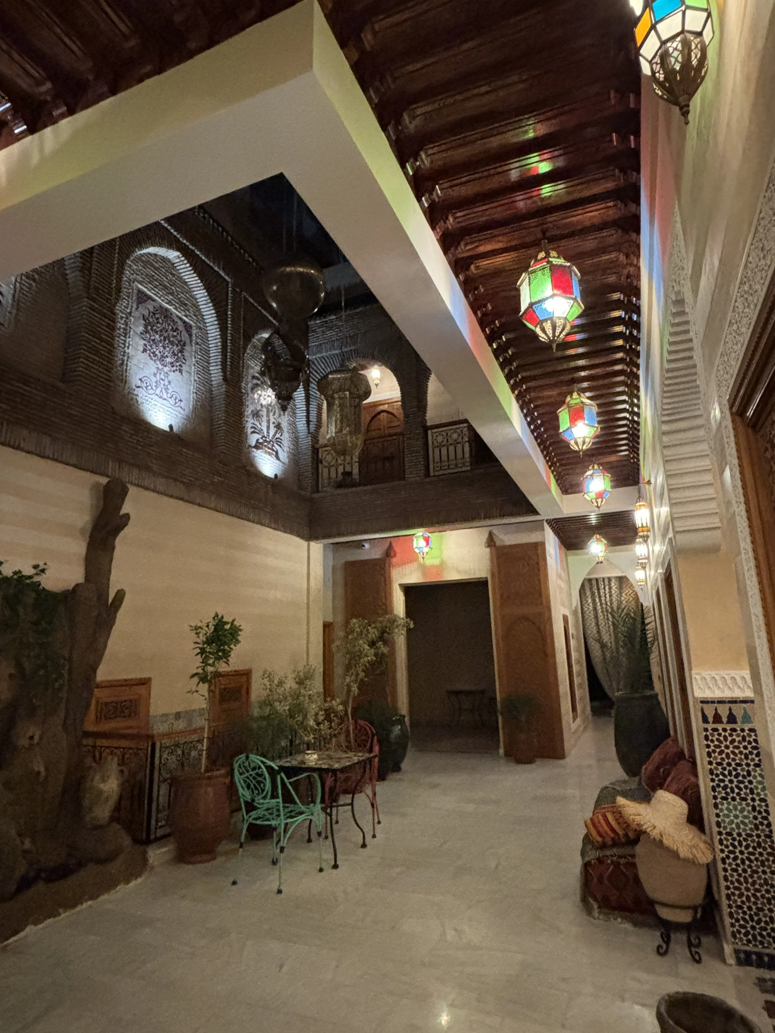
Part of the experience is actually getting to the hotel, since you will need to navigate the maze of small narrow alleys to the side of one of the main souks.
It is a pretty small scale establishment structured around a central open air courtyard which is acts also as its lobby (so to speak) and brekafast area.
Upon arrival there appeared to be a small glitch with my booking.com reservation, although the wait allowed me to enjoy a traditional Moroccan tea in this very scenic room (pictured below).
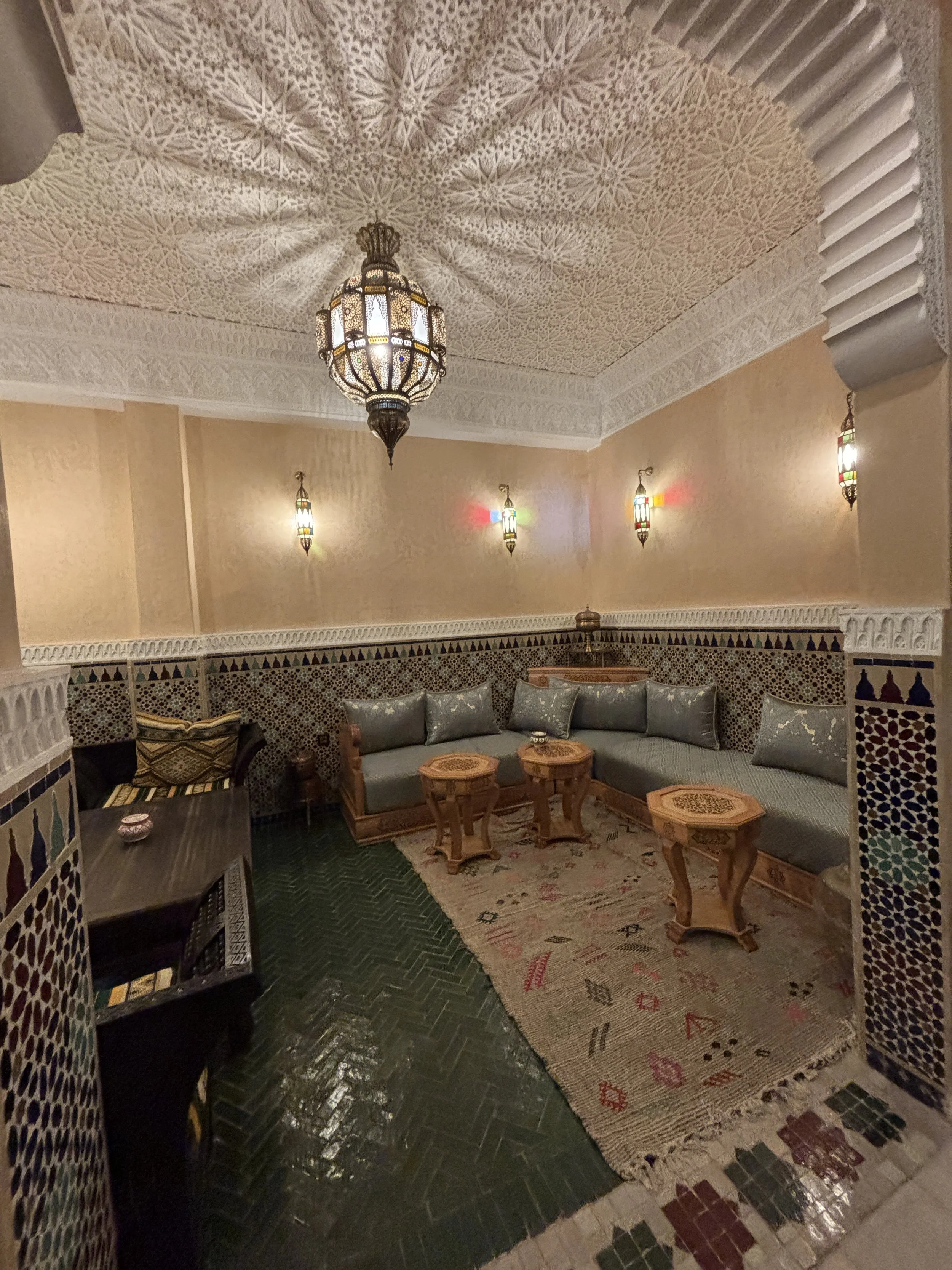
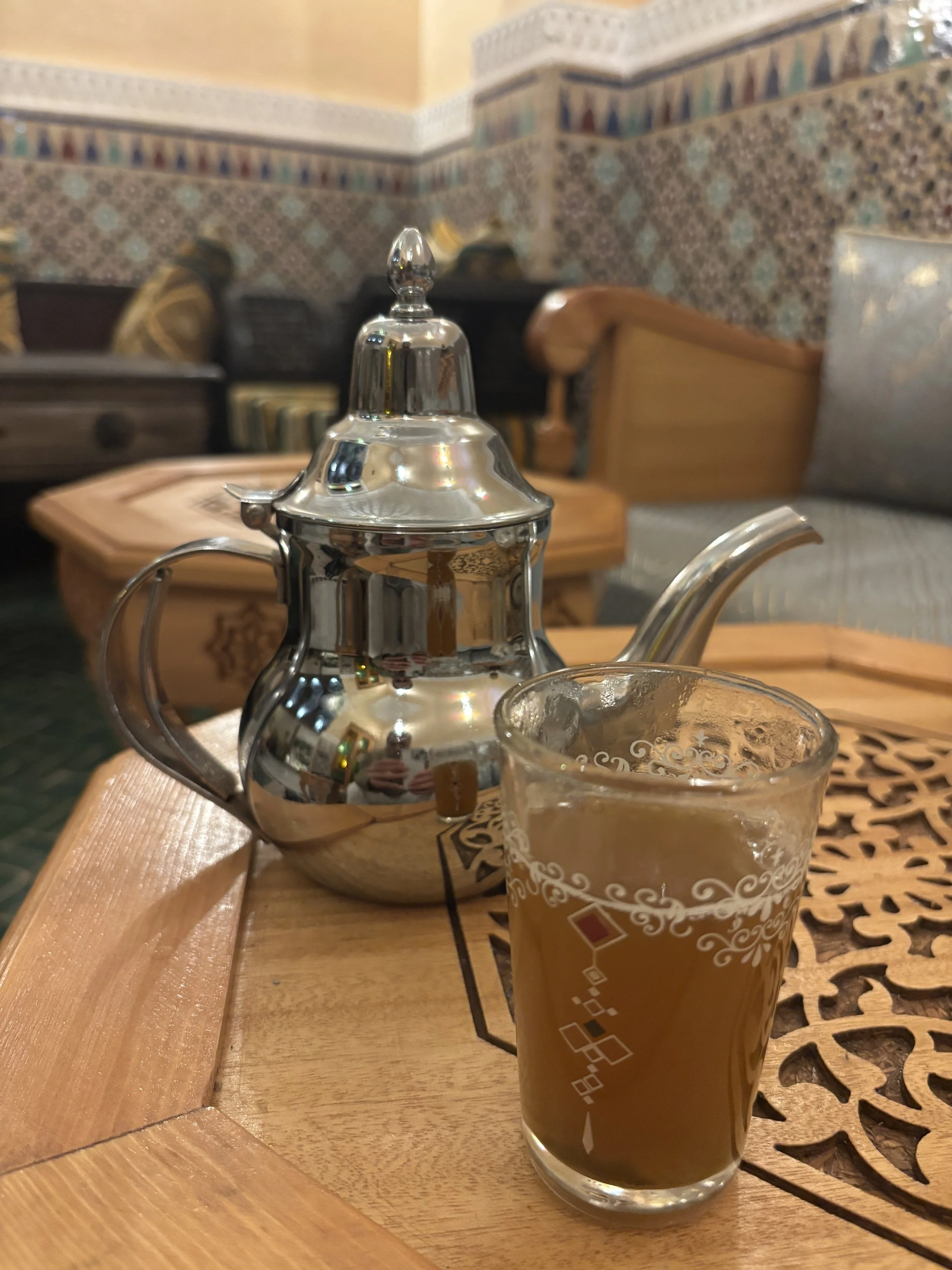
My room was on the ground floor, which meant that the windows were directly next to the common area of the riad, which made me worry a bit about it getting noisy early in the morning.
However, this concern appeared to be rather unfounded, as this is a small scale, boutique hotel and, while there were people around in the morning, it was all very quiet.
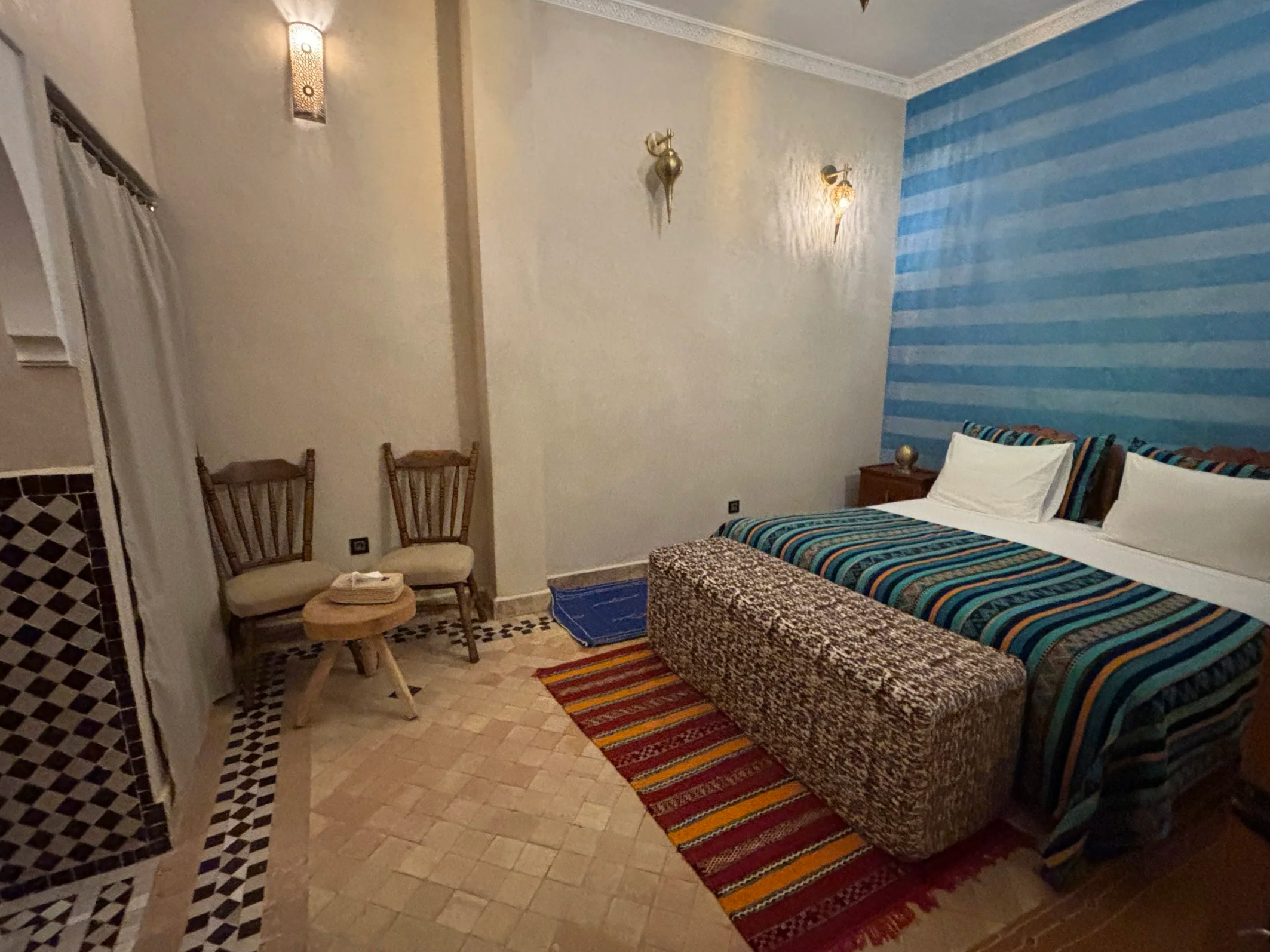
Perhaps the most interesting aspect of the room was the bathroom, tiled, open to the bedroom, yet laid out in a way that still confers a degree of privacy.
The whole experience feels refreshingly analogue: a physical key, which closes an actual lock, and light switches that took a moment to locate, one of them turned out to be tucked behind a bedside table. Little to do with your traditional corporate hotel, but I guess that's the point!
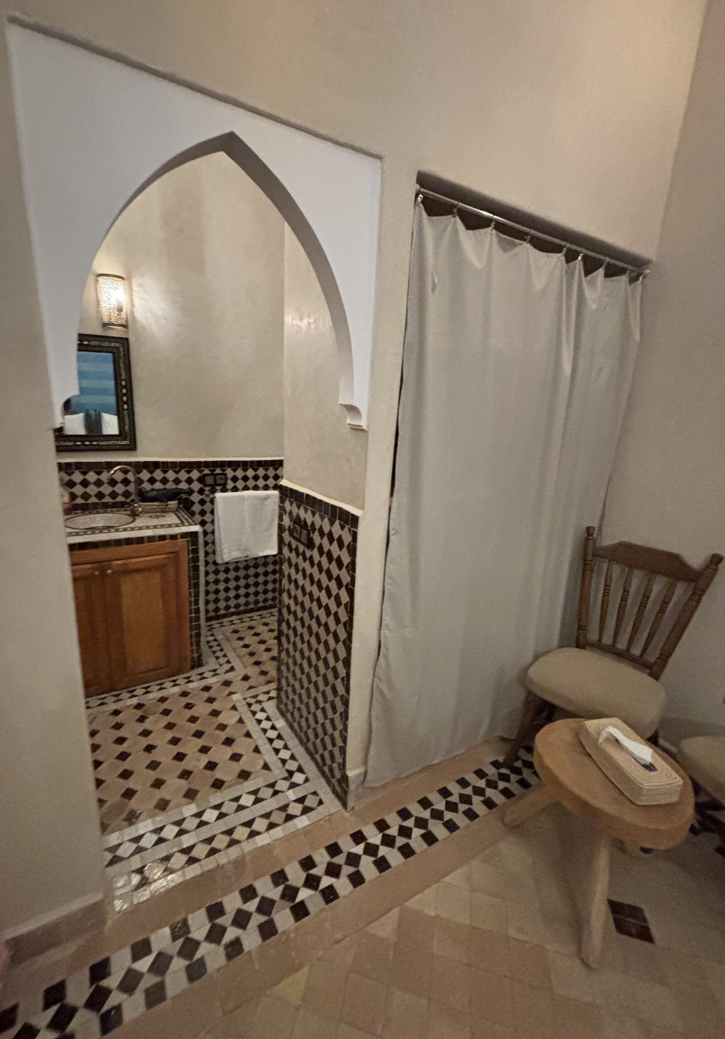
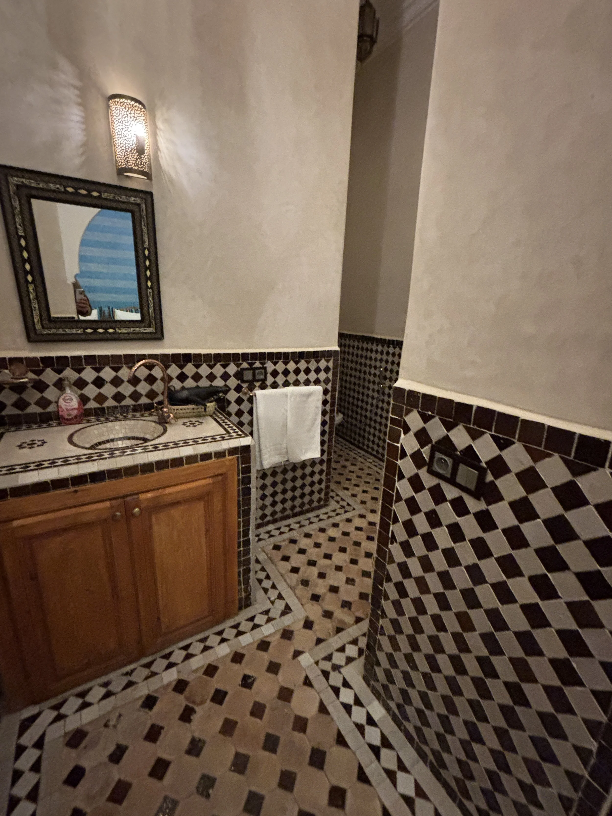
The riad has also a rooftop terrace. There are no outside views to speak of (the inside view is quite a thing, though) but it is a nice spot to catch the rays of the sun (and you can have your breakfast there as well).
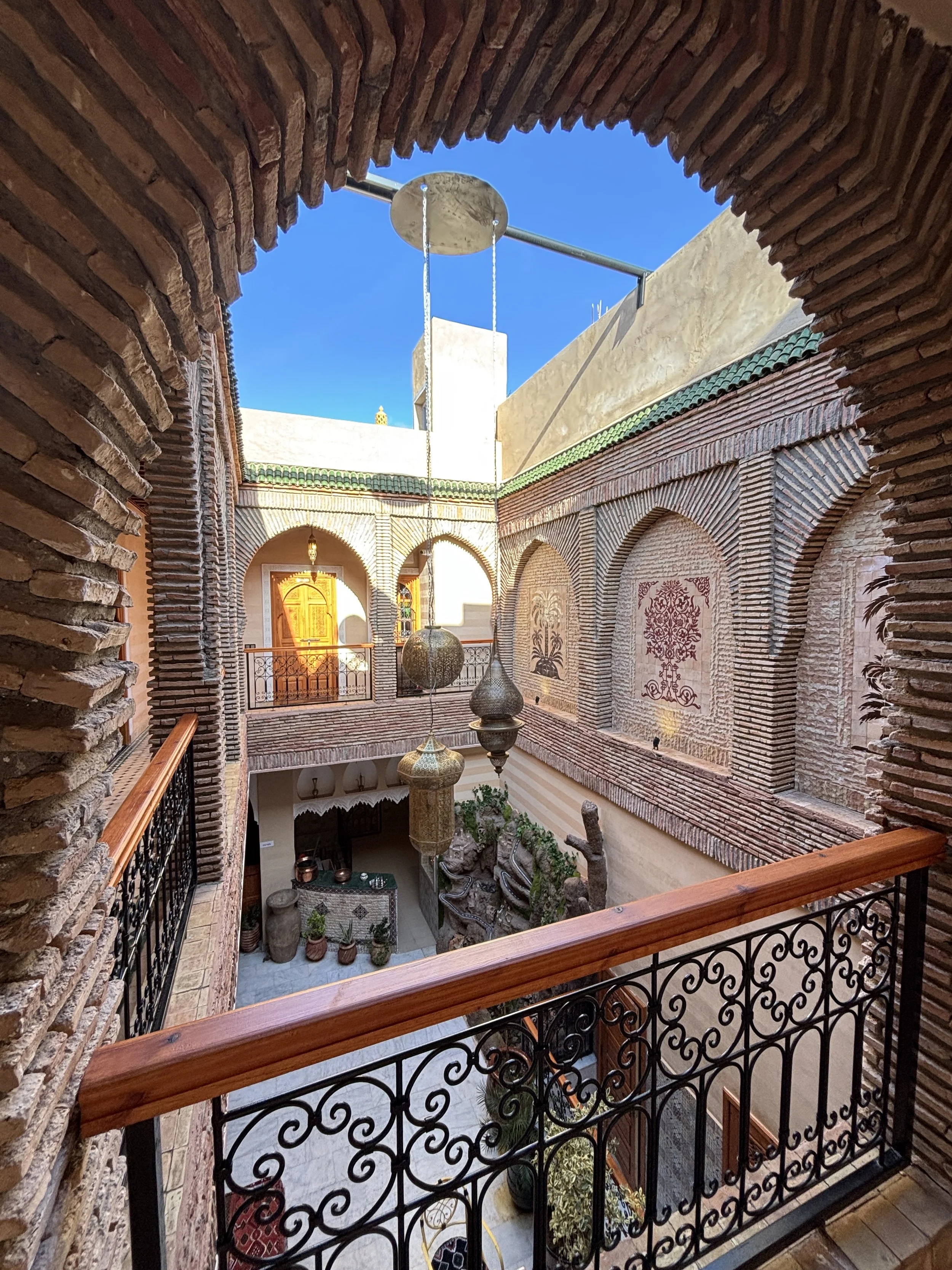
The breakfast was really good and substantious. It is served to the table, rather than being buffet-style. You have to wait a bit until it’s ready (breakfast service starts at 9am) but which gives kind of a premium feeling.
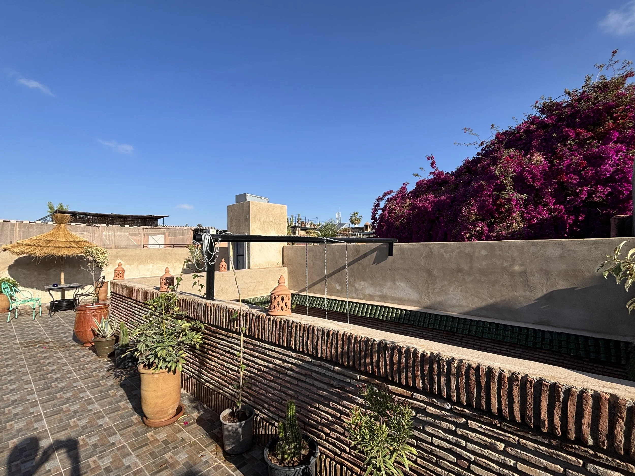
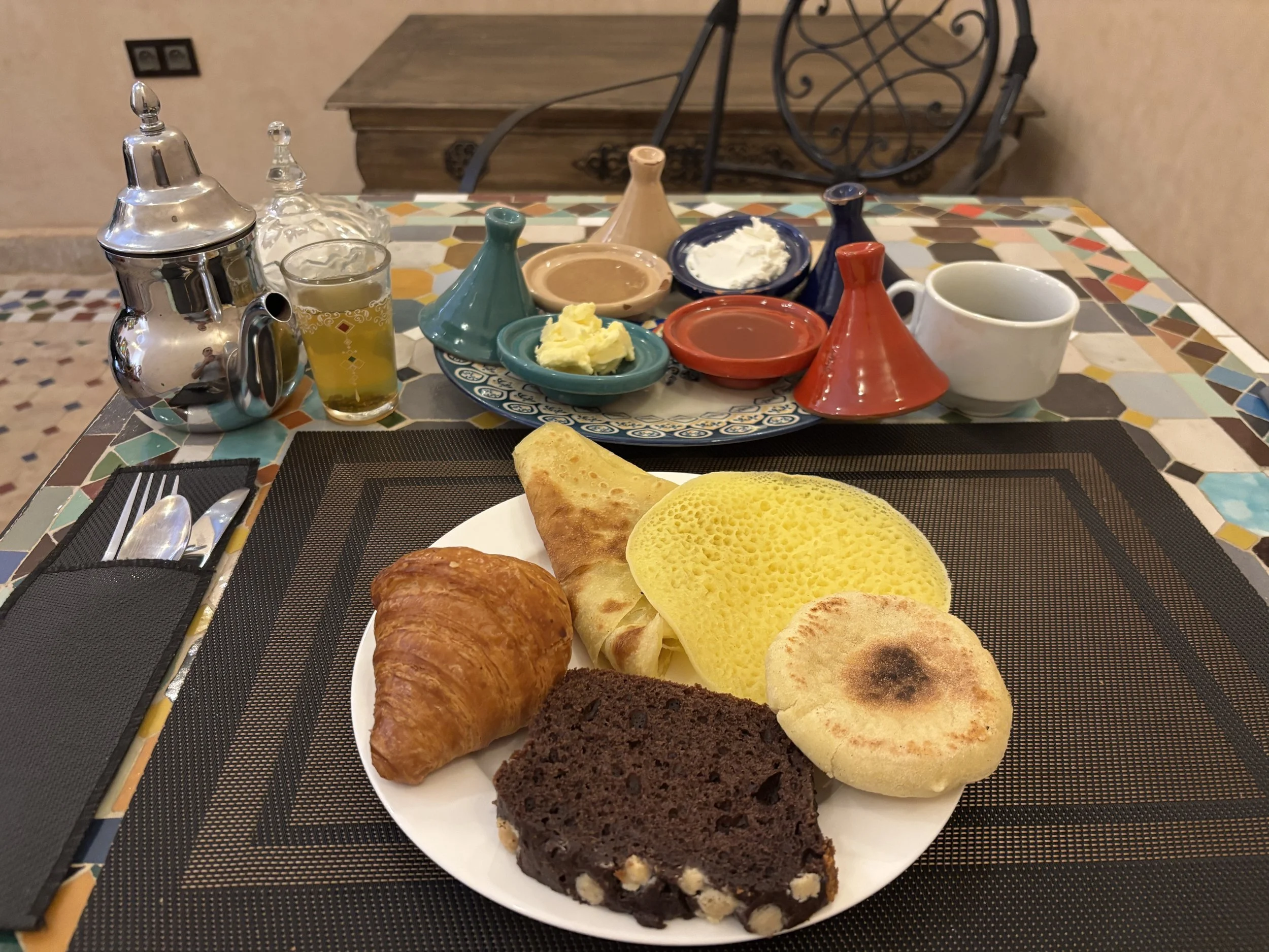
Another option to stay just outside Marrakech city center:
Caravan Serai Hotel
264 Ouled, Ben Rahmoune 40000, Marrakech
If you are looking for something a bit different and outside the buzz of the Medina, here is another rather unique hotel to check.
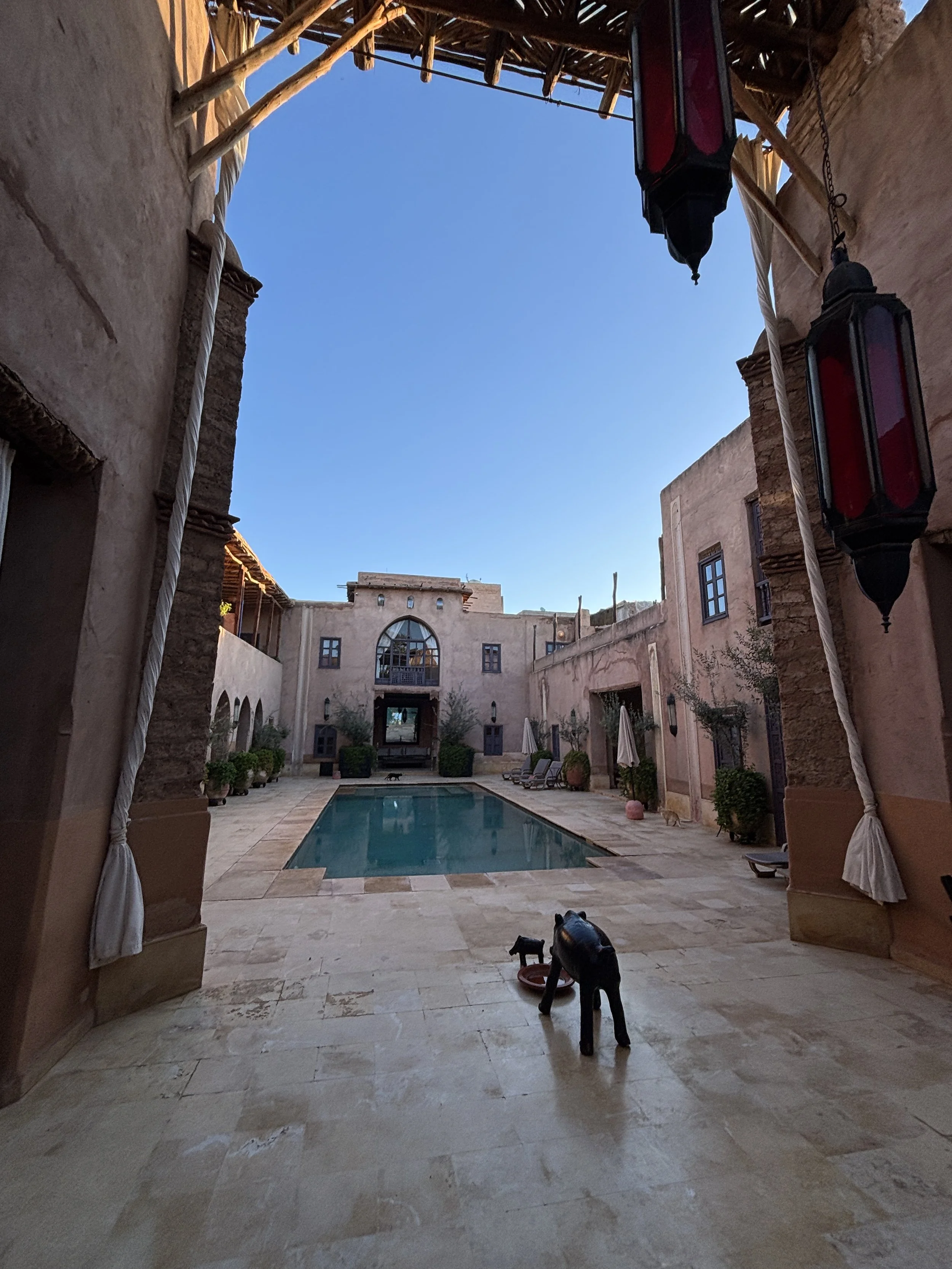
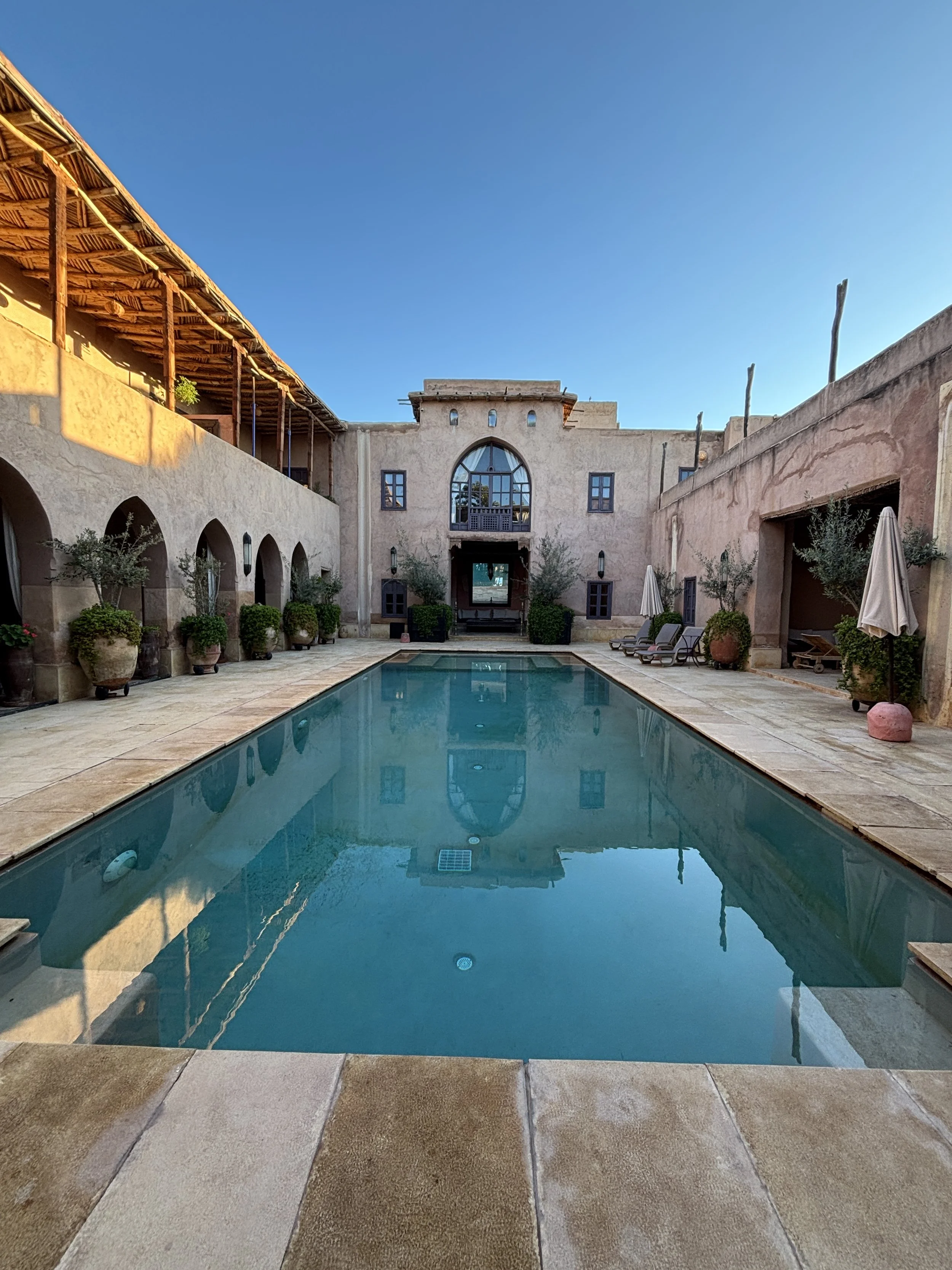
The hotel Caravan Serai is located in Marrakech’s northern outskirts, a few kilometers from the city center . It is located on the edge of a small hill overlooking the plains and offering views of the nearby Atlas mountains, as well as of the Marrakech Medina (you can even make out the siluete of the Koutoubia from there).
Bear in mind, though, that this location means you would need to take a taxi to go to and from the center, each way costing 150-200 Dirhams (€15-20/$15-20). When arriving for the first time it is a bit difficult to locate since it is in the outskirts of a little village literally on a narrow dirt track and there is only a little sign at the door which may be difficult to spot in the dark.
Once you step inside it is like an oasis of peace, very neat and quiet and with a truly unique character. I was told that the hotel opened some 20 years ago, after the owners fully restored a pre-existent structure according to traditional architectural standards.
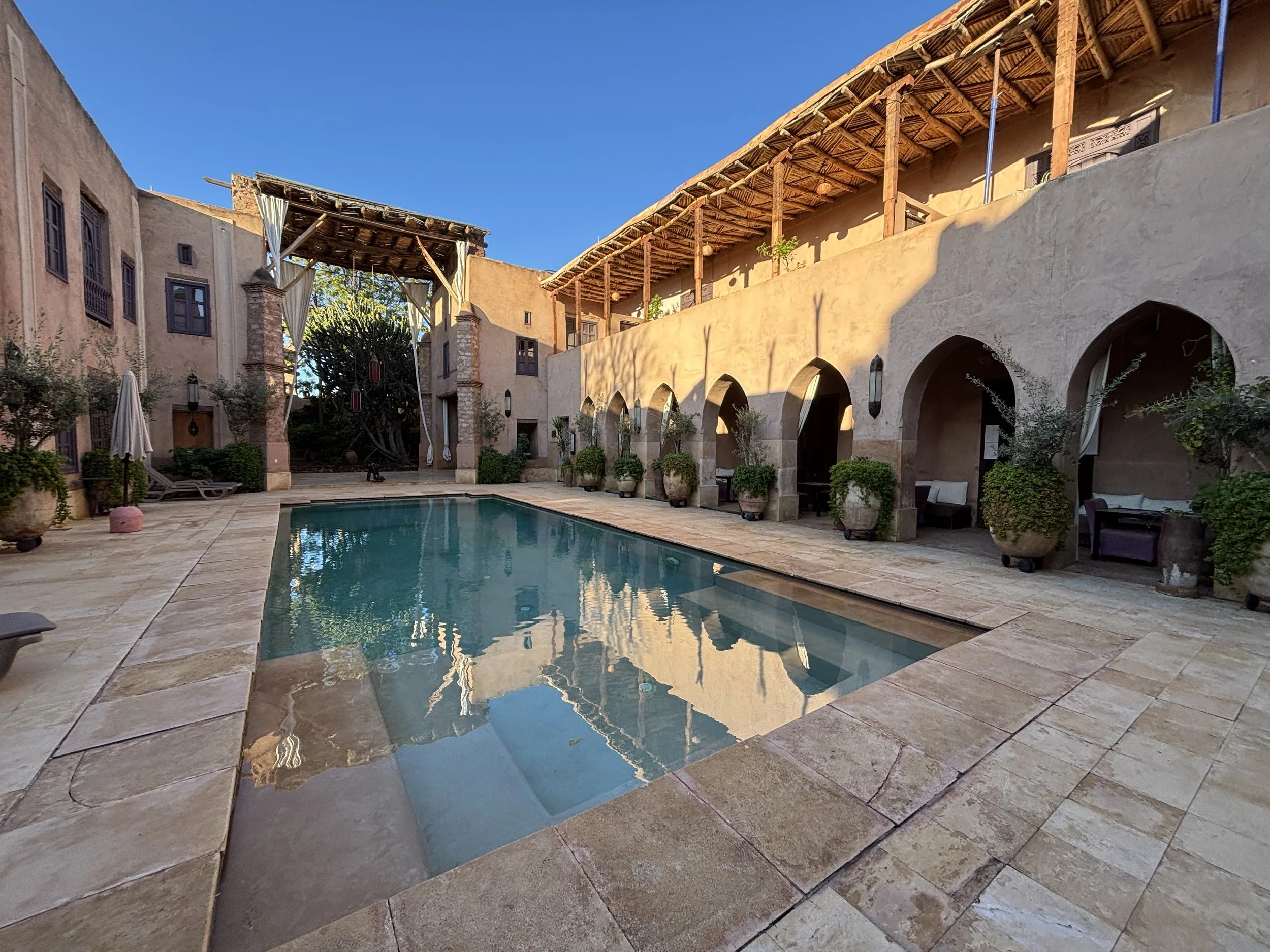
The Caravan Serai hotel has a large courtyard with a pool, with the rooms, which are rather large and in traditional style, as well (see the pictures below) located all around.

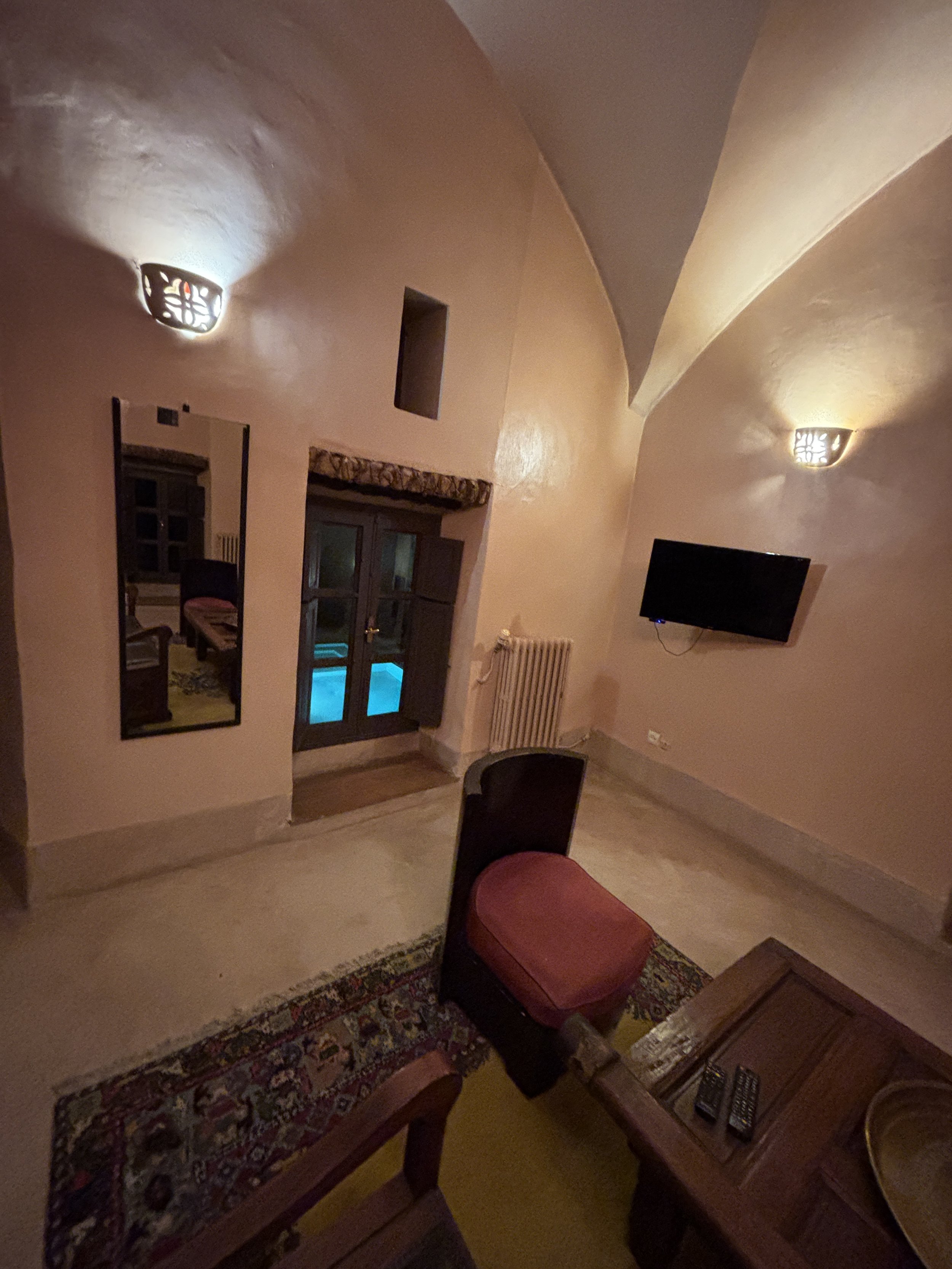
The bathroom is quite something! And there is also a spa in the property, although I didn’t have the chance to check it out!
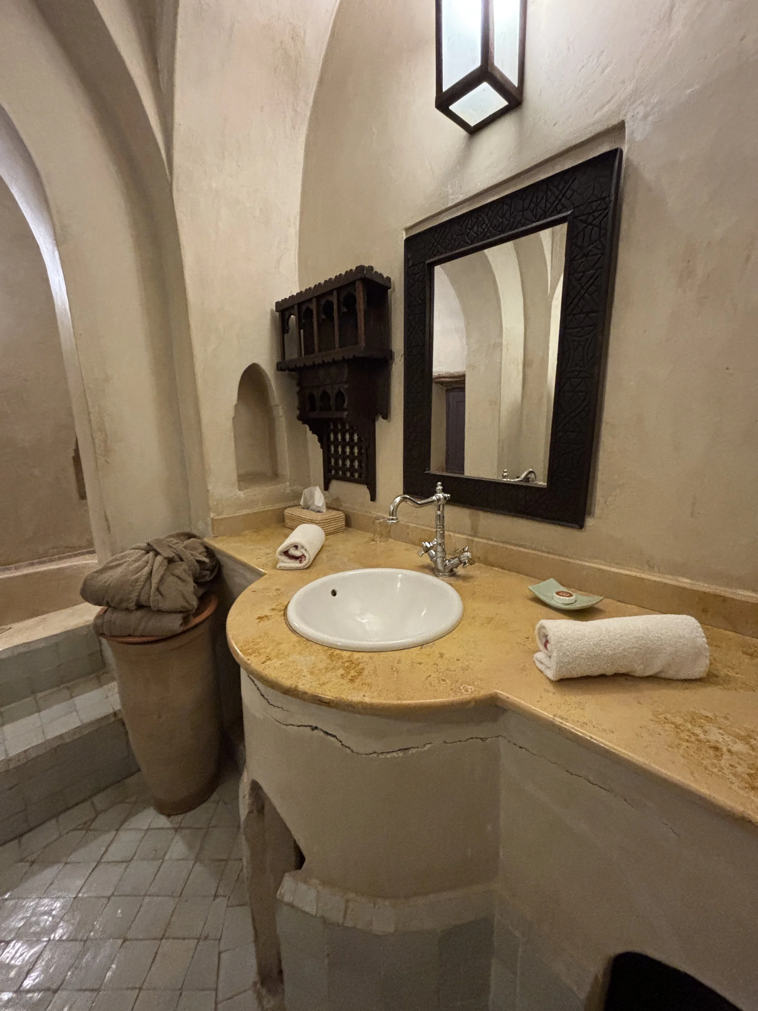
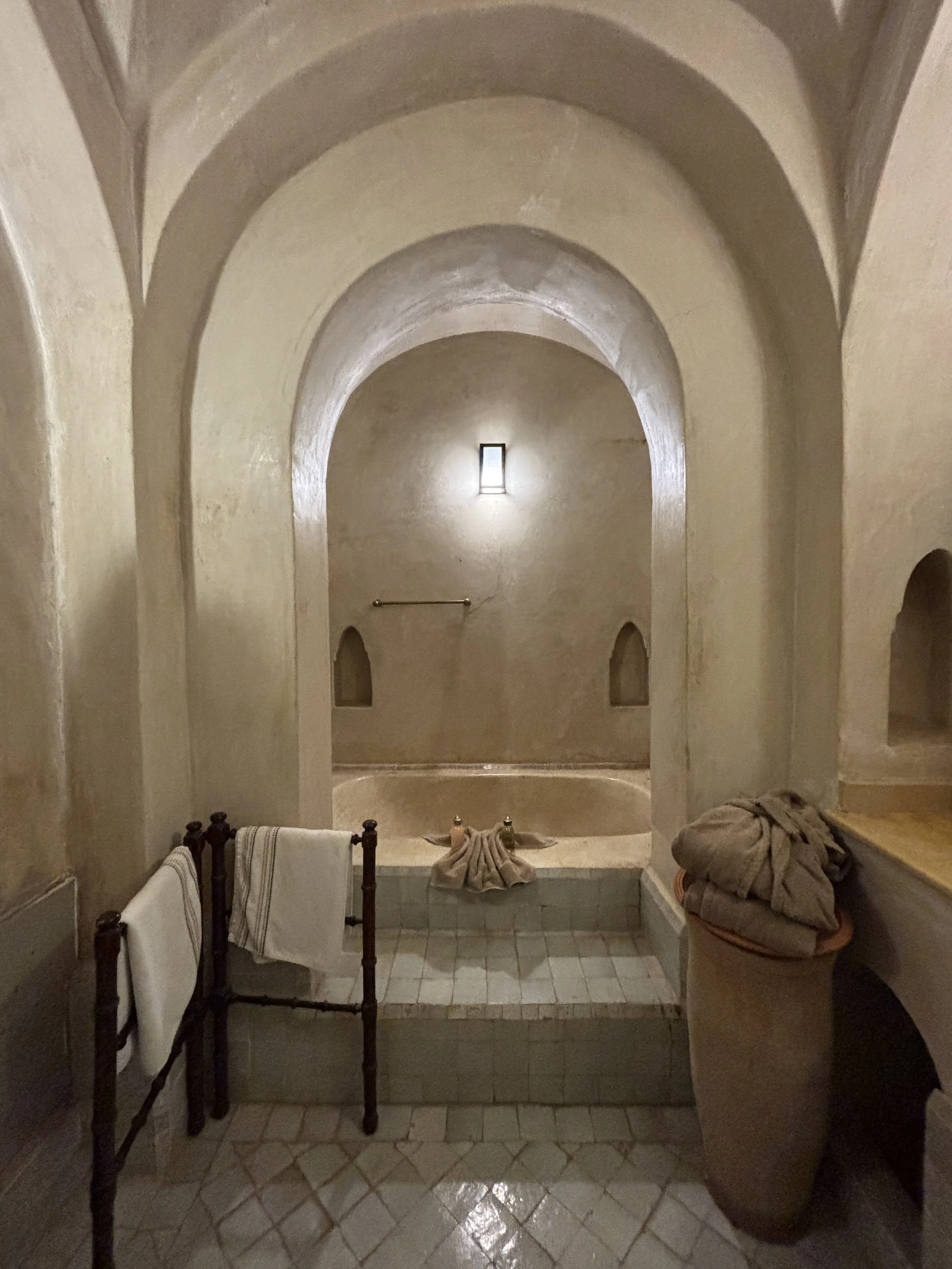
Each of the rooms have a terrace. As you can see, mine had a direct view of the pool and the courtyard.
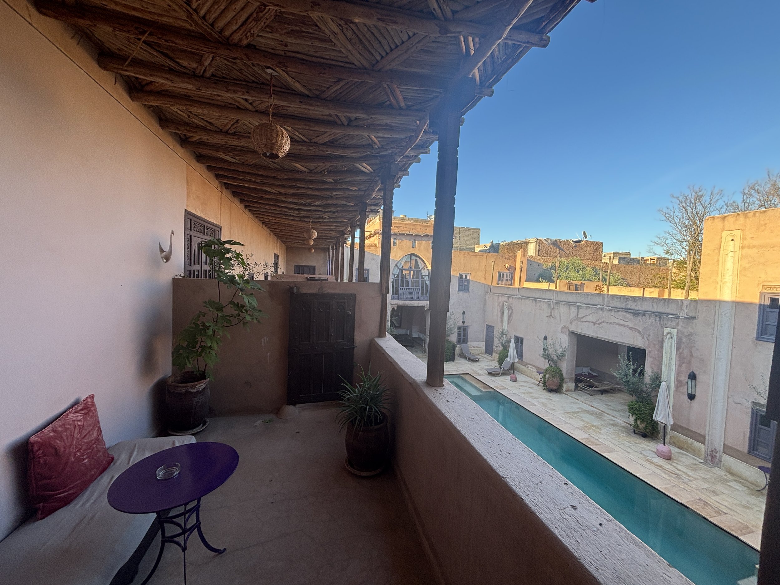
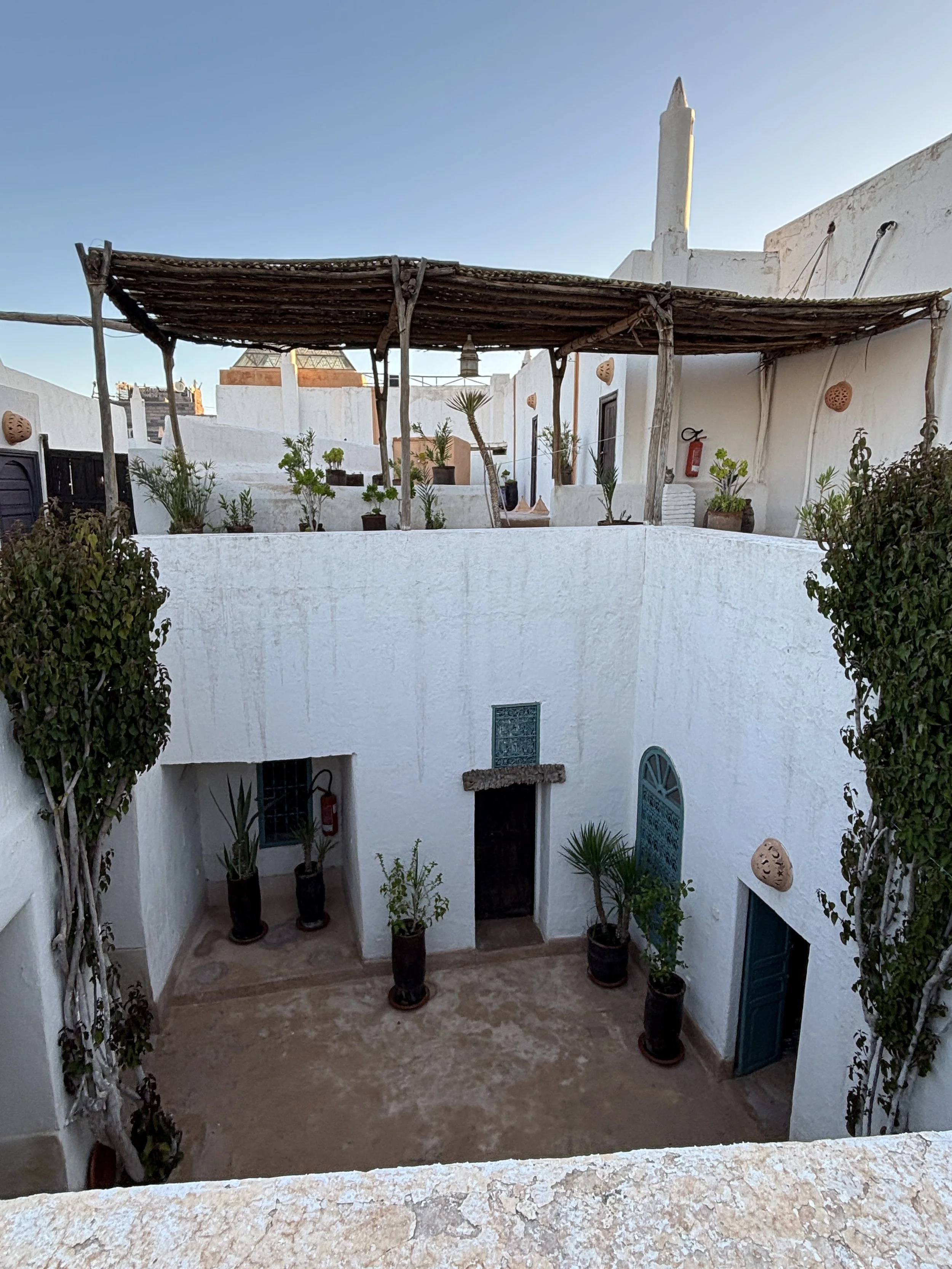
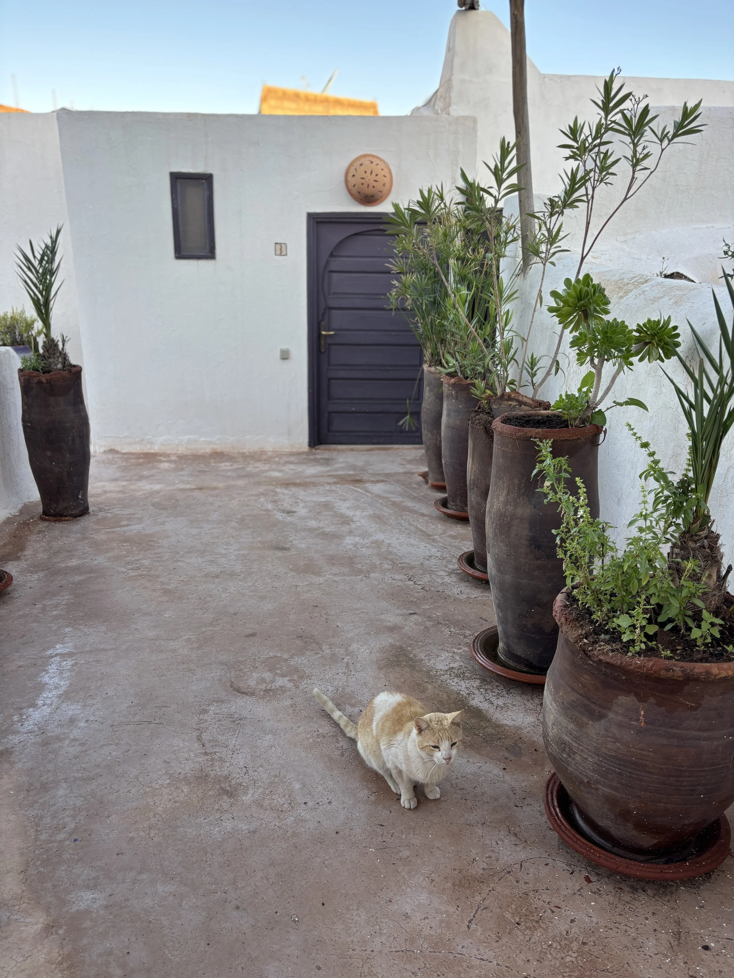
The whole set up is quite interesting, with access to some of the rooms through a sort of rooftop terrace which you get to after climbing a narrow set of stairs in a tunnel-like set up.
By the way, if you are a cat person, you will be happy to know there are quite a few felines living in the property and roaming freely through all its common areas.
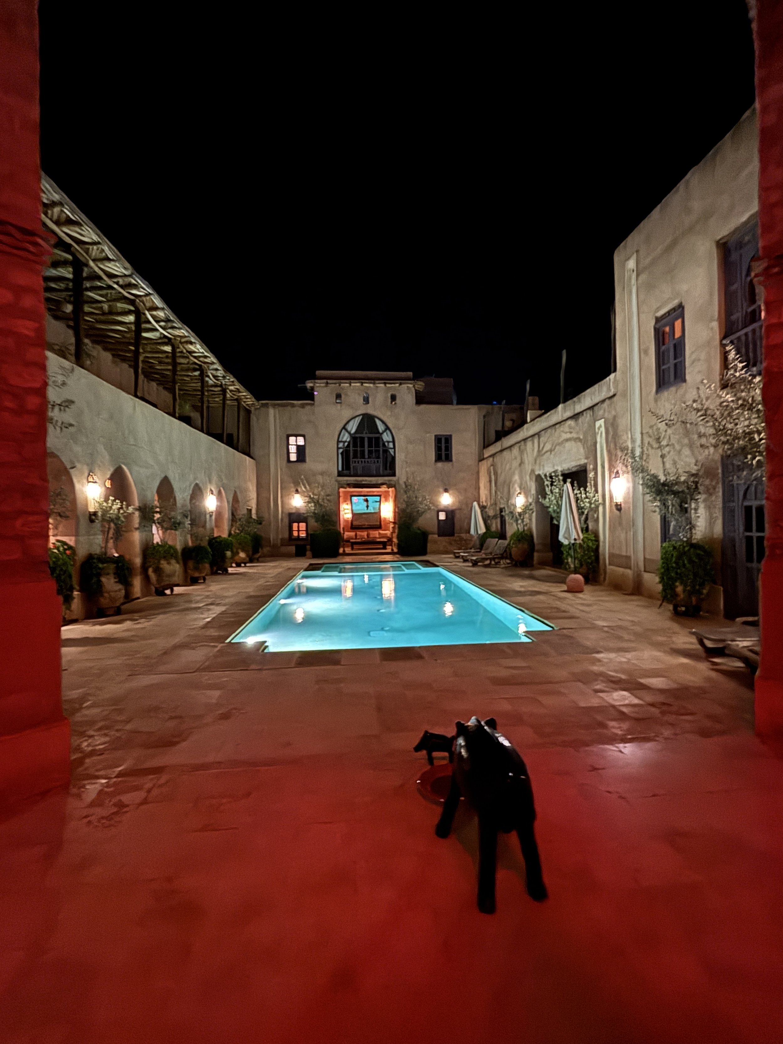
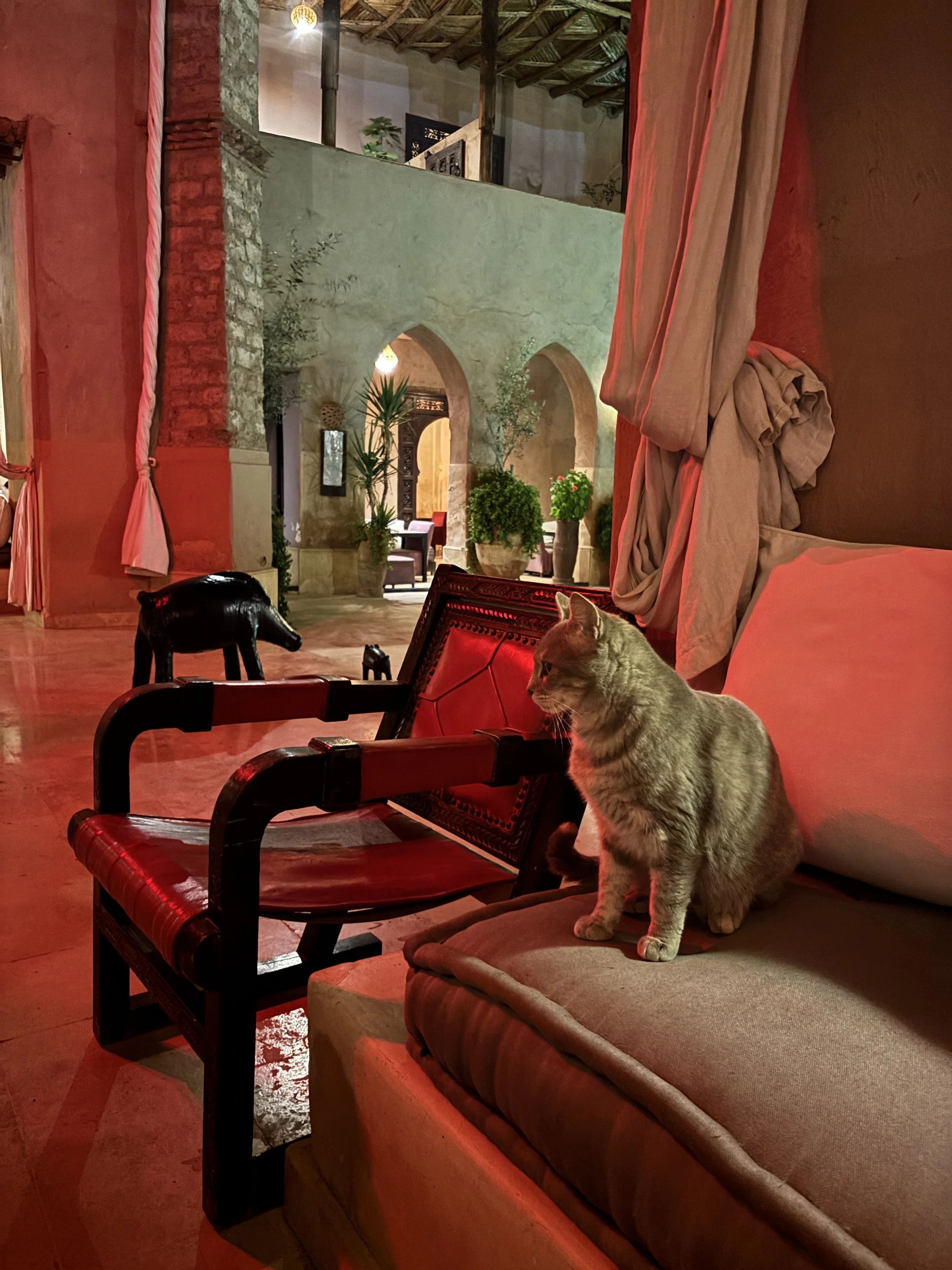
The hotel Caravan Serai has also a pool side restaurant area, which is where breakfast is served. Breakfast consists of a small buffet. It is not extravagant in terms of choices, although it covers the basics (and the staff can prepare some rather tasty pancakes on the spot and upon demand).
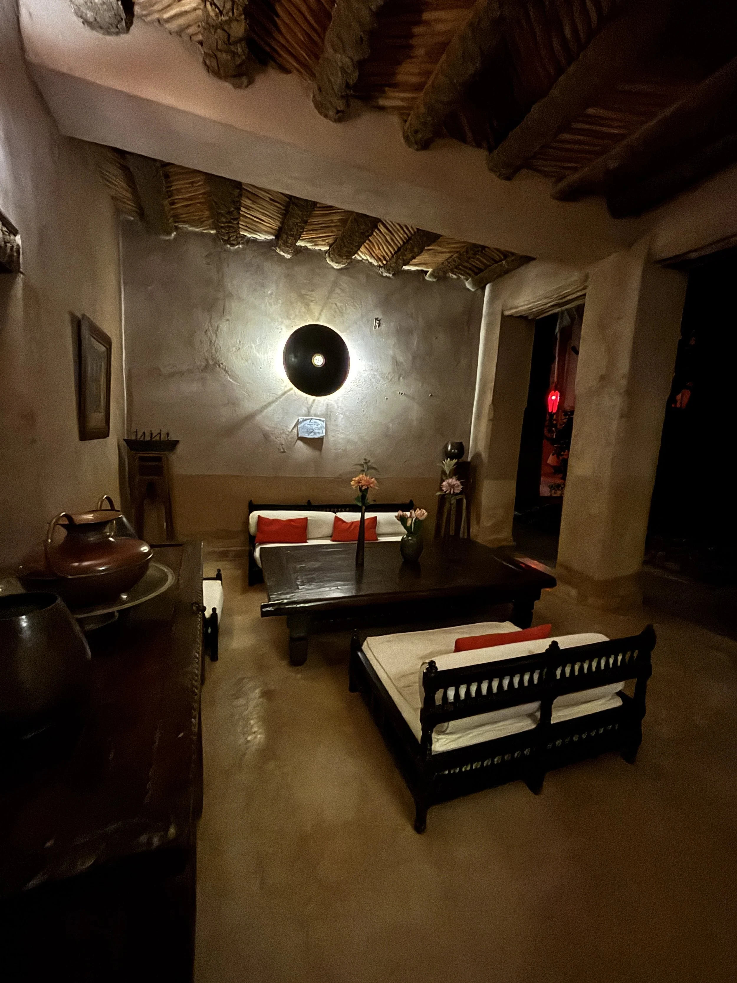
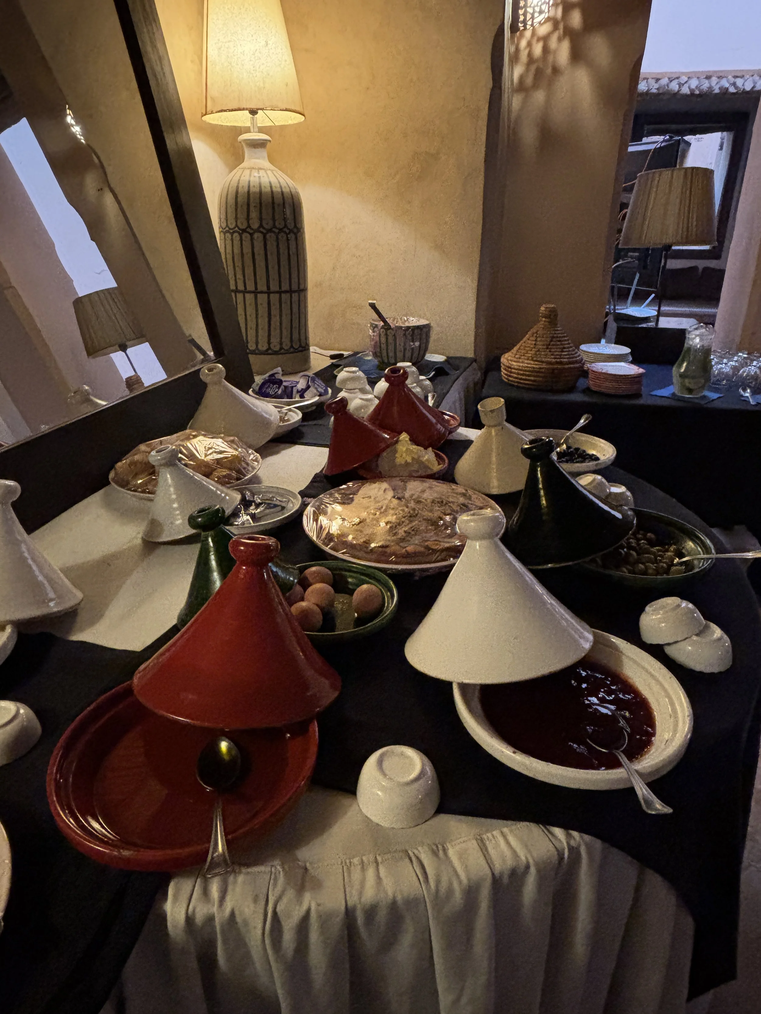
The hotel has also a nice garden, which I guess makes for a nice venue for weddings and other similar events.
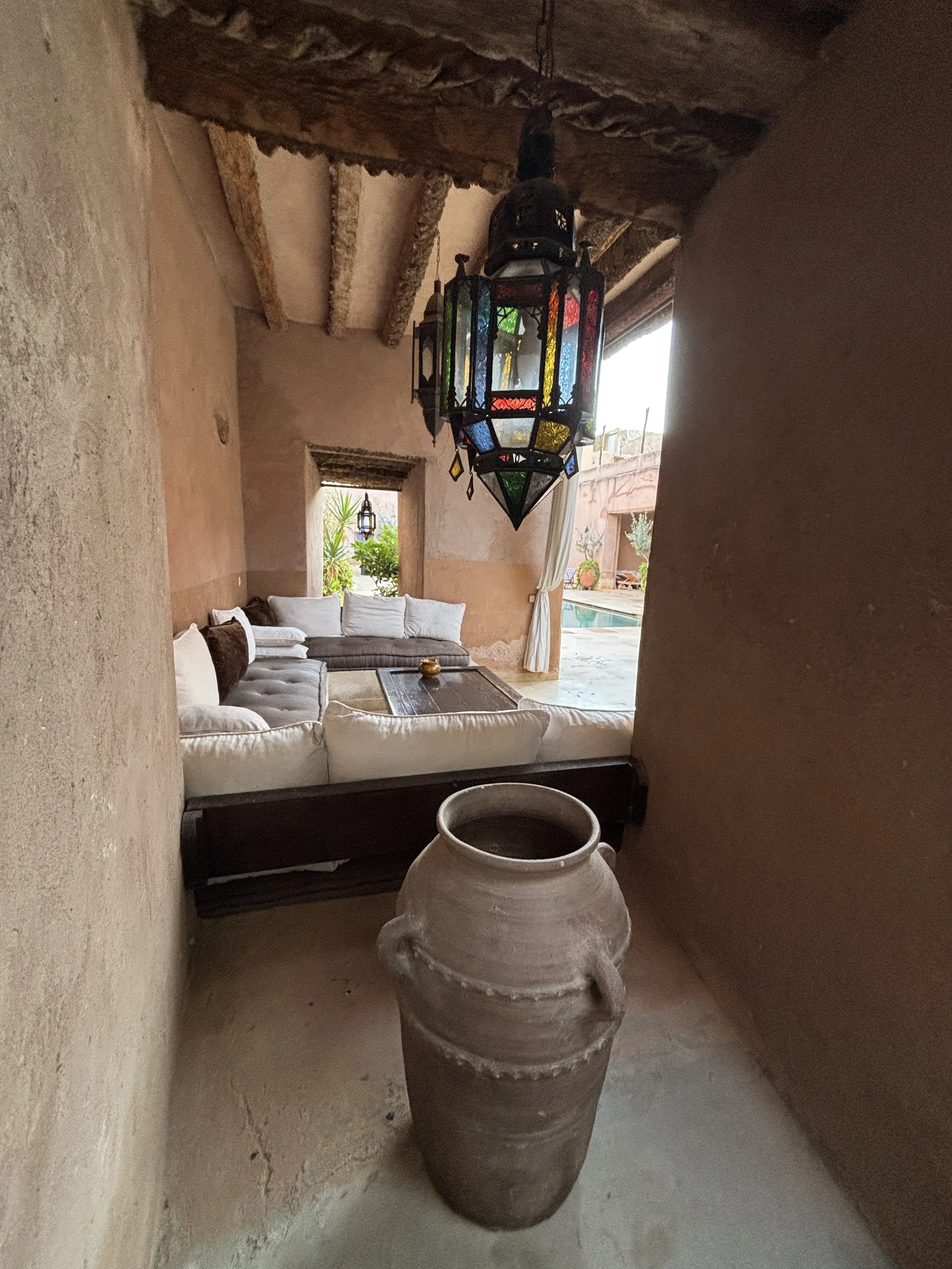
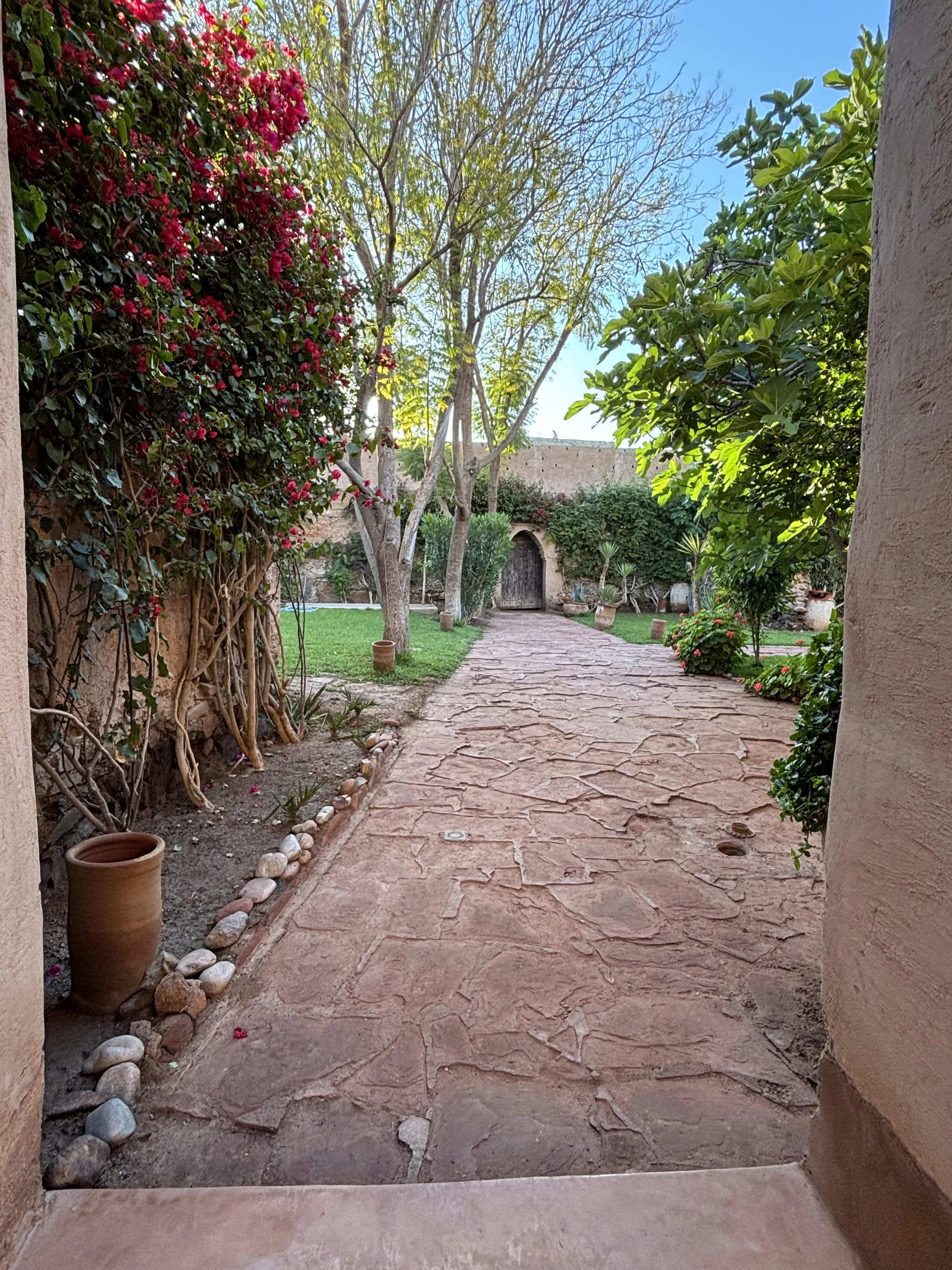
By the way, cats are not the only animals roaming free through the hotel grounds: there is also a peacock! Also, note the monumental cactus that welcomes guests to the pool area!
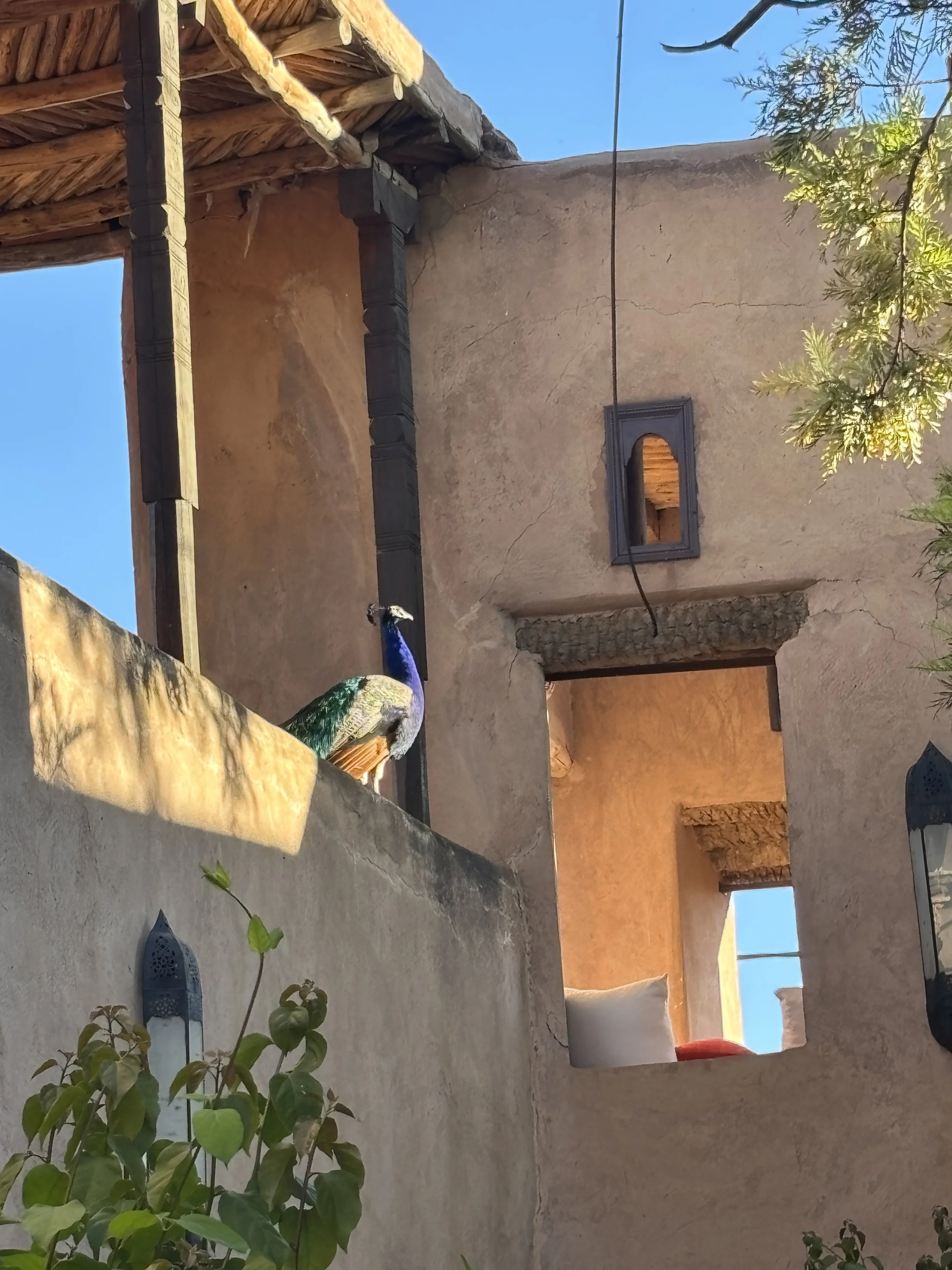
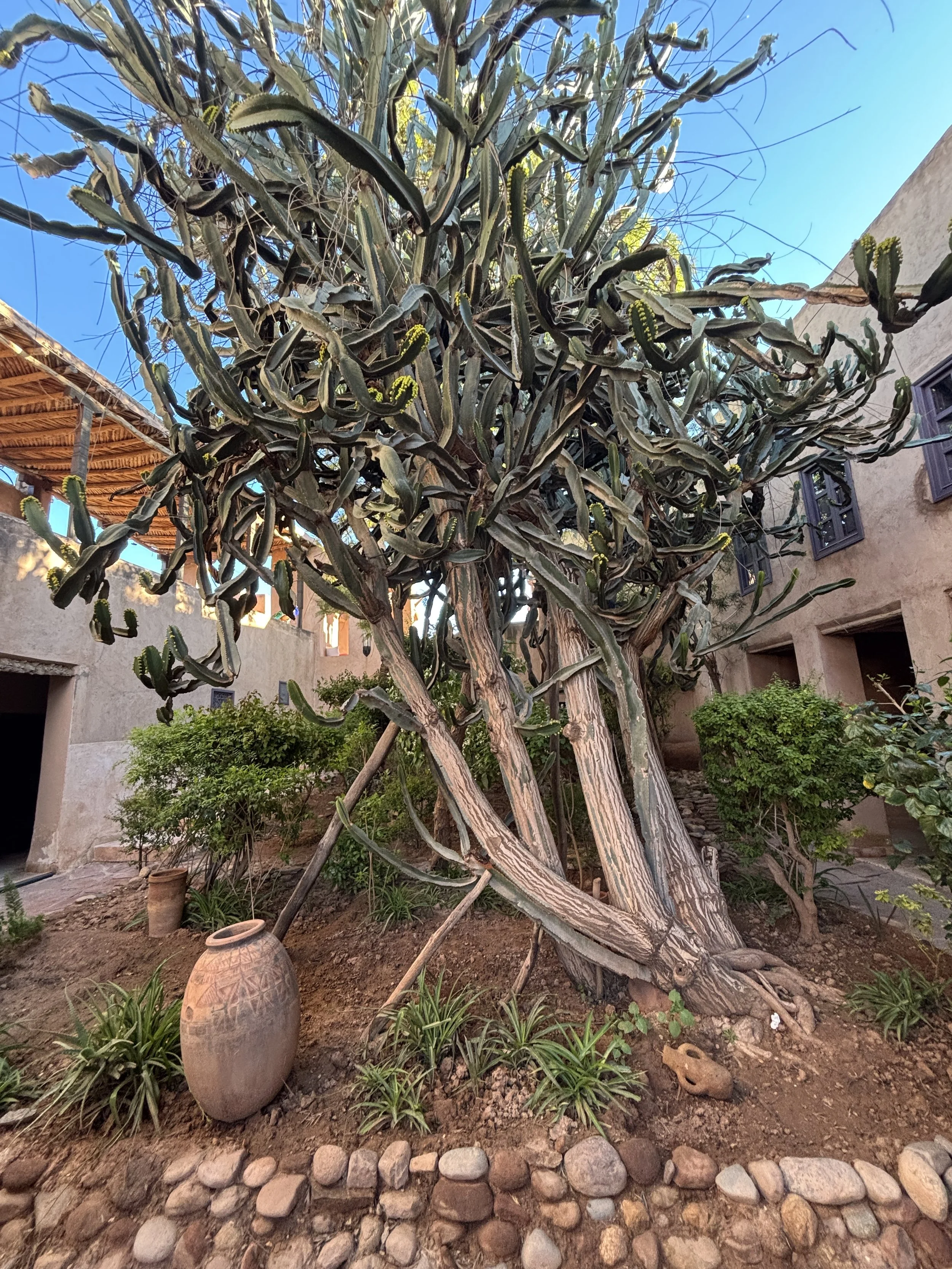
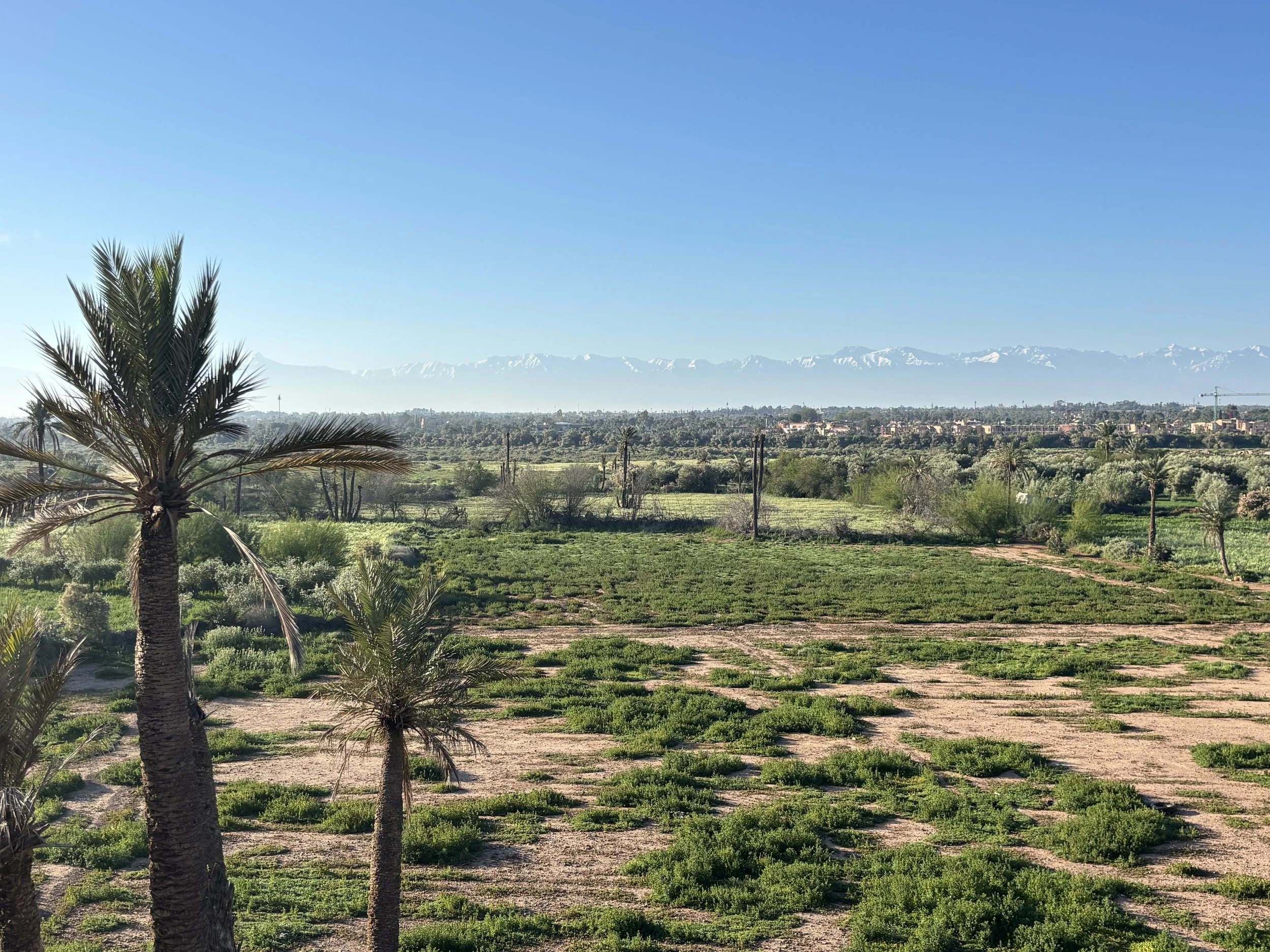
As mentioned a bit further up, another plus of this hotel are the stunning views of the Atlas mountains contrasting with the that lush landscapes of the plain of Marrakech and its palm and olive groves. This view is particularly remarkable when there is still snow in the Atlas!
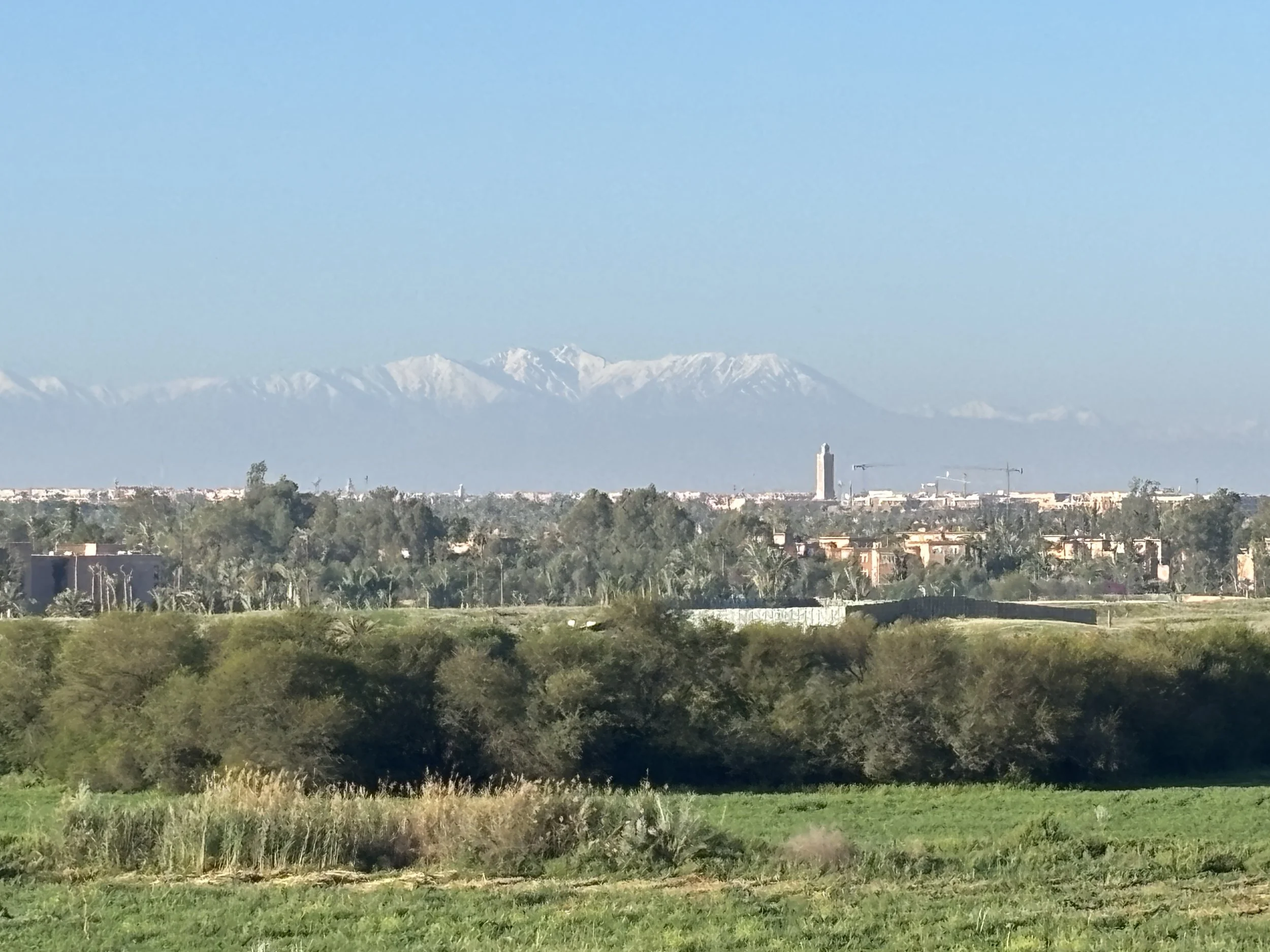
Moving around modern Marrakech: some practical tips
Let me start this section by saying that infrastructure to get to and from Marrakech is pretty good. Both the train station (left picture above) and the airport (right picture above) are state-of-the art and aesthetically beautiful.
Now, moving within the city is another matter, although you possibly won’t need to move around much if you stay close to the Medina, since the city center is pretty compact and you can get pretty much everywhere on foot.
Now, a couple of pieces of advice:
Get local currency in cash: while cards are accepted in most places, this is still a place that runs on cash. Also, I noticed that long queues form at the currency exchange and ATMs near Jemaa el Fna and the main tourist spots. However, if you look around a bit, you will see that there are some currency exchange shops which are much less crowded in adjacent areas, just avoid the main central spots and you will be fine.
Safety: I got the feeling that the Medina and central Marrakech are, in general, pretty safe. Also lots of tourists, including many families walking around pretty unconcerned. The usual precautions apply, of course, and bear in mind that some areas of the Medina get pretty crowded at peak times. As long as you are careful not to leave your wallet too exposed, should be fine. Also, while there is some hawking, mostly around Jemaa el-Fna, it is much less than I was anticipating.
Taxis: most taxis don’t take cards and are not particularly cheap. A ride to and from the airport, which is pretty close to the airport, can cost 150-200 Dirhams (€15-20/$15-20), which is quite pricey for the distance and local price levels.
Uber does operate in Marrakech, but it tends to be considerably more expensive. Other ride-hailing apps like Careem and Bolt operate in Morocco, but not in Marrakech at the time of writing these lines (only in Casablanca, Rabat and some other cities).
Languages: since Marrakech is a very touristy city, many locals, particularly those working in the tourist areas, know at least some basic English, which they usually use straightaway when seeing a foreigner. French is otherwise the lingua franca (in addition to the local Arabic and Amazigh). Quite a few people in Morocco appear to know some Spanish too.
The taxi app you may want to have when traveling to Marrakech is Roby, which is a Moroccan app. However, it is match-making app only. It connects you to an available taxi, but it does not process any payments. All payments on rides booked on Roby must be settled in cash. The app gives you the approximate amount, but it is advisable to confirm it with the driver before the ride to avoid any surprises later on.
I read there is another app called inDrive that works in a similar way and it is also available in Marrakech, but I don’t have direct experience using it.
Modern Marrakech
The modern city of Marrakech, starts just outside the walls of the Medina. The modern downtown is made of broad, palm-lined avenues.
The area around Gueliz, in particular, is pretty well maintained and its streets are quite walkable and lined with shops and restaurants (including the typical international chains).
It offers quite a contrast with the maze of narrow streets of the Medina.
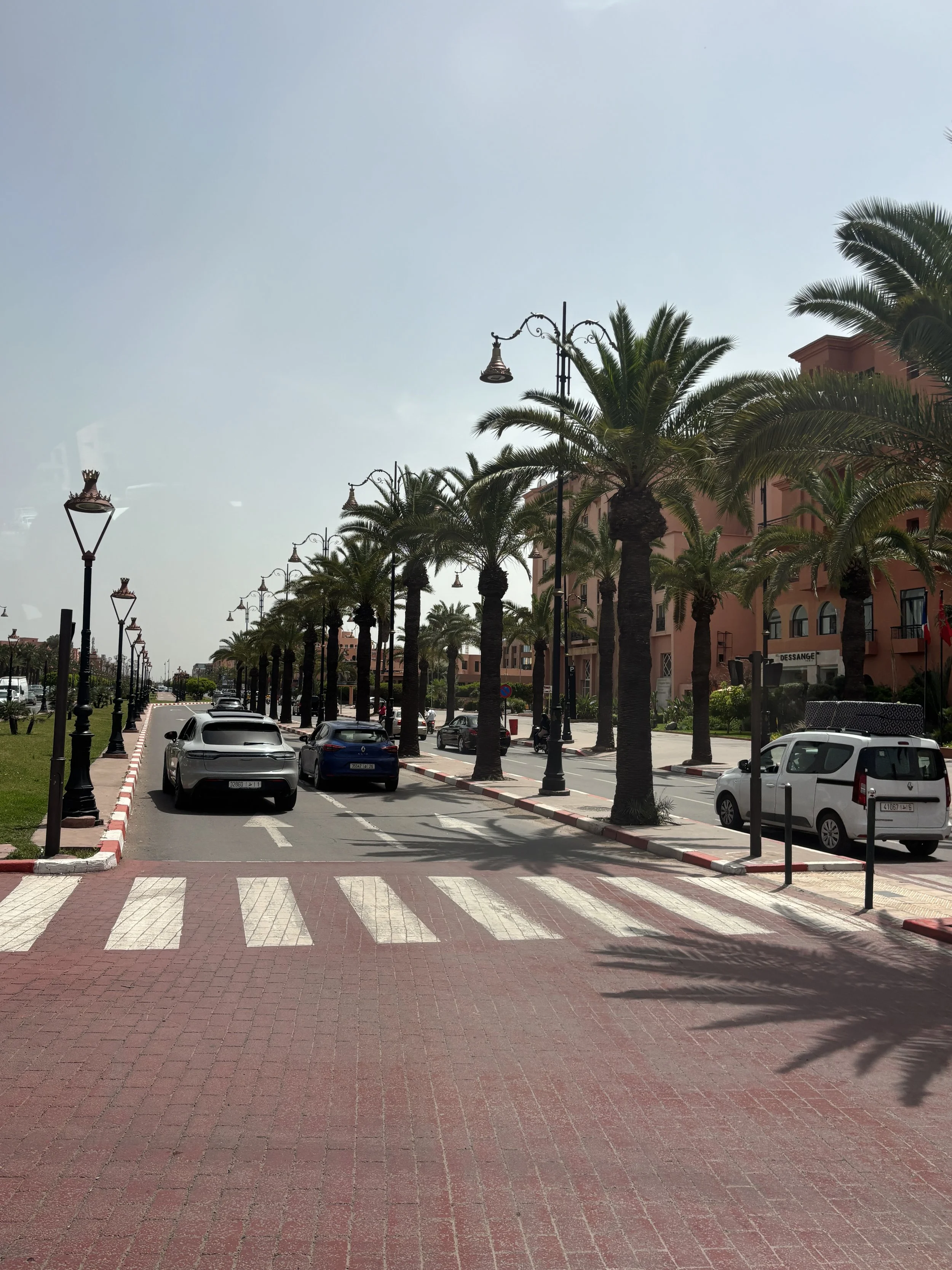
A place to eat in the modern part of Marrakech
Verandah
232 Av. Mohammed V, Marrakech 40000
https://www.werandahmarrakech.com
So, continuing with the topic of modern Marrakech. If you are looking for a modern place to rest a bit from the frenetic activity of the Medina, here is a place that, while not claiming to be traditional or “authentic” in the exotic sense of the word, offers a comfortable alternative just outside the city walls.
It offers mostly international cuisine, although it has also some Moroccan specialities in the menu, such as the chicken tagine depicted below.
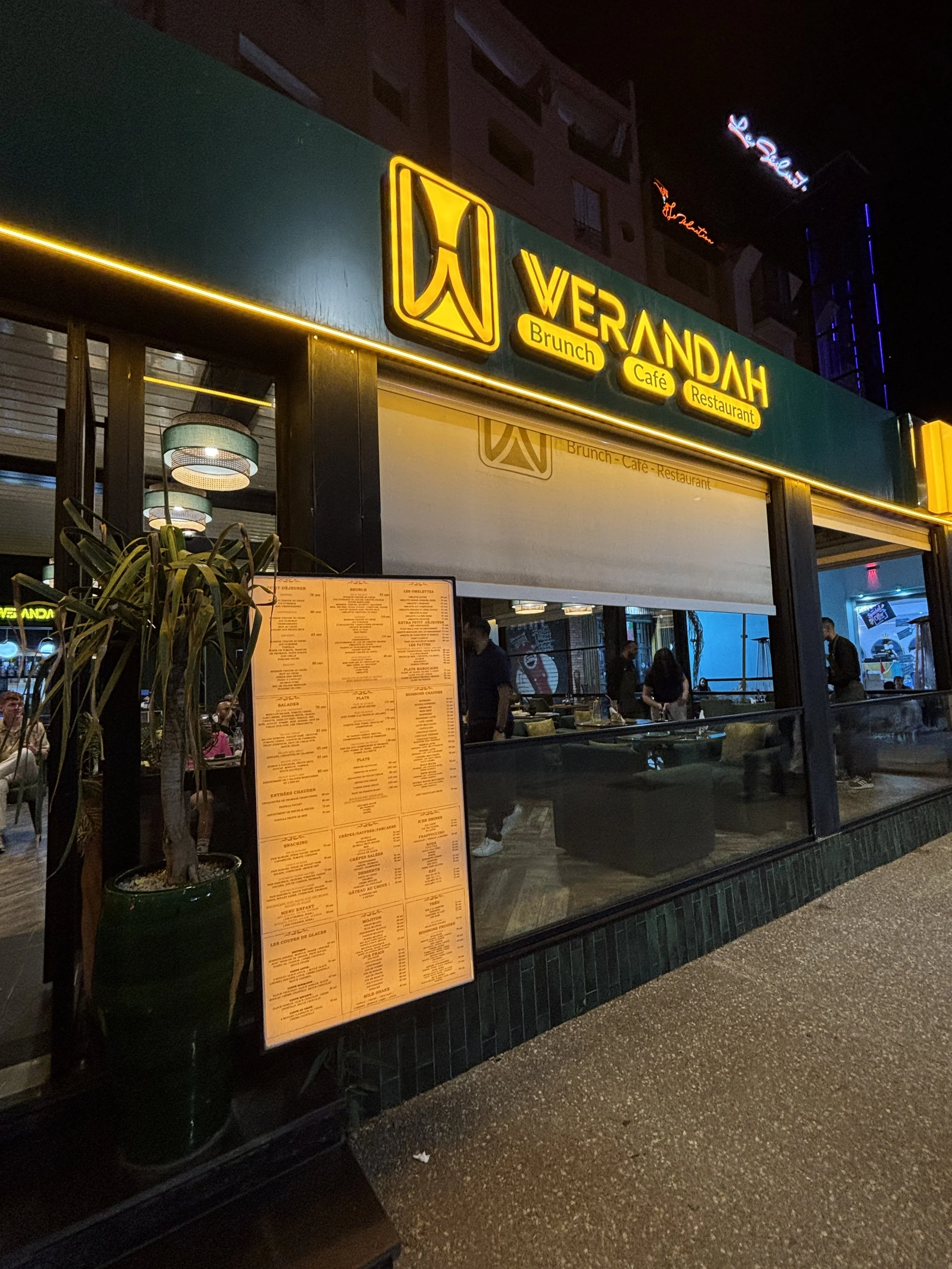
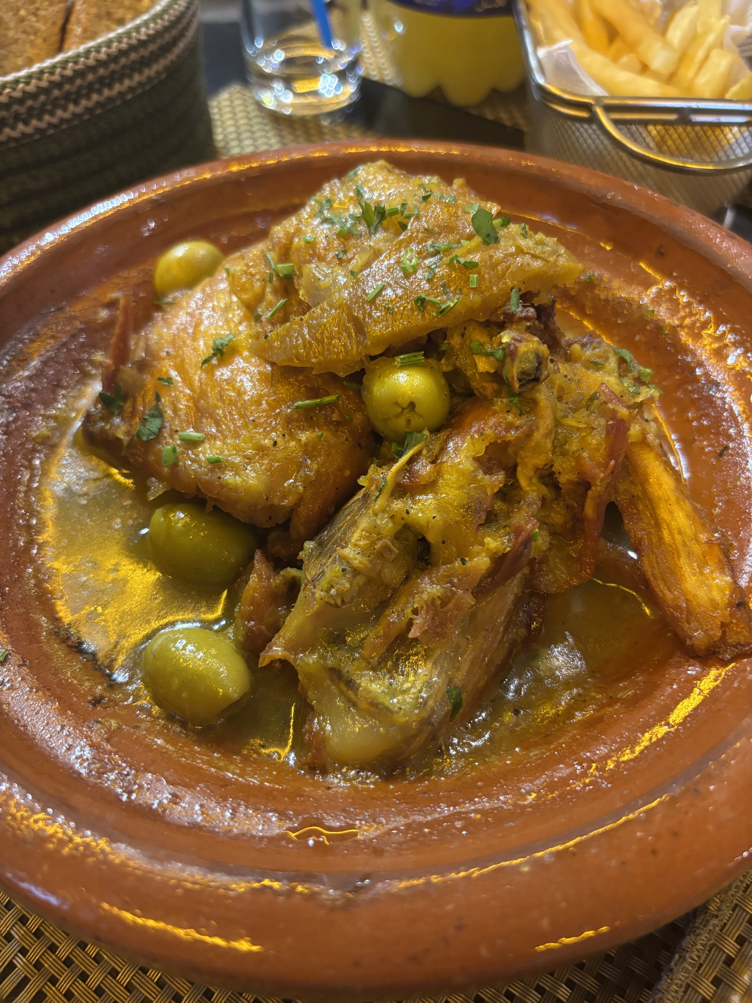
Bonus Tip: Menara Gardens
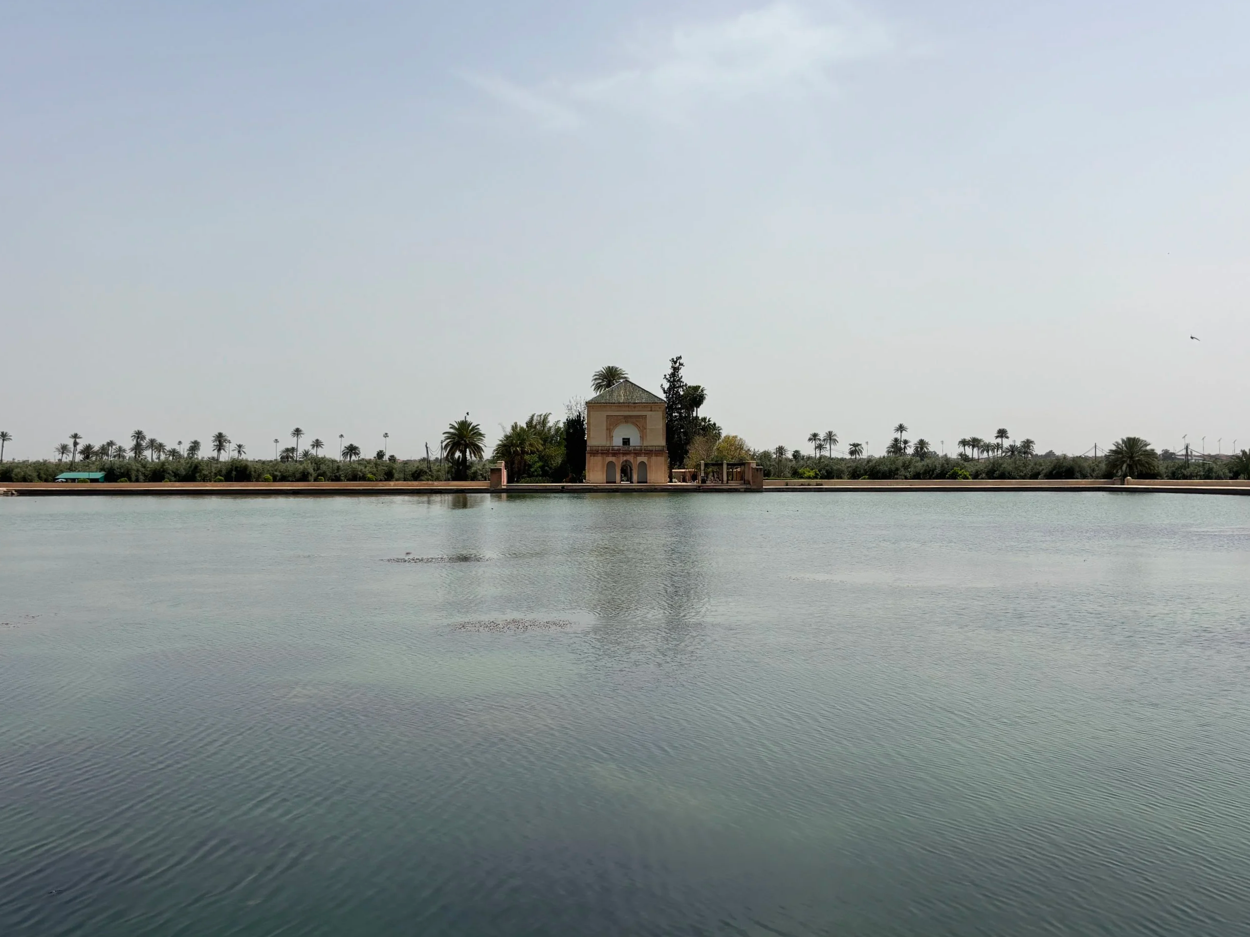
This Marrakech landmark offers one of the city’s most iconic views, with a water-side pavilion silhouetted against the backdrop of the Atlas mountains.
I had big expectations about this place, so I decided to stop by on my way to the airport, since it is located nearby. To be honest, after having been to all the other places I described earlier in this post, I found the Menara Gardens quite underwhelming.
First of all, I have no doubts that the view must be amazing when visibility is good but this was, sadly not the case when I visited. So, no views at all, although I was not too concerned about this, because I had enjoyed quite amazing views, perhaps even better, from the Caravan Seari hotel, as detailed earlier.
But also, the whole ensemble appeared to be quite run down in general and in this it contrasted with some of the other sites I had visited. I have read that there is an entry fee to enter the pavilion, but I didn’t even check since I had come primarily for the views.
The pavilion and the basin are in the middle of a large olive grove which is also a public park. By the way, one of the positives is that entrance is free (perhaps this explains the less than optimal preservation state). There are a couple of kiosks and little more in terms of infrastructure.
I also visited at a not very optimal time, in the early afternoon, when it is hottest, I guess it is much more pleasant around the evening. Nevertheless there were a few locals having picnics among the olive groves.
The Menara Gardens are some three kilometres in a straight line from Jemaa el-Fna and the Koutoubia, so, it is technically walkable, although it is a large avenue with quite a lot of traffic and little shadow, so may be better to take a taxi. It is also quite close to the airport, almost adjacent to it, actually, but the taxi would still charge the customary 150 Dirhams.
So, in short, feel free to visit if circumstances permit and you think that you will get the views, but don’t lose sleep over it if it’s not possible for whatever reason!
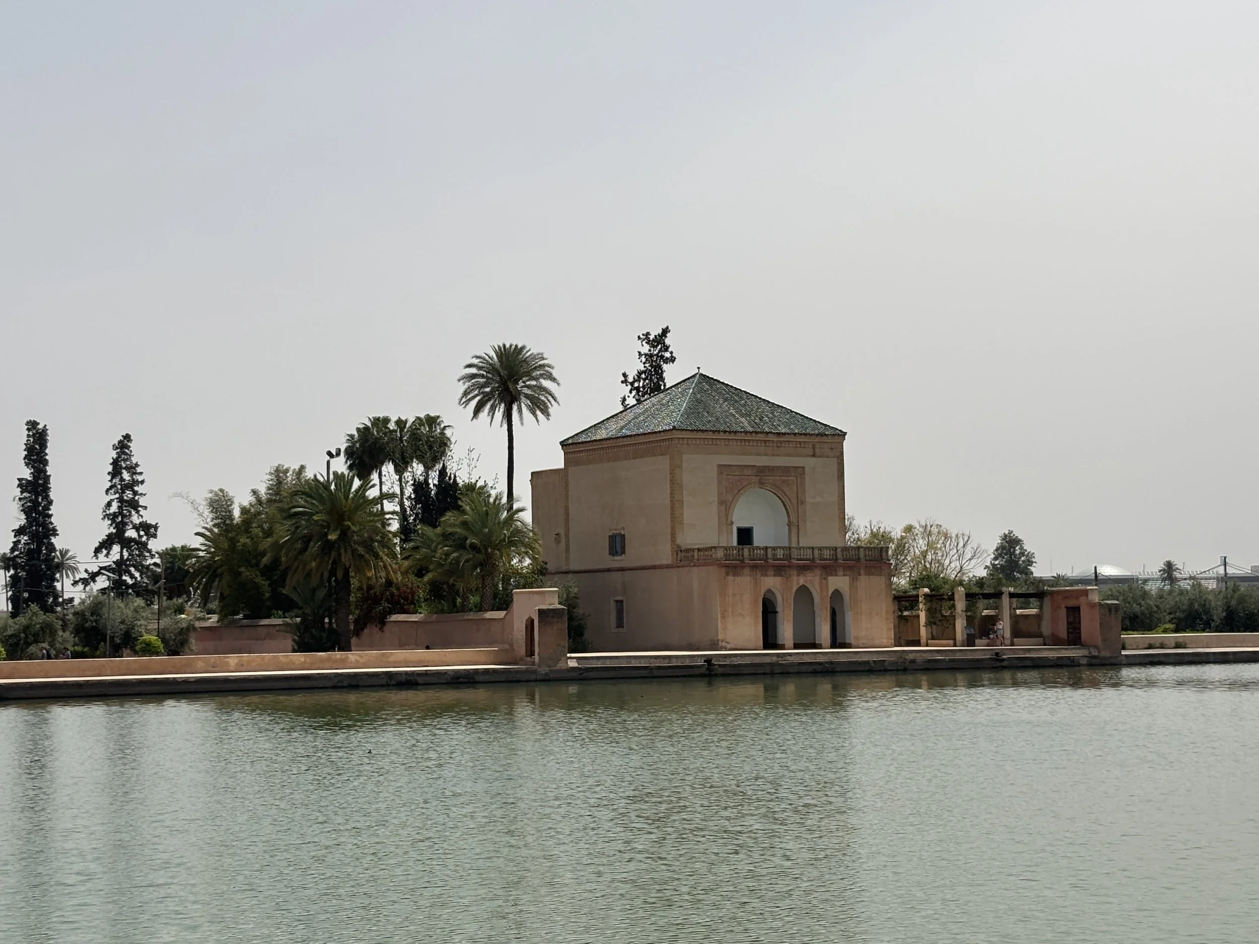
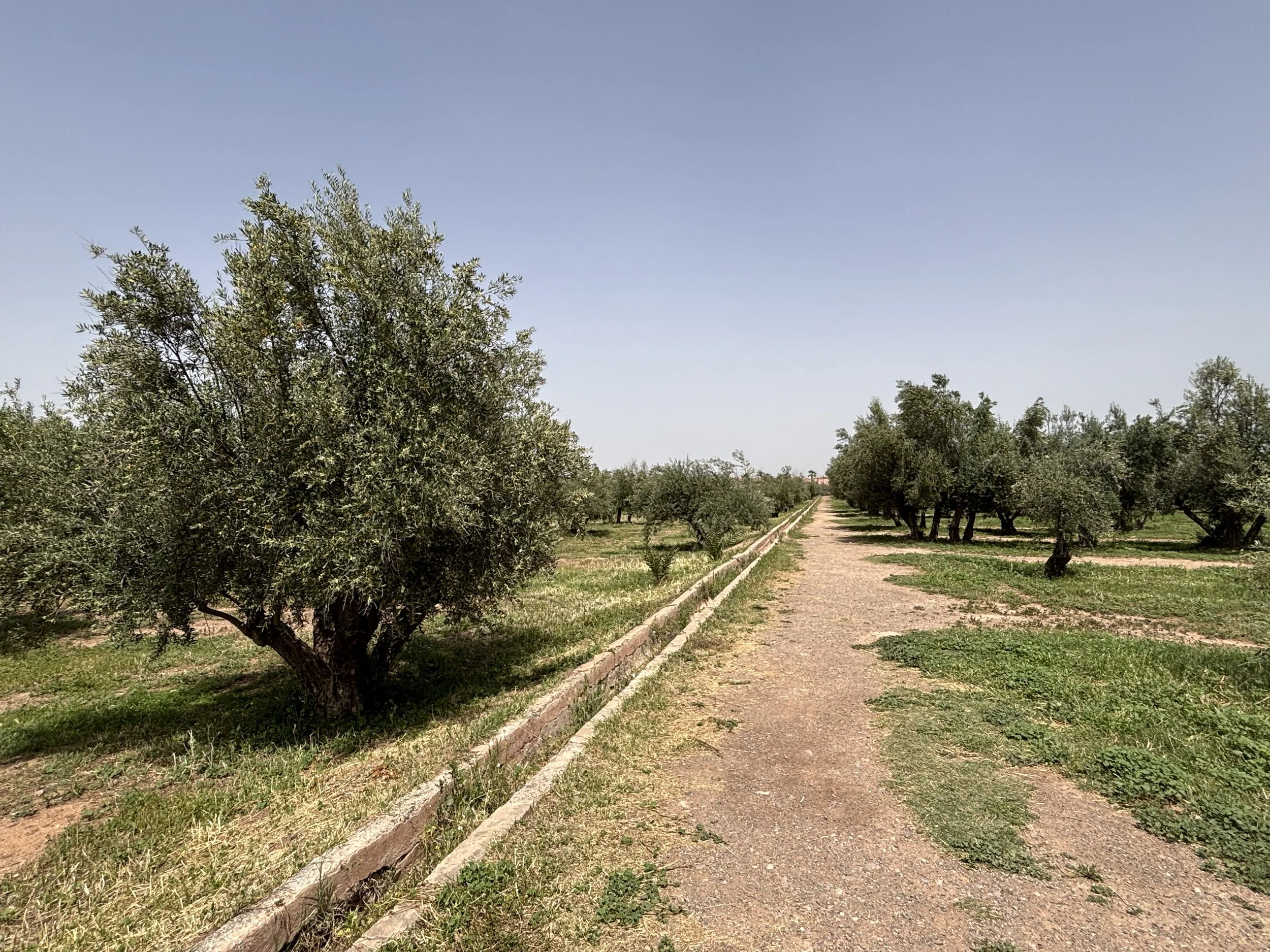
What to do and what to see in Baku and around

For many years, Azerbaijan barely registered on most travellers' minds, but not anymore.
Oil and gas wealth is undoubtedly behind this transformation. The energy resources that turned Baku into one of the largest cities in the Russian Empire, first, and the Soviet Union later, have also underpinned a rather comprehensive urban transformation programme in the last decade.
The skyline of futuristic towers and meticulously restored medieval streets are its most visible sign, but so is a newly found confidence and pride in the country’s ancestral Azeri culture.
Not unlike the Gulf monarchies further south, Azerbaijan has also backed up these public investment programmes with the organization of big-ticket international events such as the Formula 1 championship, COP29 in 2024 and many other international conferences.
And the strategy appears to be working. During this trip to Azerbaijan I came across a fair number of tourists from both east and west that have come to explore the so-called “Land of Fire”.
Not only is Baku no longer an exotic destination for adventurous travellers, its immediate hinterland, which includes a diversity of landscapes ranging from snowy mountain ranges to deserts dotted with natural and archaeological wonders, is starting to get more attention too.
However, and this is also part of the attractive, tourism in Azerbaijan is still far from being a massive affair and you can still get the sense of exploring a truly off the radar destination.
In this post I will try to summarize my experience traveling in Azerbaijan and visiting also a couple of other sites that are within a reasonable driving distance of Baku:
Old and new Baku
The ski resort of Shahdag, in the Caucasus Mountains
The Ancient petroglyphs of Gobustan, a UNESCO World Heritage Site.
I am aware that there is another major site of interest just outside Baku: the mud volcanoes, which are clustered around two different sites, one to the north of the city, the other to the south, near the Gobustan archaeological park, actually.
Due to logistics and schedules, it was not possible for me to visit them this time and include them in this itinerary, but if you have the chance I would definitely encourage you to check them out. I have them in my Baku to-do list for my next visit.
So, now let’s dive into what is to do and to see in Baku and its broader vicinity!
This post may contain affiliate links. If you book or buy something through them, I earn a small commission, at no extra cost to you. It's one of the ways I keep Places of Charm going. Thank you for your support.
The Flame Towers and Baku viewpoint
It was a bit rainy when I visited, but still a pretty view!
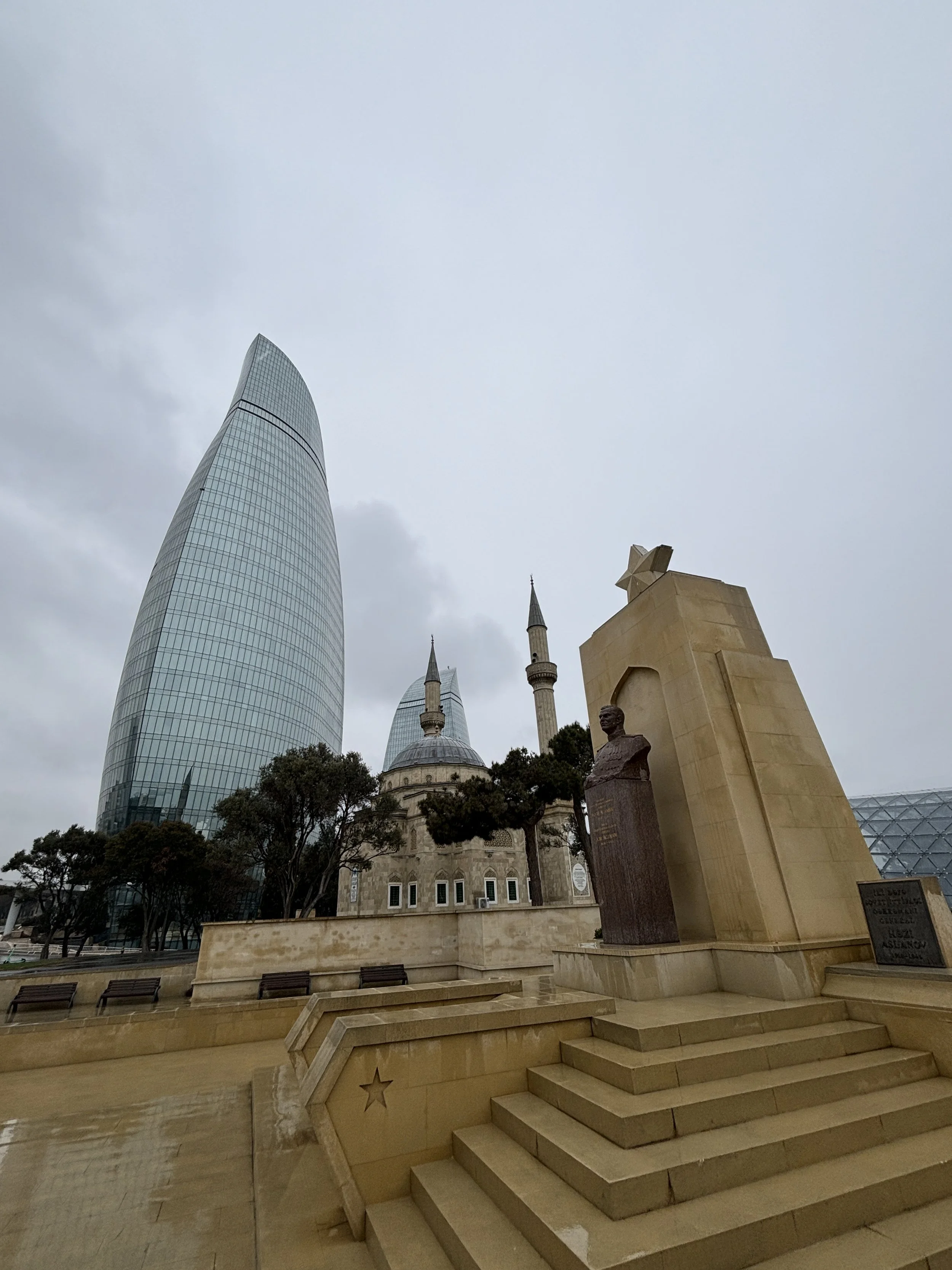
The Flame Towers have become the symbol of modern Baku since they were completed in 2012.
These three curvy skyscrapers are certainly beautiful and original in their looks. It’s hard to miss them from wherever you are in the city, because they occupy a privileged position on top of a hill overlooking the sea.
However, they are mostly about the “continent” rather than the content. In fact, there is little inside them for the regular visitor, since they contain offices, luxury apartments and the Fairmont five-star hotel.
I think it is still worth going to see them from up close, though, not just because of the architecture, but also because the park next to them, the aptly named “Highland Park” offers some really nice views of the city.
The park has also has several interesting monuments within its grounds.
These are of a patriotic nature, such as the “Martyr’s Lane”, which is a memorial to those that died during the last turbulent months of Soviet rule as well as during the long-going conflict with Armenia (which is still not yet fully resolved at the time of writing these lines, even if Azeri forces managed to get control of the disputed Nagorno-Karabakh area in 2023). The park has also monuments dedicated to the Turkish-Azeri friendship (picture below) and to the British troops that were posted in Baku after WW1.
Baku Central Park and Taza Pir Mosque
Right to the northwest of the Old Town is the Central Park and within it is the Taza Pir Mosque (“Təzəpir məscidi”), which is the main muslim religious center in Baku. The mosque was built in the early 20th C. and was restored in the early 2000s. The park itself is quiet a large open space with a bit of incline which has been solved by having several subtly layered terraces.
You have some nice views of the Flame Towers from here and the outer wall of the old town is within walking distance, all downhill. To get there you pass several streets that, unlike the old town, have not (yet) been renovated, so you can get an idea of how things may have looked like just a few decades back in time.
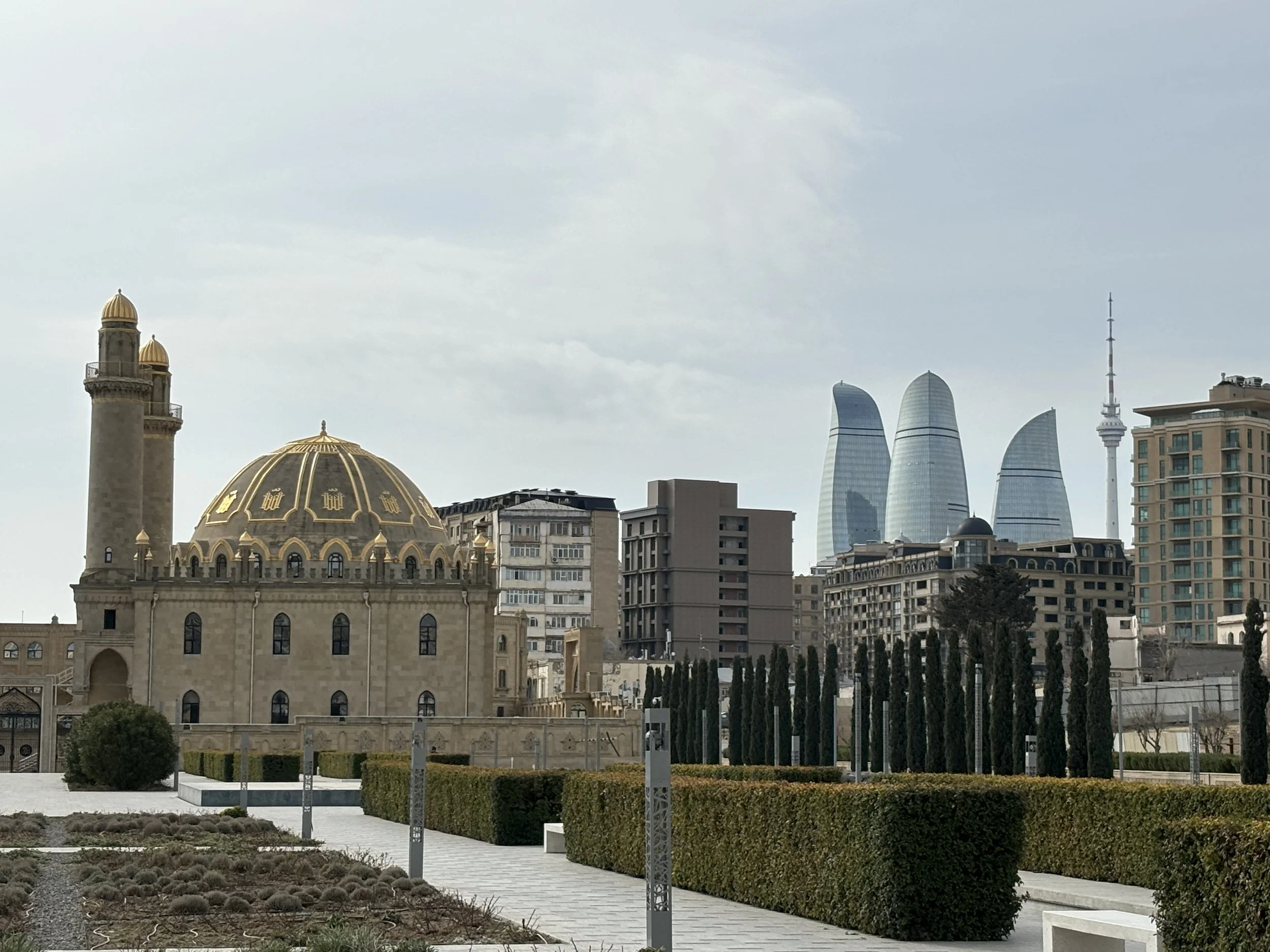
A tour of the Old Town of Baku
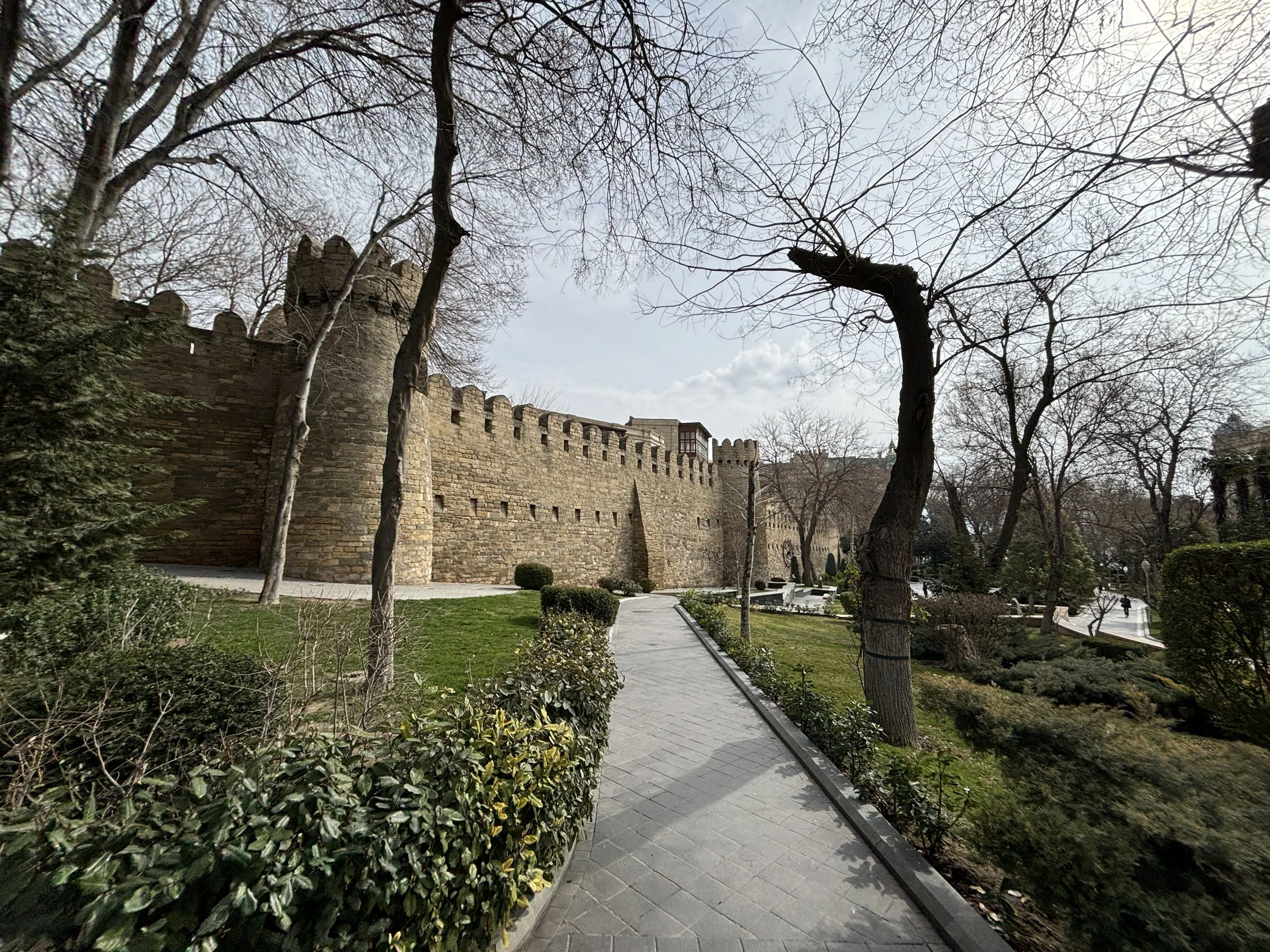
The access to the old town of Baku near the "Icherisheher metro station
A must in any trip to Baku is a walk throught the old town or “Icherisheher” (İçərişəhər) in Azeri.
The old town of Baku is a UNESCO World Heritage site and its origins are very ancient (the place was inhabited already in prehistoric times). Its walls and architectural ensemble appear to be in a great preservation state, although you can tell it has also been object of rather extensive restoration project (a little bit like is the case of Al Balad, in Jeddah, Saudi Arabia, which we described on this post, as well).
The result is a very neat and orderly neighbourhood (perhaps even a bit too aseptic at times!), which makes for quite a relaxed walk around.
I don’t know if we picked up a particularly quiet day, but the place was pretty quiet when we visited it. Nevertheless, it’s refreshing to visit a major historical city center that is not overrun by tourists nowadays! There are also quite a few souvenir shops but you don’t get the feel of overcommercialization you see in other capitals.
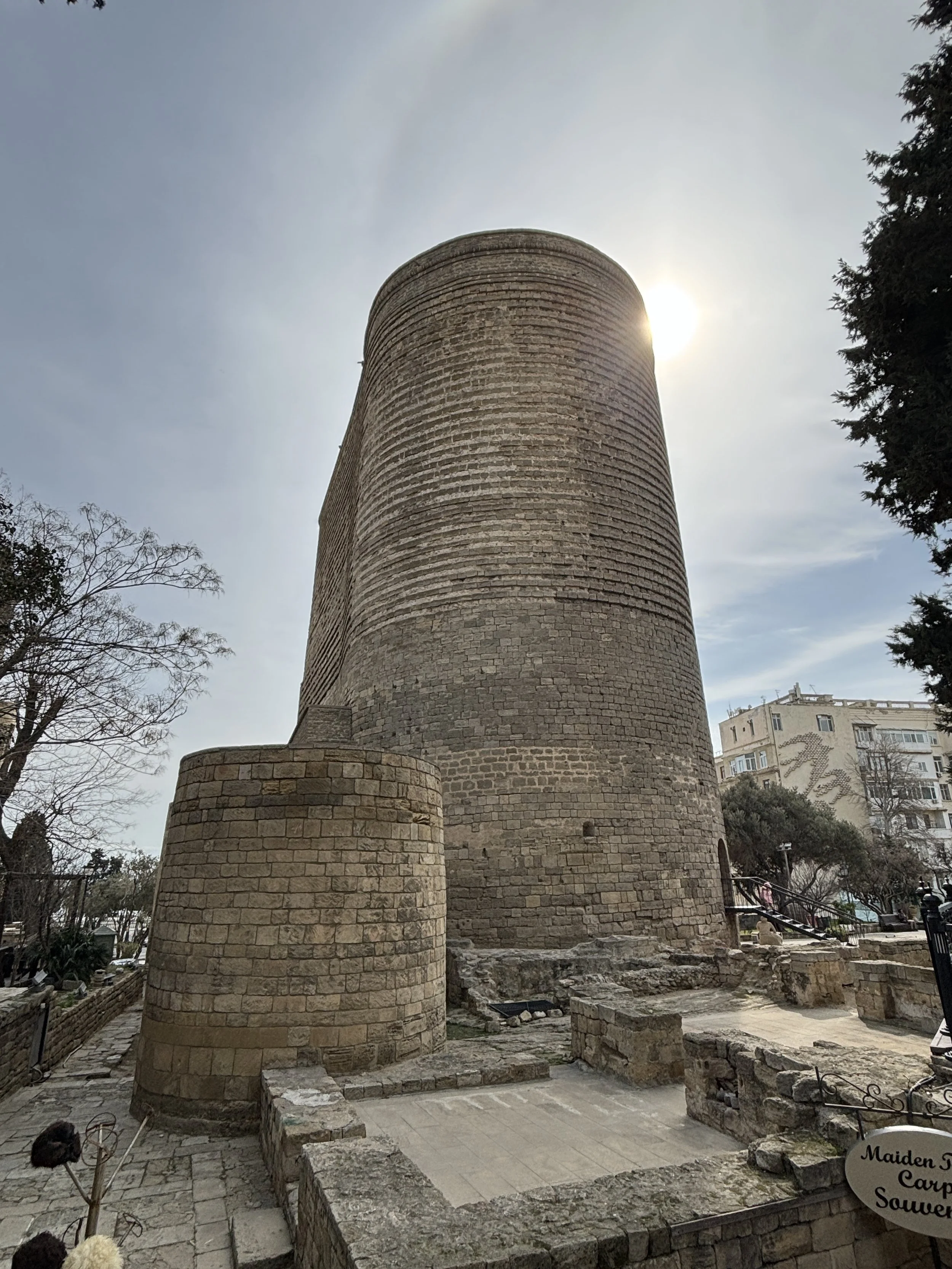
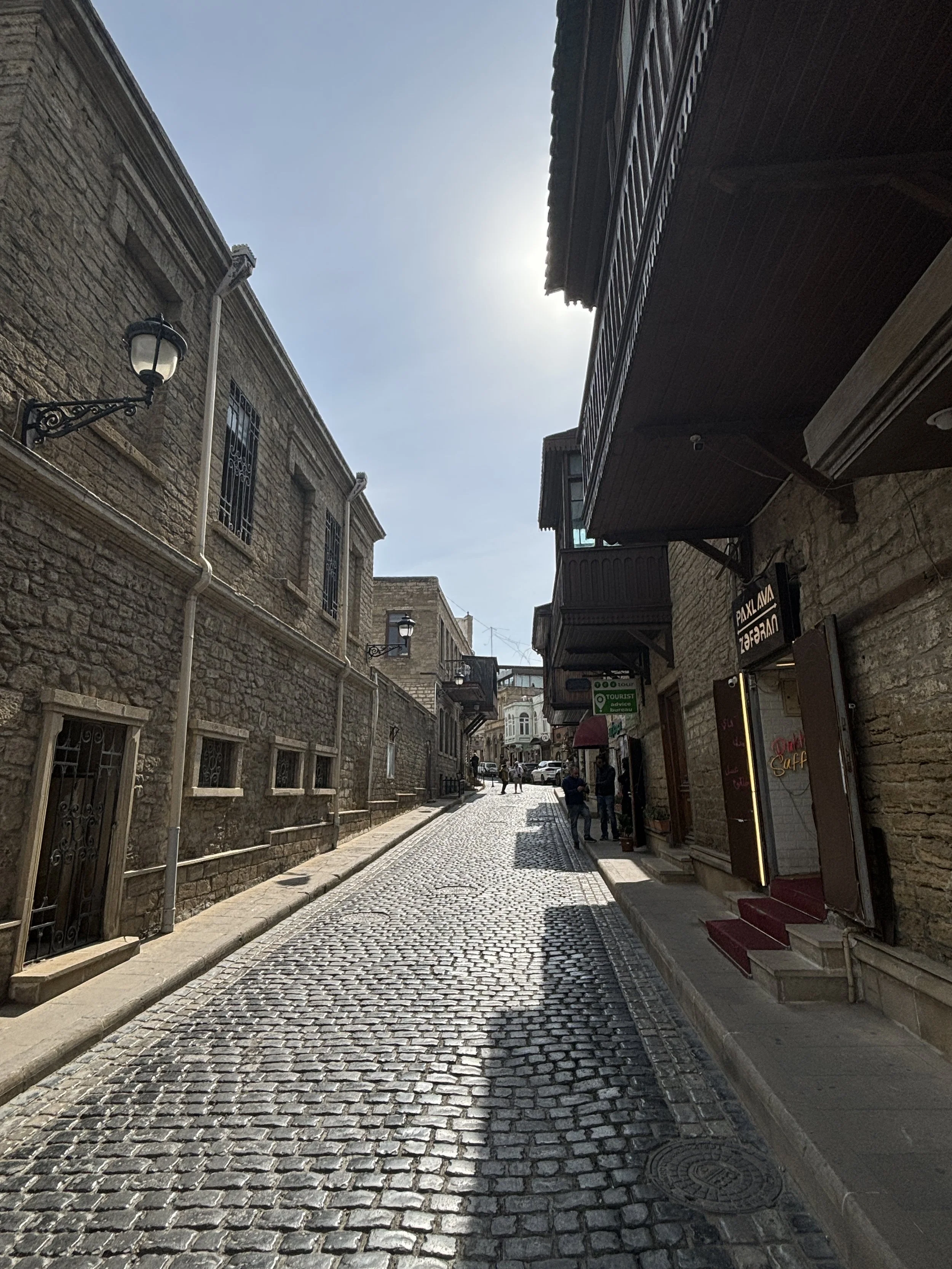
One of the highlights of Baku’s old town is the Maiden Tower (Qız Qalası), a round 29-meter tall stone tower with a view point at the top. The current construction is medieval, but it looks like there has been some sort of tower at this spot for thousands of years and archaeologists can not agree as to the original purpose, whether it was religious or military.
All of this is explained as you climb up the tower (warning: it is done through a rather narrow staircase), as each floor is arranged a bit like a little museum hall, each explaining different aspects of the tower’s and city’s history.
But the big prize is climbing all the way to the top to enjoy the 360º views of the city!
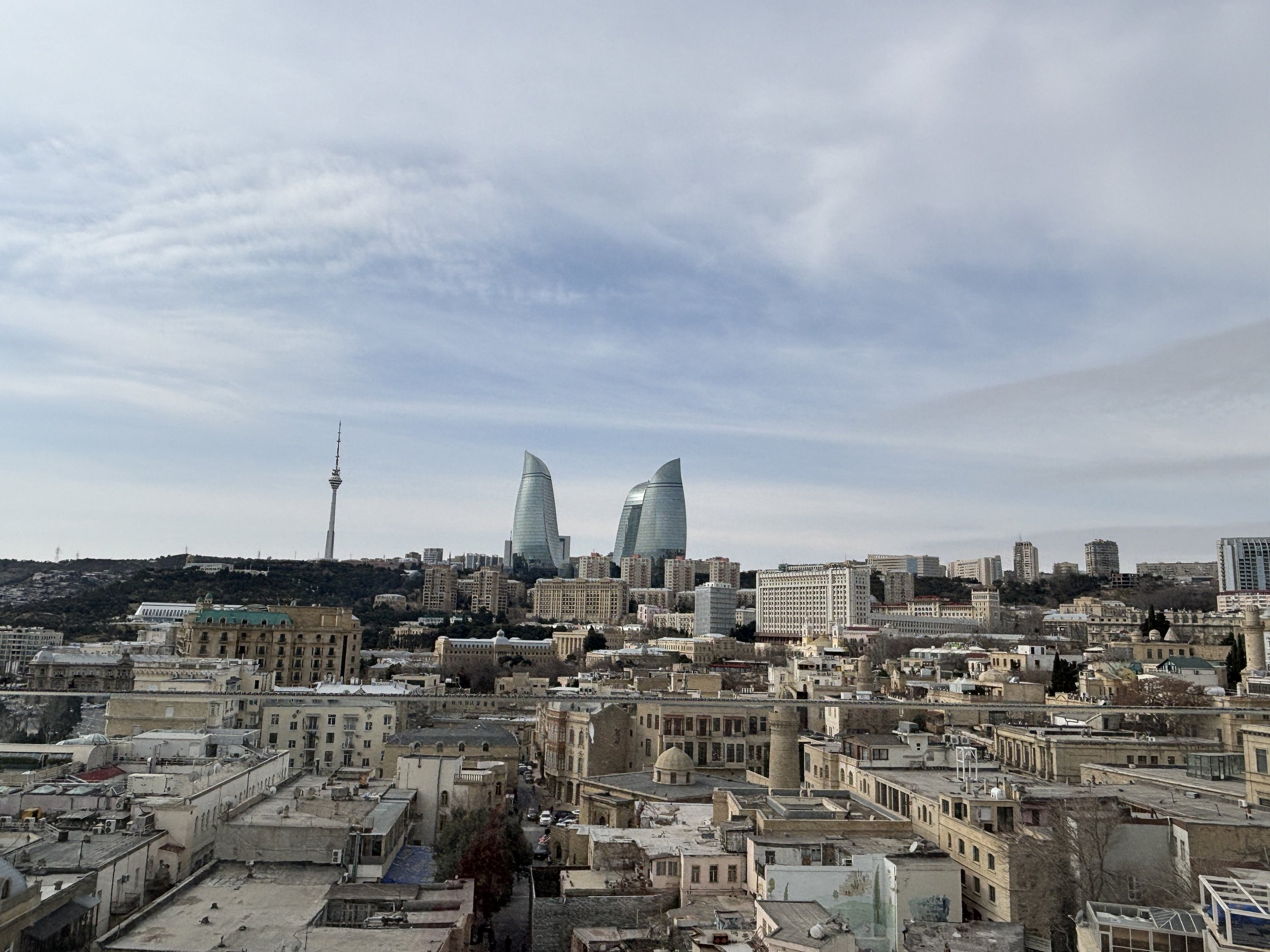
A curious fact about Baku is that it has a fleet of London-style black cabs. They were, in fact, imported from England around 2011! (although the Bolt ride-hailing service is also available in Baku)
The taxis are not apparently the only bout of anglophilia in the streets of Baku, since I managed to spot at least one red British-style phone booth!
If you are looking something with a bit more of a local flavour, don’t worry, you will find plenty of these too!
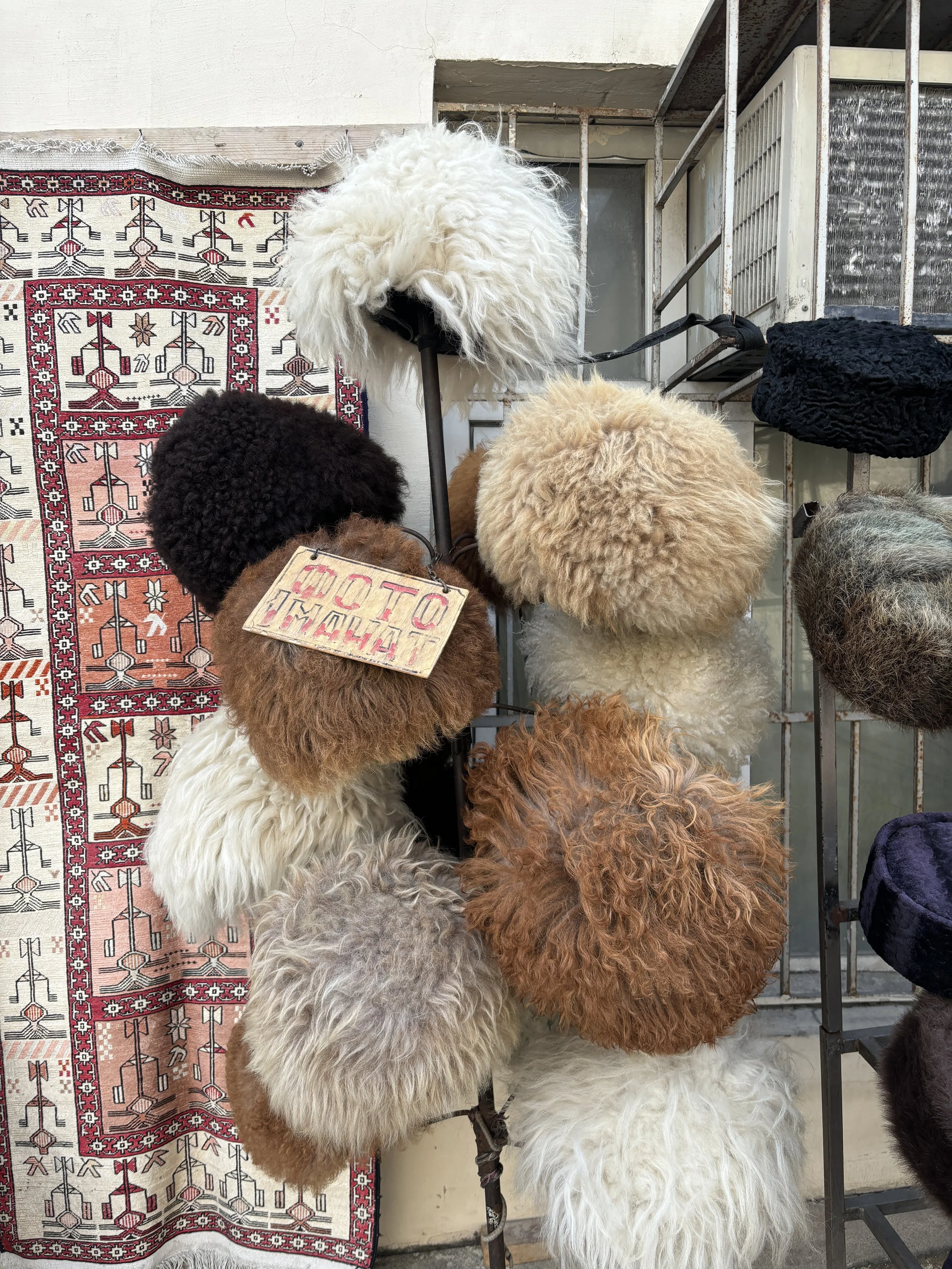
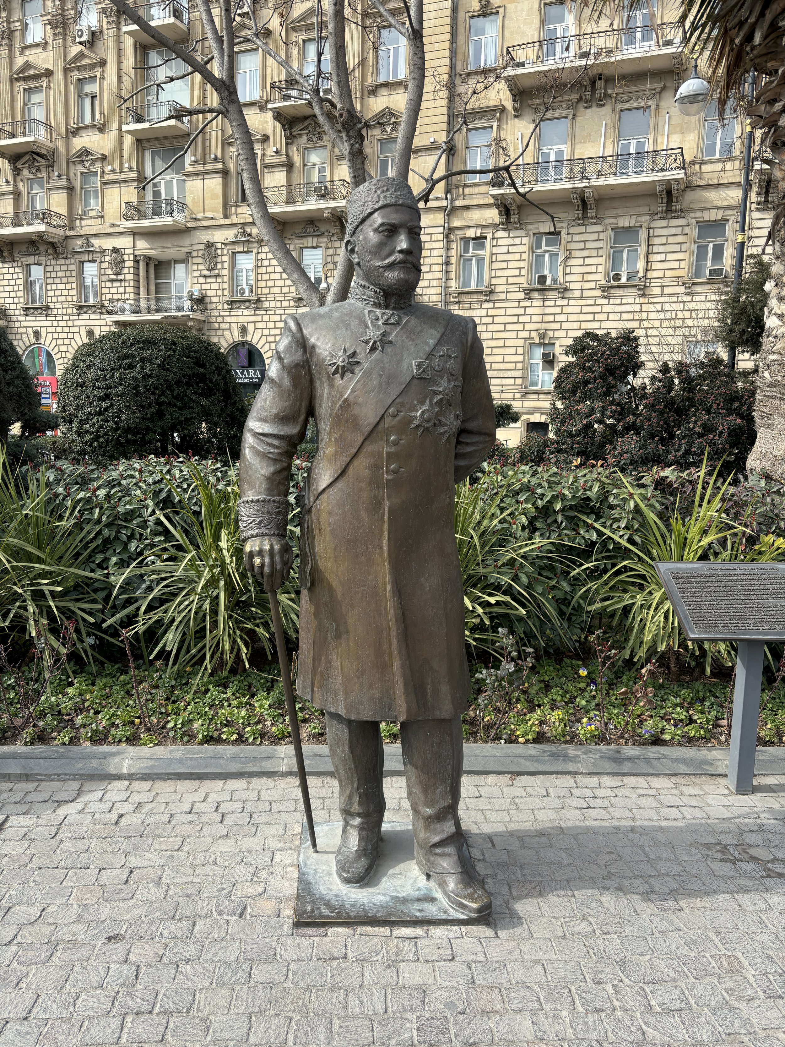
Besides the medieval part of the city, Baku is also endowed with a modern downtown which is legacy from its time as an oil boomtown in the early 20th C.
The oil business made of Baku one of the top three cities in the whole Russian Empire and this shows in the grand architecture of parts of its centre.
This part of the city has majestic buildings in the European style, with broad straight avenues and tree-lined boulevards with shops and cafés.
There are also quite a few broad squares which act as public recreational areas and there is, of course, no shortage of statues and fountains.
The public spaces in this part of the city are also kept meticulously clean and orderly.
The Caspian sea promenade
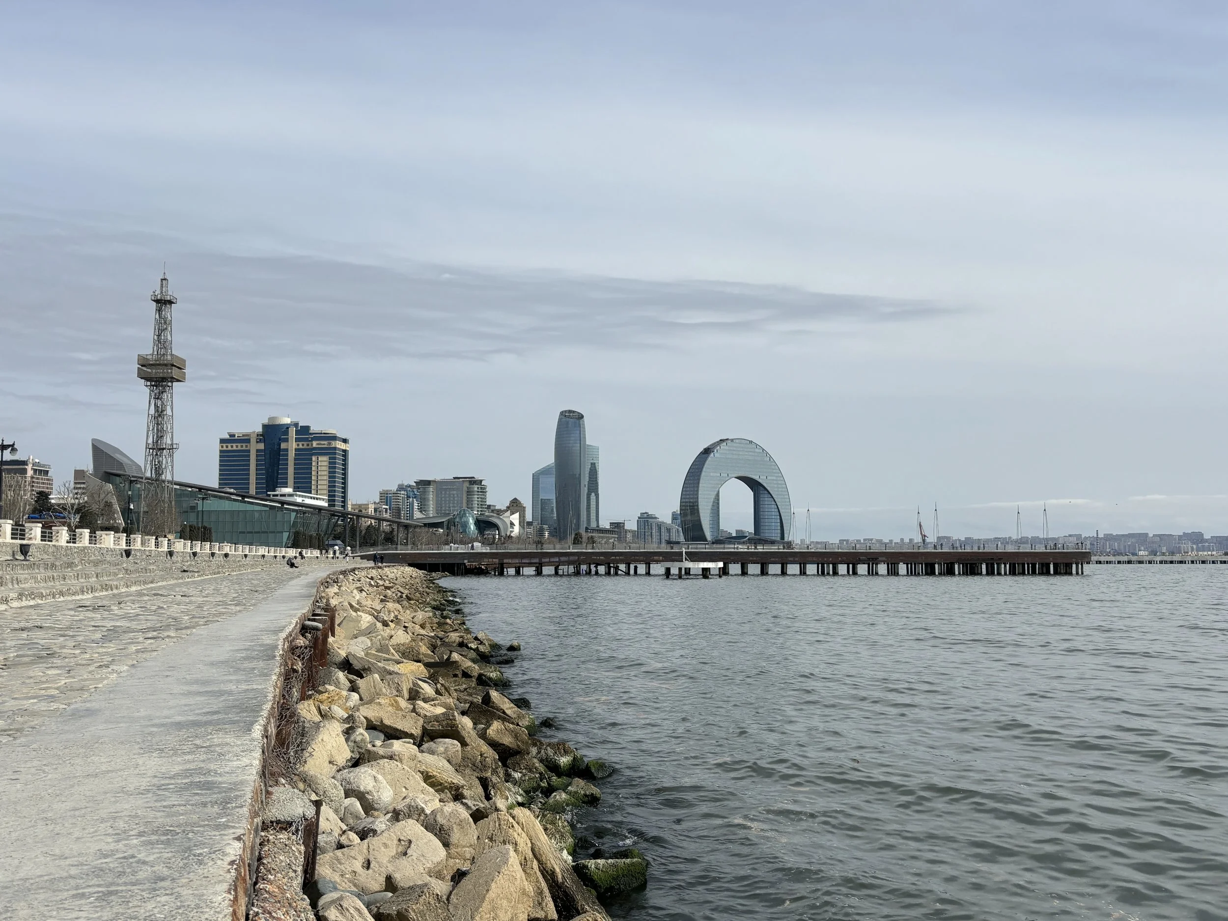
Baku is a seaside city, even if the Caspian could be technically considered a lake, since it is fully enclosed. In practical terms it doesn’t matter, because the city has a long seaside promenade, complete with a number of piers and several contemporary architectural landmarks.
The latter include the Crescent Hotel, which is the doughnut-shaped building visible in the picture above (part of a larger Korean-designed development that includes also a mall), and the National Carpet Museum, depicted below (I didn’t visit it partly because of time constraints, partly because I am not really into carpets, but this is one of the traditional crafts of Azerbaijan, so maybe worth visiting if it is your thing!).
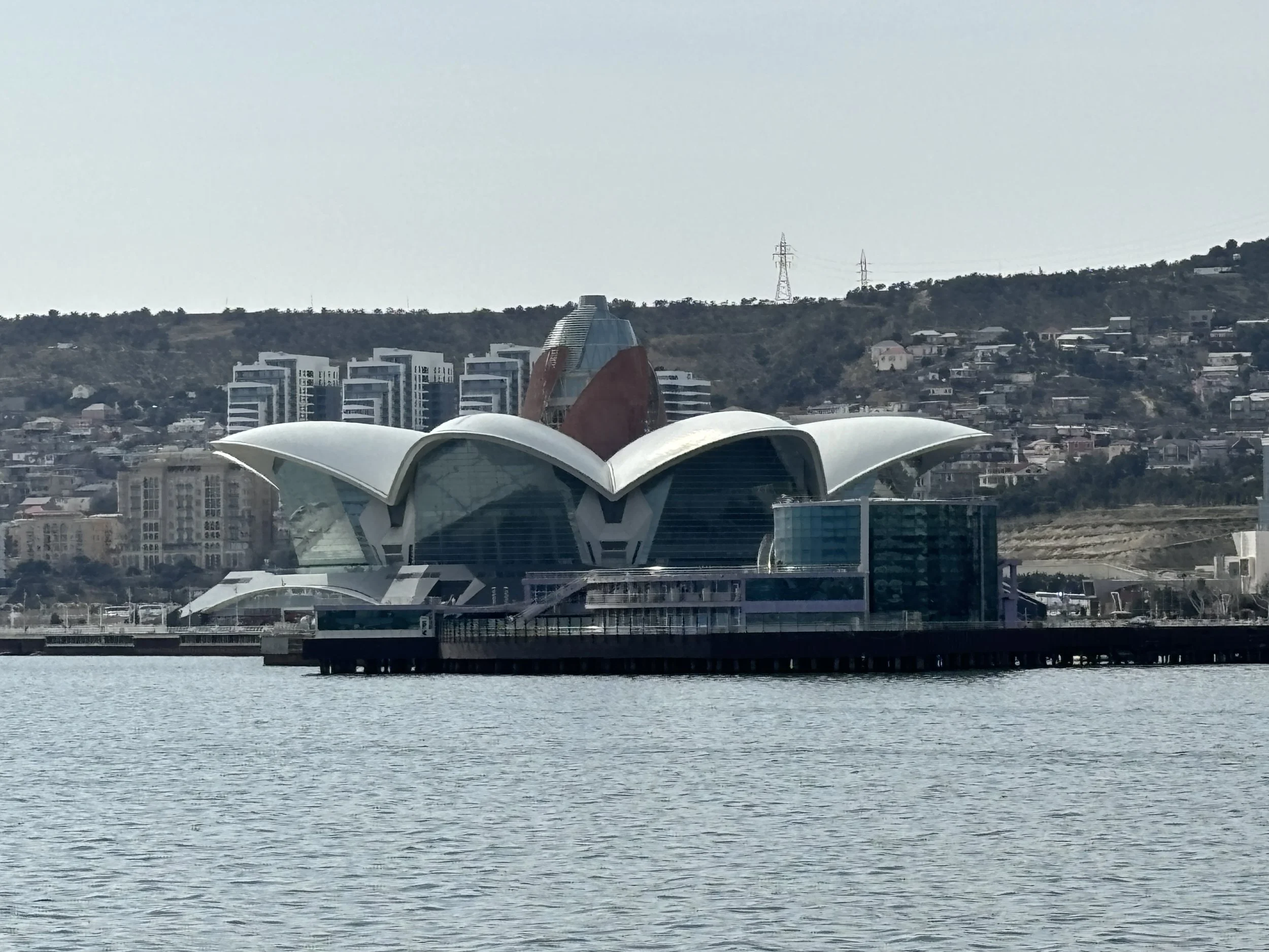
I must say that, despite being right by the water, Baku doesn’t seem to be a “beach city” in the way that, let’s say, Barcelona or Nice are.
The Caspian waters right by the promenade didn’t, actually, look very inviting and, I guess the proximity of oil extraction areas, both onshore and offshore but not far from the coast, has something to do with it. However, we were told by locals that there are some good areas for bathing in the peninsula right to the east and north of the city.
In any case, a walk onto the pier is totally recomended as it will give you an additional view of the city skyline from the water and allow you to enjoy the sea breeze.
Visiting the Heydar Aliyev Center
The Heydar Aliyev Center is the other must-visit architectural landmark in Baku.
This iconic building, the work of the late renowned architect Zaha Hadid, is part museum, part cultural centre, part conference venue. It was designed to become a symbol of the city and to represent the modernity of independent Azerbaijan, with an instantly recognizable tangible symbol.

One of the defining characteristics of the Heydar Aliyev Center is the fact that it does not have a single straight line. This gives it an appearance of dynamism and weightlessness despite being a really massive building! It is also located on top of a small hill with wide open spaces on all sides, which makes it easier to appreciate its uniqueness and the genius of its design.
While its outer appearance makes the Heydar Aliyev Center already worth the visit, its inside is also quite interesting.
First there is the architectural part, as well, with the internal spaces organized in a rather unconventional way. But the center houses also several collections and exhibits, ranging from art to the history of Azerbaijan and the life and works of the person that the center is named after, Heydar Aliyev, who ruled Azerbaijan both during the Soviet period and after independence and founded the dinasty that still rules the country).
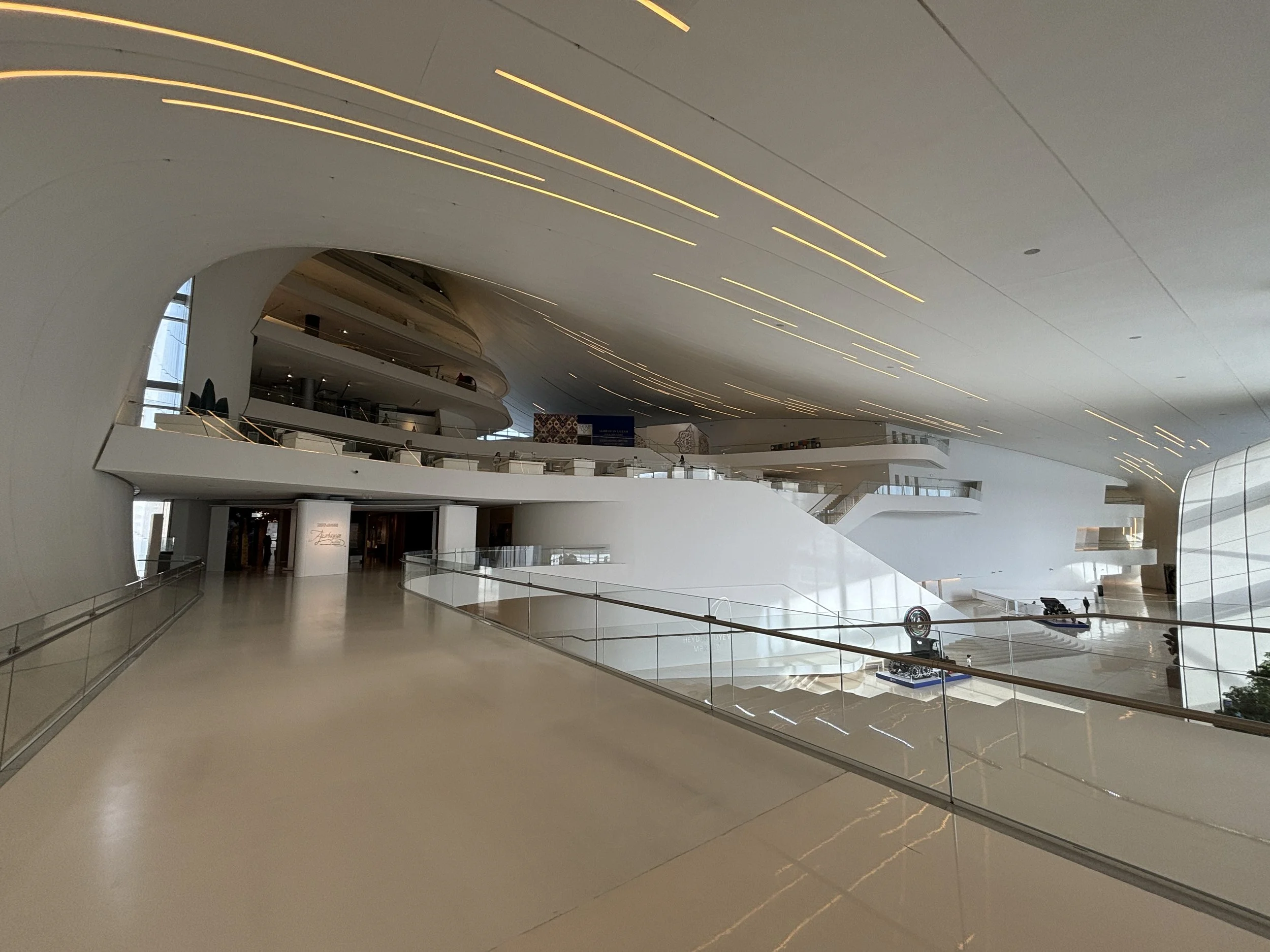
The collections are quite well presented, even if the topics can be quite eclectic. You may wanna put aside a couple of hours to see them all.
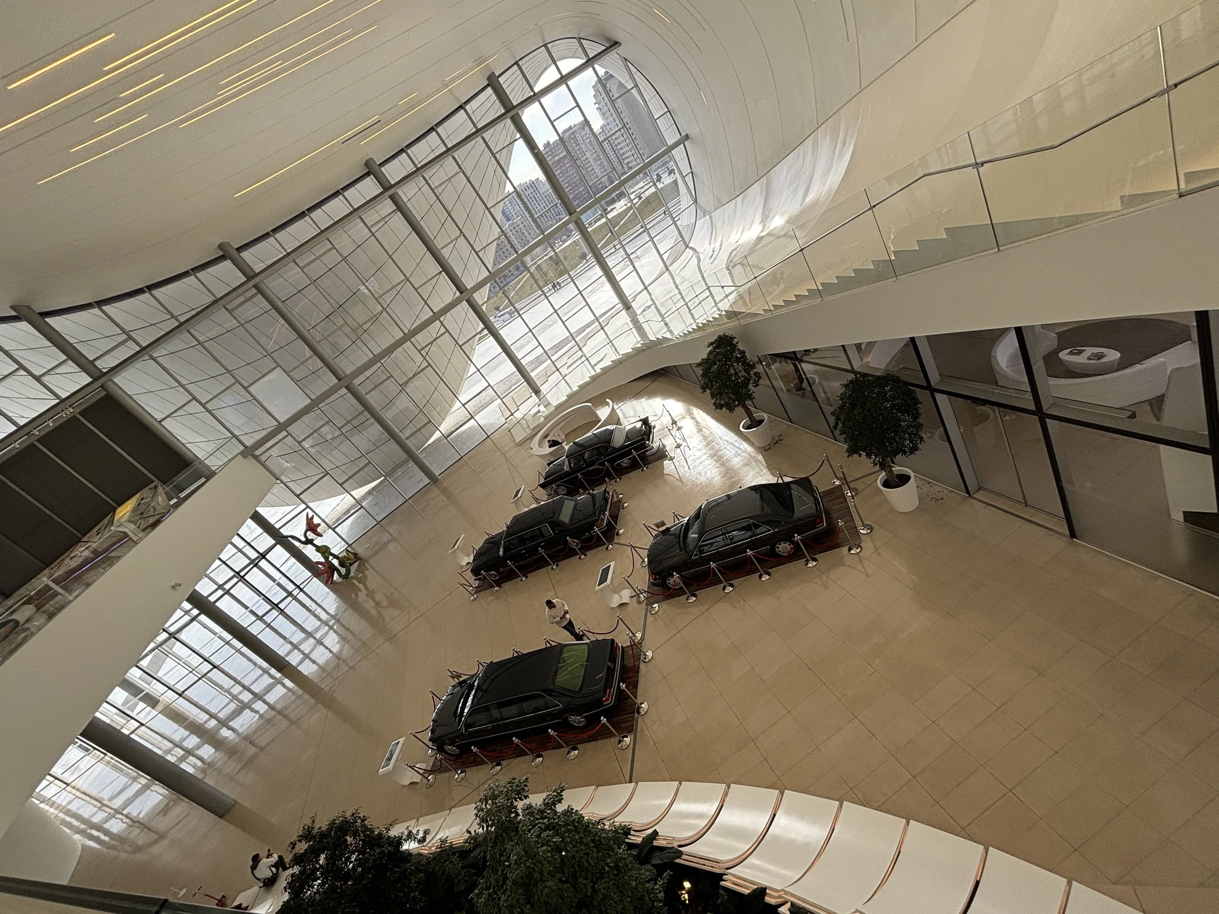
From the Heydar Aliyev Center you can get yet another view of Central Baku.
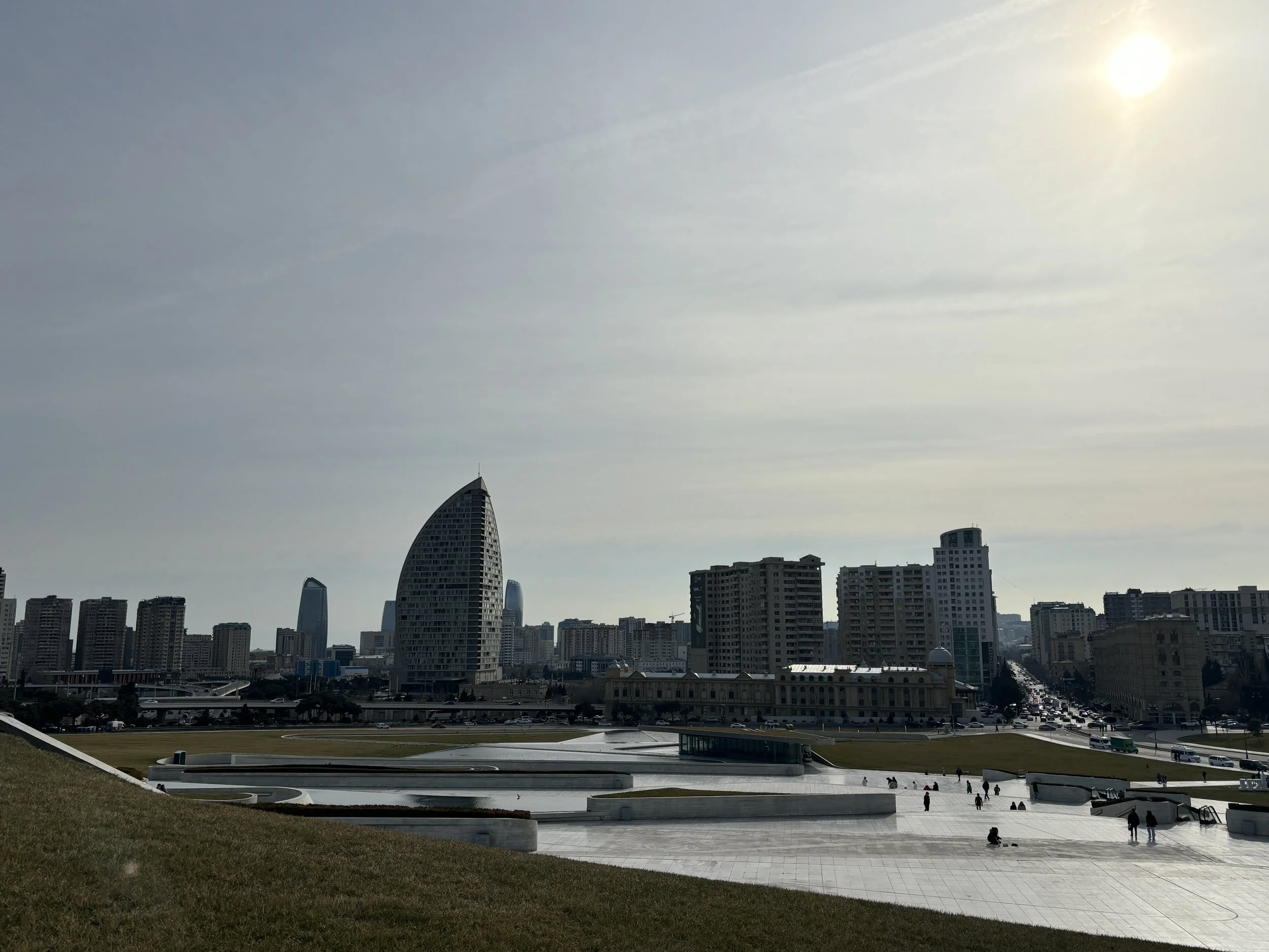
Where to eat traditional Azeri food in Baku
Qaynana Restaurant
Kichik Qala, Baku
This is a restaurant of Azeri cuisine that is located at the edge of the old town, next to one of the old city gates. If you are looking to sample traditional Azeri food, this is a great choice!
It offers great ambience and large portions of tasty traditional food at reasonable prices.
Don’t be surprised if there is queue to get in, though. It is best to try to book in advance, because this place is popular and has high turnout!
One of the specialities of this place is the freshly baked bread called çörək, baked on the spot in a traditional tandoor clay oven.
You can actually watch the whole process, from the moment they shape the dough to its baking in the tandoor and, then, the moment when it comes out of the oven and is brought straight to the tables, warm and ready to eat.
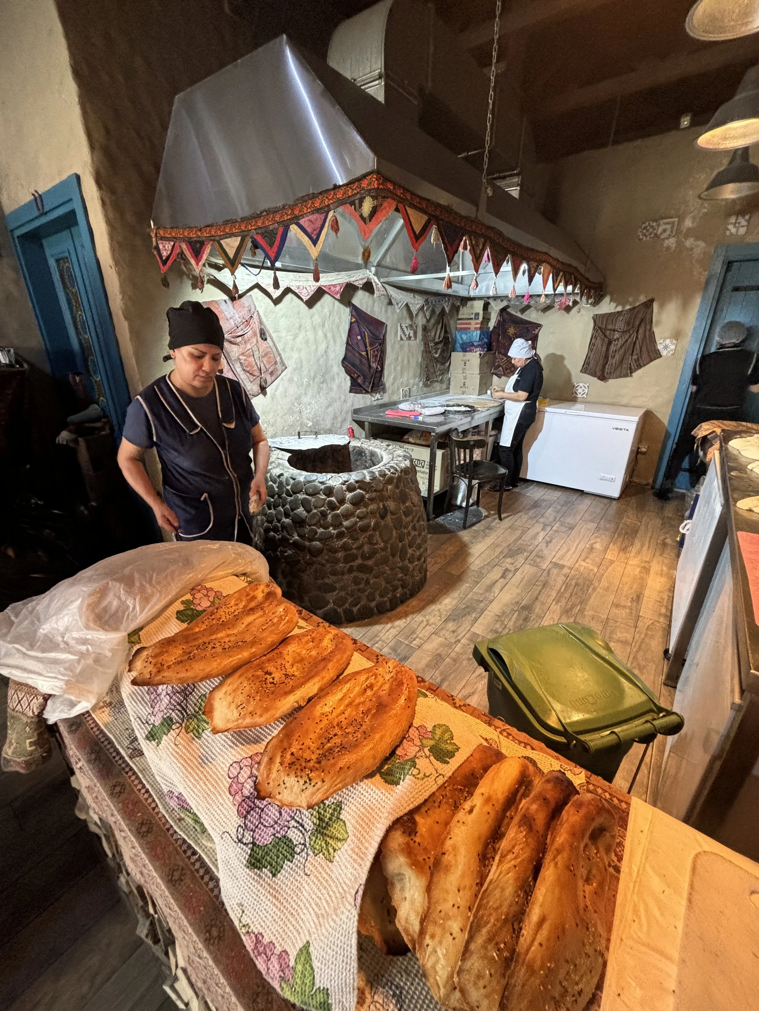
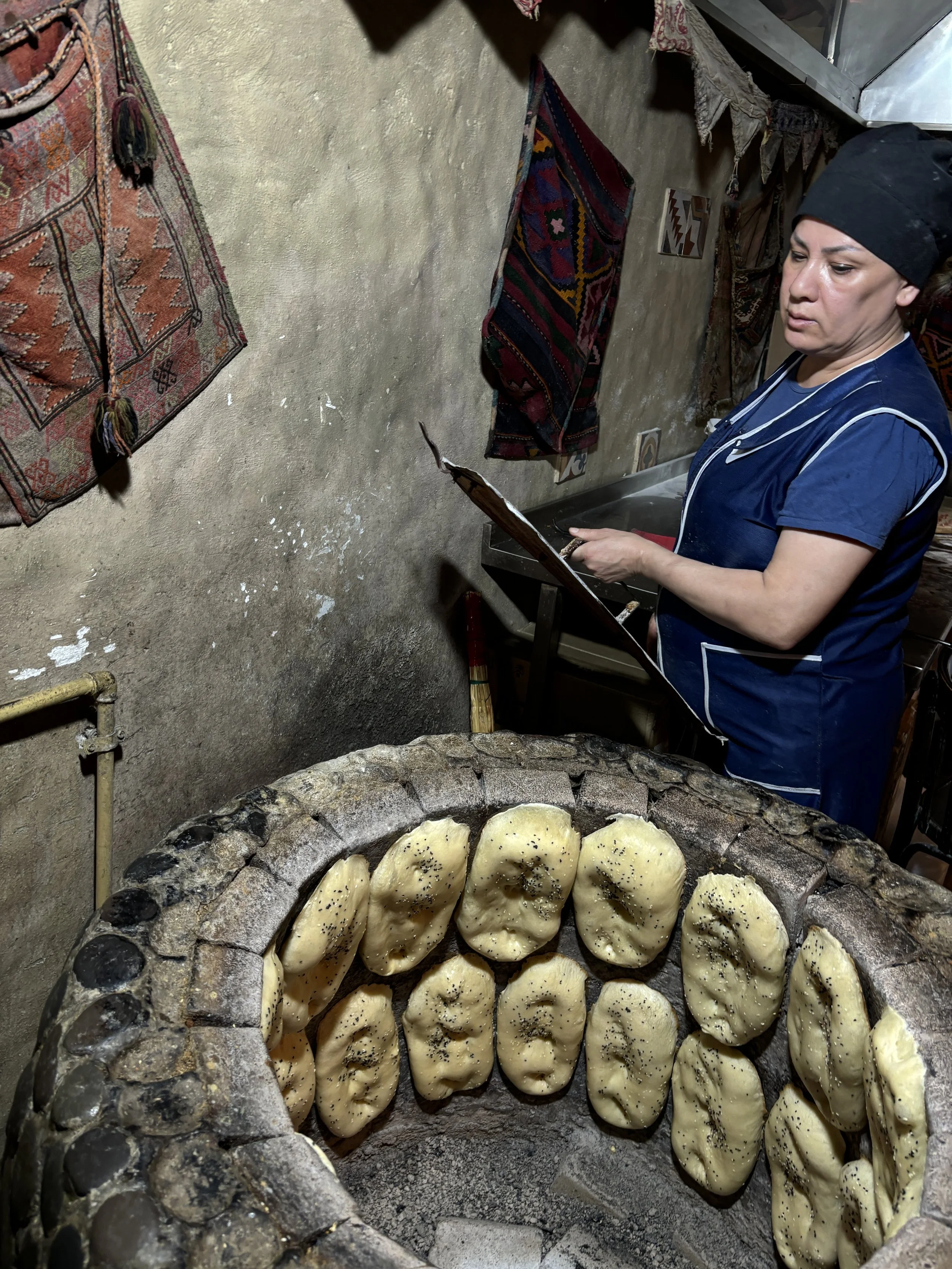
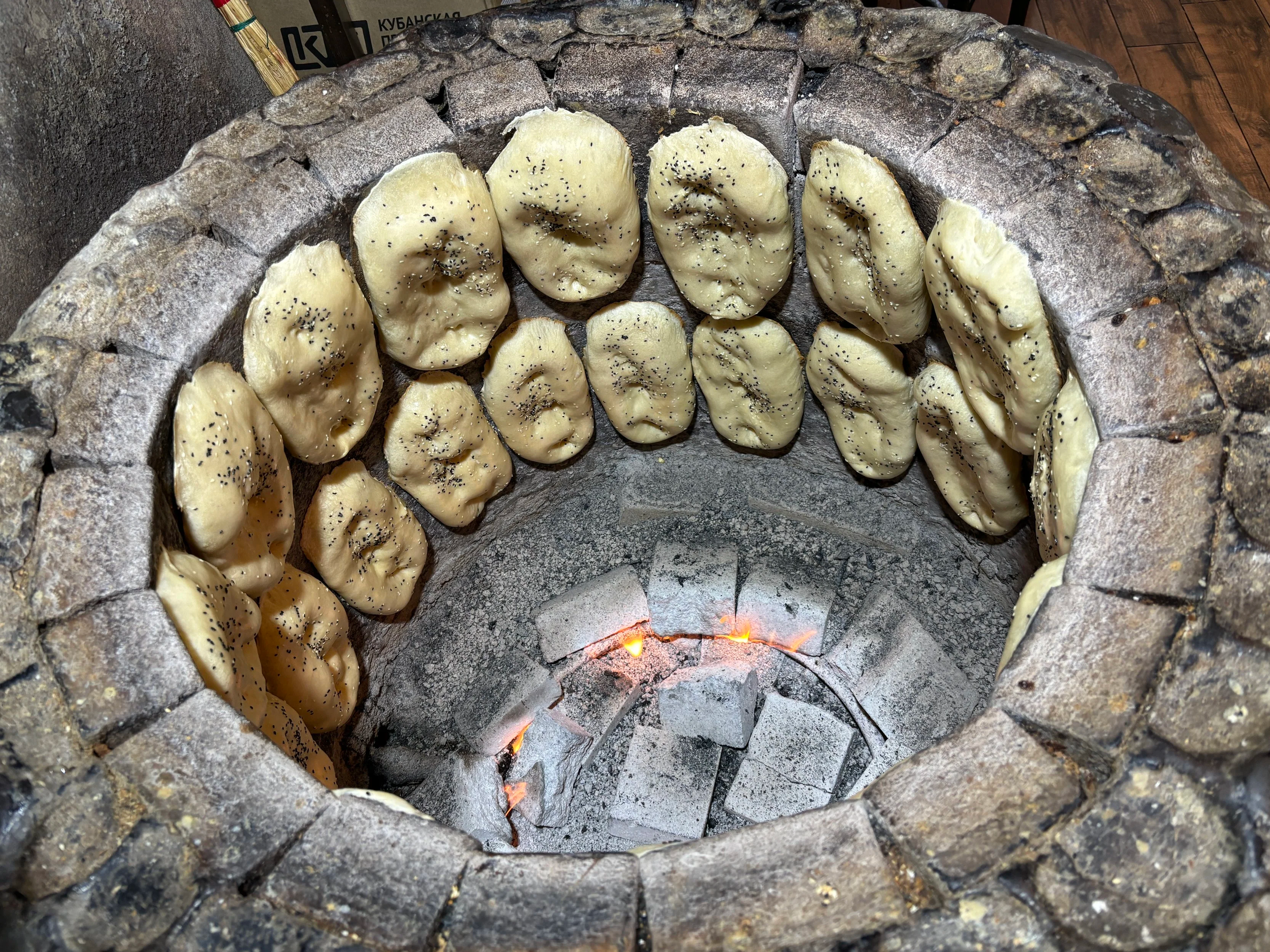
Here below you can see the final results, it is an amazingly tasty bread, but take it easy, because it is tempting to eat lots of it without even noticing. I would recommend leaving some space for the other specialities the restaurant has to offer.
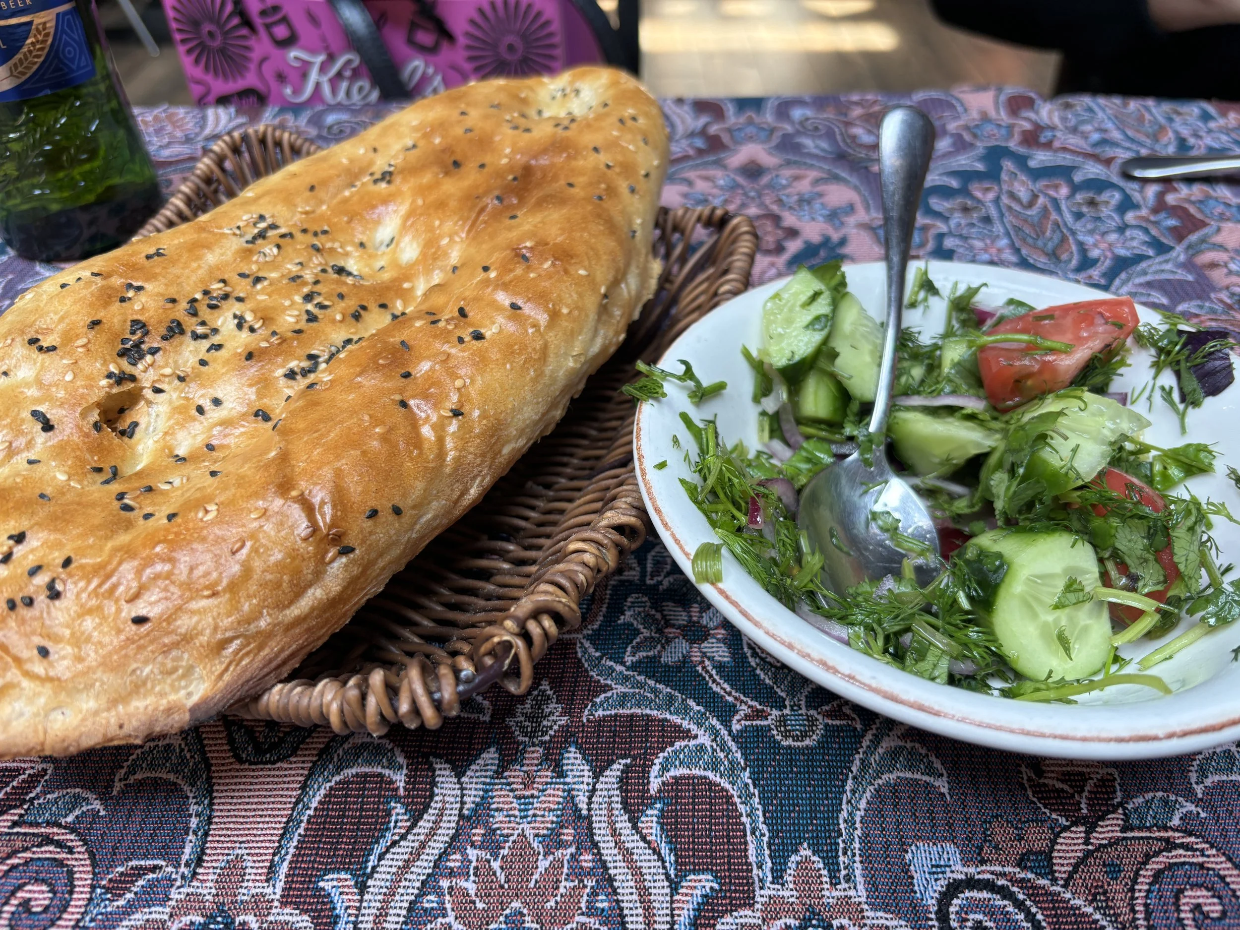
The signature dish I recommend tasting is Shah Plov, which consists of rice cooked inside this type of dough cake you can see depicted below, which is called kazmag, accompanied by lamb and dried fruit stew (chestnuts or plums with pomegranate). But this is not all…
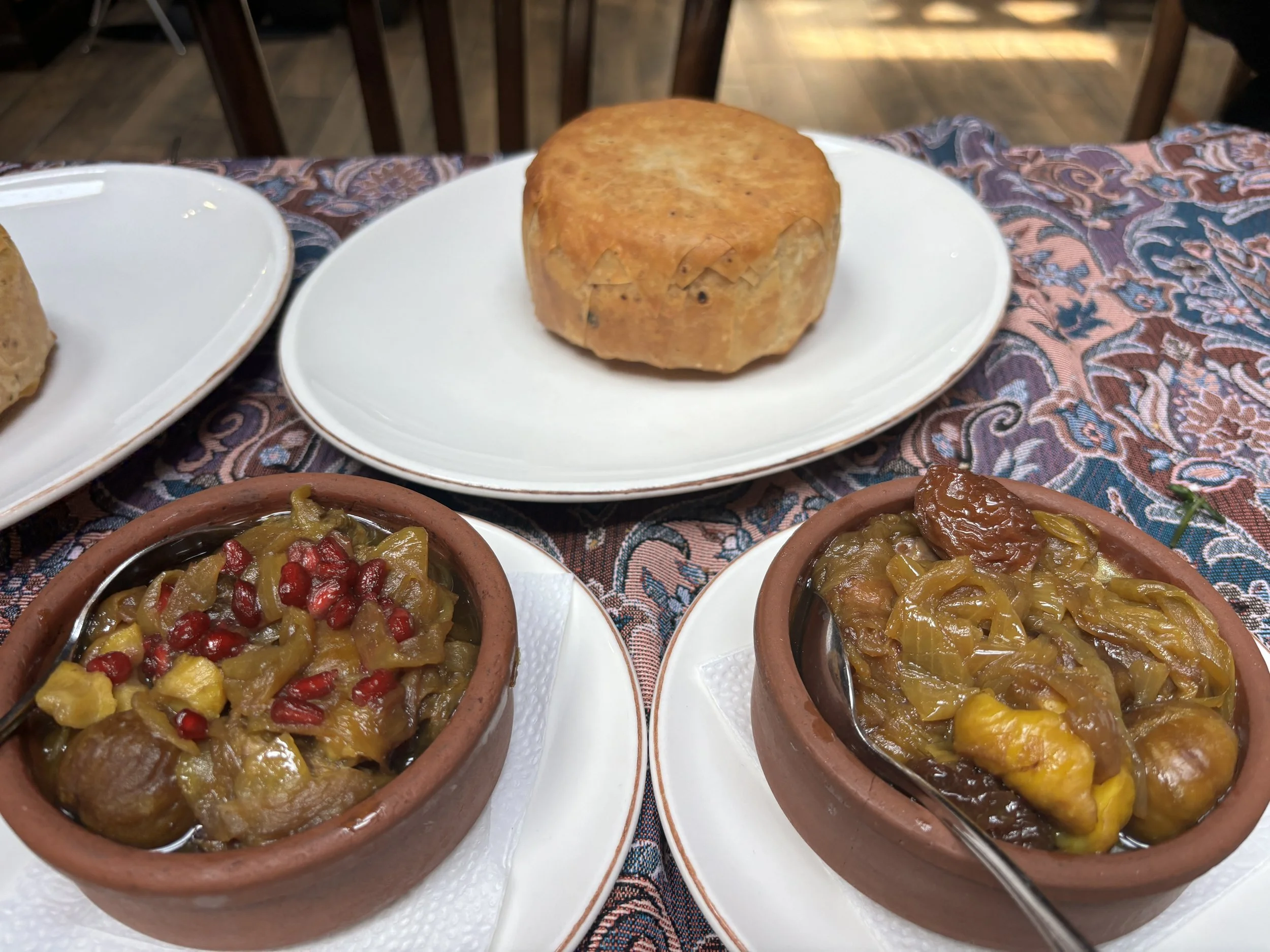
…because of the highlights of a meal at Qaynana is the moment the waiter brings the Shah Plov to the table and cuts the kazmag open with a knife. Its sides fall perfectly in different directions, leaving the warm rice exposed and ready to be mixed with the stew.
It’s a really substantious and filling dish, you have been warned!
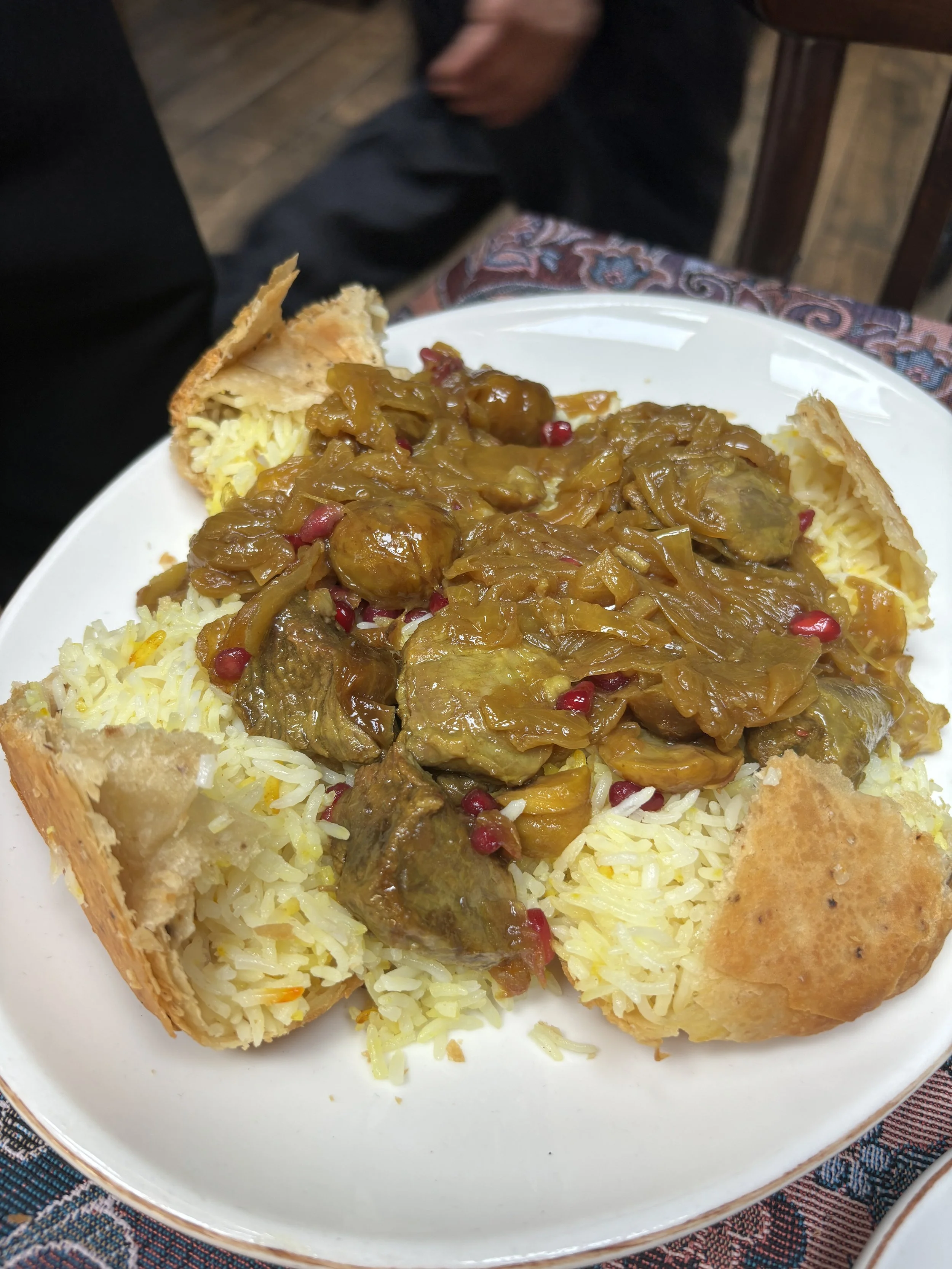
Where to stay in Baku
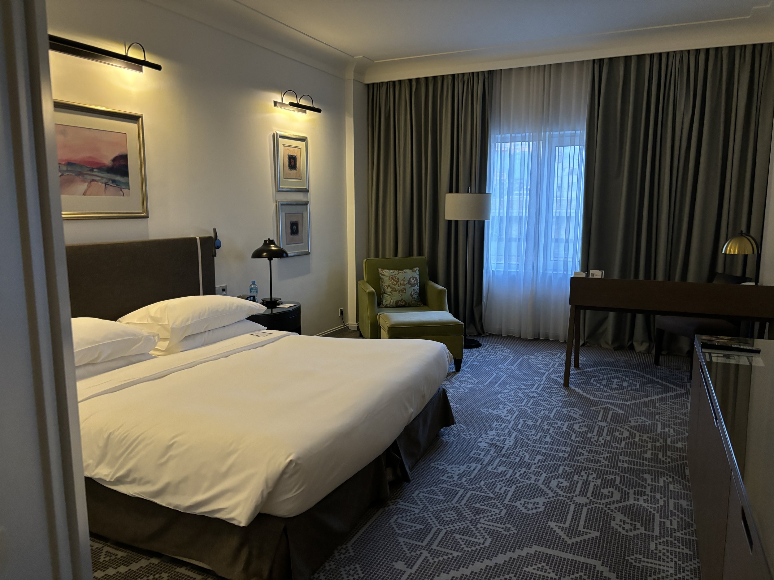
Hyatt Regency Baku
You can go wrong with this hotel. It is solid, modern hotel located in one of the city’s main avenues (not exactly next to the old town, but just a short Bolt ride away or a 25min walk if you feel like it).
The rooms are big (and the bathroom as well), staff were very helpful throughout and breakfast was really amazing, with lots of different local specialities.
Perhaps just a seasonal thing, but you can get really good rates for five-star hotels like this one in Baku!
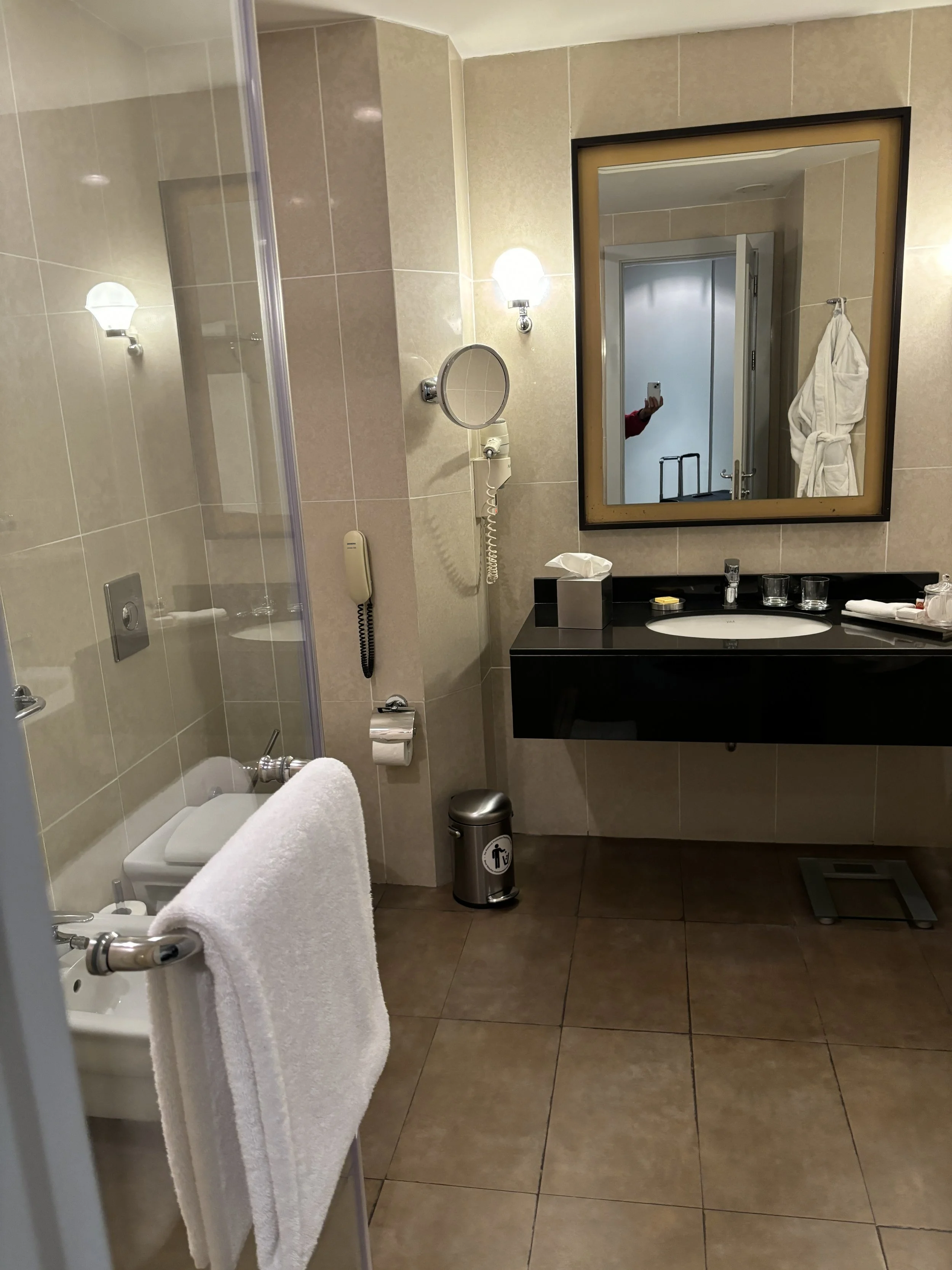
Excursions around Baku
So, now that we have checked the key hotspots in Baku, it is time to see a bit of the Azeri countryside!
On this trip I describe two such excursions:
To the ski resort of Shahdag (some 2.5-3h from Baku by car to the northwest)
A visit to the rock art of Gobustan (1h by car towards the south)
Shahdag, to be fair, is a bit far for a one day trip, so I recommend spending one or several nights there, and will provide some recommendations in this regard. The excursion to the Gobustan Rock Art can be done as a day or even half a day trip from Baku.
To both places I travelled with a local driver that we hired in Baku through recommendations of locals, but you can find tours and excursions online to these places as well.
Before getting to destination, though, if you have the chance I suggest stopping at any of the many roadside produce shops that you find throughout Azerbaijan.
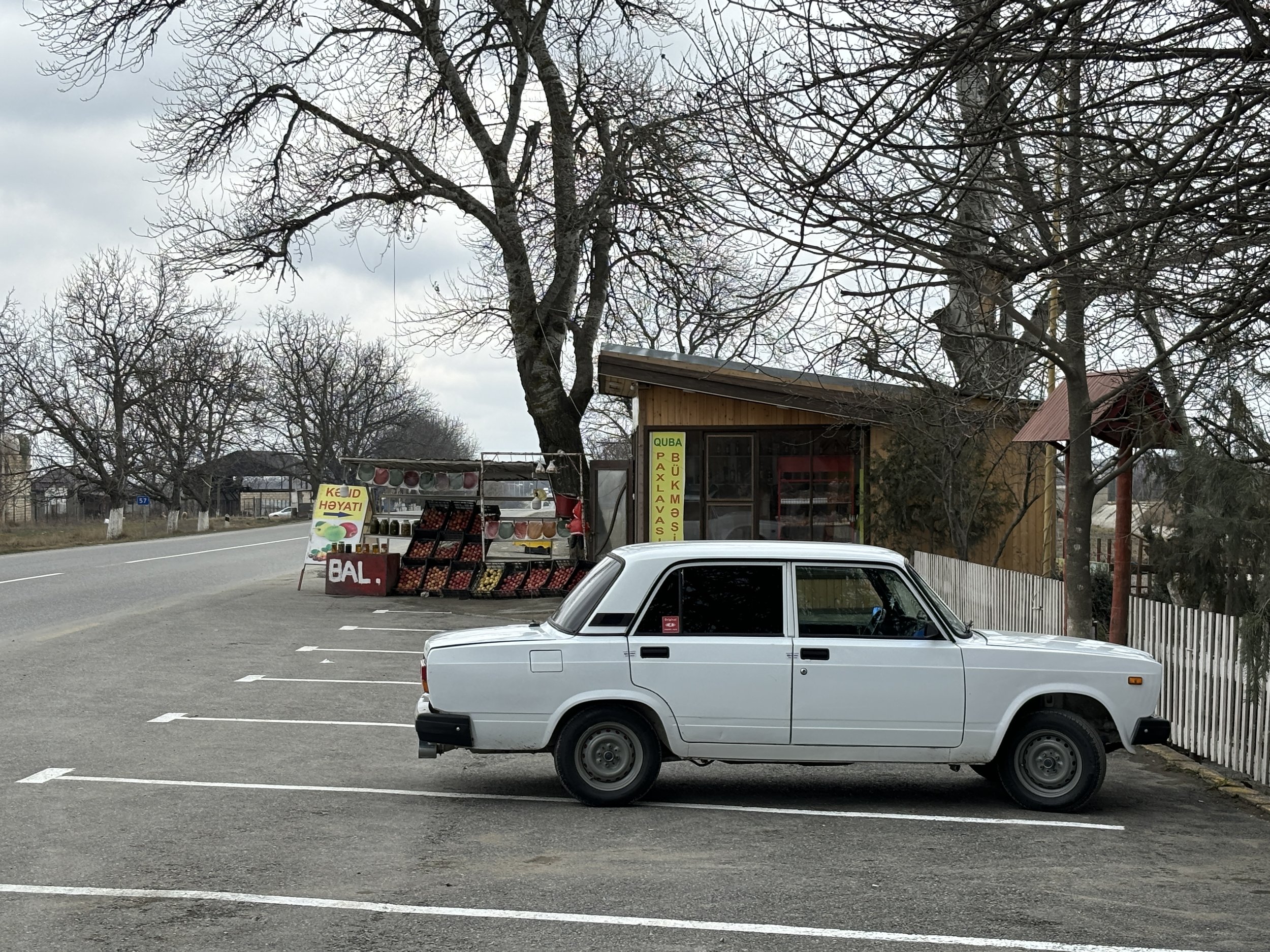
This particular shop, on the road between Baku and Shahdag was all about apples (btw, if you are into apples, do not miss this post about Mooma, the “apple paradise” in Catalonia!)
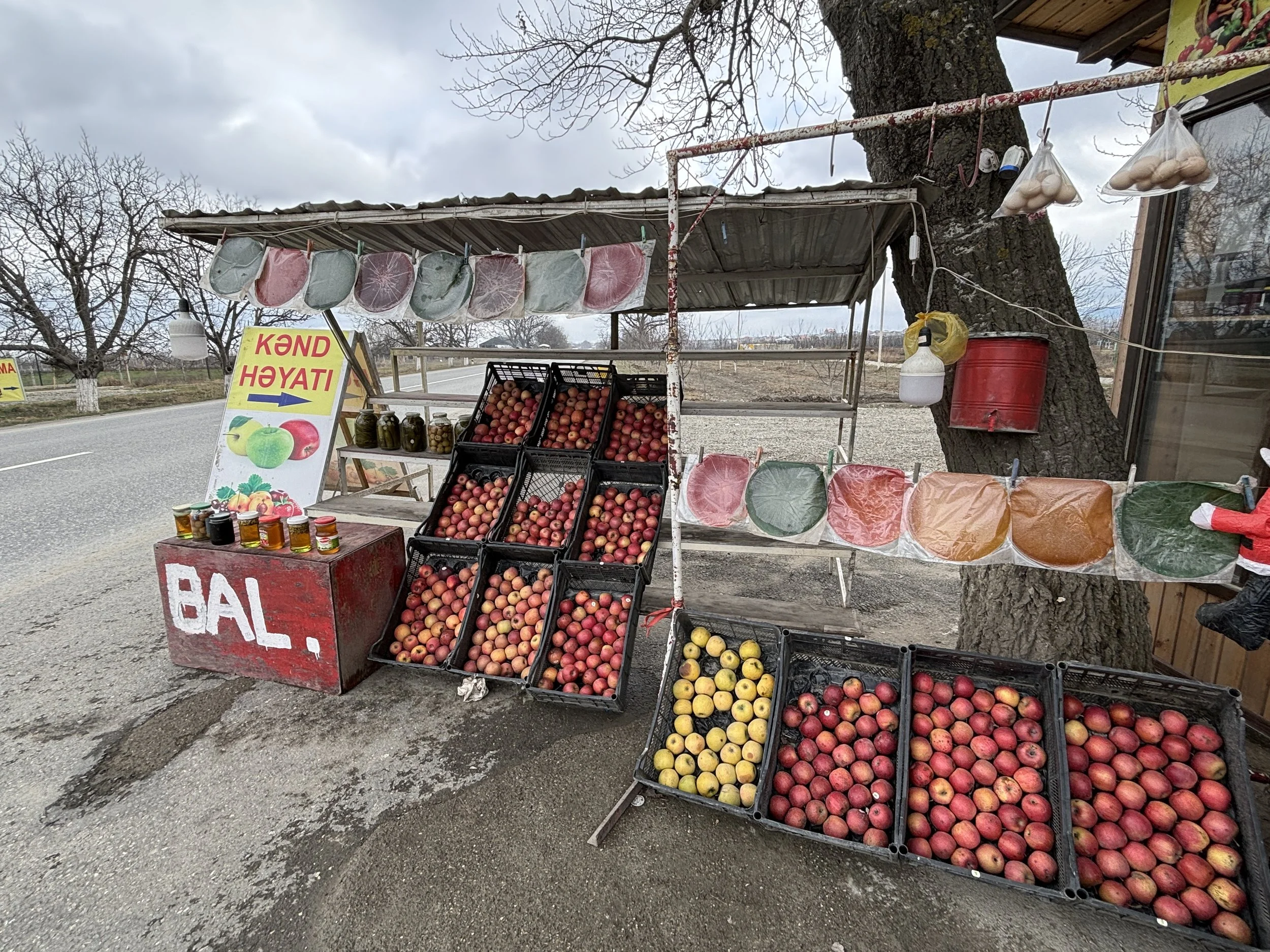
There are apples of all colours and shapes, as well as derivative products. The one that I found it particularly interesting, since I have not seen it anywhere else outside of Azerbaijan are these circles of different colours (red, brown, green) that you can see in the pictures above and below.
These are “lavashana”, a traditional Azerbaijani (and broader South Caucasus) which are round panes made of dried plum or apple paste. They are eaten as dried fruit snacks. You literally snatch little portions of the circle with your fingers as you eat it.
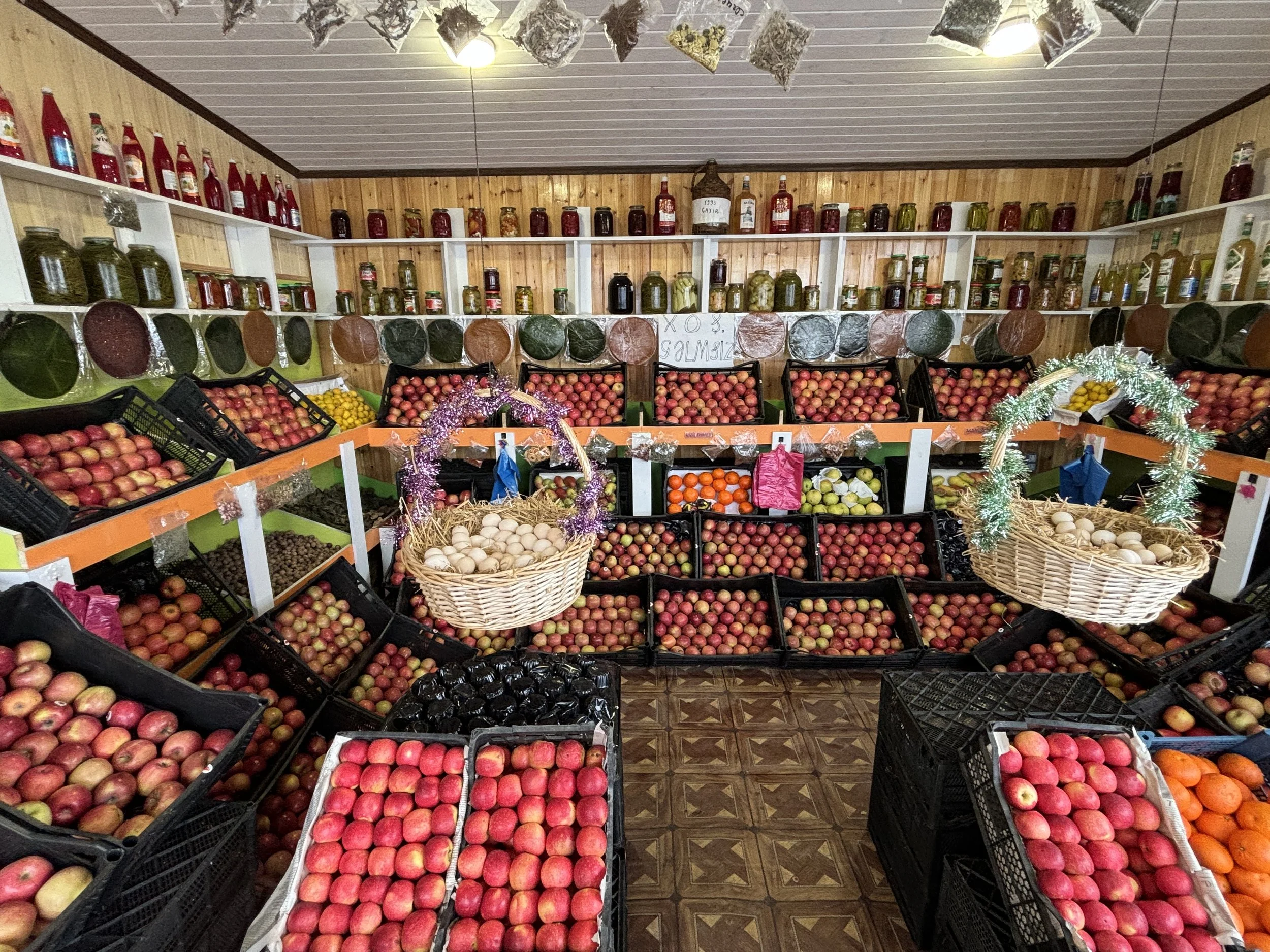
Skiing in Azerbaijan: the Shahdag ski resort
The Shahdag ski resort turned out to be an amazing find. It is located to the northwest of Baku, very close to the Russian border (you can actually see Russia from the top of the slopes).
The skiing domain has some 37 slopes ranging from 1,435 to 2,552 metres of altitude and even at the end of the season, as it was the case of our visit, you can expect really good quality snow here.
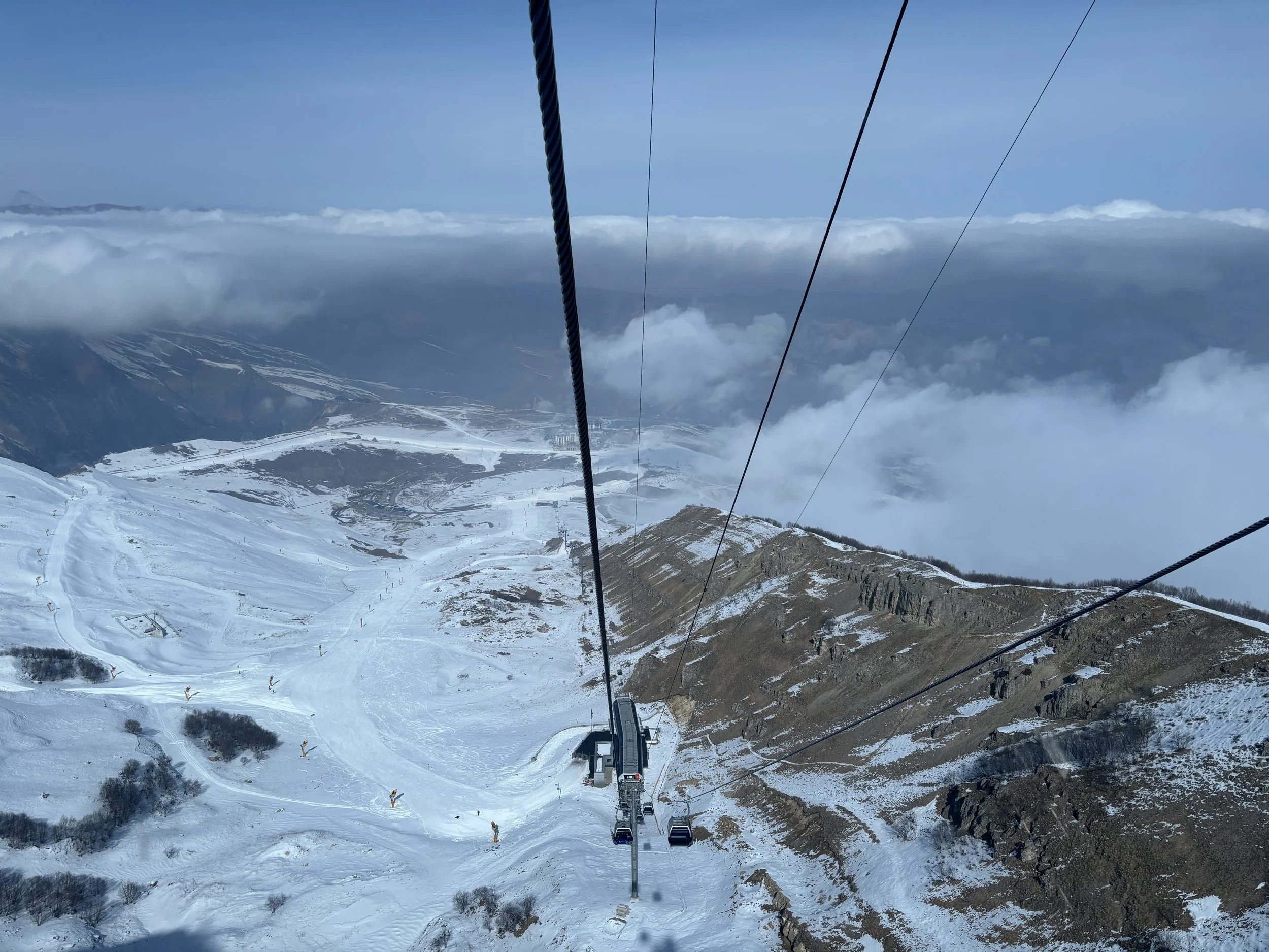
Shahdag has several things going for it:
The natural setting, which is truly magnificent.
The skiing area is quite compact, with pretty much all the slopes converging at the hotel area.
There are hardly any crowds
Prices, from the forfaits and materiel rentals to the hotels, even the most upmarket ones, have pretty reasonable prices if you compare them with what the equivalents would cost in Europe!
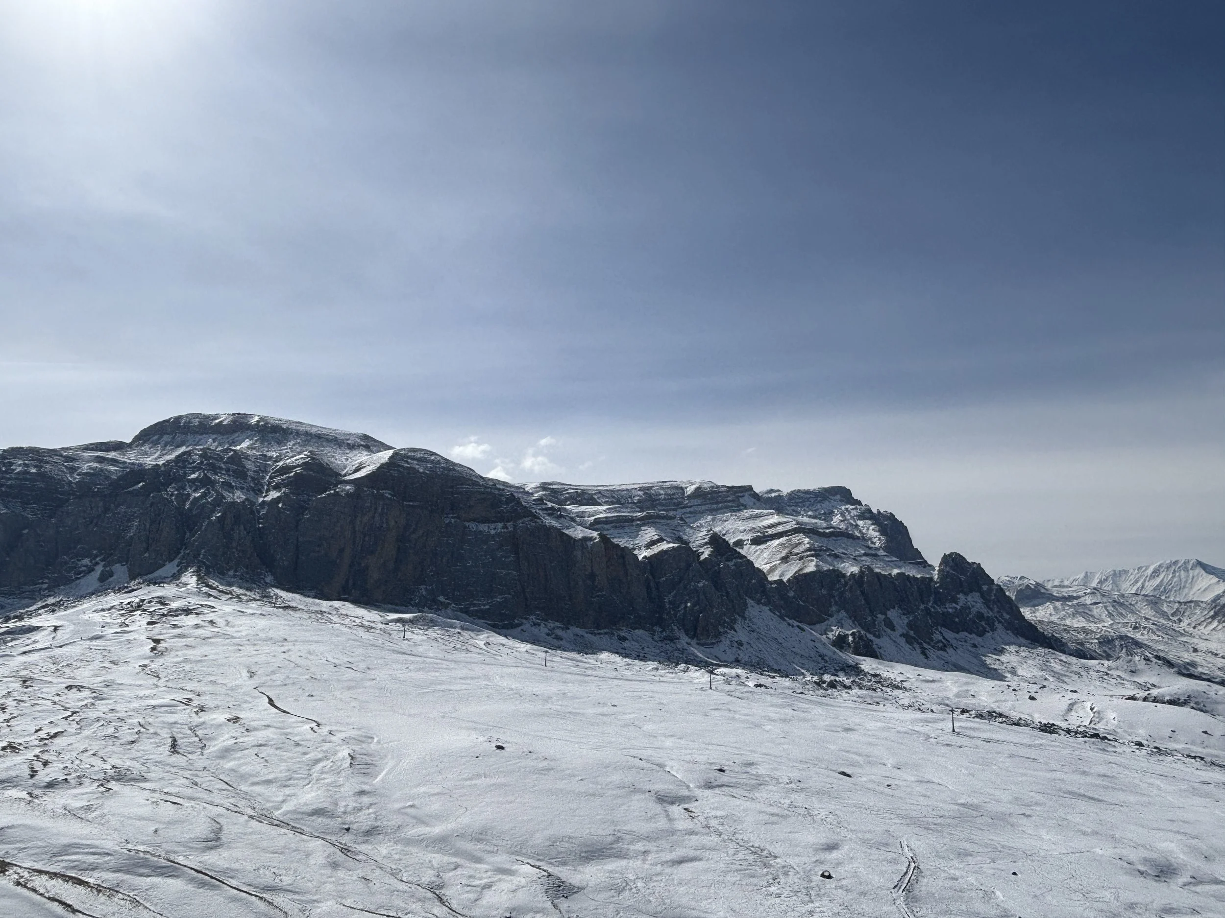
It is also worth noting that Shahdag is quite a young resort, which only opened in 2012.
It is also a sort of flagship project for the Azerbaijan tourism industry, in fact the country’s president, President Ilham Aliyev laid out the first stone of the project back in 2009.
You can tell a huge amount of investment has gone into its development because the equipment and infrastructure is all pretty new. Shahdag is, in fact, an ongoing project with plans to continue expanding it.
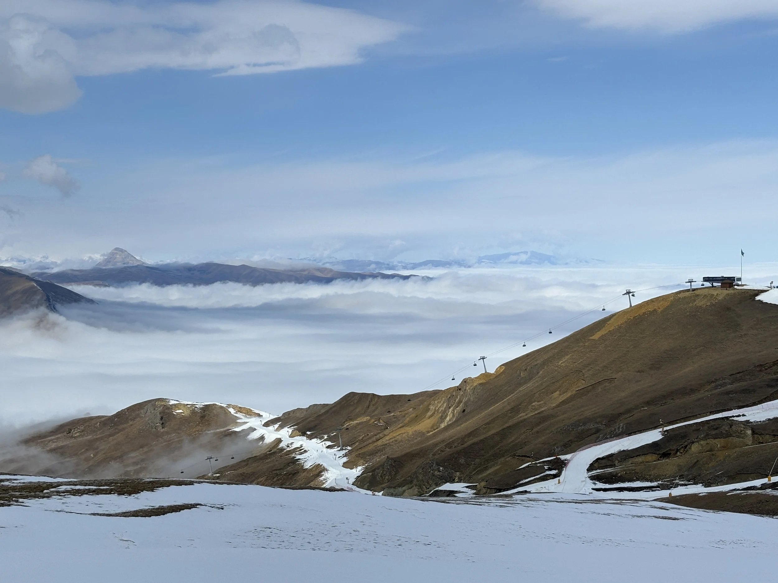
Shahdag is also a greenfield project. The centerpiece of the resort and, pretty much its only infrastructure, is the hotel cluster, which is located right at the bottom of the slopes. There is practically nothing else around.
This makes it really convenient if you are staying at one of the hotels (more on this below), but means you are virtually in an island in the middle of the mountains.
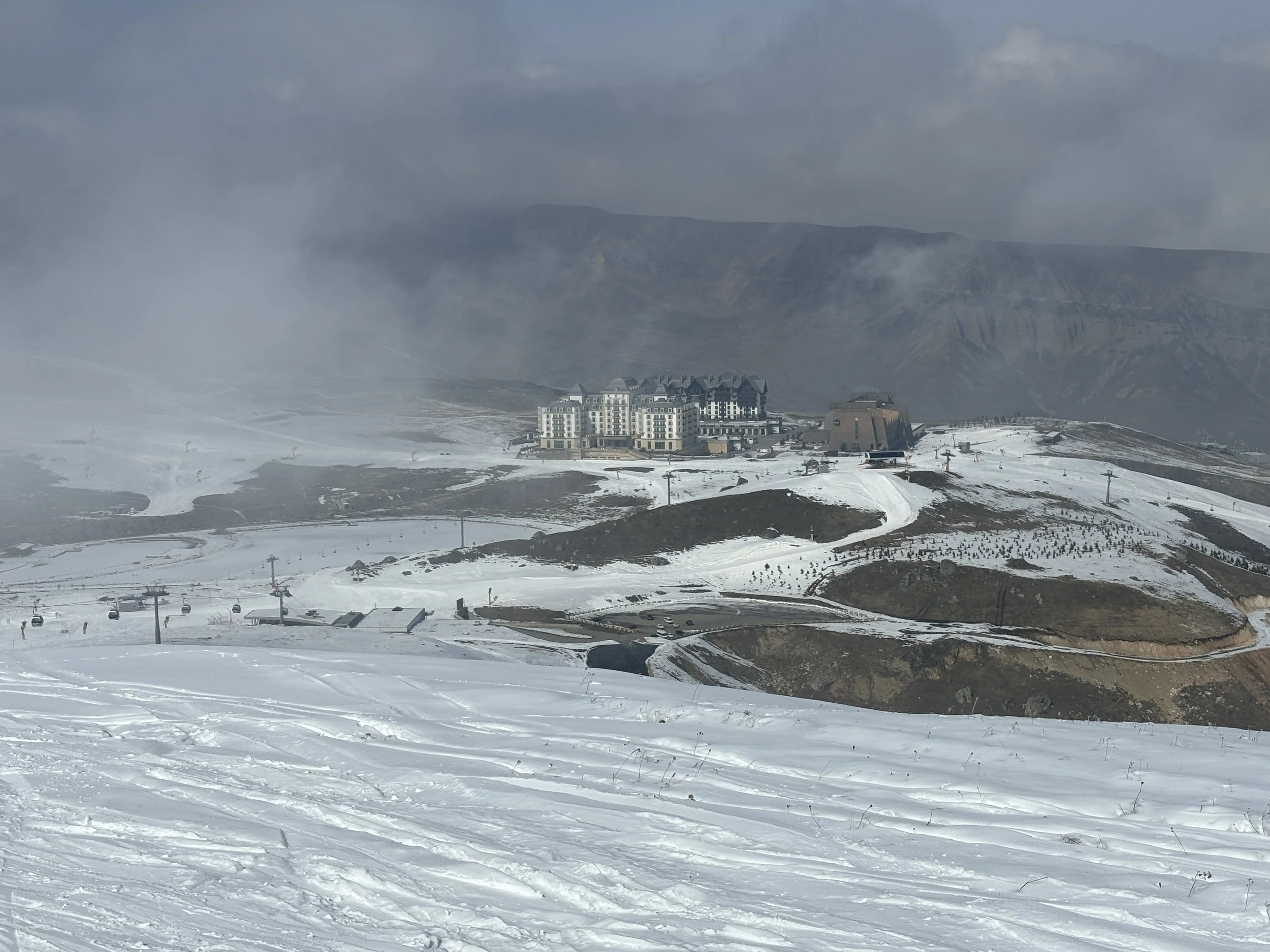
Where to stay in Shadagh
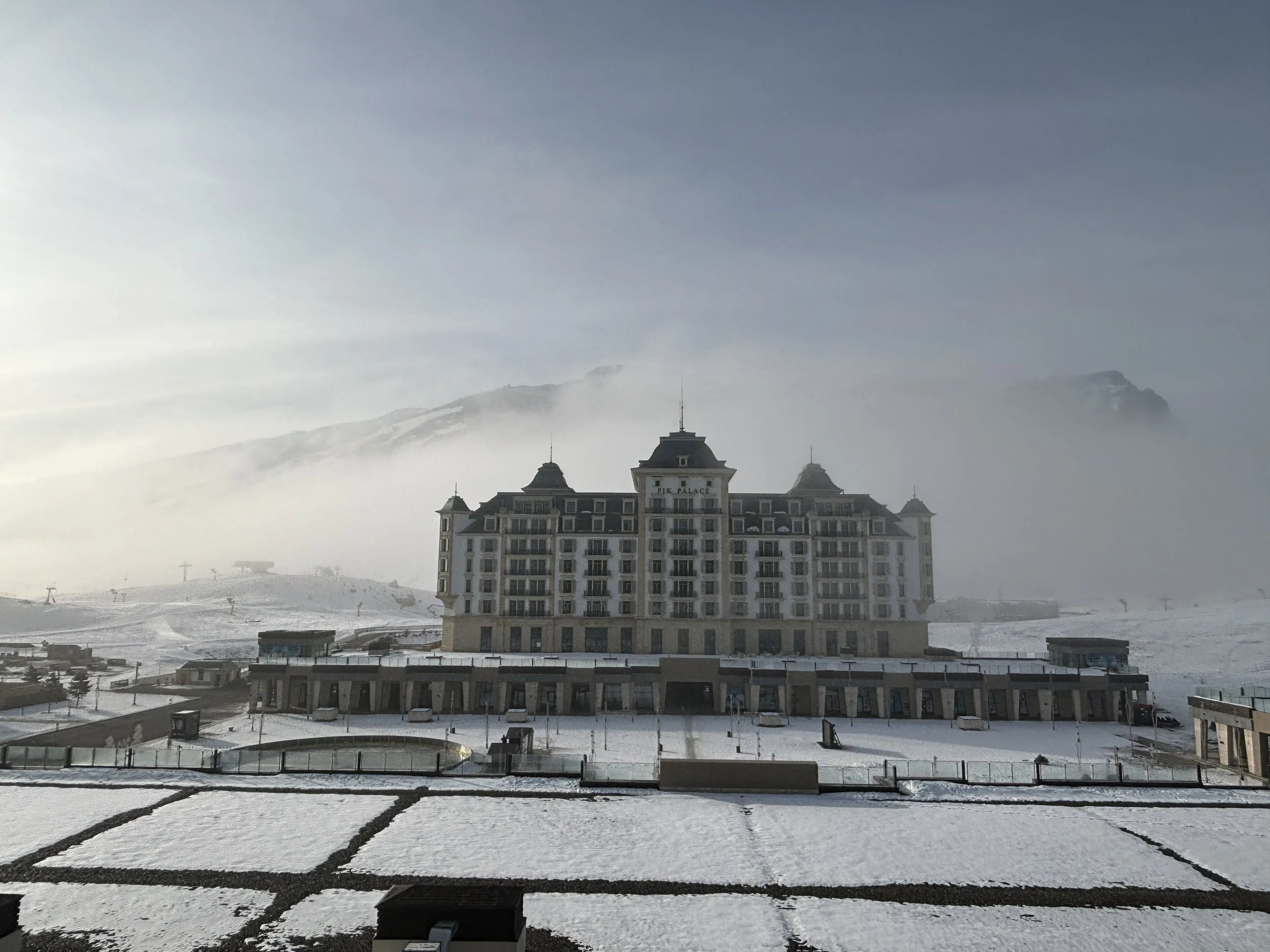
Park Chalet, Shahdag, Autograph Collection
This is one of two five-star hotels in Shahdag (there are four hotels and one apartment block in total in the resort as of 2026), both Marriott franchises and quite similar in style.
The picture above depicts the “Pik Palace, Shahdag, Autograph Collection”, as seen from the “Park Chalet, Shahdag, Autograph Collection”, where we stayed. Perhaps the Pik Palace, Shahdag, Autograph Collection is a bit more upmarket, but the differences are marginal, I think.
Park Palace, Shahdag, Autograph Collection is a rather stylish hotel, a modern take on the traditional Alpine aesthetics. You can get an idea of how the rooms look like in the pictures below.
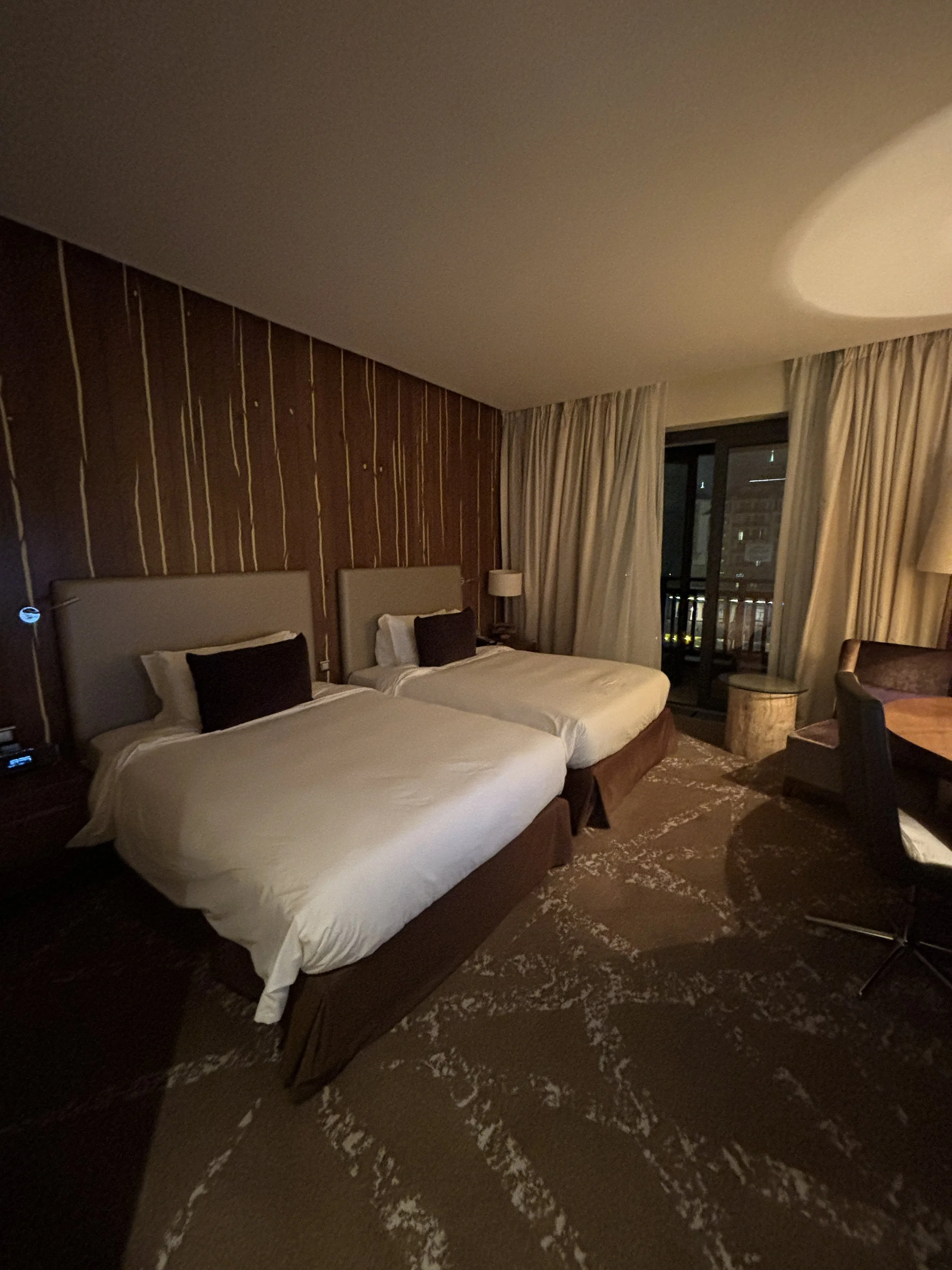
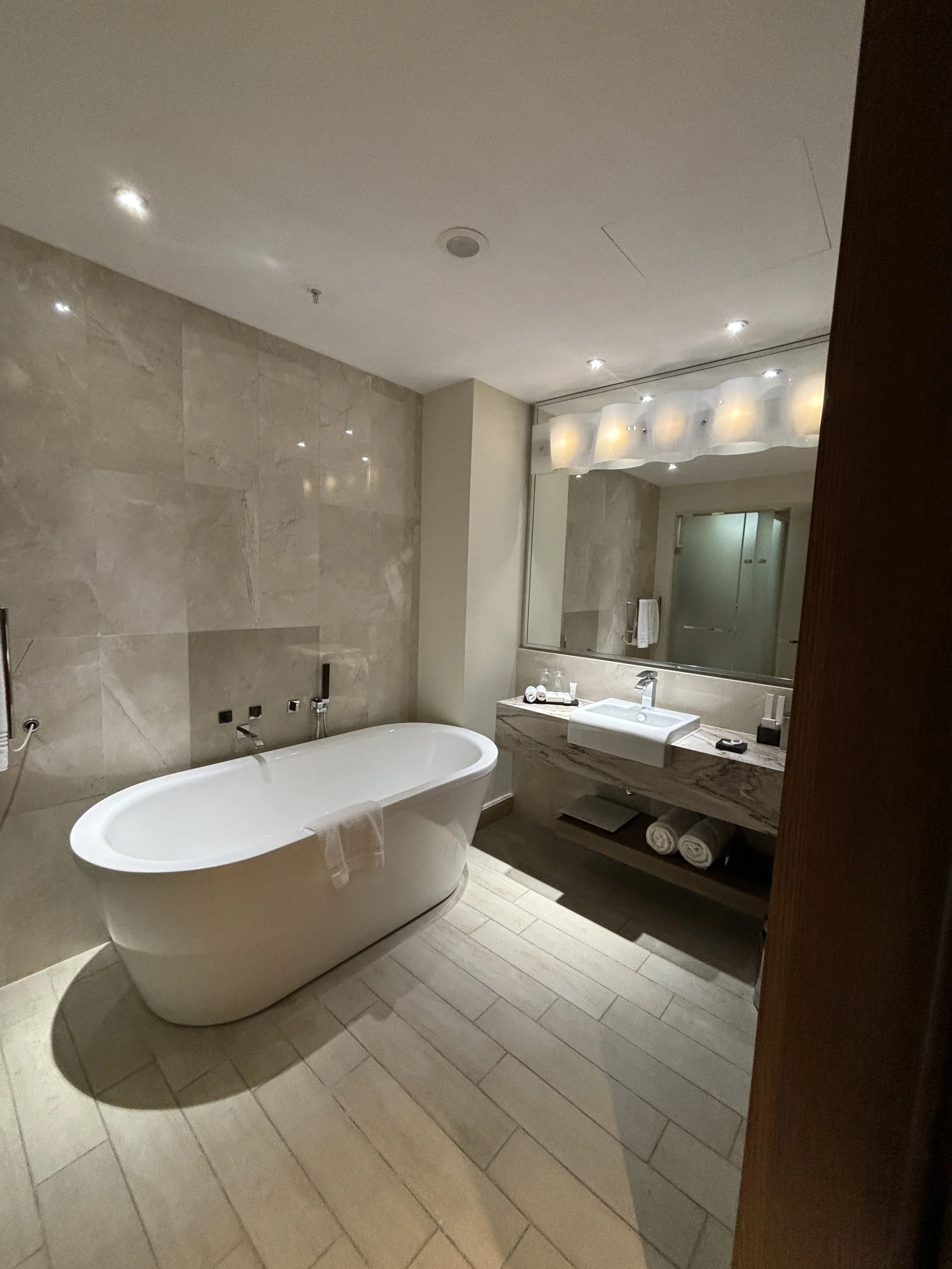
When it comes to food, the good news is that each of the two Marriott hotels has a pretty good restaurant. The food is fresh and tasty. It is perfect if you like grilled meats, because they cook them on a proper charcoal barbecue in plain sight.
The bad news is that there is very little else around. There are a couple more restaurants in the resort’s small commercial area and that’s it. There are no supermarkets or produce shops, nothing. And the restaurants can be a bit pricey, so if you spend a few days at the resort it starts to add up.
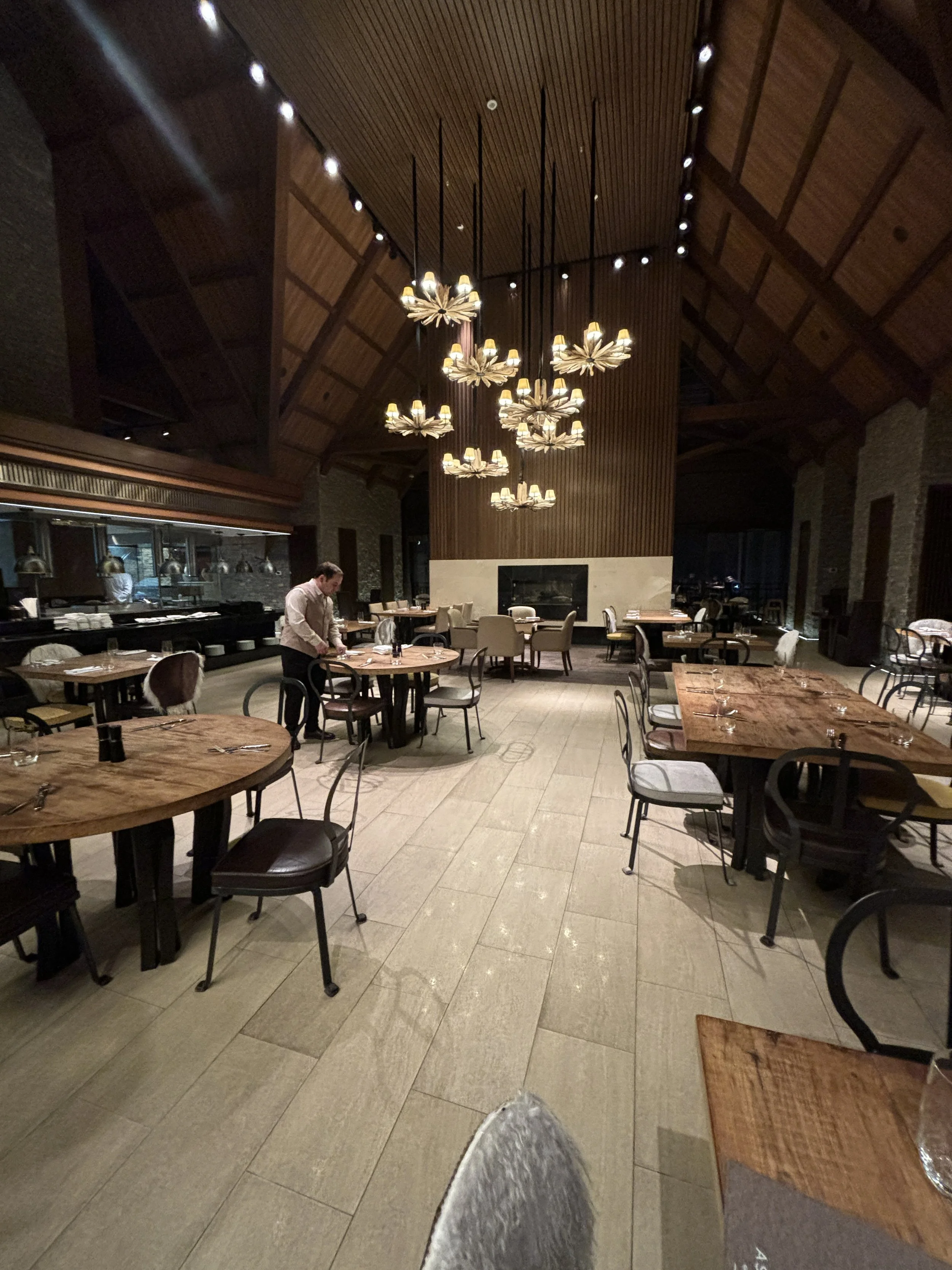
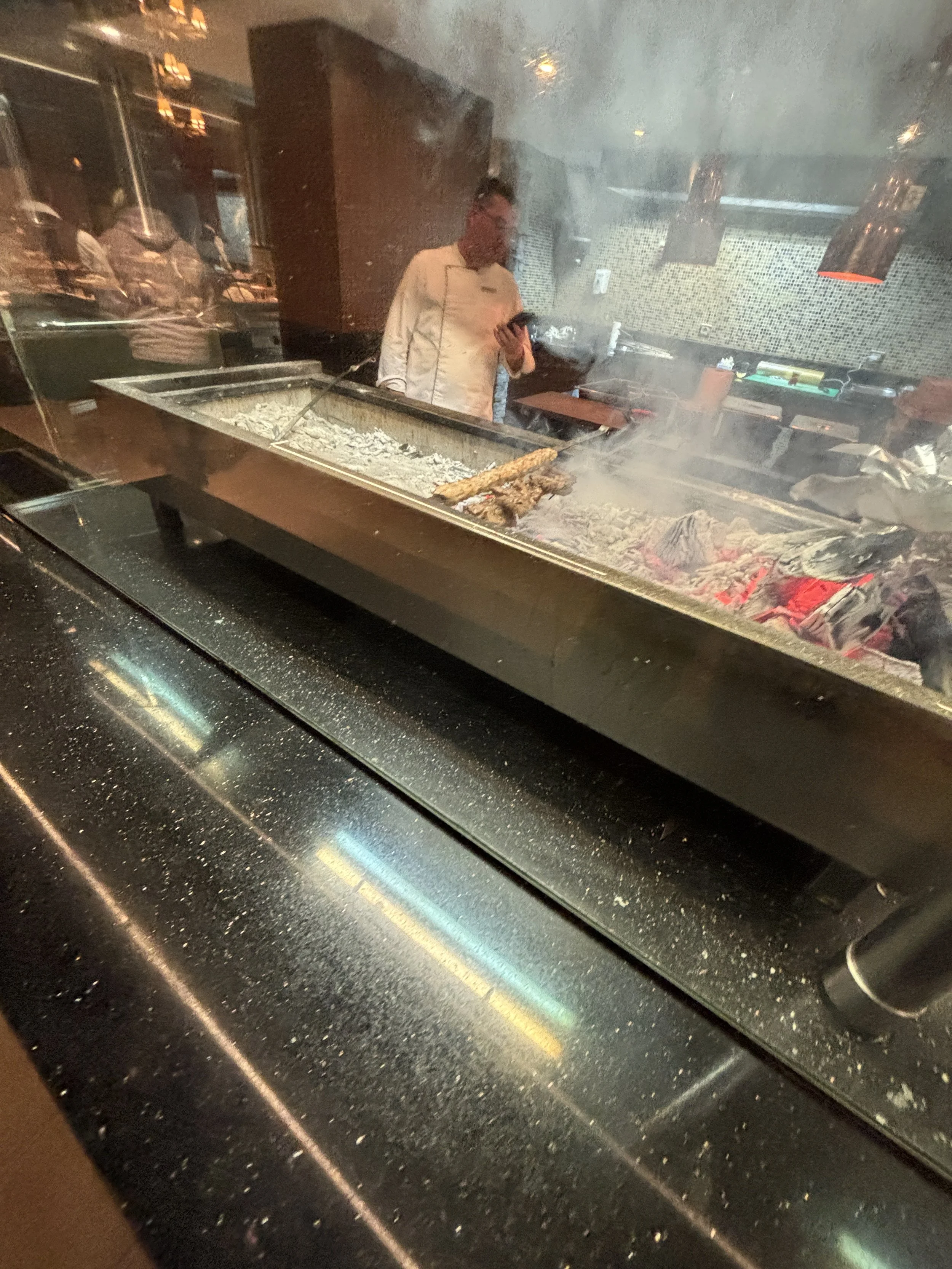
As mentioned earlier, this being the Caucasus, grilled meats (“shashlik”), served with the corresponding sides, are the signature speciality.
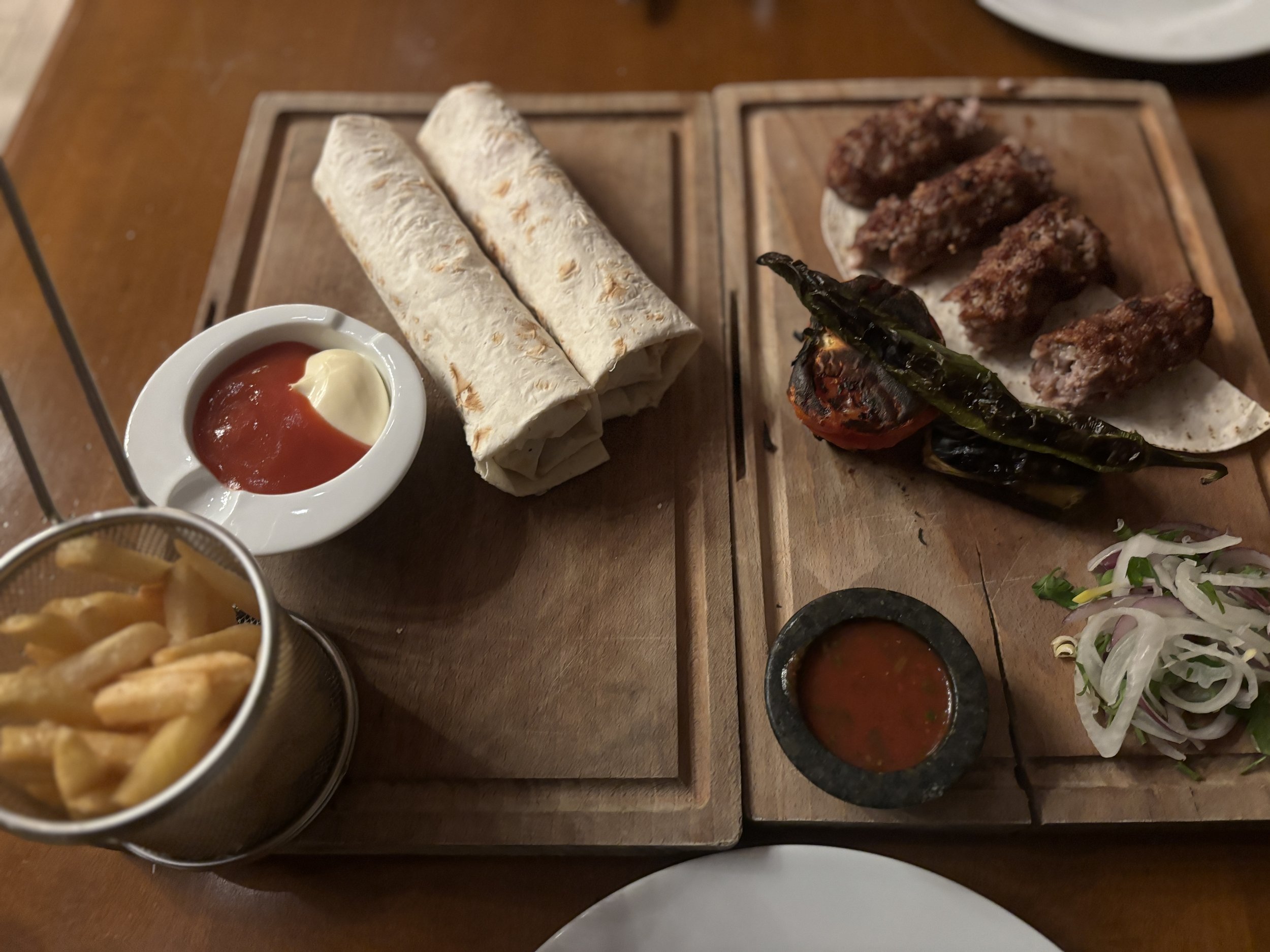
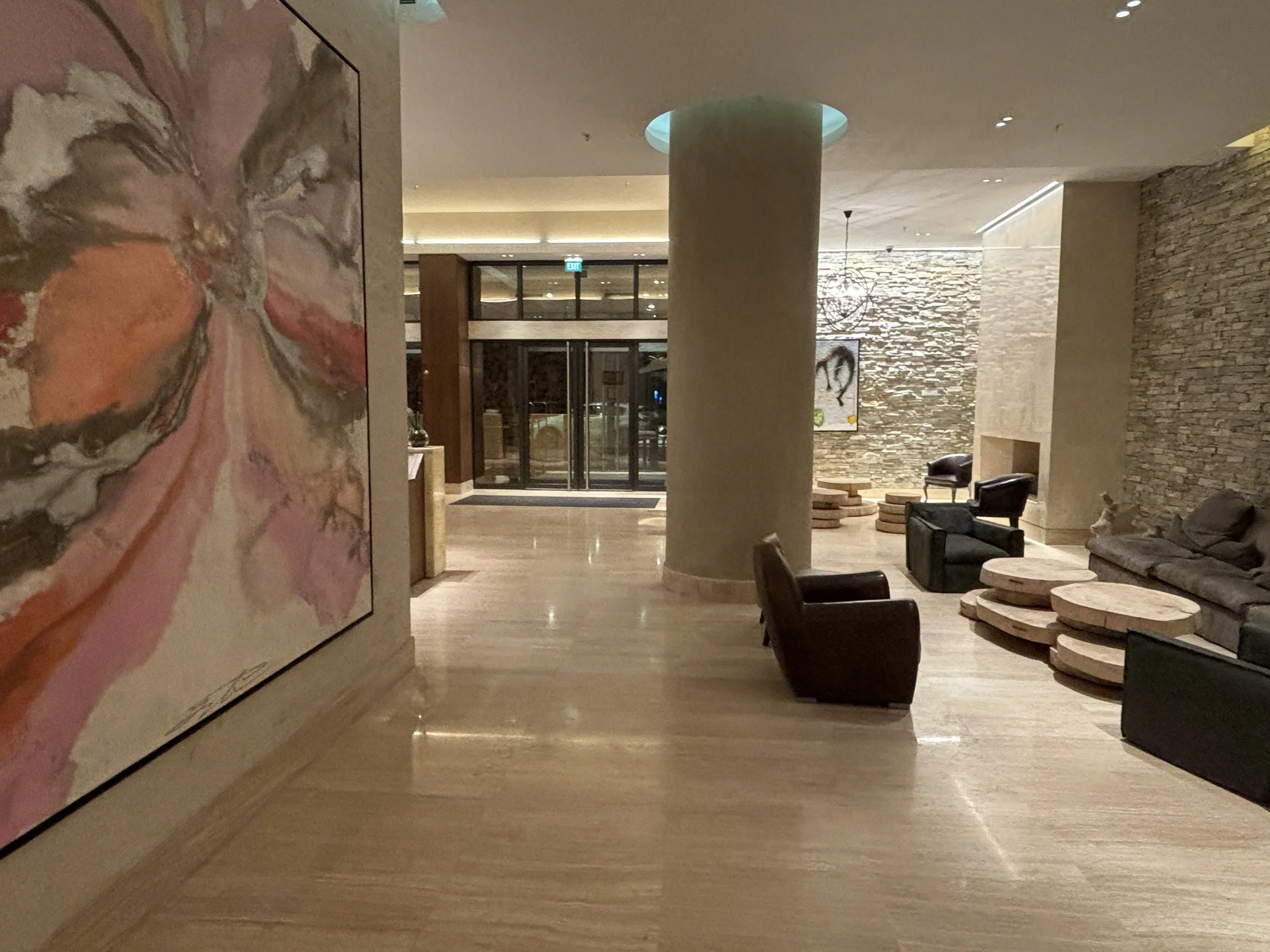
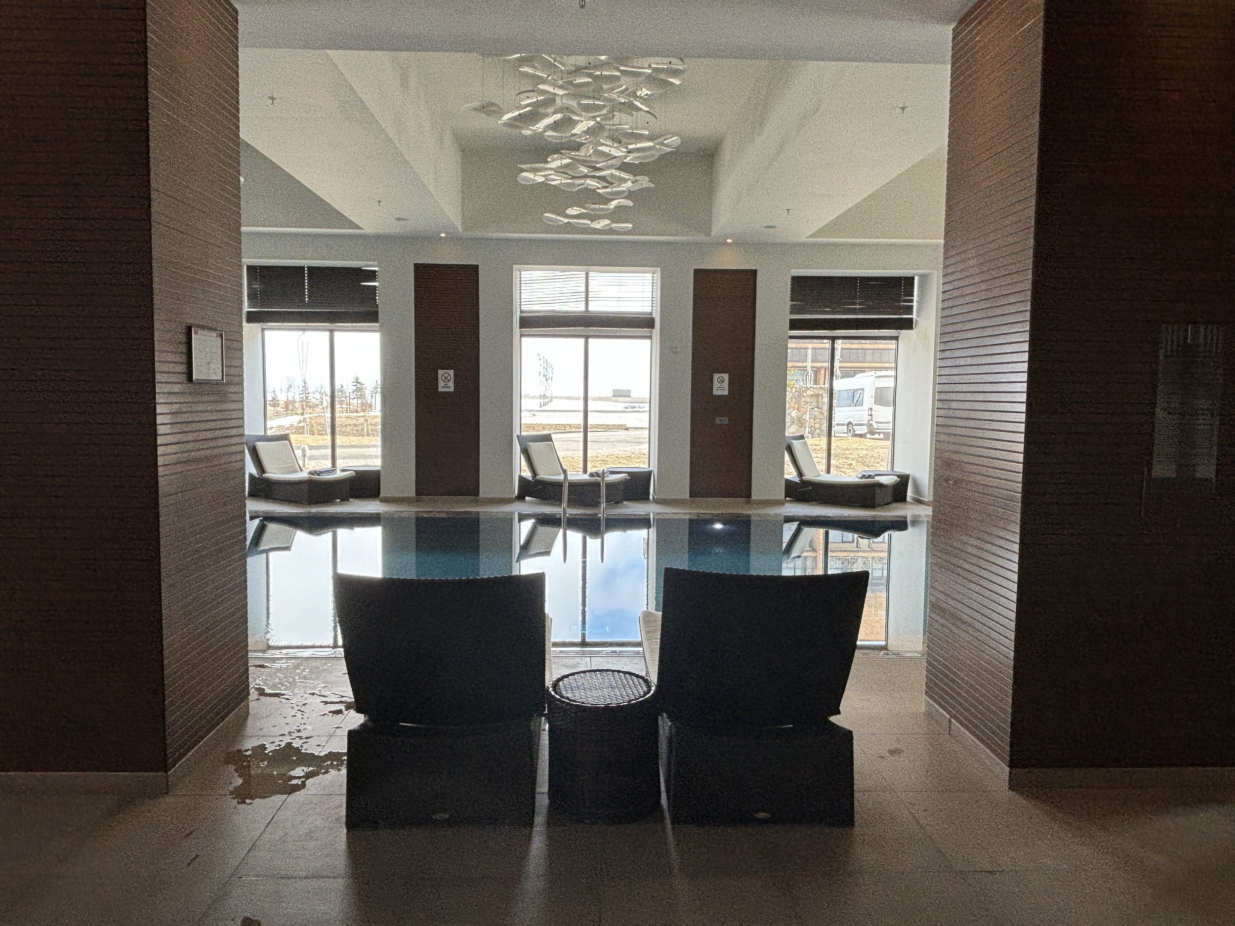
The hotel has also a well-equipped spa area with an indoor swimming pool and a gym.
Another nice feature of the hotel is that it is located right in front of the starting point of most of the ski lifts and gondolas going up the mountain, so you can just walk from your room to the slopes in a matter of minutes!
Visiting the Gobustan Rock Art Cultural Landscape
And from the mountains to the desert! Because the other outdoor area I visited near in Azerbaijan is the Gobustan Rock Art Cultural Landscape, which is also a UNESCO World Heritage Site.
The contrast with the mountains of Shadagh is sharp, the Gobustan rock art area is located in a very arid region some 60km south of Baku, where the flatlands are punctuated by a series of hills.
There are some mud volcanoes nearby but they were closed at the time of our visit, so I am not commenting on them in this post, but if you have the chance, it may be a good idea to include them in the itinerary!
It is on these ridges where the rock art is found. In fact, it is spread over a rather large area, but for regular visitors the core is Boyukdash Mountain, which is where some of the most impressive rock carvings and the museum and visitor center are located.
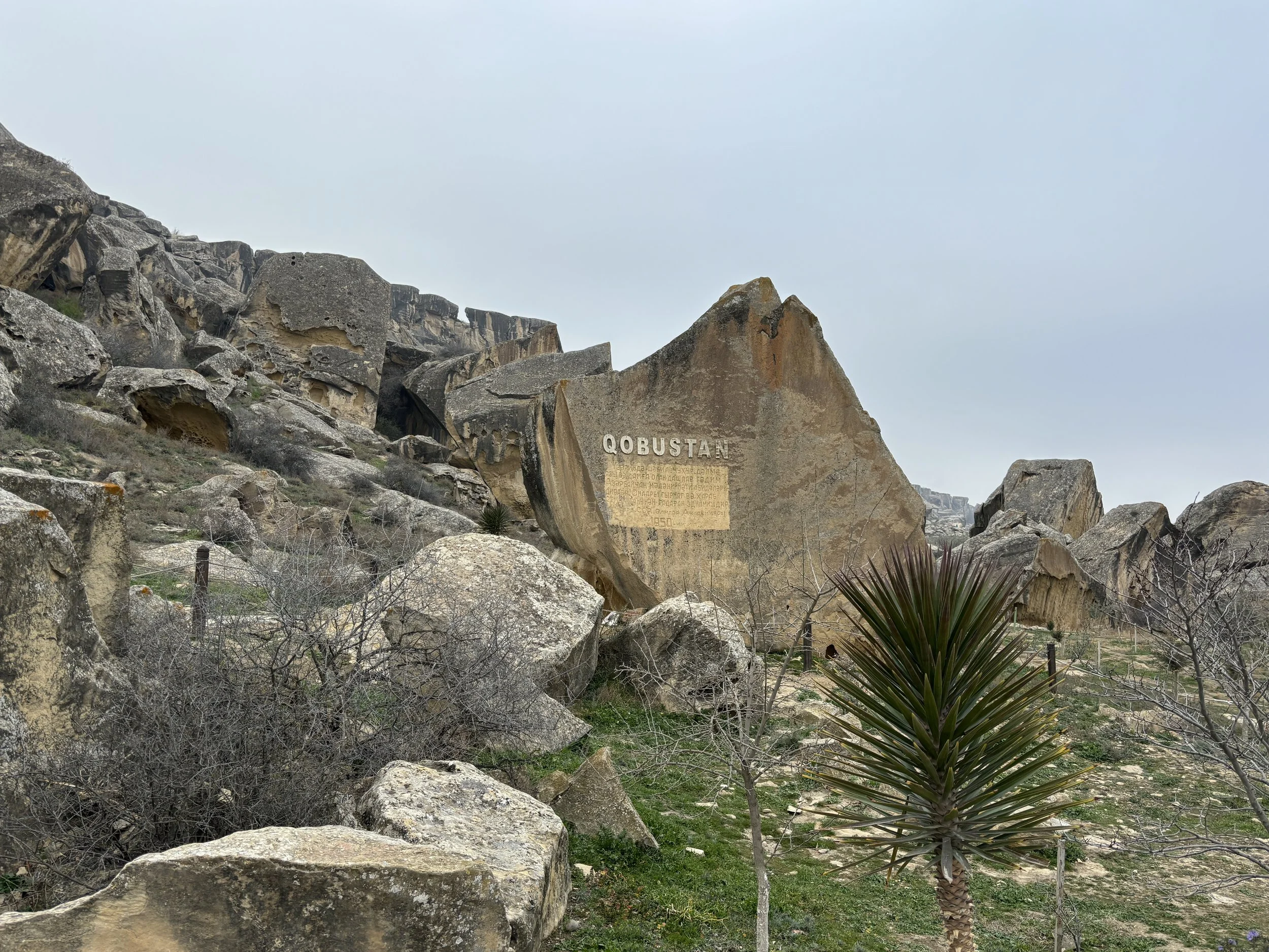
The Gobustan National Historical-Artistic Preserve Museum is quite modern (you spot the trend here!). It was inaugurated in 2011 and acts also as a visitor’s center for the main cluster of petroglyphs.
It does a good job explaining, through a rather immersive experience, the history of the area and the different rock carvings found, which stretch all the way back to the Paleolithic era 40,000 years ago, although some are as “recent” as the Middle Ages.
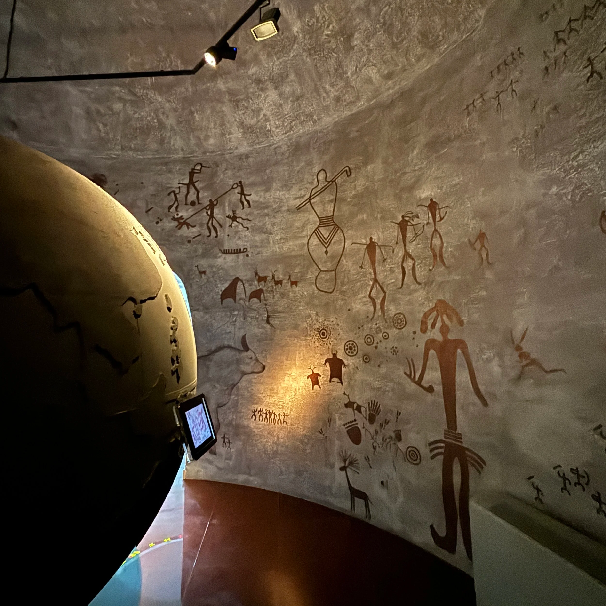
The visit then continues outside to see the rock art first hand. It is very accessible and you don’t need to be a specialist to see it, because it is all over the place. The petroglyphs are really diverse in their shapes and topics and depict humans, animals and things, like boats, for example (several thousand years ago, the Gobustan area was much closer to the Caspian sea and much greener).
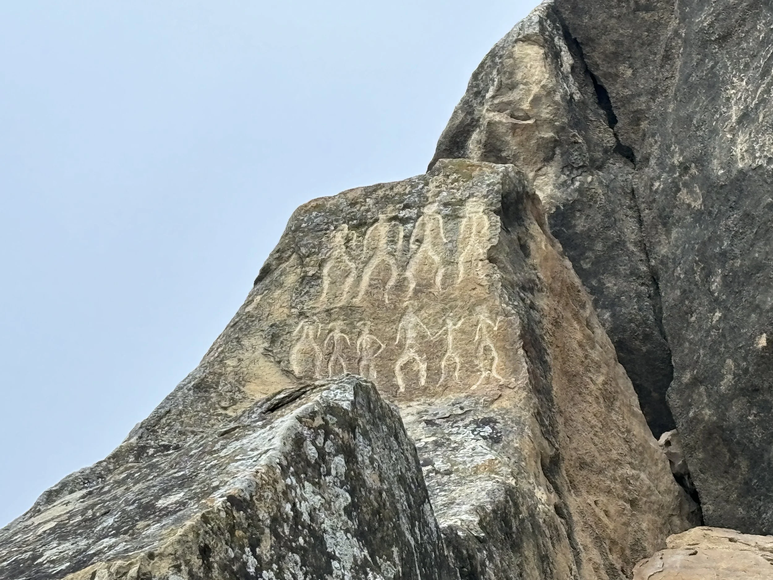
The natural setting is also quite impressive from the point of view of the landscape. The hills where the carvings are located look a bit like a sort of gigantic disassembled lego set, with huge rocks and boulders laying out on top of each other in a rather chaotic manner.
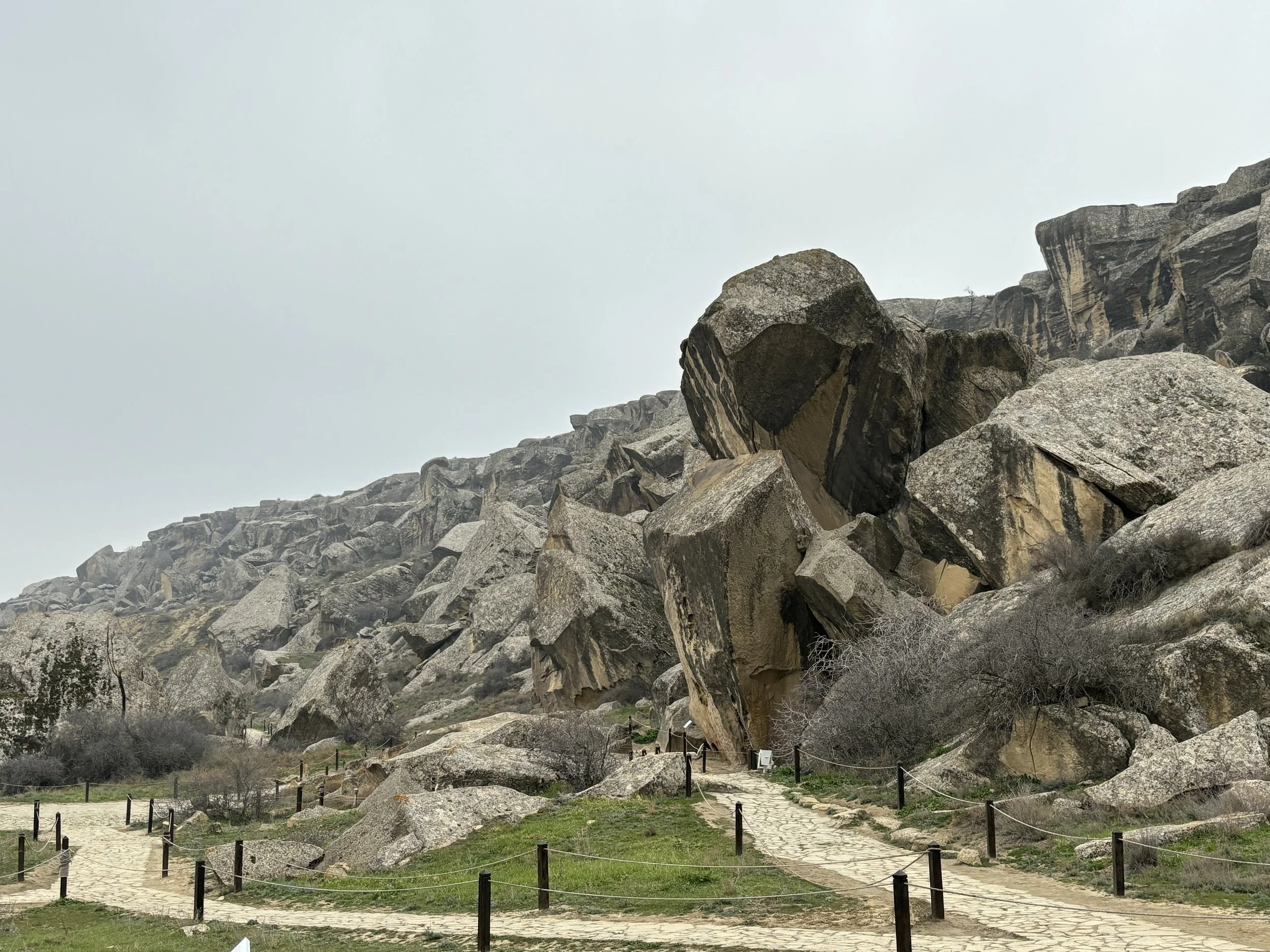
So, even if you only have half a day free after visiting central Baku this can be quite an interesting excursion to do!
Getting to and from Azerbaijan and some practical tips
Finally a word about getting to Azerbaijan plus the usual practicalities to take into account.
It’s visa free for most countries (or e-visa on arrival to be more accurate), including the EU, the US and the UK.
By the way, the following is possibly only relevant to a very small subset of travellers, but, at the time of my visit and I think it is still the case well into 2026, it was only possible to enter Azerbaijan by air, its land borders having been closed since the Covid pandemic!
In any case, Baku airport is getting increasingly well connected with many points in Europe and the Middle East and it has become quite an accessible destination.
Again, the wonders of oil-funded investment in state-of-the-infrastructure become visible at the airport, which is a really modern and convenient facility (although there is still a small Soviet-era terminal in service, which is used by a small number of flights).
By the way, the best way to get to and from the airport, and to move around more generally, is to get an e-sim that works locally and use Bolt, which is the top Western ride-hailing app in Azerbaijan. Prices can be very competitive, a ride from the airport into downtown costs the equivalent of €7 (US$8) and within Baku’s downtown it can be just a couple of euros (or dollars).
By the way, Russian is still the main foreign language for most Azeris, although the younger generation tends to know at least some basic English.
It’s also a good idea to change a bit of cash upon arrival too, even if credit cards are accepted in most places.
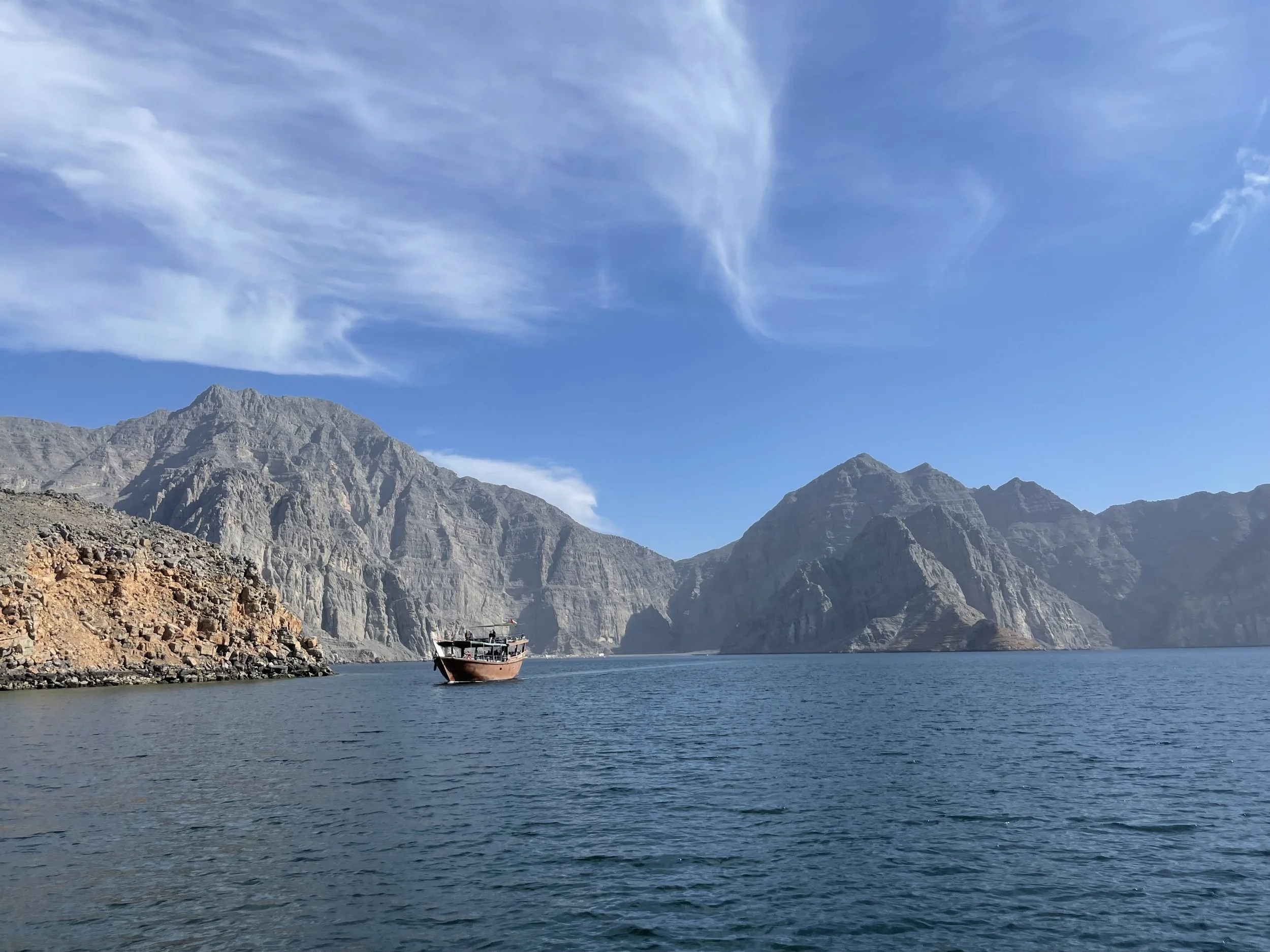
Two hours from Dubai, a World away: visiting Musandam on the Strait of Hormuz

Now that the Strait of Hormuz is the centre of the global attention for all the wrong reasons, it is perhaps a good time to remember that its southern side is one of the most truly amazing destinations you can visit anywhere in the Middle East.
The Musandam Peninsula, an Omani exclave which protrudes into the sea giving the Strait of Hormuz its curvy, contorted shape, is a land of majestic desert fjords and dramatic vertical cliffs laid out in an extremely intricate pattern.
It is hard to believe that this area, with almost no flat land or roads of any type and populated only by some fishermen which move around only by sea, is located just a couple of hours drive from the buzz of Dubai.
If you are based in Dubai, the Musandam Peninsula is perhaps the top thing to do if you are looking for places to spend a weekend somewhere out of the city. In fact, traveling to Musandam from Dubai is like stepping into a whole other world entirely!
Now, what I am going to explain here refers to a visit made before the military conflict that flared up in the Gulf in early 2026. So, a word of caution here, since I have no idea how the war may have affected the Musandam Peninsula and whether it is advisable or even possible to visit during times of conflict.
In any case, the natural attractive of this area is there to stay, so hopefully these lines about how to visit the Musandam Peninsula and what to do there will remain relevant regardless of when the fighting ends.
This post may contain affiliate links. If you book or buy something through them, I earn a small commission, at no extra cost to you. It's one of the ways I keep Places of Charm going. Thank you for your support.
In an article I wrote about the area in 2023, was titled “The Norway of Arabia” and while this comparison helps frame the type of landscapes and environment Musandam offers, I think it is worth elaborating a bit more on this label and sharing some more details of this amazing and yet relatively unknown gem of a destination.
Khasab, the gateway to the Musandam Peninsula
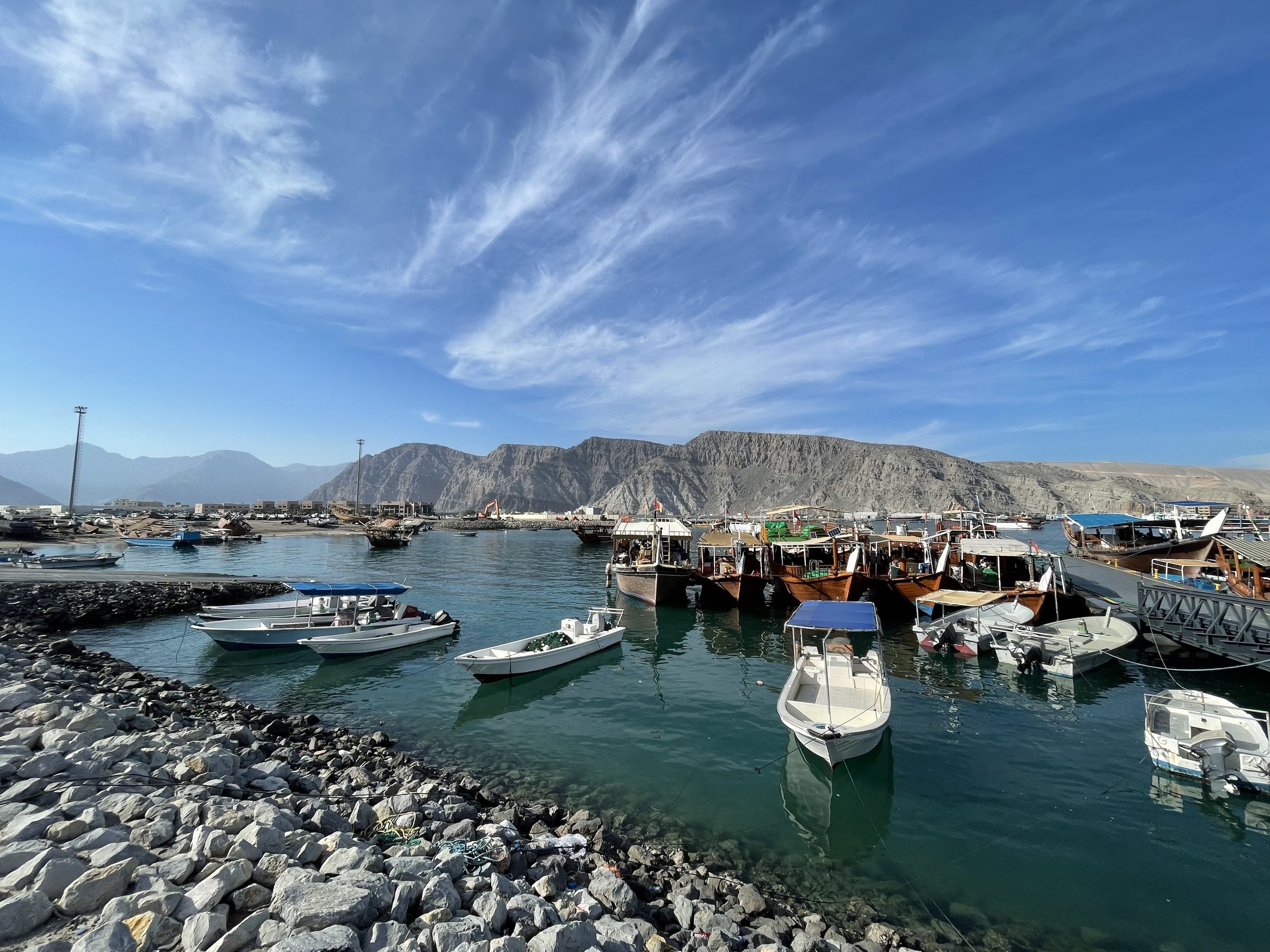
How to get to the Musandam Peninsula
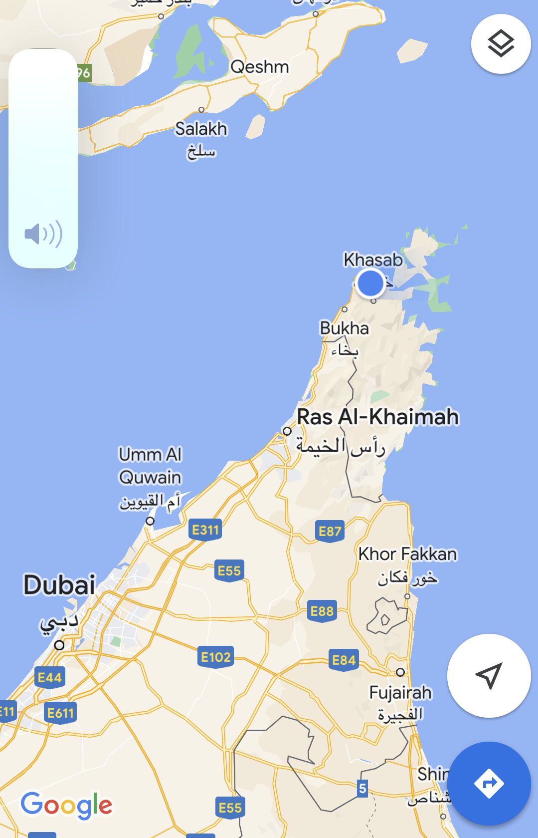
First of all some important logistic considerations:
Musandam is an Omani exclave, that is one piece of the territory of the Sultanate of Oman which is detached from the mainland and wedged between the UAE and the Strait of Hormuz. Therefore, if you travel there by land, you will have to clear Omani customs and immigration.
Now, the good news is, Oman is a relatively open country and citizens of many countries (including the EU, UK and US) can simply get a visa at the border, a process that involves just filing a form and paying a small fee.
However, it is still an international border and entry conditions may change, so check in advance on the websites of the Omani government and the travel advisory section of the embassy or consulate of your own country!
Another important consideration:
If you are traveling on a car rented in the UAE (as was our case), you need to make sure the terms and conditions of your rental allow for entry into Oman. Many car rental companies in Dubai or Abu Dhabi will do that for an extra fee. So, check it is possible before the booking and then ask for it again when picking up the vehicle.
Also, in addition to obtaining permission from the car rental company to take the car out of the UAE, you also need to take into account that Oman requires all vehicles entering its territory to have an insurance policy that covers Omani territory. Some car rental companies based in the UAE offer this, but, in such case, make sure you get all the papers and print them out, because they are going to be checked at the border and they are pretty strict with this.
The alternative is to contract an ad-hoc insurance policy for the duration of your Musandam journey right at the border. An Omani insurance company has a booth right by the border post just for this purpose. The process takes like 5min and it requires filing up a form and paying the insurance fee (at the time it was something like $60 for a 2-3 day period, but this may be subject to change).
In our case, while we had contracted the international insurance upon picking up the car in the UAE, there was, apparently, a mistake in the way it had been processed, so the border guards wouldn’t let the car in unless a new insurance policy was contracted at the local booth, which we did (we later cleared that out and got refunded by the car rental firm since it had been them messing up the paperwork).
The distance from downtown Dubai to the Oman border crossing is about 150km (90 miles) and to Khasab is about 200km (120 miles). It is nearly all through motorway, except for a short stretch between Ras Al Khaimah and the border in which it switches to a two lane road which crosses and industrial area. So, it takes a couple of hours to the border, and to that you should add another 30-40 minutes already inside Omani territory to Khasab.
You must also factor in some time for the border crossing, because it is necessary to stop, get off the car and clear immigration at the customs house. The time requirement depends on the amount of people and the “complexity” of your paperwork. On the way in we spend nearly an hour, but this is because we arrived just after several buses full of tourists (there are also some organized tours from the UAE going to Musandam) and we had to sort out the car insurance paperwork. On the way out it took us less than 10 minutes.
Roads are good. On the UAE side, you are almost all the time on a well-maintained, multi-lane motorway. On the Omani side it is a two-lane road, but it is also well-built, well-maintained and quite broad. So, as long as you take care of the border formalities, Musandam is pretty accessible.
You can also travel to Musandam by air, since there is also a small local airport. However, as far as I am aware of, it only has a few domestic flights to the Omani capital, Muscat.
Spending the night in Khasab
Fjord cruise departures are usually at 10am, so, while you could technically make it in one go from Dubai if waking up very early in the morning, I would highly recommend spending the night before the fjord tour in Khasab.
Where to stay in Khasab
Now, when it comes to choices, Khasab is nothing like the apparently almost endless supply you find across the border in the UAE. And this is a great part of what confers to Musandam such a sense of uniqueness and, without being luxurious in the material sense, of exclusivity, as well!
There are basically two major modern establishments in Khasab and both are managed by the same company, Omani hotel group Atana, the Atana Khasab Hotel, which is located in a small hill overlooking the bay of Khasab, and the Atana Musandam Resort, which is located in downtown by the port.
The latter markets itself as somehow more upmarket (perhaps on account of its slightly more central location), but, from the descriptions I have seen I think they are both pretty similar, in the four-star range. We stayed at the Atana Khasab Hotel and had a very good experience!
This, was at least, the situation when it comes to accommodation in Khasab at the time of my visit. Since things change really fast in this region, it is very possible, that some new hotels have opened since. In fact, and unless there is a deliberate policy of limiting visitor numbers, I wouldn’t be surprised if this is what ends up happening, since the appeal of the place is undeniable and it is only a matter of time until the word spreads out. I hope, if this ends up being the case, that Musandam is able to preserve its charm!
Atana Khasab Hotel
This modern hotel is located right on the main and only road leading from the UAE border into Khasab. It is located a couple of kilometres from the port and it has some very nice pool-side views of the bay of Khasab and the waters around the Musandam Peninsula. it has plenty of space to park your car, btw.
The facilities are quite modern and spacious and some rooms have direct access to the terrace.
We had dinner and breakfast at the terrace of the Atana Khasab Hotel and it was pretty good overall. The menu contains also quite a few local specialities, which is a nice touch (the um ali and mahalabia they serve for dessert are particularly tasty!)
The hotel has also quite a few outdoor spaces, including part of the dining area, which is quite nice considering that the weather in this part of the world is quite balmy in the mornings and evenings.
My description of the Atana Khasab Hotel wouldn’t be complete without a word of recognition for its staff, and particularly for Rasheed, the hotel’s restaurant manager, who went above and beyond to return us an item of great personal value that we inadvertently left behind at the hotel. Rasheed not only took care of finding it, but even drove several hundred kilometers into the UAE to deliver it in person to the resort where we were staying it at the time!
“This is Omani hospitality”, he simply said.
So, I am taking this opportunity to express again my huge gratitude for this very kind act!
What to do in Musandam?
While the base for any Musandam Peninsula excursion is Khasab, which is the main town in the exclave, there is little to see in the town itself, aside from a 16thC. Portuguese fort (Portugal controlled the area around the Strait of Hormuz for quite some time in the 16th-17th C.).
The rest of the town is pretty unremarkable. In fact, it is quite a small place. There is a sort of “downtown” with some shops and wholesale outlets near the port, but the population is pretty scattered otherwise.
The main thing to do in Musandam and, basically, the whole point of coming here is to enjoy a cruise along the fjords of the peninsula.
To do so, it is necessary to book one of the many day cruises that leave Khasab port in the morning. You can find quite a few options on Viator or Getyourguide.
We booked this tour of the Musandam fjords, which costs around $50 (€45) per person and the experience was great! I will describe it in more detail right below.
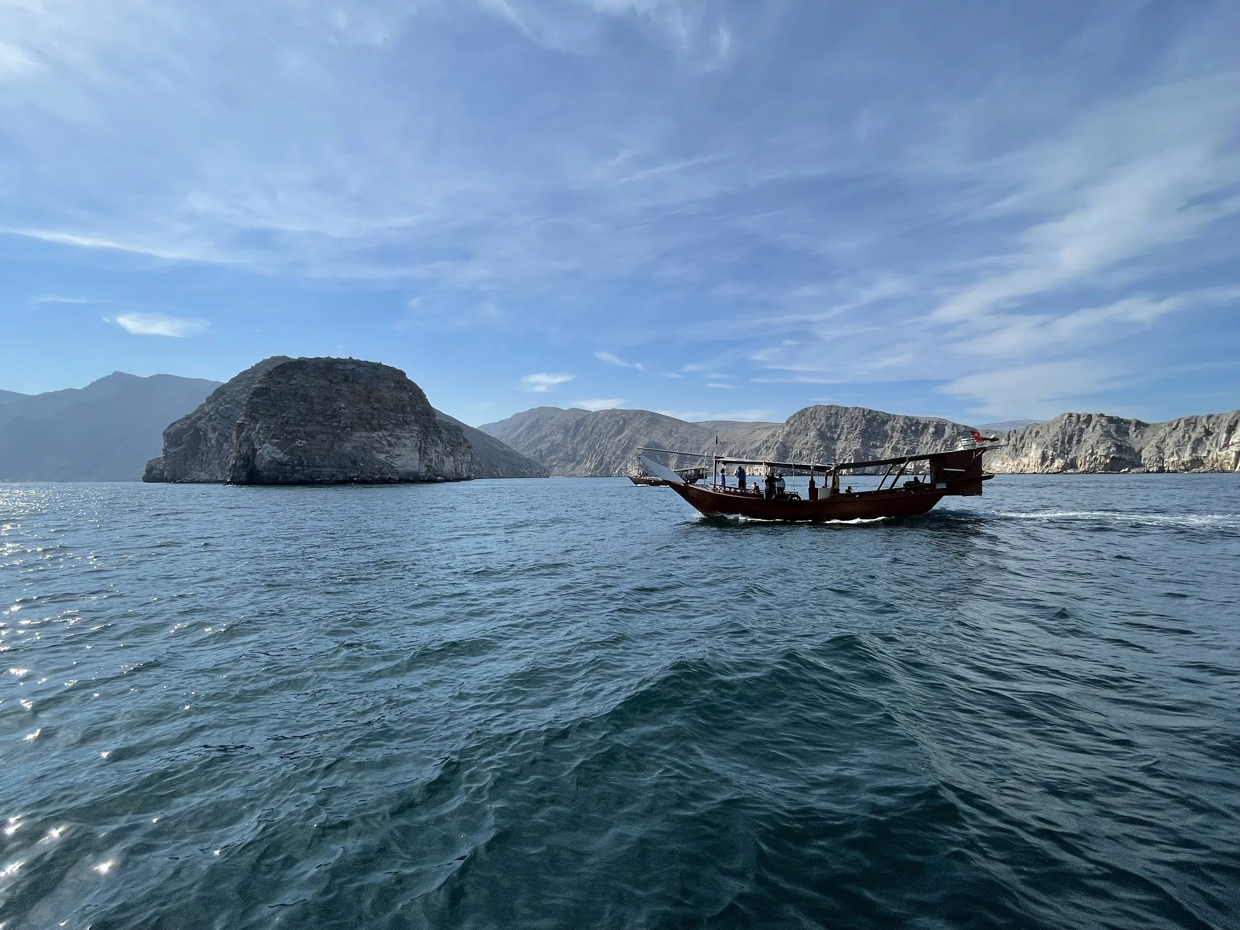
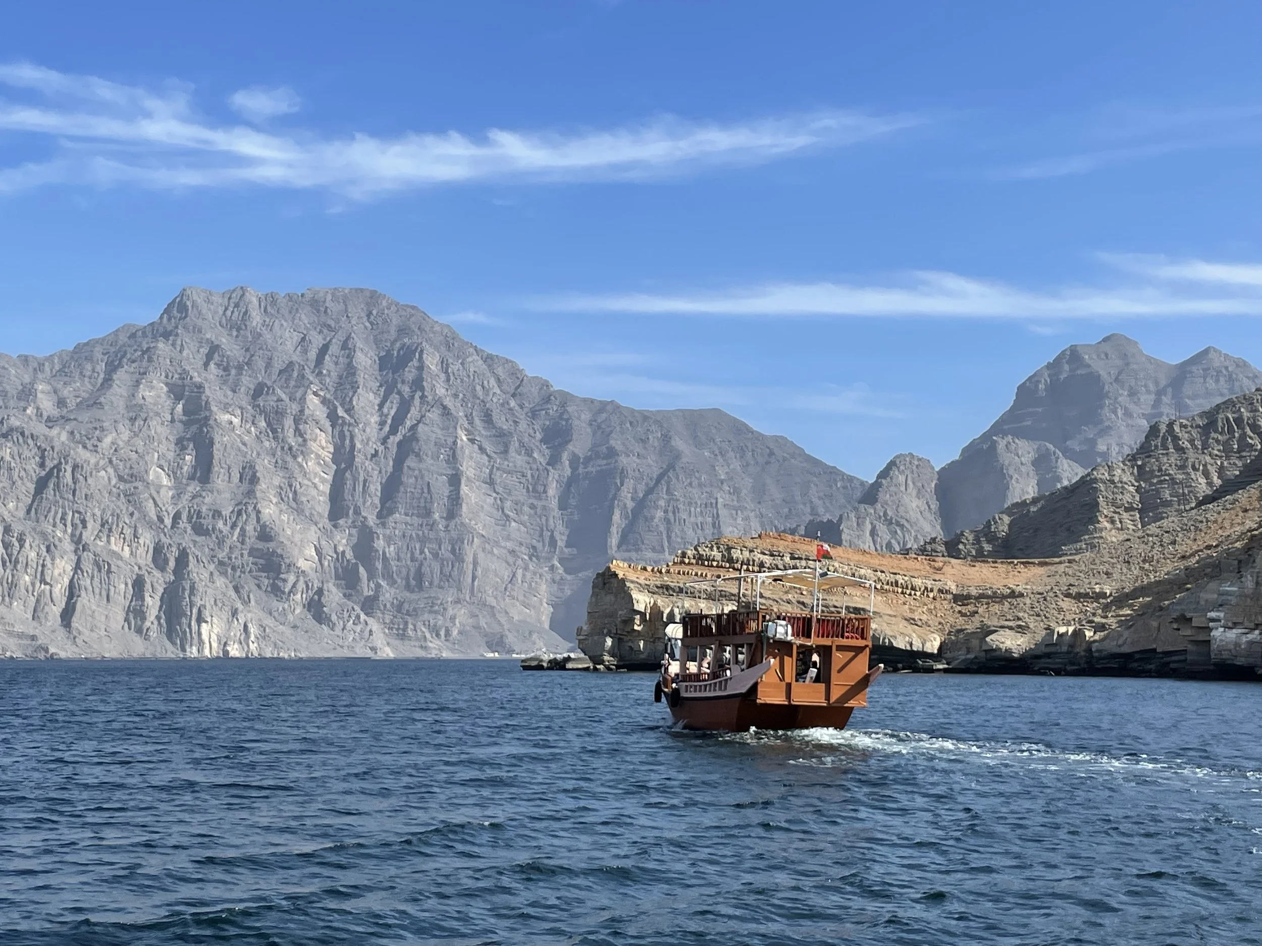
My impression is that most tours offer a pretty similar service, though: pick up in the morning at your hotel, drive to the port for a 10am departure. Then you spend around 6 hours at sea, returning in the afternoon at around 4pm or so.
The boats are of the traditional dhow type, although they are somehow modernized. They have a broad open deck where you spend most of the time. There is a protective canvas that is rolled out over it to protect from the sun as well as a cabin by the stern. The boat is also fitted with toilets, btw.
These boats are large enough to carry perhaps a couple dozen people onboard, but it is rare to see them full. In our case it was just around ten people and there was plenty of space to move around. It all felt like going on a private yacht.
The crew were also very nice. They took good care of us throughout the trip and you could see how they even strived to get us were the dolphins were!
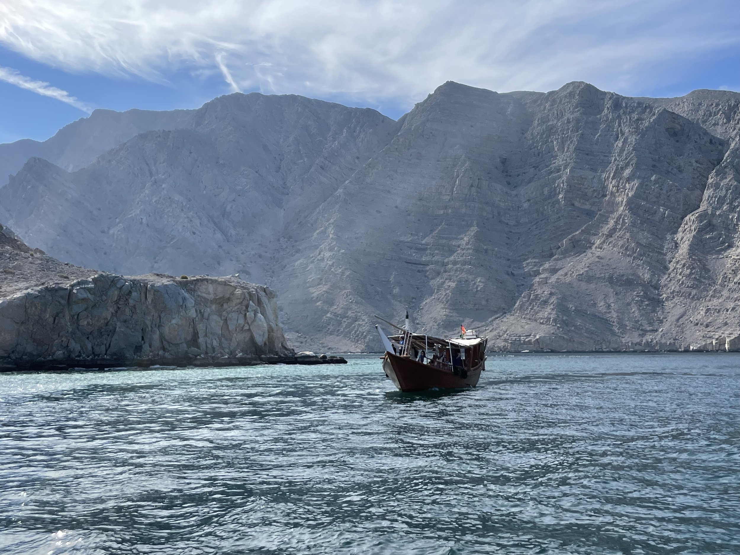
Our route took us on a loop around the Musandam’s main fjord, which is located just to the west of Khasab. We started on the south side, getting past Telegraph Island (a little rocky outcrop which once housed a rely post of the British telegraph linking London to India) to the very bottom of the fjord and then back along its north side.
We did a couple of stops, each lasting about an hour or so, during which the crew anchors the boat next to shore and it is possible to swim. The crew also lends you googles and fins to do some snorkelling, which is quite an experience in these waters. There are coral reefs, plenty of fish and some interesting creatures, such as sea cucumbers and huge sea urchins!
Lunch is included in the experience and it is served on deck. It consisted of Arabian and Indian-style food, different types of roasted meat and vegetables with rice and different types of accompanying sauces and condiments plus flat bread. It was pretty tasty and abundant. It is self-service. The crew lays out the different foods and you take as much as you want. Drinks are also served.
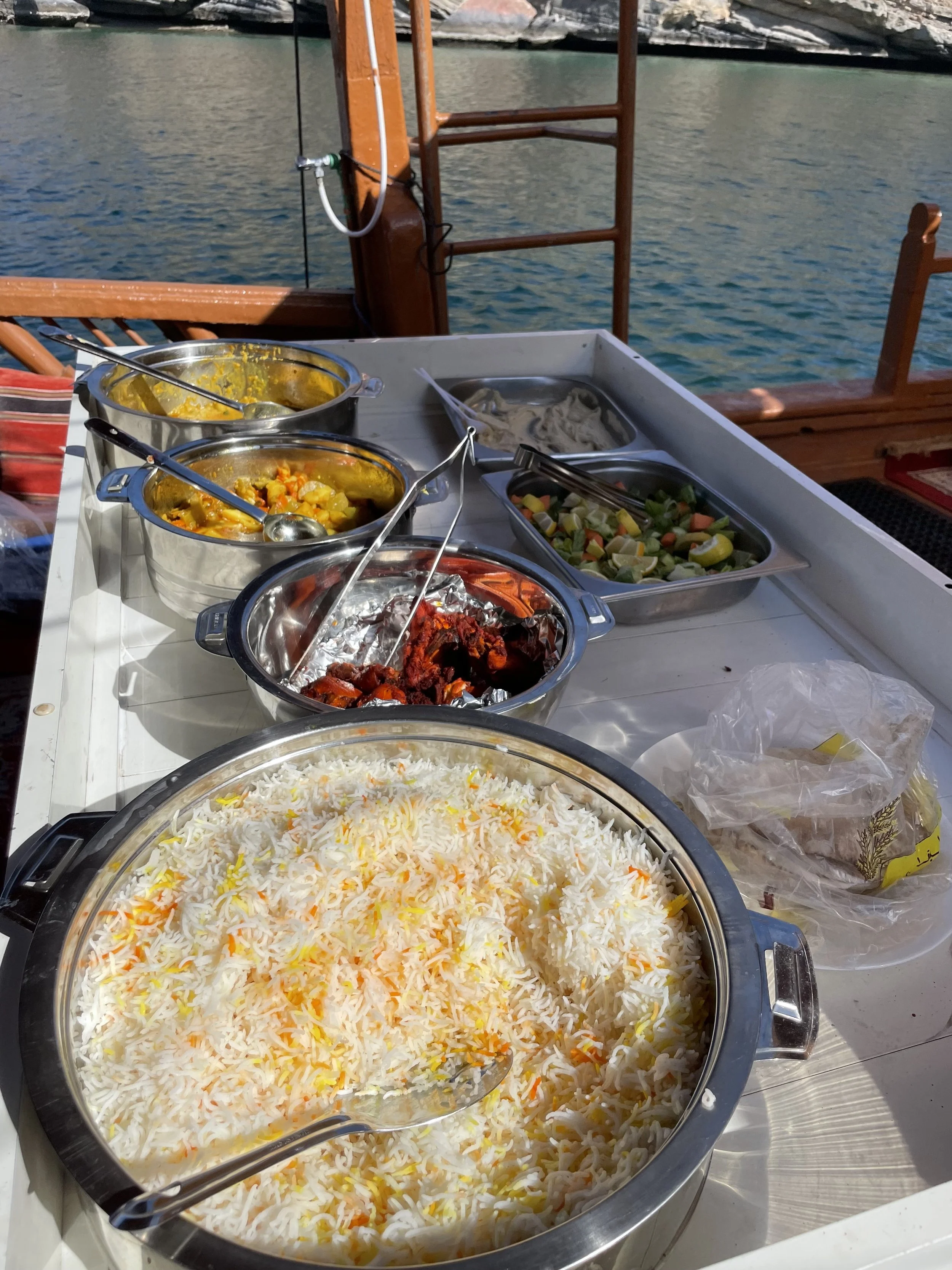
During the trip you see several other dhows following roughly the same itinerary, but the distances are so big that it never feels crowded or “touristy”, even if it is obviously a touristy, packaged activity.
In fact, one of the most awesome things of this experience is the feeling of smallness in this rock and water landscape (there is not a single tree or even a little speck of greenery on sight!).
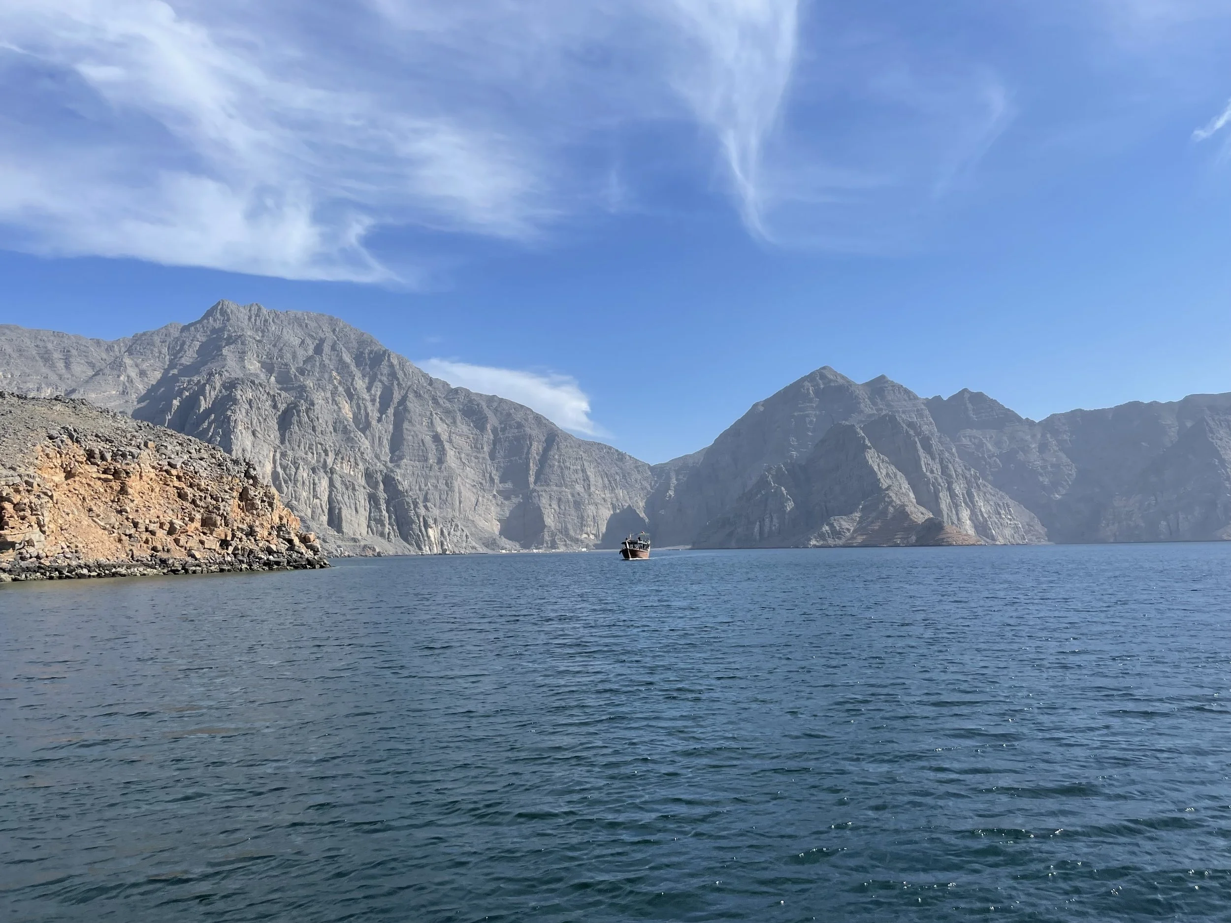
We also sailed past some settlements which can only be reached by sea. It is incredible to think this place is just a couple of hours drive from the Dubai Mall. It feels like a different planet!
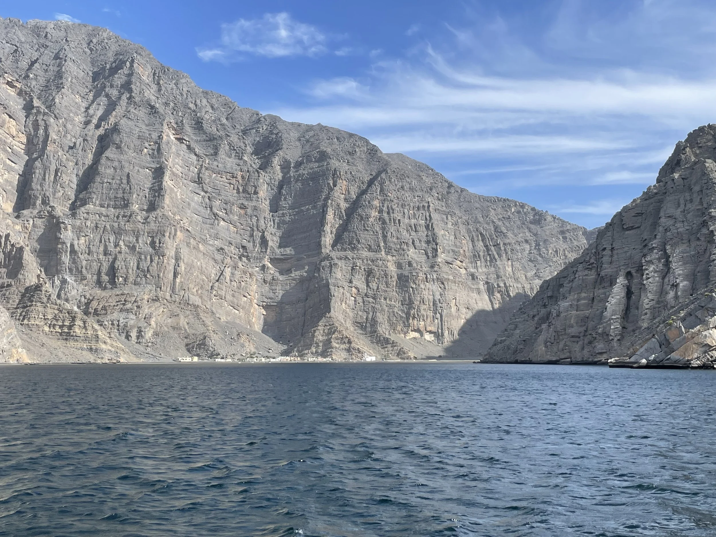
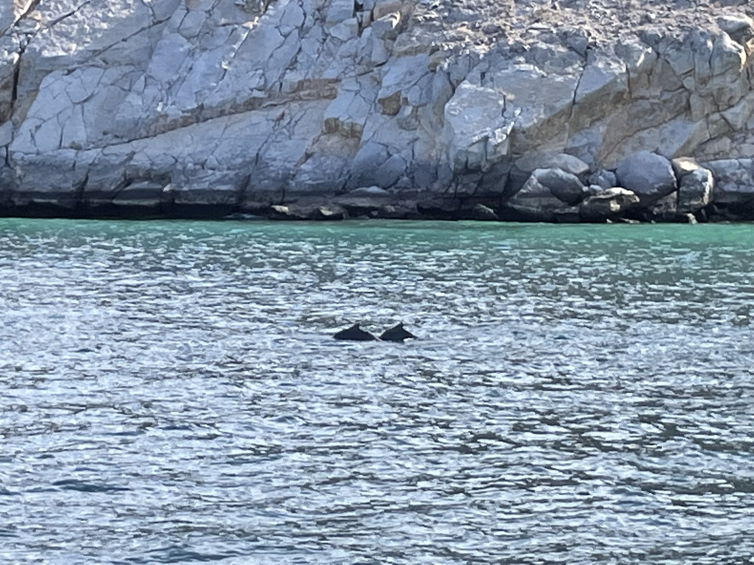
One of the highlights of the tour is the dolphin spotting. At the start of the cruise I was giving a very low chance to this happening, but, actually we saw the first dolphins barely 15 minutes into the trip and then we spotted many more at different points during our journey!
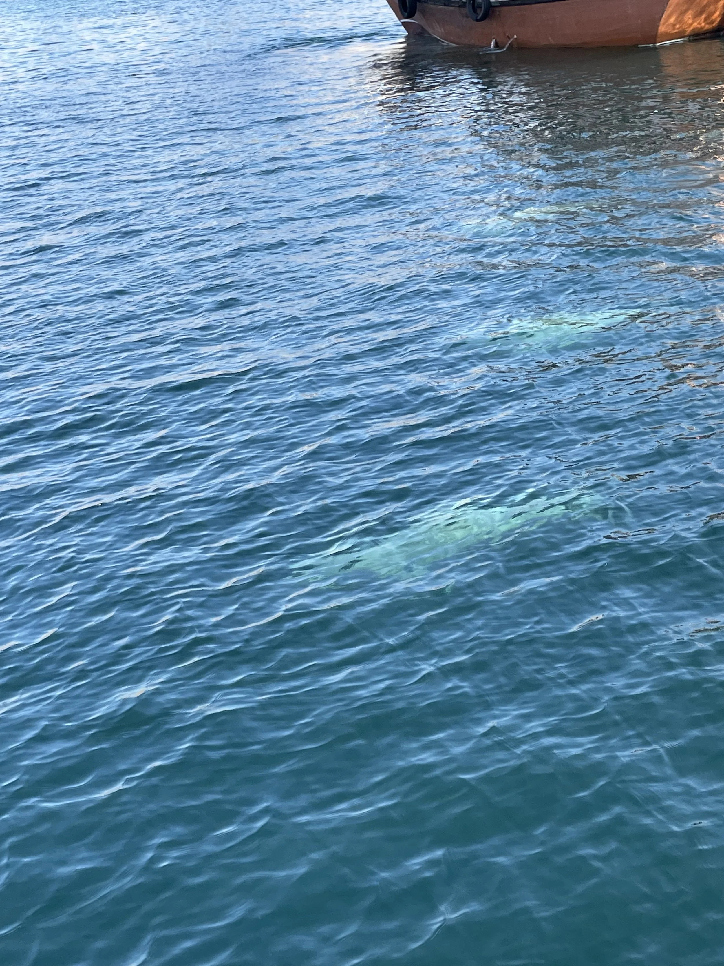
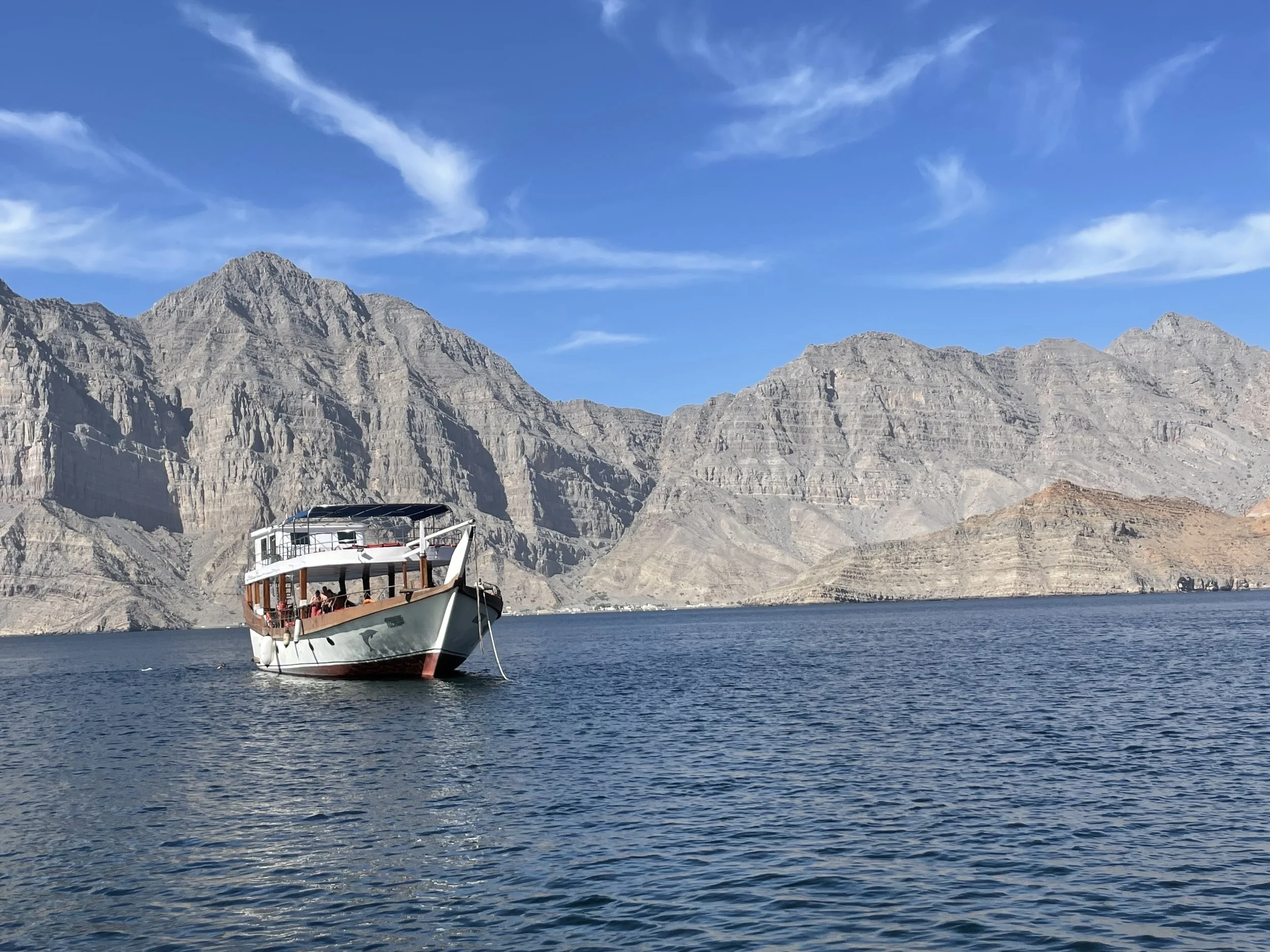
Here are some more pictures of the secluded, mineral world that is the Musandam Peninsula.
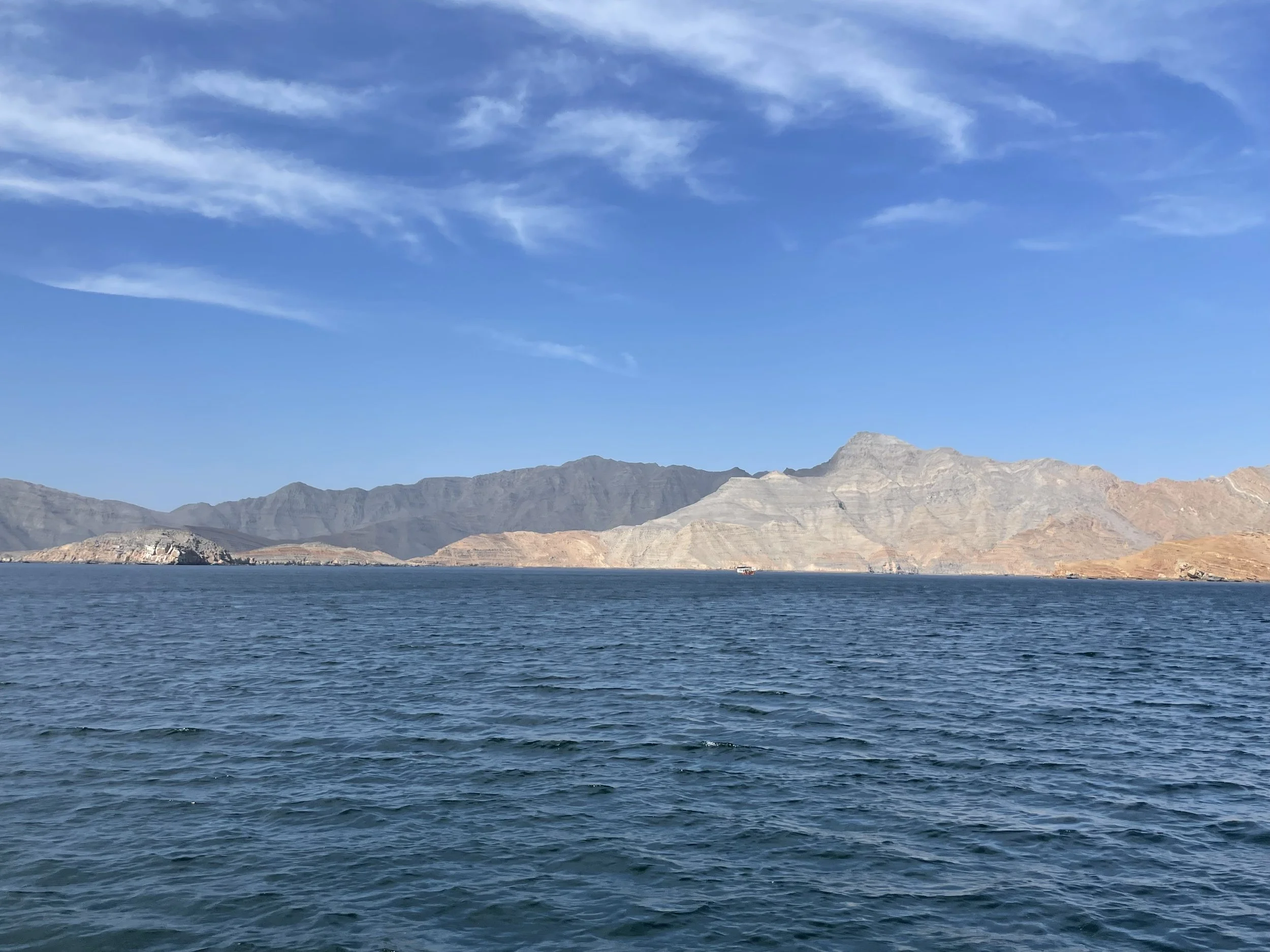
This is a really rugged area, with some peaks towering nearly 800 meters directly over the water!
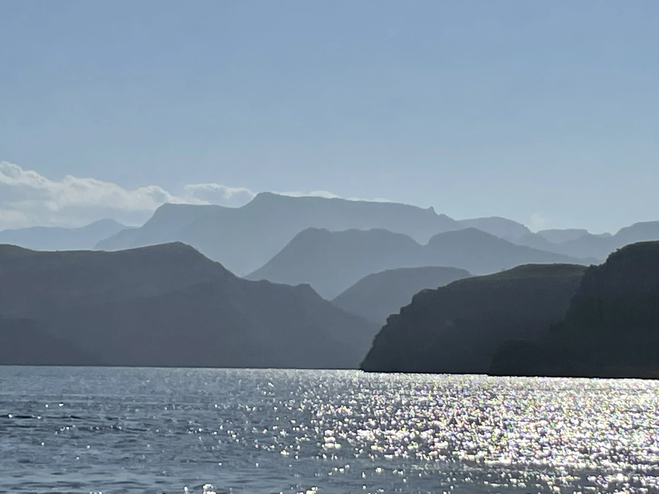
So, after returning to port, we just left Musandam for the UAE again, but you may want to consider staying for one or two more days to get more rest or simply to explore a bit more of the Musandam Governorate.
You can take the world’s longest zipline (1,800 metres), which has one of its ends right next to the Atana Khasab Hotel, or you can try to explore a bit of the interior of the exclave, which has some really high mountains reaching above 2,000 meters, although I don’t know how accessible those tracks are.
In any case, a day sailing through the waters of the Musandam Peninsula is an amazing, unforgettable experience and one I would recommend to anyone visiting this part of the world!
Further reading
If you are traveling in the area of planning to, you may want to check also my posts about:
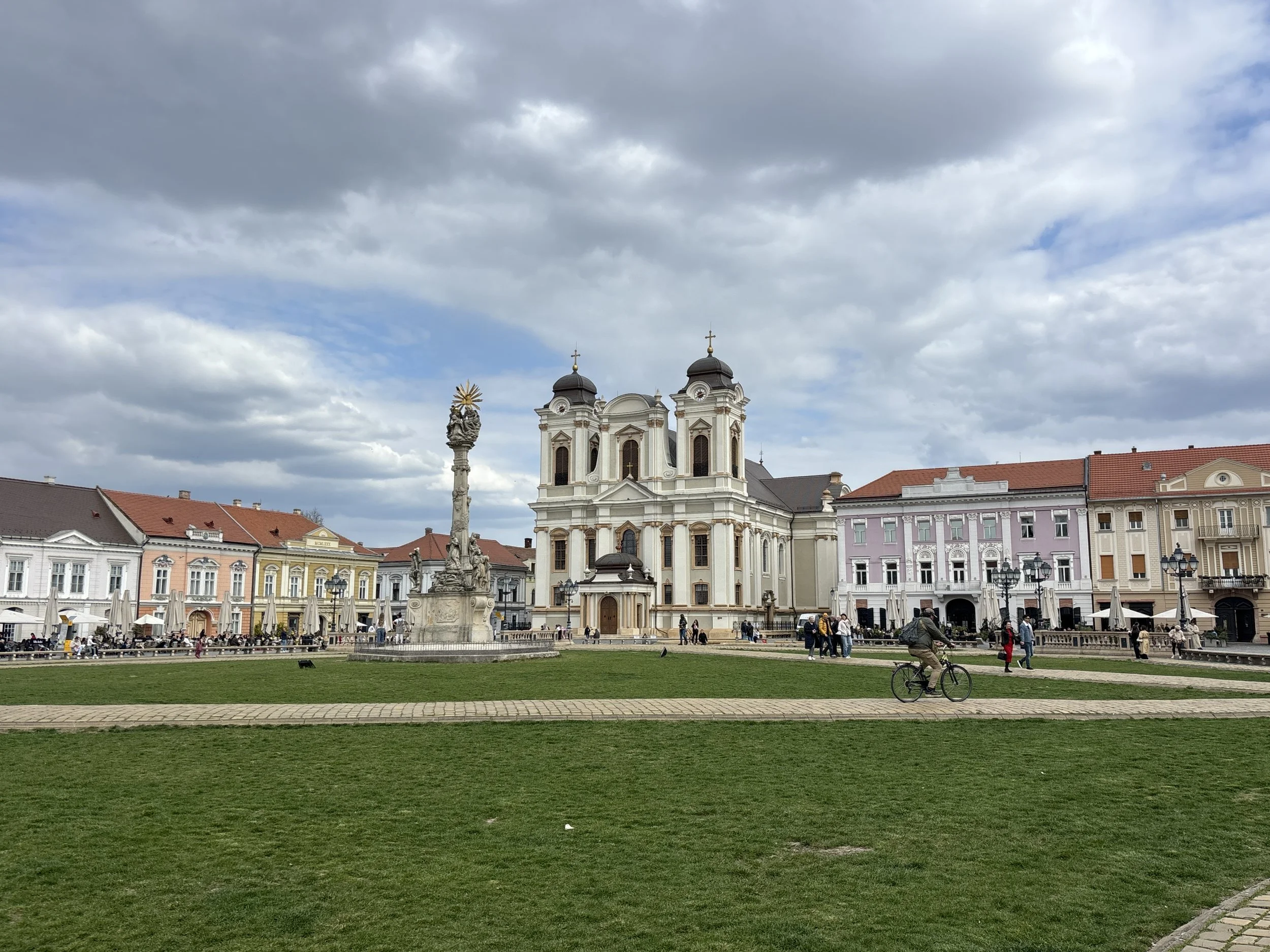
Two days in Timisoara: what to do and what to see
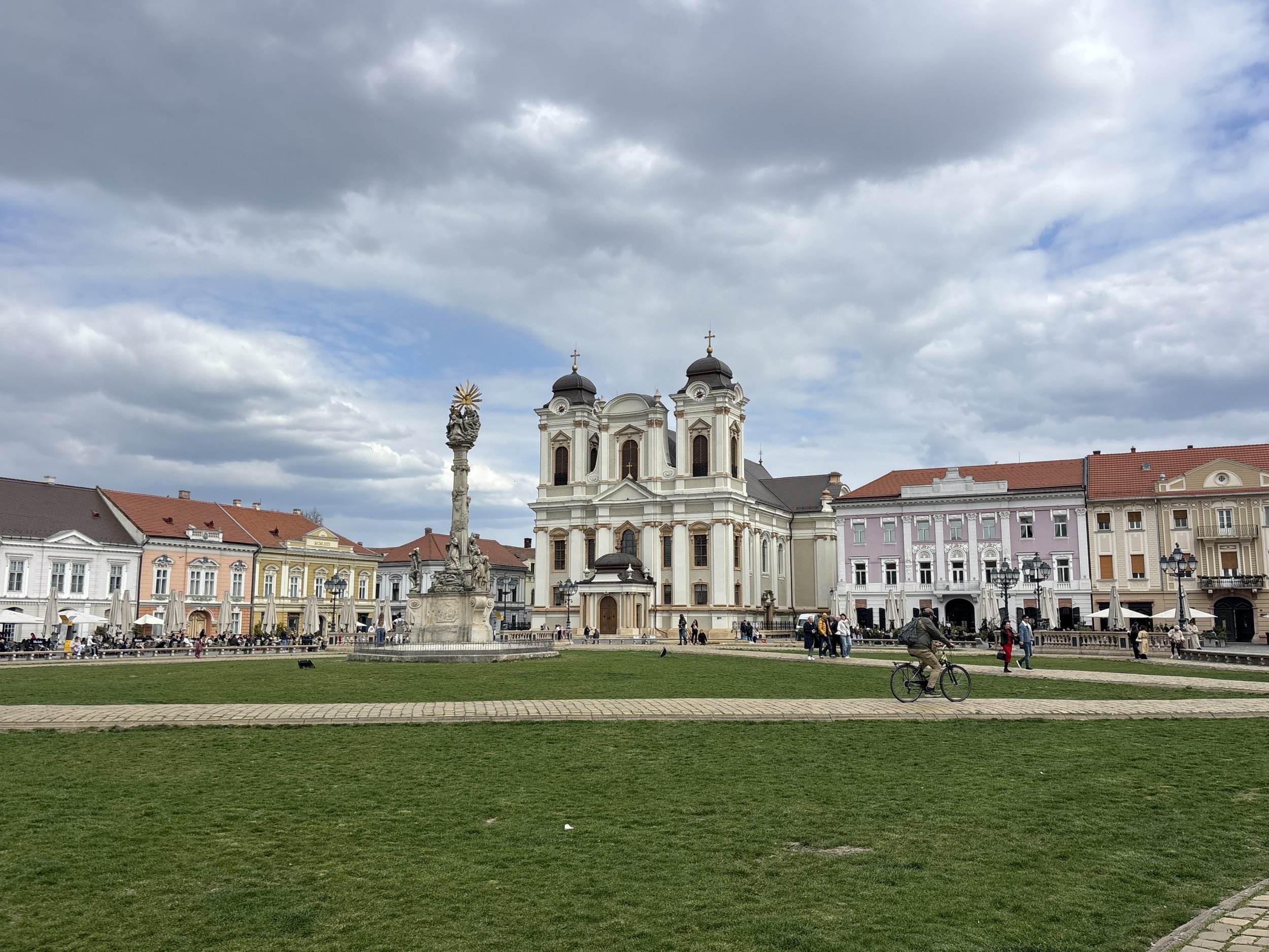
Timisoara is the capital of the Banat, a historical region of Western Romania with a rather rich and interesting history.
Perhaps no other factor has contributed more to shaping the city than its location atop one of Europe’s civilizational fault lines.
The Ottomans conquered the city in 1522 and ruled it for nearly two centuries. During that time, Timisoara was one of the westernmost cities of their Empire. In 1716, the tables turned and it was the Austrians that took the city, transformed it from the ground up and made it one of their easternmost fortresses.
Later came the modern state of Romania and, of course, the Communist period under Ceaucescu, in the downfall of which Timisoara was to play a star role.
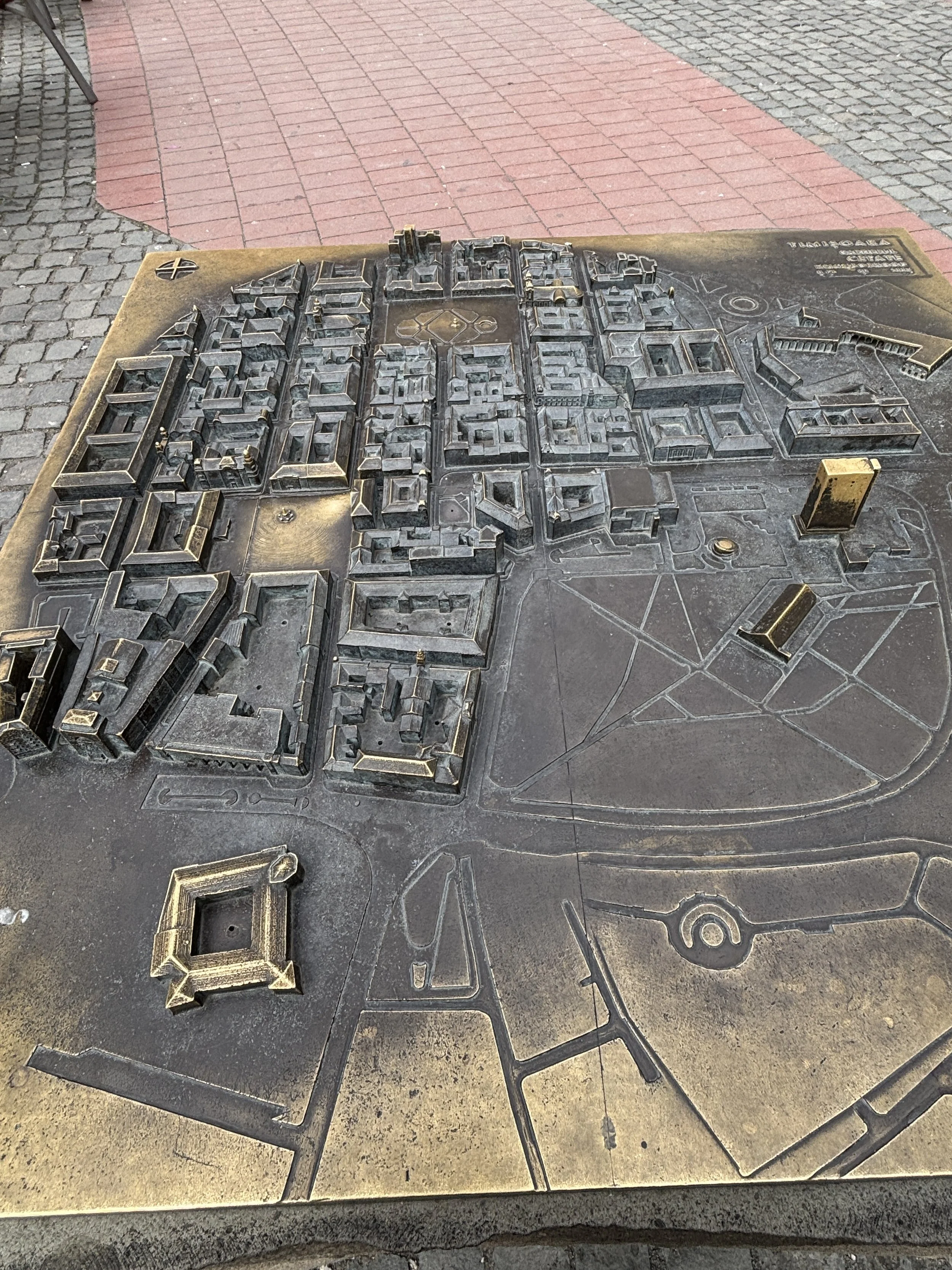
The city that most visitors see today, though, is the product of the Habsburg era. When the Austrians, led by the famous military commander Eugene de Savoy, took over the city, they soon started an ambitious program of engineering works.
In fact, to call it a “transformation” would be an understatement, because the Habsburgs basically built a new city over the foundations of the Ottoman-era one. The marshes around the old city were drained and a new urban grid was overlaid on the existing one, making way for the broad avenues and squares and Baroque buildings that make Timisoara such an architectural gem today. The city was also enclosed by star-shaped fortified enceinte containing multiple bastions.
Like many other cities in this part of Europe, Timisoara became also a cultural melting pot, with a population that, in addition to Romanians, has historically included also substantial numbers of Hungarians, Germans, Serbians and Jews. This shows in the fact that there are no less than three different cathedrals (Romanian and Serbian Orthodox and Catholic) in the historical centre of Timisoara, as well as a synagogue.
In this post I list the main points of interest in the old town plus some other things to do if visiting Timisoara, mostly connected with the role that the city played in the start of the Romanian Revolution of 1989, which ended up with the downfall of Ceaucescu’s regime and the democratization of Romania and its ultimate entry into the EU a few years later.
So what to see when visiting central Timisoara?
A walk through the Old town: from Piata Unirii to Piata Victoriei
Romanian Orthodox Cathedral
Banks of the Bega River
Maria-Theresa Bastion
Memorial of the Revolution
Museum of the Communist Consumer
This post may contain affiliate links. If you book or buy something through them, I earn a small commission, at no extra cost to you. It's one of the ways I keep Places of Charm going. Thank you for your support.
Top things to see in Timisoara’s historical centre
The historical centre of Timisoara is small, orderly and compact. It is structured along a number of large monumental squares linked by an orthogonal grid of cobblestone-paved pedestrian streets.
To be fair, the area of historical interest is not large and you can see most of it in a morning even if walking at a leisurely pace. If you allocate some time as well to visit the museums and enjoying the many cafés and restaurants in town, the two days that we I used as a reference to build this itinerary turn out to be quite optimal.
Piata Libertatii
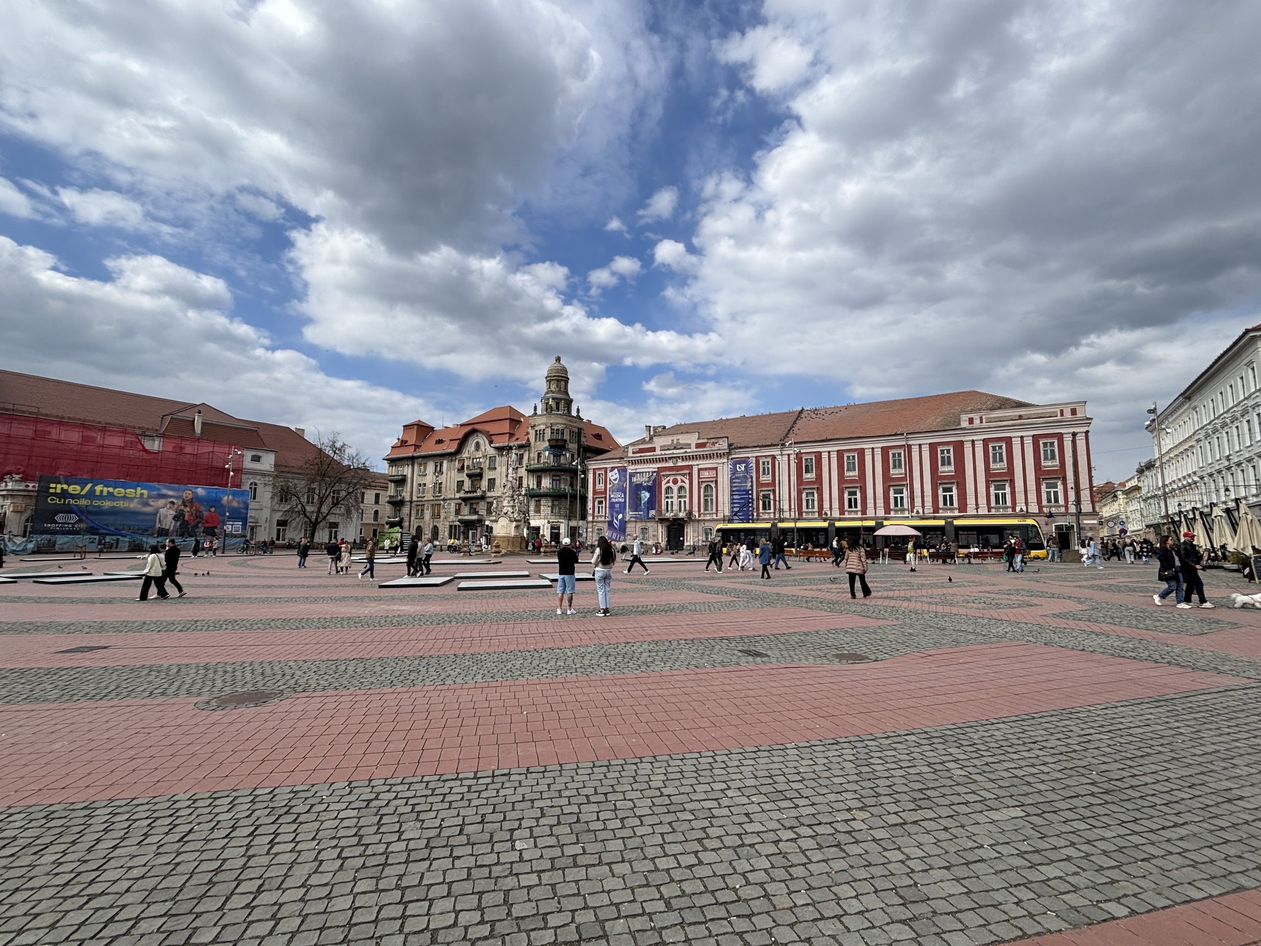
This is one of the main squares in Timisoara. Piata Libertatii (“Freedom Square”) and, while it lacks the grand splendour of the nearby Piata Unirii (there are in fact, several buildings that are undergoing renovation), it is a lively square and a major crossroads where there is always movement of people.
It is also at one end of the Vasile Alecsandri avenue (depicted below right) the main commercial axis in the old town of Timisoara.
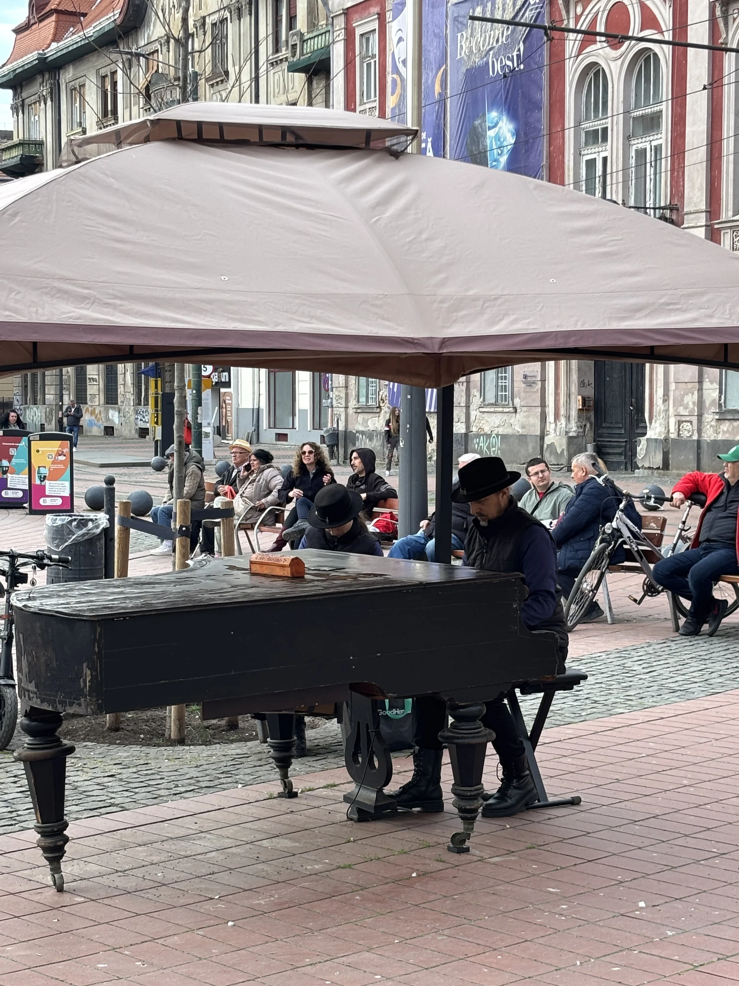
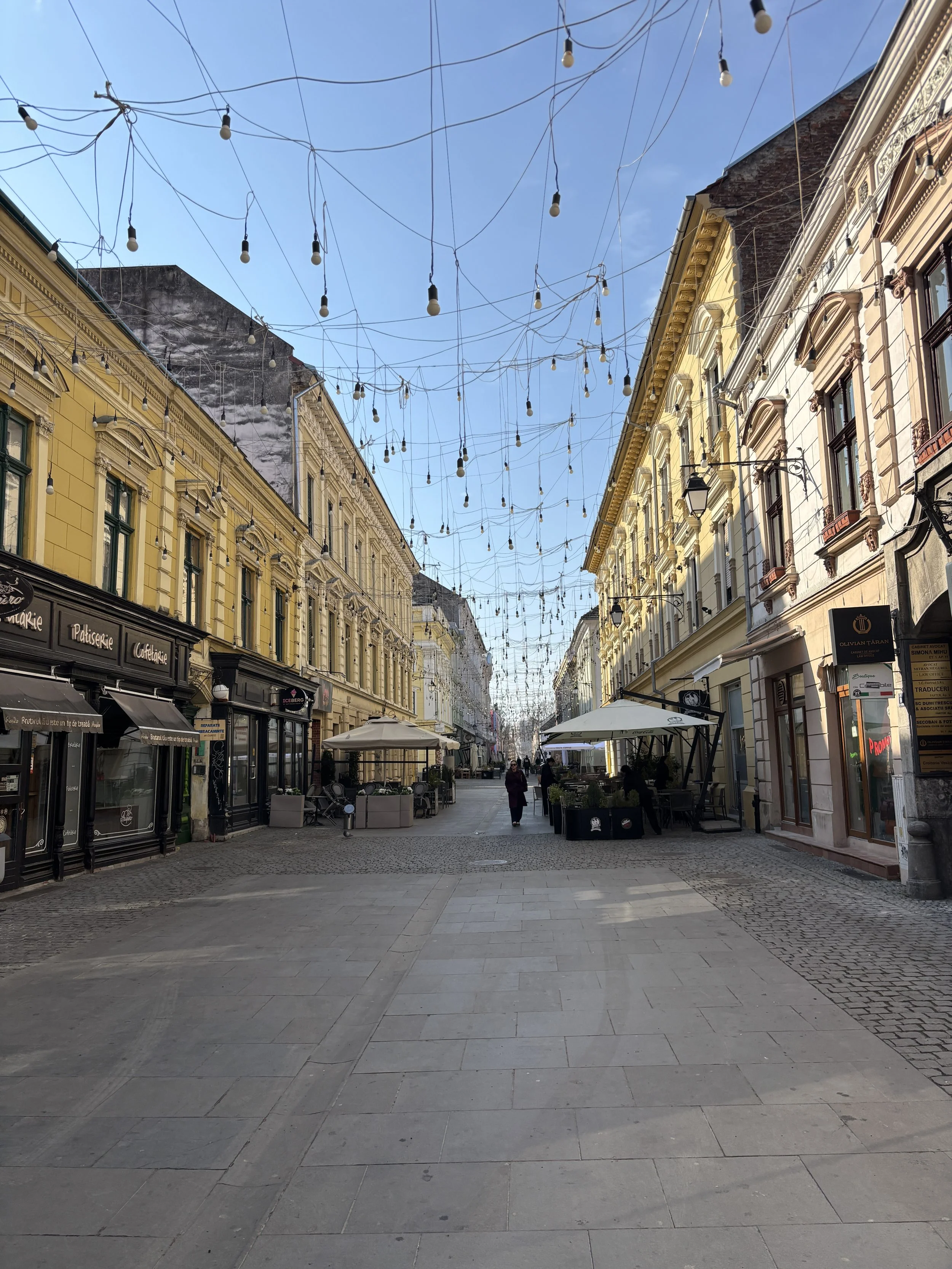
Piata Unirii
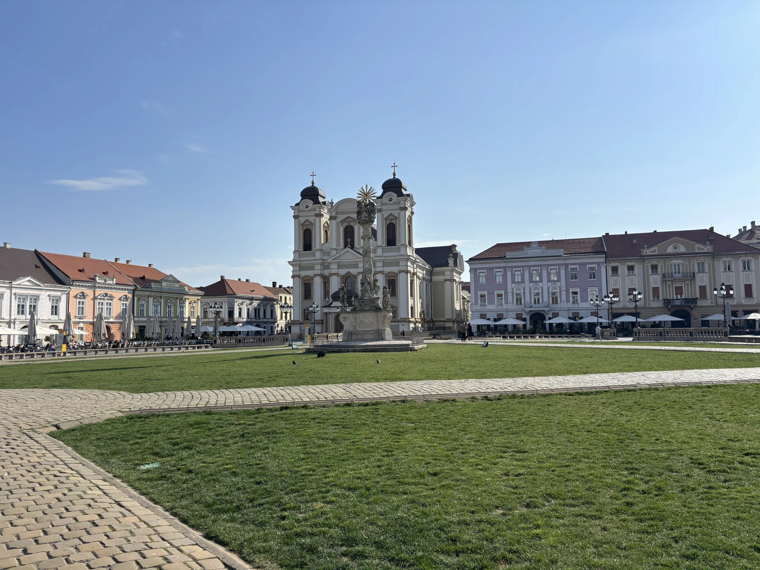
Piata Unirii (“Union Square”) is the main landmark in Timisoara’s old town: a large, open square which, in addition to the Austrian-built Catholic cathedral, contains also the city’s art museum as well as several beautiful and colourful historical buildings which line all its sides.
When the sun shines it offers an absolutely glorious panorama.
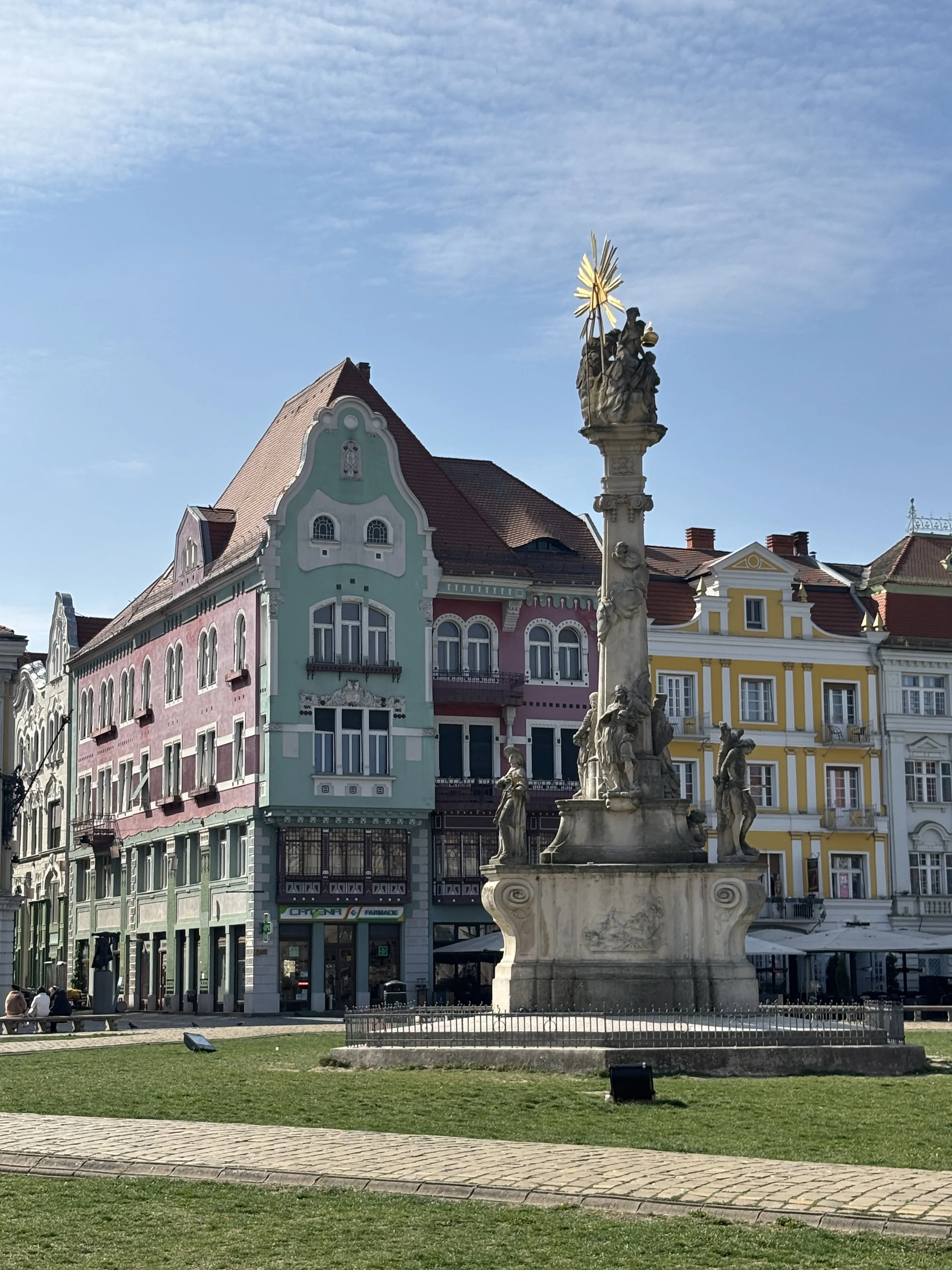
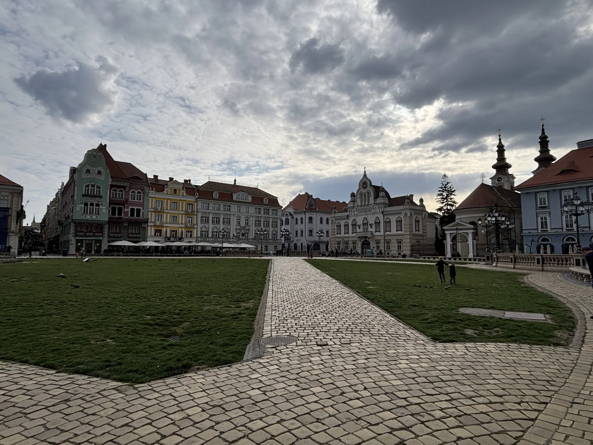
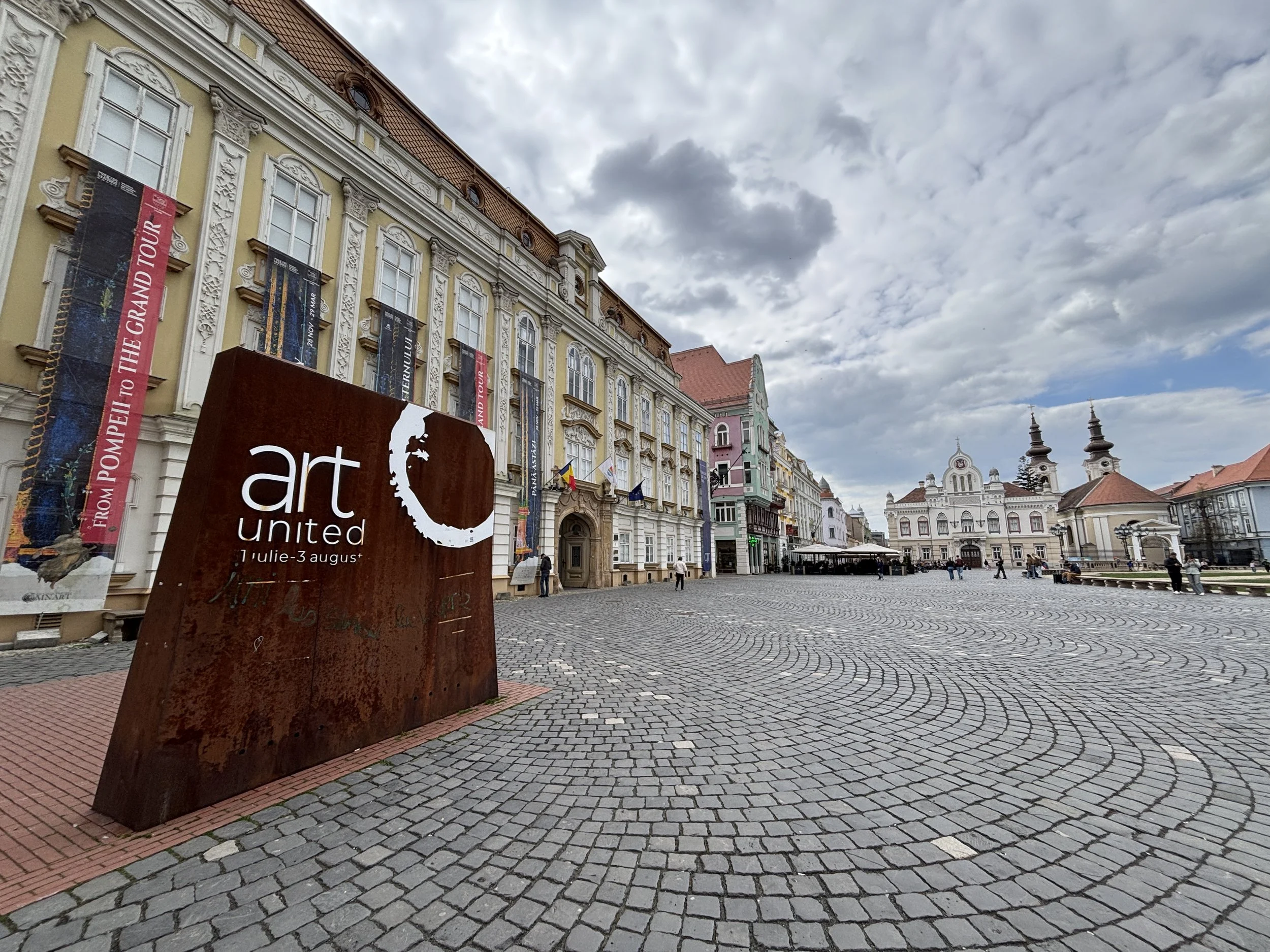
When walking through the city you can see that the historical centre has been painstakingly restored and, indeed, some buildings (including the one I stayed in, more on this further below in this post) are still undergoing a thorough renovation.
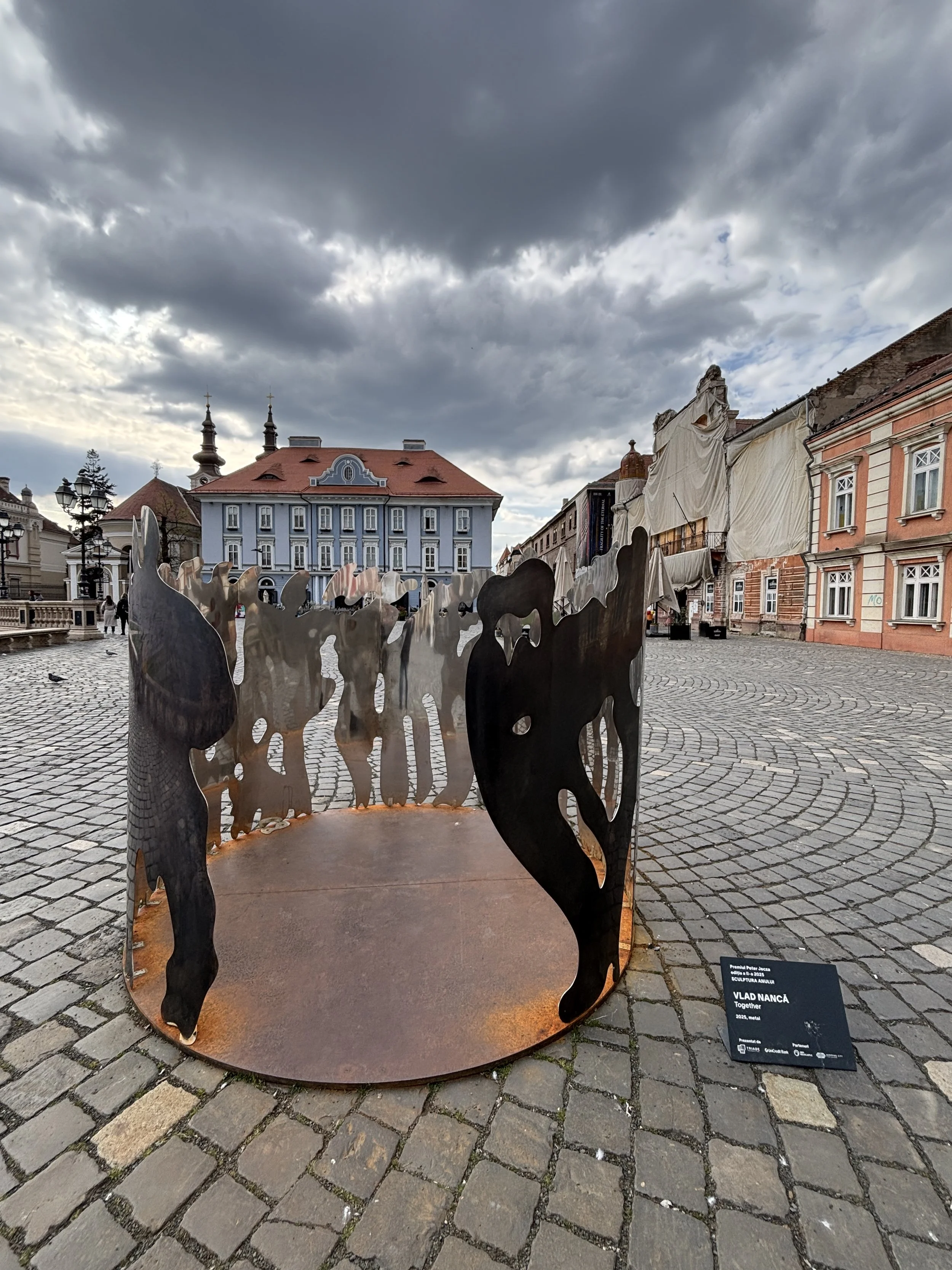
The public space has also been fitted with quite a few pieces of urban art and contemporary sculptures, as well as informational panels in both Romanian and English. There is also a QR code you can scan to get more in-depth info on your mobile phone, although, sadly there was some technical glitch that prevented the page from opening when I tried it on mine.
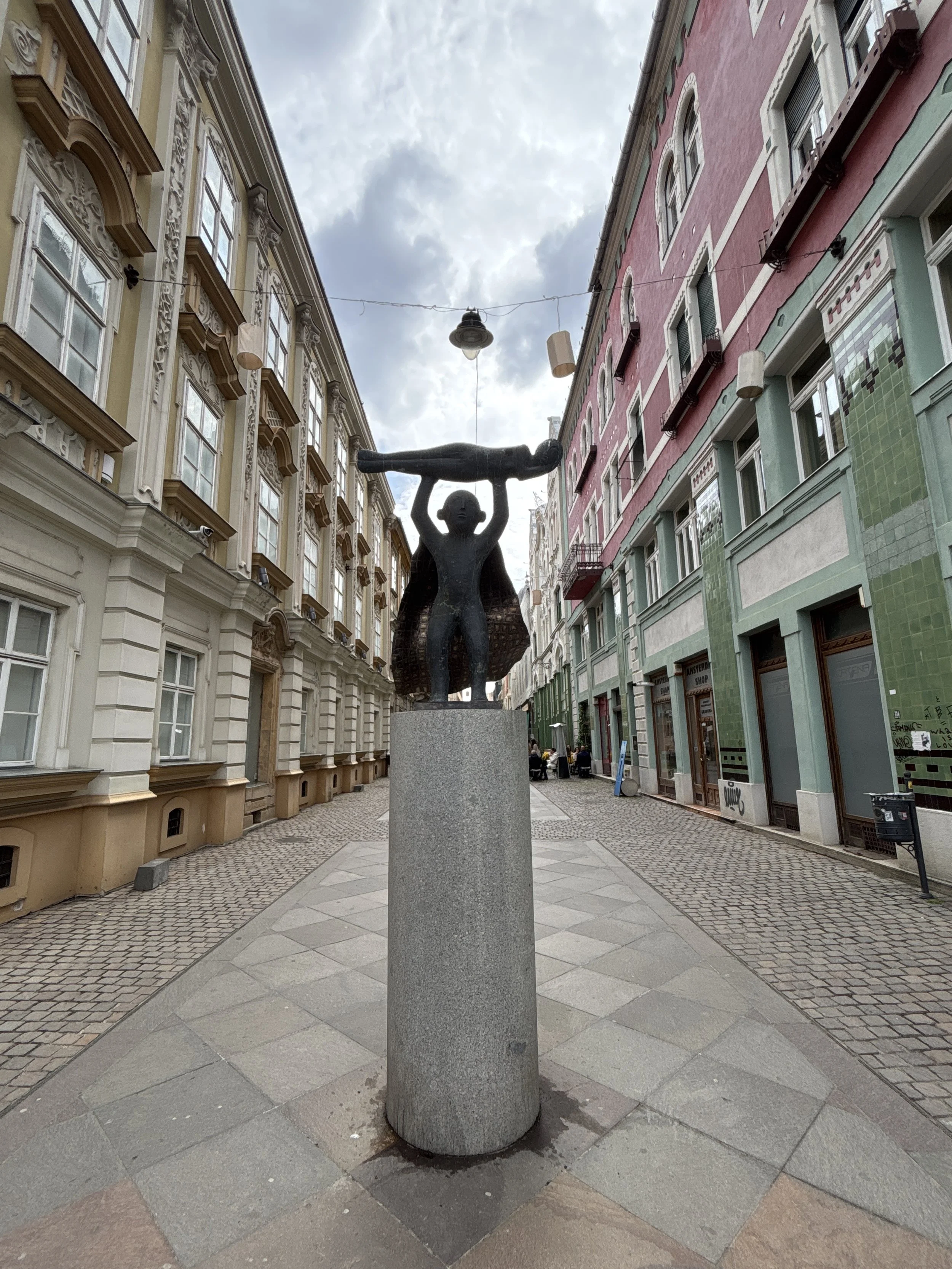
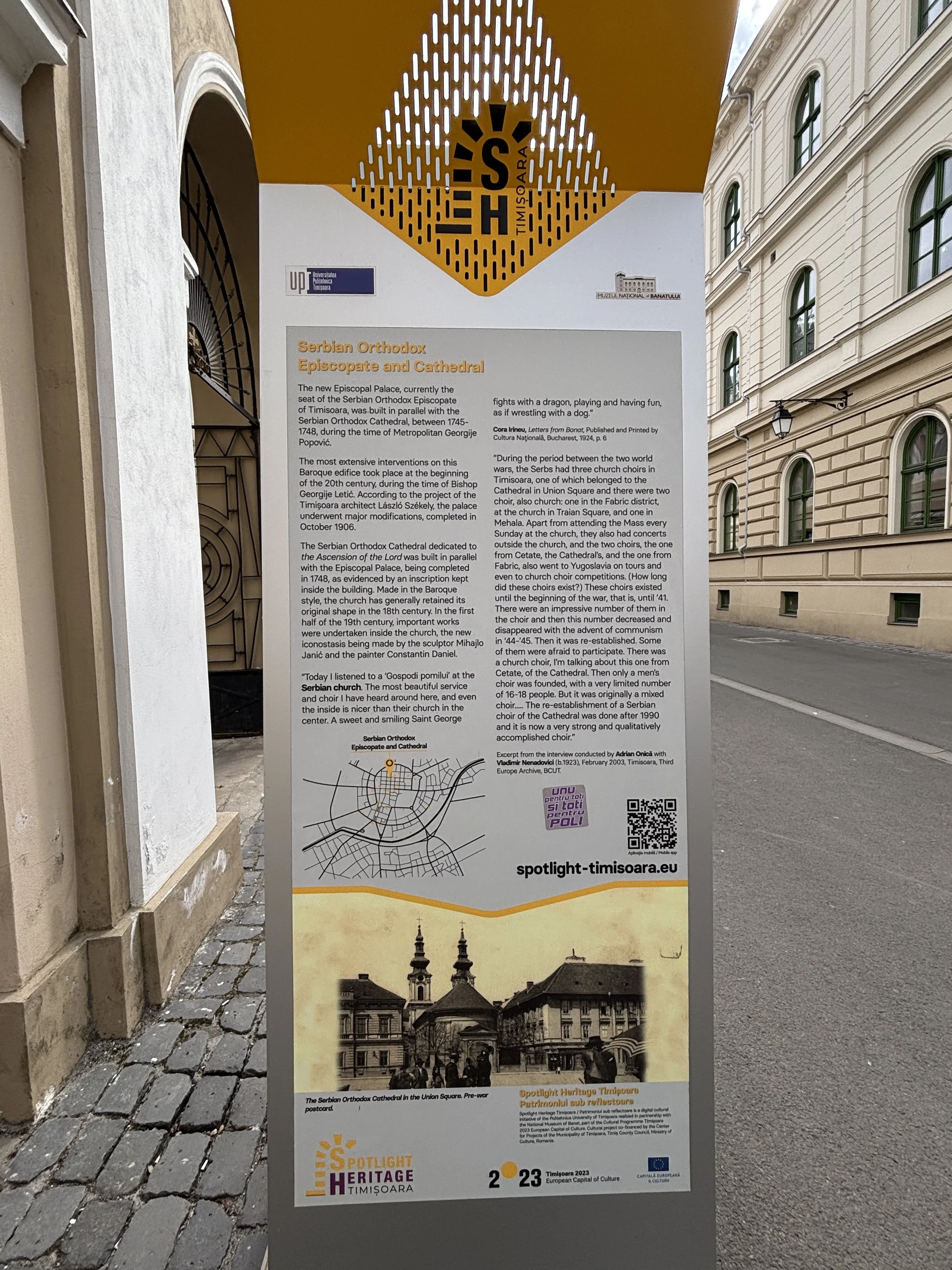
Timisoara seems to be a city well aware of its past, and it is also possible to find quite a few plates and signs marking important historical spots, whether its Romanian statesman Ioan Cuza or Eugene of Savoy, or the emplacements of buildings that are long gone, like the Ottoman hammam (roughly where present day Piata Libertatii now stands).
Another piece of relatively well preserved (and now restored) historical Timisoara is the Maria-Theresa Bastion, which was part of the Austrian fortifications, and is just a couple of minutes on foot from Piata Unirii. This is now the home of the National Museum of the Banat, but it was closed at the time of my visit.
Piata Victoriei and around
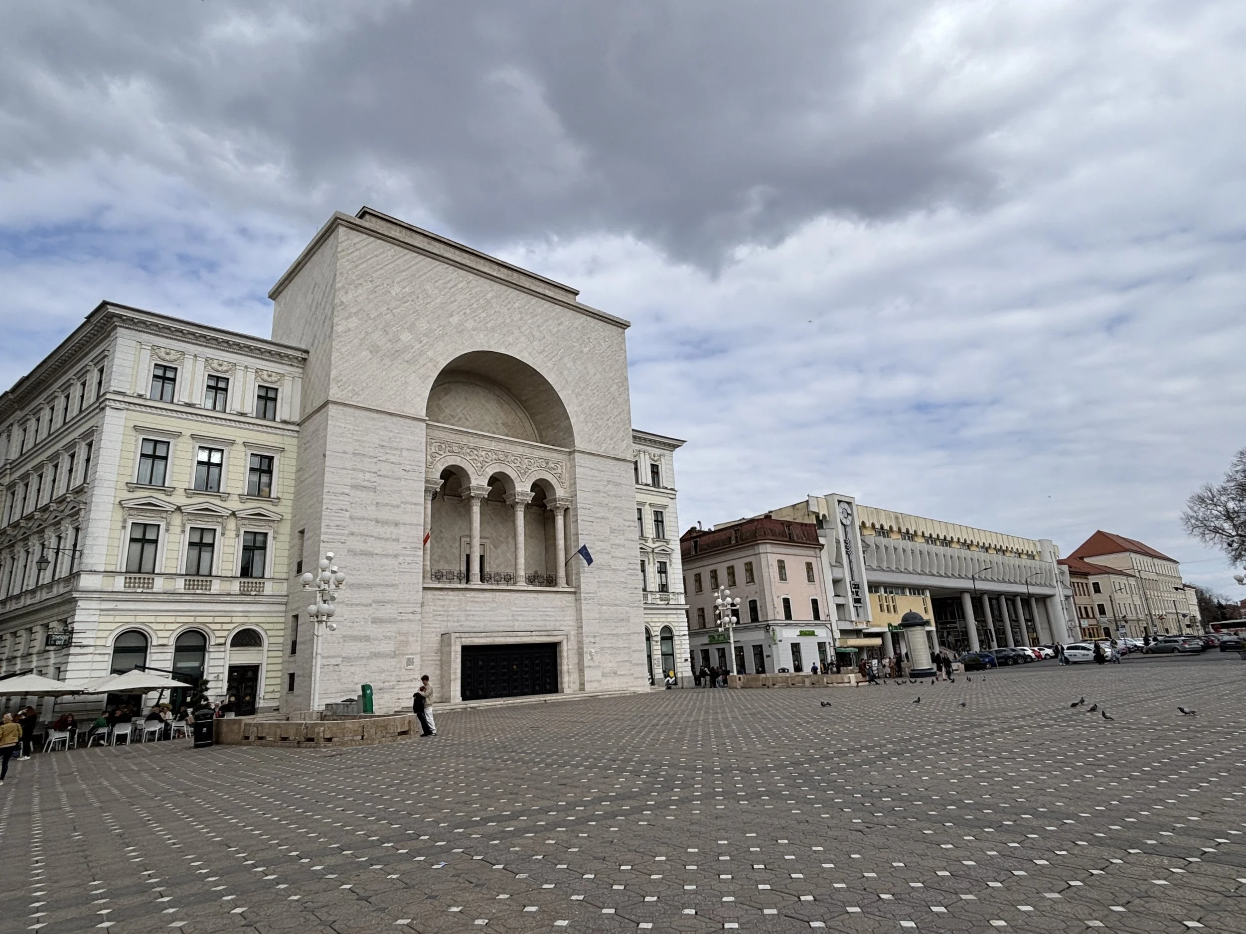
Piata Victoriei (“Victory Square”) is the third major square that gives shape and character to downtown Timisoara. Unlike the other two, this one has a more modern flair.
In fact, it is more than a square, because it transitions into an elongated gardened boulevard that ends in front of the Orthodox Metropolitan Cathedral.
At the opposite end of the boluevard from the cathedral is the National Opera House, a very distinctive building the façade of which is adorned by a large arch and a colonnade.
Piata Victoriei was a major scenario of the 1989 Romanian Revolution, with the balcony of the National Opera House acting as an impromptu gathering place for the revolutionaries. In fact, the imprint of those days is kept well alive to this day.
In addition to the musem and memorials that remembers that moment (more on this further below), it is possible to find reminders of those epic moments throughout the city, like the grafitti alluding to the 35th anniversary of those events, to the entire text of the “Proclamation of Timisoara” being proudly exhibited in Piata Victoriei.

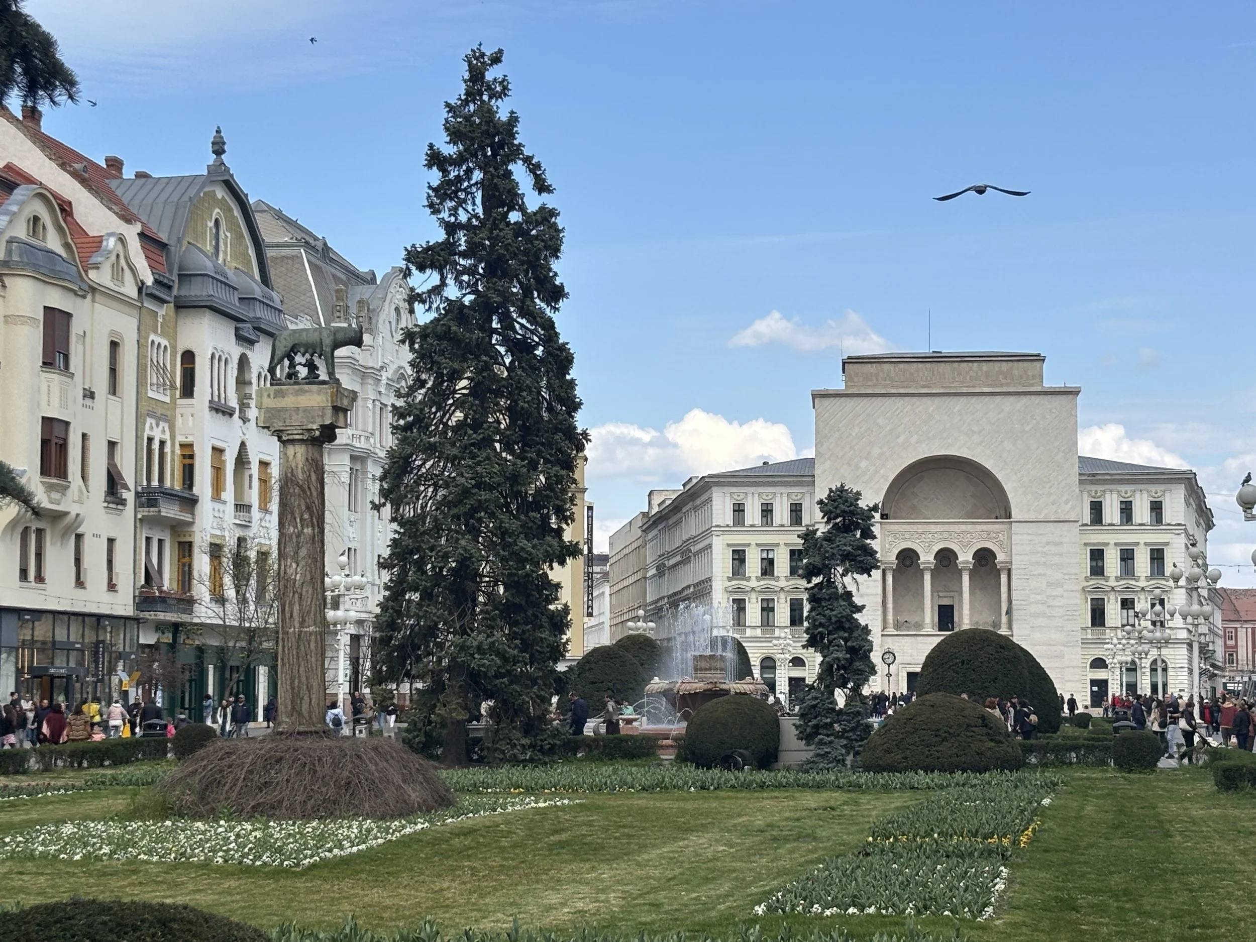
As in Cluj-Napoca, the she-wolf statue acts as a reminder of Romania’s links to Ancient Rome
The Romanian Orthodox Metropolitan Cathedral of Timisoara is another landmark of interest in this part of the city, with a very distinctive architectural style which mixes Byzantine and local influences.
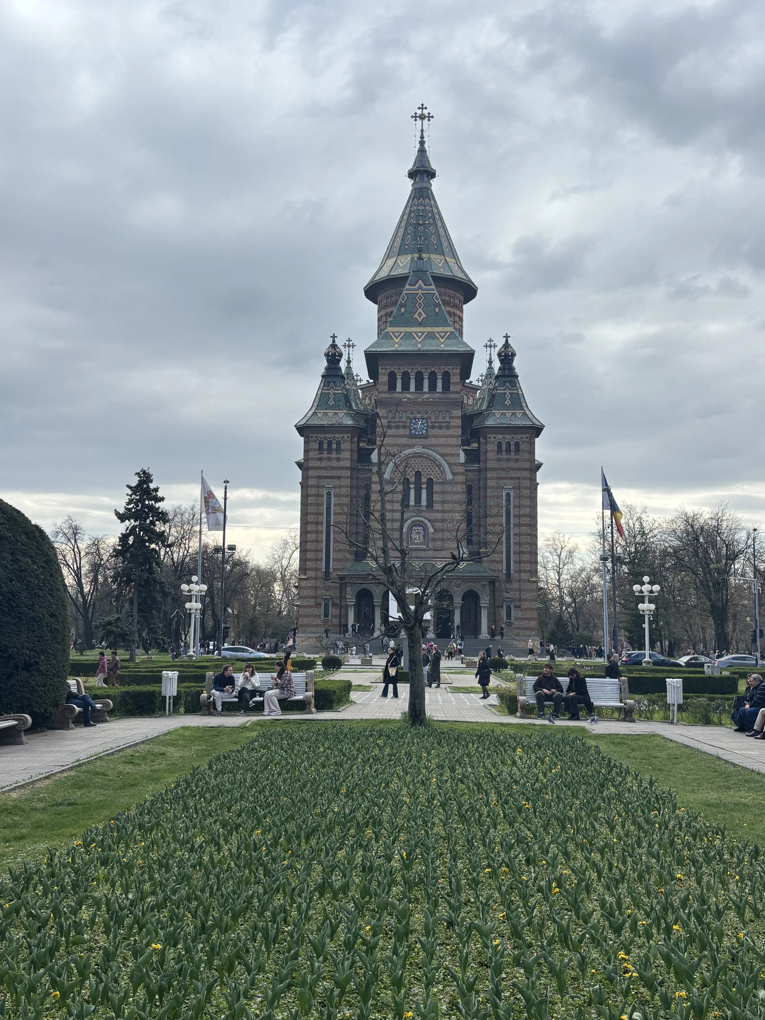
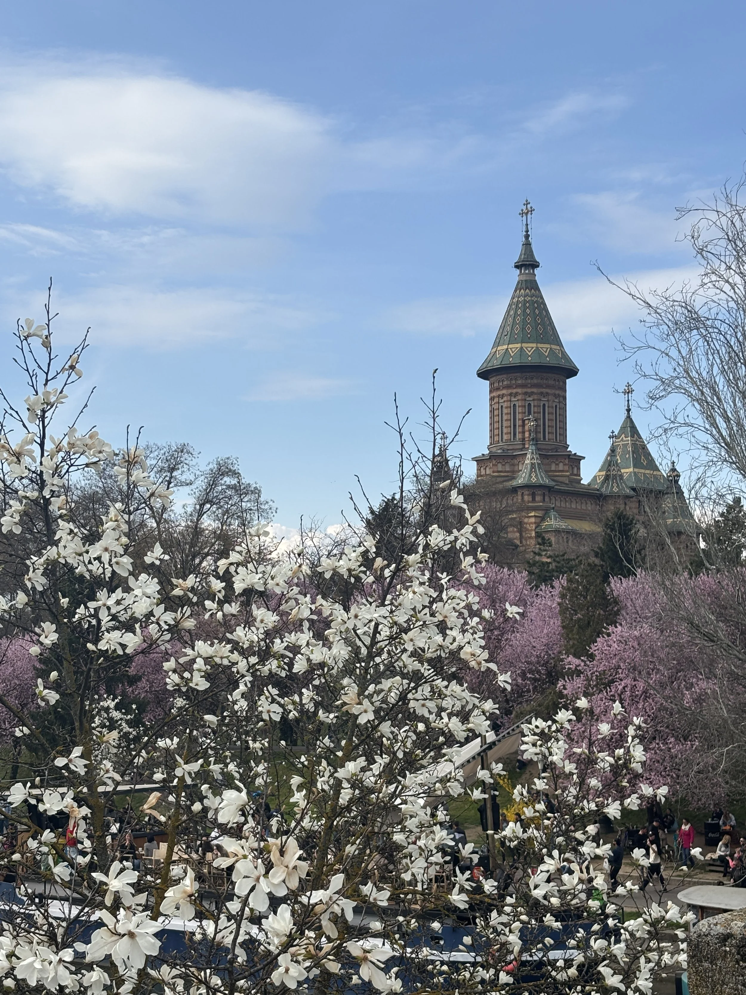
The cathedral stands at the edge of the historical town. Right next to it starts a series of gardens which run all along the banks of the Bega river and act as a nexus with the modern part of the town.
These ring of parks cover the area where the city’s outer defensive bastions used to stand. If the weather is nice, you can expect them to be packed with families strolling around or with young people having parties in the terraces and boat-restaurants.
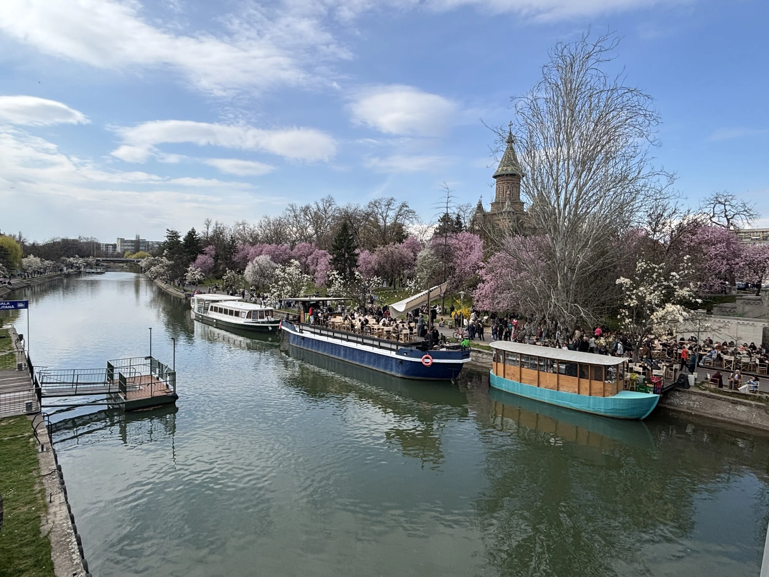
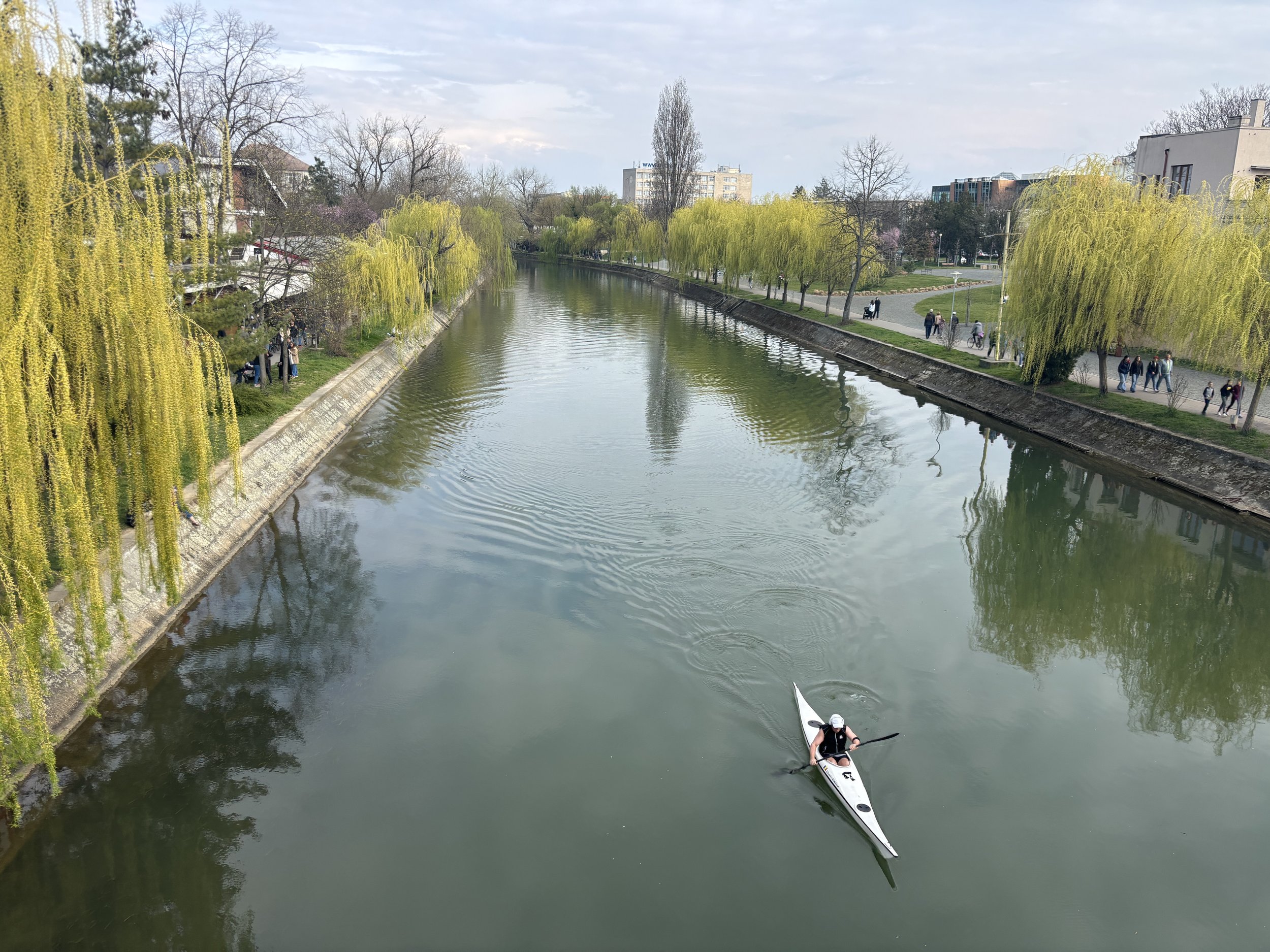
While most of Timisoara’s modern parts are rather unremarkable from the point of view of architecture (several decades of Communist dictatorship left its urban mark), the area immediately to the south of the Bega river has some avenues that are not without interest.
Here you can see how in the early years of the 20th C. Timisoara was a growing city that expanded well beyond its original kernel.
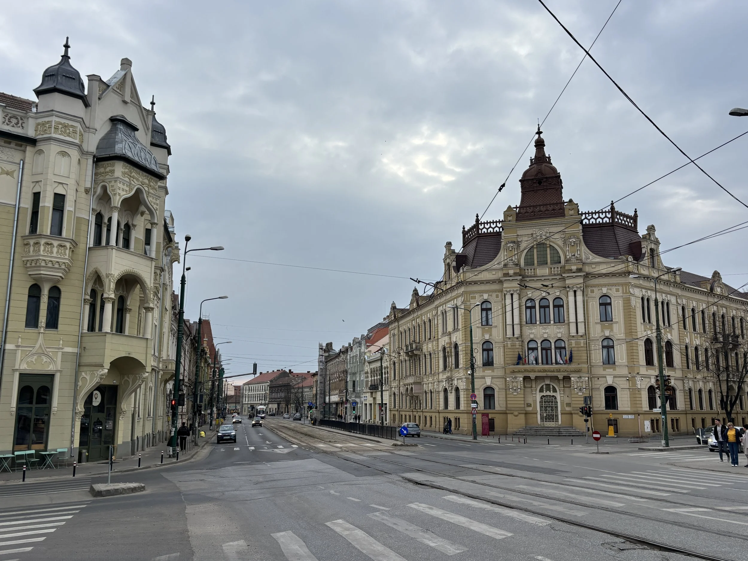
Timisoara must have been a really thriving city in the late 19th and early 20th C. as shown by the fact that it was one of the first in Europe to introduce a number of public services that were truly pioneering at the time.
It was one of the first cities in Europe to have a horse-drawn tram network in 1867 (their electrically-powered successors still plod its streets, as you can see in the picture below) and the very first city to introduce electric street lamps in 1884!
The post-war Communist regime also tried to introduce its own version of “modernity” but with far less pleasing aesthetical results. Fortunately the historical perimeter of Timisoara was relatively untouched by this branch of “architecture”.
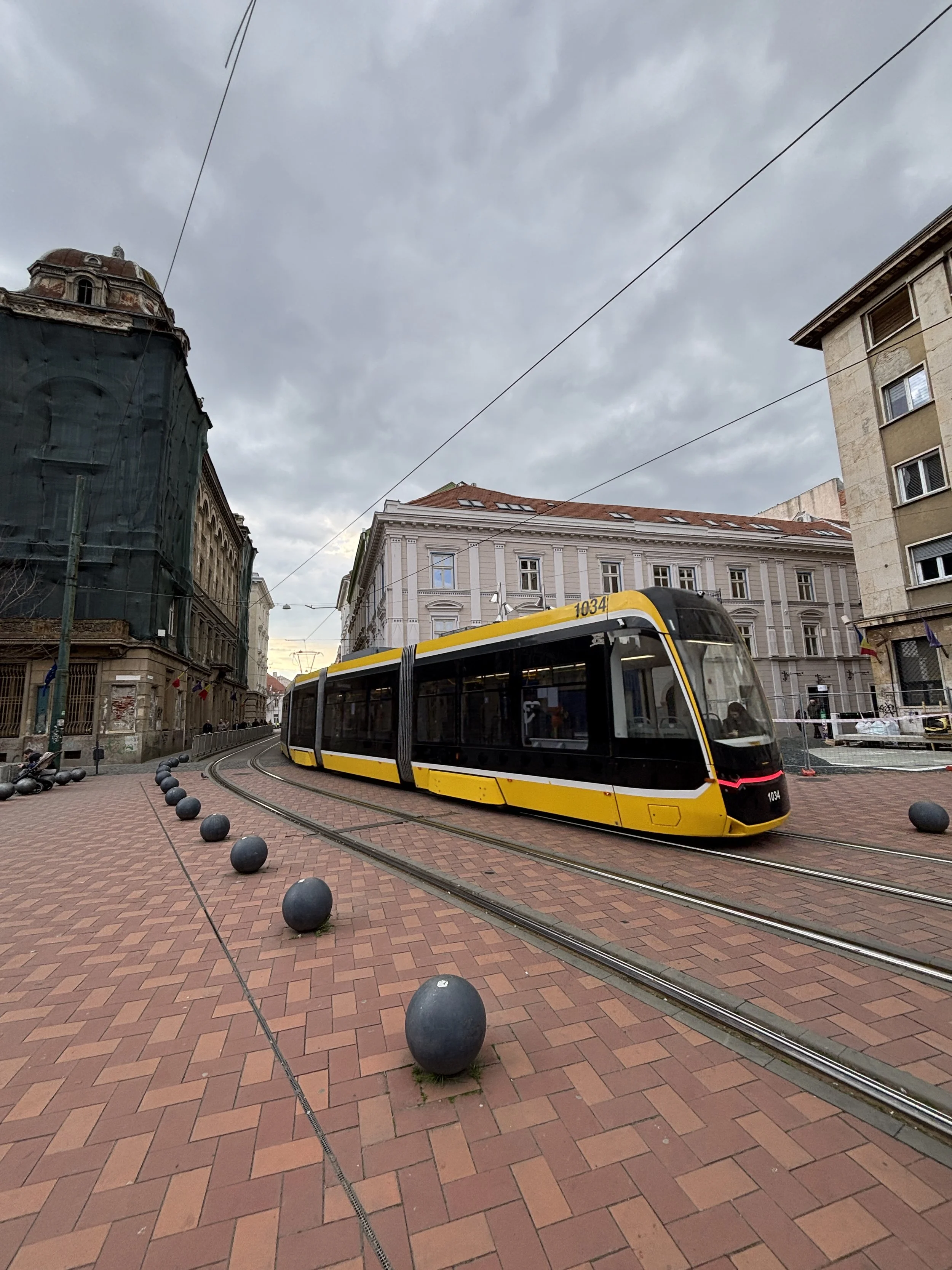
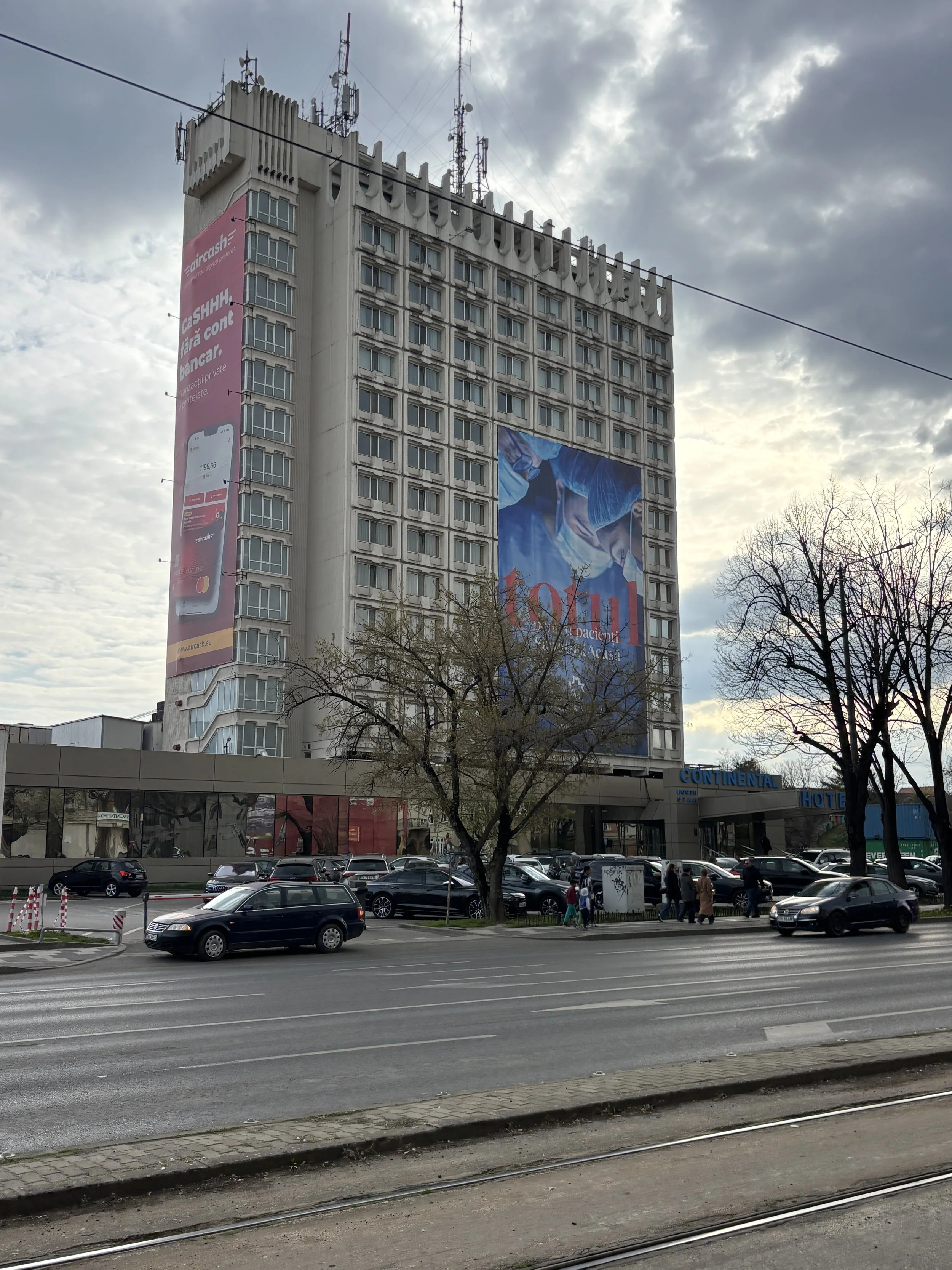
The Revolution Memorial
This is a must-visit in Timisoara, and a nice way to get a peek into the history of the city during the Cold War years, when Romania was under the totalitarian rule of Communist dictator Nicolae Ceaucescu.
The museum is, I think, run by non-profit, and the facilities are somehow basic (if quite centrally located just north of Piata Unirii) but it does a good job of conveying what life was like at that time and the sequence of events which, starting in Timisoara, led to the downfall of Ceaucescu’s regime in December 1989.
The Romanian flag with the Communist coat of arms cut off from its middle became the emblem of the 1989 Revolution. Unlike in other countries of the Eastern Bloc, the ousting of the Communist regime was a rather bloody affair, first due to government repression and later on due to the ensuing chaos.
This is a historical episode, by the way, which I covered also in my post about Bucharest, where some of the key developments of this story took place. Timisoara, however, is where everything started and today the city takes just pride in this fact!
Museum of Communist Consumers
If you didn’t have enough of Cold War Romania during the visit to the Memorial of the Revolution, you can also take a stroll to the Museum of Communist Consumers (“Muzeul Consumatorului Comunist“).
In fact, to call it a “museum” is a bit of a stretch, since it is essentially a bar which, in a rather ingenious marketing ploy, has transformed its basement into a makeshift repository filled with ordinary objects and memorabilia from the Communist period.
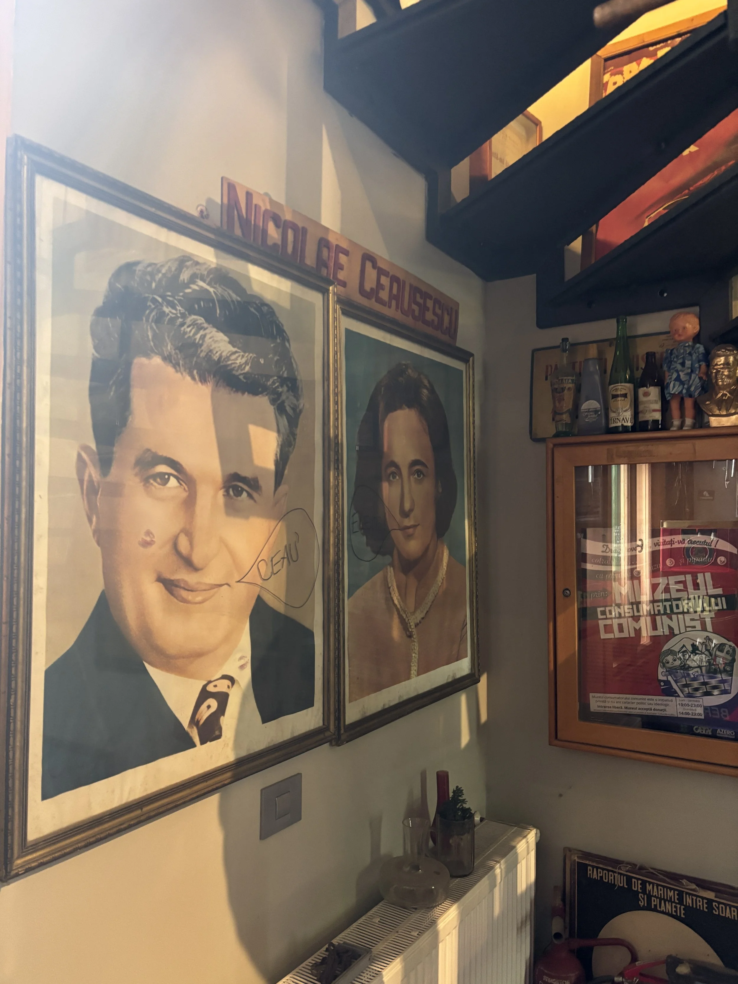
To be fair, there is not entrance fee, you just walk down the stairs and are free to roam the rooms (you may have to look for the electric switch as you walk into the next room, just as you would in a normal house). As mentioned, this is not an ordinary museum, so don’t expect any signage or audioguide.
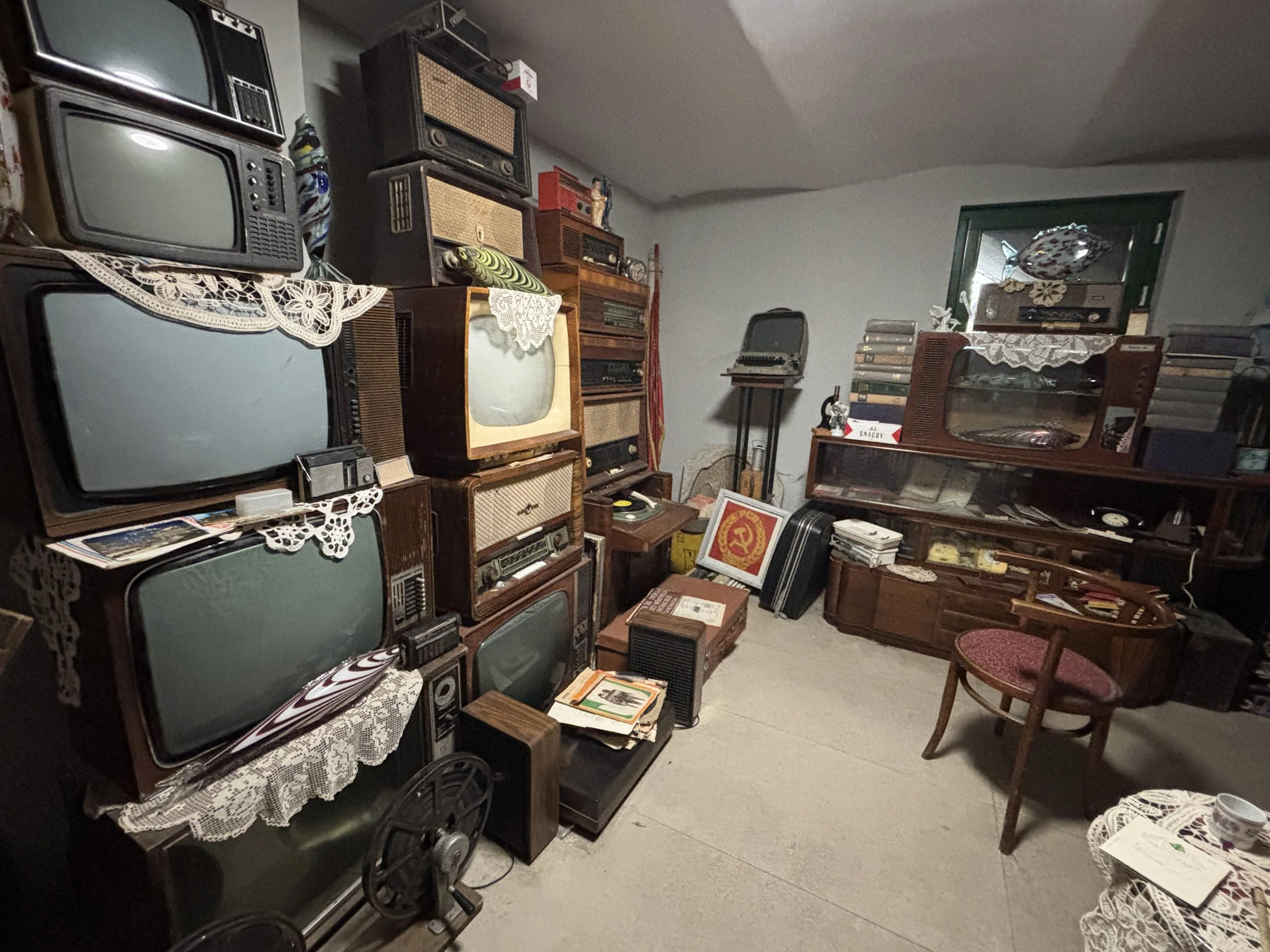
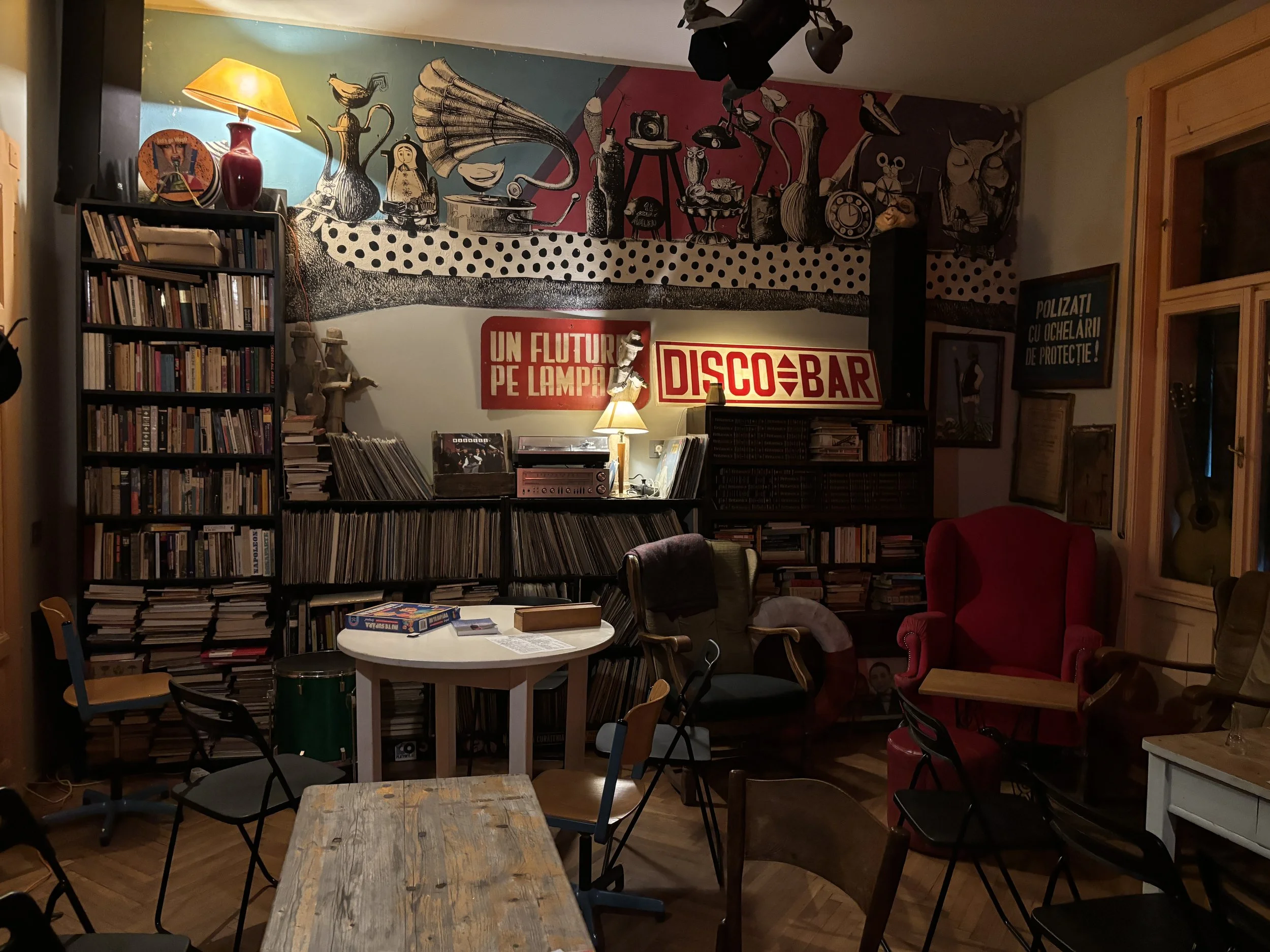
If you are interested in that era, it is not without interest, if only because of the very original way to present the “collections”. If you were born before the 90s some of the items in the collection may not look entirely unfamiliar either!
In any case, since the bar-museum is located some 15 minutes walk south of the Bega river, it is a nice excuse to get out of the old town, as well. It’s a nice walk if the weather is nice and the bar has a terrace where you can sit down to replenish energies before continuing the sightseeing.
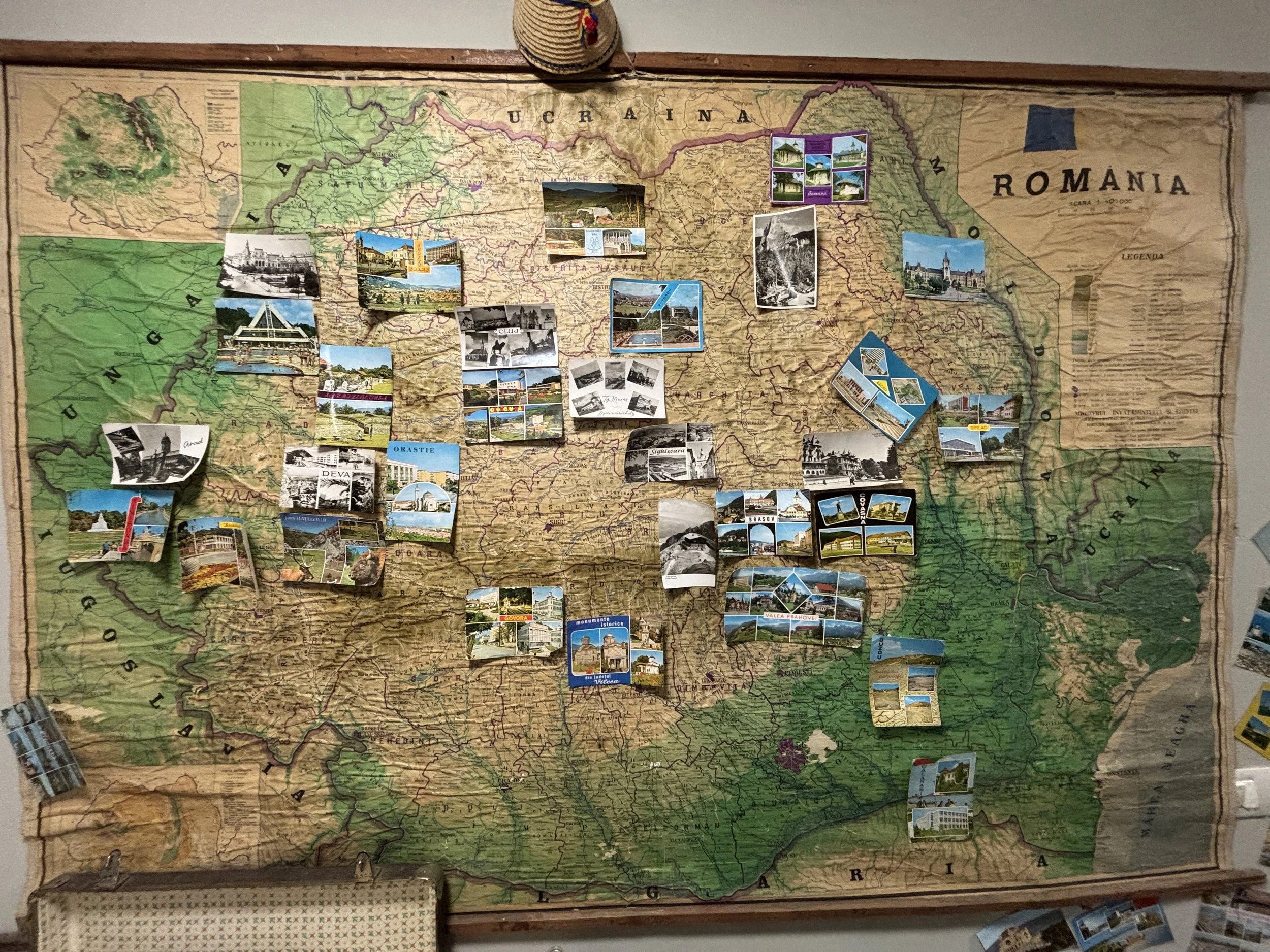
Where to eat in Timisoara
When arriving in Timisoara, one of my goals was to try some local Banat specialities and, I must say, that proved quite more challenging than I expected. There is no shortage of Italian and Asian restaurants and burger joints in Timisoara, but not really that many Banat or Romanian cuisine restaurants! In fact, I think I didn’t fully succeed at finding them, although I present here a couple of options which may be reasonably close and provide, I think, good value.
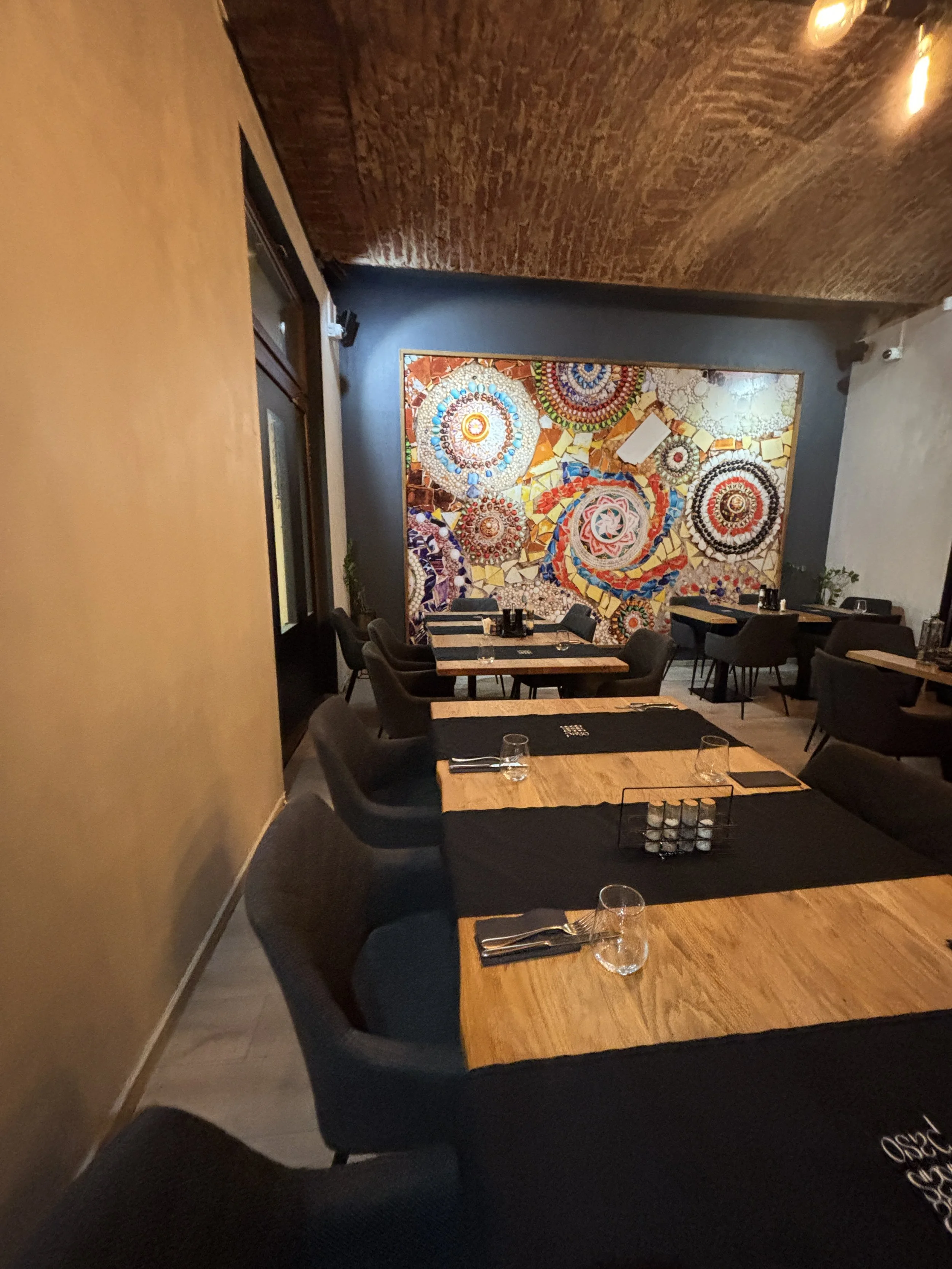
Paso Local Cuisine
Strada Eugeniu de Savoya 6B, Timișoara
https://www.pasorestaurant.com
This is a small restaurant located at the heart of the old town, providing good service and value for money in addition to a somehow lively atmosphere.
The speciality here are the meat dishes (although they do have some fish too) and, in particular, the roasted meat dishes that are so typical of the Balkans and southeastern Europe.
They only had one dessert choice, but it was pretty tasty.
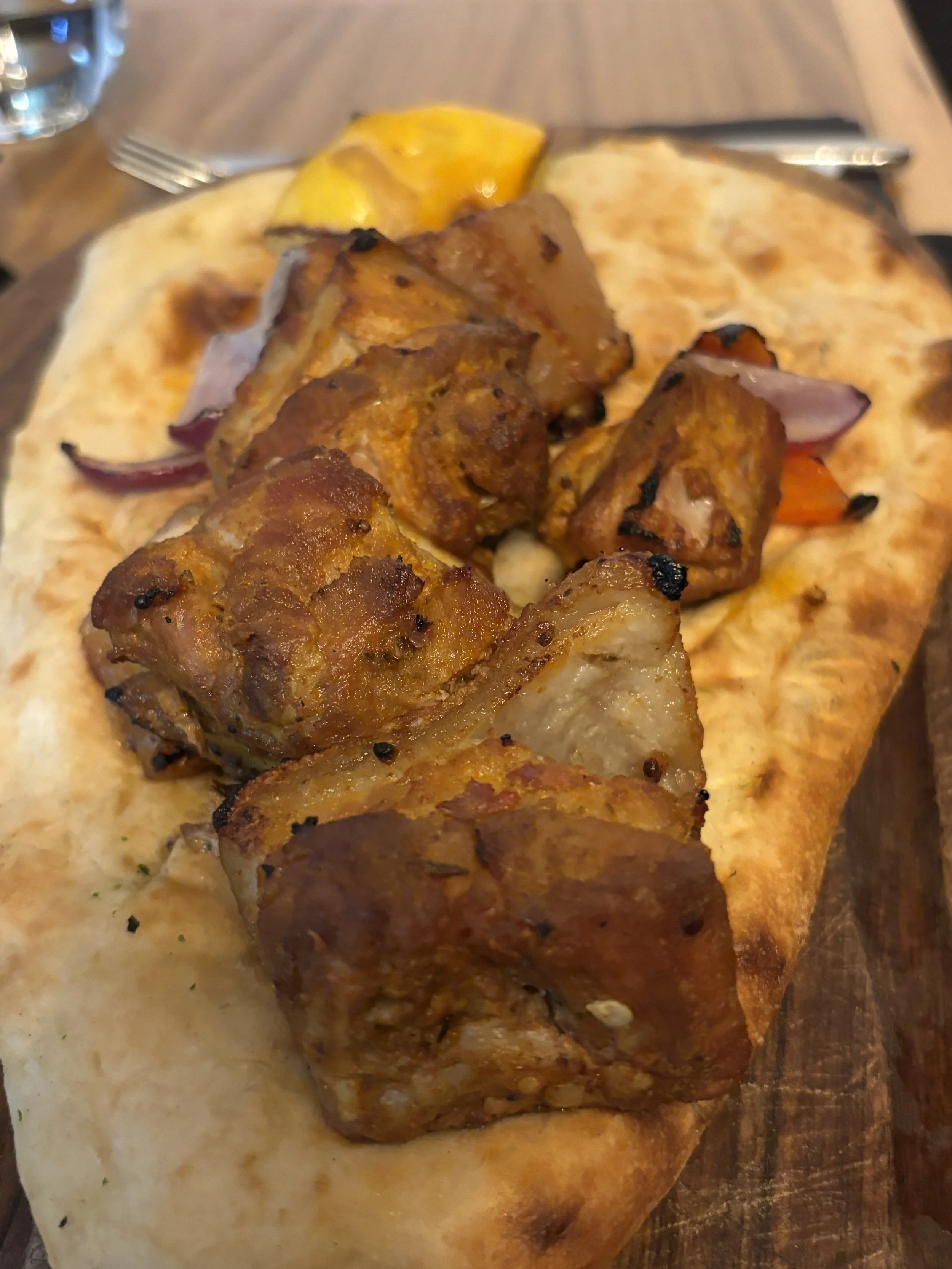
Restaurant Tinecz
Calea Aradului 51, 300254 Timișoara
This restaurant is a bit further from the historical centre, so ideally you would need to take a cab (the Bolt ride from the Piata Unirii costs something like €3). I went to try it since I saw it had good reviews and a semblance of local cuisine.
This is, in fact, the case, although it combines some dishes with a local flavour, like the “sarmale” (below), which were excellent and pretty substantious, with more, let’s say, international cuisine.
The service was pretty good throughout, as well.
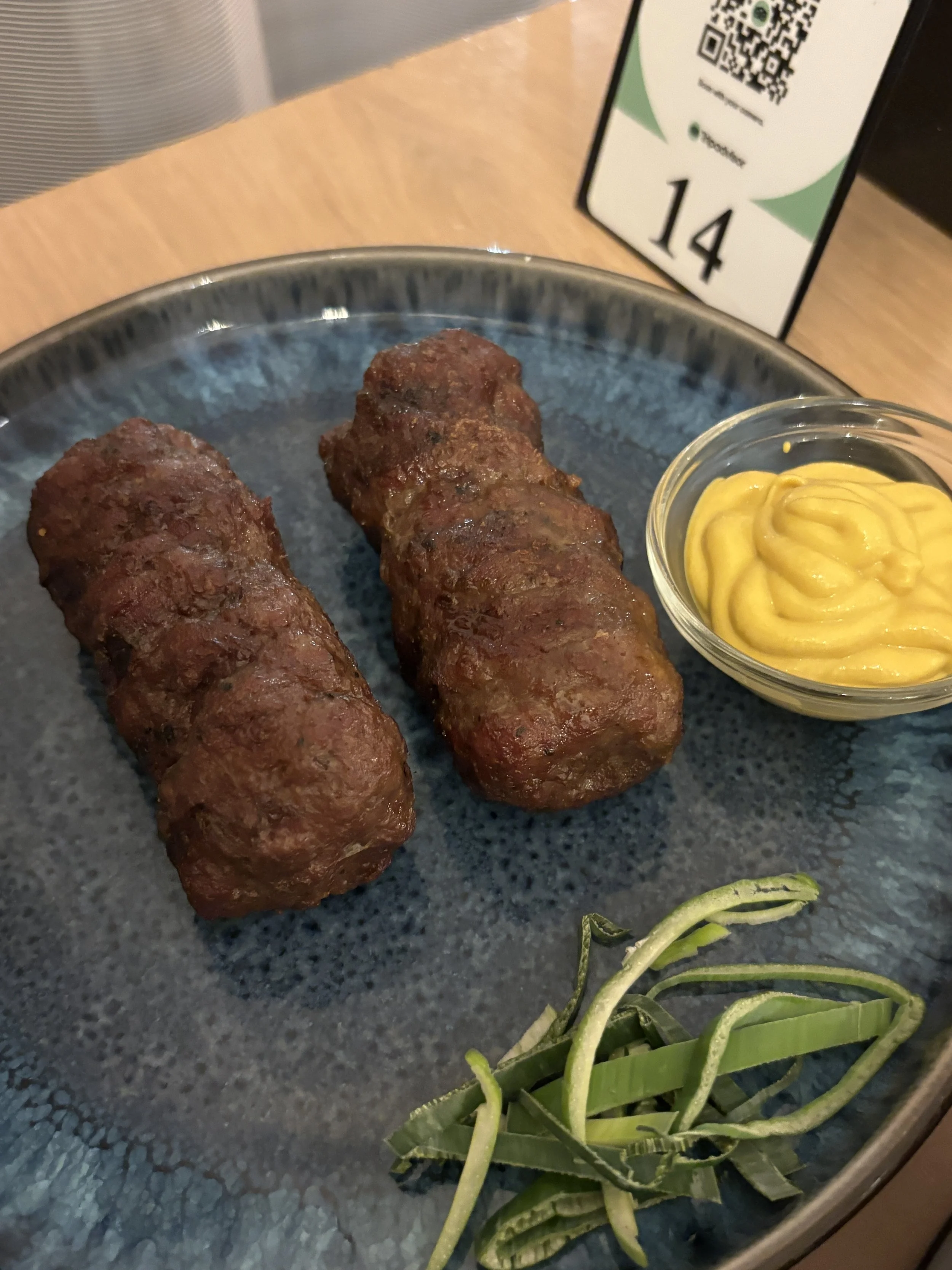
Coffee and pastries in Timisoara’s historical centre
If there is one thing I liked on the culinary front, though, it is the pastries. Here below are three places that I tried. All three are within 20 meters of each other on Vasile Alecsandri street next to Piata Unirii.
Patisserie-Cafetarie Prospero
This is, apparently, a local chain with three or four brances around town. It offers a nice range of sweet and savoury pastries and good coffee.
A’Clair by Alma Dulce
This place represents a totally different approach to coffee and bakery.
In fact it is more like a high-end patisserie offering some coffee as well.
The flagship product here is a sort of elongated sweet cake filled in the middle with cream of different flavours.
While there is not place to sit in the fancy, but rather small, interior, it does have sitting outside, on the street.
In line with the type of stylish experience it aims to offer, coffee here is served in some very original designer terracotta cups.
Service was great throughout.
Select Bakery
This is just opposite the aforementioned “Prospero” and it offers a similar selection of pastries. You can order to take away right from a little window on the side of the shop.
I particularly enjoyed this sort of triangular pastry, which is filled with a sort of cottage cheese and served warm. In fact, I liked it so much that I went back there for more the next day, and would have done the same if I had remained in town for longer!
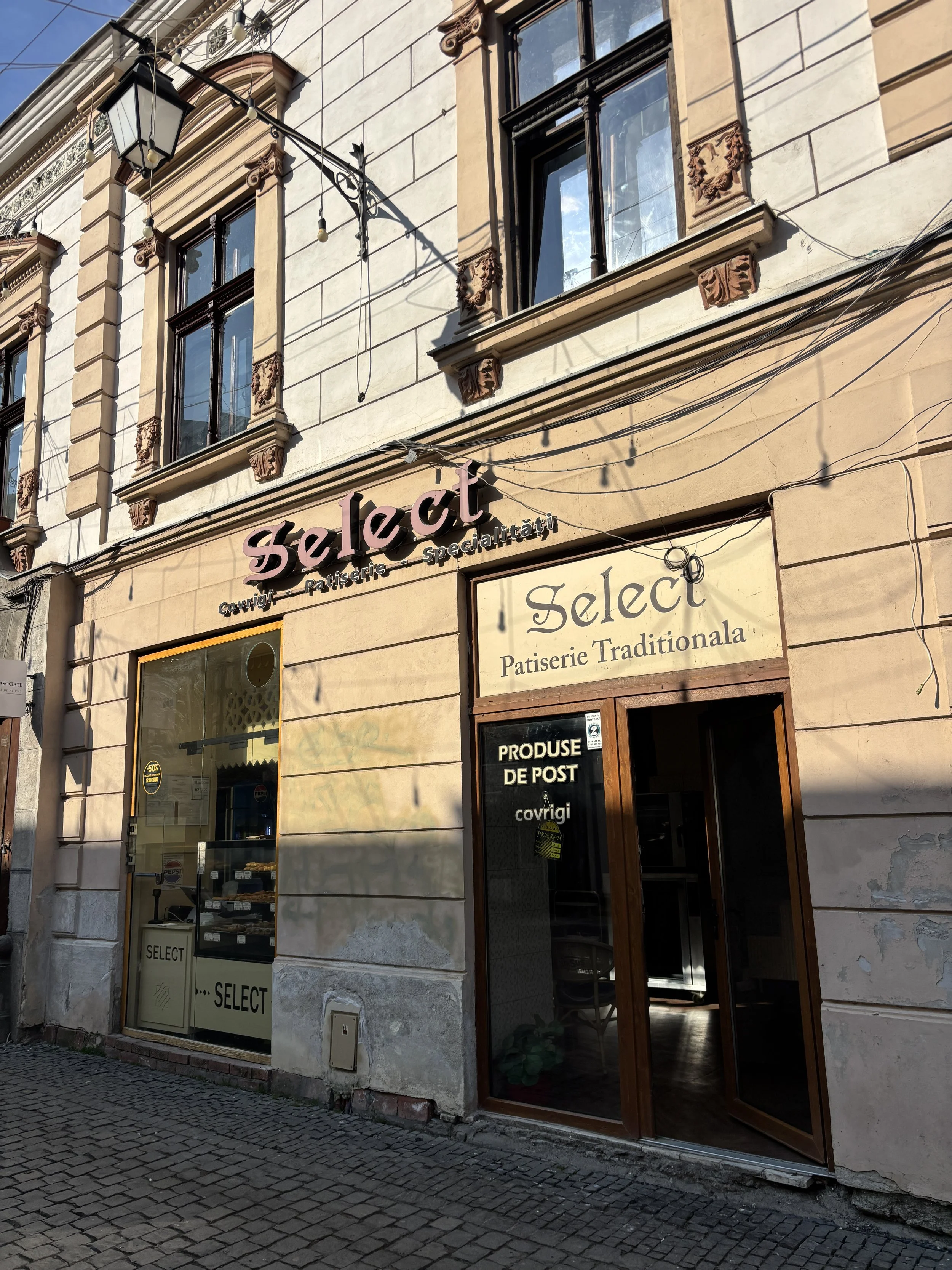
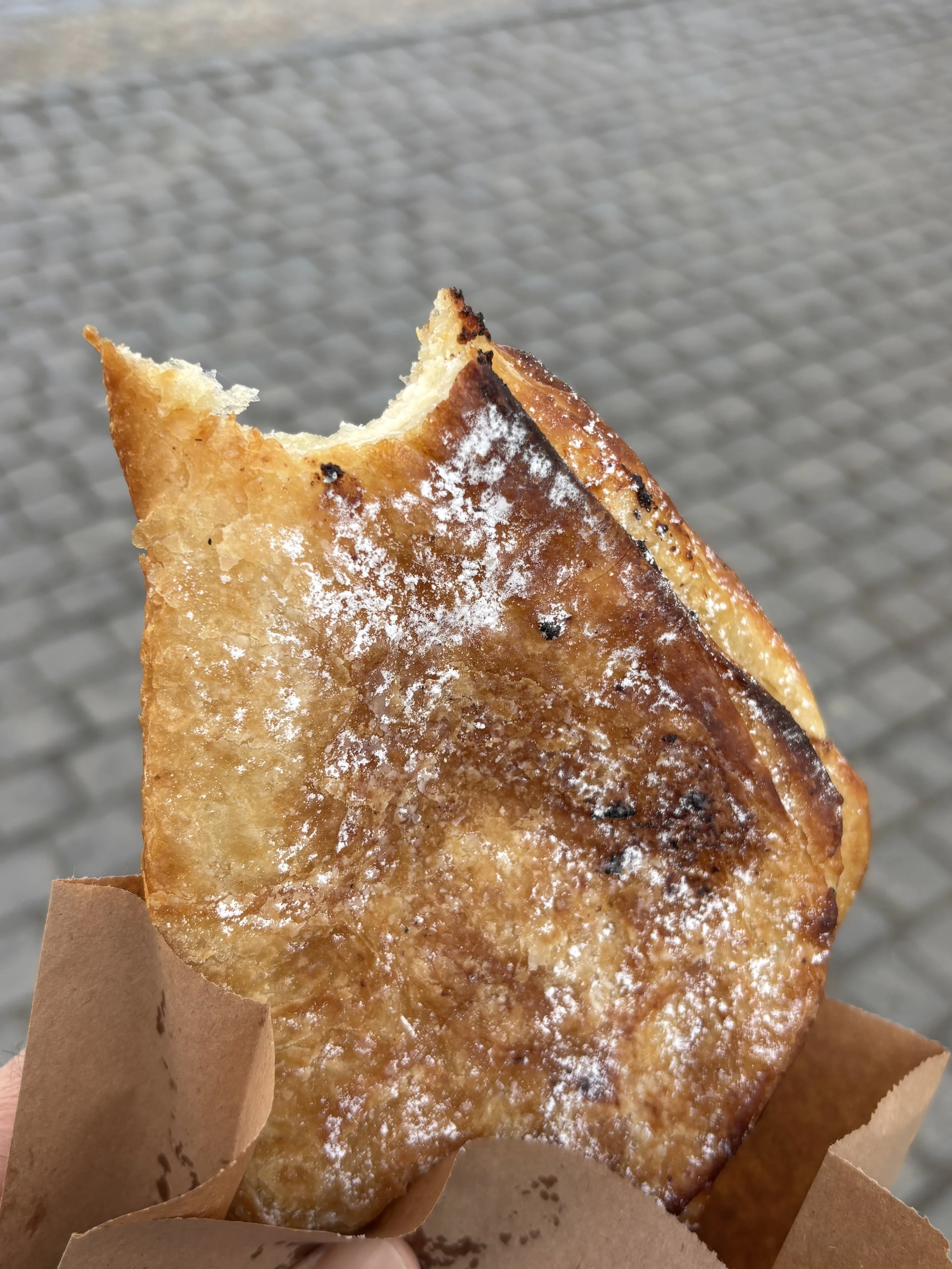
Where to stay in Timisoara
City Park Apartments
Strada Carol Telbisz 4, Timișoara
This place was great value and in absolutely convenient location. It is located in one of the large old blocks next to Piata Libertatii. The place looks completely dilapidated on the outside, but the apartments inside are modern and renovated.
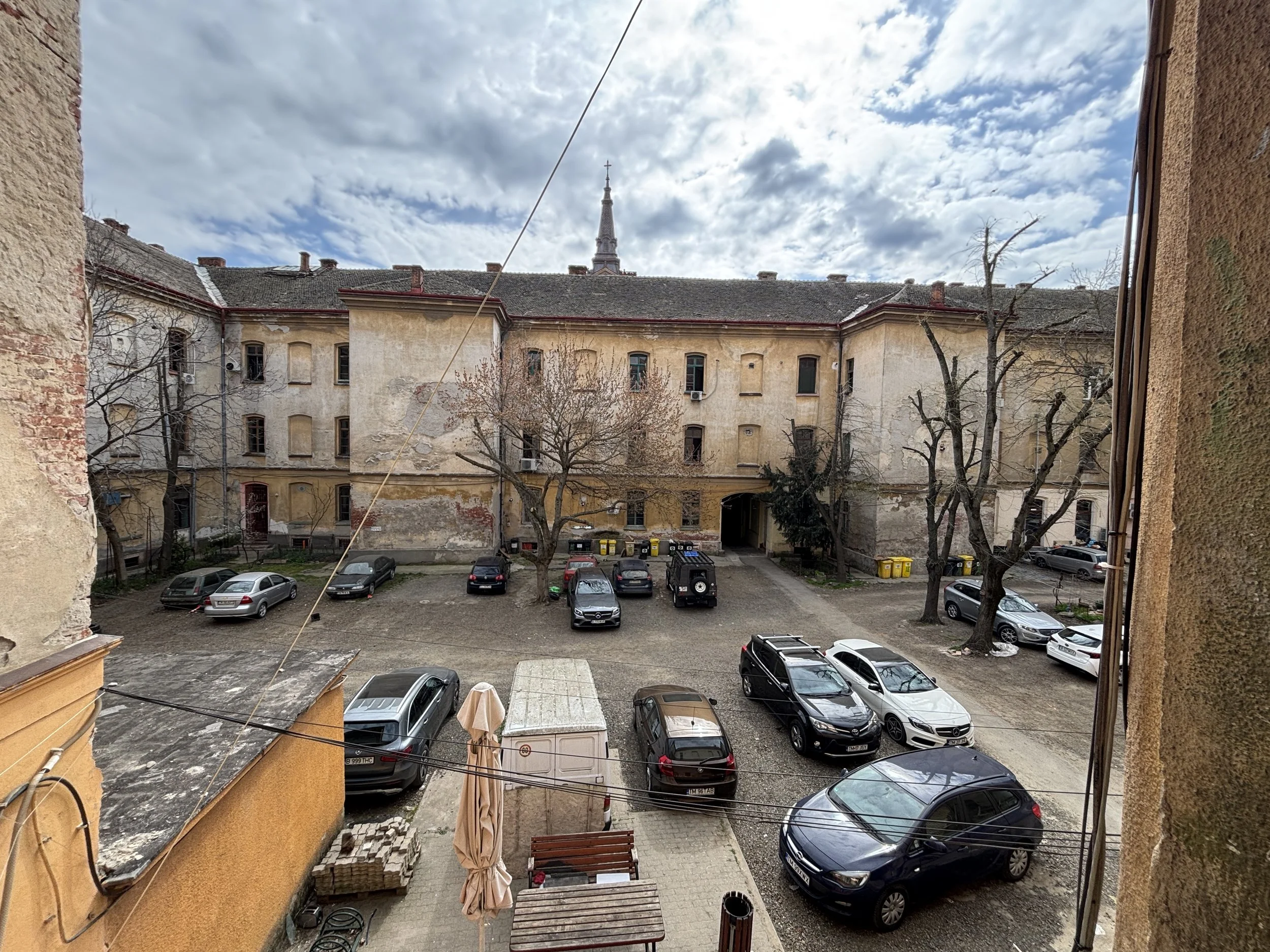
The place consists of a number of renovated apartments located in one of the wings of what I think must have been some old military barracks or something like that.
At the time of my arrival the place was pretty much a construction site. I guess the place will look completely different in a relatively short period of time, on account of its really prime location, since it is literally a two minute walk away from the main commercial axis in the historical centre.
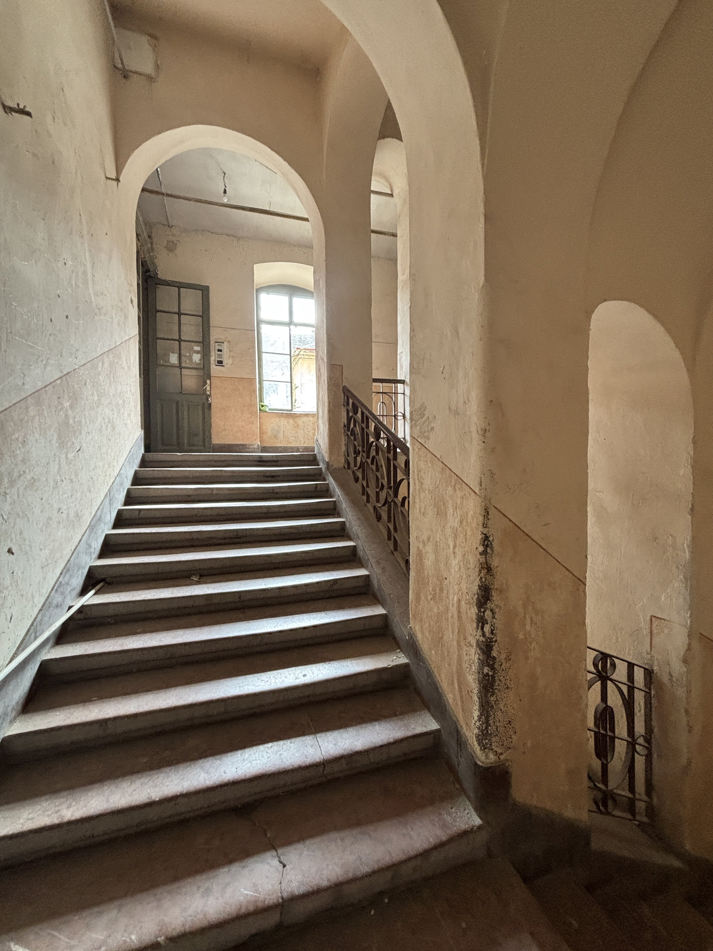
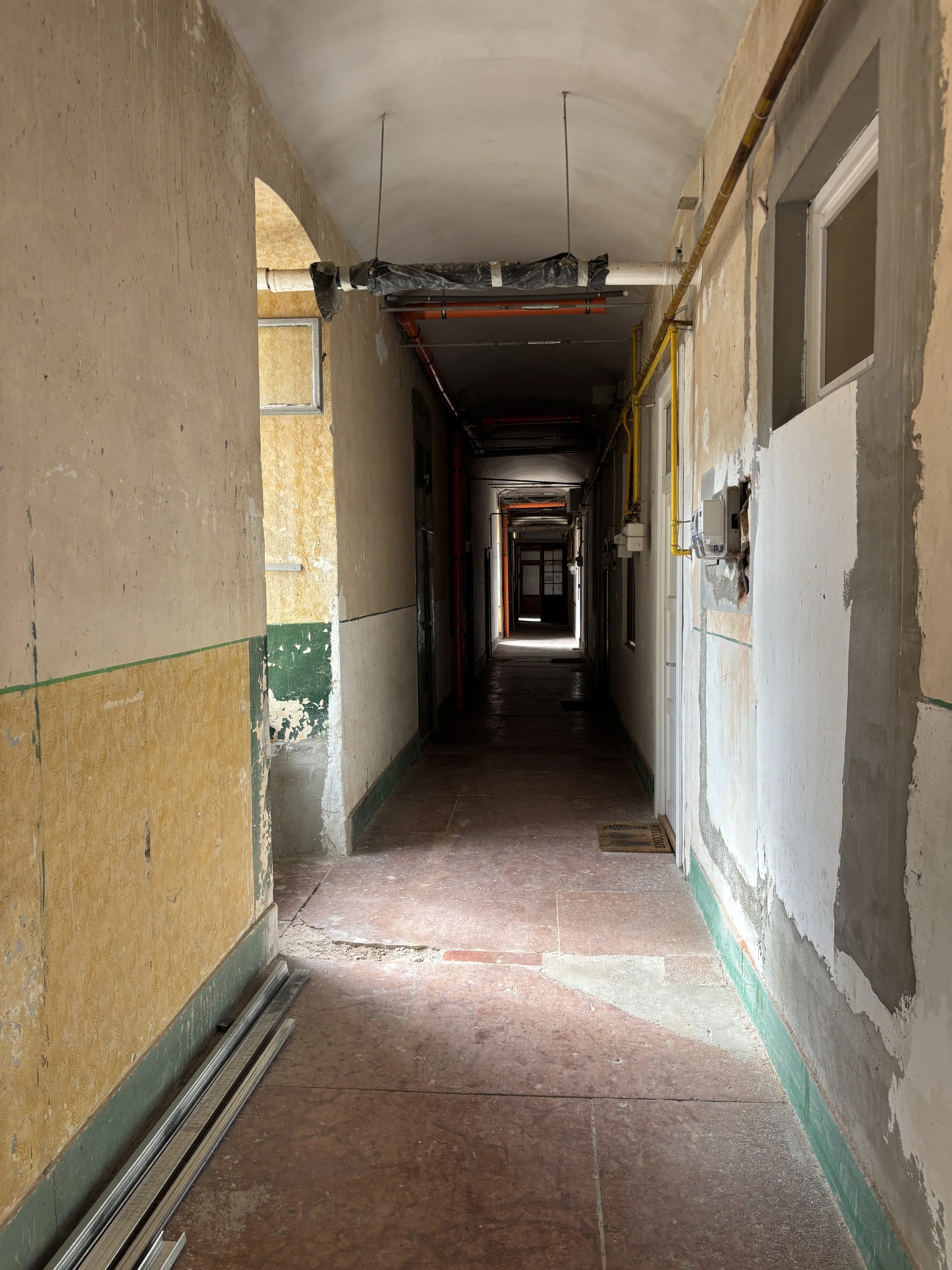
So, don’t be fooled by first impressions when you come in (the check in process is fully automated, with the property sending you the codes to access the different parts of the building), the apartments inside are in good state, renovated and are very spacious. There is also a small, equipped kitchen, and some household supplies in an antechamber. There is also an espresso machine with some available capsules.
When I arrived there was no warm water, but this was fixed in a matter of minutes when I emailed the property and they sent me instructions about how to reset the heater, which was in an adjacent room.
There is high speed wifi as well.
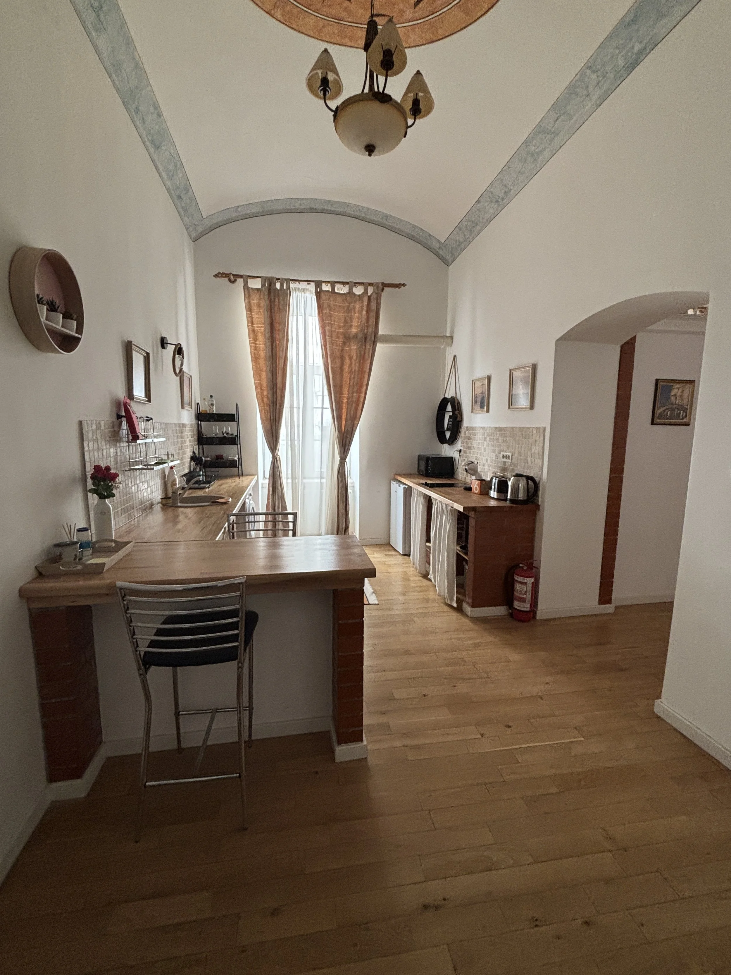
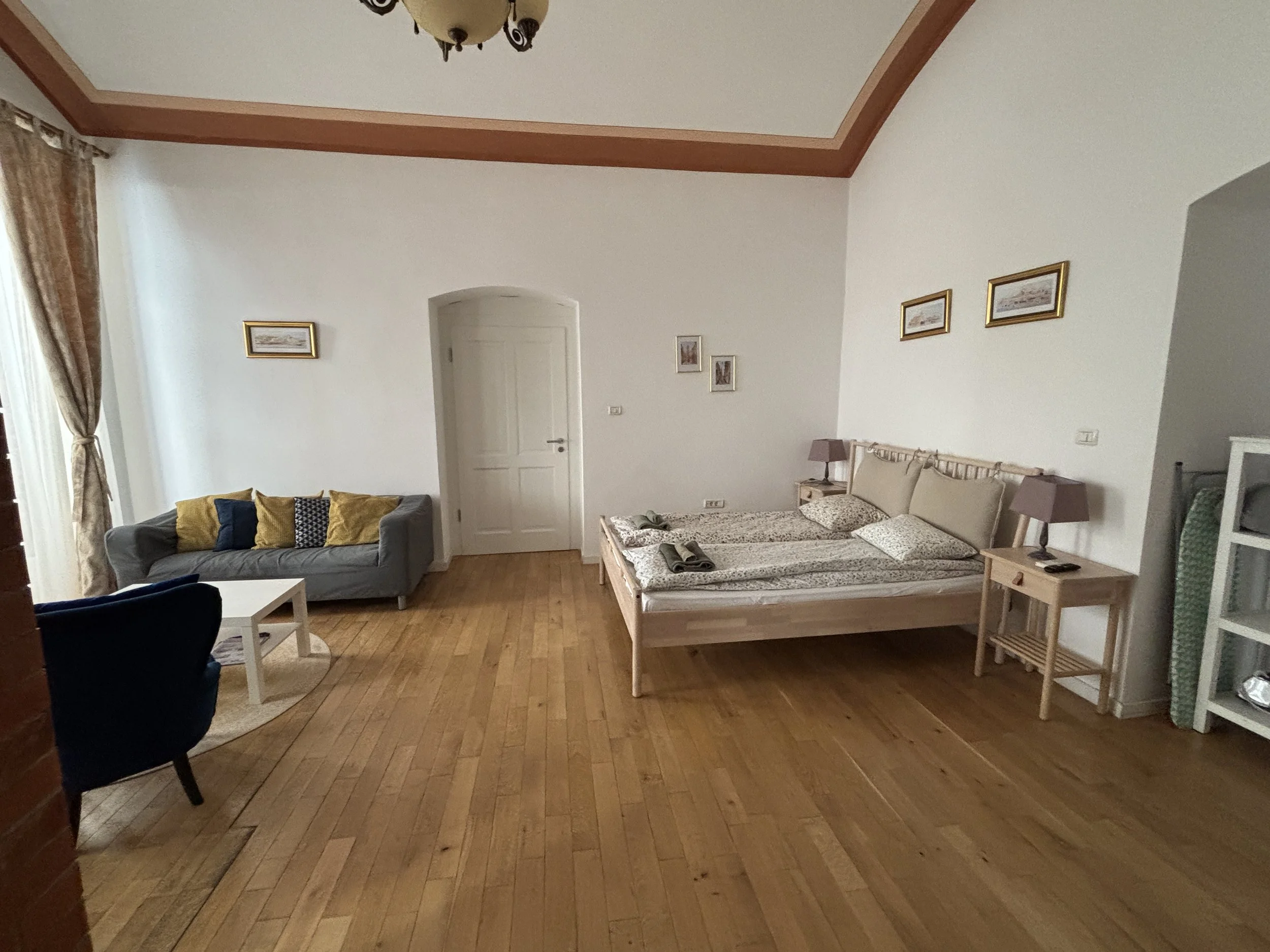
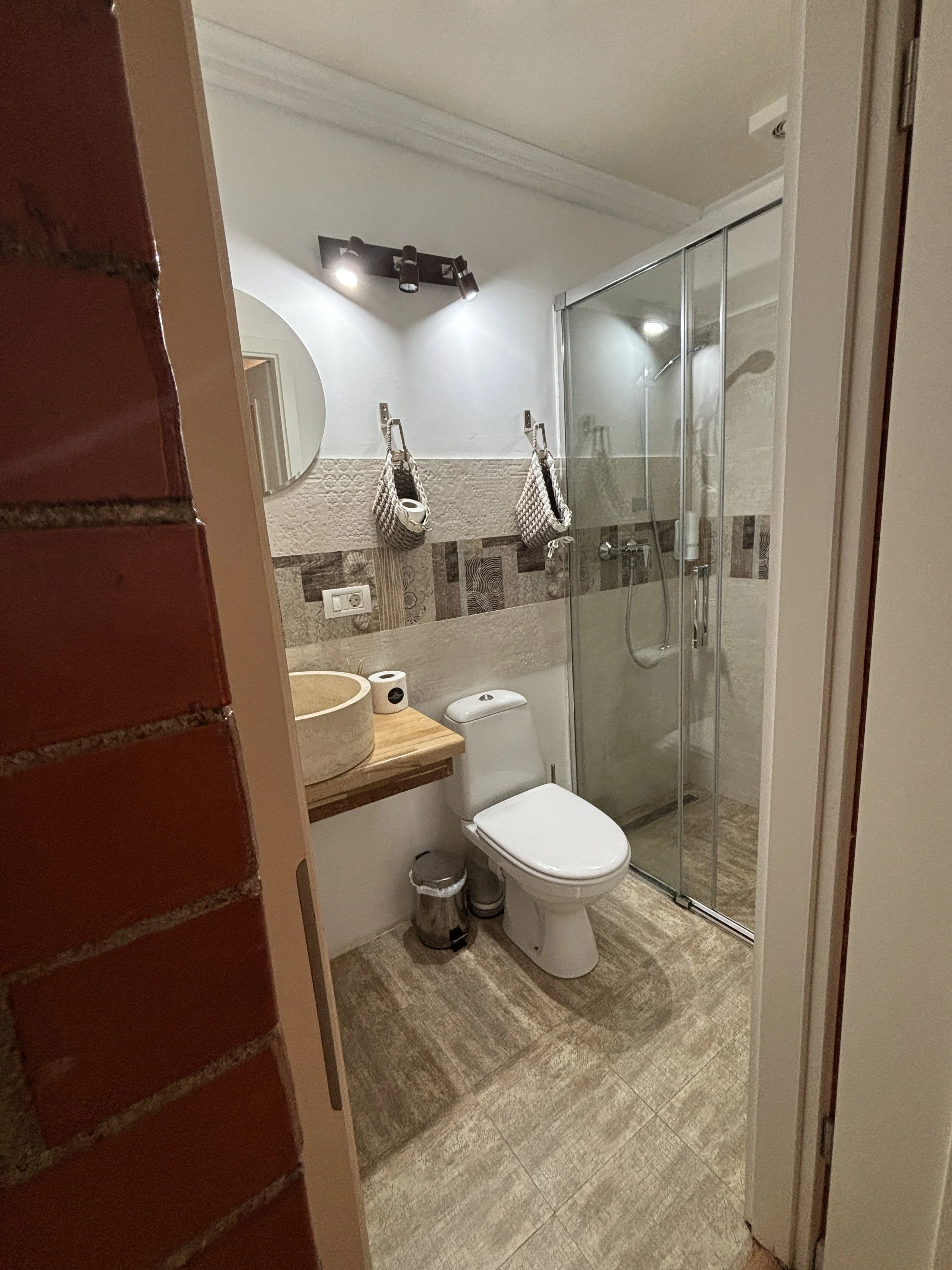
Getting to and from Timisoara
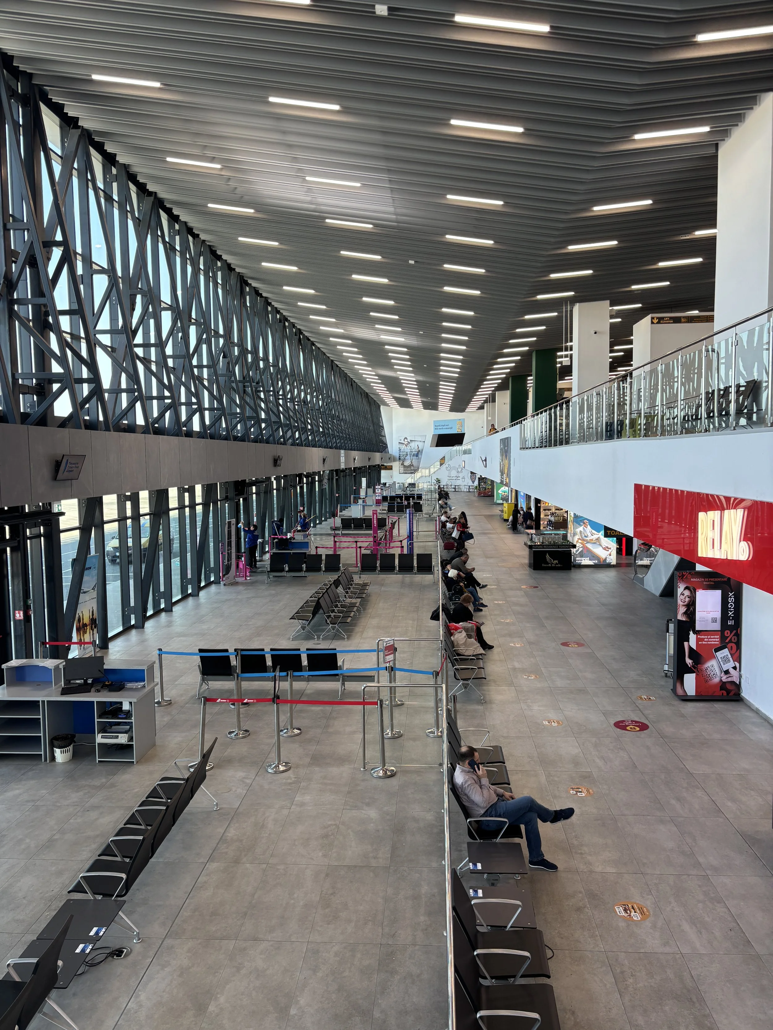
Finally, before departing, a word about logistics and how to get to and from Timisoara.
The fact is that with low-cost airlines like Wizz Air flying to Timisoara from many points in Europe, never has been so easy to explore this beautiful city.
The airport is small but very modern and functional and it costs less than €10 to get there from the center with Bolt.
This ride hailing app is possibly the best way to move around if you don’t want to get messed up with public transport schedules and the like, and it is also not very expensive. In fact, if you stay near the old town you possibly won’t need transportation within the city at all.
If you are traveling from other parts of Romania, like Bucharest or Cluj-Napoca, you may look also at the train or the bus. In such case I suggest you check this website for schedules and bookings.
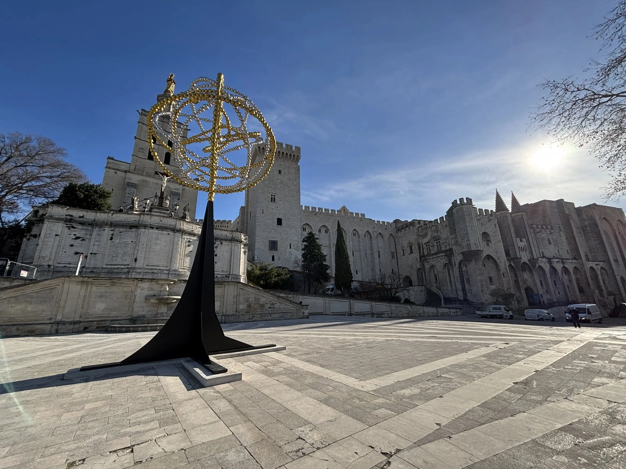
48 hours in Avignon and Nîmes: what to see, what to do

The south of France is so rich in sights and history that at, if you find yourself driving around the area on a sunny day, it is easy to feel overwhelmed by the amount of choices that present themselves.
There are, however, some sites that really stand out (and have even been recognized as such by UNESCO, which has granted them World Heritage Site status) and fortunately, several of them are relatively close to each other, so it is perfectly possible to visit quite a handful of them in a couple of days if you have access to a car.
So, what to see and what to do if you if you are traveling in the area roughly delimited between Nîmes to the west, Avignon to the east, Châteauneuf-du-Pape to the north and Aiguesmortes and the Camargue to the south? We’ll see it now!
In this post I am going to try do just that: describe an itinerary that includes, I think, some of the most impressive and interesting places to visit in the lower Rhône Valley and the region where Provence meets Occitanie. These are representative of a diverse range of historical eras and have some varied landscapes, as well.
This post may contain affiliate links. If you book or buy something through them, I earn a small commission, at no extra cost to you. It's one of the ways I keep Places of Charm going. Thank you for your support.
Visiting the Palais des Papes in Avignon
Our itinerary starts in front of the imposing ramparts of the Palais des Papes, the old papal fortress in Avignon. This small provençal town was for quite a few decades in the 14th C., the residence of a number of Popes, which made it, de facto, the centre of the Catholic world.
Pope Clement V, who was French, relocated to Avignon from Rome in 1309. Apparently in an attempt to be closer to the French court. After him, successive popes stayed in Avignon and kept enlarging their residence and making ever more majestic.
The Papal Palace in Avignon thus, evolved into one of Europe’s largest medieval fortresses, made even more impressive by the fact that parts of it are built on top of naked rock (see the picture below).
The Pope returned to Rome in 1377, although Avignon remained part of the Papal estates and, in fact, it didn’t, join France until after the French Revolution in 1791!
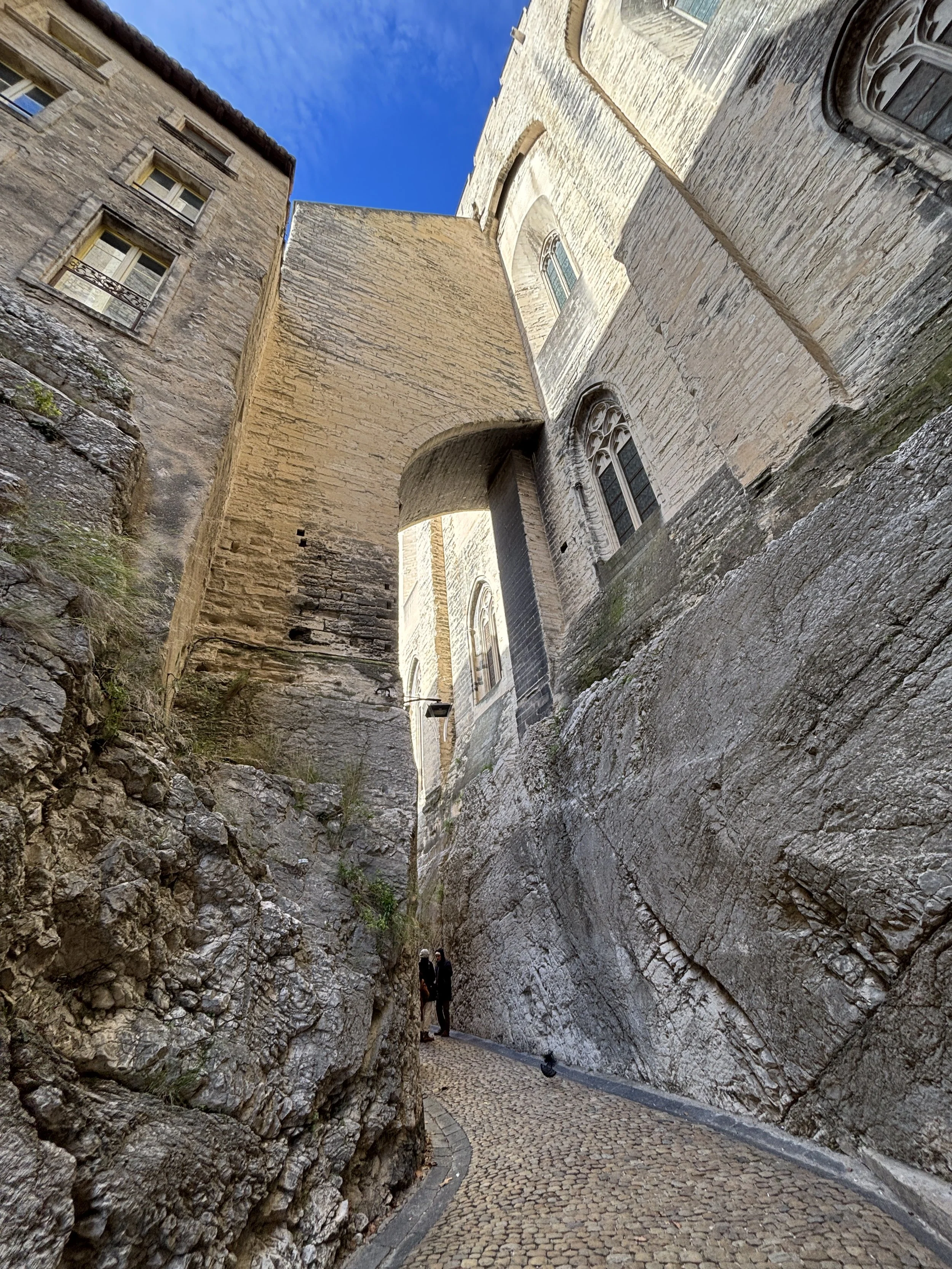
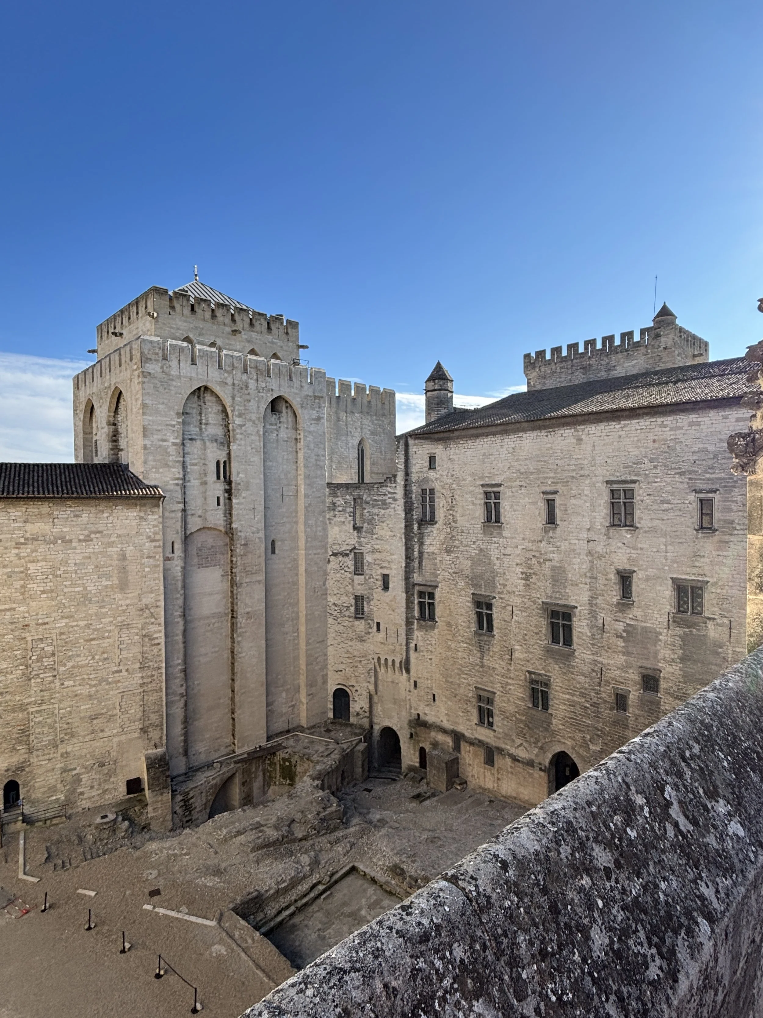
It is advisable to buy the entry ticket in advance online, since there is a slot system for visits. To be fair, we booked quite at the last minute didn’t have any issue finding available slots, but I can not guarantee this is always the case, particularly during busy holiday periods!
It is also possible to buy a ticket that combines several of the town’s historical sites, such as the palace, its gardens (which we were closed at the time of our visit and, therefore, not included here) and the bridge over the Rhône (the famous “Pont d’Avignon”). Prices range between €12 and €17 approximately depending on the option you take.
If arriving by car, the best option is to leave the car at one of the several underground paid parkings near the Palace. The closest one is just underneath the palace’s rock and it is very aptly called “Parking du Palais des Papes”. If you spend half a day touring the castle and walking around the old town you would possibly pay something on the order of €10 or so, but it saves a lot of hassle.
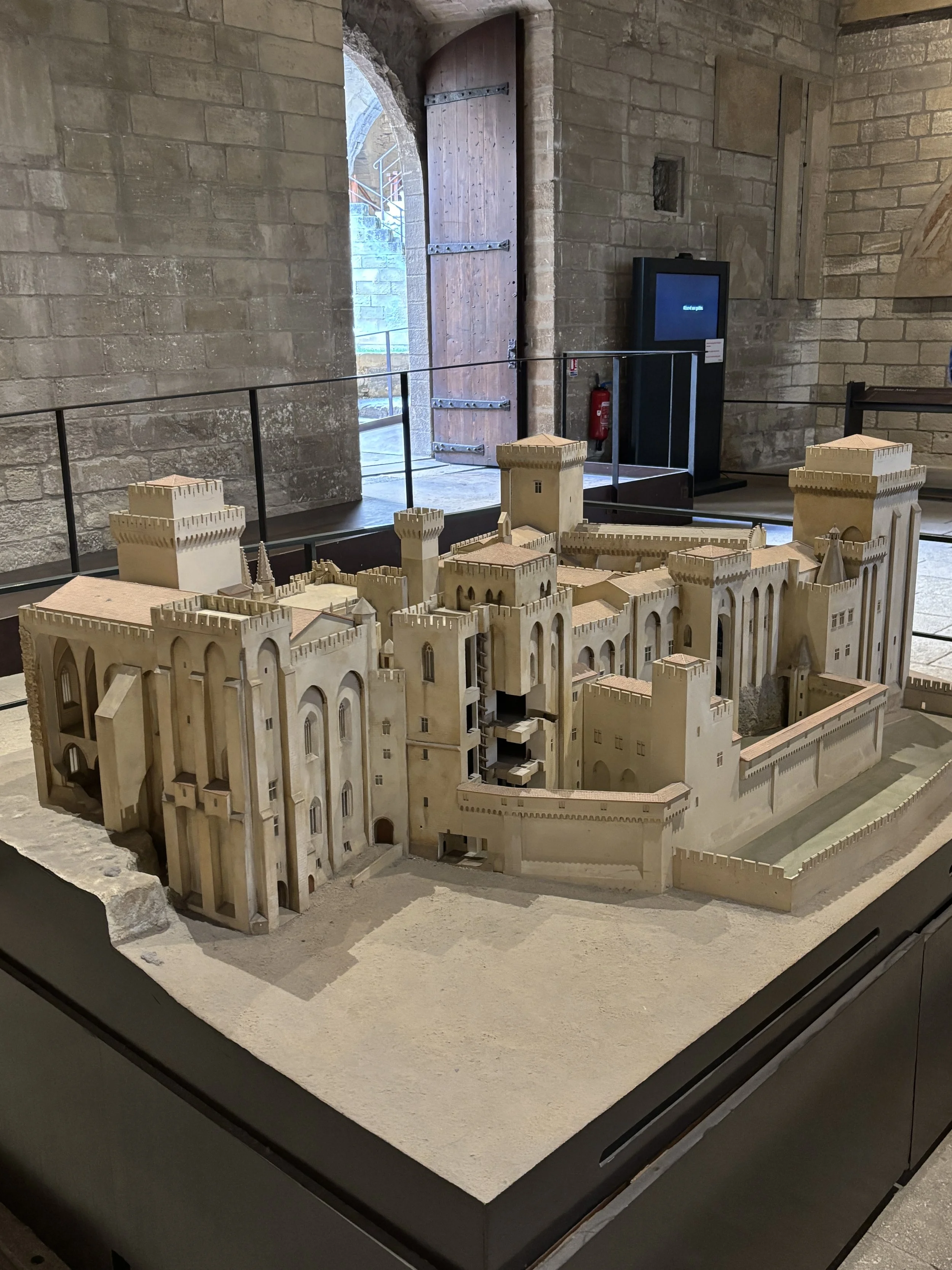
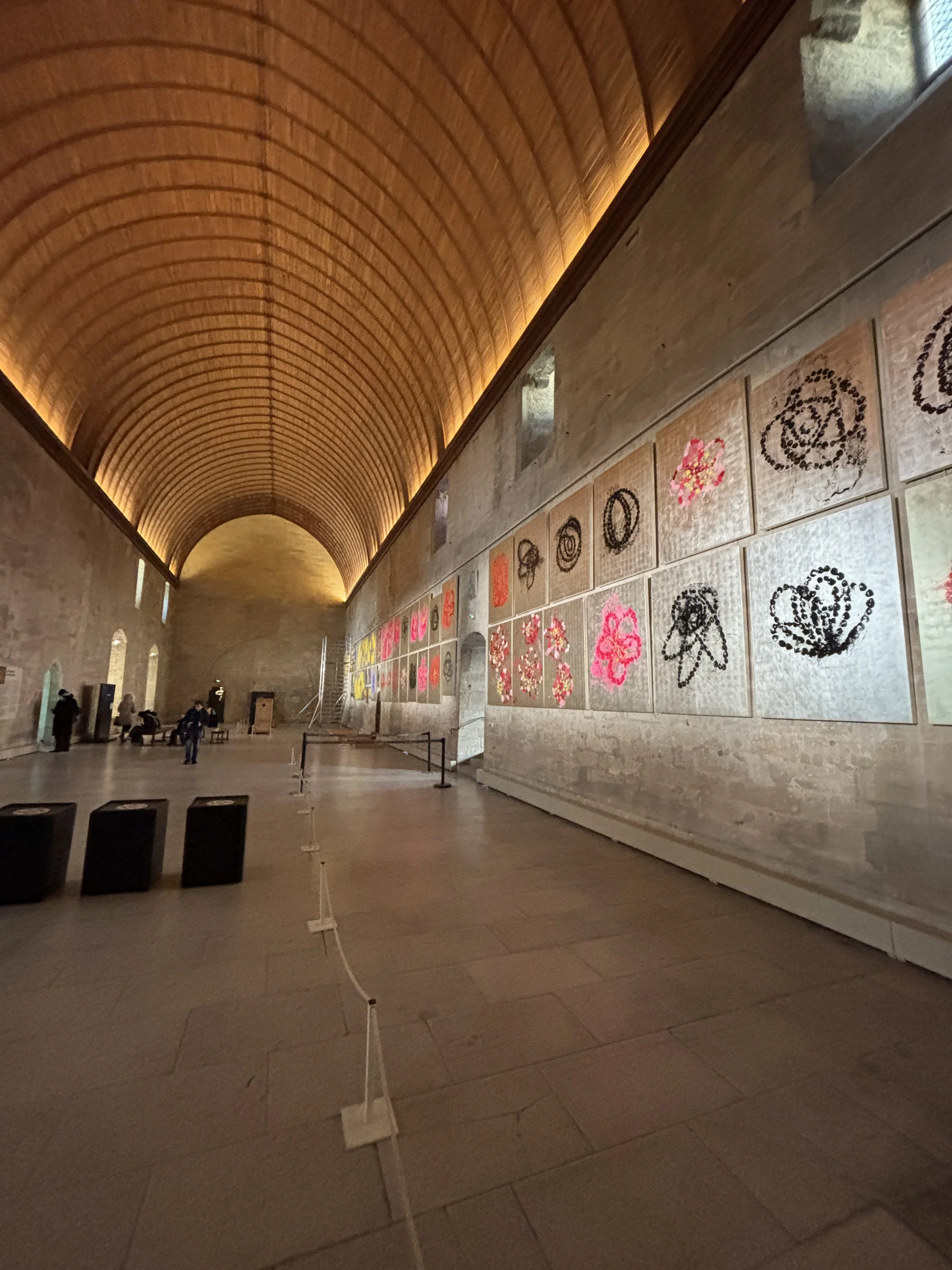
Allocate at least a couple of hours to the Palais des Papes, because the place is huge.
I recommend taking the audioguide since, in addition to having nice and comprehensive explanations, it comes in the form of a tablet with augmented reality effects. It allows you to see how the different parts of the palace-fortress would have looked like in its heyday by pointing out at specific locations.
The visit, by the way, combines indoor and outdoor spaces and it is even possible to climb to one of the fortress towers for a view of the town.
Sometimes there are also some temporary art exhibits throughout the palace (like is the case of these giant suspended crowns in the picture below).
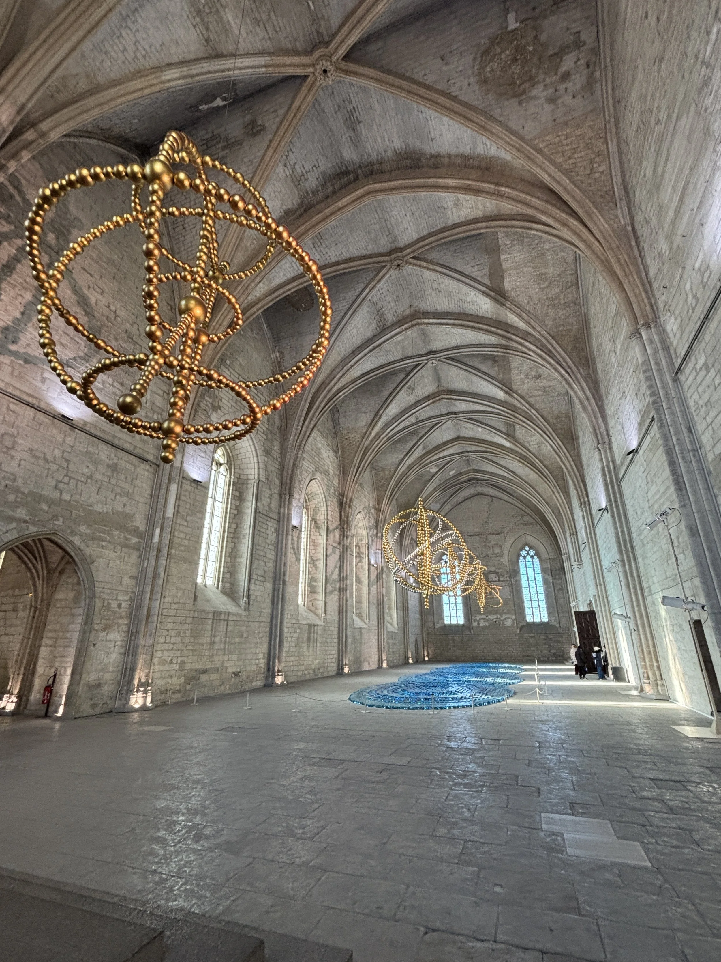
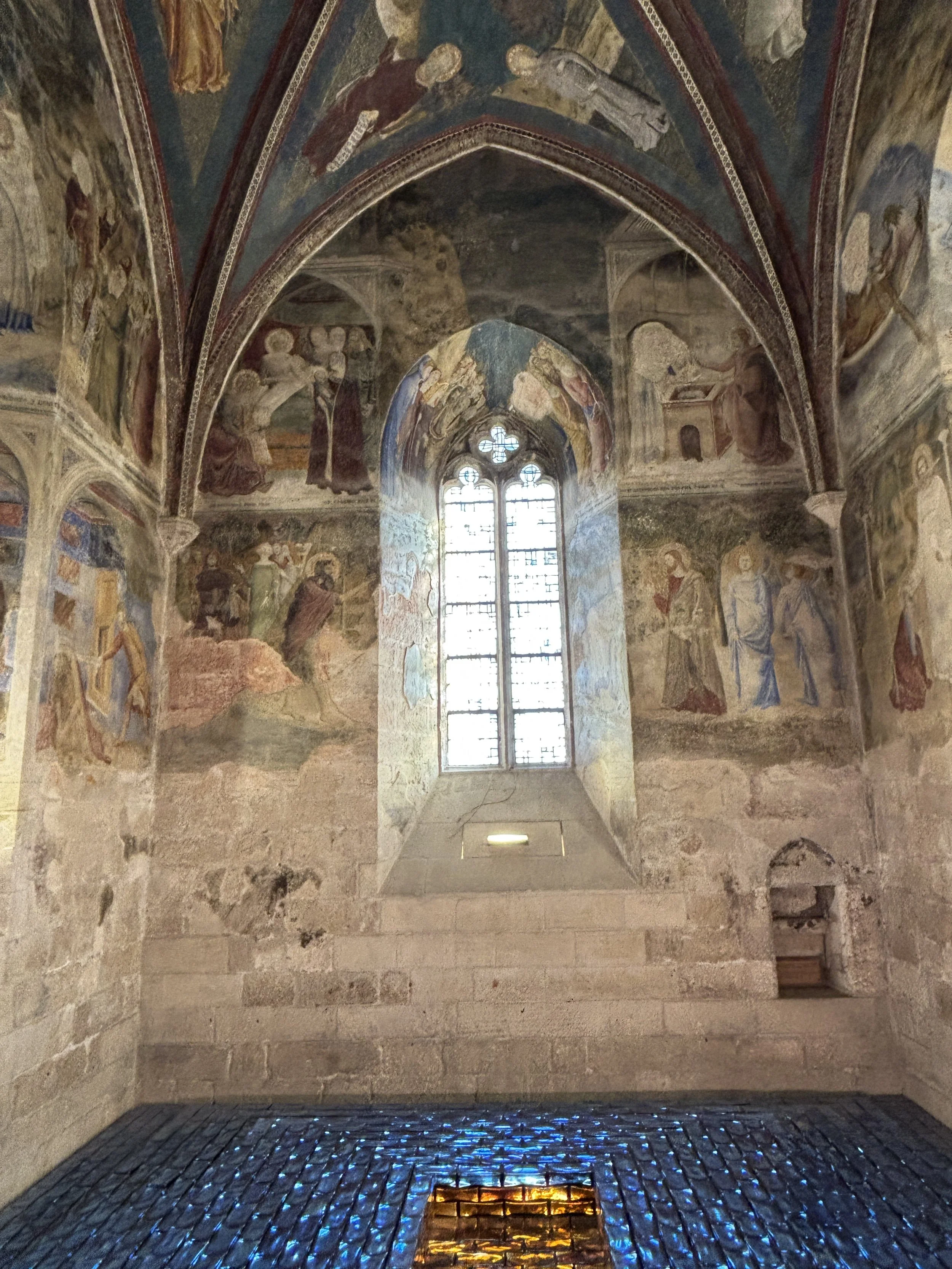
“Sur le Pont d’Avignon”
A visit to Avignon wouldn’ be complete without visiting the bridge over the river Rhône, the “Pont d’Avignon” that gives its title to the famous folk song.
The “Pont d’Avignon” is a real thing and it was built during the Middle Ages. Besides its function connecting the two banks of the Rhône, it also acted as a checkpoint to tax goods and trade and move upstream from the Mediterranean and downstream from Bourgogne and northern France.
The bridge only makes it half way across the river nowadays, since part of it was destroyed by a flood. This was apparently a regular occurence, but for some reason they stopped rebuilding it at some point.
There is a small museum at the head of the bridge which explains not just the history of the bridge and the importance of the Rhône as a major trading artery in the past, but also sheds some light into Medieval bridge-building techniques.
It is also possible to walk over the bridge and, in fact, it is from the far end of the bridge that you can get what are, possibly, the best panoramic views of the monumental ensemble of the Palais des Papes. so, make sure you include this in your visit as well!
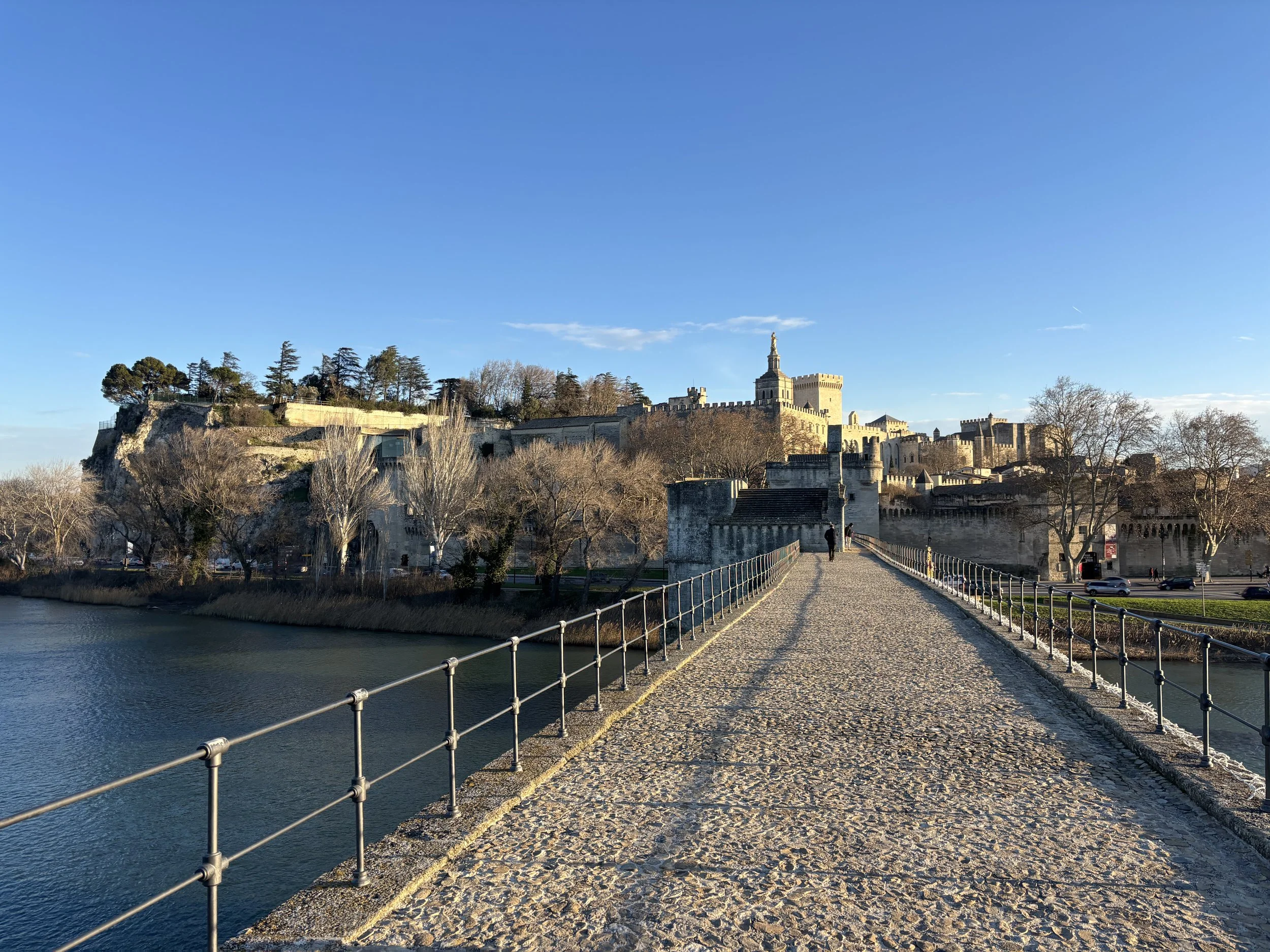
Wine tasting in Chateaunêuf-du-Pape
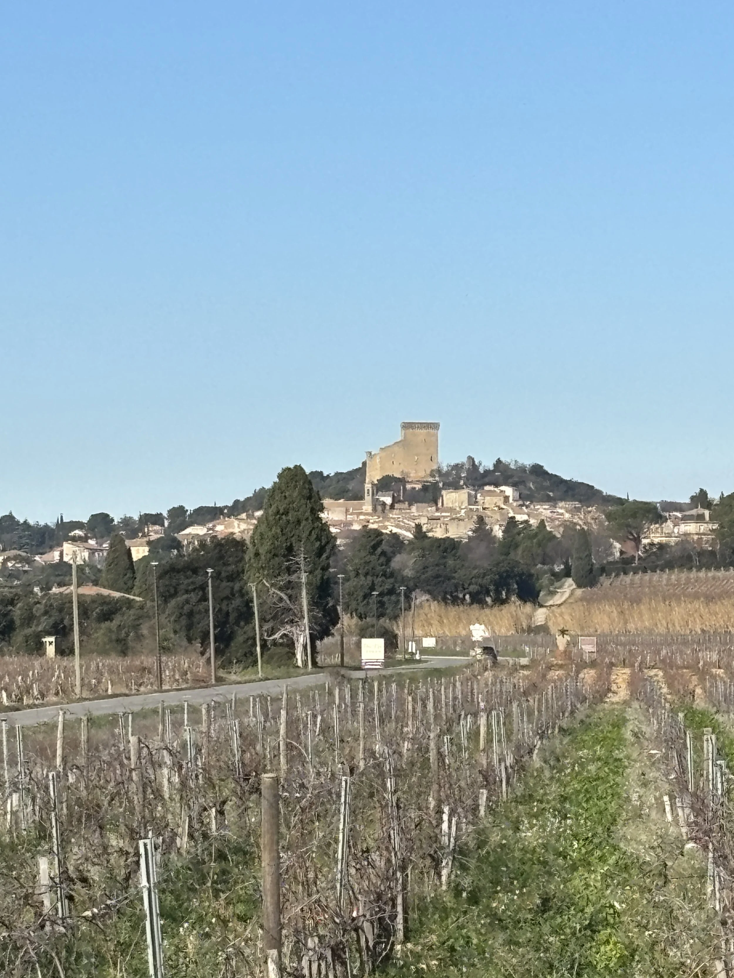
The village of Châteauneuf-du-Pape (which is named like this because the Popes had a summer residence there during the period they resided in Avignon) is home to one of France’s most prestigious wine “terroirs”.
Châteauneuf-du-Pape is an AOC (Appellation d'Origine Contrôlée) within the French and European system of geographical designations for origin for wine (and other types of produce) and a particularly renowned one, covering both red and white wines.
According to oenologists, the quality of Châteauneuf-du-Pape wines has a lot to do with the combination of sunny southern climate, the strong winds that often blow down the orographical funnel that is the Rhône valley and the soil of the area, which is peppered by a type of rounded rocks that were, once upon a time, underneath a large glacier that covered this region.
Now, I am sure a dedicated wine conoisseurs could spend a whole week in Châteauneuf-du-Pape from one cellar to the next, tasting all the different labels. We certainly didn’t have this luxury (neither do I claim to be a wine expert) and I guess that this is also the case of most of our readers (even if possibly many of you may appreciate a nice glass of wine from time to time), so we selected just one winery for a quick glimpse into the world of Châteauneuf-du-Pape wines.
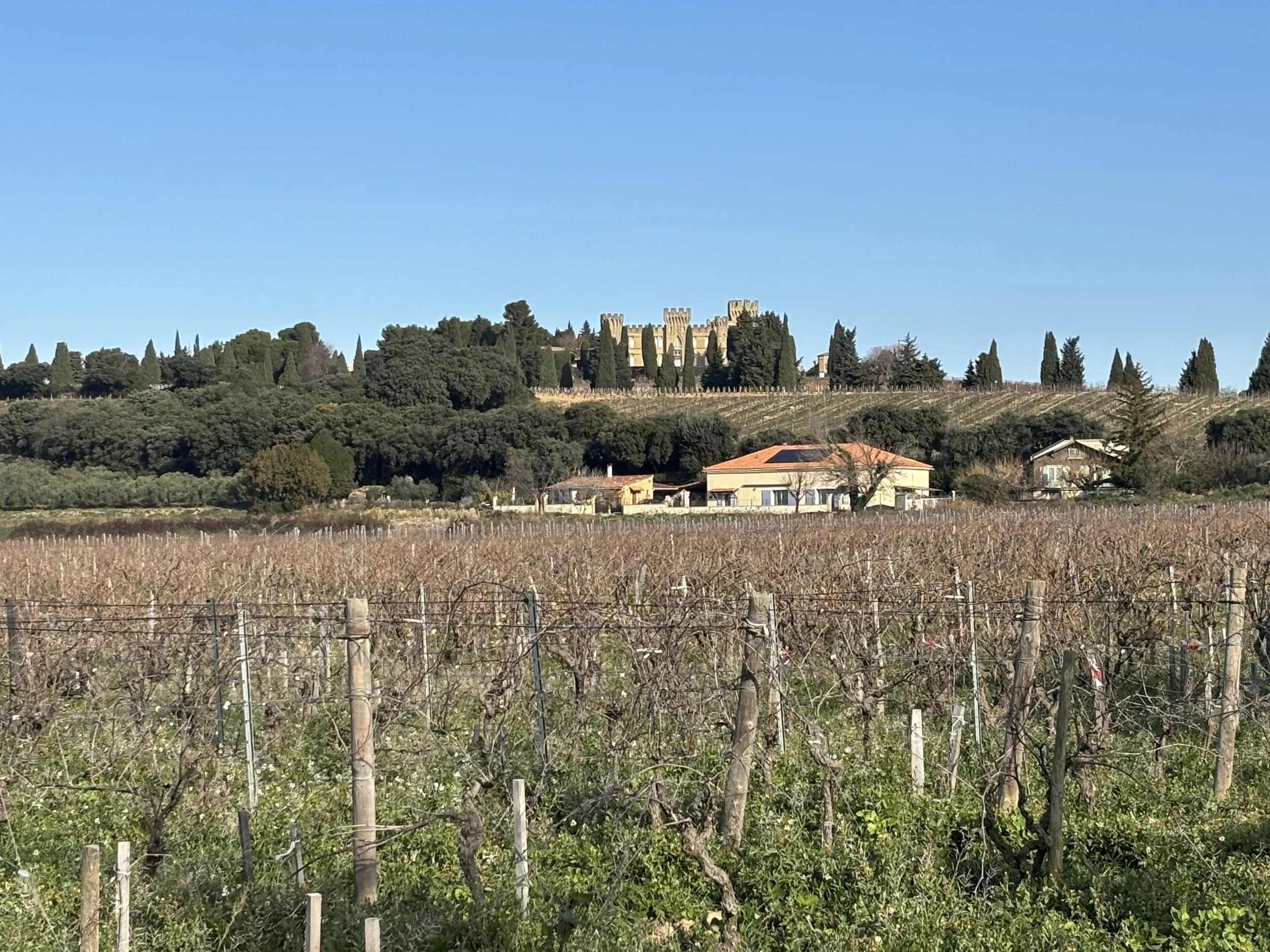
Visiting Maison Brotte in Châteauneuf-du-Pape
Avenue Pierre de Luxembourg, 84230 Châteauneuf-du-Pape
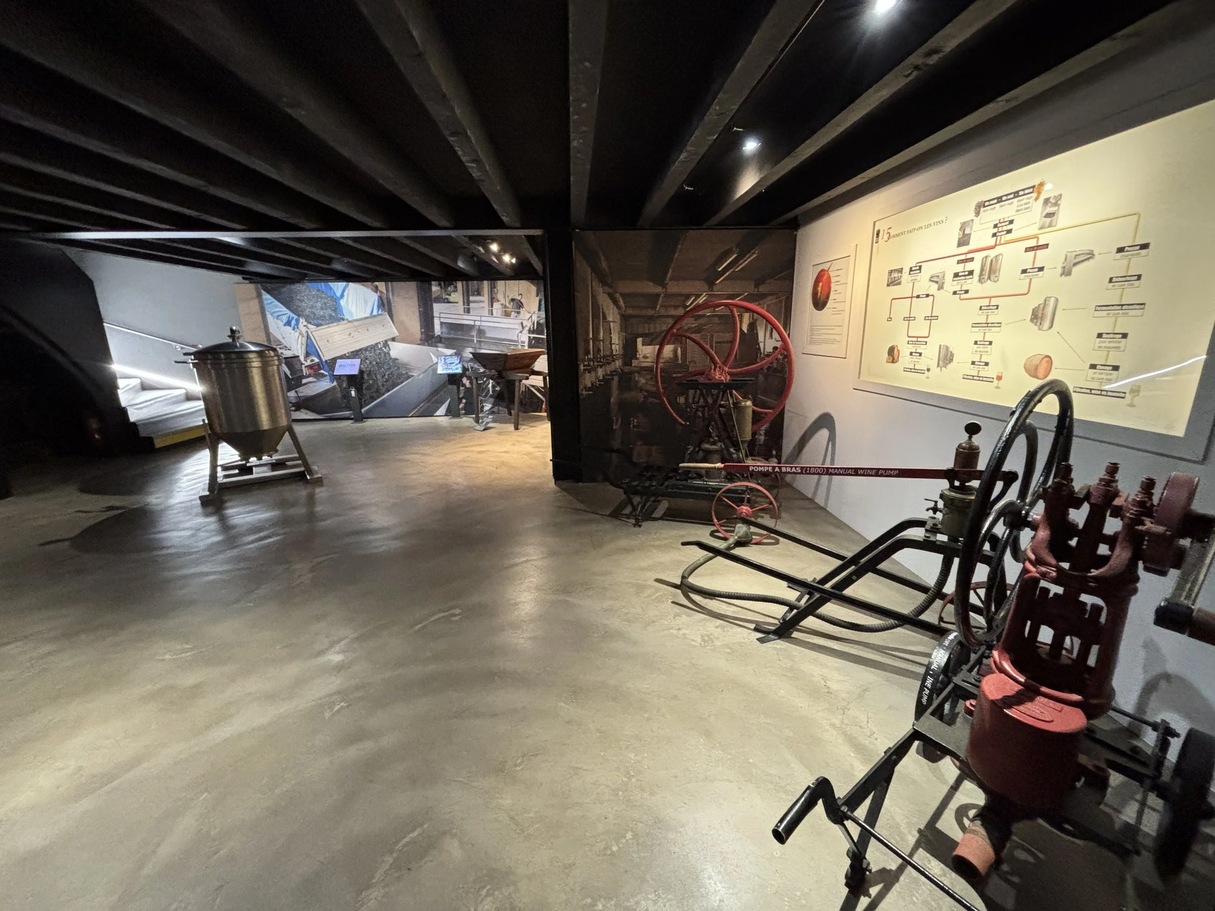
This is one of the largest wineries in Châteauneuf-du-Pape and it runs a small museum dedicated to wine-making in the region as well as the history of the Appellation d'Origine Contrôlée and its natural environment. The visit includes a rather comprehensive audioguide itinerary and ends with a tasting of half a dozen local wines.
It is advised to book online in advance. The ticket costs something like €10 per person, give or take, and includes the tasting.
From Avignon to Châteauneuf-du-Pape is about 15km or so, about 20 minutes by car. Maison Brotte is right on the main road leading into the village and it has its own parking space for visitors. So, if you have the time, definitely worth a go.
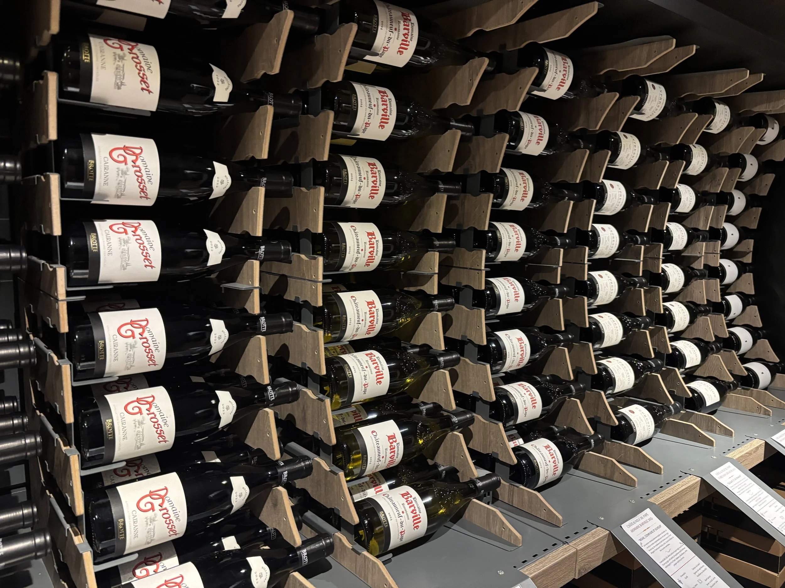
Visiting the Pont du Gard
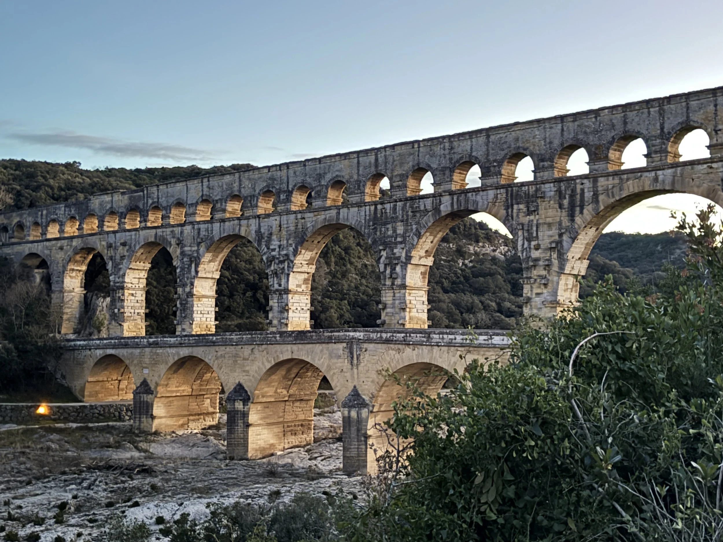
An itinerary between Avignon and Nîmes must include, of course, a detour to visit the famous Pont du Gard, one of the most impressive and best preserved Roman aqueducts to be found anywhere in the world.
This UNESCO World Heritage Site can be accessed from both banks of the river Gard. In either case, the car will only get you to about a kilometre or so from the actual aqueduct.
We approached it from the north side and there is a very large parking there and an interpretation center. Entry to the monument grounds is €8. I guess this is all the same on the south side.
A network of footpaths take you all the way to the aqueduct. You can even walk on it.
This is a very spectacular piece of Roman architecture by any consideration. We also got there at dusk when there was hardly anyone around, which made the visit even more impressive!
What to do in Nîmes
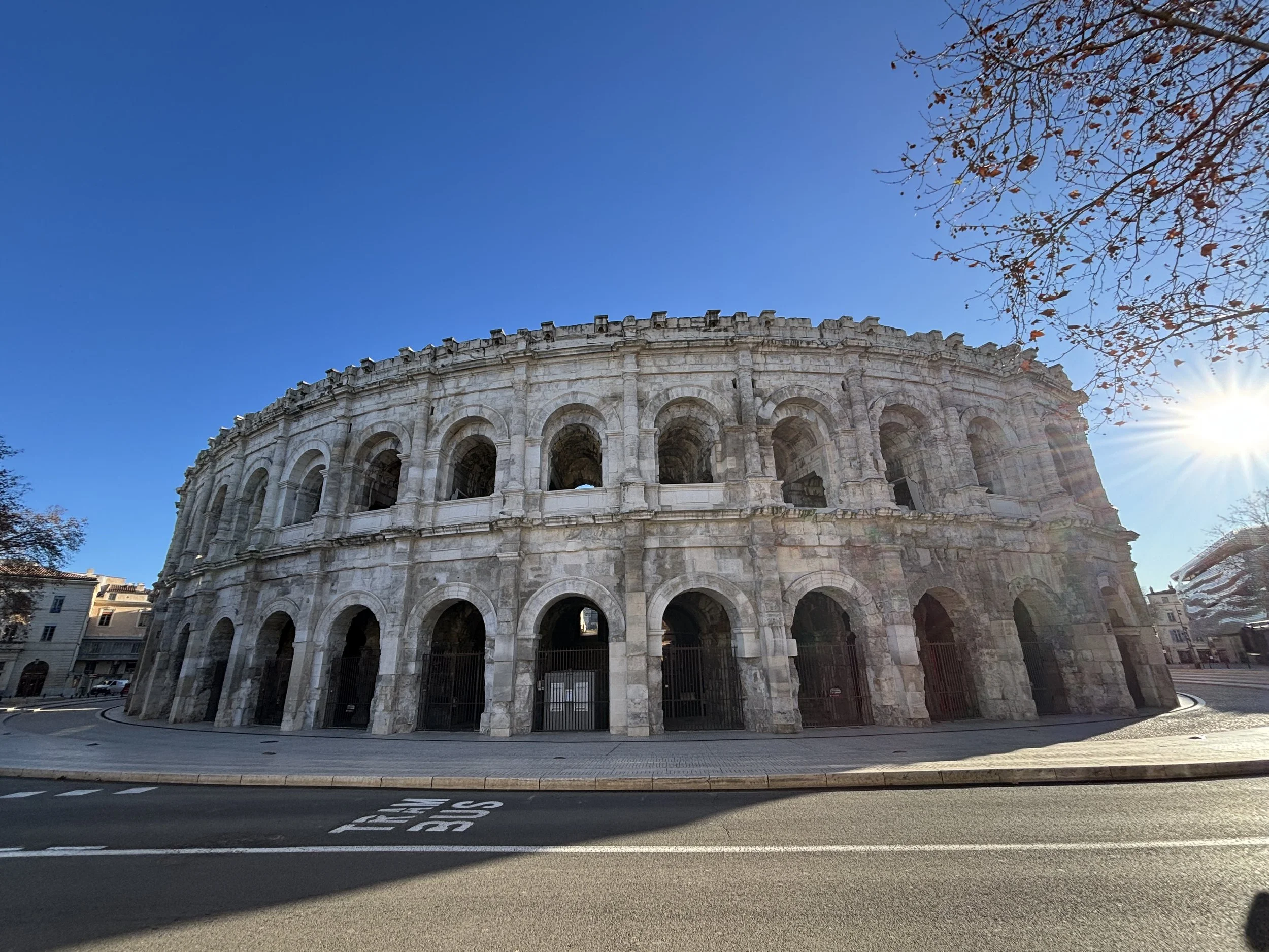
Next stop in our itinerary and our base for the night was Nîmes.
This is a very pleasant French provincial city which surprised me positively. I had heard, of course, about its Roman heritage (the city was called Nemausus in Roman times and the Pont du Gard was actually built it to keep it supplied with water), but Nîmes also has a beautiful and very walkable centre with some interesting architecture.
It is also a convenient place for an overnight stop, since, as we shall soon see, it has some great value options to eat and sleep and it is also quite easy to move around.
Visit the Arena of Nîmes
The roman amphitheatre (“Arènes de Nîmes”) is the jewel of the crown here. It is one of the best preserved (perhapsh THE best preserved) Roman arenas in the world, to the point that it is still used regularly nowadays for all sorts of spectacles. It is also super centrally located, so you can’t miss it!
Now, if you have visited other similar buildings in other parts of the former Roman Empire, you know what it is about. Nevertheless, it makes for an interesting visit, because most of the original structure is still standing you can roam through most parts of it, including the top rows, which good views of both the inside of the Arena and the city around.
The audioguide is also included with the ticket, by the way.
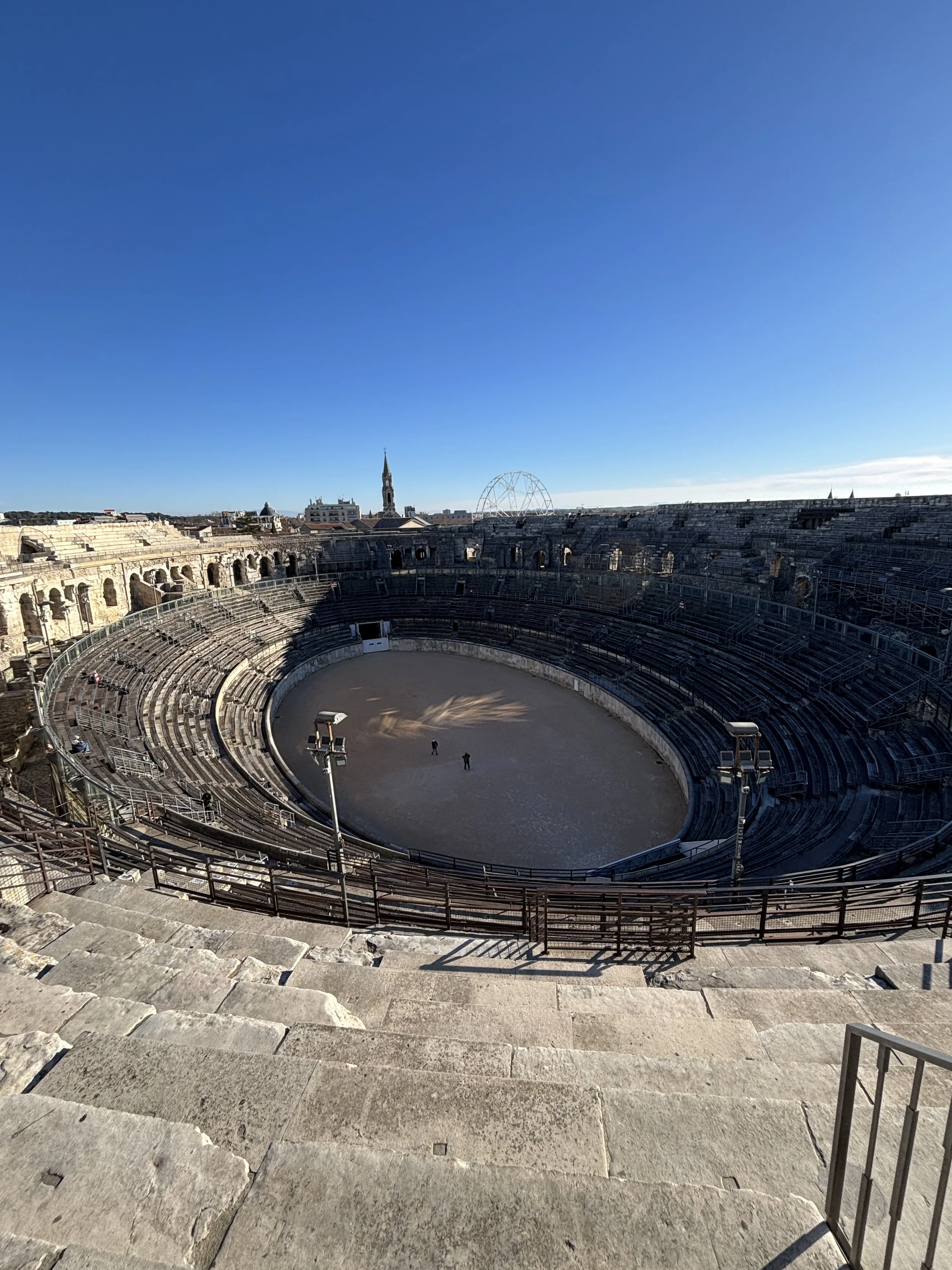
Visiting Roman Nîmes and the Maison Carrée
Nîmes is also home to another exceptionally preserved Roman structure, the temple known as “La Maisón Carrée”, which is also right in the middle of the old town. Besides the beauty of its proportions and the postcard-perfect look, it also has a small museum inside.
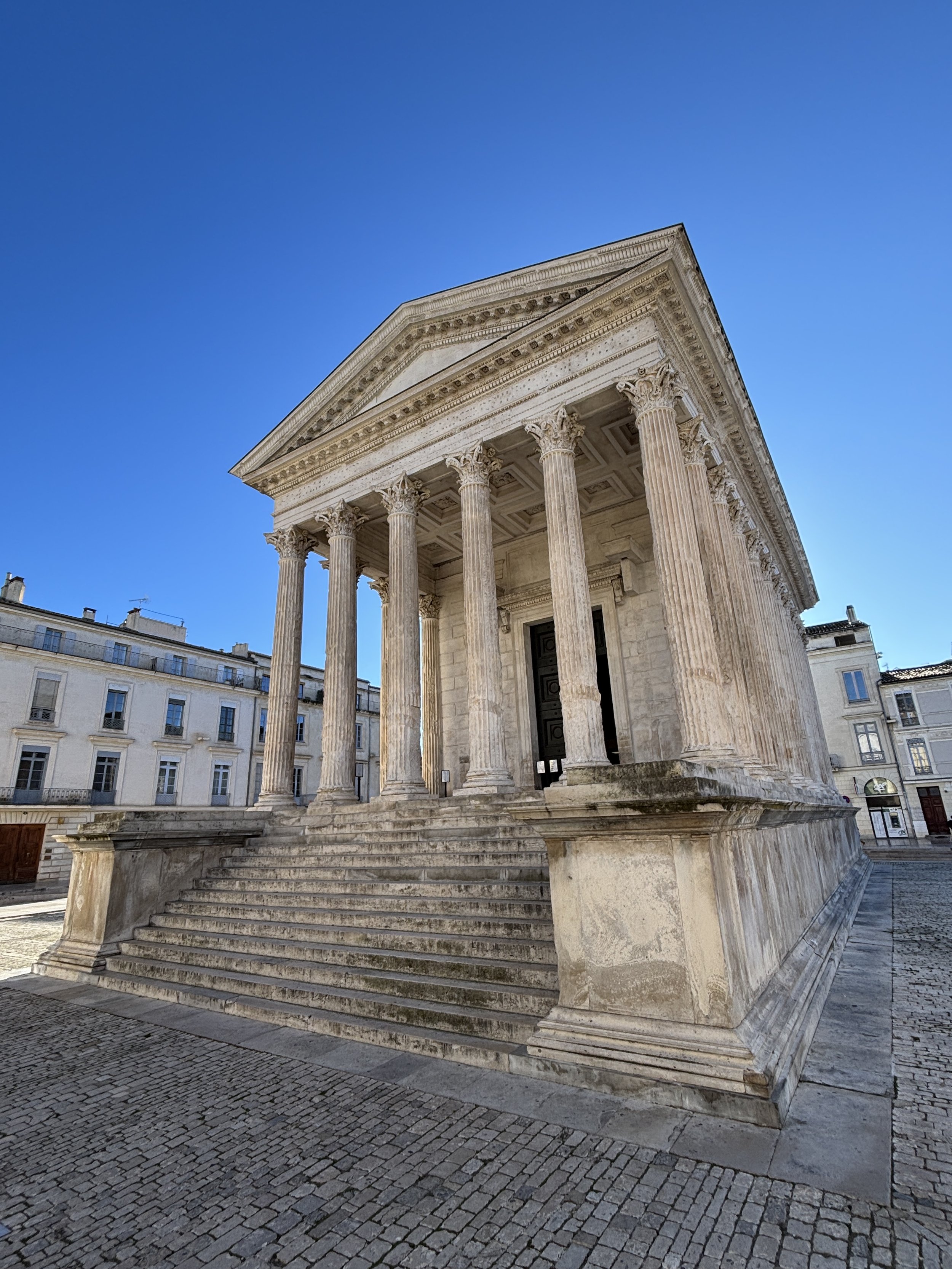
In fact there are quite a few Roman monuments in Nîmes in addition to the two presented here.
For example, there is also an old Roman defensive tower (the “Tour Magne”) at the northern edge of the city center, as well as a large archaeological museum located next to the Arena. The latter, known as “Musée de la Romanité” is housed in a contemporary landmark building next to the Amphitheatre. We didn’t have time to visit it, but read very good reviews.
It is possible to purchase a combined ticket which lets you visit all the sites for an advantageous price (although it is also possible to buy individual tickets, as well, if you don’t plan to visit them all).
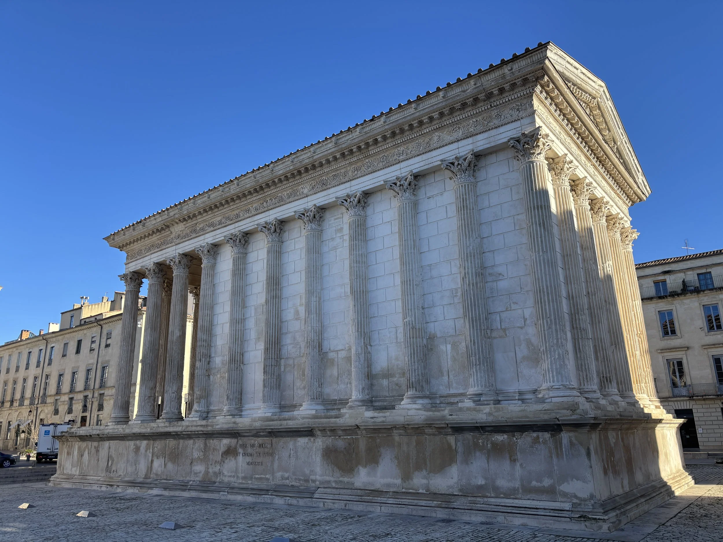
Walking in Nîmes historical center
But besides the Roman monuments, Nîmes has also a rather beautiful, even grand, downtown.
Parts of it had the typical French “Republican” civic architecture. Large majestic buildings in neoclassical style and large open space are found in the area adjacent to the Arena (including a rather impressive Great War memorial with thousands of names on it).
The old town has a more intricate maze of small streets, with plenty of shops, cafés and small hotels.
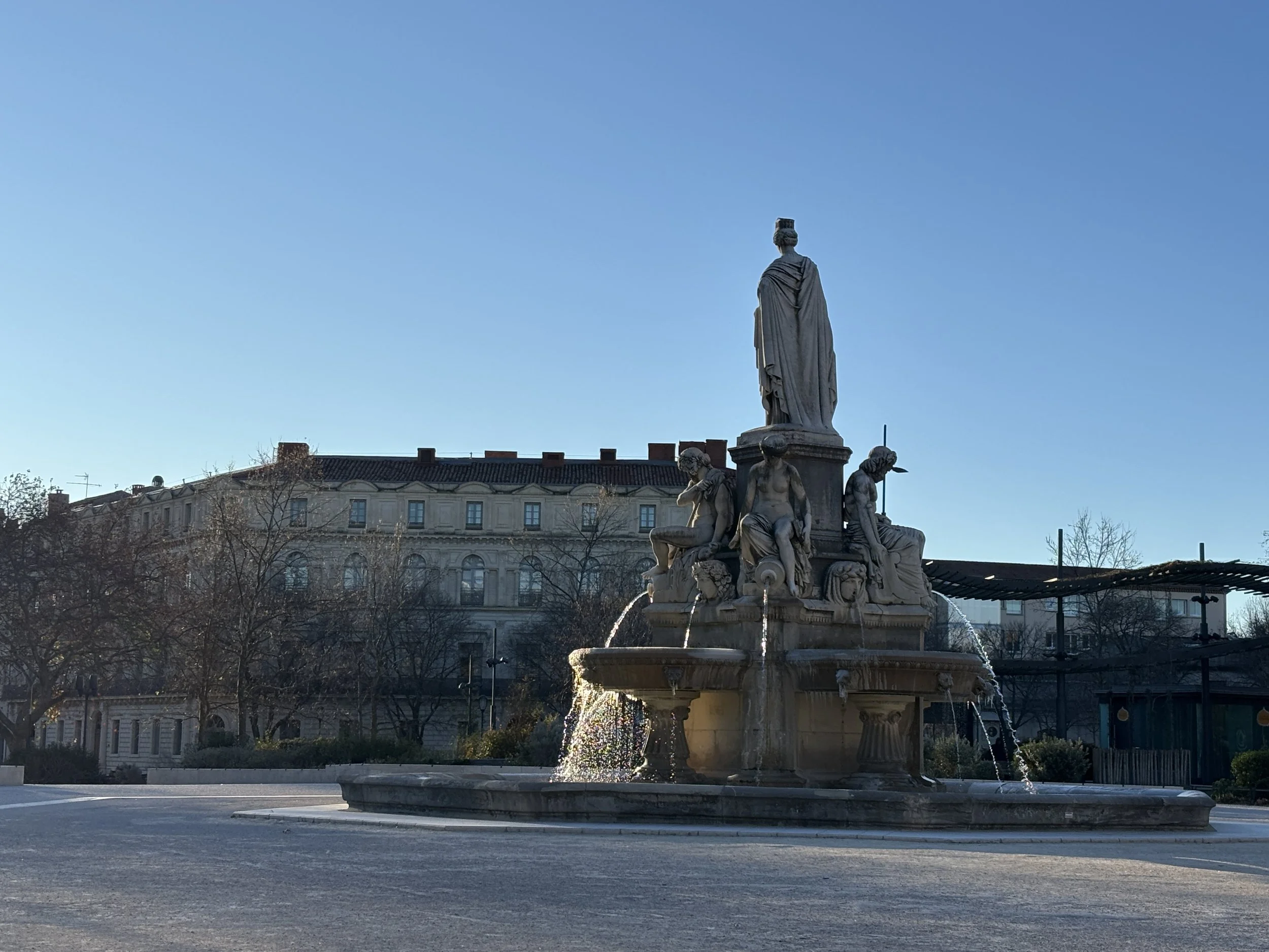
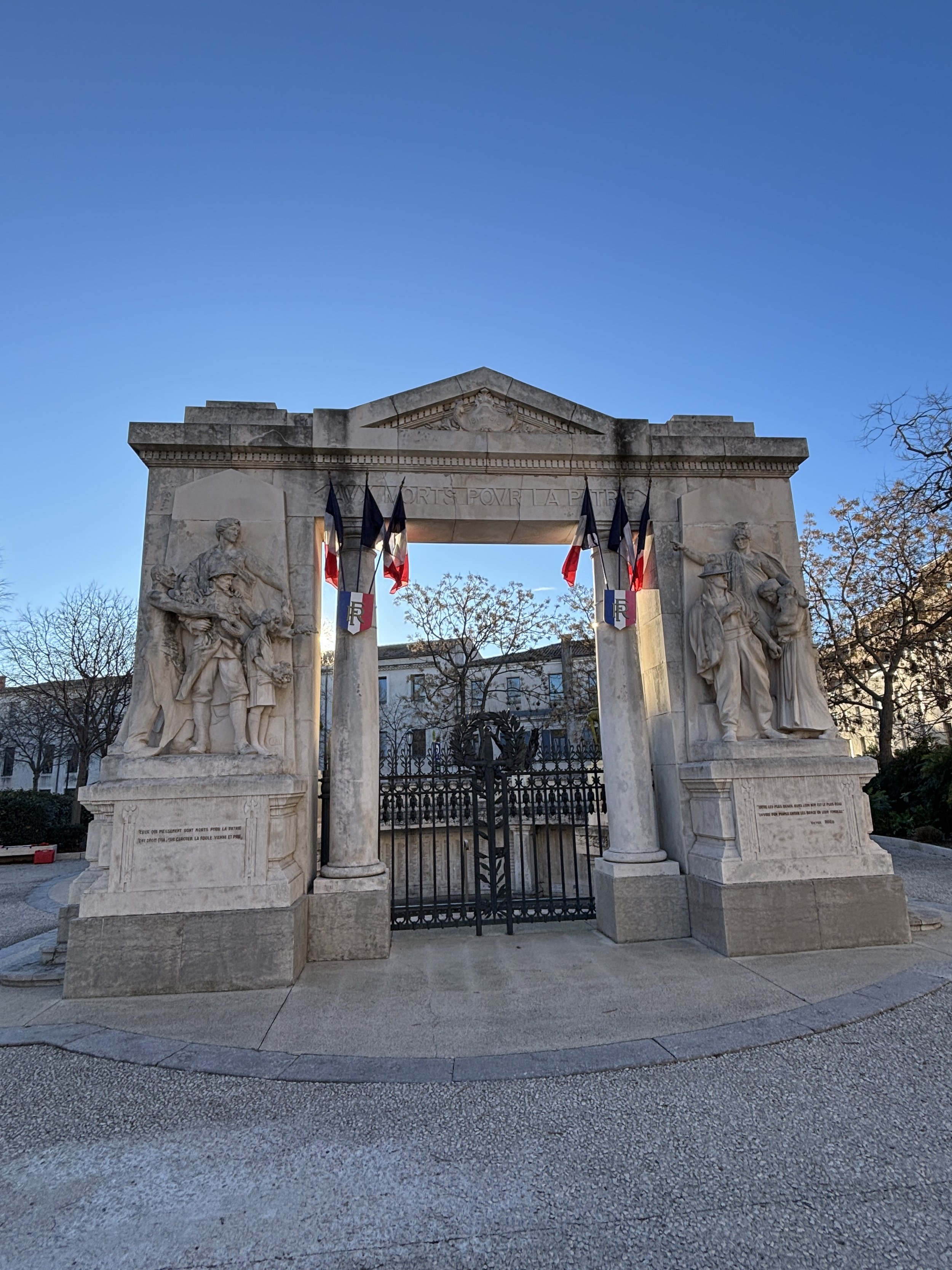
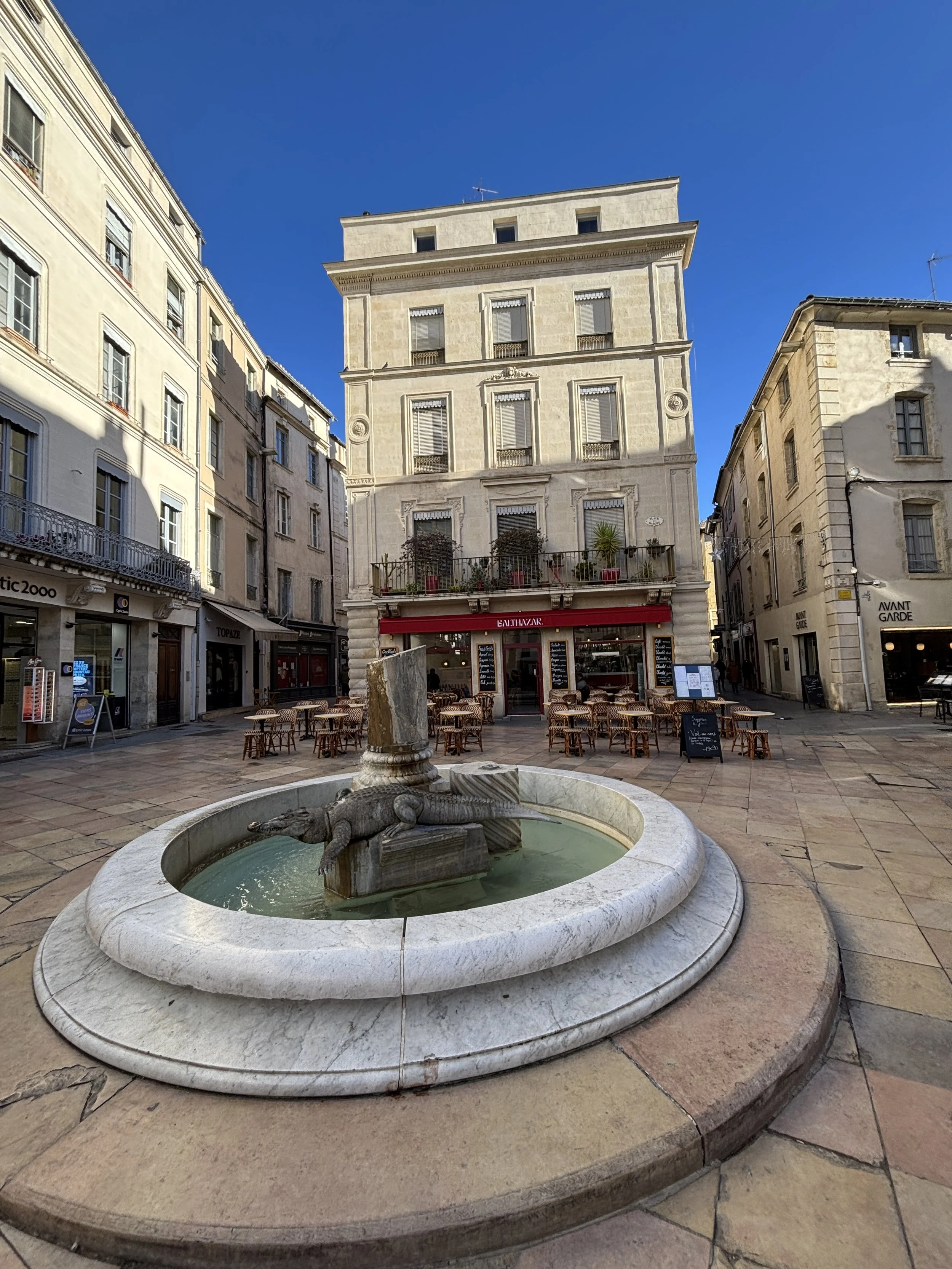
Here are quite a few details from the morning walk through downtown Nîmes, from the crocodile that adorns one of the fountains in the old town, to some touches of contemporary architecture that mix with the more traditional harmony of the old town.
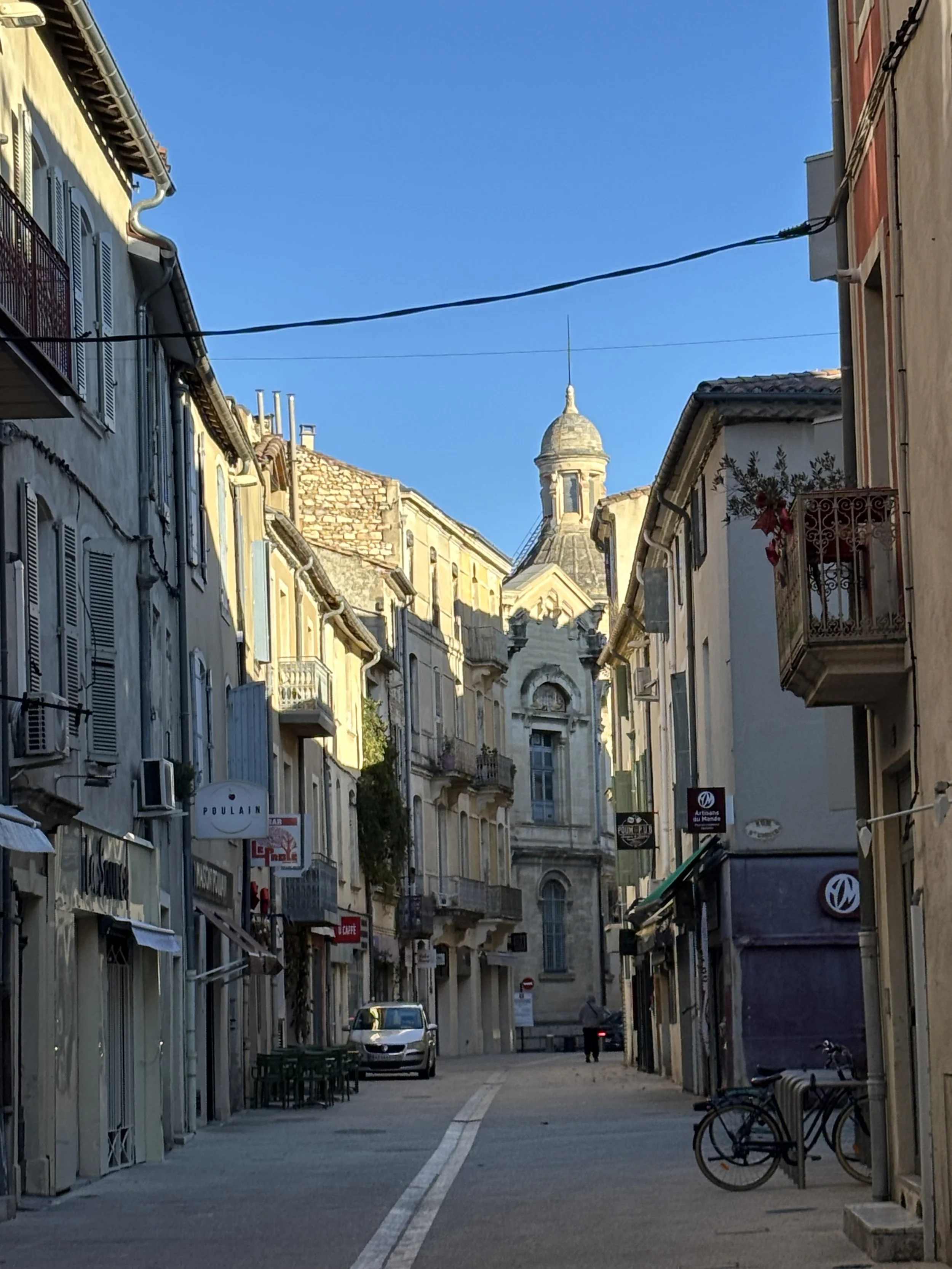
Where to eat in Nîmes
Wine Bar Restaurant Cheval Blanc
1 Pl. des Arènes, 30000 Nîmes, France
https://www.winebar-lechevalblanc.com
This is a cozy French restaurant located right in front of the Roman amphitheatre.
It features an artsy-bohemian decor with lots of motifs related to bullfighting, which is an activity which has a long tradition in Nîmes.
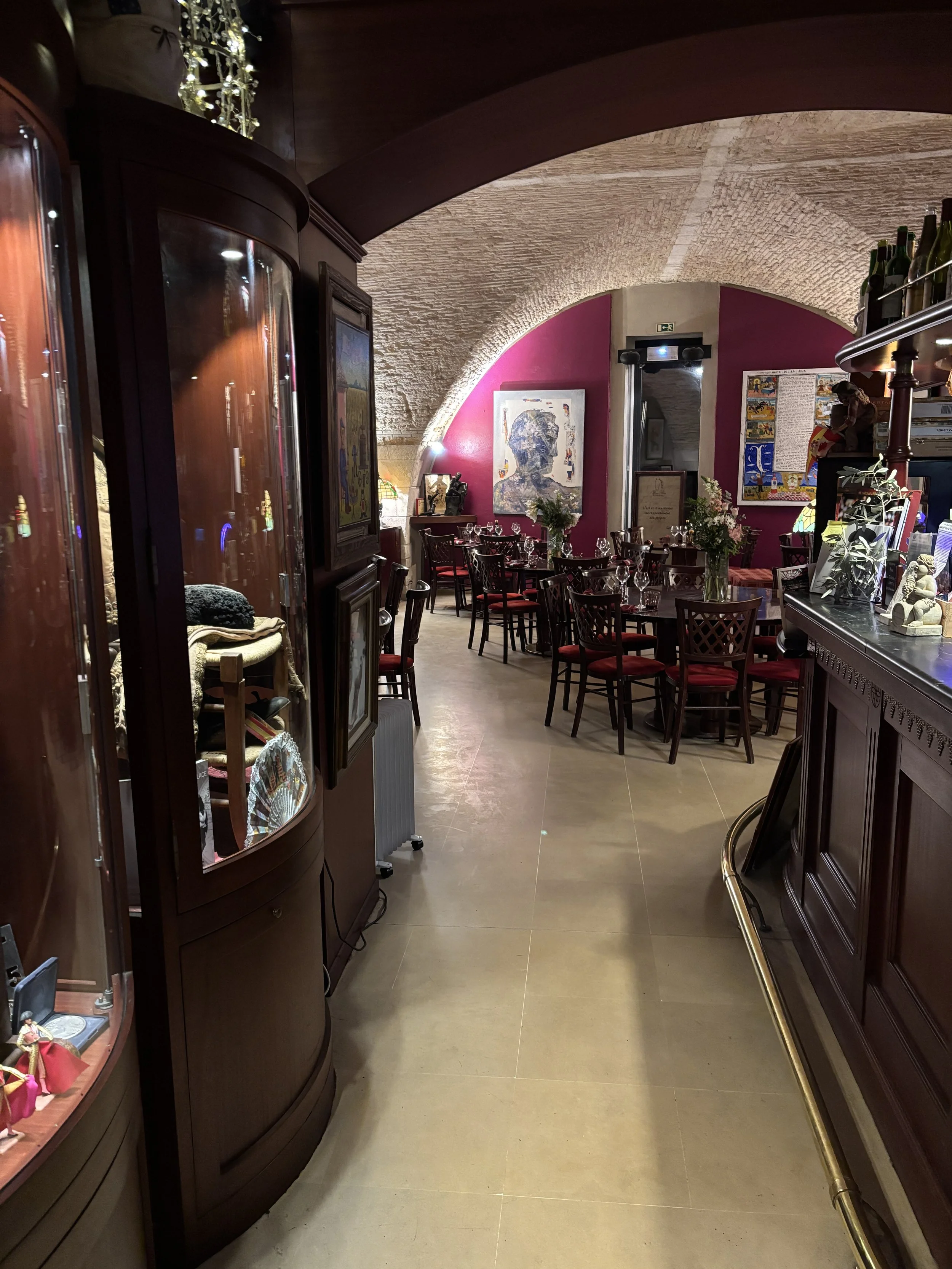
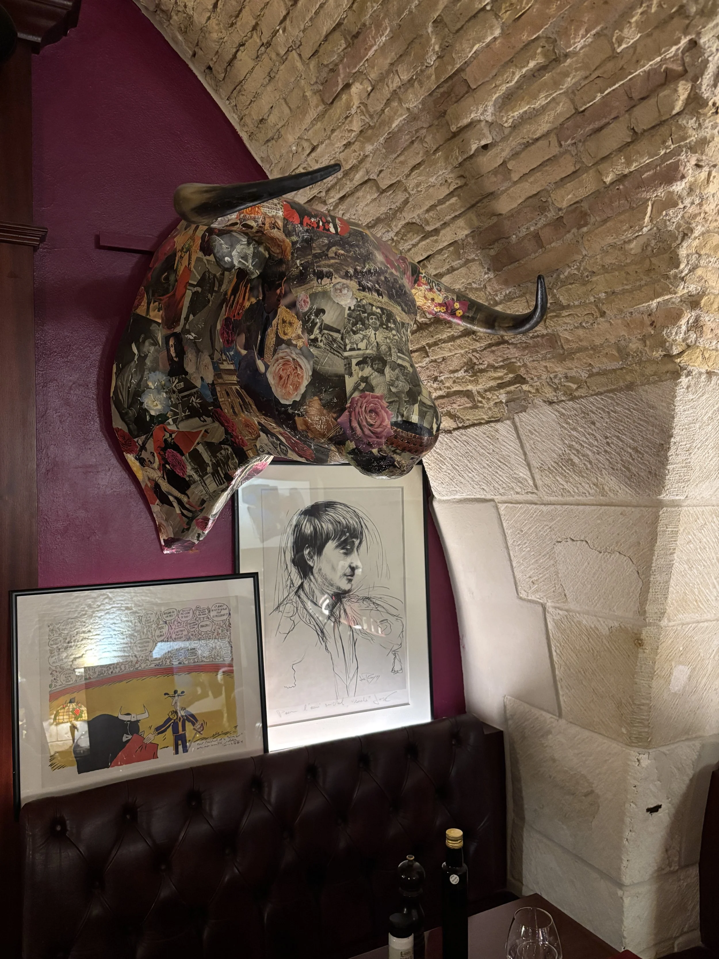
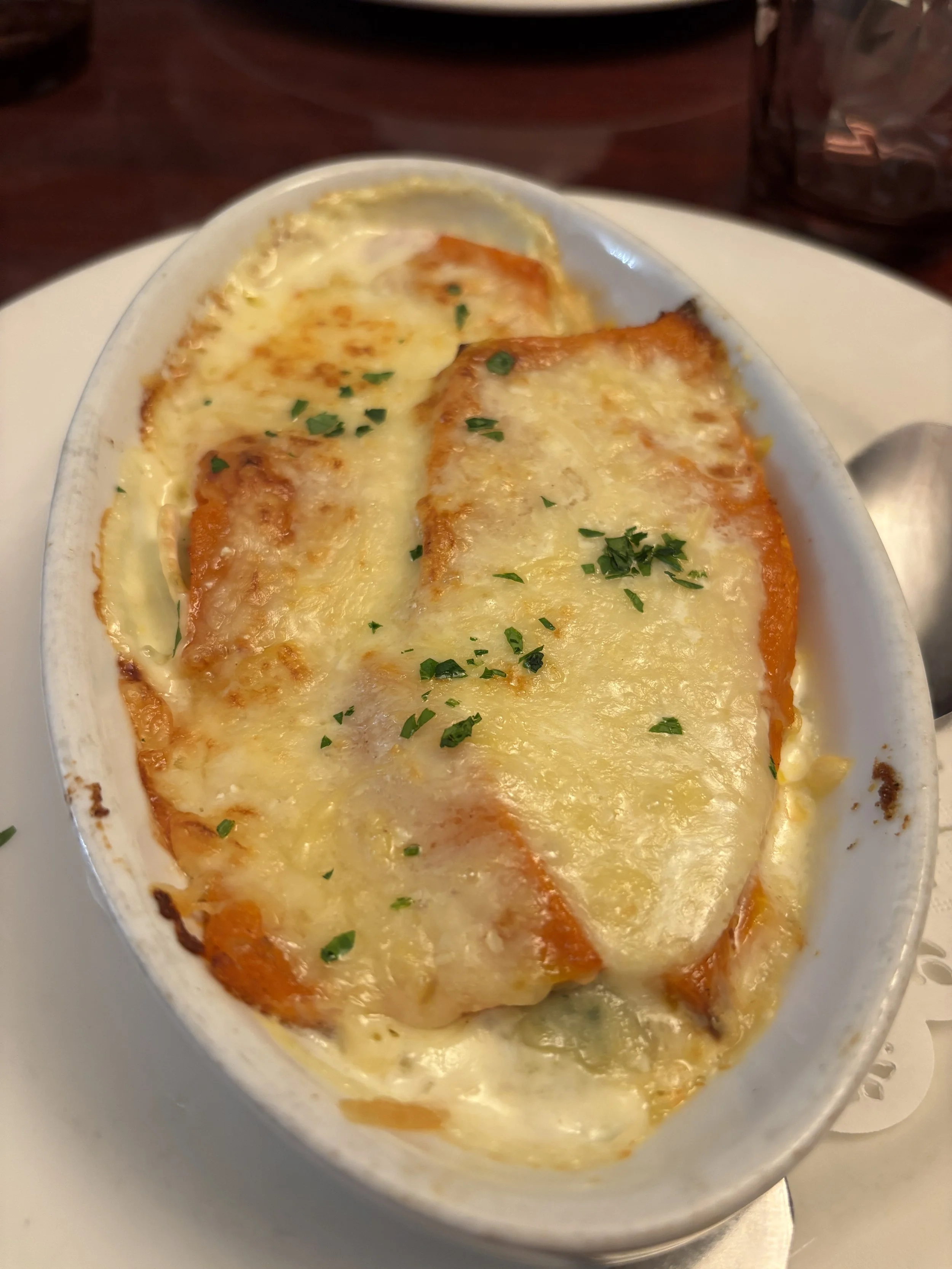
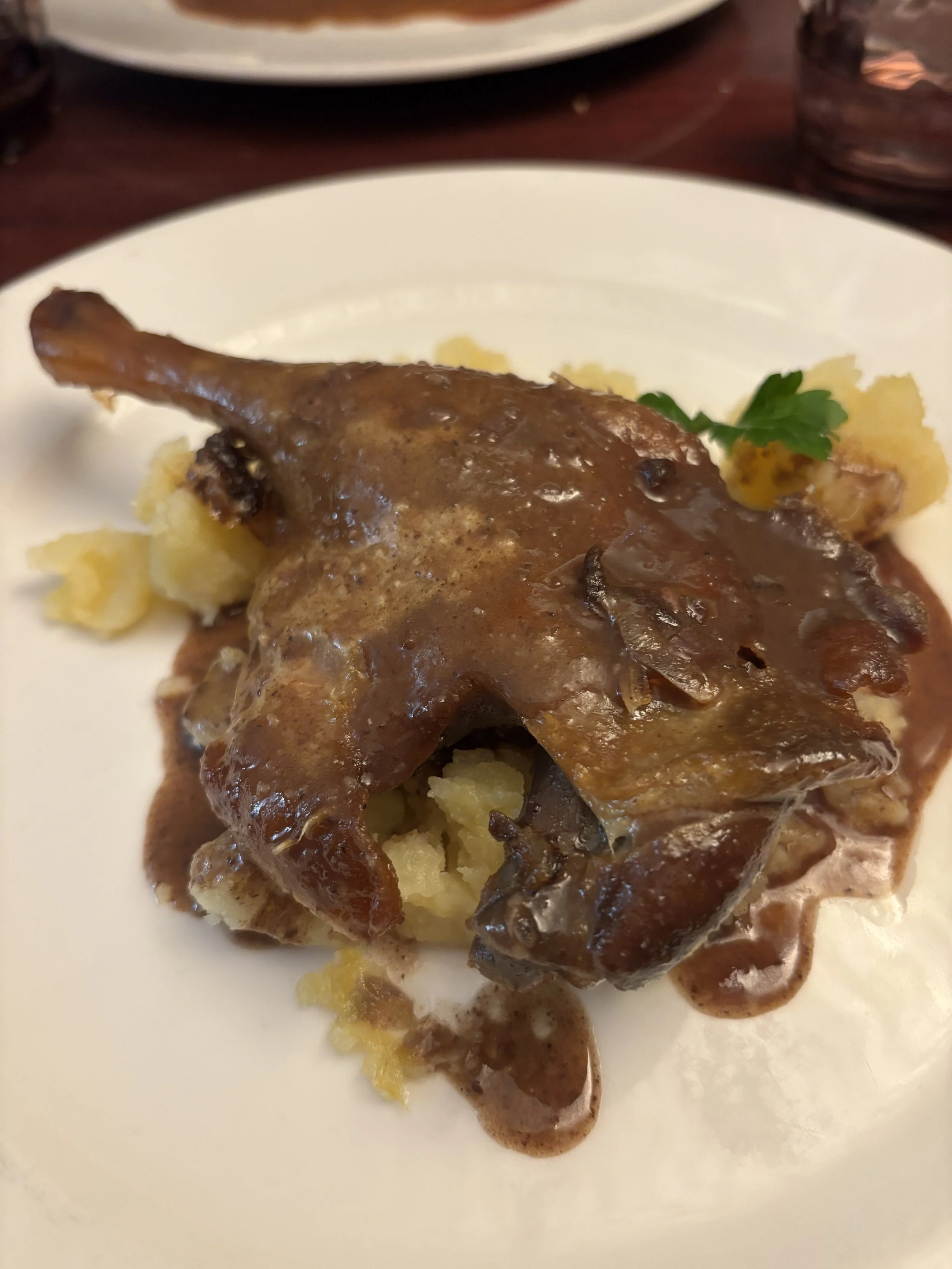
At Cheval Blanc you will find, essentially, French cuisine specialities. The food was rather good overall, it didn’t disappoint, it was exactly what we were looking for. You can see our choices here.
Service was a bit slow and at times the staff appeared a bit inexperienced, although to be fair they strived to make up for this by being extra nice and they were very diligent whenever we had some query or request.
Extra points for the desserts, which were amazing!
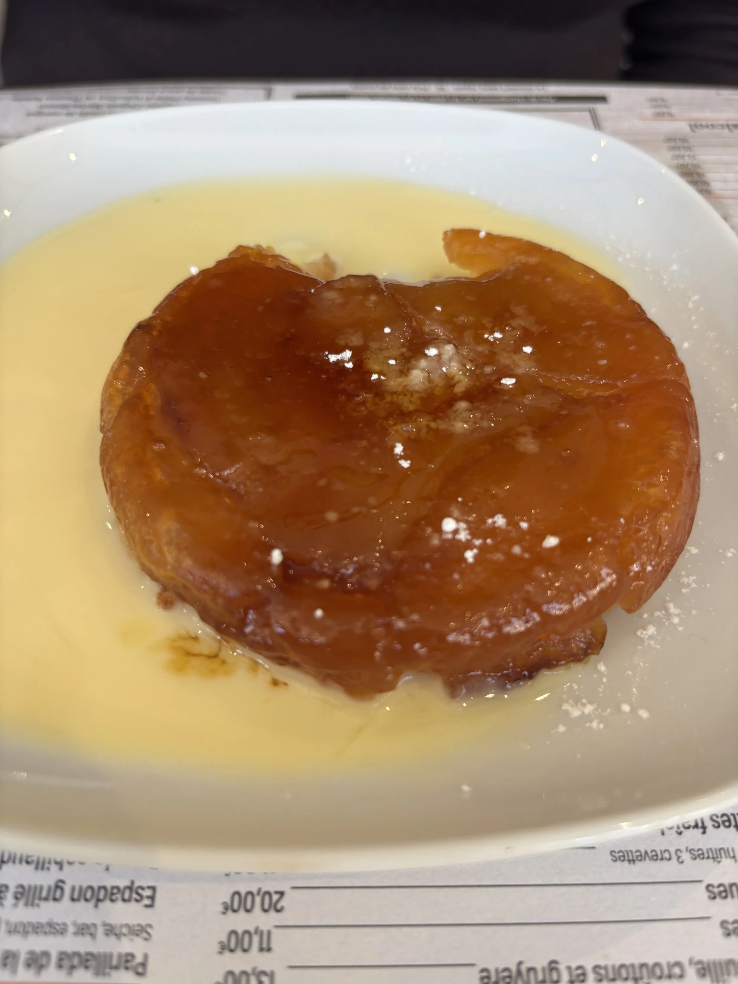
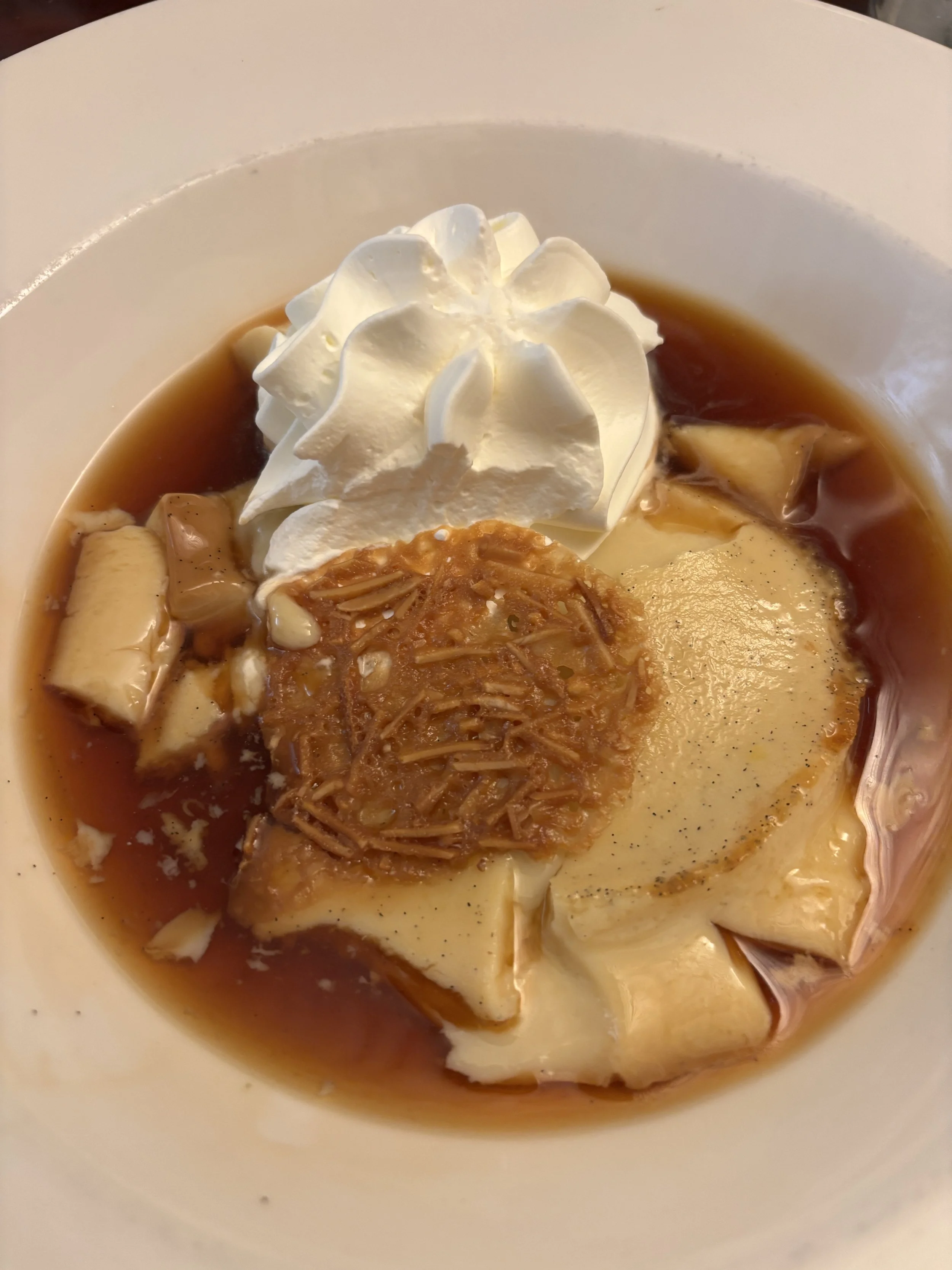
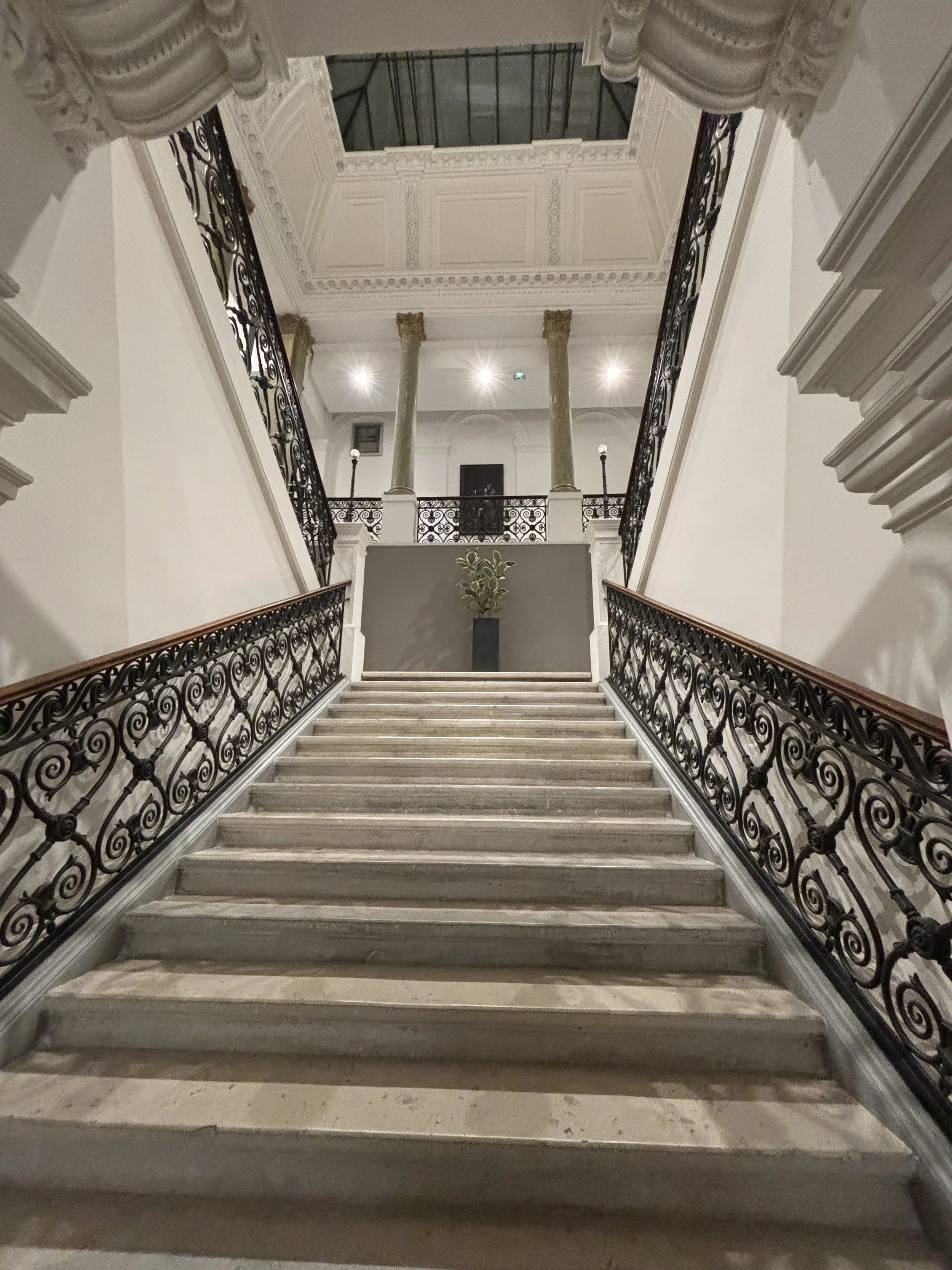
Where to stay in Nîmes
Appart'City Collection Nîmes Arènes
1 Bd de Bruxelles, 30000 Nîmes, France
This is an amazingly good value option to stay in Nîmes. It is as centrally located as it gets: just opposite the Roman Arena. and right next to the city’s main post office.
These serviced apartments (a hotel in all but name), occupies a grand, almost palatial, building which may have been a bank or something like this in the past, or at least it looks the part.
Staff at the reception were also quite nice in giving us very good advice for our visit downtown. It is also possible to park for free evenings and weekends on the nearby streets (there is a large paid car park under the adjacent square).
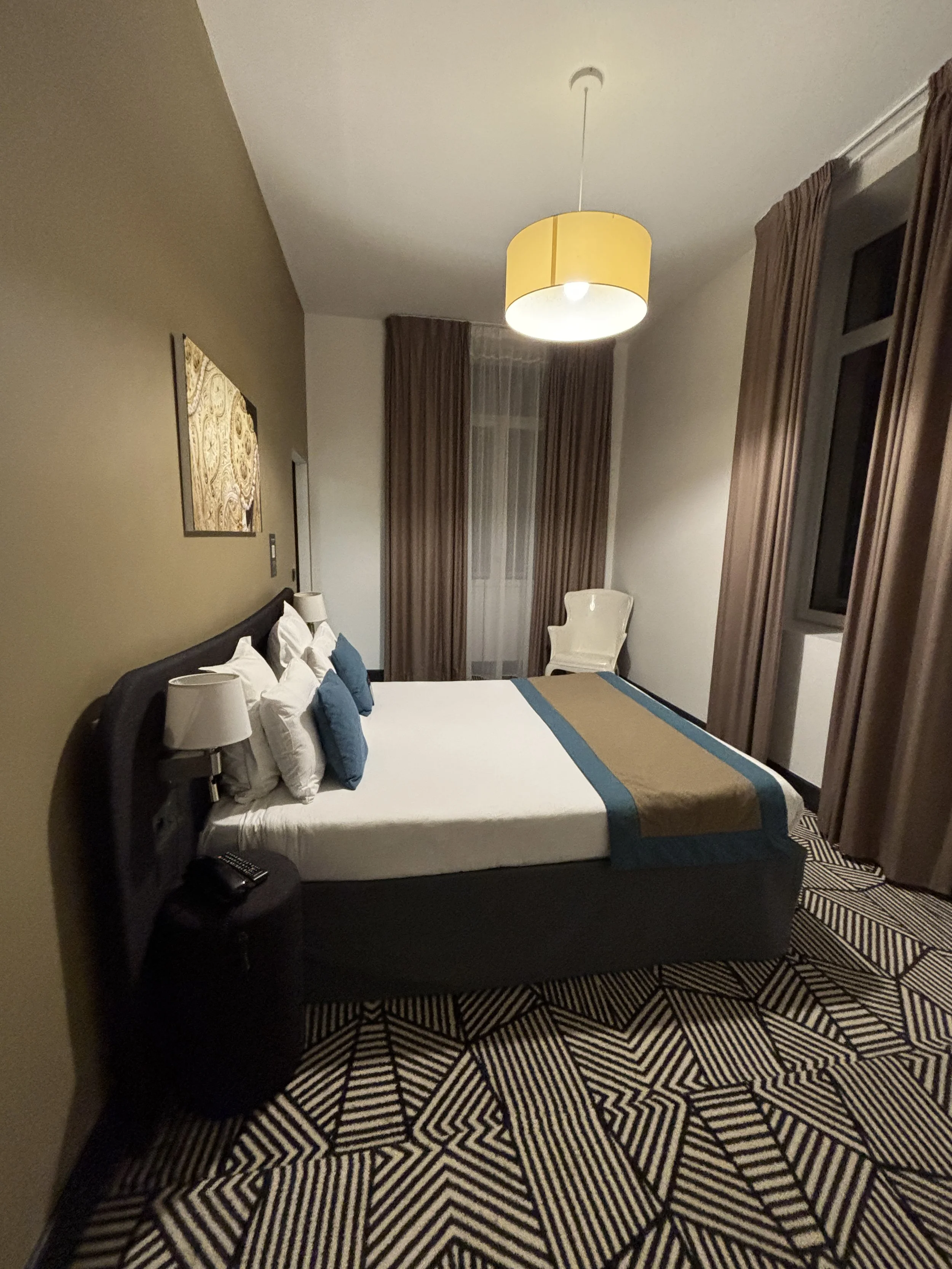

The room was huge! In fact it was more like a proper apartment with several differentiated areas: bedroom, living room-kitchen, with a large sofa that can be turned into a king size bed, bathroom and a sort of elongated studio and storage area as annex of the main bedroom.
I don’t know if all the rooms are that large, but it was truly spacious! And all of this cost around €100.
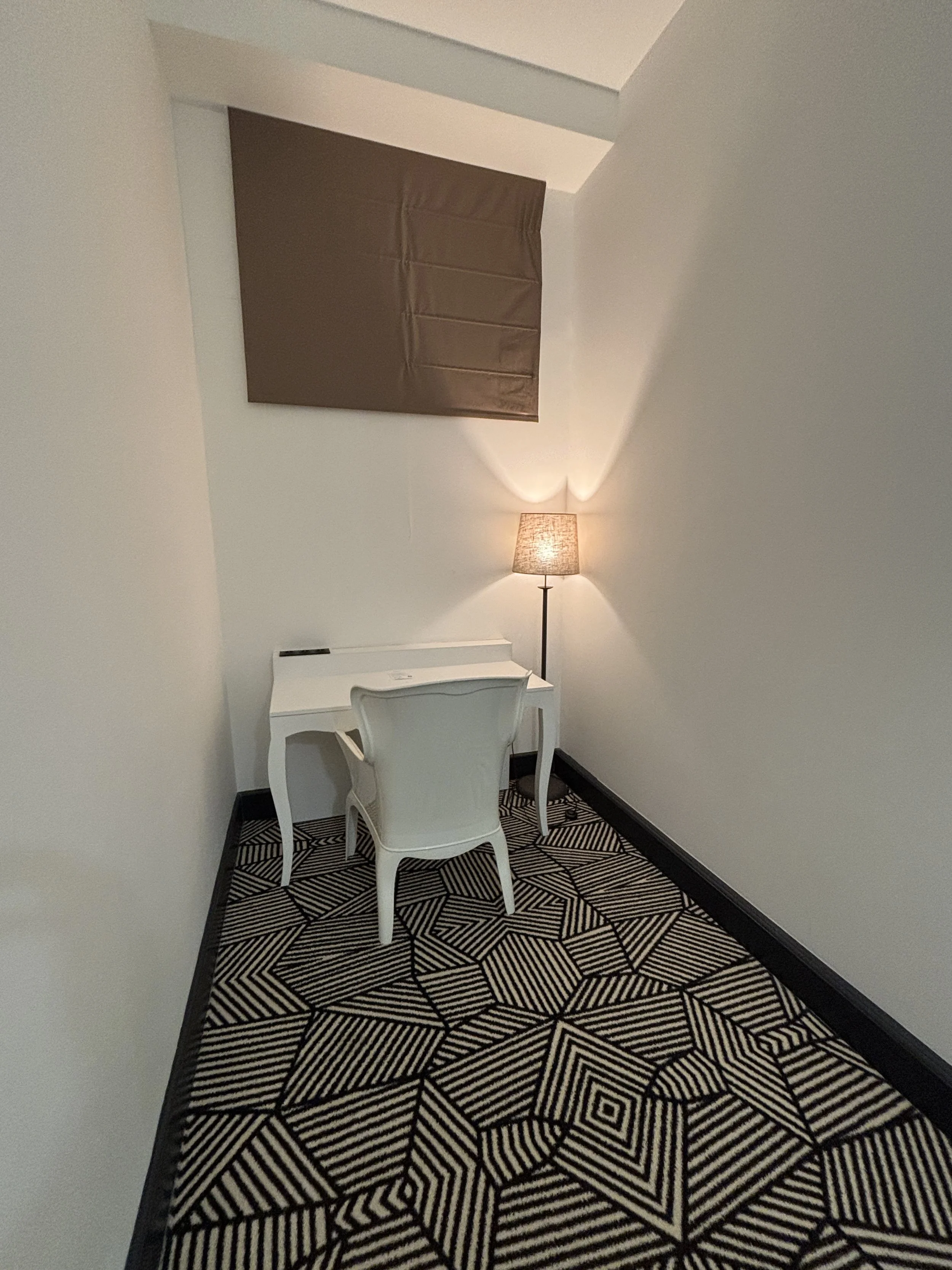
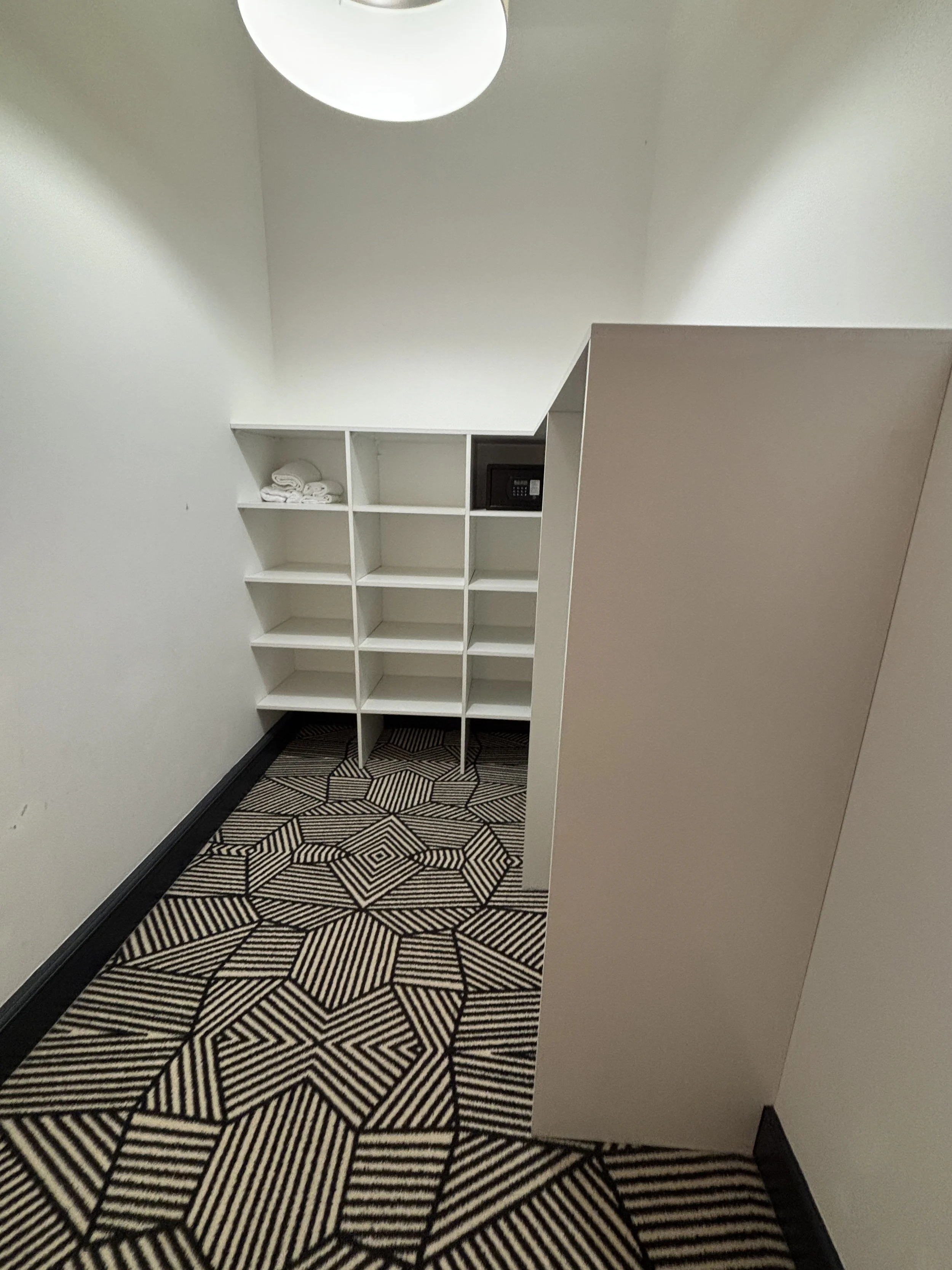
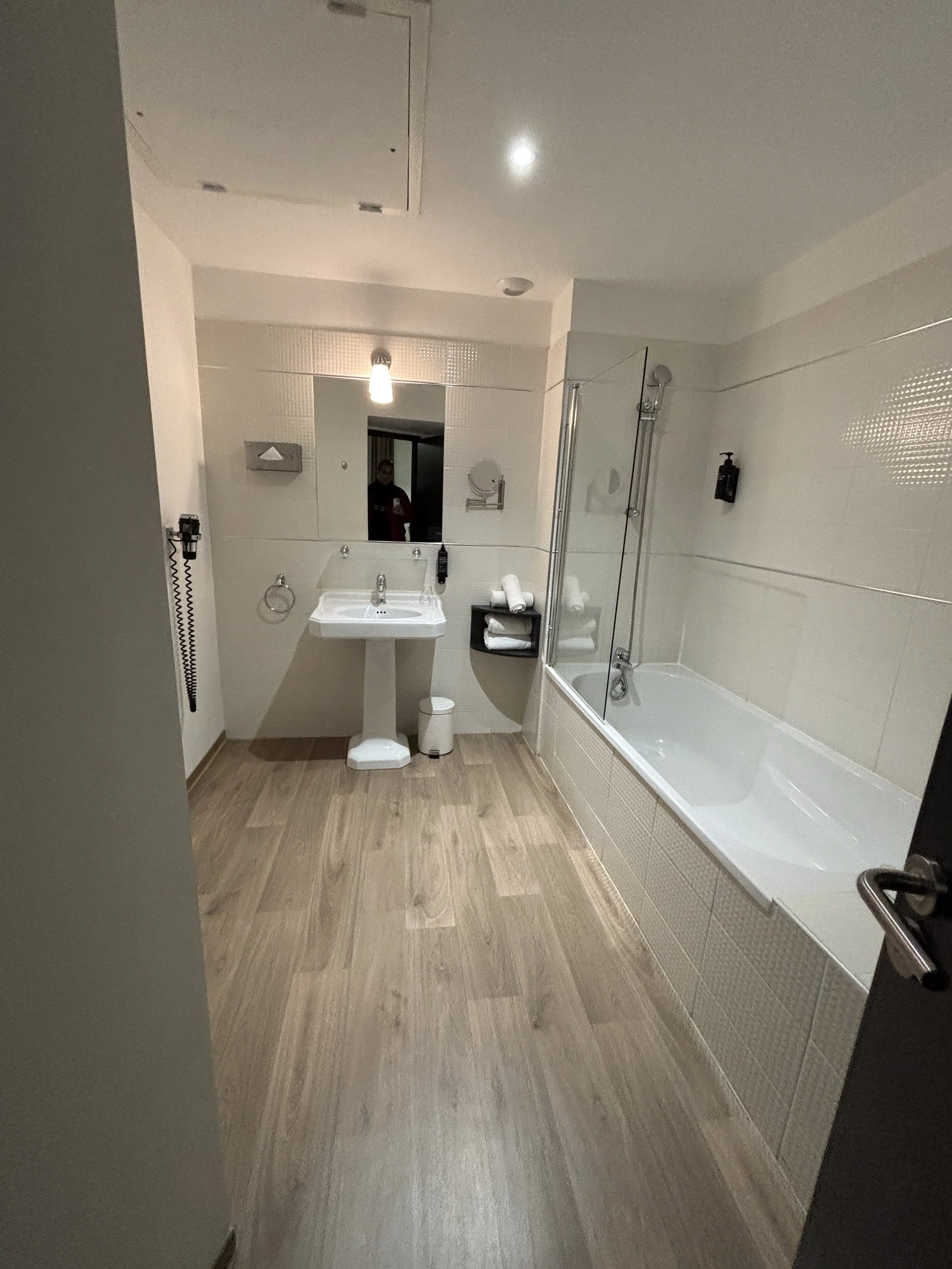
What to see in Aigues-Mortes
So, if you are in Nîmes and have a car, you may want to drive down to the Camargue, the marshy area at the mouth of the river Rhône.
The Camargue is, in fact, quite a large region that occupies most of the coastline between Montpellier and Marseille. To properly experience it, you would need to spend several days there, but, if you are short of time, you can make a quick stop at the walled medieval town of Aigues-Mortes, some 40 kilometres south of Nîmes.
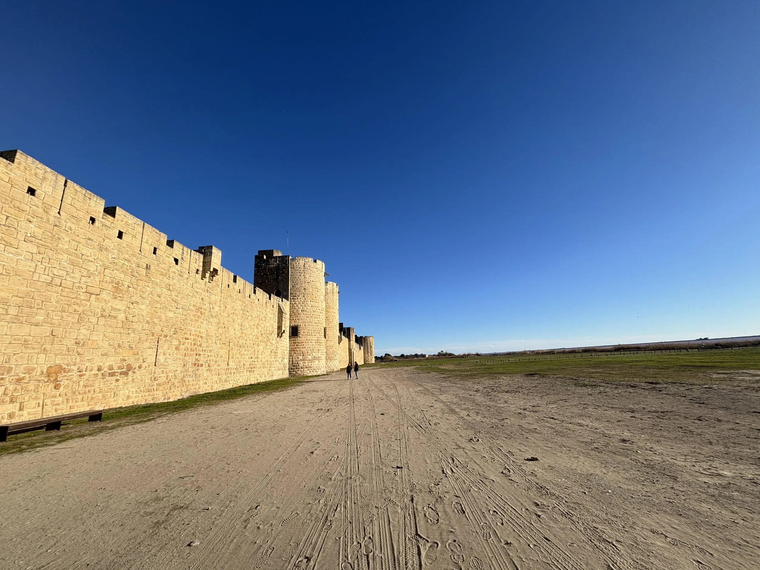
Aigues-Mortes was a departure port for the Crusades in the 13th C. You can see, from the size of its walls that this was a place of quite some importance in the Middle Ages. In fact, Aigues-Mortes has managed to preserve, to a large extent, its medieval characters, being still to this day completely enclosed by the very impressive medieval walls.
As its name implies (“Dead Waters” in Occitan language), Aigues-Mortes is surrounded by water and swamps pretty much on all sides. It is also pretty close to, but not directly on the sea shore. There is a canal on one side of the old town and a lagoon and salt pans on the other one.
This lagoon turns pink at certain times of the year (not at the time of our visit), making for some amazing photo opportunities, although, to get the best angles I think you need to get to quite some distance from the ramparts!
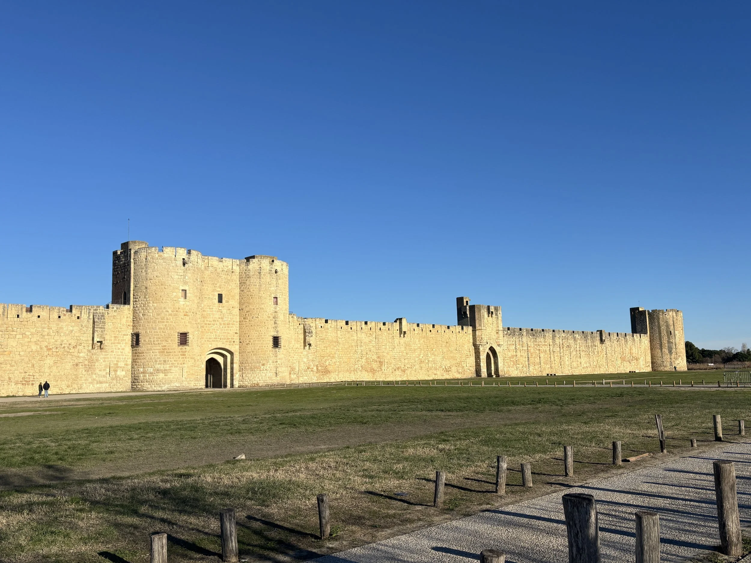
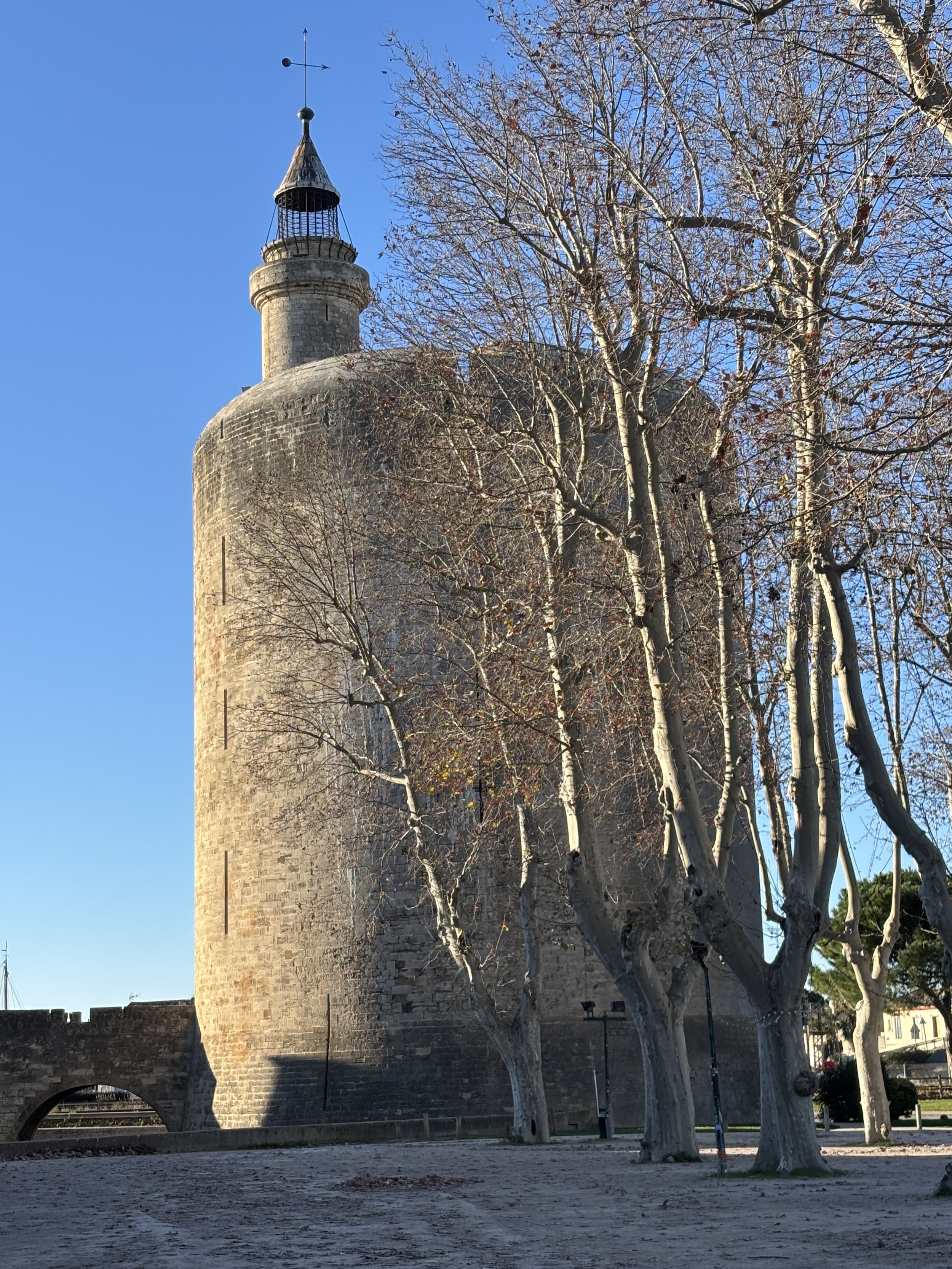
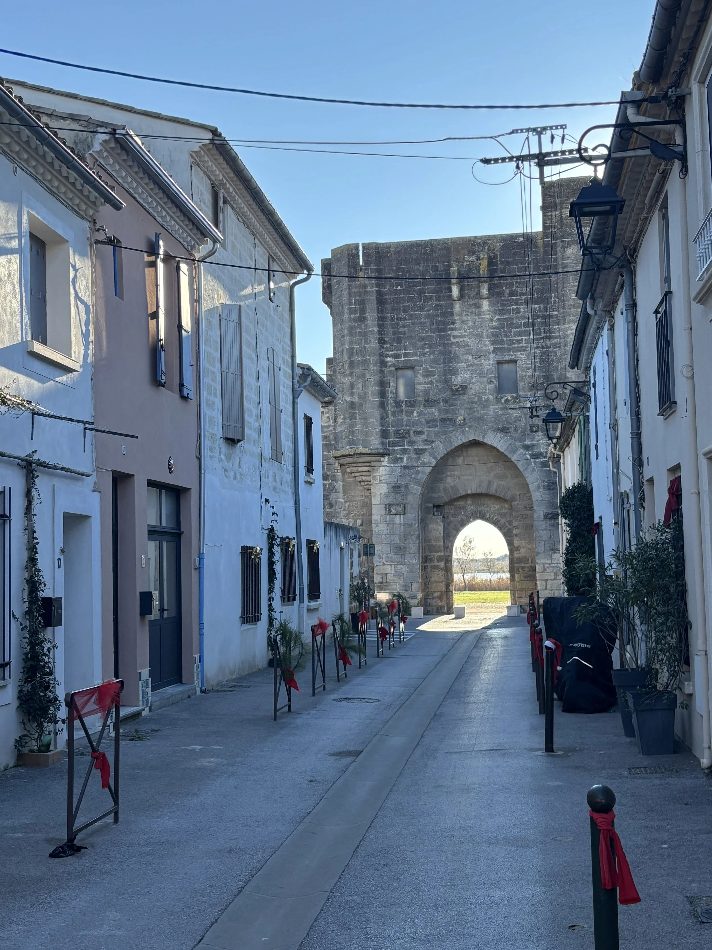
As you would expect in such a heritage-rich city, its centre is all pretty much pedestrianized (there are paid car park right outside the city gates), and while there are not major landmarks standing out within the walls, the beauty of the place is the harmony of the ensemble.
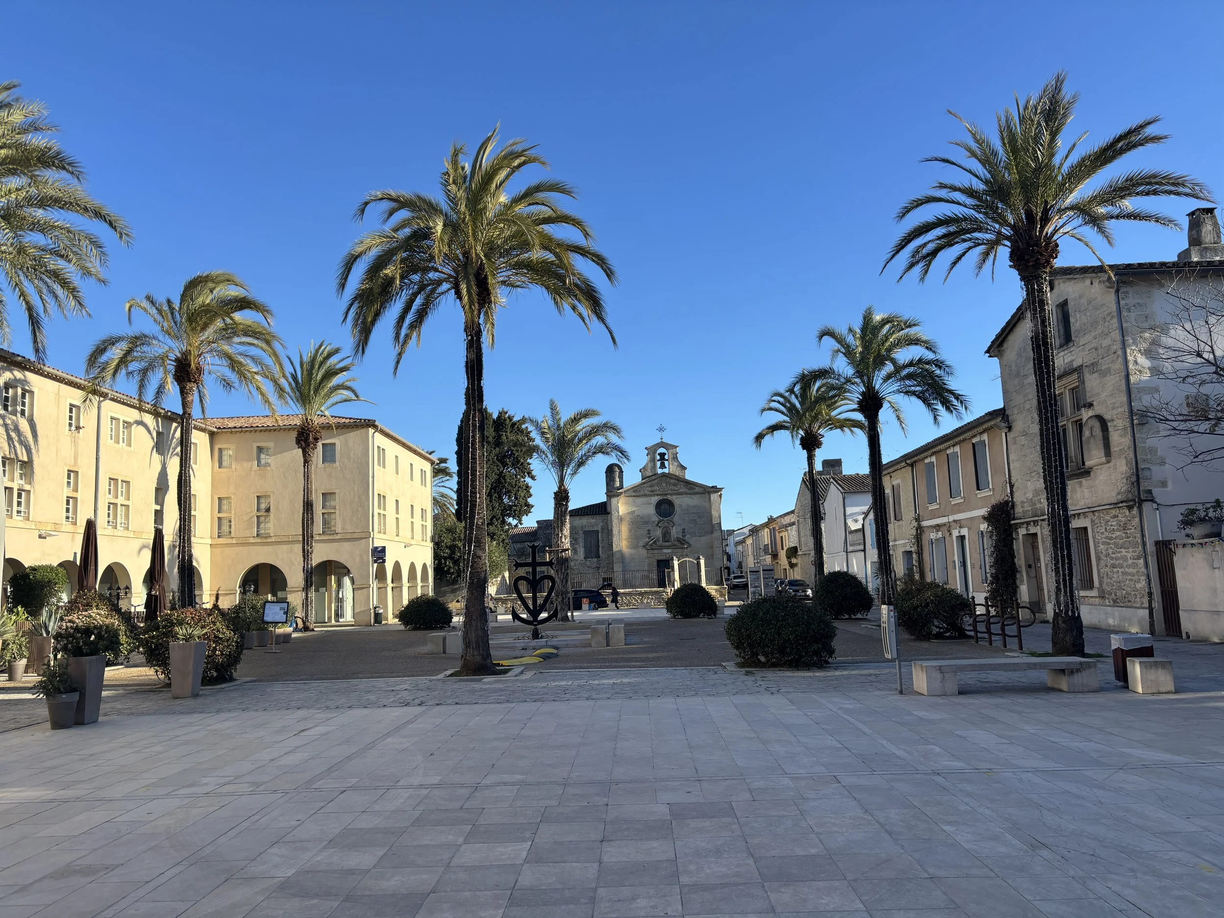
Where to eat in Aiguesmortes
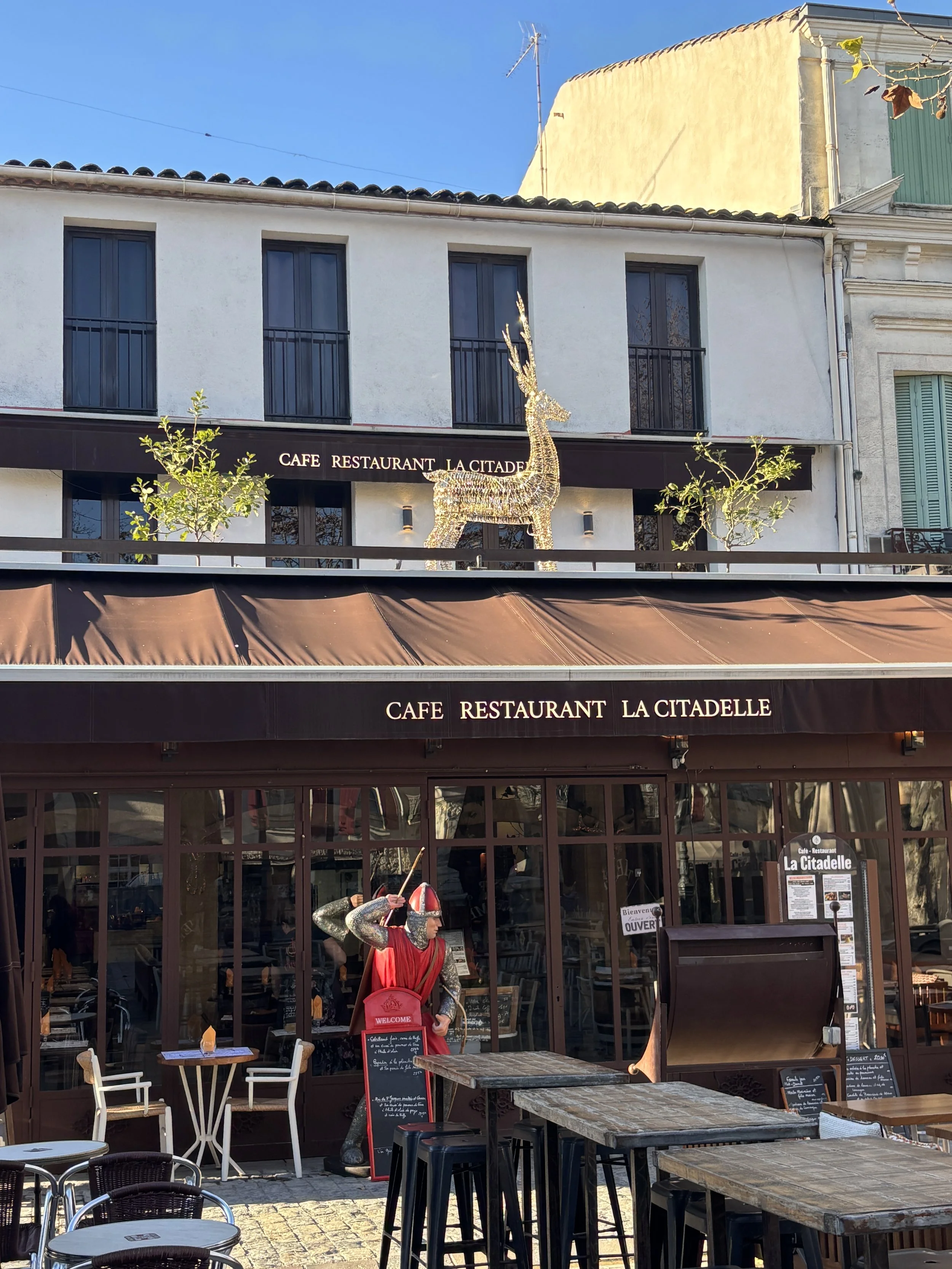
Restaurant La Citadelle
10 Pl. Saint-Louis, 30220 Aigues-Mortes
https://restaurantlacitadelle.shop
This restaurant is located on the main square of Aiguesmortes (Place Saint Louis).
We picked this place up a bit randomly (it was one of the few places that were open at the time of our visit) and it turned out to be quite a find!
It has two areas, a large spacious hall inside and a terrace (it is also a café) which I am sure it is rather nice when the weather is warm and sunny.
It is a rather unpretentious place overall, but here you can enjoy some local specialities, excellent seafood and great service.
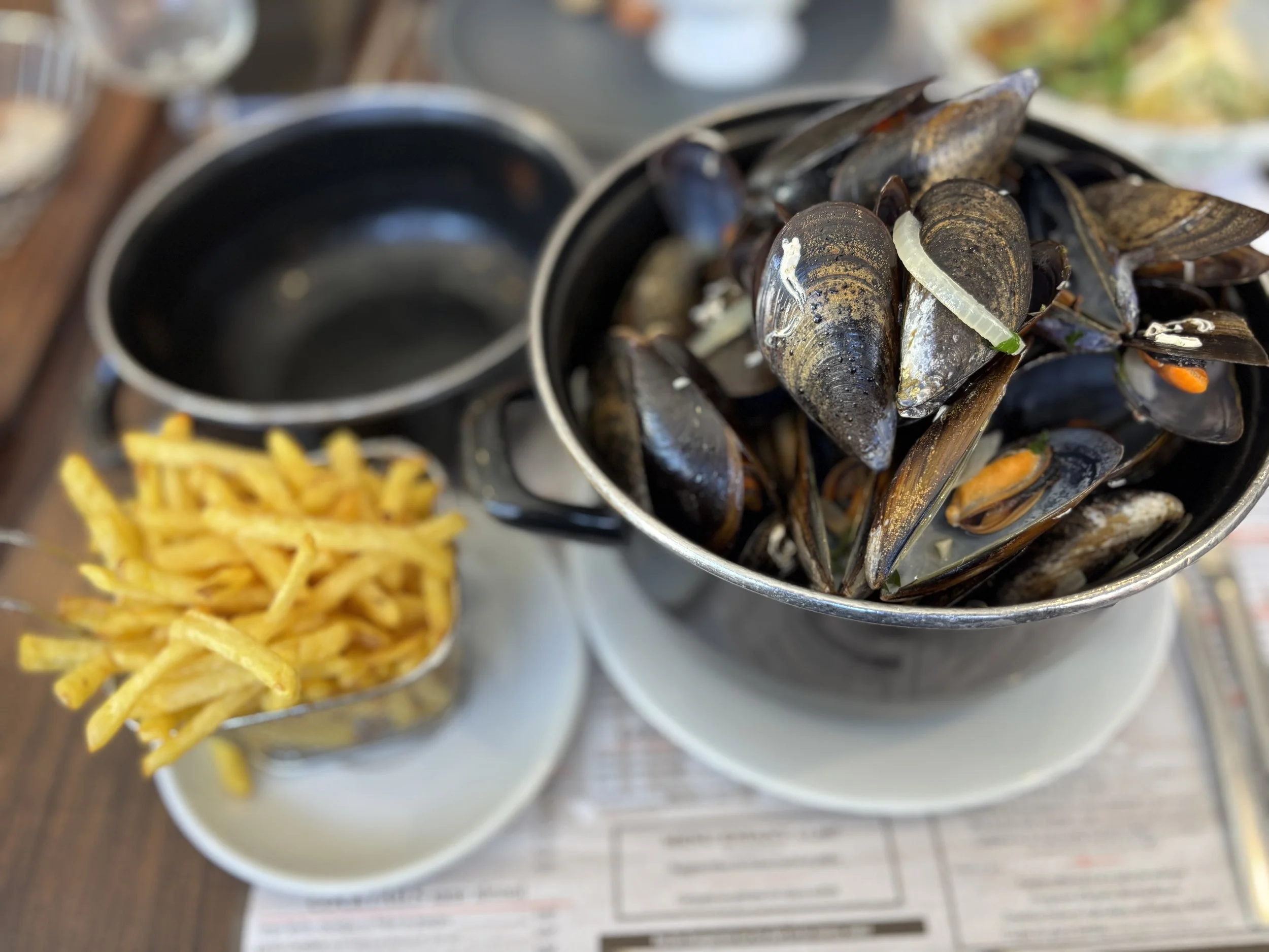
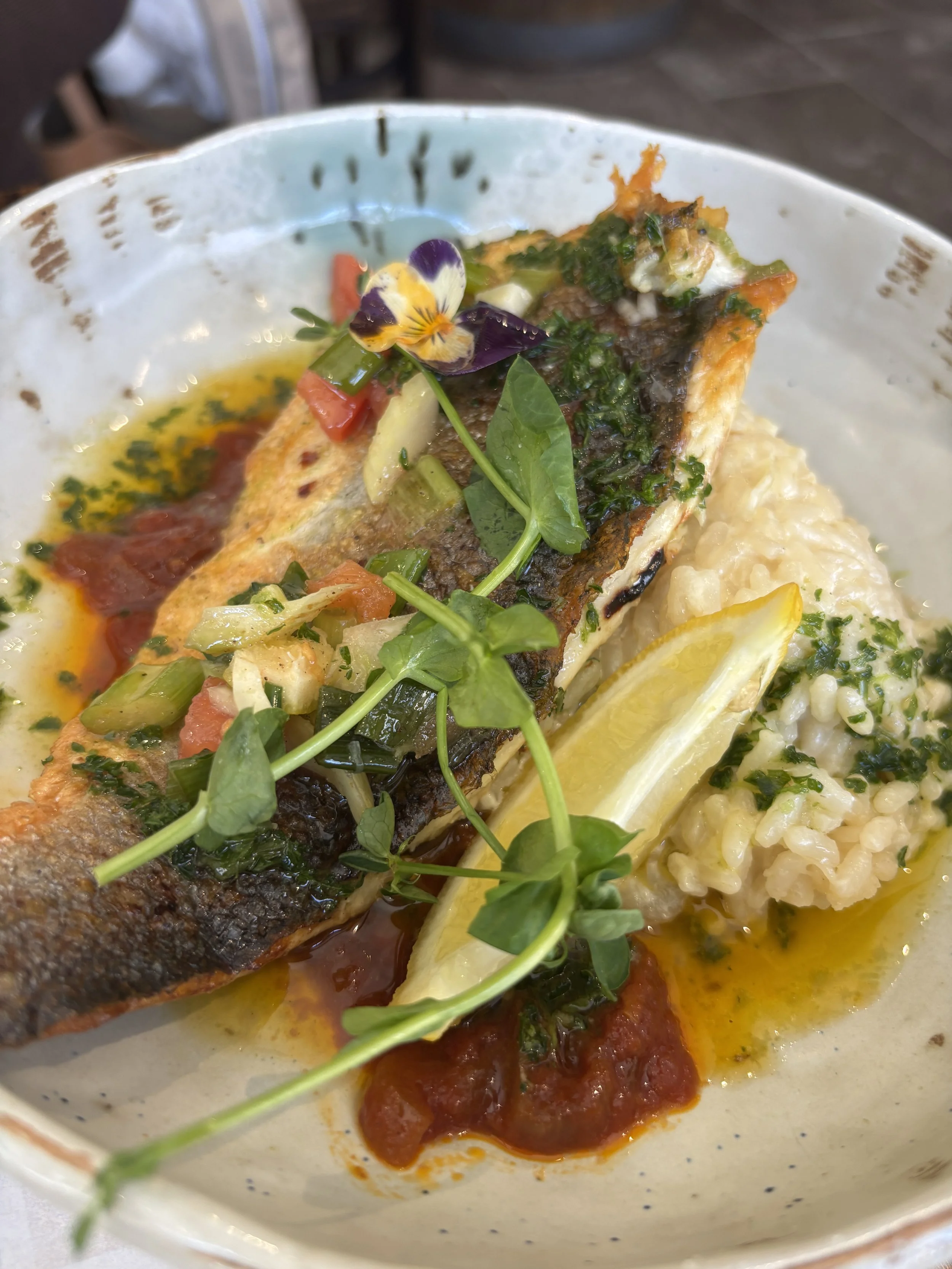
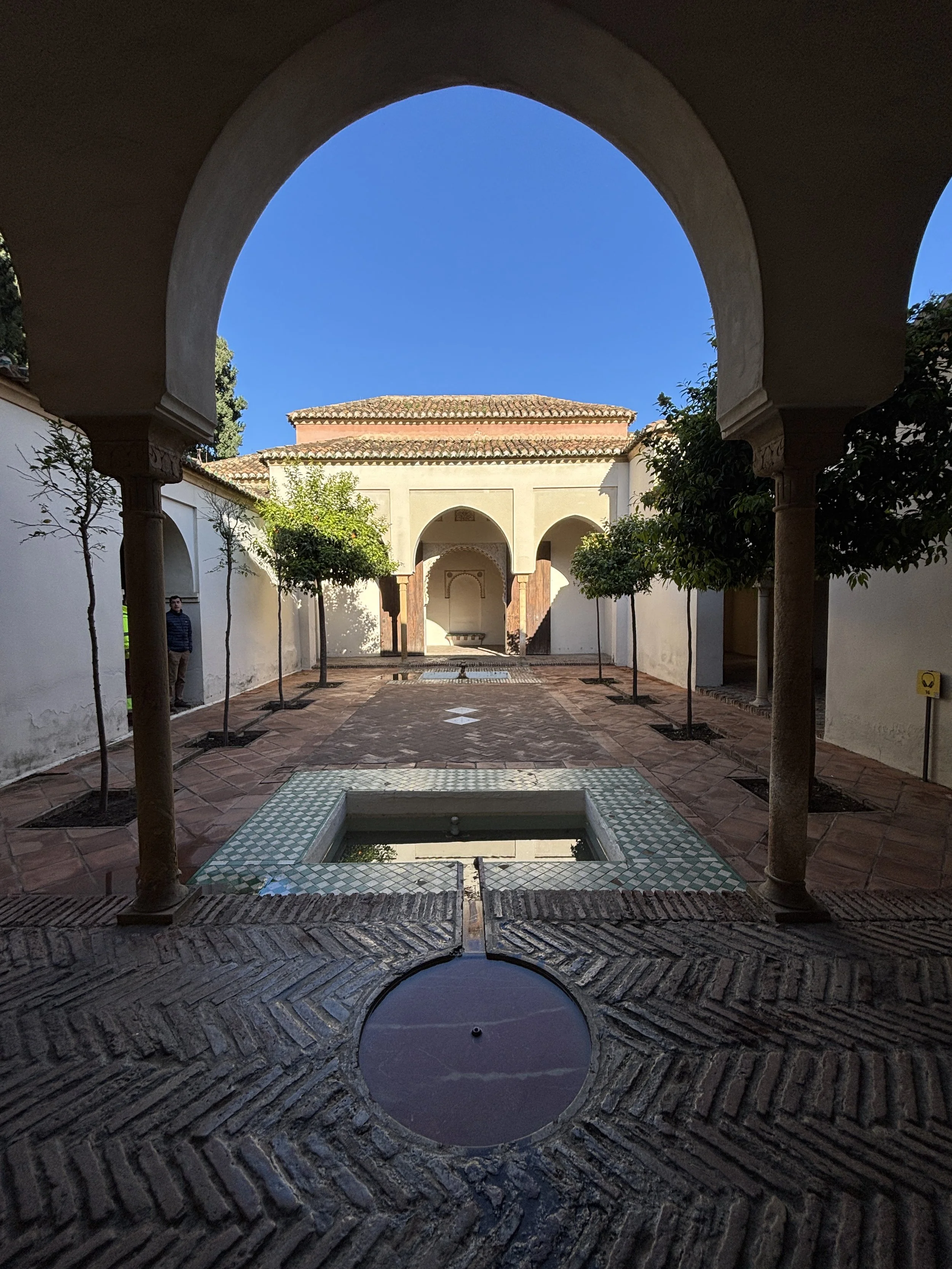
A day in Málaga, what to do and what to see
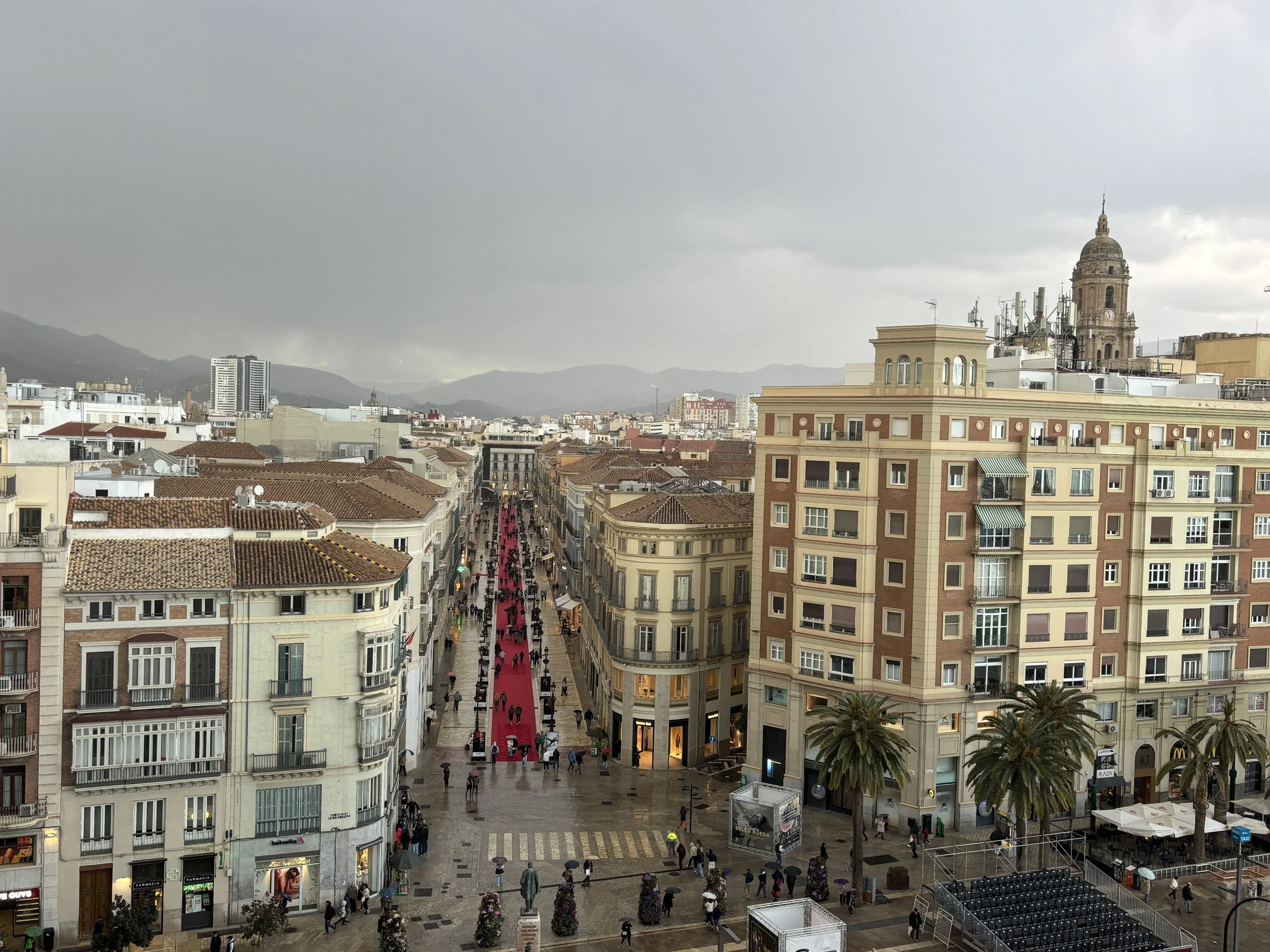
Despite being the gateway to one of Europe’s top tourist regions, the city of Málaga is, I think, often overlooked as a tourist destinations on its very own.
Of the millions of visitors that pass through Málaga airport every year, only a relatively small percentage venture into downtown Málaga itself, the rest heading straight to the many seaside resorts and golf courses that dot this narrow strip of land between the Mediterranean and the Penibetic mountains, a stretch of coastline that has come to be known as the Costa del Sol.
I must confess that I was more or less guilty of the same sin, since my previous visit to Málaga, decades ago, had just been a quick ride through town on the way to the airport. The 2026 edition of the eMobility World Congress provided the opportunity to change that and to explore a bit more of the city. And, while it is true that most of Málaga’s suburbs look a bit uninviting, as is typical of cities that grew fast during that dark era of architecture that were the 1970s, the city centre has, fortunately, preserved some truly charming corners.
In the following sections I am trying to sketch the top things to do and to see in Málaga if you are on a short visit. The good news is that Málaga’s historical center is quite compact, so you can go quite a lot even if, as it was my case, you are truly time-constrained.
This post may contain affiliate links. If you book or buy something through them, I earn a small commission, at no extra cost to you. It's one of the ways I keep Places of Charm going. Thank you for your support.
A walk through Málaga’s historical town
Most of the sights cluster within or around the old town, which borders also the port area and the hill where two old fortresses stand (the Alcazaba and Gibralfaro castle). The good news is that most of this area is pedestrianised, so this makes for a rather pleasant walk between the different sights.
Calle Marqués de Larios
This is Málaga’s main commercial axis, which you can see below. It has a rather elegant pavement made of these large white stone slabs (although the red carpet is a temporary addition for the city’s film festival).
The street is named after the Marquis of Larios, which was a prominent local industrialist in the 19th Century. The Larios family played a very important role in Málaga during most of that century and held sway over large swathes of the local economy. Their palace was located right where the “Equitativa” building stands today, the very prominent 1950s rationalist building that takes center stage in the picture below.
This building, which used to be the local headquarters of an American insurance firm, has since been transformed into a boutique hotel, the “Soho Equitativa”, which I will review further down this post.
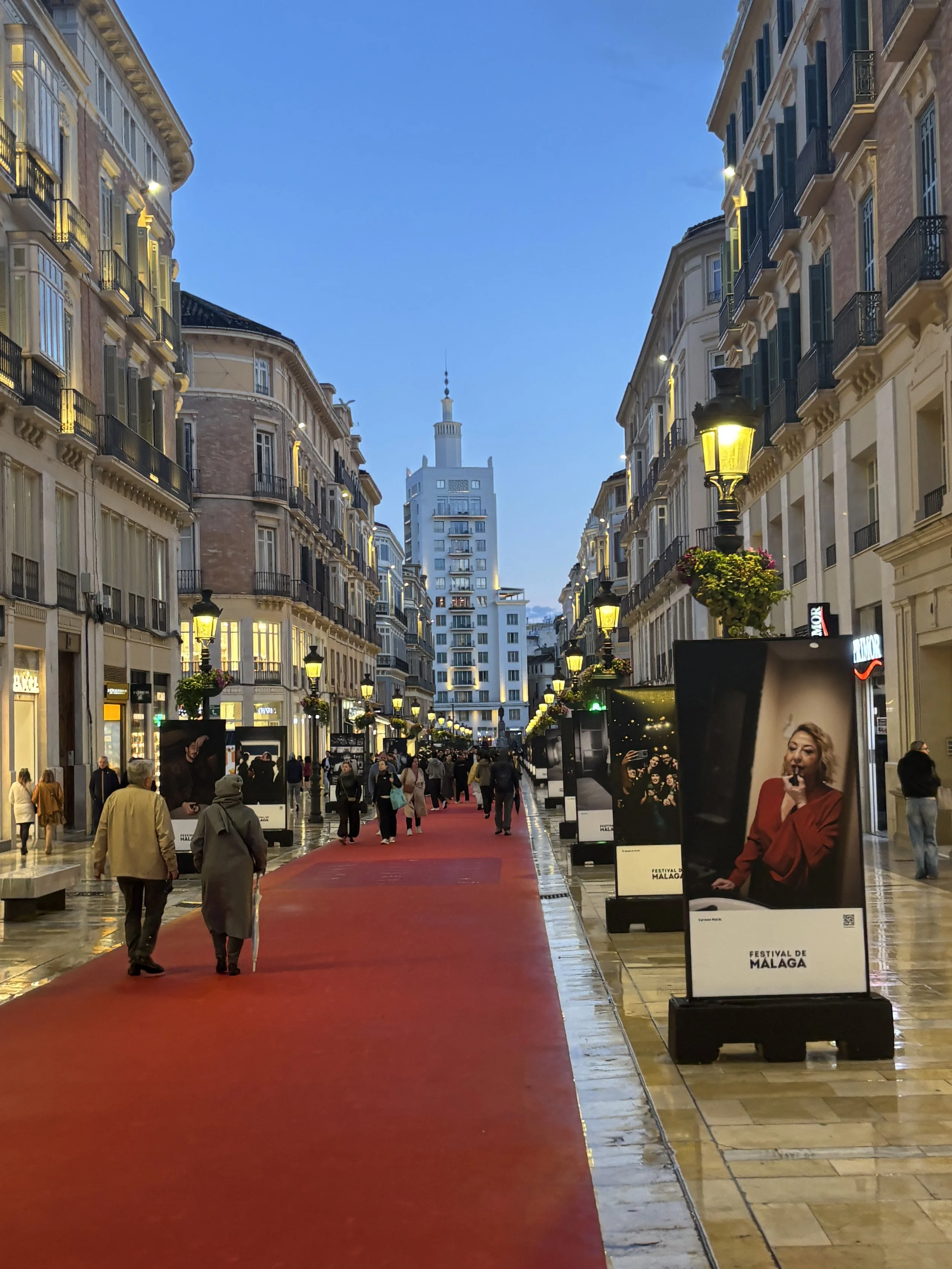
So, this street, “Calle Marqués de Larios” is where many of the well known consumer brands have set up shop (I read that at some point it was one of the most expensive locations for retailers in Spain). It was a bit rainy during the time I started my visit (so much for the “Costa del Sol” famous year-round sunshine!) but this gave the streets a particular patina that I kind of liked.
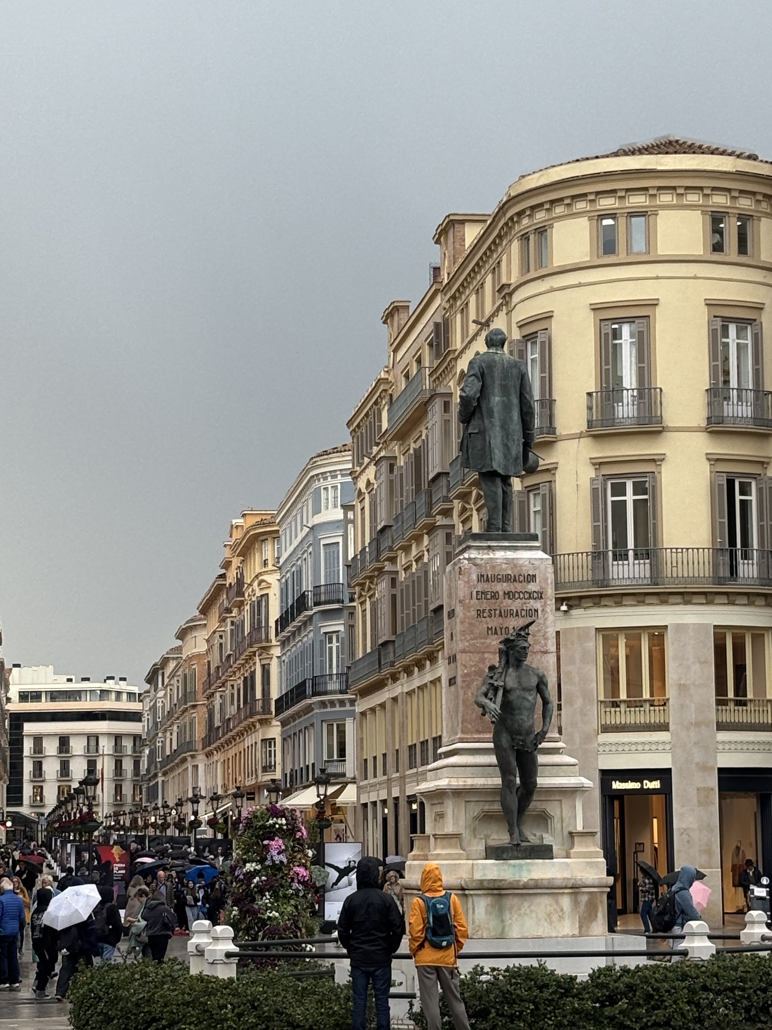
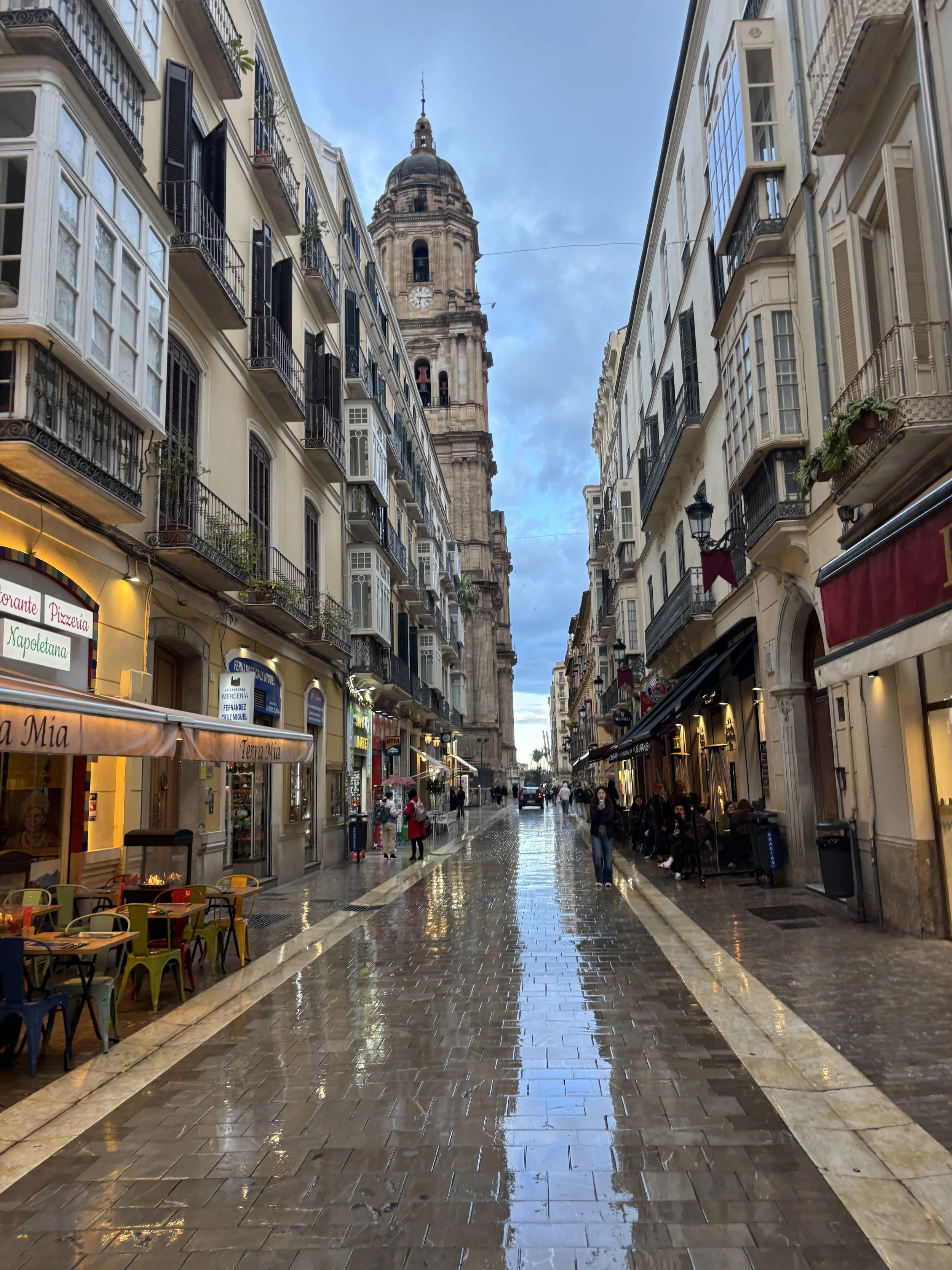
While Málaga hasn’t been immune to the sort of touristization and banalization that has afflicted most European historical centers, it is still possible to find some truly authentic retail outlets!
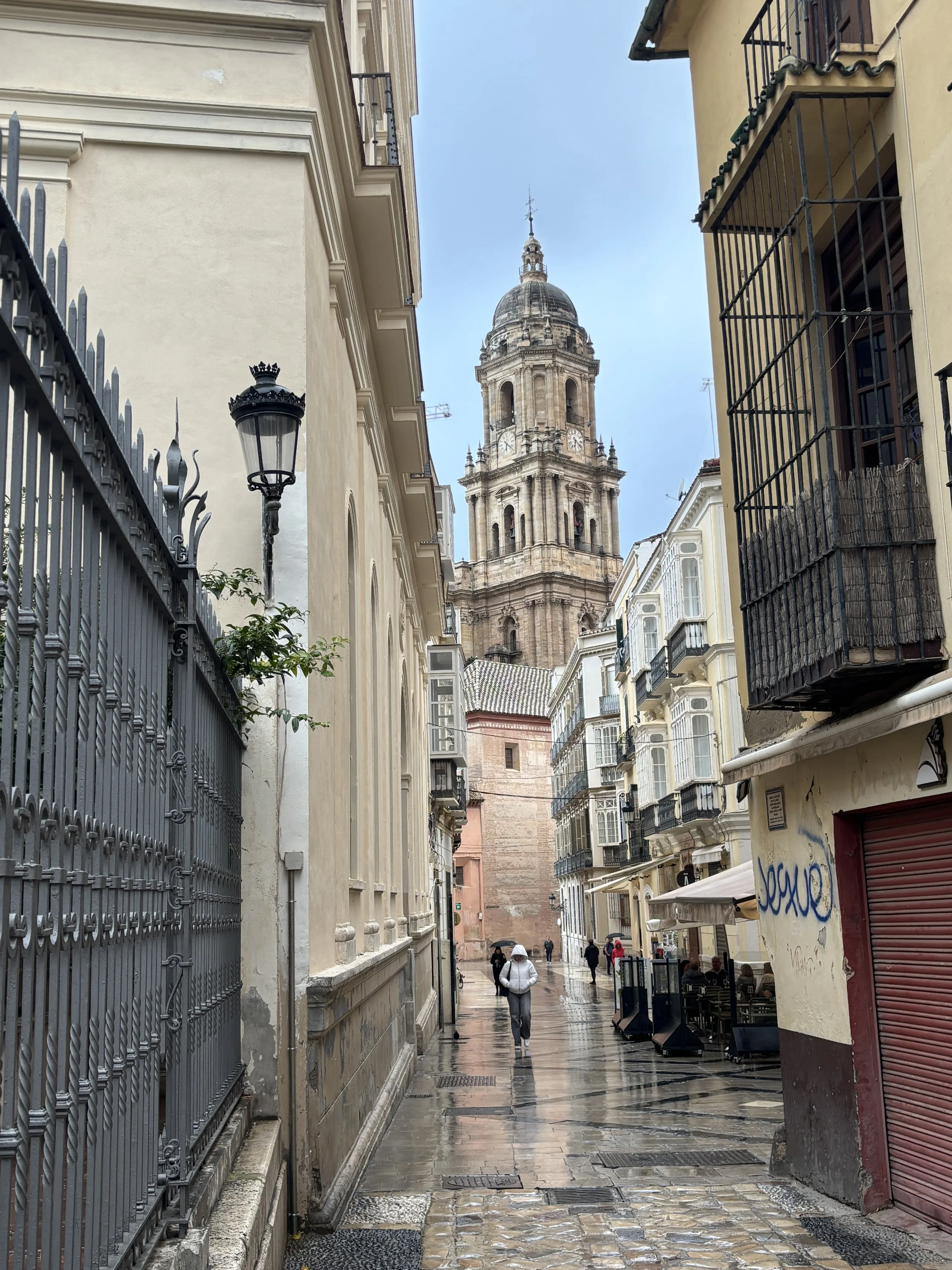
Málaga Cathedral
One of the highlights in historical Málaga is, of course, the cathedral. This one is particularly impressive because of its size!
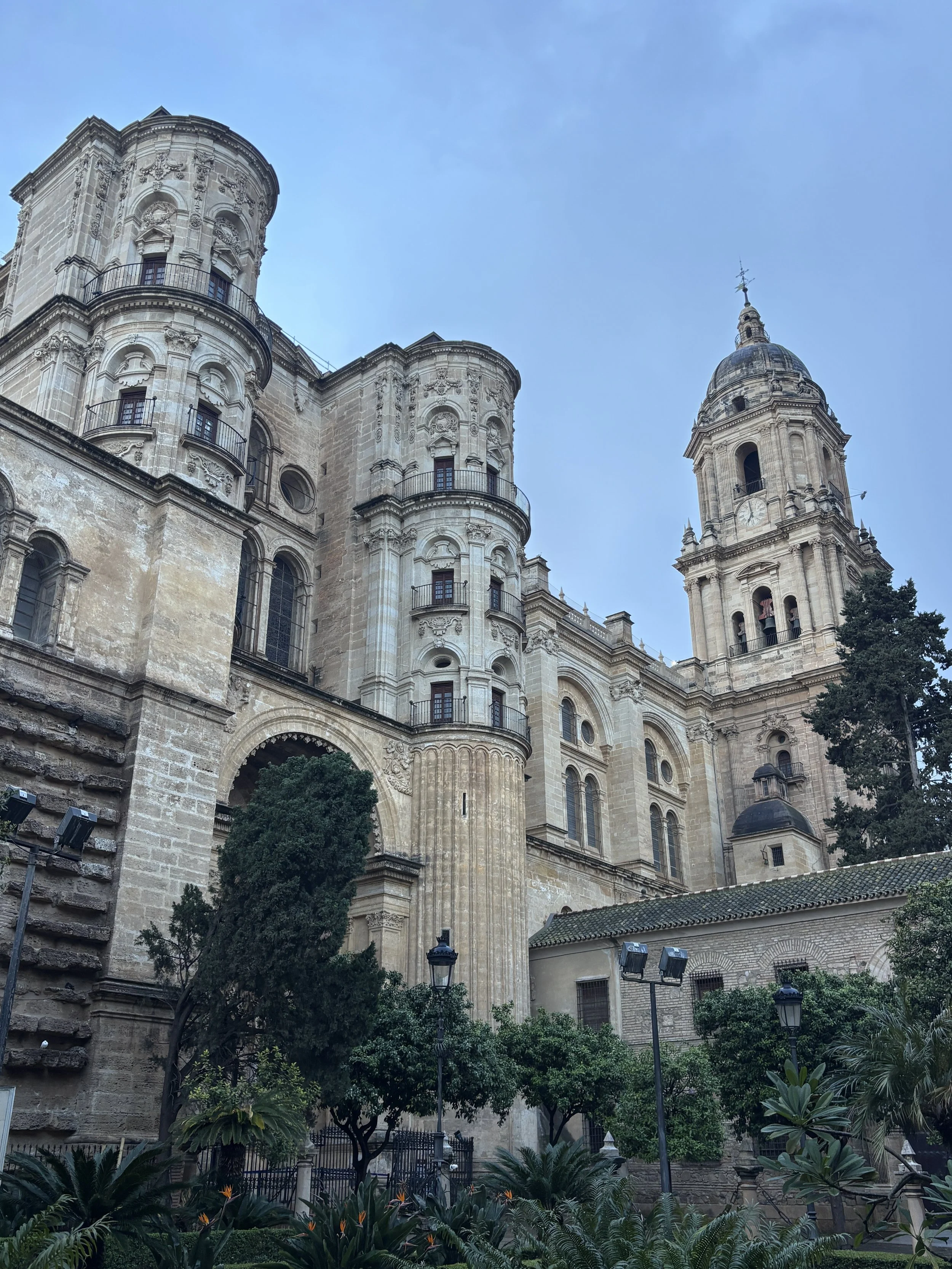
Roman Theater
Málaga is a really ancient city! One of the oldest in Europe, in fact. Málaga appears to have been founded by the Phoenicians some 500 years before the Romans arrived in the Iberian Peninsula. Rome, however, did arrive in due turn and and the city continued to prosper, changing its name from Phoenician “Malaka” to Latin “Malaca”. One of the most visible landmarks from that era is the ancient theater (“Teatro Romano”). It has its own small dedicated museum, but it was closed at the time I visited. Nevertheless, you don’t need any ticket to admire the ruins.
To be fair, it is not as big as the Ancient theaters in places like Myra and Amman, but its locaation at the foot of the old Islamic-style fortress of the Alcazaba fortress, with its medieval walls, make it quite scenic. It is also right in the middle of the old town.
Right next door, between the Roman Theatre and the Cathedral is the Málaga Museum (Museo de Málaga), which is housed in a neoclassical former customs house. Now, I didn’t have time to visit the museum, something that I kind of regret, since I head good things about it. So, I included it here so that you don’t forget to add it to your list if you have the time. It has basically to main collections: 19th Century Spanish paintings and Ancient archaeology from the local area.
I did manage to admire the exuberant palm grove that surrounds the building, though!
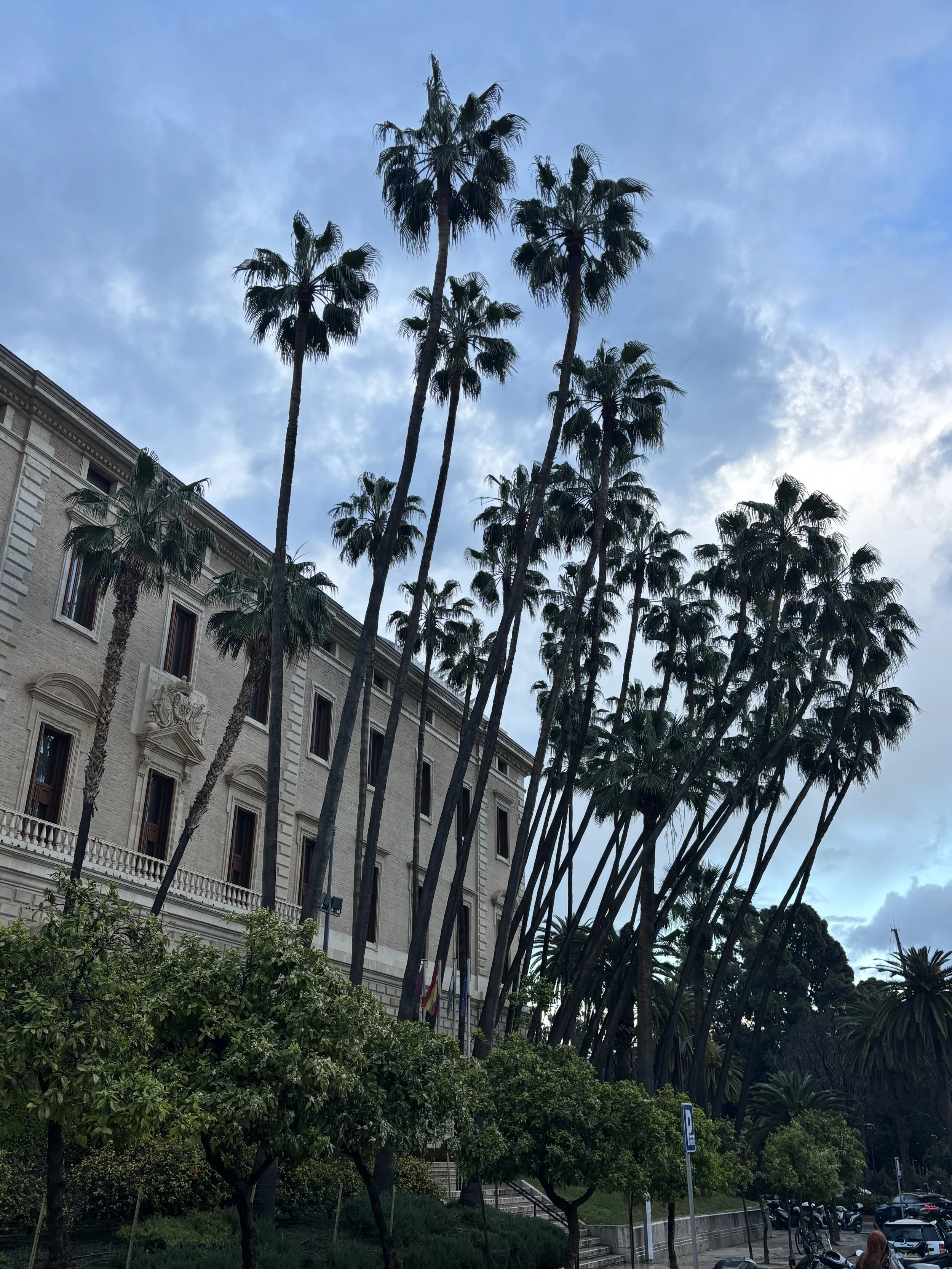
The Alcazaba of Málaga
If you have to choose only one place to visit in Málaga, this is it!
The Alcazaba is a former fortress-palace that for centuries has dominated the city from its hilltop position. Now, there is another castle even higher up on the same ridge, the castle of Gibralfaro.
The two were connected by a narrow walled enceinte, now in ruins. You can visit both nowadays, although you need to do so separately (you can purchase a joint ticket, though).
Since I had limited time I opted to visit the Alcazaba only, which I think has most to offer to the visitor. The higher Gibralfaro fortress has perhaps slightly better views, but you get a pretty nice view from the Alcazaba as well, and it saves you the climb uphill. It’s just a matter of prioritization.
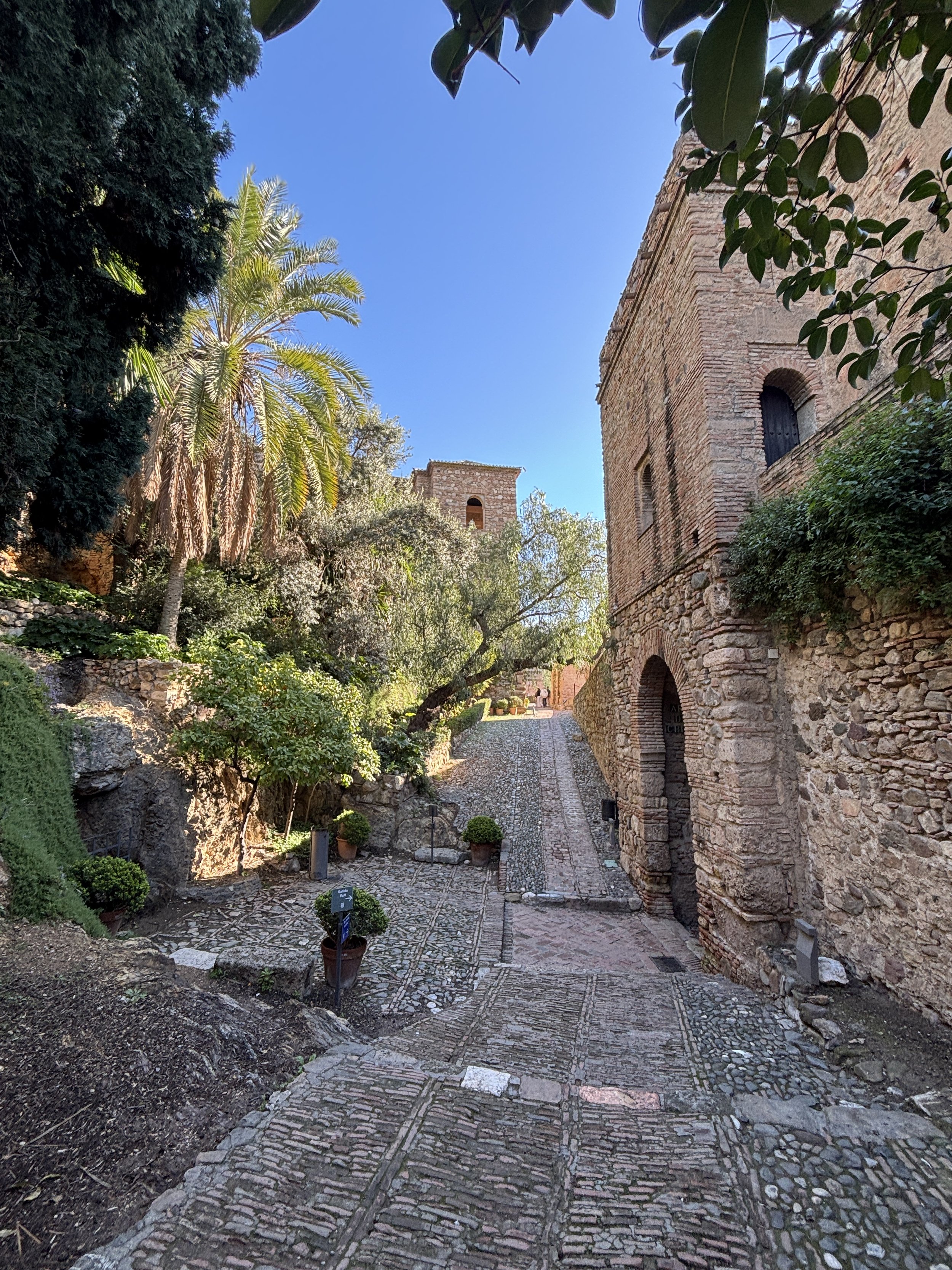
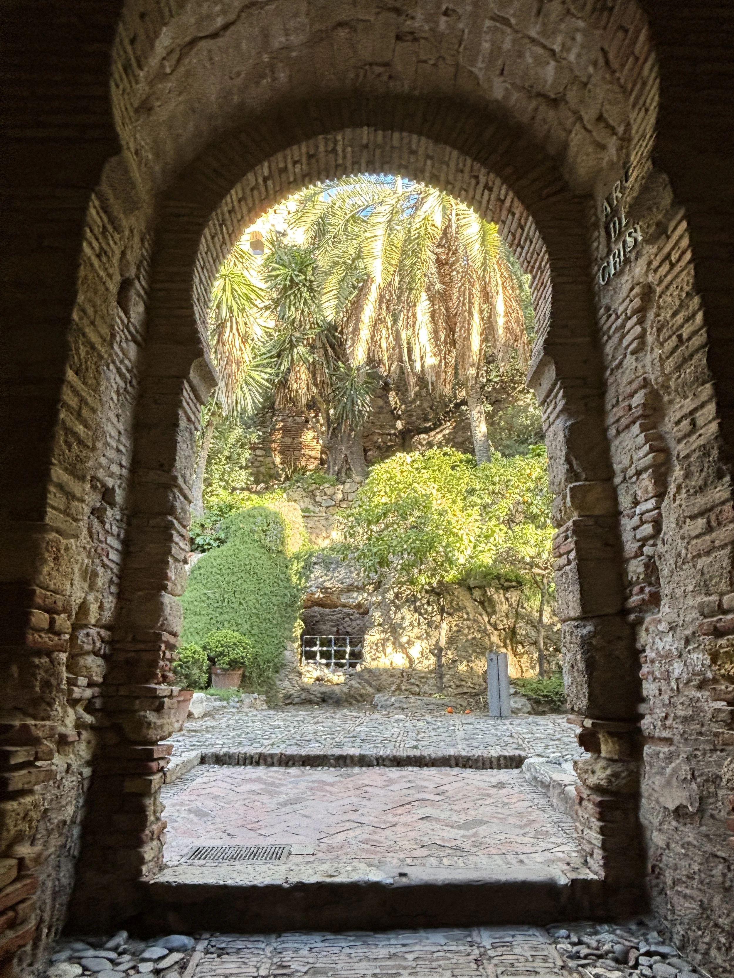
The Málaga Alcazaba as we know it today is mainly a product of the Al-Andalus era, when Spain was under Islamic rule. The foundations of the current castle were laid out in the 11th Century, but the complex has suffered modifications throughout the centuries.
By the 19th Century there was even a whole residential neighbourhood on top of the palace ruins and some plans were drawn to remove completely what was left of the old fortification.
Fortunately those plans didn’t materialize and, in fact, by the early 20th Century, with changing attitudes towards the preservation of historical heritage the Alcazaba was declared a legally-protected monument and a process of archaeological investigation, restoration (and in some cases even reconstruction!) started.
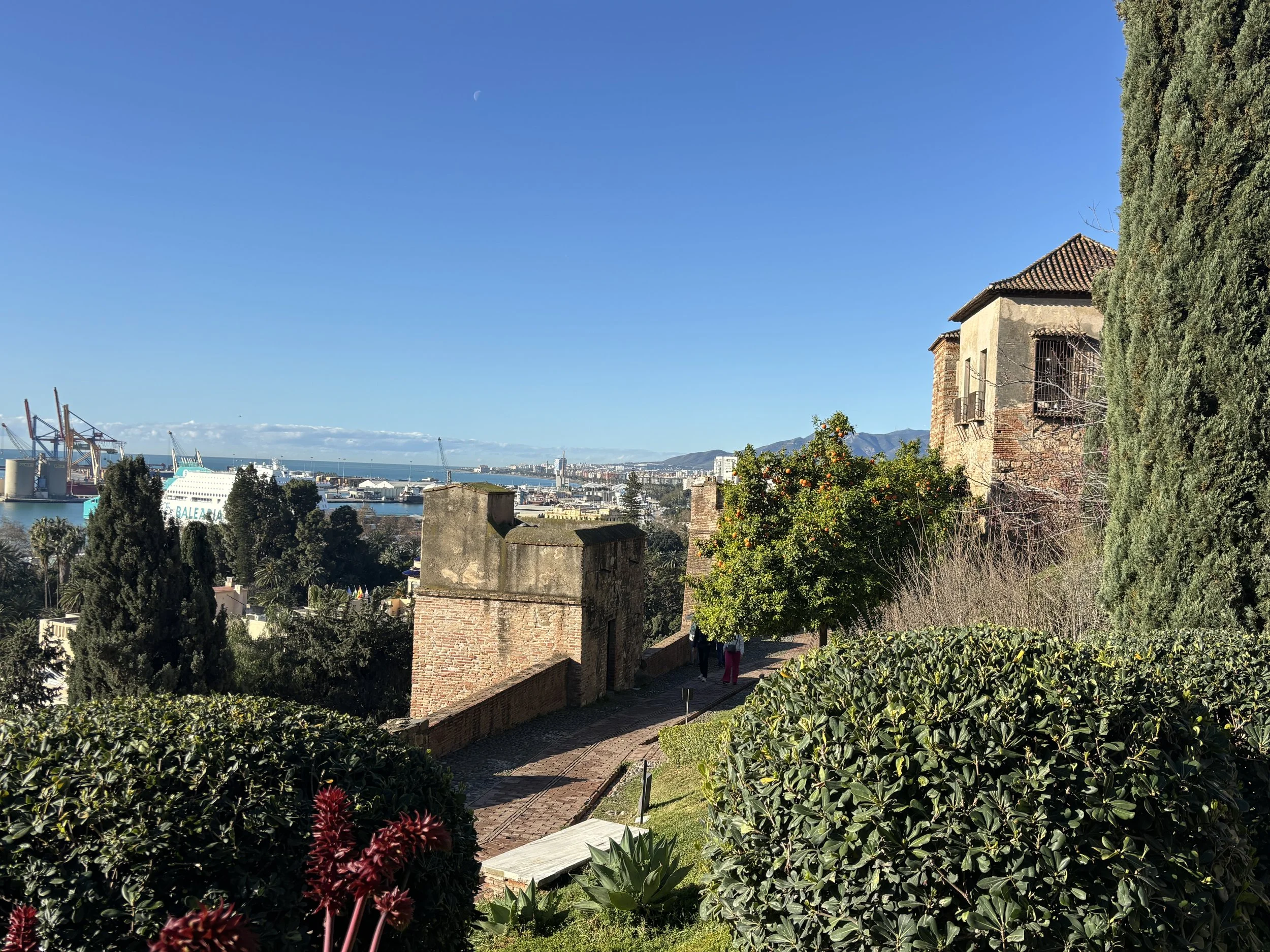
Málaga’s Alcazaba is, in some ways, like a mini-Alhambra of Granada, with its magnificent views, patios and palatial quarters in Islamic Andalusí style.
However, most of what you see today is a relatively modern reconstruction (albeit a tastefully done one!) since most of the buildings had become a total ruin and some areas had to be cleared of other later constructions that had been built on top.
Seeing the result, I think it was the good decision to take!
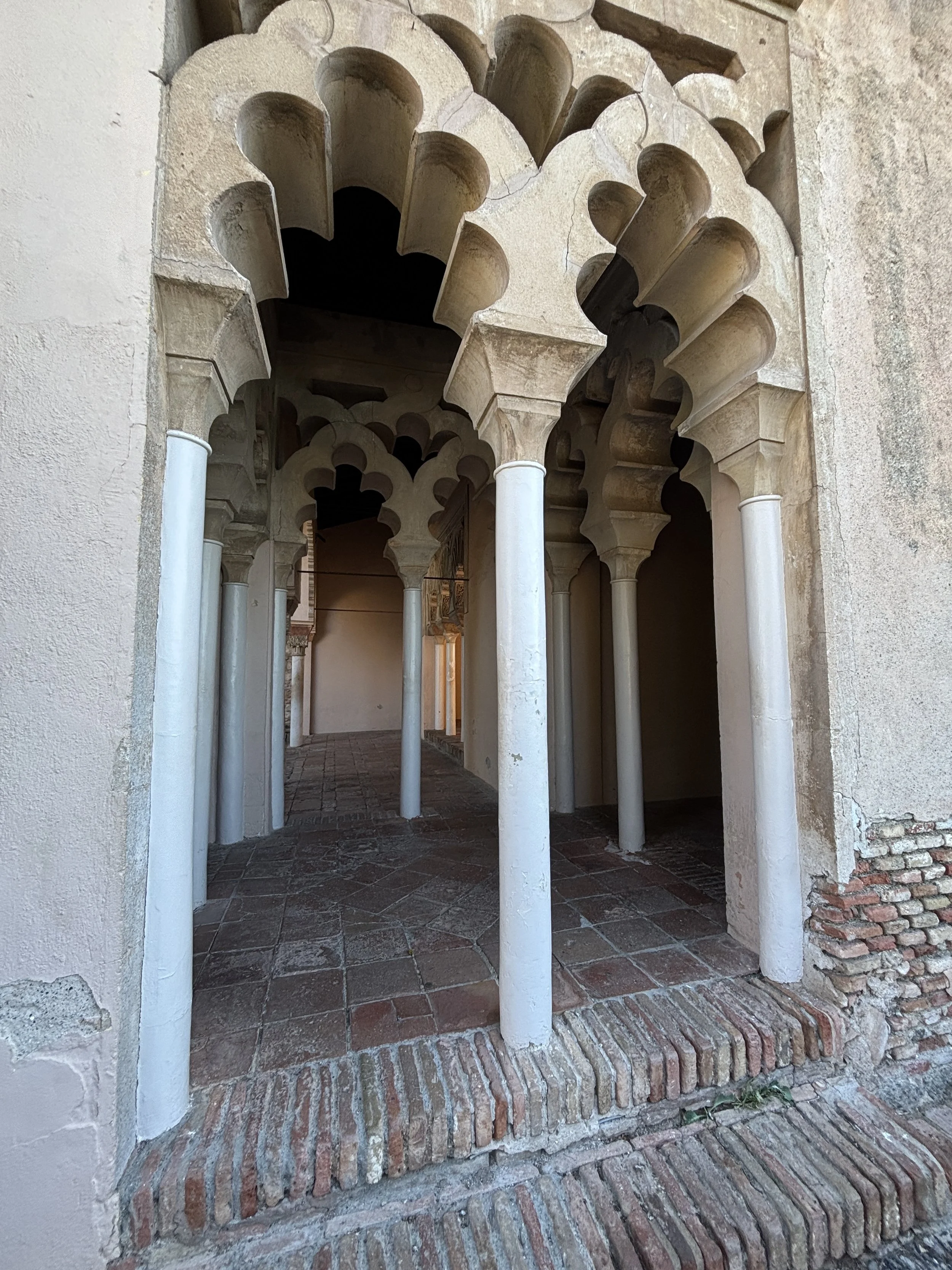
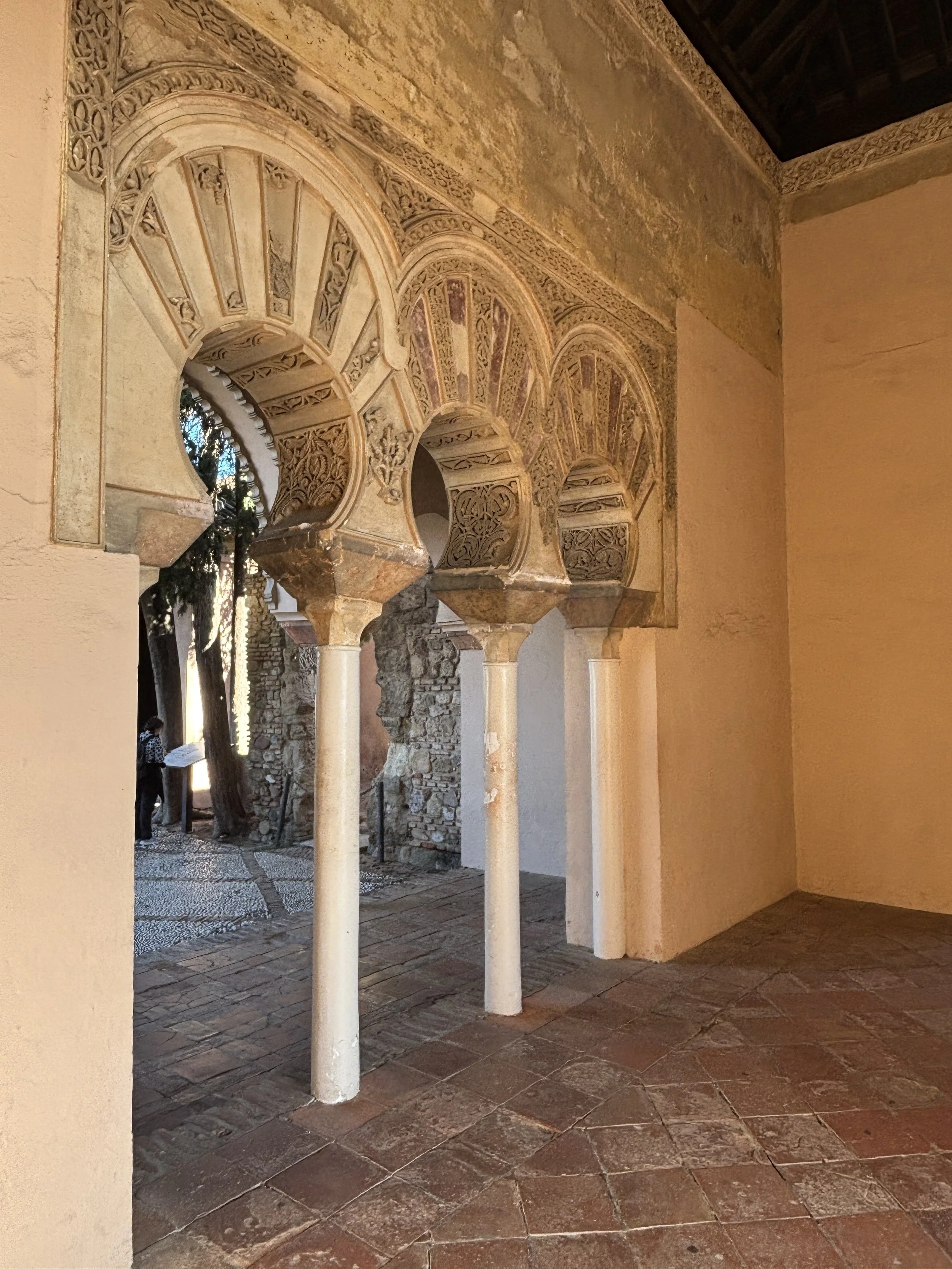

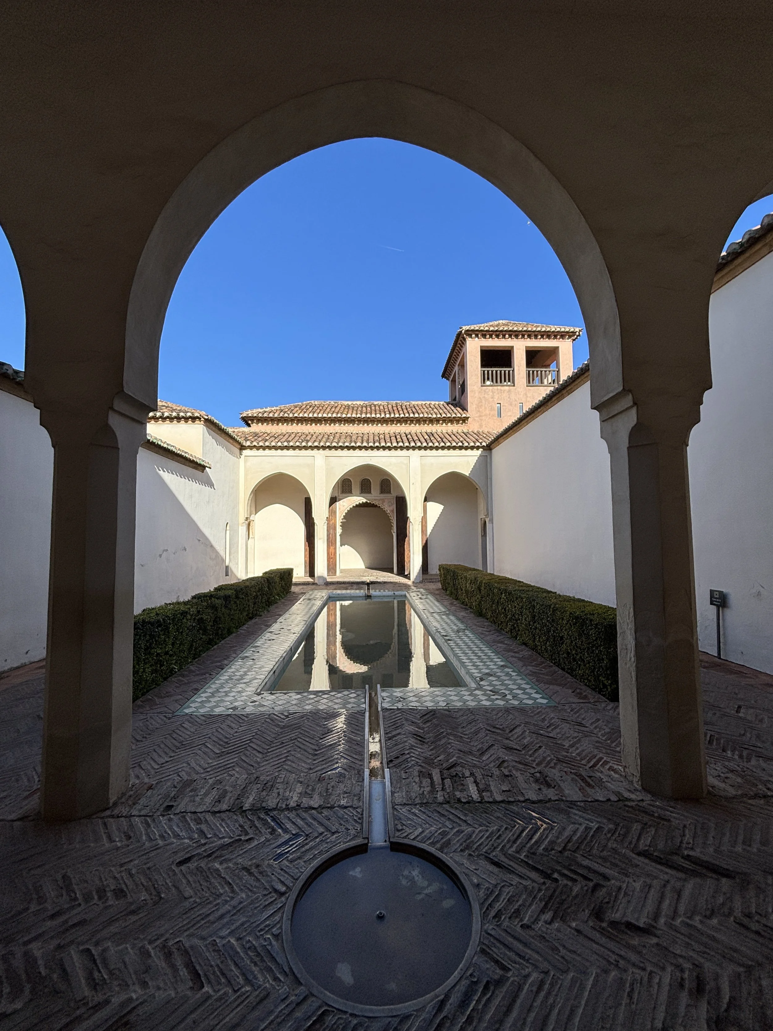
Entrance to the Málaga Alcazaba is €7 (or €10 if you buy the combined ticket that gives you also access to Gibralfaro fortress). The ticket has a QR code that you can access to get an audioguide which runs straight through your phone (you need an internet connection), a pretty smart and convenient approach!
The Alcazaba also opens a bit earlier than other museums, so it is a good idea to start the day here.
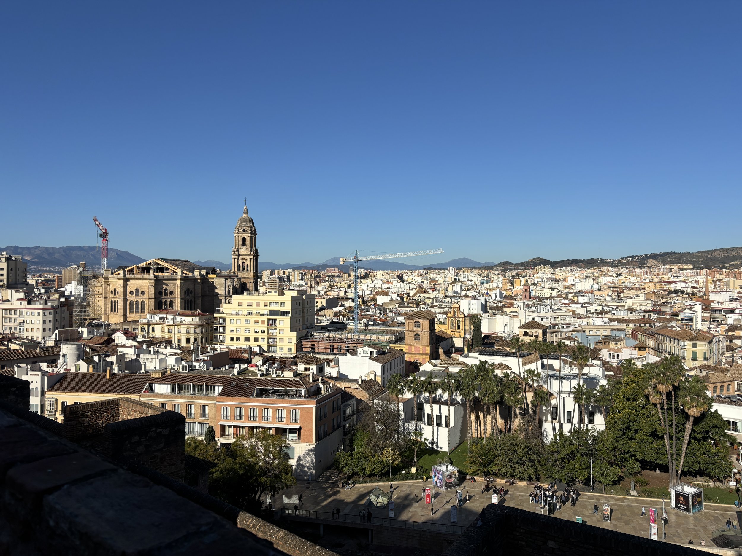
Picasso Museum of Málaga
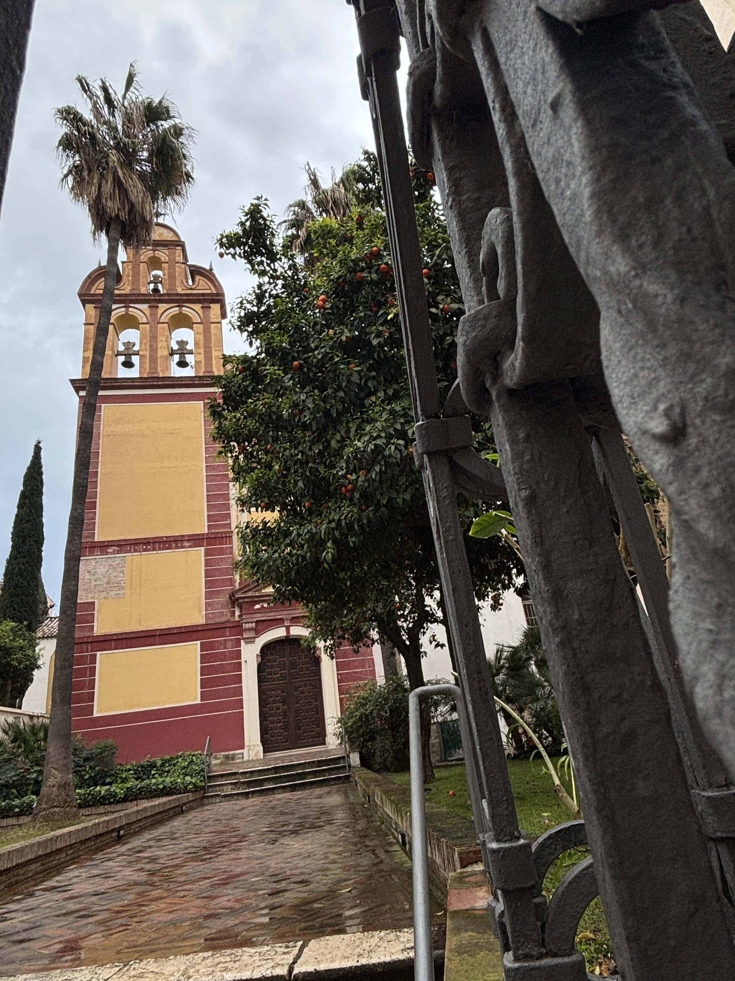
Pablo Ruiz Picasso, one of the most influential and universal artists in history, was born in Málaga and, while he left the city quite early in his life, his imprint remains in the city through the Picasso Museum of Málaga.
The museum is located in the middle of the historical center in the Palacio de Buenavista, a fully restored 16th-century palace, which was, in turn, built on top of Roman and Phoenician foundations. IT is also adjacent to the church of San Agustín (picture on the right), also from the 16th C. and sharing its courtyard with the museum building.
Btw, the museum must not be confused with Picasso’s birthplace, which is actually some 200 meters away, on Plaza de la Merced, and it is also an exhibition space (which unfortunately I wasn’t able to visit).
Practical note: there are two queues to enter, one for those that purchased the ticket online (you are encouraged to do so by using a QR code displayed by the entrance to the museum) and another for those that wish to buy the ticket onsite.
It was a bit confusing, particularly since both queues appeared to be growing by the minute at the time of my visit. Interestingly, the “online ticket queue” was not only longer, but seemed to move more slowly. So, since I was not sure how much time would it take, I decided to try the ticketless-cash only queue. It turned out to be the right decision, since every few minutes a member of staff let some people from that, much shorter, queue in.
So, I don’t really know if this is how it always works, and hadrd to understand the logic when it looked like those pre-purchasing were being penalized (perhaps on some days there are numerus clausus and those that didn’t buy online can not get in?). In any case, but thought worth sharing the experience.
The entrance fee is not cheap (€13) but I think it is good value for what you get.
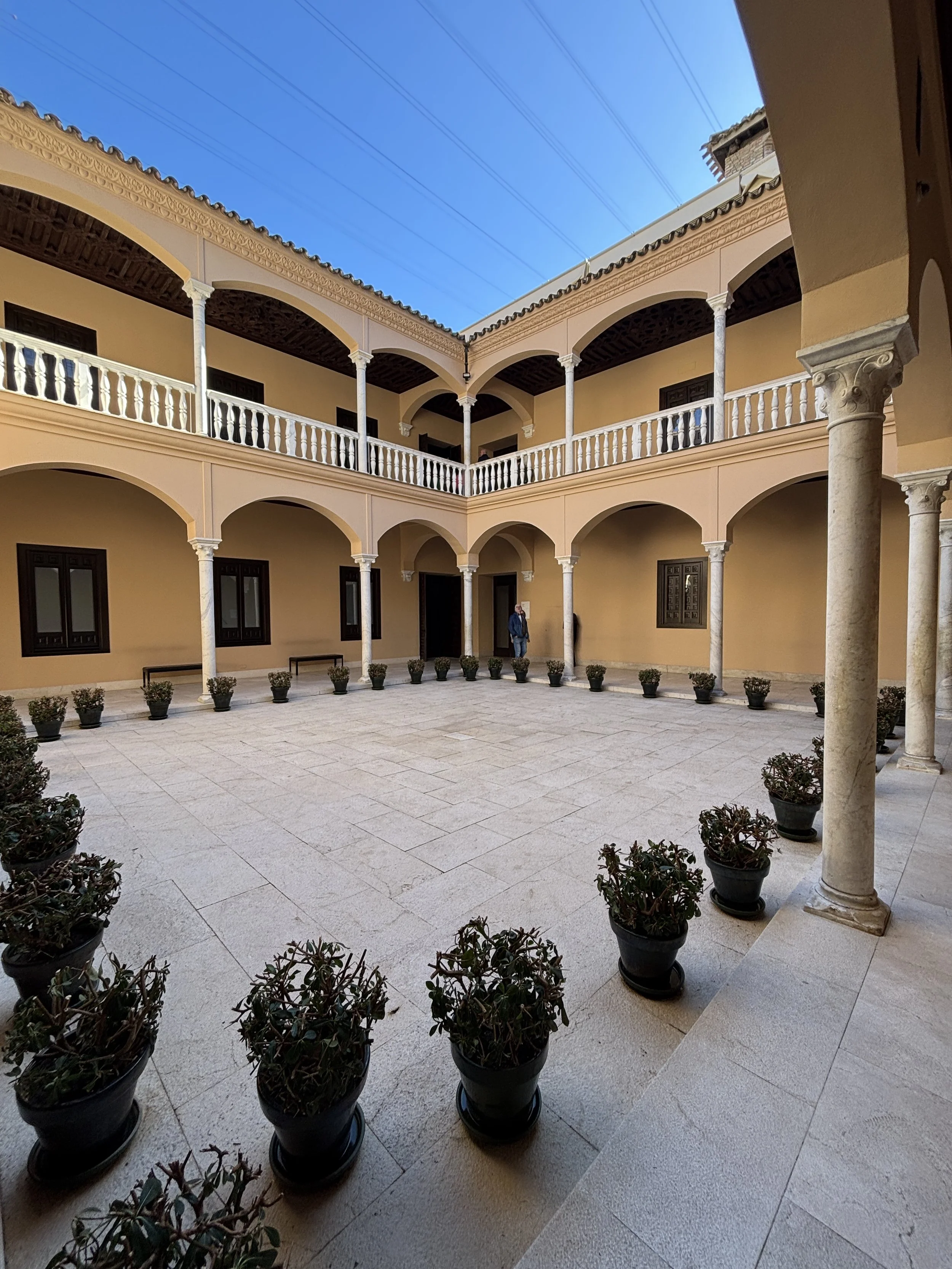
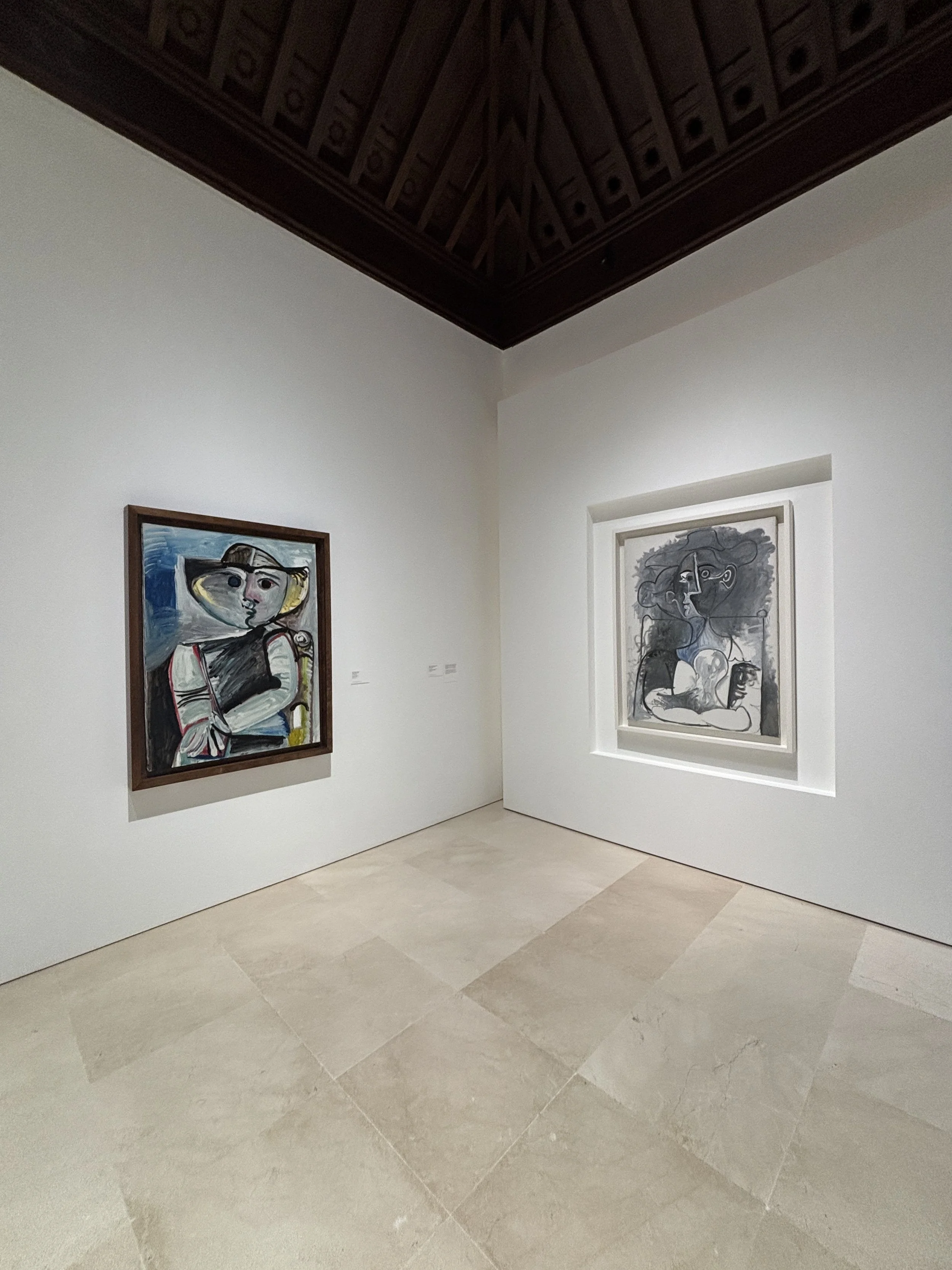
While the museum is not huge, it holds a really interesting collection that covers pretty much the whole of Picasso’s life and which were gathered by the artist’s daughter-in-law and one of his grandsons.
There is also a section with paintings by other influential artists that were contemporary with Picasso.
So, I would say this is the other highlight I would visit if having to prioritize the things to see in Málaga.
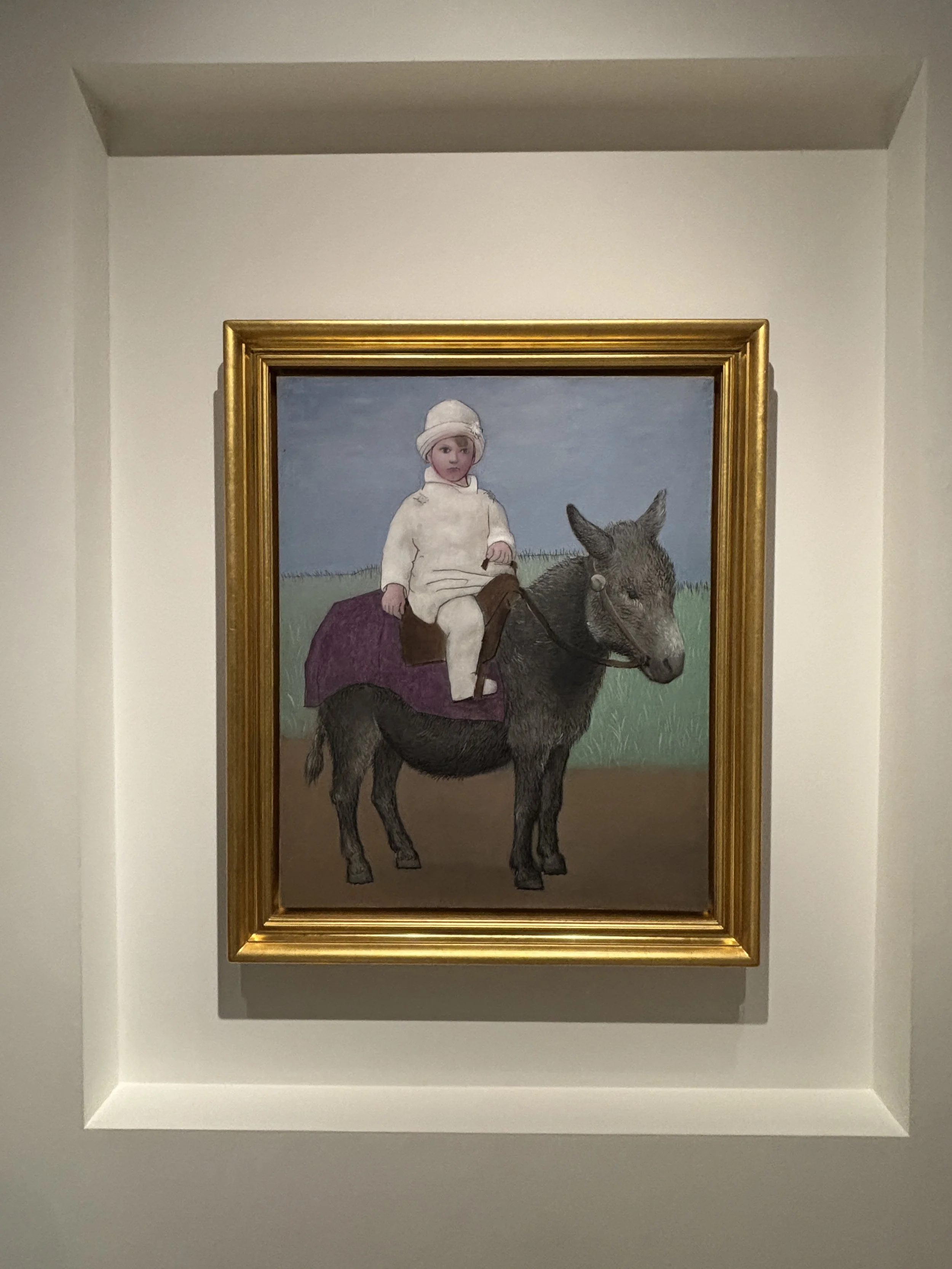
By the way, if you are interested in the life and work of Picasso, you may also want to check this piece I published on CNN a few years ago about the places that inspired and influenced the artist’s work in Catalonia during his youth.
The Port of Málaga
Since Málaga is a port city, a walk through the harbour could not be missing from this post. This time it had to be an evening one, but it still delivered some rather impressive sights, and I am not referring to the handful of mega-yachts moored along the quay!
There is a promenade all along the quais which offers the sea-view of the historical Málaga skyline, complete with the cathedral, the Alcazaba and the line of walls, illuminated at night, that run all the way up to Gibralfaro castle.
What’s more, the port of Málaga has also some interesting architectural landmarks that are made even more interesting because of the contrast in styles. This is the case of this Mondrian-style glass cube which hosts the Centre Pompidou Málaga and a small modern art collection, and the elegant Chapel of the Port nearby.
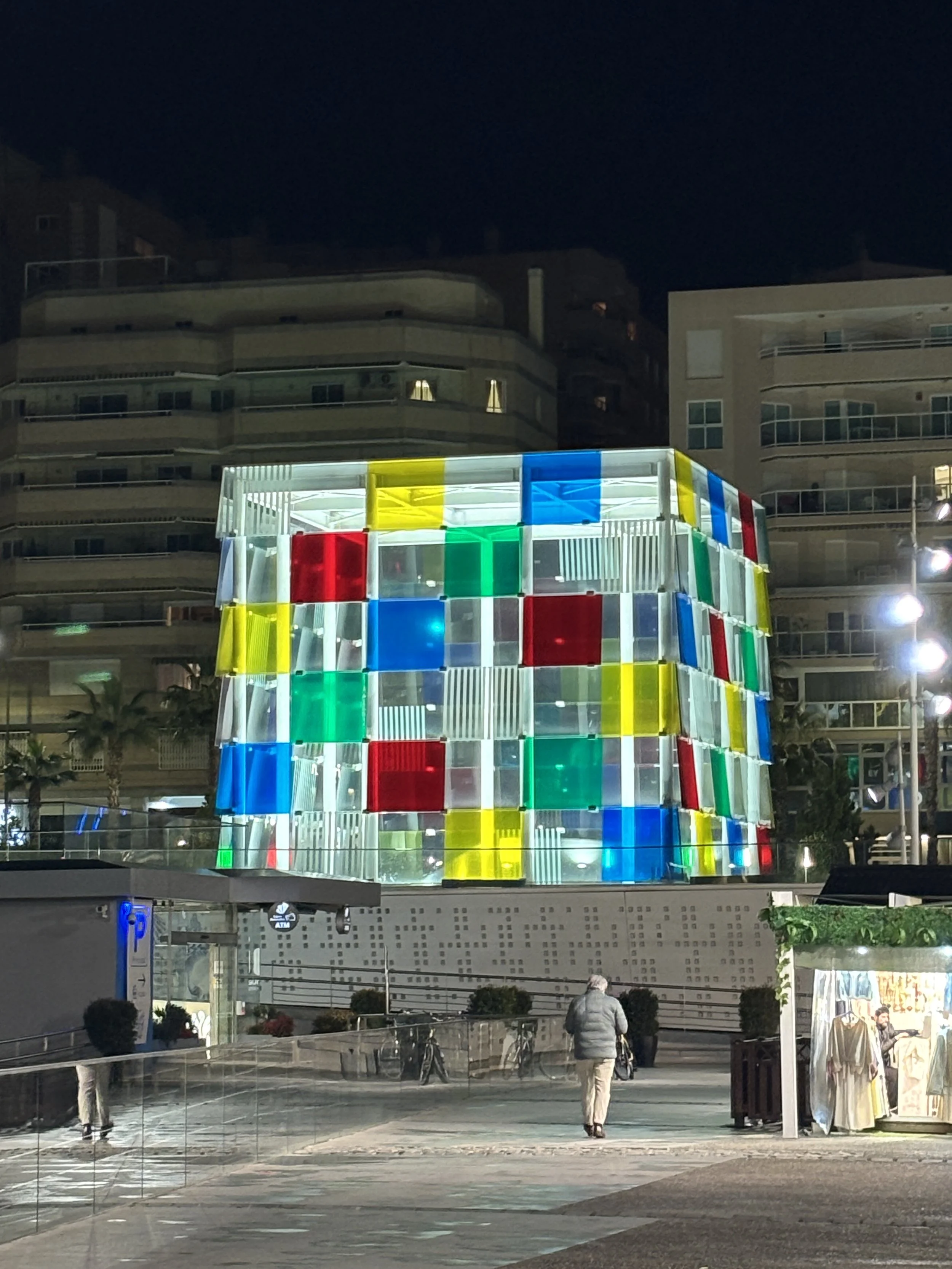
And if you make it all the way to the port’s lighthouse (“La Farola de Málaga”), you may as well eat or drink something at the “Trocadero Casa de Botes”. This is a stylish quayside restaurant which offers a cozy indoor atmosphere and some nice views of the port and the city. Definitely a place to check if you are looking for a place with real character to eat in Málaga.
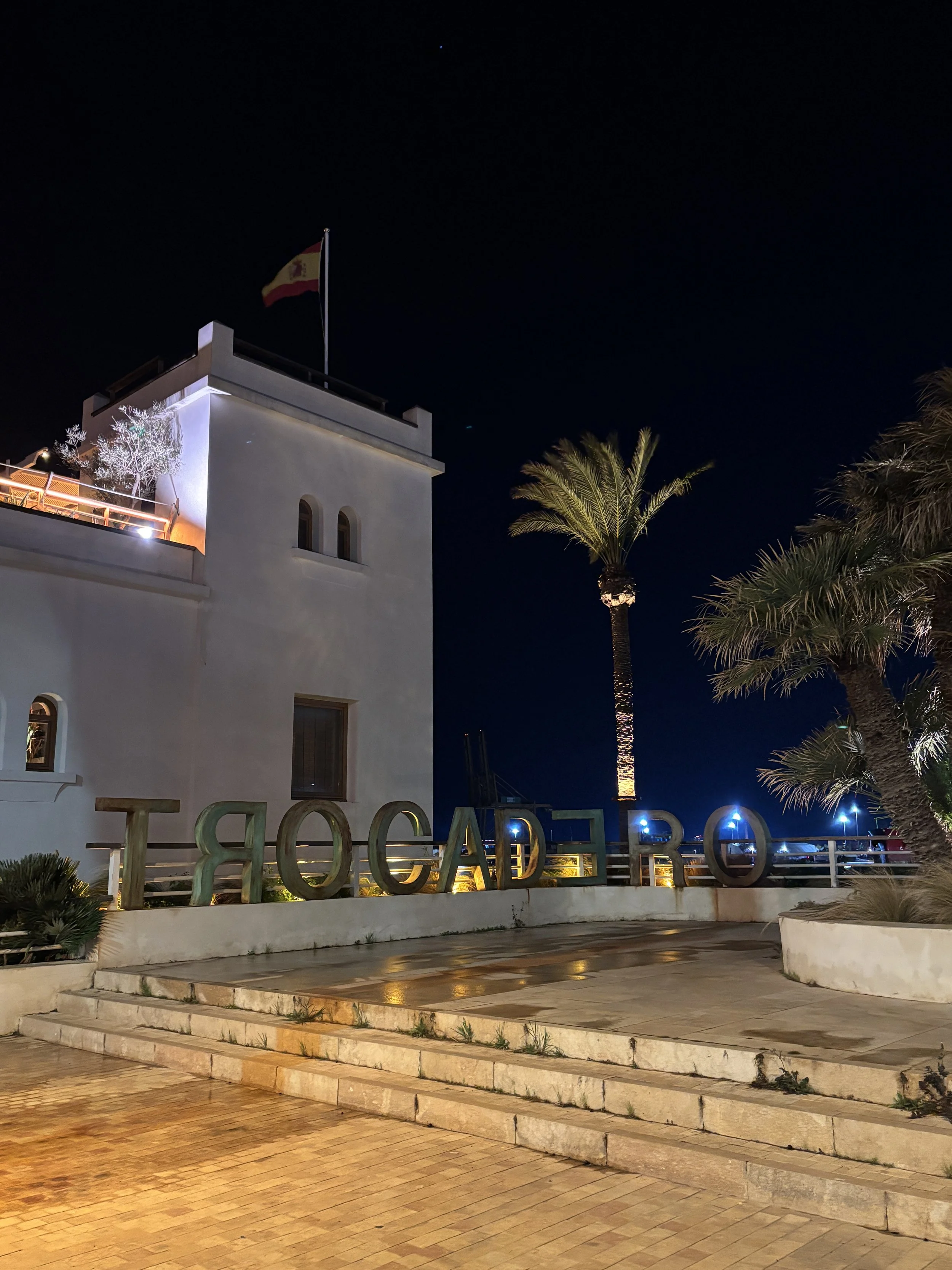
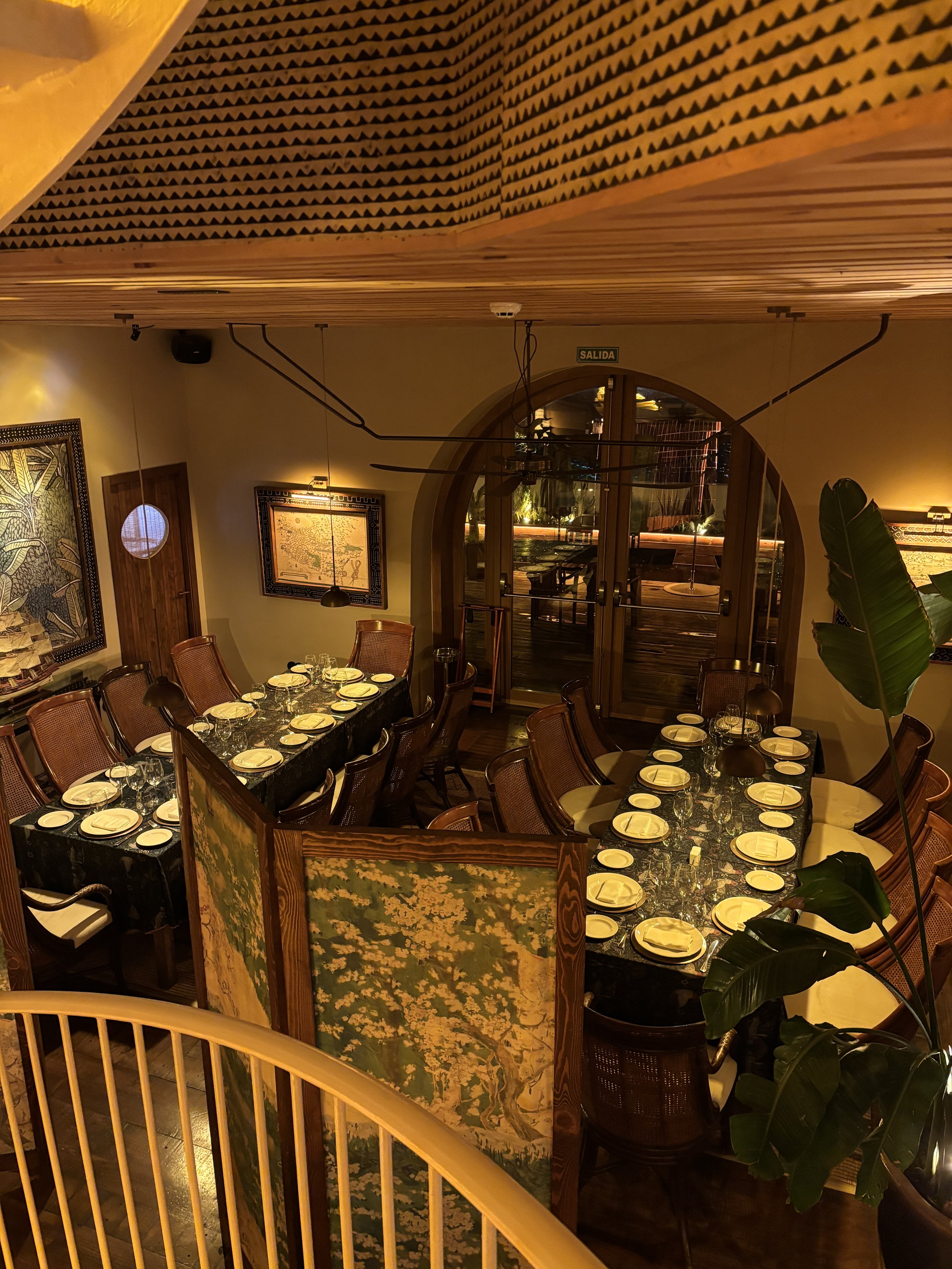
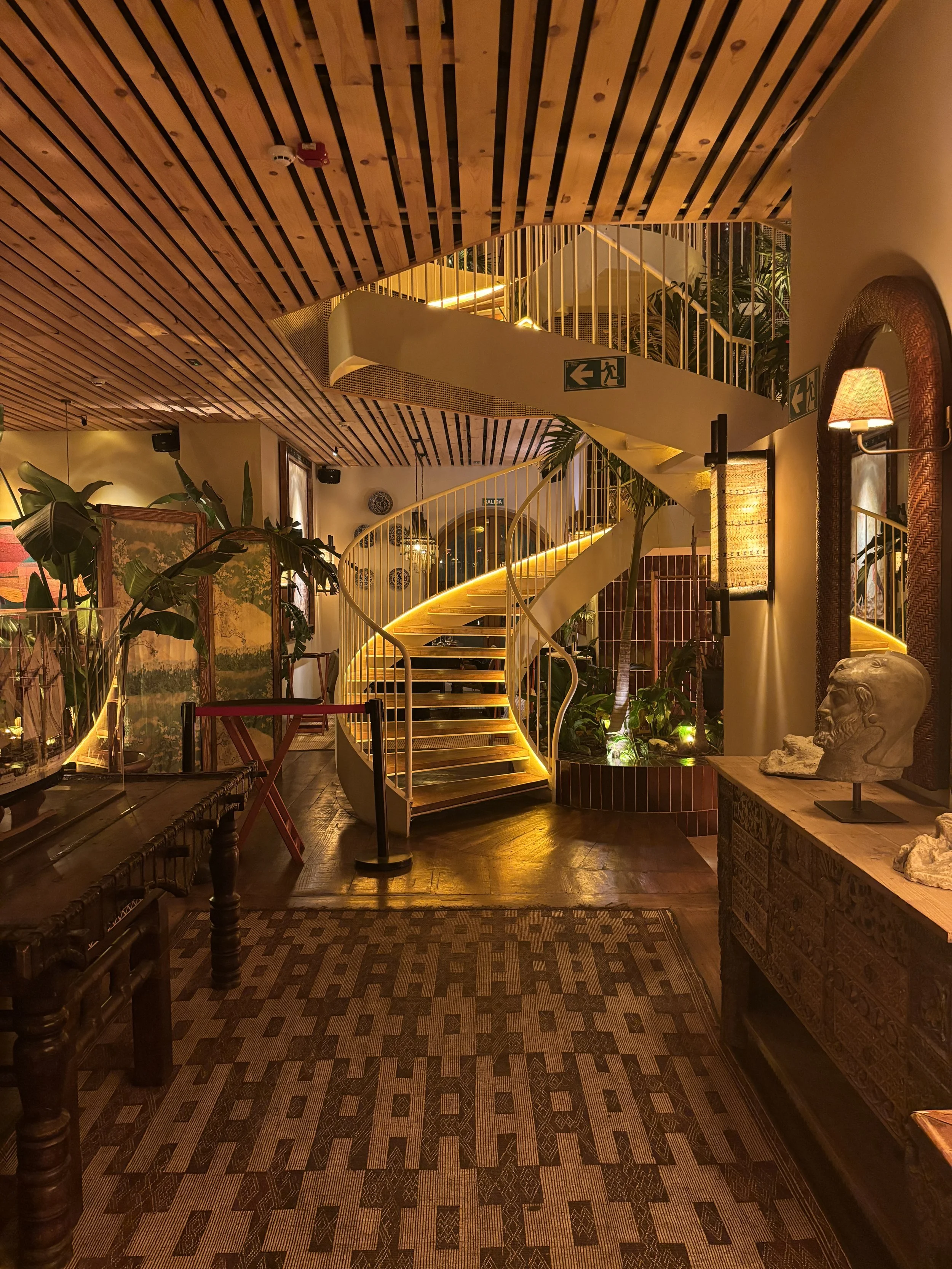
Where to stay in Málaga
Hotel Soho Boutique Equitativa Málaga
Edificio La Equitativa, Alameda Principal, 3
29001 Málaga
This is a very nice hotel located right at the intersection of Calle Larios and the Alameda avenue, the two major avenues in Málaga’s downtown, and next to the port area. What’s more, as described earlier in this post, the Equitativa building is a landmark on its very own. Built in the 1950s, this 14-storey rationalist building would not be out of place in a major US downtown.
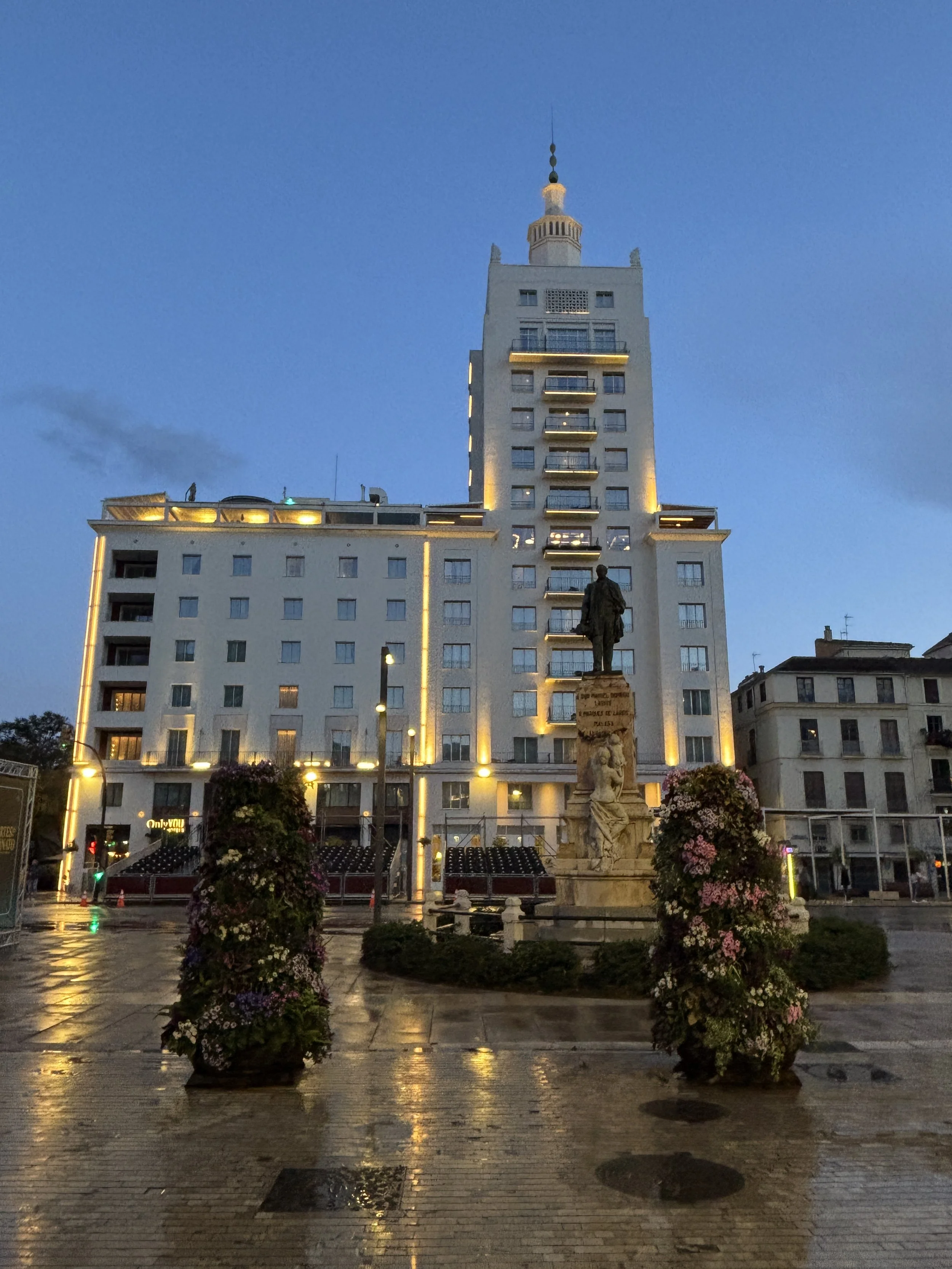
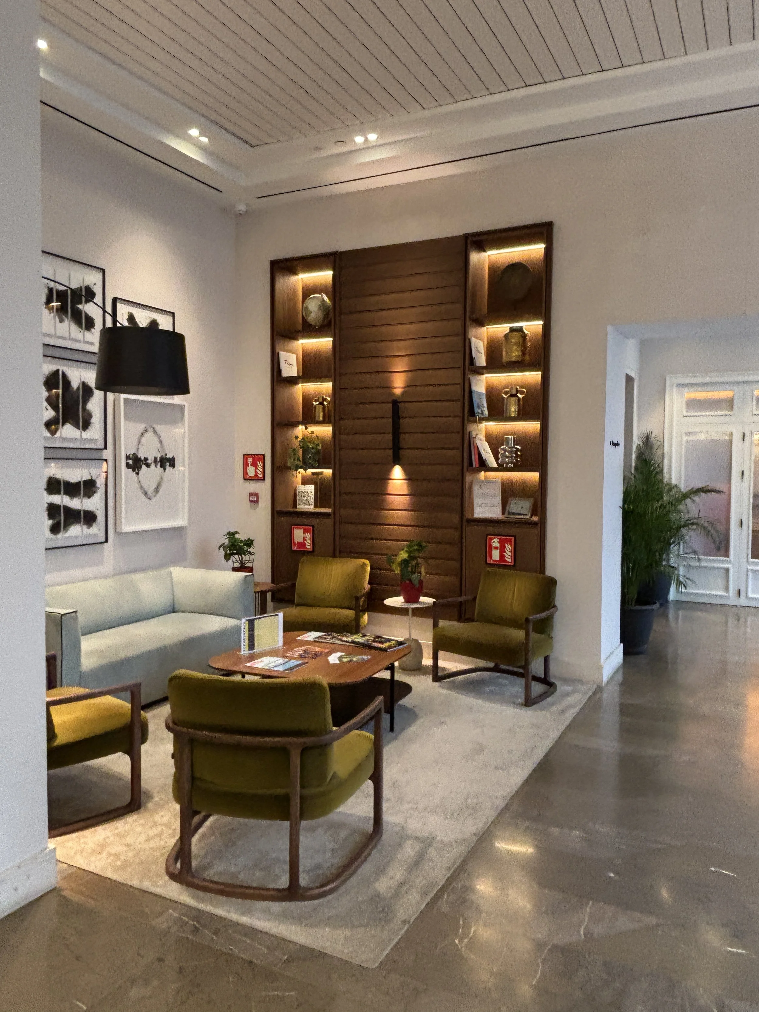
Rooms are not big, but are very cozy. The bed is comfortable and the room has everything you need to work, if needed. The bathroom is also pretty modern and stylish and has a huge shower room.
Also remarkable is that you may get great views of the city. I was just on floor 4th (of 14) and it was already like a panoramic viewpoint of the aforementioned Calle del Marqués de Larios right in front. I can only imagine how the views must have been from rooms further up.
By the way, there is a bar and a panoramic terrace (with a small outdoor pool, also with views) on floor 7th.
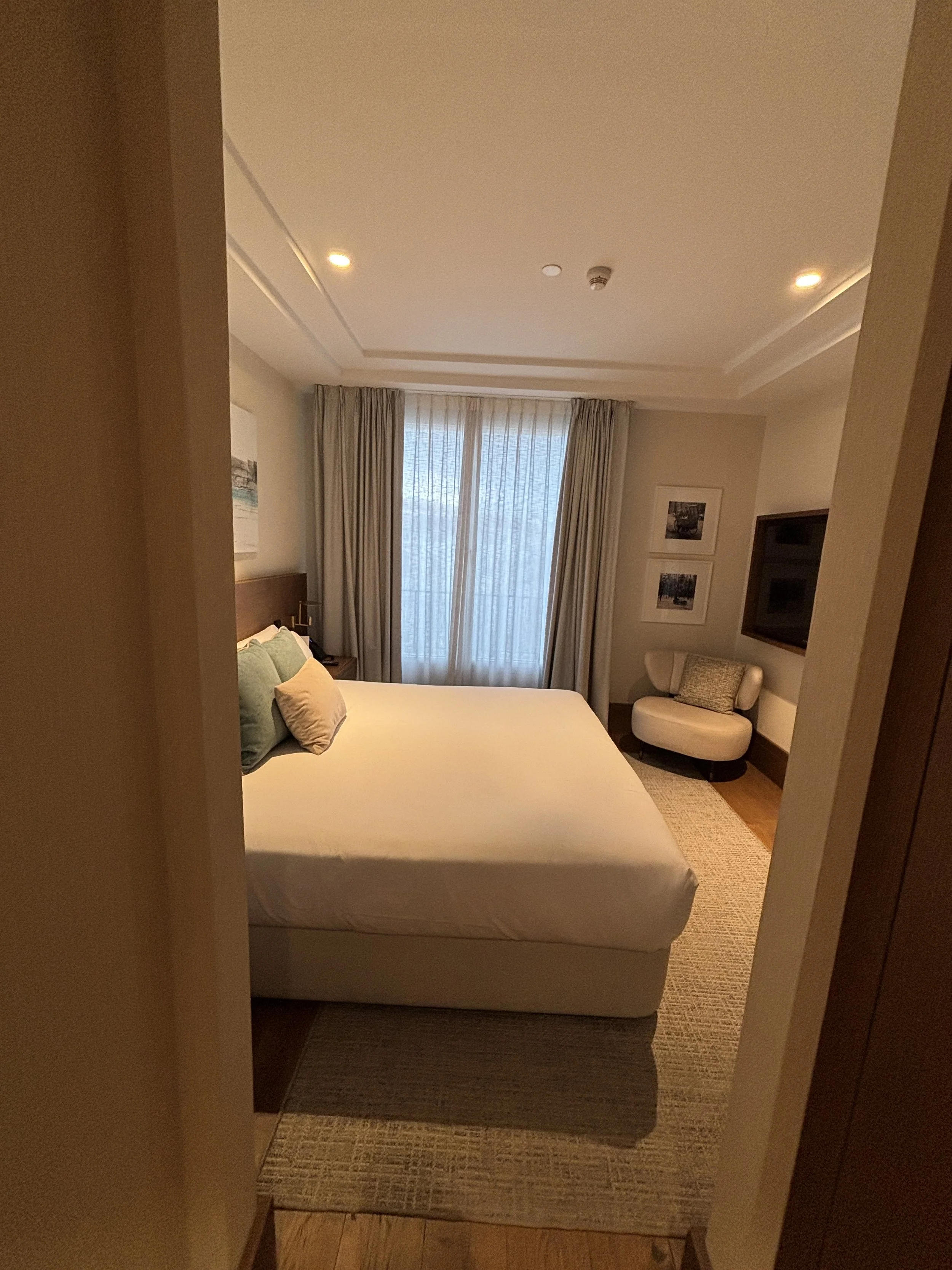
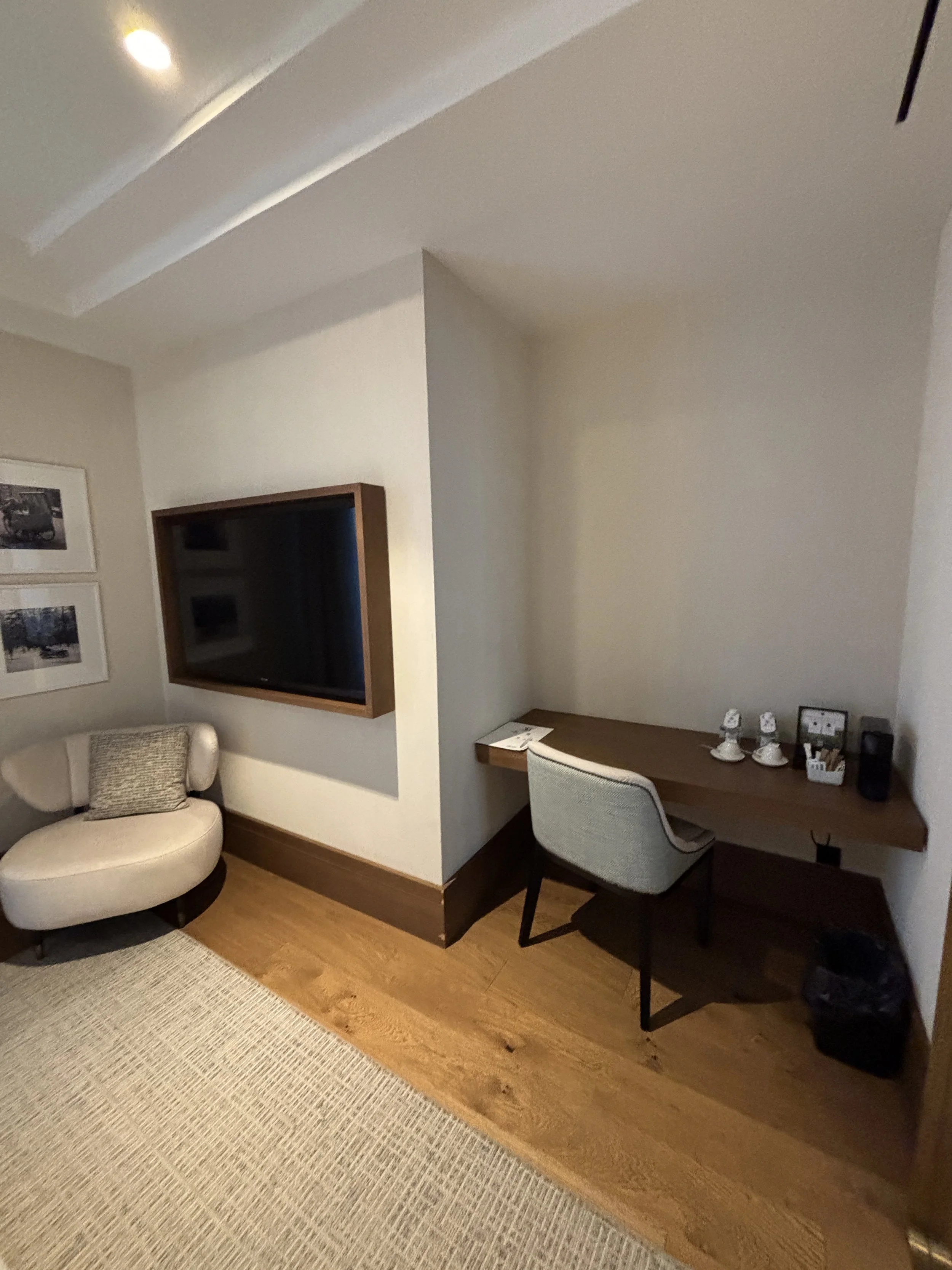
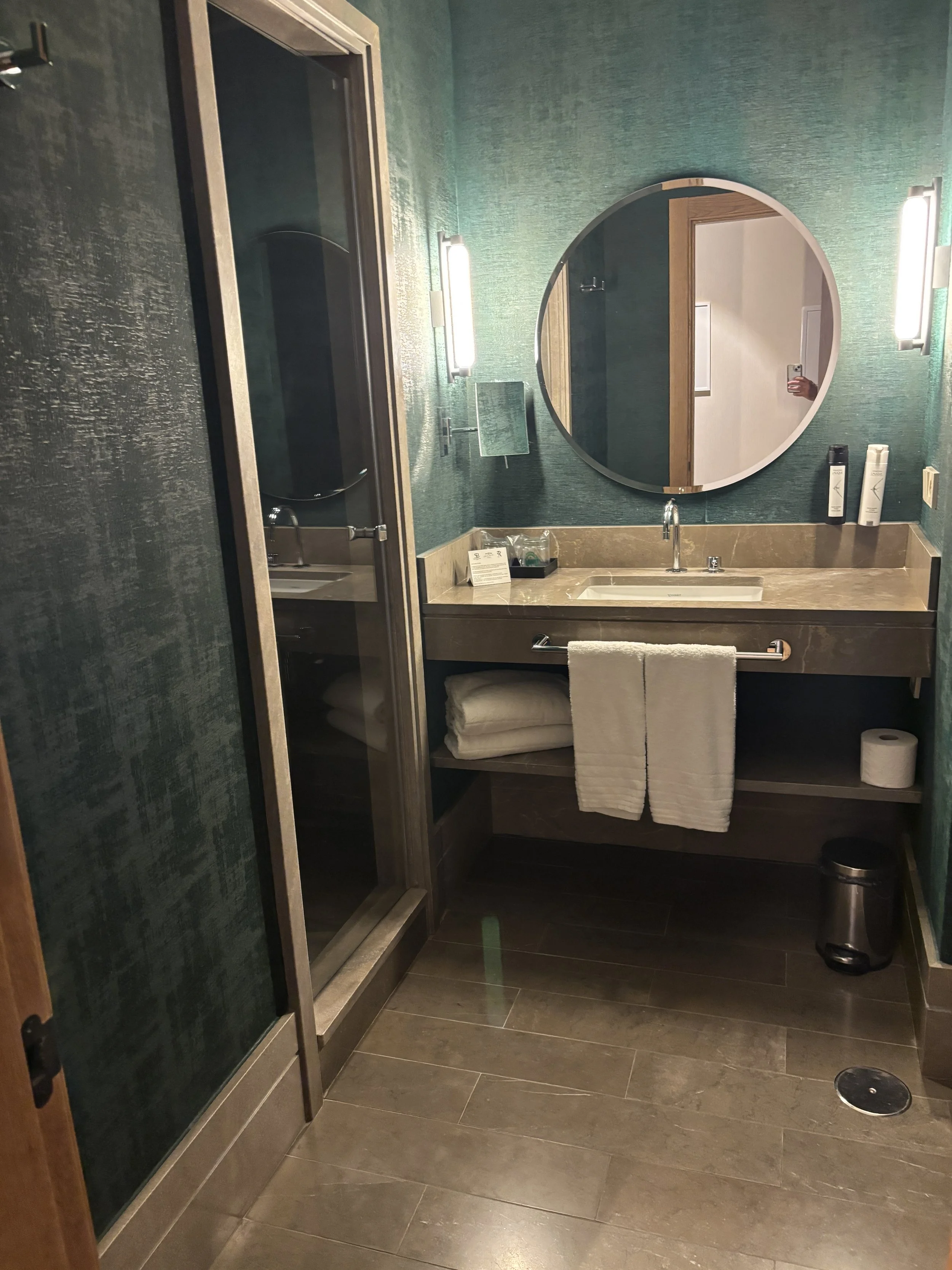
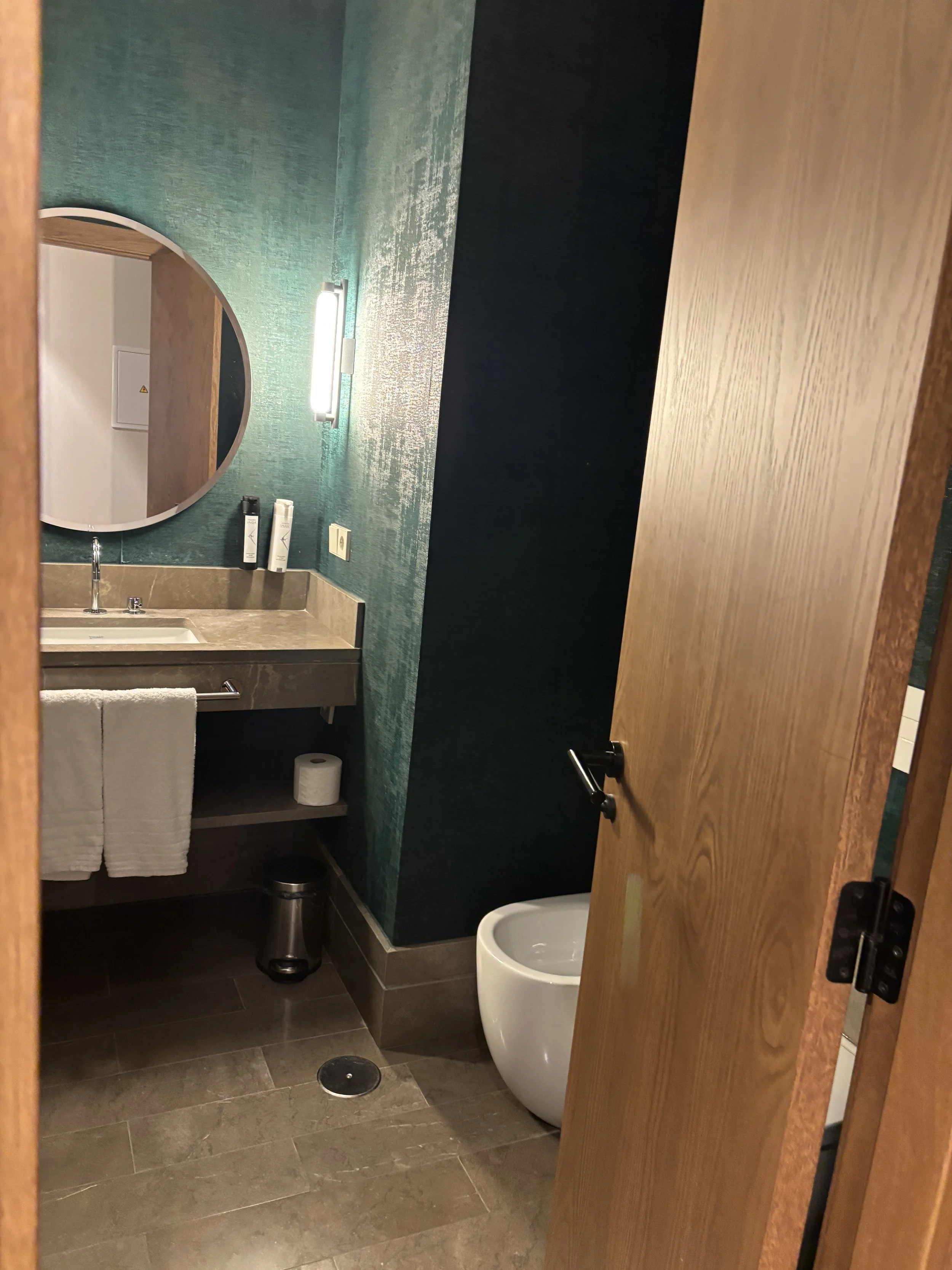
Last but not least, a couple of shots of the breakfast, which, as you can see here, was particularly solid when it comes to the pastry department!
So, definitely a hotel I would recommend as a place to stay in Málaga!
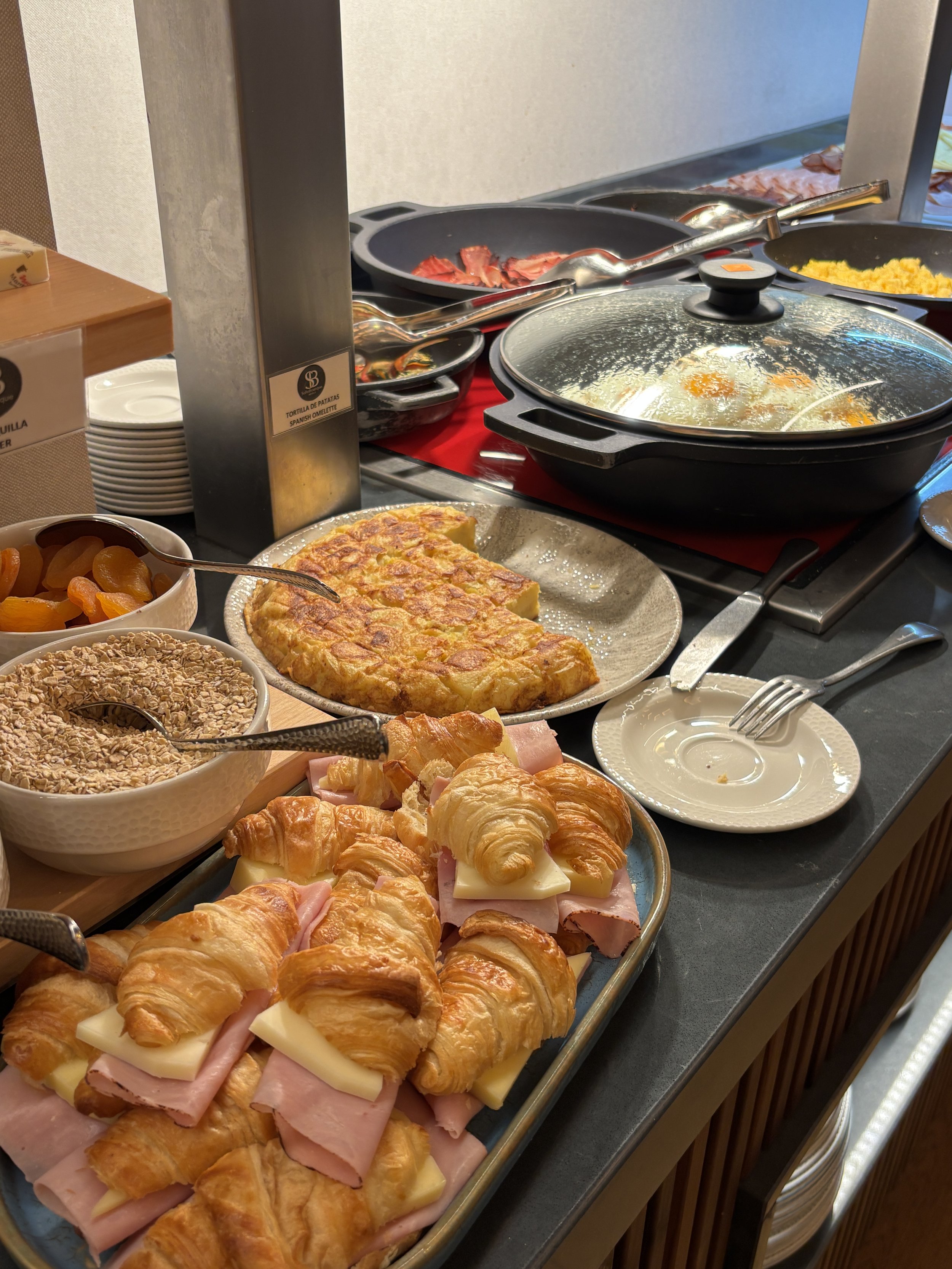
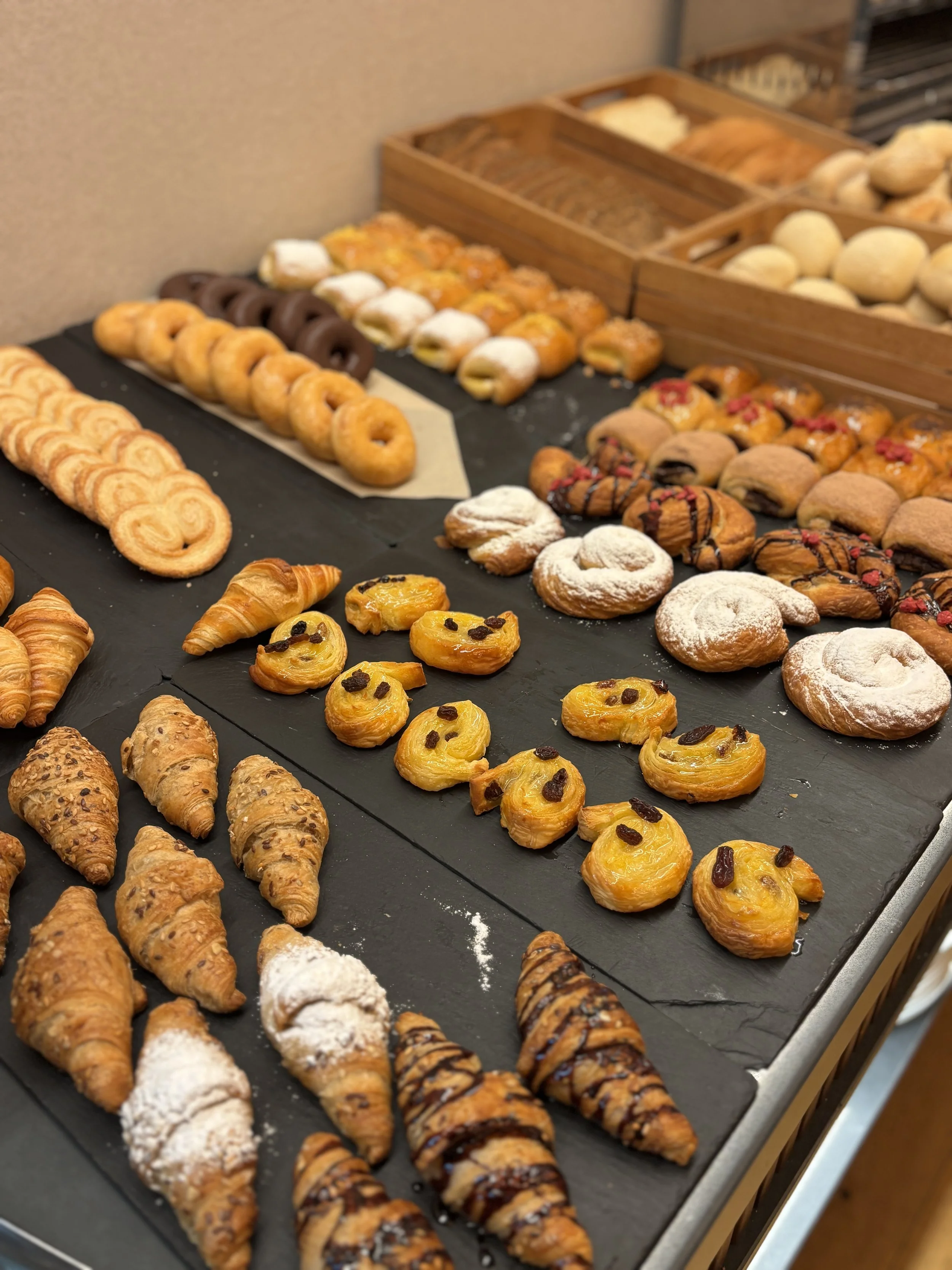
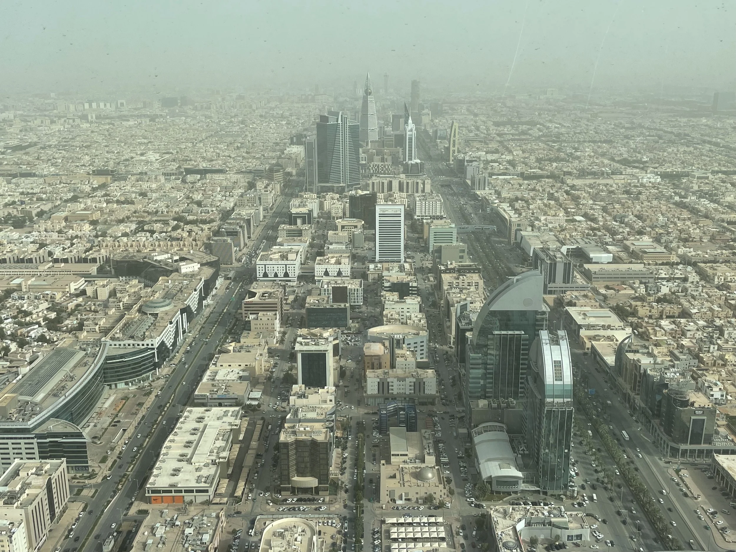
48 hours in Riyadh: what to do and what to see (Updated)
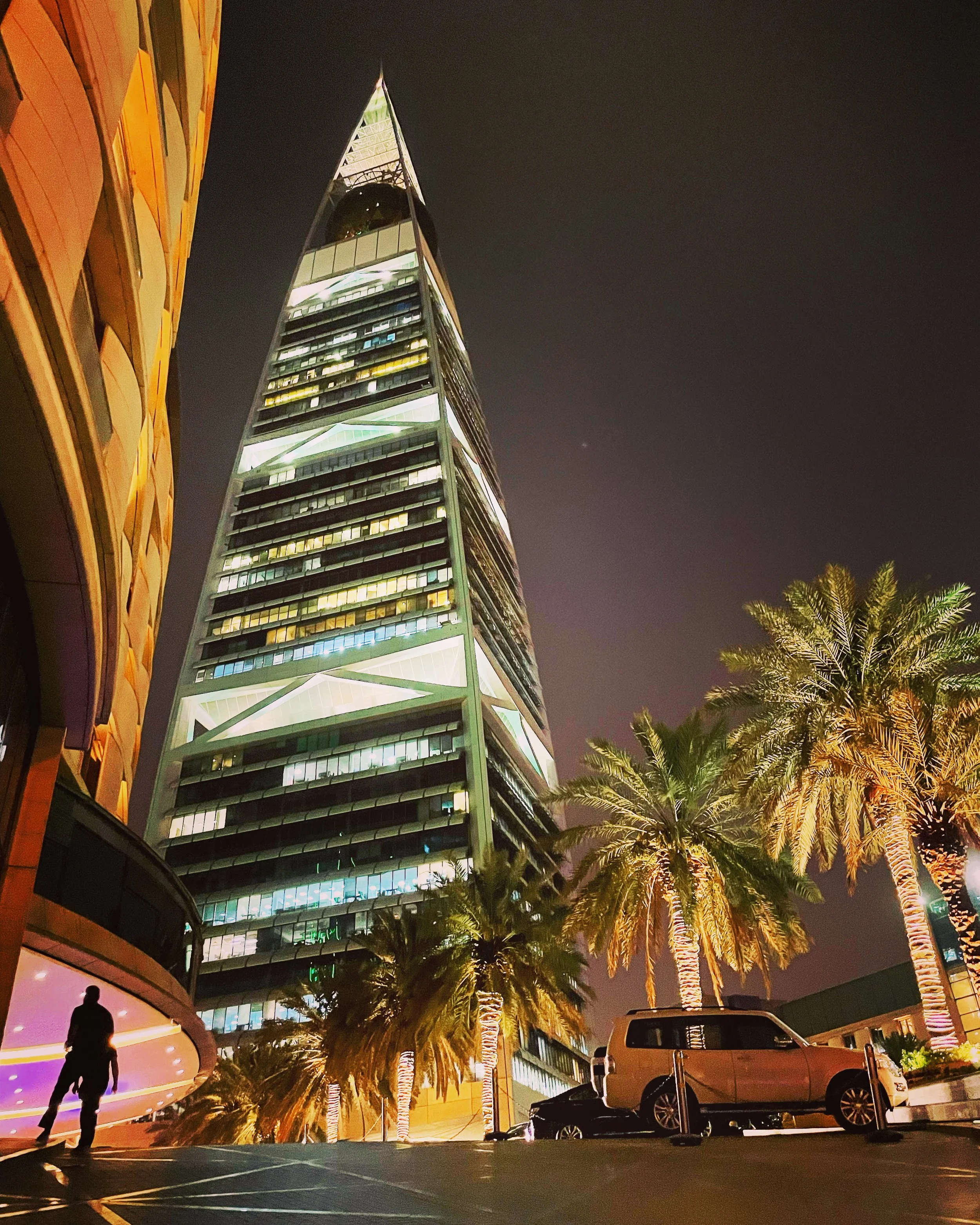
Al Faisaliah Tower, Riyadh
When I first published this post, it was meant to be a classical “48 hours in the city” type of article. However, successive business trips to the Saudi capital have allowed me to explore more of the city, to the point that I have kept adding more recommendations about what to do and what to see when visiting Riyadh. So, it may be quite challenging now to do it all in 48 hours.
Nevertheless, I still think the places and experiences that I list on this post are still mostly doable in a relatively short visit, so, in keeping with the theme of this site, I decided to keep the title while continuing to enrich the content.
Table of contents:
Top views in Riyadh
Riyadh Season
Boulevard City
Boulevard World
Royal Saudi Air Force Museum
Where to stay in Riyadh
Where to eat in Riyadh: two suggestions
Day trips around Riyadh: the Edge of the World
Saudi Arabia has emerged as one of the world’s up and coming tourist destinations and this is not random. There is a very deliberate intent, under the “Vision 2030” strategy to make of tourism one of the forces capable of driving economic diversification away from oil.
The Saudi government is, in fact, investing heavily to make of the kingdom one of the top countries by number of visitors in the world: new airlines, airports, resorts and cities are in the menu. In fact, a whole new business district gleaming with new skyscrapers, hotels and office buildings appeared to have emerged out of nowhere in the short time since my earlier visit.
So, it is entirely possible that some Saudi cities may look quite different in a few years time, see for example, the massive restoration work that is going into restoring Jeddah’s historical district, but let’s focus on the Riyadh of 2026.
What interesting things can a visitor see and do in Riyadh already today? Let’s have a look…
Top thing to do in Riyadh
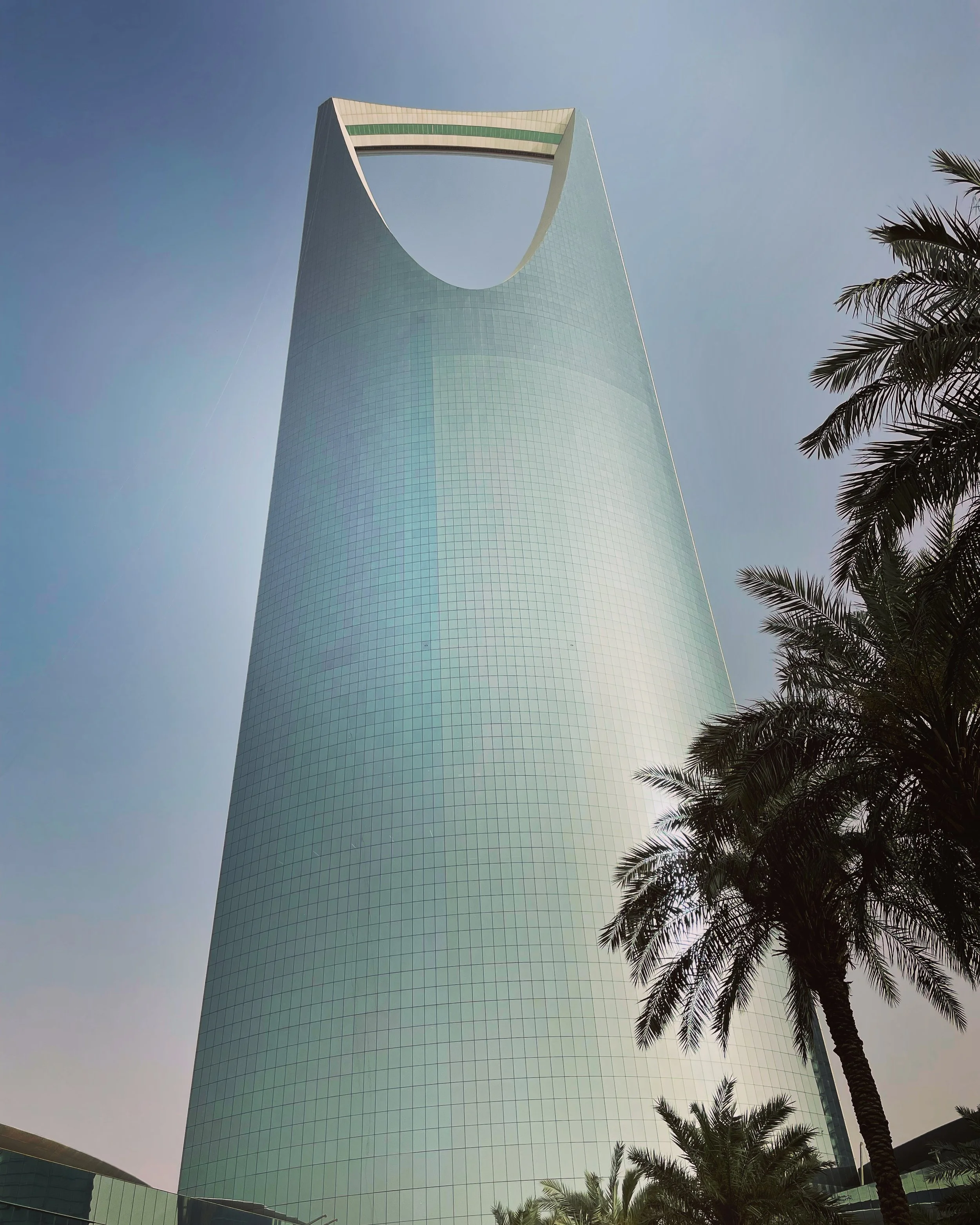

The bridge at the top of Riyadh’s Kingdom Center
If there’s an iconic building in Riyadh, this is the Kingdom Center, a 302m skyscraper with a very prominent “eye” at the top.
The very top level of the building, which acts as a bridge between the two sides of the opening, can actually be visited. And this is actually something I would recommend doing first if you find yourself with some spare time in Riyadh.
From the top of the Kingdom Center you have the best views of the city, giving you an idea of the extension covered by the urban sprawl. It is even possible to discern exactly where the city ends and the desert starts, without transition.
From here you can also get an excellent view of Riyadh’s central strip, which the Saudi authorities expect to develop, over time, as a sort of Dubai or Manhattan-like skyscraper district.
As of 2025, only a few of the planned high rises are currently standing. One of them is the Al Faisaliah Tower, which is another iconic skyscraper, with a roughly triangular shape and a giant 24-meter diameter ball at its top (you can see it in the picture opening this entry).

One thing that surprised me is that there was almost no one around when I visited, neither in the viewpoint, nor in the luxury mall at the base of the building. I counted about a dozen employees on my way to the top, but only a couple of other visitors in the whole time I spent there.
Nevertheless, the views were magnificent!
Riyadh Season & Boulevard City

One of the symbols of the process of liberalization that Saudi Arabia is undergoing is the Riyadh Season.
This is a festival that runs from October to March, with many cultural and entertainment activities scheduled throughout the city. This is quite a radical development is you think that cinema, music and other forms of entertainment were severely curtailed until only a few years ago!
The Riyadh Season has several venues but one of the epicenters is Boulevard City and the adjacent Boulevard World (BLVD World), a massive entertainment complex on the western side of Riyadh. Think Disneyworld meets Time Square, but in the desert!
At the time of my first visit I was only able to pay an evening visit to Boulevard City, so I will focus first on this bit. The area is being developed so fast that it is likely that by the time you read this post, new amusement areas have already sprung up in the vicinity (there is certainly no shortage of land for this!).
UPDATE (as of March 2026): indeed, by the time of my next visits, Boulevard World was already completed and in full swing. So keep reading because I will describe it next as well!

You can tell Boulevard World is really new and no effort has been spared in order to create a sort of immersive experience with plenty of sensorial stimuli, be it light, music or water effects.
In some ways, it is not too different from the typical set up of a World Expo (and, yes, after Osaka, the next World Expo will actually be held in Riyadh!)
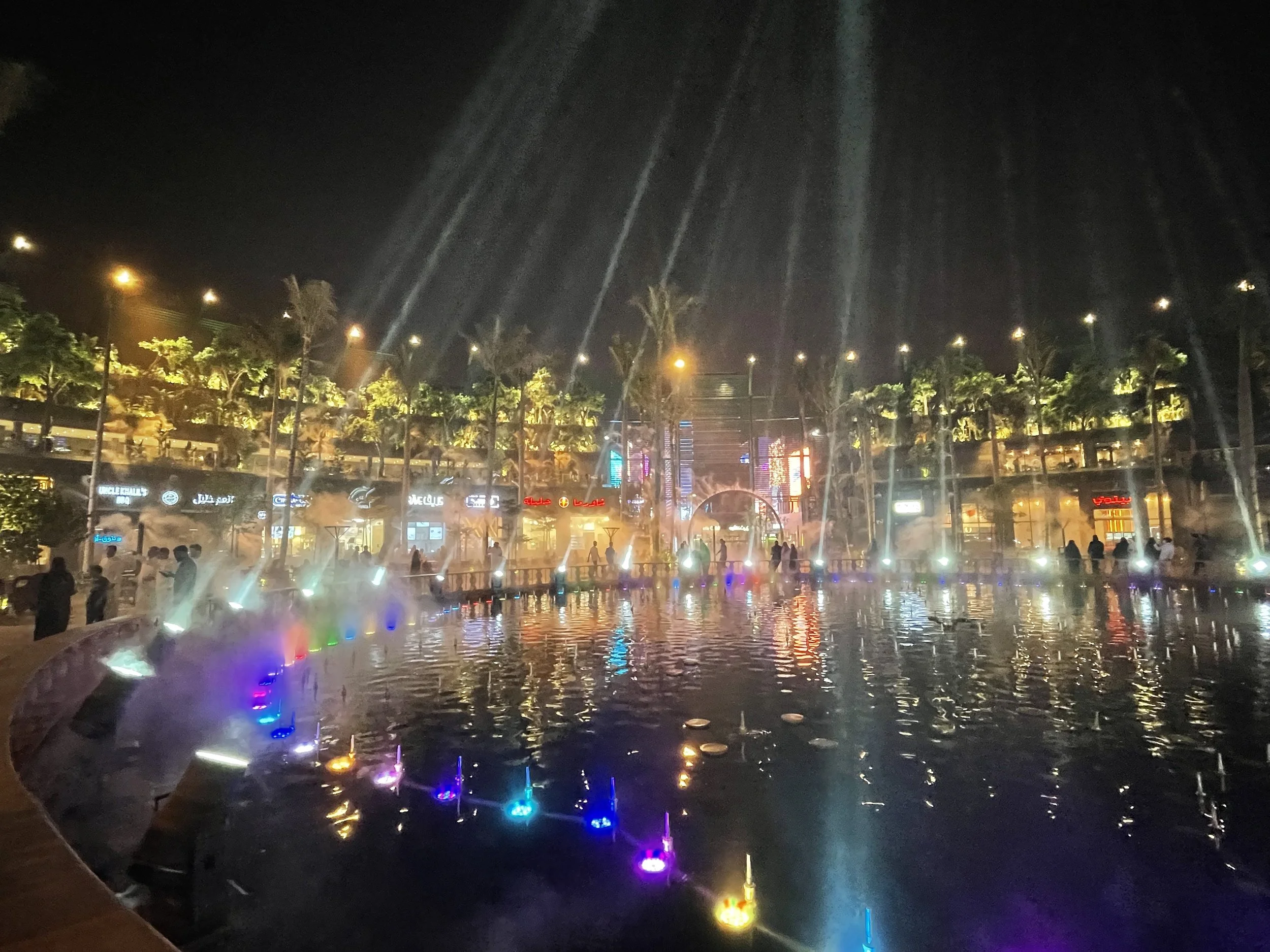

By the way, to give you an idea of the scale of the place, Boulevard World also hosts a massive man-made lagoon, which is quite a thing considering the Riyadh’s desert environment! (always wondered where do they get the water from to run such a huge city in this very high and dry location).
There are also plenty of places to eat throughout Riyadh’s Boulevard City, although the two suggestions I present further below are actually in other parts of the city.
Visiting Boulevard World in Riyadh
Boulevard World is the theme park adjacent to the Boulevard City (and both together are part of the collection of amusement venues and festivals that are known as “Riyadh Season”).
I had been to Boulevard City before, a true example of the social transformation that has been going on in Saudi, so I was curious to see what Boulevard World next door was about, particularly considering that Boulevard City is already a pretty vast entertainment complex. The visit didn’t disappoint and, as you may imagine, it has been built on a massive scale.
What is Riyadh’s Boulevard World, then?
If you have been to any of the Disney parks or to a place like Port Aventura, near Barcelona, the concept will sound immediately familiar: it is a massive entertainment venue which is organized in different thematic sections each aiming to reproduce a country or region of the world. Visitors can follow an itinerary that takes them on an (almost) literal world tour and can enjoy activities, foods and shopping related to each of these areas.
There is an entrance fee of either 29 or 58 rials depending on whether it’s weekday or weekend, that is $8 or $16 (€6.7 / €13.4) respectively at March 2026 exchange rates.
So, pretty reasonable compared to Disney, I think!
To get the ticket you will need to download an app called Webook. It is a bit annoying to have to download an app you may never use again just for one purpose, but, apparently there is no other way! The purchase process, however, is pretty straightforward once you have downloaded the app.
The whole place is structured around a vast artificial lake, with the different countries and regions of this “World” easily recognizable by the iconic landmarks you come across.
There are sections dedicated to: Saudi (with Jeddah’s famous coral houses), China, Turkey, Central Asia, the GCC countries, Egypt, Africa, Greece, Ancient Rome, Italy, Mexico, Spain, India, the US, France, Thailand, Japan…and quite a few other places I can’t even remember!
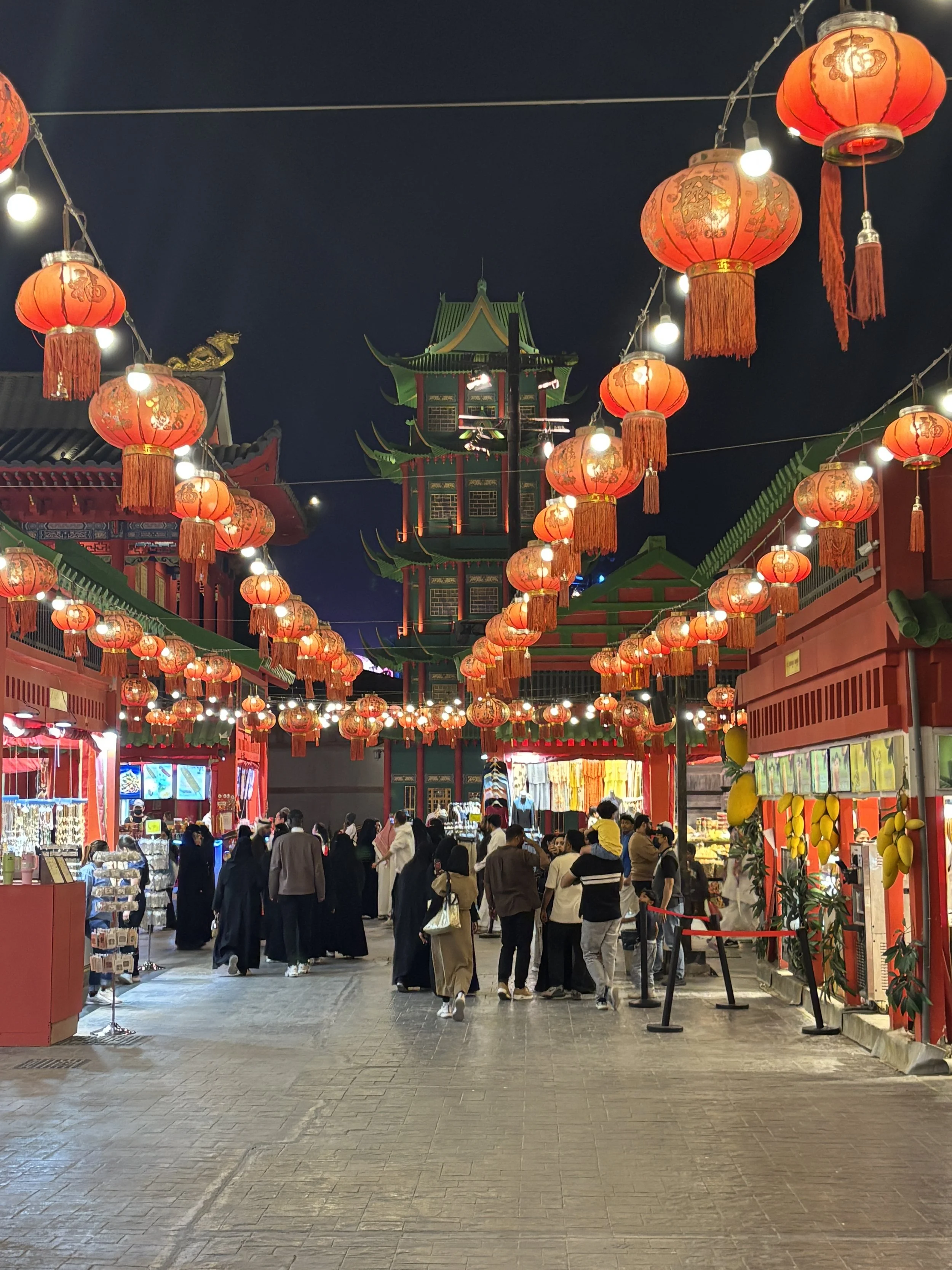

And there are also some items that are not country-specific but pretty cool, as well, like real size dinosaurs and a giant sphere covered in LED lights that keeps depicting different very realistic images all the time, a bit like the famous sphere in Las Vegas…because there is a touch of Vegas, as well, in this whole Boulevard concept.
It is a pretty huge territory and, even if we practically didn’t stop to eat, drink or play, it took us a good two hours to walk the whole itinerary at a relatively fast pace.
So, definitely a place to visit in Riyadh if you have some spare time in the evening, but, beware! If you are planning to see both, Boulevard City and Boulevard World, better do each of them on separate days, because otherwise it can be exhausting!
The Saqer Al-Jazirah Saudi Royal Air Force Museum

I did cover this museum in this post for the Allplane aviation site, however, I thought any post about things to do and to see in Riyadh should include a mention to this excellent museum.
If you are even minimally interested in aviation, you will like it! Even if, truth, be said, it is far from easy to reach. The only way to get there is by taxi/Uber and the entrances are not clearly signalled, so actually my Uber left me at the far end of the perimeter, not at the main entrance.
Likewise, getting back to my hotel was a small odissey, since I Uber drivers kept cancelling rides at the last moment and took me something like one hour or waiting time, plus a not very pleasant walk on the side of the mortorway to a nearby McDonald’s to be able to get a ride back! So make sure you have enough battery and a charger with you and some way to access the internet on your phone if you don’t wish to get stranded!
On the positive side, I must say that the museum staff were super friendly and helpful and helped me with my internet connection and offered me tea and sweets during my wait.

The museum collections are pretty impressive and are split between an indoor and an outdoor part. Pretty much every model of aircraft operated by the Royal Saudi Air Force is in display here and there are also some civilian aircraft that were once operated by flag carrier Saudia, including a rather remarkable Lockheed L-1011 Tristar.

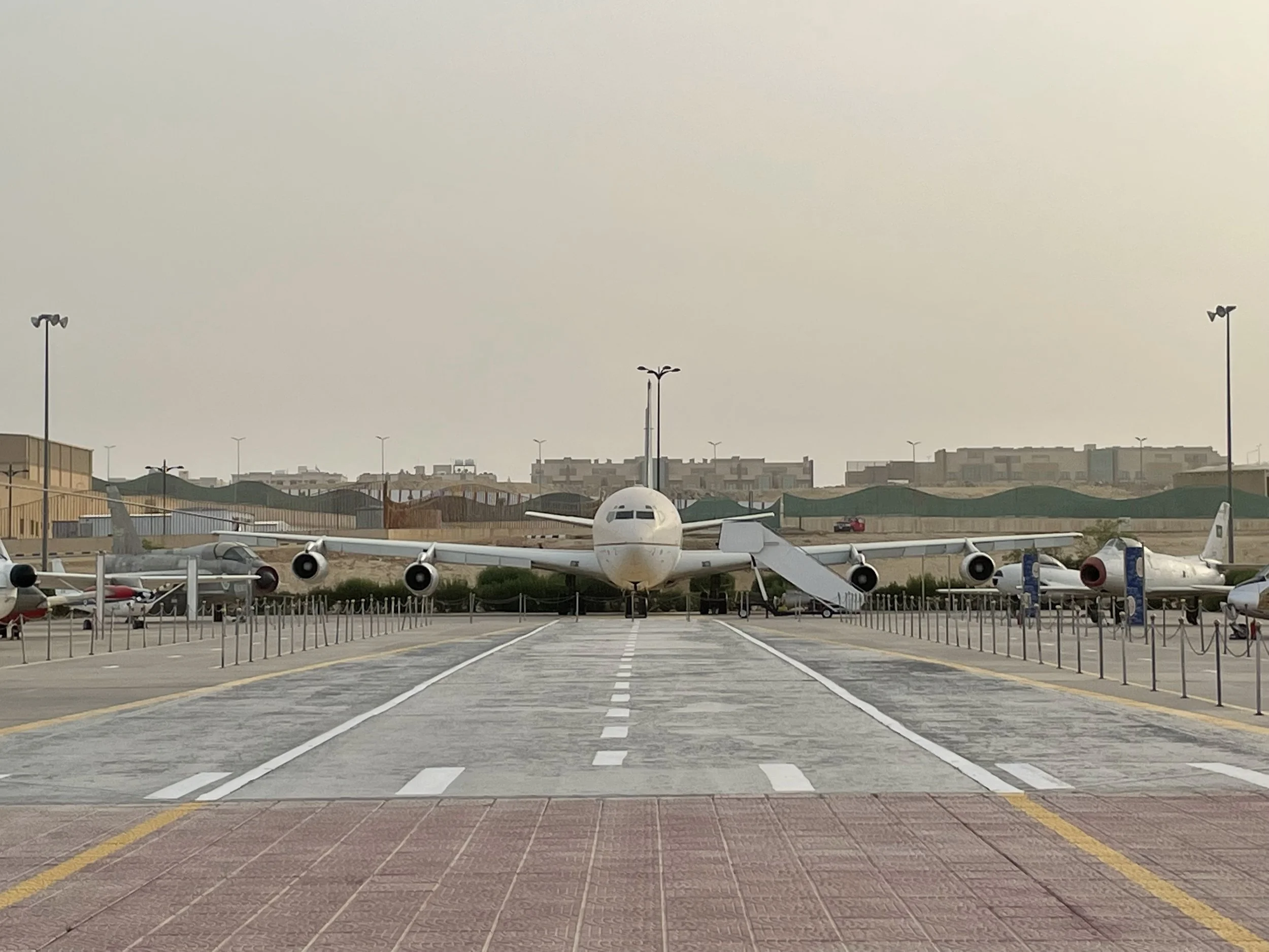
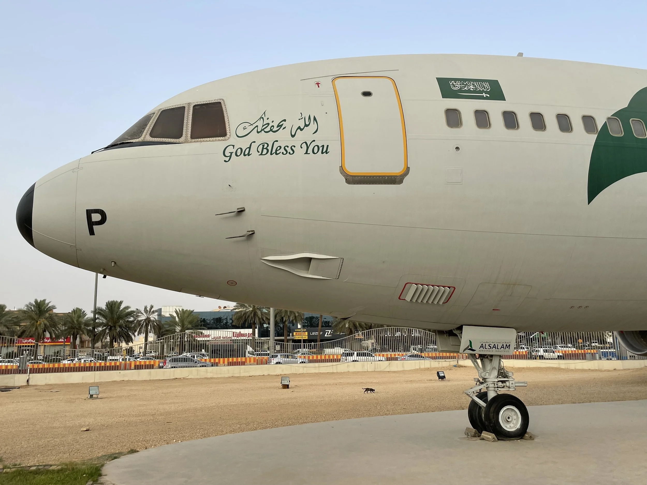

Where to stay in Riyadh
Since I have been at two different hotels in Riyadh, on different occasions, I will outline both here, starting by the one I liked the most.
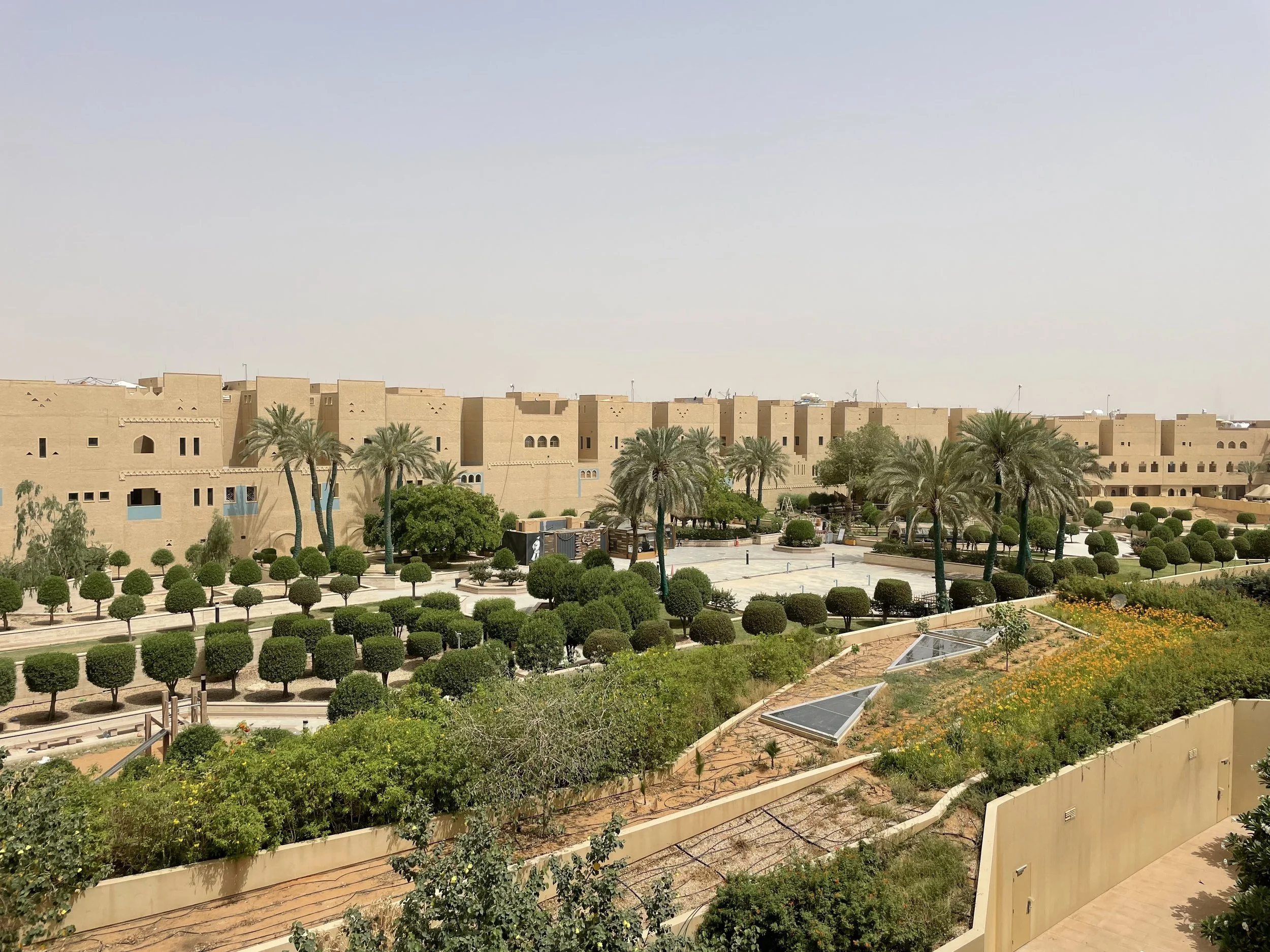
Radisson Blu Diplomatic Quarters

This is a very nice hotel, located in the diplomatic area of Riyadh, to the west of the city. In fact, the whole area has some sort of special security status, as there are checkpoints to get in an out.
The whole facility is super new and it shows in its design. It is not super central, but you need a car to move anywhere in Riyadh, so I guess this is a rather secondary consideration here.
Also worth of note is the breakfast, which was really tasty and had an interesting mix of international and Arabic specialities.
I was also surprised to find out the room had a small kitchen!


A couple more pics of the room, which was impeccably clean and contemporary in style.

Al Waha Hotel Riyad
This is a more centrally located hotel, belonging to a local chain.
The room was quite spacious, but, to be honest, there were some service glitches and, overall, despite being technicall a four-star, it was not nearly at the same level as the other hotel I previously commented on.
The registration took very long, I understand there is some paperwork to be filled, but it was not done very efficiently to say the least.
Then there were issues with some of the lights in the room, namely the one in the cupboards, which wouldn’t switch off due to some faulty sensor, so I had an ongoing fight throughout the night, since it activated at random several times, waking me up.
Last and not least, my room was not done upon coming back from my day appointments and this, I was told, was due to not having indicated my preferences for room cleaning, since apparently it is a requirement so that female staff can know when they can enter a room. This is apparently by regulation, but I would have appreciated some warning before hand.
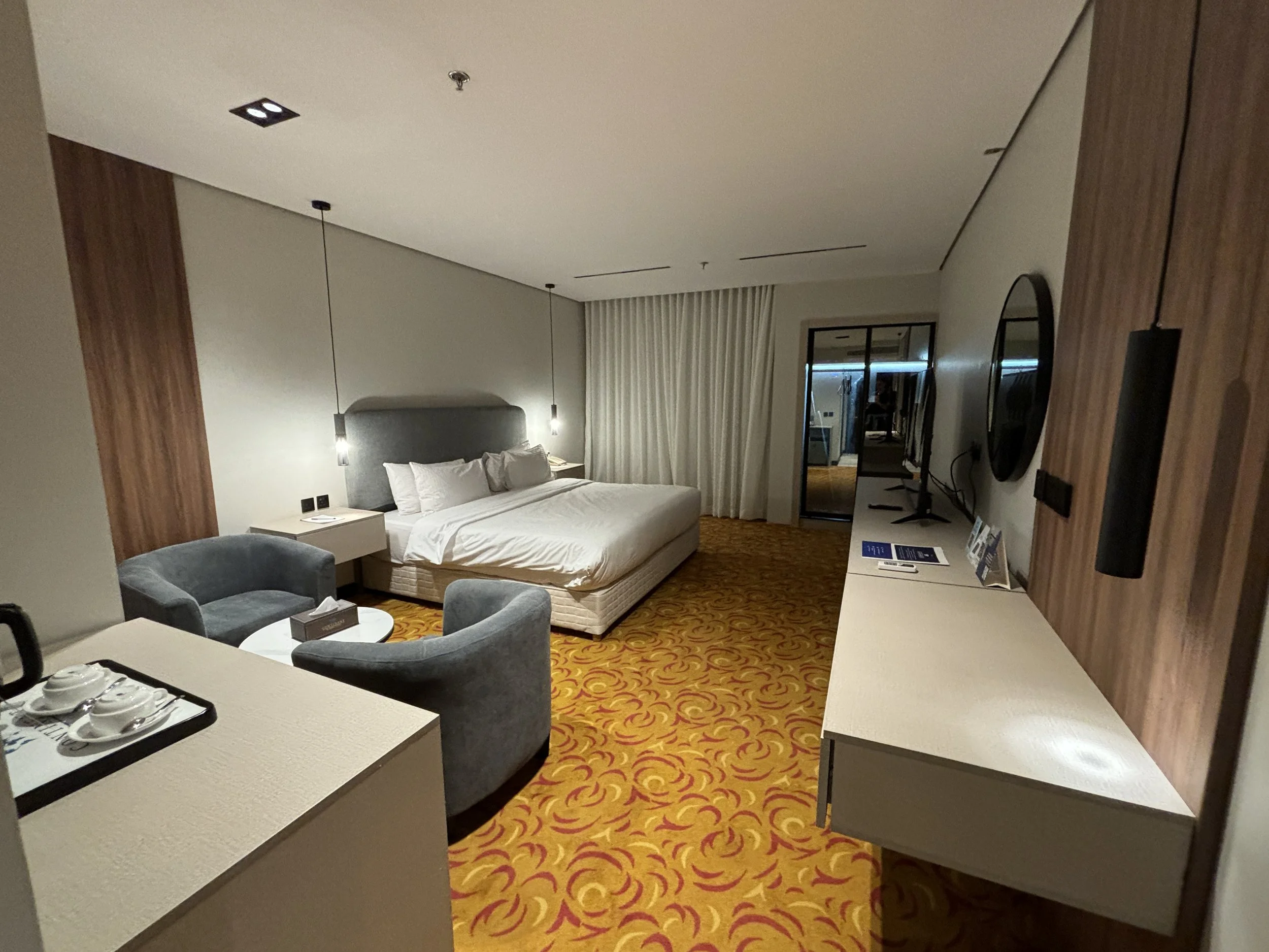
Having said that, when I complained about the above points, the staff were apologetic and they made sure the issues were fixed on the second day of the stay.
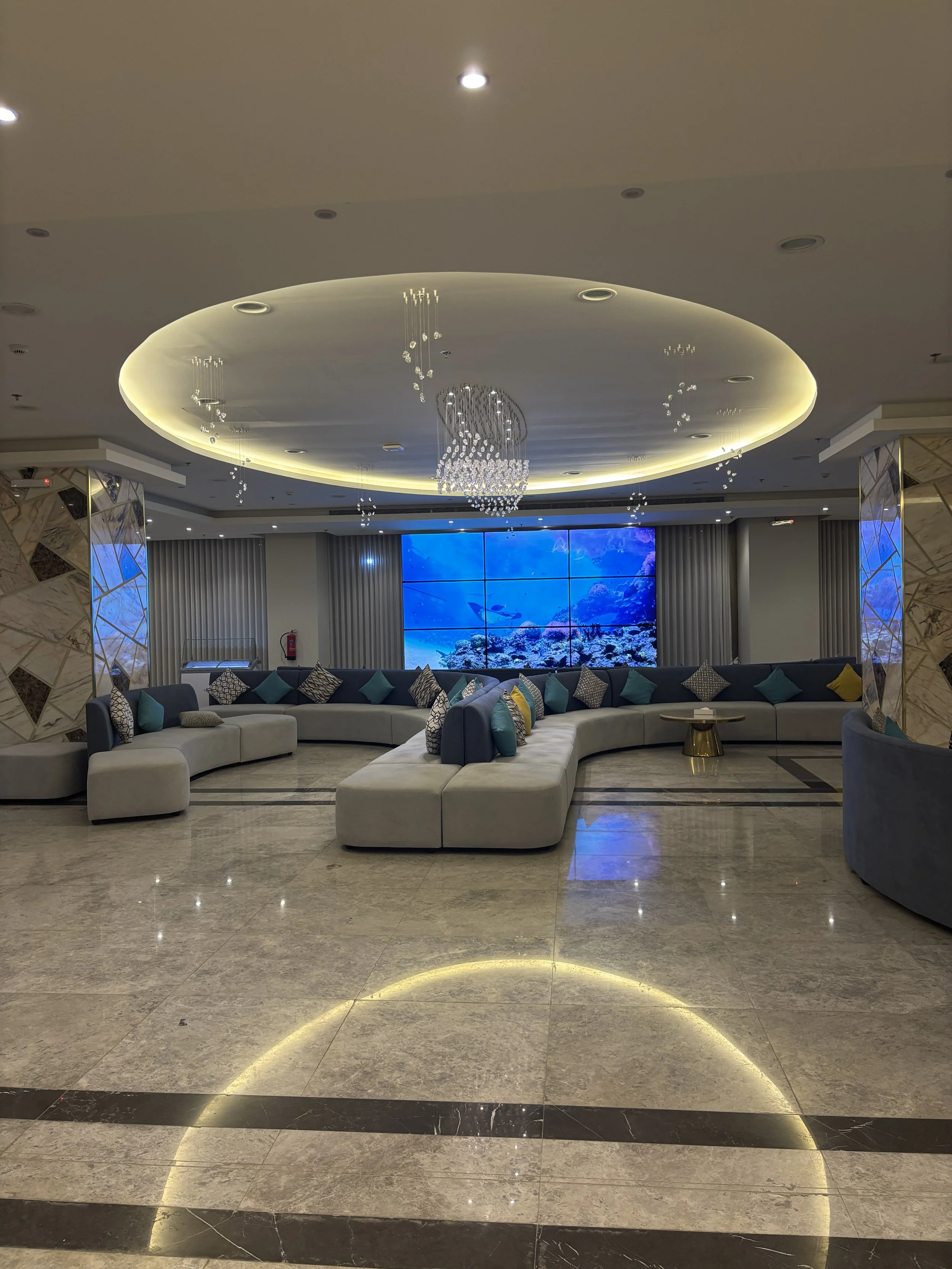
Best Western Premier Riyadh
King Ibn Saud Abdulaziz Saudi, As Sulimaniyah
Riyadh, 12621
This hotel appears to be quite new or recently renovated. It is a great value option to stay in Riyadh, offering good quality-price. Staff were also very friendly throughout.
Location-wise it is not super central, but not too far from downtown either. In Riyadh you always need to take a car or taxi ride anyway!
Breakfast was ok, although I would say that is the weakest part of its value proposition.
Other positive features: fast wifi and a comfortable lobby stocked at all times with Arabic coffee and dates.
The room was really large. In fact it was more like a two-piece apartment. Perhaps the most remarkable thing is that the bathroom was split in two separate pieces, with the shower alone being almost like a room in itself!
You can check how the rooms at the Best Western Premier Riyadh look like in the pics below:
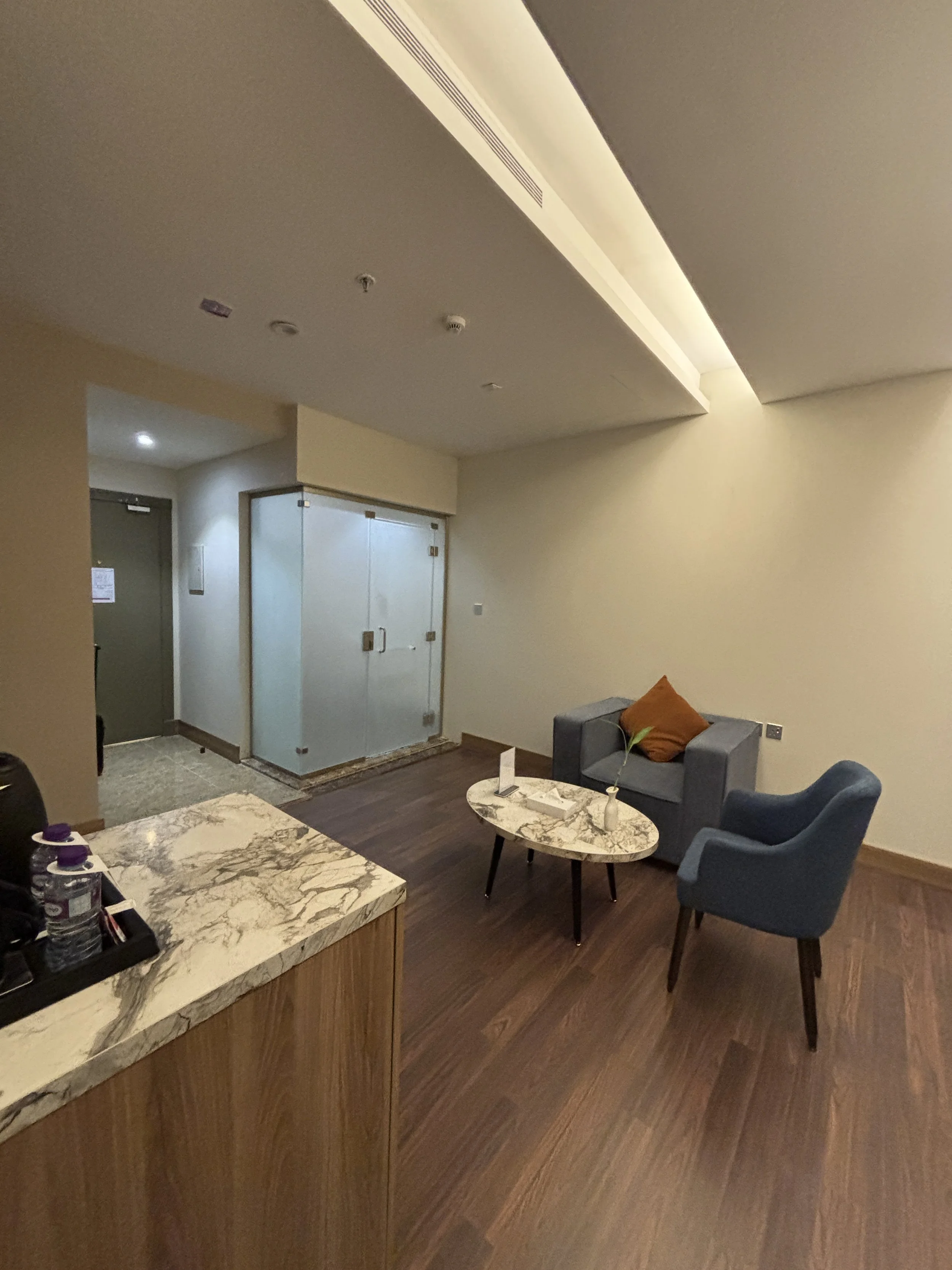
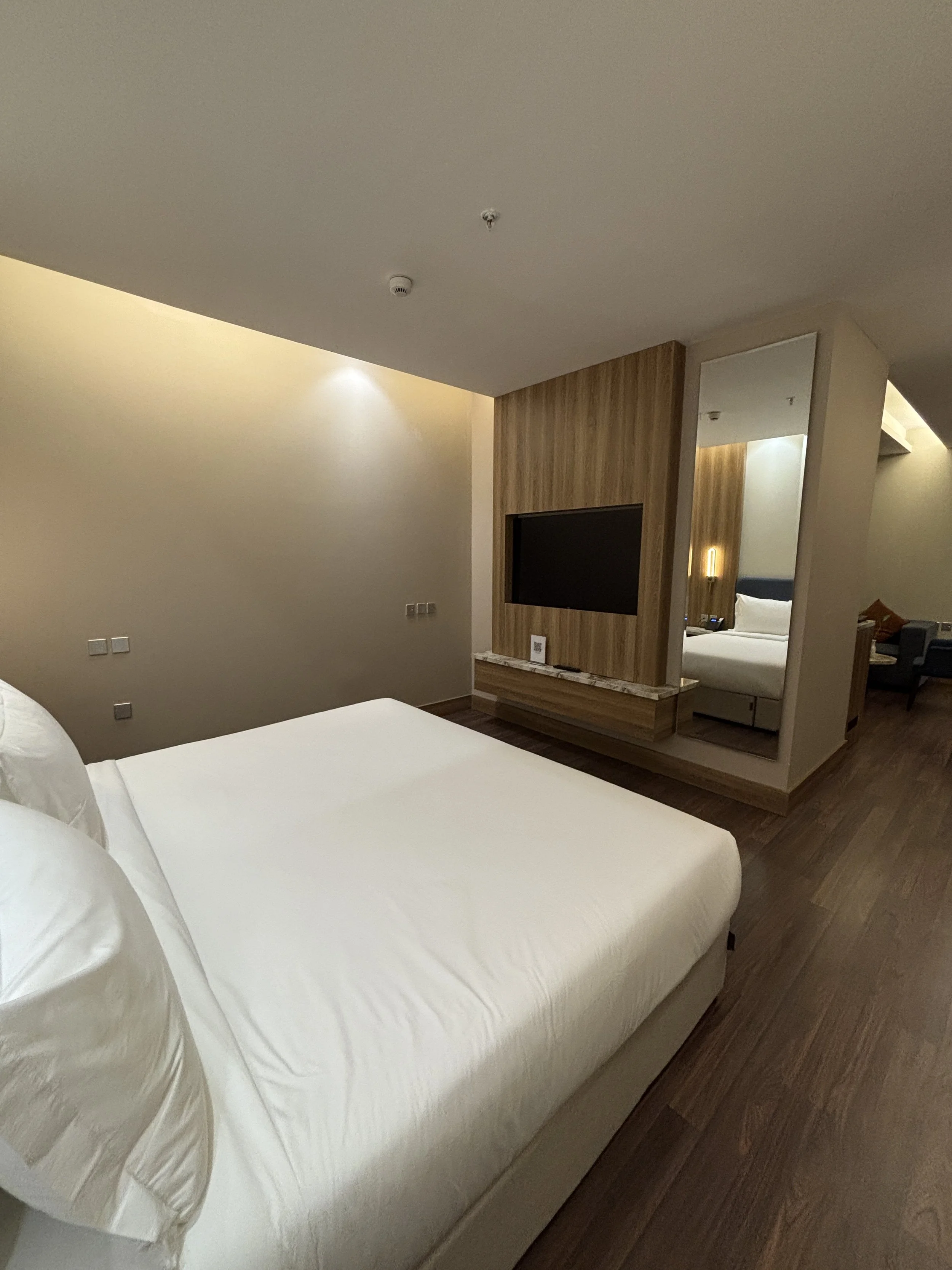
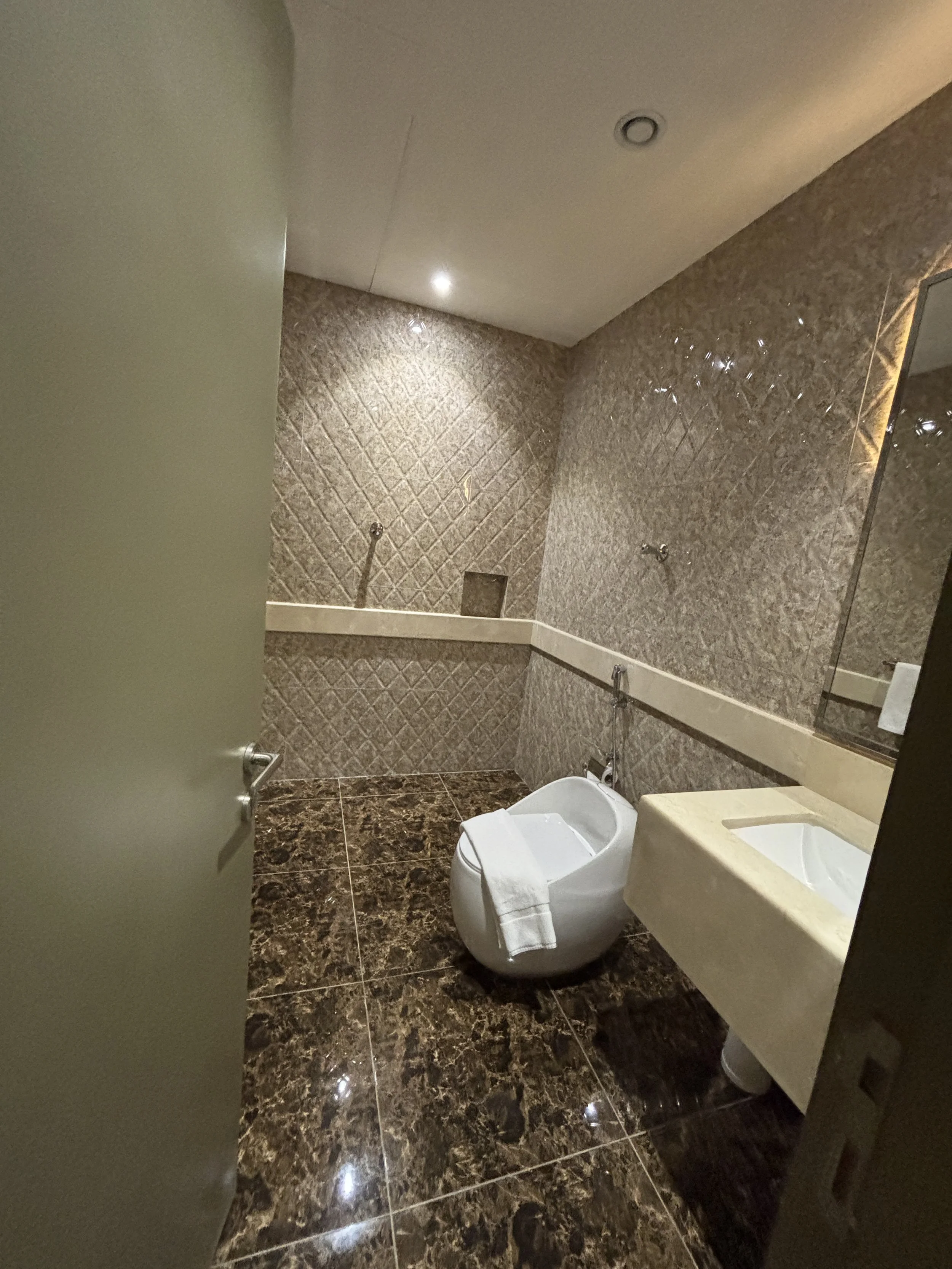
Where to eat in Riyadh
When it comes to getting the proper Saudi eating experience in Riyadh, the choice is clear.
Najd Village
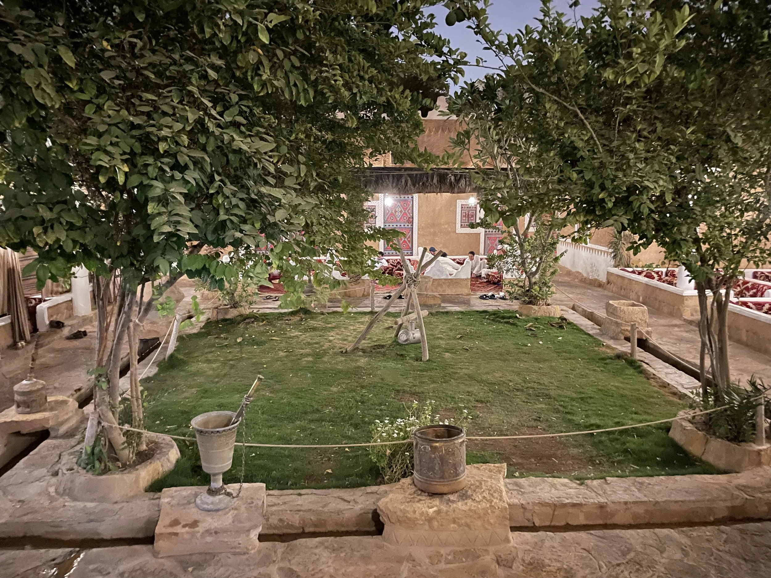
This is a bit like an oasis in the middle of central Riyadh. There are no traditional tables, but rather an array of eating areas arranged around a central courtyard with a small garden.
Najd Village restaurant aims to replicate the atmosphere of the desert caravanserais, where desert travelers used to rest and eat. You actually seat on the ground, or rather on carpets, and usually you would share the

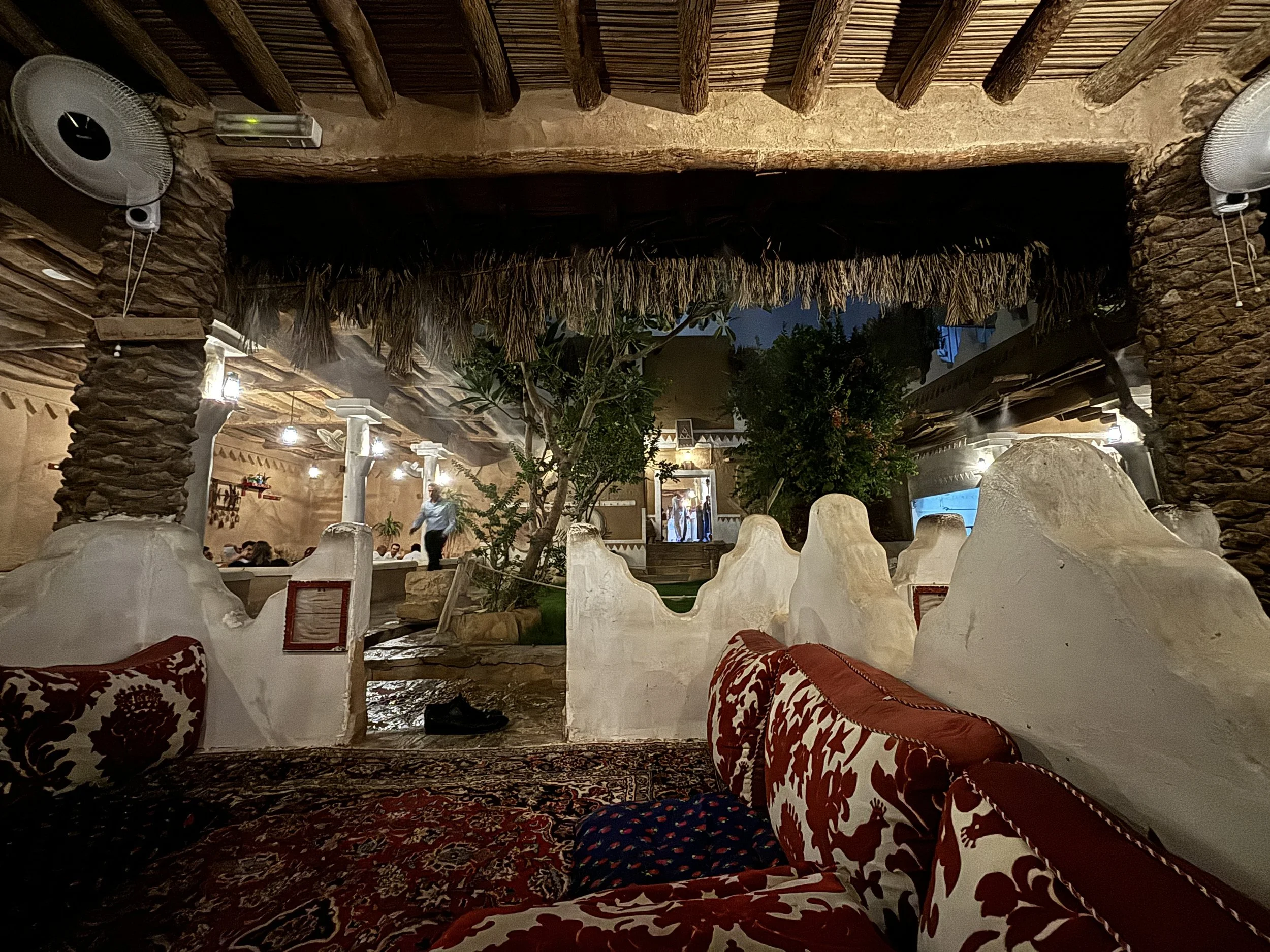
Now, beware the portions, because they are really, really huge!
We were three in our group and we each ordered one item from the menu and we could hardly finish it! But it was really good! I’ve been twice to this restaurant and the standards have been pretty consistent.
As per the food, there is a good selection of Arabic cuisine specialities, lots of nicely cooked meat and rice with a diversity of breads to go with, which really adds to the experience!
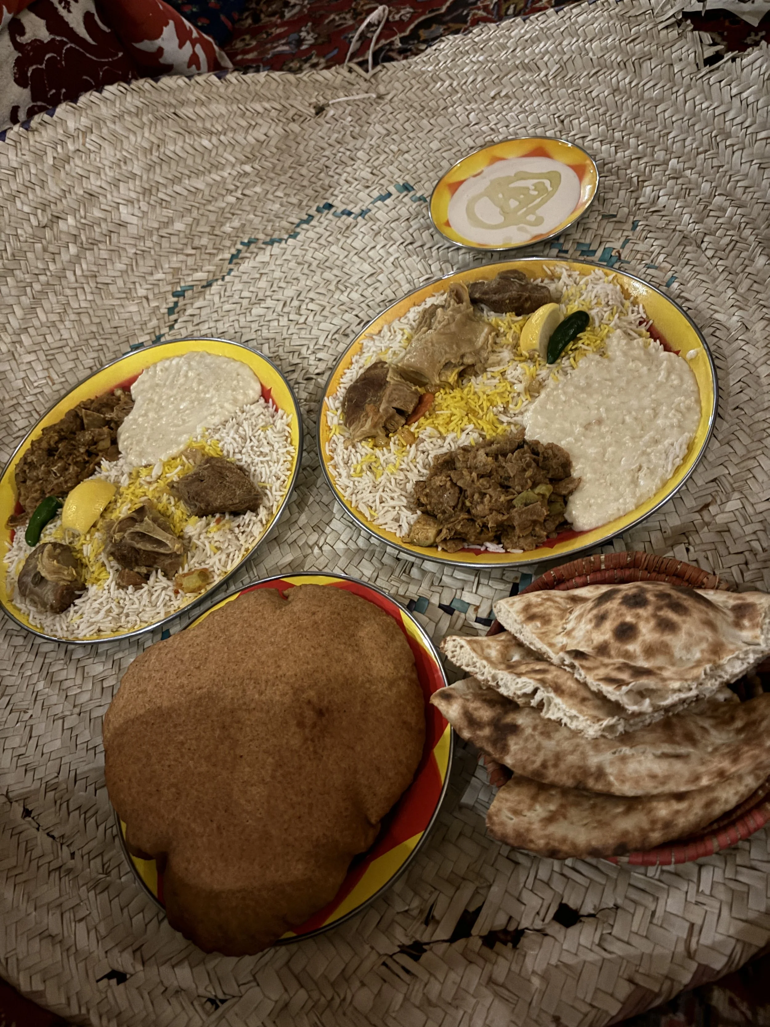

Restaurant Awani - أواني Tahlia
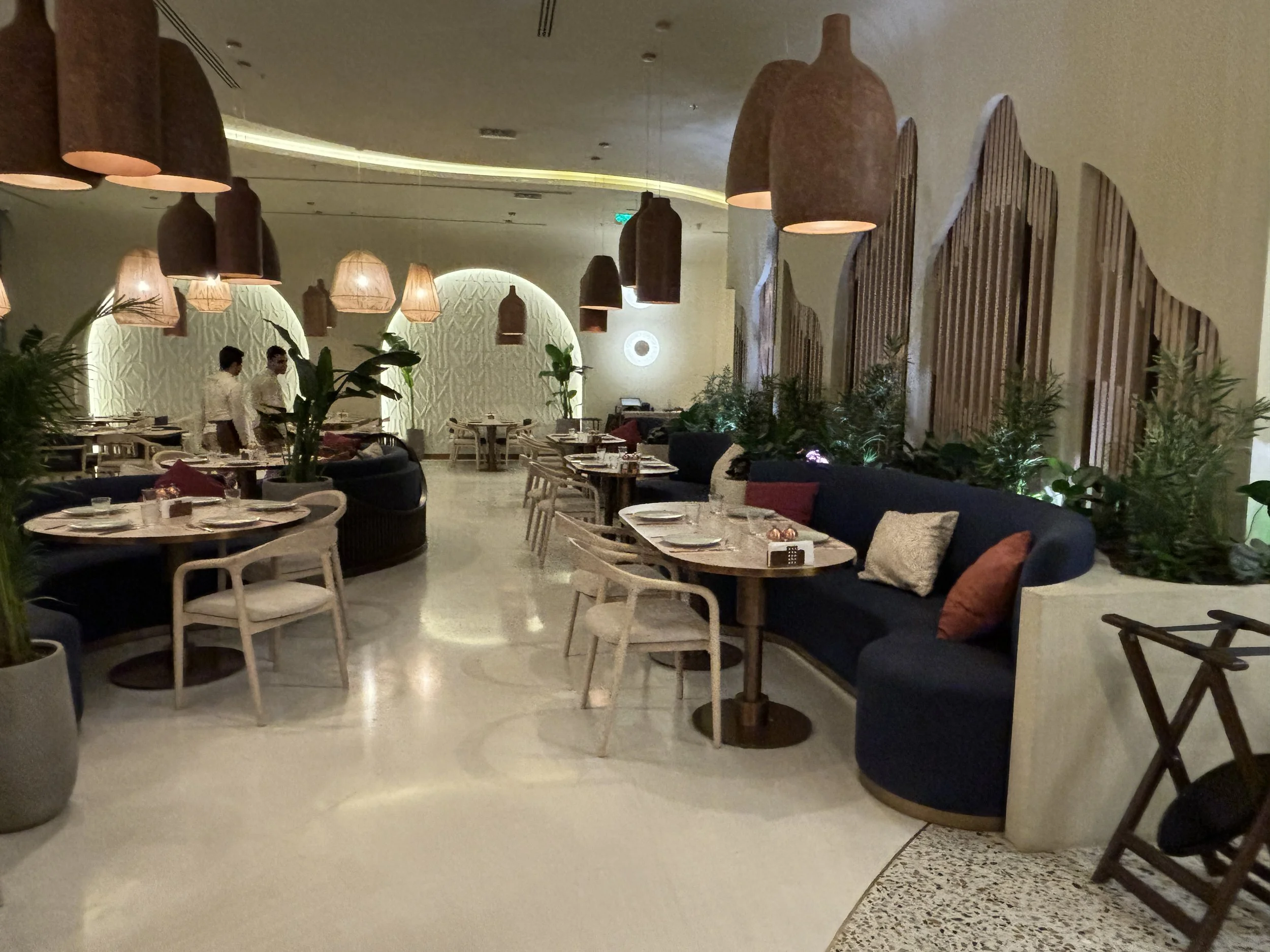
This more of a Lebanese place offering specialities from the broader Middle East. It is rather central, modern and functional, and the dishes were actually pretty tasty, so I thought it worth including it here, even if it is not really a local Saudi cuisine restaurant. You can get an idea of what it is like with the pictures below.
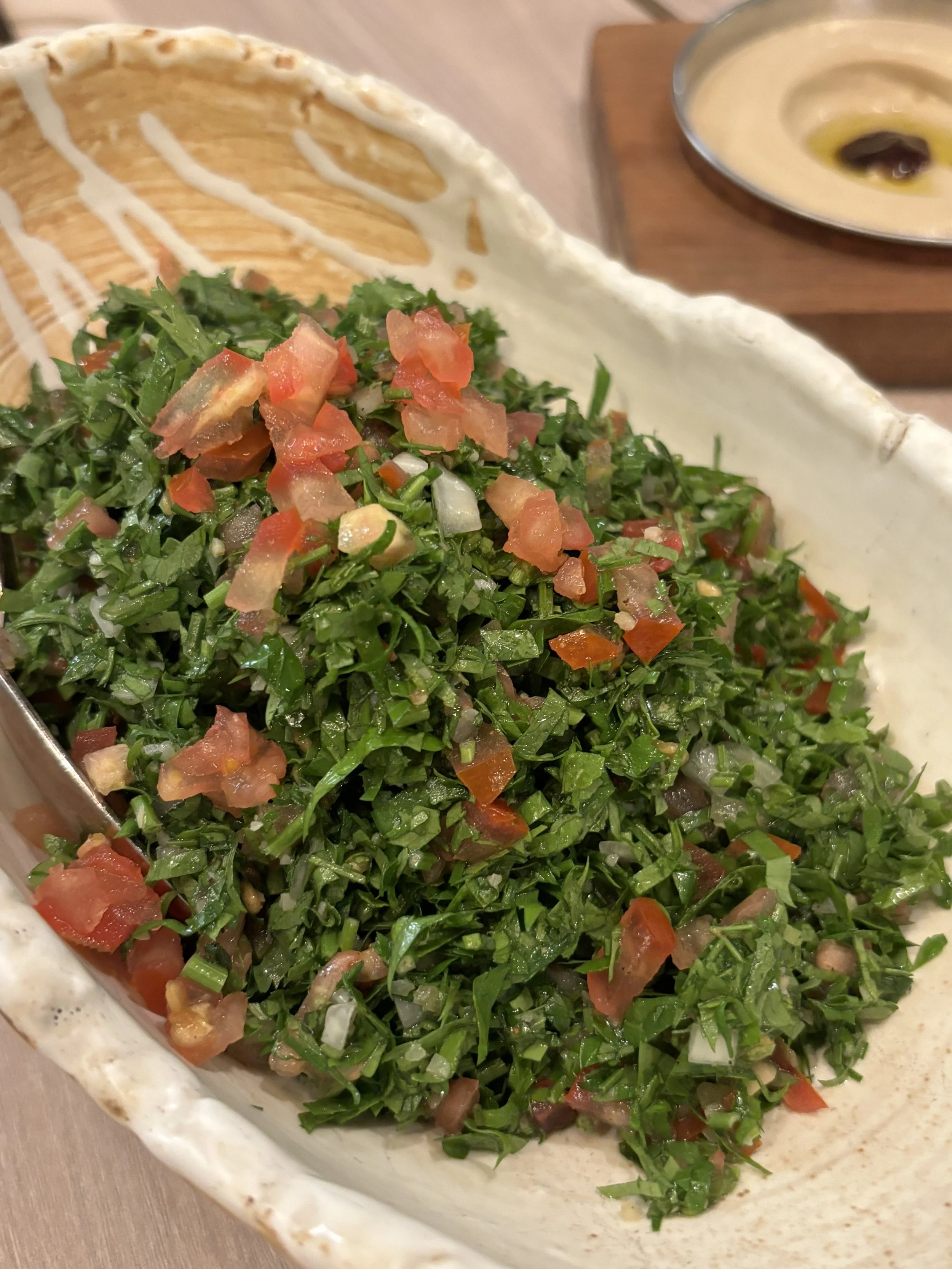


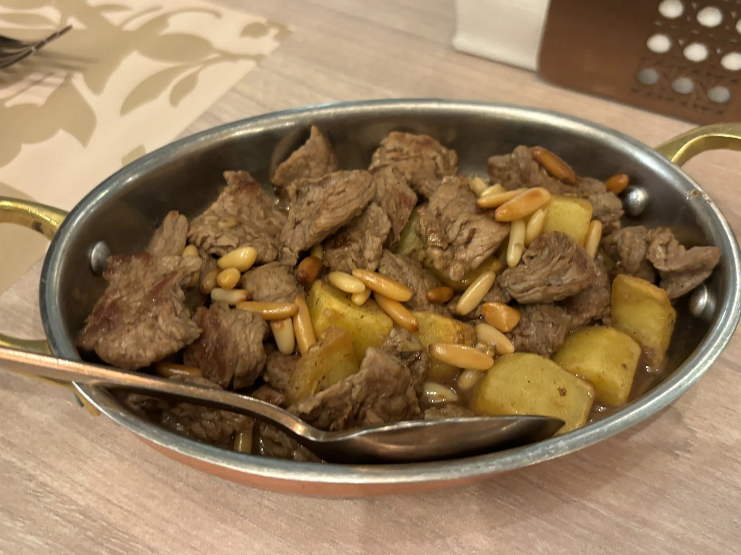
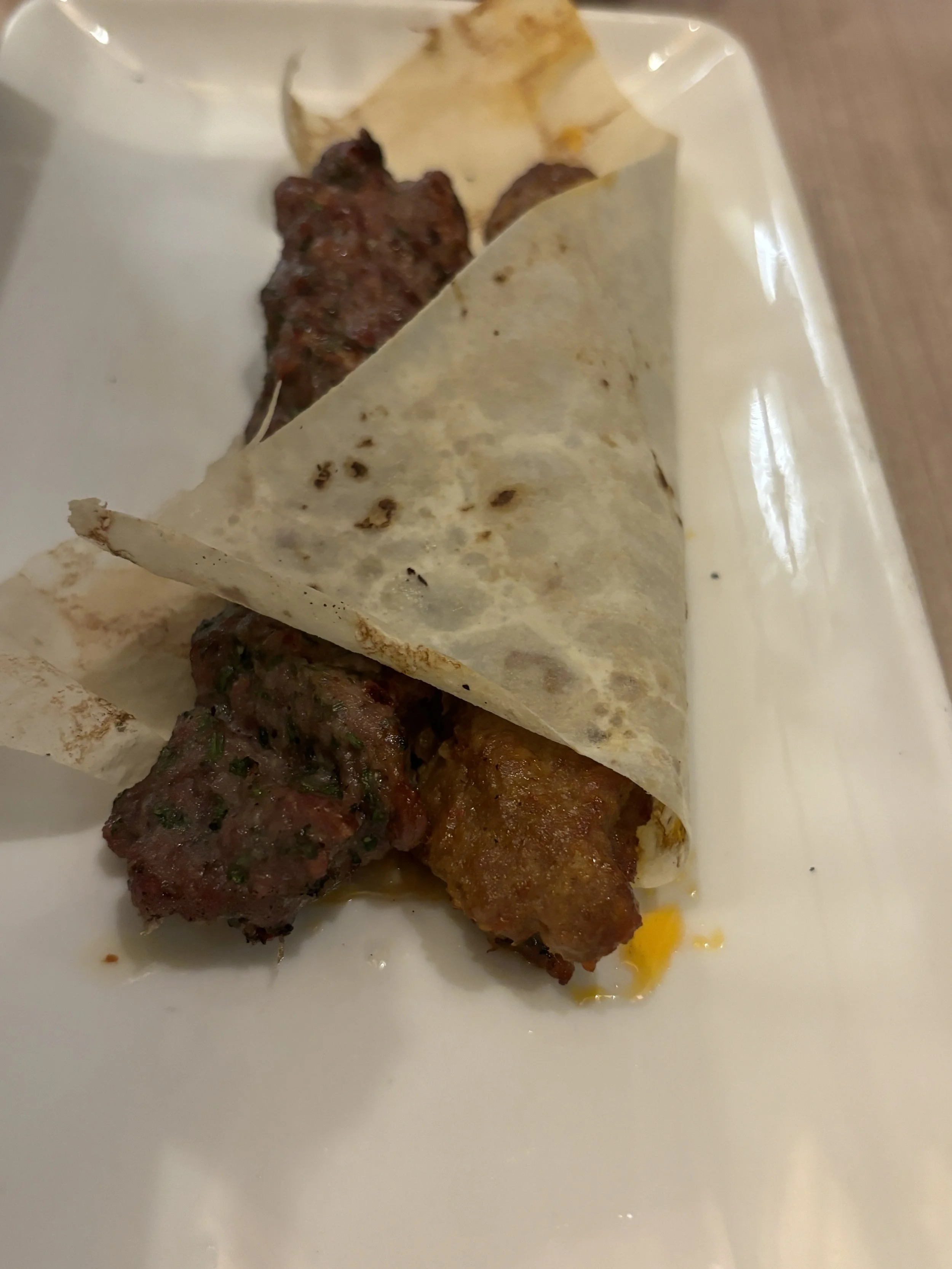
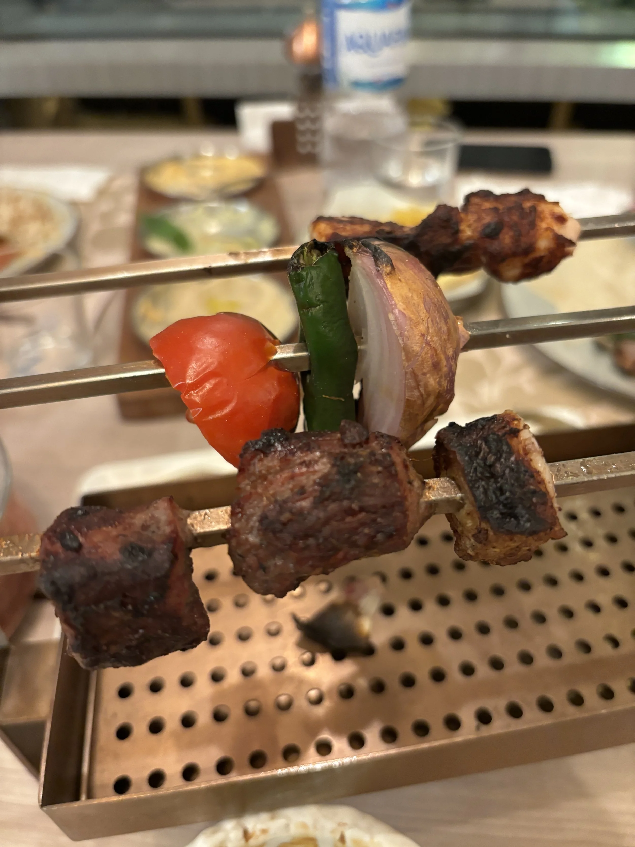
Day trip from Riyadh: a tour of the Edge of the World

If looking for something to do just outside Riyadh, but without having to venture very far out, the Edge of the World tour is your thing. It can even be done in half a day, since the main sights are less than an hour by car from western Riyadh.
Very important, though: you need to get a guide with a proper 4x4 car. This is not an activity a non-local can really do on its own. There is, however, no shortage of companies offering day tours of the Edge of the World from Riyadh.
In fact two “Edges of the World” are marketed as day excursions from Riyadh by these tour operators.
We chose the one called “Second Edge of the World” by a company called Riyadh Tours, but my understanding is that, whether “first” or “second” Edge of the World, it is pretty much the same experience, with the difference being the access route. One of the routes is only open on certain days, while the other is always open.
Only the “Second Edge of the World” was available when our group was there, but don’t be fooled by the name, it was well worth it!
In fact, I think the actual experience is pretty similar and it involves venturing out into the desert towards a ridge of hills west of Riyadh, contemplate the otherworldly landscape, have lunch on the spot and head back to the city.
Definitely one of the top things to do in Riyadh if you have a spare half-day!
This was quite an interesting experience for me, since I always imagined the Saudi desert as a sort of flat space with sand dunes, but the reality is a lot more diverse. There are, actually, quite a few plateaus and hills in the desert and not all of it is sandy, a big part of it is actually a hard crusty surface!


So, in these tours (I think they more or less follow the same programme), the guide comes pick you up to the hotel in his vehicle and he takes you through a number of panoramic viewpoints in the desert.
The Edge of the World derives its name from the fact that there is a vertical cliffs that falls directly over the vast plain of the Saudi desert. It is pretty spectacular and provides great opportunities for Instagram-like pictures.

Most of the tours include also a lunch on the spot. The guide carries everything that is needed for this in the back of the car. At the time of the visit the temperature was pretty warm, in the high twenties-low thirties celsius, but still pretty bearable. So our guide just spread out some carpets and cooked some simple, but tasty meal on the spot. It was a great convivial moment with the group, an amazing experience.


As an added bonus, on our way to the Edge of the World we passed by some bedouin settlements that had camels and we stopped for a quick look at these amazing animals. As you can see in the picture below, they were quite friendly!

By the way, is planning a trip to Saudi Arabia, you may also like my post about Jeddah, its UNESCO World Heritage historical town and the Red Sea Corniche!
And if you considering traveling with Saudia, the national airline of the Kingdom of Saudi Arabia, check out my Saudia flight review!
What to see and what to do in Shenzhen (day trip from Hong Kong)
If there is a city that has come to epitomize the Chinese economic miracle, that is Shenzhen. What was just a collection of fishermen’s villages on the border with, then British, Hong Kong, has grown, in the course of three decades, into one of the China’s largest metropolises and the beating heart of many of its export-oriented industries.
To be honest, Shenzhen is not your typical tourist destination, in the classical sense of the “tourist” at least. There is, of course, not much to see that isn’t less than 30 years old, but this is precisely the point of a visit to Shenzhen!
It is certainly a place that sees a significant flux of visitors, if only because it’s a major economic hub, but also a place where you can get a quick glimpse of the “new” China without having to go “full in”.
This is because mainland China is just a simple metro ride from next-door Hong Kong, a convenient base for the foreign visitor, since it is way more integrated into the, let’s say, “international travel infrastructure” which many travellers outside China are used to, from the availability of payment methods such as Visa and Mastercard to the availability of ride hailing apps like Uber to the use of the English language.
This type of quick day-trips to Shenzhen have also been made way easier by the decision taken by the Chinese authorities to grant visa-free access to the country to the citizens of a large number of countries, including most of European Union members and the United Kingdom (alas, not the United States at the time of writing these lines).
So, read on for our recommendations about what to see and what to do in Shenzhen if one a day trip from Hong Kong.
Traveling to Shenzhen by metro
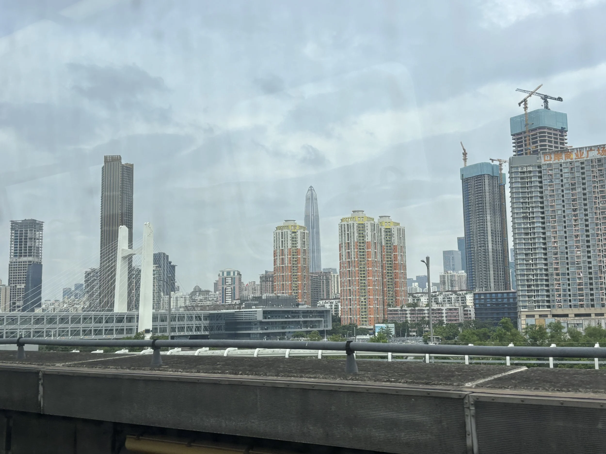
There are several ways to cross into Shenzhen from Hong Kong, but perhaps the cheapest and most straightforward is simply to take the metro to the border crossing and connect with the Shenzhen metro there. There are, in fact, several places where it is possible to cross into Shenzhen from Hong Kong and two places where the metro systems of the two cities connect: the Lo Wu (罗湖 Luohu) and Futian (福田 / Lok Ma Chau) border crossings.
I chose to use the later, since not only it has a direct connection to Hong Kong’s downtown (Admiralty) through the East Rail Line, but it also offers a rather direct access to Shenzhen’s central business district. If you are looking to just get a taste of what modern Shenzhen is like, I would go for this one.
The metro ride from Admiralty is about one hour long. If you wish to secure a seat, it is possible to pay a bit extra to get into the first class carriage. To do so, you just need to tap your card into a reader located directly on the carriage’s door. I did opt for the First Class option on the way there and used a normal carriage on the way back. It is a bit nicer, but the difference is not huge, but neither is the price difference. The main point is that you get a much better chance to get a seat.
The border between the Special Administrative Region of Hong Kong, which is part of China but has a special autonomous regime, and mainland China is marked by the Shenzhen River (深圳河). The Hong Kong metro leaves you on its side of the river and you then cross on foot to the Chinese side through a cross-border bridge.
On the north bank of the river you will have to go through Chinese immigration and customs. There is a huge hall with multiple lanes and the process is pretty fast. At the time of my visit, citizens of visa-free countries just had to fill in a short form and present it to the border check point together with the passport.
And, voilà, you are in China proper!
Preparing for the excursion to mainland China
Crossing into mainland China is quite an interesting experience because the moment you cross the border, quite a few things you that, as a Westerner, you take for granted in Hong Kong, are simply no longer available.
So, it is important to prepare beforehand to avoid surprises or hassle once you cross the border and make the most of your time on the mainland!
Here are some practical things you must take into account if traveling to China:
e-Sim: you will need your phone and (Chinese) apps all the time, so make sure you get an e-Sim that includes China mainland coverage to avoid roaming charges and be functional at all times.
VPN: as you know, many Western platforms, including popular ones such as Google and Facebook, are not available in China!
Payments: Visa, Mastercard and Amex? mostly don’t work, also, many processes are optimized for digital payments, so best is to download Chinese apps such as Alipay (the one I used) or Weibo. I would say Alipay is possibly easier to use if you are a foreigner in China. It also allows it to link to your Western card, so this saves a lot of hassle.
Maps: Google Maps works (see the point about VPN though!) but I think possibly not as well as in other places (I did come across some less than optimal directions, although could find my way generally) and, possibly not as well as the Chinese native apps.
Ride app: forget about Uber, the local equivalent is called Didi
Language translation app: also essential since, unlike in Hong Kong, most mainland Chinese don’t speak English, so translation apps are used all the time.
What to visit in downtown Shenzhen?
Obviously Shenzhen is an entirely new city so don’t expect much in terms of history. It is also an active industrial hub, so most of the city’s territory is made of non-descript industrial or residential developments. There is, however, plenty around the Central Business District (conveniently within easy reach of the Futian border crossing) to keep you busy for the day!
For example, I arrived mid-morning from Hong Kong and I left early evening around sunset with the sensation of having just but scratched the surface.
Here is what I managed to visit:
Lianhuashan Park (must visit, for the sights)
Shenzhen Industry Museum
Shenzhen Museum
COCO Park Mall (yes, a mall is a must in any first visit to China!)
Walk to Lianhuashan Park for the views


If you are on a short day trip, like it was my case, I would start by heading to Lianhuashan Park by metro first and make my way down to Futian from there. Why? Because Lianhuashan Park offers some truly scenic views of Shenzen’s central business district. It is also a nice walk from there to the iconic Shenzhen Civic Center (市民中心) depicted in the middle of the picture above, which hosts the two museums I visited.
Lianhuashan Park is just 3-4 metro stops from the Futian border crossing and it is direct on Shenzhen’s metro red line (Line 4), you can get off the train at the station “Children’s Palace” which is close to one of the park’s entrances.
The park covers a small forested hill and is criss-crossed by several foot paths. It is perfectly well kept and you may even stumble upon one of these robot dogs (perfect embodiment of the sort of advanced electronics that Shenzhen is famous for!)
The highlight of any visit to Lianhuashan Park is getting the views of the Central Business District, but there are also a couple of other landmarks.
One of them is the statue of Deng Xiaoping, the Chinese Communist Party leader that engineered the country’s economic transformation and the rise of Shenzhen as a Special Economic Zone (SEZ). The other is a tree planted by China’s current leader, Xi Jinping, which, to all appearances, is growing strong.
Walking to the Central Business District
While Shenzhen is not really a pedestrianized city, the Central Business District is quite walkable, particularly the main axis that runs from Lianhuashan Park down to the Civic Center building and continues towards the Ping An International Financial Center (PAFC), the skyscraper (to the right side of the image below), which dominates Shenzhen’s skyline. At 600 meters of height, as of March 2026, the PAFC is the second tallest bulding in China and fifth in the world!
Although it has an observation deck offering what I imagine are amazing views of the city, Ping An International Financial Center, however, was not where I headed next. Instead I opted to visit a couple of museums which are housed within the Civic Center building, which, I hoped, would help me better understand the history of Shenzhen and its fast development over the last few decades.
Shenzhen Industry Museum
This is quite an interesting, if a bit unusual, small museum. It is more of a commercial exhibition space than a “museum” in the proper sense of the word. Here you can see showcased quite a few products and companies that are based in Shenzhen, with a very strong focus on electronics and technology.
Entrance is free and there were not many people around when I visited (in fact, I didn’t see that many people around the Civic Center area, which is remarkable, considering is in the center of major megalopolis!)

The Shenzhen Industry Museum can be seen in about 30 minutes. To be honest, it is not super visitor-friendly, in the sense that the displays are not particularly engaging and it is difficult, at least for a foreigner, what each exhibit is about other than the overarching theme that these are all cutting-edge technologies and products made locally in Shenzhen. However, I think the museum’s theme is pretty much on point, since industrial and technological development is very much “the story” of Shenzhen, and the museum is pretty accessible, so it is worth dropping by.
As someone with an interest in the aerospace industry, the exhibits about this field drew most of my attention, in particular this chronological display (below) showing all aircraft types (civilian and military) developed in China since the 1950s.
Visiting the Shenzhen Museum
This is the other museum I visited in Shenzhen. If the Shenzhen Industry Museum was on the western wing of the Civic Center, the Shenzhen Museum is on the eastern one.
This is, however, a much larger and content-dense museum which tells the history of Shenzhen and the surrounding Pearl River Delta region, from the pre-historic times all the way to the present.
Entrance is free, as well.
The museum’s scope is quite large. In fact, since I had limited time and it was clear I would not have time to see see all of of it, decided to focus on the history section. I was not to be disappointed by this choice!
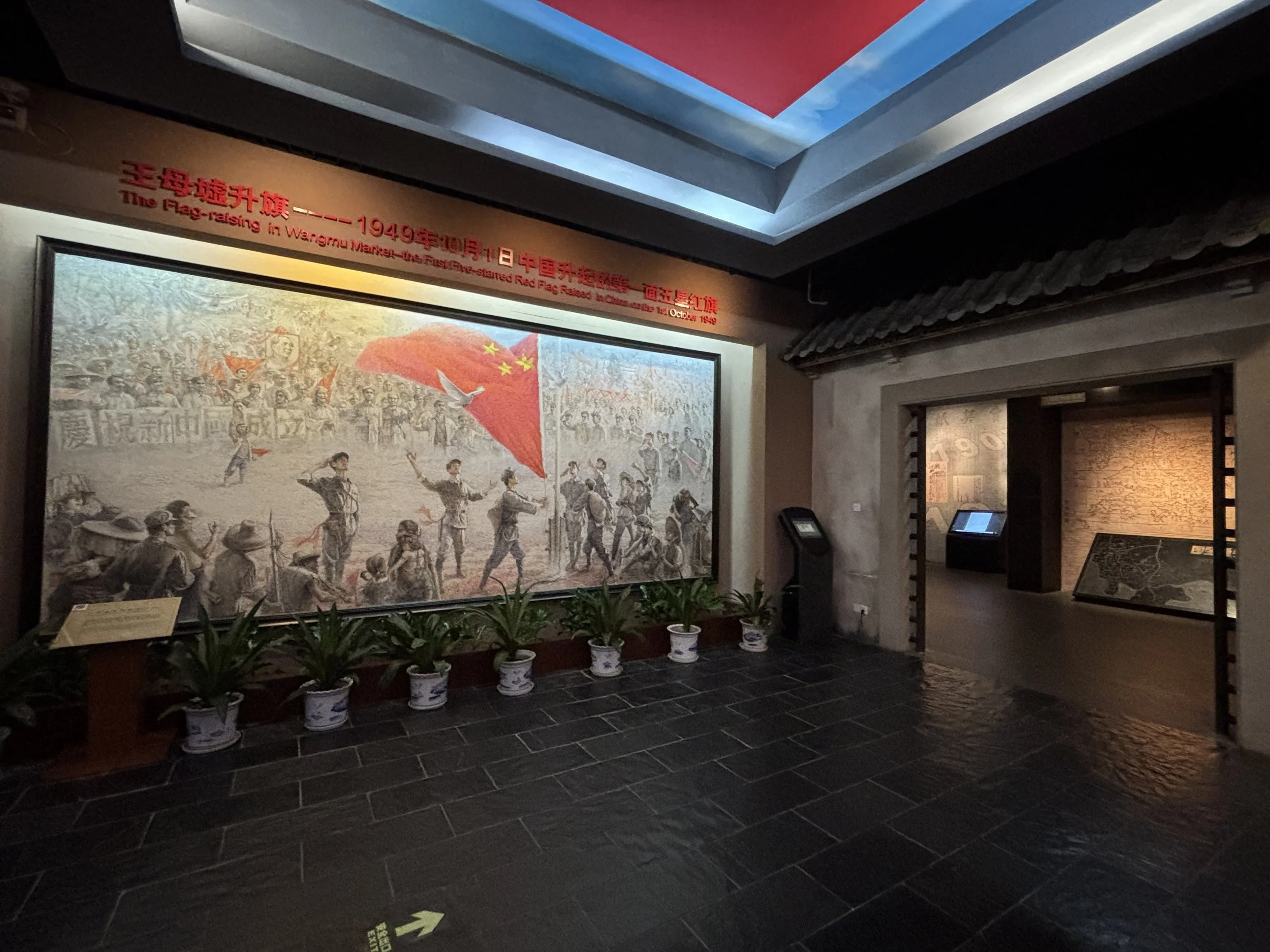
The materials are actually presented in a rather engaging way and signage and explanations are also available in English. Room after room, you get to learn quite a lot about the origins of modern Shenzhen and Pearl River Delta, even if, like me, you were not previously familiar with the history of this part of the world.
The Museum has no shortage of dioramas and other visual elements to support its story-telling. Although it covers thousands of years, since the early inhabitants of the region all the way through Imperial China, the Colonial Era, etc, what I found most interesting is the last few decades, when it explains the rise of Shenzhen, including some very realistic depictions of what it took to create the present-day metropolis.
So, definitely, make sure you include Shenzhen Museum in your to-do list if visiting the city.
By the way, I also got positive reviews of the Shenzhen Science & Technology Museum, which is, actually, not far from the Civic Center and the Shenzhen Museum. This is a new museum, opened in 2025, designed by the Zaha Hadid architecture studio. Unfortunately, I did not have time to include it in my itinerary, but I thought it was a good idea to mention it, something for the next visit!
A quick glimpse of modern China in Shenzhen
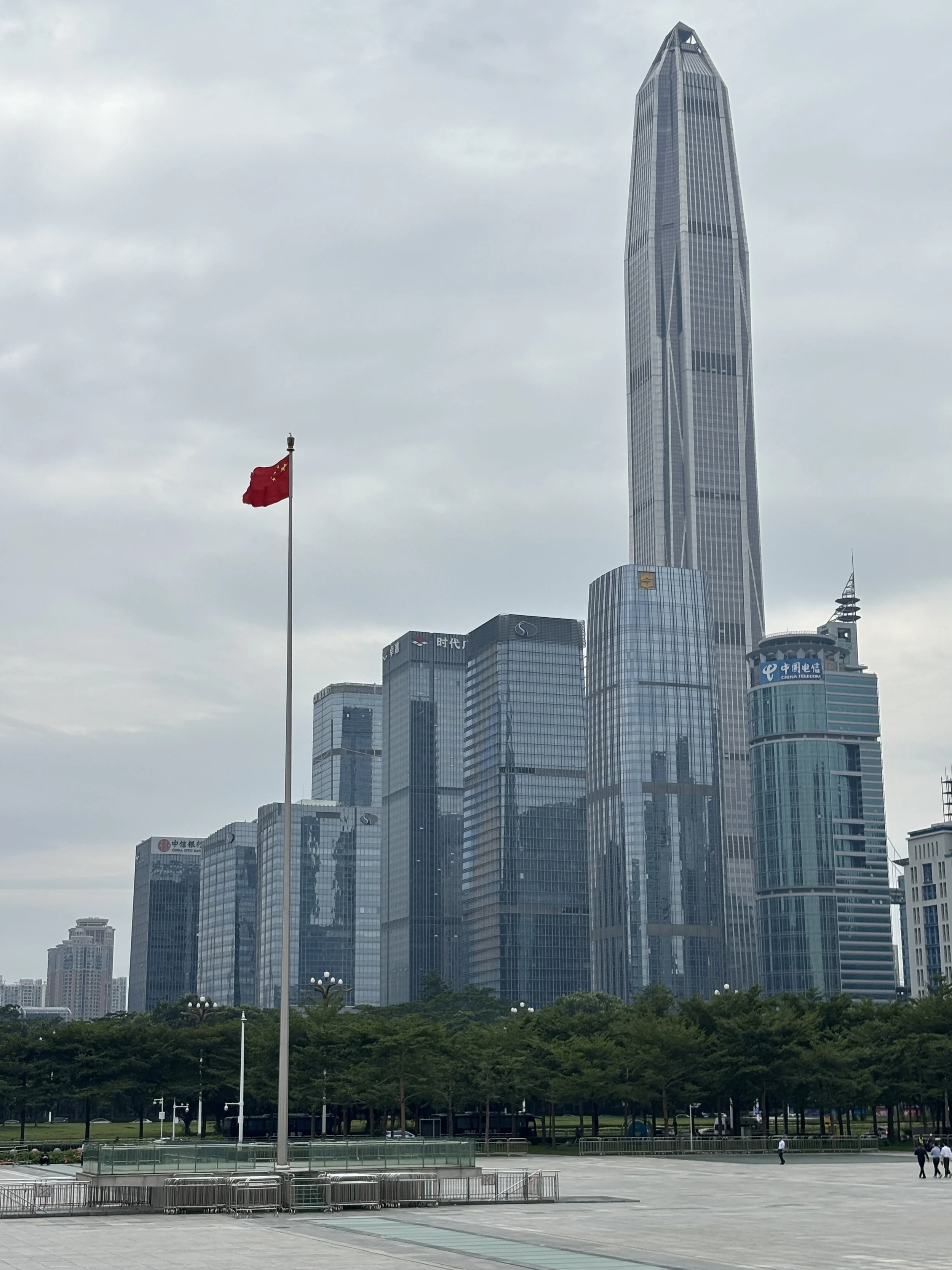
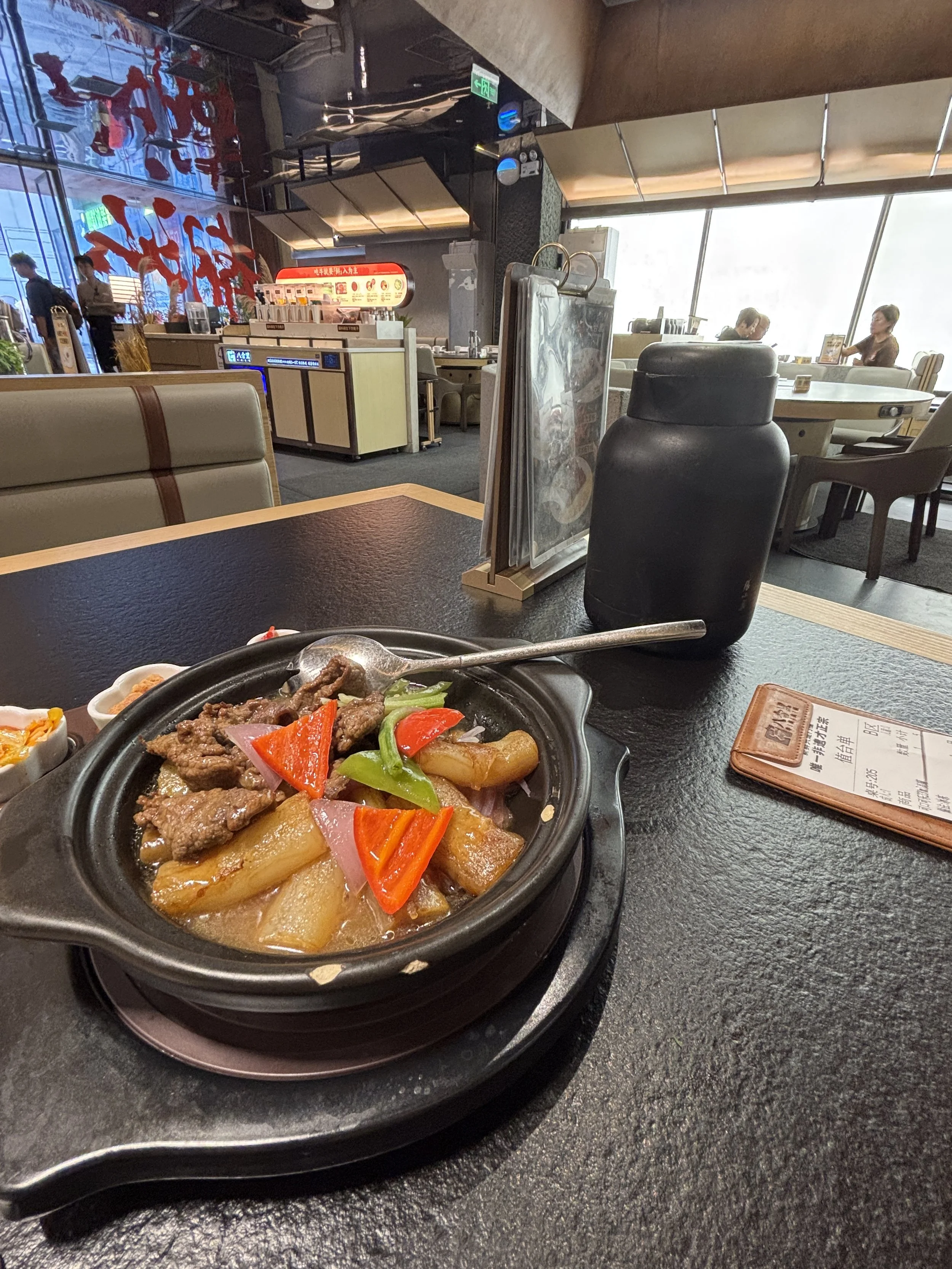
But, besides visiting museums, the main goal of this one day excursion to Shenzhen was to get a taste of modern, capitalistic China, and to do this, nothing better than heading towards one of the city’s malls.
COCO Mall is one of the most centrally located malls in Shenzhen, right in the middle of the Central Business District and within 10 minutes walk of the Civic Center.
This is also a good spot to get a meal after all the walking through the park and the museums, since there are quite a few restaurants here offering different flavours of Chinese and international cuisines at very competitive rates.
The mall itself, is like any other commercial centre of this sort that you can find anywhere else in the world, from LA to Dubai. And perhaps that was the most interesting finding, that, even in an economy and society that appear, from the outside, so different from the West (note my previous comments about access to internet platforms, etc.), there was an absolute sense of familiarity in the environment of the COCO Mall.
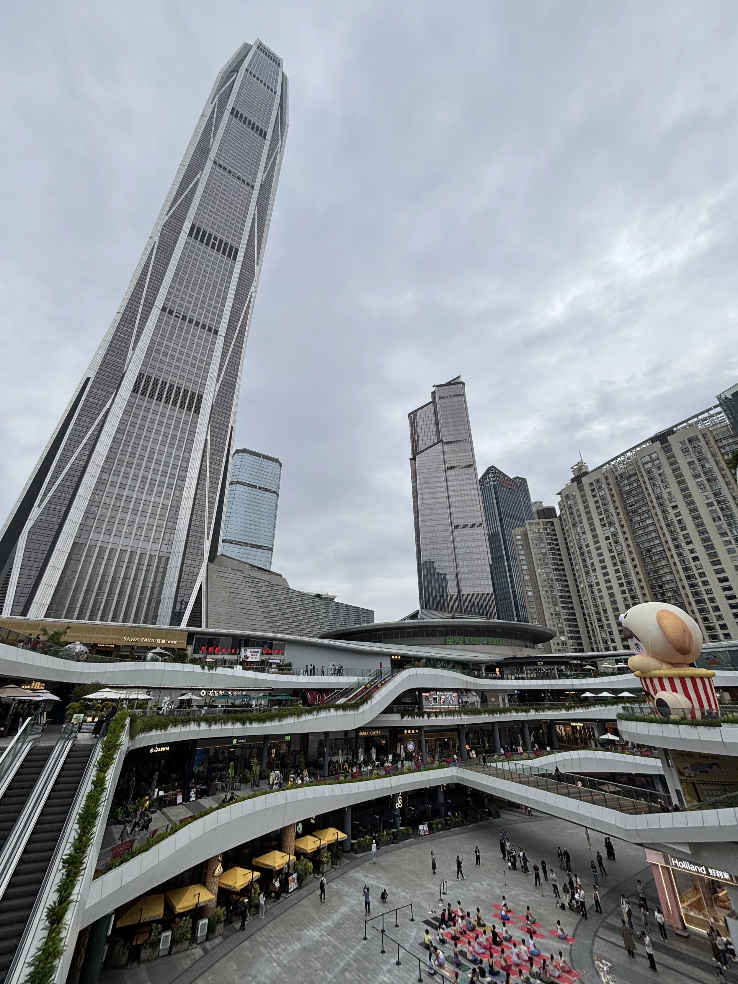
So, if you have followed more or less this itinerary and if not planning to overnight in Shenzhen, it is possible that, by this point is starting to be time to head back to the border.
From COCO Mall you can take the metro, Futian Border Crossing is just a couple of stops away, or, as in my case, I ordered a Didi ride, in order to see more of the city on the surface.
The taxi rides, by the way, are pretty cheap and, from what I saw, the cars tend to be modern, electric models. This is also part of the modern China experience!

Three days in Kyoto and Nara: top things to do & to see
There’s not doubt that Japan is in fashion. Whether is the currency depreciation, better and more convenient air links or the pull of the Expo 2025 Osaka, the fact is that more people than ever are visiting the land of the rising sun. I became also, recently, one of these first time visitors to Japan, and I shared on this site my impressions of Osaka, its 2025 Expo and its best pavilions.
But if you visit Japan, it is also very likely that you will pass through Kyoto, as well, since this is the country’s historical capital and it has one of the highest concentrations of heritage sites in the country. What’s more, you may also combine your visit with that of nearby Nara, another place of historical significance which has become also popular because of the numerous small (and cute) deer that freely roam its streets.
In fact, there are so many sites to see in and around Kyoto that it can easily take you a whole week going through the most relevant ones. We didn’t have that much time, unfortunately, so, in tune with the usual theme of this site, I will try to compress here what we managed to see here in around three days.
I am aware I may have missed quite a few spots that are equally deserving of a mention, but I guess quite a few visitors find themselves in the same position, of having to make choices and prioritize.
So, I hope the following lines can somehow to be of help to readers with limited time choose what to do and what to see in Kyoto.
Visiting Fushimi-inaru and its thousands of Torii Gates
This is an iconic place and one of the must-visit spots in Japan. I guess this has become even more the case in the current Instagram era, since the colourful Torii Gates that line up to path to Mount Inari make for the quintessential Japan-themed photo opportunity.
How to get to Mount Inari?
Mount Inari is one of the several hills at the southeastern edge of Kyoto. You can get there from central Kyoto on a suburban train of the JR Nara Line. It takes around half an hour to get from Kyoto’s central station to Fushimi-inari station at the foot of the hill.
The moment you get off the station you realize you have arrived at a major tourist hotspot, since it is full of souvenir shops, fast food joints and the like.
The area of interest extends all the way up to the top of the hill (some 250m high). There is a designated path. The Torii Gates are actually inside a public park, so entrance is free and open 24 hours.
There are several Shinto shrines around Mount Inari and, in fact, this area is known to have been a center of religious practice since at least the 8th C. Its most distinctive element, however, and the one that gets most attention from visitors is the Torii gate-lined winding path going uphill for some 4km or so. There are some 10,000 Torii Gates lining up the path, each of these colourful traditional Japanese structures having been erected as an offering.
If you visit Fushimi-inaru during the day in good weather you are likely to come across some crowds, so you will need to have some patience to get a good shot at the gates!
By the way, one thing I found quite fascinating is that many visitors rent Japanese traditional attire to wear during the visit. There are many establishments between the train station and the entrance to the park which specialize in this trade. This is, actually a practice that is common at quite a few historical places in Asia, I had seen it, for example at Seoul’s Gyenongbokgung Palace. It’s surprising the first time you see it, but the outcome is actually quite cool!
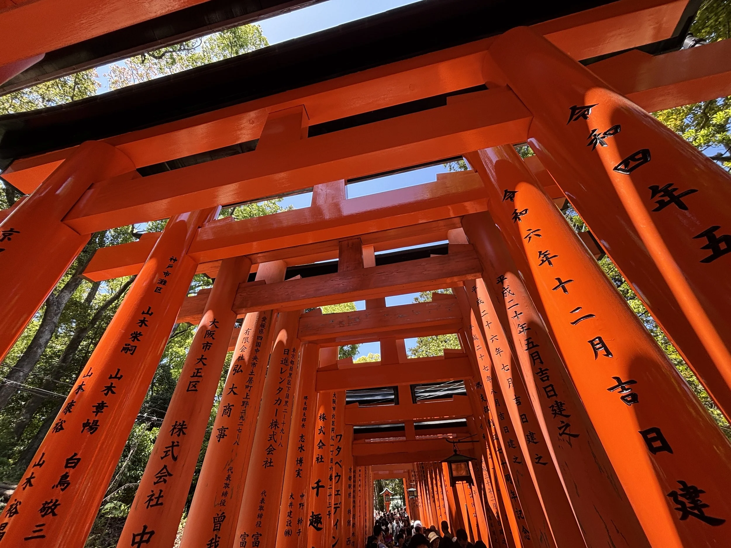
The climb up Mount Inari takes a couple of hours if done at a leisurely pace, stopping to take pictures and the like. From the top you have pretty good views of the Kyoto metropolitan area.
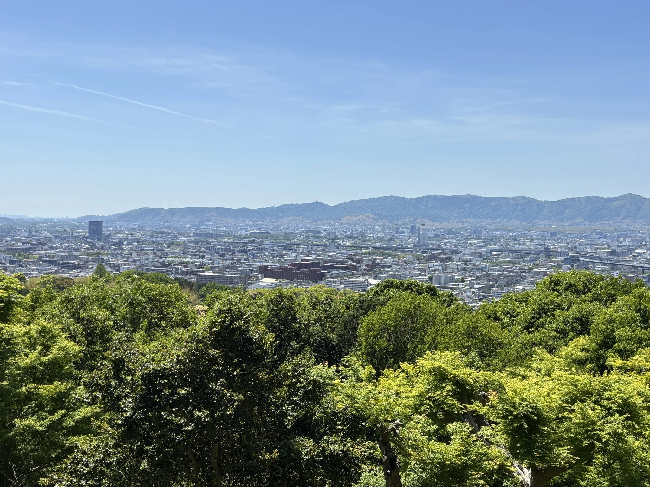
Some random advice about traveling around Kyoto (and Japan)
Kyoto has a good metro network, which is complemented by suburban trains, which are also integrated in the same system, centered around Kyoto’s Central Station.
It is also remarkable that, while we are used to the image of super modern Shinkasen trains, many of the suburban trains are actually quite old vintage, although very well maintained.
The Suica card works here as well (I guess most foreign visitors arrive via Tokyo and have bought their cards there). It is important to have always some cash at hand to refill it, since many stations work only (or primarily) with cash and you may have issues exiting at the barrier gates if you don’t have the right amount to top up your card!

Using Japan’s luggage forwarding system
This is one of the great services that, as far as I know, are only available (or at least generally used) in Japan. If traveling around the country, you can forward your bags to your next destination at very competitive rates and with a very high degree of confidence they will arrive on time. It is often possible to get same day delivery.
This worked great for us, since we were moving from Kyoto to Nara (more on this excursion further down the article) and then onwards to Osaka. For something like $20 we could get rid of the problem of moving around with luggage and could enjoy the day much better. There are a few companies offering this service, I would advice checking with your hotel or ryokan to select one.
In our case, the hotel staff coordinated everything. We just told them where we wanted to send the luggage to, paid and then left the luggage to the care of the hotel, where they would be picked up. When we arrived in Osaka some 8 hours later, there they were, waiting for us at our next hotel!

One more practical note: if you are short of time or on the move, one of the best options to get a substantious and healthy meal is to get one of the bento boxes sold at all supermarkets and convenience stores at stations. For reference, here above you can see the one that we got for the short train ride between Kyoto and Nara.
Visiting the Kinkaku-ji Temple
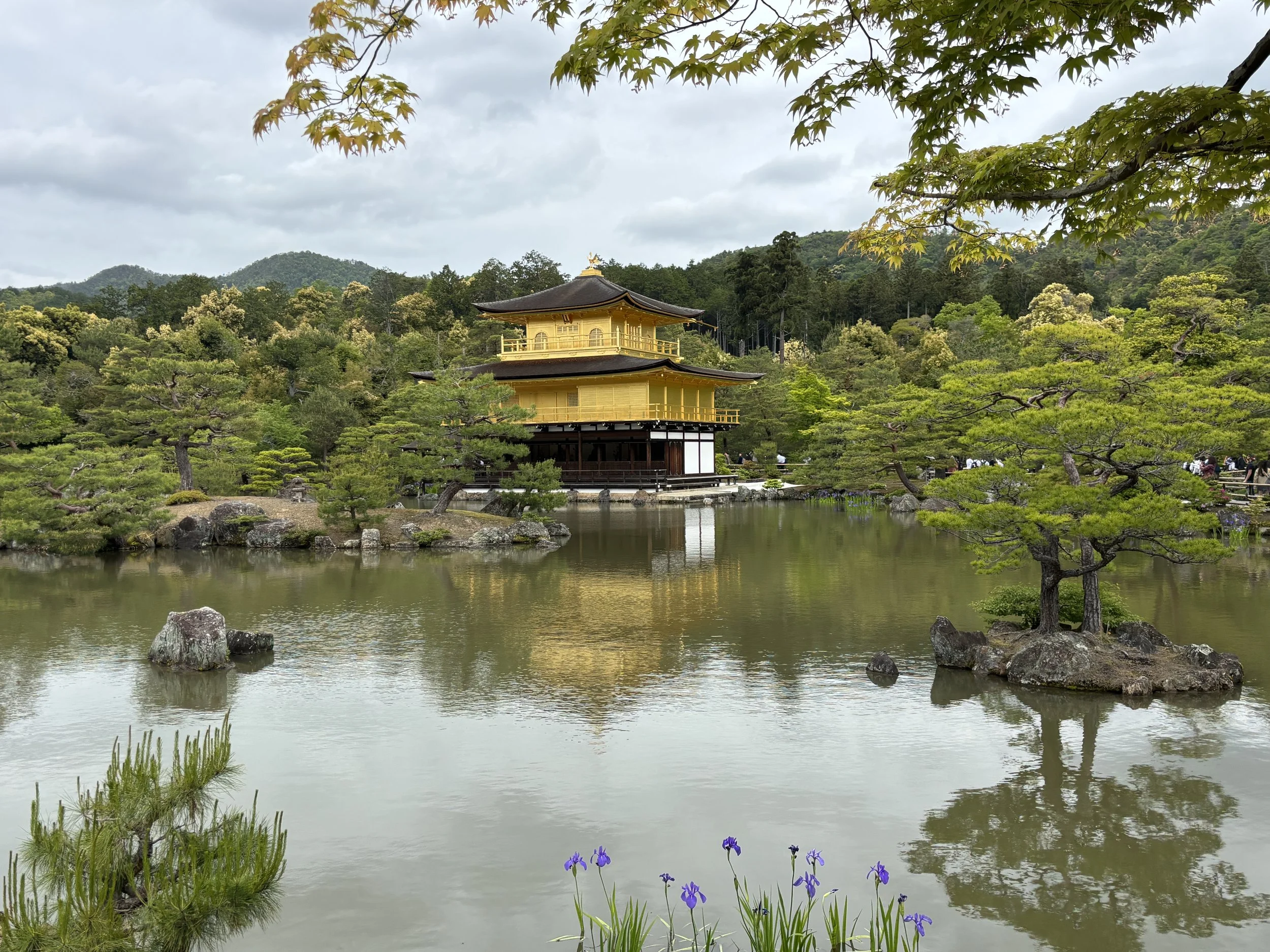
This is also a must-visit in Kyoto. The Kinkaku-ji temple or “Golden Pavilion” is a beautiful temple covered in gold leaf and located in the middle of a small pond surrounded by carefully manicured gardens.
The actual structure that you see now is a reconstruction, since the original one burned down in 1950, but you wouldn’t be able to tell, since it has been rebuilt to the latest detail.
Unlike Fushimi-inaru, there is an entrance fee to visit the Kinkaju-ji grounds. The temple itself is not accessed, but you can walk along the pond and see it from some distance. The garden grounds offer the postcard-perfect quintessentially Japanese views.
Kinkaku-ji is located at the northern edge of the city, so if coming from the centre the best way to get there is possibly to get a taxi, which, generally speaking, is not very expensive in Kyoto. Metro stations are not super close, but there are some bus lines that work like clockwork and if you have internet access to see find the stops and schedules on Google, it can also be a convenient option (we did that actually on the way back).
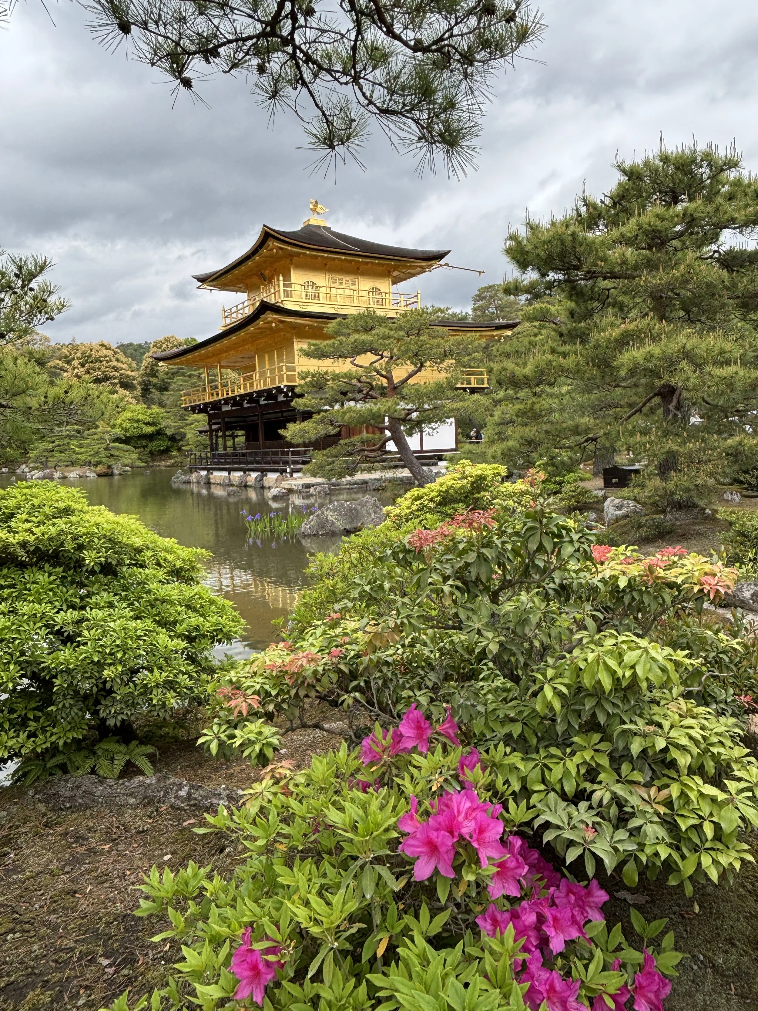
Eating at Kyoto’s Nishiki Market
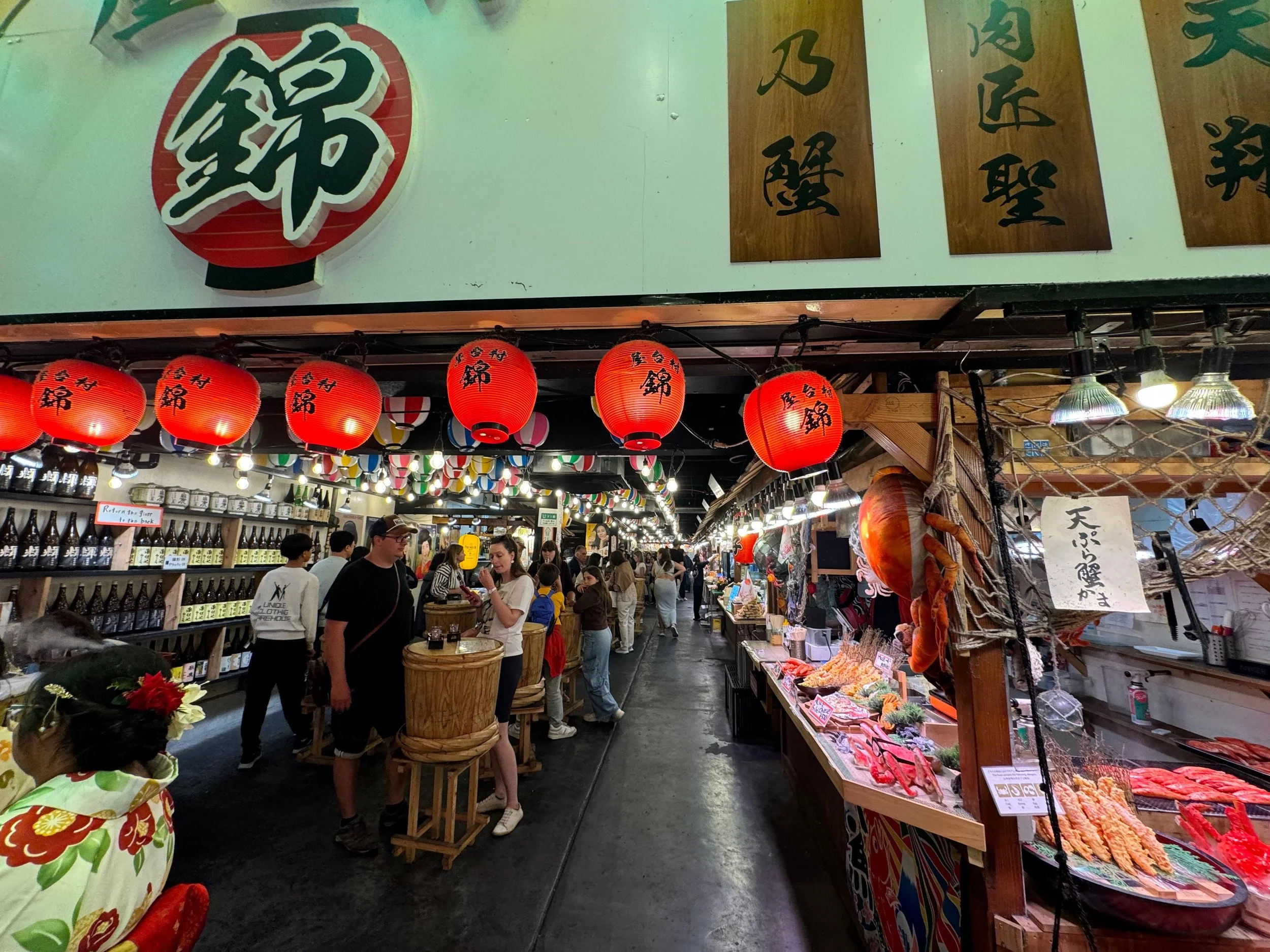
Because of its central location, Nishiki Market could be a good option for a pit-stop and some lunch while traveling between the different points of interest in and around town (many of Kyoto’s tourist hotspots are actually on the edges of the city).
Here you will find dozens of food stalls offering a countless number of very interesting options and covering pretty much the whole spectrum of Japanese culinary specialities. So, take your time to walk around an nibble here and there as you go!
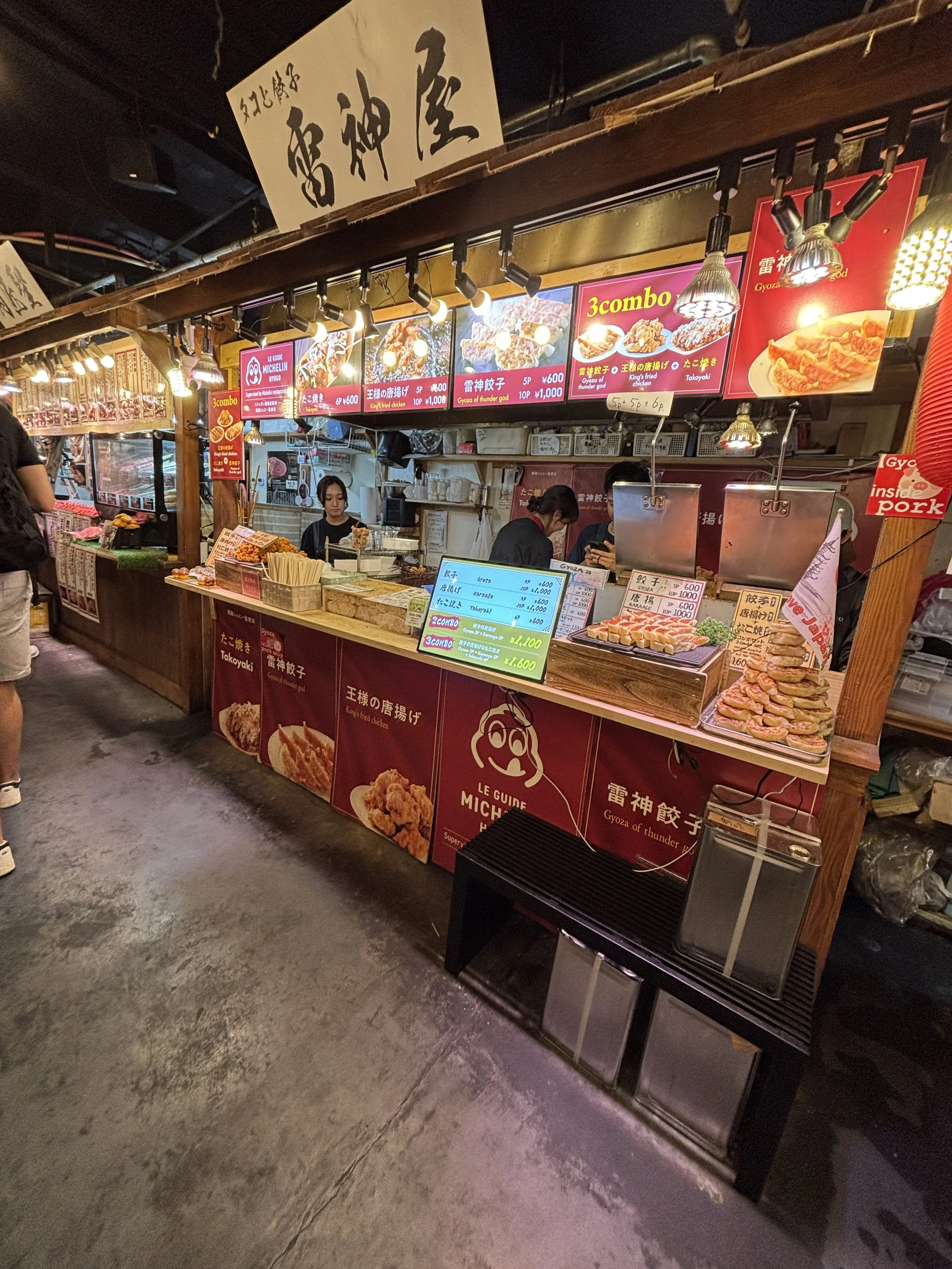
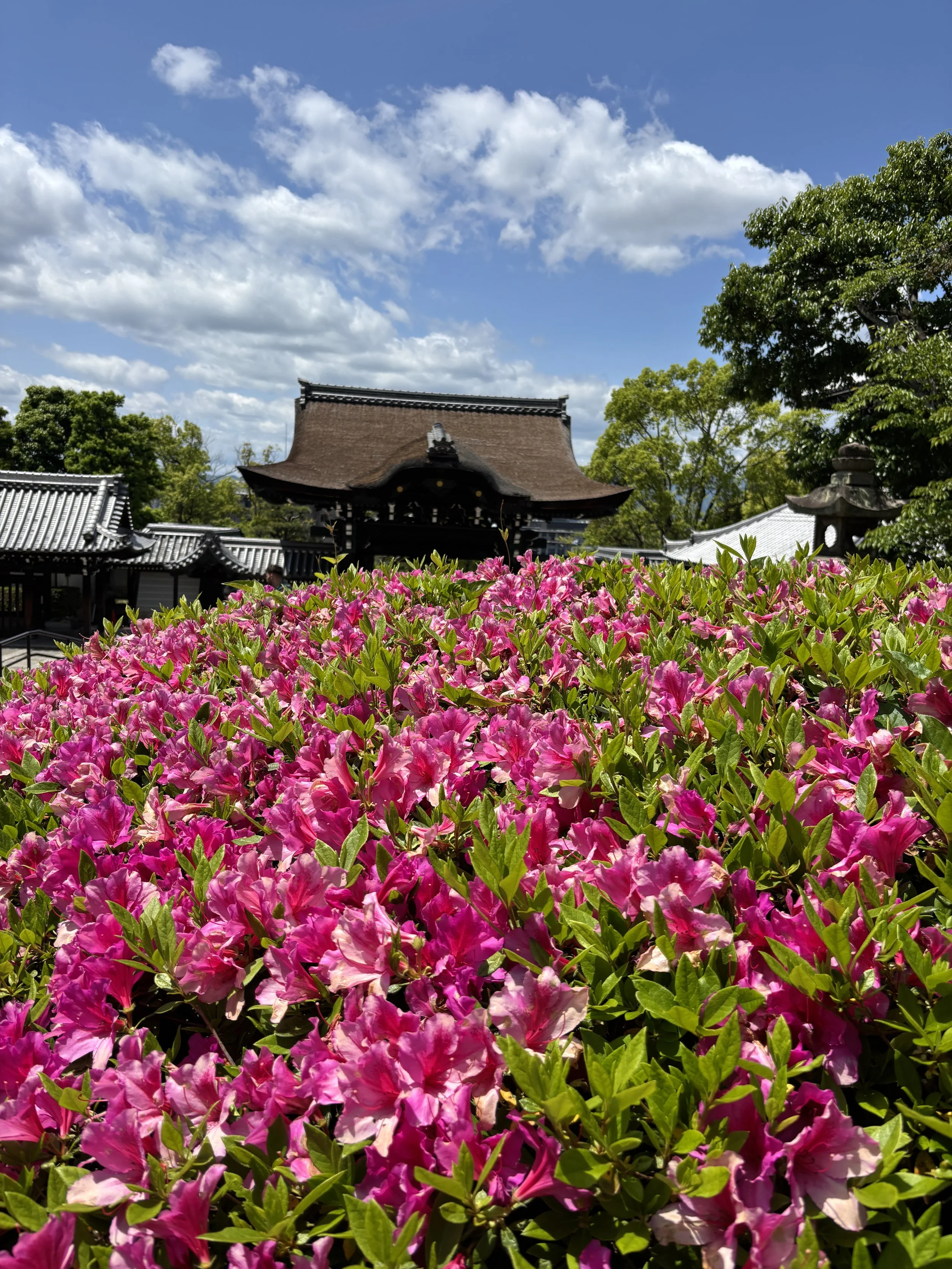
Kiyomizu-dera Temple and Higashiyama
This is yet another temple area on the eastern side of Kyoto, but very close (within walking distance) to downtown on the eastern side of the Kamo River.
I say “area” because, while, the Kiyomizu-dera temple is the centerpiece, Higashiyama is a whole historical district that contains several shrines and other spots of interest, such as the Ninenzaka and Sannenzaka commercial streets, which are lined with wooden houses built in traditional Japanese style.
Some of the landmarks in this area, such as, for example, the Yasaka Pagoda, have become somehow iconic of the city and have come to represent the “image” of Kyoto and, more generally, of Japan, as well.
The temple itself is at the top of a small hill offering views of downtown Kyoto. There are several paths to access Kiyomizu-dera, one of the most scenic ones starts at the Otani Hombyo Temple, which is, itself, not without interest. This narrow path then climbs uphill leaving a large cemetery on its side.
The temple compound at the top and its grounds contain several colourful buildings, including this pagoda you see in the photo below. It also offers views of the city below.

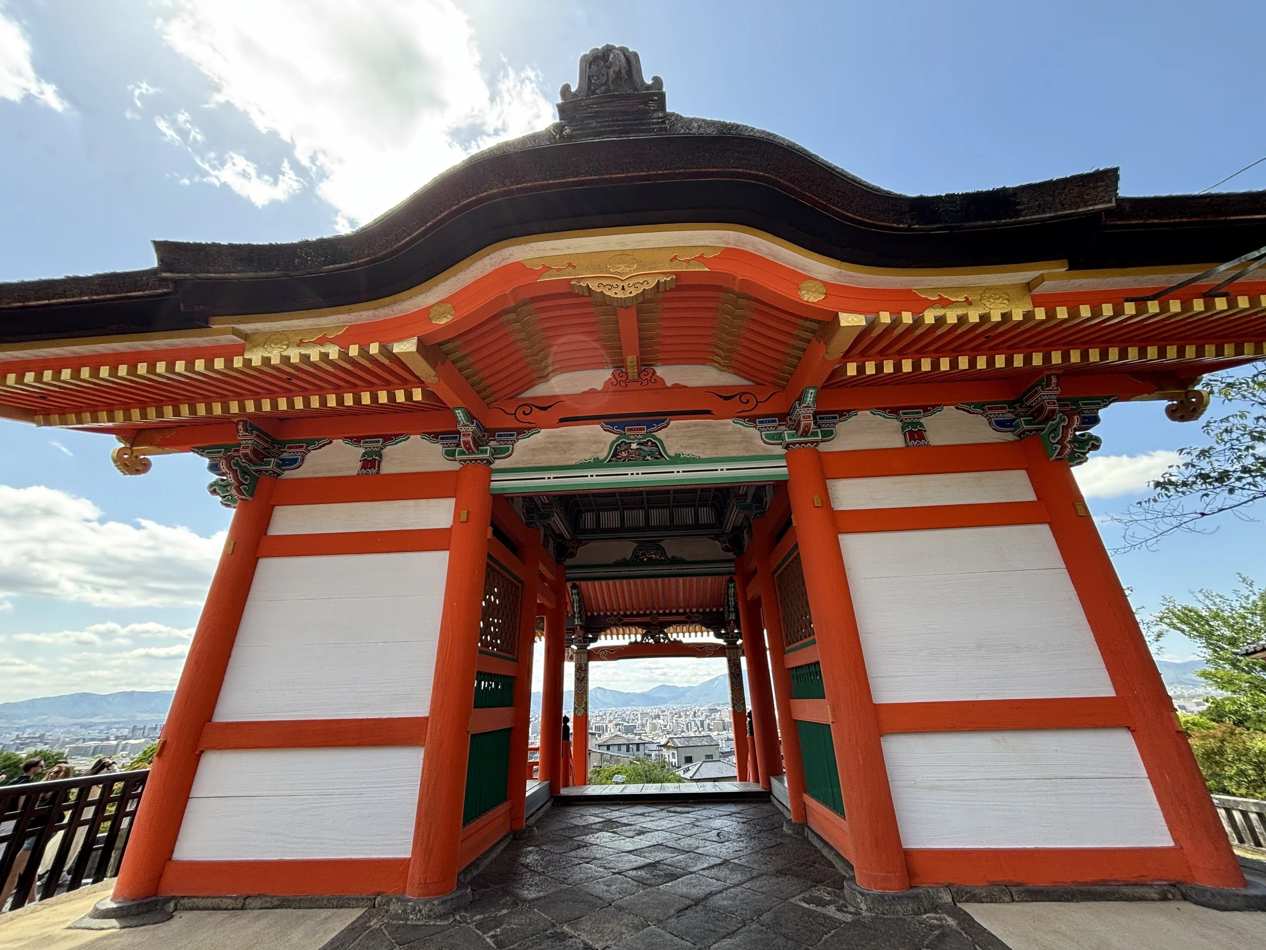
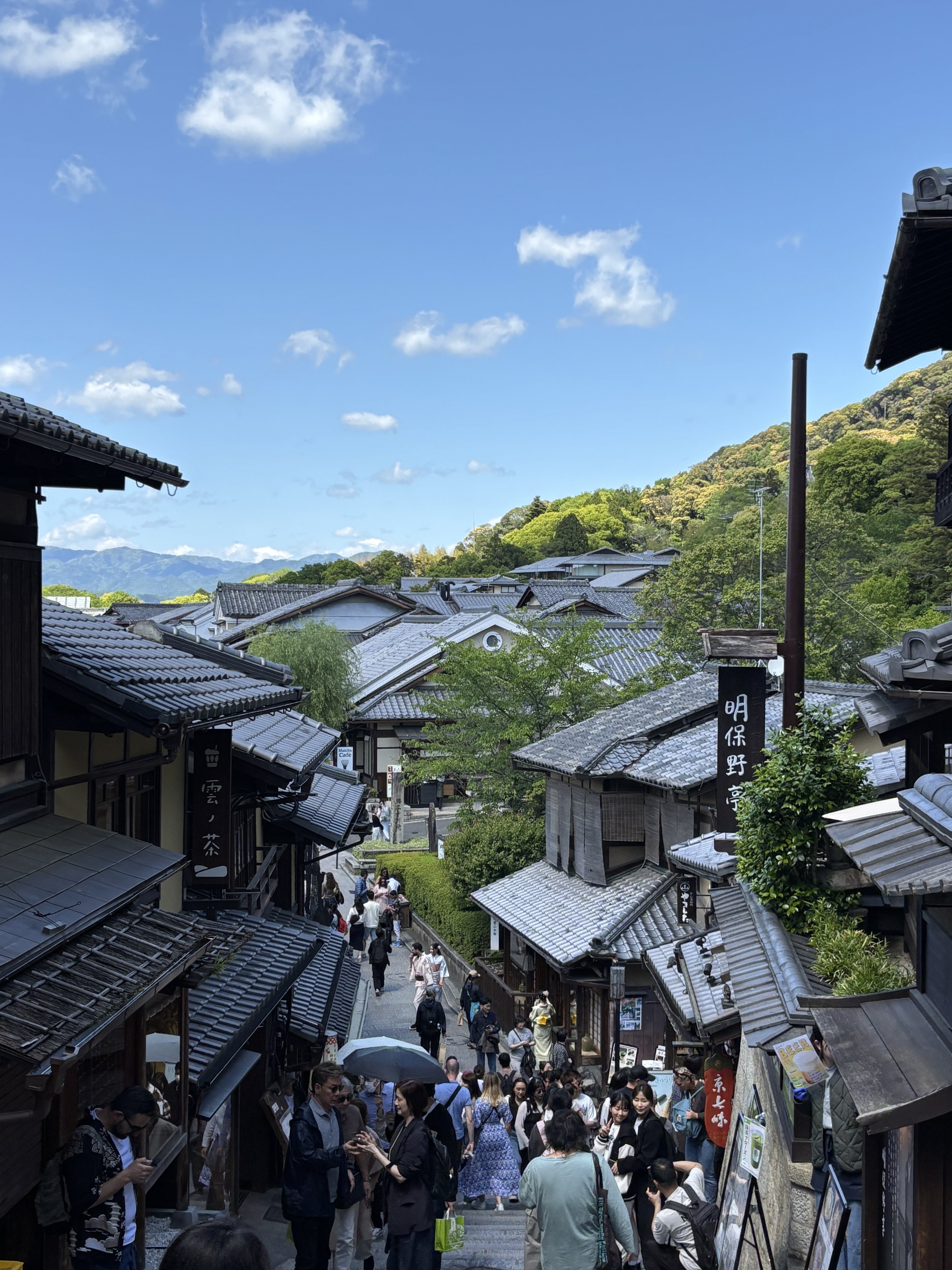
When coming downhill from the temple you will find some of the most charming areas of Kyoto. The narrow streets of the Higashiyama district (depicted above) are nowadays packed with tourists, but nevertheless, you wouldn’t want to miss it if in Kyoto.
Also remarkable is the siluete of the Yasaka Pagoda (below), another iconic Kyoto landmark.
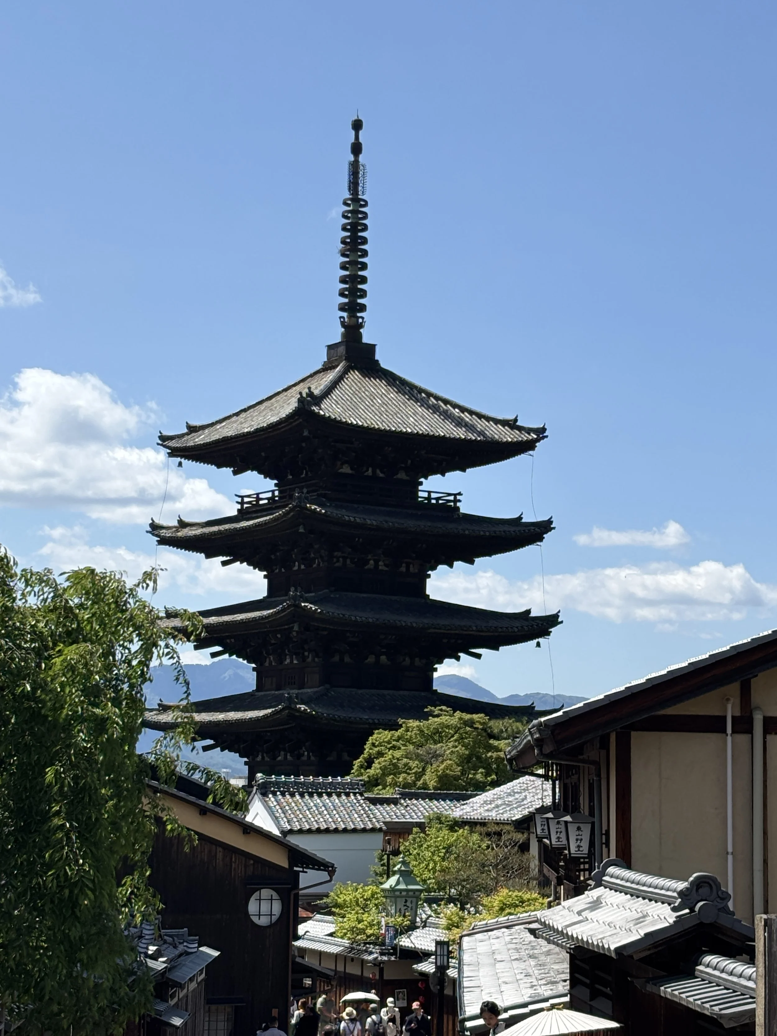
Continuing with our Higashiyama walk and turning slightly north we get to the Yasaka Shrine, another temple, which is located within the grounds of Maruyama Park.
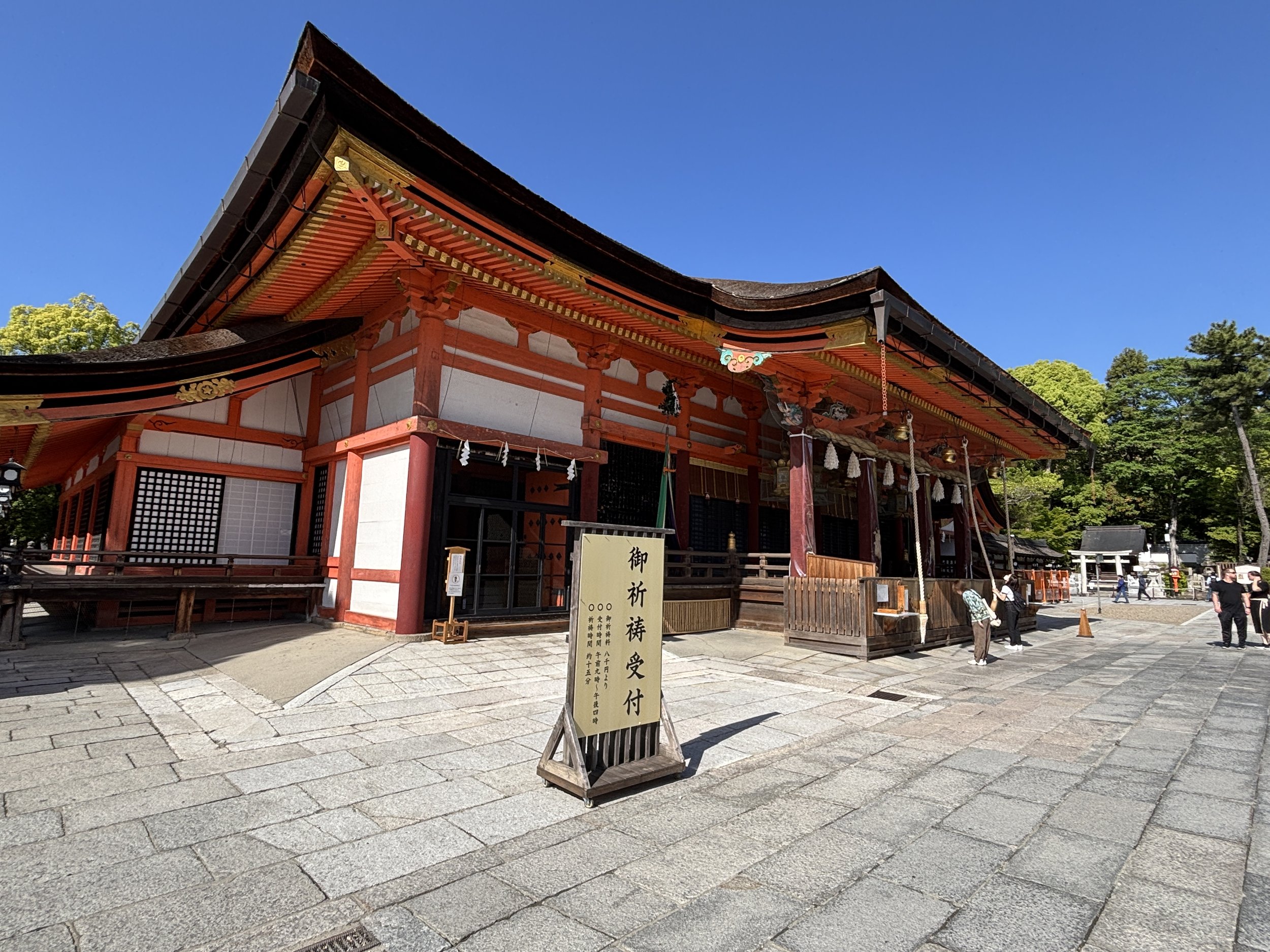
To be honest, perhaps the main point in getting there is actually to enjoy the walk itself, particularly in nice weather, since it runs through some nicely preserved areas of the city. The park itself is also a beauty spot and it hosts quite a few interesting wild birds too!
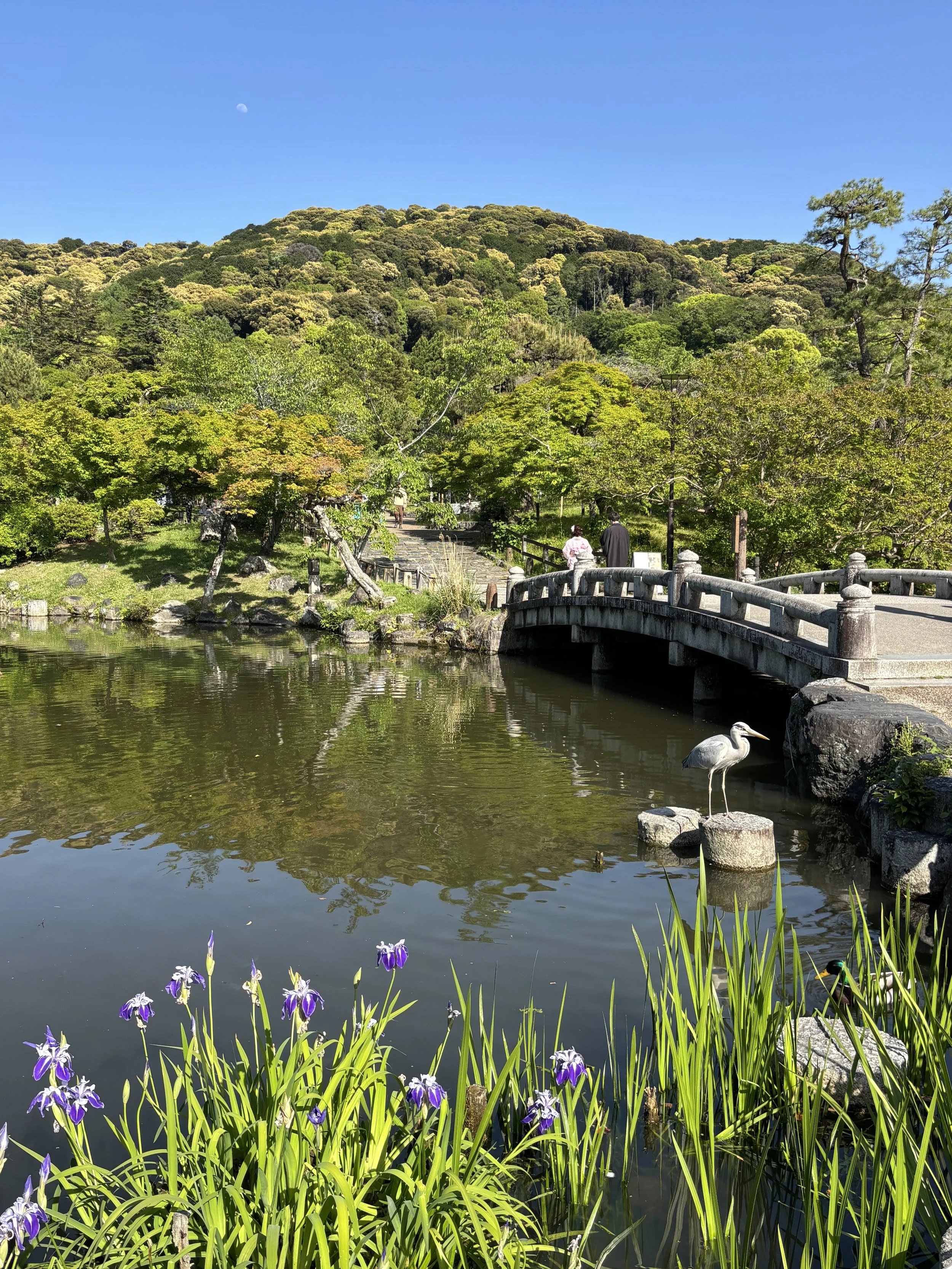
Maruyama Park
Kyoto at night
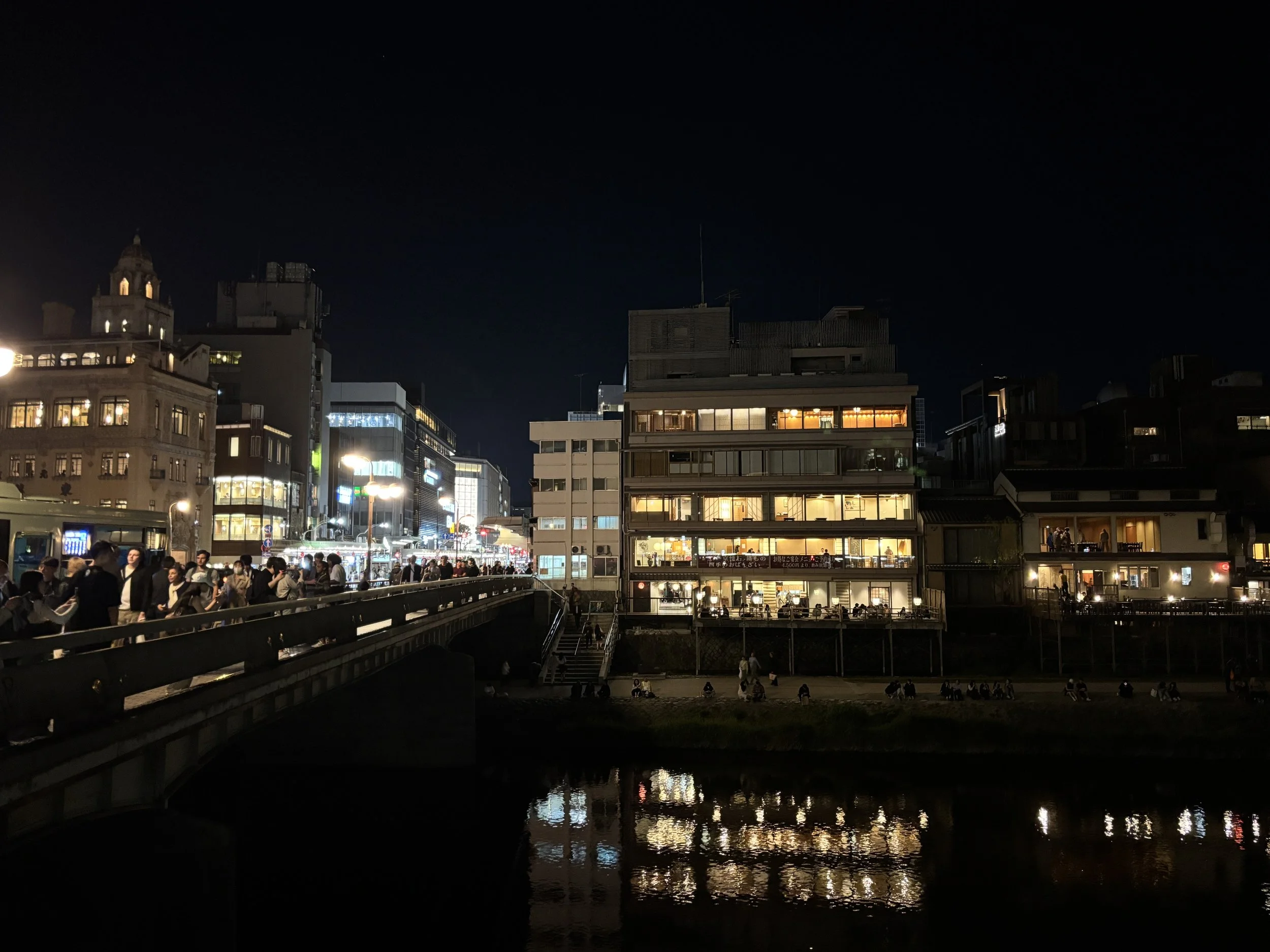
The Kyoto experience wouldn’t be complete without an evening walk in the area in the vicinity of the Gion district. This area is buzzing with activity in the evening, with quite a few restaurants and shops on both banks of the Kamo river, as well as adjacent and smaller Takase River (which looks more like a canal, tbh).
Visting the Arashiyama Bamboo Forest

This is another area on the edge of town, but on the far west side this time.
What’s to see around the Arashiyama Bamboo Forest?
Well, you guess…! A handful of temples and the bamboo forest that lends its name to this section of the post.
To be honest, the bamboo forest was quite underwhelming. You just walk on a nondescript path along the bamboos but I would not say it is aesthetically that exceptional, certainly not to merit, on its own, the long metro ride from downtown (in this cute, little train, btw).
The broader area around it, however, had some beautiful sites. Even if we were not able to visit the Tenryu-ji UNESCO World Heritage temple, we could walk around the surrounding gardens, which area also quite beautiful.
I also found quite interesting the sight of the Togetsukyo Bridge, which spans the Katsura, a relatively shallow but very wide fast flowing mountain river.
You can see the pictures from this area below. Nice enough, but if your are short of time, this would be possibly the one that I would cut out, since it is a bit further to get to and, in my opinion, a bit less interesting than the other spots mentioned earlier in this post.
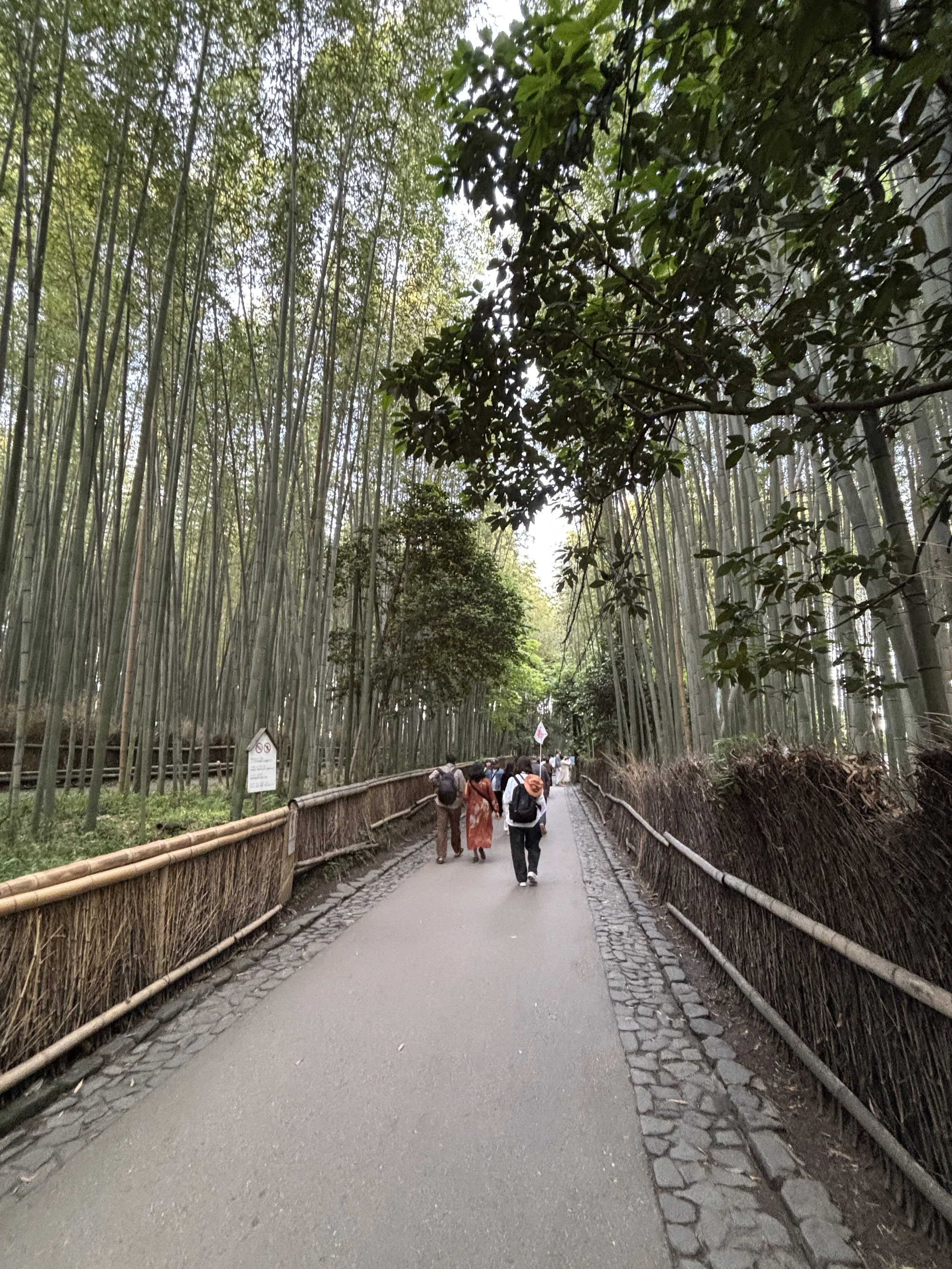
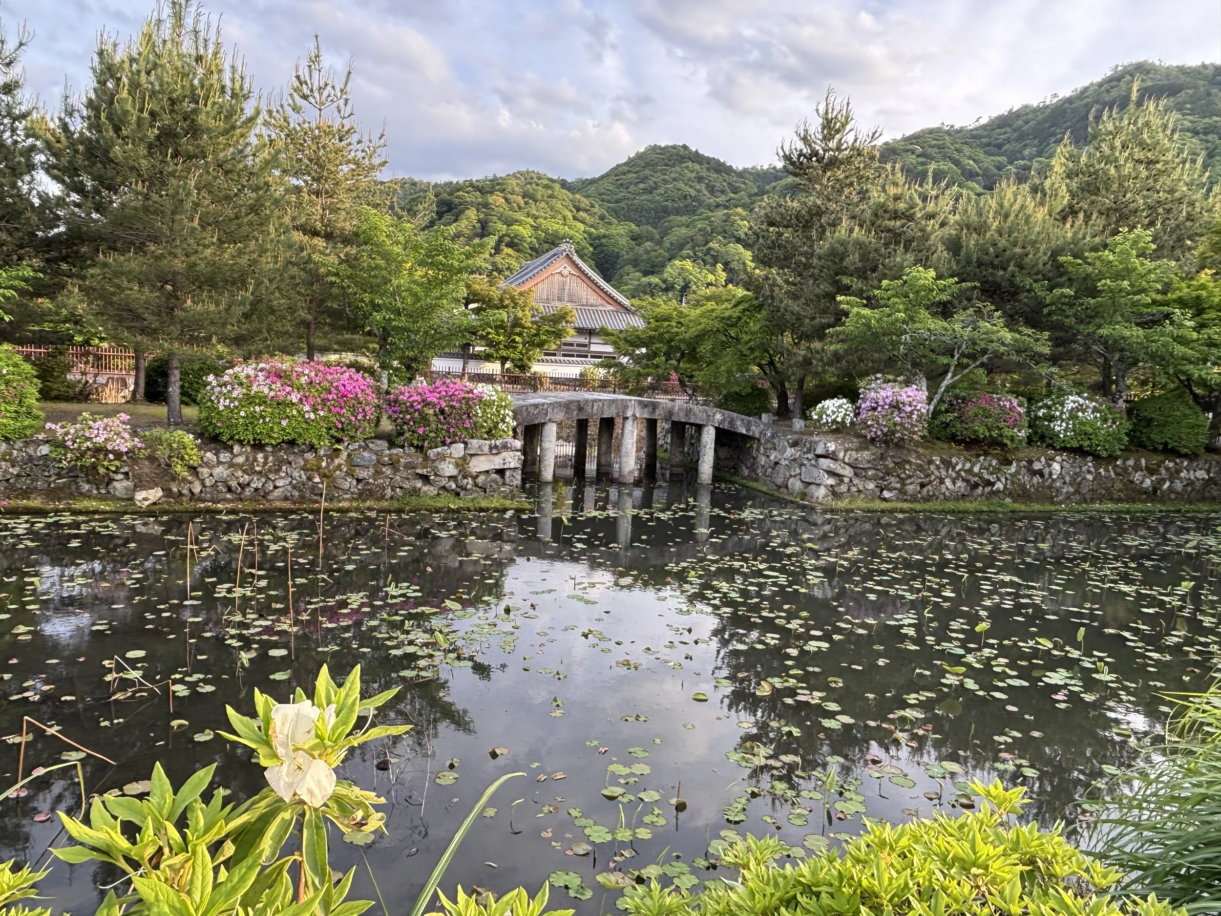
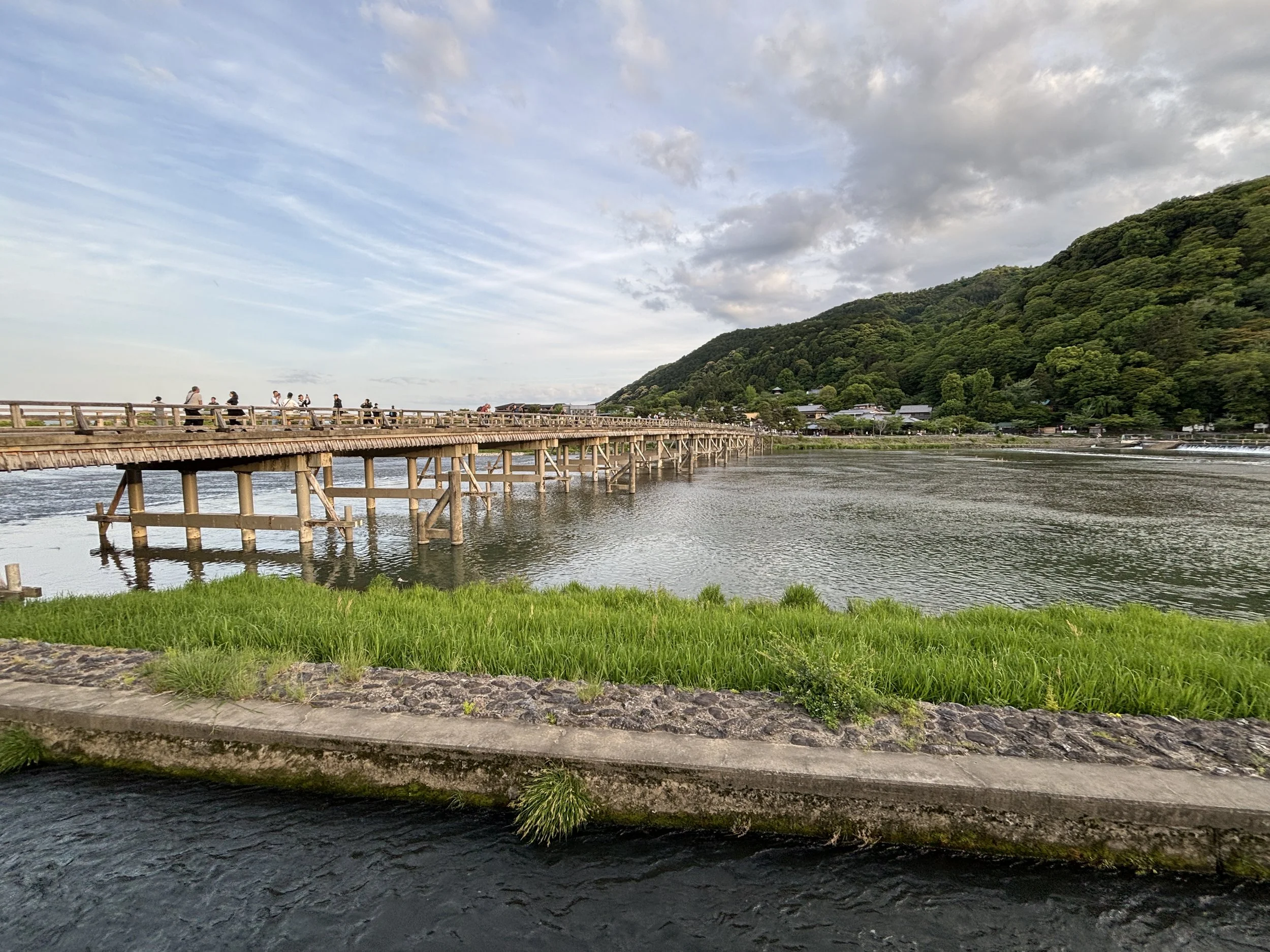
Places to eat in Kyoto
Tomisen Restaurant
Shimogyo Ward, Minamicho, 576-4 2
This place was recommended by the staff at our hotel and it did not disappoint. It is a really small, local place and it serves, primarily sushi. The atmosphere is quite casual, the food was fresh and service good (even if they did speak much English).
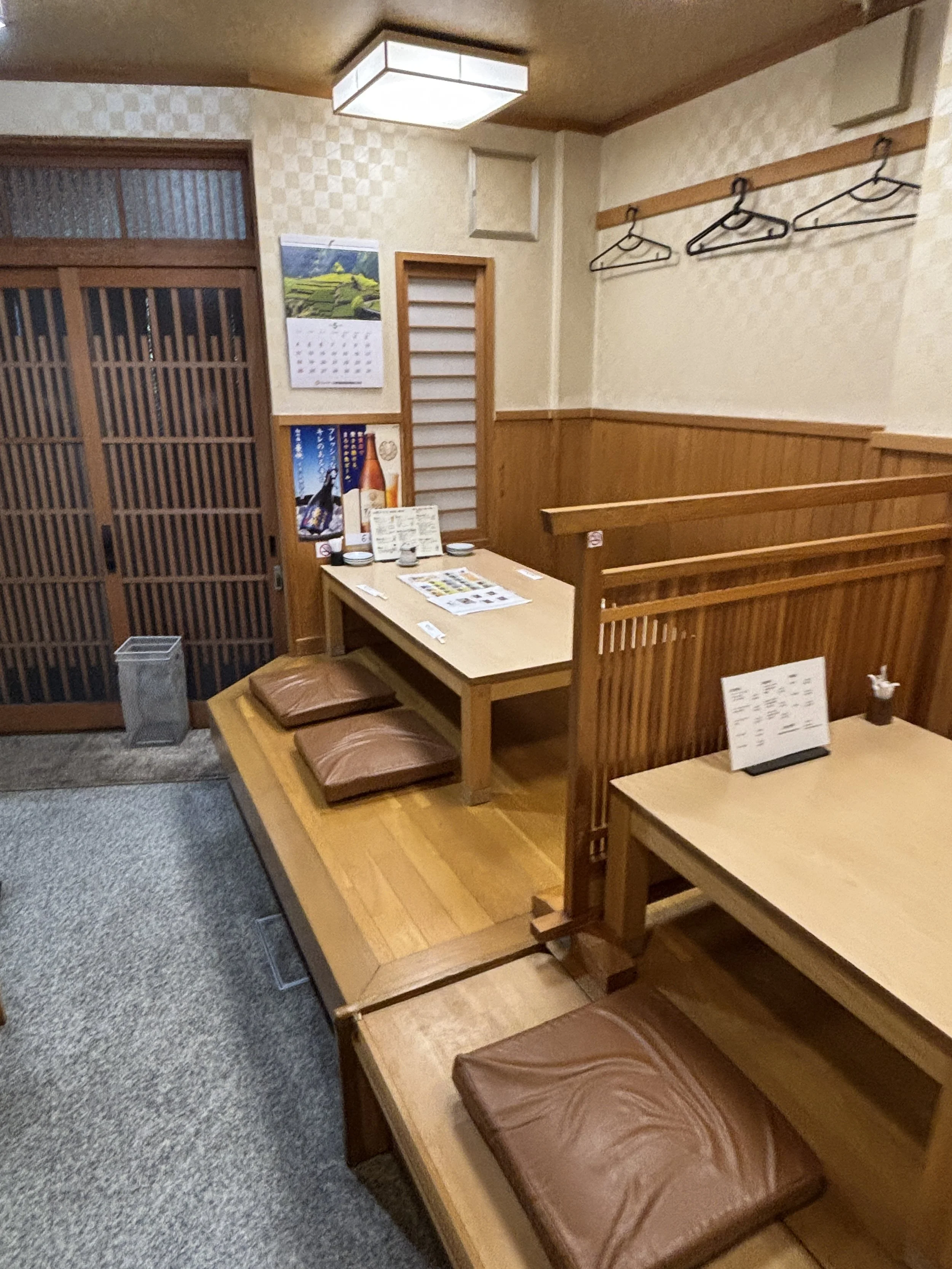
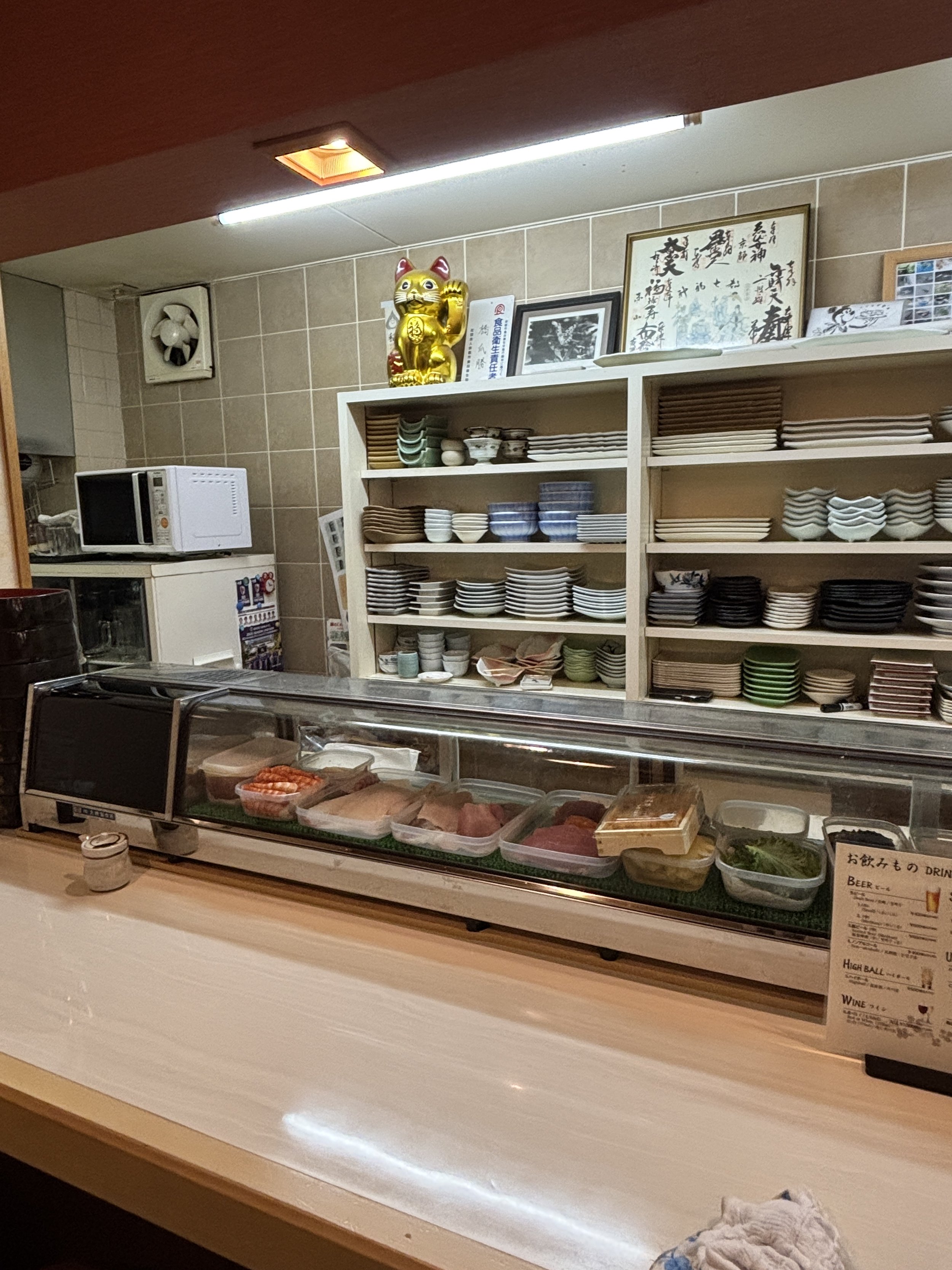
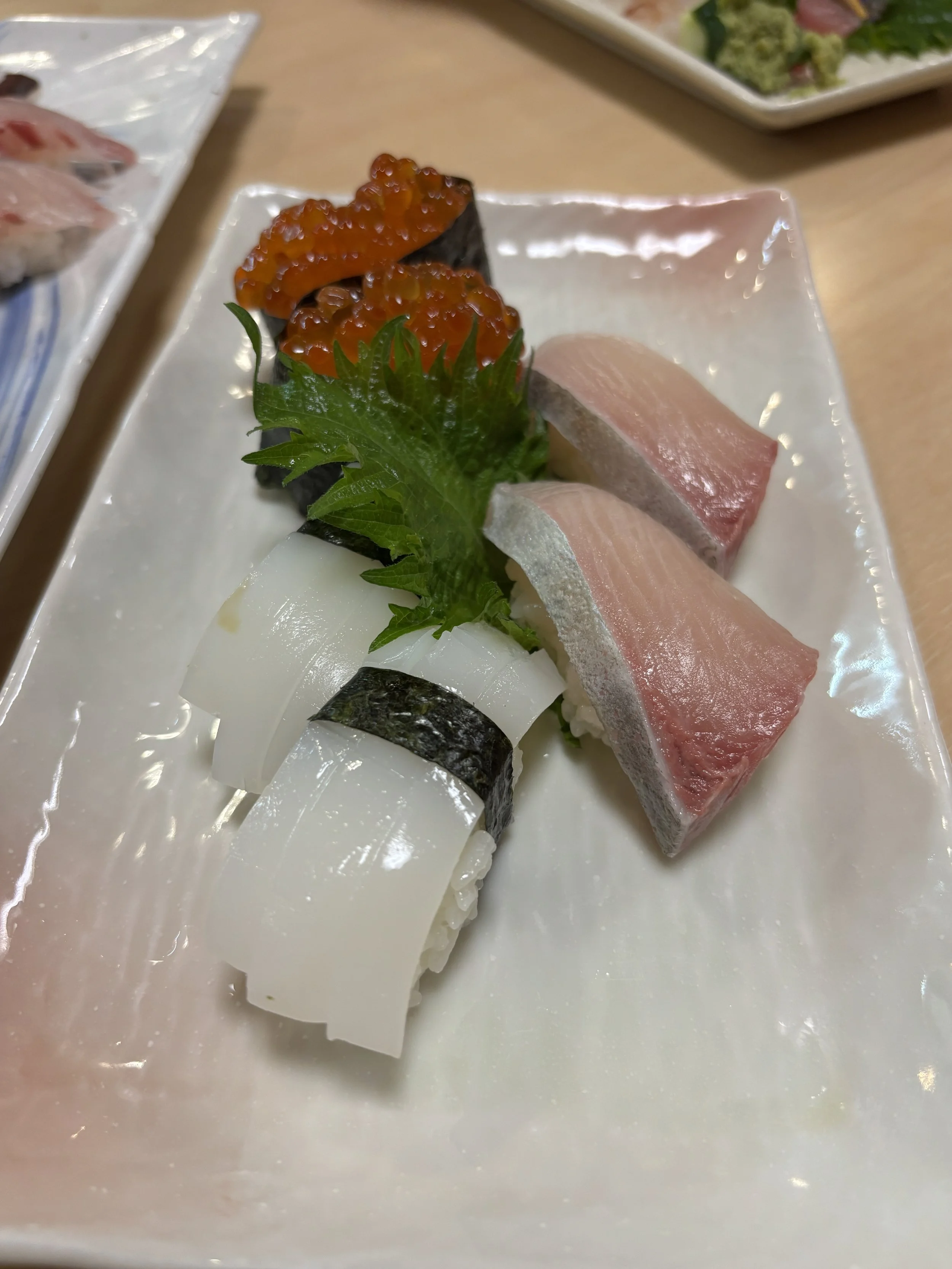
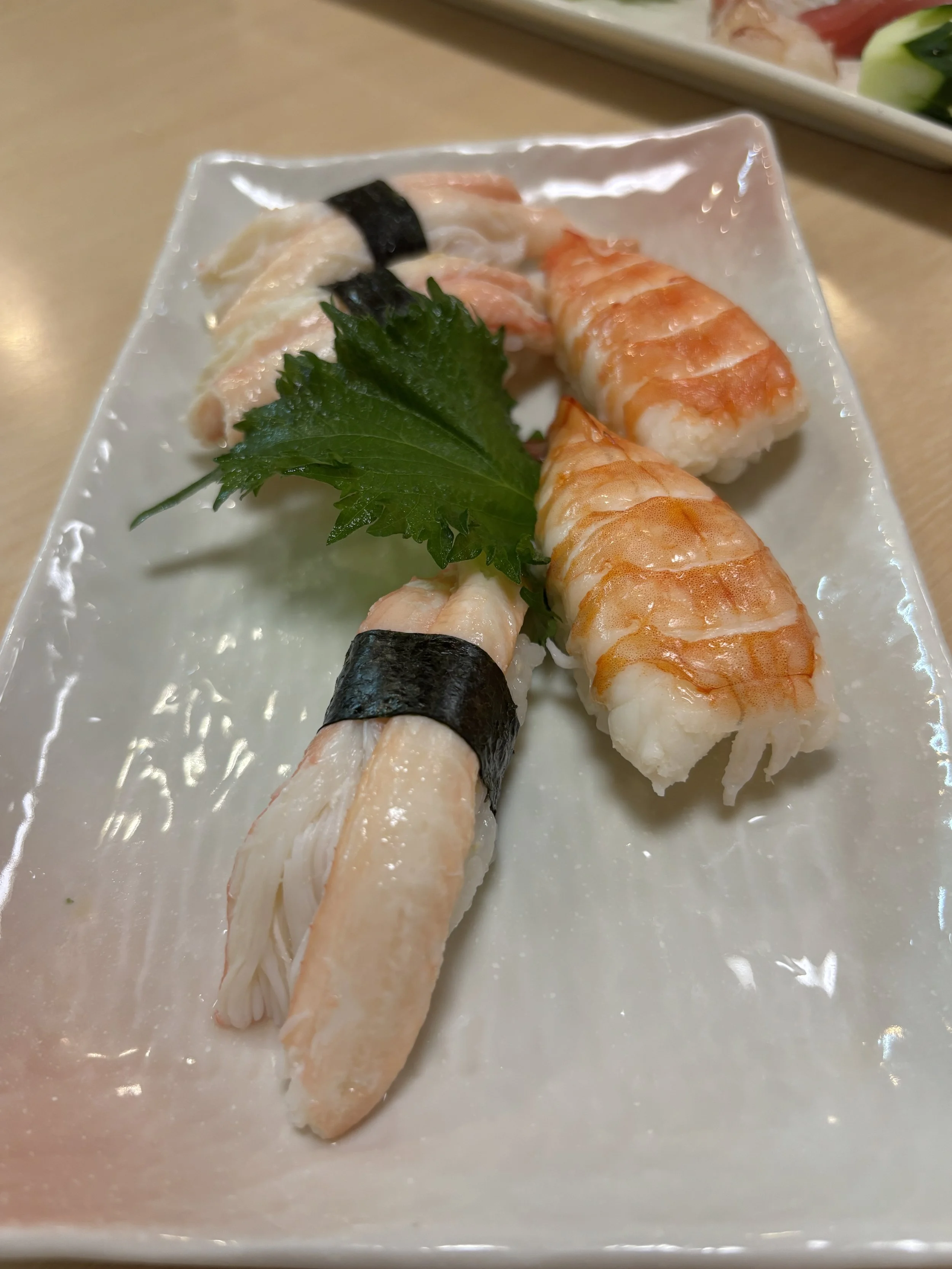
Where to stay in Kyoto
I am going to suggest two options here, since we spent the night of our arrival into Kyoto in a more, let’s say, modern western-style (albeit of a Japanese chain and with some loal characteristics), while for the rest of the days we opted for a more traditional ryokan.
Mitsui Garden Hotel Kyoto Shijo
〒600-8472 Kyoto, Shimogyo Ward, Myodenjicho, 707-1
Pretty central and providing great value for money.
While it belongs to a major hotel chain (there are other Mitsui Garden hotels in Kyoto, so check the name well when looking for directions!), it does not feel “corporate” at all!
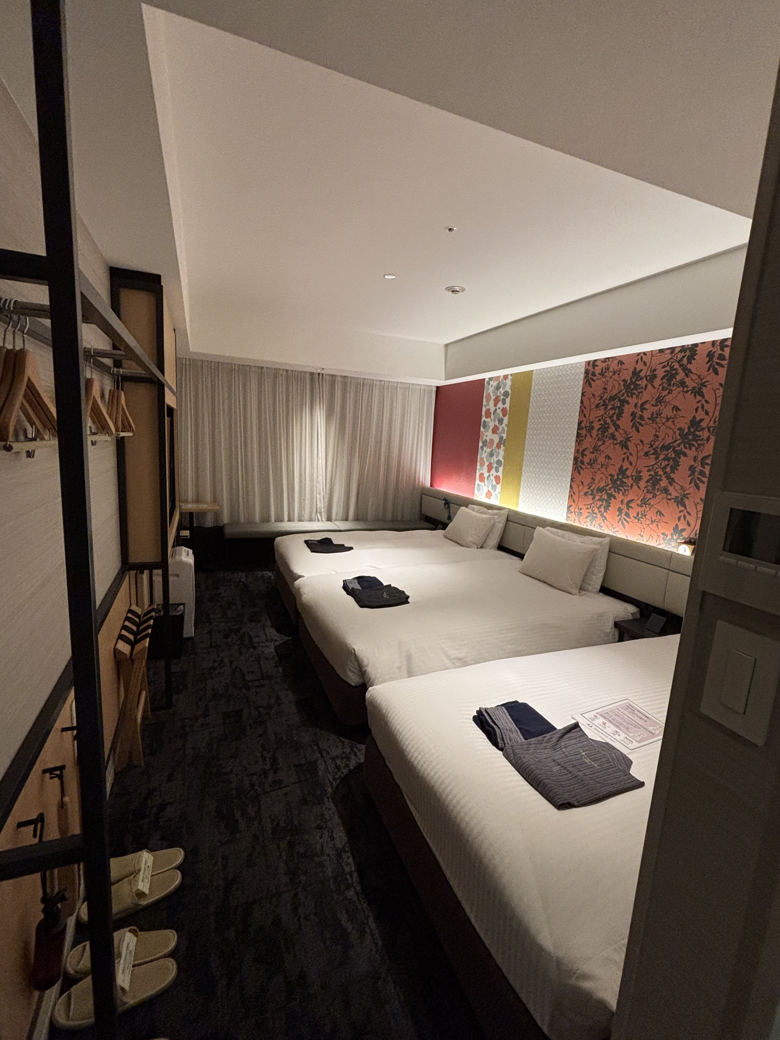
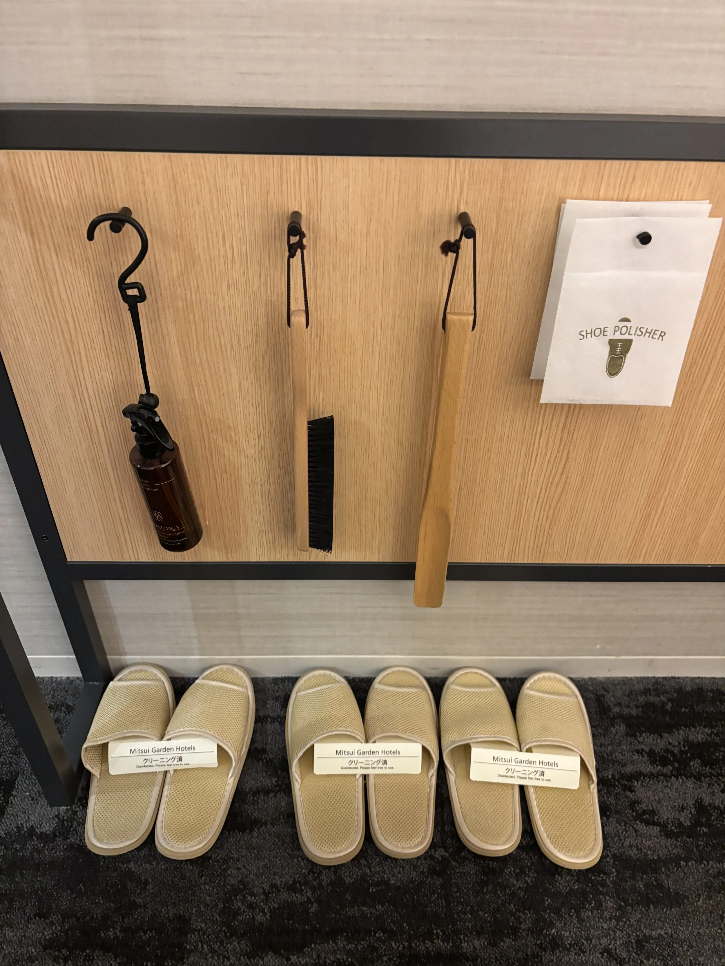
We spent only a night here, so I didn’t get to try all the facilities, for example, it does have its own onsen, which is open during the night and early morning hours. The breakfast was pretty varied, with quite a few Japanese specialities.
I also liked the little details, a classic of Japanese hotels, such as the slippers and the kimonos!
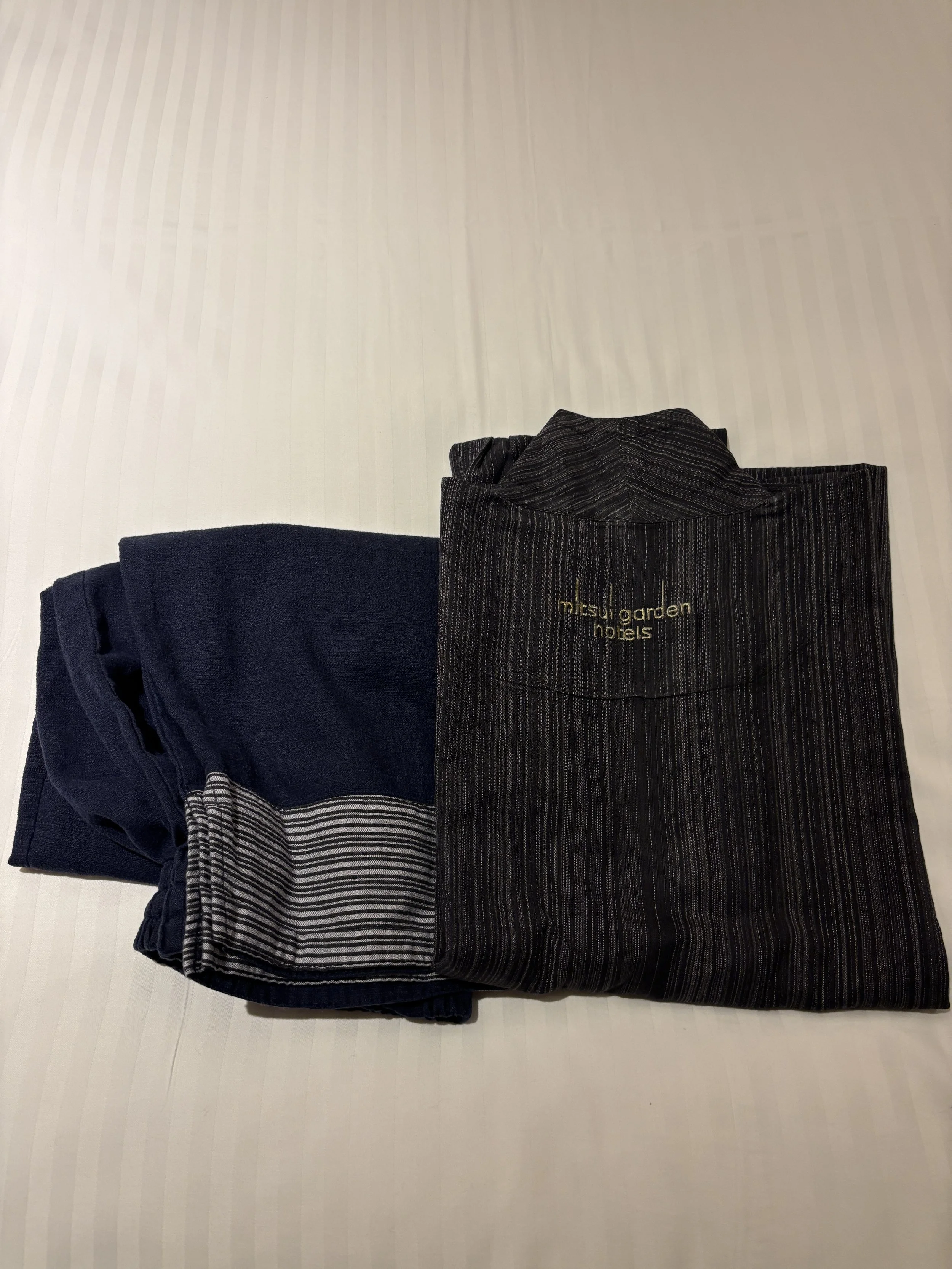
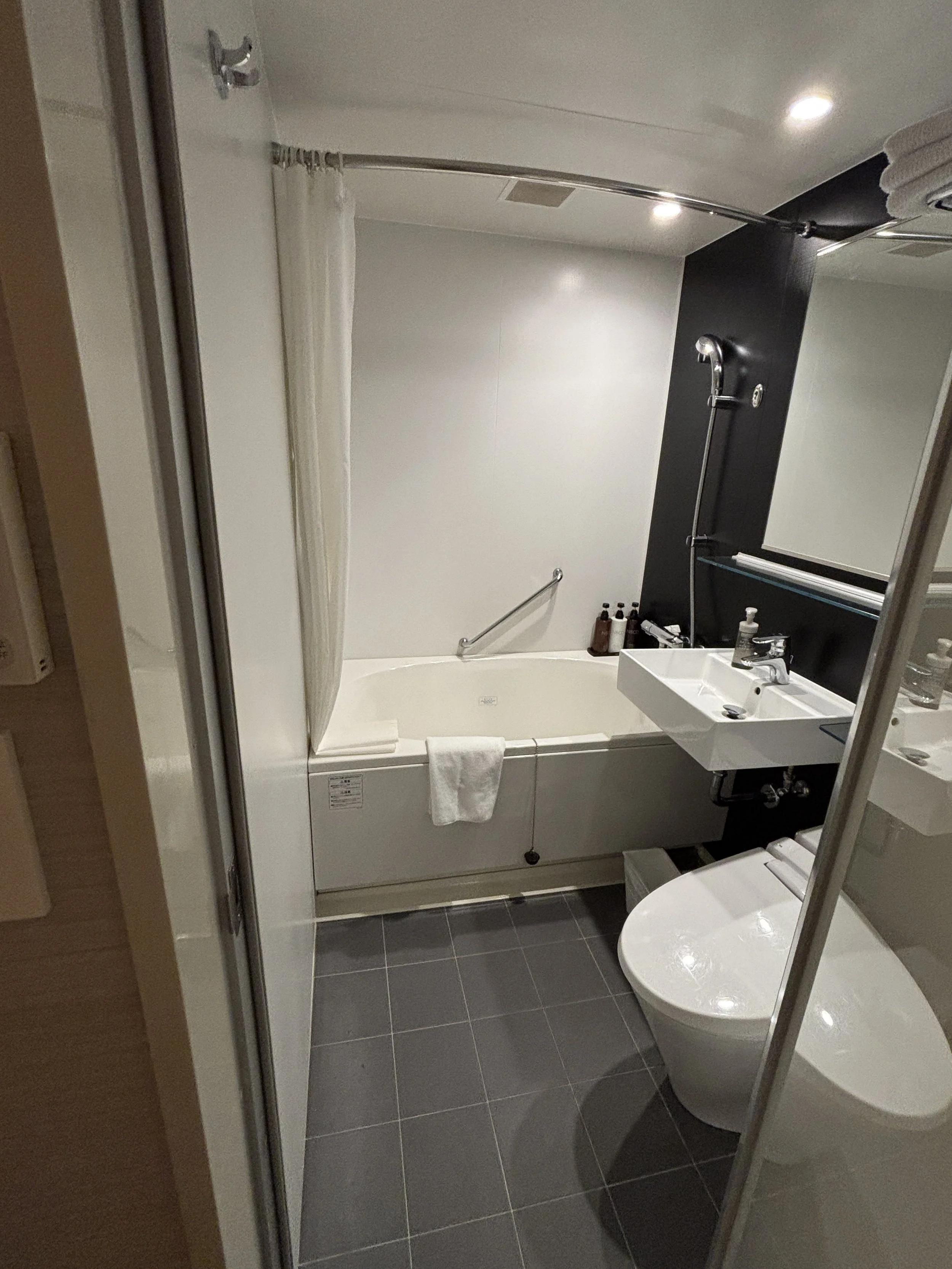
Ryokan Ryokufuso
〒600-8323 Kyoto, Shimogyo Ward, Kanayacho, 490
The trip to Japan wouldn’t be complete without staying at a proper ryokan, so I opted for this one, which had great recommendations, and it did not disappoint: Japanese aesthetics and design and service excellence at its best!
This ryokan is also quite centrally located and it has its own onsen (although it is not spring water) with views of the city, since it is in the upper section of the building.
Our room at Ryokan Ryokufuso was quite large and, of course, laid out in traditional style. As you can see in the pictures below, it consisted of a large living room (which doubles as bedroom) and an ante-chamber with a little sink and table to prepare tea, plus the shower room and toilet in two separate pieces.
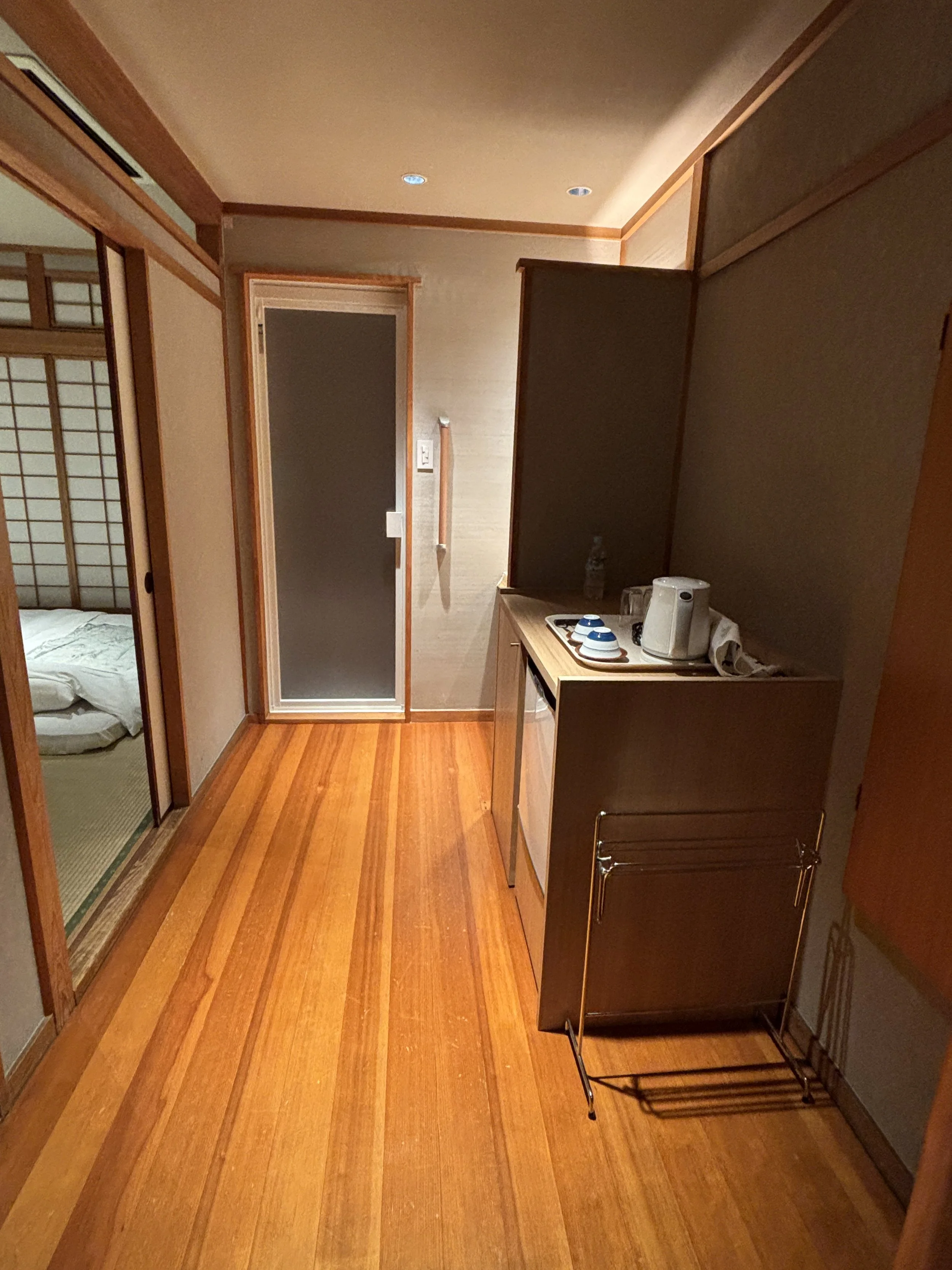
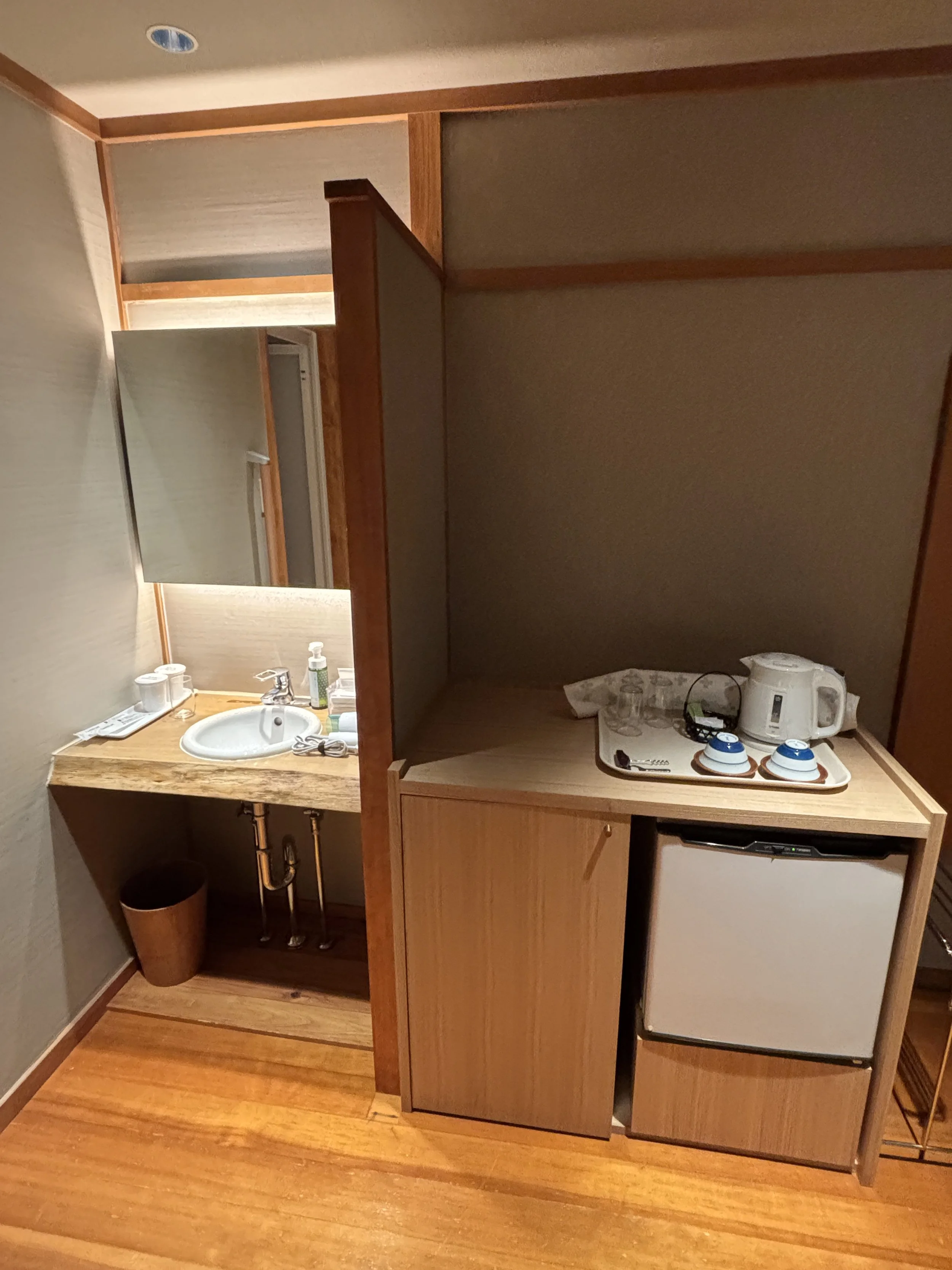

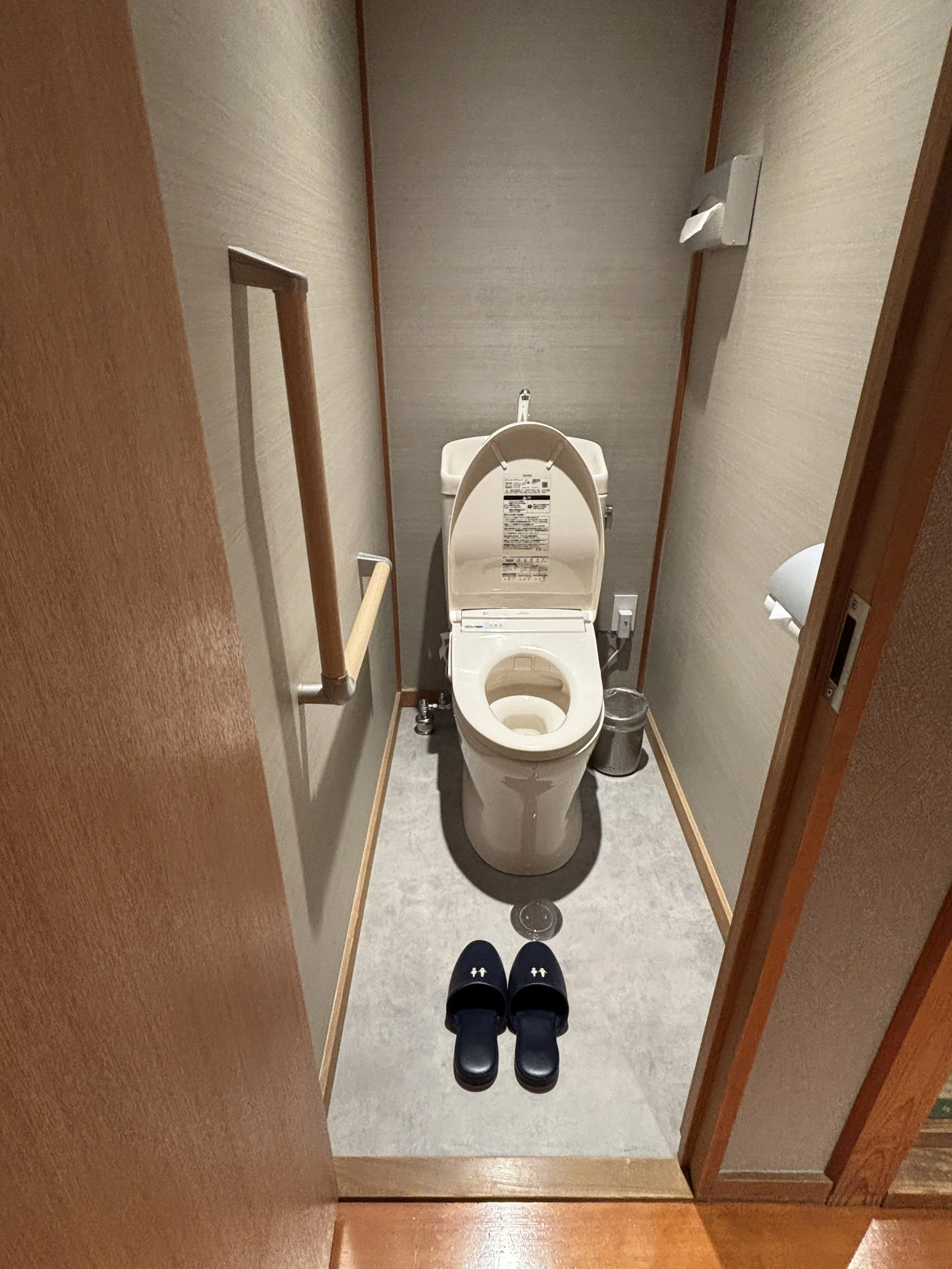
I must say, as well, that the staff at the ryokan were also very helpful throughout (some of them spoke decent English) with indications and, for example, helping arrange our luggage forwarding.
Ryokan Ryokufuso is, overall, great value for money and an excellent choice if you are looking for some traditional Japanese-style in Kyoto with good comfort and a central location.
Day excursion from Kyoto to Nara
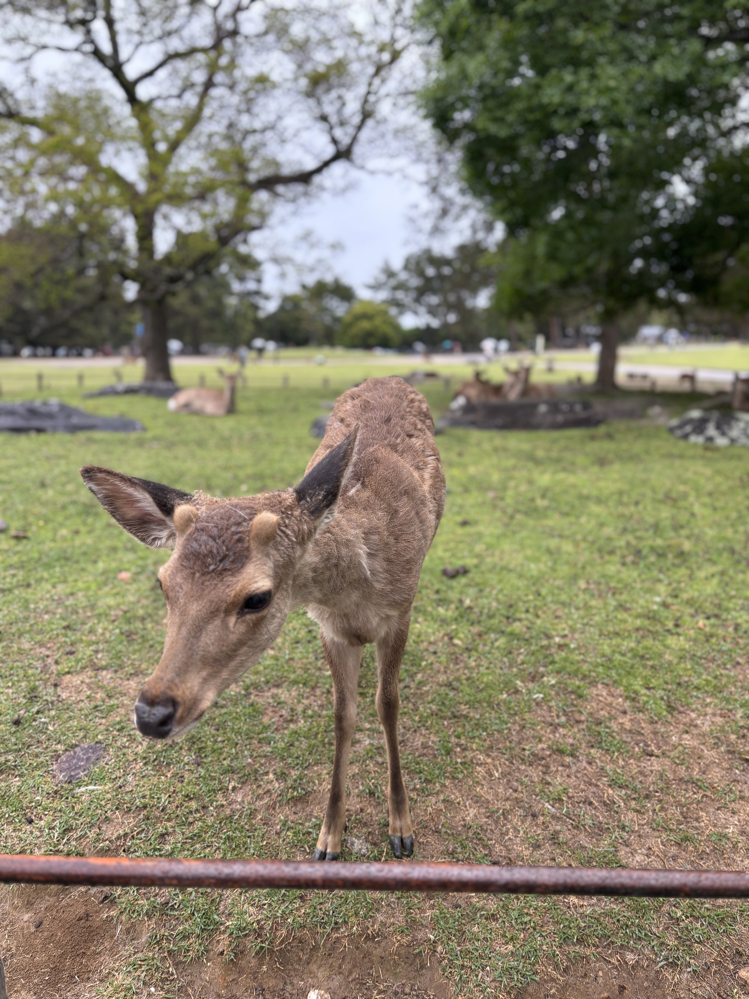
Although it is, technically, a different city, the historical city of Nara is often included in Kyoto itineraries, since it is relatively close (about an hour by suburban train). It can be visited as a day trip from Kyoto or, as we did, as part of an itinerary that ended in Osaka, which is also about the same distance from Nara as Kyoto is. So, either way, don’t forget to visit Nara!
And, while the city has quite a few historical monuments (Nara was, actually, the capital of Japan for a period in the 8th Century, before it was moved to Kyoto), the thing that really stands out in Nara and the one you are most likely to remember is this little fellow depicted on the right, or to be more exact, the whole lot of them.
Because there are thousands of these little sika deer roaming freely the streets of Nara. They are, apparently, considered to be sacred messengers of the gods and designated as national treasures.
They are all over the place and are used to people feeding them, In fact, you can buy food for them at some street stalls and they have learned to bow to visitors to get it.
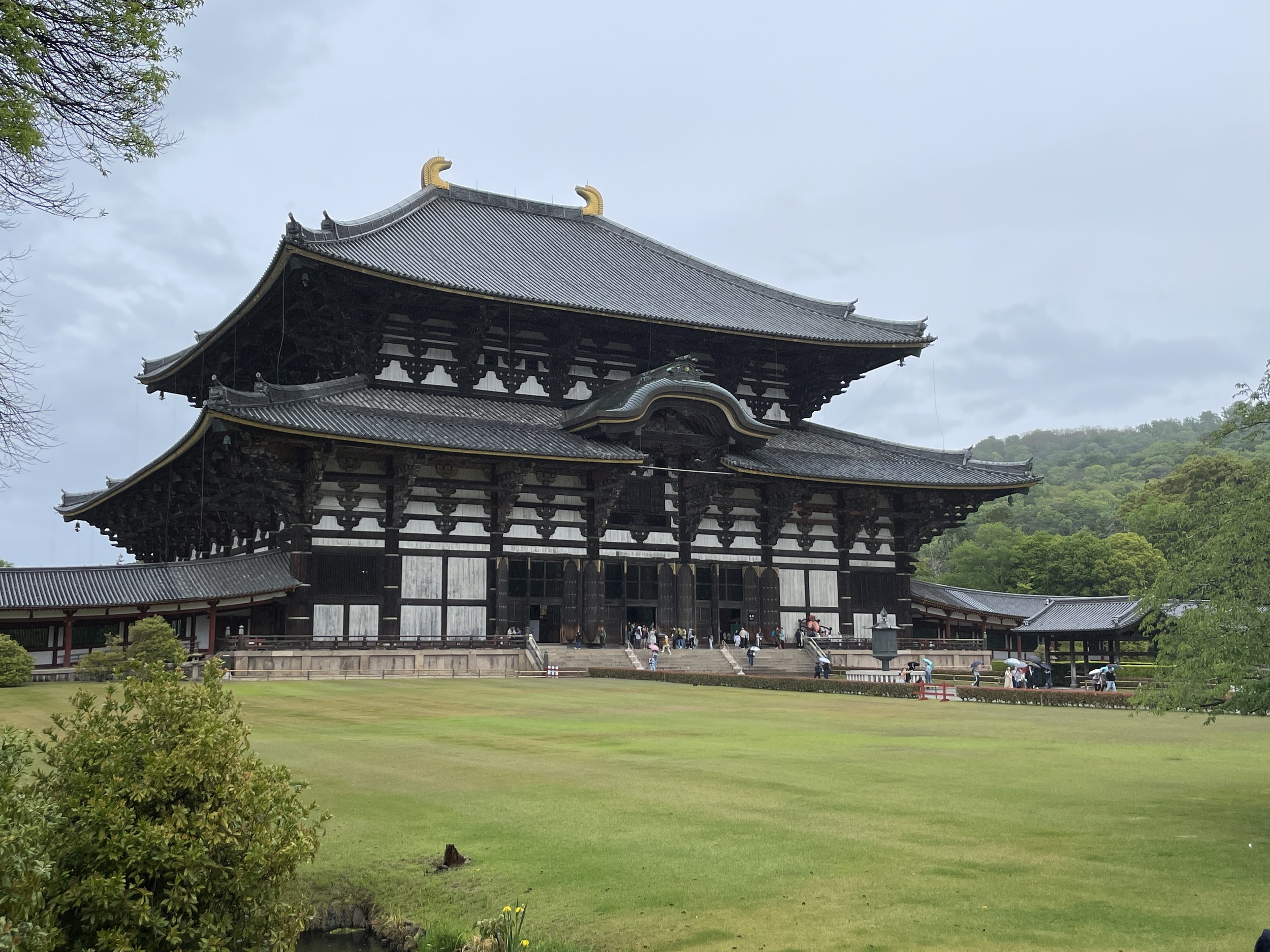
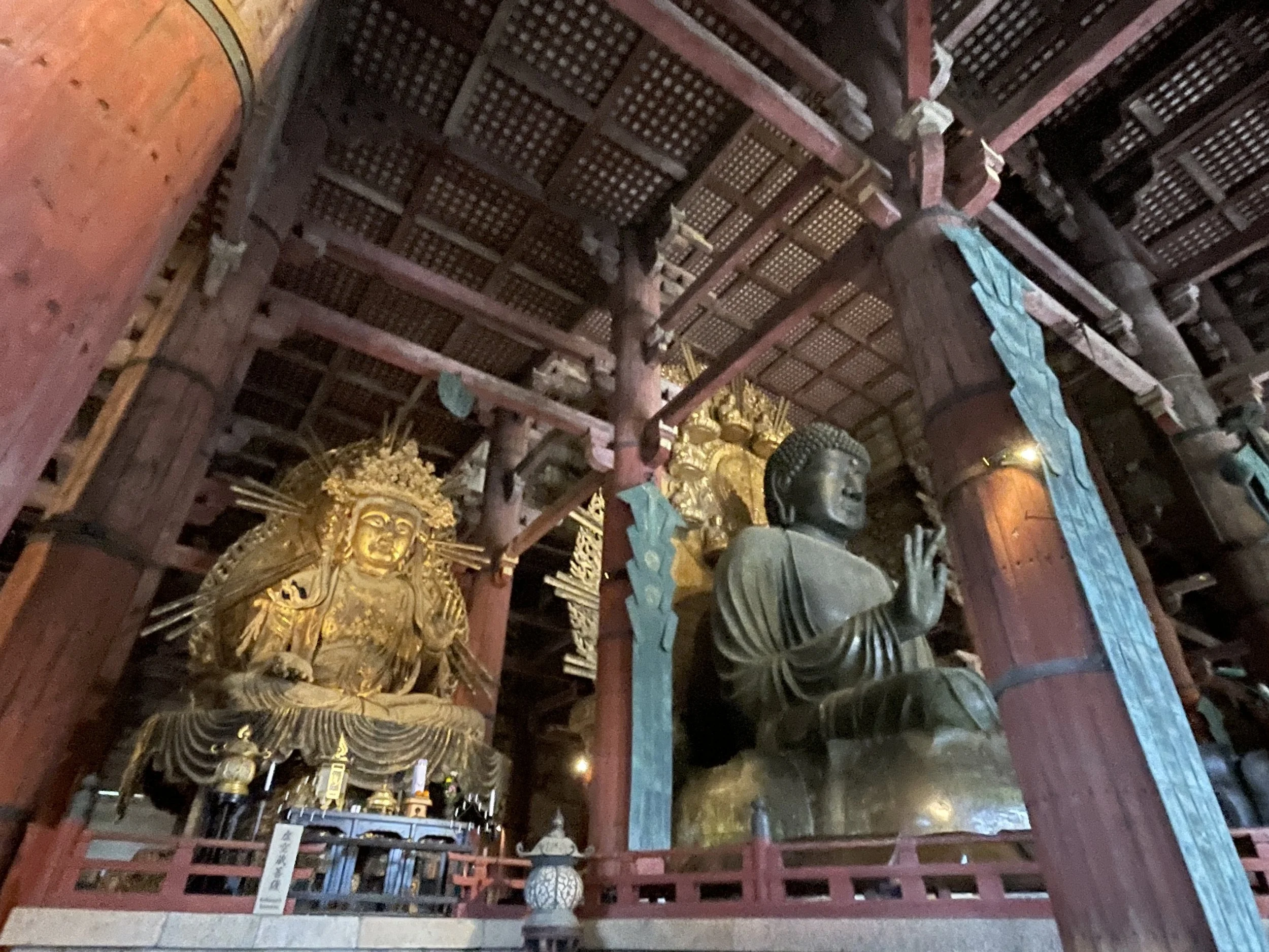
What else to see in Nara?
Deer aside, the other major highlight in Nara is the Todai-ji Temple, which houses the world’s largest bronze Buddha statue. The temple, which has been rebuilt several times throughout the centuries, is really big!
There are also other temples and shrines in its vicinity, although if you have limited time, I would say just focus on the main “tourist” alley, which runs from Kintetsu-Nara train station, across Nara Park and past the National Museum towards the Todai-ji Temple grounds and back.
It’s a nice walk, with open spaces all around and you will also see plenty of deer along the way. All of these spots are also within walkable distance of each other.