Visiting the Osaka 2025 World Expo: what to expect (I)

Osaka, Japan’s second largest city, is the site of the 2025 World Expo. And, while I have always take this massive events with a pinch of salt, I think this one is well worth a visit and a perfect excuse to visit Japan and combine it with other interesting sights in the broader Osaka-Kyoto-Nara area (which will be the subject of another blog post soon).
What’s more, I’ve got the impression that Osaka is somehow of an overlooked destination when it comes to Japan. It may not be the capital city or have the historical richness of Kyoto, but it is actually a great metropolis and this Expo rightly puts it in the map.
So, in a two-post series I am going to try distil my impressions of the Osaka 2025 World Expo and I will share, as well, some practical insights about how to get to the Expo and what to do while there, particularly if you have limited time, as it was my case.
Getting tickets for the Expo
First of all, you will need to get tickets. And I suggest you start looking for them well in advance.
The Osaka Expo has a system of shifts, so the ability to visit certain pavilions and the Expo itself is organized by time slots. I booked some three weeks in advance and, while there was broadly good, but not total, availability for the Expo itself, it was hard to find them for some of the top slots.
You can then enter a lottery system that allows you to request access to certain pavilions that have already been sold out.
And this is the point at which I will lay out my strongest criticism of the Osaka Expo: the official website is a mess and, at points, thoroughly unintelligible. I have noticed that Japanese websites (same with the official railway companies websites) are quite different in their approach to processes and flow to what we are used to in the West (and most of the world for that matter), and perhaps his conforms to local practice, but I found the Osaka Expo site to be extremely complicated to navigate from a user perspective.
The processes seem way more complex that they really should be, way too many steps, and the way information is expressed is far from helpful. It takes a while to understand what is going on and where you should be clicking. So arm yourself with some patience if trying to book tickets!

Also, that lottery system I was referring to earlier is sub-divided in different time-windows, so you may apply one week in advance or three days in advance, but all of this is explained in a rather complicated way and the process itself is not very clear. I tried using the system for some pavilions and simply gave up.
This is, I found, one of the paradoxes of Japan, which is super advanced in certain things, but then some processes seem like straight out of the 1990s and the early years of the internet.
Getting to the Expo from downtown Osaka
So, let’s say you have survived the booking site ordeal and made it to Osaka. Congratulations, because despite this initial criticism, the Expo is truly amazing!
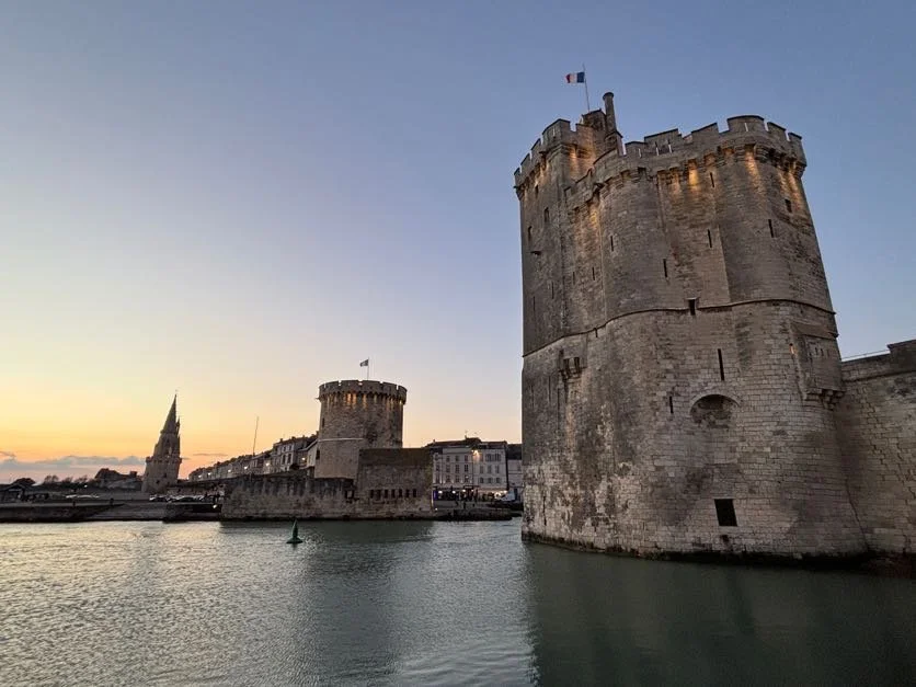
The site of the Expo is a small artificial island just off Osaka’s port area (it looks like artificial islands are quite the thing in the Osaka area, since Kansai airport, the city’s international gateway, is also located on one, just as the airport in nearby Kobe, as well!).

The Expo has two public entrances: East and West. Most people come through the East one, which is located next to the Yumeshima (“Island of Dreams”) metro station. This is the end station of the green line, which takes you downtown (Hommachi and Osaka Castle area) in about 20-25min, so it is pretty accessible.
As pretty much everywhere in Japan, I recommend getting a Suica wallet card to move around in public transport.
Interestingly, while the station can get really crowded at peak times, like around 21.00 when the Expo prepares to close, crowd management is really, really good. In the evening we were channeled through a pre-arranged path between the Expo gates and the metro station and while there was a constant and rather significant flow of people, it never felt congested, we even had a decent amount of space inside the metro wagons. So, kudos to the Expo organizers in that regard!
Arriving at the Osaka Expo


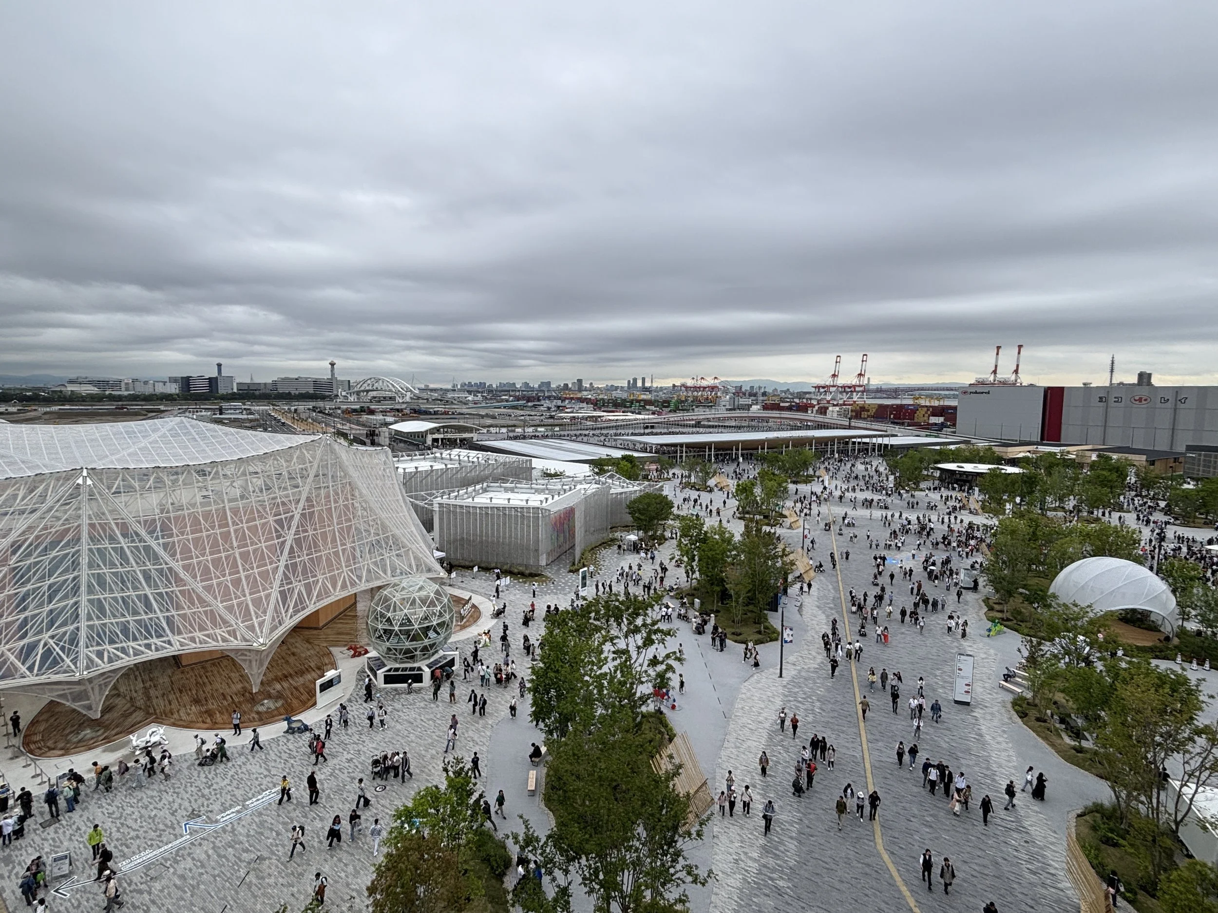
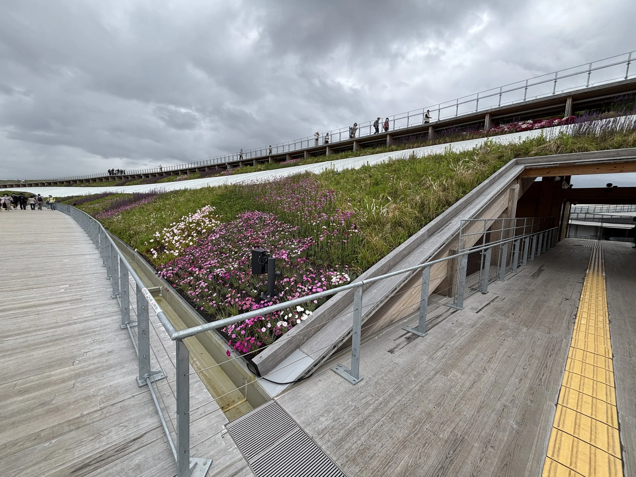
Most of the Osaka Expo, including pretty much all the national pavilions, are enclosed within a massive wooden ring.
Yes, you read that right! There is a massive wooden enclosure several storeys high, which doubles also as a view point (more on this soon below!).
The structure itself pays homage to Japanese wood craftmanship. To learn more about the philosophy behind it and its significance, I recommend checking this CNN story out.
Sadly, because it is truly a thing of beauty, the whole ring will be entirely dismantled after the expo and the wood used for other purposes.
This intended re-use of the materials is, actually, pretty consistent with the core theme of the Osaka Expo: circularity and sustainability. You will see how this topic is pervasive throughout the Expo and many national pavilions have structured their content and message around it.

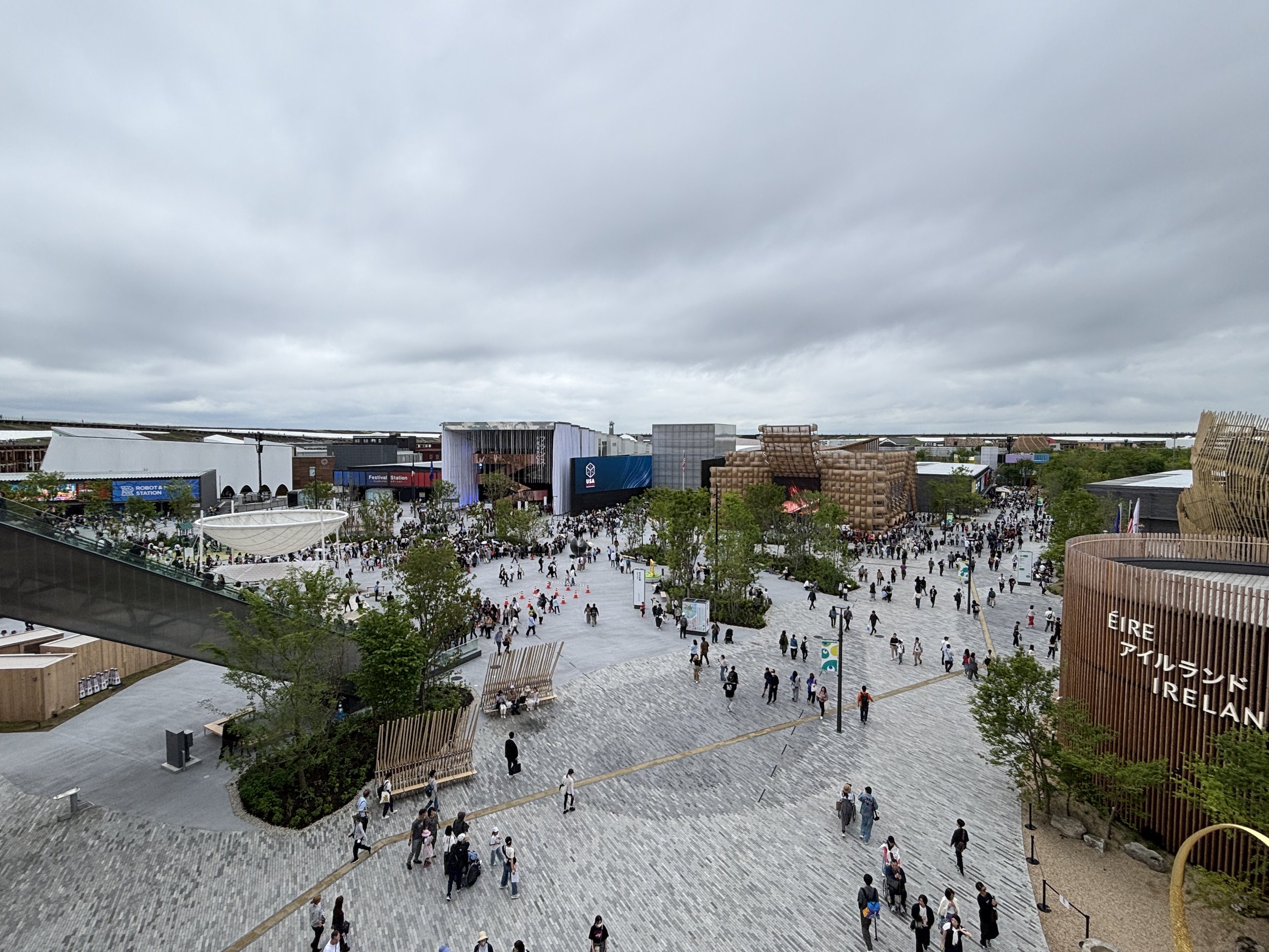
This ring, however, shouldn’t be thought of as a sort of barrier delimiting the inner core of the Expo, but rather like a sort of continuous gate embracing the whole extent of the Expo. In fact, the ring, as you can see above, is a totally porous element that you can walk through at pretty much any point.
There are also some pavilions, mostly the thematic ones, that are located outside of the ring, as are some services, such as shops and service facilities and the whole access area of the Expo. So people cross in and out of the ring all the time.

Here’s one recommendation: as soon as you get into the Expo’s grounds, head to one of the official shops next to the entrance and get yourself one of the “passports”. You will then be able to put a stamp each time that you visit one of the pavilions. It’s big fun, specially if you travel with children!

First thing to do at the Osaka Expo: Walk the Ring
So, I would suggest, first thing to do when you arrive at the Expo and after you’ve got your passport at the shop, is to go up the wooden ring for the magnificent views.

You can walk all around, but I’d say some of the best views are possibly from the east side, where several of the largest national pavilions are located.

The top of the ring is also a thing of beauty and it is structured in two levels, with some gardens in between. There are escalators, stairs and lifts connecting all together. You also get some views of Osaka’s port area from the top.

Here is a view of another section of the Expo, the lake where some water and music shows take place at regular times.


Some practical considerations about the Osaka Expo
Queues:
Yes, there are queues at most of the major pavilions and this is despite some of them having a system of advanced slot booking. So, arm yourself with patience and be strategic with what you wish to see. Also, I found the crowds to be much less towards the evening and some great pavilions, like Saudi Arabia and Spain could be visited with almost no waiting time, but this may just be anecdotal.
Cash:
Unlike the rest of the Japanese economy, the Expo is entirely cashless.
Food and drinks:
There are several eating options at the Expo. Some pavilions have bars, restaurants or food stalls. I had the chance to experience the Swiss and German ones, for example. However, I would say the best option quality-price is to visit one of the several food courts that dot the Expo’s territory. There is a diversity of fairly priced choices there and, while busy, it was not super crowded. Btw, there are also free water dispensers throughout the Expo too, so you may want to bring your own refillable bottle.
The Portuguese Songs
This is not part of the permanent programme of the Expo, but it was one of the first sights I came across, and a rather impressive one at that! As part of the “Alentejo Days” at the Portugal Pavilion in May (a number of activities dedicated to this region of Central Portugal), there were regular performances of “Cante Alentejano” throughout the day. I found it quite aesthetically interesting so posting a couple of pictures here (and may post a video as well when I find time to do the editing!).


Which Pavilions to visit at the Osaka 2025 Expo?
My time at the Expo was rather limited, since I just managed to squeeze in two full days before my return to Tokyo and Europe, but I think I made a rather efficient use of time. So, in this post and the next I am going to show some of the pavilions that I visited and what I found of interest in each of them.
Also, big thanks to the Expo media team that help me arrange some of the pavilion visits!
Japan Pavilion

As a host country, Japan’s pavilion is, of course, one of the hgilights of the Osaka 2025 World Expo. It is also the only national pavilion that is outside of the wooden ring, located just outside of it and close to the Expo’s east entrance.
Note that Japan’s is one of those pavilions that requires advanced booking, since, not unsurprisingly, demand is high!
In fact, the Japanese pavilion is also a wooden ring. Its structure reflects, as well, Japanese aesthetics and materials. Its main topic is…you guessed it…circularity and recycling!


So, the pavilion is organized itself if a circular way: you walk around its structure and find out about different technologies, particularly those reliant on microorganisms such as algae, that are being used to recycle stuff and make stuff while minimizing waste. The pavilion has even its own bio-power plant (which you can see in the picture above).


“Nothing goes to waste” is kind of the message that pervades the whole exhibit.


The role of algae in these waste recycling processes is highlighted throughout the exhibits. This way, we learned, for example, how algae can theoretically produce 50 times more protein per the same amount of water than beef or 36 times more than soybeans, or how they can absorb 14 times more Co2 than a cedar tree.

We were also shown how, through farming (see for example in the picture above how algae are move through tubes or, below, how they can be cultivated in ponds), all these algae and micro-organisms can be put to work to produce a number of advanced materials.

Interestingly, many of these transformation and waste-recycling processes depicted at the pavilion are taking place for real, on-site. So, you have some of them producing energy at the aforementioned biogas plant, but also being transformed into tangible items at a robot-assisted 3D printing facility. In fact, Japan’s Pavilion portrays itself as a “factory”, where waste is transformed and given a new lease of life as useful new things.

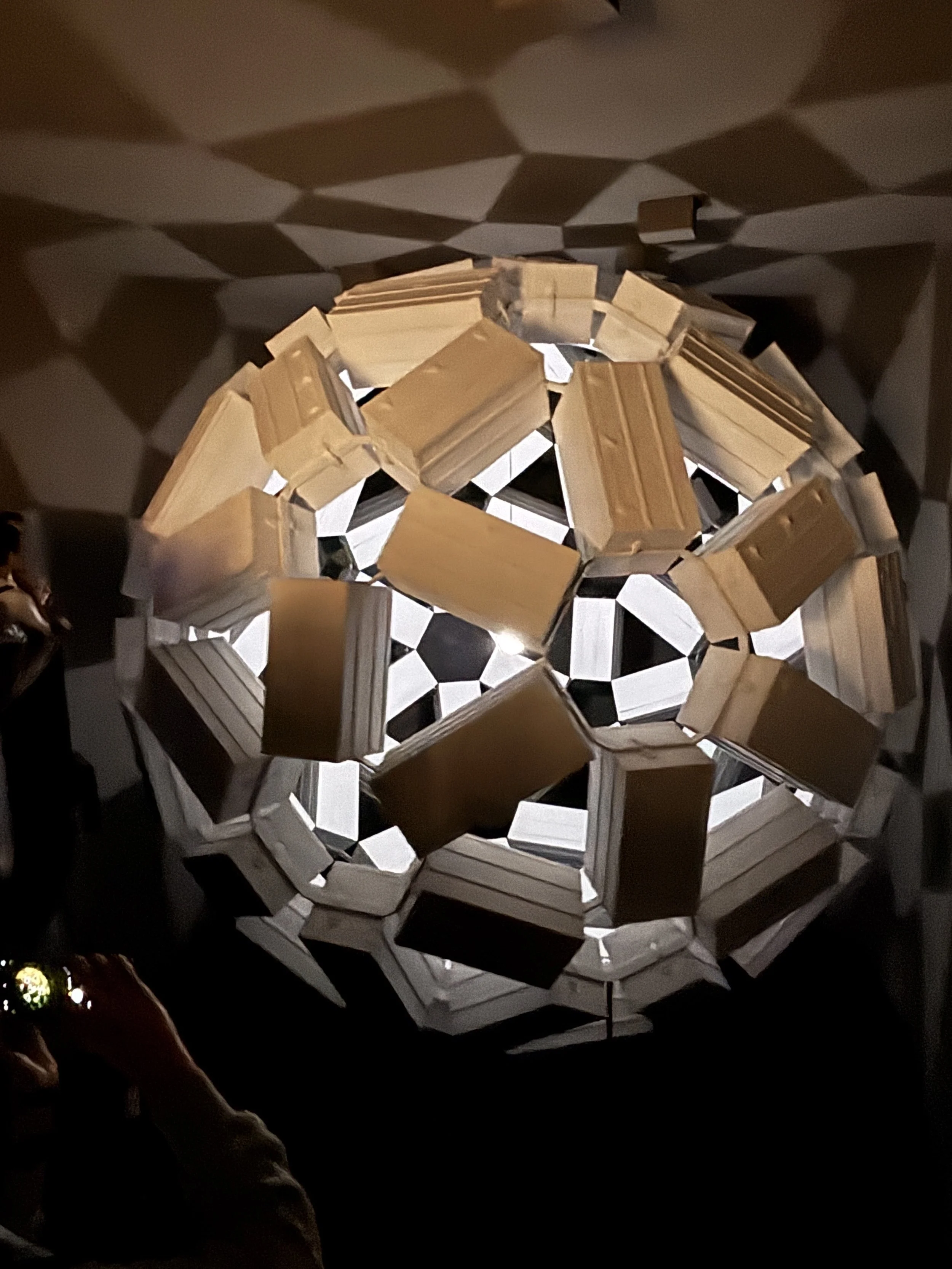
The pavilion showcases, as well, some Japanese tech made possible by advanced materials. Here in the pictures, for example, I show two of these: an airless, non-inflatable football ball made of semi-rigid components and an ultra-light mesh that helps space proves soften their ground impact.


The central space of the pavilion is taken by this breathtakingly beautiful, zen-style pond, which is fed by what was formerly waste water, which has been depurated on-site. We were told that after the process it is so clean that you could drink it!

German Pavilion

Germany’s pavilion is also all about sustainability and circularity.
Besides being one of the most interesting from the architectural point of view (like in the case of Japan’s here the circular shape delivers a message!), the star of Germany’s pavilion (and your companion during the visit) is this little cute kawaii-style mascots, called “Circulars”, which you are given at the entrance.
The circulars have sensors that make them change colour and talk to you about the different exhibits throughout the visit.


Besides showcasing multiple initiatives and companies in Germany that are active in the circular economy, developing sustainable solutions in different areas of life, the German pavilion itself is made in a sustainable way. Most of the materials are reusable or organic. For example, a special type of fungus with a wood-like appearance and consistency has been used to make some elements of the structure.
There is also a nice garden terrace, with some of the exhibits located outdoors.


South Korea Pavilion

This was a pavilion strong in visual effects.
A big part of the action is actually outside, with the pavilion’s facade being used as a massive video screen.
Inside, the highlight is a technology-themed futuristic, and also rather touching, video story set in the future. Aviation enthusiasts will notice how eVTOLs play a prominent role!

Pavilion of Saudi Arabia
As the country organizing the next Expo, in Riyadh in 2030, Saudi Arabia was one I couldn’t miss.
The first part consisted in a live music performance combined with a visual show projected onto the walls of the pavilion. A truly beautiful sensorial combination.

The pavilion is yet another channels for Saudi Arabia to showcase some of the massive projects it is investing in in order to turn the kingdom into one of the world’s top tourist destinations.
As it couldn’t be otherwise, there is also a whole section about environmental programs and the restoration work that is being conducted at several ecologically sensitive areas, such as the Red Sea, where, for example, coral is being 3D-printed in an effort to speed up reed regeneration.

France Pavilion
The French pavilion was somehow a hybrid between a museum and fashion boutique.
In great part this is explained by the fact that some major French luxury brands have sponsored it.
The resulting aesthetics are actually pretty cool and there are some exhibits that are quite eye-catching.
I’d say it gives a good sense of what is typically understood by French elegance and style. All in all, a great advertisement for the Japanese market of one of France’s greatest exports (after all, at the time of writing these lines, LVMH is, I think the most valuable publicly-listed French company).

France’s pavilion has also some nicely arranged outdoor space and an interesting scale model collection which merges French and Japanese iconic historical monuments (see below).


Brazil Pavilion
Brazil’s is a relatively small pavilion, with the main exhibit (below) focusing on the topic of environmental preservation. The inflatable, 3D shapes, represent people, animals and plants that come alive with movement.
There is also a video exhibit which highlights the numerous historical links between Japan and Brazil, a country that is home to several million people of Japanese descent.

United Arab Emirates (UAE) Pavilion
As the UAE was the site of the latest Expo, which took place in Dubai in 2022, I was also curious to check this one. As you can see, the exhibit was structured around palm-tree-like structures. The UAE’s fledgling space programme takes a place of honour.

Turkmenistan


This is an interesting one. Turkmenistan has one of the largest and more visually striking pavilions at one of the Expo’s prime locations. Kind of unexpected from a closed country, which gets a negligible number of visitors.
What I can say is that the people reacted with interest, queueing to get a rate glimpse of this little known country, which has been ruled by the same family since the fall of the Soviet Union.
The exhibits are quite a thing, starting by a presentation video that, let’s say, defies a bit the standard aesthetic canons in this genre of production.


There was also an exhibition of pretty much everything that is produced in Turkmenistan, from apples to detergent I guess this is how a Soviet trade show may have looked like sometime in the 1970s.
Interestingly, dogs feature prominently throughout both the presentation video and the exhibit!


Switzerland Pavilion
Besides appealing to a number of Swiss estereotypes (mountains, cows, cheese, etc), this pavilion was centered mostly on showcasing Switzerland’s technical prowess in a number of fields, from medicine to space tech.

The cake shown below, for example, is capable of producing electricity on its own, by combining the right ingredients and inducing a chemical reaction. Will this ever have a practical application? Maybe.
Swiss space tech had also a prominent space (pun intended!) in the exhibit. This is an industry in which Switzerland punches above its weight and one that Swiss institutions have been keen to promote internationally, since it is not that well known to general public.


What’s interesting also is the bar at the uppermost floor, with great views of the central area of the Expo. Prices are more Swiss than Japanese, though!

Stay tuned for the second part of the Osaka Expo walk around…
And this is all for Day One at the Osaka Expo! In the next instalment of this series, we’ll look at some other pavilions that caught my eye at the Osaka Expo, including those of superpowers USA and China as well as some of the thematic ones.
Watch this space!

48 hours in Jeddah: top things to see and to do

Jeddah is likely one of the most historical cities in the Arabian Peninsula.

Located on the shores of the Red Sea, Saudi Arabia’s second largest city is just a short drive from Mecca, the most sacred place in the Muslim world, something that becomes apparent already at the airport, as you encounter crowds of pilgrims from all over the world.
In fact, this coastal location and its role as a gateway to Mecca has made of Jeddah, for many centuries, a major trading entrepot.
Unlike other cities in the region, which have developed pretty much out of the desert, Jeddah has a faily large historical center, which has gained it a spot in the UNESCO World Heritage list and offers a glimpse (even if extensively restored) into the Arabia of yesteryear.
By the way, my impression of Jeddah are based on a couple of short forays during a recent business trip I made to the city, so this post, by no means intends to be a comprehensive tourist guide.
I am sure there plenty of other blogs that can offer much more detailed insight into some aspects of the city, such as the several museum-houses that are open in the Al Balad area of Jeddah (many of them were not open when I visited), cultural sites and events and places to eat in the city.
I hope, though, that these few lines and pictures can offer you some broad impressions about what to do and what to see if you travel to Jeddah.
Al-Balad neighbourhood, visiting Jeddah’s old town
This is, without a hint of doubt, the most interesting part of Jeddah, Al-Balad is the historical core of the city (in this aerial picture you can see how it looked like as recently as 1938 and compare with a modern picture of the city!). Its roots date back, at least, to the 7th C. and its ensemble has been recognized as a World Heritage Site by UNESCO.
I would say there is not “one thing” to see in Al-Balad, the main thing to do is to walk around and admire the architectural ensemble built in the traditional style of the Hejaz region of Western Arabia. Many of these houses were built using coral blocks from the Red Sea as building material and framed by “roshan”, the wooden windows which often protrude from the facades.

The Souq Al Alawi is, what I would say, the main gateway to Al-Balad. At the time I visited (in the evening) it was packed by visitors and buzzing with activity. There are many souvenir shops and cafés around. To be honest, it is quite a touristized spot, but it is a good reference point to start the walk, since it opens in a rather broad and lively square.
It is also here that we find one of the singular buildings of note, the Nassif House Museum (picture above), which houses an exhibition about old Jeddah, although I found the information is provided in a not very clear way. Apparently it also has a rooftop which is sometimes accessible to visitors and has great views of the whole historical town, but it was closed when I visited and, again, could not find much info about when they open.
So, what follows are some snaps of my walk through Al-Balad. While the aforementioned square was quite crowded, it gets a bit quieter as you start walking into the maze of small streets, as visitors disperse around.


In the picture below you can find two clear examples of Roshan windows, in the two colour tones that prevail through Al-Balad, the natural wooden, brown one and the pale green one.

You will also find several pieces of street art when walking around Al-Balad. This one, for example, evoking fish is a timely reminder of Jeddah as a seaport. In fact, one of the attractions marketed to tourists is the fish market, which is not too far from Al Balad, but I didn’t have the time to visit it.

Al-Balad: an ongoing restoration project
One thing that becomes apparent is that Al-Balad is currently the object of a major restoration project. This is, like so much going on in Saudia Arabia right now, part of the Vision 2030 tourism drive.
In 2023, the Saudi government, through its sovereign wealth fund, the Public Investment Fund (PIF) even created a special entity, the Al Balad Development Company, to undertake this work. The goal is to make of Jeddah’s Al -Balad one of the top tourist attractions in the Middle East.

Seeing the state of disrepair some of these magnificent buildings are in, one can only wish they succeed, although it would be great if they did not overdo it. A great part of the charm of Al-Balad is that, even if you know that a big part of it has been restored, it has managed to preserved most of its authentic atmosphere,. It would be tragic if it ended up looking like a theme park.

Wherever you go in Saudi Arabia, there is passion for football, as you can see, even in the middle of the historical district. Actually, shortly before my visit, Jeddah had hosted the Spanish Supercup, which was won by FC Barcelona.

Al-Balad can be equally interesting at dusk and at night.
In fact, it is possibly the most lively time, since, like in many places in the Middle East, much social life happens in the evening, to avoid the extreme heat during the day. In Al-Balad, some of the main streets are even decorated with lights, which makes the place more scenic.
I would recommend timing the visit to enjoy it both during daylight and in the evening.


Visiting Al-Balad’s historical museum-houses
Several of the historical houses that dot Al-Balad have been restored and are open as visitors. I had the chance to visit three of them, which I detailed next.
Bear in mind, though, that although some of them have some sort of small exhibit inside, perhaps the word “museum” is a bit of a stretch. I had the chance to visit three of them.
Overall I found much information is missing that could help visitors plan the visit and the itineraries better.
For example, it is not that clear which ones are open and when and once you are at the house in question, there is not much contextual information either. In fact, there is not even a ticket counter or anything like this, entrance was free in all three of them and you just walk in.
Also, several of these houses have rooftop terraces that are open at certain times and on certain days, but this information was also not very clear and staff that were around at different spots didn’t seem to know either.
Anyway, here are the museum-houses I visited in Al-Balad.
1. Nassif House Museum
This one has been mentioned already and it is perhaps the best known and most crowded.

2. Al-Sharbatly House
I visited Al-Sharbatly house, located at the northern edge of Al-Balad, as I was dashing through the area looking for a rooftop terrace to see the sunset. That effort was unsuccessful, but I was rewarded by stumbling upon the opening of an art exhibition.
This house, I learned later, has just been completely restored by a businessman who happens to be a descendant of one of the first owners. Here is an interesting article with more details on this story.

As I mentioned, there was an art exhibition inside by Saudi artist Hams Almureh. Not only that, but I was invited to join a small tour group, but also had the chance to meet the artist at the end of it.
Hams Almureh is from Taif, a region in southwestern Saudi Arabia, near the Yemeni border. She has recovered a traditional technique to paint on palm leaves weaved together to form a 100% organic canvas. Quite interesting.


3. Baeshen House Museum
This was the third house that I visited, in the very center of Al-Balad. It was a short visit since there were two or three ground floor rooms open to the public containing a mix of old (but not ancient) objects and what looked like some type of contemporary art exhibit. I must say I didn’t fully get what this one was about.


Shopping in Jeddah
Let’s start by saying that I really didn’t go shopping while in Jeddah. But, I thought worth mentioning the shopping experience, because there is no shortage of shops in Jeddah, particularly if you are into spices and fragances.
There are several modern malls next to Al-Balad (although just outside of it, in the modern part of the city), as well as many smaller bazaar-style shops (from where the aroma of frankincense emanates constantly) lining the most transited streets in Al Balad and along the commercial axis which connects with the modern commercial area between Al Balad and the sea.
It is also possible to find some street stalls on the eastern edge of Al Balad.


The Jeddah Corniche

The other must see area in Jeddah is the famous “Jeddah Corniche”, the seaside promenade which stretches for quite a long way along the sea shore.
Some consideration, though: the Corniche is really long and it is not (at least at the time of my visit) continuous all the way. I opted to take a cab and head towards its northern side, next to the Al-Rahmah mosque, which you see pictured here.
My intention was to walk south from here as far as I could on my way back to the hotel, which was located not far from the southermost end of the Corniche. At the very least I was hoping to be able to get to the Jeddah Aquarium, which I had read is one of the city’s highlights and take a cab back to the hotel from there.
The first kilometer or so looked quite promising: there is a broad promenade lined with quite a few shops and cafés. The weather was also quite pleasant with a slightly warm breeze, but not too hot. The proximity of the sea means that temperatures can be a bit milder than in other parts of Saudi Arabia.
As you get to the area next to the Formula One circuit, though, the promenade gets truncated. The pedestrian boulevard ends and it becomes a motorway for cars only. At this point the route is also devoid of any amenities and very few people are around, just a few anglers every here and there. Cab prices also happened to be more expensive than where I started my walk, I guess because it is not a very transited spot, so I decided to turn back.

I don’t know whether the discontinuity in the pedestrian part of the promenade is permanent or due to construction work, since there is some development going on along the seafront. In any case, since I was short of time and had already got my glimpse of the sea, I decided to get back to the hotel. The southern part of the Corniche will have to wait for another day.

I like the image below because somehow encapsulates how tradition and modernity mix in Saudi Arabia at the moment.

Walking along the Alhamra Corniche
This another seaside promenade, although a bit further south and closer to downtown. It was right next to my hote (more on this below), so I decided to go for a walk.

Despite this being, in theory, a prime seaside spot, I was kind of underwhelmed. There was a stretch of boulevard with some very basic entertainment and food and drink options around. Just a few people walking by (the weather was rather nice, but I guess most people are using to walking out in the evening, not in the morning!)

The water looked pretty nice here, since it is more of less a secluded area protected from the open seas by a a sort of bay and several outlying islets.

However, it doesn’t seem that they are making much use of its recreational possibilities. It is not just the uninviting signage, the boulevard is also interrupted at several points by road works and other infrastructure.
It is still possible to keep walking, although at some spots it is not too pleasant, and get to “Jeddah Beach”, which, to be fair, was a massive disappointment.
Not that I was expecting a pristine beach, but what I came across is just a barren, open space, which is partly used as parking lot and it is not kept particularly clean.
Reminds me a bit of Barcelona’s seaside in the 1980s, before the city decided to successfully open itself up to the sea! Plenty of potential here!

Where to stay in Jeddah
Ritz-Carlton Jeddah
Southern Corniche, District, Al Hamra
Jeddah 21493
https://www.ritzcarlton.com/en/hotels/jedrj-the-ritz-carlton-jeddah/overview

This is a grand hotel which acts also as a major conventions center. Palatial style, pretty nice overall.

The hotel is quite high (it is possibly one of the highest structures in this part of the city, and the upper floors have views of Jeddah’s port and part of the city. To be totally honest, while Al-Balad is truly unique, the modern part of Jeddah is nothing to write home about, but seaside views are always welcome!

Here is how the rooms at the Rtiz-Carlton Jeddah look like.


Nice and elegant, as you would expect in a hotel of this category.
Lots of marble in the bathroom and one detail that I liked: this retro-style alarm clock by the bedside!

One great thing of the Ritz-Carlton Jeddah is breakfast at one of the top floors. Amazing views and amazing food!
Last but not least, if you travel to Jeddah, chances are you will do so on Saudia, which is the main carrier at the … airport (JED). If you do so, you may want to check my Saudia flight review.

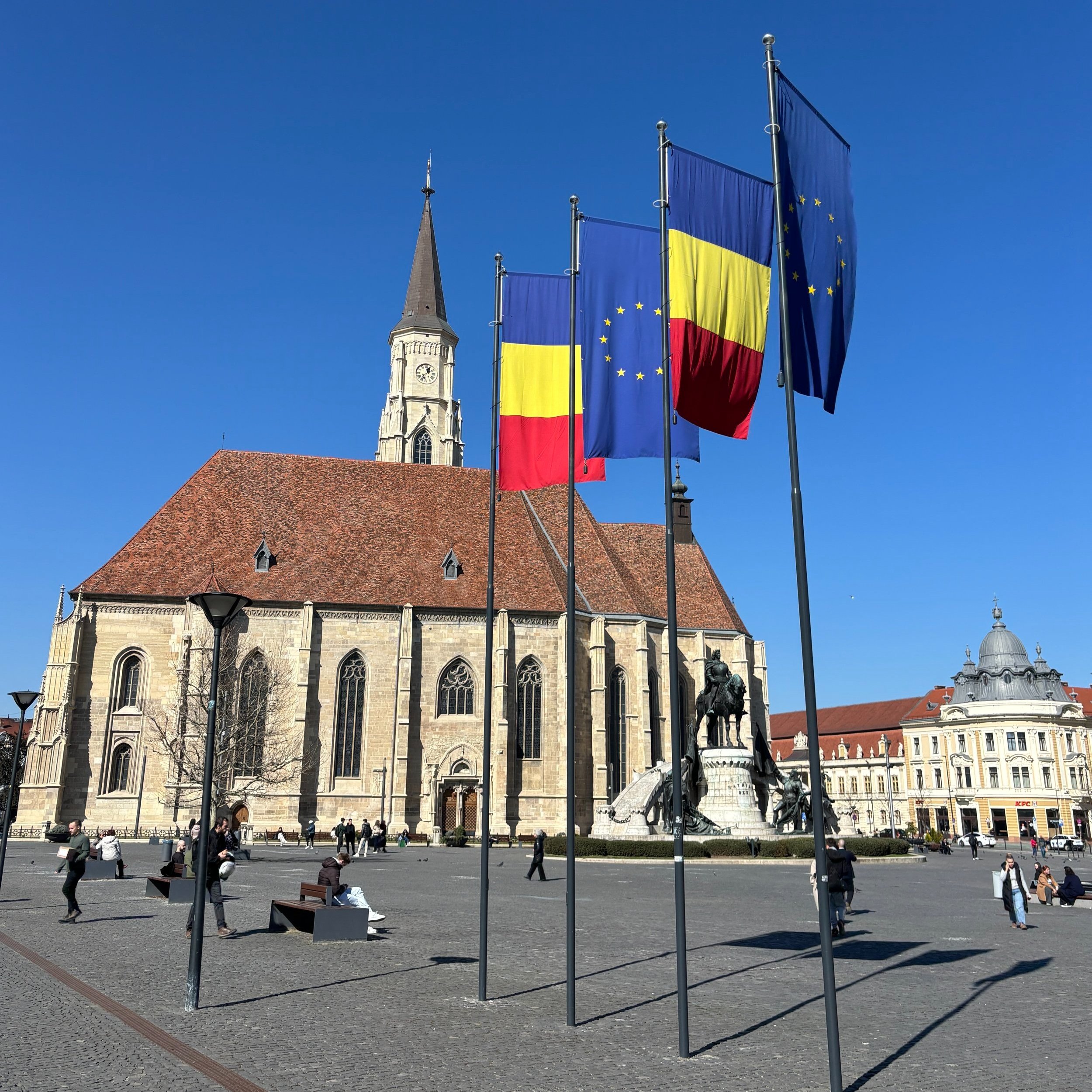
Top things to see and to do in Cluj-Napoca, the heart of Transylvania

A recent aviation conference, Aviation-Event CLJ 2025, hosted by Avram Iancu Cluj International Airport, provided me an ideal opportunity to set foot in Romania for the very first time.
And what can I say? It totally surpassed my expectations!
Cluj-Napoca turned out to be a truly hidden hem (in fact, increasingly less hidden, since airlines are connecting the city to an increasing number of destinations throughout Europe and beyond), with a rather pleasant, tidy, beautiful and very walkable city center.
In this post I will share what I think are the top things to see and to do in Cluj-Napoca, the city that has come to be known as the “heart” of Transylvania.
To be clear, this was a short stay, but Cluj-Napoca’s historical center is not huge, so you can get a good grasp of the place in a couple of days, which is the amount of time I spent sightseeing in Cluj.
A walk through the old town of Cluj
Cluj-Napoca is an ancient city. In fact, the second part of its name, “Napoca”, which was added in the post-war years, is a reference to its past as a Roman colony.

Romania takes big pride in its Roman heritage (starting by the name of the country itself!). In fact, the fortified Roman city of Napoca was one of the northermost Roman outposts in this part of Europe, almost at the limits of the Roman province of Dacia.
But, this is only part of the story, because, like many places in this part of Eastern Europe, borders have changed frequently in this part of Europe and populations and languages have mixed, with different linguistic and national groups often living side by side for centuries.
This is also the case of Cluj. For long time the city was part of the historical kingdom of Hungary (with some prominent Hungarian kings being actually born in the city). It later became part of the Austro-Hungarian Empire and, finally, joined the independent state of Romania.

An obelisk marking the visit to the city of Cluj of Austrian Emperor Francis I in the early 19th C.
In addition to the Romanian-speaking population, which today is the vast majority, Cluj, like the rest of Transylvania, has also a sizable Hungarian-speaking minority and, until WW2 it had also substantial, Jewish and German-speaking (Saxon) populations too.
This diverse cultural mix is reflected in the fact that the city has three names. In addition to its Romanian name Cluj, the city has also been known historically as Kolozsvar (Hungarian), Klausenburg (German) and Claudiopolis (Latin).
Likewise, the center of Cluj has historically been dotted by churches of different confessions (Roman Catholic, Romanian Greek Catholic, Romanian Orthodox and Protestant) in addition to synagogues (most of the Jewish heritage was, sadly, lost during WW2, when the local community was deported and killed by the Nazis).

We had the privilege to be guided around the center of Cluj by Catalin, of Cluj Guided Tours, who helped us understand the many nuances and rather complex history of this city and the different peoples that have shaped its past.

The present-day historical center of Cluj corresponds roughly with what used to be within the walled perimeter of the city, but fortifications were torn down by the Austrians in the 18th C. so only a couple of towers remain in place.


The city center has a handful of pedestrianised cobbled streets of the sort you find in many of the cities across what used to be the Austro-Hungarian Empire. Fortunately, and unlike in other cities in this part of Europe, this area hasn’t been overtly taken over (at least not yet!) by Irish pubs and souvenir shops!
One of the key points in the old town is this whitewashed house depicted in the picture above (in fact, as our guide explained to us, it is the amalgamation of three different houses), where one of the greatest Hungarian kings, Matthias Corvinus, was born in the 15th C. A plate by the door marks this event.
It is said that the king later granted a long-lasting tax exemption to the inn where he was born.
Equally interesting is the adjacent and somehow “newer” part of town, which contains most of the 18th and 19th C. buildings, kept in perfect condition, together with a handful of broad avenues and commercial streets.

It is here where we find another of the city’s singular monuments, the Monument of the Signers of the Transylvanian Memorandum, which alludes to an episode in the late 19th C., in which Romanians living within what was then the Austro-Hungarian Empire petitioned the emperor in Vienna for equal rights as a national minority.


The Church of Saint Michael, Cluj
The center of gravity of Cluj is Unirii Square, a wide open space which contains two of the city’s landmarks: Saint Michael’s Church and the monument to Mathias Corvinus, the aforementioned king of Hungary.

Besides its monumental appareance, flanked by grand buildings on pretty much all sides, Unirii Square acts also as a nexus between different parts of the city center: the old town, the commercial area and the university area, and it sees a constant flux of people.
The Church of Saint Michael is a rather remarkable and beautiful building, with plenty of light coming in through its stained glass windows.
The church was originally much more extensively decorated, but most of this decor was either smashed or covered during a period, in the 16th C. when it was taken over by Protestants. It later returned to the Roman Catholic Church and some of those artistic elements were restored to some extent, like some of the frescoes you can see in the picture below. The elaborately carved wooden lectern was also preserved.


Cluj is a university city
Another element that makes contemporary Cluj stand out is its university activity. About one in four of the city’s inhabitants is a student!
This has also helped Cluj become a center of knowledge-based industries in Romania, such as IT and pharma, although many of the major faculties are actually located around the old town, for example in the area depicted below (the style of which reminded me of Italy somehow!).

What to see in modern Cluj
It is not all about the old town in Cluj. The more modern bits of the center are not devoid of interest.
It is worth walking to Avram Iancu Square to see the Dormition of the Theotokos Cathedral, which it is actually quite recent (for the standards of the rest of the city) and was completed in 1933. The square is named after local national hero Avram Iancu (the same who gives name to the airport!), who campaigned for the rights of Romanians within the Austro-Hungarian Empire in the 19th Century. Iancu has also a statue in the middle of the square.
Opposite the cathedral there are a number of remarkable ornate buildings form the same period, including the Romanian Opera House (there is another opera house in Cluj, the Hungarian one!).


Also, not far from there are the works of the new Greek Catholic cathedral, which, apparently, have been ongoing for a rather long period of time, to the point that our guide compared them to Gaudí’s Sagrada Familia in Barcelona, not a far-fetched comparison!

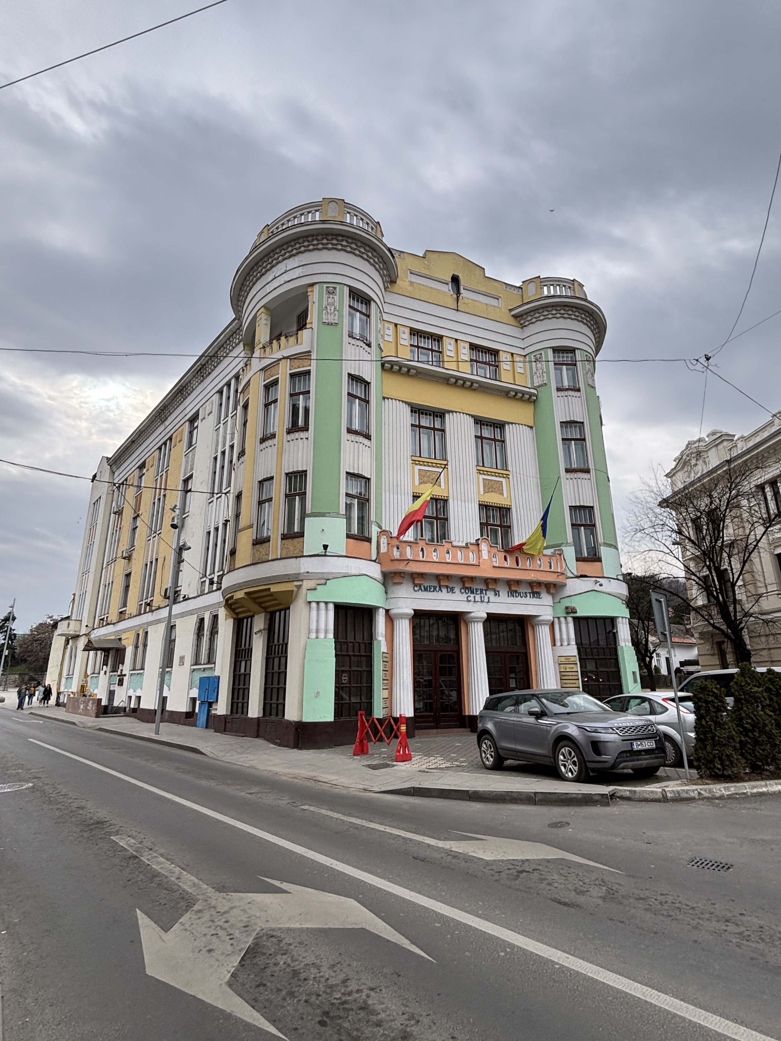
Throughout the center you can also find quite a few remarkable buildings, most of them built sometime in the late 19th or early 20th C. periods.


Cluj has also its fair share of Communist-era brutalist buildings, although most of them are in the outskirts of the city (you see quite a few of them on the way from the center to the airport).


The river Someșul Mic (with its adjacent canals) flows through the very center of Cluj, just north of the historical center.
This is not a large river, but it offers some sights from atop its bridges and it is also flanked by some green recreational areas, such as Cluj’s Central Park, which shall see shortly.

Walking through Cluj’s Central Park
Cluj’s Central Park (“Parcul Central”), a broad and elongated, recreational area next to the old town, is a rather remarkable space.
It is was given this recreational function already in the 19th C. and it has the look and feel of the urban gardens of that era (it has some pavilions dating back to those times, which are now waterside restaurants and cafés).

The Central Park has preserved its original structure, with three parallel tracks running through it. The central one was for carriages, while the two lateral ones were for people riding horses and walking, respectively. They were separated by greenery and small irrigation ditches joined by these cute little wooden bridges you can see in the pictures.


At opposite ends of the park you find two other Cluj landmarks.
On the west side are the stadium and sports pavilion (both quite large for a city of this size). Next to the stadium there is also an open air fair of traditional Transylvanian products.
At the other end, where the park meets the old town, there is this monument (below) dedicated to all those that opposed the Communist dictatorship. Notice the broken shackles and the fractured hammer and sickle, pretty strong symbolism here!

Grabbing some food on the go in Cluj

Since I was having all my meals at the conference I was attending, the gastronomic section is going to be quite limited this time.
However, I would like to share the coordinates of a small bakery where I stopped to have a bite during my sightseeing walk.
If you are just looking to eat something light and rest a bit while on the go, you can’t go wrong with this one!
Community Foods Bakery
Strada Regele Ferdinand 3
Cluj-Napoca 400110
Where to get the best views of Cluj

For a bird’s view of central Cluj you would need to climb up to Centatuia Hill, which overlooks the old town across the river. The most straightforward way to get there is to just walk uphill from the center, it’s a bit steep but, if you are in ok shape should not take more than 15-20min.
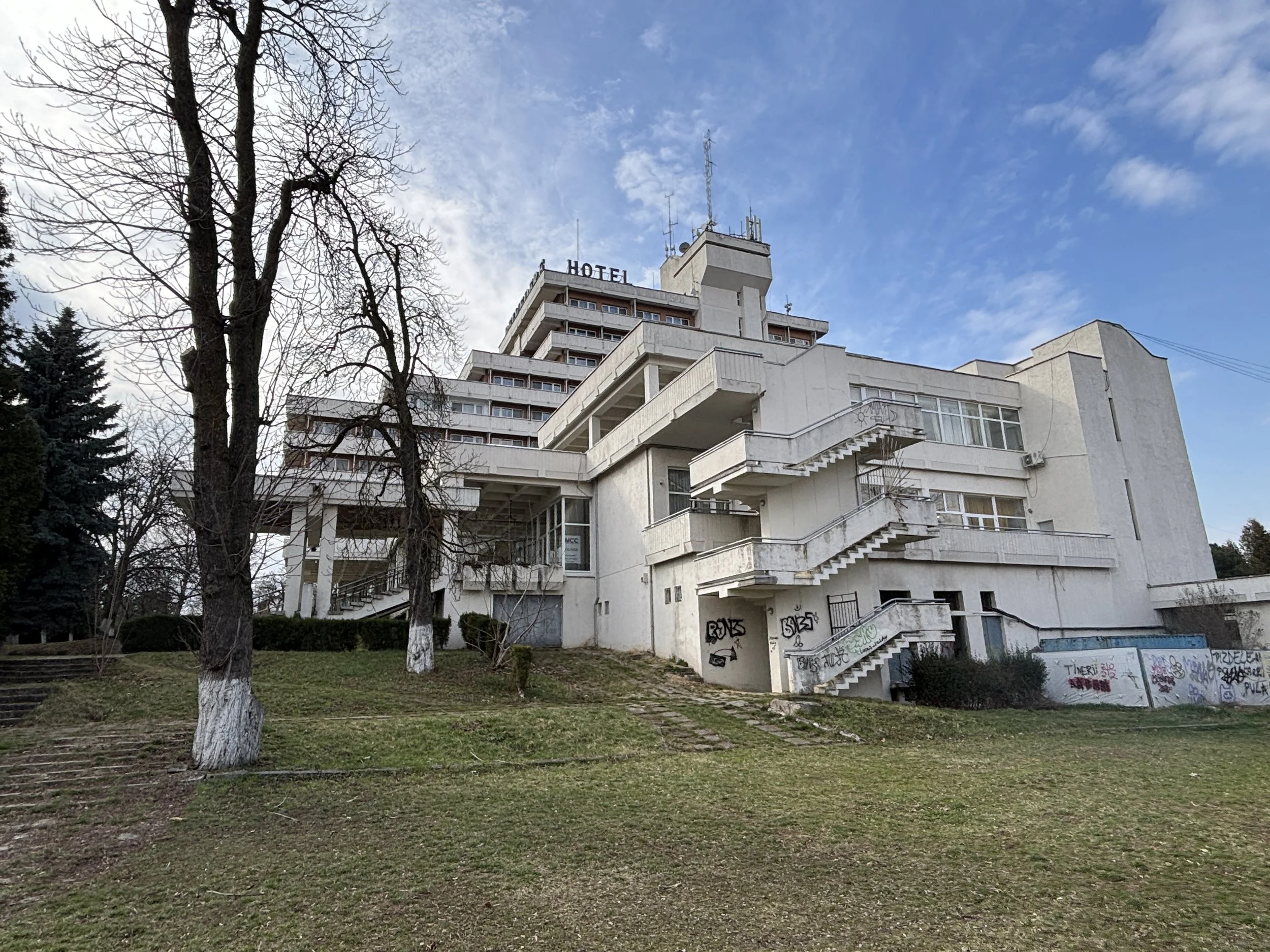
The Austro-Hungarians built a fortress on top of this hill (partly replacing the old city walls as a defensive stronghold), but almost nothing remains today of that.

On this spot, later on, the Communist regime built the “Transylvania Hotel”, which was later renamed as “Belvedere Hotel” because of the hill-top views.
This was the hotel of reference in Cluj during that era and it is still open to this day as a hotel, although today its interior today looks a bit like time-travel to the 1970s
Where to stay in Cluj

Here is the hotel recommendation for Cluj-Napoca:
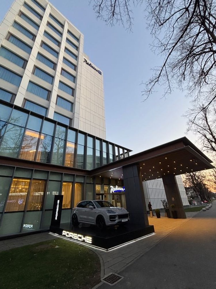
Radisson Blu Hotel, Cluj
Aleea Stadionului 1
Cluj-Napoca 400372
This was the venue of the Aviation-Event conference and it was a rather pleasant stay.
The hotel is very modern and it has a nice location, at the western end of the Central Park, just opposite the stadium. Service was impeccable throughout.


48 hours in La Rochelle, Île de Ré and Rochefort: what to do and what to see
The history and fortunes of the French historical port of La Rochelle and its adjacent island, l’Île de Ré, are intrinsically tied to the Atlantic Ocean. In fact, the whole Charente Maritime region, where both are located, has always leaned on the sea as a source of wealth and activity. This extends, as well, to the nearby, also historical town, of Rochefort, which, while laying quite a few miles inland on the river Charente, was for centuries a major French navy base.
What follows is an account of my brief, two-day visit to this region and the places that I visited. By no means do I claim it to be the most exhaustive and comprehensive guide you can find on this region, but it presents a few ideas about interesting places you can visit if you have a car (important!) and a rather time-constrained schedule, as it was my case.

One particular aspect which you will find, perhaps missing to a large degree is gastronomy, since I prioritized sightseeing (and being on the move) to sitting down to have a proper meal. But I must say, that, having seen what I saw, I wouldn’t mind going back some day, with more time (and a larger budget!) to tick this box too!
So, here’s my short chronicle of my trip to La Rochelle, Île de Ré and Rochefort…
A walk through La Rochelle: the Vieux Port and the Old Town
La Rochelle has a truly majestic old port, with two stone towers giving access to its historical basin. This is, after all, a city which has played a key role in many episodes of the history of France. Since La Rochelle was a protestant bastion it played an important role in the French wars of religion in the 16th C. and it was, later on, besieged by royal forces led by the famous Cardinal Richelieu when he was combatting the Huguenot revolts in France in the 17th C.

It was also from La Rochelle through which most trade and immigration towards “New France” (Nouvelle France), that is, present day Québec, was conducted. So, the city’s trade networks extended across the Atlantic and onwards to many other ports throughout Europe.

Last but not least, La Rochelle was also a major German submarine (U-Boat) base during WW2 and there are some remarkable sites linked to that period.
Unfortunately, the impressive U-Boat bunkers at La Pallice (which were so solid that it was not possible to demolish them after the war) are off visits, since they are within the industrial port complex, although in summer it is possible to get close from the seaside if you book one of the organized boat tours of the port.
So, visitors interested in that episode of WW2 history that took place in La Rochelle have to make do with a visit to the, somehow misleadingly named “U-Boat Bunker”. It is advertised this way, and while it is true that it is a bunker and that it is linked to the U-Boat activities in the city, it is, actually, a much smaller facility which was built downtown to protect the valuable submarine commanders during air raids. I am sure it is also quite interesting to visit, but, unfortunately, at the time of my visit it was closed, so this is one of the things I will have to leave for my next time in the city. If you wish to learn more about it, though, you can have a look at it here.

My hotel (more on this further below) was quite close to the main train station and the historical center, so I went for a walk along the historical quays and the old town, which was quite nice, since it was a sunny, although quite cold, afternoon.

Went for a night walk, as well…


Overall, La Rochelle is a very tidy and clean city and the area next to the quays was truly lively and packed with people walking around and also sitting at the numerous cafés and restaurants.
The area on the far side of the basin from the old town is also not devoid of charms, there is an large aquarium and a maritime museum (which, like in the case of the bunker, could not visit do to timing) and a few interesting historical ships docked alongside.


One of them is the “Shtandard” a replica of a 18th C. Russian sailing ship which goes on tour regularly and that I had actually visited when it docked in Barcelona some years earlier!

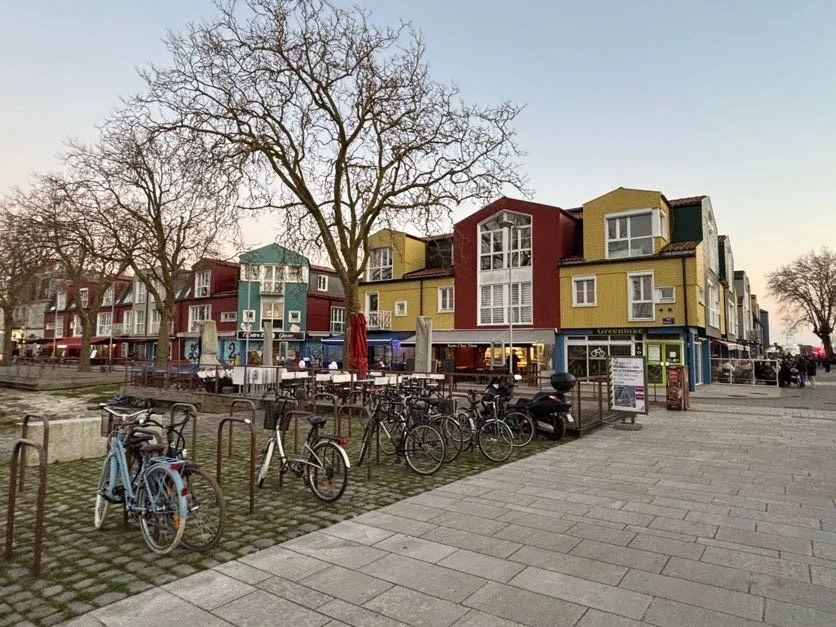
I also found quite interesting a small area by the quays with small colourful houses, something which reminded me somehow of Scandinavia.
Where to stay in La Rochelle
B&B La Rochelle Centre Hotel
140 Bd Joffre, 17000 La Rochelle
https://www.hotel-bb.com/es/hotel/la-rochelle-centre
I opted for some place that offer good value, with some parking space and not far from the center, and the B&B Hotel ticked all the boxes (there are two B&Bs in La Rochelle, so make sure you check which one is yours! My navigator took me to the wrong one, which is not far away, a bit of oversight on my side!)
This is a functional hotel, do not expect luxury, but if you are looking for something modern, clean and efficient, I think the quality-price was pretty good. Staff were also very friendly.


It has a parking that costs €8 for 24h, although if there is quite a lot of parking space on the street it is located in, which is free to park in the evening from around 6pm to 9am and on Sundays, so depending on the times you need to park it may also be an option.
Where to eat in La Rochelle
Un Voyage à Damas

13 Quai de Marans, 17000 La Rochelle
As mentioned earlier, gastronomy is one of the aspects of my trip that were possibly sidelined in favour of having more time to see more sites and places. Nevertheless, I sat down for a quick dinner at a Syrian restaurant that I came across during my walk back to the hotel from the old town.
It was correct overall, you can see how they prepare the food. Service was good.
A day driving through the Île de Ré
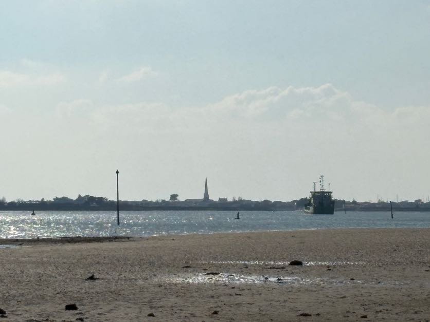
The Île de Ré is an island located just off La Rochelle. In fact, it is not close to the mainland that it is linked by a suspension bridge (there is a toll which costs around €4 and is paid only on accessing the island, not on the way back).
So, I decided to go on a full tour of the island, all the way to its furthest point and using the northern road, which runs through the picturesque towns of La Flotte and Saint-Martin-de-Ré.

The Île de Ré seems to be an upmarket holiday destination in France, popular with French elites, a bit like the Hamptons is in the East Coast. And I can see why.
Île de Ré is a low-lying island where water is literally everywhere, not just on the ocean side, with long, open beaches, but it also has plenty of marshy areas where fine salt is harvested and oysters are grown. So, even if is not really a “wild” landscape, you always have the feeling of being close to nature. Also, the island’s few towns have, generally speaking, been remarkably well preserved and well kept and there is no shortage of interesting sites.
Pit stop at Rivedoux-Plage

Rivedoux-Place is the first village when you access the island and, while it doesn’t get mentioned in most of the online guides and other tourist information material I gathered about IÎle de Ré, I thought it was worth a mention here, since I found this place not devoid of charms.
As soon as you leave the bridge, the “island vibe” is evident, hard to describe in objective terms, but surely the feeling of being very close to the sea, which is obvious in Rivedoux, as the road soon starts tracing the contours of the coastline. At low tide present quite an interesting landscape, with the mainland bridge in the background and, even a few people venturing into the mud flats to pick up shells and other seafood.
Where to eat in Île de Ré (Rivedoux-Plage)

Perhaps my opinion of Rivedoux-Plage is also shaped by the fact that I enjoyed a great breakfast here:
Boulangerie Feuillette
126 Av. Gustave Perreau, 17940 Rivedoux-Plage
The choice of pastries and sandwiches at this place was simply mouth-watering and quality turned out to be great as well, as was the coffee and a very, very reasonable prices. Plus service was excellent (they even added a complimentary little pastry to my breakfast) and it offers a cozy environment with views to the sea. There is also some not crowded parking space next to it. I, actually, liked it so much that I stopped again in the evening in my way back.
Abbaye des Chateliers
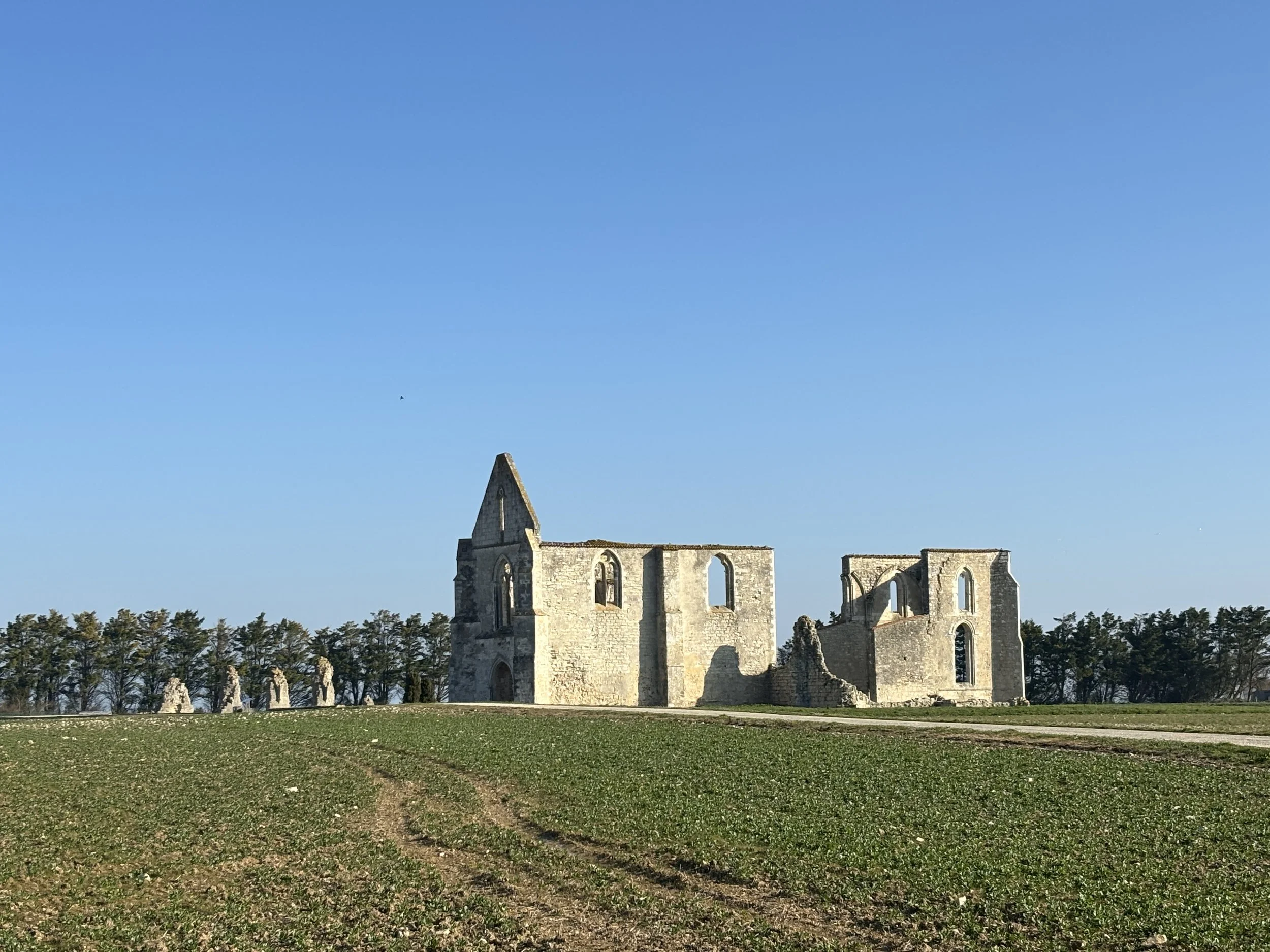

It doesn’t take long after you leave behind Rivedoux-Plage for the many suprises that this island has in story to come into sight.
While I tried, unsuccessfully, to get a good view of the 17th C. Fort La Prée fortress (it was closed at the time of my visit), the ruins of the Abbaye des Chateliers, a 12th C. came into sight. These are located on an open field in a somewhat elevated plateau overlooking the sea.
There is a small parking space next door and some walking paths. The ruins are just the few walls standing, with some signs providing contextual information. In fact, the site is beautiful on its very own, particularly in a sunny, cold day, as it was the case, but the old derelict structure makes it rather special.
Visiting Saint Martin de Ré

The next stop was Saint-Martin-de-Ré, which is the largest town of the island, its “capital”.
The first thing that comes into sight are the imposing 17th C. ramparts, complete with a moat, and several buildings that, from the look of its, seem to still have a military function. Following the signs I got to a large outdoor parking which is on the east side of town, just outside the perimeter of the old town.
From here is a nice 2min walk to the old port following the seaside fortifications.
The center of Saint Martin de Ré didn’t disappoint! The area around the quays is perfectly well kept with the type of stone buildings and historical façades that are typical in this part of Atlantic France. I guess the sight hasn’t changed that much since the 18th C.

One interesting feature here is that the port is divided in two sections, one of them gets emptied of water in low tide, as it was the case at the time of my visit, with all boats being left literally in the mud. Another, inner part of the port, keeps its water thanks to a system to locks. This is, apparently a rather old system that has been place for centuries.

Saint-Martin-de-Ré was an important trading port in centuries past, exporting mostly salt from the island’s many marshes, as well as being the point of departure towards the penal colonies of many French prisoners, all the way until the first half of the 20th century.
The quay area is right now full of chic stores, selling fashion items and upmarket souvenirs (I really liked the nice vintage-style postcards on sale at several of the island’s shops) including a store dedicated exclusively to Tintin (the only one in France apparently!). The old town is dominated by the structure of the old medieval church (another derelict religious building!), most of which has been in ruins already from before the time of the French Revolution! (although a smaller church was built right next to it and it is active to this day).


Most of the interesting sights are along the quays, which make for an interesting walk.
There is also a tourist information center next to the parking lot, where you can get maps of the island and where I got perfect service when I went to ask for some itineraries.
Visiting Ars-en-Ré, one of France’s most beautiful villages

The next stop was Ars-en Ré, a small village located close to the island’s narrrowest point, on a narrrow strip of land with the sea on one side and a lagoon on the other one.
Ars-en-Ré is one of “Les Plus Beaux Villages de France”, a network which gathers close to 200 of the most beautiful villages in France. Members of this network must have some intrinsic aesthetic qualities and must also adhere to certain conditions and standards to remain small and cute.
There are, actually two such villages on the island of Ré, the other, La Flotte, I could only pass by very quickly, since by that time it was already getting quite late.
Ars-en-Ré has a small network of pedestrianised streets lined with whitewashed houses. But the main reference point is the triangular church steeple, in the center of the village. This structure, like it was the norm in Île de Ré in the past, is painted entirely white (the lower part) and black (the tip), because it had also a role as beacon, visible from far out at sea.
Where to eat in Île de Ré (Ars-en-Ré)
Le Fournil d'Ars-en-Ré
28 Pl. Carnot, 17590 Ars-en-Ré
Yes, another bakery!
But if you don’t want to spend much time sitting down, this place has a really nice assortment of sandwhiches and pastries and it is conveniently located on the village’s main square.

Btw, Ars-en-Ré has also a small port, which doesn’t open into the sea but onto the northern lagoon. At the time of my visit this area was undergoing some public works, so it was hard to access the lagoon from here and had to drive around all the way to a place called La Patache, which is on the northern side of the island, where the lagoon meets the open sea.
Phare des Baleines

This is a place I would definitely recommend visiting if you come to Île de Ré. The lighthouse is located at the westernmost point in the island, it’s all the way to the Newfoundland from here!
Besides being rather beautiful , a sort of textbook lighthouse in its shape. It is also the tallest structure in many miles around.
It is possible to go up, although beware, it requires climbing a spiral staircase with quite a large number of steps! (no lift available). The top of the lighthouse gives you a great 360º degree view of the islands and the surrounding ocean. So, it is well worth it if you can manage.
It was extremely windy when it went up!


At the base of the lighthouse there is a small exhibit explaining lighthouse technology and the history of lighthouse building in France. Pretty simple but quite interesting.
And, last but not least, despite its small size, the souvenir shop (which is also where you buy the tickets to go up the lighthouse, has also a rather amazing bookshop dedicated to naval and maritime topics!
Once you have visited the lighthouse, I recommend taking the small path that runs along the beach, which is called “Conche des Baleines”. This is a long, sandy beach open to the ocean which you can access by flights of stairs located every certain distance.

The beach was at low tide when I visited and it was possible to walk through the wet sand dotted with podles and seaweed. A number of long stone structures protrude from the beach into the ocean. These are "écluses à poissons", or “fish-locks” and have been used by the locals for many centuries to trap and capture fish when the tide recedes. These are an element of historical heritage and it is forbidden to walk on them or trample with them in any way. There used to be almost 150 of these all over the island, but only a small number are still currently in use.

If you walk another 500m towards the north you will come across another interesting historical site, this one not so ancient: two WW2-era German bunkers.

These were built as part of the “Atlantic Wall”, which the Germans built during WW2 to prevent allied landings (which finally took place in Normandy). The bunkers are currently half destroyed, since the sand dunes that they were built over have shifted with the years and parts of the structure have fallen over and been partly covered by sand, but it is still possible to inspect them from up close.


This beach has also an additional connection to WW2: it was here that the Omaha Beach scenes of the 1962 epic movie “The Longest Day” (possibly one of the best films about the way ever made) about the D-Day landings were filmed!
The coastal path all along the coast, following roughly the top of the dune ridge, quite a pleasant walk if you have the time!
Further north is another sizable village, Les-Portes-en-Ré, which I just skipped on my drive to La Patache, which is at the point where the island’s lagoon meets the ocean. Most of the island’s salt flats are located all around the lagoon, as are also some aquaculture establishments. However, there is not much to see, since the landscape is quite flat, with only the steeple of the church at Ars-en-Ré standing in the distance, on the far side of the lagoon, as the only recognizable landmark.
The return trip was following roughly the same route, with an stop also at several of the beaches along the way. The tide was now up, which made for an interesting change!

Visiting Rochefort

Since I had to drive to Bordeaux airport on my way back, there was a chance to explore some other sites of interest in the Charente Maritime region. So, I decided to make a stop at Rochefort, which is some 40km south of La Rochelle.
This town, located on the banks of the meandering Charente river, was between the 17th and early 20th centuries, a French Navy base and arsenal and its main sight is closely connected to this naval heritage.
La Corderie Royale

This very long and narrow building was, from the 17th C. and throughout the sail ship era, an industrial facility that produced all sorts of ropes for the French navy’s sailing ships (“corde” means rope in French, so “corderie” is the place where ropes are made).
The long ropes used on sail ships had to be extended to their whole length during parts of the manufacturing process, hence the 374 meters-long structure along the banks of the river Charente!
The place lost its importance after the navy switch to thermal forms of propulsion, which means that sails and ropes were no longer needed. The Corderie Royal was then abandoned and pretty much fell apart, until some local politicians had the idea to recover it for the city in the 1970s. It was then pretty much rebuilt to its former appearance and given a new use as a museum and cultural center.

Today part of the Corderie Royal is a museum explaning the past of this building, the rope-making process (with some rope-making artisans demonstrating the process on site) and the history of Rochefort as a French Navy town. Another part of the building hosts temporary exhibitions.

Stopping at La Galaxie des Pierres Levées

I stumbled upon this place literally by chance when doing a mid-way stop on the motorway between Bordeaux and La Rochelle.
In fact, prior to seeing it, I had never heard of this place, but found it unique enough to include it in this story.
La Galaxie des Pierres Levées is a massive conceptual art installation located next to the Pierre de Crazannes rest area (“Aire de la Pierre de Crazannes”) on the A837 motorway, not far from Rochefort, actually.
The sight is quite impressive (and a bit weird, tbh!) and it consists of a huge number of megaliths laid out in an open field.

The Galaxie des Pierres Levées (which would translate as “the galaxy of standing stones”) represents the five continents, represented by five megaliths at its center. From there, several arms stretch out in spiral, each with hundreds of sculpted megaliths. Apparently there are several artists, from different parts of the world, working on the stones each year. When completed it will have a total of 365 stones.
But this is not some strange archaeological site. It is in fact an installation, devised by an artist called Alain Tenenbaum. It started to take shape in 2005 and is expected to be completed by 2060. The site opened to visitors in 2023 (free entrance, just walk in) and new stones are being added on a yearly basis.
I wonder what archaeologists of the future will make of this!

Things to see in Bulgaria: Plovdiv and the Buzludzha Monument

A recent winter trip to Bulgaria (to attend the Aviation-Event SOF 24 aviation conference) offered the me chance to venture beyond the capital, Sofia, and explore the central part of the country as well.
My itinerary included a morning visit Plovdiv, which is Bulgaria’s second city, as well as a drive to the Shipka area, at the foot of the Balkan Mountain Range that crosses the country from West to East. The latter has quite a few things going for it.
In fact, the main reason for me to drive all the way to Shipka was the possibility of finally visiting the Buzludzha Monument (“Паметник на Бузлуджа”), one of the most eye-catching Communist-era buildings in Eastern Europe. Its truly unique and bizarre architecture is quite a thing, particularly if visited on a foggy, cold day, as it was the case!
But there are other interesting to see and to do around Shipka, starting by the amazing landscapes, and continuing with the beautiful golden-domed Orthodox churches and Ancient Thracian tombs that are found all over part of Bulgaria.
By the way, a note on logistics: Plovdiv and Shipka are not very distant from each other, but it’s at least a good 2-3 hours from either of them to Sofia and another 1.5h drive between Plovdiv and Shipka. So, if you intend to see both I highly recommend an overnight stay in the area.
A morning in Plovidv, what to do and what to see
Located in a plain in Central Bulgaria, Plovdiv is a very old city, one of the oldest in Europe, in fact.
This area was populated by the Thracians, an Ancient people, which gave to History the famous Spartacus, leader of the largest ever slave revolt against Rome (and depicted in several movies and TV series, the best of which possibly Stanley Kubrik’s, shot in 1960 and. with Kirk Douglas playing the main Spartacus role).
With Ancient Trace being located at a major cross-roads of the Ancient World, at the intersection of the routes linking the Balkans, Asia Minor (present day Turkey) and the Greek World, the city that, in due time, would become Plovdiv, saw quite a few comings and goings.
A big part of the heritage you can now find in the city dates back to the Roman period, when the city was known as “Philippopolis” (which evolved until getting to the present name, Plovdiv).
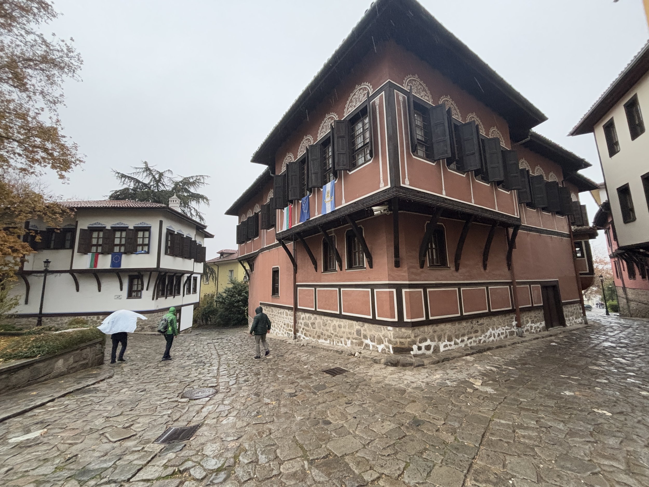
During our short walk through Plovdiv we could see some of those Ancient remains and also some relatively more recent, but also interesting, parts of the old town with buildings that date back to the Bulgarian “Revival Period” of the 19th C. This historical period, which gave origin to a specific type of architecture and aesthetic, is called this way because it is when Bulgarians started to assert their own national and cultural identity under the Ottoman domination.
Worth mentioning that during our Plovdiv excursion our guide was Lubomir Botev, of Traventuria, who provided excellent indications and explanations throughout the trip.
Visiting the Roman mosaics of Plovdiv

One of the archaeological highlights of Plovdiv are the late Roman mosaics at the site of the Ancient Episcopal Basilica of Philippopolis.
These mosaics are now preserved under a roof and there is a relatively new museum building which explains their history, but, unfortunately, it was not always like this. For decades these mosaics were not particularly well kept, particularly during Bulgaria’s chaotic 1990s, and they suffered some damage and even theft.
Fortunately this seems to have been solved now and the mosaics are currently exhibited within a rather impressive setup. As the name implies, the museum is located at the site of the city’s late Roman and Byzantine basilica, which was a major civic and, later, religious building, hence the richness of its decoration.

Most of these mosaics contain references to religious concepts and themes, even if many of them are in the form or rather cute animals and birds. As the excursion’s guide told us, some of them seem designed so that each spectator can more or less come up with its own version or interpretation of what they want to tell us.

As it is common in many ancient sites, the Episcopal Basilica of Plovdiv was modified and transformed several times throughout history and you can see the different layers of mosaics, which in some places are several feet thick.
Overall the current museum makes a great job of telling the story of the place and it is even fitted with some fancy hologram tech that allows you to “interact” with some of the figures that appear depicted in the mosaics. Definitely a must visit in Plovdiv.
A boutique hotel on top of the old Roman baths
Villa Flavia Heritage Boutique Hotel
ul. "Otets Paisiy" 13
4000 Plovdiv, Bulgaria
But the mosaics at the Episcopal Basilica Museum is not the only ancient site you can see from up close in Plovdiv. In fact, most of the Roman and Byzantine city is embedded in the modern town, or rather underneath it.
An example of this is Villa Flavia, a modern boutique hotel which happens to be right on top of Plovdiv’s old Roman baths.
When the site where the hotel now stands was being developed, workers uncovered the remains of the old Roman baths, so the solution was to integrate them into the structure of the hotel, which, in fact has made of this feature a unique sign of identity and differentiation.

When you come into the hotel’s small lobby, the first thing you come across is a round hole on the ground covered with a glass you can walk over. This is a window onto the archaeological layer of the hotel, which can also be visited downstairs.
Walk one floor down and you get to see some of the structures of the old Roman baths, such as the hypocaust, which were the chambers through which hot air was let through it order to heat the bathing area.
The hotel has also a lovely courtyard decorated with Roman-style columns, it’s a pitty that it was such a rainy day! So, now you know, if you are looking for a rather unique and nice place to stay in the historical part of Plovdiv, this is a good option to check!


From Roman ruins to the Bulgarian Revival period
Our walk through central Plovdiv continued, next, towards another highlight of the ancient city: the amphitheatre.
While there are quite a few old Roman amphitheatres out there, this facility was a must for every self-respecting Roman city, the one in Plovdiv has the particularity of being truly enmeshed into the urban fabric. In fact, the Roman amphitheatre of Plovdiv is located right in the middle of one of city’s main commercial streets.

Bulgarian Revival-style Architecture in Plovdiv
But not everything to see in Plovdiv dates back to the Roman times!
A large part of the old town is made of the relatively more recent, but also pretty charming cobbled streets lined with houses dating back to the Bulgarian revival architecture period.
This is a style that became popular in the 19th C. as Bulgarians started to assert their wish of independence from the Ottoman Empire. This is a part of the city that gives a truly Balkan feel to Plovdiv.

Several of these houses, most of which used to belong to prominent trading families of Plovdiv, can be visited. We visited one of them: Hindliyan House.
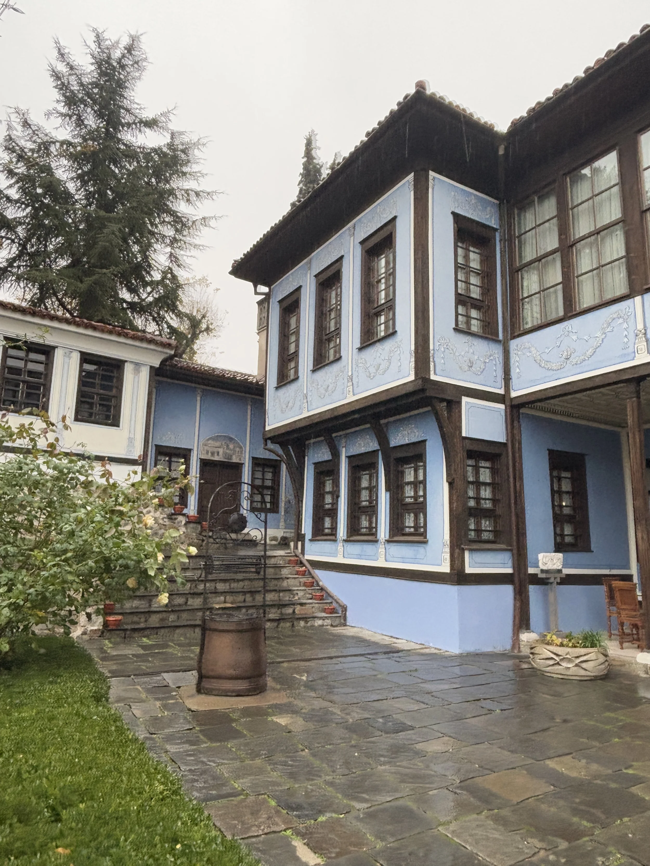

Built in the 1830s, this blue-painted house was the home and business HQ of Stepan Hindliyan, a Plovdiv merchant of Eastern origins.
The trading community of Plovdiv had many international connections and this shows in the decor and features of the house.
Although the predominant style is local, it contains also several international references and had some features that were considered incredibly advanced at the time, such as a marble bathroom.


This house, which is not huge and can be seen in about half an hour, is very well preserved and it offers an interesting glimpse into the lifestyle of the affluent classes of old Plovdiv.
On the road to the Buzludzha Monument: things to see in Shipka

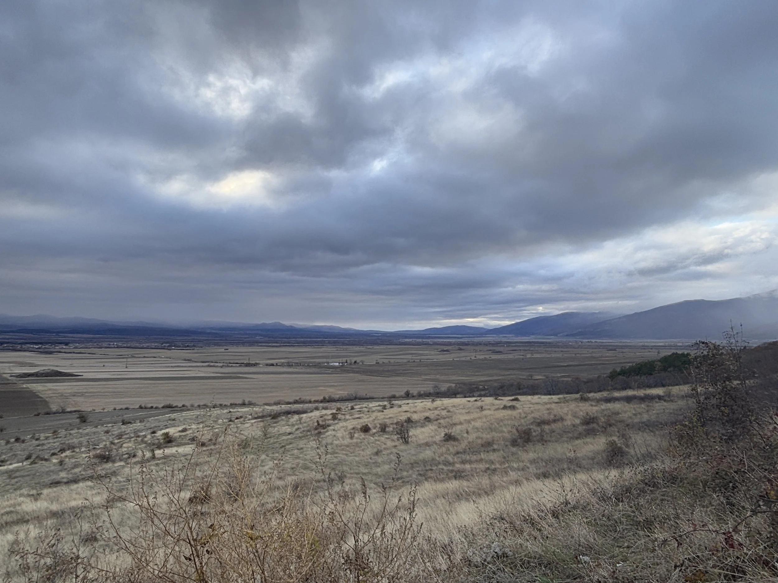
About 1.5h drive north of Plovdiv you come across the Central Balkan Mountains, which run west to east across a large swath of Bulgaria. Right at the foot of these mountains you find the rather picturesque district of Shipka.
The town of Shipka is at the southern end of one of the main mountain passes connecting the northern part of Bulgaria, that is the part of the country that lies on the north side of the mountain range, to the central and southern plains where Plovdiv is located.
In fact, the drive itself is quite a sightseeing experience, since this is a relatively rural part of the country and goes through some beautiful landscapes.

The road is reasonably good and it is also dotted with some remarkable roadside monuments erected during the Communist times. Some of them look a bit run down nowadays, but they make for a rather awe-inspiring sight, particularly in the Winter light. Quite an appetizer ahead of my visit to the Buzludzhda Monument, which was the primary reason I had come all the way to this part of Bulgaria.


Visiting the Buzludzha Monument

In the outskirts of the town of Shipka is one of the weirdest structures produced by the Communist regimes of Eastern Europe. The Buzludzha Monument was built on top of the peak of the same name at an altitude of around 1,400m. It is a huge concrete, some say UFO-shaped, building that was designed to be a sort of meeting point for high ranking officers of the Bulgarian Communist Party.
The Buzludzha Monument never saw much use, because the Iron Curtain fell in 1989 and the Communist dictatorial regimes of Eastern Regime collapsed with it. So, it soon fell into disrepair and, in fact, it is no longer possible to access the interior, where there are some large mosaics and other decor from that era.
Because of its really unique shape and location, the Buzludzha Monument has since become a sort of iconic archaeological site which draws a constant stream of visitors interested in that period of European history.

In fact, I was even a bit surprised to find several other visitors there, some from places as far as The Netherlands, since the previous day it had been snowing heavily in Sofia, Plovdiv and other parts of Bulgaria and the weather was still unstable enough that I had serious doubts about making the attempt to reach the summit. In fact, aside from the last 200m, which were at the edge of the clouds and in rather icy conditions, the rest of the road turned out to be clean of snow and in good conditions.
The place is truly impressive, even if a bit frightening, particularly in the challenging weather conditions that I came across, but this made the whole place a lot more scenic.

The grand hall indoors can’t be visited, though, so you will need to check online to see how it looks like!


It was necessary to walk with a lot of caution, since some surfaces around the monument were iced over.

So, at the time of my visit (in early December 2024) what you can do is basically walk all around the monument. There is a car park at the foot of the stairs that lead to the monument and from there there is a concrete platform that allows you to walk along the edge of the mountain and make a 360º circle around it.
There is little else to see (although I am sure that there are some urban explorers that have managed to break into it).


The Buzludzha Monument is atop a densely forested mountain area.
The road to access it from the side of Shipka (there is another route coming from the north side of the range) has quite a lot of turns, but it is rather wide and in good condition.
When I set out for the monument I was not sure whether it would be open all the way to the top, due to the winter conditions, but it turned out to be clean of snow.
There are also some buildings (I think one of them is a hotel and a restaurant) quite close to the monument, they seemed to be open, although I didn’t stop to check. Other than that there is no other service infrastructure between the plains and the summit.
How to get to the Buzludzha Monument from Sofia?
I had to do quite a bit of research before deciding to visit the Buzludzha Monument, so here are some of my impressions on the logistics of getting there. I know there are some agencies that offer guided tours to the monument, but I have no experience with those, so I would comment on how to get there on your own.
First of all: can you visit the Buzludzha Monument as a day trip from Sofia? Yes, I did that. BUT be warned that it is a rather long trip if done in one day!
Also, I would forget about going there in public transportation. You would need a car (or taxi) anyway for the last stretch of the road, so it is best to rent a car if you have this option and want to go on your own.
There are basically three ways to get to the Buzludzha Monument by car from Sofia:
From the northern side of the mountain range (route E772 and then via Gabrovo). I can’t comment on this one, since I didn’t do it, but I heard from Bulgarian people with knowledge of the matter that it is better to avoid this option, particularly in Winter, and it is best to get there through the south side.
Taking the A1 motorway (Bulgaria’s main highway) towards Plovdiv and then take the exit northwards towards Route 64 and connecting with E871, and then head east and then north to Shipka. This is probably the fastest and most comfortable way to get to the Buzludzha Monument from Sofia. It is a bit longer in total number of kilometres, but the A1 Highway is well maintained and convenient to drive through. The roads between Plovdiv and Shipka and one lane on each direction, but they run through mostly flat or slightly hilly ground, and are in a decent condition, so it is a relatively nice drive.
From Shipka to the Buzludzha Monument there are two mountain roads. I took the most southerly one, which runs from a spot halfway between Shipka and Kazanlak. It turned out to be a much better road that I expected from the way it looks in the map. It zigzags up the mountain, but it is actually quite wide and in good condition.
Some online reviews point out at potholes, and while there are some, they are very manageable. I also read that there may be snow in Winter and I would certainly expect that in very snowy days, since it goes up to 1,400m and winters in this part of Europe are cold, but when I visited in December it was clean despite the previous days having snowed a bit. In this regard, there’s an app called LIMA, which provides real time updates on the state of Bulgaria’s roads.
Finally, there is another way to reach the Buzludzha Monument from Sofia, also from the south side, and this is taking E871 all the way. I did that on my way back to the capital. The road is ok, but it is a two lane road and it goes through the middle of many villages, so it is rather slow. It is possibly more scenic, since it runs all along the southern edge of the mountain range. It runs mostly through flat ground, but it also traverses a couple of mountain passes, these are not too high (they are not on the main mountain range), but I encountered some snow when driving through in early December. So, unless you like this type of driving, the most straightforward way to do this trip is to stick to the A1 motorway as much as possible.
Exploring the lands of the Ancient Thracians

And from the Communists, to Ancient times, because this part of Bulgaria is one of the richest in terms of archaeological remains from the Thracian civilization.
Around the IV C. BC and until the Roman domination, these lands were ruled by Thracian kings that built their tumulus-type tombs in these plains.
The landscape around Shipka is dotted with these burial mounds that resemble little artificial hills. Many of these have been excavated and researched and today some of them can be visited.

Since I had little time, I opted to visit the one that is known as the “Tomb of Seuthes III”, which is just off the main road next to the entrance to the town of Shipka.
This particular Thracian royal tomb has a little visitors’ center. Entry is free. Since it was quite late in the day and kind of off season, there was no one around at the time of my visit other than a lady, the very welcoming curator of the small museum.
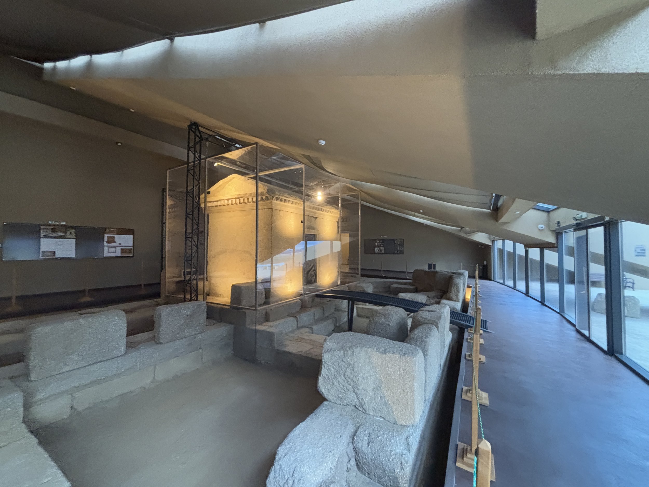
The site can be seen quite quickly because, to be honest, it is rather small, but it is quite interesting to be able to see what’s inside these mounds. The state of preservation of the monumental structures that were found inside of the mound was also pretty remarkable. There is also a small exhibit providing a bit of contextual historical information about the Thracians and the archaeological research that has been conducted at the site.
Quite an interesting, generally underreported, topic and a good starting point for further reading at home!
Visiting the Shipka Memorial Church

Shipka is also a place of religious significance, since it has the Shipka Memorial Church and the adjacent monastery. So, the visit could not be complete without stopping briefly to visit the former.

The Shipka Memorial Church is an Orthodox church which was built at the turn of the 19th C. (it opened in 1902) in the Russian style.
This choice of style is, in fact, not random, since the church commemorates the joint fight of Bulgarians and Russians against the Ottomans in the war of 1877-78, which brought about the independence of Bulgaria.
Shipka, in particular, was the setting of some of the key battles of that war. In fact, no less than four battles (!) were fought for the control of the Shipka Pass, which links the north and south sides of the Balkan Mountains. This was a major strategic location that was successfully defended by a joint Russian-Bulgarian force.
The church is quite beautiful inside. Again, due to how late it was in the day, there seemed to be no one around at the time of my visit.

And, after Shipka, it was a nearly 3 hour drive all the way to Sofia. I couldn’t end this post without a picture of the awe-inspiring landscapes of this part of Bulgaria!


24 hours in Astana, what to do and what to see

This is the second instalment of my Kazakhstan series: after a couple of intense days in Almaty, the country’s largest city and former capital, I flew to the northern steppes to visit Astana, the city, which since 1997 has been Kazakhstan’s capital.
Astana was a really interesting place to visit, because while it is not an entirely new settlement, it has been fully transformed since its designation as a capital, with most of it having been built pretty much from scratch as a planned city.
In fact, Astana is still pretty much a work in progress and, was it not for the freezing temperatures, you would be forgiven for thinking you are at some of the fast-growing cities on the shores of the Persian Gulf.

Upon arrival at the airport you get a first taste of the type of architecture that you find throughout the city: essentially newly built structures, but often with a touch of tradition in them, which give them singularity.
Also at the airport, this mural which depicts some of the main landmarks that I visited during my 48 hiours in Astana and that we will soon see as we move further down this post.
Did you know that Astana has changed names thrice in as many decades?
The city was called Akmola in Soviet times. Then in 1997 it changed its name to Astana, which means “capital” in Kazakh languages. Then, again, in 2019 its name was changed to Nur-Sultan, in hounour to the then president Nursultan Nazarbayev. This latest change was shortlived, though, since following a wave of political protests in 2021, the name reverted to Astana once more!
Moving around Astana
Let’s start by saying that Astana is not really a walkable city.
It is not just the fact that it can get really hot in summer and freezing cold (like really, really cold, on the order of -40 C) in winter, but also that the urban design is not designed for pedestrians: there are large, broad avenues and big distances between the different landmarks, even within the city center.
In this regard, it has more in common with Dubai, Riyadh or certain American cities than with Almaty. If you like contemporary architecture and urban planning, though, it can be a really interesting city to visit.
Let’s see what is there to do and to see, where to eat and where to stay in Astana if your schedule is limited to a couple of days only.

Here you can see some sights from the restaurant Vechnoy Nebo (reviewed further below), which is located at the so-called “Moscow Tower”, one of the tallest buildings in downtown Astana.

Astana will soon have the tallest building in Central Asia, the 320m, 78 storey-high Abu Dhabi Plaza (below), the construction of which has been funded by the eponymous UAE Emirate.

When I visited Astana, the city had just held the Nomadic Games, which, as the name implies, is a sort of Olympics, but of sports and other physical activities that were (some still are!) practiced by nomadic peoples, of which Kazakhs used to be one. Think different styles of horse riding, archery and different modalities of fighting, among others.

Astana is also home to the largest mosque in Central Asia, and one of the largest in the world for that matter. Astana’s Grand Mosque is, in fact, so big that it is able to host up to 235,000 people inside! Here you can see it at dusk.

Another iconic building in Astana is the Khan Shatyr mall, which is shaped like a yurt, the traditional tent of Kazakhs and other nomadic peoples of Cental Asia. Inside it is just a normal mall, but it is quite an interesting building to see from outside, particularly in the evening, when it changes colours every few minutes.

Astana is full of contemporary monumental architecture, with long, broad avenues designed to create impressive perspectives.

The Baiterek monument
This egg-shaped 105m-tall structure is, perhaps, the most iconic sights in Astana. It was built to mark the transfer of the capital from Almaty to Astana, in 1997.

It is possible to get to the top of the egg, from where there are 360º views of Astana.


The National Museum of Kazakhstan
This museum covers the whole history of the lands that are now Kazakhstan, from the ancient times all the way to the present.

It is built on a grand, monumental scale and it is way more than an architectural shell, it does have some truly interesting collections inside.


As someone interested in ancient history, I found totally fascinating the rooms dedicated to the Scythians and other ancient nomadic peoples that once roamed the steppes of Kazakhstan and greater Central Asia.
These are cultures that are not very well known in the West despite having been quite influential in shaping settled empires from Europe to China. The clothing, jewellery and other arctifacts they produced were also absolutely stunning!


The museum offers also a glimpse into the life of the traditional way of life of the Kazakh people, which carried on pretty much undisturbed until the relatively late arrival of Russian and later Soviet rule.

And, while Nursultan Nazarbayev, last president of the Kazakh SSR and first president of independent Kazakhstan, fell somehow from grace in 2022 (when he was stripped of many of the official roles he held after resigning as president in 2019), he still has its place of honour at the museum.
Btw, did you notice this pyramid in the background? This is the next Astana landmarks, which we will visit!

Astana’s Palace of Peace and Reconciliation
This pyramid-shaped building is one of the most unique in Astana and definitely a must. Designed by the studio of renowned British architect Norman Foster, the Palace of Peace and Reconciliation is meant to be a sort of ecumenical center that brings together all religions and faiths of Kazakhstan (and, by extension, the whole world)

Like many other contemporary buildings in Astana, the pyramid is full of symbolic elements. Besides its architectural value, the Palace of Peace and Reconciliation is also a conference and event venue. Featuring an auditorium and several spaces designed to hold high level meetings.


It is possible to get to the very top level of the pyramid through a rather unique elevator that follows the outer contour of the building at roughly a 45º angle. At the lower floors you find be able to enjoy, yet, more views of the city (through the painted that highlight the overall peace theme of the building) as well as some rather interesting spaces that have an almost James-bondesque feel.


Where to eat in Astana
Sandyq
Sarayshyq St 34/3, Astana 010000
This restaurant, specializing in Kazakh cuisine is named after the wooden box (“sandyq”) in which nomadic Kazakh people used to keep their belongings when moving around the steppe.
It occupies several floors of a modern building in the center of Astana and it is decorated throughout to provide a proper “Kazakh” experience.


Sandyq is a great place to taste a mix of Kazakh specialities, such as the different varieties of cheese (which can be quite pungent and salty), soup (which is mixed also with cheese).

…and, of course, the quintessential Kazakh meat dish: horse meat!

There are also a number of rooms for group meals and, I must highlight that, while Sandiq’s set up and menu will certainly appeal to tourists, there were plenty of locals eating there too, including some birthday parties that at some point started singing Kazakh songs!

This was in addition to the repertoire of Kazakh music courtesy of the restaurant.


Restaurant Vechnoye Nebo
This is a restaurant specializing in the cuisine of the Turkic peoples, as represented by traditional female dresses, from all over Central Asia and all the way to the edges of Europe.
But besides the food and the ambience, one of the highlights of this restaurant (and perhaps its name, which in Russian means “eternal sky (heaven?)” is the 360º views it has over downtown Astana.
This is because it is located on one of the top floors of “Moscow Tower” one of the tallest buildings in Astana.


Restaurant Vechnoye Nebo (“Вечное небо”)
18, Dostyk Street BC “Moscow”, Floor 25, Astana
http://www.vechnoenebo-dostyq.kz
Here you will find a broad array of specialities from the Turkic culinary traditions (together with some international ones as well).


Restaurant Marcello
Turkistan Street 28, Astana 020000
https://www.instagram.com/marcello.restaurant
This is an Italian-style restaurant managed by a local restaurateur offering a cozy atmosphere in downtown Astana.

Besides the large and tasty pizzas it also offers a broad array of other dishes, including some touches of local Kazakh and Central Asian cuisine.


Where to stay in Astana
Sheraton Astana Hotel
Abu Dhabi Plaza Adreça: Syganak St 60/1, Astana 010000
https://www.marriott.com/en-us/hotels/tsesi-sheraton-astana-hotel/overview/
This is a modern hotel operated by the famous international chain. It is located within the grounds of Abu Dhabi Plaza, which includes, adjacent, the aforementioned tallest skyscraper in Astana.


The rooms are rather spacious and the bed is comfortably, although I would suggest caution when opening the cupboard doors: one of the compartments next to where the coffee machine is located opens upwards rather than sideways and activated with a mechanism that makes it bounce unexpectedly, so you can get easily hit in the face if too close to it (don’t ask me how I found about it!).

Tasting Kazakh cheese in Astana
Breakfast at the Sheraton Astana is a good opportunity to try different Kazakh specialities, particularly the cheeses, such as the ubiqutuous “kurt” (the tiny balls of salty cheese) and zhent (which has the look and texture of a sponge). If you like them, there is a supermarket right next to the hote, where you will find many of these traditional cheese types, well packed in an easy to transport way and at a good price!

Last but not least, a word of thanks to Air Astana, Kazakhstan’s national airline, which made this trip to Astana possible.
You can also check my flight reviews of Air Astana’s Economy and Business Class.

24 hours in Almaty, Kazakhstan, what to do and what to see

Almaty is Kazakhstan’s largest city and it was also its political capital until 1997, when the government moved to more centrally-located Astana (I did visit Astana in the same trip and a post with my impressions is coming up soon, btw!).
Kazakhstan is the size of whole of Western Europe and Almaty is literally at one of its corners, right on the foothills of the Tian Shan mountain range, which limits with Kyrgyzstan and China. The view of the Tian Shan’s snowy peaks is, actually, the first sight greeting visitors arriving at Almaty’s international airport (you can find also my review of Air Astana’s flight from Europe here).
These mountains play, actually, an important role in the life of Almaty’s residents and I had a chance to get a taster of them, but, since we have only 24 hours in the city, let’s go on a quick city tour first!
A walking tour of central Almaty

If you have ever been to any of the capitals of the former Soviet republics, some parts of Almaty will look familiar to you. Although Almaty has been settled for many centuries, it was during the Soviet period that the city grew to become one of Central Asia’s largest cities and that it got most of the landmarks I visited during this tour.


What is interesting about Almaty’s architecture, though, is that, interspersed with the classical Soviet-era styles (like the Opera palace depicted above), there are many elements that draw from local Kazakh culture.
As an example, these intricate motifs (right side picture), inspired in traditional Kazakh art, which decorate the facade of quite a few buildings in central Almaty. Judging by the type of construction, I’d say these are from around the 1970s.
Also remarkable is that most of central Almaty is laid out in a grid-like pattern, with rather wide streets intersecting at right angles. There is also quite a lot of greenery, since the city is not very densely built and there is ample space between buildings.
Our tour took place on a rainy Autumn day, which made for a nice walk in the cool (but not too cold!) air. I hope these pictures capture a little bit of the city atmosphere, like here below, at the head of Panfilov Street, one of the main pedestrianised avenues in Almaty.

A ride in the Almaty metro
Let’s start by saying that the metro (subway) in Almaty is rather limited, in fact it is not, properly speaking, a transport network, because, as of 2024, it has just one line.
What’s interesting here is that, while it was inaugurated in 2011 and part of it has been built even later, the style is unmistakably Soviet. This is not because its engineers suffered from some sort of nostalgia, but because the design and construction of the Almaty metro project actually started in the 1980s.
Apparently, every Soviet city qualified to get a metro system from the moment it reached a population of 1M. Almaty got to that magical figure (after some gerrymandering with the city limits, we were told during the excursion) only as the Soviet Union was starting to crumble. Plans were laid out, but the Soviet collapse and the chaotic years that ensued meant that the project was put on a very slow track, until it was restarted in the early 2000s. So, when it was time to get back to work on the metro, the same blueprints were used (why not?).
It is well worth taking a ride on the Almaty metro just to have a peek at the different mosaics and decor elements you find at several points.
But let’s first have a look at the metro map to get an idea of the extension of the system and, one thing of note: see the line of mountains on a blue background at the top of the map? This shows the Tian Shan mountain range, which Almaty citizens use always as a reference point when navigating their city. The mountains here help with orientation, the same way that the sea or rivers play in other cities as an geographical anchor element.


The other interesting element are the mosaics and mural art that you find all over the metro. These depict mostly Kazakh themes. Here above you can see a glass mural dedicated to Aport apple, which is a local apple variety which has become a source of local pride and a sort of symbol of Almaty.

But what I found most interesting are the many mosaics throughout the metro system that allude to local Kazakh culture (again those tile patterns!) as well as the history of Central Asia and the Silk Road.

See for example these depictions of ancient cities at Zhibek Zholy (Жібек Жолы) station. How many monuments and places are you able to recongize in this map of the Silk Road?


The city baths
Bath houses play an important role in Turkic culture (Kazakhs are a people of Turkic origin), so it’s not a surprise that another building of reference in Almaty is the Arasan public bath (today known as the “Arasan Wellness & SPA”).
It was built in the 1980s in response to Tashkent, in neighbouring Uzbekistan (and a rival for urban primacy in Central Asia) having built earlier its own bath complex.
It’s a rather modern interpretation of the traditional public bath concept with plenty of interesting decorative details built in.

Panfilov Park, Ascension Cathedral and Memorial of Glory
This is sort of Almaty’s “central park”. Although it is not huge, it has several of the city’s landmarks in it, such as the Orthodox cathedral of the Ascension, which was built in wood and using a rather innovative (for the time) earthquake-resistant approach that has allowed to survive undamaged several episodes of seismic activity.

The park is named after Panfilov’s “28 Guardsmen”, a mostly-Kazakh unit in the Soviet army that suffered very high losses while defending Moscow in 1941.
Like every city in the former Soviet Union, Almaty has here, as well, its WW2 memorial with its eternal flame. There is also a military history museum next to the park, although there was no time to visit it.


The Green Bazaar
The Green Bazaar is located less than five minutes walk away from Panfilov Park and it is one of the must-see places in Almaty, if only to relish in the broad diversity of flavours and smells here. It is also a good spot to taste and buy traditional Kazakh produce, such as the famous Aport apples or Irimshik, a sort of brownish soft cheese.

The bazaar is very well organized by product category (dried fruit, pickled food, dairy, meat…) and by ethnicity. So, it seems that every national group specializes in one type of produce. For example, we were told dried food vendors are mostly Uzbek, while the dairy section is mostly taken care of by Turkish women.

There is also a Korean section (see below). Many ethnic Koreans were deported to Kazakhstan from the Far Eastern territories of Russia on Stalin’s orders around the time of WW2 and they are now a sizeable minority in Kazakhstan. Because of the lack of the original ingredients in their new homeland, Koreans adapted some of their dishes to the local produce and tastes.


Aport apples

Irimshik cheese
An evening walk through Almaty
Days are short in Autumn, so part of the walking tour took place in the evening, which is something that has its own appeal.

Here is a view of two landmarks of 1970s brutalist architecture in Kazakhstan. On the right is the building that used to house the Ministry of Geology, a pretty important institution in a country that derives much of its wealth from natural resources!
The building with the crown-like top to the left is the Kazakhstan Hotel. Arguably the top hotel in town for many years and, still today, one of the city’s main hospitality establishments.
At just over 100m high, the Kazakhstan Hotel was also, at the time of its construction, the tallest building in the country. It was also built with seismic activity in mind and its structure is said to be able to stand earthquakes of up to 9.0 in the Richter scale. In fact, the structure was successfully tested during its construction with a special machine that shook it up simulating a strong earthquake, with the chief architect and engineers on top (skin in the game!).

During our walk we were also able to see several of the statues scattered around central Almaty, with very different themes. For example, here on top you can see a fountain that represents the Kazakh horoscope (similar to the Chinese one) and, below, a statue dedicated to Soviet-era rock star Victor Tsoi.


Another iconic hotel in town is the Almaty Hotel, which was has a surprisingly modern-looking design despite having been built in the 1960s (the interior has been renovated but the structure remains the same).
Curious historical fact: the first director of the hotel, Rakhimzhan Koshkarbayev, was the Soviet soldier that hoisted the red flag over the Reichstag during the Battle of Berlin, in 1945 (the iconic photo was a later reenactment, though).
The entrance of the Almaty Hotel is also decorated with these beautiful mosaic depicting scenes from Kazakh traditional tales.

More street art, here in an underground passage. Note, again, the Aport apple theme!


And, here, with this picture of the Kazakh Academy of Sciences, that we conclude our tour of the city centre. Before turning to the outdoor experience in the mountains, though, a word about the excellent tour guide, provided by Walking Almaty.
Shymbulak ski resort

Almaty is surrounded by great outdoors, including some world-class natural parks. You don’t even need to go as far as Altyn-Emel or Charyn Canyon (two truly unique national parks which are within driving range of Almaty, but which are, perhaps, best visited with an overnight stay), truly Alpine nature is a short taxi and cable-car ride away from the city center!
Shymbulak, is a suburban ski resort. The base station of the Shymbulak cable car is barely a 15min drive from Almaty city center (provided there is no traffic!).


The cable car will take you in a few minutes to a height of more than 2,200 meters of altitude. In Winter this is where the skiing area starts, but you can visit year round for the mountain sights, trekking (it was rainy and cloudy when we visited though) or to enjoy the restaurants and services (more on this in the food section further down).
These mountains are very popular with Almaty residents, who come here for a bit of outdoors sports and to breathe the fresh mountain air.
It is in this valley, half way up the mountain, that you find the Medeu skating ring, the highest in the world of its type. This sports facility became famous during Soviet times, because local conditions of altitude and prevailing low winds enabled many ice skating world records to be set here!

We arrived just in time to experience the first snow of the season!
Where to stay in Almaty
Intercontinental Hotel Almaty


This is a nice, modern hotel. The rooms (and bathroom) are big. The staff were also very friendly and helpful.
I also enjoyed the breakfast very much, since it include a broad variety of sweet and salty foods as well as international and Kazakh specialities, including different types of local cheese as well as camel and horse milk and dairy!

Where to eat in Almaty
Here are some nice options to eat out in Almaty and Shymbulak. It is mostly international cuisine (Italian and Turkish mostly), so don’t expect super typical Kazakh dishes here (you will have to wait to my upcoming post about Astana for this!), but all of them were pretty good and you can’t go wrong with them.
Monte Bambini, Shymbulak

This is a cozy mountain restaurant next to the base station of the Shymbulak cable car. Here you can find a mix of European and Central Asian specialities.


Big Chefs, Shymbulak
Big Chefs is also in Shymbulak but at the other end of the cable car, up in the mountain.
Turkish cuisine is the main focus here. The mezze, for example, were really good and the portions quite generous. There is also a nice dessert selection.


Aurora Café, Almaty

This is an upmarket Italian restaurant in central Almaty (with a nice aeronautical touch by the entrance!).


It’s got a pretty good selection of dishes, which include also some Central Asian shashlik, of course, besides more international fare.


And last, but not least, big thanks to the team at Air Astana, the main airline of Kazakhstan, which worked hard to make sure we experienced the best of Almaty during our short but intense stay!

In the footsteps of Napoleon on the island of Elba

Arriving to Elba on the Windstar Wind Surf
There is a tiny island off the coast of Tuscany where Napoleon Bonaparte was king for less than a year.
This short period of time, however, was more than enough to leave its imprint and more than two centuries later, the name of Elba appears inextricably linked to that of the emperor of the French and there are, indeed, quite a few sites on the island connected to this historical figure.
But you would be wrong to assume that Napoleon is all that the island of Elba has to offer!
In fact, even without the Napoleonic stuff, Elba is an amazing destination on its own right just on account of its natural and historical heritage. We had the chance to visit recently in the month of July (perfect summer weather!) and, while we spent less than 12 hours on it, I can say that it was one of the highlight stops of our Windstar Cruises sailing around the Western Mediterranean.
So, let’s see what awaits the visitor in Portoferraio, the capital of Elba!
By the way, please, note that, while Elba is relatively small, this post covers only a tiny part of it, there are also a couple of other notable settlements, like Porto Azurro, numerous beaches and some mountainous areas (which get to a height of more than 1,000 meters). So, I would not rule out another visit in the future!
What to do and what to see in Portoferraio, Elba
Our visit started in the port of Portoferraio, where our ship, Windstar Wind Surf, arrived in the early hours of the morning.
If you asked some generative AI to draw some postcard-perfect picture of a picturesque Italian Mediterranean historical port city, it would possibly come up with something similar to Portoferraio!

And the first one to greet us literally off the ship’s gangway was…Napoleon himself! as well as Cosimo de Medici, because, while the Buonaparte gets most of the attention nowadays, the island of Elba is also linked to another of the great names of European history, the Medicis, which controlled the island for some time in the 16th C.

As far as the public space is concerned, though, Napoleon is all over the place, with this effigy and other associated symbology being ubiquitous in Portoferraio.
The cruise dock was just within walking distance of the historical center of Portoferraio, so just a quick and pleasant stroll away from the main sights.
Portoferraio is located at the tip of a rocky cape at one edge of a bay on the central-northern shore of the island. The port and the old town are surrounded by a line of small ridges that give it a semi-circular shape, not unlike some sort of theater auditorium which leans towards the sea.
Adding to the natural defense provided by the hills, on the land side Portoferraio is enclosed by the walls of Forte Falcone, the hilltop fortress that dominates the old town.
So, given our limited time onshore, we skipped the shops and cafés around Piazza Cavour, the most commercial area, located right next to the quays, and opted to walk uphill across the old town towards Palazzina dei Mulini, which was Napoleon’s residence during this stay on Elba (he used also another mansion on the mountain side of the island as a summer residence).
This was not just out of interest for Napoleonic history, but also quite practical, since the museum-residence is located on the far side of the old town and the way there offers a chance to walk right through the center of town and also get some nice views from its upper side.

It gets uphill very quickly in Portoferraio. The whole town is built on the slopes of a hill and, as soon as you get a couple of streets off the main commercial street it’s all small narrow streets, sometimes turning literally into stairs due to the steepness.

If you are looking for the “Mediterrannean vibe”, though, you will find plenty here!

So, a few hundred steps later we made it to Napoleon’s palace or, shall we say “villa” or “residence” since its proportions are not out of tune with the place.


To our surprise, though, we found out that it only opens at 2pm!
This proved to be a blessing in disguise, because we, then, decided to explore the nearby beach, called Spiaggia delle Viste (or “Beach of the sights”) and we were not disappointed!

The beach, a little cove with steep cliffs on both sides, is located just underneath Napoleon’s residence and it is accessed through a which you can access through a ramp just meters away from the museum entrance.
The beach was not crowded at all despite its proximity to the urban center, the cliffs and the exuberant vegetation gives it a protected feel. Also, the water was crystalline and a tad warm. Warning: it is a rocky beach, so it is full of pebbles, which I personally like, but I know it’s not everyone’s cup of tea!

By the way, what is this?! is the Royal Navy’s Mediterranean Squadron still keep an eye on the Buonaparte, lest he escapes and wreaks havoc in Europe again?!

Where to eat in Portoferraio, Elba
Ristorante Le Viste, https://www.ristoranteleviste.com
The only structure on the beach is the restaurant Le Viste, where we had lunch.


While not super cheap, Le Viste turned out to be a great place to have something to eat or to drink while enjoying the pristine waters of the Le Viste beach.
In our case, it was just right to get some shelter from the midday sun after bathing, change clothes and have some light meal and refreshments before heading for the museum in the early afternoon.
Visiting the Palazzina dei Mulini - Napoleon’s museum and villa on Elba
So, after our second attempt and about half an hour of queueing under the sun (yep, apparently we were not the only Napoleonic-histroy buffs in town that day!), we got into the Palazzina dei Mulini.


The residence itself is not too big (particularly if considering it housed not just the Emperor but part of his family and retinue).
It is a two-floor villa, and has been restored to how it may have looked like during the few months that Bonaparte lived here.
Note the neoclassical, Empire-style furniture throughout (although apparently Napoleon preferred to sleep in his own simple military campaign bed, even when indoors!)


I’d say the best of Palazzina dei Mulini are its gardens, which are quite something, though, pretty pleasant and with great views of the Mediterranean sea.
This place may have felt too small for a man that aspired to rule most of Europe, but in and by itself, Palazzina dei Mulini would make for an awesome summer residence!


The Napoleonic heritage on Elba

It may have been a short lived reign (although Bonaparte, in its usual hyperactive drive, implemented quite sweeping political and economic reforms on the island) but Elbans do certainly remember Napoleon.
It is simply not possible to walk around Portoferraio without stumbling upon references to Napoleon right and left. I have tried to collect here some of them.


There are other sites in Portoferraio that are very closely linked to Napoleon, such as the Theater of the Vigilanti, which is a former church that Bonaparte transformed into a small-scale opera house, or a cultural center (named after a local Napoleonic officer, De Laugier), which hosts exhibits about the Emperor. Since our ship’s departure time was 6pm, we didn’t have that much time left, though.
So, we just skipped those and opted for another walk around the historical center of Portoferraio on our way back to the ship. Here are some of the snaps we took along the way.


So, this short but intense trip to Elba ended where it started, in the docks, that once saw Napoleon and a small number of followers embarking for France and the period that has come to be known as the “100 Days” before he was again beaten at Waterloo…
But this is a story behind the scope of this post, which just aimed to pinpoint and showcase some of the very interesting sights on Elba and the activities you can do there, even in a short time.
I think Elba is a perfect example of underrated destination. While it is not short of historical and natural charms, it rarely gets mentioned among the places that deserve a visit in this part of Italy.
My theory is that the small stretch of water that separates it from the mainland makes it too much of an effort to get to for the many tourists that have, in any case, their hands full with plenty of other interesting places in the Tuscan mainland. Nevertheless, it is a destination that I recommend very much visiting. In this regard, cruises like Windstar’s are a perfect way to get there.

By the way, to see where this amazing Mediterranean journey took us next, check out our comprehensive review of the Windstar Cruises Wind Surf!


Around the Mediterranean in style on Windstar Cruises Wind Surf

Cruise ships come in all shapes and sizes, but only a few of them are able to provide something akin to the super-yacht experience.
We are not just talking about a matter of scale (although this matters quite a lot too!) but of an entire philosophy that permeates every element of the experience. This is in addition to the truly unique wow factor that comes from sailing on one of only a handful of sail-powered cruise ships out there.
This is why, the moment the opportunity came up to sail the Mediterranean onboard Windstar Cruises Wind Surf, we didn’t think it twice!
What follows is our account of an unforgettable journey sailing through the incredibly blue waters of the Western Mediterranean, from Civitavecchia, near Rome, to Palamós, in the heart of the Catalan Costa Brava (you will find the itinerary on Windstar Cruises website as “Yachtman’s Harbors of the Rivieras”.
Keep reading for a detailed review of how the Windstar Cruises experience is like!
The journey was courtesy of Windstar Cruises. Opinions are all our own.
The Ship

The ship which took us on this Mediterranean journey, “Wind Surf” is one of only two ships of its kind ever built (the other being “Club Med 2”, which operates for the eponymous French tour-operator).
These two sibling ships happen to be also the two largest active sailing ships in the world (by length) and have quite some story behind…

Both ships were ordered by Windstar Cruises from a French shipyard in the late 1980s, but ownership changes at Windstar at the time put the project at risk. This is when Club Med stepped in. The French company took over the two ships and, upon completion, put them in service with the names “Club Med 1” and “Club Med 2”.
In 1998, Windstar Cruises was finally able to acquire one of the two, “Club Med 1”, and add it to its fleet after giving it its current name: “Wind Surf”.
At 14,700 tons and 617 ft (188m) of length, Wind Surf is small by the standards of a cruise industry that has got used to launching ever larger ships, but this is the whole point.

Wind Surf’s most eye-catching feature, the one that captures the attention (and the imagination!) of people onshore wherever it turns up is, of course, its superstructure, with five 67.5-meter-high masts and the accompanying rigging.
To be clear, Wind Surf is a hybrid, which is is mostly propelled by diesel engines. Wind, however, plays a key role, not just when it comes to helping propel the ship, but also in confering it a rather unique personality.
When making full use of wind power, Wind Surf propulsion is assisted by 7 triangular sails. These are rolled out through a full automated mechanism every day as the ships gets underway.

Wind Surf can carry up to 342 passengers and a crew of around 210. A passenger to crew ratio which gives you an idea of the type of personalized service Windstar Cruises strives to provide.
The ship has a total of six decks. There are 150 staterooms on decks 2 and 3 and 18 ocean view suites on deck 5. Those looking for an even more exclusive experience have a choice of 2 deluxe ocean view bridge suites and…wait for it…an “Officer’s Suite” which is located within the officer's quarters!

Most of the ship’s common areas are on Deck 4.

Here you find the reception, which is on duty 24/7, the excursions counter, a shop, a library, some workspaces, and a large lounge area (where some of the live entertainment and the pre-excursion briefings take place) with its own indoors café, as well as one of the ships’ restaurants, “Amphora” (more on food and drink onboard shortly!)
Before we proceed further, a note here about the elegant but unpretentious, no-nonsense decor style found throughout the ship, which we quite liked. It definitely adds to the authenticity of the overall experience.
The dominant pastel and wood-like tones inside and white-washed outside, both with touches of deep blue, do also a great job in setting the maritime yacht-like atmosphere.

On a schooner-like ship like Wind Surf, a big part of the action happens outside, whether it’s at the poolside terrace and bar, eating outdoors at the Veranda restaurant or simply sunbathing or walking along the decks while contemplating the Mediterranean coastline.
In this regard, one of the ship’s focal points is astern: the poolside area.

Wind Surf has a small pool, which, while not large enough to swim in it, is ideal to relax as you float and let the motion of the ship swing you around. There are two other adjacent warm-water hydro-massage tubs which provide great views of the landscape around.
Sun beds and a bar, which will prepare pretty much whichever cocktail you fancy on the spot, complete this particularly popular section of the ship.


Those of you that like to enjoy the sea breeze will be happy to know that there are two other partly open decks, 5 & 6, that allow you to walk the whole length of the ship, a full 360 degrees.

Deck 5 is, astern, quite similar in structure to the pool deck and located right above it, but instead of the pools, it has a larger bar with some indoor space that becomes the ship’s focal point late in the evening, when it usually hosts live music shows.
Also on Deck 5, but indoors and amidship, you find the Spa (more of this later) and, closer to the ship’s bow, the bridge. In this regard, We were positively surprised by the friendliness of the captain and crew, who showed us around when we happened to walk by.
By the way, in case you were wondering this is what the bridge of Wind Surf looks like!

Keep going up and you get to Deck 6 (the top one). Here you can get really, really close to the rigging and it is the best spot from where to watch the unfurling of the sails. This takes place every evening to the sound of some really epic music by Greek composer Vangelis.

It is pretty amazing to watch how, thanks to the automated mechanism, it takes only a few minutes for all seven sails to be rolled out.
It is also on this deck, on the bow side, that you find Wind Surf’s other restaurants: Veranda/Candles (partly outdoors) and Stella (which is fully indoors).
This deck, particularly the platform right above the ship’s bow, is a great place to enjoy the actual sailing sensation.

The state rooms

As mentioned earlier, there are different types of cabins, the vast majority of them are state rooms and all of our comments refer to this type of accommodation.
Our state room was on Deck 3, but I think they are all pretty similar regardless of the deck you are in.
You can move up and down the different decks either through the stairs or by using the lift. We used the former option most of the time, since distances within the ship are always short and it can be much faster to just walk than wait for the lift.
So, without further ado, let’s get into the room to see how they look like…

State rooms are 188 sq ft (17.46 sq m) and are fitted with a queen size bed and an ensuite bathroom.
I was very positively impressed by a number of tiny details in the room.
Let’s start by the Queen Size bed, which, we can attest, is truly comfortable. It’s got good natural light, but also lamps and a couple of reading lights. There’s a flat screen TV with a DVD player as well (tbh, we didn’t use it at all, since we seldom watch TV, but some may find it useful to know that it’s there).
But, do you what’s the one thing that we really, really liked? The two round portholes!
Yes, I am aware that nowadays most cruise ships have balconies, and these are cool, but…portholes? That give you the feeling to be sleeping onboard a real ship! And, you know what? If you like balconies, I’ve got news for you…pretty much the whole three upper-most decks of Wind Surf are, in essence, a large interconnected balcony, with plenty of space to sit down, lay down or sunbathe.

More stuff: there is plenty of space for storage, there’s a whole cupboard and a large amount of drawers and shelves, so we never felt the space was tight.
There is also a desk, which comes in very handy to shift through the trip’s papers and is also stocked with some fresh fruit.
Then some of the usual amenities: a safe, a mini-bar, hair-dryer, etc. There are also robes available.
Another pleasant suprise is that there are also universal electricity plugs (since Windstar Cruises is an American company and most passengers are from the US, I had brought a US-EU adapter, but it turned out not to be necessary!).


The bathroom is about as big as it can be in this kind of setting, but pretty well fitted.
It’s got a spacious sink top. It must have a really efficient air circulation mechanism because things, like wet swimming suits, dry really fast, despite the confined space.
Also, the shower is really nice, powerful! (perfect to rinse the salt out and freshen up after a water sports session at the marina).
There is also a set of L’Occitane toiletries.

The restaurants
One aspect of the Wind Surf experience we particularly enjoyed was food and drink.
Let’s start by saying that all meals are included in any of the four restaurants onboard, which is great. Also, regardless of each of the restaurants offering a somehow different type of experience (some elements, like the wine list were common to all, though), the food was really great in all of them.
There are four (in fact, three, if you count Veranda and Candles as one) restaurants onboard Wind Surf:
Veranda, which is on the top deck, partly outdoors, and is the only place open for buffet breakfast and lunch
Candles, which is, basically, Veranda but turned into an à-la-carte, reservation-required restaurant in the evenings
Amphora, which is the largest of the ship’s restaurants and located on the main deck
Stella Bistro, on the top deck indoors, specializes in French cuisine and it is, possibly, the poshest of the lot.
One important thing to bear in mind, though, is that while Veranda and Amphora work on a first-come-first-served basis, Stella Bistro and Candles, require advance reservation and our advice is to book early in the trip because they fill in really fast!
And, btw, Windstar Cruises has a partnership with the James Beard Foundation, a non-profit organization based in the US which aims to elevate the culinary arts. Some of the dishes onboard have the James Beard Foundation stamp.
Shortly below we will proceed to offer a glimpse of each of them.

Next a word about the ships’ bars. There are three of them, two astern, on decks 4 (poolside) and 5, and one indoors at the ship’s Lounge.
It’s important to note that, while all meals and non-alcoholic drinks are included for all passengers, it is not the case for wine and other alcohol drinks (and this includes the meals you have at restaurants).
If you are on an all-inclusive package, you get all drinks, no matter which one, by-the-glass. Otherwise you need to purchase your drinks individually or buy one of the day packages.
Whether you drink or not, is your decision, now, if you do, it may be a good idea to make sure your package includes drinks, since Wind Surf is stocked with a good wine cellar (at this point, special mention gotes to head sommelier Eleonora, which provided great recommendations throughout the trip!) and their staff can really prepare nice cocktails!
So, as promised, let’s go have a look at each of the restaurants. During our trip we had a chance to try all of them at least once and here is a summary of our experience.
Please note that the menu may vary with time and route!
Veranda
This is the most casual of the lot. As the name implies, it is located (partly) outdoors, on the top deck, although it does have space indoors too.
This is the only place to have breakfast and lunch, mostly from a buffet with both cold and warm dishes, although you can order some things à-la-carte too.
The buffet offers pretty much the same basic choices daily, although with some variations. The à-la-carte offering varies a bit every day, particularly when it comes to items such as fish.
Some of the food is prepared outside, where there is an open grill.

We would say the main thing with Veranda is choosing the right table for the time of the day in order not to get too much direct sun, since not all tables have cover. If in the Mediterranean in the middle of the summer it can get really hot already quite early in the morning!
Below are some snapshots of our meals at Veranda, to give you an idea.


Candles
Location-wise, Candles is the same as Veranda, but in the evening it becomes an à-la-carte restaurant and advance reservation is required.
We particularly enjoyed the fish dishes here!

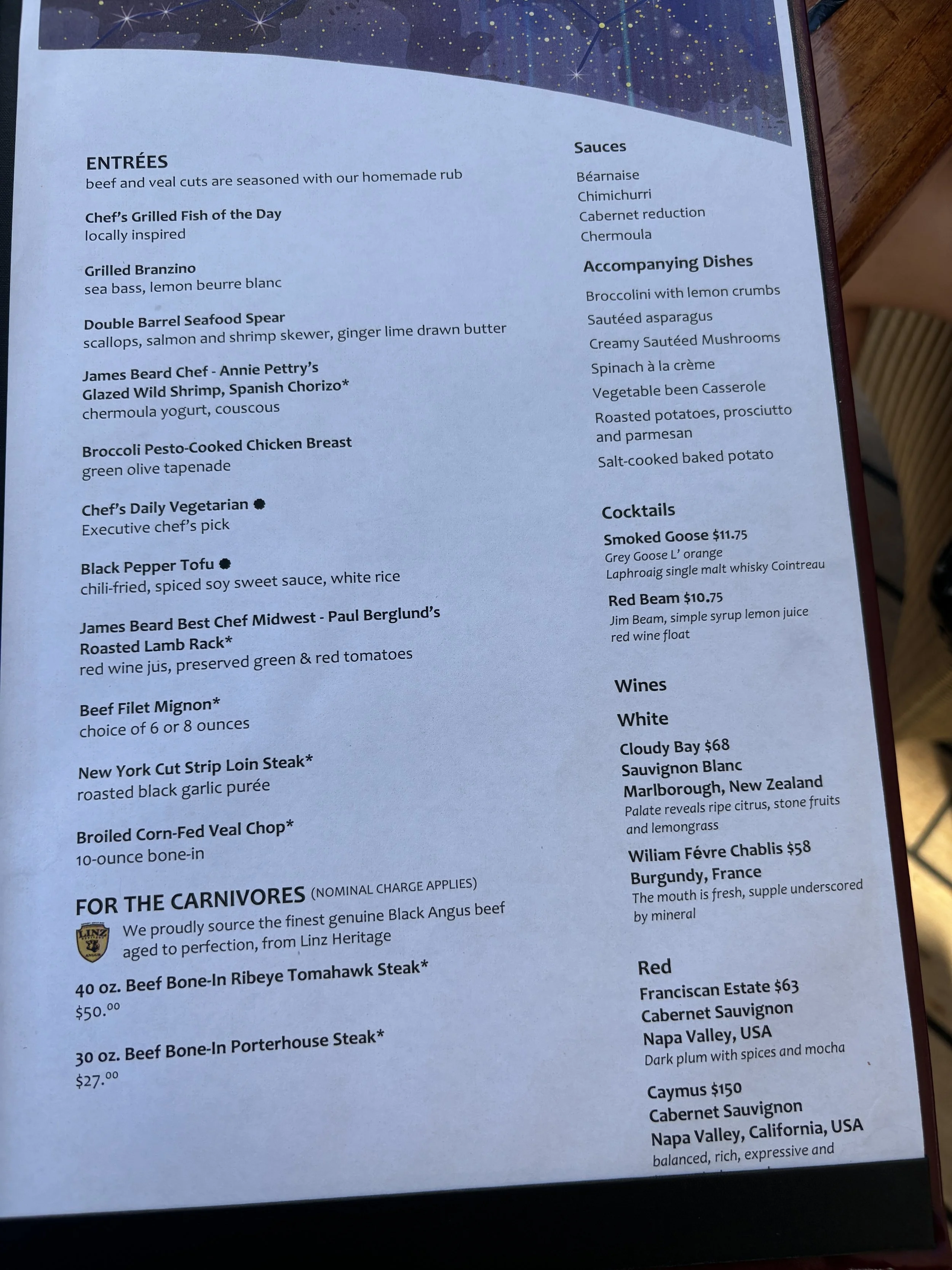


Amphora
This is the everyday restaurant for dinner when onboard. You don’t need an advance reservation, you just show up and wait to be seated (which, at least in our case, was always immediately, since the place is rather big!), which makes it often the “default” option for dinner.
However, don’t let this casual approach mislead you, Amphora is a proper sit-down restaurant offering a pretty good quality experience, both in terms of food, service and atmosphere.
If anything, it gets, perhaps, a bit less of natural light than the other venues, mostly due to the fact that is located one deck down.

We had dinner a few times at Amphora, so here is a collection of images of what we had.
Amphora Meal 1:


Tomato Tart

Seared U10 Scallops


Vitello Tonato

Pan-roasted sea bream

Amphora Meal 2:
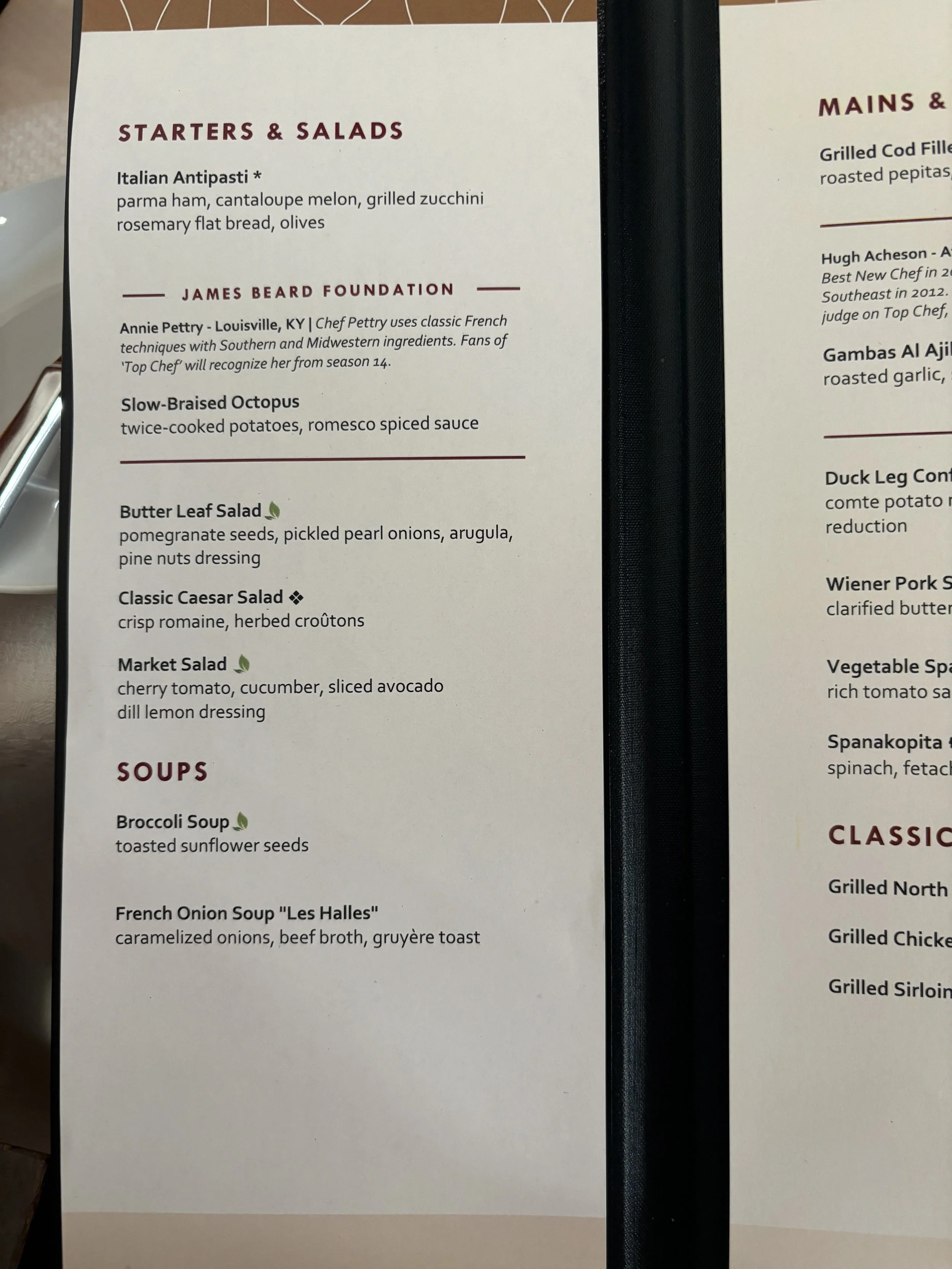


Slow-braised octopus


Spanakopita
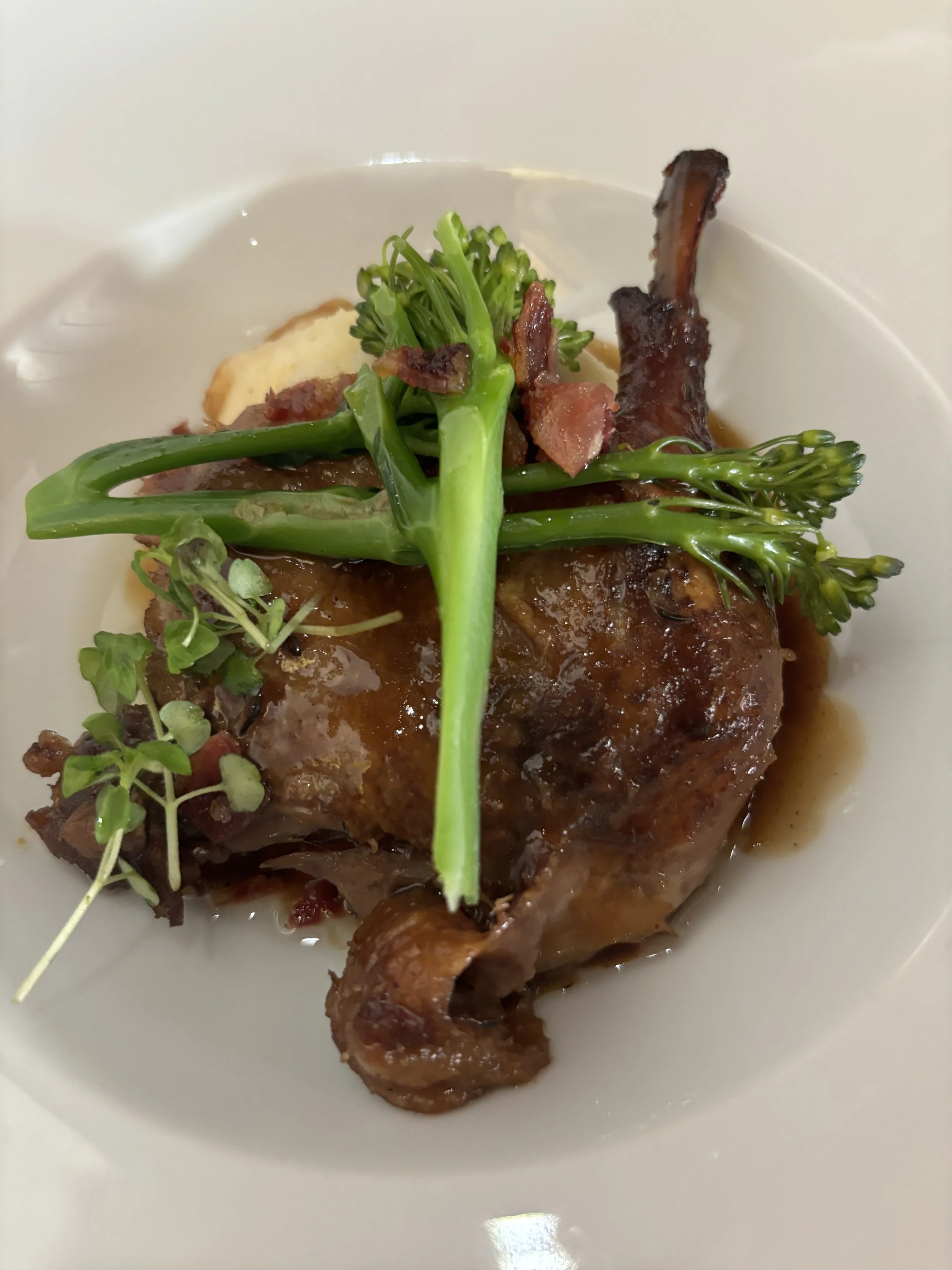
Duck leg confit

We particularly liked this Californian Cabernet Sauvignon (thanks for the recommendation to sommelier Eleonora!)

Amphora Meal 3:


Stella
This is possibly the most “upmarket” of all of Wind Surf’s restaurants.
French Parisian Bistro
It requires reservation and we advise it you do it early in the trip. We left it for our second day and it was actually quite hard to find a spot, although staff made a good effort to finally accommodate us!
It is located on the top deck, right next to Veranda/Candles, but inside and closer to the ship’s bow.
Really nice layout and a bit more airy and with more natural light than Amphora.
The food was also excellent. Which one we like the most? It’s hard to say and I’d say it comes down to the specific dishes. The wine list was the same for both restaurants and here I must add a special mention to the Wind Surf’s sommelier in chief, Eleonora, which was a nice and very insightful guide in our choice of wines throughout the whole week (she shuttles between the different restaurants).

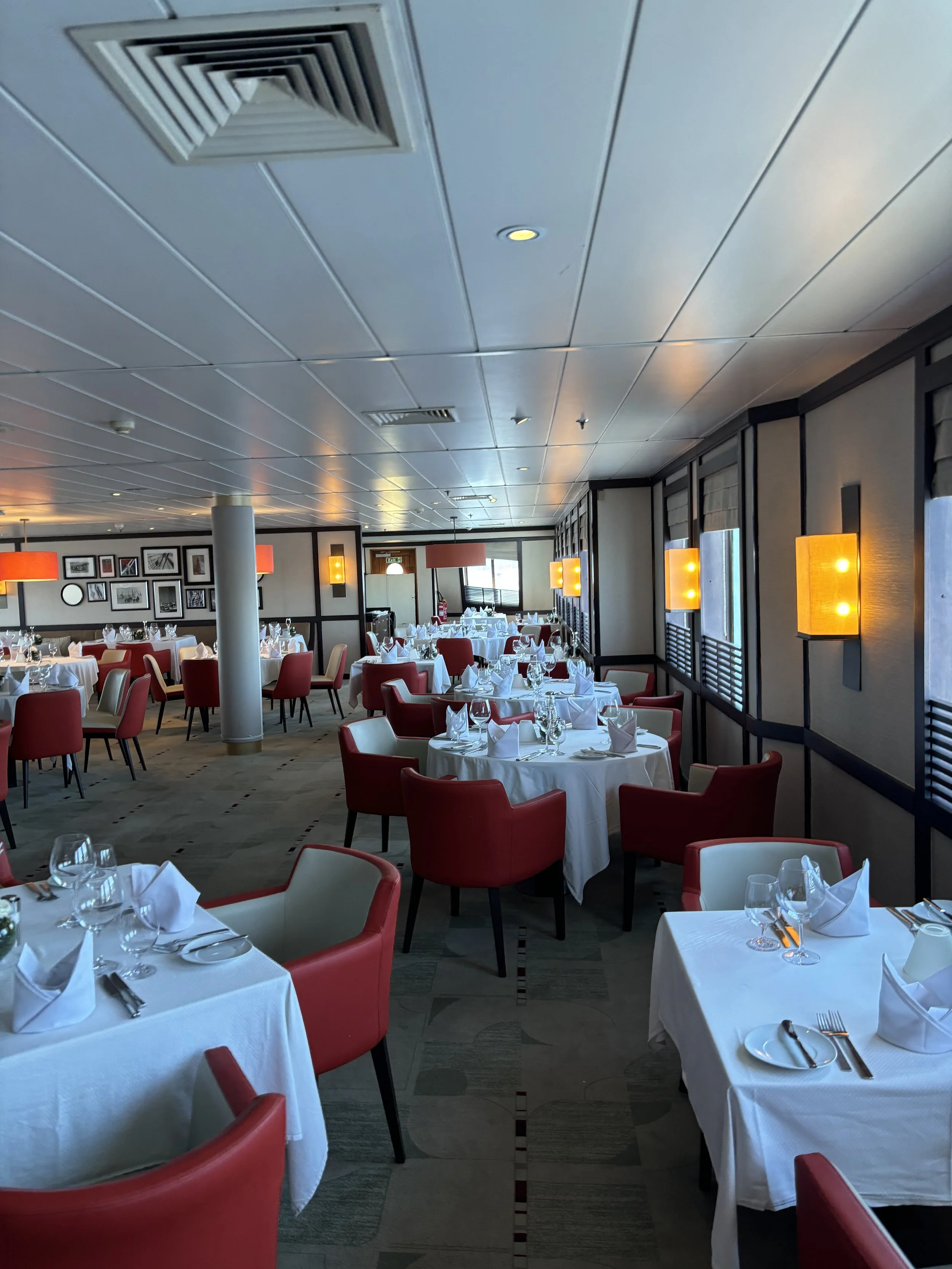


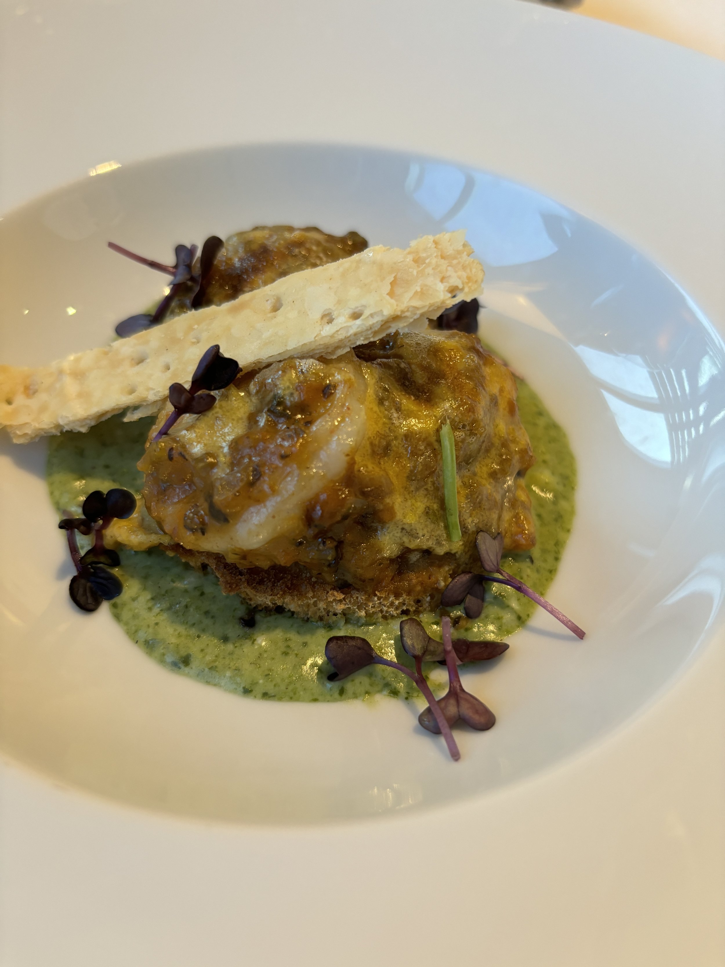


Amenities
So what else can you expect onboard a Windstar cruise. In this section we have tried to summarize several other aspects of the experience.
The fact is that, even on such a relatively small ship, there is so much to do that ultimately you have to be selective. What we describe here is what we did and it is just a cross-section of what is available.
Onboard Wifi
Wind Surf is equipped with SpaceX Starlink satellite connectivity, which provides fast and reliable internet everywhere, also when on the high seas.
Take into account, though, that, just as with the drinks allowance, access to Starlink depends on the package you are on. In any case, it can be purchased separately.
The onboard Starlink pass gives access to one device at a time, although it can be switched between devices depending on what you need the connectivity for.
Bear in mind that, if you have an EU mobile phone with a data plan, you may get internet access while on port and close to shore (thanks to the EU’s roaming directive), but as soon as the ship sets sail, you will need to log into the ship’s satellite network to get reliable connectivity.
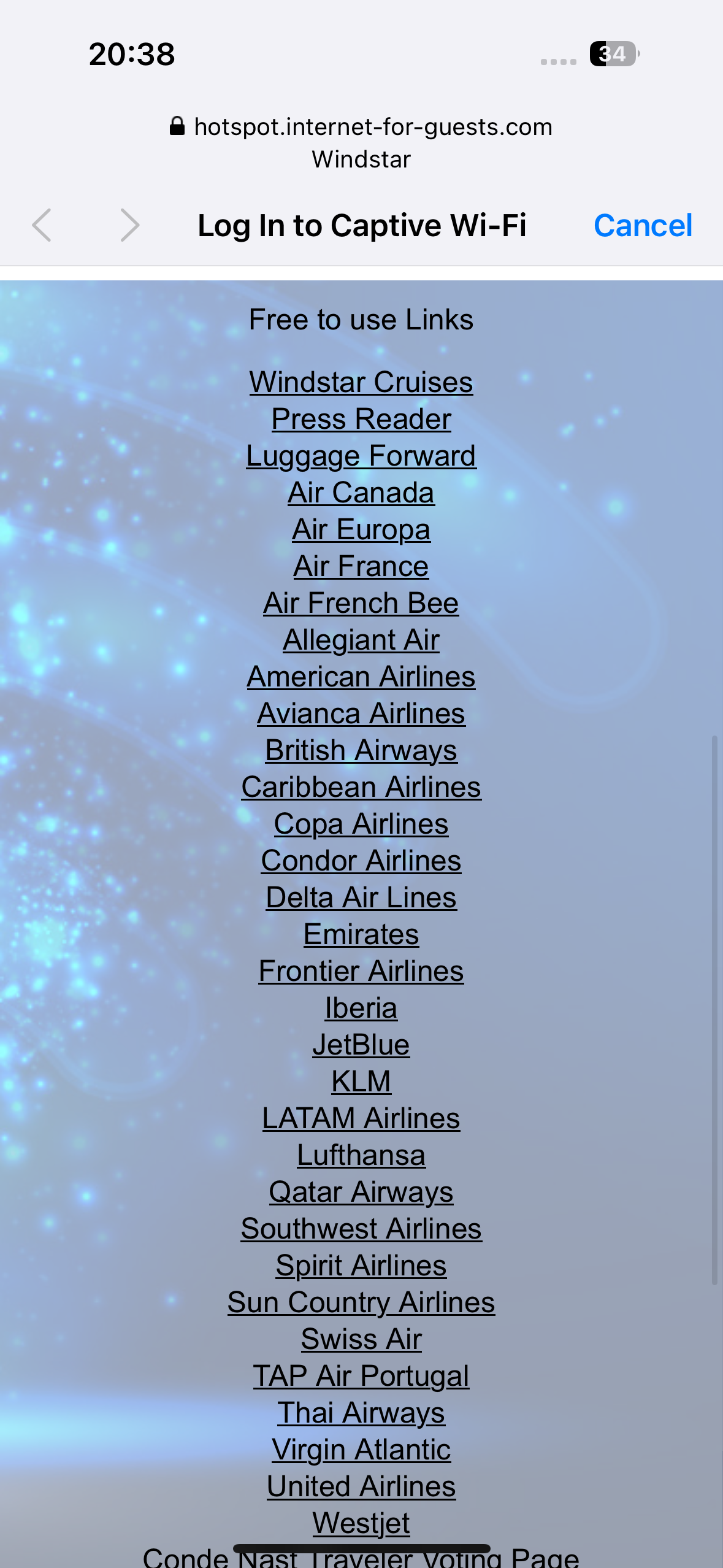
Whether you have Starlink access or not, all passengers have access to a number of websites (these includes the Windstar Cruises as well as many major airlines and other travel-related resources. It also gives access to a digital media kiosk which gives access to several major media outlets.
Spa & Fitness
Wind Surf has also its own onboard spa, which offers a broad selection of treatment. These must be booked in advance and are paid separately.
In my case, I opted to undergo a postural and walking assessment, conducted by one of the onboard spa specialists. This included a postural evaluation, an analysis of the feet position when walking and a 40-minute session to practice some exercises for postural health.
While technically booked at the spa, this was done at the onboard gym.
This gym is relatively small (the right size for the ship, since it was never crowded), but well equipped with fitness machines, weights and other equipment. It also has lots of natural light, since it is located on the top deck.
Shows, music and entertainment
Shows and other social functions take place pretty much daily during the trip, usually in the evenings.
Dont’t expect, however, the sort of large theater-like spectacles you find on large cruise ships. On Windstar everything is much more intimate.
This is the case of the live music performance that takes place every night at the Deck 4 bar, for example.


We also enjoyed a Pub Quiz evening, brilliantly conducted by PJ, a South African crew member that acts as the ship’s master of ceremonies.
Other occasions that provided an opportunity to meet personally the crew and other fellow passengers were an evening drink with the captain, a thematic evening dedicated to learning about Polynesia (a part of the world where Windstar Cruises has quite a lot of activity) and a star-gazing meeting at the bridge at night, with the guidance of Wind Surf’s captain and other officers.
There was also a show evening at the Lounge in which several members of the crew performed several dances from their countries of origin as well as some humoristic sketches, everything conducted again by the very talented PJ!
This account wouldn’t be complete without a mention to two other special, and rather tasty!, treats that we got to enjoy in the perfect weather of the Cote d’Azur:
One was the ice-cream evening by the pool - no further ado needed.


The second, and on a much, much larger scale, was the outdoor dinner-barbequeue that all passengers were invited to join while the ship was anchored of Cannes.
Massive amounts of super-fresh food was cooked and served on deck in a casual, festive atmosphere. The evening was also amenized by live music. Below is a collection of pictures from that evening to give you an idea of the scale of it all.


And if we are talking about the “soft” aspects of the experience, we would also like to highlight the level of attention and service from the ship’s crew, particularly from the crew member assigned to take care of our state room (thanks Raysid!), which kept leaving small nice details for us to find when coming back from shore! Here’s a small sample :)


Excursions

An integral part of every cruise experience are, of course, the shore excursions and Windstar is no exception!
In this regard, the relatively small size of Wind Surf becomes a big plus, because it allows it to call at the smaller ports no other cruises are able to enter or, simply, dock offshore and offer a combination of excursions and water sports (both are feasible if you time your shore visits well!).

At every stop, usually 4-5 shore excursions are offered, with different intensity and duration (from 2 to 8 hours). Unless you are on an all-inclusive package excursions are contracted separately, with prices ranging from some $60 for things like a walking tour of Cannes to something like $250-300 for longer outings, which in some cases included wine tastings and other activities.
It is recommended to book in advance because spots are limited and the most popular excursions fill up fast. Assembly is usually at around 8-8.30am.

Those going on shore excursions have access to quite a lot of prep info, starting with a briefing the day before at the ship’s lounge, which provides not just practical tips, but also some cultural and historical context about each destination. You also get a one pager delivered to your room (these resources can also be accessed digitally on the ship’s portal)

When Wind Surf anchors off-shore, such as at Portofino, Montecarlo, Cannes and Sanary-sur-Mer, the ship’s auxiliary launches are used to shuttle passengers to and from shore (there is always a small Windstar branded tent onshore by the embarkation/disembarkation point).
This, in my opinion, gives to this type of smaller cruises and extra allure!

We went to shore at all the ports or towns that Wind Surf stoped at, although we only took one organized excursion, during our Cannes stop to the nearby town of Antibes.
A group of some 20-30 of us left Cannes in a bus together with a local guide, who showed us around the old town of Antibes (which has Ancient Greek origins and is one of the oldest cities in Southern France).
Our program was roughly as follows:
8.15am Assembly and transfer by launch to the port of Cannes
9am Bus to Antibes (which is some 15 miles distant)
9.30 to 12.30 Guided tour of Old Antibes, a relatively small but charming little seaside town, complete with a castle and a lively fresh food market. The tour included also an a taste of absinthe at a local historical bar.
13.00 Back onboard

Our Itinerary: Civitavecchia (Rome) to Palamós
While the purpose of this post is to describe the experience onboard Wind Surf, the itinerary and choice of ports is, of course, is also an essential element of the journey.
Sailing in the Mediterranean is synonymous with landscape and history overload, so we provide here just an outline of each, and have decided to describe each of them in a series of separate posts.
Portoferraio, Elba
A beautiful little island, the largest of the Tuscan archipelago, and renowned for being the first place of exile of Napoleon Bonaparte. While it is certainly a must for Napoleonic-era buffs, there is a lot more than Bonaparte on Elba, including a picturesque steep old town and some amazing beaches.
Portofino (and Cinque Terre)
A postcard-perfect colourful seaside hamlet which encapsulates the essence of the “poshest” Italian Riviera. It is also a stepping stone to explore other beautiful spots along the Ligurian coast, even the somehow distant, but still pretty accessible by public transport, Cinque Terre.
Montecarlo
A European classic, the world’s second smallest country and a billionaire’s lair. Getting into Montecarlo from the sea is quite the experience!
Cannes (Antibes)
Cannes is famous because of its connection to the world of cinema and, while we gave the modern city a pass, it is also a hub to explore other locations along the Côte d’Azur (as we did visiting nearby Antibes).
Sanary-sur-Mer
This was quite a discovery! I must confess I hadn’t heard of this small, colourful seaside town before, but it fit the program perfectly. Just the right size for a mid-morning visit, stroll along the pleasant quais, climb the town’s old tower and do some shopping around.
Palamós
The largest port in the Catalan Costa Brava. While the town of Palamós is nothing to write home about (it was aesthetically destroyed by 1970s architecture). It is a hub to visit some beautiful spots in the area, such as the medieval villages of Pals and Peratallada or some of the nearby coves and beaches. We actually ended our cruise here, since we had planned to stay a few more days in the Costa Brava area and it made more sense logistically to skip the last night of the cruise.
Barcelona
Not much to add here! One of Europe’s great cities and one we are not neutral about, since we call it home!
Each of these places has a charm of its own, but we would say that what remains constant is the awe that the presence of Wind Surf generated among those watching it from afar!


Water sports at the Wind Surf marina

We have left for the last what is, in our opinion, one of the highlights of a Mediterranean cruise on Wind Surf: the marina.
When the ship is at anchor, weather permitting, the area astern of deck 2 becomes a water sports platform from 10am to 12pm and from 1pm to around 4-5pm.
Forget about material things. This is what true luxury is about!
Whether you are into active water sports, such as kayaking or paddle surf, or you just wish to chill out on an inflatable platform within sight of iconic landmarks like the Montecarlo skyline, the Wind Surf marina has you sorted! Just show up an enjoy. Towels and equipment are provided.
There are, of course, some limitations, such as, not venturing further than some 100m from the ship, but overall, it is pure bliss!


So, in summary, what’s our overall impression of Windstar’s Wind Surf cruise?
We’ve got some experience with cruises, including some high end ones on relatively small ships, and Windstar’s is certainly unlike any other cruise we’ve been on.
It is not about the, let’s say, “classic”, more material, idea of luxury, although on this account Windstar also scores high (particularly on the culinary front!), but about being able to do things that are accessible if on a small ship: water sports at some of the most exclusive spots on the Cote d’Azur, accessing small ports, star-gazing in the company of an experienced sea captain and so on…
Also, the uniqueness of Wind Surf. Granted, sails only provide part of the propulsion, but, still, it is nice to sail on such a majestic ship. There is something special about watching the coast fade in the distance from the wooden deck as the sail unfurl: the feeling of connection to the sea and to thousands of years of maritime history.


48 hours in Chisinau, Moldova - what to do and what to see

Moldova is, perhaps, one of the most less well known destinations in Europe.
Wedged between Romania and Ukraine, Moldova has faced its fair share of challenges since becoming independent in 1991, following the dissolution of the Soviet Union.
In addition to a fragile economy, the war in neighbouring Ukraine has added to Moldova’s already complicated geopolitical situation. A slice of Moldovan territory has, for the last three decades, been controlled not by the country’s internationally recognized government, but by a separatist entity backed by Russia, resulting in a chronified source of tension.
Nevertheless at the time of writing these lines, and despite these lingering problems, Moldova is looking at the future with some renewed optimism after having received EU candidate status. Enhanced air connectivity, currently provided both by local airlines like Flyone and pan-European low cost carrier Wizz Air and with perspectives to keep growing, as participants in the 2024 Aviation-Event can attest, is also helping develop the tourism industry in Moldova, still small but with plenty of potential.
The fact is that all these geopolitical issues fade in the background when visiting Chisinau, particularly if the weather is nice, like it was the case during this trip!

Arriving to Chisinau
Before jumping onto the Moldovan capital’s main attractions, a couple of visual treats for aviation enthusiasts!
Btw, Chisinau airport is rather pleasant and built at a rather human scale. It appears to have been refurbished at some point in the last few years, since its rather functional and modern inside.
It is also quite close to the city center (a 15-20min drive).

What to see in central Chisinau

Let’s start by saying that there isn’t one major, iconic landmark in Chisinau.
Don’t expect to find a Tour Eiffel or Big Ben here. Rather than seeking to take a picture with one iconic sight, I’d say the most interesting thing to do is to walk and look around. Chisinau is not big and you can easily walk pretty much around the whole of the city center, which has an interesting mix of neoclassic, local and Soviet-style architecture.
The streets and urban space in general and kept tidy and clean throughout and, what’s more, the urban layout, with orthogonal and rather broad avenues dotted with some green areas dotted with multiple fountains makes for quite a pleasant walk when the weather is nice.

Most of the sights are located within 500m of the central square, Cathedral Square (“Parcul Catedralei”): the triumphal arch and the statue to Stephan the Great, a 15th C. Moldovan king, which, btw, appears on the country’s bank notes (get some if you have the chance, they make for an interesting souvenir because they look rather unique!) and, the Orthodox Cathedral, of course.
It is also in this area where you find the major business and government business as well as many shops and restaurants.
Btw, there is no metro in Chisinau, so most public transportation relies on buses and trolleybuses, but you won’t need any of these if you just stay in this area of the center, since it is very walkable.


One curiosity that caught my eye: on Cathedral Square there are some displays that show…the newspapers of the day (both in Romanian and Russian)! I ignore what is the origin of this and whether it still makes sense in the internet ear, but it is rather interesting to see it, like a relic of another time!


Another remarkable things: there are lots of figurative bronze statues around Chisinau, many of them with casual, everyday scenes. I have tried to collect them in this post. In my opinion, they fit really well in a urban decor that includes also other more Soviet styles.


Not to be missed: best viewpoint in Chisinau
A singular building that I’d recommend visiting is the Chisinau City History Museum, which is located in a tower on a gentle hillside about 10min walk from the central square. Even if it is not that tall in absolute terms, the museum is relatively higher than most of its surroundings, so the tower provides one of the best viewpoints over mostly low-lying Chisinau. There is a panoramic, 360-degree, terrace at the top.
Bonus point: on the day of my visit entrance was free (although I think the fee is quite low anyways!)


The museum itself is rather small (the structure of the building means that the exhibition rooms are spread over several floors) and exhibits are laid out in a rather old fashioned way. Signage is in Romanian, so hard to read much (although speakers of Latin-based languages may be able to roughly understand some of it), but it gives you a feel of the history of the place and the different eras it went through over the last few centuries, when Moldova was at the crossroads of three large empires: Russia, Ottoman and Austro-Hungarian.
Below is the view: as mentioned earlier, there are no major landmark or iconic sights, but you get a feel of the place and the dimensions of the city.

Park and Lake Vale Morilor
Continuing the walking route, right across the road from the museum is Chisinau’s largest park, the “Parcul Valea Morilor”, which has a large pond (with the same name as the park) at its center.
This whole section of Chisinau is full of educational institutions and university faculties built in a style that would be instantly recognizable to anyone that has traveled in Eastern Europe and the former Soviet space.

As mentioned above Lake Valea Morilor is at the center of the adjacent park, although located at a slightly lower level than the surrounding hills, so this provided urban planners with the opportunity to build some monumental flights of stairs connecting the lake to the city.
Among these are the “Cascade Stairs”, which consist of a series of stepped mounumental neoclassical fountains that would not be out of place at any of Europe’s royal palaces.

Lake Valea Morilor is, actually, an artificial reservoir. A number of trails make for good jogging or walking along its shores. There were also a number of people fishing and quite a few aquatic birds around. The lake itself is not huge, but in relation to the size of the city it is quite a landmark!

Again, the street statue thing. This one is possibly quite recent. It sets the vibe.


Original architecture in Chisinau
Another singular building found on the way between the Vale KMorilor Park and Cathedral Square is the National Museum of Ethnography and Natural History of Moldova, built in a sort of “Oriental” style in the late 19th C. It is the oldest museum in Moldova and, throughout its history it has changed its name and the focus of its exhibits several times, in tune with the political changes that have taken place in the country.

And to close the architectural chapter of this post, with a couple of other buildings that caught my eye because of the original shape or decor. One of them is the Chisinau circus, an obvious example of Communist-era architecture showing its age, the other, a mural in the city center (if you look with attention, you will find the former within the latter!).


Visiting the Cricova Winery

But, perhaps, Moldova’s top attraction are its wineries!
I had the chance to visit the Cricova winery, which is located just a few miles outside Chisinau.
Moldova was the main wine producer in the whole of the Soviet Union and, to this day, wine-making remains a flagship industry for the country, with the Cricova winery being the top winery.
In fact, a visit to the Cricova winery is sort of a must if you come to Chisinau. Proof of that is the VIP picture gallery on display at the winery, which is pretty much a who is who of global business and politics of the last few decades.

This map shows the extent of Cricova’s underground cellars.
What’s rather unique with the Cricova winery is that most of it is, actually, underground!
We were told, and I guess this is more legend than fact, that at some point in the past, it was forbidden to make wine in Moldova, but some monks kept the tradition in some caves in this region, hence the, literal, underground wine-making tradition.

The Cricova winery is a proper underground city with many km of tunnels, so, after watching a short film about the history of the place, visitors move in these electric vehicles that are a cross between a train and a golf cart.

If you have ever been to a winery, these images will be familiar to you.

In addition to the rooms dedicated to wine-making proper, visitors can also see a number of other areas within Cricova’s underground facilities, such as dining rooms (the winery hosts events regularly, including the one I was attending on this occasion!) with a rather unique decor, and even a chapel!


Eating Moldovan specialities
The visit to the Cricova winery provided also the opportunity to taste some local specialities, such as “Sarmale”, which is a sort of cabbage dumpling filled with rice and meat, which was served inside a stuffed inside a red pepper (left side picture). We also got some fried carp fish served alongside a polenta-type corn-based cake (right side picture), all together with Cricova wines and “Divin”, which is a sort of brandy made with the local grapes.


Where to stay in Chisinau
Park City Hotel
Strada Eugen Doga 2A
Chișinău, Moldova
This turned out to be a pretty good place to stay! It is a 4-star hotel operated by a local company. It is located right in the center of the city, on a pedestrian street adjacent to the main square.
It is located on a high-rise (for Chisinau standards) and the upper floors have some views.
The room was rather large, spotlessly clean and modernly furnished. Good, fast internet as well.
The breakfast was ok, nothing to write home about, but correct.


Short trip to Lithuania: exploring Vilnius and Trakai

Lithuania is, perhaps, the least well known of the three Baltic countries.
While Riga has a relatively well connected airport and Tallinn is just a stone’s throw from Helsinki, Lithuania really requires a trip on its very own.
And this is something I had the chance to do not long ago. The experience did not disappoint and I will share some of the impressions in this mostly-visual post.
Vilnius, the old town
Vilnius’ historical center is not huge, but very walkable (as you can see here, many of its streets are cobbled) and photogenic.

Also, it is not exactly flat, the old town has a bit of an incline converging on the city’s cathedral square (this is one of two major squares in Vilnius’ old city, the other being Town Hall square, at the opposite end of the historical center).
Cathedral square is, thus, the center of gravity of the city, but this is not your typical old town central square. For a starter, it is not right in the middle of the old town, but at its edge, acting as a nexus between the narrow, cobbled streets of the old town, the straight commercial streets of the modern city and a major forested park.
Cathedral square is also dominated by a relatively high (for a urban environment) and steep hill, at which top are the vestiges of Gediminas Castle, and criss-crossed by two rivers, the Vilnia and the Neris.

The cathedral is also quite unique in that, unlike those in other Central and Eastern European cities, it is built in neoclassical style, with its clock tower separate and in front of the main building.
Next to it is the former palace of the Dukes of Lithuania, which ruled a powerful state in the late Middle Ages and early modern era, which stretched from the Baltic to the Black Sea.
Nowadays this building complex houses several museums and temporary exhibitions.

But the one thing you should do if you come to Vilnius is climb up to Gediminas Tower for the best views of the city.
There is a small funicular that will get you there from the museums next to the cathedral, but health and weather permit, I recommend walking (there is a track from the back of hill that starts next to the Vilnia river embakment). It is a bit steep at times, but a nice walk (also cobbled!).

It was quite cold, but the views were absolutely worth it!


I stumbled upon a ceremony in which new Lithuanian army officers were sworn in. Here’s the band, which played the national anthem and other marches.
Walking around the old town you can notice that a lot of effort and investment has gone into restoration works. The results are certainly paying off and most of the city is now postcard-material, although when getting into some side streets it is still possible to see a fair number of derelict buildings (I guess a bit of imperfection adds some authenticity to the ensemble too!).

Although today it is overwhelmingly Lithuanian, Vilnius had historically been quite a multi-ethnic, multi-cultural city, with significant Polish, Jewish and Russian populations as well. According to the 1897 Russian Empire census, at the turn of the 19th C., Jews were the largest population group in Vilnius, followed by the Poles.


Vilnius is also a city of churches. Interestingly and, rather uniquely, I think, for this part of Europe, most of these churches are built in an Italianate style.
Apparently in the 16-17 C. Jesuits, many from Italy, had a strong influence in Lithuania, which was the last European country to convert to Christianity and, to this day, remains strongly Catholic.

Was it not for the typically Northern European winter weather, you may be forgiven for thinking you are in Italy. The Baroque facades, the decorations and colours of many of Vilnius’ churches make you feel like it at times!


Modern Vilnius
There is also a modern Vilnius, which spreads on both banks of the Neris river. Most of the commercial activity is in the area adjacent to the old town, with many shops, restaurants and cafés located along Gediminas Avenue and Vilnius street.
A business district with some mini-skyscrapers has sprung on the north bank of the Neris, although I am not sure there is much to do there unless you have work to do there, the best views are from the other bank.


It is also possible to walk or cycle along the Neris embankment. I am sure it makes for great outdoors recreation in the summer, but at the time of my visit if was rather cold!

The memory of the 50 years of Soviet occupation, between 1940 and 1990, are very present, even more so after the Russian invasion of Ukraine, in 2022.


The Soviets ruled Lithuania and the other Baltic countries with an iron hand and deported tens of thousands of Lithuanians to Siberia in terrible conditions. Many of them never came back.

Excursion to Trakai
Trakai is, possibly, one of the easiest out-of-town excursions you can do from central Tallinn if your schedule is time-constrained.
Trakai is one of Lithuania’s most historical towns. It is located some 25 km west of Vilnius at the center of the Trakai Historical National Park.
For a period of time in the 14th and 15th Centuries, Trakai, with its two imposing castles, acted as a de facto capital of the Grand Duchy of Lithuania. That was just at a very important moment in the history of the country, right as it was adopting Christianity and increasing its contacts with other European kingdoms.
Another interesting aspect of Trakai’s history is that it was home to a community of Karaim, that is Turkic-speaking Jews from Crimea (also known as Karaite Jews), which were settled in the area by the Grand Duke of Lithuania in the Middle Ages and preserved their language and cultural and religious traditions through the following centuries.
Getting to Trakai from Vilnius is easy, there are trains running pretty much every 30 minutes or so. The station is located in the outskirts of the village, though, and you need to take either a bus or a taxi or just walk the couple of kilometers to the castle, which is what I actually did.

What to see in Trakai?
The Island Castle, of course. This is the best preserved of two castles on Trakai and, as it name implies, it is located on an island, which is in middle of a lake.
The whole of Trakai is actually located on a narrow isthmus that protrudes into the lake and to get to the Island Castle you need to pass a series of bridges and another smaller island. A bit like in the fairy tales!

At the time of my visit, in fact, could possibly have walked straight away since the lake was frozen solid with ice.
There is another castle on the adjacent Peninsula, although it is partly in ruins.
In fact, the Island Castle, which was built in the 13th and 14th Centuries, also fell into disrepair and by the 19th Century was mostly in ruins too.
However, its was thoroughly restored in the mid-20the Century and today can be visited more or less in what would have been the original state.

The castle is made of red brick. It has an interior courtyard around which there are several museum rooms where the story of the castle and of the Grand Duchy of Lithuania and, later, the Polish-Lithuanian Commowealth are explained.

The visit continues in the upper section of the castle, which towers over the rest of the grounds. Here there is another, more narrow, central courtyard, surrounded by high walls. Here it is possible to continue learning about the history of the castle through the exhibits in the different rooms.

The rest of Trakai is not without its charm. Besides the ruins of the other castle, which I did not visit, there is promenade that takes you from the castle to the station and which is dotted by long lying wooden houses.
This is clearly a spot that gets its fair share of tourists (many of them local from what I could tell) and the areas next to the castle are full of souvenir shops and some bars.
I guess in the summer time, the lake makes for some great recreation and there is, in fact, a footpath the runs along the lake shore.
It took me about 30 minutes to walk, at a good pace, but not particularly fast, from the castle to the station.
Tasting Lithuanian food in Vilnius
Restaurant Bernelių Užeiga
Pilies g.10, Vilnius
Ok, this is a bit touristy in its appearance (including the staff wearing traditional dress!), but I was taken here by some Lithuanian colleagues, so the food is really the real deal.
I am aware that “pink soup” is one of Lithuania’s signature dishes and Lithuanians take great pride in it, featuring it even in their postal stamps. But pink soup is a summer speciality, and here is was winter and rather cold, so went for something more earthy, instead!
Started with what is considered a very typical snack in Lithuania, which is basically crumbs of fried rye bread eaten together with melted cheese and a touch of garlic and butter.

Then tried “cepelinai”, which are a sort of potato dumplings (their consistency is a bit reminiscent to that of gnocchi) that are eaten together with butter or sour cream with some crispy onions on top.

They are typically filled with meat, although I think there are other fillings as well.

24 Hours in Brunei's capital, Bandar Seri Begawan
Brunei Darussalam is one of the smallest countries in Asia, roughly twice the size of Luxembourg and nested between the territory of Eastern Malaysia in the island of Borneo.
Brunei, however, is a rich country thanks to its oil and gas reserves, or at least its Sultan is (besides being an absolute monarch, he has a fortune estimated in some $30 billion).
At some point before the rise of the internet billionaires and for a number of it was even considered the richest man on the planet.
One thing it isn’t, though, is a tourist hotspot, although it is quite easy to get to from the region’s main hubs, such as Kuala Lumpur or Singapore. It has even a flag carrier, Royal Brunei Airlines, that operates a fleet of Dreamliners to destinations as far away as London.
So, during a recent trip to Malaysia I came across a cheap Air Asia ticket from Kuala Lumpur to Bandar Seri Begawan and, despite the really early wake time (the flight was around 6am!), I decided to give it a go!
Getting to Brunei

As mentioned, I flew to Brunei from Kuala Lumpur (although not on the plane depicted here!), which is a bit less than a two hour flight.
Visitors from a relatively long list of countries, which include most European states and the US and Canada, don’t need to request a visa in advance before traveling to Brunei. Although it is necessary to fill in a form online before passing through customs.

Luckily Brunei airport has good public wifi (although some technical glitch prevented me from completing the customs form at the first attempt), so once you have completed the form you get a message on your screen with a reference number that you must show to the border control officer.
The airport is small and tidy, a bit like the rest of the capital.
One piece of advice is that you print your boarding pass for the return trip, because for some reason they only accept paper boarding passes to access the air side of the airport.
Another important thing to take into account is that public transportation options are very limited. One thing that becomes apparent immediately is that Brunei is a very motorized country and people move everywhere by car, to the point that even downtown the streets are often deserted. To be fair, there is a public bus, but I was told that it doesn’t really have a set schedule, so you may end up with a rather long wait.
Also, if planning to order a taxi, bear in mind that neither Uber nor Grab (its south-east Asian equivalent) are available in Brunei. There are a couple of local alternatives, but since I didn’t feel like starting the whole sign up and ordering process (which involved receiving some sms that never arrived) I ended up messaging the hotel and asking them to arrange a transfer for me (from what I read in online forums, it seems to be, ultimately, what many people staying at hotels do.
Once you have this sorted, it is a pretty short ride to the very center, less than 15min. The roads are really good and tidy, possibly the best in the region (except perhaps Singapore).
Things to see in Bandar Seri Begawan
The capital of Brunei, Bandar Seri Begawan, is really small, or at least the downtown is (from what I could see from the plane when approaching to land, it looks like most people live quite spread out in the suburbs). But when I say “small” I mean very, very small. The downtown proper, which is next to the river front is literally a grid of 4-5 streets.
Since I had barely 24 hours in the country and well aware of the lack of public transportation, I picked up a pretty central hotel (which turned out to be a great choice as you will see further down the text).
Next are the few things I did, I think they are pretty much the top of things to do in Brunei’s capital, but I am sure that more experienced travellers can point towards some additional ones.
City center and Omar Ali Saifuddien Mosque

The Omar Ali Saifuddien Mosque is THE landmark of the city and its most recognizable sight. It is located downtown by a lake that makes for great picture-taking (well aware of the needs of the Instagram era, local authorities have installed a giant frame at the nearby park, right at the spot that allows you to take the iconic picture).

Next to the mosque there is a park and what looks like the only mall downtown. There are quite a few traditional shops in the adjacent streets, many of them selling jewellery, but most, let’s say, “modern” shops are in this small, which has also a small food court and seems to be one of the major gathering points downtown (although, just like the rest of the city, it was very, very quiet, no matter what time of the day or the evening I passed by).

On the positive side, Bandar Seri Begawan’s downtown is walkable and it feels safe.

I just happened to visit a few days before a major royal wedding and the city streets were all adorned and embellished for the occasion and, presumably, for some sort of parade or motorcade.

I post, here below, a picture of one of the major thoroughfares crossing downtown, not a single pedestrian to be seen. In fact, most of the other people (not many) I came across during my walks were, very visibly, fellow tourists.

Like many capital cities, Bandar Seri Begawan, is located next to a major body of water, in this case the Brunei river, which is also home to a significant share of the city’s population as we will soon see when I describe my visit to the Kampong Ayer floating city.

There is a short promenade along the banks of the Brunei river, with views of the Kampong Ayer floating city on the water side, while there some shops and food joints (I wouldn’t really call them restaurants), land side.


Here below is some street art encapsulating the main sights in Bandar Seri Begawan.

Brunei’s Museum of Royal Regalia

Although, at first, I was not too keen in going to museums, preferring to just walk around and see the sights, I had around 3 hours before the start of my Kampong Ayer river tour, so I decided to go see the Museum of Royal Regalia, which happened to be just around the corner from my hotel. It proved to be a good decision and the museum didn’t disappoint!

The Museum of Royal Regalia exhibits many of the ceremonial elements used by the court of the Sultan of Brunei as well as many of the gifts he has received from dignitaries of other nations.
I must say that the scale and the way in which all these items are exhibited makes for quite an interesting sight. Like in the rest of the city, I was pretty much the only visitor at the time.
The visit is done barefoot (you leave your shoes at some sort of pidgeon-holes set at the entrance for this purpose). There is also a visitor’s book where you can write your name and place of origin when you come in. It offers a glimpse of the number and profile of visitors that are following more or less the same route as you!

The displays of ceremonial gear are quite something and, while they are used very sparsely, it must be quite impressive to see them put to use for real.


As an aviation enthusiast, I couldn’t avoid remarking that aviation was well represented at the museum. This applies, both to the gifts section, like, for example, these two scale models of Antonov planes brought by an Ukrainian delegation, and to another exhibit showing the Sultan’s wide-body, long-range jets.


The museum offers also a glimpse (at small scale) of some aspects of palace life that are usually not in the open, such as the large ceremonial hall with capacity for 5,000 attendees.


The floating city of Kampong Ayer and Brunei river tour
One of the highlights of the trip was the river tour that took me to the Kampong Ayer river city and to see some stretches of jungle near the city.

The tour, which was arranged by the hotel, started in this canal right by the city center. It costs the equivalent of €30 and it takes about 3 hours.
It is pretty much the only way to see Kampong Ayer, which is an interesting part of Bandar Seri Begawan because it lies right in the middle of the river. In fact this so-called “Venice of the East” is home to between 10,000 and 20,000 people living on houses that are built on top of stakes that protrude from the water. It is considered the largest floating city in the World and it was mentioned already by travellers in the 16th C.

So, it turned out this was going to be an individual tour, after all! Here is my guide (Hj.Sofree Hj.Aji, who can be reached on “Padi Boat: +6738788261 or +6738788651 ”). He happens to be a resident of Kampong Ayer himself!

When heading into the river we took a little detour to see the bridge from up close. There are two large bridges in Brunei, this one, built by South Korean engineers across the Brunei river and another longer one (30km), recently completed, which unites Brunei’s mainland with its eastern enclave to the east, providing geographical continuity to the country.

And here are some views of Kampong Ayer, which is a proper city with houses, schools, fire and police station…all built over water.
We cruised along the “streets” without stopping and headed to the jungle a bit further out from the city…


It doesn’t take long to get into the jungle, even if not far from the city center and in a relatively urbanized area, it is possible to spot quite a few animals here.


And, indeed, it didn’t take long to spot a few monkeys. This, to my understanding, are some species of proboscis monkeys, a type of monkey recognizable by its really long nose which is typical of Borneo. We also managed to spot a saltwater crocodile, but it disappeared under the water very quickly!


And here is a glimpse of part of the palatial complex of the Sultan. Brunei’s royal palace is said to be the largest residential building in the world, with 1788 rooms and 257 bathrooms. The palace is not open to tourists, so one of the ways to see some parts of it is from the water.
And here below is the riverfront of downtown Bandar Seri Begawan, it practically fits all in this picture!

Where to stay and where to eat in Bandar Seri Begawan
The Brunei Hotel
I picked this one up online mainly on the basis of its very central location and it turned out to be a very good choice.
It is a four-star hotel, reasonably priced, very clean and with nice service. I think there are some slightly cheaper options downtown, but I am not sure they offer as much value.
The staff were very friendly (in general I found people to be very friendly throughout my stay!) and they gave me an early check in (my flight arrived quite early in the morning), gave me a room with canal views and helped me arrange the airport transfers and river tour.

The wifi connection worked really well. The hotel has also a restaurant, although I didn’t try it (seen the issues I had later finding a place to dine, possibly I should have given it a try!).
I also liked the fact that there are purified water stations in the corridors and you have a bottle in your room that you can refill whenever you want.


Some pics of my cozy room at The Brunei Hotel, complete with views of the canal (this course of water is barely 100m from the main river and it is from here that I would later start my river tour)

When it comes to food. My main piece of advice is: be careful with the schedules! I tried to have dinner at around 20.30 only to find the mall’s food court closing down.
This meant that the only other options at hand were some fast food joints, none of which was particularly appealing, so I ended at Pizza Hut, and a couple of ice-cream parlours (this was very good, I must say!).
Earlier in the day I had lunch at the aforementioned food court. There are 4 or 5 restaurants serving different types of Asian food. I opted for these seafood noodles and it was very tasty and reasonably priced, hence my later attempt to go back to the same place (the city is not exactly bustling with eat-out options!)


And that’s what my 24 hours in Brunei offered…just to close this post, here is one more image of the iconic Omar Ali Saifuddien Mosque at night!


Cruise Report: on the Norwegian Encore maiden voyage
Exploring a state-of-the-art cruise ship during its inaugural sailing

Have you ever had the chance to drive a brand new car?

The smell of new that pervades everything is perhaps one of the most powerful, memorable sensory experiences.
This is not unlike sailing on a ship that is, literally, off the yard.
On November 2019, I was among those that were invited by Norwegian Cruise Line to experience the latest, state-of-the-art ship of this Miami-based cruise operator.
The Norwegian Encore’s maiden voyage, from Bremerhaven, on Germany’s North Sea coast, to Southampton, in England, would give us a chance to get a short, but intense taste of what this cruise ship has to offer in terms of facilities and service.
Continue reading for a short, but comprehensive tour of the ship and a glimpse of what the Norwegian Encore experience it is like…
How is it like to sail on the Norwegian Encore

The Norwegian Encore is a 169,000-ton “Breakaway Plus” class ship for capacity for 4,000 passengers and 2,000 crew, which makes it the 11th largest cruise ship in the world at the time of writing these lines.
As is often the case with these very large ships, you don’t really get the sensation of being in a crowded place, though. And there is so much to do onboard that people distribute themselves all over the place, it is rare to find some bottleneck.

Here’s a glimpse of the staterooms (with veranda).
Did I mentioned that wi-fi worked great everywhere on the ship?


The central pool deck area, a classic of any cruise ship worth its name!
Although November weather in the North Sea did not invite to take a dip into the water! Thus, no swimming this time, although it still made for a great party venue and viewing platform (one of the things when sailing on the English Channel is that you come across lots of maritime traffic, a treat for ship-spotters!)

In these pics you can get a view of the Norwegian Encore pool deck area and some of the adjacent amenities, such as those warm water jacuzzies on the side and the massive aquapark.


Plenty of entertainment indoors too and for a diversity of aesthetic tastes, as you can see here, from the 1950s American diner style to a more classical lounge area.


In case you are a Starbucks junkie, you would be glad to know that there is one onboard! (and Starbucks coffee machines are also available at the buffet area)

And of course, entertainment by the ship’s very own theatre company. Only time for one show, but was great!

Special mention goes to the games arcade. It was a first for me, nevertheless it was quite interesting to check out the whole range of immersive experiences using the latest 3D entertainment technology, from driving a formula one racing car to shooting zombies and slaying dragons.
Plenty of options to choose from!

The Haven
One of the most interesting aspects of the trip was becoming acquainted with The Haven, Norwegian’s premium product.
This is a secluded area, literally a private haven within the buzz of the large ship, which bring the levels of comfort, privacy and service one step up.

The Haven experience is designed to provide a peaceful and calm environment in a rather elegant setting. It has its own indoor swimming pool and indoor area, as you can see here (the set up reminded me that of classical Roman baths for that matter!)

And staterooms in The Haven are considerably larger and more luxurious


There is also its own a-la-carte restaurant, that we had the chance to try out, and a dedicated bar and lounge area. There is plenty of space to relax and socialize at The Haven, just in a more exclusive atmosphere.


The Food
But if you ask me, I’d say food is one of the highlights of a cruise on the Norwegian Encore.
There is, of course, a buffet area (where breakfast is served) on one of the upper-most decks and, if on MSC Meraviglia, the star of the buffet (in my opinion) was pizza, at Norwegian Encore I was positively impressed by the choices of Indian and Asian food available.
But there are plenty of other à-la carte restaurants onboard.
Although the journey was short, two nights and one day, we were able to sample the different eating options available: from Mexican and Italian to Chinese cuisine.


My favourite, though, was the “Q Texas Somkehouse”, a sample of which you can see below.


Oh! And, last but not least, we enjoyed as well as a cocktail and wine tasting, the latter with the ships’ sommelier. This was, of course, a special treat on a very special trip, but the same is available to passengers on regular cruises.


Cruise on MSC Meraviglia
Quality cruising at scale

In late 2018 I accepted an invitation from MSC Cruises to experience one of its most modern ships, MSC Meraviglia as it sailed around the Western Mediterranean.
What follows is an account of the different aspects of the ship that I enjoyed during the few days I was onboard. To be fair, the ship is so huge that I literally didn’t have time to try out many of the features available to its guests. Far from aiming to do a comprehensive review of MSC Meraviglia, I hope these lines can convey an idea of how is it like to sail on this amazing ship.
The Ship

MSC Meraviglia is a really large, modern ship.
It was launched in 2016 and had its maiden voyage the following year.
For some time, MSC Meraviglia was among the world’s five largest cruise ships, and, although some larger ships have since come into service, it remains among the top ten of the ranking. It is capable of carrying some 4,500 passengers and a crew of 1,500.
Happy to report, though, that those large numbers are perfectly compatible with a great passenger experience as you will see in the next passages!

The Itinerary
MSC Meraviglia at port in Cagliari, Sardinia
On this cruise MSC Meraviglia followed a clockwise route around the Western Mediterranean. Starting from Genoa, sailing down the Italian coast to Civitavecchia, near Rome, then on to Palermo, in Sicily, Cagliari (Sardinia), Palma (in the island of Majorca), Valencia, Marseilles and back to Genoa.
We boarded the ship in Palermo, so did not do a full circle, but spent 4 nights onboard, which allowed us to check out quite a few highlights, including the exclusive Cirque du Soleil show and several of the dining venues onboard.
The State Rooms

One question I get often is whether it feels crowded in cruise ships of that size. And to be honest, this is something that never ceases to amaze me, because the answer is a resounding No! How do ship designers manage to create this sort of hotel-like conditions? this is a question I don’t have an answer for. But from a traveler point of view staterooms onboard MSC Meraviglia are very comfortable and don’t feel tight when it comes to space.
I have been on premium, smaller cruise ships before and the stateroom at MSC Meraviglia stood well the comparison.
It was all very modern, as you would expect of such a new ship, and spotlessly clean. We had seaview veranda.
As it was going to be my birthday during the cruise, there was also a bottle of champagne and some chocolate and strawberries waiting for me, which was a very nice detail!

Facilities

Like in most modern cruise ships, the pool deck is one of the central spots on the ship. Even if it was early November, the weather was pretty warm when we left Palermo, so the open deck pools were quite busy!
As you would expect, there are also other smaller pools, a solarium and an indoor gym all around the pool area.


One of the things I liked about MSC Meraviglia (and I think it is a feature of most, if not all, MSC ships) is the way the space is structured around a central gallery that allows you to walk pretty much unimpeded from stern to bow, with most of the services easily accessible alongside. At the centre is a wide plaza that acts as a central hub, linking also several floors of the ship.


Although the glitter and bling that you find in some of these areas (including a rather generous use of Swarovski crystals) are not exactly my cup of tea, this layout has quite a few advantages, for example, it makes it very easy to orient yourself when walking around the ship and it gives you a sensation of space. Despite the large number of people onboard, you rarely feel a sensation of crowdedness.

I particularly liked the minimalist, simple, modern lines of the bar at this central plaza. Its sea-facing windows are also great if you find yourself in the need to do some work while sailing!

The central gallery is really the core of the ship. Most of the shops and specialty restaurants line it and this is where invariably you are going to find yourself again and again.

The vault, lit by thousands of LED lights, produces quite amazing displays. If the themes at normal times can already be quite elaborate, including the ship’s very own interpretation of Michelangelo’s Sixtine Chapel frescoes, it is something to be seen when one of the regular sound and light shows are performed.
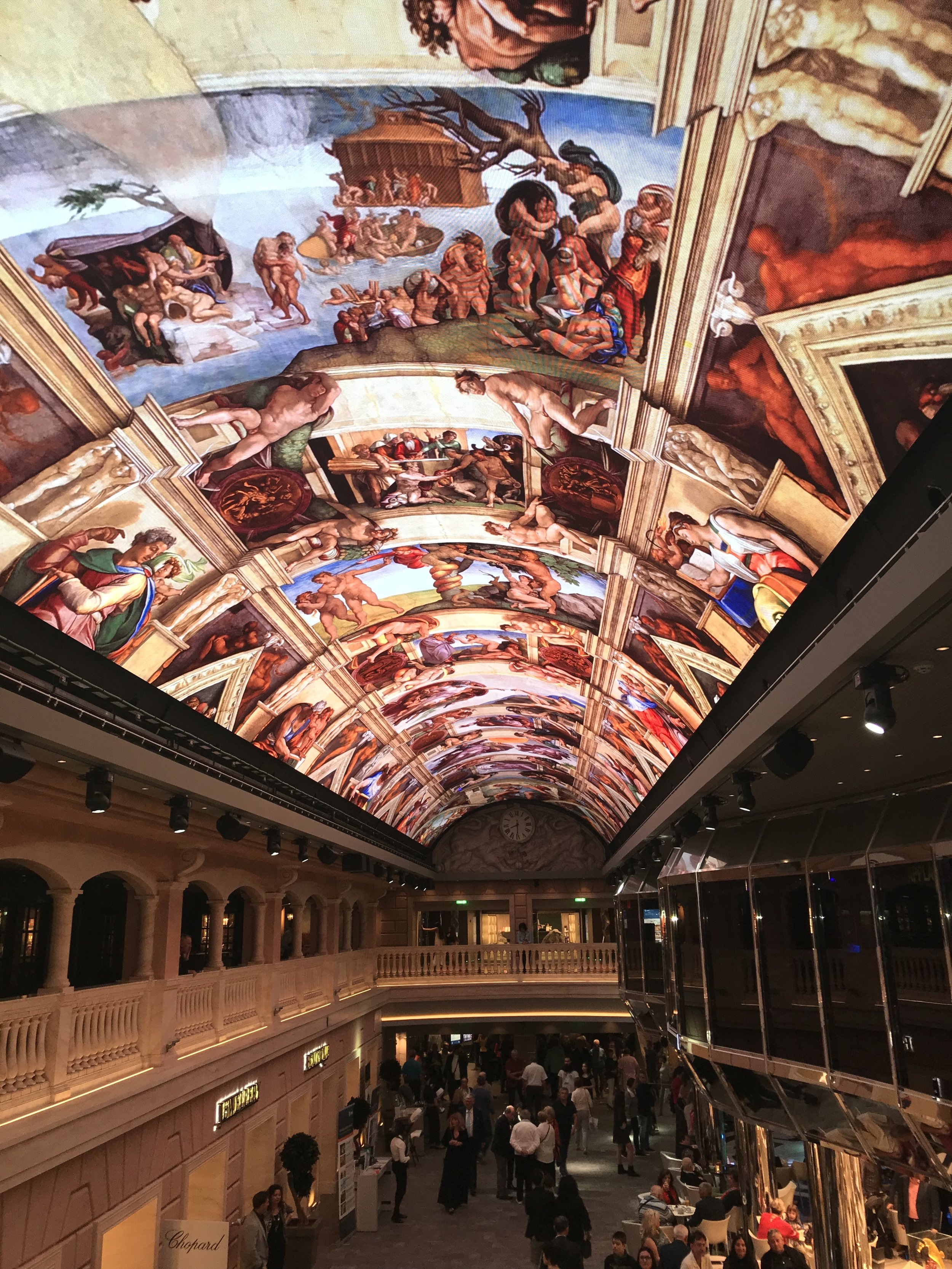

The central gallery is also the setting for all sort of shows, from the purely audiovisual, such as this one about roaring dinosaurs, all the way to full theatrical performances that passengers are invited to join somehow.


Passengers looking for some pampering can visit the Aurea Spa (most treatments are charged aside, though).
A couple of other elements of the MSC experience that are worth mentioning here.
The MSC for Me app, that lets you check in and book a number of experiences and activities throughout your trip. Something quite handy in such an entertainment-packed ship as MSC Meraviglia (more on this soon!)
The ship is also fitted with the Yacht Club area. This is, in fact, a more exclusive area within the ship that provides are more secluded, upmarket experience for those passengers looking for a more premium experience, yet, still willing to enjoy the advantages of a larger ship, such as the Cirque du Soleil shows, etc.
Shows & Entertainment onboard
In fact, if there is an aspect of the cruise experience where MSC really stands out and it is possibly a differentiating factor, this is the shows and theatrical performances onboard.
MSC Meraviglia has actually two theaters, one where the ship’s excellent theater company performs.
The other one, at the bow of the ship, is a smaller theater specially designed to accommodate the performances of the Cirque du Soleil. The Montreal-based arts company has an exclusive partnership with MSC Cruises to develop shows that are specifically designed to be performed at sea.
Ship’s Company Show

Although the Cirque du Soleil gets most of the attention and it is, indeed, a remarkable feat to have such a top-notch artistic company onboard, I would like to share some words also about the ship’s own theater and music company.
There are several shows every day, we attended pretty much all of them, and always had a great time!

Cirque du Soleil
One of the highlights of the cruise for sure.
MSC Meraviglia was the first cruise ship to host a Cirque du Soleil performance at sea. As you might imagine, the very intricate, complex acrobatic moves of these artists have an extra degree of complexity when performed on a moving surface, such as the ship. Although you can hardly feel the movement in a ship such as MSC Meraviglia, there is still movement and when success depends on millmetric moves, this is no small issue.
The Cirque performs in a specially designed stage, that is located in the center of the room, with spectators seating in tables all around (you can eat and drink during the show).
There were two different shows on offer, which are called “Viaggio” and “Sonor” (we watched the latter) on MSC Meraviglia at the time of our cruise. But far from being a one-off thing, the partnership between the Cirque du Soleil and MSC means that new shows are going to be introduced on other ships of the fleet.
You can learn more about this through this article that I wrote when I visited the Cirque’s HQ and training centre in Montreal to learn more about how this cooperation with MSC Cruises is unfolding.
No need to say that these shows have all the spectacularity and excellence that are the hallmark of the Cirque!

Eating & Drinking onboard MSC Meraviglia

Quite a few options to eat onboard MSC Meraviglia.
The simplest and most casual one is the buffett. Here I would higlight the pizza, that was really good and varied (as expected in an Italian-owned ship!)
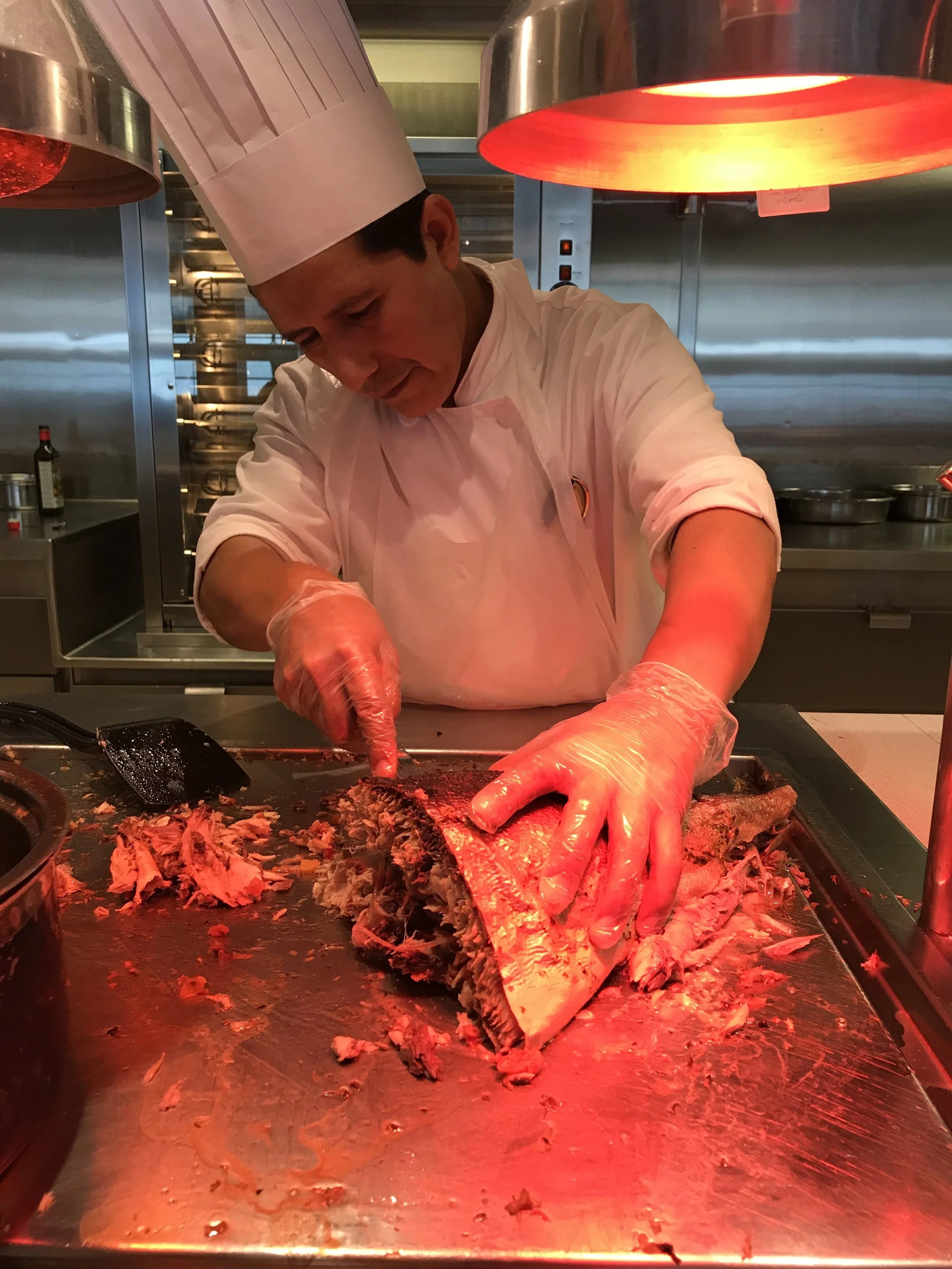
There are also a couple of large restaurants at the bow of the ship.
These are large and with high turnover, nevertheless I was quite impressed by the level of service and the food. Let me remark that these are not specialty restaurants that you need to book in advance, you just show up and you get seated almost immediately.
The service was impeccable and the food and drink great.

We also tried one of the specialty restaurants, the Kaito Teppanyaki, as you may have guessed, specializing in Japanese cuisine.
This was also an amazing experience (and not just because of my “surprise” birthday cake). Not only the food was great, but the chef turned out to be a proper artist, and was able to entertain us all while he was cooking.


Summing it up
MSC has managed to provide a great experience at scale, which is not an easy thing to do! MSC Meraviglia proves that large numbers are not opposed to quality.

The blossoming of the fruit trees in Aitona
What if I told you there’s a place in Europe where it’s possible to see a similar ephemeral phenomenon for a few weeks towards the end of Winter?
The region around Lleida, the capital of Western Catalonia, are famous for their fruit-growing agriculture. On the plains and rolling hills of the Segrià county, the fruit orchards extend as far as the eye can see, just that, unlike in Japan, here it is not cherry trees, but mainly peaches and pears that you get to see.
The result is equally, if not more, spectacular, although it had long remained somehow far from the public imagination.
The blossoming of the cherry trees, or “sakura”, is one of the most well known images of Japan and it draws people from all over the world.
This is starting to change now, with the introduction, by local authorities and businesses of fruit tourism products and activities, together with the accompanying marketing materials, signage and the like.

Remember, this is a very seasonal phenomenon, starting in late February or early March and lasting for 2-3 weeks. The exact dates to experience it at its height may vary a bit every year, so it is best to check with Aitona’s town council or with the local tourism organization.

At the heart of the fruit tourism experience are a couple of large estates that open their doors to tourists around these dates. Only organized groups are allowed in and on certain times during the weekends, since these are private commercial farms where all sorts of normal working activities are taking place.


The pink of the blossoming peach trees is the dominating colour, but far from being the only one. White (of pear trees, I think, but I am not an expert!) and green of other crops been grown in adjacent fields make for a truly multi-colour mosaic.


The water from the nearby Segre river, which flows between its source near Llívia, in the Pyrenees, and the Ebro river, makes possible this intensive agriculture in the lower Segrià basin.
This is particularly evident in the fruit growing estates where this blooming takes place.
They are traversed by a network of canals and hydraulic works, including the small reservoir of Utxesa, which divert some of the waters of the Segre river and use them to generate hydropower and water the crops.

Bonus track: archaeological sites - the Iberian settlement of Gebut (Soses)

Even if the flat lands of Western Catalonia are, generally speaking, a rather dry, steppe area, wherever there is water, civilization flourishes, and this has been the case here for many thousands of years.
One of the key campaigns of the Roman civil war between Caesar and Pompey was fought in this area (over control of the Segre passes and the nearby city of Ilerda, modern day Lleida). When that happened, this area was populated by an Iberian tribe called the Ilergetes and the vestiges of some of their settlements are found all over the area near Aitona.
The road between Aitona and Lleida runs along a series of low, semi-desertic hills (as soon as you get a few hundreds of meters from the river or irrigation works, the dryness of the area becomes again apparent!), and on top of one of them (located next to the town of Soses), it is possible to visit the ancient Iberian settlement of Gebut. To judge by the dimensions of the excavated area, this was possibly of a rather sizable settlement for the standards of the time (there are several other smaller archaeological sites in the area, such as the Poblat de la Genó, near the fruit orchards).

There is no museum or visitor’s center as such, although it is easily accessible from the road and there is a small parking where you can leave the car and then visit the ruins on foot. At the time of my visit I was the only visitor, but there was a member of the town’s service staff doing maintenance work and he kindly showed me around.

There is some signage that lets you get an idea of what was going on here around VII-VI C. BC, although there is still much to be uncovered here.
Archaeologists continue working on the site and making new findings, such as a defensive wall that possibly measured around 5 meters of height.
There is still so much that is not fully known about the Iberian civilization and lots of archaeological sites have been identified all over Catalonia that are still waiting to get proper love from archaeologists and the public alike!

48h in Iceland in winter: what to do and what to see

Iceland has become a very popular tourist destination in recent years and there are very good reasons for that. The list of natural wonders one can admire in Iceland is so long that a requires quite a few days to enjoy it thoroughly and it is well beyond the scope of this post.
Many people visiting Iceland, though, have relatively short time to make the most of their visit. This is particularly true of the many transit passengers traveling between Europe and America that get the chance to explore the country’s natural wonders.
In my case, it’s the national airline Icelandair that flew me there, giving me the chance to enjoy the amazing Saga Premium class, which I reviewed here.
I decided to make this, rather short, trip to Iceland after receiving an invitation to visit the bi-annual Icelandair Mid-Atlantic Tradeshow. It was great that, despite the intense professional programme, there was also some time for sightseeing in and outside Reykjavik.
What follows is my report and my recommendations for time-pressed first time visitors to Iceland!
Iceland Golden Ring Tour
This is a classic itinerary that can be day in a day (even half a day if hard pressed) starting and returning to Reykjavik. In fact, we did it during the month of January, when the Icelandic days are terribly short (it is dark until past 10am and again at around 4pm or so), nevertheless we managed to see quite a lot. Of course, we were in the hands of Reykjavik Excursions and a great guide, Albert, which, in addition to making the most out of our time to show us around and sharing the most interesting facts about each location we visited, he also kept us well entertained with its great Icelandic sense of humor!
Geysir geothermal area
This was our first stop, perfectly timed when the sun was already out. The Geysir area is know because, as the name indicates, this is an area where there is volcanic activity very close to the surface. Here you can admire the geyser that gives its name to the place, but also other boiling water springs.
The area is very easily accessible from the road, via a short walking path (in winter is advisable to bring warm clothing and waterproof shoes, though, since the soil can get really wet and damp!)
In recent years a large visitor’s center and a high end hotel have opened right next to the geysers area.


Here below is the geyser, which people congregate around to watch. I am not sure what is the frequency of the explosions, we had to wait only for about 5 minutes until one came up. Apparently it really depends on how much pressure the steam builds up underground.

Gullfoss Waterfall

This waterfall on the Hvítá river is a rather majestic sight.
The Gullfoss Waterfalls are actually two waterfalls in one. The top one is 11 meters tall, the lower one, 21. There are also two ways to approach it, the higher and lower one. We took the lower one, from where this picture is taken, which is very accessible by road.
Our guide told us that this waterfall was saved from being tamed and fitted with hydroelectric facilities in the early 20th century thanks to the constant fight of Sigríður Tómasdóttir, the young daughter of a local farmer Tómas Tómasson, who pretty much devoted her life to preserving this amazing landscape. At some point she even threatened to throw herself to the waterfall if the plans of the British developers went ahead. She persevered and she won and today the waterfalls are protected natural heritage.
If you are looking for a quintessentially Icelandic sight, this is it!
Friðheimar greenhouses
Is it possible to cultivate tomatoes and fruits commercially near the Arctic circle?
Yes! provided you have access to plenty of geothermal power. This is what drives this truly interesting agricultural and gastronomical business pretty much in the middle of the Arctic wilderness.
A couple of entrepreneurs from Reykjavik bought this farm in the 1990s with the idea to breed Icelandic horses here. They soon realized that the place offered other possibilities too!


Coming inside the Friðheimar greenhouse is like landing on another planet, particularly if, like us, you do so on a dark, cold winter day.
When you pass the door you come into a lush and warm, exuberant environment. You could as well be in the tropics!

What makes this place so interesting, though, is that Friðheimar is not just a greenhouse, but a gastronomic destination in its own right. Here you can eat surrounded by greenery, but, what’s more, you can learn the fascinating story of this place and how the family that owns it has been developing it using, mainly, the organically grown tomatoes that they harvest year-round.


Cherry tomatoes are the star here, but there are many other crops, such as aromatic basil, cucumbers or other vegetables and even fruits.


People learn here about the cultivation process, which includes organic, non-agressive pest control methods, and pollinization through the use of (imported) bees.


The menu is all based on local ingredients, with the tomato being, again, the star. Even the drinks have tomato as the base ingredient (there’s even tomato beer!)
There is also a shop where you can buy all sort of products made with the locally grown tomato, from sauce to jam. They also distribute it in supermarkets and shops throughout Iceland.
Oh, and the horse-breeding project was not abandoned. It is also well and thriving and visitors can also enjoy horse shows!
The whole concept of Friðheimar reminded me a bit of that of Mooma, in Catalonia, which I wrote about here, just that instead of apples this one is built around tomatoes.


Efstidalur II Dairy farm
Not far from Friðheimar, we made a pit stop at this dairy farm that is famous in Iceland because of its ice-cream.
This is not km.0 ice-cream, but pretty much “metre.0” ice-cream since the cow shed is literally integrated with the ice-cream shop, to the point that you are only separated by a thin glass window!


Also quite amazing to think that Icelandic cows produce enough milk to supply each inhabitant of this country with more than a litre of milk per day year-round!

Fontana Spa and Lake Laugarvatn
This is an ideal place to enjoy the thermal water of Iceland.
Located next to Lake Laugarvatn, this place has offered, for nearly 100 years, the possibility of bathing in hot springs. Volcanic activity here is close to the surface and, in some places, you just have to dig a few centimetres for boiling water to bubble to the surface.

At Fontana Spa you can bathe in a series of swimming pools with water at different temperatures, or spend some time in the sauna (the structure on the left of the picture) and alternate it with bathing in the icy waters of the lake!
But the other things this place is famous for is the geothermal bakery. Here they bake rye bread by digging a hole in the ground next to the thermal water springs.
The bread mix is left buried underground in a pot for it to bake overnight in the warm lava-heated ground, which acts as a natural oven a. 24h later, it gets dug out and immediately chilled in the waters of lake Laugarvatn and voilà! you have some delicious bread!


The next step is to try it and see whether it has baked as expected! From what we were told, there is some variability in how the bread gets cooked, since the natural heat is not always equally distributed throughout the ground at all times, so the flavour and consistency of the bread can vary considerably from one batch to the next.

Happy to report that we were lucky with the bread and it turned out to have an almost perfect consistency and a taste on par.


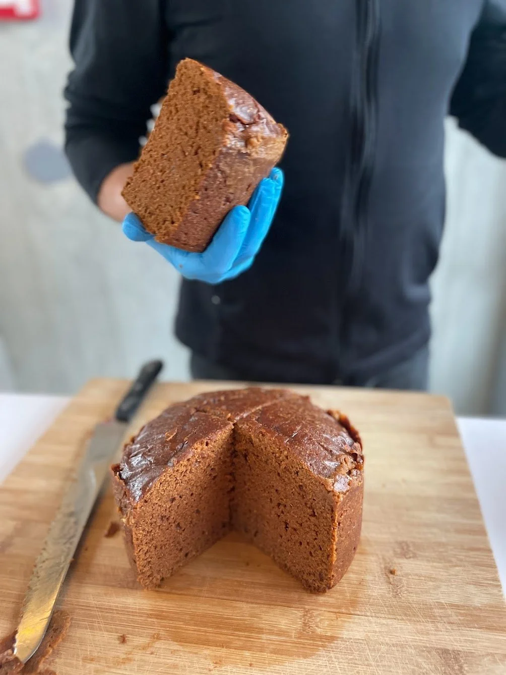
Even better if you eat the bread together with the locally-made organic butter and smoked trout from lake Laugarvatn.

We were actually told that when Gordon Ramsay visited this place, he was totally blown away by the flavours and immediately requested to go see the trout smoke house, which is located on the opposite shore of the lake, with a view to selling it in his restaurants in the US.

And, then, back to Reykjavik! (the traditional Golden Ring tour includes also a visit to the Þingvellir National Park, but we were short of time, so drove straight to the capital. Here are some of the landscapes we passed through before it became again dark.


Things to do and see in Reykjavik
Downtown Reyjkjavik
As you may imagine, Reykjavik is not a huge city, plus it is also considerably spread out, so the center is quite tiny. Nevertheless it is quite pleasant to walk through, even in a chilly winter day. Here are a couple of pics that give you a feel of the place.
You can see here, in the background, the contemporary glass-and-steel architecture of the Harpa concert hall (more about this singular building further down this text).


Hallgrímskirkja
This church is, perhaps, the most well known man-made landmark in Reykjavik and in the whole of Iceland.
Construction of this 74m-high Lutheran church started in the 1940s, but it was not considered finished until 1986! It was built in a modern style, with stylized, clean lines, that has turned it into one of the symbols of the country.


The church is on top of a small hill overlooking the center of the city and, in front of it, there is this statue of Leif Ericsson, the viking leader that is said to have been the first European to set foot in the Americas.

Harpa Concert Hall
I had the chance to get inside this building, not because of a concert, but because I attended an event that took place here.
While I don’t consider myself an expert in modern architecture, I quite liked the way it is designed, very modern but also quite spacious and functional (like most buildings in Iceland, a lot of care goes into great design!)


Whales of Iceland
This is an interesting museum about the sealife, and very particularly whales, that live in Icelandic waters.
Here you will find some 21 different whale replicas built at scale, with plenty of information about how they live and communicate. The museum offers also some sailing tours to go see the real thing (it is conveniently located in one of the city wharves).
I would have like to have had more time to go through all the collections properly!


Iceland Flyover
Located right next to Whales of Iceland, this is a totally recommended experience!
If you don’t have time to explore the nature of Iceland (or even if you do!), this is a thrilling full-motion movie that will make you feel as you were flying over the most spectacular natural spots of Iceland.
There is a bit of a short introductory story-telling part (with audiovisual animation) and then you move onto the circular cinema theatre, fasten your seatbelt and prepare for a truly immersive experience that will make your head spin!


Road trip through the heart of Germany - UPDATED
It is not as celebrated as its French or Italian counterparts, but the German countryside has a charm of its own…

The original post has been updated with additional tips, pictures and info from a second visit to Schwäbisch-Hall in late 2021.
It may not be as celebrated as its French or Italian counterparts, but the German countryside has a charm of its own.
In fact, to talk about “countryside” in Germany may not carry the same meaning as in other European countries where there is a more neat divided between urban and rural life. Germany’s economy is quite decentralized and you can find industrial activity pretty much everywhere. Even the smallest of towns may be part of a long, global supply chain that starts at the nearby Autobahn exit.
It is, in fact, one of these small-town global industrial giants that I had come to visit in this quiet corner of Germany, but, as usual, the long drive from Frankfurt Airport to my final destination of Schwäbisch Hall offered some interesting sightseeing opportunities along the way.
While Germany’s larges cities where bombed almost to obliteration during WW2 and, therefore pretty much all you see around is either modern or reconstructed, small cities in towns have often managed to preserve quite well their old, traditional looks.
Driving from Frankfurt International Airport to Schwäbisch Hall
The 200km-long route on the rented car had some surprises in store…
Although I set out from Frankfurt (FRA) with the idea of stopping somewhere around half-way for a quick bite. Serendipity intervened in quite an unexpected way.
Sinsheim, Germany
Imagine you are driving along the Autobahn, concentrated looking ahead and all the sudden you get a glimpse, just ahead of you, on one side…of a Concorde…yes, nothing less than the now-retired supersonic airliner….But what if I told you that, next to it there was a…wait for it…a Tupolev Tu-144, the Concorde’s Soviet equivalent!
I could not believe my eyes at first, but as I the car got nearer it became clearer that this was no mirage.
As soon as the first exit sign appeared on the side of the road, I didn’t hesitate. That was the first (unscheduled) stop of the trip and well worth it.
Technik Museum Sinsheim
The Auto & Technik Museum Sinsheim is quite a treat for anyone with an interest in all sort of vehicles and moving machines. A proper celebration of motion technology.

A Tupolev Tu-104, the first viable jet airliner in the World, a Tu-144, the “Concordsky” and the Concorde, all in one row
In my case were the aircraft on display that caught my eye, but these are just a part of the larger collection that includes a large number of classical cars, tanks and railway material as well.
In fact, it is quite amazing how in the middle of a non-descript German provincial town you can find such an amazing technology museum.
Since my time was somehow limited, I did not pay the full ticket to get inside of the two industrial-style buildings that contain the indoor collections, mainly cars, and I went, instead, to see the aircraft collection, which is totally outdoors.

Aircraft from different eras, both civilian and military, on display in the most incredible positions from the roof of the museum and even on top of several stalls in the parking lot.

Here are some of the pictures that I took before heading back to the Autobahn, as I intended to reach Schäbisch Hall in daylight.
As you can see, some of the most iconic aircraft of aviation history are represented at the Sinsheim museum outdoor display: the Junkers Ju-52, The Douglas DC-3, the Concorde…


Bad Wimpfen, Germany
Next stop was not far ahead: the tiny village of Bad Wimpfen, a short 10km detour from the Autobahn.

As all German places with the word “Bad” in their name, Bad Wimpfen is a spa town. In this case, the exploitation of a natural salt-water source during the 19th Century for therapeutical uses is at the origin of this name.
The wall-enclosed old town its on an elevated escarpment overlooking the river Neckar.
Bad Wimpfen has actually a very long history, as this area was settled already in pre-Roman times. Most of the old town developed in the Middle Ages, when the town got its status as “market town” and even some German emperors passed through it occasionally.
The cobbled streets and wood-framed houses, some of them dating back to the 13th Century, give it a sort of fairy tale atmosphere. Bad Wimpfen is still today a market town, but on the day that I visited, a cloudy Winter working day, little was seemed to be happening. In fact, I hardly saw anyone during my short walk through the pedestrianised center of the old town.
One piece of advice I would give is: bring small change coins with you if visiting Bad Wimpfen, all parking spaces around the old town are paid by the meter, but unless you have a resident’s pass, the machines only admit coins (no cards or notes).

Schwäbisch Hall, Germany

A scale model of the old town of Schwäbisch-Hall
Another 45 minutes in the car would take me to the ultimate destination of this trip, the curiously named city of Schäbisch Hall.
(actually I got curious about the name, so I checked it only and it is apparently a combination of a reference to the Swabian League, a German medieval confederation of different territories, and the word Hall, that often refers to places where salt was produced)

If you are accessing the historical center from the other side of the river, you will have the chance to cross a couple of old stone bridges, one of them with a wooden roof, which makes it a bit more picturesque
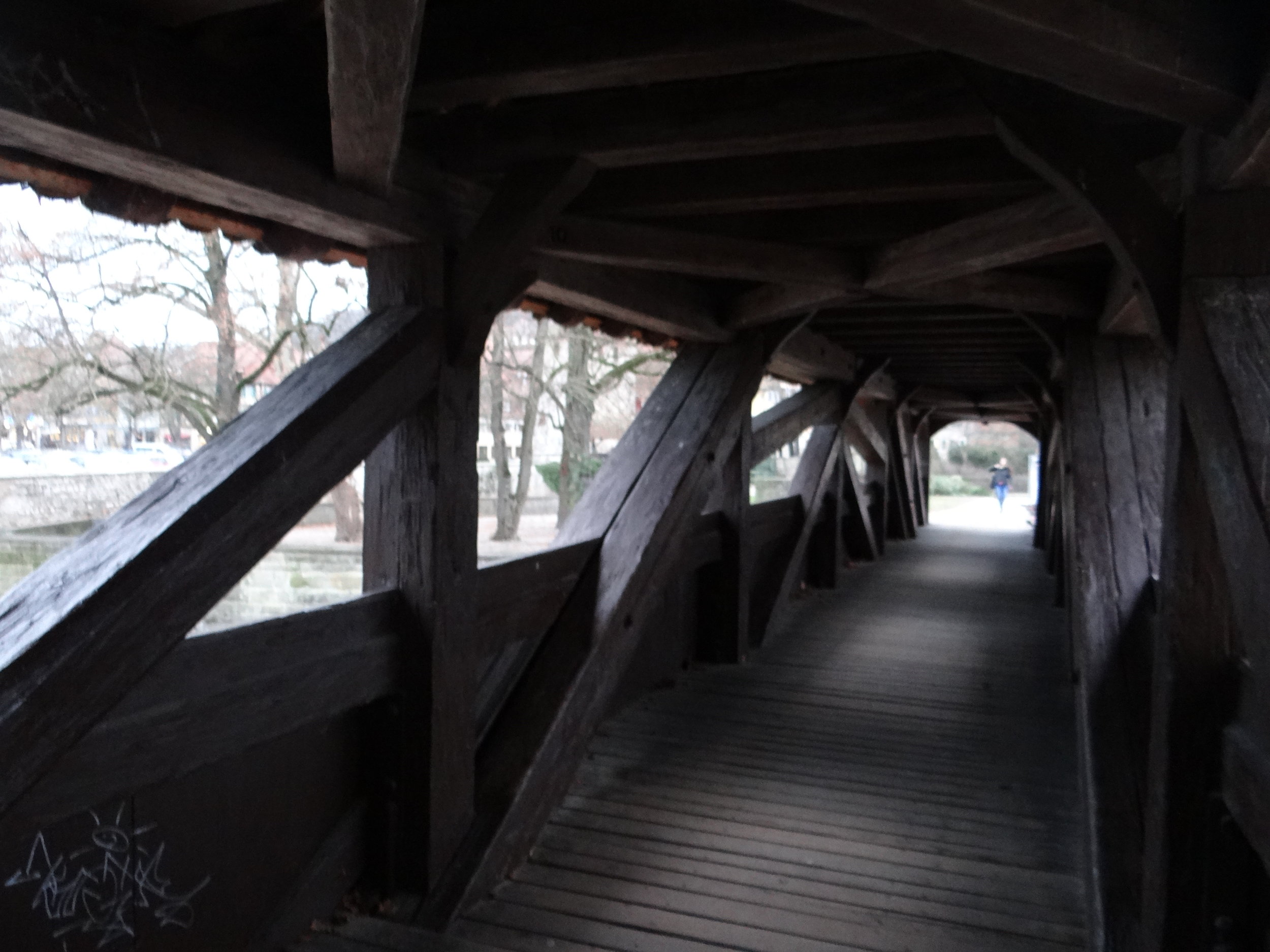

Schwäbisch Hall is a town of some 40,000 inhabitants. The old town is nested on a foothill along the banks of the river Kocher, that traverses its urban center.
It was already getting dark when I arrived, so the light was far from ideal to take pictures, but at least I had enough time for a stroll through the streets of the nicely preserved historical center.


The old town is built on an inclined planed, literally on the side of a hill, and presided by the towering presence of the church of St.Michael, right in the center of the Marktplatz (or “market square”).
This focal point, the main place of interest in Schwäbisch Hall, is on the upper part of the old town, so you need to walk up some steep streets to reach it.

Schwabisch Hall Marktplatz and Saint Michael church in the evening hours

Portico of the church of Saint Michael in Schwäbisch-Hall
Unlike other German market squares, the one at Schwäbisch Hall has the particularity of not being flat, the floor it is built on has quite a steep gradient. Perhaps to compensate for this, the church has quite an impressive set of stairs at the front.

There are quite a few remarkable houses around the Marktplatz and, as you can see here, not all of them are timber-framed!
Also, at the edge of the old town, on the banks of the river, there is a modern shopping area, but well integrated in the harmonious style of its surroundings.

Timber-framed houses are all over Schwäbisch Hall
Here are some more pics of my second visit to town. As you can tell from the light and colours, I enjoyed somehow sunnier weather this second time around!

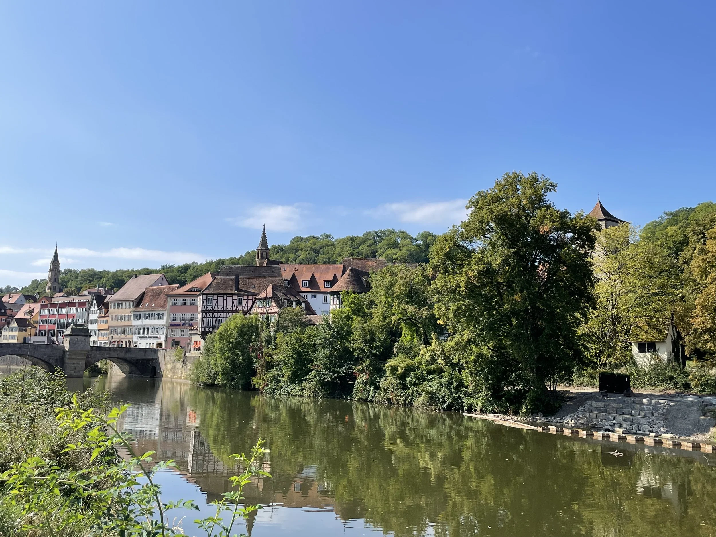
Where to stay in Schwäbisch Hall
Kronprinz Hotel
Bahnhofstraße 17, 74523 Schwäbisch Hall
http://hotel-kronprinz-schwaebischhall.de
This four star independent hotel is located next to the river bank, just opposite the historical center (if you get a room on the upper floors you get the views).
The decor is a far cry from the contemporary design that prevails in most business hotels nowadays, here you will find more of a “homey” atmosphere. Also important is the fact that it is just 5min walk from the very center, yet not exactly in the core of the old town, which I guess facilitates it having its own parking space (always quite handy in the narrow streets of Europe’s old towns). Not luxurious, but clean and correct.
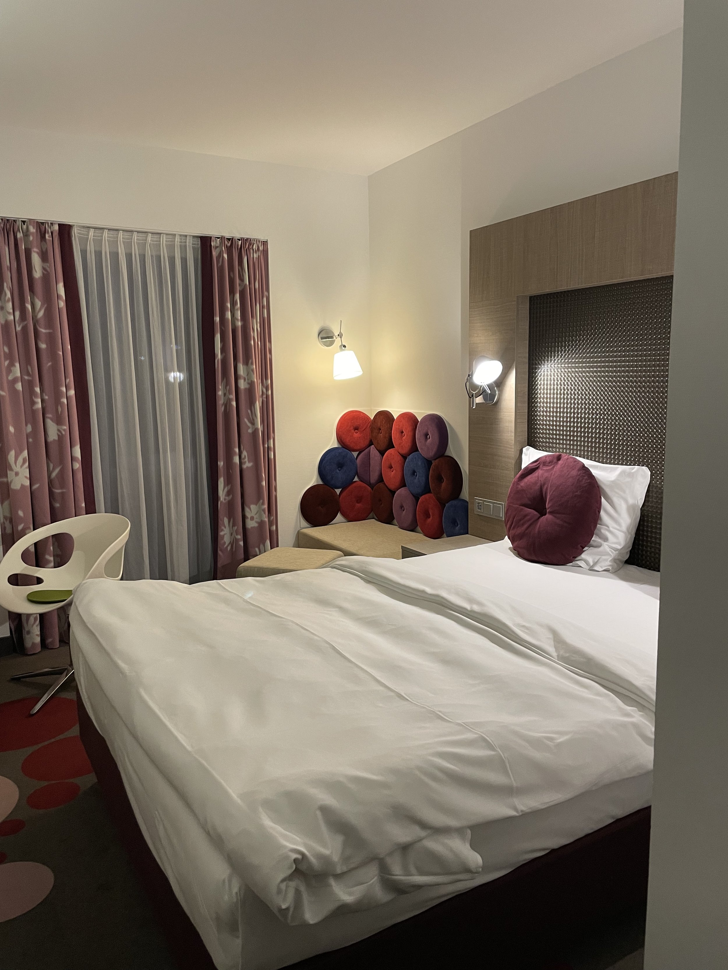
Hotel SMartino
Dolanallee 17
74523 Schwäbisch Hall
This is a functional, modern hotel that provides great value. There is just a caveat, though, and it is that you will need a car, since the hotel is in the outskirts of Schwäbisch-Hall, on a little hill and next to the town’s small airport (which gets only executive and general aviation flights).
The hotel has its own parking for guests and, in any case, it is no more than a couple of km from the very center of town, so it is actually quite convenient.
To be clear, this a motel-type place, but in a nice way, even stylish in a sort of contemporary designer style. The breakfast was also pretty good.
An interesting excursion around Schwäbisch Hall
Hohenloher Freilandmuseum
The next day, after finishing my work commitments, as I had still quite a few hours to make my way leisurely to Frankfurt Airport, I decided to stop at the Hohenloher Freilandmuseum.
Located in a rural area just a few km from Schwäbisch Hall, the Hohenloher Freilandmuseum is an open air museum that aims to display how life was in this part of Germany in centuries past.
The museum is actually spread over several hectares. Buildings from several location in Baden-Würtenberg were dismantled and brought here to the reassembled.
Although the museum was, technically, closed when I arrived, one of the paths that leading to its grounds was open, so there I went. After all, I was not interested in one specific aspect of German rural life, but looking to get a sense of the place.


As I approached a cluster of houses, each of them representative of a specific rural construction style, I stumbled upon some people that were doing repair work.
One of them offered to show me one of the houses so that I could get a glimpse of what the museum is about. Thanks to him I can show you what’s inside this 16th Century German farmhouse.


I must say, though, that one of the places I liked the most was the old train station. This station was also brought to the Hohenloher Freilandmuseum from its original location.
It even has a tiny old steam locomotive on display!

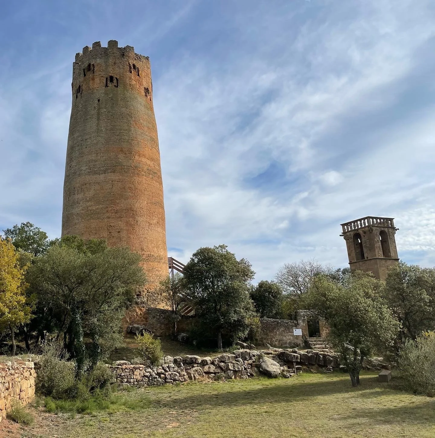
The Tower of Vallferosa, a 1000-year old unique fortification
One of the best preserved examples of early medieval fortification in Europe

If you have been to Central Asia the outline of this tower may look familiar and, most likely, it is not by coincidence.
The Tower of Vallferosa (“Torre de Vallferosa” in Catalan language) is nowadays located in a sparsely populated area in the highlands of Central Catalonia, less than 100 miles from Barcelona.
About 1,000 years ago this was right at the point of contact between two civilizations.
To the north, the Catalan Counties, to the south, the lands of Al-Andalus. This 33-meter tower, or we should rather say, two towers, since there are actually two concentric cilindric structures, was part of the fortified border that separated Christendom from the Islamic world.
The tower dates back to at least 970 AD but, in fact, it is possible that there was already some sort of earlier fortification or, at the very least, that there was some sort of influence from Islamic architecture.
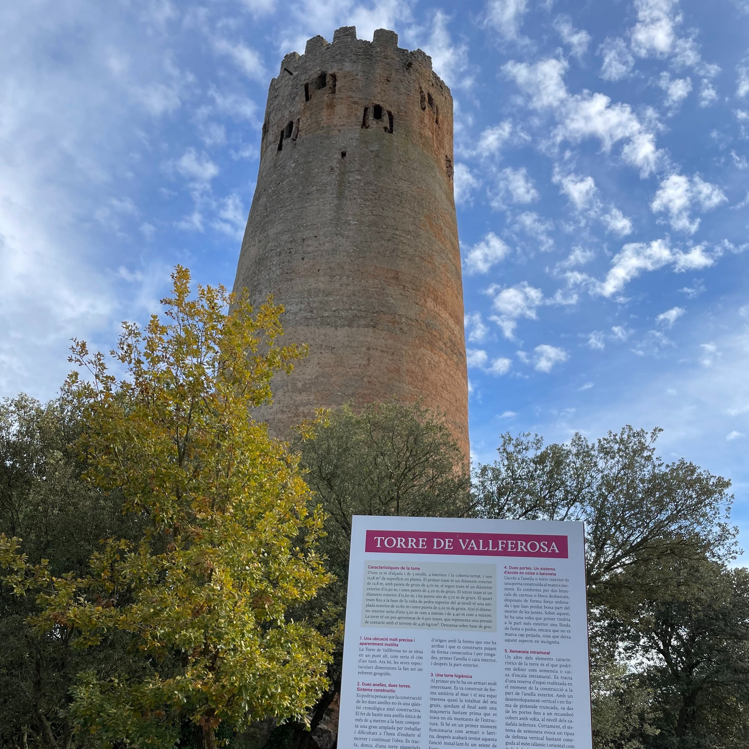
There are plenty of towers, castles and fortifications dating back to that era, currently half-hidden in the forests and hills of rural Catalonia, but this one is unique, not just because of its scale, but also because of its great state of preservation.
To get to the tower you would either need to drive through a dit track (which passes through private land, so I am not sure it is open to everyone, or trek a couple of miles from the nearby Torà to Solsona road (which, by the way, offers some great views of the vast forests that cover this region). It is an easy, wide track with a bit of gradient, but shouldn’t be an issue for anyone without serious mobility issues, including children.
The tower has gone through some restoration work recently, but unclear up to what extent. One of the elements that has been added is a wooden staircase and platform that allows you to climb to about half the height of the tower, where one of its gates is located (although it was closed when I visited).
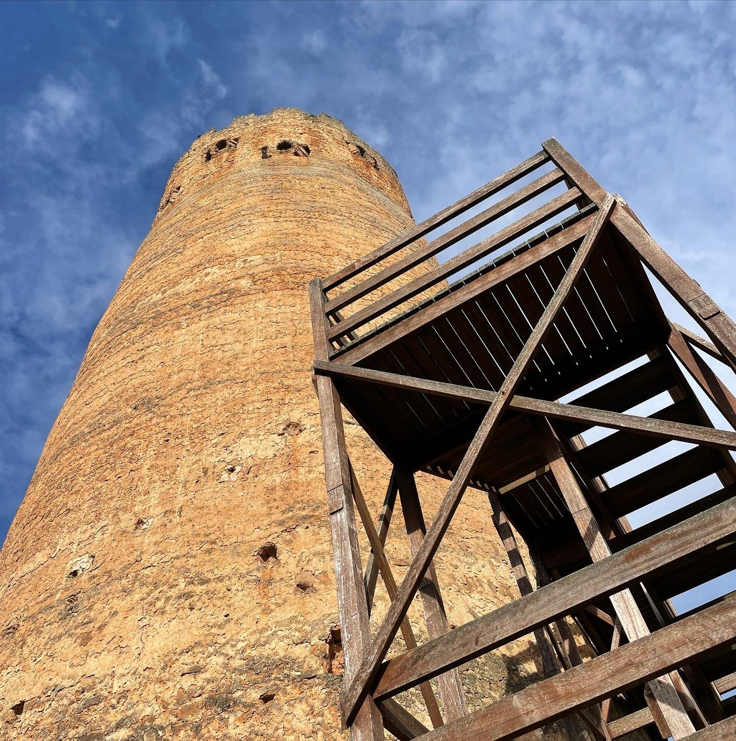

The tower is actually in much remarkably better state than the adjacent, currently abandoned, hamlet and its 17th C. church, Sant Pere de Vallferosa, which are in themselves quite a suggestive sight.
There are still some inhabited farmhouses around this area, but the village was abandoned at some point in the mid-20th C.
Although its location now seems remote, at the time of its construction, the tower must have been guarding a way for cattle and perhaps for salt (from the Cardona mines further north) between the uplands towards the southern plains.
The tower of Vallferosa is one of the few of this age and time that has made it to our day with practically no modifications, even a section of the original roof seems to have been preserved.
Note also how the door was situated at a height of 10m, which, in case of attach allowed the defenders to remove the staircase and make it very hard to reach without the proper equipment.

Besides being an interesting trekking excursion, a visit to the Tower of Vallferosa can be complemented by a stop at the nearby village of Torà (in whose territory it is located).
While the modern part of the village is nothing special, it has a, admittedly small, historical center that is worth a visit if you wish to do a technical stop to replenish supplies on the drive to or from the tower.

Penelles, the Catalan village that became Europe's street art capital
How a small rural village became a huge open air museum

Wondering which place on earth that, possibly, concentrates more art per capita?
Forget about Paris, Florence or Venice…
Penelles, a tiny village (pop. 400) in the agrarian flatlands of Western Catalonia, emerges as a likely candidate.
That is, of course, provided you consider street mural painting an art genre, and I am pretty sure after visiting Penelles, you will have no doubts about the answer to this question...

Cinema Paradiso makes an appearance in Penelles (Catalonia)


For the last 4 years this eminently rural settlement is the setting of an international mural painting festival that is seeing more and more of its houses and buildings converted into works of art.


Plenty of storks around too!
The Gargar Festival (named after the “gar-gar” sound made by a species of pin-tailed sandgrouse, a bird that abounds in the area) started as an initiative of some local artistic entrepreneurs and has since gathered institutional support and recognition, just becoming bigger and bigger every year. It usually takes place in May.
Also the topics have become more diverse. At the start it was mainly topics connected to rural life, but nowadays you can find all sort of themes and styles.
Similarly, several local inhabitants have seen their portraits in large format paintings.
To this date, over a 100, mostly large scale, mural paintings adorn local houses.
The mural paintings of Penelles - A collection
We visited recently and spend a good deal of time walking the streets and documenting the most interesting pictures. What follows is a compilation of some of the most spectacular mural painting you can find on the streets of Penelles. Enjoy!
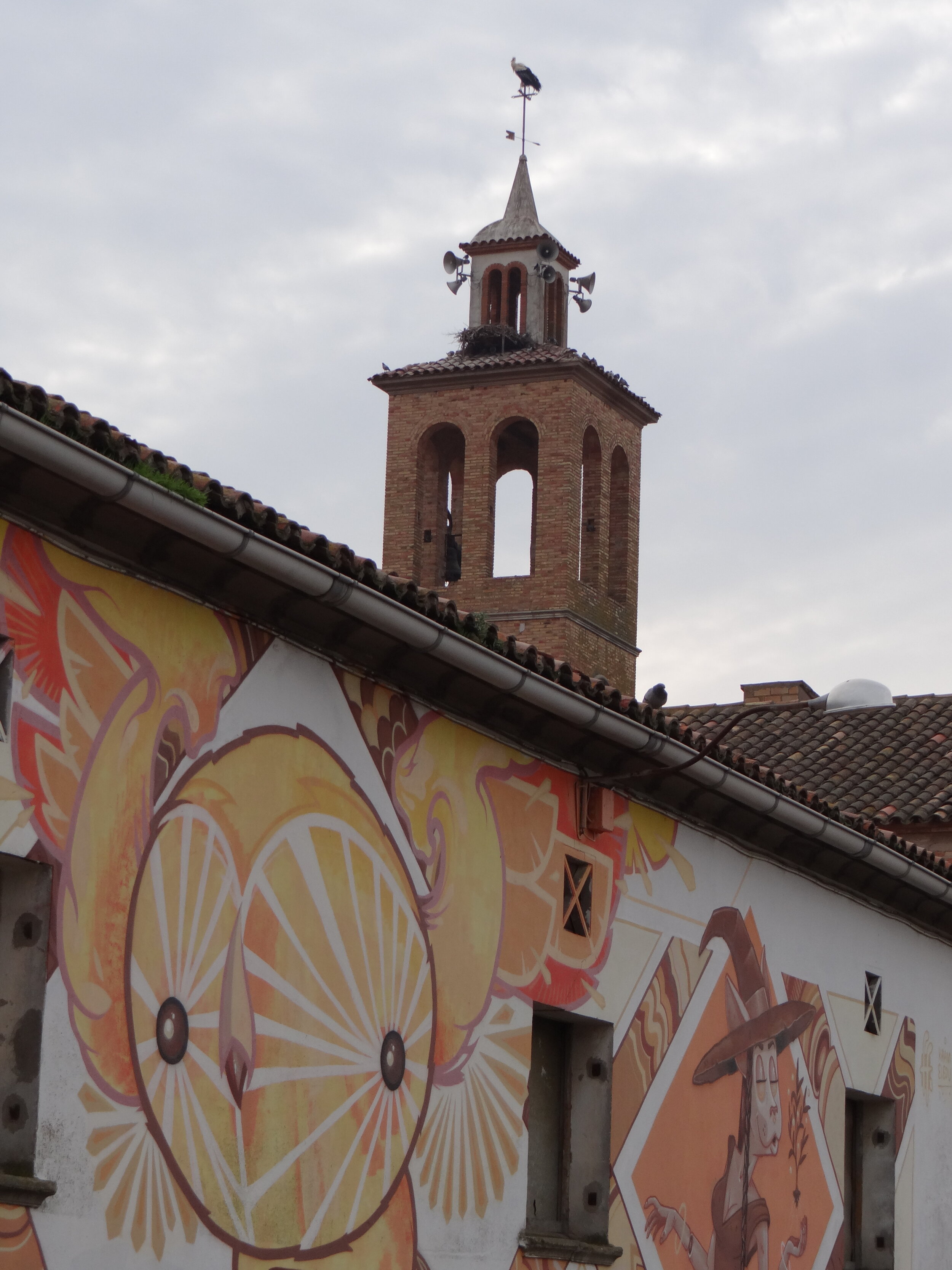
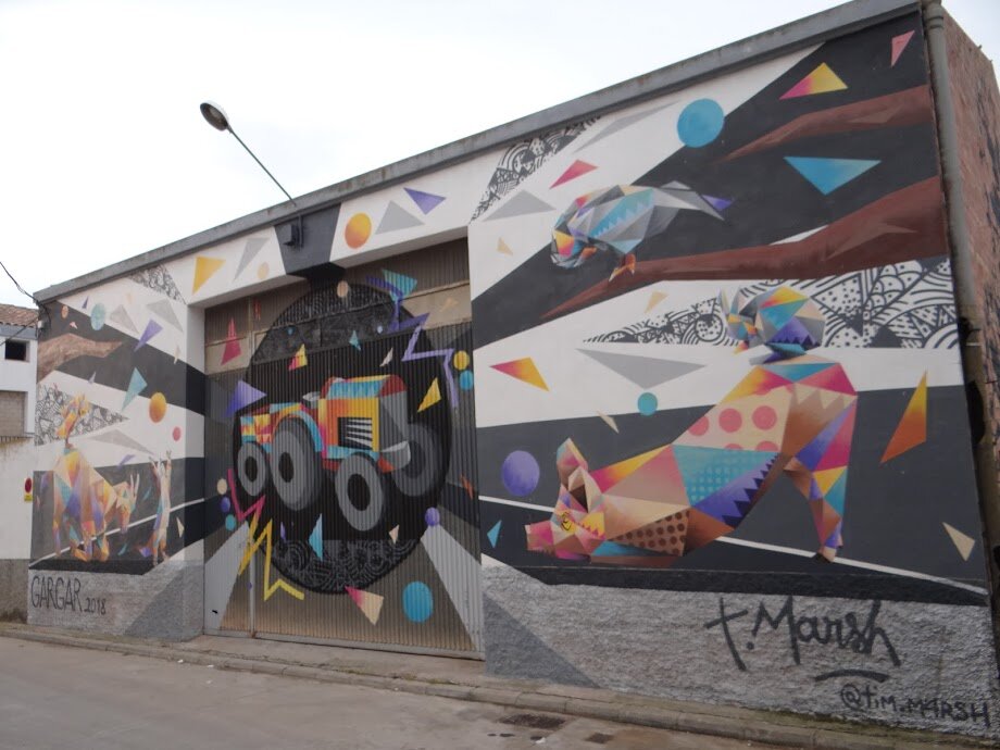
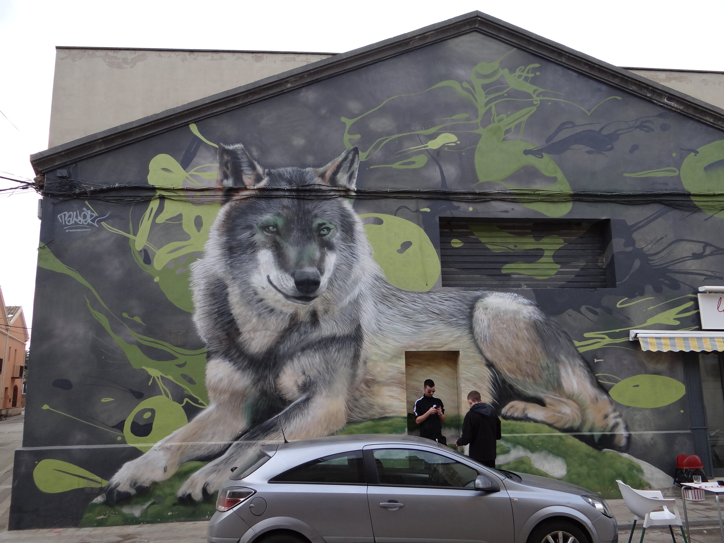
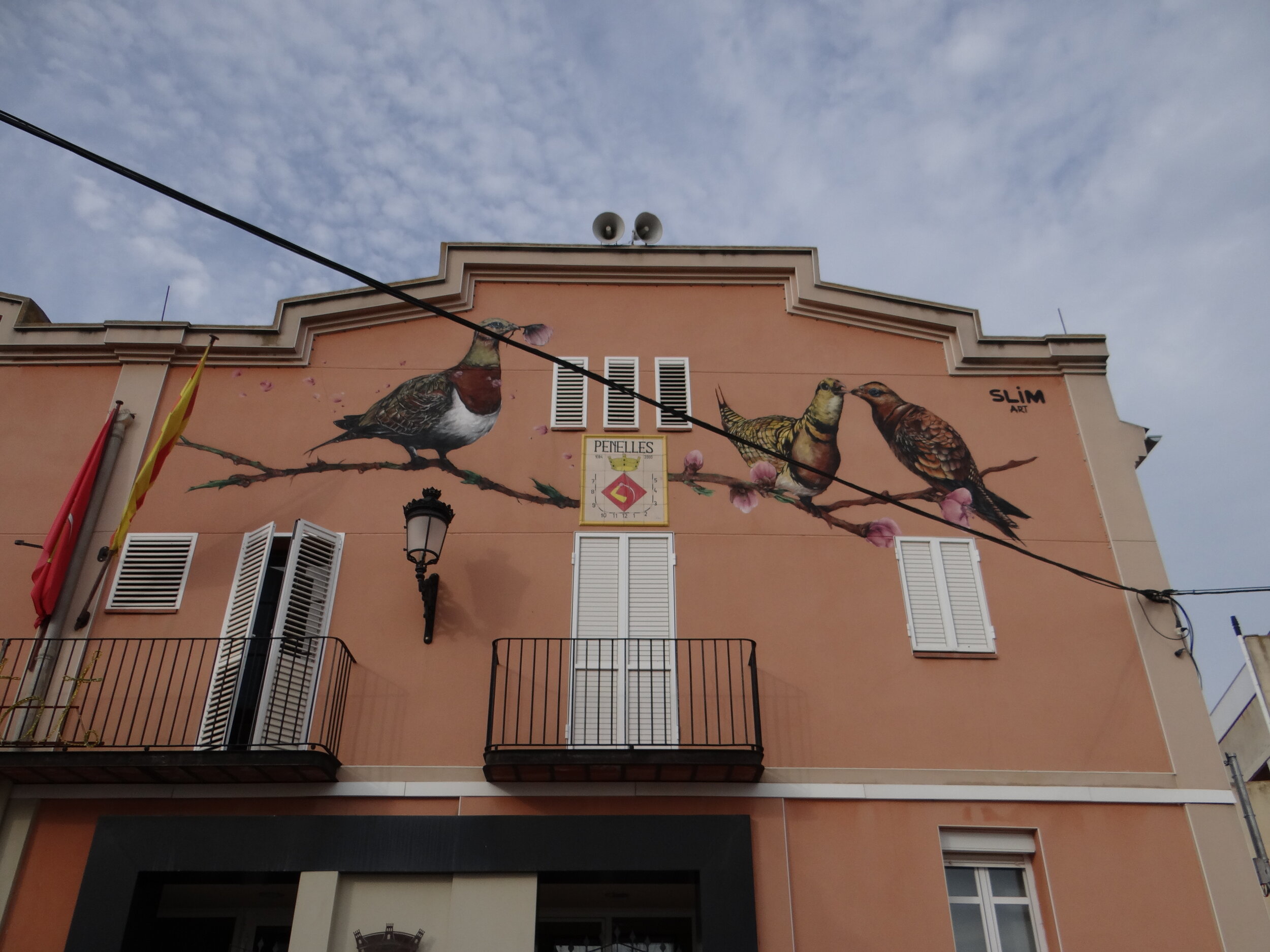
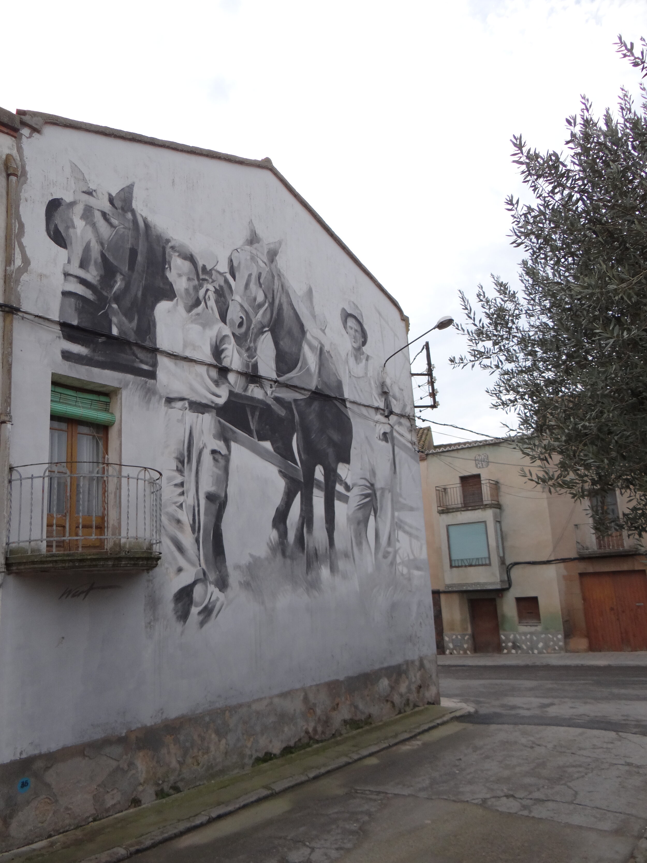
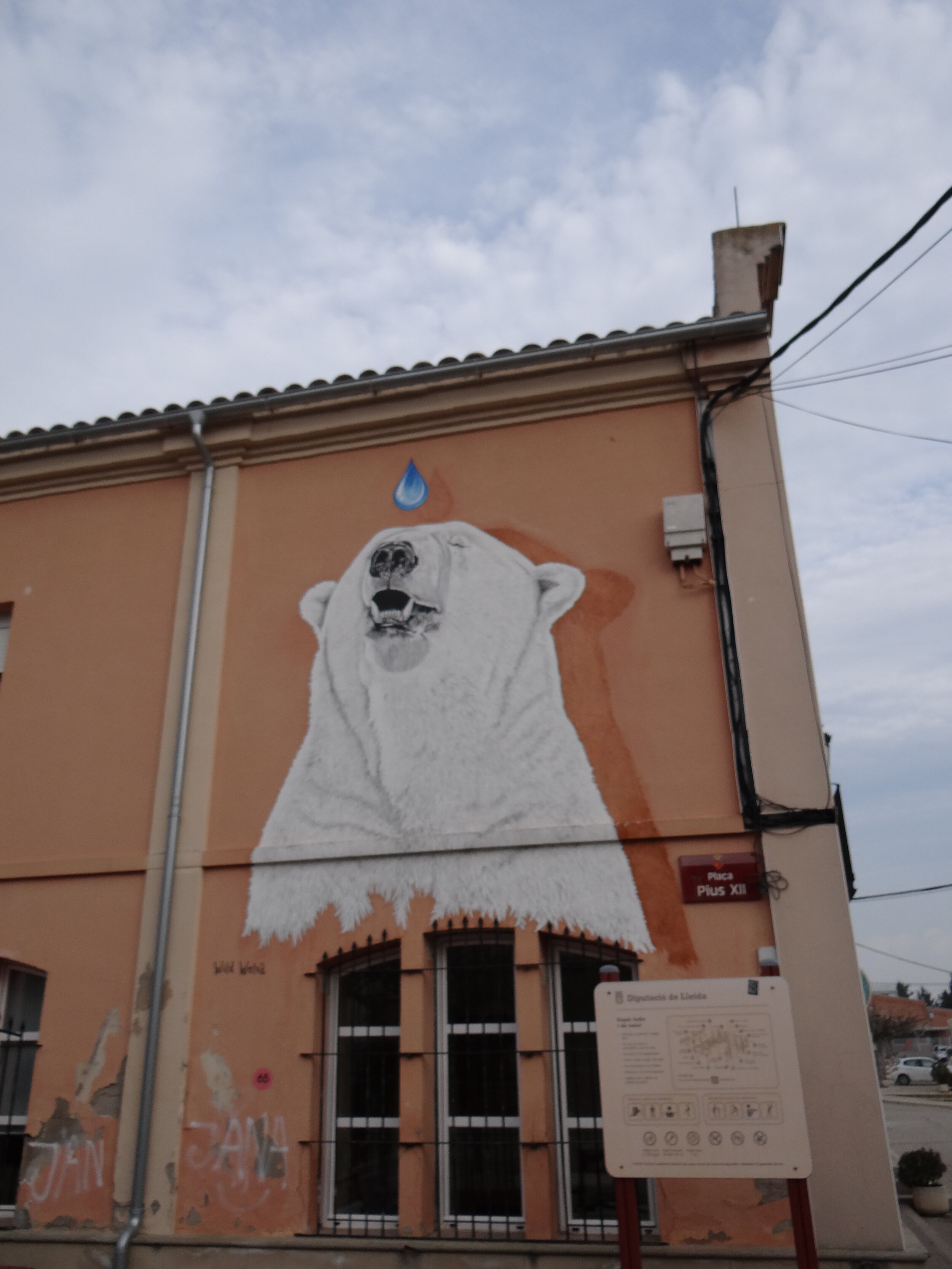
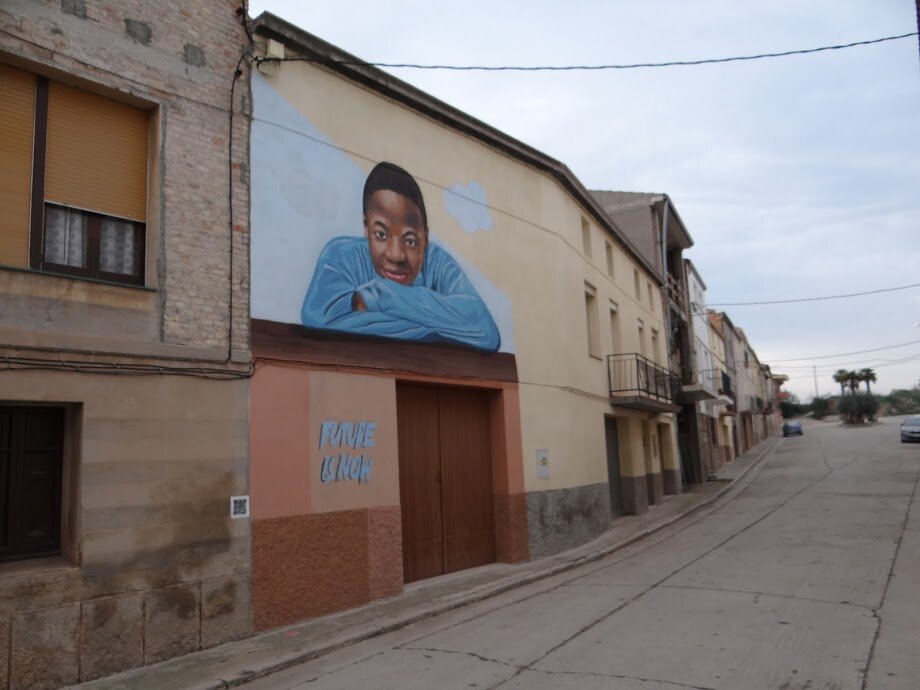
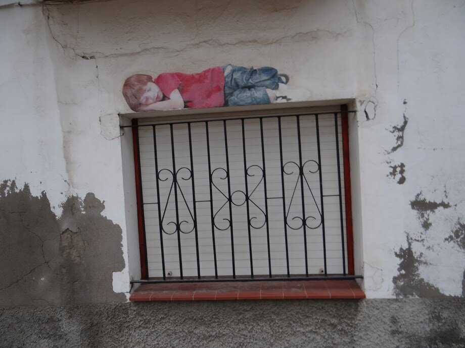
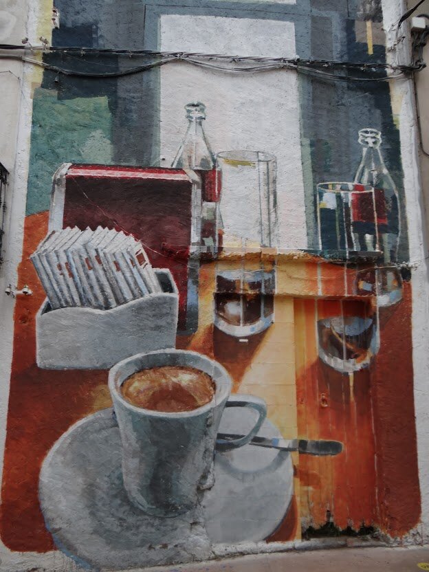
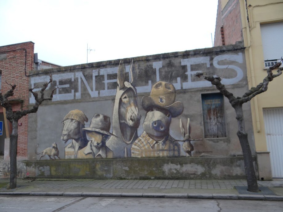
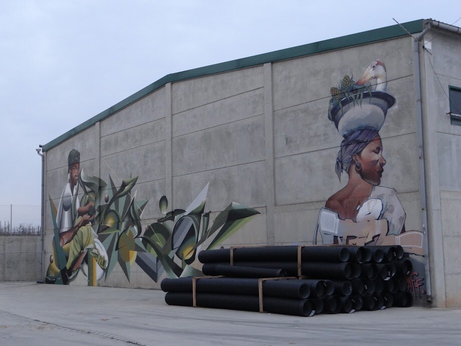
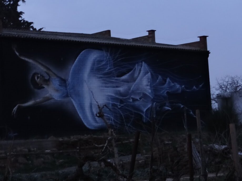
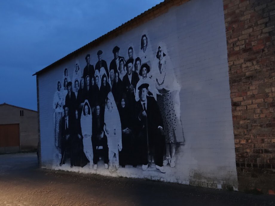
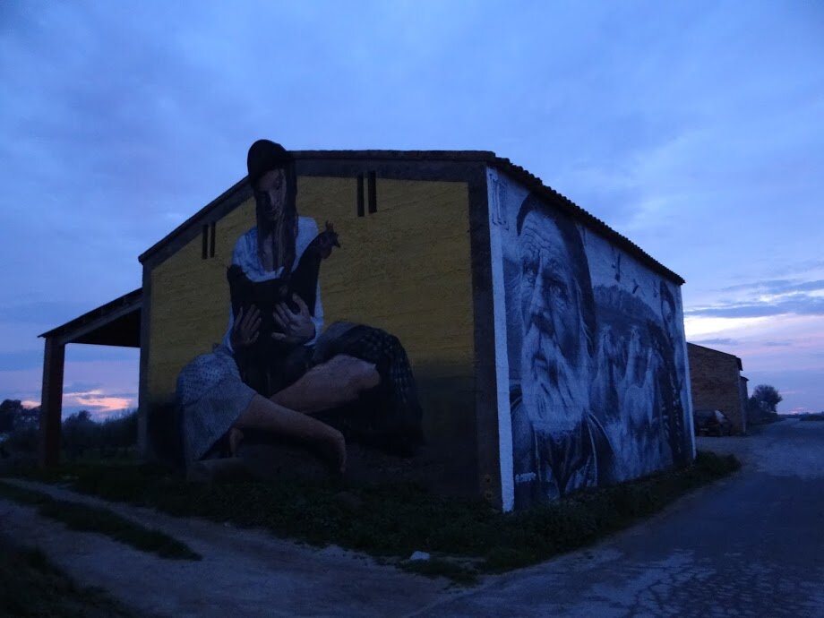
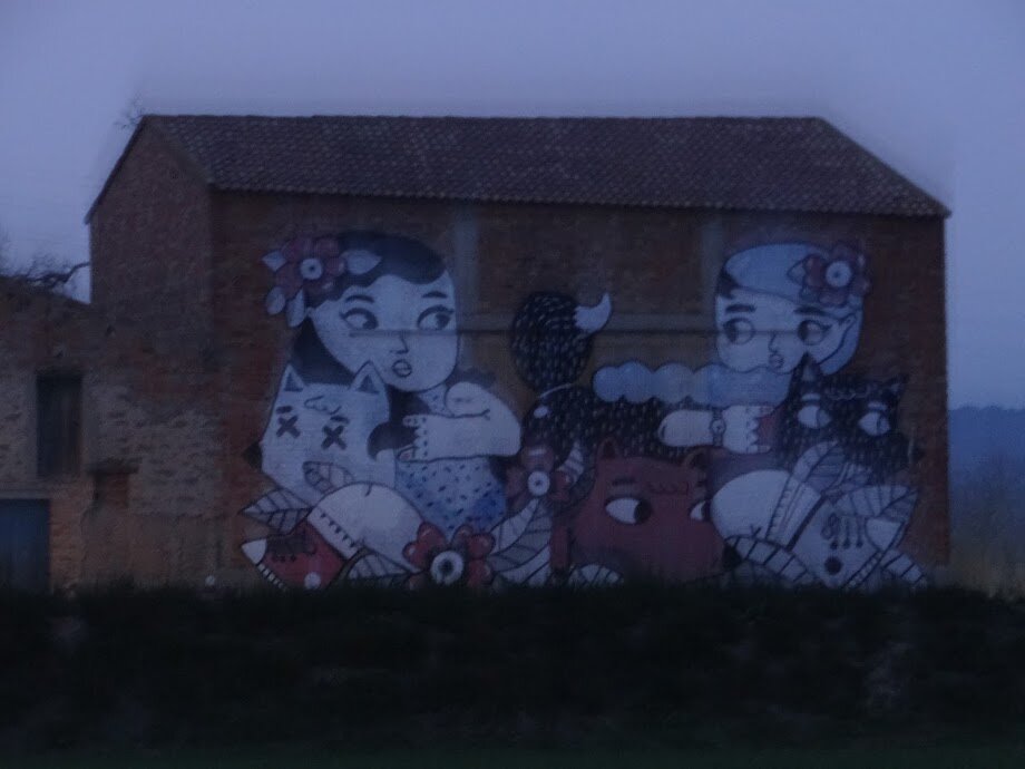
At the time of writing these lines it is not clear whether the 5th edition of the Gargar Festival will take place, in view of the restrictive measures put in place to stop the coronavirus epidemic.
In any case, whether this year or the next, it is only to be expected that the Penelles open air museum will just get bigger and more interesting!
How to get to Penelles
Penelles is some 150km West of Barcelona
The village is located just a couple of kilometres off the C-53 road, that links Tarrèga and Balaguer, in the province of Lleida.
From Barcelona the best way is to drive through the A-2 free motorway and exit at Anglesola, just past Tarrèga.
It takes about 1h 45min to drive all the way from Barcelona.
There are also bus services from either Lleida (L-110, one daily on weekdays) and Tarrèga (L-205, 3-4 daily depending on the day). You can check the timetables here.


A Day in Palermo
Everything else is in the shadow
What to do an what to see in Palermo, Sicily

24 hours is an awfully short time to experience one of Western Europe’s most ancient cities in continuous habitation. Yet, readers of this blog are not alien to this sort of lightning visits, that although brief, provide a glimpse into fascinating worlds.
It’s not the goal of this post to make a list of the numerous peoples and civilizations that have made of Sicily their home throughout millenia (there is plenty of info out there for those interested in the full historical account), all the way up to more infamous associations that have stuck in popular imagination (“everything else is in the shadow” as a Sicilian promotional slogan stated a few years ago!).
Instead, on this post I would try to present a number of highlights that I managed to visit during my short stay in the Sicilian capital, I hope it captures, if only a little bit, the essence of what a traveller can find and see in Palermo nowadays.
Because, besides the many specific attractions, such as magnificent Palazzo Normanni (a UNESCO World Heritage Site) or the Cathedral (both covered in this post), Palermo is eminently a city to walk around, a places that oozes “mediterranean-ness” through and through.
This is also the reason this is mainly a very visual picture-heavy post.
A walk through Palermo

Although very old (it was founded by the Phoenicians centuries before Roman domination), Palermo is like a living organism, that sheds some layers to get some new on top. This is why most of the central area doesn’t look “that” old. It is not a museum, but a breathing city.
In fact, the 19th century and the Italian Risorgimento (a political change that still today generates mixed feelings in Sicily) could be considered a rather recent period for Palermo’s standards, but has left its imprint in the very center of the city, with its broad avenues and neoclassical opera houses

In contrast to other historical Italian cities, it is quite easy to navigate the very center of Palermo.
Besides being at the heart of the commercial activity, avenues such as the Via della Libertà and the Via Maqueda cut through the seaside plain where most of the city is located and provide also an easy way to access its most ancient core.

Street market in Palermo, where all sort of fruit, vegetables, fish and other merchandise is sold. Mediterraneanness in full swing.

As there was a national celebration on those days, plenty of shops decorated with , always elegant, Italian military fashion

Fruit vendors on the streets of Palermo. Citrus fruits are the local stars

And as it was the start of the Winter, chestnut vendors added to the picture
But if you were coming to Palermo looking for the picturesque, for a quintessentially Mediterranean postcard: narrow blooming streets, laundry left hanging from balconies to dry, colourful markets…you certainly will get that as well!

A walk through the old part of of Palermo gets you some scenes that are typically Mediterranean and certainly the one that matches what many would expect. Almost like a postcard.

Monumental Palermo

Quattro Canti, a reference point in the center of the old town. Its name “four corners” refers to the symmetry of the richly decorated (and a tad dilapidated, but in an interesting way) façades
They say one image is worth more than a thousand words, and I think this possibly applies to websites and blogs as well, so…

The Fontana Pretoria, a monumental fountain that, interestingly enough was originally built in Florence and, later, disassembled in 644 pieces and moved to Palermo in 1574!

Church of Saint Catherine of Alexandria

The Church of San Cataldo is a rather unique structure, built in the XII Century in Arab-Norman style and featuring no less than three red round cupolas. It is a UNESCO World Heritage Site.

The church of San Giovanni degli Eremiti is very ancient, tracing back its origins to the 6th century.

If the San Giovanni degli Eremiti is interesting in itself, it is also surrounded by a garden and the ruins of an old cloister, now partly taken over by exuberant lemon, fig and palm trees

The church of San Giovanni degli Eremiti features also the red domes that are characteristic of the Sicilian Arab-Norman style. This church is also a UNESCO World Heritage Site
Palermo Cathedral

The massive, monumental cathedral of Palermo was built from the 12th Century on top on an earlier church

There is plenty to see inside the cathedral, of course, but if you have the chance, you should get up the roof for some amazing views of the city of Palermo and its magnificent natural setting!

Palazzo dei Normanni
If the cathedral is interesting enough, hold your breath for the even more spectacular Palazzo dei Normanni next door and the amazing Cappella Palatina.
The Palazzo dei Normanni (or “Palace of the Normans”) has been a sit of power for over a millennium. In fact, as it is located in the highest ground in the city, its location has been occupied since Phoenician times. The Normans built here their royal palace (hence its name) in the XI century.
But the jewel of this massive fortified building is the Cappella Palatina (“Palatine Chapel”).
Although commissioned by the Normans, the chapel’s style clearly shows the Eastern influences, Byzantine and Arabic, with an interior gleaming with golden mosaics and intricately carved roofs.
If you have limited time in Palermo, do make sure this one is on top of your list!

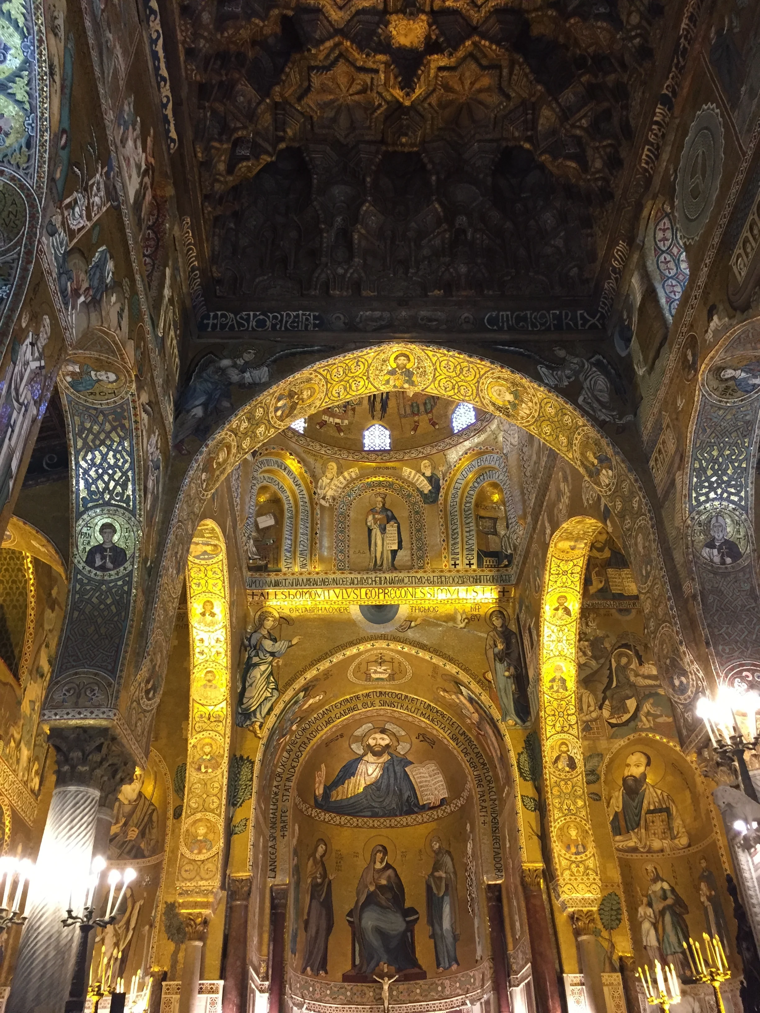

Besides a museum and a major tourist attraction, the Palazzo Normanni continues to be in use for a number of present-day functions, not least of them, is being the seat of the Sicilian assembly (the regional parliament) and of an astronomical observatory.

Not everything is medieval at Palazzo dei Normanni, here is for example a Chinese-style room.
Where to stay in Palermo
Hotel Federico II
Via Principe di Granatelli, 60, 90139 Palermo
https://www.hotelfedericopalermo.it
This is a nice and very central independent hotel.
Its interior has all the modern comforts, but the rooms have also a classical touch that is very fitting to the place.
The hotel Federico II is located on one on the side streets off the main commercial axis and literally 5 minutes away by foot from the historical center.

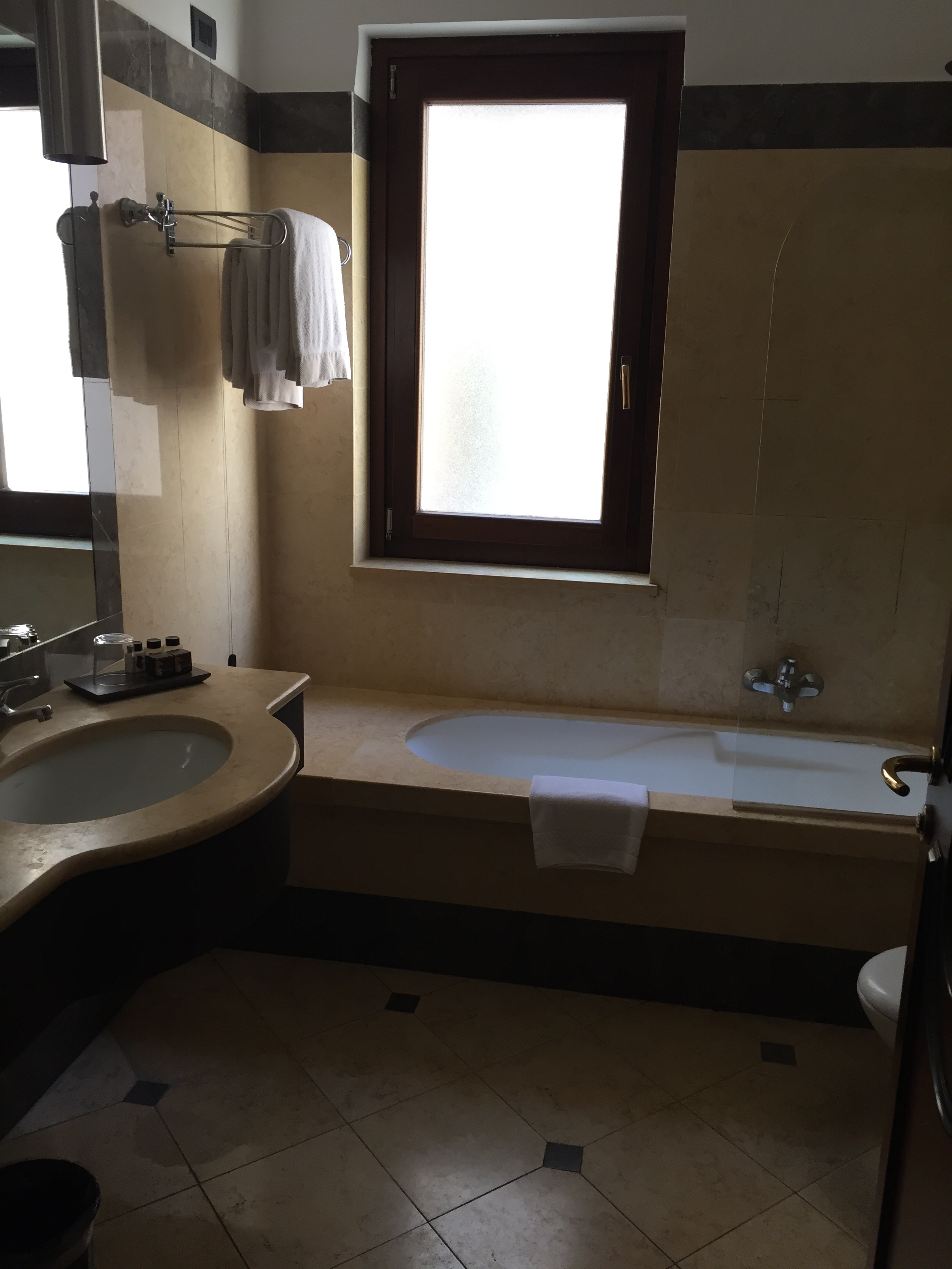
Where to eat in Palermo
One of the best things of Palermo is, you name it! the food
Il Culinario
Via Concettina Ramondetti Fileti, 24/26
90133, Palermo
Food is one of the main reasons to travel to Palermo and Sicily. In this case, time did allow only for a limited tasting of local specialities.
This, quite centrally located, place is a rather casual osteria. It was busy all the time and at least part of the clientele were locals.
We sought some advice from the staff and the result is what you can see in pics below. It did not disappoint.
Service was efficient and pricing was rather reasonable as well!


During the day we ate mainly on the go. In this regard, the local speciality to try (and it makes for very convenient “fast food Sicilian edition” are the “arancini”, which resemble a falafel, but made of rice. They are available in different flavours.
Special mention also to Sicilian sweets, that are a constant temptation during the city walks. Get your pick!

